Central Reclamation, Phase
III
Studies, Site Investigation,
Design and Construction
Environmental Impact Assessment
Report
Volume 2 -
Appendices
(July
2001)
APPENDICES
Appendix
A Project
History
Appendix
B Review of Reclamation
Methodology for CRIII Minimum Option
Figure b.1 Location of Site Investigation Stations b1.gif
Figure b.2 Seabed Level Contour Plan b2.gif
Figure b.3 Base of Marine Depostis Contour Plan b3.gif
Figure b.4 Base of Alluvium Contour Plan b4.gif
Figure b.5 Typical Geological Sections Through Reclamation Area b5a.gif b5b.gif
Figure b.6 Extent of Seawalls (Permanent and Temporary) b6.gif
Figure b.7 Typical Cross Sections Through Reclamation Areas b7.gif
Figure b.8 Horizontal Alignment of Central – Wan Chai Bypass Tunnel b8.gif
Figure b.9 Vertical Alignment for Central – Wan Chai Bypass Tunnel b9.gif
Figure b.10 Horizontal Alignment of Hong Kong Station Extended Overrun Tunnel b10.gif
Figure b.11 Typical Section of Existing Seawall and Proposed Hong Kong Station Extended Overrun Tunnel b11.gif
Figure b.12 Vertical Alignment for Hong Kong Station Extend Overrun Tunnel b12.gif
Figure b.13 Routing of Culvert Extensions b13.gif
Figure b.14 Recommended Reclamation Methods for Infrastructure Works b14.gif
Figure b.15 Section Through Reclamation in Area to North and East of Existing "Star" Ferry Piers b15.gif
Figure b.16 Graph to show Primary and Secondary Settlement for Marine Deposits b16.gif
Figure b.17 Envisaged Construction Programme for Final Reclamation Area West Works b17.gif
Figure b.18 Extent of Dredging and Sample Locations b18.gif
Appendix
C Detailed Construction
Programme
Page c01 Detailed Construction Programme Sheet 1 of 6 c01.gif
Page c02 Detailed Construction Programme Sheet 2 of 6 c02.gif
Page c03 Detailed Construction Programme Sheet 3 of 6 c03.gif
Page c04 Detailed Construction Programme Sheet 4 og 6c04.gif
Page c05 Detailed Construction Programme Sheet 5 of 6 c05.gif
Page c06 Detailed Construction Programme Sheet 6 of 6 c06.gif
Appendix
D Sample Output File for Road
Traffic Noise Assessment / Confirmation Letter from Transport Department on
CRIII Road Speeds
Page d01 Page 1 of 7 d01.gif
Page d02 Page 2 of 7 d02.gif
Page d03 Page 3 of 7 d03.gif
Page d04 Page 4 of 7 d04.gif
Page d05 Page 5 of 7 d05.gif
Page d06 Page 6 of 7 d06.gif
Page d07 Page 7 of 7 d07.gif
Appendix
E Powered Mechanical
Equipment (PME) for Different Construction Tasks during Normal Daytime Working
Hours
Page e1.01 Unmitigated Scenario – Construction Activities Page 1 of 10 e101.gif
Page e1.02 Unmitigated Scenario – Construction Activities Page 2 of 10 e102.gif
Page e1.03 Unmitigated Scenario – Construction Activities Page 3 of 10 e103.gif
Page e1.04 Unmitigated Scenario – Construction Activities Page 4 of 10 e104.gif
Page e1.05 Unmitigated Scenario – Construction Activities Page 5 of 10 e105.gif
Page e1.06 Unmitigated Scenario – Construction Activities Page 6 of 10 e106.gif
Page e1.07 Unmitigated Scenario – Construction Activities Page 7 of 10 e107.gif
Page e1.08 Unmitigated Scenario – Construction Activities Page 8 of 10 e108.gif
Page e1.09 Unmitigated Scenario – Construction Activities Page 9 of 10 e109.gif
Page e1.10 Unmitigated Scenario – Construction Activities Page 10 of 10 e110.gif
Page e2.01 Unmitigated Scenario – Construction Activities Page 1 of 11 e201.gif
Page e2.02 Unmitigated Scenario – Construction Activities Page 2 of 11 e202.gif
Page e2.03 Unmitigated Scenario – Construction Activities Page 3 of 11 e203.gif
Page e2.04 Unmitigated Scenario – Construction Activities Page 4 of 11 e204.gif
Page e2.05 Unmitigated Scenario – Construction Activities Page 5 of 11 e205.gif
Page e2.06 Unmitigated Scenario – Construction Activities Page 6 of 11 e206.gif
Page e2.07 Unmitigated Scenario – Construction Activities Page 7 of 11 e207.gif
Page e2.08 Unmitigated Scenario – Construction Activities Page 8 of 11 e208.gif
Page e2.09 Unmitigated Scenario – Construction Activities Page 9 of 11 e209.gif
Page e2.10 Unmitigated Scenario – Construction Activities Page 10 of 11 e210.gif
Page e2.11 Unmitigated Scenario – Construction Activities Page 11 of 11 e211.gif
Appendix
F Detailed Calculations
and Results of Cumulative Construction Noise Impacts during Normal Working
Hours
Page f1.01 Unmitigated Scenario – Construction Schedule Page 1 of 11 f101.gif
Page f1.02 Unmitigated Scenario – Construction Schedule Page 2 of 11 f102.gif
Page f1.03 Unmitigated Scenario – Construction Schedule Page 3 of 11 f103.gif
Page f1.04 Unmitigated Scenario – Construction Schedule Page 4 of 11 f104.gif
Page f1.05 Unmitigated Scenario – Construction Schedule Page 5 of 11 f105.gif
Page f1.06 Unmitigated Scenario – Construction Schedule Page 6 of 11 f106.gif
Page f1.07 Unmitigated Scenario – Construction Schedule Page 7 of 11 f107.gif
Page f1.08 Unmitigated Scenario – Construction Schedule Page 8 of 11 f108.gif
Page f1.09 Unmitigated Scenario – Construction Schedule Page 9 of 11 f109.gif
Page f1.10 Unmitigated Scenario – Construction Schedule Page 10 of 11 f110.gif
Page f1.11 Unmitigated Scenario – Construction Schedule Page 11 of 11 f111.gif
Page f2.01 Unmitigated Scenario – Construction Schedule Page 1 of 12 f201.gif
Page f2.02 Unmitigated Scenario – Construction Schedule Page 2 of 12 f202.gif
Page f2.03 Unmitigated Scenario – Construction Schedule Page 3 of 12 f203.gif
Page f2.04 Unmitigated Scenario – Construction Schedule Page 4 of 12 f204.gif
Page f2.05 Unmitigated Scenario – Construction Schedule Page 5 of 12 f205.gif
Page f2.06 Unmitigated Scenario – Construction Schedule Page 6 of 12 f206.gif
Page f2.07 Unmitigated Scenario – Construction Schedule Page 7 of 12 f207.gif
Page f2.08 Unmitigated Scenario – Construction Schedule Page 8 of 12 f208.gif
Page f2.09 Unmitigated Scenario – Construction Schedule Page 9 of 12 f209.gif
Page f2.10 Unmitigated Scenario – Construction Schedule Page 10 of 12 f210.gif
Page f2.11 Unmitigated Scenario – Construction Schedule Page 11 of 12 f211.gif
Page f2.12 Unmitigated Scenario – Construction Schedule Page 12 of 12 f212.gif
Appendix
G Powered Mechanical Equipment
(PME) for Different Construction Tasks during Restricted Working
Hours
Page g.01 Powered Mechanical Equipment (PME) for Restricted Periods g01.gif
Appendix
H Detailed Calculations and
Results of Cumulative Construction Noise Impacts during Restricted Working Hours
Page h.03 Noise Receiver Reference Page 3 of 15 h01.gif
Page h.04 Noise Receiver Reference Page 4 of 15 h02.gif
Page h.05 Noise Receiver Reference Page 5 of 15 h03.gif
Page h.06 Noise Receiver Reference Page 6 of 15 h04.gif
Page h.07 Noise Receiver Reference Page 7 of 15 h05.gif
Page h.08 Noise Receiver Reference Page 8 of 15 h06.gif
Page h.09 Noise Receiver Reference Page 9 of 15 h07.gif
Page h.10 Noise Receiver Reference Page 10 of 15 h08.gif
Page h.11 Noise Receiver Reference Page 11 of 15 h09.gif
Page h.12 Noise Receiver Reference Page 12 of 15 h10.gif
Page h.13 Noise Receiver Reference Page 13 of 15 h11.gif
Page h.14 Noise Receiver Reference Page 14 of 15 h12.gif
Page h.15 Noise Receiver Reference Page 15 of 15 h13.gif
Appendix
I Sample CALINE
Air Quality Model Output
Page i.01 Page 1 of 4 i01.gif
Page i.02 Page 2 of 4 i02.gif
Page i.03 Page 3 of 4 i03.gif
Page i.04 Page 4 of 4 i04.gif
Appendix
J Sample ISCST3
Air Quality Model Output
Page j.01 Page 1 of 10 j01.gif
Page j.02 Page 2 of 10 j02.gif
Page j.03 Page 3 of 10 j03.gif
Page j.04 Page 4 of 10 j04.gif
Page j.05 Page 5 of 10 j05.gif
Page j.06 Page 6 of 10 j06.gif
Page j.07 Page 7 of 10 j07.gif
Page j.08 Page 8 of 10 j08.gif
Page j.09 Page 9 of 10 j09.gif
Page j.10 Page 10 of 10 j10.gif
Appendix
K Calculation of Dust
Emission Factors
Page k.01 Scenario 1 of 8 k01.gif
Page k.02 Scenario 2 of 8 k02.gif
Page k.03 Scenario 3a of 8 k03.gif
Page k.04 Scenario 3b bof 8 k04.gif
Page k.05 Scenario 4 of 8 k05.gif
Page k.06 Scenario 5a of 8 k06.gif
Page k.07 Scenario 5b of 8 k07.gif
Page k.08 Scenario 6a of 8 k08.gif
Page k.09 Scenario 6b of 8 k09.gif
Page k.11 Scenario 7a of 8 k10.gif
Page k.12 Scenario 7b of 8 k11.gif
Page k.13 Scenario 8a of 8 k12.gif
Page k.14 Scenario 8bof 8 k13.gif
Appendix
L Sample Computer Output
from FDM used in Construction Air Quality Assessments
Page l.01 Scenario 1 Daytime and Night-time – Unmitigated Page 1 of 15 l01.gif
Page l.02 Scenario 1 Daytime and Night-time – Unmitigated Page 2 of 15 l02.gif
Page l.03 Scenario 1 Daytime and Night-time – Unmitigated Page 3 of 15 l03.gif
Page l.04 Scenario 1 Daytime and Night-time – Unmitigated Page 4 of 15 l04.gif
Page l.05 Scenario 1 Daytime and Night-time – Unmitigated Page 5 of 15 l05.gif
Page l.06 Scenario 1 Daytime and Night-time – Unmitigated Page 6 of 15 l06.gif
Page l.07 Scenario 1 Daytime and Night-time – Unmitigated Page 7 of 15 l07.gif
Page l.08 Scenario 1 Daytime and Night-time – Unmitigated Page 8 of 15 l08.gif
Page l.09 Scenario 1 Daytime and Night-time – Unmitigated Page 9 of 15 l09.gif
Page l.10- Scenario 1 Daytime and Night-time – Unmitigated Page 10 of 15 l10.gif
Page l.11 Scenario 1 Daytime and Night-time – Unmitigated Page 11 of 15 l11.gif
Page l.12 Scenario 1 Daytime and Night-time – Unmitigated Page 12 of 15 l12.gif
Page l.13 Scenario 1 Daytime and Night-time – Unmitigated Page 13 of 15 l13.gif
Page l.14 Scenario 1 Daytime and Night-time – Unmitigated Page 14 of 15 l14.gif
Page l.15 Scenario 1 Daytime and Night-time – Unmitigated Page 15 of 15 l15.gif
Appendix
M Dust Levels for Different
Construction Scenarios (Unmitigated)
Page m.01 Scenario 4 – Unmitigated Page 1 of 3 m01.gif
Page m.02 Scenario 4 – Unmitigated Page 2 of 3 m02.gif
Page m.03 Scenario 4 – Unmitigated Page 3 of 3 m03.gif
Appendix
N Dust Levels for Different
Construction Scenarios (Mitigated)
Page n.01 Scenario 4 – Mitigated Page 1 of 3 n01.gif
Page n.02 Scenario 4 – Mitigated Page 2 of 3 n02.gif
Page n.03 Scenario 4 – Mitigated Page 3 of 3 n03.gif
Appendix
O Hydraulic and Water Quality
Modelling Results
Figure o1.1 Central Reclamation Phase III Baseline model mesh near Central o01.gif
Figure o1.2a Baseline Layout, surface flow patterns, wet season spring tide o02.gif
Figure o1.2b Baseline Layout, surface flow patterns, wet season neap tide o03.gif
Figure o1.3a Baseline Layout, maximum speeds, wet season spring tide o04.gif
Figure o1.3b Baseline Layout, maximum speeds, wet season neap tide o05.gif
Figure o1.4a Baseline Layout, surface flow patterns, dry season spring tide o06.gif
Figure o1.4b Baseline Layout, surface flow patterns, dry season neap tide o07.gif
Figure o1.5a Baseline Layout, maximum speeds, dry season spring tide o08.gif
Figure o1.5b Baseline Layout, maximum speeds, dry season neap tide o09.gif
Figure o1.6a Baseline Layout, tide-averaged dissolved oxygen concentrations, wet season spring tide o10.gif
Figure o1.6b Baseline Layout, tide-averaged dissolved oxygen concentrations, wet season neap tide o11.gif
Figure o1.6c Baseline Layout, tide-averaged dissolved oxygen concentrations, wet season o12.gif
Figure o1.7a Baseline Layout, tide-averaged total BOD5 concentrations, wet season spring tide o13.gif
Figure o1.7b Baseline Layout, tide-averaged total BOD5 concentrations, wet season neap tide o14.gif
Figure o1.8a Baseline Layout, tide-averaged unionised ammoniacal nitrogen concentrations, wet season spring tide o15.gif
Figure o1.8b Baseline Layout, tide-averaged unionised ammoniacal nitrogen concentrations, wet season neap tide o16.gif
Figure o1.8c Baseline Layout, tide- and depth-averaged unionised ammoniacal nitrogen concentrations, wet season o17.gif
Figure o1.8d Baseline Layout, tide-averaged total inorganic nitrogen concentrations, wet season spring tide o18.gif
Figure o1.8e Baseline Layout, tide-averaged total inorganic nitrogen concentrations, wet season neap tide o19.gif
Figure o1.8a Baseline Layout, tide- and depth-averaged total inorganic nitrogen concentrations, wet season o20.gif
Figure o1.9a Baseline Layout, tide-averaged E. coli concentrations, wet season spring tide o21.gif
Figure o1.9b Baseline Layout, tide-averaged E. coli concentrations, wet season neap tide o22.gif
Figure o1.10a Baseline Layout, tide-averaged dissolved oxygen concentrations, dry season spring tide o23.gif
Figure o1.10b Baseline Layout, tide-averaged dissolved oxygen concentrations, dry season neap tide o24.gif
Figure o1.10c Baseline Layout, tide- and depth-averaged dissolved oxygen concentrations, dry season o25.gif
Figure o1.11a Baseline Layout, tide-averaged total BOD5 concentrations, dry season spring tide o26.gif
Figure o1.11b Baseline Layout, tide-averaged total BOD5 concentrations, dry season neap tide o27.gif
Figure o1.12a Baseline Layout, tide-averaged unionised ammoniacal nitrogen concentrations, dry season spring tide o28.gif
Figure o1.12b Baseline Layout, tide-averaged unionised ammoniacal nitrogen concentrations, dry season neap tide o29.gif
Figure o1.12c Baseline Layout, tide- and depth-averaged unionised ammoniacal nitrogen concentrations, dry season o30.gif
Figure o1.12d Baseline Layout, tide-averaged total inorganic nitrogen concentrations, dry season spring tide o31.gif
Figure o1.12e Baseline Layout, tide-averaged total inorganic nitrogen concentrations, dry season neap tide o32.gif
Figure o1.12f Baseline Layout, tide- and depth-averaged total inorganic nitrogen concentrations, dry season o33.gif
Figure o1.13a Baseline Layout, tide-averaged E. coli concentrations, dry season spring tide o34.gif
Figure o1.13b Baseline Layout, tide-averaged E. coli concentrations, dry season neap tide o35.gif
Figure o2.1 Central Reclamation Phase III construction phase model mesh near Central o36.gif
Figure o2.2a Intermediate Layout, surface flow patterns, wet season spring tide o37.gif
Figure o2.2b Intermediate Layout, surface flow patterns, wet season neap tide o38.gif
Figure o2.3a Intermediate Layout, maximum speeds, wet season spring tide o39.gif
Figure o2.3b Intermediate Layout, maximum speeds, wet season neap tide o40.gif
Figure o2.4a Intermediate Layout, tide-averaged dissolved oxygen concentrations, wet season spring tide o41.gif
Figure o2.4b Intermediate Layout, tide-averaged dissolved oxygen concentrations, wet season neap tide o42.gif
Figure o2.5a Intermediate Layout, tide-averaged total BOD5 concentrations, wet season spring tide o43.gif
Figure o2.5b Intermediate Layout, tide-averaged total BOD5 concentrations, wet season neap tide o44.gif
Figure o2.6a Intermediate Layout, tide-averaged unionised ammoniacal nitrogren concentrations, wet season spring tide o45.gif
Figure o2.6b Intermediate Layout, tide-averaged unionised ammoniacal nitrogren concentrations, wet season neap tide o46.gif
Figure o2.6c Intermediate Layout, tide- and depth-averaged unionised ammoniacal nitrogren concentrations, wet season o47.gif
Figure o2.6d Intermediate Layout, tide-averaged total inorganic nitrogren concentrations, wet season spring tide o48.gif
Figure o2.6e Intermediate Layout, tide-averaged total inorganic nitrogren concentrations, wet season neap tide o49.gif
Figure o2.6f Intermediate Layout, tide- and depth-averaged total inorganic nitrogren concentrations, wet season o50.gif
Figure o2.7a Intermediate Layout, tide-averaged E. coli concentrations, wet season spring tide o51.gif
Figure o2.7b Intermediate Layout, tide-averaged E. coli concentrations, wet season neap tide o52.gif
Figure o2.9a Intermediate Layout, simulation of floating debris, wet season neap tide, LW release o53.gif
Figure o2.9b Intermediate Layout, simulation of floating debris, wet season neap tide, HW release o54.gif
Figure o3.1 Central Reclamation Phase III operational phase model mesh near Central o55.gif
Figure o3.2a Final Layout, surface flow paterns, wet season spring tide o56.gif
Figure o3.2b Final Layout, surface flow paterns, wet season neap tide o57.gif
Figure o3.3a Final Layout, maximum speeds, wet season spring tide o58.gif
Figure o3.3b Final Layout, maximum speeds, wet season neap tide o59.gif
Figure o3.4a Final Layout, surface flow patterns, dry season spring tide o60.gif
Figure o3.4b Final Layout, surface flow patterns, dry season neap tide o61.gif
Figure o3.5a Final Layout, maximum speeds, dry season spring tide o62.gif
Figure o3.5b Final Layout, maximum speeds, dry season neap tide o63.gif
Figure o3.6a Final Layout, tide-averaged dissolved oxygen concentrations, wet season spring tide o64.gif
Figure o3.6b Final Layout, tide-averaged dissolved oxygen concentrations, wet season neap tide o65.gif
Figure o3.6c Final Layout, tide- and depth-averaged dissolved oxygen concentrations, wet season o66.gif
Figure o3.7a Final Layout, tide-averaged total BOD5 concentrations, wet season spring tide o67.gif
Figure o3.7b Final Layout, tide-averaged total BOD5 concentrations, wet season neap tide o68.gif
Figure o3.8a Final Layout, tide-average unionised ammoniacal nitrogen concentrations, wet season spring tide o69.gif
Figure o3.8b Final Layout, tide-average unionised ammoniacal nitrogen concentrations, wet season neap tide o70.gif
Figure o3.8a Final Layout, tide- and depth-averaged unionised ammoniacal nitrogen concentrations, wet season o71.gif
Figure o3.8d Final Layout, tide-averaged total inorganic nitrogen concentrations, wet season spring tide o72.gif
Figure o3.8e Final Layout, tide-averaged total inorganic nitrogen concentrations, wet season neap tide o73.gif
Figure o3.8f Final Layout, tide- and depth-average total inorganic nitrogen concentrations, wet seasono74.gif
Figure o3.9a Final Layout, tide-averaged E. coli concentrations, wet season spring tide o75.gif
Figure o3.9b Final Layout, tide-averaged E. coli concentrations, wet season neap tide o76.gif
Figure o3.10a Final Layout, tide-averaged dissolved concentrations, dry season spring tide o77.gif
Figure o3.10b Final Layout, tide-averaged dissolved concentrations, dry season neap tide o78.gif
Figure o3.10c Final Layout, tide- and depth-averaged dissolved concentrations, dry season o79.gif
Figure o3.11a Final Layout, tide-averaged total BOD5 concentrations, dry season spring tide o80.gif
Figure o3.11b Final Layout, tide-averaged total BOD5 concentrations, dry season neap tide o81.gif
Figure o3.12a Final Layout, tide-averaged unionised ammoniacal nitrogen concentrations, dry season spring tide o82.gif
Figure o3.12b Final Layout, tide-averaged unionised ammoniacal nitrogen concentrations, dry season neap tide o83.gif
Figure o3.12c Final Layout, tide- and depth-averaged unionised ammoniacal nitrogen concentrations, dry season o84.gif
Figure o3.12d Final Layout, tide-averaged total inorganic nitrogen concentrations, dry season spring tide o85.gif
Figure o3.12e Final Layout, tide-averaged total inorganic nitrogen concentrations, dry season neap tide o86.gif
Figure o3.12f Final Layout, tide- and depth-averaged total inorganic nitrogen concentrations, dry season o87.gif
Figure o3.13a Final Layout, tide-averaged E. coli concentrations, dry season spring tide o88.gif
Figure o3.13b Final Layout, tide-averaged E. coli concentrations, dry season neap tide o89.gif
Figure o3.16a Final Layout, simulation of floating debris, wet season neap tide LW release o90.gif
Figure o3.16b Final Layout, simulation of floating debris, wet season neap tide HW release o91.gif
Figure o3.17a Final Layout, simulation of floating debris, dry season neap tide LW release o92.gif
Figure o3.17b Final Layout, simulation of floating debris, dry season neap tide HW release o93.gif
Figure o4.1 Residual Seasonal Water Flows In The Region o94.gif
Table o1a Dissolved Oxygen at Sensistive Receivers (Wet Season) o95.gif
Table o1b Dissolved Oxygen at Sensistive Receivers (Dry Season) o96.gif
Table o2a Total BOD5 at Sensitive Receivers (Wet Season) o97.gif
Table o2b Total BOD5 at Sensitive Receivers (Dry Season) o98.gif
Table o3a Unionised ammonical nitrogen at Sensitive Receivers (Wet Season) o99.gif
Table o3b Unionised ammonical nitrogen at Sensitive Receivers (Dry Season) o100.gif
Table o4a Total Oxidised nitrogen at Sensitive Receivers (Wet Season) o101.gif
Table o4b Total Oxidised nitrogen at Sensitive Receivers (Dry Season) o102.gif
Table o5a Total Kjeldahl nitrogen at Sensitive Receivers (Wet Season) o103.gif
Table o5b Total Kjeldahl nitrogen at Sensitive Receivers (Dry Season) o104.gif
Table o6a Total Inorganic nitrogen at Sensitive Receivers (Wet Season) o105.gif
Table o6b Total Inorganic nitrogen at Sensitive Receivers (Dry Season) o106.gif
Table o7a Phosphate at Sensitive Receivers (Wet Season) o107.gif
Table o7b Phosphate at Sensitive Receivers (Dry Season) o108.gif
Table o8a Suspended Solids at Sensitive Receivers (Wet Season) o109.gif
Table o8b Suspended Solids at Sensitive Receivers (Dry Season) o110.gif
Table o9a E.coli at Sensitive Receivers (Wet Season) o111.gif
Table o9a E.coli at Sensitive Receivers (Dry Season) o112.gif
Appendix
P Information Abstracted
from Previous Sediment Quality Report for the Project Site as applicable to the
CRIII Minimum Option Layout
Figure p.01 Location of Vibrocore Sample Statoins Applicable to the CRIII Minimum Option Layout p01.gif
Appendix
Q Cumulative Water Quality
Assessments for CRIII and WDII projects undertaken as part of the WDII EIA
Study
Figure q01 Cumulative Construction Scenario – Tidal Averged Surface SS Elevation Spring-Neap Cycle, Wet Season q01.gif
Figure q02 Cumulative Construction Scenario – Tidal Averged Surface SS Elevation Spring-Neap Cycle, Dry Season q02.gif
Figure q03 Cumulative Construction Scenario – Tidal Averged Sedimentation Rate Spring-Neap Cycle, Wet Season q03.gif
Figure q04 Cumulative Construction Scenario – Tidal Averged Sedimentation Rate Spring-Neap Cycle, Dry Season q04.gif
Figure q05 Coastline Configuration for Cumulative Operation Scenario q05.gif
Figure q06 Operation Scenario – Surface Flow Pattern in Victoria Harbour q06.gif
Figure q07 Operation Senario – Depth Averaged Flow Speed in Victoria Harbour Wet Season q07.gif
Figure q08 Operation Senario – Surface Flow Pattern in Victoria Harbour Dry Season q08.gif
Figure q09 Operation Senario – Depth Averaged Flow Speed in Victoria Harbour Dry Season q09.gif
Figure q10a Operation Senario – Tidal and Depth Averaged DO & BOD5 Concentrations, Spring-Neap Cycle, Wet Season q10.gif
Figure q10b Operation Senario – Tidal and Depth Averaged DO & BOD5 Concentrations, Spring-Neap Cycle, Wet Season q11.gif
Figure q11a Operation Senario – Tidal and Depth Averaged NH3-N & TIN Concentrations, Spring-Neap Cycle, Wet Season q12.gif
Figure q11b Operation Senario – Tidal and Depth Averaged NH3-N & TIN Concentrations, Spring-Neap Cycle, Wet Season q13.gif
Figure q12 Operation Senario – Tidal and Depth Averaged E.coli Concentration, Spring-Neap Cycle, Wet Season q14.gif
Figure q13a Operation Senario – Tidal and Depth Averaged DO & BOD5 Concentrations, Spring-Neap Cycle, Dry Season q15.gif
Figure q13b Operation Senario – Tidal and Depth Averaged DO & BOD5 Concentrations, Spring-Neap Cycle, Dry Season q16.gif
Figure q14a Operation Senario – Tidal and Depth Averaged NH3-N & TIN Concentrations, Spring-Neap Cycle, Dry Season q17.gif
Figure q14b Operation Senario – Tidal and Depth Averaged NH3-N & TIN Concentrations, Spring-Neap Cycle, Dry Season q18.gif
Figure q15 Operation Senario – Tidal and Depth Averaged E.coli Concentration, Spring-Neap Cycle, Dry Season q19.gif
Figure q16 Operation Senario – Tidal Minimum Depth Averaged DO Concentration, Spring-Neap Cycle, Wet Season q20.gif
Figure q17 Operation Senario – Tidal Minimum Bottom Layer DO Concentration, Spring-Neap Cycle, Wet Season q21.gif
Figure q18 Operation Senario – Tidal Minimum Depth Averaged DO Concentration, Spring-Neap Cycle, Dry Season q22.gif
Figure q19 Operation Senario – Tidal Minimum Bottom Layer DO Concentration, Spring-Neap Cycle, Dry Season q23.gif
Appendix
R SedPlume Modelling
Scenarios and results from Previous Studies for the Project
Site
Figure r.01 Construction Works Areas r01.gif
Figure r.02 Scenario 1 – Suspened Sediment Concentrations, Dry Season Spring Tide r02.gif
Figure r.03 Scenario 1 – Suspended Sediment Concentrations, Dry Season Spring Tide r03.gif
Figure r.04 Location of the Cooling Water Intakes and Outlets r04.gif
Figure r.05 Scenario 2 – Suspened Sediment Concentrations, Dry Season Spring Tide r05.gif
Figure r.06 Scenario 2 – Suspened Sediment Concentrations, Dry Season Spring Tide r06.gif
Appendix
S EMSD Cooling Water
Systems Data
Page s.01 EMSD Cooling Water Systems Data Page 1 of 14 s01.gif
Page s.02 EMSD Cooling Water Systems Data Page 2 of 14 s02.gif
Page s.03 EMSD Cooling Water Systems Data Page 3 of 14 s03.gif
Page s.04 EMSD Cooling Water Systems Data Page 4 of 14 s04.gif
Page s.05 EMSD Cooling Water Systems Data Page 5 of 14 s05.gif
Page s.06 EMSD Cooling Water Systems Data Page 6 of 14 s06.gif
Page s.07 EMSD Cooling Water Systems Data Page 7 of 14 s07.gif
Page s.08 EMSD Cooling Water Systems Data Page 8 of 14 s08.gif
Page s.09 EMSD Cooling Water Systems Data Page 9 of 14 s09.gif
Page s.10 EMSD Cooling Water Systems Data Page 10 of 14 s10.gif
Page s.11 EMSD Cooling Water Systems Data Page 11 of 14 s11.gif
Page s.12 EMSD Cooling Water Systems Data Page 12 of 14 s12.gif
Page s.13 EMSD Cooling Water Systems Data Page 13 of 14 s13.gif
Page s.14 EMSD Cooling Water Systems Data Page 14 of 14 s14.gif
Appendix T Baseline Study - Description
of the Environment
Figure t.01 Baseline Landscape And Visual Character Areas t01.gif
Figure t.02 Baseline Visual Envelope And Photo View Point Location t02.gif
Figure t.03 Primary Visual Receivers And Proposed Development Heights t03.gif
Figure t.04 Landscape And Visual Characteristics Photograph View A And B t04.gif
Figure t.05 Landscape And Visual Characteristics Photograph View C t05.gif
Figure t.06 Landscape And Visual Characteristics Photograph View D And E t06.gif
Figure t.07 Landscape And Visual Characteristics Photograph View F t07.gif
Figure t.08 Aerial View of the Study Area from The West (1997) Photograph View G t08.gif
Figure t.09 Aerial View of the Study Area from The East (1997) Photograph View H t09.gif
Appendix
U Planning and Development
Control Framework
Appendix
V Landscape & Visual
Impact Assessment for Redesign of the Hong Kong Station Extended Overrun
Tunnel
Figure v.a1 View South From Vistoria Harbour – Day 1 with Minimum Mitigation if there is a programme delay on Promenade Landscape Works v01.gif
Figure v.a1 View South From Vistoria Harbour – Day 1 with Promenade Landscaping v02.gif
Figure v.a3 View South From Vistoria Harbour – Year 10 with Promenade Landscape Proposal v03.gif
Figure v.b1 View South West From Expo Drive (At Grade) – Day 1 with Minimum Mitigation if there is a programme delay on Promenade Landscape Works v04.gif
Figure v.b2 View South West From Expo Drive (At Grade) – Day 1 with Promenade Landscaping v05.gif
Figure v.b3 View South West From Expo Drive (At Grade) – Year 10 with Promenade Landscape Proposal v06.gif
Figure v.c1 View Friom Promenade – Day 1 with Minimum Mitigation if there is a programme delay on Promenade Landscape Works v07.gif
Figure v.c2 View Friom Promenade – Day 1 with Promenade Landscaping v08.gif
Figure v.c3 View Friom Promenade – Year 10 with Promenade Landscape Proposal v09.gif
Figure v.d1 View West From Lung Wui Road (At Grade) – Day 1 with Minimum Mitigation if there is a programme delay on Promenade Landscape Works v10.gif
Figure v.d2 View West From Lung Wui Road (At Grade) – Day 1 with Promenade Landscaping v11.gif
Figure v.d3 View West From Lung Wui Road (At Grade) – Year 10 with Promenade Landscape Proposal v12.gif
Figure v.e1 View North West Across Tamar Site From Wanchai – Day 1 with Minimum Mitigation if there is a programme delay on Promenade Landscape Works v13.gif
Figure v.e2 View North West Across Tamar Site From Wanchai – Day 1 with Promenade Landscaping v14.gif
Figure v.e3 View North West Across Tamar Site From Wanchai – Day 1 with Promenade Landscape Proposal v15.gif
Figure v.f1 View East From Lung Wui Road (At Grade) – Day 1 with Minimum Mitigation if there is a programme delay on Promenade Landscape Works v16.gif
Figure v.f2 View East From Lung Wui Road (At Grade) – Day 1 with Promenade Landscaping v17.gif
Figure v.f3 View East From Lung Wui Road (At Grade) – Year 10 with Promenade Landscape Proposal v18.gif
Appendix
W Built Heritage Impact
Assessment
APPENDIX A PROJECT
HISTORY
A.1
Background To The Project
Reclamation at Central and Wan Chai was
first proposed in 1983 by the Study on Harbour Reclamation and Urban Growth
(SHRUG). Since then, the case for reclamation has been reconfirmed under a
number of other studies. These include the Central and Wan Chai Reclamation
Feasibility Study (CWCRFS) (1991), and the subsequent Central and Wan Chai
Reclamation Development - Development of Urban Design Parameters Study (DUDPS)
(1993). As a result of these studies and detailed engineering work, a portion of
the Central and Wan Chai reclamation has already been implemented. The Central
Reclamation Phase I (CRI) and Central Reclamation Phase II (CRII) reclamation
works were completed in early 1997, leaving CRIII subject to further
study.
In June 1997, the then Legislative
Council (LegCo) enacted the ‘Protection of the Harbour Ordinance’. Under the
Protection of the Harbour Ordinance (Harbour Ordinance), the central harbour is
to be protected and preserved as a special public asset and a natural heritage
of the people of Hong Kong. The Harbour Ordinance does not prohibit reclamation;
however, all public bodies are required to have regard to the principle of
"presumption against reclamation" and should assess the public benefits of any
necessary reclamation projects in the central harbour against the preservation
of this part of the harbour.
Subsequent to consultation with the
Executive Council (ExCo), an outline zoning plan based on a "Streamlined Option"
for CRIII was prepared and gazetted on 29 May 1998. Upon expiry of the
exhibition period, 71 notices of objections were received. Most of these were
expressions of concern for the necessity of extensive reclamation and its
consequent impact to the harbour.
There is, however, a general
acknowledgement that some reclamation is necessary to accommodate essential
transport infrastructure links in the area and to provide for a quality,
world-class waterfront.
On the basis of the reaction to the
streamlined option, this study provides a minimum reclamation profile
which:-
o
provides
sufficient land for required marine and land based transport
infrastructure;
o
has a limited
impact on the harbour; and
o
provides adequate
land to produce a high quality waterfront promenade which is to the standard of
urban waterfronts elsewhere in the world.
A.2
Planning And Development Context
A.2.1
Strategic Planning Context
A.2.1.1
Study on Harbour Reclamations and Urban Growth
(SHRUG)
Proposals for harbour reclamation were
first outlined under the Study on Harbour Reclamations and Urban Growth (SHRUG)
undertaken in 1983. SHRUG postulated that the future growth in the metropolitan
area bounding the harbour could only be achieved through a commitment to land
reclamation. Three main urban reclamations, namely West Kowloon, Green Island,
and Central and Wan Chai were identified. Central Reclamation Phase III was
first proposed as a component part of the Central and Wan Chai
Reclamation.
A.2.1.2
Port and Airport Development Strategy (PADS)
SHRUG proposals were embraced and
developed by the Port and Airport Development Strategy (PADS) which was
completed in 1989. PADS articulated an urban development strategy premised on
the relocation of the international airport at Kai Tak to an alternative
location and the development of a major new port in the western harbour. The
strategy emphasised the role of new land reclamation as a support resource to
new air and port infrastructure. The strategy also gave recognition to the need
to provide for the expansion of the Central Business District (CBD) on Hong Kong
Island to allow for the continued expansion of the Hong Kong economy which was
anticipated to be stimulated by the implementation of PADS
proposals.
A.2.1.3
Metroplan
Metroplan was approved by the Executive
Council of the Hong Kong Government in 1991 to provide a land use - transport
-environmental framework for the entire Metro Area. This comprised Hong Kong
Island, Kowloon, New Kowloon and Tsuen Wan - Kwai Tsing. A time horizon
extending to the year 2011 was assumed for planning purposes. A territorial
population of about 6.5 million people was assumed to be achieved by 2011.
Principal objectives of Metroplan that are relevant to this study
are:-
o
to enhance Hong
Kong’s role as an international business, finance and tourist
centre;
o
to achieve a more
balanced distribution of jobs relative to population concentrations, the
locational preferences of new enterprises and the ease of
travel;
o
to create an urban
form that will foster a sense of identity;
o
to conserve and
enhance major landscape attributes and important heritage
features;
o
to provide a
multi-choice, high capacity transport system that is financially viable, energy
efficient and makes provision for the safe and convenient movement of
pedestrians; and
o
to provide a
strategy that can be carried out by both the public and private sectors under
variable circumstances, particularly with respect to the availability of
resources and significant changes of demand.
Metroplan is currently under review.
The Stage 1 review has been completed. This has examined the baseline situation,
formed broad suggestions for tackling the identified land use, transport and
environmental problems, and set out the actions for the Stage II Study. The
Stage II review, which commenced recently, will carry out a more detailed and
comprehensive review of the Metro Area. It is anticipated that a revised
development strategy will result from the review process to guide the planning
and development of the Metro Area to the year 2016. One of the major changes
which will have to be addressed is the tremendous growth in population currently
anticipated by Government for the year 2016 (currently estimated at 8.9
million). Central Reclamation III is likely to be utilised principally for
public, Government and commercial purposes.
A.2.1.4
Territorial Development Strategy Review (TDSR)
In 1998 the Hong Kong Government of the
Special Administrative Region (SAR) of China completed the Territorial
Development Strategy Review. The review was intended to provide a land
use-transport-environmental framework from which more detailed plans and
programmes could be prepared. The current strategy was endorsed by the Executive
Council on 24 February 1998. A time horizon extending to 2011 was assumed with a
territorial population of about 8.1 million people. In seeking to satisfy the
land use needs arising from demographic and economic pressures, the TDSR
formulated a broad strategy which would require the optimal use to be made of
spare capacities in currently agreed plans and programmes: through the
redevelopment of obsolete areas; by the development of supplementary sites on
the periphery of urban areas; and by the provision of land in new strategic
growth areas created both by harbour reclamation and the use of suitable lowland
rural areas.
A.2.2
Development Proposals for Central and Wan Chai
Reclamation
The Recommended Outline Development
Plan and Development of Urban Design Parameters Study
(1993)
Initial planning proposals for the CWCR
were first produced in September 1989. These proposals were subsequently refined
leading to the production of a Recommended Outline Development Plan (RODP) in
1993.
It is important to note that the 1993
RODP was preceded by an urban design analysis and eventually accompanied by a
series of urban design parameters. Thus the land use parameters included within
the plan were considered in two and three dimensions with detailed thought being
given to the realisation of the proposals through a considered approach to land
disposal and the application of lease conditions. Most importantly the urban
design and planning approach gave detailed consideration to the integration of
proposed development on the reclamation with that in the urban hinterland.
Emphasis was also given to the management of space and pedestrian circulation
set within practicably achievable parameters which gave strong emphasis to
quality.
A.2.2.2
Hong Kong Island West Development Statement
(HKWDS)
As a follow-up to Metroplan, five
Development Statements have been completed. The most recent and relevant of
these is the Hong Kong Island West Development Statement, where the needs of the
Central Reclamation have been considered in detail. The HKWDS was endorsed by
the Committee on Planning and Land Development (CPLD) in
1997.
The study confirmed that reclamation
(although possibly a reduced reclamation) was essential to support key transport
and other infrastructure as well as a number of key land uses.
The HKWDS also took cognisance of the
recommendations of the "Comprehensive Study on Marine Activities, Risk
Assessment and the Development of a Future Strategy for the Optimum Usage of
Hong Kong Waters" (MARAD) which concluded in broad terms that the future
strategy for port development should be to decentralise port functions to the
east and west, leaving the central harbour for marine - based recreational
activities. To this extent, HKWDS proposed the introduction of the latter and
advocated a series of schemes linked to the development of a high quality
waterfront promenade.
Protection of the Harbour
Ordinance
Notwithstanding the depth of studies
and public consultation undertaken for Metroplan and the TDSR and the views
taken by the Government in selecting preferred strategies in each case, there
was opposition to harbour reclamation. Concerns relate to the effect of
reclamation on such issues as water quality, marine safety, and aesthetics. This
eventually led to the enactment on 30 June 1997 of the "Protection of the
Harbour Ordinance" which establishes a presumption against reclamation in the
central harbour, with the limits set by :-
o
on the east - a
straight line drawn from the extreme south-east point of Hung Hom adjacent to
Kowloon Bay to the extreme north point of Hong Kong Island at North Point;
and
o
on the west - a
line following the course of the easternmost conduit of the tunnel defined in
Section 2 of the Western Harbour Crossing Ordinance (Cap
436).
The main provision under Section 3 of
the Ordinance is the establishment of a legal presumption against reclamation in
the central harbour. The Department of Justice has advised that the principle
does not prohibit reclamation or impose any specific procedural requirement, but
requires that public benefit of the preservation of the central harbour to be
weighed against the public benefit of the reclamation project before a decision
to proceed with the project is taken. Provided that the balancing exercise is
undertaken, the court would not substitute its own decision for that of the
public officers and bodies concerned.
There are two principal concerns
:-
o
the extent to
which new reclamation is required to be kept within minimum limits in order to
satisfy the needs of the community for additional land both for new land uses
and infrastructure that functionally cannot be located elsewhere and which need
to be located within a proposed reclamation area; and
o
in determining the
minimum limits of any new reclamation, it should be established that the
attributes of the central harbour would not be unreasonably diminished (or,
conversely, enhanced) as a special public asset and natural heritage of the Hong
Kong people.
Plan Structure
The current OZP was prepared against a
backcloth of a strong harbour reclamation lobby but was at the same time
required to respond to the findings of successive strategic and localised
studies, all of which confirmed the need for reclamation. The strategic studies
which had addressed the need for reclamation and the detailed reclamation
studies which examined the feasibility of the reclamation on engineering,
planning, urban design, property market, etc. grounds all confirmed the need for
the Central and Wan Chai reclamation for a range of reasons. Most importantly,
each of the property studies undertaken broadly confirmed the need for a similar
quantum of commercial development to enable Hong Kong’s future economic
prosperity and to provide for the expansion of the Central Business District. Of
importance is that the principal area within which future commercial growth is
to be facilitated lies within the current Draft OZP Planning
Area.
Whilst the OZP has given emphasis to
the accommodation of sites for commercial development, it has also had to
respond to high level demands for various G/IC facilities.
The current OZP Planning
Components
The OZP is essentially a hybrid version
of previous planning proposals for the reclamation. The plan reflects proposals
arising form Government’s review of the requirements for the remaining CRIII and
Wan Chai Development Phase II (WDII), and has adopted some elements of past
proposals. The OZP was premised as a response to perceived land use requirements
and did not have the opportunity to undertake a detailed urban design
appreciation.
The Draft OZP has a Planning Area
amounting to some 58.35 ha. The plan includes some 15 separate sites allocated
to commercial use. A large reservation (the Tamar Basin reclamation) is
allocated for the development of a new Central Government Complex, and the
balance of land use is ascribed to G/IC and open space purposes. It is notable
that the OZP is not prescriptive on the extent of land which should eventually
be committed to hotel use. No residential sites are included within the Planning
Area.
A.2.3
Overview
This section has outlined past plans
and studies applicable to the Study Area. The assessment reveals that there has
been a clear shift in thinking over the last 16 years partially as a result of
greater public awareness of, and, influence upon, the planning
process.
Early studies were predicated on a
strong commitment to economic growth, a portion of which was to be reliant upon
large-scale land formation. PADS and Metroplan (and later TDSR) separately saw
land reclamation as a means to an end and as an avenue through which Hong Kong’s
prosperity could be enhanced and improvement of decaying areas could be
achieved, whilst maintaining an awareness of the concomitant environmental
concerns.
Each strategic study envisaged that
Central Reclamation would provide core functions (principally
commercial/economic functions) ancillary to their economic objectives. The need
for land within the vicinity of Central has also been confirmed by the Office
Lands Development Strategy (OLDS).
The Protection of the Harbour
Ordinance marked a significant change in direction. The Ordinance gave implicit recognition to the
need to consider natural and heritage resources in juxtaposition to strategic
development goals.
To this extent, the review contained
within this chapter provides important background to the sort of considerations
which should influence the preparation of a revised reclamation option for
Central Reclamation III. On the one hand, there needs to be a commitment to
minimise the impact of reclamation on the harbour while, conversely, a
commitment to the provision of a quality waterfront which addresses public
aspirations.
APPENDIX B
Review of Reclamation Methodology for CRIII Minimum
Option
B.1
Site
Geology
B.1.1
Geological Profile for CRIII Minimum Option
Site
A considerable amount of Site
Investigation work has been undertaken as part of the Central Reclamation Phases
I, II and III which is applicable to the reclamation layout for the Minimum
Option. In particular the previous CRIII Marine Site Investigation Contract
undertaken in 1995/1996, which included works entrusted to TDD by MTRC for the
Hong Kong Station Extended Overrun Tunnel, provides a substantial amount of
applicable data. The location of applicable site investigation stations are
illustrated on Figure B.1. A review of available site investigation information
indicates that the typical geological profile for the reclamation area is that
summarised in Table B.1.
Table B.1 : Typical Geological
Profile
|
Soil Type |
Thickness |
Top Level of Soil
Stratum |
|
Marine
Deposits |
3 |
-11 |
|
Alluvium |
3 |
-14 |
|
Completely Decomposed Granite |
25 |
-17 |
Contour Plans of the seabed level, base
of Marine Deposits and base of Alluvium as derived from available site
investigation information are presented in Figures B.2 to B.4. Typical
geological sections through the reclamation area are presented in Figures B.5a
and B.5b.
The soils present immediately below the
seabed were investigated in some detail during the previous CRIII full
reclamation project for the design of the various infrastructure works. In
addition a Sediment Quality Report was prepared as required by Works Branch
Technical Circular 22/92 – Marine Disposal of Dredged Mud. The soils below the
CRIII Minimum Option reclamation area are as follows :
·
a thin layer
(approximately 1 m) of Recent Marine Deposit-very soft, black silt/clay with
shell fragments and organic matter of artificial contamination;
·
a layer of Marine
Deposit (from approximately 1 m to 4 m below the seabed) – soft, dark greenish
grey, sandy silty clay with occasional shell fragments;
and
·
a layer of
Alluvium – brownish yellow, clayey / silty fine to course sand with occasional
subangular fine to medium gravel.
B.1.2
Engineering Preparation of
Soils Below the CRIII Minimum Option Site
B.1.2.1
Introduction
Engineering properties for soils,
particularly for Marine Deposits, have been derived from all existing available
field and laboratory test data. Whilst the data covers the majority of the CRIII
Minimum Option site, there is little or no data for areas surrounding existing
ferry piers, landing steps and helipad (refer also to Figure B.1) due to the
inability to recover soil samples from these areas in previous fieldwork
contracts.
Tables B.2 – B.3 below summarise the
engineering properties of the soils.
B.1.2.2
Bulk and Dry Densities
Tables B.2 provides a summary of Bulk
and Dry Density test results for the Marine Deposits found below the
site.
Table B.2 : Marine Deposits – Summary of Bulk
and Dry Densities
|
Test type |
No. of tests |
Maximum Values |
Minimum Values |
Mean Values |
|
|
|
(mg/m3) |
(mg/m3) |
(mg/m3) |
|
Bulk Density |
172 |
2.12 |
1.27 |
1.67 |
|
Dry Density |
25 |
1.39 |
0.66 |
1.01 |
Table B.3 provides a summary of Bulk
and Dry Density test results for the Alluvial Clay found below the
site
Table B.3 : Alluvial Clay – Summary of Bulk and
Dry Densities
|
Test type |
No. of tests |
Maximum Values |
Minimum Values |
Mean Values |
|
|
|
(mg/m3) |
(mg/m3) |
(mg/m3) |
|
Bulk Density |
45 |
2.28 |
1.64 |
2.02 |
|
Dry Density |
14 |
1.98 |
1.3 |
1.66 |
B.1.2.3
Odeometer Test Results
Table B.4 provides a summary of
Oedometer test results for the Marine Deposits and Alluvial Clay found below the
site. These results are particularly pertenant to settlement
assessments.
|
Test type |
No. of tests |
Maximum Values |
Minimum Values |
Mean Values | |||
|
Mv x 10-3 (m2/kN) |
Cv (m2/yr) |
Mv x 10-3 (m2/kN) |
Cv (m2/yr) |
Mv x 10-3 (m2/kN) |
Cv (m2/yr) | ||
|
Marine Deposits |
54 |
19.2 |
20.5 |
1.19 |
0.38 |
6.39 |
2.62 |
|
Alluvium Clay |
21 |
4.2 |
28.7 |
0.25 |
0.5 |
1.11 |
10 |
Table B.5 provides a summary of
Triaxial test results for Marine Deposits, Alluvial Clay and Alluvial Sand found
below the site.
Table B.5 : Summary of Triaxial Test
Results
|
|
|
Soil
type |
|
|
|
|
|
Marine
Deposits |
Alluvial Clay |
Alluvial Sand |
|
Values from |
C' (kPa) |
6.42 |
2.83 |
8.85 |
|
Triaxial Tests |
f' |
28.94 |
33.58 |
32.32 |
B.1.2.5
Standard Penetration Test
Results
Table B.6 provides a summary of
Standard Penetration Test results for all soils found below the
site.
Table B.6 : Summary of Standard Penetration Test
results
|
SPT'N |
FILL |
Marine Sand |
Marine Clay |
Residual Soil |
Alluvium |
CDG |
HDG |
C/HDG |
|
0-2 |
1 |
9 |
56 |
|
3 |
|
|
|
|
3-5 |
1 |
7 |
3 |
|
9 |
8 |
|
|
|
6-10 |
1 |
3 |
4 |
|
26 |
25 |
|
|
|
11-15 |
|
|
|
1 |
30 |
28 |
|
|
|
16-20 |
|
1 |
|
|
23 |
34 |
|
|
|
21-25 |
1 |
|
1 |
1 |
13 |
18 |
|
|
|
26-30 |
|
|
|
|
15 |
24 |
|
1 |
|
31-35 |
|
|
|
|
14 |
22 |
|
1 |
|
36-40 |
|
|
|
|
10 |
29 |
|
|
|
41-45 |
|
|
|
|
6 |
21 |
|
|
|
46-50 |
|
|
|
1 |
6 |
20 |
|
|
|
>50 |
2 |
|
|
|
13 |
210 |
3 |
39 |
|
|
|
|
|
|
|
|
|
|
|
TOTAL |
6 |
20 |
64 |
3 |
168 |
439 |
3 |
41 |
|
TOTAL NUMBER OF COUNTS : |
744 |
|
|
|
|
| ||
B.1.3 Sediment Quality Study
Results
A Sediment Quality Study was conducted
and Sediment Quality Report prepared for the CRIII project in 1995/1996. Whilst
the extent of the reclamation has been reduced since that time from 32 ha to 18
ha, the results of that study still remain applicable to the Minimum Option
Layout. The earlier study classified the seabed sediments below the CRIII site
according to their level of contamination by seven heavy metals as stipulated in
the Environmental Protection Department Technical Circular No. 1-1-1992,
Classification of Dredged Sediments for Marine Disposal. The contamination
levels presented in the Technical Circular serve as criteria for determining the
disposal requirements of the dredged materials. Definition of the classification
is as follows :
|
·
Class
A |
Uncontaminated material, for which no special dredging, transport or disposal methods are required beyond those which would normally be applied for the purpose of ensuring compliance with EPD’s Water Quality Objectives, or for protection of sensitive receptors near the dredging or disposal areas. |
|
·
Class
B |
Moderately contaminated material, which requires special care during dredging and transport, and which must be disposed of in a manner which minimises the loss of pollutants either into solution or by re-suspension. |
|
·
Class
C |
Seriously contaminated material, which must be dredged and transported with great care and which cannot be dumped in the gazetted marine disposal grounds as it must be effectively isolated from the environment upon final disposal. |
For sediments to be identified within a
particular class, only the concentration of one metallic type needs to be
exceeded. The criteria for delineating the three classes of sediment
contamination are shown in Table B.7.
Table B.7 : Classification of Sediments by Metal
Content (mg/kg dry weight)
|
Class |
Cadmium |
Chromium |
Copper |
Mercury |
Nickel |
Lead |
Zinc |
|
A |
0.0 – 0.9 |
0 – 49 |
0 –54 |
0.0 – 0.7 |
0 - 34 |
0 – 64 |
0 – 149 |
|
B |
1.0 – 1.4 |
50 – 79 |
55 – 64 |
0.8 – 0.9 |
35 - 39 |
65 – 74 |
150 – 190 |
|
C |
1.5 or more |
80 or more |
65 or more |
1.0 or more |
40 or more |
75 or more |
200 or more |
The study results indicated that the
marine sediments in the study area contain high levels of heavy metals. The
bottom mud (1 – 2 m below the seabed), is seriously
contaminated.
An Electrochemical Potential analysis
conducted as part of the study indicated that the sediments are anaerobic mud.
The study also confirmed that the Total Organic Carbon (TOC) contents in the
sediments are high (up to 6% of dry weight).
In 2000, a new Works Bureau Technical
Circular (WBTC 3/2000) was issued to provide new requirements for testing and
classification of seabed sediments. Further sediment quality study works are
currently in progress to recover new seabed samples for testing and
classification in accordance with this new WBTC. However, it is anticipated that
these works will only serve to confirm the contamination status identified in
the early study. A new Sediment Quality Report will be prepared and issued to
relevant Government Departments to provide information obtained from the
fieldwork and laboratory testing work undertaken.
For the proposes of this review, the
results of the earlier study conducted in 1995 / 1996 will be used for
classification of seabed sediments.
A number of major infrastructure works
will be constructed on the CRIII reclamation platform immediately following its
formation. The foundation requirements for these works and their ability to
tolerate settlement (both direct and differential) have a direct bearing on the
reclamation method to be used for forming the reclamation platform. The
foundation requirements for each of these infrastructure works is outlined in
this Chapter.
B.2.2
Seawalls and Cooling Water Pumping Stations
The seawalls and cooling water pumping
stations require a solid foundation to virtually eliminate settlement for
stability reasons. Given the high profile nature of the project, it is critical
that a reliable foundation is provided for the seawalls. The design of the
seawalls for the earlier Central Reclamation Phase I and Phase II projects was
based upon dredging all soft seabed deposits to provide the required solid
foundation. It is recommended that a similar approach be adopted for the
seawalls within the CRIII project.
The extent of seawalls (both permanent
and temporary) required for the project is shown on Figure B.6. The temporary
seawalls are needed to form two initial reclamation areas required to construct
reprovisioned facilities thus enabling completion of the reclamation to proceed.
In theory, it would appear possible not to remove soft deposits below the
temporary seawalls. However, these seawalls will retain land directly accessible
to the public (for access to reprovisioned ferry piers, public landing steps,
cooling water pumping stations etc.) and therefore they need to be designed in a
manner such that they are treated on the same status as permanent seawalls.
Given the recommendation to remove soft
seabed deposits below seawalls for CRIII, the geometry and extent of both
initial reclamation areas and the need to complete the infrastructure works on
or adjacent to these areas (including cooling water pumping stations, cooling
water pipelines, stormwater culvert J extension, public transport facilities
etc.) as early as possible, it is further recommended that the whole of both
initial reclamation areas should also have all soft seabed deposits removed from
below them i.e. it is recommended that both initial reclamation areas be fully
dredged. Typical cross sections through both areas are provided in Figure B.7.
These cross sections demonstrate the practical difficulties which would exist
with trying to retain the limited amount of soft seabed deposits between
existing and proposed dredged foundation trenches for the seawalls. The sizes of
these initial reclamation areas are highly constrained both by their location
and the need to provide sufficient land for the public to access the facilities
constructed on or adjacent to them. Therefore they can neither be reduced or
increased in size in order to minimise dredging. The extent of dredging required
for construction of the initial reclamation areas is indicated on Figure B.6.
The quantity of material to be dredged for the initial reclamation areas and the
remaining permanent seawalls outside these areas have been computed and are
presented in Table B.8.
|
Area |
Quantity of Material to be Dredged (m3) |
|
Initial Reclamation Area West |
55,850 |
|
Initial Reclamation Area East |
202,000 |
|
Other Permanent Seawalls |
106,650 |
|
Total |
364,500 |
B.2.3
Central - Wan Chai Bypass Tunnel
In the Comprehensive Feasibility Study
for Minimum Option it was recommended that the Central - Wan Chai Bypass Tunnel
be constructed by diaphragm walling with "top down" construction. Therefore the
foundations will extend down through the soft seabed deposits below the CRIII
site to provide a solid foundation with minimum settlement.
The current alignment for the Central -
Wan Chai Bypass Tunnel is presented in Figure B.8. It can be divided into three
distinct sections as follows :
·
Section 1 is
located within the Initial Reclamation Area East, where it is recommended that
the reclamation be formed by a fully dredged method (refer to paragraph B.2.2
above);
·
Section 2 is
located between the existing seawall forming the boundary of Central Reclamation
Phase I and the Initial Reclamation Area East. The approximate length of this
section of tunnel is 390 m.
·
Section 3 is
located between the Initial Reclamation Area East and the eastern boundary of
the reclamation. The approximate length of this section of tunnel is 190
m.
The vertical alignment currently
proposed for the Central-Wan Chai Bypass Tunnel is such that the bottom of the
tunnel base slab lies within or below the soft seabed deposits for the majority
of the CRIII area (refer to Figure B.9).
Due to constraints imposed by
maintaining ferry and public vessel operations until reprovisioned facilities
are completed, the construction of the reclamation platform between the Initial
Reclamation Areas cannot be commenced until approximately 24 months after
construction works start. It will therefore be critical to ensure that
sufficient land is provided to enable construction of the tunnel works in this
area to commence immediately thereafter. Any delay in completing tunnel works
will have a direct impact upon completing at-grade roads above. If not removed
during the formation of the reclamation platform these soft deposits will either
be removed during the diaphragm wall construction or the general excavation for
construction of the tunnel box. Reclamation methods which involve time consuming
improvement of the undredged foundation materials or maintaining of surcharge
loads are therefore much less favourable from a programme viewpoint than the
fully dredged reclamation method given the fact that the soft seabed deposits
will have to be removed in any event.
In the areas to the sides of the tunnel
the practicality of ground improvement techniques which include surcharging is
questionable due to the need to provide sufficient working space for diaphragm
wall construction. Failure to remove long term settlements in the areas to the
sides of the tunnel would lead to differential settlements in roads / utilities
which cross the tunnel. This in turn would necessitate unacceptable maintenance
works having to be undertaken for what is a high profile project. Without
dredging to the sides of the tunnel, ground improvement of some form would be
required. Recent examples in Hong Kong have shown that failure to implement such
ground improvement measures adequately can adversely affect diaphragm walling
works to be carried out afterwards. Where very weak, underconsolidated, marine
clays were not detected prior to diaphragm walling at one site in Hong Kong, it
was necessary to weld steel plates onto the reinforcement cage in order to
prevent the clays squeezing in and displacing concrete. Where ground treatment
to improve the strength of the clays prior to construction is found to be
unsuccessful then a costly and time-consuming programme of trial diaphragm wall
panels may need to be implemented; the design of such a programme of work is
complex and demands additional ground investigation and comprehensive
instrumentation and monitoring.
It is therefore recommended that full
removal of soft seabed deposits should be implemented for the areas directly
under and to the sides of the tunnel in the zones outside the Initial
Reclamation Areas. The reasons for this recommendation are summarized below.
These reasons are in addition to the fact that the majority of soft seabed
deposits would be removed in any event during general tunnel excavation (refer
to Figure B.9).
·
Full dredging
would permit construction of the tunnel diaphragm walls at an early date after
commencement of reclamation work;
·
The potential for
differential settlements occurring in road / utilities crossing the tunnel would
be reduced or eliminated. This is turn would minimise or remove totally the need
for maintenance works to rectify problems associated with such
settlements.
·
Full dredging
would eliminate totally the risk of excavating contaminated muds either during
diaphragm wall or general tunnel excavation works and associated difficulties
with disposal of these materials.
·
Full dredging
would simplify and improve the quality of diaphragm wall construction works as
problems have been encountered on other projects where muds have been left in
place.
·
Full dredging
would remove the environmental and health/safety risks associated with organic
gas releases as marine deposits are disturbed or removed during subsequent
construction of the tunnel.
B.2.4
Hong Kong Station Extended Overrun Tunnel and Associated Ventilation
Structures
It is currently envisaged by the MTRC
that the Hong Kong Station Extended Overrun Tunnel will be constructed as a
floating box on a dredged formation.
The current alignment for the Hong Kong
Station Extended Overrun Tunnel (EOT) is presented in Figure B.10 and indicates
that the tunnel will largely be constructed immediately adjacent to the existing
seawall in the area currently occupied by the existing "Star" Ferry Piers and
Queen’s Pier. Record drawings obtained from the Civil Engineering Department
show that the existing seawall is founded on a dredged trench. A typical section
for the existing seawall along with the position of the EOT superimposed is
presented in Figure B.11. Given the fact that a part of the proposed tunnel will
be located over the dredged trench and that the envisaged construction method
for the tunnel is for a floating box, the MTRC have stipulated in their Draft
Entrustment Agreement for Construction of the EOT that:
"Phase 3
Central Reclamation shall be formed by Government using the fully dredged
method. All existing material with CPT cone resistance of less than 1.2mPa shall
be removed and replaced with marine sand fill up to formation level. The marine
sand fill shall be compacted by vibrocompaction to achieve a CPT cone resistance
of at least 10mPa.
Ground
improvement measures such as groundwater drawdown shall be applied to minimise
the total settlement to less than 75mm over 120 years and the differential
settlement to less than 1:1000."
It should also be noted, as for the
Central-Wan Chai Bypass Tunnel, that the current vertical alignment for the EOT
will require virtually all soft seabed deposits along its alignment to be
removed during tunnel construction if they are not removed during the
reclamation platform construction. This is illustrated in Figure B.12 which
indicates the vertical alignment for the EOT.
B.2.5
Extensions to Stormwater Drainage Culverts F, J and
K
The current routings for the extensions
to stormwater drainage culverts F, J and K are shown on Figure B.13. The figure
indicates that the extensions to culverts J and K are located in the Initial
Reclamation Area East and on the permanent seawall respectively. The reclamation
method for these areas was discussed in detail in paragraph B.2.2
above.
The extension to culvert F crosses both
the Hong Kong Station Extended Overrun Tunnel and the Central and Wan Chai
Bypass Tunnel before crossing the Initial Reclamation Area West and discharging
into Victoria Harbour.
As the reclamation method recommended
for the Initial Reclamation Area West and the areas under and to the side of the
tunnels (refer to paragraphs B.2.2 - B. 2.4) involves total removal of soft
seabed deposits, a similar approach needs to be adopted for the entire culvert
extension in order to avoid adverse differential settlements along the culvert
alignment.
The major infrastructure works which
will be constructed on the CRIII reclamation platform include :
·
Central Wan Chai
Bypass Tunnel;
·
Hong Kong Station
Extended Overrun Tunnel;
·
Stormwater Culvert
Extensions.
The consideration of foundation
requirements for these works along with the seawalls and cooling water pumping
stations, which form an integral part of the seawall, presented in this chapter
has resulted in the recommendation that all soft seabed deposits below them
should be removed. The extent of soft seabed deposits requiring removal to
comply with this recommendation is presented in Figure
B.14.
Figure B.14 indicates that two areas to
the north and east of the existing "Star" Ferry Piers could be reclaimed in a
manner such that the soft seabed deposits could be retained in place. It should
be noted, however, that at-grade roads and associated utilities will be located
within these areas (refer to Figure B.14) and in certain instances will extend
into the adjacent areas where it is recommended that the soft seabed deposits be
removed to satisfy foundation requirements of major infrastructure works. Figure
B.15 provides a typical cross section for this area. It illustrates that the
soft seabed deposits in this area which could be retained are located in two
thin strips which makes their retention difficult from a practical construction
perspective.
Table B.10 indicates the quantities of
soft seabed deposits which would be removed for the areas shown on Figure B.14
and the quantities which could possibly be retained in the areas to the north
and east of the existing "Star" Ferry Piers.
Table B.10 Estimated Quantity of Soft Seabed
Deposits to be removed for Infrastructure Works Detailed on
Figure B.10
|
Area |
Quantity of Soft Seabed Deposits to be removed (m3) |
|
Initial Reclamation Area West |
55,850 |
|
Initial Reclamation Area East |
202,000 |
|
Other Permanent Seawalls |
106,650 |
|
Remaining CWB Areas |
87,500 |
|
Remaining EOT Areas |
39,000 |
|
Remaining Culvert Extension Areas |
10,000 |
|
Quantities in Areas to North and East of Existing "Star" Ferry Piers = 79,000m3 | |
An assessment of the effects which
retaining the soft seabed deposits in the areas to the north and east of the
"Star" Ferry Piers would have on the construction of the CRIII works and the
long term impacts of leaving them in place is presented in section B.3 below.
An assessment has been undertaken of
the settlements predicted to occur if soft seabed deposits (comprising marine
deposits) are retained in the two areas to the north and east of the existing
"Star" ferry piers (refer also to Figures B.14 and B.15)
For the purposes of the assessment, a
typical geological section has been considered comprising of 3.5m of marine
deposits. This section has been based on the results of all available ground
investigation data. It should be noted, however, that due to the poor coverage
of data in the area immediately adjacent to the "Star" ferry piers there is a
risk that the thickness of insitu marine deposits could potentially be greater
than the thickness (3.5m) assumed for the assessment. Therefore the resulting
settlements associated with the reclamation in this area could be greater than
those computed and presented in this chapter.
Further ground investigation in this
area is not possible due to the continuing operation of ferry services from the
"Star " ferry piers.
In the assessment, both the primary
settlement and secondary compression associated with the insitu marine deposits
have been assessed. In addition the creep settlement associated with the placed
fill has also been considered. For the purposes of the assessment it has been
assumed that the fill will be marine sand fill as recommended in the
Comprehensive Feasibility Study for Minimum Option. Five basic reclamation
construction scenarios have been considered as detailed
below:
Case 1:
Untreated marine deposits;
Case 2:
Vertical prefabricated band drains within the marine deposits (1.5m
centres);
Case 3:
Vertical prefabricated band drains with 20kPa (1m) surcharge for 4, 8 and 12
months;
Case 4:
Vertical prefabricated band drains with 80kPa (4m) surcharge for 4, 8 and 12
months; and
Case
5:
Vertical prefabricated band drains with 180kPa (8m) surcharge for 4, 8
and 12 months.
For the reclamation fill, if untreated,
the secondary creep settlement has been assessed to be of the order of 297mm
over a 50 year period. This element of the settlement will occur throughout the
reclamation area and will be dependent on the thickness of the placed fill given
that similar placement techniques are utilised. It should be noted, however,
that the settlement magnitude can be substantially reduced or eliminated using
vibrocompaction techniques. An remaining settlement after vibrocompaction will
tend to occur quickly with long term settlement being minimal in
magnitude.
The predicted primary and secondary
settlements of the marine deposits associated with the five basic reclamation
construction scenarios are presented on Figure B.16 (for the purposes of the
assessment one way drainage of the insitu marine deposits was assumed). Table
B.11 summarises the magnitudes of the primary consolidation and secondary
compression for the five reclamation construction scenarios. It also indicates
the time period required for completion of the primary consolidation after
completion of fill placement or removal of surcharge.
|
Reclamation
Construction Scenario |
Magnitude of Primary Consolidation (mm) |
Time for completion of Primary Consolidation (months) |
Magnitude of Additional Secondary Compression over a 50 year period (mm) |
|
Case 1: Untreated Marine Deposits |
1164 |
83 |
60 |
|
Case 2: Vertical prefabricated band drains |
1164 |
21 |
60 |
|
Case 3: Vertical prefabricated band drains and 1m Surcharge |
1164 |
19 |
105 |
|
Case 4: Vertical prefabricated band drains and 4m Surcharge |
1164 |
9 |
128 |
|
Case 5: Vertical prefabricated band drains and 8m Surcharge |
1164 |
6 |
140 |
Table B.11 Summary of Settlement Assessment
Results
It can be seen from the settlement
predictions presented in para. B.3.2 above that a significant magnitude of
settlement will take place within the marine deposits in areas where the soft
seabed deposits are retained below the reclamation. As the assessment has been
based on an average thickness of marine deposits it should be noted that the
primary settlements associated with the consolidation of the marine deposits
could be significantly higher where the thickness of the marine deposits are
greater. Given the scarcity of site investigation data in the area around the
"Star" Ferry piers, the risk of greater settlements is considered high. In
addition the settlements will vary as a function of the variability of the
marine deposit thickness and will not be of a uniform value as indicated in the
table. Indeed settlements across these areas of the reclamation could be highly
variable over short distances especially adjacent to the edges of tunnels (refer
to Figure B.15) causing potentially damaging absolute and differential
settlement problems within the reclamation.
It can seen from the results presented
that the use of vertical prefabricated band drains can significantly
enhance the settlement rates. The improvements will, however, vary within the
reclamation and depend upon the thickness of the insitu marine deposits. Table
B.11 also indicates that surcharging will accelerate the settlement rates within
the marine deposits. As for the vertical prefabricated band drains, the
actual improvements will depend on the thickness of the marine
deposits.
If ground improvement techniques are
used significant instrumentation and monitoring would be required to control the
duration of surcharge loading as part of an observation approach which is
commonly adopted in such reclamations. Such monitoring of reclamation
settlements is essential to confirm assumptions made in the settlement
predictions as regards the magnitude and extent of the settlement and the
ongoing settlement rates, all of which could have significant implications to
the long-term performance of the reclamation platform. This instrumentation
needs to be carefully protected from damage and therefore effectively precludes
any other construction activities being undertaken in the
vicinity.
From the primary and secondary
settlement values predicted for the soft seabed deposits it can be seen that
differential settlements will be present at the junction between the dredged and
undredged areas of the reclamation particularly at the tunnel interfaces (refer
to Figure B.15). These are more significant in the short term, depending on
ground improvement techniques adopted but will also be problematic in the long
term considering the secondary compression settlements which are predicted in
the marine deposits over a 50 year period. These differential settlements will
be of particular concern with respect to at-grade roads, utilities, and ground
bearing structures located at the junction between the dredged and undredged
zones of the reclamation (refer also to Section B.2)
B.3.4
Impacts of Reclamation Construction Scenarios on CRIII Construction
Programme
The information contained in this
section was applicable in late 2000 when the review of reclamation methodology
was carried out. Whilst the construction programme start date for CRIII has been
delayed to August 2002 with related delays to the completion of key
infrastructure works wihtin the reclamation, the principles contained in this
paragrah are still appropariate.
The CRIII construction programme
prepared for the CRIII Comprehensive Feasibility Study for Minimum Option was
developed to suit the key dates for the following infrastructure
works:
·
The Hong Kong
Station Extended Overrun Tunnel;
·
At-Grade Highways;
and
·
Provision of land
for modification works to the advance tunnel section of the Central Wan Chai
Bypass (CWB) located below Man Yiu Street.
The Hong Kong Station Extended Overrun
Tunnel structural works will need to be completed by December 2005 (as specified
by the MTRC in the draft entrustment agreement for construction of the
works).
The at-grade roads within the CRIII
area need to be completed by April 2006 in order to relieve congestion within
the busy Central Business District. An earlier proposal from Transport Bureau to
construct a temporary 4-lane 2way trunk road on the CRIII reclamation connecting
Road P2 on CRI and Road D8 on CRII was abandoned on the premise that the CRIII
at-grade new permanent road network would be available for use by early
2006.
The reclamation at the western side of
CRIII needs to be completed by early 2006 to permit construction of upgrading of
the CWB under Man Yiu Street (to suit the change from dual-2 to dual-3
configuration).
The two areas of reclamation situated
to the north and east of the existing "Star" Ferry piers are reclaimed as part
of the Final Reclamation Area West (FRAW). In accordance with the construction
programme the reclamation of this area is programmed to begin in April 2004 and
to be completed at the end of 2004 to permit infrastructure works on the
reclamation platform to commence. The major infrastructure works to be
constructed in the FRAW include:
·
Cooling Water
Systems for future development programmed to commence in May
2004;
·
Stormwater
Drainage Culvert Extension construction programmed to commence in August
2004;
·
Hong Kong Station
Extended Overrun Tunnel (EOT) works programmed to commence in October
2004.
·
Advance Trunk Road
Tunnel (ATRT) works for the Central Wan Chai Bypass (CWB) programmed to commence
in October 2004;
An extract from the construction
programme for the works in the FRAW area is attached as Figure B.17 for
reference.
B.3.4.2
Impacts of Reclamation Construction Scenarios on CRIII Construction
Programme
Impacts on the CRIII construction
programme have been assessed for the following three basic reclamation scenarios
for the areas to the north and east of the existing "Star" Ferry
piers:
·
Full Removal of
soft marine deposits;
·
No removal of soft
marine deposits but installation of vertical prefabricated band drains;
and
·
No removal of soft
marine deposits but installation of vertical prefabricated band drains and
placement of surcharge mounds.
The CRIII construction programme is
based upon the full removal of soft marine deposits.
In the second reclamation scenario, the
time required for the installation of vertical prefabricated band drains
would be offset by not having to spend time removing the soft marine deposits.
After completion of installation of the vertical prefabricated band drains, no
further impacts would result to the construction programme as follow on
infrastructure works would be under construction while settlement of the soft
marine deposits was ongoing. Table B.11, however, indicates that not all primary
consolidation of the soft marine deposits would be completed prior to
construction of at-grade roads and utilities in the areas to the north and east
of the existing "Star" Ferry piers. Thus the construction of these works would
have to be delayed until at least the primary consolidation was
completed.
For the third reclamation scenario a
layer of surcharge has to be placed on the reclamation platform. It is
anticipated that at least 2 months would be required to place the surcharge
layer and to remove it on completion of primary consolidation. As follow on
infrastructure works in the areas of surcharging could not commence until the
surcharge had been removed, this will have an adverse impact on the construction
programme. Delays to the programme will comprise of both the time required to
place and remove the surcharge material and the time period for which the
surcharge has to be left in place. Depending on the height of surcharge placed,
the delays to the programe would be in the order of 8-12 months. These delays
could not be recovered in follow on infrastructure works (which are already
programmed to a tight programme) and therefore the key dates as stated in para.
B.3.4.1 would be delayed by 8-12 months.
Two basic options have been considered
for the areas of reclamation to the north and east of the existing "Star" Ferry
piers. For the first option all the soft seabed deposits are removed prior to
placing the reclamation fill. For the second option the soft seabed deposits are
retained and the reclamation fill is placed on top of these
deposits.
For the option where all the soft
seabed deposits are removed there will be no settlements related to the soft
seabed deposits. This option is therefore considered to be the "safest" option
in terms of providing a stable platform on which to place the reclamation fill
and construct later infrastructure works.
For the option where the soft seabed
deposits are retained settlement predictions have been undertaken to assess the
levels of settlement which can be anticipated from placing the fill on top of
these deposits. The results of these assessments have shown that significant
levels of primary and secondary compression are likely to occur within the soft
seabed deposits both during and after the placement of the reclamation fill. In
addition it is also evident that in the absence of some form of ground treatment
these settlements are likely to occur over a significant period of time, up to
83 months for primary consolidation. This will result in significant impacts to
the construction programme for infrastructure, structures and utilities
overlaying the completed reclamation.
In the area to the north and east of
the "Star" Ferry piers, the average thickness of soft seabed deposits is 3.5m.
For this thickness of soft seabed deposits, primary settlements of the order of
1164mm are predicted with 95% occurring over the first 83 months after placement
of the reclamation fill. In order to enhance the rate of primary settlement
within the soft seabed deposits vertical prefabricated band drains can be
installed to reduce the drainage paths and increase the rate at which primary
settlements occur. The rate of settlement can also be further enhanced by the
use of surcharging. The assessment results indicate that the use of vertical
prefabricated band drains can have significant benefits to the rate of
primary settlement with 95% of the primary consolidation occurring within 21
months of placing the reclamation fill. Surcharging was found to provide further
enhancements to the primary settlement rate.
An assessment of the impacts of the
ground improvement proposals on the construction programme has also been
conducted. This assessment showed that the use of vertical prefabricated band
drains only would have no direct impact on the continuation of construction
works but would require construction of roads and services in the vicinity to be
delayed by 3-6 months (as only 18 months are available within the CRIII
programme after completion of the filling in FRAW). The use of vertical
prefabricated band drains and surcharge on the other hand would delay
completion of key infrastructure works by 8-12 months. It should be noted that
the procedures required for the installation of prefabricated band drains are
complicated containing potential for errors which would adversely affect drain
performance and settlement times. The method for drain installation also
requires great care to avoid disturbing the soft seabed deposits both during
installation of the drains and the subsequent placement of the lower layers of
reclamation fill. Finally as the settlement predictions are based upon effective
drain installation, any deviations from predicted performances, which would only
be obvious after reclamation platform completion, would result in programme
difficulties as rectification works would have to be undertaken or later works
delayed until the required settlements had been completed.
Considering the analysis undertaken, it
is recommended that all the soft seabed deposits should be removed in the areas
to the north and east of the existing "Star" Ferry piers. This recommendation is
made for the following resources:
·
The practical
difficulties in retaining the soft seabeds in place due to the sectional shape
of deposits to be retained (refer to Figure B.15); and
·
The adverse
impacts and/or risks associated with ground treatments which need to be employed
if the soft seabed deposits are retained are:
o
Surcharging if
employed, would extend the construction programme by 8 -12 months - these delays
would need to be accepted by Government and the MTRC.
o
Vertical
prefabricated band drain installation is known to be risky and any errors in the
installation would adversely affect the construction programme. It would also
delay the completion of roads and services in the vicinity by 3-6 months. These
delays would have to be accepted by Government.
B.4
Proposed Dredging Plan for CRIII project
Based upon the recommendations
contained in Sections B.2 and B.3 of this review paper, a proposed dredging plan
for the CRIII project has been prepared and included as Figure B.18. The
quantity of material to be dredged has been calculated to be
580,000m3 based upon currently available seabed level data and
geotechnical field and laboratory text results. Using the information contained
in the Sediment Quality Report for the CRIII Full Reclamation prepared in
1995/96, it has been assessed that the quantities of contaminated and
non-contaminated material which would have to be dredged is as
follows:
Contaminated Material to be Dredged:
375,000m3
Non-Contaminated Material to be Dredged:
205,000m3
Appendix
F2
Mitigated
Scenario
The quiet PMEs used for the mitigated
scenario assessment are listed below. The sound power levels used for these PMEs
in the unmitigated scenarios are also included for
reference.
|
TM |
|
TM |
BS5228 |
BS5228 |
|
CNP Ref |
Description |
SWL, dB(A) |
Ref. |
SWL, dB(A) |
|
CNP002 |
Air compressor |
102 |
Table C7/16 |
96 |
|
CNP004 |
Paver |
109 |
Table C8/24 |
101 |
|
CNP026 |
Hand-held breaker |
114 |
Tabel C2/10 |
110 |
|
CNP027 |
Breaker, excavator mounted |
122 |
Table C8/13 |
110 |
|
CNP030 |
Bulldozer |
115 |
Table C3/27 |
109 |
|
CNP044 |
Concrete lorry mixer |
109 |
Table C6/35 |
100 |
|
CNP047 |
Concrete pump |
109 |
Table C6/36 |
106 |
|
CNP048 |
Crane |
112 |
Table C7/114 |
101 |
|
CNP067 |
Dump truck |
117 |
Table C9/27 |
105 |
|
CNP081 |
Excavator/loader |
112 |
Table C3/97 |
105 |
|
CNP104 |
Grader |
113 |
Table C9/11 |
110 |
|
CNP141 |
Lorry |
112 |
Table C9/27 |
105 |
|
CNP170 |
Poker |
113 |
Table C6/32 |
100 |
|
CNP185 |
Road roller |
108 |
Table C8/27 |
104 |
|
CNP186 |
Vibratory roller |
108 |
Table C3/116 |
106 |
Appendix
H
Detailed
Calculations and Results of Cumulative Construction Noise Impacts during
Restricted Working Hours
Noise Receiver
References
The noise receiver references used for
the presentation of results in this Appendix relate to the buildings detailed
below:
|
Receiver Reference used in this Appendix |
Receiver Location |
|
6 |
Mandarin Oriental Hotel |
APPENDIX O : HYDRAULIC AND WATER
QUALITY MODELLING FIGURES
Introduction
The Hydraulic and Water Quality Results
are presented in figure and tabular format as described below
Figures
Contour plots of individual water quality parameters are included for
three modelled scenarios – baseline, intermediate (construction) and operation.
Baseline and operation plots are presented for both wet and dry seasons (spring
and neap tides) whereas intermediate scenario plots are presented for wet season
(spring and neap tides) only. Plots are also provided for surface flow pattern,
maximum speeds and excess temperature.
The extent of the plots was selected to provide detailed information
close to the project site. Information provided on the plots indicates that at
the eastern and western limits, conditions are virtually identical for all three
modelled scenarios. Variations beyond the plot boundaries cannot therefore be
attributed to the CRIII project works.
Tables Actual
values of water quality parameters at 25 sensitive receivers within Hong Kong
Waters (refer also to chapter 2 of Volume 1 of the report) are presented for the
three modelled scenarios – baseline, intermediate (construction) and operation.
Baseline and operation results are presented for wet and dry seasons (spring and
neap tides). Intermediate (construction) results are presented for wet season
(spring and neap tides) only. The results are presented in a format such that
they can be compared directly with WQOs as defined in Chapter 3 of Volume 1 of
the report and reproduced in this Appendix. Where a modelled result exceeds a
WQO it is identified by shading in the tables.
FIGURES
LIST
|
Figure
No. |
Title |
|
Figure
1.1 |
Central Reclamation Phase III
Baseline model mesh near Central |
|
Figure
1.2a |
Baseline Layout, surface flow
patterns, wet season spring tide |
|
Figure
1.2b |
Baseline Layout, surface flow
patterns, wet season neap tide |
|
Figure
1.3a |
Baseline Layout, maximum speeds,
wet season spring tide |
|
Figure
1.3b |
Baseline Layout, maximum speeds,
wet season neap tide |
|
Figure
1.4a |
Baseline Layout, surface flow
patterns, dry reason spring tide |
|
Figure
1.4b |
Baseline Layout, surface flow
patterns, dry reason neap tide |
|
Figure
1.5a |
Baseline Layout, maximum speeds,
dry reason spring tide |
|
Figure
1.5b |
Baseline Layout, maximum speeds,
dry reason neap tide |
|
Figure
1.6a |
Baseline Layout, tide-averaged dissolved oxygen concentrations, wet season spring tide |
|
Figure
1.6b |
Baseline Layout, tide-averaged dissolved oxygen concentrations, wet season neap tide |
|
Figure
1.6c |
Baseline Layout, tide-and depth-averaged dissolved oxygen concentrations, wet season |
|
Figure
1.7a |
Baseline Layout, tide-averaged total BOD5 concentrations, wet season spring tide |
|
Figure
1.7b |
Baseline Layout, tide-averaged total BOD5 concentrations, wet season neap tide |
|
Figure
1.8a |
Baseline Layout, tide-averaged unionised ammoniacal nitrogen concentrations, wet season spring tide |
|
Figure
1.8b |
Baseline Layout, tide-averaged unionised ammoniacal nitrogen concentrations, wet season neap tide |
|
Figure
1.8c |
Baseline Layout, tide-and depth-averaged unionised ammoniacal nitrogen concentrations, wet season |
|
Figure
1.8d |
Baseline Layout, tide-averaged total inorganic nitrogen concentrations, wet season spring tide |
|
Figure
1.8e |
Baseline Layout, tide-averaged total inorganic nitrogen concentrations, wet season neap tide |
|
Figure
1.8f |
Baseline Layout, tide-and depth-averaged total inorganic nitrogen concentrations, wet season |
|
Figure
1.9a |
Baseline Layout, tide-averaged E. coli concentrations, wet season spring tide |
|
Figure
1.9b |
Baseline Layout, tide-averaged E.coli concentrations, wet season neap tide |
|
Figure
1.10a |
Baseline Layout, tide-averaged dissolved oxygen concentrations, dry season spring tide |
|
Figure
1.10b |
Baseline Layout, tide-averaged dissolved oxygen concentrations, dry season neap tide |
|
Figure
1.10c |
Baseline Layout, tide-and depth-averaged dissolved oxygen concentrations, dry season |
|
Figure 1.11a
|
Baseline Layout, tide-averaged total BOD5 concentrations, dry season spring tide |
|
Figure
1.11b |
Baseline Layout, tide-averaged total BOD5 concentrations, dry season neap tide |
|
Figure 1.12a
|
Baseline Layout, tide- averaged unionised ammoniacal nitrogen concentrations, dry season spring tide |
|
Figure
1.12b |
Baseline Layout, tide- averaged unionised ammoniacal nitrogen concentrations, dry season neap tide |
|
Figure
1.12c |
Baseline Layout, tide-and depth-averaged unionised ammoniacal nitrogen concentrations, dry season |
|
Figure
1.12d |
Baseline Layout, tide-averaged total inorganic nitrogen concentrations, dry season spring tide |
|
Figure
1.12e |
Baseline Layout, tide-averaged total inorganic nitrogen concentrations, dry season neap tide |
|
Figure
1.12f |
Baseline Layout, die-and depth-averaged total inorganic nitrogen concentrations, dry season |
|
Figure
1.13a |
Baseline Layout, tide-averaged E.coli concentrations, dry season spring tide |
|
Figure
1.13b |
Baseline Layout, tide-averaged E.coli concentrations, dry season neap tide |
|
Figure
2.1 |
Central Reclamation Phase III construction phase model mesh near Central |
|
Figure
2.2a |
Intermediate Layout, surface flow patterns, wet season spring tide |
|
Figure
2.2b |
Intermediate Layout, surface flow patterns, wet season neap tide |
|
Figure
2.3a |
Intermediate Layout, maximum speeds, wet season spring tide |
|
Figure
2.3b |
Intermediate Layout, maximum speeds, wet season neap tide |
|
Figure
2.4a |
Intermediate Layout, tide-averaged dissolved oxygen concentrations, wet season spring tide |
|
Figure
2.4b |
Intermediate Layout, tide-averaged dissolved oxygen concentrations, wet season neap tide |
|
Figure
2.5a |
Intermediate Layout, tide-averaged total BOD5 concentrations, wet season spring tide |
|
Figure
2.5b |
Intermediate Layout, tide-averaged total BOD5 concentrations, wet season neap tide |
|
Figure
2.6a |
Intermediate Layout, tide-averaged unionised ammoniacal nitrogen concentrations, wet season spring tide |
|
Figure
2.6b |
Intermediate Layout, tide-averaged unionised ammoniacal nitrogen concentrations, wet season neap tide |
|
Figure
2.6c |
Intermediate Layout, tide-and depth-averaged unionised ammoniacal nitrogen concentrations, wet season |
|
Figure
2.6d |
Intermediate Layout, tide-averaged total inorganic nitrogen concentrations, wet season spring tide |
|
Figure
2.6e |
Intermediate Layout, tide-averaged total inorganic nitrogen concentrations, wet season neap tide |
|
Figure
2.6f |
Intermediate Layout, tide-and depth-averaged total inorganic nitrogen concentrations, wet season |
|
Figure
2.7a |
Intermediate Layout, tide-averaged E.coli concentrations, wet season spring tide |
|
Figure
2.7b |
Intermediate Layout, tide-averaged E.coli concentrations, wet season neap tide |
|
Figure
2.8 |
Not used. |
|
Figure
2.9a |
Intermediate Layout, simulation of floating debris, wet season neap tide, LW release |
|
Figure
2.9b |
Intermediate Layout, simulation of floating debris, wet season neap tide, HW release |
|
Figure
3.1 |
Central Reclamation Phase III operational phase model mesh near Central |
|
Figure
3.2a |
Final Layout, surface flow patterns, wet season spring tide |
|
Figure
3.2b |
Final Layout, surface flow patterns, wet season neap tide |
|
Figure
3.3a |
Final Layout, maximum speeds, wet season spring tide |
|
Figure
3.3b |
Final Layout, maximum speeds, wet season neap tide |
|
Figure
3.4a |
Final Layout, surface flow patterns, dry season spring tide |
|
Figure
3.4b |
Final Layout, surface flow patterns, dry season neap tide |
|
Figure
3.5a |
Final Layout, maximum speeds, dry season spring tide |
|
Figure
3.5b |
Final Layout, maximum speeds, dry season neap tide |
|
Figure
3.6a |
Final Layout, tide-averaged dissolved oxygen concentrations, wet season spring tide |
|
Figure
3.6b |
Final Layout, tide-averaged dissolved oxygen concentrations, wet season neap tide |
|
Figure
3.6c |
Final Layout, tide-and depth-averaged dissolved oxygen concentrations, wet season |
|
Figure
3.7a |
Final Layout, tide-averaged total BOD5 concentrations, wet season spring tide |
|
Figure
3.7b |
Final Layout, tide-averaged total BOD5 concentrations, wet season neap tide |
|
Figure
3.8a |
Final Layout, tide-averaged unionised ammoniacal nitrogen concentrations, wet season spring tide |
|
Figure
3.8b |
Final Layout, tide-averaged unionised ammoniacal nitrogen concentrations, wet season neap tide |
|
Figure
3.8c |
Final Layout, tide-and depth-averaged unionised ammoniacal nitrogen concentrations, wet season |
|
Figure
3.8d |
Final Layout, tide-averaged total inorganic nitrogen concentrations, wet season spring tide |
|
Figure
3.8e |
Final Layout, tide-averaged total inorganic nitrogen concentrations, wet season neap tide |
|
Figure
3.8f |
Final Layout, tide-and depth-averaged total inorganic nitrogen concentrations, wet season |
|
Figure
3.9a |
Final Layout, tide-averaged E.coli concentrations, wet season spring tide |
|
Figure
3.9b |
Final Layout, tide-averaged E.coli concentrations, wet season neap tide |
|
Figure
3.10a |
Final Layout, tide-averaged dissolved oxygen concentrations, dry season spring tide |
|
Figure
3.10b |
Final Layout, tide-averaged dissolved oxygen concentrations, dry season neap tide |
|
Figure
3.10c |
Final Layout, tide-and depth-averaged dissolved oxygen concentrations, dry season |
|
Figure
3.11a |
Final Layout, tide-averaged total BOD5 concentrations, dry season spring tide |
|
Figure
3.11b |
Final Layout, tide-averaged total BOD5 concentrations, dry season neap tide |
|
Figure
3.12a |
Final Layout, tide-averaged unionised ammoniacal nitrogen concentrations, dry season spring tide |
|
Figure
3.12b |
Final Layout, tide-averaged unionised ammoniacal nitrogen concentrations dry season neap tide |
|
Figure
3.12c |
Final Layout, tide-and depth-averaged unionised ammoniacal nitrogen concentrations, dry season |
|
Figure
3.12d |
Final Layout, tide-averaged total inorganic nitrogen concentrations, dry season spring tide |
|
Figure
3.12e |
Final Layout, tide-averaged total inorganic nitrogen concentrations, dry season neap tide |
|
Figure
3.12f |
Final Layout, tide-and depth-averaged total inorganic nitrogen concentrations, dry season |
|
Figure
3.13a |
Final Layout, tide-averaged E.coli concentrations, dry season spring tide |
|
Figure
3.13b |
Final Layout, tide-averaged E.coli concentrations, dry season neap tide |
|
Figure
3.14 |
Not used. |
|
Figure
3.15 |
Not used. |
|
Figure
3.16a |
Final Layout, simulation of floating debris, wet season neap tide, LW release |
|
Figure
3.16b |
Final Layout, simulation of floating debris, wet season neap tide, HW release |
|
Figure
3.17a |
Final Layout, simulation of floating debris, dry season neap tide, LW release |
|
Figure
3.17b |
Final Layout, simulation of floating debris, dry season neap tide, HW release |
|
Figure
4.1 |
Residual Seasonal Water Flows in the Hong Kong Region |
Tables
LIST
|
Table
No. |
Title |
|
Table 1 |
Dissolved Oxygen at Sensitive
Receivers |
|
Table 2 |
Total BOD5 at
Sensitive Receivers |
|
Table 3 |
Unionised Ammonical Nitogen at
Sensitive Receivers |
|
Table 4 |
Total Oxidised Nitrogen at
Sensitive Receivers |
|
Table 5 |
Total Kjeldahl Nitrogen at
Sensitive Receivers |
|
Table 6 |
Total Inorganic Nitrogen at
Sensitive Receivers |
|
Table 7 |
Phosphate at Sensitive
Receivers |
|
Table 8 |
Suspended Solids at Sensitive
Receivers |
|
Table 9 |
E.Coli at Sensitive
Receivers |
|
|
|
Table O.1 : Water Quality
Objectives (WQOs) (All Phases) for Victoria Harbour
|
Water Quality Objective |
Part or Parts of Zone |
|
A.
AESTHETIC APPEARANCE |
|
|
There should be no objectionable odours of discolouration of the water. |
Whole zone |
|
Tarry residues, floating wood, articles made of glass, plastic, rubber or of any other substances should be absent. |
Whole zone |
|
Mineral oil should not be visible on the surface. Surfactants should not give rise to a lasting foam. |
Whole zone |
|
There should be no recognisable sewage-derived debris. |
Whole zone |
|
Floating, submerged and semi-submerged objects of a size likely to interfere with the free movement of vessels, or cause damage to vessels, should be absent. |
Whole zone |
|
The water should not contain substances which settle to form objectionable deposits. |
Whole zone |
|
B.
BACTERIA |
|
|
The level of Escherichia coli should not exceed 1 000 per 100 mL, calculated as the geometric mean of the most recent 5 consecutive samples taken at intervals of between 7 and 21 days. |
Inland waters |
|
C.
COLOUR |
|
|
Human activity should not cause the colour of water to exceed 50 Hazen units. |
Inland waters |
|
D.
DISSOLVED OXYGEN |
|
|
a)
The level of dissolved oxygen should not fall below 4 mg per litre
for 90% of the sampling occasions during the whole year; values should be
calculated as the annual water column average (see Note). In addition, the
concentration of dissolved oxygen should not be less than 2 mg per litre
within 2 m of the seabed for 90% of the sampling occasions during the
whole year. b)
The level of dissolved oxygen should not be less than 4 mg per
litre. |
Marine
waters Inland waters |
|
E.
pH |
|
|
a)
The pH of the water should be within the range of 6.5-8.5 units. In
addition, human activity should not cause the natural pH range to be
extended by more than 0.2 unit. |
Marine waters |
|
b)
Human activity should not cause the pH of the water to exceed the
range of 6.0-9.0 units. |
Inland waters |
|
F.
TEMPERATURE |
|
|
Human activity should not cause the daily temperature range to change by more than 2.0 oC. |
Whole
zone |
|
G.
SALINITY |
|
|
Human activity should not cause the salinity level to change by more than 10%. |
Whole zone |
Table O.1 : Water Quality Objectives (WQOs) (All
Phases) for Victoria Harbour (Cont’d)
|
Water Quality Objective |
Part or Parts of Zone |
|
H.
SUSPENDED SOLIDS |
|
|
a)
Human activity should neither cause the suspended solids
concentration to be raised more than 30% nor give rise to accumulation of
suspended solids which may adversely affect aquatic
communities. |
Marine waters |
|
b)
Human activity should not cause the annual median of suspended
solids to exceed 25 mg per litre. |
Inland waters |
|
I.
AMMONIA |
|
|
The un-ionized ammoniacal nitrogen level should not be more than 0.021 mg per litre, calculated as the annual average (arithmetic mean). |
Whole
zone |
|
J.
NUTRIENTS |
|
|
a)
Nutrients should not be present in quantities sufficient to cause
excessive or nuisance growth of algae or other aquatic
plants. |
Marine waters |
|
b)
Without limiting the generally of objective (a) above, the level of
inorganic nitrogen should not exceed 0.4 mg per litre, expressed as annual
water column average (see Note). |
Marine waters |
|
K.
5-DAY BIOCHEMICAL OXYGEN DEMAND |
|
|
The 5-day biochemical oxygen demand should exceed 5 mg per litre. |
Inland waters |
|
L.
CHEMICAL OXYGEN DEMAND |
|
|
The chemical oxygen
demand should not exceed 30 mg per litre. |
Inland waters |
|
M.
TOXIC SUBSTANCES |
|
|
a)
Toxic substances in the water should not attain such levels as to
produce significant toxic, carcinogenic, mutagenic or teratogenic effects
in humans, fish or any other aquatic organisms, with due regard to
biologically cumulative effects in food chains and to interactions of
toxic substances with each other. |
Whole zone |
|
b)
Human activity should not cause a risk to any beneficial use of the
aquatic environment. |
Whole zone |
|
Note: Expressed normally as
the arithmetic mean of at least 3 measurements at 1 m below surface, mid
depth and 1 m above the seabed. However in water of a depth of 5 m or less
the mean shall be that of 2 measurements (1m below surface and 1m above
seabed), and in water of less than 3 m the 1 m below surface sample only
shall apply. | |
Appendix
P
Information
Abstracted from Previous Sediment Quality Study Report for the Project Site as
applicable to the CRIII Minimum Option Layout
P.1
Introduction
The information presented in this
Appendix was obtained from previous Sediment Sampling and Testing Survey Works
conducted for the project site in 1995/1996 and from ongoing Sediment Sampling
and Testing Survey Works being conducted to satisfy the requirements of the
recently issued WBTC NO. 3/2000. The information presented is as
follows:
Figure
P1
Location of Vibrocore Sample Stations Applicable to the CRIII Minimum
Option Layout (both sampling work conducted in 1995/1996 and
2000).
Table
P.1
Vibrocore Reference and Types of Tests Conducted in 1995/1996 (Sediment
Classification Tests in accordance with WBTC 3/2000 were conducted on seabed
samples taken from all locations listed in Table P.1 during the testing works in
2000).
Table
P.2
Test Type 1 Results and Sediment Classification for Tests Conducted in
1995/1996.
Table
P.3
Test Type 2 Results for Tests Conducted in 1995/1996. (Results of Cu, Zn,
TBT, PAH and PCB concentration in the Dry Sediment from seabed samples collected
in 2000 are included as a footnote to this table).
Table
P.4
Test Type 3 Results for Tests Conducted in
1995/1996
Where appropriate, assessment criteria
for the various contaminants within the sediment and elutriate have been
provided with the tables for information. The discussion on the tests results is
provided in Chapter 10 of this EIA Report.
Table P. 1 Vibrocore Reference and Types of
Tests Applied Conducted in 1995/1996
|
Vibrocore Reference |
Testing Applicable |
|
VB1 |
Test types 1 and 2 |
|
VB2 |
Test types 1 and 3 |
|
VB11 |
Test types 1 and 3 |
|
VB13 |
Test type 1 |
|
VB15 |
Test type 1 |
|
VB16 |
Test types 1 and 2 |
|
VB17 |
Test type 1 |
|
VB20 |
Test types 1 and 2 |
|
VB21 |
Test types 1 and 3 |
|
VB23 |
Test types 1 and 3 |
|
VB24 |
Test type 1 |
|
VB27 |
Test types 1 and 3 |
|
VB31 |
Test types 1 |
|
VB32 |
Test types 1 and 3 |
|
VB37 |
Test types 1 and 3 |
Test Type 1 comprised
of :
·
Analysis for Chromium (Cr),
Cadmium (Cd), Copper(Cu), Mercury(Hg), Nickel(Ni), Zinc(Zn) and Lead
(Pb);
·
Analysis for Dry
Weight;
·
Analysis for Total Organic
Carbon Content(TOC);
·
Analysis for Chemical Oxygen
Demand(COD);
·
Analysis for Electrical
Potential and Conductivity
Test Type 2
comprised of elutriate tests
Test Type 3
comprised of pore water tests
Table P. 2 : Test Type 1 Restults and Sediment
Classification
for Tests Conducted in 1995/1996
|
Sampling |
Sampling |
Heavy Metal Parameter (mg/kg dry weight) |
Classification in
accordance with EPD Circular |
Classification in accordance with WBTC 3/2000 (1) | ||||||
|
Station |
Depth
(m) |
Cd |
Cr |
Cu |
Ni |
Pb |
Zn |
Hg | ||
|
|
0.00 |
0.40 |
44.10 |
239.00 |
15.10 |
40.40 |
156.00 |
0.22 |
C |
H |
|
VB1 |
0.90 |
0.05 |
20.60 |
8.40 |
12.20 |
30.10 |
34.80 |
<0.04 |
A |
L |
|
|
1.90 |
0.05 |
25.30 |
8.80 |
15.90 |
33.80 |
42.20 |
<0.04 |
A |
L |
|
|
2.90 |
0.03 |
12.10 |
5.30 |
6.80 |
25.80 |
53.00 |
<0.04 |
A |
L |
|
|
0.00 |
0.33 |
41.30 |
169.00 |
17.10 |
55.10 |
98.40 |
0.77 |
C |
H |
|
VB2 |
0.90 |
0.30 |
31.50 |
130.00 |
7.40 |
96.30 |
79.60 |
0.46 |
C |
H |
|
|
1.90 |
0.08 |
26.60 |
11.80 |
14.30 |
53.30 |
45.50 |
<0.04 |
A |
L |
|
|
2.90 |
0.05 |
23.50 |
8.30 |
15.40 |
34.50 |
42.30 |
<0.04 |
A |
L |
|
|
0.00 |
0.49 |
51.50 |
250.00 |
14.60 |
60.30 |
176.00 |
0.78 |
C |
H |
|
VB11 |
0.90 |
0.71 |
73.30 |
376.00 |
25.70 |
71.30 |
218.00 |
0.42 |
C |
H |
|
|
1.90 |
0.45 |
51.20 |
233.00 |
15.20 |
57.40 |
155.00 |
0.50 |
C |
H |
|
|
2.90 |
0.50 |
22.70 |
105.00 |
12.90 |
708.00 |
354.00 |
2.94 |
C |
H |
|
|
0.00 |
0.30 |
30.10 |
90.40 |
13.50 |
56.70 |
74.50 |
0.18 |
C |
H |
|
VB13 |
0.90 |
1.02 |
93.20 |
500.00 |
29.50 |
90.90 |
250.00 |
0.60 |
C |
H |
|
|
1.90 |
0.09 |
14.30 |
17.10 |
11.00 |
69.90 |
38.50 |
0.07 |
B |
L |
|
|
2.90 |
0.05 |
9.90 |
4.50 |
8.20 |
14.80 |
21.60 |
<0.04 |
A |
L |
|
|
0.00 |
0.57 |
52.70 |
264.00 |
8.40 |
74.70 |
207.00 |
0.40 |
C |
H |
|
VB15 |
0.90 |
0.06 |
10.30 |
3.00 |
3.30 |
11.60 |
20.10 |
<0.04 |
A |
L |
|
|
1.90 |
0.10 |
18.10 |
5.60 |
11.50 |
13.30 |
36.10 |
<0.04 |
A |
L |
|
|
2.90 |
0.07 |
12.70 |
4.20 |
7.60 |
12.30 |
25.40 |
<0.04 |
A |
L |
|
|
0.00 |
0.19 |
22.40 |
59.60 |
7.50 |
47.70 |
55.10 |
0.07 |
B |
L |
|
VB16 |
0.90 |
0.35 |
55.90 |
145.00 |
17.60 |
240.00 |
224.00 |
0.59 |
C |
H |
|
VB17 |
0.00 |
0.74 |
64.30 |
333.00 |
26.20 |
78.60 |
214.00 |
0.30 |
C |
H |
|
|
0.00 |
1.03 |
110.00 |
398.00 |
37.50 |
150.00 |
375.00 |
1.10 |
C |
H |
|
VB20 |
0.90 |
0.89 |
109.00 |
335.00 |
35.70 |
141.00 |
357.00 |
1.10 |
C |
H |
|
|
1.90 |
0.13 |
30.90 |
20.00 |
21.80 |
25.50 |
69.10 |
0.07 |
A |
L |
|
|
2.90 |
0.07 |
11.90 |
5.40 |
6.70 |
13.30 |
23.80 |
<0.04 |
A |
L |
1.
The Classification has been
conducted uisng heavy metal results available. Further sediment sampling and
testing is in progress to determine all other contaminant levels required by
WBTC 3/2000.
Table P. 2 : Test Type 1 Restults and Sediment
Classification
for Tests Conducted in 1995/1996
(Cont'd)
|
Sampling |
Sampling |
Heavy Metal Parameter (mg/kg dry weight) |
Classification in
accordance with EPD Circular |
Classification in accordance with WBTC 3/2000 (1) | ||||||
|
Station |
Depth
(m) |
Cd |
Cr |
Cu |
Ni |
Pb |
Zn |
Hg | ||
|
|
0.00 |
0.10 |
15.90 |
5.80 |
9.90 |
13.60 |
31.10 |
<0.04 |
A |
L |
|
VB21 |
0.90 |
0.44 |
50.00 |
208.00 |
22.90 |
60.40 |
150.00 |
<0.3 |
C |
H |
|
|
1.90 |
0.25 |
29.70 |
89.20 |
13.30 |
32.90 |
93.90 |
0.49 |
C |
H |
|
|
2.90 |
0.09 |
19.80 |
11.70 |
13.00 |
16.80 |
39.60 |
<0.04 |
A |
L |
|
|
0.00 |
0.70 |
69.10 |
319.00 |
21.20 |
65.10 |
186.00 |
0.46 |
C |
H |
|
VB23 |
0.90 |
0.55 |
66.80 |
276.00 |
30.00 |
64.50 |
175.00 |
0.60 |
C |
H |
|
|
1.90 |
0.75 |
91.10 |
269.00 |
29.00 |
120.00 |
311.00 |
0.80 |
C |
H |
|
|
2.90 |
0.51 |
33.80 |
81.70 |
13.70 |
183.00 |
268.00 |
0.70 |
C |
H |
|
|
0.00 |
0.93 |
85.10 |
372.00 |
37.20 |
106.00 |
263.00 |
0.30 |
C |
H |
|
VB24 |
0.90 |
0.73 |
68.10 |
330.00 |
28.60 |
85.70 |
220.00 |
0.40 |
C |
H |
|
|
1.90 |
0.11 |
16.80 |
16.80 |
6.70 |
20.70 |
34.60 |
<0.1 |
A |
L |
|
|
0.00 |
0.63 |
69.80 |
302.00 |
30.20 |
83.70 |
209.00 |
0.60 |
C |
H |
|
VB27 |
0.90 |
0.15 |
23.10 |
27.70 |
13.10 |
9850.00 |
151.00 |
0.52 |
C |
H |
|
|
1.90 |
0.07 |
18.50 |
5.80 |
10.40 |
71.50 |
31.30 |
0.06 |
A |
L |
|
|
2.90 |
0.08 |
14.90 |
4.20 |
9.10 |
27.10 |
27.10 |
<0.04 |
A |
L |
|
|
0.00 |
0.59 |
67.90 |
294.00 |
29.40 |
65.60 |
188.00 |
0.20 |
C |
H |
|
VB31 |
0.90 |
1.26 |
120.00 |
501.00 |
34.90 |
129.00 |
370.00 |
0.90 |
C |
H |
|
|
1.90 |
0.79 |
95.20 |
275.00 |
29.30 |
141.00 |
311.00 |
0.97 |
C |
H |
|
|
0.00 |
0.47 |
44.10 |
198.00 |
15.20 |
85.10 |
228.00 |
14.10 |
C |
H |
|
VB32 |
0.90 |
0.09 |
25.90 |
17.10 |
16.00 |
20.70 |
55.20 |
0.45 |
A |
L |
|
|
1.90 |
0.12 |
18.20 |
9.50 |
16.10 |
23.20 |
44.80 |
0.20 |
A |
L |
|
|
2.90 |
0.09 |
18.70 |
7.30 |
13.30 |
18.70 |
39.00 |
0.09 |
A |
L |
|
|
0.00 |
1.00 |
87.80 |
390.00 |
29.30 |
144.00 |
390.00 |
1.20 |
C |
H |
|
VB37 |
0.90 |
1.16 |
88.20 |
378.00 |
30.20 |
149.00 |
428.00 |
1.30 |
C |
H |
|
|
1.90 |
1.03 |
108.00 |
422.00 |
35.10 |
105.00 |
375.00 |
1.10 |
C |
H |
|
|
2.90 |
0.57 |
64.80 |
176.00 |
20.20 |
128.00 |
304.00 |
0.80 |
C |
H |
|
|
5.90 |
0.04 |
12.30 |
9.40 |
8.40 |
13.20 |
27.60 |
0.04 |
A |
L |
1.
The Classification has been
conducted uisng heavy metal results available. Further sediment sampling and
testing is in progress to determine all other contaminant levels required by
WBTC 3/2000.
|
Sampling Station |
Sampling Depth (m) |
Cond @25 uS/cm |
Moisture
% |
Redox
Pot |
TOC % |
TIC
|
TC
% |
COD mg/kg |
|
|
0.00 |
4880.00 |
45.60 |
167.00 |
1.40 |
1.40 |
2.80 |
423.00 |
|
VB1 |
0.90 |
4000.00 |
36.80 |
147.00 |
1.20 |
0.70 |
1.90 |
79.00 |
|
|
1.90 |
4000.00 |
40.80 |
176.00 |
0.60 |
0.40 |
0.90 |
101.00 |
|
|
2.90 |
2760.00 |
22.60 |
138.00 |
0.20 |
<0.1 |
0.20 |
26.00 |
|
|
0.00 |
5320.00 |
49.20 |
103.00 |
2.40 |
1.30 |
3.60 |
413.00 |
|
VB2 |
0.90 |
5220.00 |
46.00 |
151.00 |
2.70 |
2.00 |
4.60 |
269.00 |
|
|
1.90 |
4120.00 |
36.20 |
150.00 |
1.30 |
0.20 |
1.60 |
102.00 |
|
|
2.90 |
3660.00 |
36.20 |
150.00 |
0.90 |
0.20 |
1.20 |
78.00 |
|
|
0.00 |
3290.00 |
32.00 |
154.00 |
1.00 |
0.20 |
1.20 |
346.00 |
|
VB11 |
0.90 |
4950.00 |
49.50 |
157.00 |
1.20 |
0.20 |
1.40 |
317.00 |
|
|
1.90 |
3610.00 |
35.50 |
89.00 |
0.90 |
0.20 |
1.10 |
295.00 |
|
|
2.90 |
3260.00 |
29.40 |
83.00 |
5.20 |
1.80 |
7.10 |
333.00 |
|
|
0.00 |
4490.00 |
43.60 |
132.00 |
0.90 |
1.60 |
2.50 |
496.00 |
|
VB13 |
0.90 |
5670.00 |
56.00 |
98.00 |
1.80 |
<0.2 |
1.90 |
636.00 |
|
|
1.90 |
3130.00 |
29.90 |
67.00 |
1.20 |
1.70 |
2.90 |
93.00 |
|
|
2.90 |
2870.00 |
25.90 |
96.00 |
1.30 |
1.20 |
2.50 |
135.00 |
|
|
0.00 |
5320.00 |
54.50 |
111.00 |
6.00 |
1.00 |
7.10 |
681.00 |
|
VB15 |
0.90 |
3320.00 |
30.20 |
91.00 |
2.40 |
2.60 |
5.00 |
100.00 |
|
|
1.90 |
4060.00 |
39.10 |
98.00 |
3.10 |
<0.1 |
3.10 |
82.00 |
|
|
2.90 |
3640.00 |
33.10 |
96.00 |
2.80 |
<0.1 |
2.80 |
75.00 |
|
|
0.00 |
3900.00 |
32.90 |
152.00 |
0.50 |
0.40 |
1.00 |
149.00 |
|
VB16 |
0.90 |
3620.00 |
37.40 |
122.00 |
2.70 |
0.80 |
3.70 |
224.00 |
|
VB17 |
0.00 |
6130.00 |
58.00 |
122.00 |
1.30 |
<0.2 |
1.40 |
333.00 |
|
|
0.00 |
5800.00 |
57.30 |
183.00 |
1.60 |
<0.2 |
1.80 |
679.00 |
|
VB20 |
0.90 |
5780.00 |
55.20 |
123.00 |
2.00 |
<0.2 |
2.20 |
491.00 |
|
|
1.90 |
4800.00 |
45.00 |
100.00 |
2.20 |
1.60 |
3.70 |
282.00 |
|
|
2.90 |
3780.00 |
32.90 |
84.00 |
0.90 |
3.20 |
4.00 |
201.00 |
|
|
0.00 |
5160.00 |
48.50 |
94.00 |
0.40 |
2.20 |
2.50 |
1020.00 |
|
VB21 |
0.90 |
5590.00 |
52.00 |
147.00 |
1.00 |
0.7 |
1.70 |
1180.00 |
|
|
1.90 |
3740.00 |
36.10 |
86.00 |
4.70 |
2.90 |
7.60 |
610.00 |
|
|
2.90 |
3660.00 |
34.40 |
152.00 |
1.30 |
2.20 |
3.40 |
617.00 |
|
|
0.00 |
5210.00 |
24.70 |
122.00 |
1.20 |
<0.1 |
1.30 |
770.00 |
|
VB23 |
0.90 |
5580.00 |
56.60 |
147.00 |
1.70 |
<0.2 |
1.70 |
1230.00 |
|
|
1.90 |
5250.00 |
51.70 |
131.00 |
1.60 |
<0.2 |
1.70 |
1160.00 |
|
|
2.90 |
3000.00 |
29.00 |
134.00 |
3.50 |
1.70 |
5.20 |
852.00 |
|
|
0.00 |
6050.00 |
62.40 |
100.00 |
2.00 |
<0.2 |
2.00 |
1840.00 |
|
VB24 |
0.90 |
3200.00 |
54.50 |
103.00 |
2.50 |
<0.2 |
2.50 |
1420.00 |
|
|
1.90 |
2780.00 |
53.70 |
100.00 |
9.10 |
<0.2 |
9.10 |
626.00 |
|
|
0.00 |
6040.00 |
57.00 |
135.00 |
1.30 |
1.00 |
2.30 |
942.00 |
|
VB27 |
0.90 |
4020.00 |
35.00 |
152.00 |
2.00 |
2.20 |
4.20 |
615.00 |
|
|
1.90 |
3200.00 |
29.80 |
88.00 |
0.40 |
1.60 |
1.90 |
499.00 |
|
|
2.90 |
3090.00 |
26.20 |
146.00 |
0.50 |
1.20 |
1.80 |
596.00 |
|
|
0.00 |
5680.00 |
55.80 |
118.00 |
1.20 |
<0.2 |
1.50 |
1220.00 |
|
VB31 |
0.90 |
5400.00 |
54.10 |
121.00 |
2.40 |
<0.2 |
2.50 |
915.00 |
|
|
1.90 |
5080.00 |
45.40 |
124.00 |
2.00 |
<0.1 |
2.10 |
769.00 |
|
|
0.00 |
4360.00 |
34.20 |
195.00 |
1.70 |
2.20 |
3.90 |
236.00 |
|
VB32 |
0.90 |
4940.00 |
42.00 |
142.00 |
0.30 |
2.90 |
3.20 |
181.00 |
|
|
1.90 |
4270.00 |
39.70 |
141.00 |
1.50 |
3.30 |
4.70 |
174.00 |
|
|
2.90 |
3990.00 |
35.90 |
143.00 |
0.30 |
2.10 |
2.40 |
179.00 |
|
|
0.00 |
6090.00 |
59.00 |
68.00 |
2.70 |
0.20 |
2.90 |
817.00 |
|
VB37 |
0.90 |
6480.00 |
60.30 |
68.00 |
2.50 |
<0.2 |
2.50 |
1030.00 |
|
|
1.90 |
5900.00 |
57.30 |
68.00 |
1.90 |
0.20 |
2.10 |
808.00 |
|
|
2.90 |
5170.00 |
50.60 |
178.00 |
1.50 |
<0.2 |
1.60 |
567.00 |
|
|
5.90 |
2580.00 |
27.50 |
127.00 |
0.80 |
1.10 |
1.90 |
90.00 |
Table P. 3 Test Type 2 Results for Tests
Conducted in 1995/1996
|
Sampling Station |
Sampling Depth (m) |
Cd ug/L |
Cr ug/L |
Cu
(3) ug/L |
Ni ug/L |
Pb ug/L |
Zn(3) ug/L |
Hg ug/L |
NH3-N mg/L |
Tributyl/Tin ug/L |
|
VB2 |
0.0 |
<2 |
14 |
<10 |
<10 |
<10 |
<100 |
<0.2 |
11.8 |
<0.02 |
|
VB11 |
0.0 |
<2 |
<10 |
<10 |
<10 |
<10 |
<100 |
<0.2 |
15.9 |
<0.02 |
|
VB21 |
0.0 |
<2 |
<10 |
<10 |
<10 |
<10 |
<100 |
<0.2 |
15.2 |
<0.02 |
|
VB23 |
0.0 |
<2 |
<10 |
<10 |
<10 |
<10 |
<100 |
<0.2 |
17.1 |
<0.02 |
|
VB27 |
0.0 |
<2 |
<10 |
<10 |
<10 |
<10 |
<100 |
<0.2 |
8.2 |
<0.02 |
|
VB32 |
0.0 |
<2 |
<10 |
<10 |
<10 |
<10 |
<100 |
<0.2 |
2.3 |
<0.02 |
|
VB37 |
0.0 |
<2 |
<10 |
<10 |
<10 |
<10 |
<100 |
<0.2 |
30.1 |
<0.02 |
|
Water Quality Standard ug/L |
2.5 (1) |
15(1) |
5(1) |
30(1) |
25(1) |
40(1) |
0.3(1) |
Not Applicable |
0.1(2) | |
1.
Environmental Quality
Standards and Assessment Levels for Surface Waters (from HMIP(1994)
Environmental and BPEO Assessment Principle for Integrated Pollution
Control)
2.
Michael H. Salazar and Sandra
M. Salazar (1996). "Mussels as Bioindicators: Effects of TBT on Survival,
Bioaccumulation, and Growth under Natural Conditions" in Organotin,
edited by M. A. Champ and P. F. Seligman. Chapman & Hall,
London.
3.
Due to insufficient sample
available for testing, the detection levels for Cu and Zn do not prove
conclusively that contamination levels within the elutriate would be acceptable.
Therefore an assessment of the leaching potential has been made using a
partitioning coefficient approval utilising the sediment data below collected in
Decmber 2000 from the CRIII site.
|
Contaminant |
Contaminant Level (mg/kg dry weight) |
Acceptance
| ||||||
|
|
VB2 |
VB11 |
VB21 |
VB23 |
VB27 |
VB32 |
VB37 |
Criteria (3) |
|
Cu |
243 |
215 |
251 |
212 |
237 |
226 |
221 |
390 |
|
Zn |
272 |
297 |
303 |
305 |
312 |
289 |
360 |
410 |
|
TBT(in Interstitial Water) |
<0.015 |
0.015 |
<0.015 |
<0.015 |
0.021 |
<0.015 |
0.024 |
0.15 |
Table P. 3 Type 2 Test Results for Tests
Conducted in 1995/1996
|
Test Method |
Analysis Description |
Units |
LOR |
VB2 (0.0m) |
VB4 (0.0m) |
VB6 (0.0m) |
VB8 (0.0m) |
VB11 (0.0m) |
VB21 (0.0m) |
VB23 (0.0m) |
VB27 (0.0m) |
VB32 (0.0m) |
VB37 (0.0m) |
|
EP-075B-WS |
POLYNUCLEAR (1) AROMATICS (PAHs) |
|
|
|
|
|
|
|
|
|
|
|
|
|
|
Napthalene |
µg/L |
2 |
<7 |
<4 |
<4 |
<4 |
<4 |
<4 |
<4 |
<4 |
<7 |
<4 |
|
|
2-Methylnaphthalene |
µg/L |
2 |
<7 |
<4 |
<4 |
<4 |
<4 |
<4 |
<4 |
<4 |
<7 |
<4 |
|
|
2-Chloronaphthalene |
µg/L |
2 |
<7 |
<4 |
<4 |
<4 |
<4 |
<4 |
<4 |
<4 |
<7 |
<4 |
|
|
Acenaphthylene |
µg/L |
2 |
<7 |
<4 |
<4 |
<4 |
<4 |
<4 |
<4 |
<4 |
<7 |
<4 |
|
|
Acenapthene |
µg/L |
2 |
<7 |
<4 |
<4 |
<4 |
<4 |
<4 |
<4 |
<4 |
<7 |
<4 |
|
|
Fluorene |
µg/L |
2 |
<7 |
<4 |
<4 |
<4 |
<4 |
<4 |
<4 |
<4 |
<7 |
<4 |
|
|
Phenanthrene |
µg/L |
2 |
<7 |
<4 |
<4 |
<4 |
<4 |
<4 |
<4 |
<4 |
<7 |
<4 |
|
|
Anthracene |
µg/L |
2 |
<7 |
<4 |
<4 |
<4 |
<4 |
<4 |
<4 |
<4 |
<7 |
<4 |
|
|
Fluranthene |
µg/L |
2 |
<7 |
<4 |
<4 |
<4 |
<4 |
<4 |
<4 |
<4 |
<7 |
<4 |
|
|
Pyrene |
µg/L |
2 |
<7 |
<4 |
<4 |
<4 |
<4 |
<4 |
<4 |
<4 |
<7 |
<4 |
|
|
N-2-Fluorenylacetamide |
µg/L |
2 |
<7 |
<4 |
<4 |
<4 |
<4 |
<4 |
<4 |
<4 |
<7 |
<4 |
|
|
Benz(a)anthracene |
µg/L |
2 |
<7 |
<4 |
<4 |
<4 |
<4 |
<4 |
<4 |
<4 |
<7 |
<4 |
|
|
Chrysene |
µg/L |
2 |
<7 |
<4 |
<4 |
<4 |
<4 |
<4 |
<4 |
<4 |
<7 |
<4 |
|
|
Benzo(b) & (k) fluoranthene |
µg/L |
2 |
<13 |
<8 |
<8 |
<8 |
<8 |
<8 |
<8 |
<8 |
<13 |
<8 |
|
|
7.12-Dimethylbenz(a) anthracene |
µg/L |
2 |
<7 |
<4 |
<4 |
<4 |
<4 |
<4 |
<4 |
<4 |
<7 |
<4 |
|
|
Benzo(a)pyrene |
µg/L |
2 |
<7 |
<4 |
<4 |
<4 |
<4 |
<4 |
<4 |
<4 |
<7 |
<4 |
|
|
3-Methylcholanthrene |
µg/L |
2 |
<7 |
<4 |
<4 |
<4 |
<4 |
<4 |
<4 |
<4 |
<7 |
<4 |
|
|
Indeno(1.2.3-cd)pyrene |
µg/L |
2 |
<7 |
<4 |
<4 |
<4 |
<4 |
<4 |
<4 |
<4 |
<7 |
<4 |
|
|
Dibenz(a.h)anthracene |
µg/L |
2 |
<7 |
<4 |
<4 |
<4 |
<4 |
<4 |
<4 |
<4 |
<7 |
<4 |
|
|
Benzo (g.h.i)perylene |
µg/L |
2 |
<7 |
<4 |
<4 |
<4 |
<4 |
<4 |
<4 |
<4 |
<7 |
<4 |
|
EP-066-WS |
TOTAL (1) POLYCHLORINATED BIPHENYLS (PCBs) |
µg/L |
1 |
<3 |
<2 |
<2 |
<2 |
<2 |
<2 |
<2 |
<2 |
<2 |
<2 |
(1)
Due to insufficient sample available for testing, the detection levels do
not prove conclusively that contamination levels within the elutriate would be
acceptable. Therefore an assessment of the leaching potential has been made
using a partitioning coefficient approach utilising the sediment data below
collected in December 2000 from the CRIII site.
|
Contaminant |
Contaminant level (mg/kg dry weight) |
Acceptance
| ||||||
|
|
VB2 |
VB11 |
VB21 |
VB23 |
VB27 |
VB32 |
VB37 |
Criteria (1) |
|
Total LPAHs |
143 |
85 |
81 |
183 |
125 |
84 |
121 |
5,200 |
|
Total HPAHs |
676 |
480 |
571 |
1,500 |
699 |
451 |
658 |
12,000 |
|
Total PCBs |
18 |
14 |
17 |
102 |
24 |
13 |
48 |
130 |
APPENDIX
Q
Cumulative Water Quality Assess,emts fpr CRIII and WDII projects
undertaken as part of the WDII EIA Study
Q1 Construction Phase Cumulative
Assessment
Q.1.1
Introduction
Q.1.1.1 A
construction phase cumulative assessment of the WDII, CRIII and Yau Tong
projects has been undertaken by the WDII Consultant. Full details of this
assessment are provided in Reference 8. The key information from the assessment
has, however, been reproduced in this Appendix for easy
reference.
Q1.2
Dredging and Filling Activities for Cumulative
Assessment
Q1.2.1
The dredging and filling activities considered for the cumulative
assessment for the three projects are detailed in Table Q.1
below.
Table Q.1 Dredging and Filling Activities for
Construction Phase Cumulative Assessment
|
Description |
Production Rate (m3 per day) |
Plant |
Dump Interval (hours) |
Fines Release Rate (Kgs-1) |
Sediment Loss Rate (kgs-1) |
Maximum Fines Release Rate (kgs-1) |
|
CRIII Dredge Final East |
100m3 per hour |
1 grab dredger of 8m3 capacity |
- |
1.86 |
|
15.19 |
|
CRIII Fill Final East |
17,800 m3 per day |
1 bottom dumping barge of 1,000m3 capacity |
0.9 |
13.33 |
|
|
|
Yau Tong (Mitigated Scenario) |
10,000 m3 per day |
Bottom dumping with silt curtain |
Spill loss during first 10 minutes for each 1 hour dumping cycle |
45.26 |
|
45.26 |
|
WDII Dredging
|
4500 |
1 close grab dredger of 8m3 |
- |
|
1.56 |
- |
|
WDII Seawall
trench sand filling |
1875 |
1 close grab dredger of 8m3 |
- |
|
0.18 |
- |
|
WDII Dredging
|
2250 |
1 close grab dredger of 8m3 |
- |
|
0.78 |
- |
|
WDII Seawall
trench sand filling |
1875 |
1 close grab dredger of 8m3 |
- |
|
0.18 |
- |
|
WDII Dredging WCR/RHKYC B'water Area A5 |
2250 |
1 close grab dredger of 8m3 |
- |
|
0.78 |
- |
|
WDII Seawall trench sand filling WCR/RHKYC B'water Area A6 |
1875 |
1 close grab dredger of 8m3 |
- |
|
0.18 |
- |
|
WDII Dredging
|
1000 |
1 close grab dredger of 8m3 |
- |
|
0.35 |
- |
|
WDII Dredging
|
1000 |
1 close grab dredger of 8m3 |
- |
|
0.35 |
- |
|
WDII Dredging
Submarine Sewage Pipeline |
1000 |
1 close grab dredger of 8m3 |
- |
|
0.35 |
- |
1.
For the purpose of modelling,
two dredging locations are considered with A7 close to Hong Kong Island and A8
close to Tsim Sha Tsui. However, it should be noted that the dredging will be
performed by 1 close grab dredger and, thus, will only operate at one location
at a time.
Q1.3 Prediction and Evaluation of
Environmental Impacts
Q1.3.1
Figures Q.1 and Q.2 show the extent of SS elevations for the cumulative
assessment during the wet and dry season respectively. As shown in these
figures, the extent of SS impact during the dry season appears smaller than that
of the wet season. The construction cumulative SS concentration, at various
sensitive receivers (including those considered for the CRIII assessments) are
presented in Table Q.2.
|
Sensitive Receiver |
SS concentration (absolute value) in surface layer (mg L-1) | ||||||
|
|
Criterion |
Dry season |
Wet season | ||||
|
|
|
Mean (1) |
Maximum (1) |
% time in compliance |
Mean (1) |
Maximum (1) |
% time in compliance |
|
Cooling Water Intakes |
|
|
|
|
|
|
|
|
Windsor House |
- |
10.1 |
30.4 |
- |
23.8 |
236.3 |
- |
|
Excelsior Hotel & World Trade Centre |
- |
8.1 |
20.6 |
- |
14.0 |
55.8 |
- |
|
Sun
Hung Kai Centre |
- |
22.8 |
88.2 |
- |
12.0 |
85.3 |
- |
|
Great Eagle Centre / China Resources Building |
- |
11.3 |
59.7 |
- |
7.3 |
62.2 |
- |
|
Wan Chai Tower / Revenue Tower / Immigration Tower |
- |
11.3 |
59.7 |
- |
7.3 |
62.2 |
- |
|
Hong Kong Convention and Exhibition Centre Phase I |
- |
14.7 |
255.4 |
- |
7.7 |
53.2 |
- |
|
Hong Kong Convention and Exhibition Centre Extension |
- |
10.5 |
38.4 |
- |
8.3 |
48.4 |
- |
|
Telecom House / HK Academy for Performing Arts / Shun On Centre |
- |
14.4 |
123.8 |
- |
8.2 |
78.1 |
- |
|
MTRC South Intake |
< 40 |
14.4 |
123.8 |
97.6 |
8.2 |
78.1 |
99.3 |
|
Prince's Building Group at CRIII |
- |
11.3 |
44.0 |
- |
7.5 |
31.6 |
- |
|
Queensway Government Offices at CRIII |
- |
15.9 |
178.4 |
- |
9.3 |
262.8 |
- |
|
Admiralty Centre at CRIII |
< 40 |
15.9 |
178.4 |
92.8 |
9.3 |
262.8 |
98.7 |
|
HSBC & Hotel Furama at CRIII |
- |
10.1 |
24.8 |
- |
18.9 |
140.2 |
- |
|
WSD Saltwater Intakes |
|
|
|
|
|
|
|
|
Wan Chai |
< 10 |
12.2 |
38.1 |
50.1 |
9.3 |
31.1 |
68.0 |
|
Central Water Front |
< 10 |
8.7 |
20.8 |
75.7 |
6.6 |
31.9 |
92.2 |
|
Sheung Wan |
< 10 |
9.0 |
21.6 |
73.4 |
6.2 |
24.5 |
96.6 |
|
Quarry Bay (2) |
< 10 |
8.1 |
16.3 |
92.6 |
9.3 |
25.1 |
68.0 |
|
Kowloon South |
< 10 |
7.5 |
7.5 |
100.0 |
5.8 |
5.8 |
100.0 |
|
Tai Wan |
< 10 |
7.5 |
9.8 |
100.0 |
6.6 |
16.2 |
94.8 |
|
Kennedy Town |
< 10 |
7.7 |
11.3 |
98.8 |
5.8 |
6.6 |
100.0 |
|
Sai Wan Ho |
< 10 |
7.8 |
13.5 |
96.4 |
7.9 |
24.1 |
81.9 |
|
Siu Sai Wan |
< 10 |
7.5 |
8.8 |
100.0 |
7.3 |
13.8 |
89.0 |
Notes: (1)
Absolute value of SS includes the ambient SS level (7.5 mg L-1
for dry season and 5.8 mg L-1 for wet season) in the surface layer of
water column.
1.
As the invert level of the
intake is located at the second top layer of the water column, the SS levels at
the second top layer are quoted.
o
Bold number
indicates exceedance of
criterion.
Q1.3.2
Figures Q.3 and Q.4 show the tidal-averaged sedimetation rate of SS
during the wet and dry seasons, respectively. Both figures indicate that the
sedimentation rates at waters near the Green Island and within Junk Bay are much
lower than 0.2kgm-2 per day. Thus, it is considered that the marine
works from WDII, CRIII and Yau Tong Development will not adversely impact the
coral communities at waters near the Green Island and within Junk
Bay.
Q1.4 Specific Mitigation Measures for
Cumulative Scenario
Q1.4.1
To minimise the potential SS impact, specific mitigation measures are
recommended for the CRIII work during concurrent CRIII and WDII reclamation
works. These include :
i.
deployment of silt
curtains around the close grab dredgers to contain SS within the construction
site during dredging and seawall filling; and
ii.
deployment of silt
screens at the cooling water intakes and WSD salt water intakes to further
minimise the intake of SS within the sea water.
Q1.4.2 According to the
Contaminated Spoil Management Study conducted for EPD in 1991, the
implementation of silt curtain around the close grab dredgers will reduce the
dispersion of SS by a factor of 4 (or about 75%). However, silt curtains should
not be used in areas where current speeds are higher than 1.0 m s-1,
and the effectiveness of the silt curtains will be reduced in areas of current
speeds greater than around 0.5 m s-1. Thus, silt curtains will
be recommended for seawall dredging and seawall trench filling near the existing
coastline where current speeds are less than 0.5 m s-1.
Similarly, the implementation of silt screen at the intake could reduce the SS
level by a factor of 2.5 (or about 60%). This SS reduction factor has been
established under the Pak Shek Kok Reclamation, Public Dump EIA (1997) and has
been adopted in a number of recent studies, including the Western Coast Road EIA
study.
Q1.4.3 Table Q.3
summarises the application of silt curtains and silt screens under the
cumulative scenario. Table Q.4 summarises the predicted SS levels at the
intakes after the implementation of these measures. With the measures
recommended in Section Q1.4.1, all the sensitive receivers will comply with the
relevant water quality criteria. Further mitigation measures for cumulative
scenario is considered not necessary.
Table Q.3 : Application of Silt
Curtains and Silt Screens under Cumulative Scenario
|
Mitigation Measures |
Location of Applications |
|
Silt Curtains |
·
Construction sites where
dredging and seawall filling are undertaken, including CBR1, WCR1, WCR3E,
Wan Chai PCWA, Extended Waterfront Promenade / Breakwater of Kellett
Island Marina and FRAE of CRIII. |
|
Silt Screens |
·
WSD salt water intakes at
Wan Chai, Central Water Front, Sheung Wan, Quarry Bay, Sai Wan Ho and Siu
Sai Wan. ·
Cooling water intakes for
Windsor House, Excelsior Hotel and World Trade Centre, Sun Hung Kai
Centre, Great Eagle Centre / China Resources Building, Wan Chai Tower /
Revenue Tower / Immigration Tower, HKCEC Phase I, HKCEC Extension, Telecom
House / Hong Kong Academy for Performing Arts / Shun On Centre, MTRC South
Intake, Prince’s Building Group at CRIII, Queensway Government Offices at
CRIII, Admiralty Centre at CRIII, HSBC and Hotel Furama at
CRIII. |
|
Sensitive Receiver |
SS concentration (absolute value) in surface layer (mg L-1) | ||
|
|
|
Dry season |
Wet season |
|
|
Criterion |
Maximum (1) |
Maximum (1) |
|
Cooling Water Intakes |
|
|
|
|
Windsor House |
- |
5.3 |
25.4 |
|
Excelsior Hotel & World Trade Centre |
- |
4.3 |
7.3 |
|
Sun
Hung Kai Centre |
- |
11.6 |
10.3 |
|
Great Eagle Centre / China Resources Building |
- |
8.7 |
8.0 |
|
Wan Chai Tower / Revenue Tower / Immigration Tower |
- |
8.7 |
8.0 |
|
Hong Kong Convention and Exhibition Centre Phase I |
- |
28.3 |
7.1 |
|
Hong Kong Convention and Exhibition Centre Extension |
- |
6.2 |
6.6 |
|
Telecom House / HK Academy for Performing Arts / Shun On Centre |
- |
15.1 |
9.5 |
|
MTRC South Intake |
< 40 |
15.1 |
9.5 |
|
Prince's Building Group at CRIII |
- |
6.7 |
4.9 |
|
Queensway Government Offices at CRIII |
- |
20.1 |
28.0 |
|
Admiralty Centre at CRIII |
< 40 |
20.1 |
28.0 |
|
HSBC & Hotel Furama at CRIII |
- |
5.0 |
15.8 |
|
WSD Saltwater Intakes |
|
|
|
|
Wan Chai |
< 10 |
6.1 |
4.9 |
|
Central Water Front |
< 10 |
4.3 |
7.0 |
|
Sheung Wan |
< 10 |
4.5 |
6.0 |
|
Quarry Bay (2) |
< 10 |
4.3 |
7.0 |
|
Kennedy Town |
< 10 |
3.7 |
2.4 |
|
Sai Wan Ho |
< 10 |
3.6 |
8.1 |
Notes:
(1)
Absolute value of SS includes the ambient SS level (7.5 mg L-1
for dry season and 5.8 mg L-1 for wet season) in the surface layer of
water column, with the deployment of silt curtains at CRIII and WDII at the
dredging and fill release points (except dredging along the routes of WSD cross
harbour water mains and the reprovisioned Wan Chai East submarine sewage
pipeline) and installation of silt screens at the seawater intakes.
(2)
As the invert level of the intake is located at the second top layer of
the water column, the SS levels at the second top layer are
quoted.
-
Other WSRs, including WSD Cheung Sha Wan intake, WSD Cha Kwo Ling intake,
WSD Yau Tong intake, planned intakes at Gren Island East, North and West, Kau Yi
Chau Fishery, PLA Headquarters intake, Queen Mary Hospital intake, Stage 1 Phase
1 intake and Wah Fu Estate intake were found not to be impacted by marine works
from CRIII and WDII.
Q1.5
Conclusion
Q1.5.1
With the mitigation measures proposed in Section Q.1.4 in place, the
water quality impacts on sensitive receivers will be kept within acceptable
limits.
Q2 Operation
Phase Cumulative Assessment
Q2.1
Introduction
Q2.1.1
An operation phase cumulative assessment of the WDII, CRIII and other
planned reclamation projects to be completed prior to 2012 has been undertaken
by the WDII Consultant. Full details of this assessment are presented in
Reference 8. The key information from the assessment has, however, been
reproduced in this Appendix for easy reference.
Q2.2 Coastline Configuration for
Cumulative Assessment
Q2.2.1
The operation phase coastline configuration adopted for the cumulative
assessment is presented in Figure Q.5. This coastline configuration was based
upon latest available information from the various planned reclamations to be
undertaken prior to 2012. It includes the completed reclamation coastline for
the CRIII project.
Q2.3 Pollution Loading Inventory for
Cumulative Assessment
Q2.3.1
The pollution loading inventory adopted for the cumulative assessment was
that compiled for the WDII project, based on the WDII expedient connection
survey conducted in January 2000 and the pollution load inventory compiled under
the on-going study titled "Update of Cumulative Water Impacts and Hydrological
Effects of Coastline Development and Upgrading of Assessment Tool, Agreement No.
CE42/97."
Q2.4 Prediction and Evaluation of
Cumulative Impacts
Q2.4.1
Water Movement
Q2.4.1.1
The simulated surface flow patterns in the Victoria Harbour for the flood
and ebb tides in the wet season are shown in Figure Q.6. Contour plots of
depth-averaged flow speeds for the same tides are shown in Figure Q.7 .
Equivalent results for the dry season are presented in Figures Q.8 and Q.9. The
flow patterns correspond to the instantaneous water movements when the maximum
flow discharges are observed across the Victoria Harbour between Tsim Sha Tsui
and Wan Chai. Although the figures do not show the location of the Green Island,
the hydrodynamic effect of Green Island has been taken account of in the model
and represented by a thin dam.
Q2.4.1.2
In general, the modelling results for both wet and dry seasons
demonstrate that flow speeds in the Victoria Harbour are moderate. Relatively
higher flow speeds can be found between North Point and Kowloon Bay, between Wan
Chai and Tsim Sha Tsui, and at the eastern harbour entrance near Lei Yue Mun.
Within the Central Harbour area, the near shore flow speeds are generally lower
than 0.25ms-1 and the highest flow speed occurs near the HKCEC
Extension .
Q2.4.1.3
The wet season flow speed contours indicate that the ebb tide flow speed
in the Victoria Harbour is higher than that for the flood tide. The
depth-averaged ebb tide flow speeds lie within the range of 0.6 ms -1
and 1.0 ms -1, with a maximum of 1.12 ms -1 between
North Point and Kowloon Bay. The depth-averaged flow speeds in the Victoria
Harbour during the flood tide are generally less than 0.6 ms -1 and
the highest speed is 0.78 ms -1 at the eastern harbour entrance. The
flow speeds in the Central Harbour area are slow with relatively higher flow
speed in the channel between the new extension of the HKCEC and the Wan Chai
Waterfront.
Q2.4.1.4
From the dry season simulation, the contour plots show that the flow
speeds for both flood and ebb tides are similar. In general, the depth-averaged
flow speeds in the Victoria Harbour are less than 0.6 ms -1 . The
respective maximum speeds for the ebb and flood tides are 0.91 ms -1
and 0.80 ms -1, both occurring at the eastern harbour entrance.
Similar to the wet season case, the Central Harbour area experiences low flow
speeds but higher speeds can be found near the HKCEC
Extension.
Q2.4.1.5
The modelling results for the two seasons suggest that the west season
ebb tide flow speeds in the Victoria Harbour are generally higher than those in
the dry season. For the flood tide simulations, the flow speeds are more
comparable between the two seasons.
Q2.4.1.6
Comparison with the baseline modelling results shows that the flow speed
distributions within the Victoria Hrabour before and after the implementation of
the CRIII and WDII projects are very similar. The reclamation causes slight
change in the prevailing currents in the Central Harbour area. The maximum flow
speeds in the harbour are slightly decreased by approximately 0.1 ms
-1, mainly attributable to the local change of the coastline and is
unlikely to affect the overall flow regime in the Victoria
Harbour.
Q2.4.1.7
A comparison of the mean and maximum discharge rates across the Victoria
Harbour between the baseline and operation scenarios is presented in Table Q.5,
to assess the impact of planned reclamations upto 2012 on the overall
assimilative capacity of the harbour. The mean and maximum discharge rates
during the flood and ebb tides are taken at sections to the west and east of the
harbour, between Yau Ma Tei and Sheung Wan, and across Lei Yue Mun
respectively.
Table Q.5 Discharge Rates at Sections
to the East and West of the Victoria Harbour
|
Section |
Season |
Tide Phase |
Mean discharge (m3 s -1) |
Percentage change (%) | |
|
|
|
|
Baseline |
Operation |
|
|
Victoria Harbour East |
Wet |
Flood Ebb |
3926 4503 |
3731 4389 |
-4.96 -2.54 |
|
|
Dry |
Flood Ebb |
4832 4007 |
4636 3864 |
-4.07 -3.56 |
|
Victoria Harbour West |
Wet |
Flood Ebb |
3139 3663 |
3079 3674 |
-1.92 0.31 |
|
|
Dry |
Flood Ebb |
4026 3131 |
3979 3117 |
-1.18 -0.45 |
|
Section |
Season |
Tide Phase |
Maximum discharge (m3 s -1) |
Percentage change (%) | |
|
|
|
|
Baseline |
Operation |
|
|
Victoria Harbour East |
Wet |
Flood Ebb |
8464 11410 |
7995 10980 |
-5.54 -3.77 |
|
|
Dry |
Flood Ebb |
9234 9302 |
8944 9000 |
-3.14 -3.25 |
|
Victoria Harbour West |
Wet |
Flood Ebb |
6733 9040 |
6583 9015 |
-2.23 -0.28 |
|
|
Dry |
Flood Ebb |
7402 6997 |
7394 7004 |
-0.11 0.10 |
Q2.4.1.8
In general, the results show that the predicted mean discharges across
the Victoria Harbour in the operation phase are decreased by less than 5% from
the baseline scenario. Flow discharges in the operation phase took into account
the cumulative effect of the Kowloon Point reclamation, the revised South East
Kowloon Development reclamation, the Yau Tong Bay reclamation, the Western Coast
Road reclamation, the CRIII and the WDII reclamations in the Victoria Harbour
and some other reclamations outside the Victoria Harbour. Larger changes in
discharge rate are observed at the eastern cross-section, particularly for the
flood tide. The volume of flow through the east sectin (Qe) or the
west section (Qw) of the Victoria Harbour is determined not only by
the volume of flow through the other section, but also the volume of water (V)
that could be retained within the Victoria Harbour between both sections. The
area of the Victoria Harbour will be reduced after the completion of major
reclamation projects within the Harbour. Thus, Qe will be reduced due
to lower Qw and lower V during the ebb tide, and Qw will
be reduced due to lower Qe and lower V during the flow tide in the
operation phase. As the west section is wider than the east section, the
reduction of volume of flow through the west section will have smaller change in
discharge rate, while the reduction of the same volume of flow through the
narrower east section will have higher change in the discharge rate. Thus, it is
not surprising to see the precentage change of discharge rate through the east
section is generally higher than that of the west section. Considering the
marginal change in flow discharge through the Victoria Harbour, unacceptable
water quality impact is not anticipated.
Q2.4.2
Water Quality in Victoria Harbour
Q2.4.2.1
For each seasonal condition simulated in the cumulative operation
assessment, the water quality model results are presented as contour plots of
tidal and depth-averaged water quality parameters for one spring-neap cycle. The
parameters illustrated in this way are DO BOD, NH3-N, TIN and E.coli. All
averaged values are arithmetic means except that for E. coli which refers to
geometric mean.
o
Wet Season
Results
Q2.4.2.2
The results of the wet season water quality simulations for the operation
scenario are shown in Figures Q.10 to Q.12 and Q16 and
Q17.
Q2.4.2.3
The depth-averaged DO concentration contours in the Victoria Harbour
reveal a similar patern to that of the baseline condition. The DO in the harbour
varies between 4 mg L-1 and 5.5 mg L-1. DO levels are
generally higher at the western side of the harbour than those on the eastern
side. The lowest DO is found at the eastern harbour entrance, possibly due to
the oxygen uptake associated with the decay of BOD loads discharging from the
SSDS interim outfall at the Stonecutters' Island, exceeding the WQO for
depth-averaged DO. Low DO level is also observed within the semi-enclsoed area
adjacent to Stonecutters' Island as a result of its low flushing capacity. In
the vicinity of the Central Harbour area, although the tidal minimum depth
averaged DO is marginally lower than 4.0mgL-1 (refer to Figure Q.16),
it still complies with the WO of annual depth averaged DO concentration when the
dry season predicitons are also considered. The tidal minimum bottom DO is
generally greater than 3.0mgL-1 (refer to Figure Q.17) and, thus,
complies with the WQO of bottom DO.
Q2.4.2.4
The overall distributions of BOD are largely unchanged form the baseline
scenario. In general, the simulated BOD concentrations in the Victoria Harbour
are less than 2 mg L-1. BOD level in the Victoria Harbour decreases
gradually from the western side, where the SSDS interim outfall is located,
towards the eastern side with the BOD level of less than 1.0 mg L-1.
On the other hand, elevated BOD concentrations are observed within the
semi-enclsoed area adjacent to Stonecutters' Island and within the Yau Ma Tei
Typhoon Shelter. High BOD levels are also found near the sewage outfall from the
Wan Chai catachment, but the BOD concentrations within the Central Harbour area
are generally less than 2 mg L-1.
Q2.4.2.5
The overall NH3-N levels in the Victoria Harbour are slightly increased
by approximately 0.05 mg L-1 when compared with the baseline
condition, but the distributions are similar. The NH3-N concentrations in the
operation phase scenario are less than 0.2 mg L-1 within the Central
Harbour area. The WQO for NH3-N is, however, specified in terms of the unionised
ammonia level. With reference to the WQO of 0.021 mg L-1 for
unionised ammonia, the total NH3-N level at 32.4oC, pH8 and salinity
of 30.8 ppt is estimated to be 0.22mg L-1 . The predicted
concentrations of total NH3-N in the Central Harbour area therefore do not
exceed the WQO for NH3-N.
Q2.4.2.6
Similar to the changes in NH3-N level, the predicted TIN concentrations
in the Victoria Harbour are slightly higher in the operation scenario than those
in the baseline scenario. This may be attributed to the increase in pollution
load between the baseline scenario and the operation scenario. Higher TIN levels
can be found near the western harbour and also within the semi-enclosed area
adjacent to Stonecutters' Island. The depth-averaged TIN concentrations in the
Central Harbour area are less than 0.4mg L-1. Elevated TIN level is
observed near the stormwater discharges. Hence, the WQO for TIN
(0.4mgL-1) cannot be met near the stormwater outfalls but slight
improvements from the baseline simulation are observed in the operation
scenario.
Q2.4.2.7
Comparing with the baseline simulation results, the E. coli levels in the
Victoria Harbour are only marginally affected. The E. coli concentrations range
form 1.0 x 10⁷ cfu m-3 (1000 cfu per 100mL) to 5.0 x
108 cfu m-3 (50000 cfu per 100 mL) near the submarine
sewage outfall locations. In general, the E. coli level is higher in the western
harbour than that on the eastern side. Within the Central Harbour area the
predicted E. coli concentrations are less than 1.0 x 10⁸ cfu
m-3 (10000 cfu per 100mL).
Q2.4.2.8
The depth averaged mean and 90%ile SS concentration at EPD's routine
monitoring stations VM4, VM5 and VM6 range between 8.1/mgL-1 at
station VM4 and 9.7mgL-1 at VM6. This is higher than the predicted in
the baseline scenario by upto 26.5% and, thus, complies with the WQO for
SS.
o
Dry Season
Results
Q2.4.2.8
The water quality modelling results for the operation scenario, dry
season are presented in Figures Q.13 to Q.15 and Q.18 to
Q.19.
Q2.4.2.9
The DO concentrations in the Victoria Harbour simulated for the dry
season are comparable to the baseline conditions. The depth-averaged DO
concentrations are greater than 6.0 mgL-1 at the eastern side of the
harbour, while those for the western harbour are slightly lower, between 5.0
mgL-1 and 6.0 mgL-1. However, DO levels fall below 4.0
mgL-1 within the semi-enclsoed areas adjacent to the Stonecutters'
Island, breaching the WQO (>4.0). This is consistent with the baseline
scenario due to the slow tidal flow within the semi-enclosed area. In the
vicinity of the Central Harbour area, the tidal minimum depth averaged are
bottom DO concentrations (refer to Figures Q.18 and Q.19) are both greater than
5.0 mgL-1, which comply with the WQO for depth averaged and
bottom DO.
Q2.4.2.10 The BOD
concentration distributions in the Victoria Harbour are similar to that in the
baseline simulation. The predicted BOD levels in dry season are genarally lower
than that in the wet season. Lower BOD levels in the dry season are likely to be
the result of lower BOD pollutant loadings from stormwater discharges. The BOD
concentrations in the Central Harbour area are around 1.0
mgL-1.
Q2.4.2.11 The pattern
of NH3-N distributions in the Victoria Harbour is largely unchanged from the
baseline scenario. The NH3-N concentrations are generally less than 0.15
mgL-1 within the harbour areas, but higher levels are found in the
western side of the harbour and within the semi-enclsoed area adjacent to the
Stonecutters' Island. In the Central Harbour area, the NH3-N concentrations are
less than 0.2 mgL-1 and, thus, comply with the WQO for unionised
ammonia level of 0.021mgL-1, which is equivalent to a NH3-N level of
0.67 mgL-1 at 17.1oC, pH 8 and salinity of
30.8ppt.
Q2.4.2.12 The
simulated TIN concentrations in the Victoria Harbour are similar between the
baseline and operation scenarios. Because of the lower TON loadings from
stormwater discharges, the dry season TIN level in the vicinity of the Central
Harbour area is much lower than that in the wet season. In general, the TIN
concentrations in the Central Harbour area are less than 0.3 mgL-1
and, thus, comply with the WQO for TIN of 0.4
mgL-1.
Q2.4.2.13 The
modelling results for the operation scenario indicates that the distributions of
E. coli concentrations in the Victoria Harbour are slightly altered, but the
general trend is similar. The E.coli levels are similar between the dry and wet
seasons, with slightly higher overall levels for the dry season. The simulated
E. coli concentrations near the Central Harbour area are generally less than 1.0
x 108 cfu m-3 (10000 cfu per 100mL), with higher values
near the reprovisioned Culvert L west of the HKCEC
Extension.
Q2.4.2.14 Comparison
with the baseline water quality modelling results suggests that the levels of
pollutant in the Central Harbour area are similar between the baseline and
operation phases. No unacceptable water quality impacts associated with the
CRIII and WDII reclamations are envisaged in the Victoria
Harbour.
Q2.4.3
Water Quality at Sensitive Receivers
Q2.4.3.1
The main water sensitive receivers identified in the Central Harbour area
include WSD saltwater pumping stations and a number of seawater intakes for the
cooling water systems of the neighbouring commercial buildings. In general,
these intakes are located within a few metres from the water surface and, thus,
the water quality within the surface layer is of main
concern.
Q2.4.3.2
From the water quality model, time-series of the SS, DO, BOD, NH3-N and
E.coli concentrations in the surface water layer at the WSD saltwater intakes
and surface SS concentration at the cooling water intakes are extracted. The
mean and maximum values of the water quality parameters in the wet and dry
seasons, together with the relevant criteria, are shown in Tables Q.6 to Q.10
for comparison.
|
Sensitive Receiver |
SS concentration (absolute value) in surface layer (mg L-1) | ||||||
|
|
Criterion |
Dry season |
Wet season | ||||
|
|
|
Mean |
Maximum |
% time in compliance |
Mean |
Maximum |
% time in compliance |
|
Cooling Water Intakes |
|
|
|
|
|
|
|
|
Windsor House |
- |
16.7 |
22.1 |
- |
8.9 |
12.3 |
- |
|
Excelsior Hotel & World Trade Centre |
- |
16.7 |
22.1 |
- |
8.9 |
12.3 |
- |
|
Sun
Hung Kai Centre |
- |
8.3 |
9.9 |
- |
7.6 |
8.5 |
- |
|
Great Eagle Centre / China Resources Building |
- |
8.1 |
10.0 |
- |
7.5 |
8.8 |
- |
|
Wan Chai Tower / Revenue Tower / Immigration Tower |
- |
8.1 |
10.0 |
- |
7.5 |
8.8 |
- |
|
Hong Kong Convention and Exhibition Centre Phase I |
- |
8.1 |
10.0 |
- |
7.5 |
8.8 |
- |
|
Telecom House / HK Academy for Performing Arts / Shun On Centre |
- |
8.1 |
10.0 |
- |
7.5 |
8.8 |
- |
|
MTRC South Intake |
< 40 |
8.1 |
10.0 |
100 |
7.5 |
8.8 |
100 |
|
WSD Saltwater Intakes |
|
|
|
|
|
|
|
|
Wan Chai (1) |
< 10 |
8.3 |
9.9 |
100 |
7.6 |
8.5 |
100 |
|
Central Water Front |
< 10 |
8.5 |
9.7 |
100 |
7.0 |
8.8 |
100 |
|
Sheung Wan |
< 10 |
8.5 |
9.7 |
100 |
7.0 |
8.8 |
100 |
|
Quarry Bay (1) |
< 10 |
6.2 |
8.2 |
100 |
7.3 |
8.5 |
100 |
|
Kowloon South |
< 10 |
17.4 |
19.5 |
0 |
7.2 |
9.0 |
100 |
|
Tai Wan |
< 10 |
6.9 |
9.6 |
100 |
7.5 |
8.3 |
100 |
|
Cha Kwo Ling |
< 10 |
5.8 |
7.2 |
100 |
7.3 |
8.1 |
100 |
|
Kennedy Town |
< 10 |
8.6 |
10.4 |
93.9 |
5.6 |
6.3 |
100 |
|
Sai Wan Ho |
< 10 |
5.7 |
7.4 |
100 |
7.3 |
8.0 |
100 |
|
Siu Sai Wan |
< 10 |
4.5 |
5.6 |
100 |
6.0 |
6.9 |
100 |
|
Yau Tong |
< 10 |
5.6 |
7.2 |
100 |
7.2 |
8.1 |
100 |
Notes:
1.
The depth of the intake is
within the second top layer of the water column. The SS level in the second
layer is quoted.
|
Sensitive Receiver |
DO concentration in surface layer (mg L-1) | ||||||
|
|
Criterion |
Dry season |
Wet season | ||||
|
|
|
Mean |
Minimum |
% time in compliance |
Mean |
Minimum |
% time in compliance |
|
WSD Saltwater Pumping Station |
|
|
|
|
|
|
|
|
Wan Chai (1) |
> 2 |
5.9 |
5.6 |
100 |
5.2 |
3.9 |
100 |
|
Central Water Front |
> 2 |
5.6 |
5.3 |
100 |
5.5 |
4.0 |
100 |
|
Sheung Wan |
> 2 |
5.6 |
5.3 |
100 |
5.5 |
4.0 |
100 |
|
Quarry Bay (1) |
> 2 |
6.2 |
5.9 |
100 |
4.3 |
3.4 |
100 |
|
Kowloon South |
> 2 |
5.5 |
5.4 |
100 |
6.7 |
5.4 |
100 |
|
Tai Wan |
> 2 |
6.1 |
5.8 |
100 |
5.3 |
4.1 |
100 |
|
Cha Kwo Ling |
> 2 |
6.3 |
6.1 |
100 |
5.1 |
4.2 |
100 |
|
Kennedy Town |
> 2 |
5.5 |
4.9 |
100 |
5.7 |
4.9 |
100 |
|
Sai Wan Ho |
> 2 |
6.3 |
6.1 |
100 |
4.9 |
3.9 |
100 |
|
Siu Sai Wan |
> 2 |
6.5 |
6.3 |
100 |
4.6 |
4.0 |
100 |
|
Yau Tong |
> 2 |
6.3 |
6.1 |
100 |
4.9 |
4.1 |
100 |
Notes:
(1)
The depth of the intake is within the second top layer of the water
column. The DO level in the second layer is quoted.
|
Sensitive Receiver |
BOD5 concentration in surface layer (mg L-1) | ||||||
|
|
Criterion |
Dry season |
Wet season | ||||
|
|
|
Mean |
Maximum |
% time in compliance |
Mean |
Maximum |
% time in compliance |
|
WSD Saltwater Pumping Station |
|
|
|
|
|
|
|
|
Wan Chai (1) |
< 10 |
0.8 |
1.0 |
100 |
1.7 |
2.3 |
100 |
|
Central Water Front |
< 10 |
1.0 |
1.5 |
100 |
1.7 |
2.1 |
100 |
|
Sheung Wan |
< 10 |
1.0 |
1.5 |
100 |
1.7 |
2.1 |
100 |
|
Quarry Bay (1) |
< 10 |
0.5 |
0.7 |
100 |
1.4 |
1.9 |
100 |
|
Kowloon South |
< 10 |
0.7 |
0.7 |
100 |
1.7 |
2.3 |
100 |
|
Tai Wan |
< 10 |
0.5 |
0.7 |
100 |
1.6 |
2.0 |
100 |
|
Cha Kwo Ling |
< 10 |
0.4 |
0.5 |
100 |
1.6 |
2.5 |
100 |
|
Kennedy Town |
< 10 |
1.0 |
1.5 |
100 |
0.9 |
1.5 |
100 |
|
Sai Wan Ho |
< 10 |
0.4 |
0.6 |
100 |
1.6 |
2.2 |
100 |
|
Siu Sai Wan |
< 10 |
0.2 |
0.3 |
100 |
1.1 |
1.5 |
100 |
|
Yau Tong |
< 10 |
0.3 |
0.5 |
100 |
1.5 |
2.2 |
100 |
Notes:
(1)
The depth of the intake is within the second top layer of the water
column. The BOD5 level in the second layer is
quoted.
|
Sensitive Receiver |
NH3-N concentration in surface layer (mg L-1) | ||||||
|
|
Criterion |
Dry season |
Wet season | ||||
|
|
|
Mean |
Maximum |
% time in compliance |
Mean |
Maximum |
% time in compliance |
|
WSD Saltwater Pumping Station |
|
|
|
|
|
|
|
|
Wan Chai (1) |
< 1 |
0.15 |
0.20 |
100 |
0.17 |
0.24 |
100 |
|
Central Water Front |
< 1 |
0.22 |
0.35 |
100 |
0.19 |
0.30 |
100 |
|
Sheung Wan |
< 1 |
0.22 |
0.35 |
100 |
0.19 |
0.30 |
100 |
|
Quarry Bay (1) |
< 1 |
0.08 |
0.13 |
100 |
0.15 |
0.21 |
100 |
|
Kowloon South |
< 1 |
0.21 |
0.24 |
100 |
0.10 |
0.18 |
100 |
|
Tai Wan |
< 1 |
0.10 |
0.16 |
100 |
0.16 |
0.22 |
100 |
|
Cha Kwo Ling |
< 1 |
0.06 |
0.09 |
100 |
0.15 |
0.25 |
100 |
|
Kennedy Town |
< 1 |
0.31 |
0.44 |
100 |
0.07 |
0.17 |
100 |
|
Sai Wan Ho |
< 1 |
0.06 |
0.10 |
100 |
0.16 |
0.20 |
100 |
|
Siu Sai Wan |
< 1 |
0.02 |
0.05 |
100 |
0.10 |
0.14 |
100 |
|
Yau Tong |
< 1 |
0.06 |
0.10 |
100 |
0.15 |
0.23 |
100 |
Notes:
(1)
The depth of the intake is within the second top layer of the water
column. The NH3-N level in the second layer is quoted.
|
Sensitive Receiver |
E. coli concentration in surface layer (cfu per 100 mL) | ||||||
|
|
Criterion |
Dry season |
Wet season | ||||
|
|
|
Mean (1) |
Maximum |
% time in compliance |
Mean (1) |
Maximum |
% time in compliance |
|
WSD Saltwater Pumping Station |
|
|
|
|
|
|
|
|
Wan Chai (2) |
< 20000 |
6241 |
12520 |
100 |
4300 |
13410 |
100 |
|
Central Water Front |
< 20000 |
5095 |
19560 |
100 |
4453 |
11110 |
100 |
|
Sheung Wan |
< 20000 |
5095 |
19560 |
100 |
4453 |
11110 |
100 |
|
Quarry Bay (2) |
< 20000 |
3691 |
6732 |
100 |
2333 |
8650 |
100 |
|
Kowloon South |
< 20000 |
1558 |
2558 |
100 |
435 |
2988 |
100 |
|
Tai Wan |
< 20000 |
3713 |
8763 |
100 |
3715 |
15460 |
100 |
|
Cha Kwo Ling |
< 20000 |
842 |
2575 |
100 |
3467 |
17240 |
100 |
|
Kennedy Town |
< 20000 |
721 |
5593 |
100 |
173 |
3838 |
100 |
|
Sai Wan Ho |
< 20000 |
2508 |
5001 |
100 |
7994 |
18820 |
100 |
|
Siu Sai Wan |
< 20000 |
123 |
1265 |
100 |
1516 |
4403 |
100 |
|
Yau Tong |
< 20000 |
1380 |
4514 |
100 |
2966 |
12220 |
100 |
Notes:
1.
Average values are calculated
as geometric mean.
(2)
The depth of the intake is within the second top layer of the water
column. The E. coli level in the second layer is
quoted.
Q2.4.3.3
The results show that the SS concentratins at the sensitive receivers are
generally increased when compared with the baseline scenario and to a greater
extent in the dry season. The SS level at the WSD Kowloon South Salt Water
Intake is increased considerably beyond the target limit. However, this is
likely to be assoicated with the high pollution load at the SSDS interim outfall
at the Stonecutters' Island in the operation year and the slow tidal flow in the
semi-enclosure area near Yau Ma Tei. The exceedance of SS level at the WSD
Kennedy Town Salt Water Intake appears to be related with the increase in
background SS concentration (that may be associated with the increased pollution
loading from adjacent local outfalls and the pollution load from the SSDS
interim outfall) and is unlikely to be affected by the operation of the CRIII
and WDII reclamations.
Q2.4.3.4
For the DO, BOD and NH3-N at the WSD salt water intakes, the prediced
concentrations are similar to that simulated for the baseline scenario, and 100%
compliance in time with the WSD's target limits can be achieved in the operation
scenario. For E. coli levels at the WSD salt water intakes, the predicted
concentrations during the operation phase of the CRIII and WDII will also comply
with the WSD's target level.
Q2.5 Specific Mitigation Measures for
Cumulative Scenario
Q2.5.1
The results of the cumulative assessment for the operation year of 2012
presented in section Q2.4 above illustrates that these will be no adverse water
quality impacts in the Central Harbour area associated with the operation of the
CRIII or WDII projects. Thus operational stage mitigation measures are not
considered necessary.
Q2.6
Conclusion
Q2.6.1
Hydrodynamics
Q2.6.1.1
A cumulative assessment of the hydrodynamic impact due to planned
reclamation upto 2012 including CRIII and WDII has been made. Under this
assessment the hydrodynamic impacts have been assessed for the dry and wet
seasons over a spring-neap tidal cycle. For both seasons, the baseline and
operation simulations have been compared. The assessment concluded
that:
o
The wet season ebb
tide flow speeds in the Victoria Harbour are higher than that in the dry season.
For the flood tide simulations, the flow speeds are more comparable between the
two seasons.
o
The flow speed
distributions within the Victoria Habrour before and after the implementation of
the reclamation projects including CRIII and WDII are very similar. The
reclamation projects will only cause slight change in the prevailing currents in
the Central Harbour area.
o
The predicted mean
discharges across the Victoria Harbour East (Lei Yue Mun) and Victoria Harbour
West (Yau Ma Tei - Western District) will be decreased by less than 5% and 2%,
respectively, during the wet season after the completion of WDII reclamation, as
well as other reclamations within the Victoria Harbour, including the CRIII,
Kowloon Point Development, the South East Kowloon Development, the Yau Tong Bay
Development and the Western Coast Road reclamation.
o
The predicted mean
discharges across the Victoria Harbour East (Lei Yue Mun) and Victoria Harbour
West (Yau Ma Tei - Western District) will be decreased by about 4% and less than
1.5%, respectively, during the dry season after the completion of WDII
reclamation, as well as other reclamations within the Victoria Harbour,
including the CRIII, Kowloon Point Development, the South East Kowloon
Development, the Yau Tong Bay Development and the Western Coast Road
reclamation.
Q2.6.1.2
Therefore, it is concluded that the reclamation projects including CRIII
and WDII will have minimal impact on the hydrodynamic regime of the Central
Harbour area.
Q2.6.2
Water Quality
Q2.6.2.1
An assessment of the water quality impact during the operation year of
2012 has been made. Comparison between the baseline and operational water
quality modelling results suggests that the levels of pollutants in the Central
Harbour area are similar under both the baseline and operational scenarios. No
unacceptable impacts associated with the operation of the CRIII and WDII
projects upon the water quality in the Victoria Harbour are envisaged. Based on
the moedlling results for the cumulative assessments, operation phase mitigation
measures for the CRIII or WDII projects are not considred necessary. Operational
water quality monitoring and aduit is therefore not considered necessary.
Appendix R - SedPlume Modelling
Scenarios and Results from Previous Studies for the Project
Site
R.1 Introduction
This Appendix provides details of
previous SEDPLUME modelling conducted in 1996/1997 for the CRIII project site.
It describes the modelling scenarios conducted to assess the far field impacts
associated with spring tides, which have the largest tidal excursions and
therefore give the largest area impacted by elevated suspended solid
concentrations.
The SEDPLUME model used was a part of
the WAHMO suite of coastal hydraulic and water quality models. As basic tidal
flow data, the SEDPLUME model used results from the WAHMO model of tidal flows.
The WAHMO model of tidal flows had been set up to simulate tidal flows for 1987
conditions and calibrated by simulating all relevant reclamations for 1995
conditions and comparing the mdoel with flow data sets collected on spring and
neap tides in the 1995 dry season. The calibrated and validated model was
accepted by the EPD in 1996.
R.2 Description of
Modelled Scenarios
R.2.1 Scenario 1
Description
In Scenario 1 it was assumed
that a single grab dredger would be employed on the Area West 1 (refer to Figure
R.1) and three grab dredgers on the eastern island - Area East 1 (refer to
Figure R.1) for dredging the seawall trenches for the Area West 1 and Area East
1 respectively. The rate of working for the dredger on Area West 1 was taken to
be 1,000m3 per day and on the eastern island the combined rate of
working for the three dredgers was taken to be 2,750m3 per day. The
loss of fine sediment to suspension was assumed to be 5%, with a dry density of
488 kg m -3 for the fine portion, which gave a loss rate of 0.424 kg
s-1 for Area West 1 and a combined loss rate of 1.165 kg
s-1 for the Area East 1 for the duration of a 16-hour day. The loss
of sediment to suspension at Area West 1 was simulated by injecting the sediment
into the model at a single point and for the eastern island at three points,
which reflected the number of stationary grab dredgers working in each
area.
R.2.2 Scenario 2
Description
In Scenario 2 it was assumed
that a single trailer dredger would be carrying out filling and that it would be
working on the eastern island - Area East 1. The maximum rate of filling was
assumed to be 25,000m3 per day for a 16-hour day. It was assumed that
100% of the fines content of the fill material would be lost to suspension with
the fines content being taken to be 5% based on values obtained from other
reclamation proejcts. The loss of fines to suspension was thus calculated to be
10.59 kg s-1 for the duration for the 16-hour working day which is
based on a dry density of the fines of 488 kg m-3.
R.2.3 Differences Between Input to
Modelled Scenarios Undertaken in 1996/1997 and
1999/2000
For the above scenarios modelled in
1996/1997, it is recognised that these are certain differences in input
assumptions when compared to the 1999/2000 modelled scenarios presented in
Chapter 10 of this EIA Report. These differences are summarised in Table R. 1
along with an explaination as to why they occur and an indication of whether
they produce more or less conservatism in the modelling.
Table R. 1 Differences in Impact Assumptions for
SEDPLUME Models
|
Item |
Difference between 1996/1997 and 1999/2000 Modelling Assumptions |
Effect on Conservatism of the Modelling Results | |
|
Loss of fines to suspension |
100% loss of
fines (1996/1997)
|
The higher release rate for the 1996/1997 modelling will produce more conservative results than the 1999/2000 modelling | |
|
Dry Density of Dredging and Filling Materials |
488 kgm-3 for fines content |
(1996/1997) |
No theoretical difference as the same type of material are to be dredged / filled. However, the higher density values used in the 1999/2000 modelling make this modelling more conservative than the 1996/1997 modelling. |
|
|
1340
kgm-3 for entire dredge material |
(1999/2000) |
|
|
|
(the densities are presented in a different manner in 1999/2000 to suit the mdoel input requirements) |
| |
|
Total Loss Rates |
1996/1997
Modelling Scenario
1 Area West 1,
Dredging, Loss Rate 0.424kgs-1 Scenario
2 Area East 1,
Filling, Loss of fines 10.59kgs-1 for 16-hr working
day |
The net loss rate for the Scenerio 2 of 1996/1997 modelling is higher than that in the 1999/2000 modelling. | |
|
|
1999/2000
Modelling Scenerio
1 Initial East,
Filling, Fines Release Rate 13.33kgs-1 at dump intervals of 1.2
hrs. Initial West,
Filling, Fine Release rate 10.0kgs-1 at dump intervals of
2.7hrs Scenerio
2 Final East,
Dredging, Loss Rate 1.86 kgs-1 |
| |
|
Construction Equipment |
Grab Dredgers
for Dredging |
(1996/1997) |
The larger reclamation area considered in 1996/1997 was associated with larger quantities of dredge and fill materials so that the results of the modelling will be conservative when compared to the 1999/2000 modelling. Programme periods for reclamation works are similar for both the 1996/1997 and 1999/2000 reclamation construction works. |
|
|
Grab Dredgers
for Dredging |
(1999/2000) |
|
|
|
(the differences are due to the reduction in reclamation area) |
| |
R.3 Results of
Modelled Scenarios
R.3.1
Introduction
The SEDPLUME model results from the
above scenarios were presented in elevated concentration of SS above the ambient
(background) level. Comparisons were made between the predicted SS evaluations
and the WQO allowance of SS elevation (3.6mg/l).
R.3.2 Scenario 1
Results
The contours (Figure R.2) of suspended
solids concentration above ambient level on the flood tide show plumes extending
from the works area along the coast of Hong Kong Island past Sheung Wan with the
majority of the plumes having elevated concentrations in the range 2 - 5 mg
l-1, with peak elevated concentrations off Western District in the
range 5 - 10 mgl-1. In the lower layer there were areas of higher
elevated SS concentrations, greater than 20 mg l-1, to the east of
the dredging sites which are caused by re-erosion of the slack water deposits
from the ebb tide. On the ebb tide the contours of elevated SS concentration in
the upper layer show a plume with elevated concentrations in the range 2-5
mgl-1 extending some 2 km to the east of the dredging site. There is
an area with higher elevated concentrations, in the range 10 - 15
mgl-1, shown on the western side of the HKCEC reclamation. The plume
in the lower layer is similar but with areas of high elevated concentration,
which are caused by re-erosion of slack water deposits.
The time history graphs (Figure R.3) of
elevated SS concentrations at the sea water intakes show the maximum impacts at
Intake 3 (Figure R.4), where the SS concentration increases by 8
mgl-1. At Intake 2 (Figure R.4) the maximum SS concentrations have
increased from 2 mgl-1 to 4 mgl-1 while at the other
intakes maximum suspended sediment concentrations still remain below 2
mgl-1 to 4 mgl-1 while at the other intakes maximum
suspended sediment concentrations still remain below 2 mgl-1. The
increment is within the WQO's allowance. Intake 4 appears to have no significant
impact of SS from dredging.
The contour plots also show that there
are virtually no SS impact at Wanchai and North Point flushing water
intakes.
R.3.3 Scenario 2
Results
The contours of elevated SS
concentrations on the flood tide show a plume extending from the filling site
along the Central Reclamation Phase I to beyond Sheung Wan in the upper layer
(Figure R.5).
Maximum elevated concentrations are at
the filling site and are greater than 80 mgl-1 . There are also
elevated suspended solids shown to the east of the dredging site which are the
sediment remaining in suspension from the previous ebb tide. In the lower layer
(Figure R.5) a plume is shown from the filling site extending westwards along
the CRI. Again there is sediment present to the east of the dredging site from
the previous ebb tide and there are small areas to the immediate east of the
HKCEC caused by re-erosion of the recently deposited
material.
On the ebb tide a small plume is shown
to extend eastwards past the HKCEC in the upper layer with concentrations of
greater than 80 mgl-1 close to the site of filling. Elsewhere on the
ebb tide in the surface layer suspended sediment concentrations are less than 10
mgl-1. In the lower layer (Figure R.5) the pattern of suspended
sediment concentrations is similar to that in the upper layer but with higher
concentrations further away from the dredging site.
The time history graphs of elevated SS
concentrations at the sea water intakes (Figure E.6) show predicted impacts at
Intakes 1, 2 and 3 (Figure R.4) which are on the flood side of the filling
operations. Intake 3 shows the maximum impact of up to 40 mgl-1
increase in the upper layer while the impacts at Intakes 1 and 2 are about 8 and
18 mgl-1 increase in the upper layer. The other intakes are mainly
impacted in the lower layer with maximum increased of 10 mgl-1 at
Intake 8. Intake 4 (Figure R.4) is not impacted by SS from filling
oeprations.
The contour plots also show that there
is less than 5 mgl-1 elevation of SS at Wanchai flushing water intake
and no impact at North Point flushing water intake.
Appendix
T
Baseline Study -
Description of the Environment
T.1
Introduction
T.1.1 The CRIII works landscape and
visual character zones are indicated on Figure T.1. The baseline visual envelope
and photo view point locations are indicated in Figure T.2. Primary Visually
Sensitive Receivers (VSRs) are depicted in Figure T.3. Photograph views of
baseline landscape and visual characteristics are indicated in Figures T.4 –
T.9.
T.2 Character
Areas
T.2.1 The CRIII works area is composed of
the following 17no. landscape and visual character zones:
CA1 The Servicemen’s Guides
Association
The low-rise development of the
Servicemen’s Guides Association Building, commonly referred to as the Fleet
Arcade, is of low visual amenity and does not dominate the surrounding space.
The site has direct access to the waterfront which is currently used as a
sitting out terrace for a McDonald’s restaurant. Adjacent to the three-storey
building is an area of vent shafts, pump house, kiosks and car
parking.
CA2 Citic
Tower
Citic Tower is a new medium rise office
development which visually dominates the eastern zone of the study area (refer
to Figure T.5). The structure provides positive visual amenity and balances well
with its counterpoint development at the Central Barracks. Measures have been
taken to retain a mature Banyan tree (Ficus microcarpa) adjacent to Citic Tower,
which is one of two trees that marked the entrance to the former Tamar
basin.
CA3 Lung Wui
Road
Lung Wui Road follows an east-west
alignment approximately 40 metres south of the existing sea wall and is depicted
in Figure T.5. Views of Victoria Harbour and Kowloon Peninsula are obstructed by
perimeter fencing at the Heliport site and Servicemen’s Guides Association but
are open across the temporary park to the west. Streetscape character is
enhanced by recent tree planting and concrete block paving, both of which are of
a higher quality along the southern pavement.
CA4 Tim Mei Avenue and Tim Wa
Avenue
Tim Mei Avenue is aligned north-south
adjacent to the Citic Tower and footbridge and is depicted in Figure T.4. Views
from one-way traffic are focused north on the Heliport site. The streetscape
character is very open along it’s western boundary where a 12 metre wide
pavement incorporates high quality tree planting within concrete block
paving.
Tim Wa Avenue is aligned north-south
and incorporates two-way traffic. The road is dominated by the Central Barracks
on its western boundary and incorporates a central reservation with immature
palm tree planting. In common with Tim Mei Avenue a very wide pavement area with
tree planting has been constructed adjacent to the former Tamar basin which
gives Tim Wa Avenue a very open character.
CA5 Former Tamar
Basin
The rectangular site of the former
Tamar basin is a large ‘hardstanding’ area paved with asphalt, the function of
which currently alternates between a location for car parking and an events area
and is depicted in Figure T.4. Peripheral tree planting situated along Harcourt
Road, Tim Mei Avenue, Lung Wui Road and Tim Wa Avenue is currently immature and
provides insignificant site screening. The former Tamar basin fragments the
study area into disjointed eastern and western character
zones.
CA6 Connaught Road Central/
Harcourt Road
This busy dual 3-lane transport
corridor defines the southern edge of the subject site. The road is bridged in
three locations linking the site with Swire House, World Wide House and Exchange
Square to the west, Hutchison House in the Central section, and the United
Centre to the east. Additionally a pedestrian underpass links Statue Square with
Edinburgh Place and the "Star" Ferry Pier.
CA7 Heliport (Government Flying
Service/ Heliservices) Area
The heliport is currently located west
of Fenwick Pier Street adjacent to the sea wall with a boundary fence extending
to the pavement edge. The site is devoid of noteworthy landscape or visual
features and the boundary fence obscures views of Victoria Harbour from Lung Wui
Road.
CA8 Temporary
Park
A temporary park has been constructed
adjacent to the sea wall opposite the Central Baracks. The park is 30 metres
wide and comprises raised planters, a simple and robust concrete block paving
scheme, bespoke seating and lighting and post-mounted binoculars to view the
harbour traffic. The site is popular with visitors, primarily because it is one
of the few locations in the city where one can gain amenity access to the
harbour front.
CA9 Central Barracks
The Central Barracks is an easily
identifiable landmark within the Central - Wan Chai district and is indicated at
Figure T.3 and T.4. The PLA Forces Hong Kong Building within the barracks is of
an unusual design with an inverted base which visually dominates the study area
to a greater degree than any other single element. Visually Sensitive Receivers
(VSRs) surrounding the Central Barracks site receive views of attractive mature
trees planted within the development boundary. A mature Banyan Tree (Ficus
microcarpa) is located at the north-eastern corner of the site at the junction
of Lung Wui Road and Tim Wa Avenue. The tree is an important landscape and
visual element which marks the western extent of the former Tamar basin and is
similar to the Banyan tree transplanted at Citic Tower.
CA10 Queen’s Pier / Edinburgh Place
Queen’s Pier is a busy pedestrian
interchange. The visual amenity of the site stems from the public and private
vessels which are loading and unloading passengers. This area is cluttered with
traffic control devices, utilities, and other architectural paraphernalia which
is generally in disrepair. This is an intensively used space in a poorly
maintained state.
CA11 City Hall
City Hall is a low rise complex with a
tower block located at it’s western edge. The development is an example of
modern architecture, designed in 1958, which maintains a clean angular form. Due
to multiple uses including marriage registry, the then urban council chambers,
car park and public library, City Hall generates substantial pedestrian
activity. The building is well maintained with an attractive and unique
character. A courtyard garden provides passive amenity space for pedestrians but
there is limited spatial and visual relationship between the garden and
Edinburgh Place. The garden is a memorial space of cultural significance.
CA12 Northern Areas of Statue Square adjacent
to Connaught Road
Statue Square is connected to Edinburgh
Place by a pedestrian underpass beneath Connaught Road Central and by an
at-grade crossing at Charter Road. The spaces are aligned on a north-south axis
from the HSBC Headquarters Building, to the "Star" Ferry Pier and are located
adjacent to the Cenotaph site. Statue Square benefits from a strong sense of
enclosure and provides a green link between the study area and Charter Garden.
The square is a popular amenity resource for pedestrians and tourists. Statue
Square provides a valuable visual corridor from the study area south into the
urban fabric, noteworthy for the old and contemporary architectural styles of
the Legislative Council Building and the Hong Kong & Shanghai Bank
respectively. This is a major civic space of Hong Kong dominated by the famous
facade of the Hongkong & Shanghai Bank.
CA13 "Star" Ferry Car Park
"Star" Ferry Car Park (also known as
the Edinburgh Place Multi-storey Carpark) is a development of low visual quality
which provides a major obstacle for pedestrian circulation within the
surrounding areas. The structure creates a physical and visual barrier between
Statue Square and the "Star" Ferry Pier.
CA14 "Star" Ferry
Pier
The "Star" Ferry Pier provides a
significant landmark within the Central area of Hong Kong Island particularly
when viewed from the harbour. This old two-finger pier development generates
substantial pedestrian movement, the majority passing south into Statue Square
and the MTR system. Adjacent open space is characterised by a taxi rank,
hawkers, poor quality hard and soft landscape, and one of the few remaining
rickshaw operators in Hong Kong. Generally the "Star" Ferry Pier has a highly
animated character which is adversely affected by a lack of pedestrian space,
and the poorly maintained architectural structures and landscape
elements.
CA15 General Post Office (GPO)
The GPO building is a single medium
rise development of limited visual character located on Connaught Place. This
south-eastern corner of the study area is visually dominated by Jardine House,
which overshadows the GPO building and reduces its visual significance. A
covered, at- grade walkway passes along the GPO northern boundary and an
elevated walkway accesses the western facade. A small amount of soft landscaping
has been implemented adjacent to the eastern end of the building and hard
surfacing is of a generally poor quality throughout the immediate
environs.
CA16 Eastern Edge of Central Reclamation Phase
I
The western extent of the study area
comprises a covered pedestrian link from the GPO to the new outlying islands
ferry piers. The footpath is visually dominated by the harbour to the east and
open development land to the west. A small temporary park has been implemented
adjacent to the sea wall which leads to a convenience store. Generally the
character of this reclamation edge is very open and notably lacking in tree
planting due to the temporary nature of the development and unfinished building
works.
CA17 Victoria Harbour between Central
Reclamation Phase I and the Hong Kong Convention and Exhibition Centre
The harbour resource is contained on
three sides by reclamation and is characterised by a milieu of craft including
"Star" Ferries, Discovery Bay Ferries, hovercraft and private vessels using
Queen’s Pier. There are very limited opportunities to access the harbour edge
for passive recreation and soft landscape treatment is noticeably lacking, with
the exception of street tree planting adjacent to the Hong Kong Convention and
Exhibition Centre. The harbour is the visual focus for north and south facing
development on Hong Kong Island and Kowloon Peninsula respectively. In turn it
is visually dominated by these urban skylines.
T.3
Summary
T.3.1 The CRIII works area is highly
fragmented and comprises components which are transitional in nature. There is a
lack of physical and visual integration between the open underdeveloped eastern
character zones and the older western areas. Streetscape is generally of a low
quality and suffers from a lack of mature landscape planting. Public access to
the harbour edge is generally lacking and the two temporary parks are poorly
executed and maintained. Due to physical obstructions along the sea walls, views
within the site are generally internalised and are more focused upon urban
development to the south than upon the harbour resource. There remains visual
permeability within the Central - Wan Chai skyline especially through Statue
Square and Harcourt Garden to Wan Chai Gap. Generally, however, the CRIII works
area comprises a series of unrelated architectural elements fragmented with
numerous physically prominent utility features and temporary civil works. Little
or no coherence is derived from the surrounding urban environment nor is
advantage taken of the few positive aspects of the site.
Appendix
U
Planning and
Development Control Framework
U.1 Metroplan
U.1.1
Metroplan (October 1991) sought to provide a comprehensive framework for
the preparation of Development Statements and co-ordination of public and
private efforts to implement changes and improvements to the Metropolitan area
to the year 2011. The following summarises the relevant key landscape and visual
issues within Metroplan proposals.
Open Space
Framework
U.1.2
The Metroplan proposals advocate a clearly defined integrated open space
system. Metroplan proposes the maximisation of the amenity value of the harbour,
shorelines, urban fringes and existing major parks.
Metroplan
Urban Design Statement
U.1.3
The Metroplan Urban Design Statement includes the
following:
o
a series of broad
urban design principles which allow and encourage design/development flexibility
and identifies key areas which require a design development approach; and
§
major contextual
elements within Hong Kong Island West, including the scenic backdrop of Victoria
Peak ridgeline, Victoria Harbour, (which is the most dominant feature of the
study area), landmarks such as Central Plaza, the Bank of China, the Hong Kong
Bank, Statue Square and the LegCo Building, and buildings, parks and special use
areas are defined as important reference points providing distinctiveness and
legibility and which help to structure the urban
environment.
U.2 Central & Wan Chai Reclamation
Development : Development of Urban Design Parameters (DUDPs)- October
1993
U.2.1
This study followed on from the recommendations of the Central and Wan
Chai Reclamation Feasibility Study endorsed by the Land, Development and
Planning Committee (LDPC) in January 1991 and was a study of the proposed
reclamation project which comprised the Central, Tamar and Exhibition Cells
totalling 108 ha.
U.2.2
Design Objectives pertinent to landscape and visual issues
included:
o
an emphasis on the
special nature and character of each cell by the clear definition of open space,
both physically and visually, and by the development of distinctive landscape
proposals;
o
ensuring that a
legible and directional pedestrian circulation system is integrated within the
development, linking together major activity nodes and reinforcing links with
adjoining areas; and
o
exploiting the
design possibilities inherent in the waterfront, at ground level, as a suitable
setting for recreational activities and amenities, during both daytime and
evening.
U.2.3
The two relevant visual and landscape concerns are Pedestrian Circulation
and the Landscape Framework and Design Criteria. These are briefly reviewed
below.
Pedestrian
Circulation
U.2.4
"The underlying quality of urban environment is to a large extent,
dependent on the design, integration and continuity of its open space and
pedestrian circulation system". The DUDPS recognised that all pedestrian and
circulation areas have some recreational and amenity value which can be enhanced
if these facilities are adequately integrated at different levels as part of a
comprehensive open space and pedestrian circulation system.
The
Landscape Framework and Design Criteria
U.2.5
The Landscape Framework and Design Criteria provided in DUDPs emphasised
integration with the urban design framework and that "wherever possible
landscaped open space should provide an appropriate setting for and be defined
by adjoining building groups, establishing a framework for the detailed designed
disposition of built elements".
U.2.6
Component parts have been identified, their overall role defined and site
specific planning and design criteria presented.
U.2.7
The landscape framework and the pedestrian movement system are considered
to be inherently linked. District open spaces shall provide a range of passive
and active facilities. Major open spaces provide a dual function of creating
corridors through the new development linking with existing open and civic
spaces and providing a general landscape matrix to create a ‘special identity’.
U.2.8
Major elements of the landscape framework identified in DUDPs include the
following:
o
the Statue Square
Open Space Corridor;
o
an elevated
central corridor within the Tamar site which would provide a direct link between
the existing Admiralty complex and the new waterfront;
o
an Exhibition Park
creating an open space corridor from the existing urban area to the proposed
waterfront;
o
a large open plaza
integrated with the proposed residential sector;
o
street level
pavement , boulevards and junctions;
o
waterfront open
space including promenade; and
o
concourses, plazas
and incidental spaces.
U.3 Hong Kong Island West Development
Statement (HKWDS)
U.3.1
This statement was prepared to translate the broad concepts as laid down
in Metroplan. The statement sought to provide a co-ordinated planning and
development framework to guide the physical development and improvement of Hong
Kong Island West to the year 2011. The scope of the study included the
preparation of an Outline Master Development Plan which included sectoral
planning frameworks covering, among others, landscape and
recreation.
U.3.2
The key visual and landscape issues included the
following:
o
the shortfalls in
open space within the Hong Kong Island West area;
o
the erosion of the
urban skyline and the natural ridgeline resulting from intensification of
development and increased building heights;
o
the creation of
homogenous ‘canyon development’ with little character or
definition;
o
the deterioration
of the urban environment (lack of visual interest and a sense of history)
through demolition and redevelopment of historic buildings;
and
o
the increasing
shortfalls in the quality and quantity of district and local open space and
recreational facilities.
U.3.3
A description of the planning concept as put forward in the statement
includes "a network of parks and recreational spaces connected by pedestrian
linkages will be provided within and between each node to facilitate
connectivity and to improve the attractiveness of urban form". The statement
identifies ‘Solution Spaces’ which will be employed to achieve development
objectives and to redress shortfalls in housing, open space and G/IC
provision.
Pedestrian
Network
U.3.4
HKWDS advocated that "where, practicable, current Government standards or
other approved standards should be applied to enhance pedestrian, parking and
servicing provision." Three major pedestrian schemes relating to the CRIII were
proposed, as follows:
o
a major
underground connection between Hong Kong Station and Central MTR
(completed);
o
a grade separated
walkway system on CWR; and
o
improved cross
connections across major trunk roads including Connaught Road Central, Harcourt
Road and Gloucester Road.
Visual
Aspects
U.3.5
The HKWDS emphasised the need to maintain the existing north/south view
corridors between the Victoria Peak ridgelines and Victoria Harbour in the
eastern/ central and far western areas of HKIW. In particular, the statement
included a Recommended Urban Design and Action Plan. Relevant issues comprise
the following:
o
Building Height
Control Measures to provide guidelines to control the height of future
development which aims to achieve the following:
o
stepped building
height profiles rising gradually from the harbour;
o
maintenance of the
visual integrity of Victoria Peak and adjacent ridgelines via the preservation
of a 20% building free backdrop from Causeway Bay to Sheung Wan as viewed from
Kowloon "Star" Ferry. (Refer to Figure J.1).
o
provision of a
defined urban skyline which articulates a unique district height
profile;
o
definition of view
corridors to provide visual permeability;
o
control of
building crown features to reduce visual confusion and proliferation of
obtrusive structures; and
o
flexibility should
be maintained in the building height controls to allow for visual articulation
and dynamism of the cityscape.
Recommended
Landscape, Open Space and Recreation Action Plan
U.3.6
The main objective of the Recreation Action Plan was to "create and
define a hierarchy of open spaces which, where possible, are interconnected to
provide continuous pedestrian links via landscaped corridors and open
spaces".
U.3.7
Principal elements relevant to the CRIII Study
include:
o
Landscape
Protection;
o
Open Space &
Recreation Provision - an integrated open space framework encompassing a
hierarchy of civic open spaces, urban fringe parks, district open spaces, local
open spaces, and open space corridors;
o
Major Civic Open
Spaces - including an Exhibition Park, Statue Square Open Space Corridor, a
Gateway Park and waterfront promenade;
o
District &
Local Open Spaces - as previously described;
o
Open Space
Corridors - the creation of an integrated network of open spaces will be
achieved through progressive redevelopment and development of structured
landscape open spaces and waterfront promenade;
o
Pedestrianisation
Schemes & Recreational Routes; and
o
Streetscape
Improvement Areas - implemented as an on-going activity.
The Next
Steps
U.3.8
The HKWDS identified a number of key actions as a series of sectoral
‘next steps’ required to realise planning objectives. These include detailed
feasibility studies for open space and pedestrian networks and streetscape
improvement; development of digital building height monitoring systems; and
feasibility studies for recreational transport routes.
U.3.9
HKWDS also identified significant problems and needs within Hong Kong
Island West. The Urban Design, Landscape and Recreation Problems and Needs as
stated in HKWDS are listed below.
Problems
U.3.10
The Urban Design, Landscape and Recreation problems identified in the
HKWDS include the following:
o
the erosion of the
urban skyline;
o
the proliferation
of "pencil block" developments;
o
the proliferation
of single use (commercial offices) ribbon development along the waterfront
east-west roadway arteries;
o
the loss of
character/definition/individuality to the Urban District;
o
the overall
under-provision of active recreation facilities;
o
the general
shortage of district and especially local open space in HKIW, especially in
Sheung Wan sub-district;
o
the lack of
linkage between open spaces;
o
the poor location,
distribution and accessibility to major recreation and parks;
and
o
the poor quality
of open space.
Needs
U.3.11
The Urban Design, Landscape and Recreation needs identified in the HKWDS
include the following:
o
the need to
install mechanisms to protect listed buildings;
o
the need to
realise the potential of the waterfront for public
recreation;
o
the need for the
development of an integrated network of open spaces and pedestrian routes to
mirror those being developed for the reclamation areas or the development of
additional pocket parks within redevelopment areas;
o
the need for the
retention of the distinctive backdrop of wooded slopes and the natural ridgeline
and areas of notable townscape quality, as well as of prominent landmark
features such as the harbour waterfront;
o
the need to
protect the natural landscape features and landmarks; institutionalise the
protection of Victoria Peak Ridgeline and a 20% building free backdrop of the
Ridgeline above Wan Chai, Central and Western when viewed from the Kowloon
Peninsula which would require restrictions on development heights in Mid Levels
and adjacent areas as well as development on CWCR;
o
the need to
protect and conserve existing landscape features and to develop measures to
enable their early implementation;
o
the need to
provide ample social facilities and district open space to counter a significant
shortfall of G/IC facilities; and
o
the need to
provide sufficient open space and G/IC facilities within new reclamation where
possible.
U.3.12
The preceding issues have been considered where relevant in the
formulation of the landscape and visual framework for
CRIII.
U.4 The Draft Outline Zoning
Plan
U.4.1
The main landscape features defined by the current Draft Outline Zoning
Plan (No. S/H24/3), are limited to the Urban Waterfront, the Design Corridors,
areas associated with Pedestrian Circulation and other open space. The OZP also
provides guidance on building. Another issue relevant to the landscape and
visual assessment is building height control. OZP proposals pertinent to
landscape assessment are outlined below.
U.4.2
The OZP illustrates and provides broad principles concerning development
within the defined planning area. This review has made reference to the plan and
the Notes and the Explanatory Statement. The relevant issues are briefly
reviewed below:
The Urban
Waterfront
U.4.3
The Central Waterfront is considered essential to provide a unifying edge
to the city in the form of a large public open space at the waterfront which
should be able to provide various activity spaces for the public and to provide
much-needed east-west pedestrian connections. The waterfront promenade includes
areas reserved for water cooling pumping stations and associated facilities, and
a buffer area from the major distributor Road P2 and areas for recreation and
leisure uses.
U.4.4
Along the waterfront, focal points would be formed at where the
north-south corridors (i.e. the State Square Corridor, Civic Corridor and Arts
and Entertainment Corridor) join the waterfront promenade.
U.4.5
Towards the centre of the reclamation, the Civic Corridor and the
associated civic centre and plaza will form the centre piece of the Central
Waterfront.
U.4.6
To the west of the HKCEC Extension, the major activity node west of the
HKCEC Extension is focused around a proposed marine basin of about 1.26
hectares. The basin will be fringed by adjacent developments of special
architectural design and character. The basin will be constructed as part of the
Wan Chai Development Phase II Project.
Design
Corridors
U.4.7
The design framework of the Area is structured around three principal
design corridors, providing direct and continuous connection to the new
waterfront and forming view corridors between developments in the existing urban
area and the Victoria Harbour. There are three Design Corridors. These
are:
The Statue
Square Corridor
U.4.8
The Statue Square Corridor comprises the Statue Square Open Space
Corridor and the Historic Corridor, extending across Road P1, Road P2 and the
Hong Kong Station Extended Overrun Tunnel. The Statue Square Open Space Corridor
is a linear park, extending the full width of the Statue Square to the new
waterfront along the central axis of the Hongkong Bank
Building.
U.4.9
As part of a comprehensive development area, it is envisaged that the
proposed landscaped pedestrian deck abutting a proposed low rise commercial
development (or ‘groundscraper’) will become an important open space element and
will support a wide range of passive recreational uses.
U.4.10
The Historic Corridor is located to the east of the landscaped pedestrian
deck. The Corridor comprises a view corridor extending from the existing urban
area to the waterfront promenade. The Corridor is aligned along the central axis
of the old Bank of China, the Legislative Council Building and the Cenotaph
which are elements evocative of Hong Kong’s history.
The Civic
Corridor
U.4.11
An elevated walkway is proposed in the central part of the Civic
Corridor. It is intended that the walkway will extend across Harcourt Road from
the Admiralty Centre to the proposed Central Government Complex (CGC) at the
former Tamar Basin across Harcourt Road. The pedestrian connection would
subsequently continue through the CGC site to extend north into a civic
square.
The Arts
and Entertainment Corridor
U.4.12
The Arts and Entertainment Corridor comprises a network of footbridge
links between existing cultural buildings which include the Hong Kong Arts
Centre, the Hong Kong Academy for Performing Arts (APA), existing open space
(e.g. the Grand Hyatt Sculpture Garden), the APA open air theatre, and, proposed
future cultural-oriented developments to the north of the corridor.
Building
Height
U.4.13
It is intended to preserve a minimum of 20% building-free area to protect
the ridgeline of the Victoria Peak as recommended in Metroplan. The "CDA" site
is subject to building height restrictions. In general, building heights
decrease from south to north towards the harbour. Such control is stipulated
with full regard to the development scale of the waterfront and to ensure that
some existing signature buildings can still be seen from the major public
vantage points at Tsim Sha Tsui and the harbour.
Pedestrian
Circulation
U.4.14
In addition to the major open space corridors as mentioned above, other
north-south and east-west elevated walkways are proposed within the Area. The
pedestrian network comprises elevated walkways and subways to facilitate safe
and uninterrupted pedestrian connection.
U.4.15
Such design elements would enhance the Victoria Harbour as a public asset
and natural heritage by bringing people to the harbour and harbour to the
people.
Open
Space
U.4.16
A review of the Open Space zoning provided in the Draft OZP is provided
below:
o
As an open space
entity the waterfront promenade would become a major tourist attraction and
focus for the local community. It would incorporate substantial tree planting
and will form a green edge to the reclamation. Refreshment kiosks, small
commercial developments, festival markets and facilities for other cultural and
recreational activities will be provided to add life and namely to the
area.
o
The OZP proposes
to retain the existing Memorial Garden. The Garden’s western edge will have to
be removed for a tree lined pavement, but it will have an opportunity to be
extended north and south.
o
The site in front
of the proposed CGC is reserved for an open air civic square. It will provide a
popular gathering ground for ceremonial functions and general activities and
will form part of the major pedestrian network in the
area.
o
Another
significant open space is reserved to the north of the Hong Kong Academy for
Performing Arts. Elevated walkways are proposed to connect this area to both the
existing hinterland and the future waterfront promenade. It will be another
important link between the existing and new reclamation
area.
U.4.17
The above factors and proposals have been considered in preparing the
landscape and visual impact assessments.
Appendix
V
Landscape &
Visual Impact Assessment for Redesign of HOK
Extended Overrun
Tunnel
V.1
Introduction
The contents
of Appendix V has been provided by the MTRC Consultant for the EOT
Project.
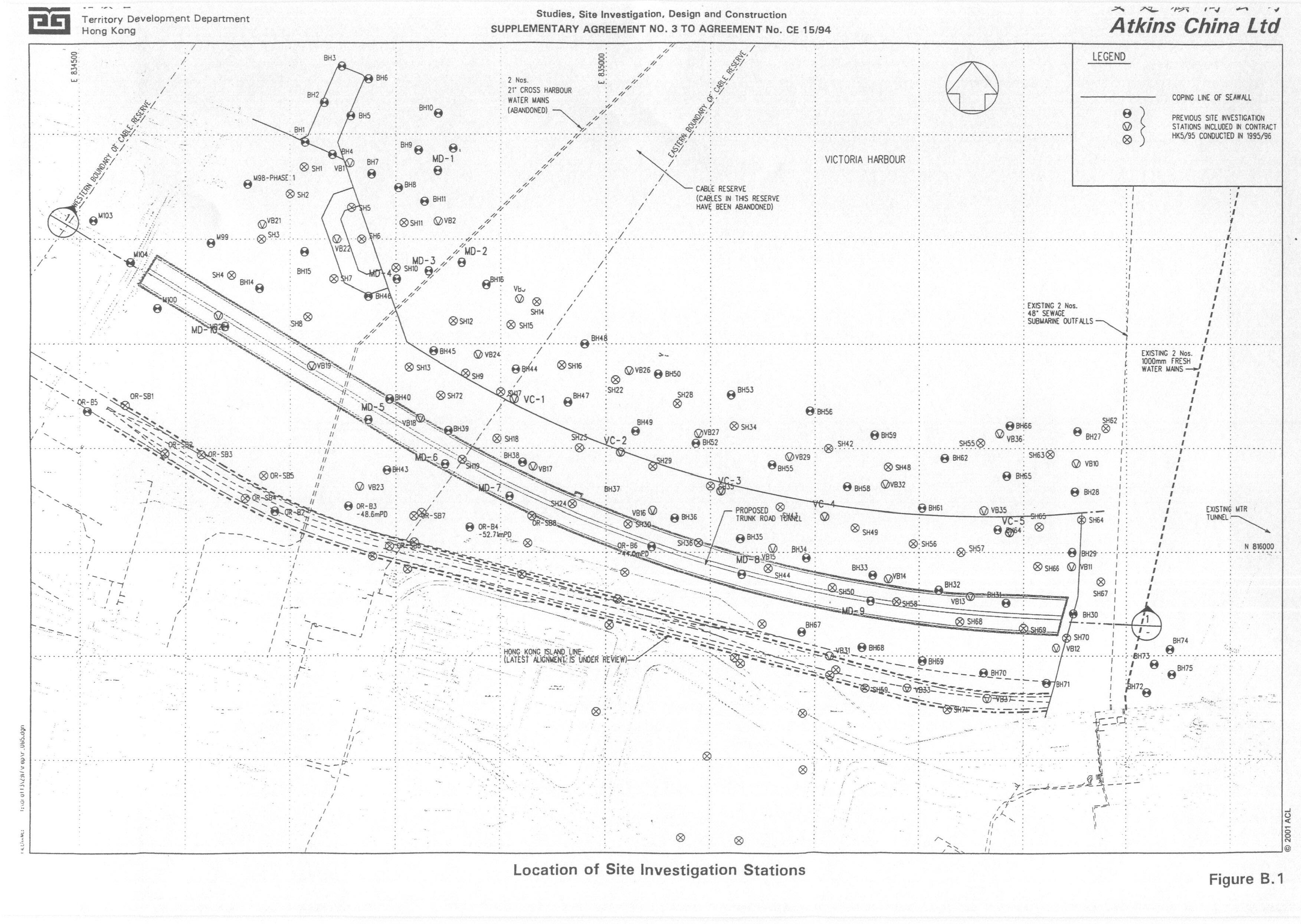
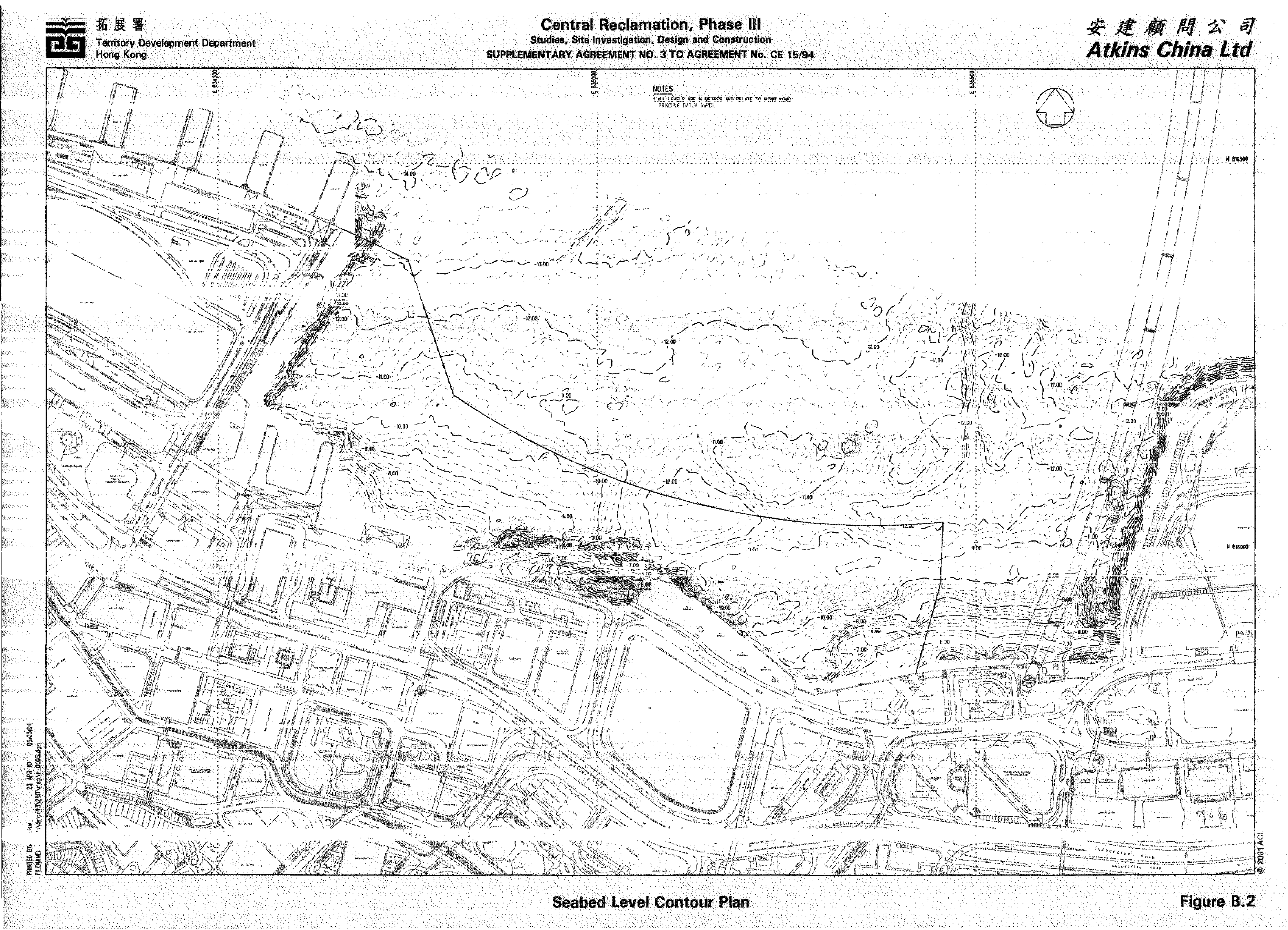
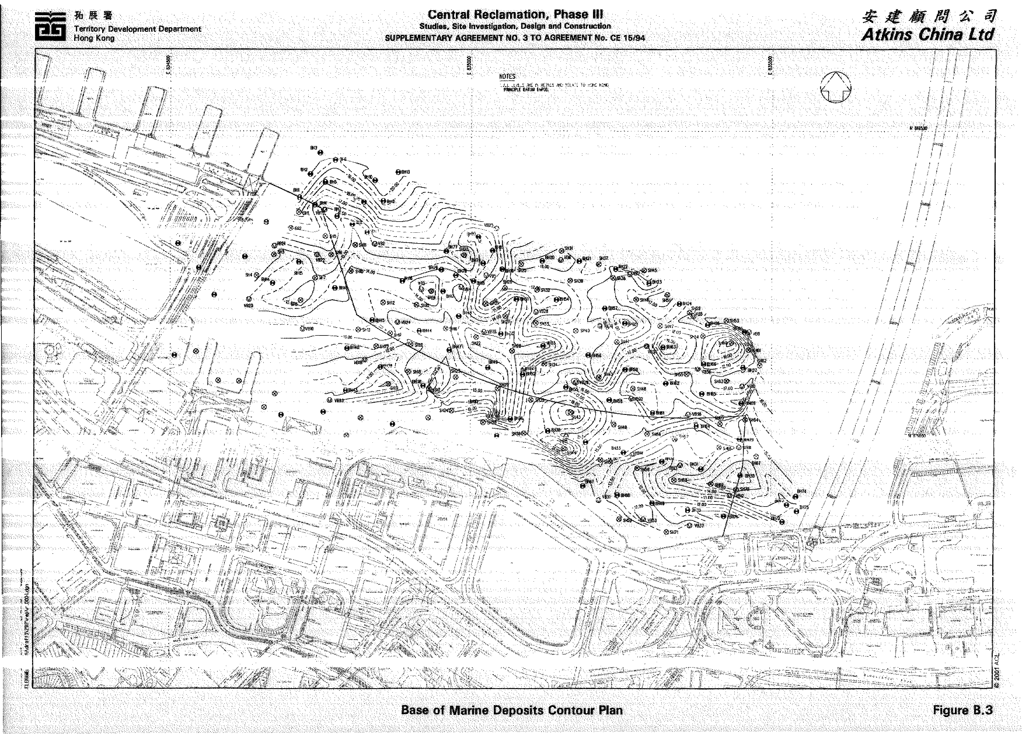
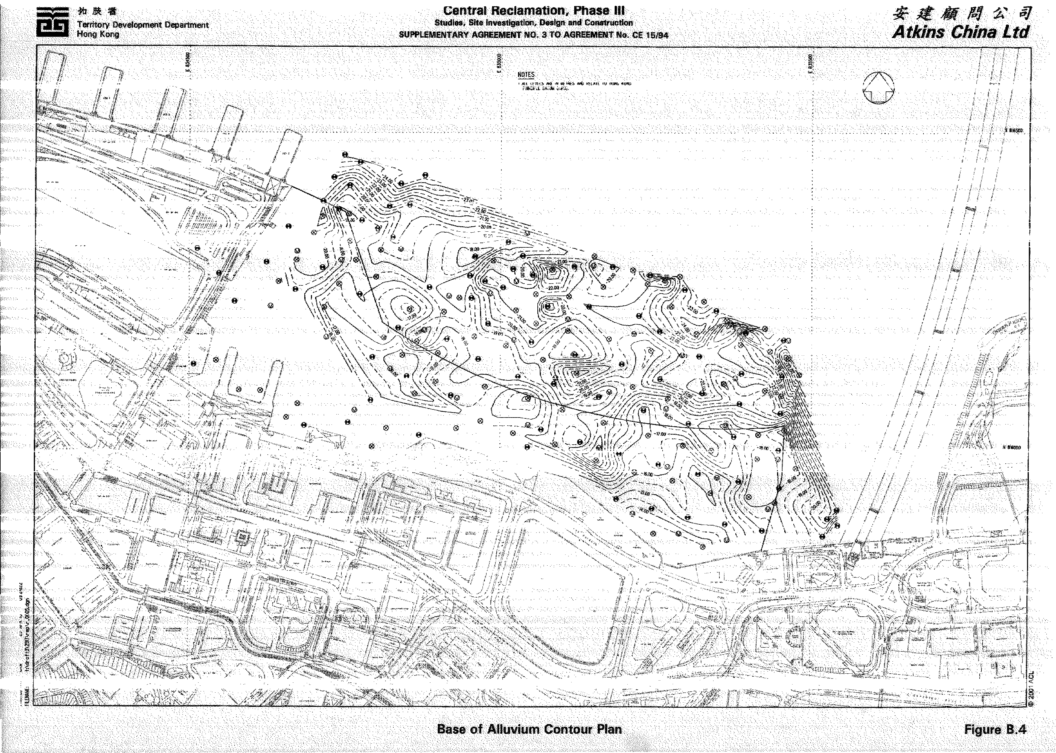
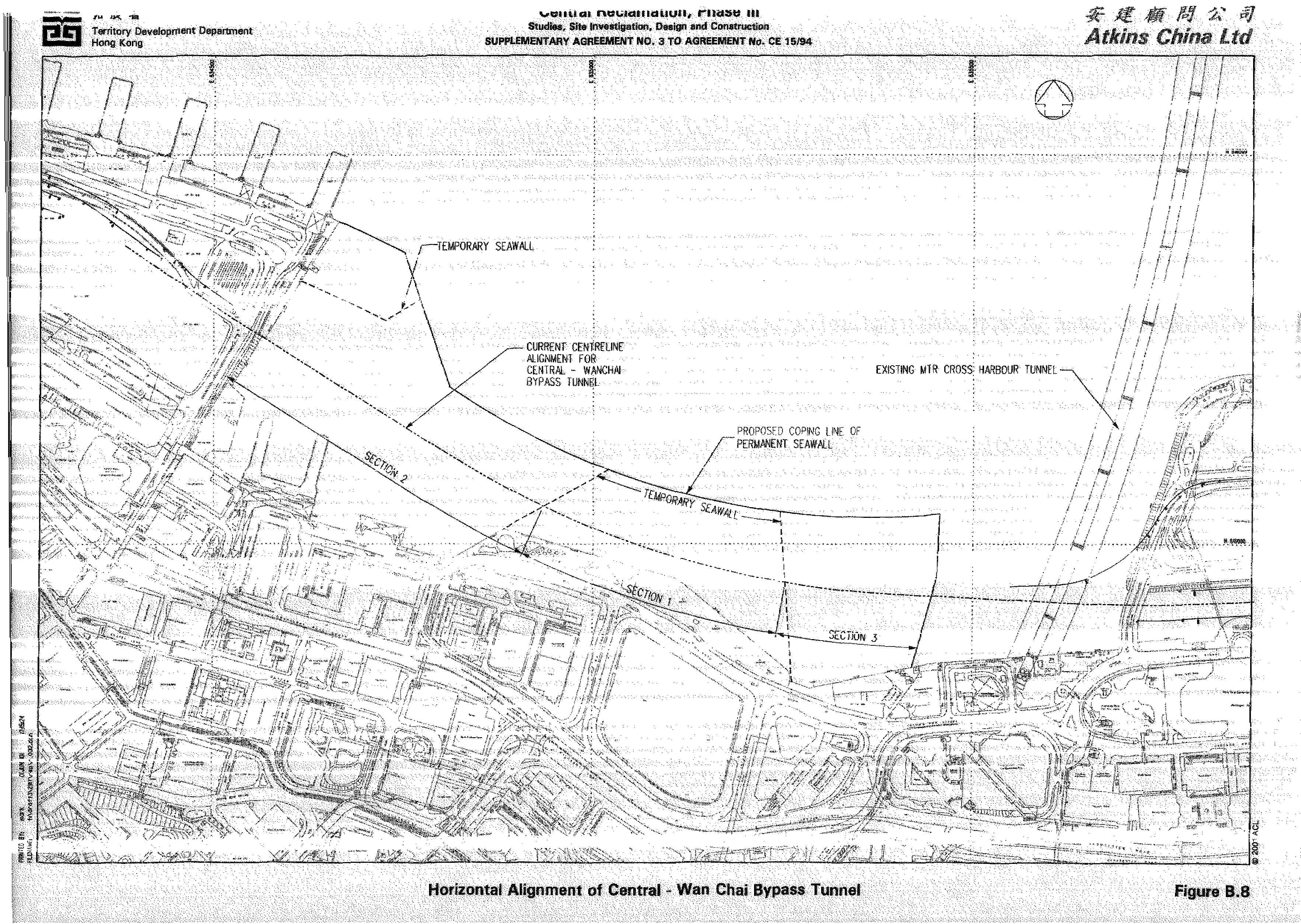
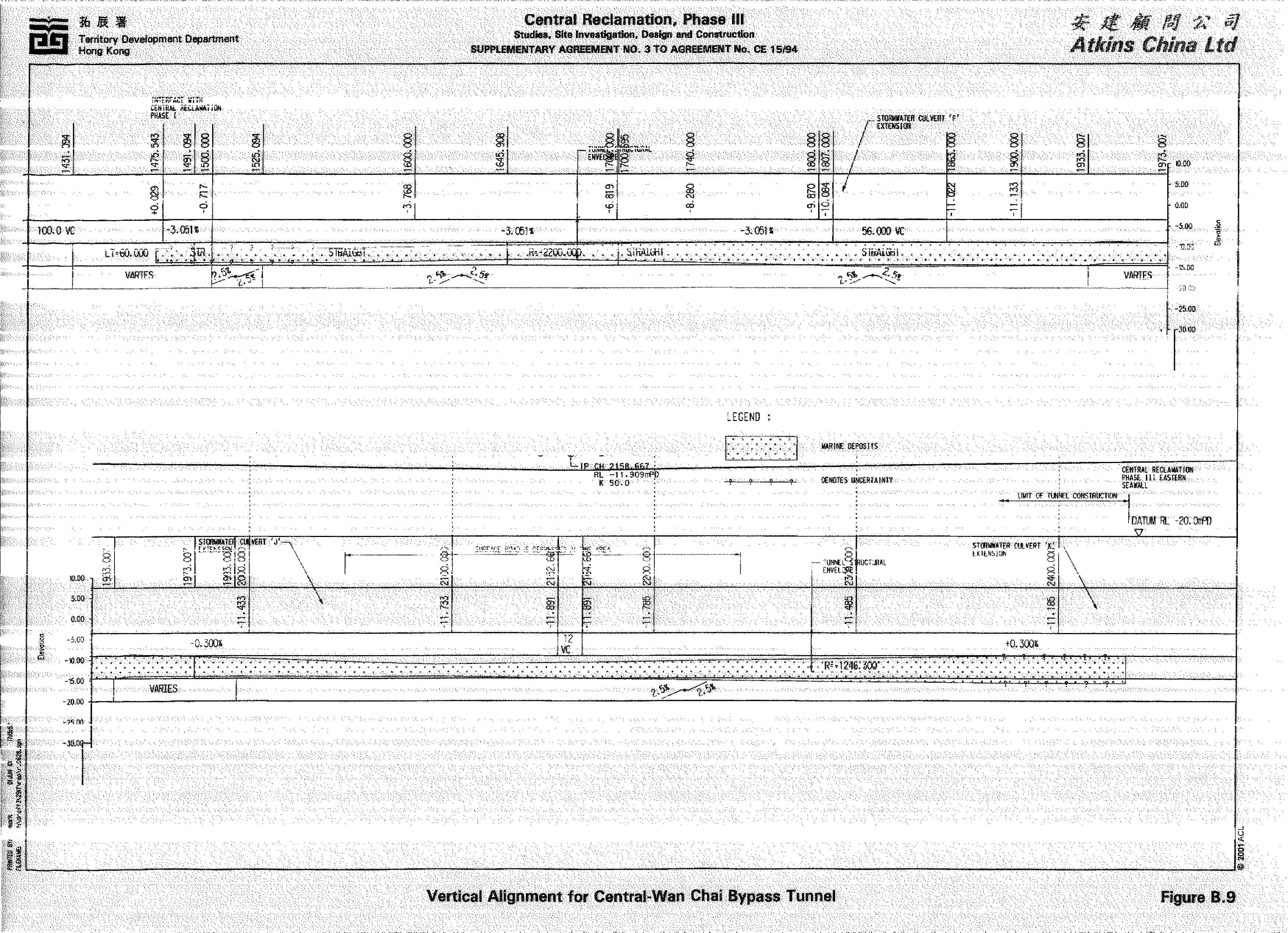
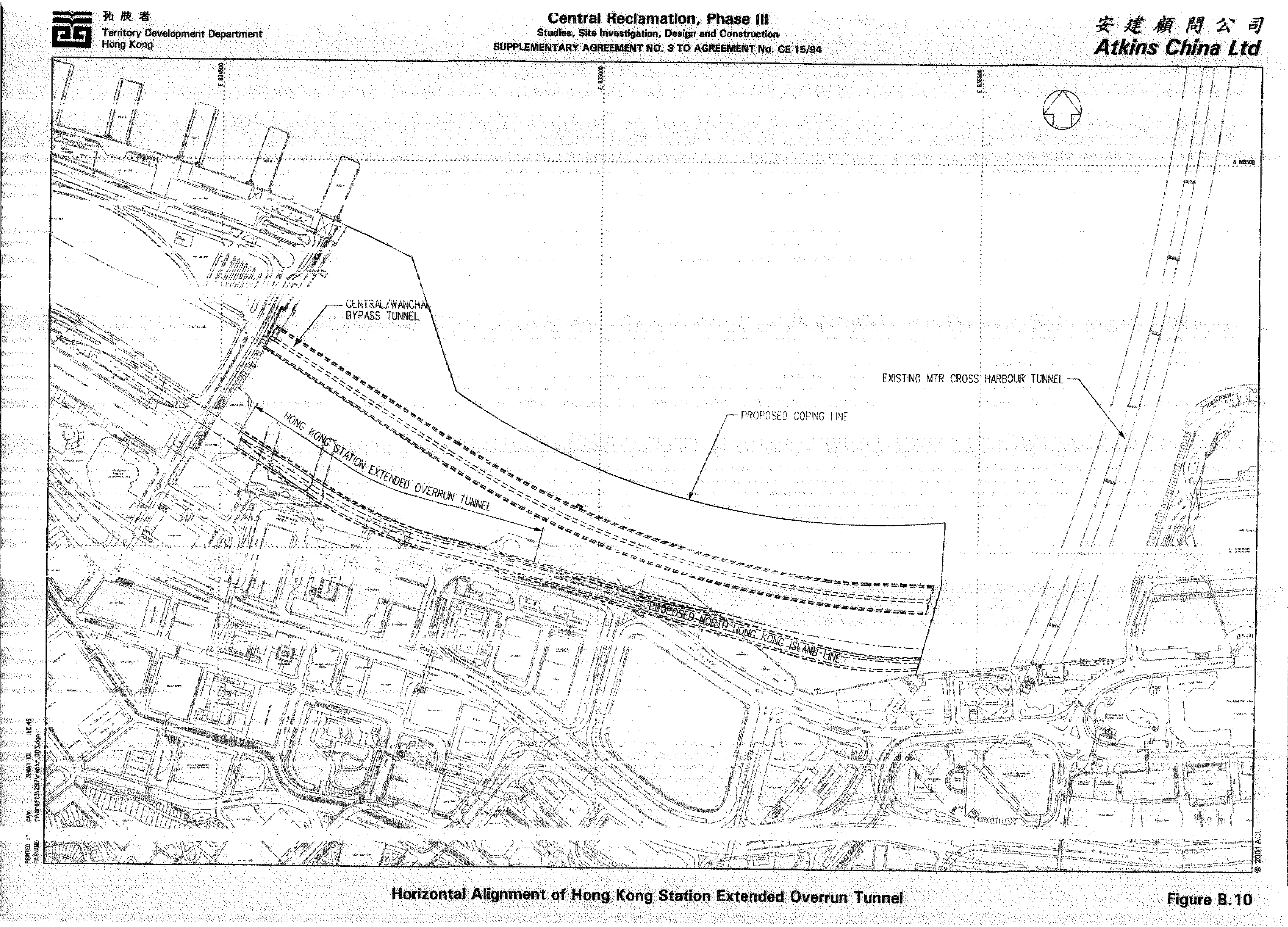
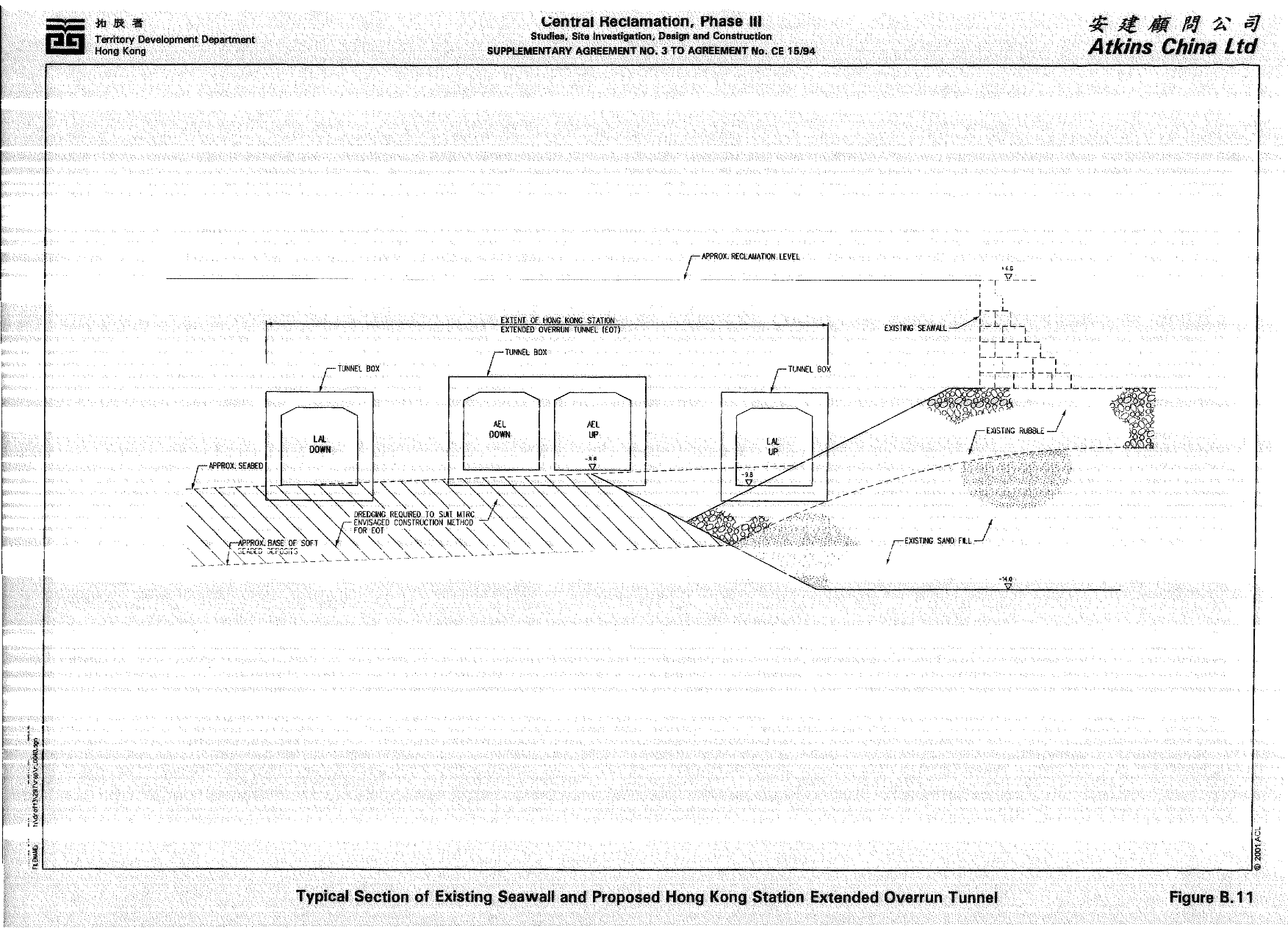
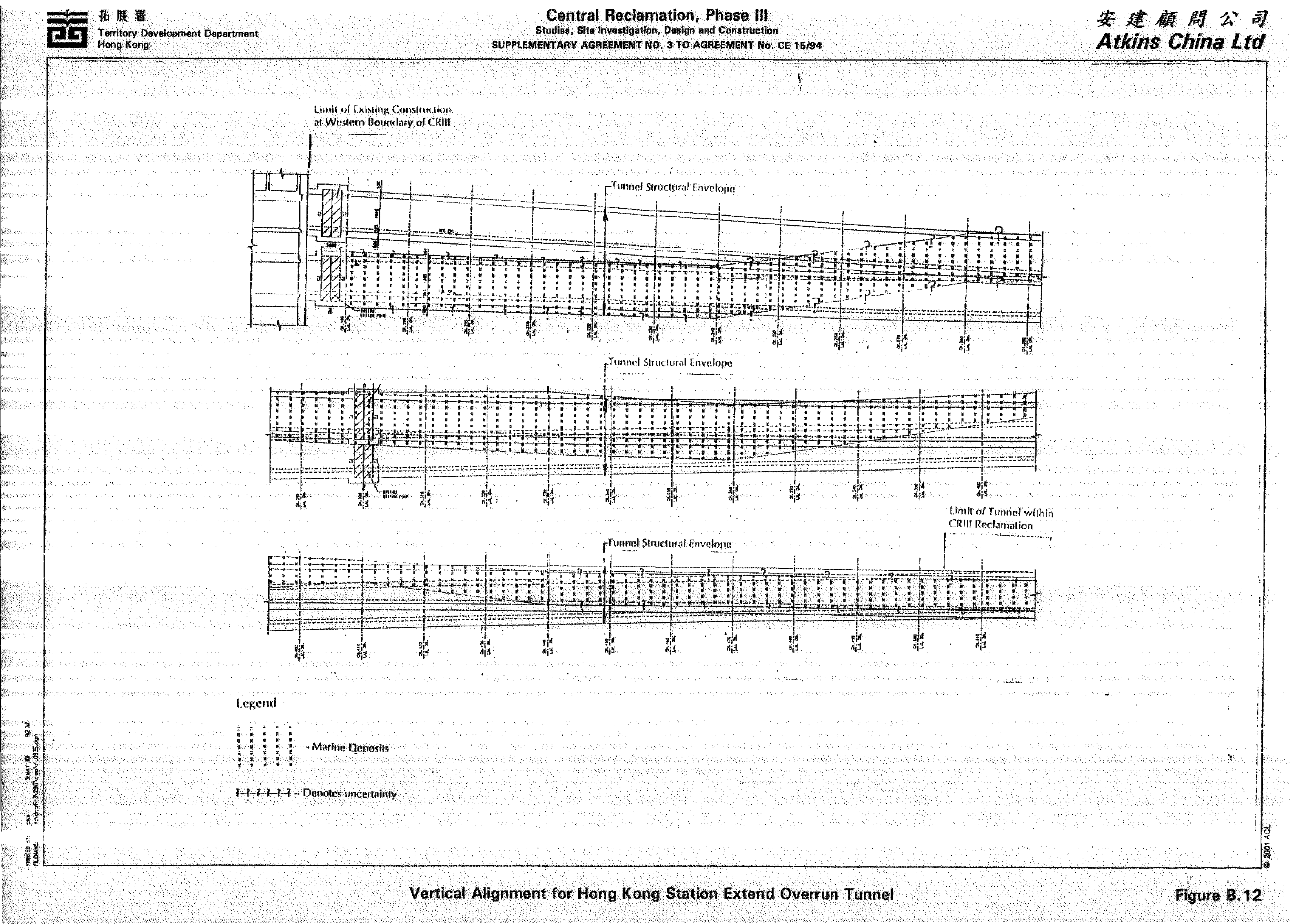
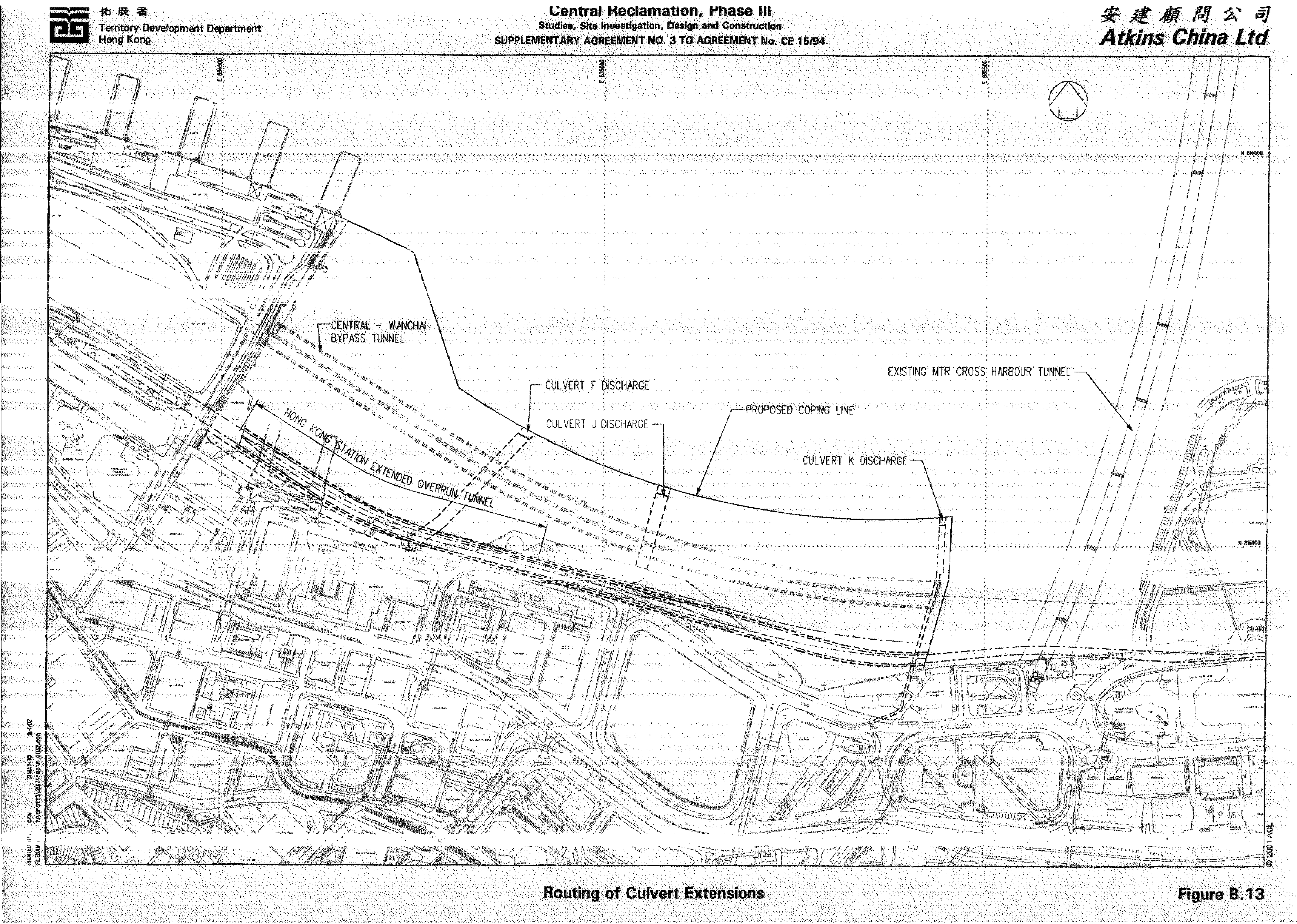
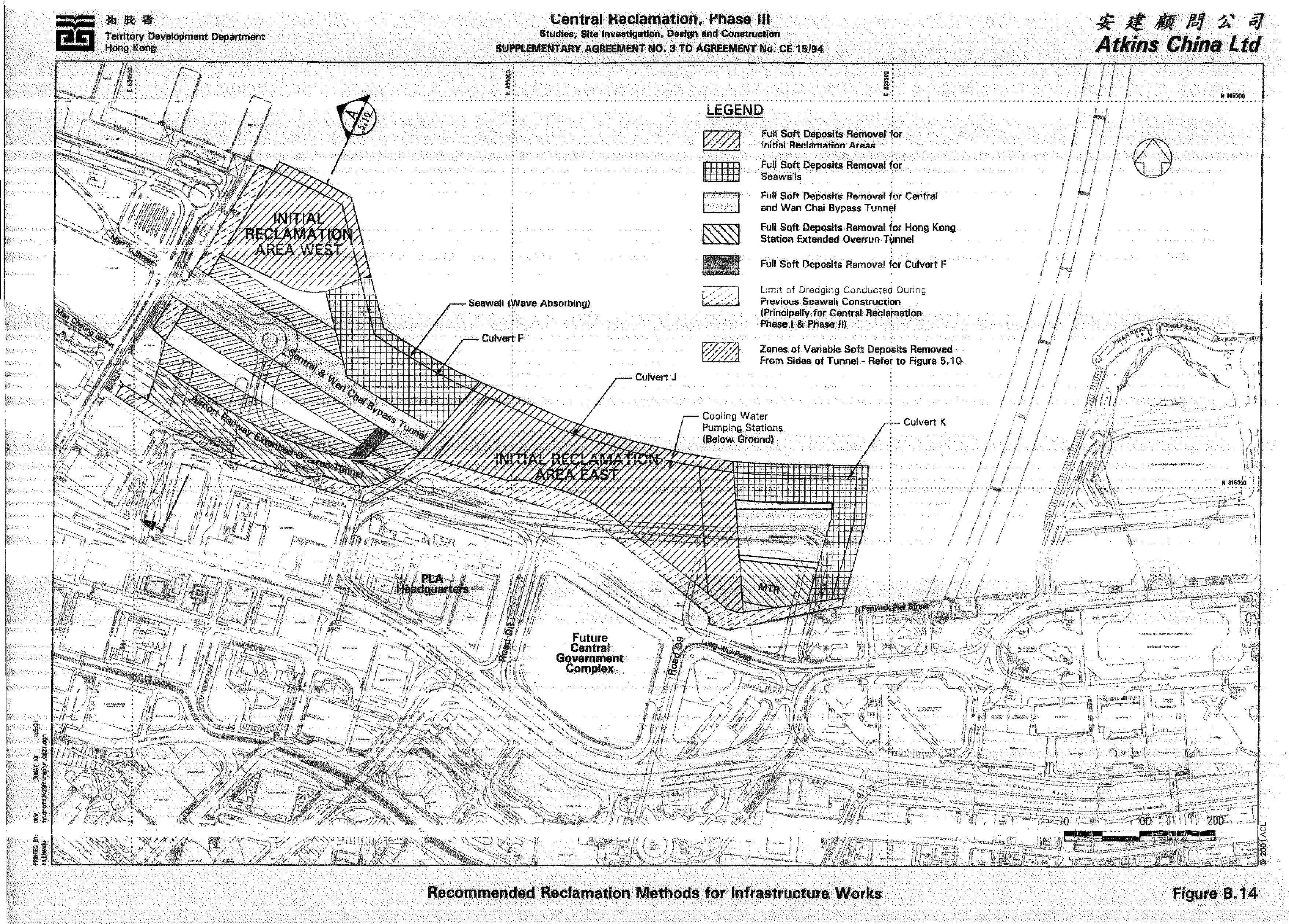
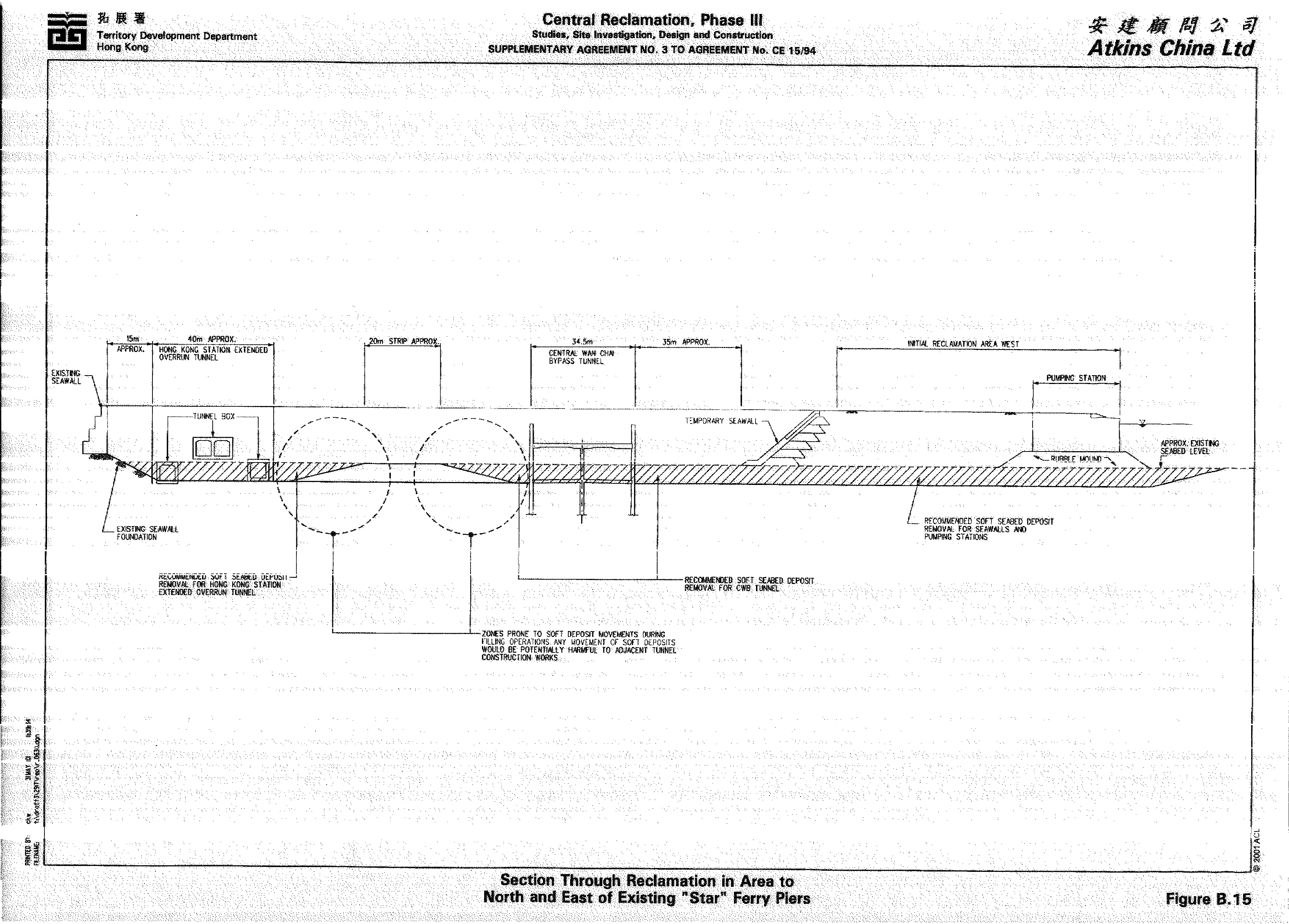
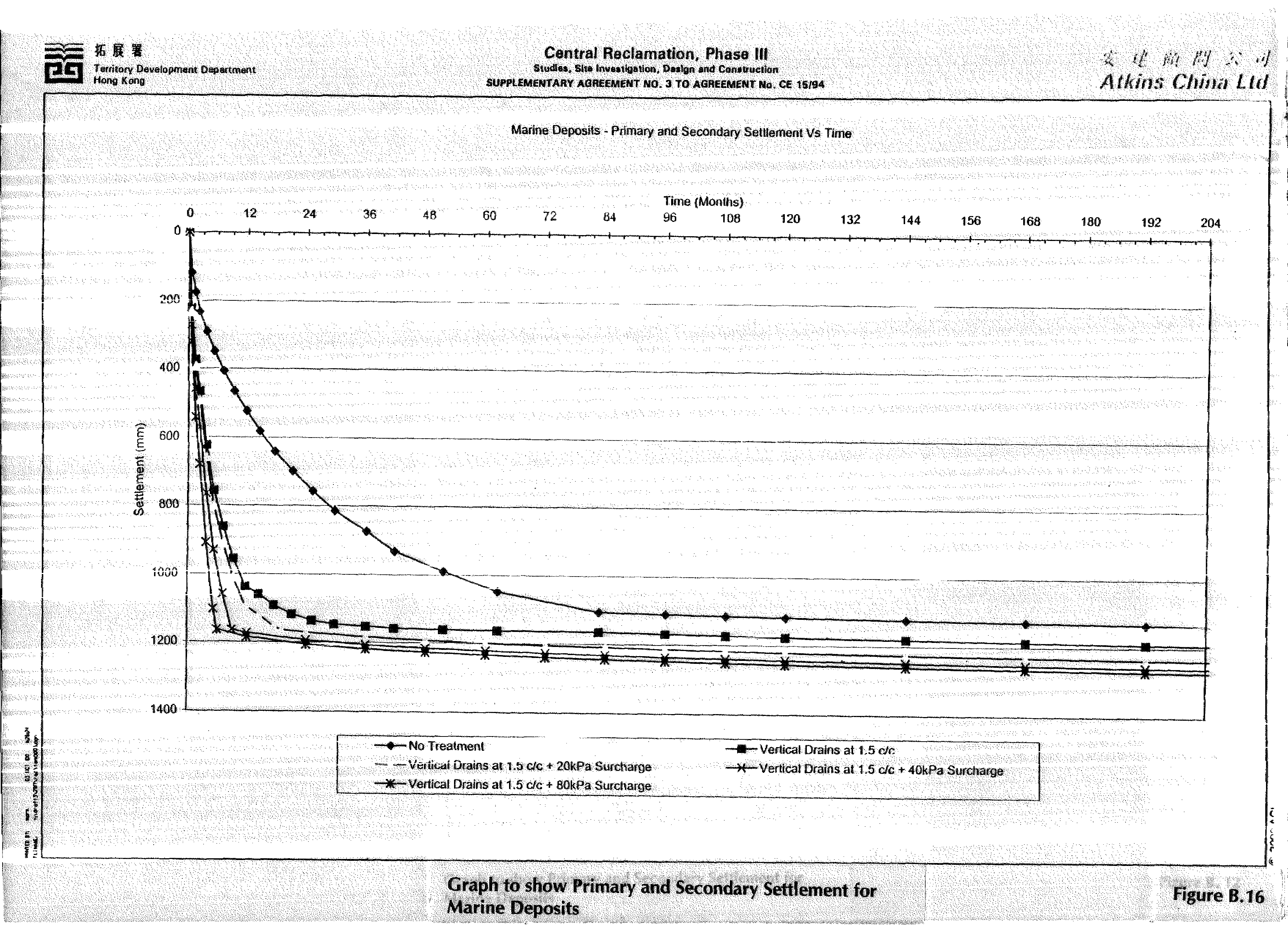
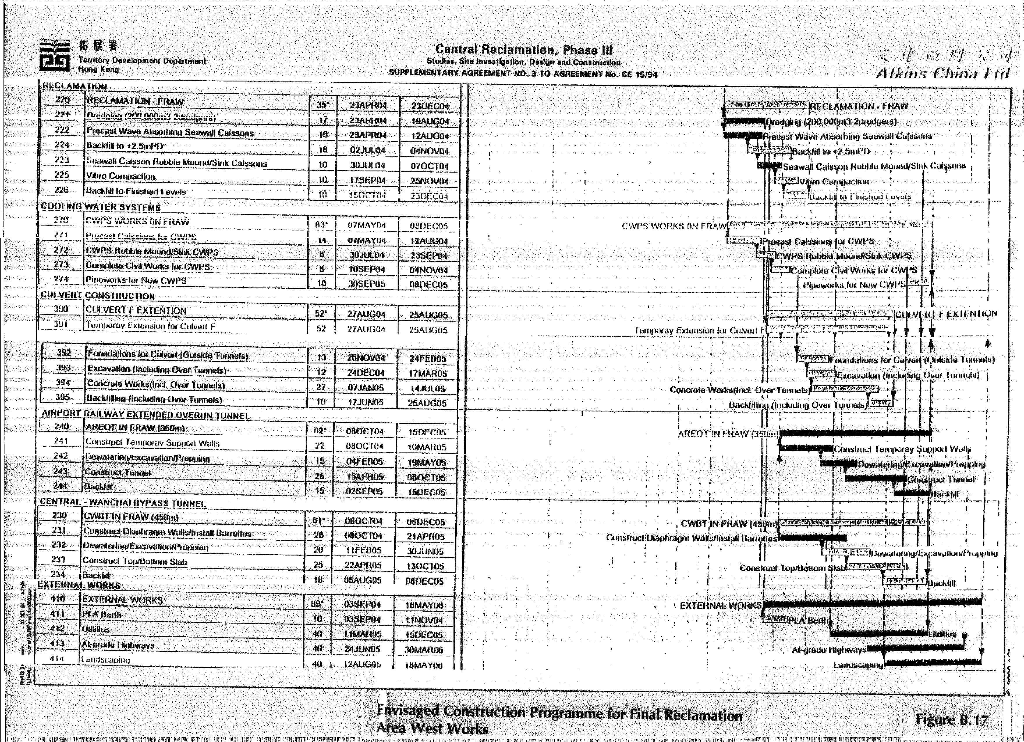
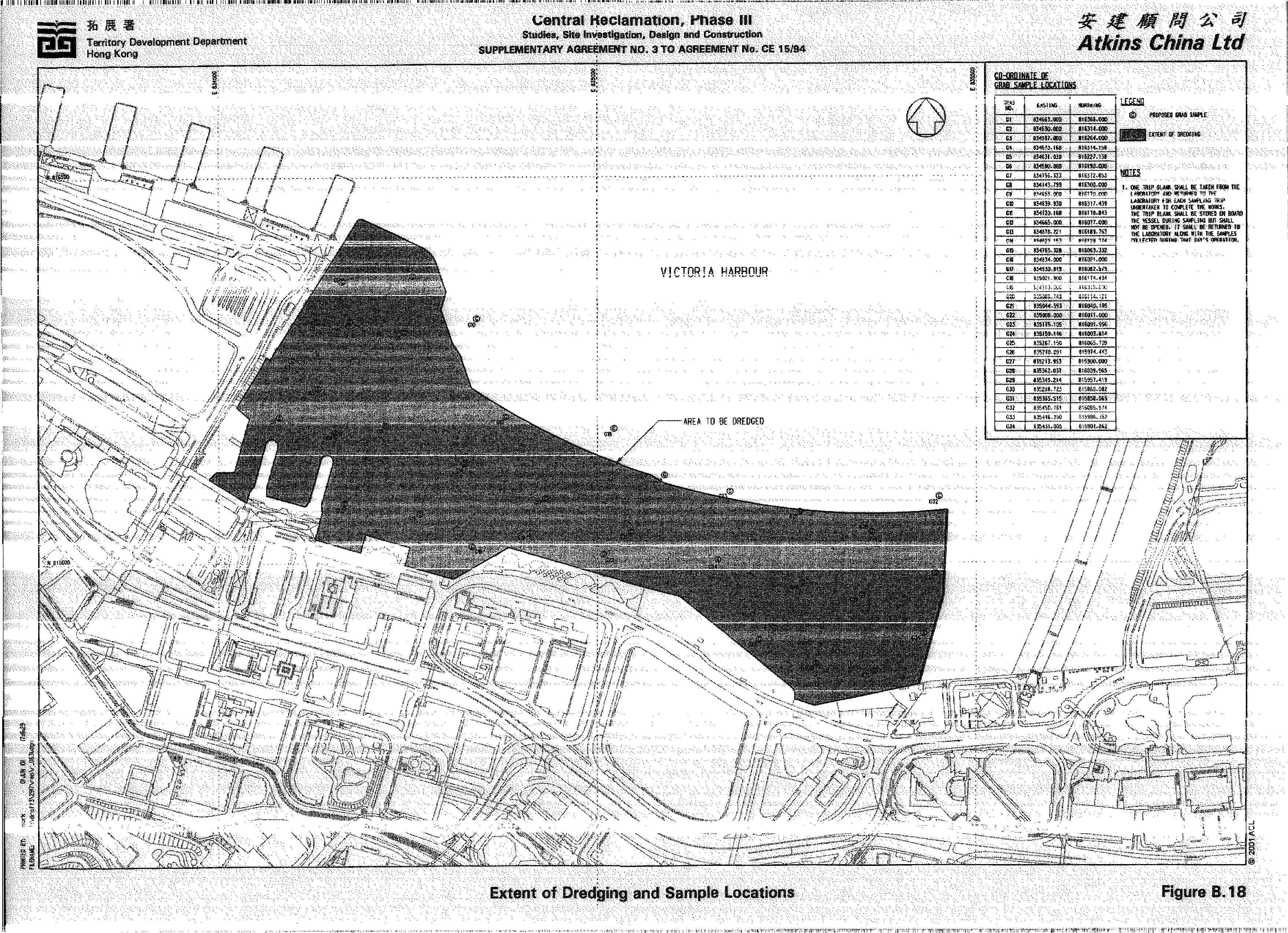
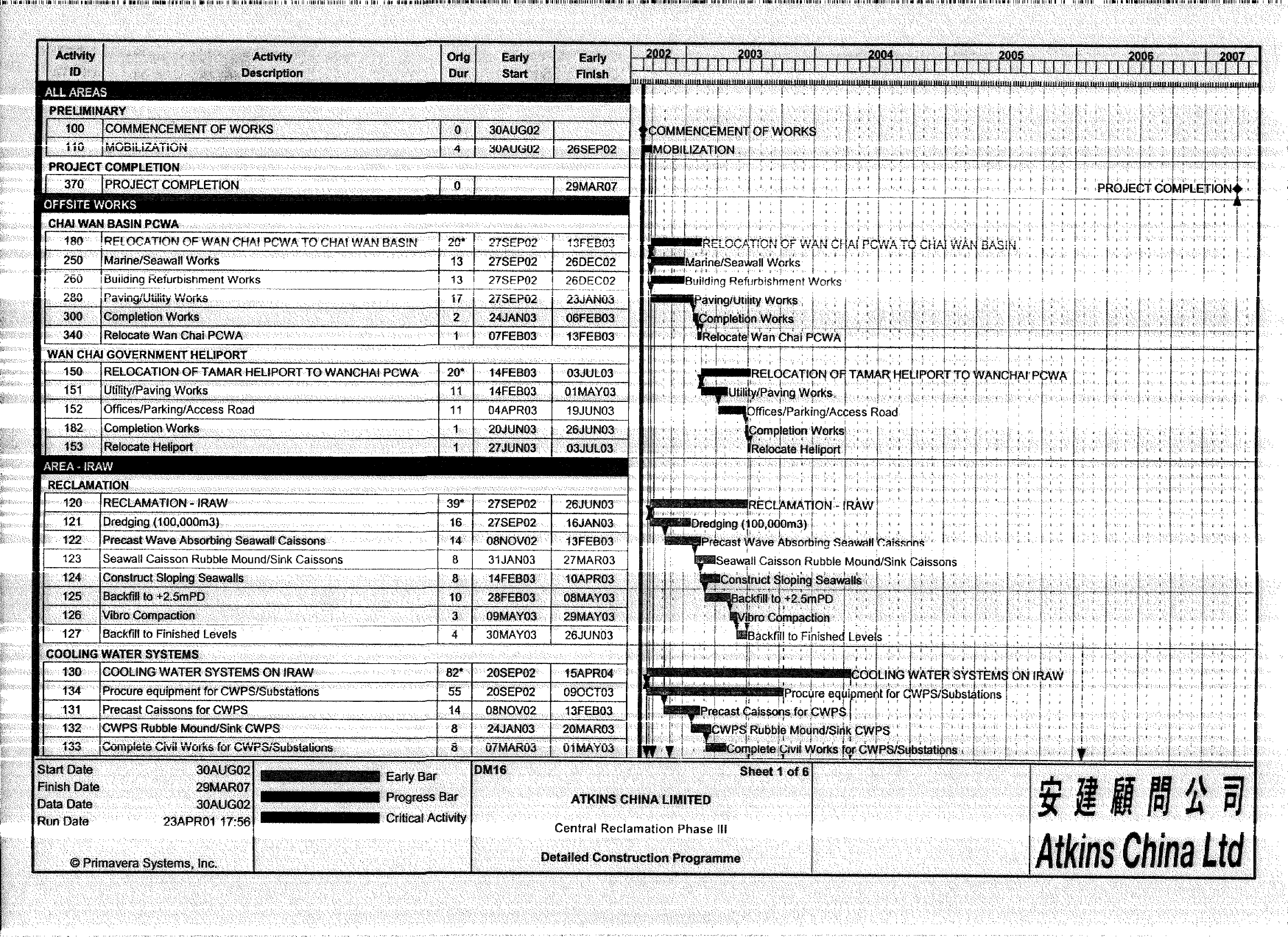
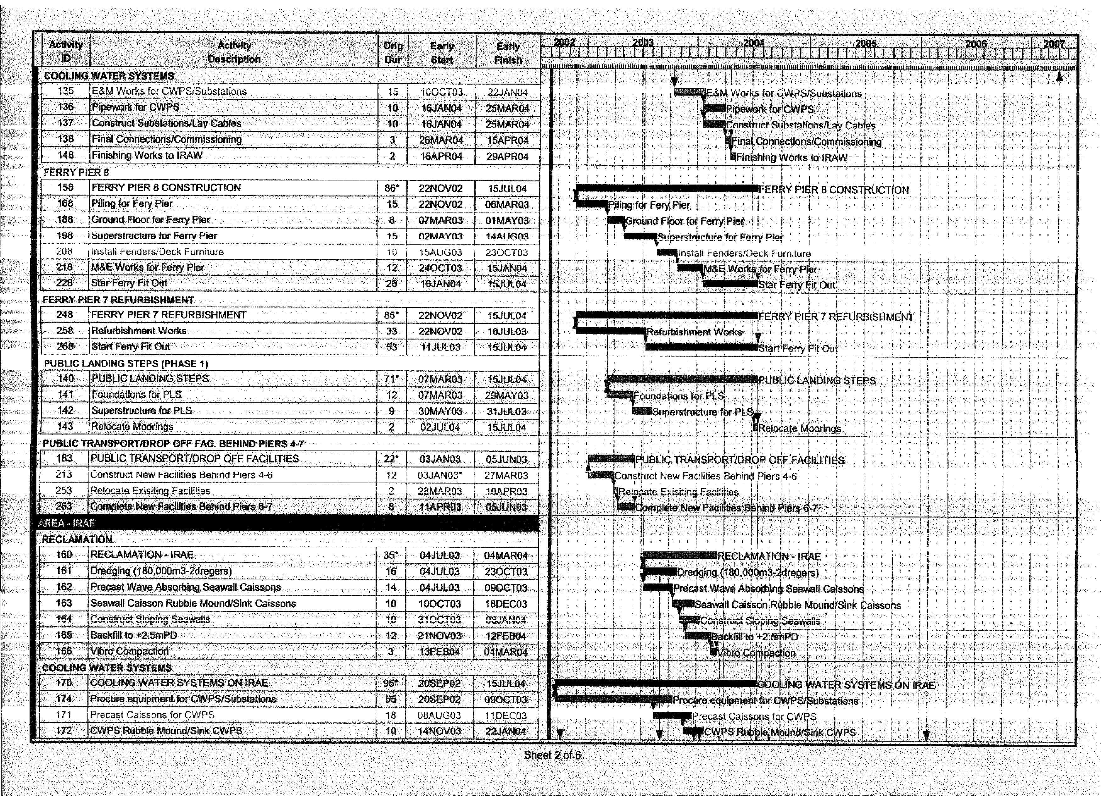
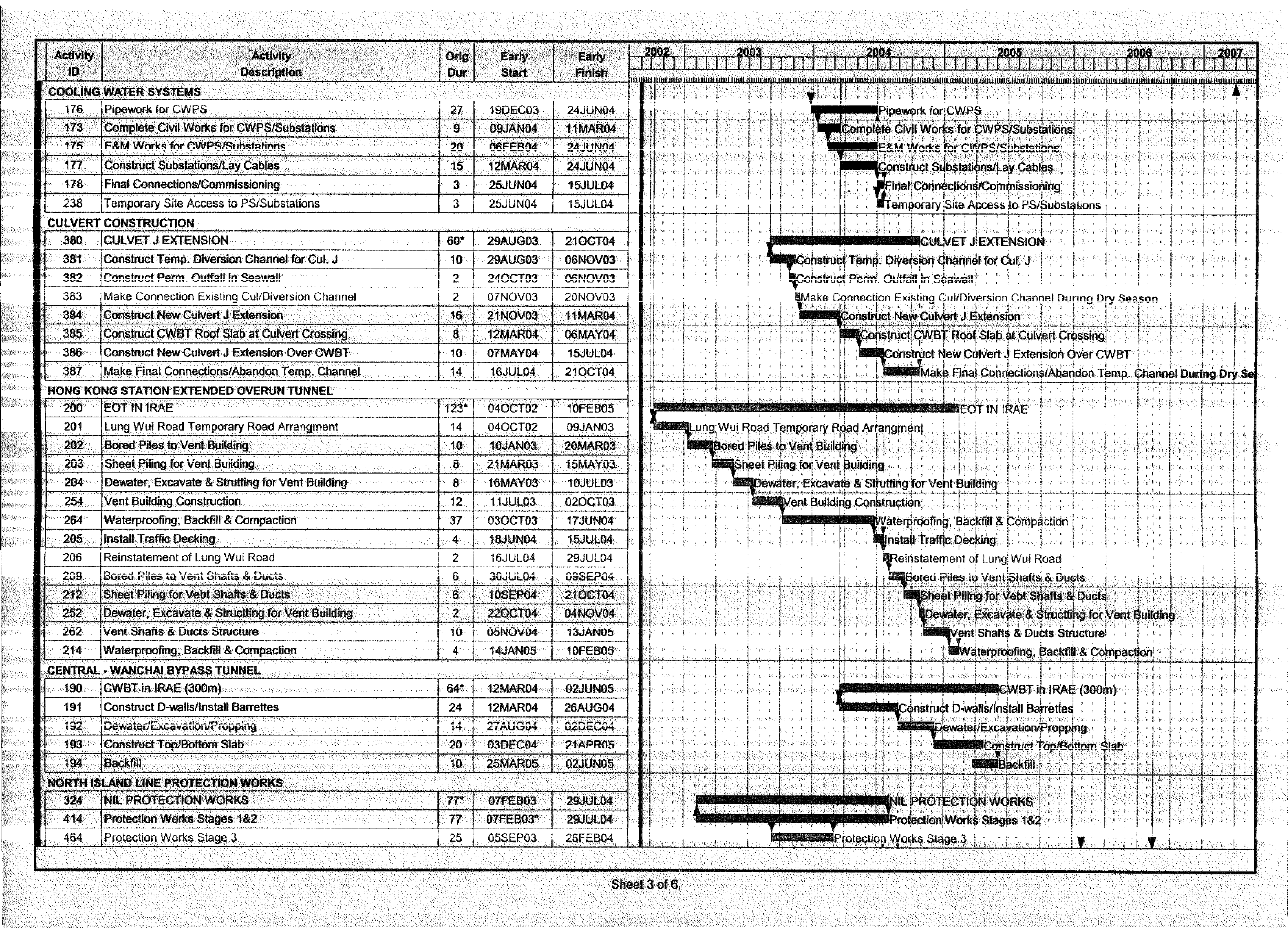
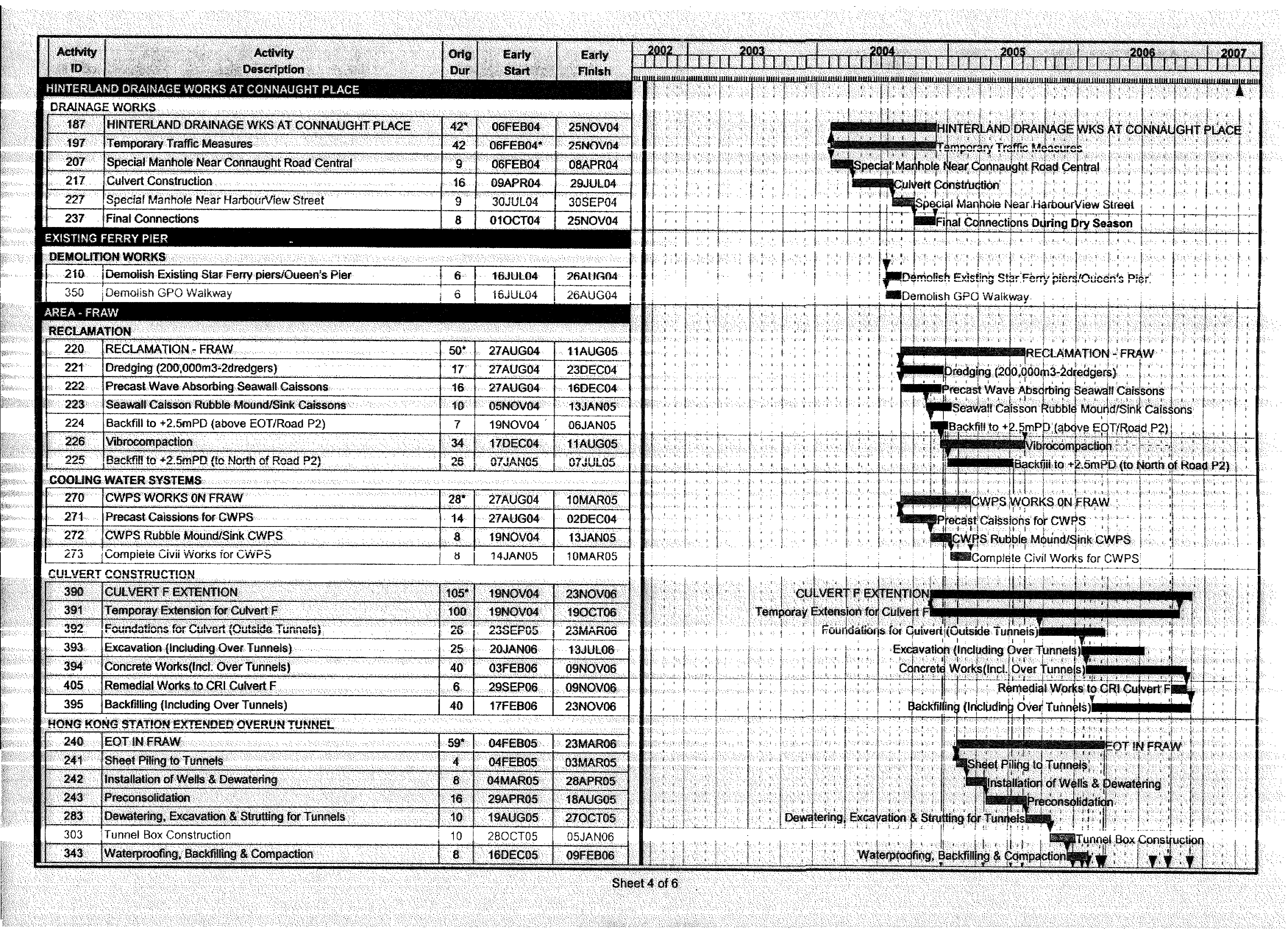
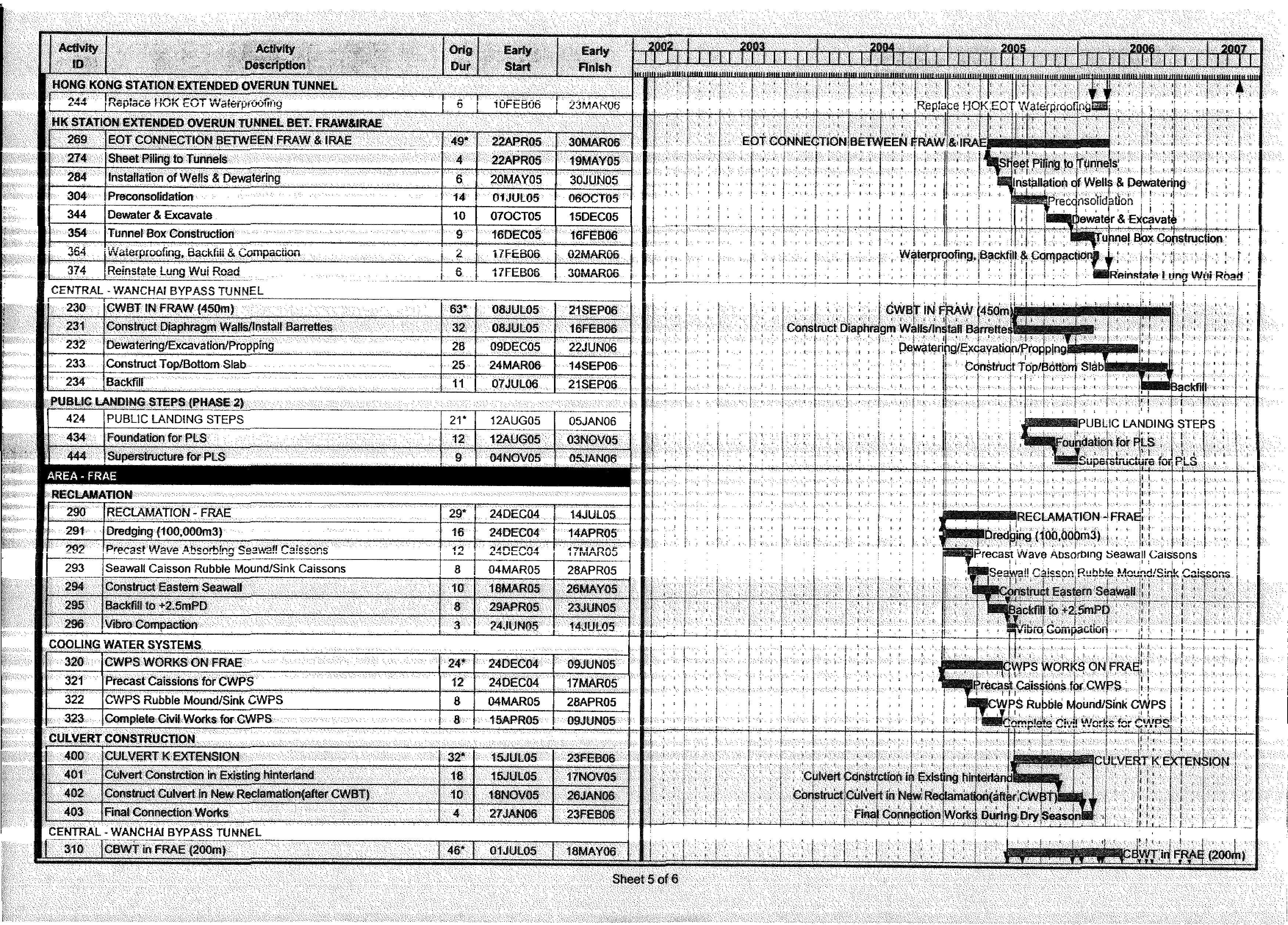
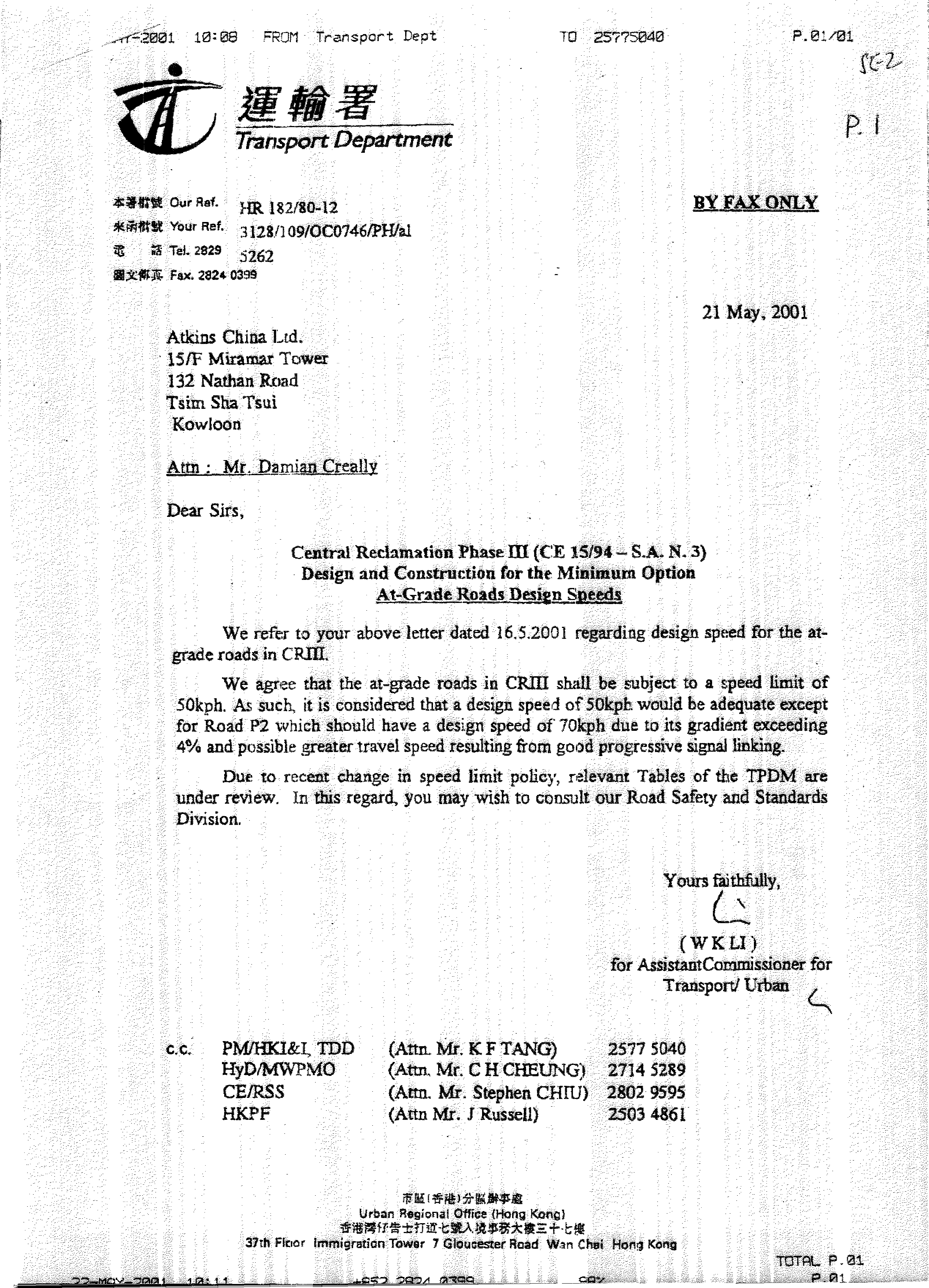
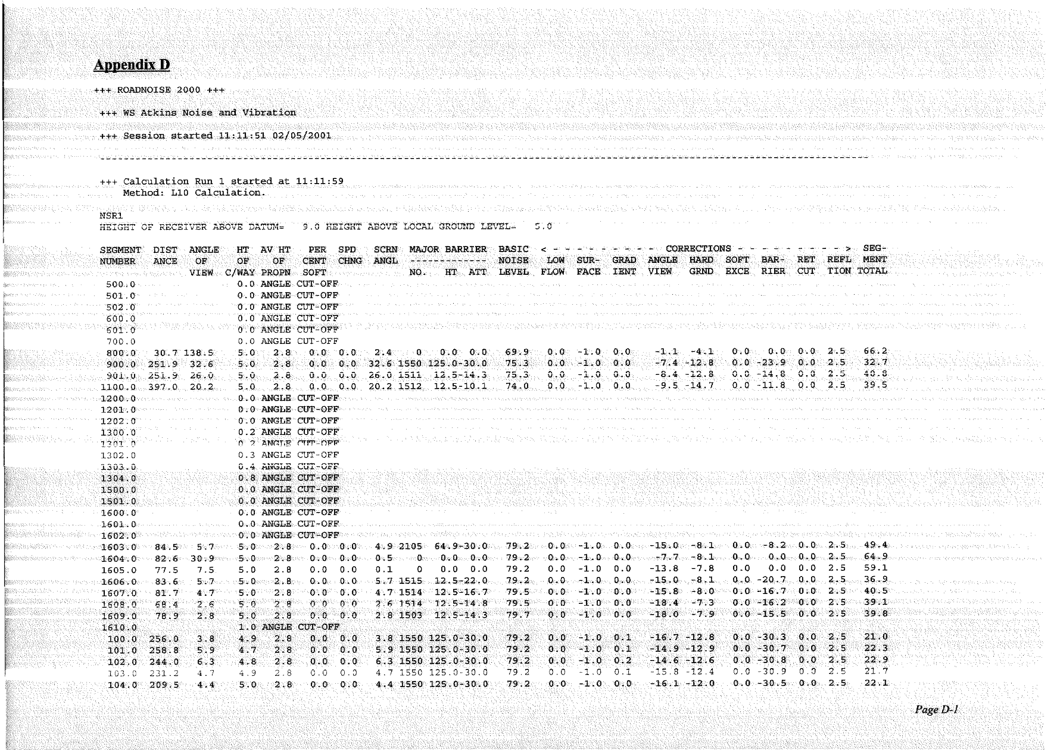
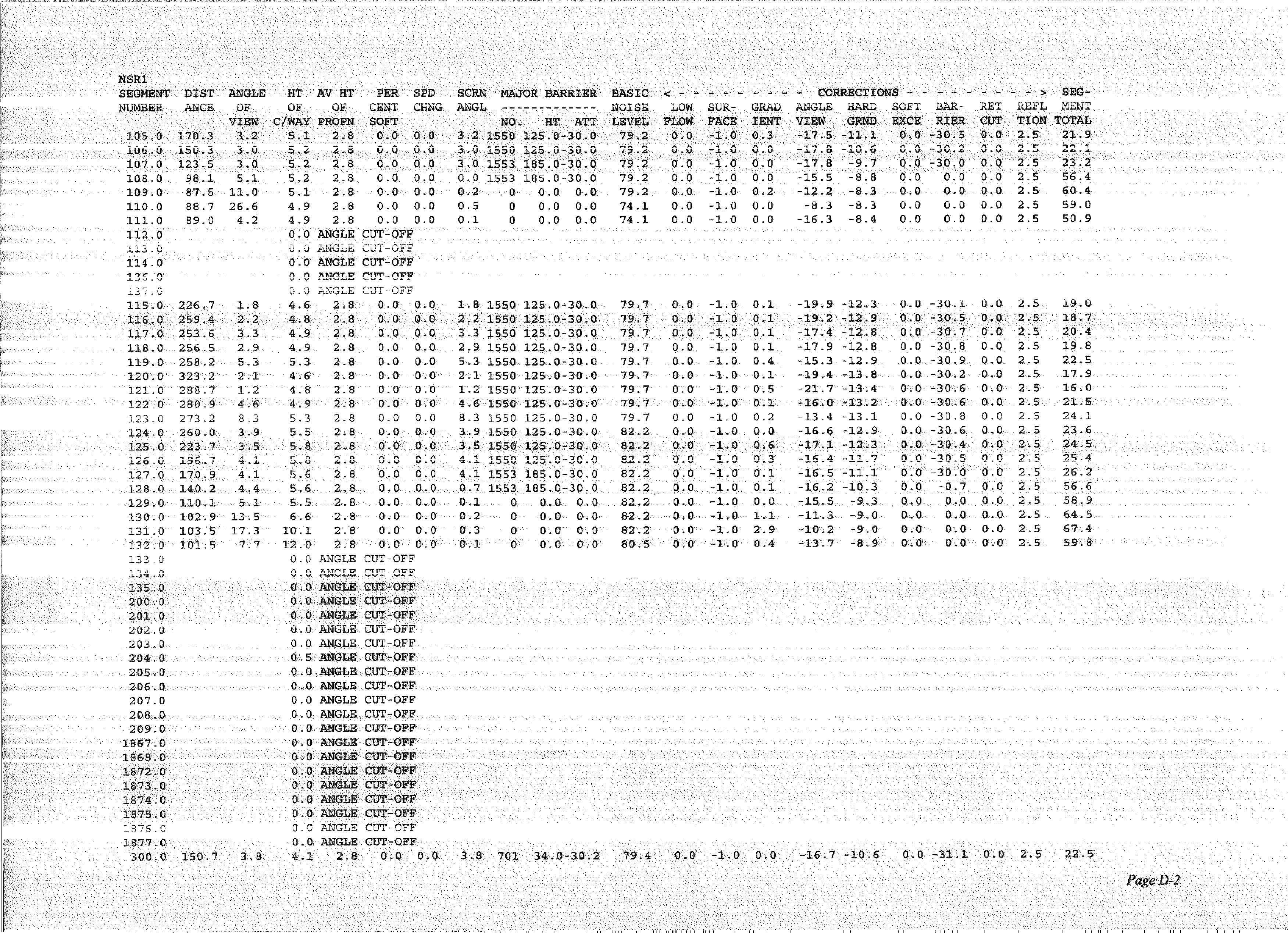
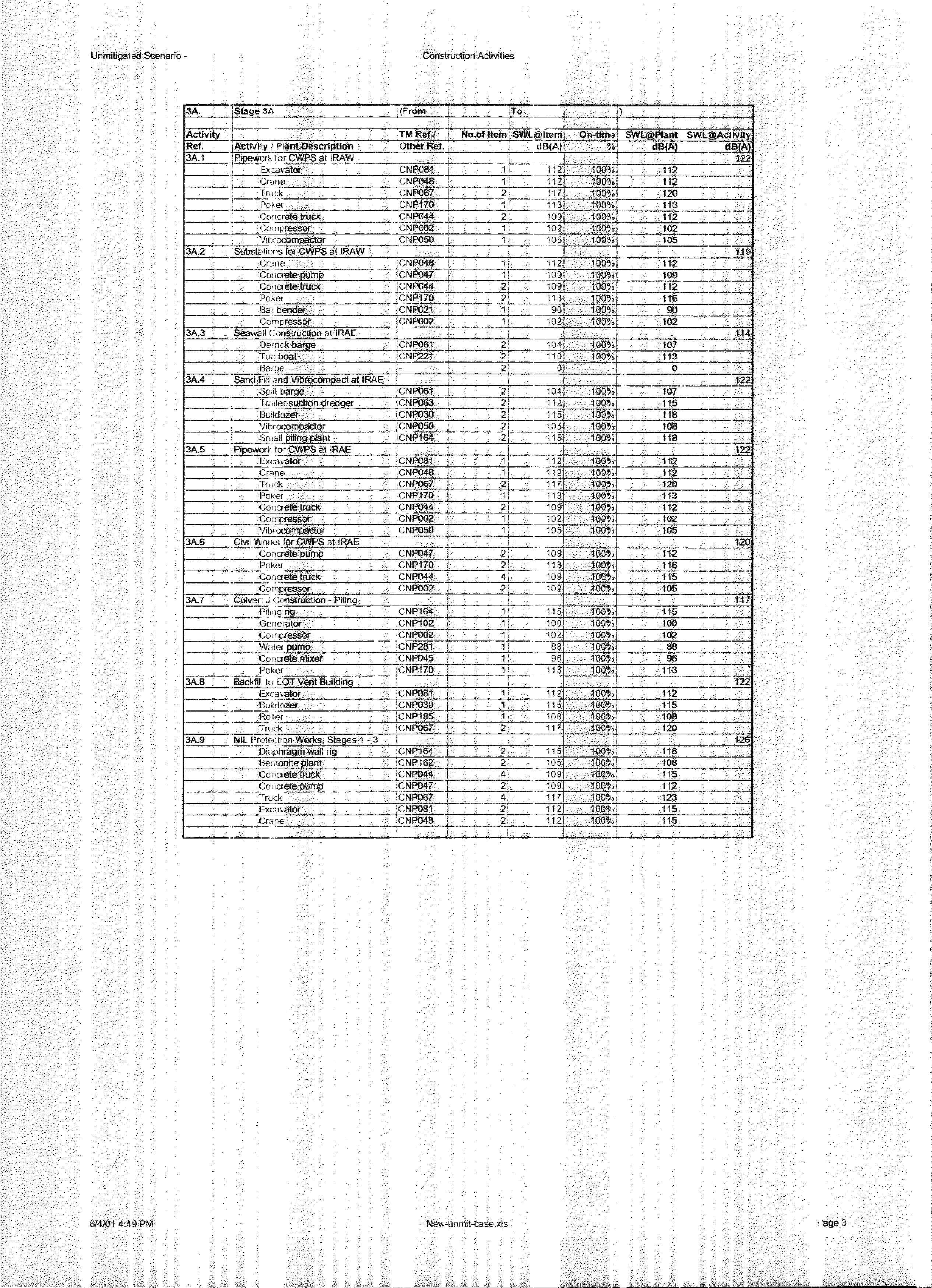
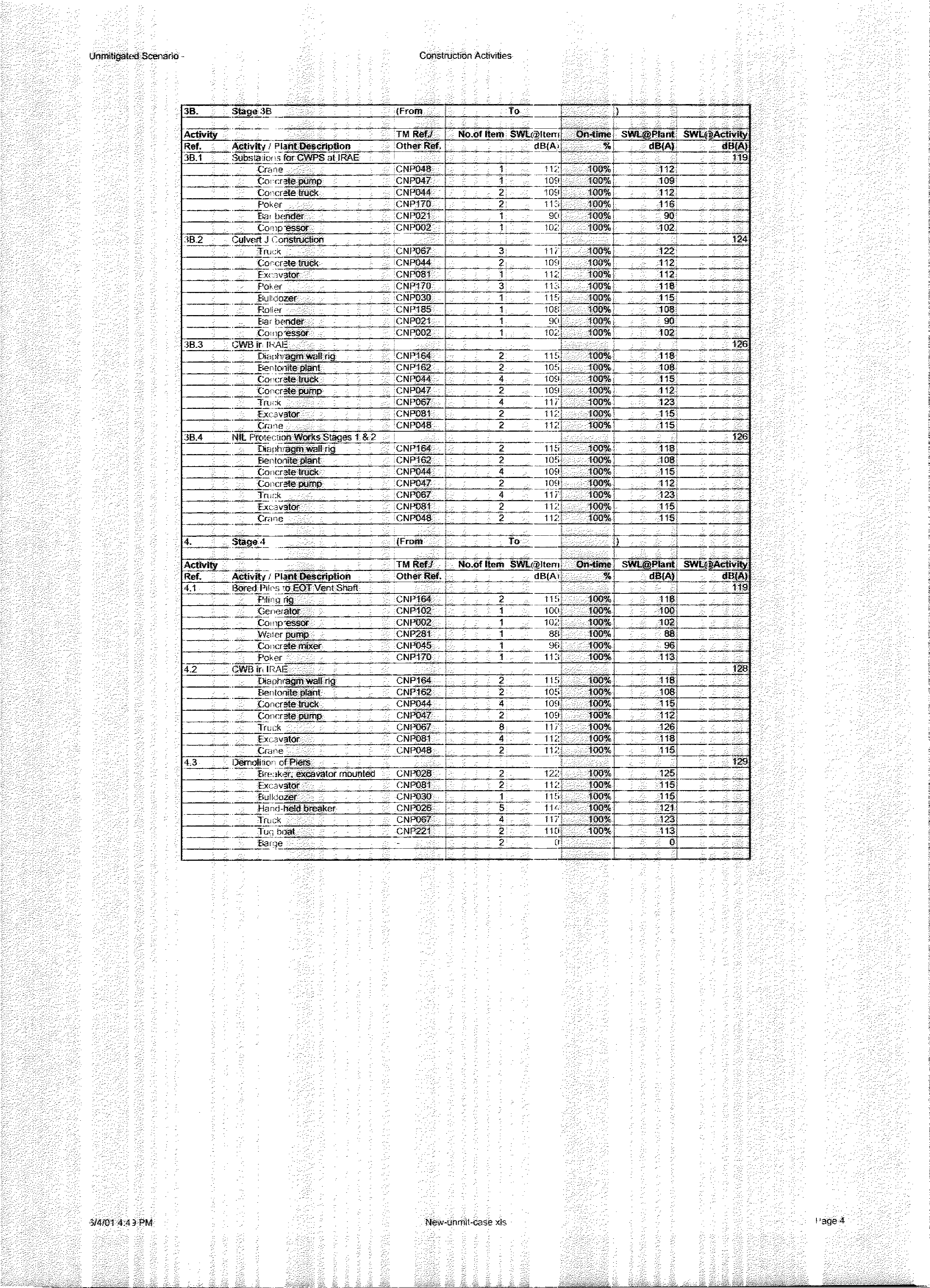
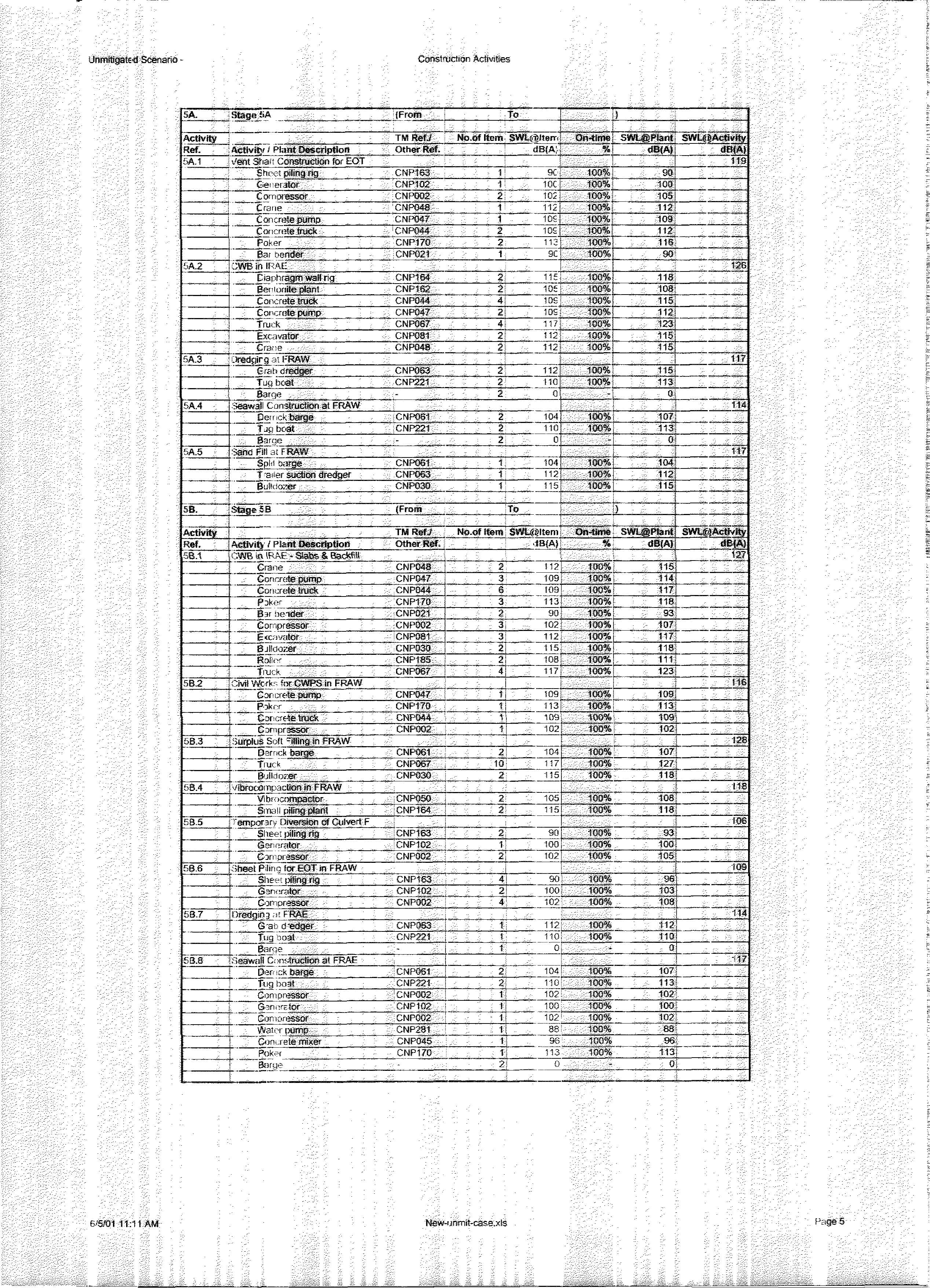
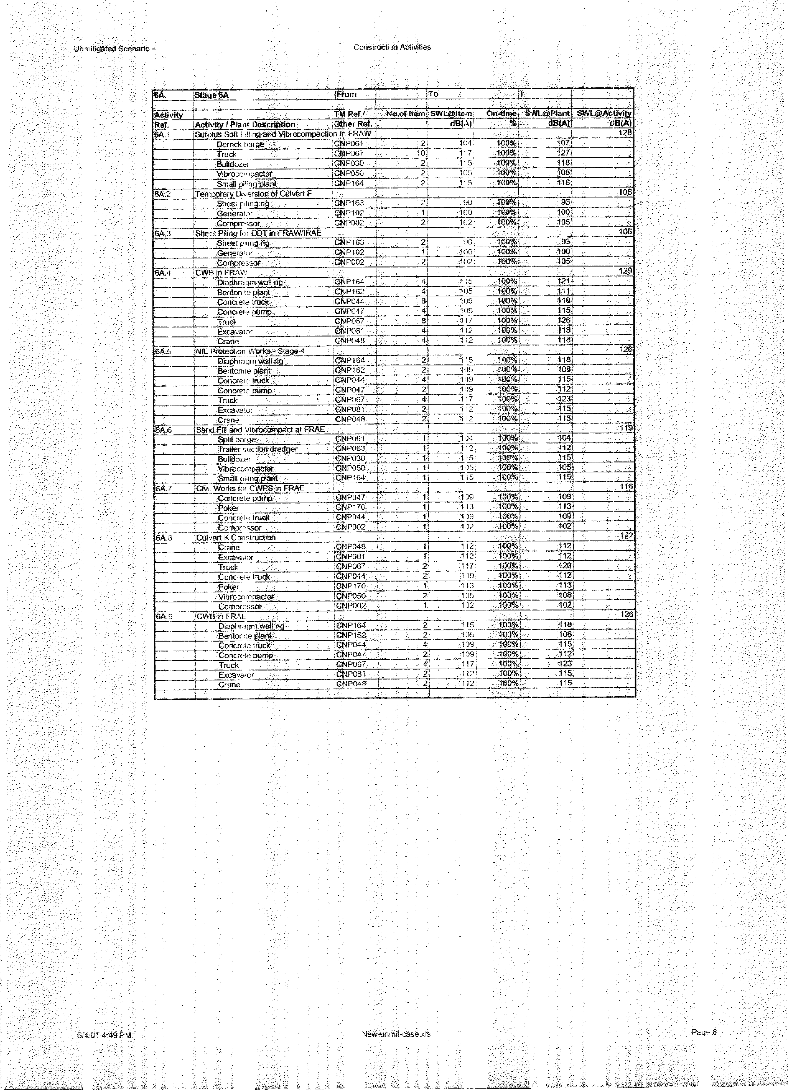
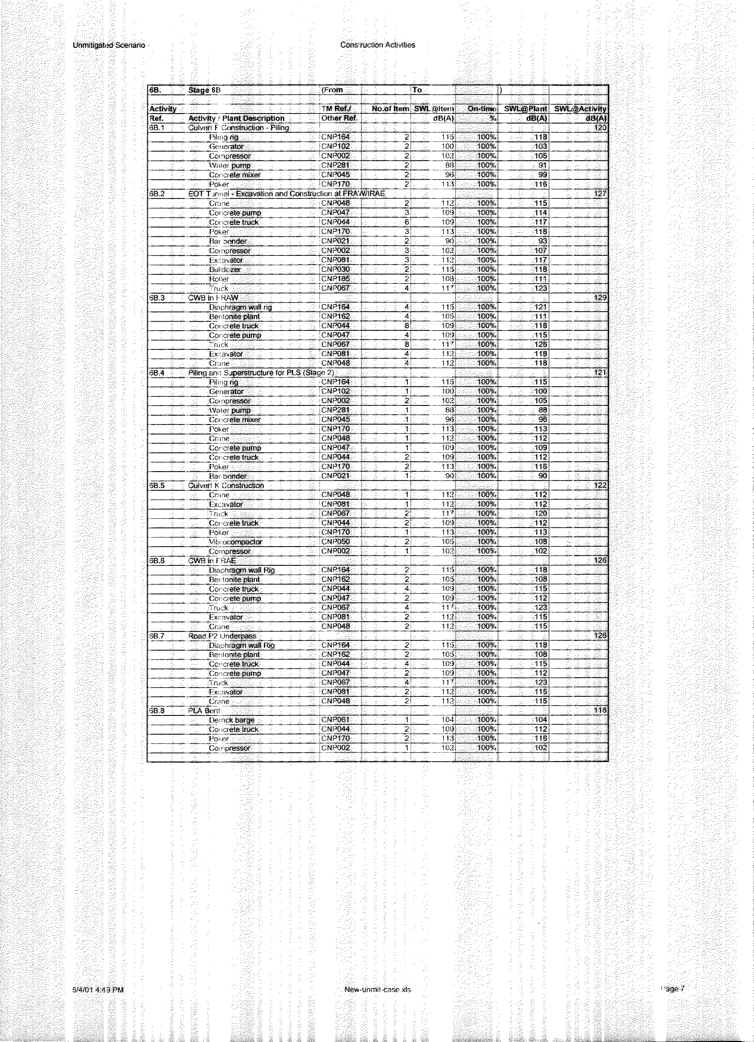
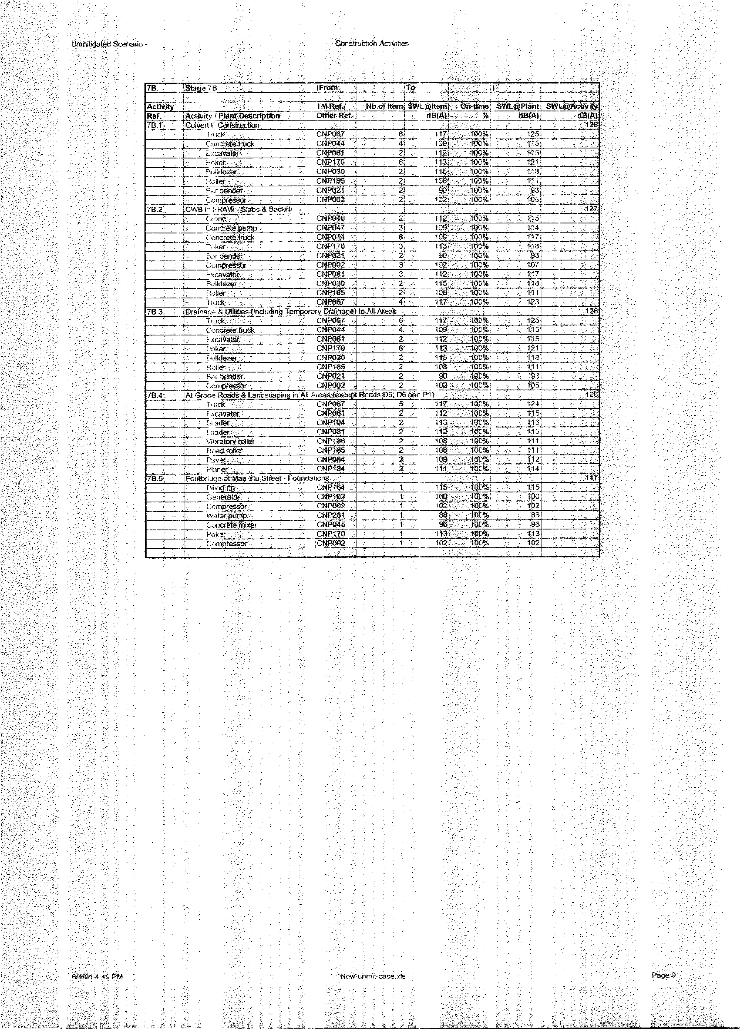
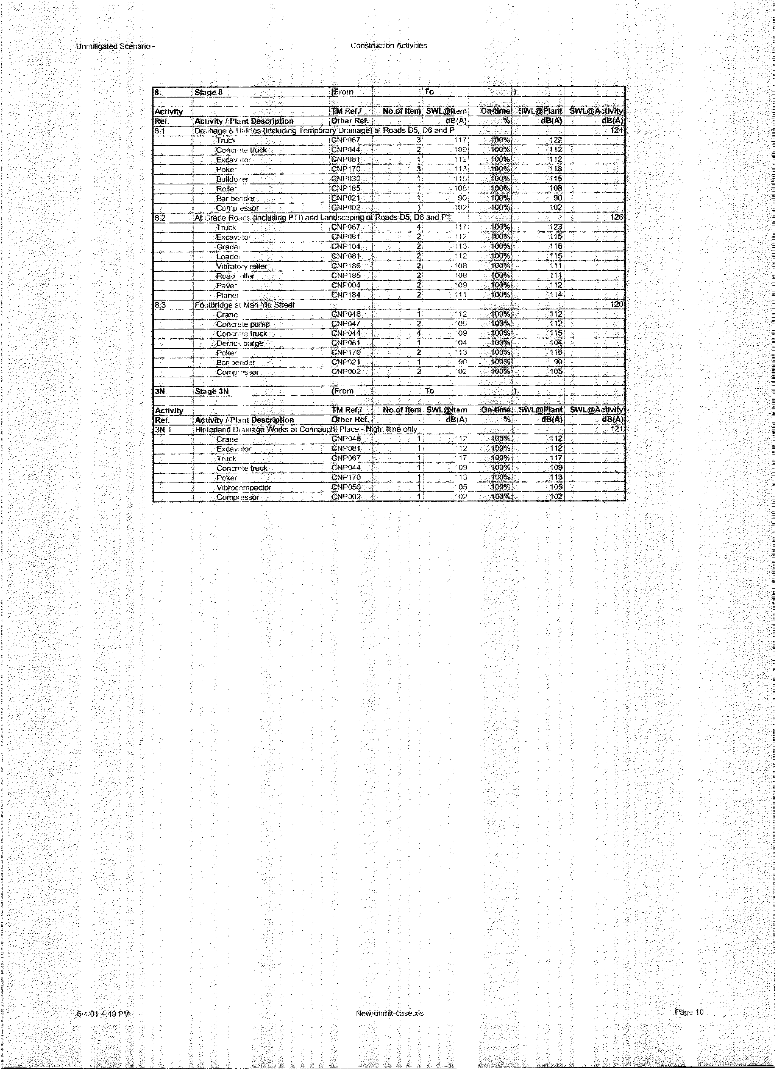
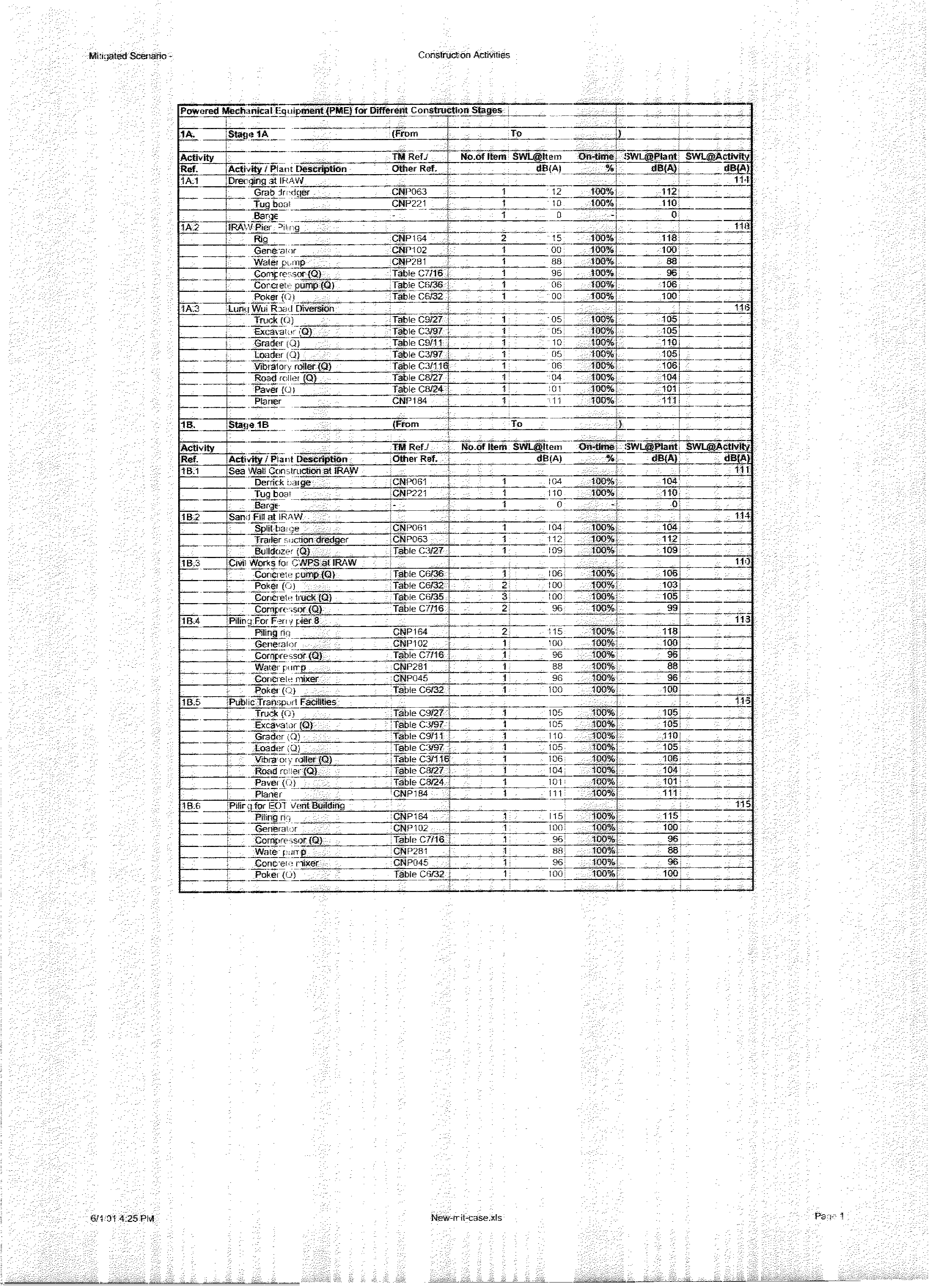
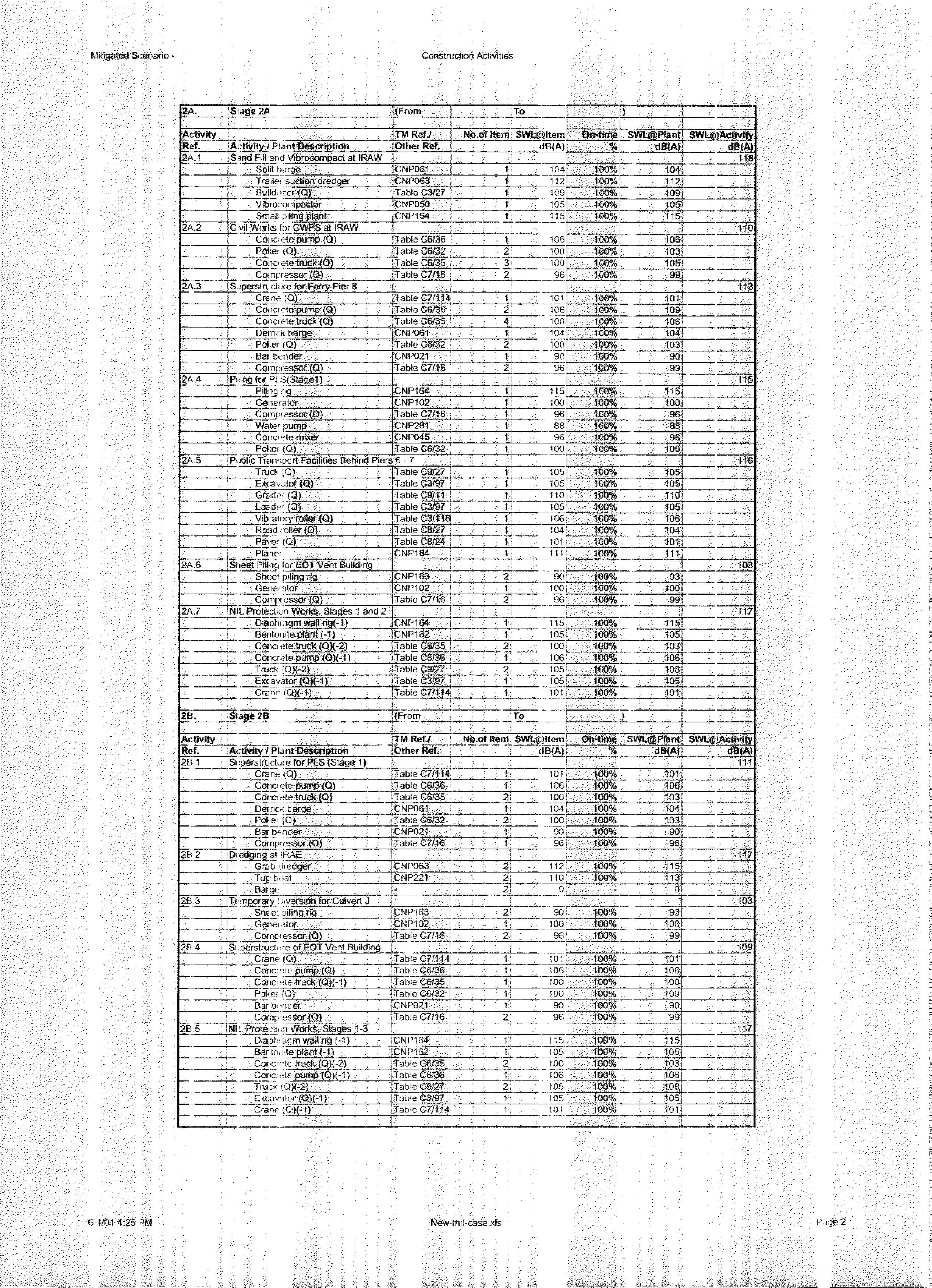
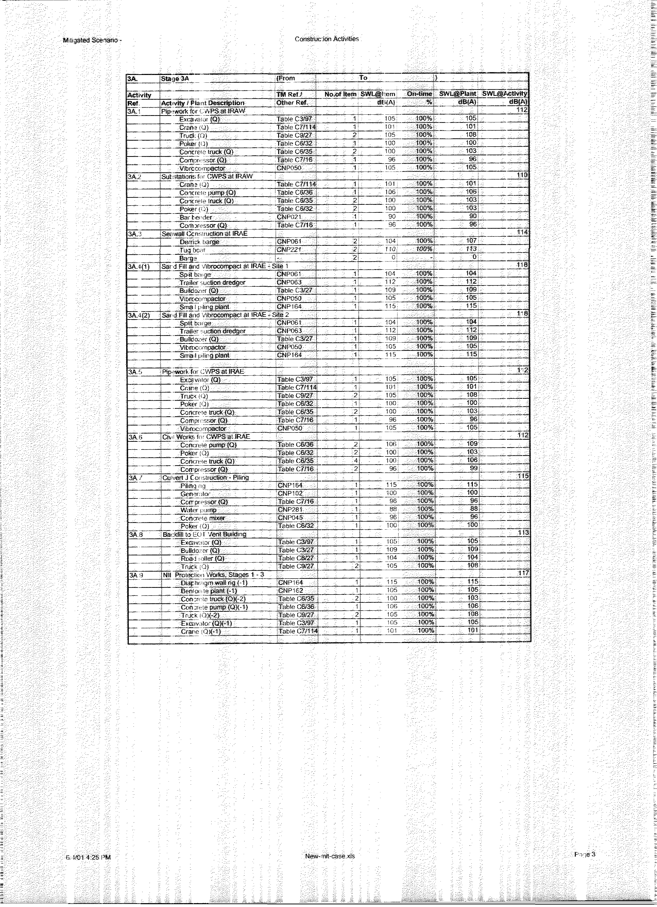
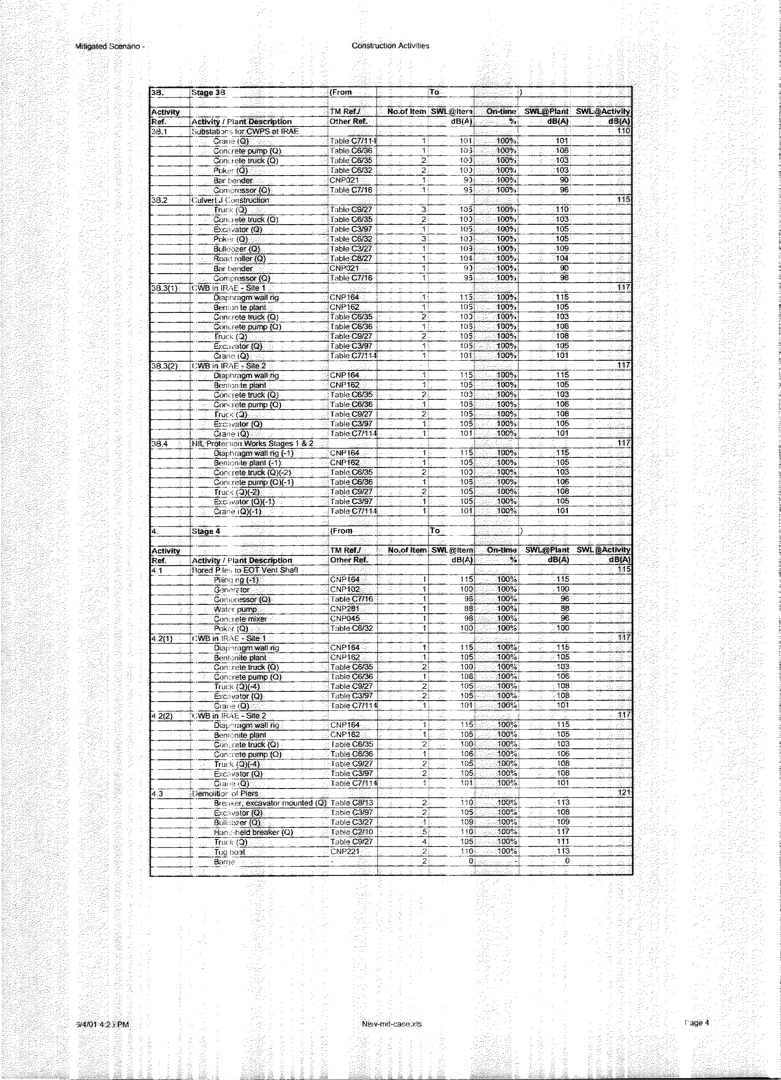
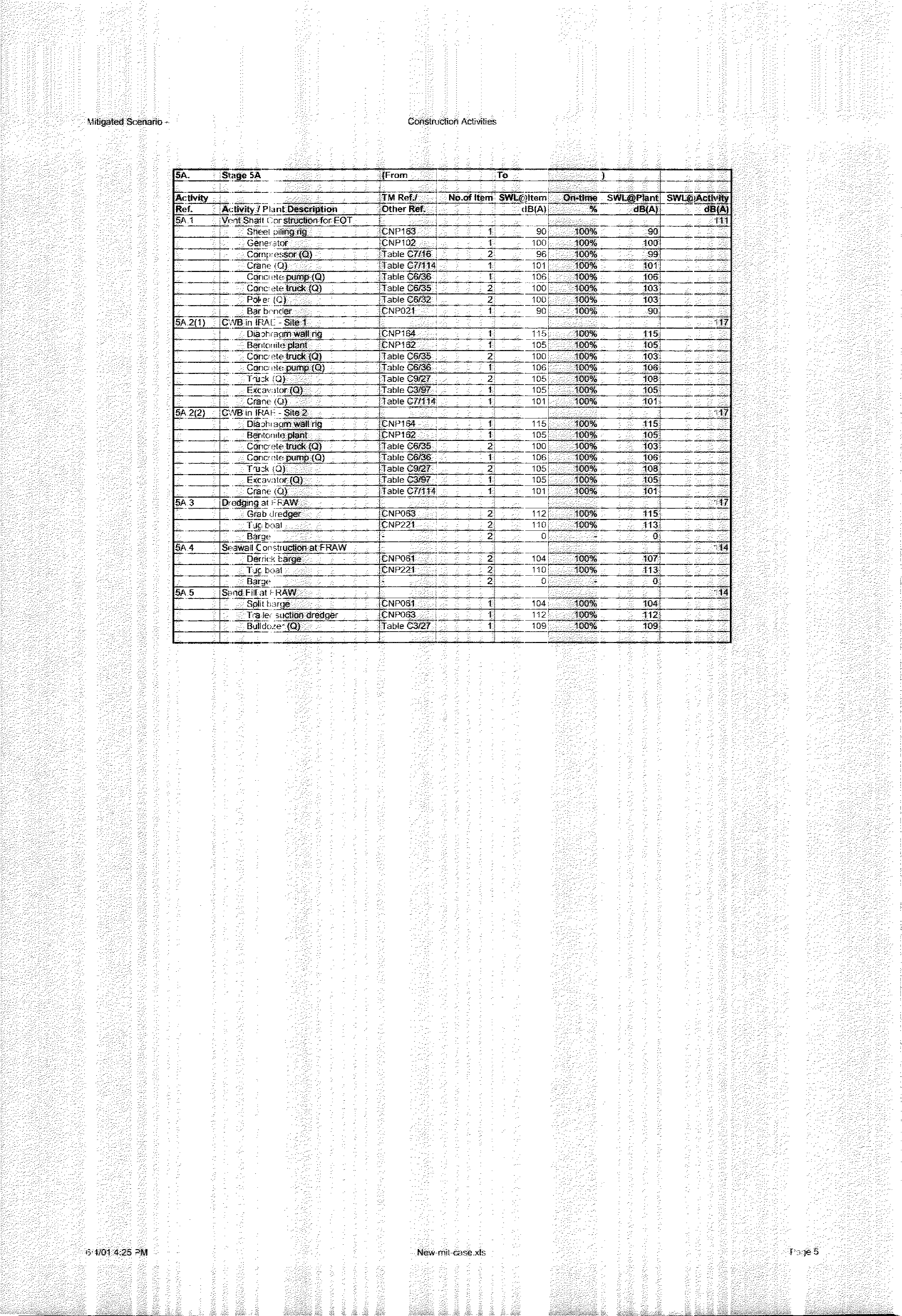
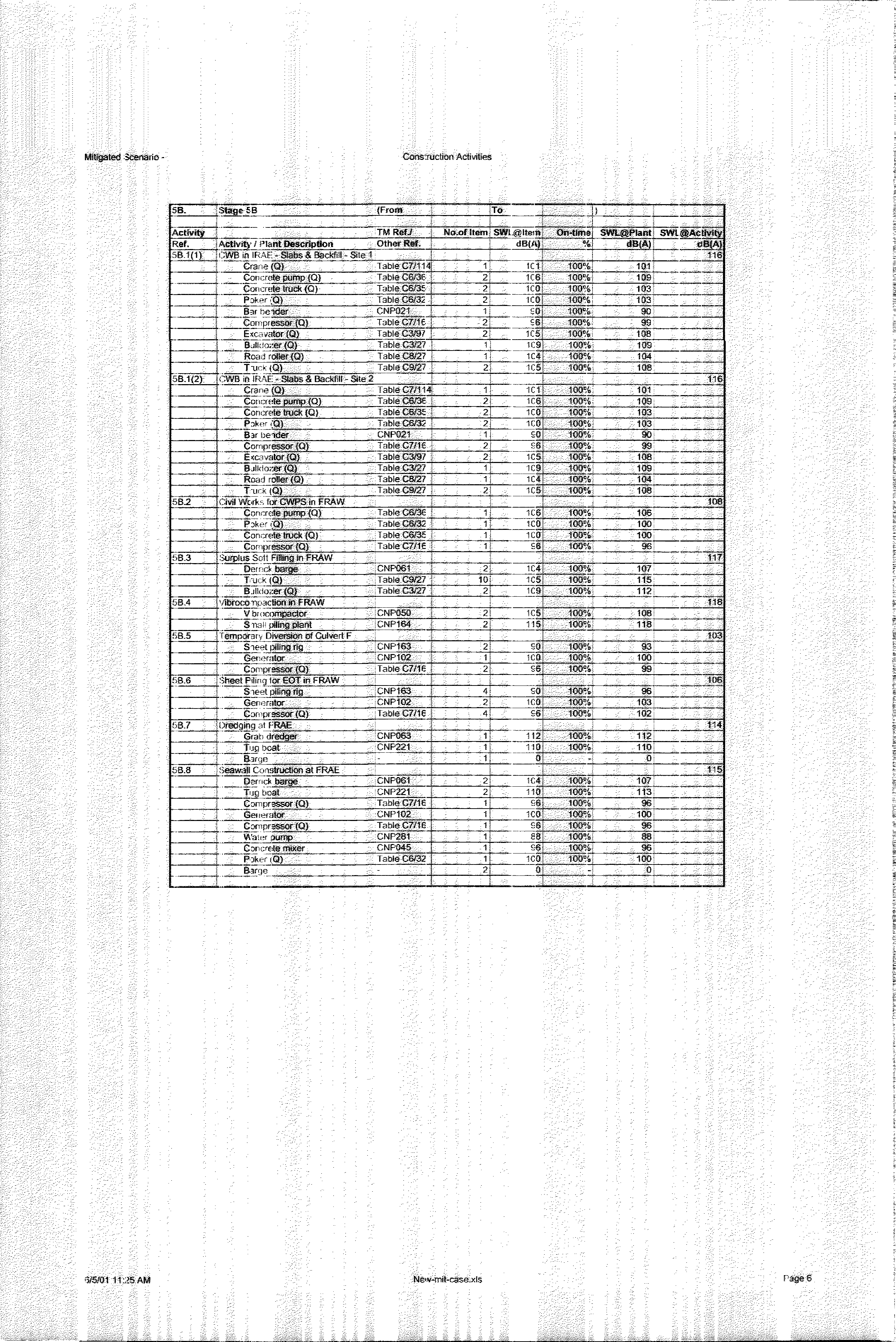
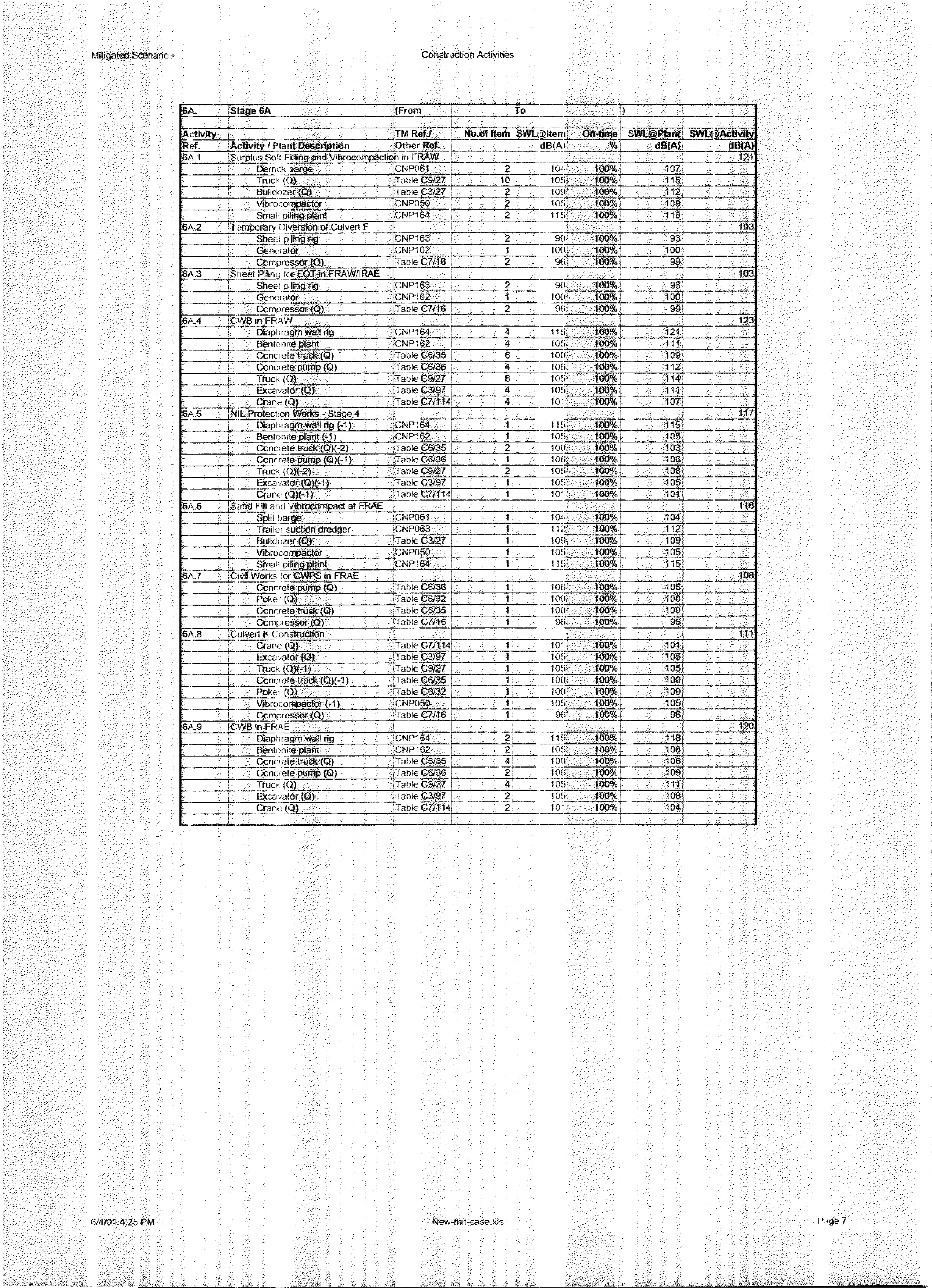
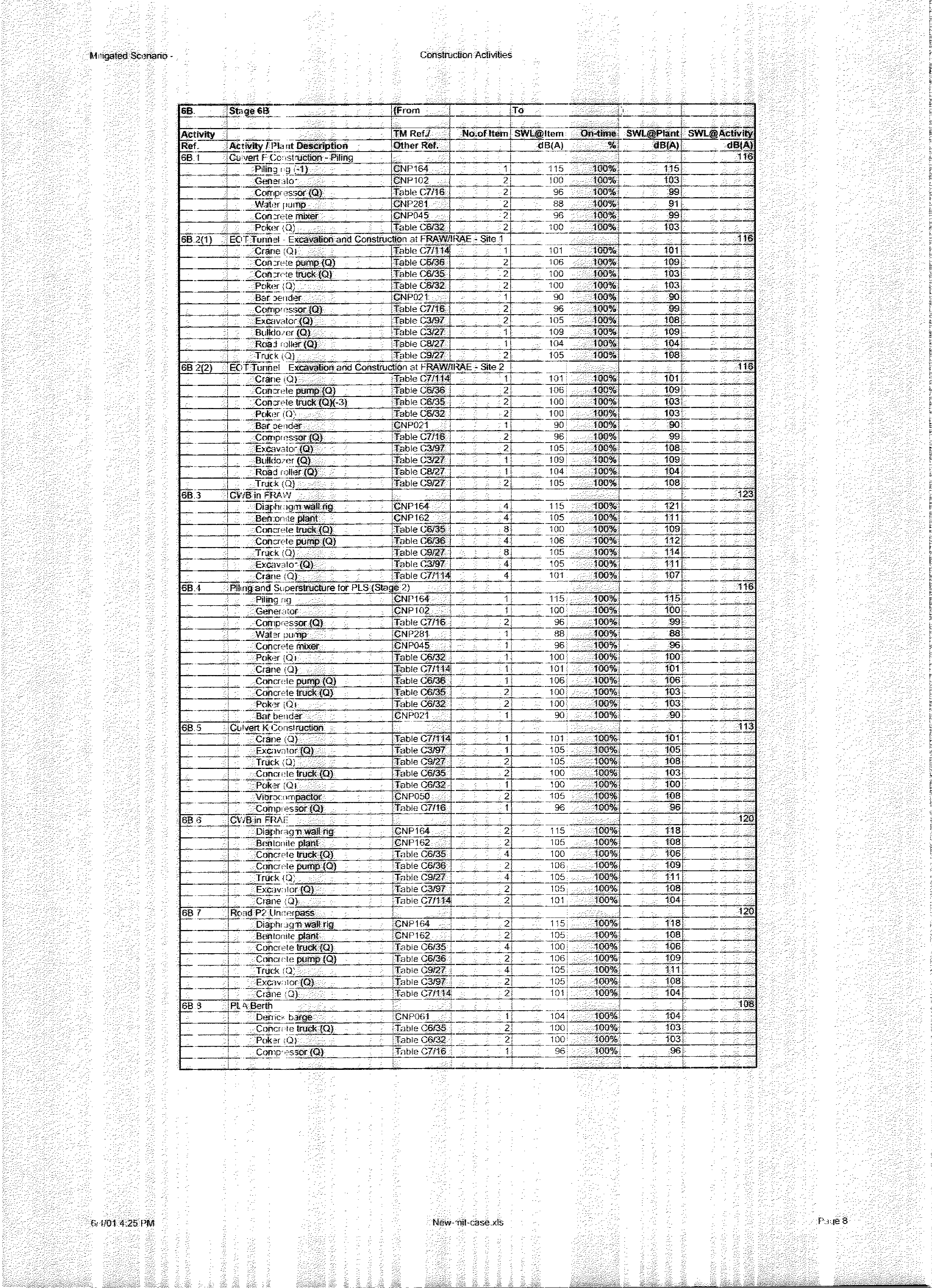
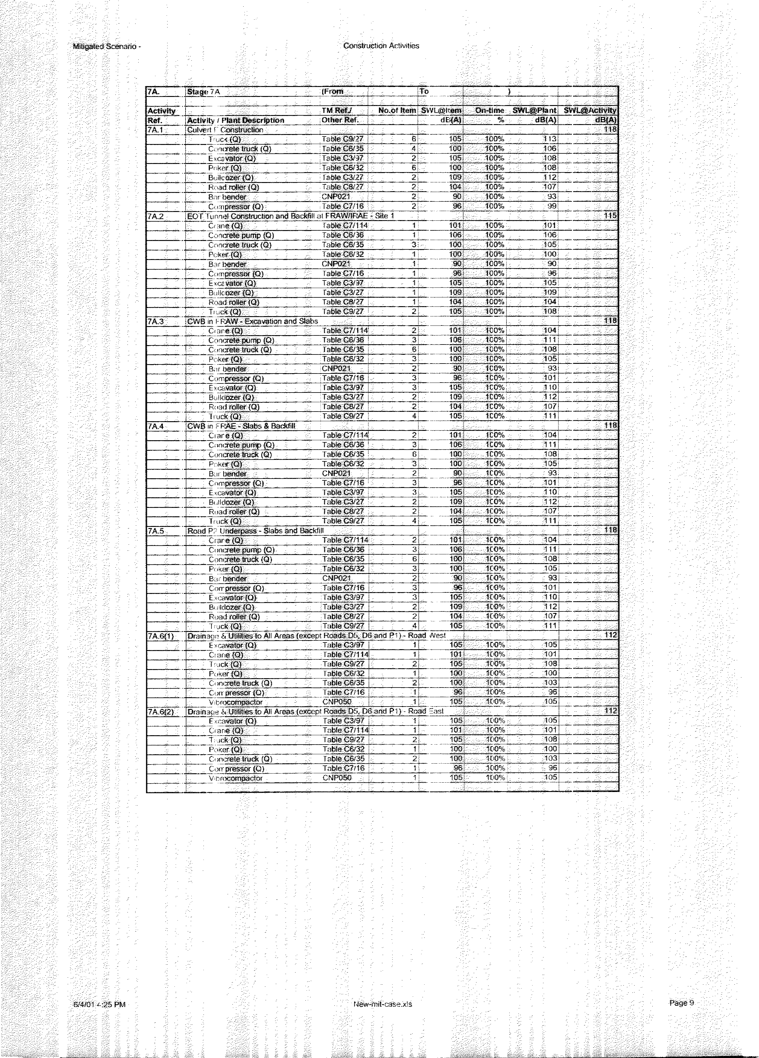
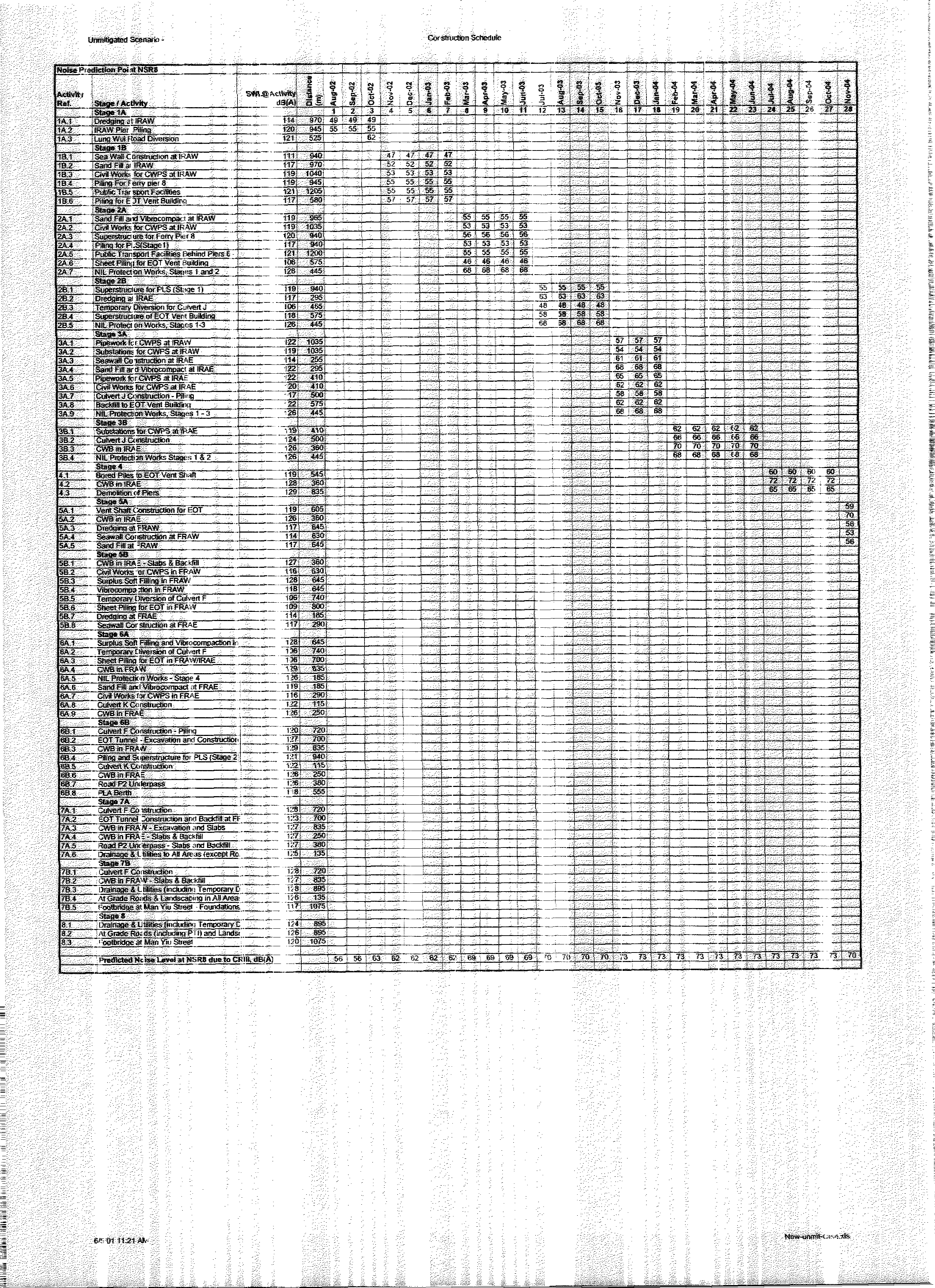
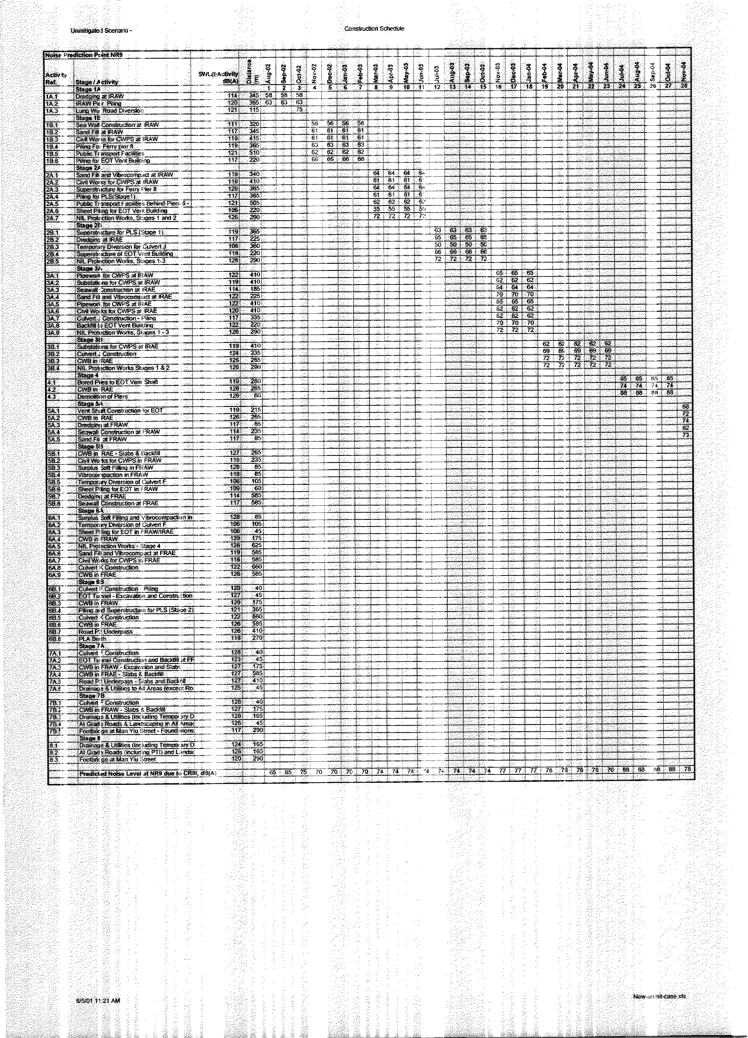
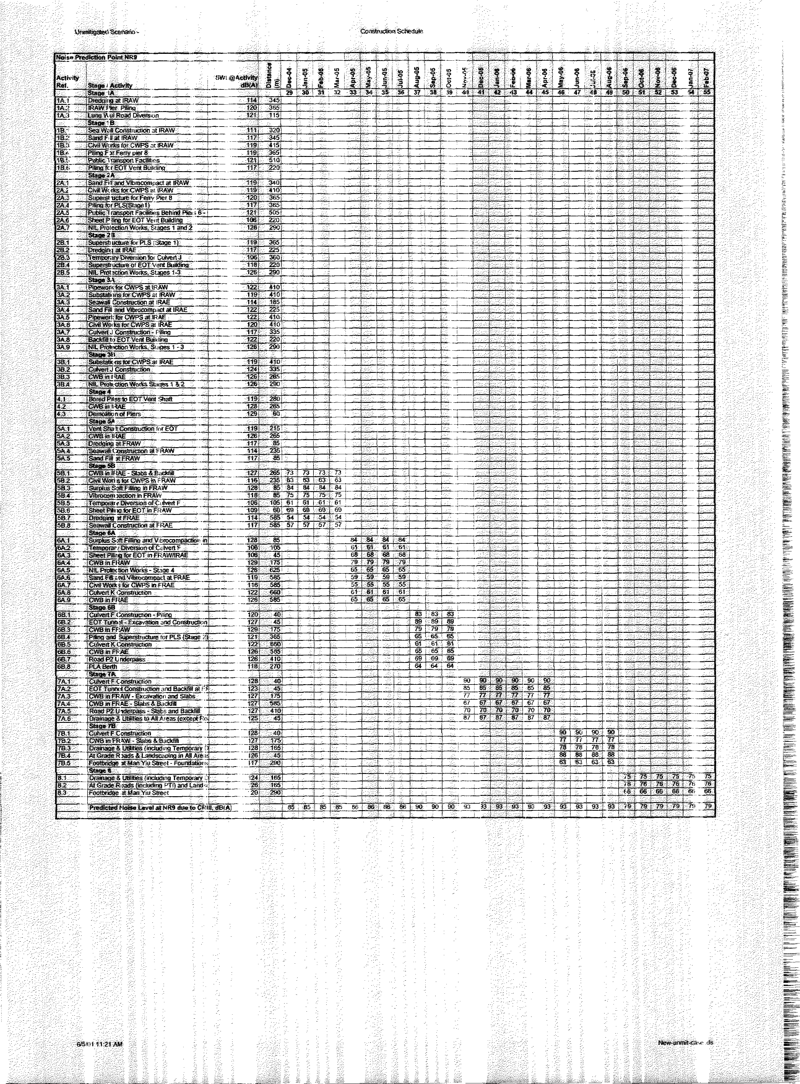
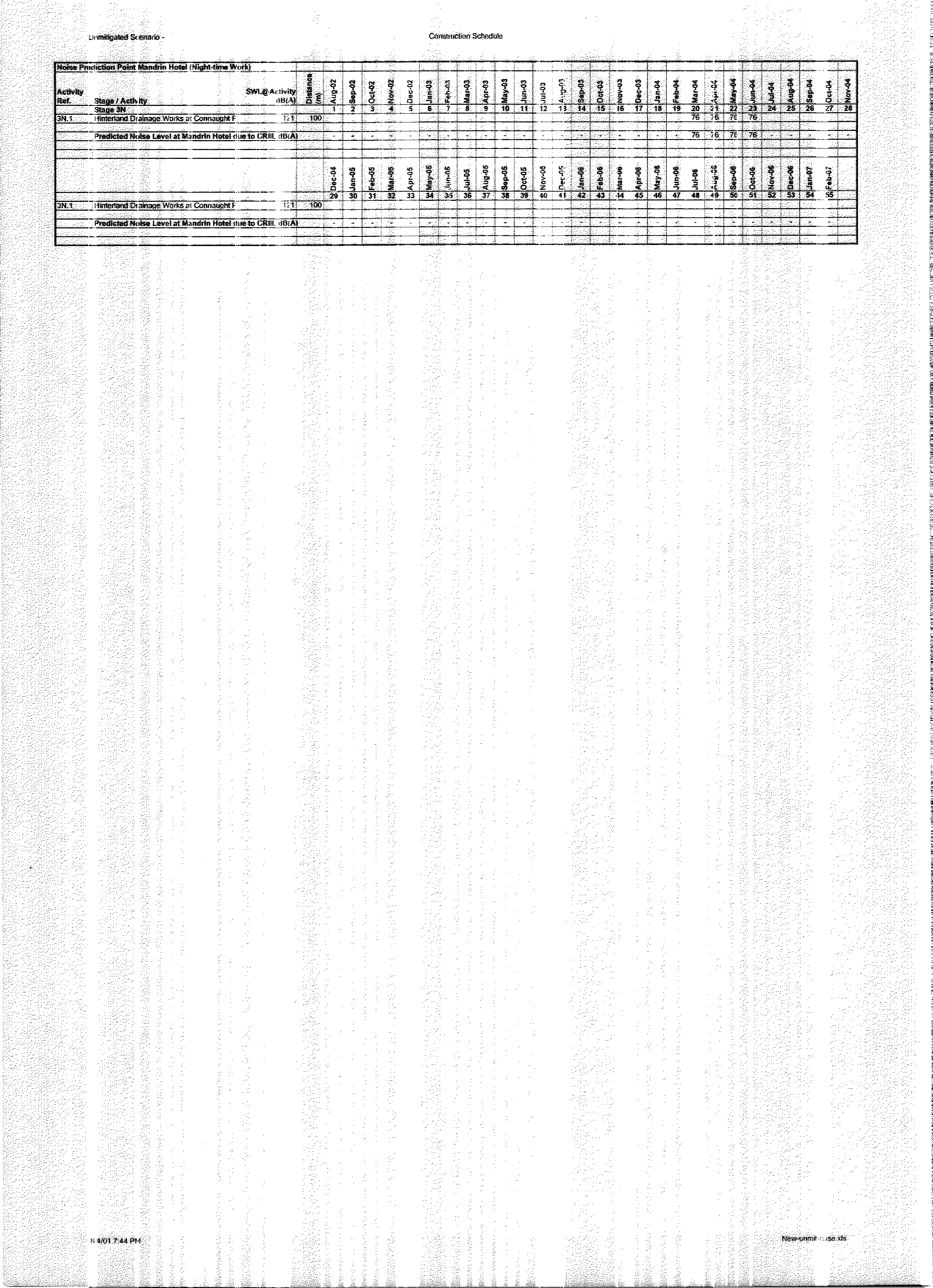
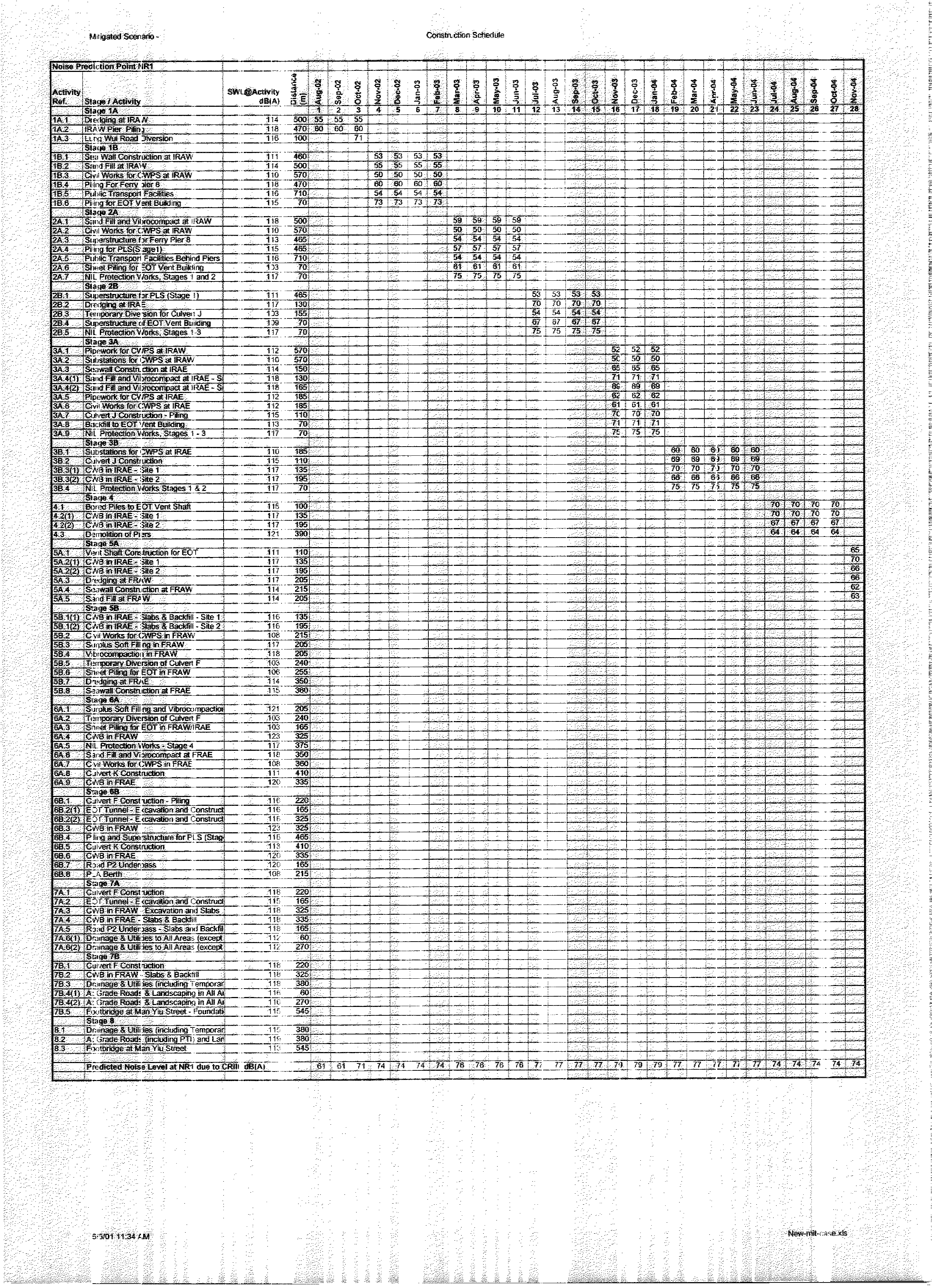
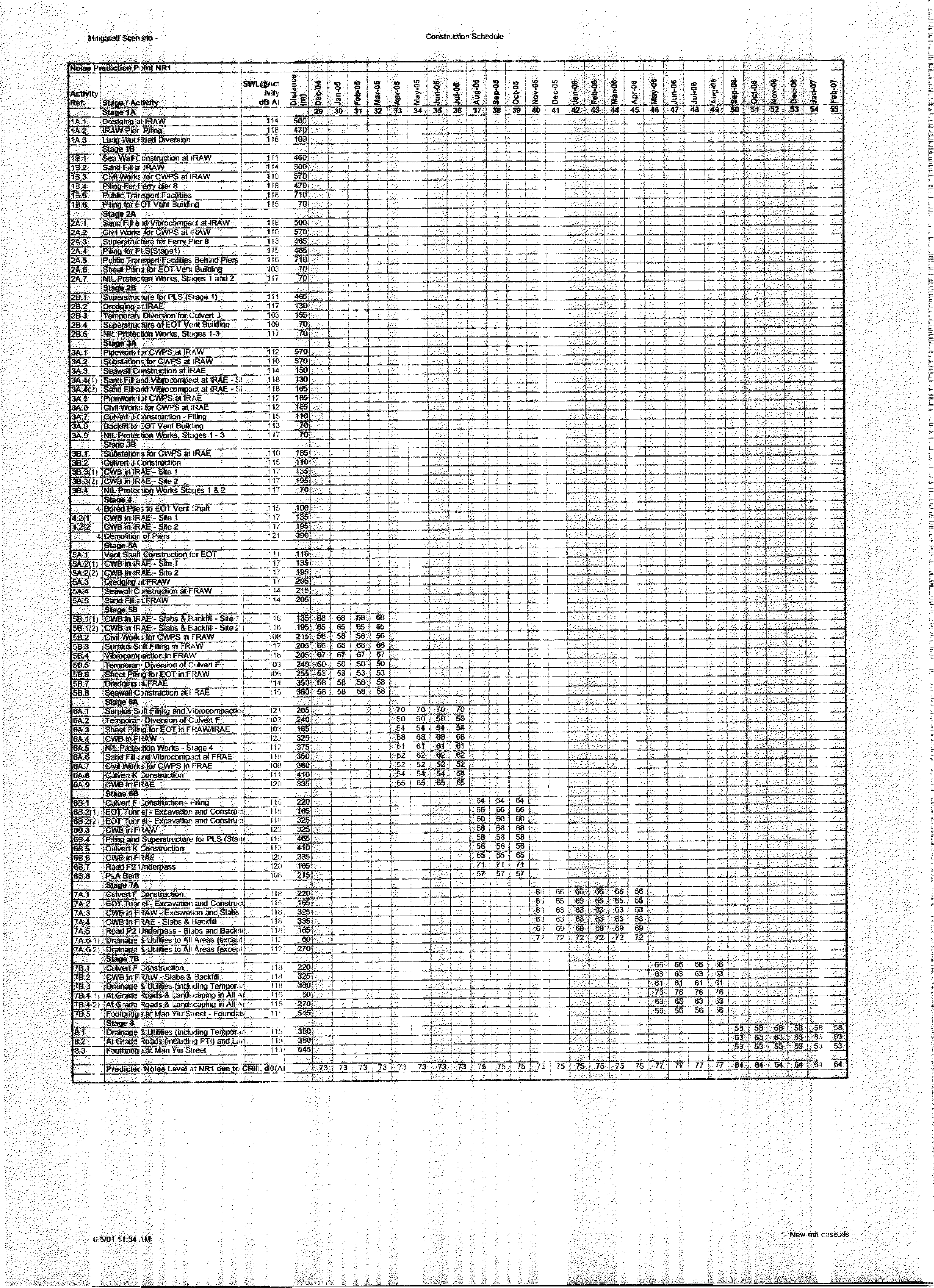
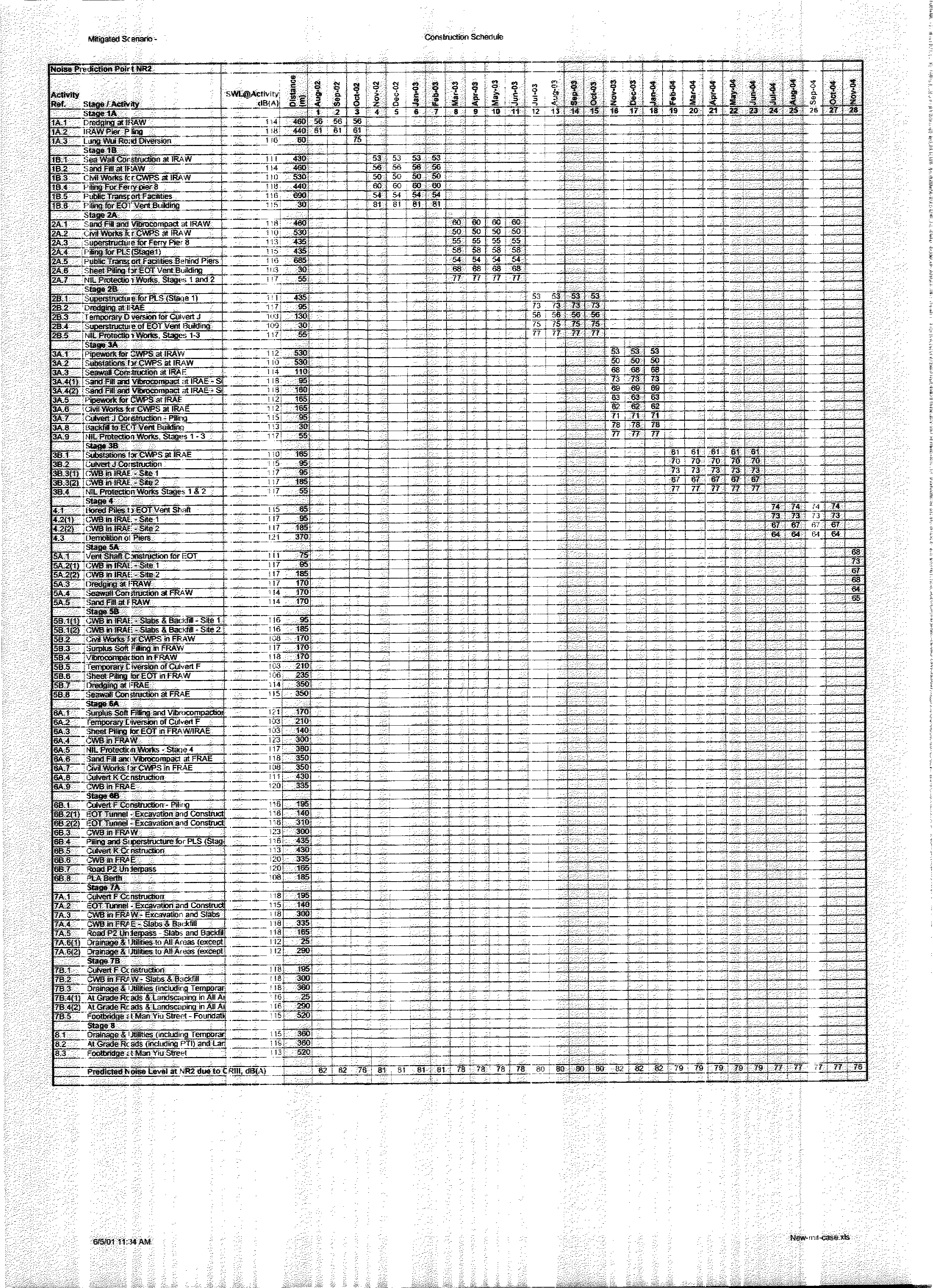
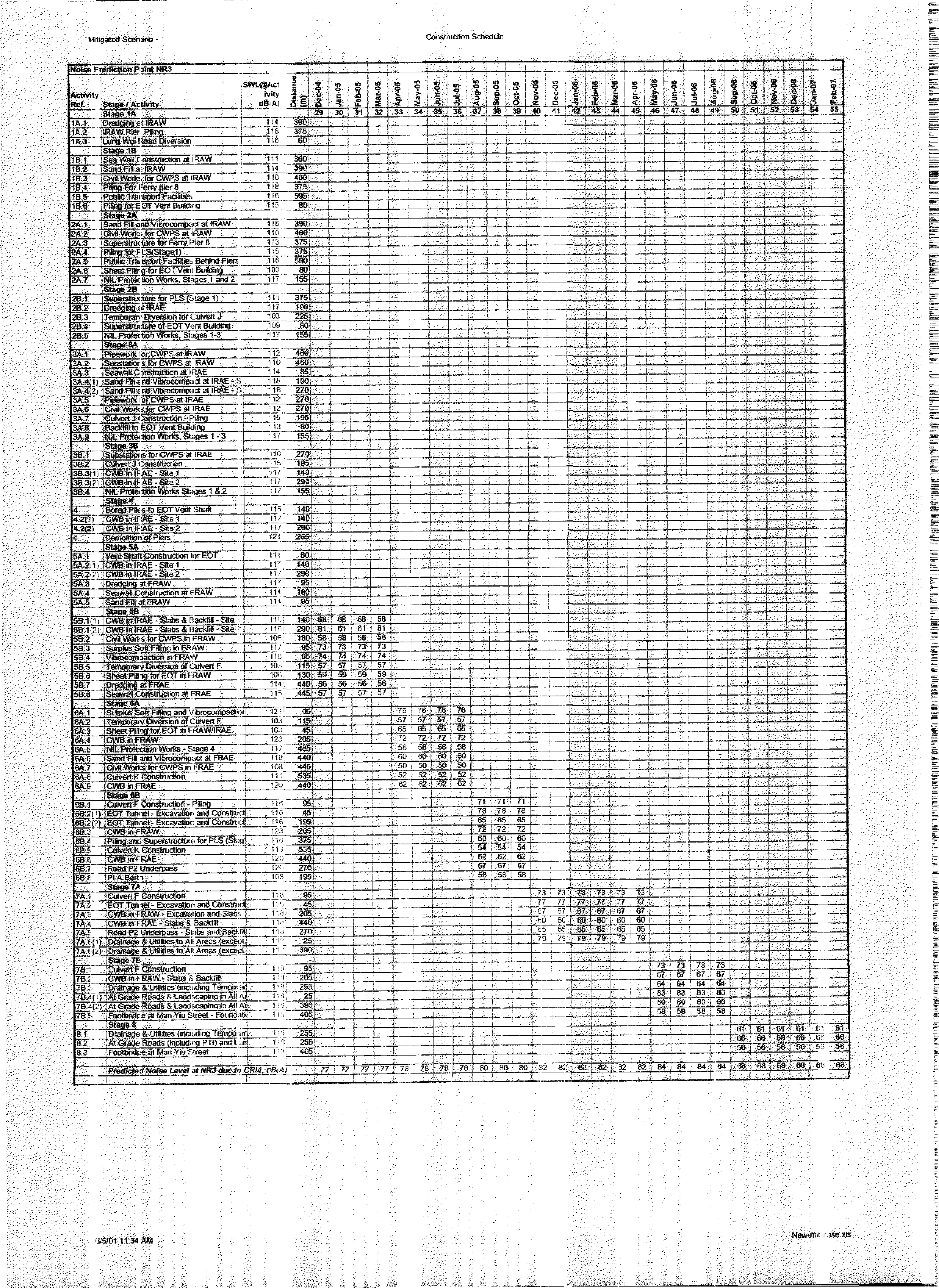
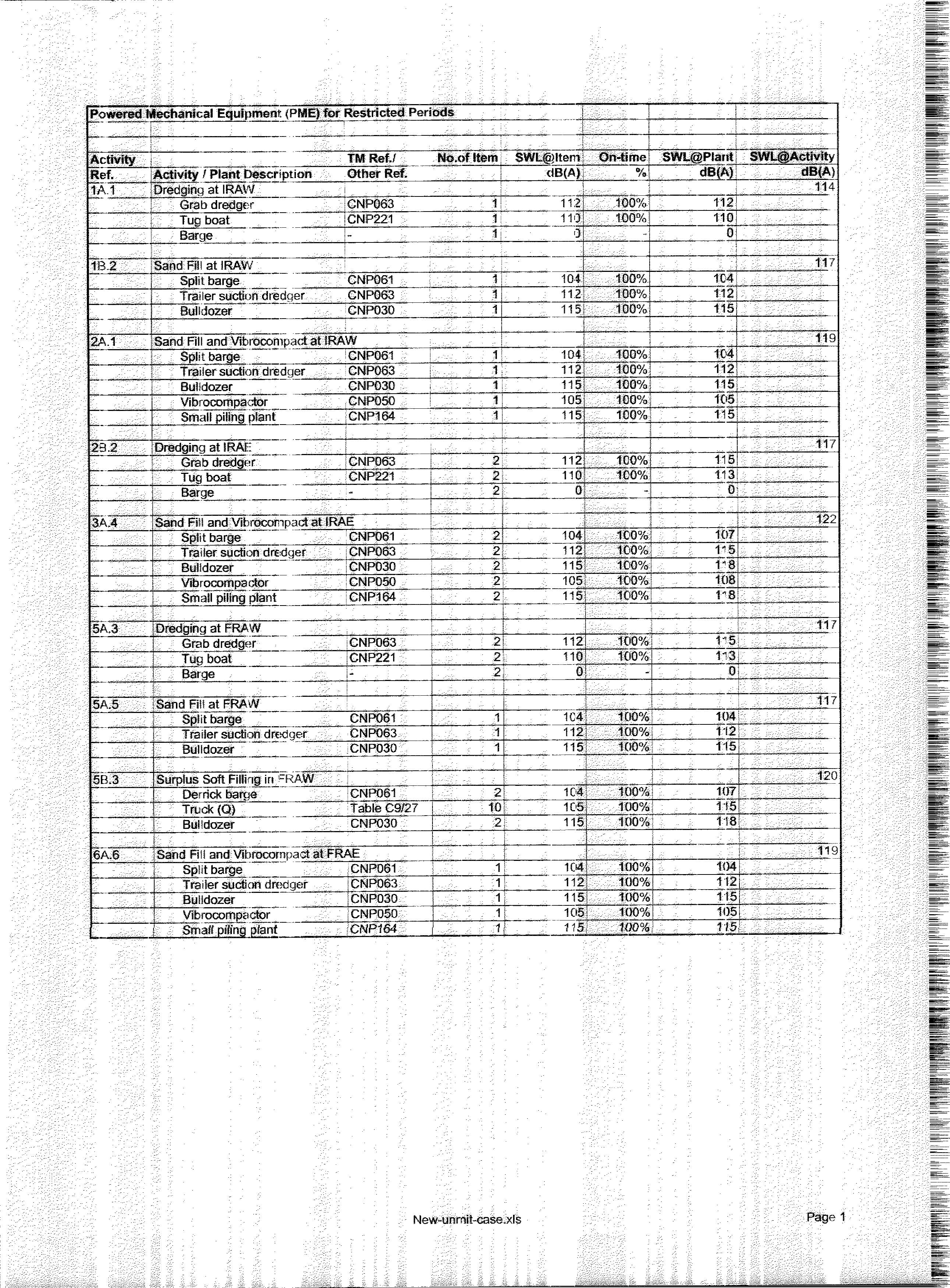
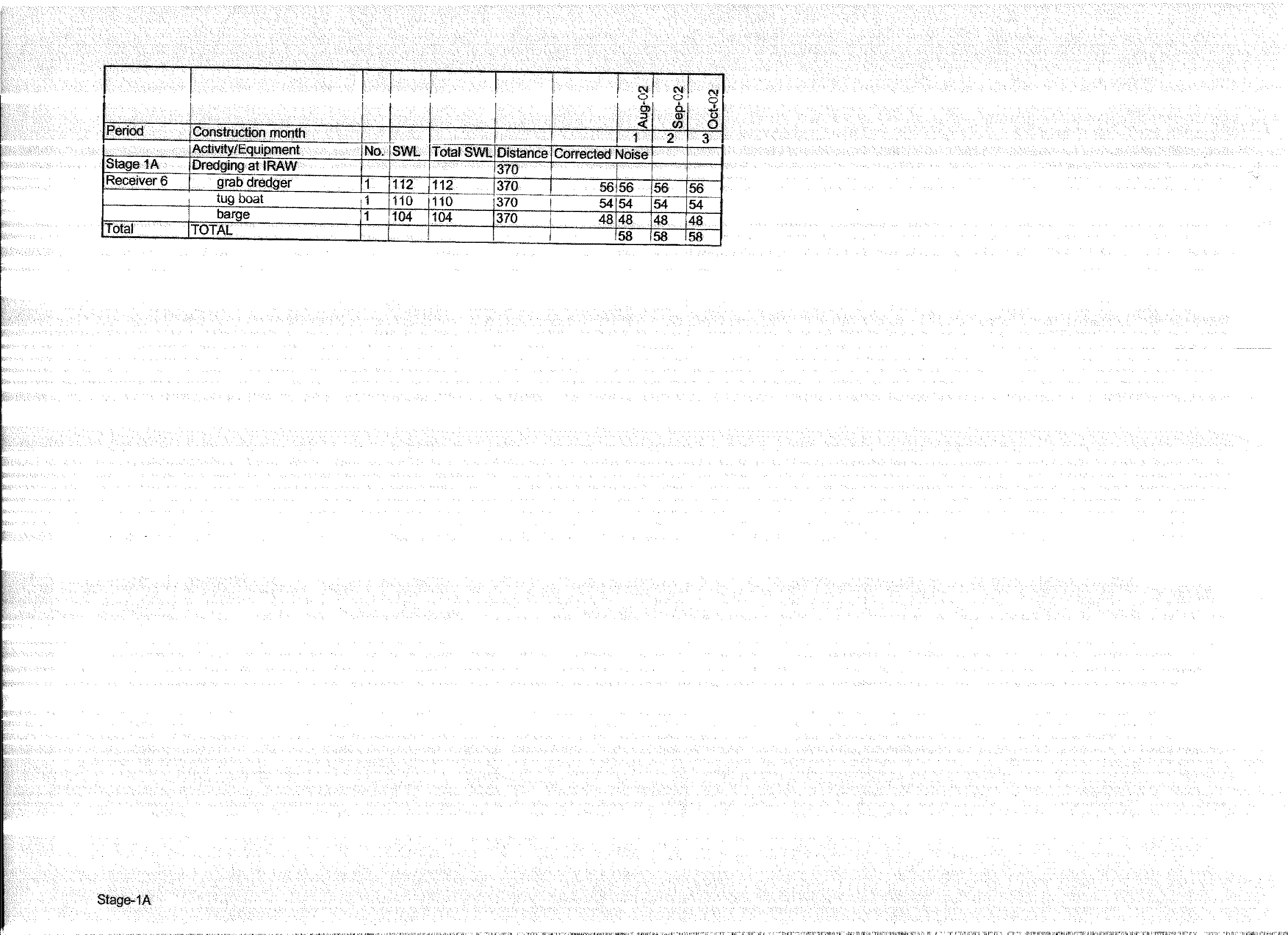
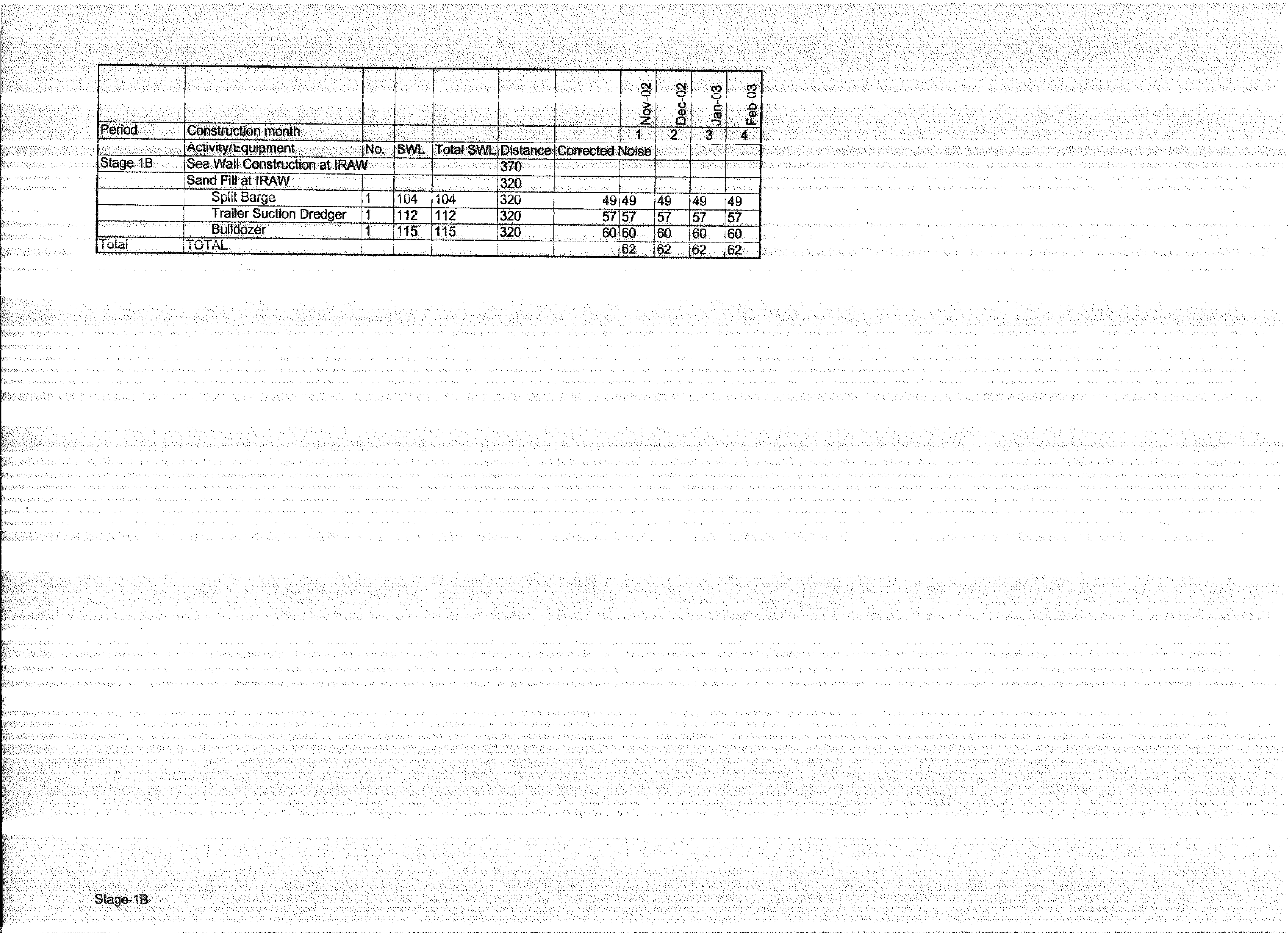
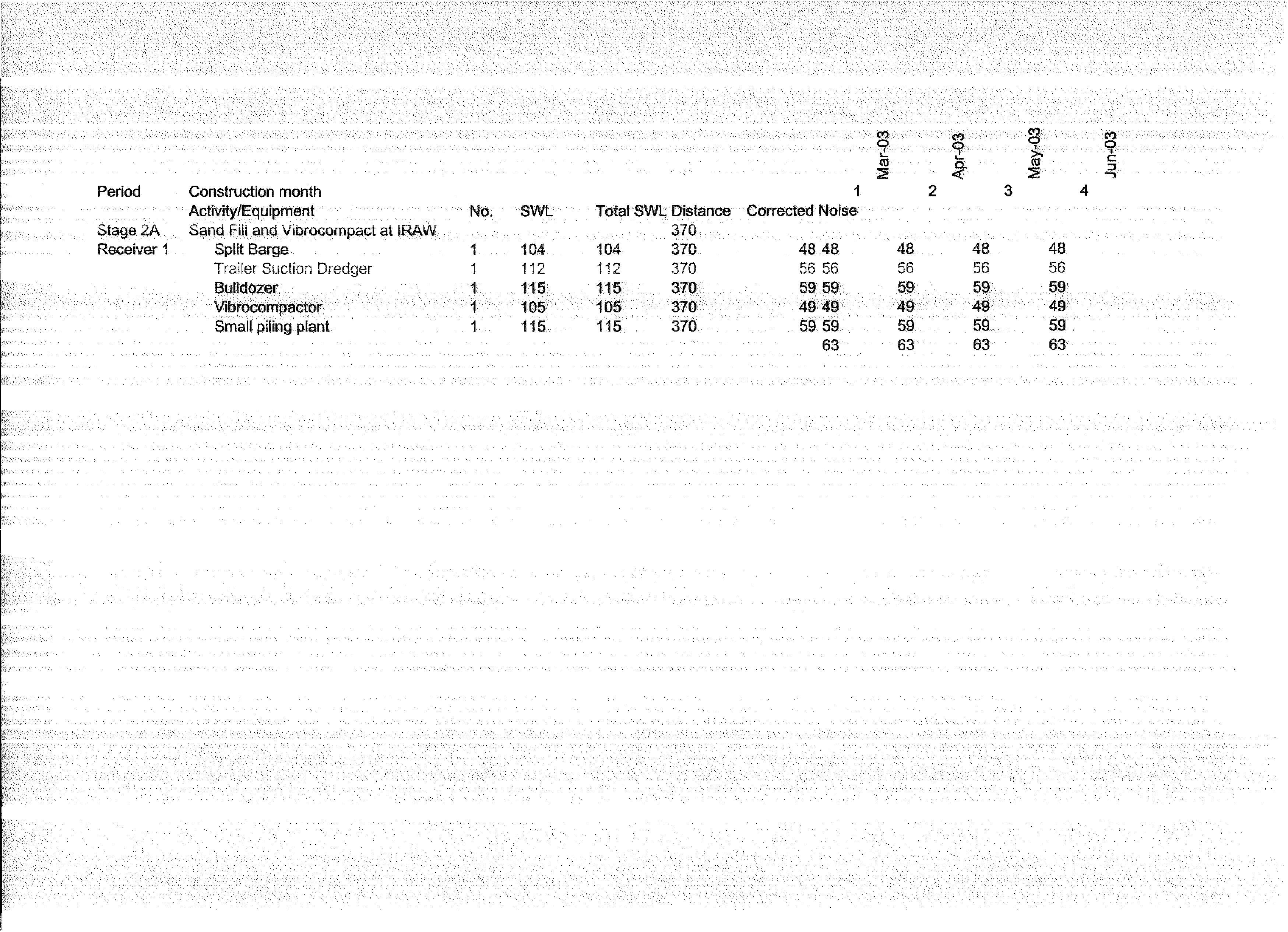
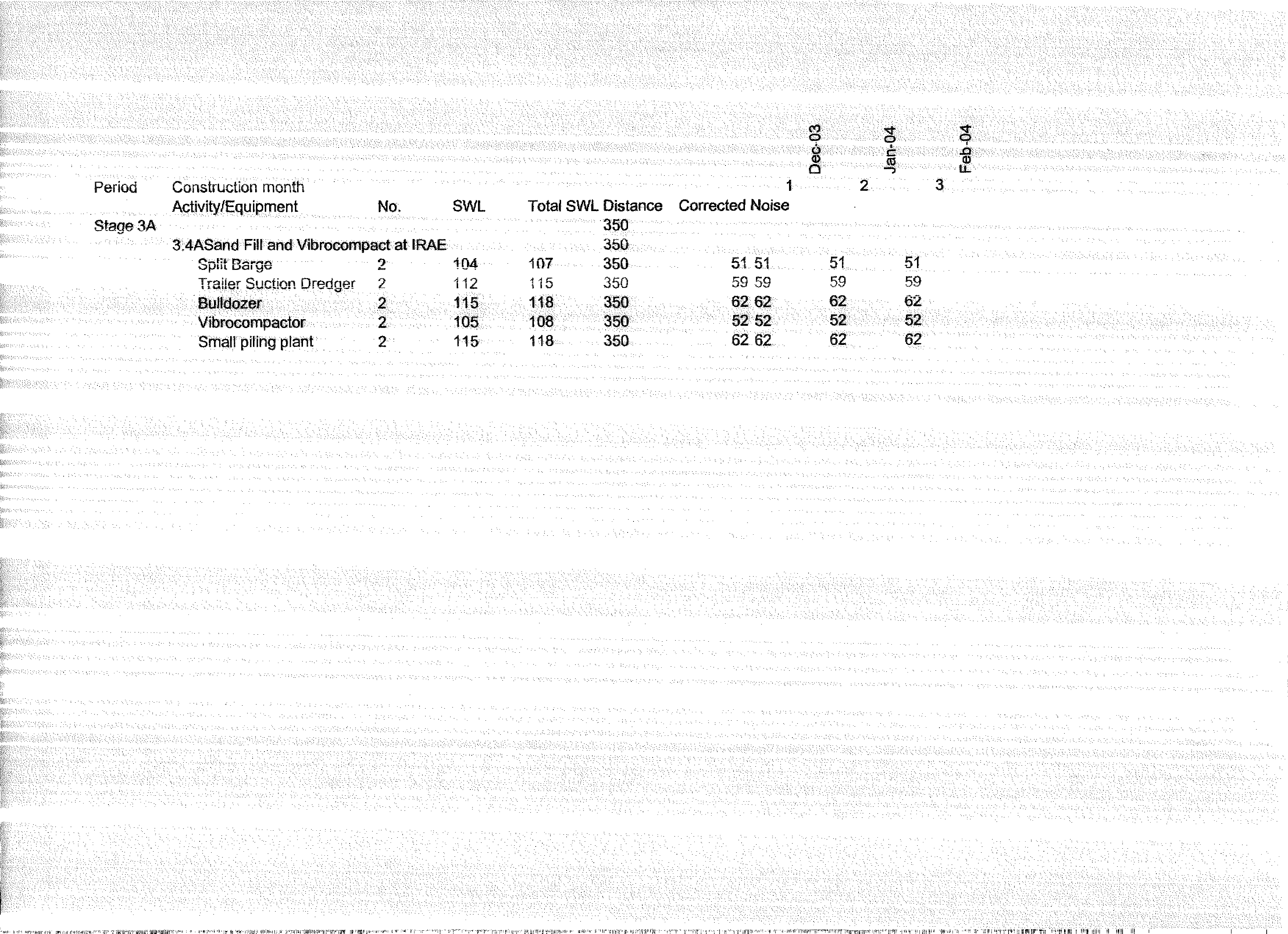
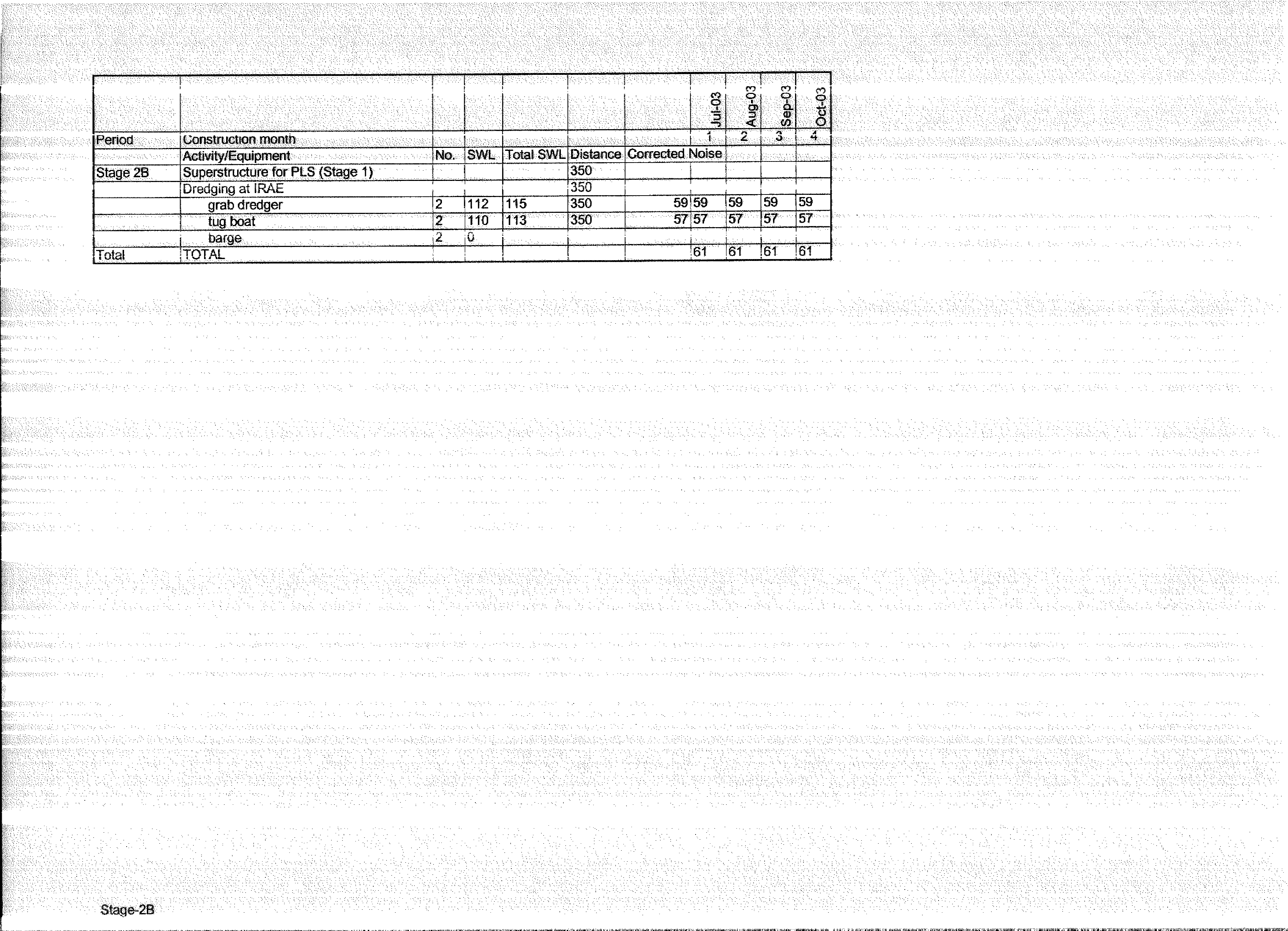
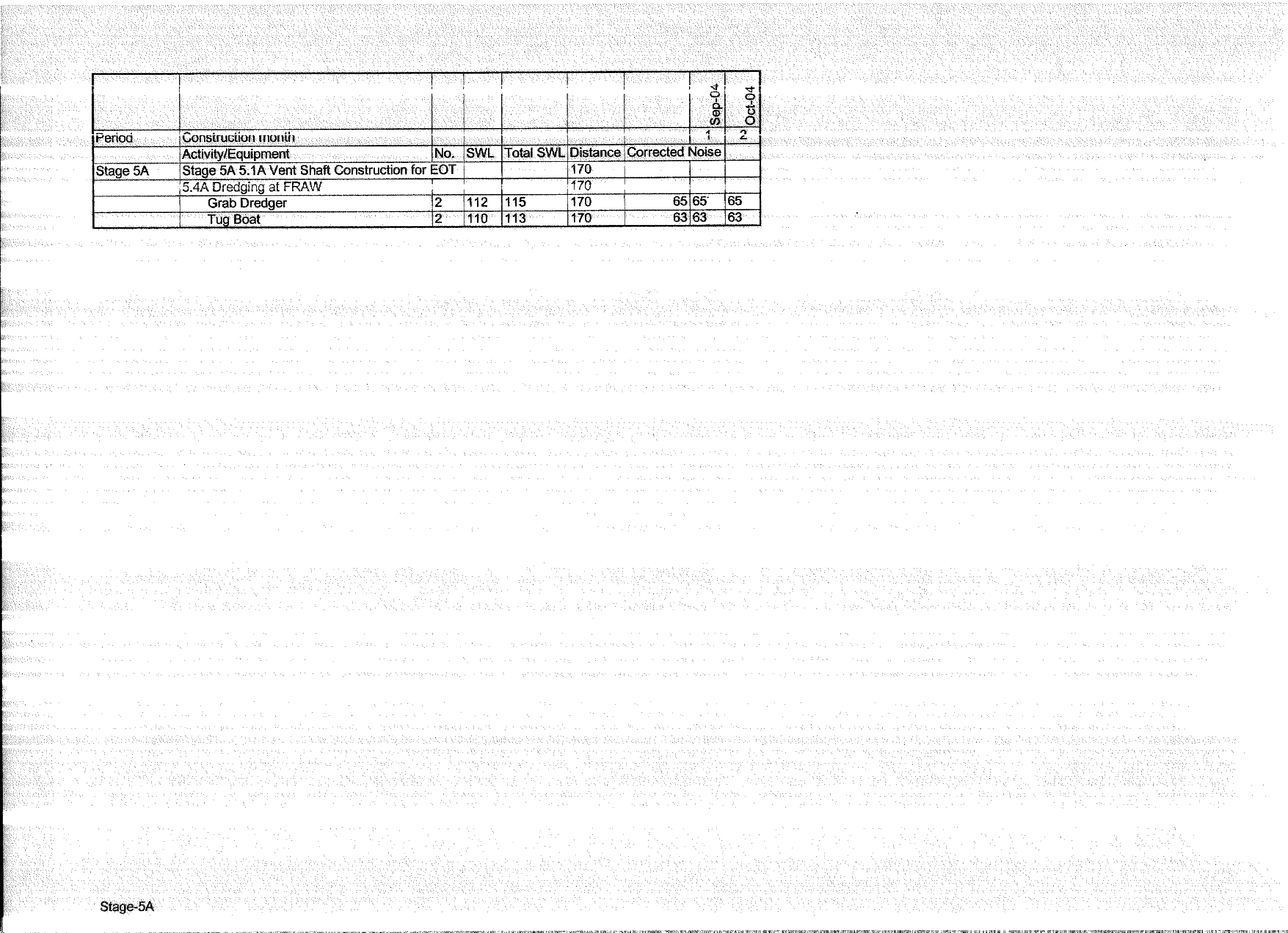
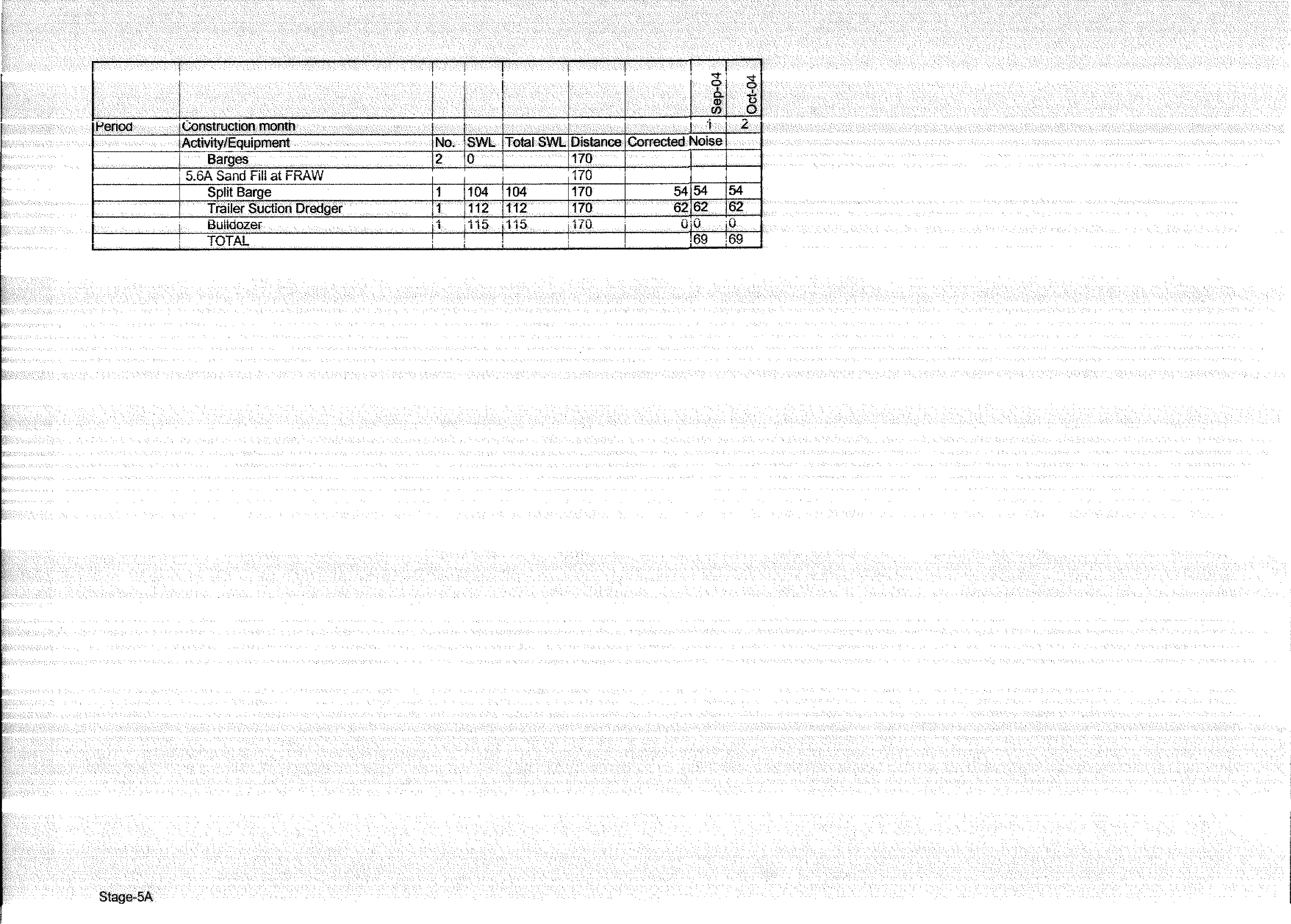
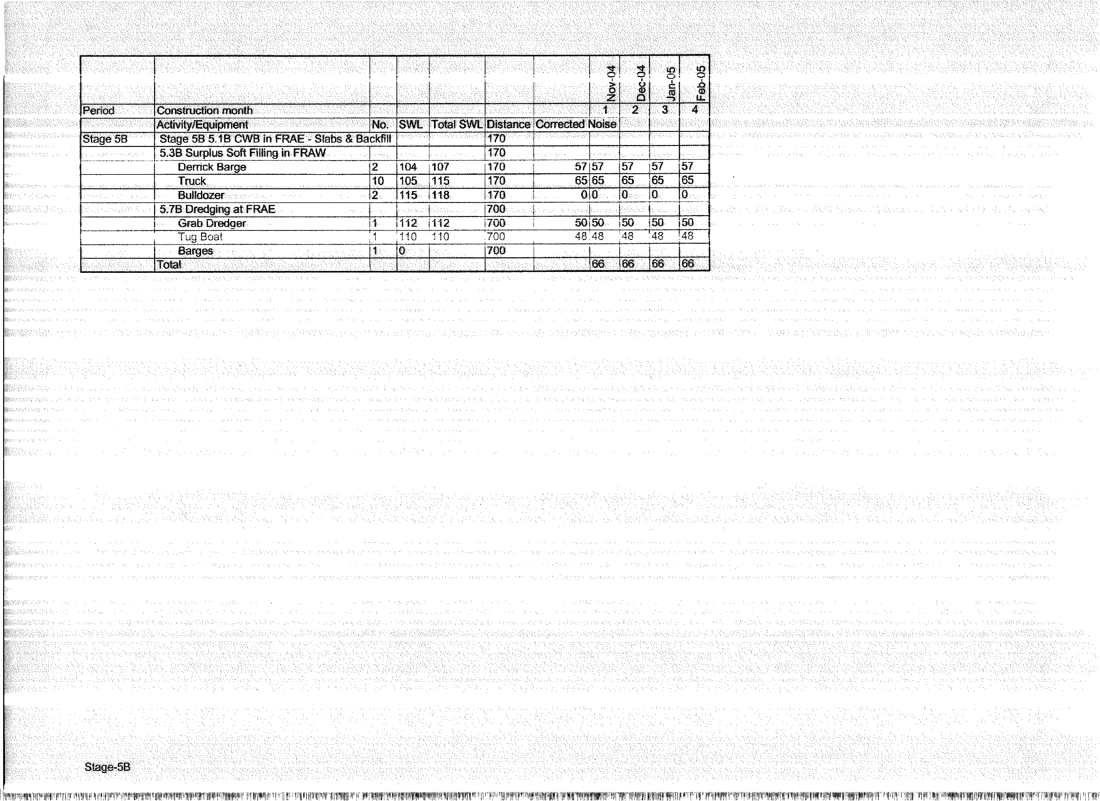
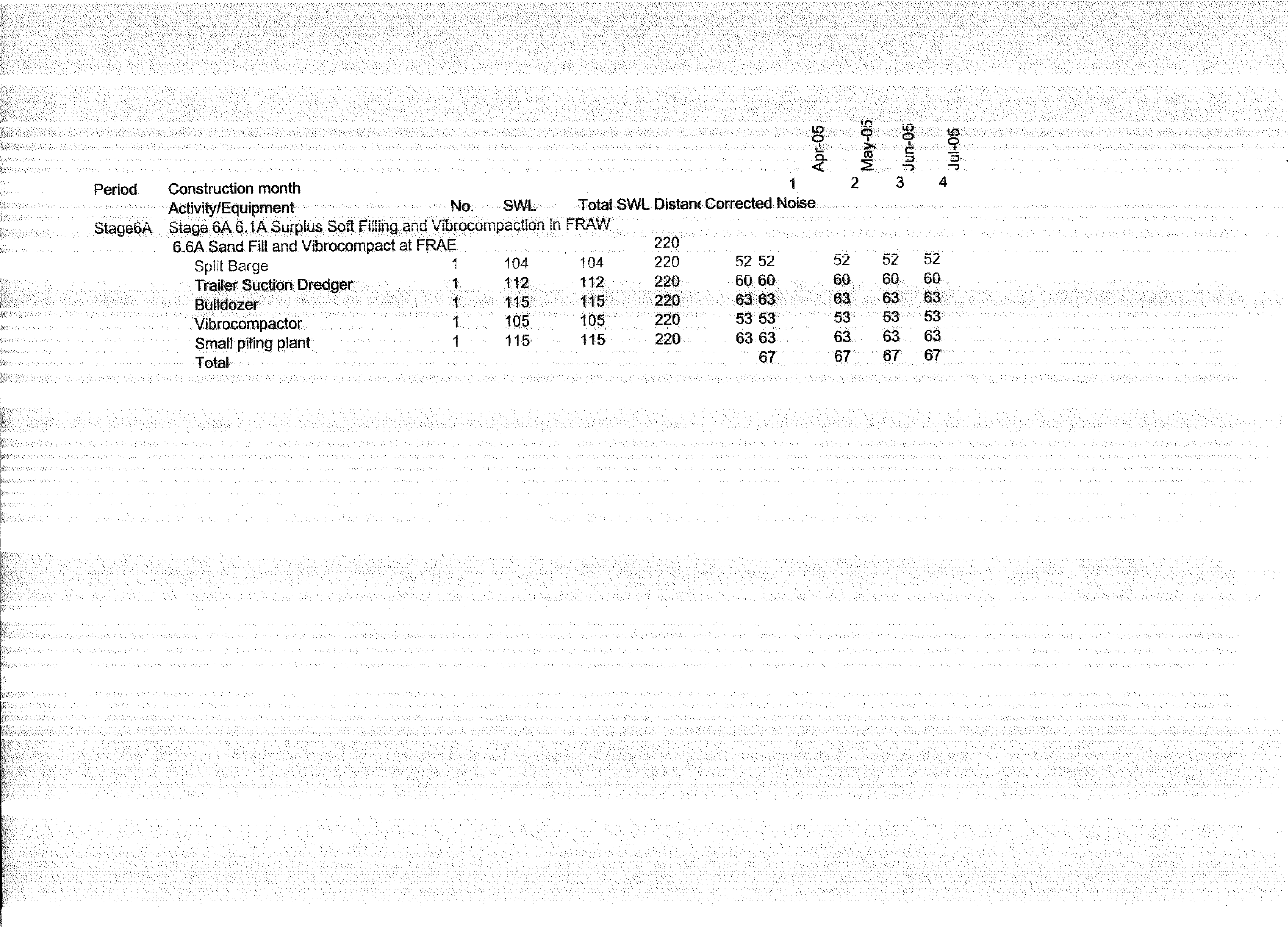
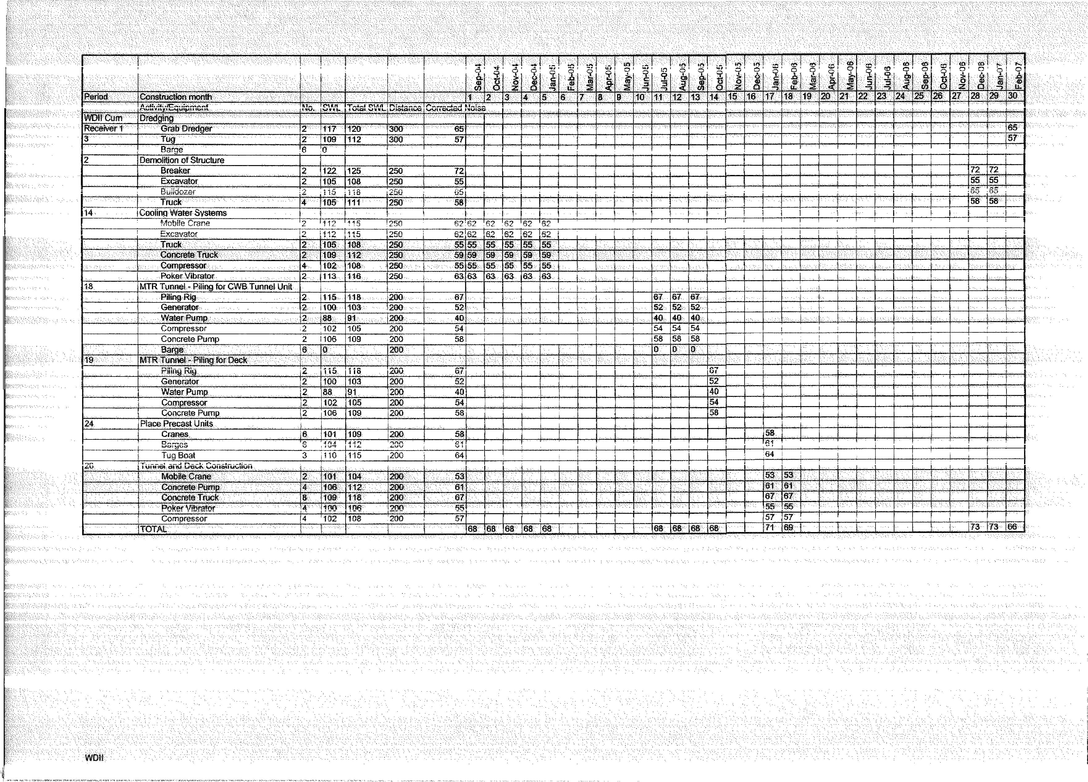
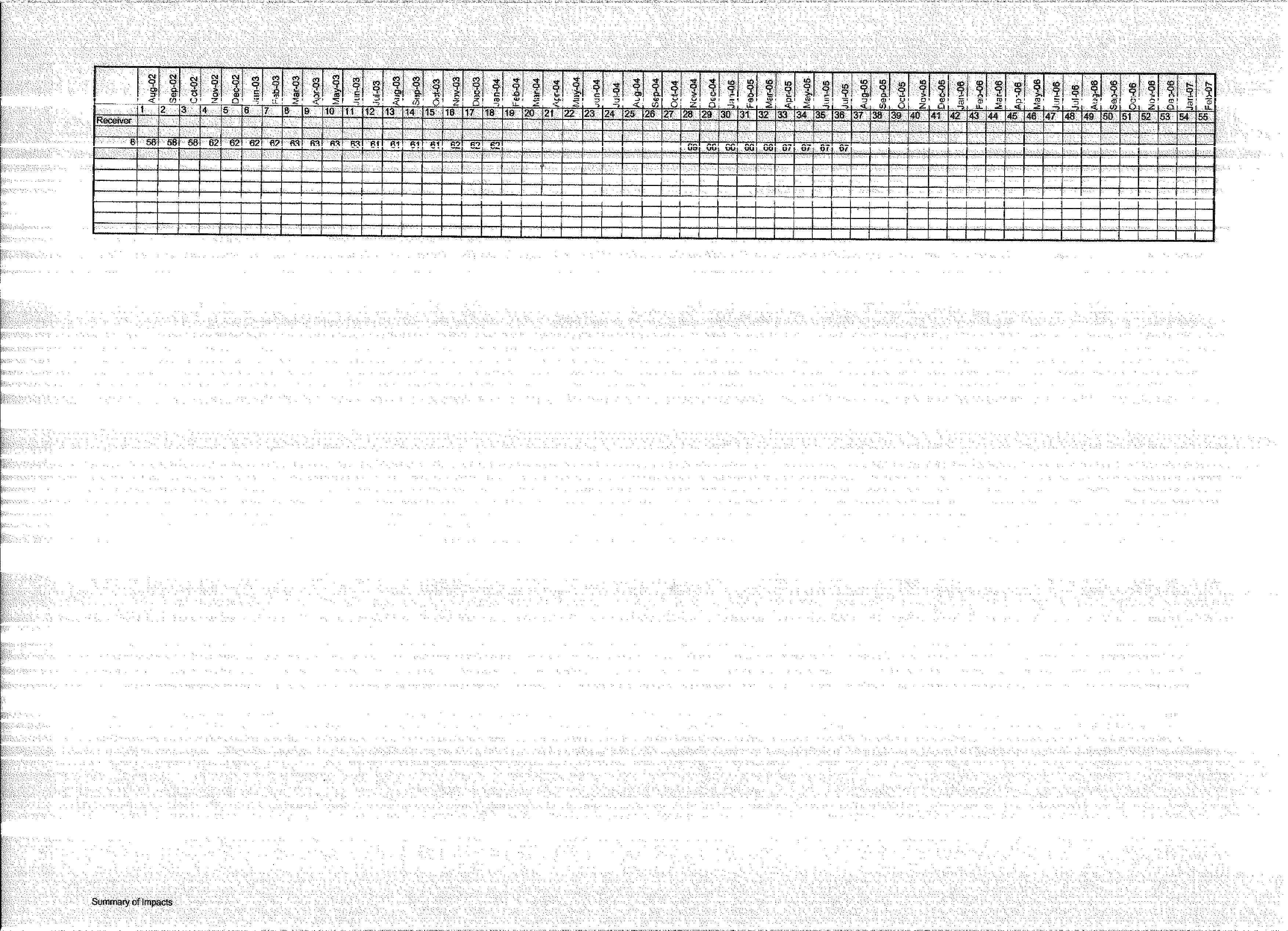
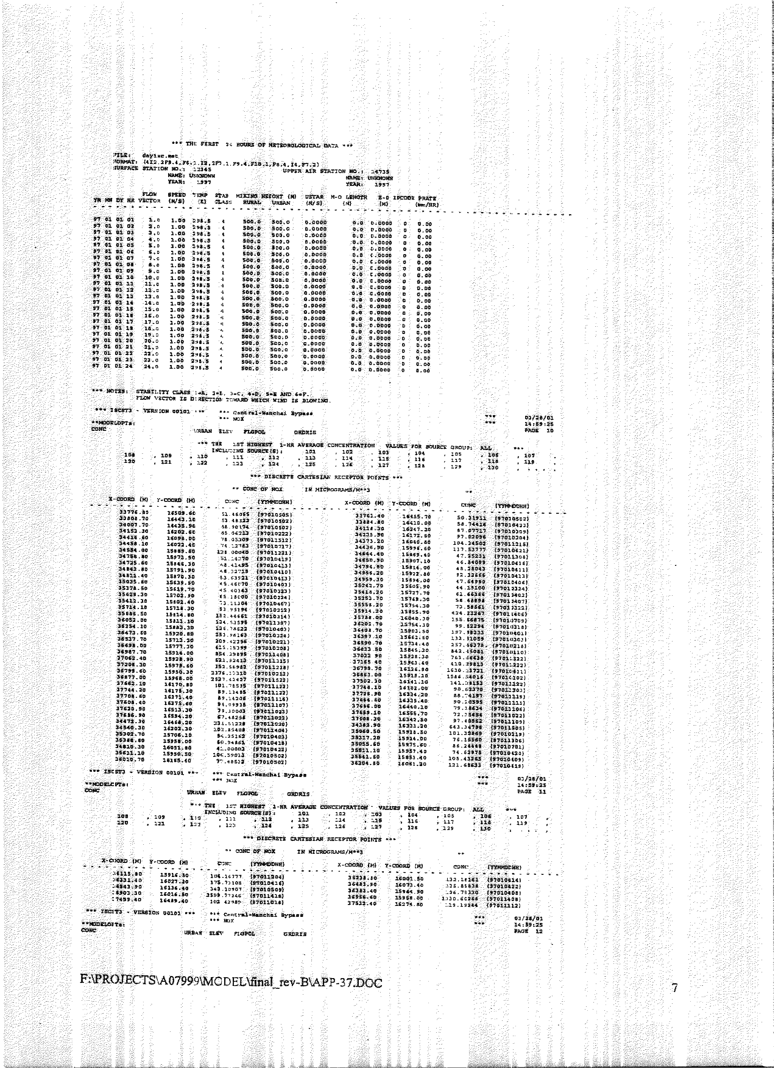
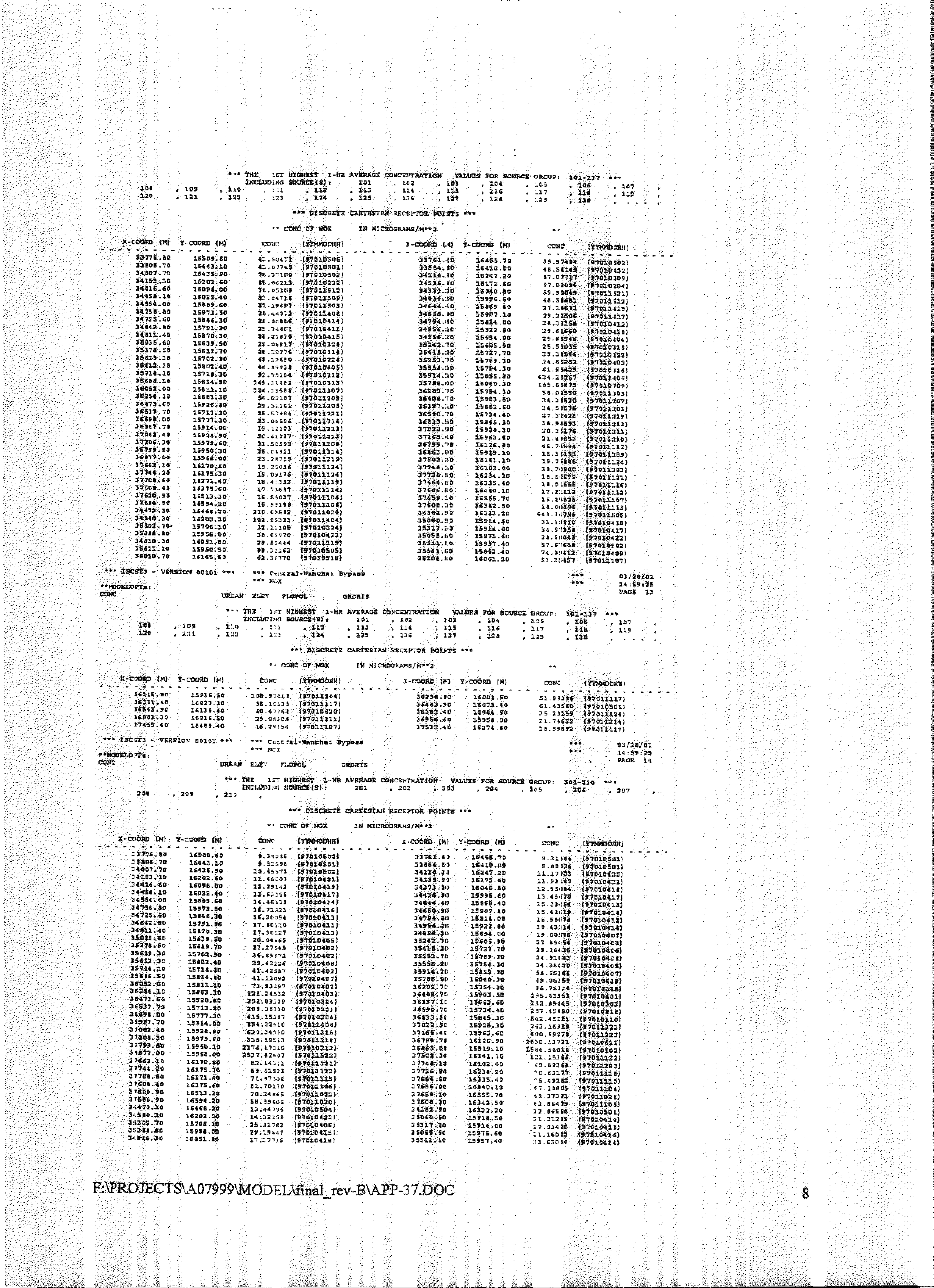
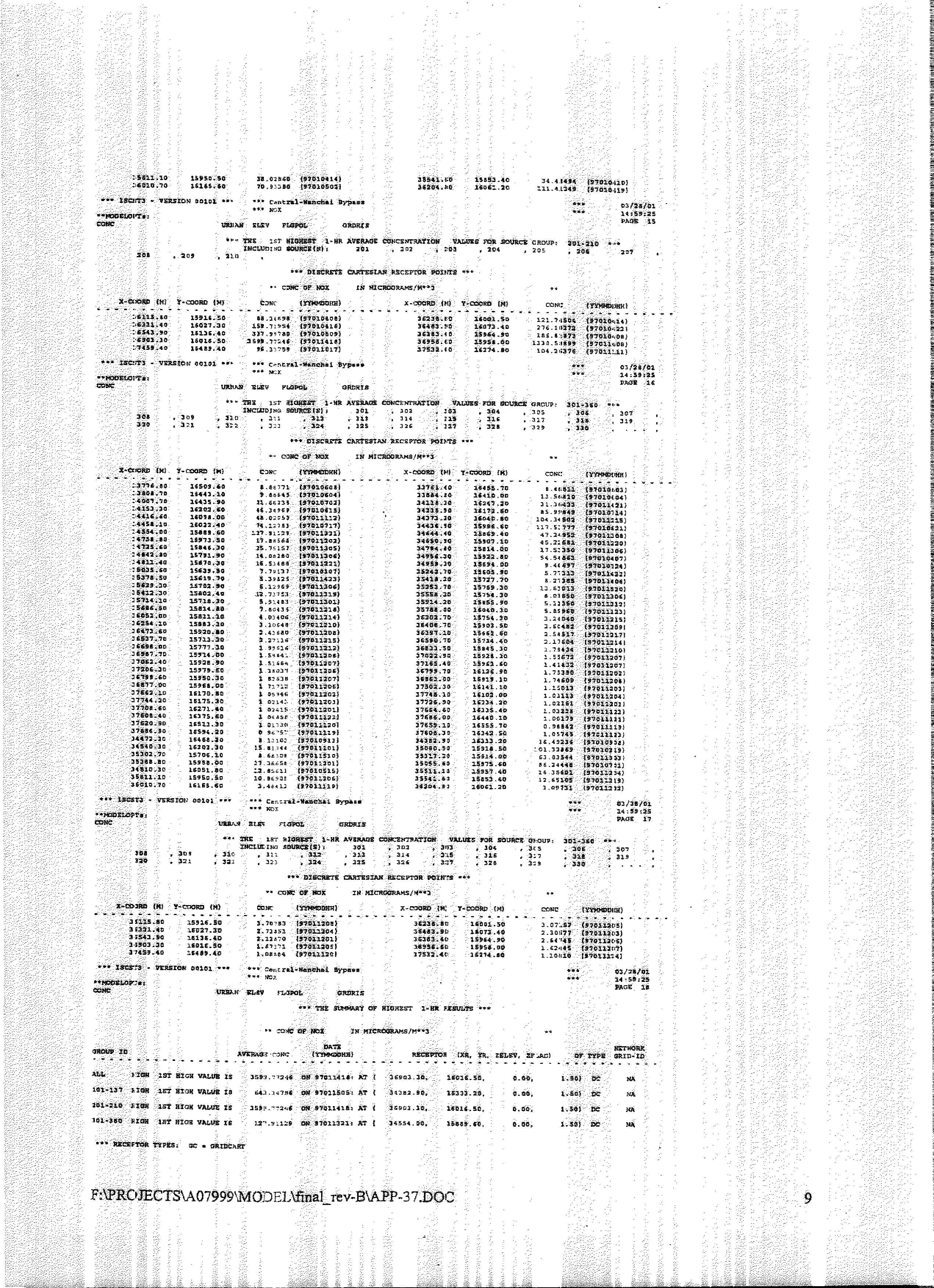
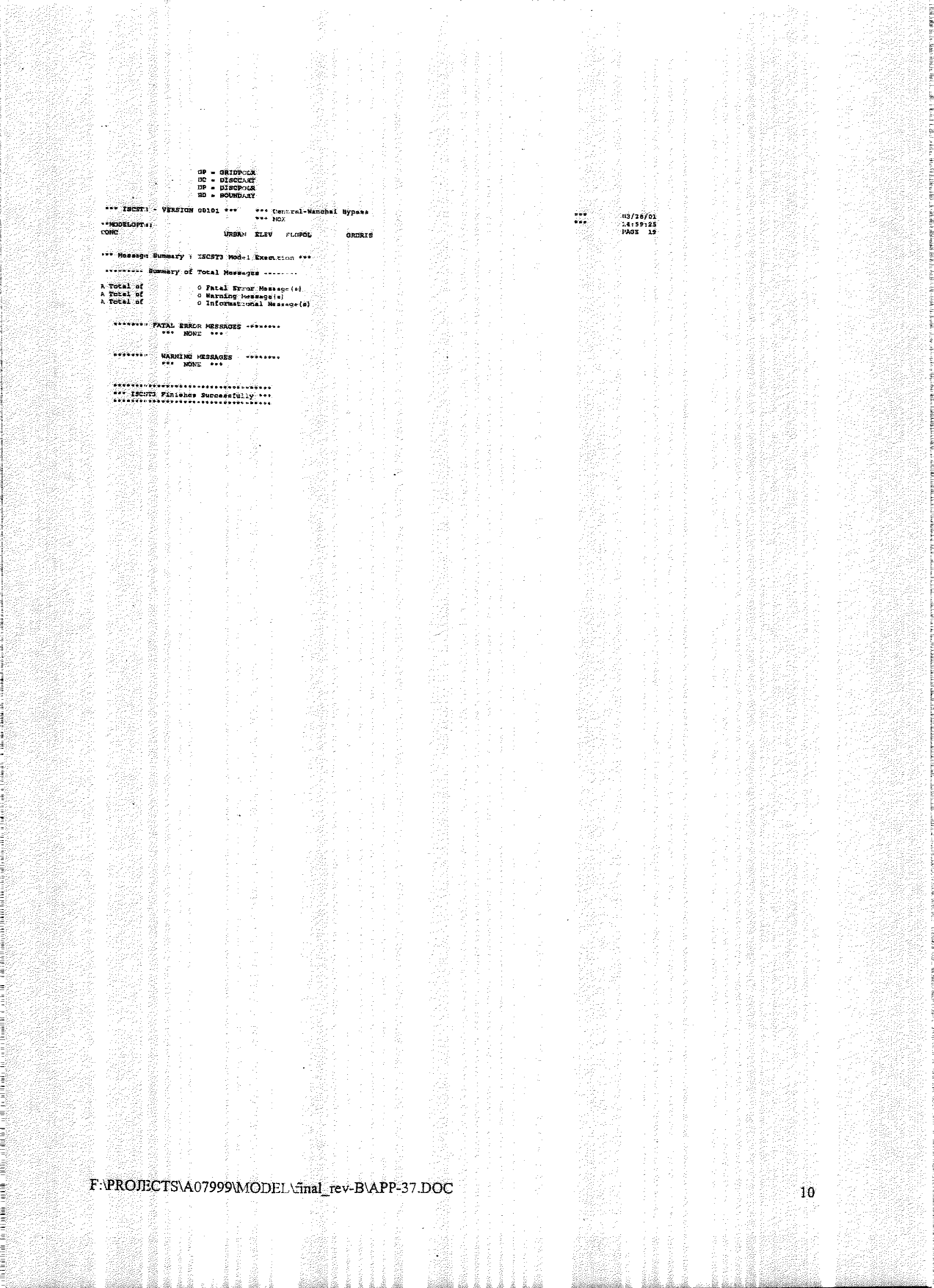
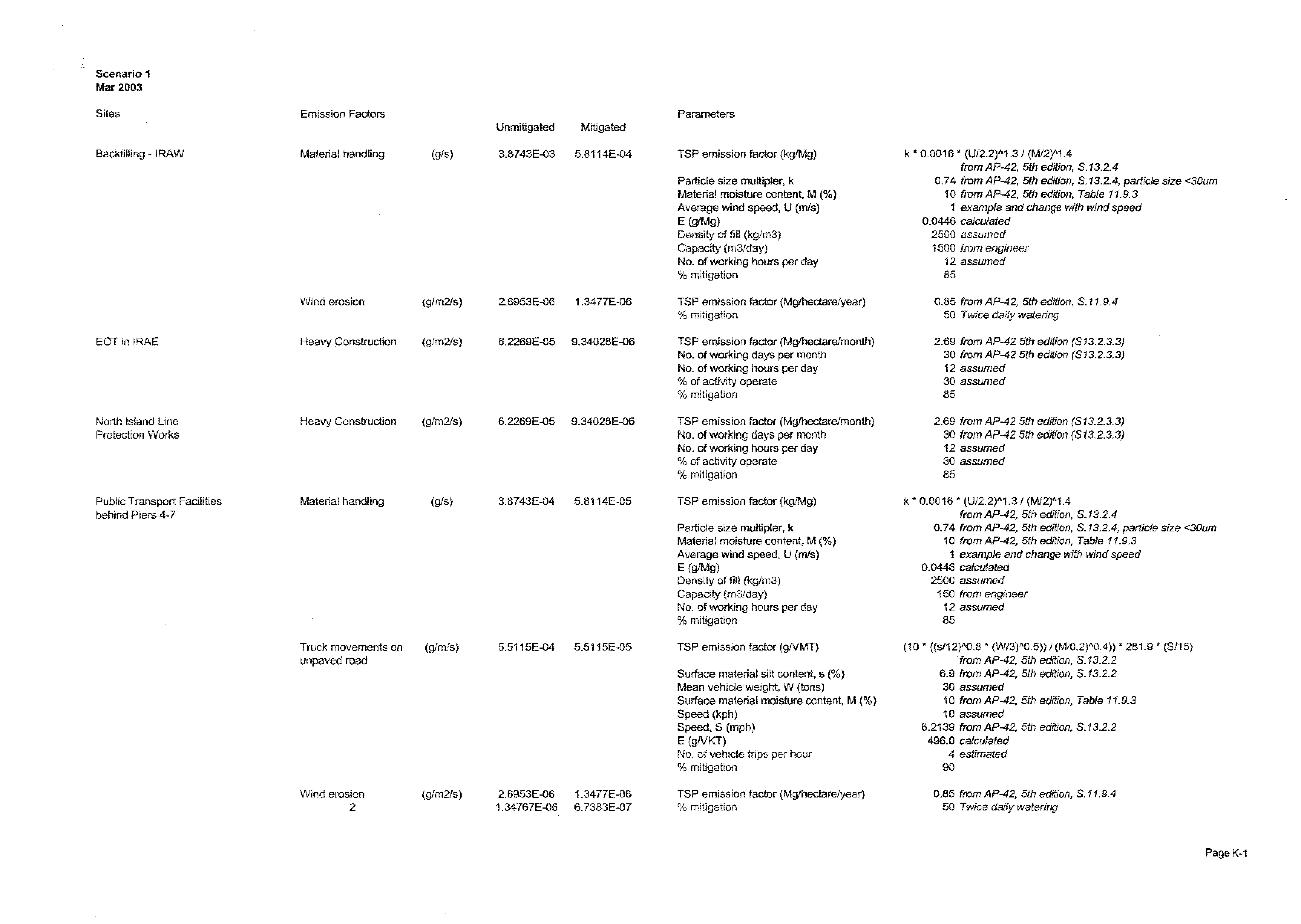
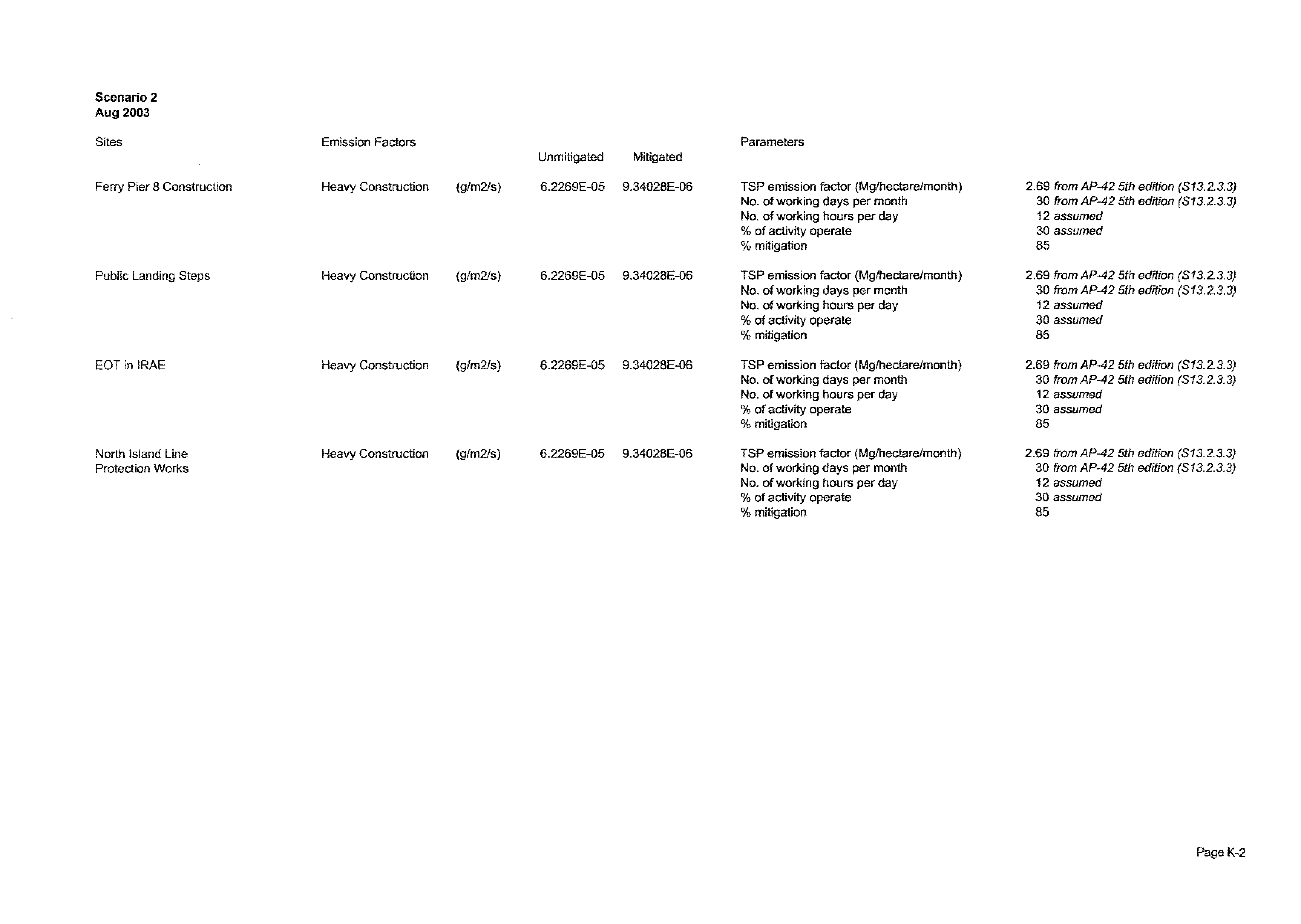
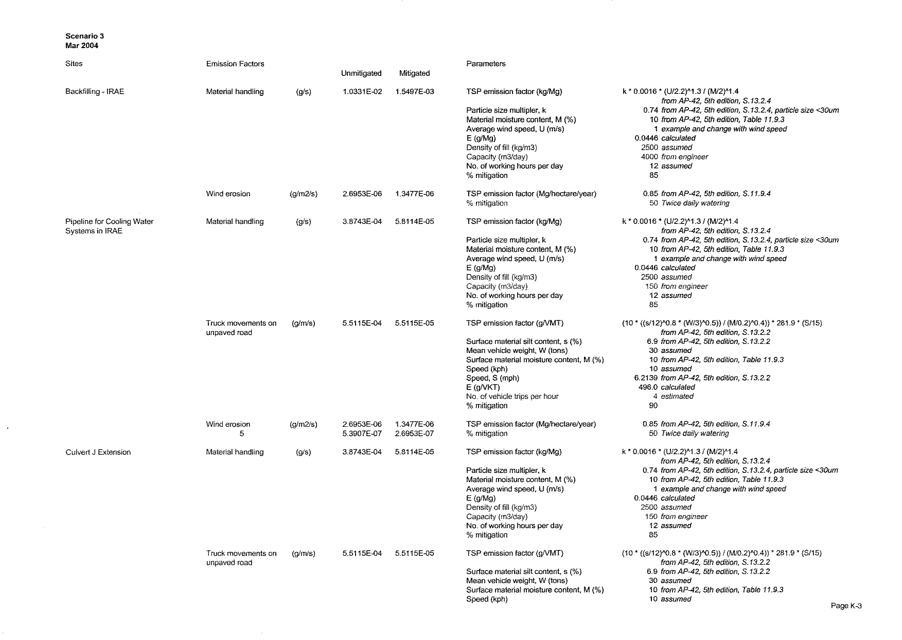
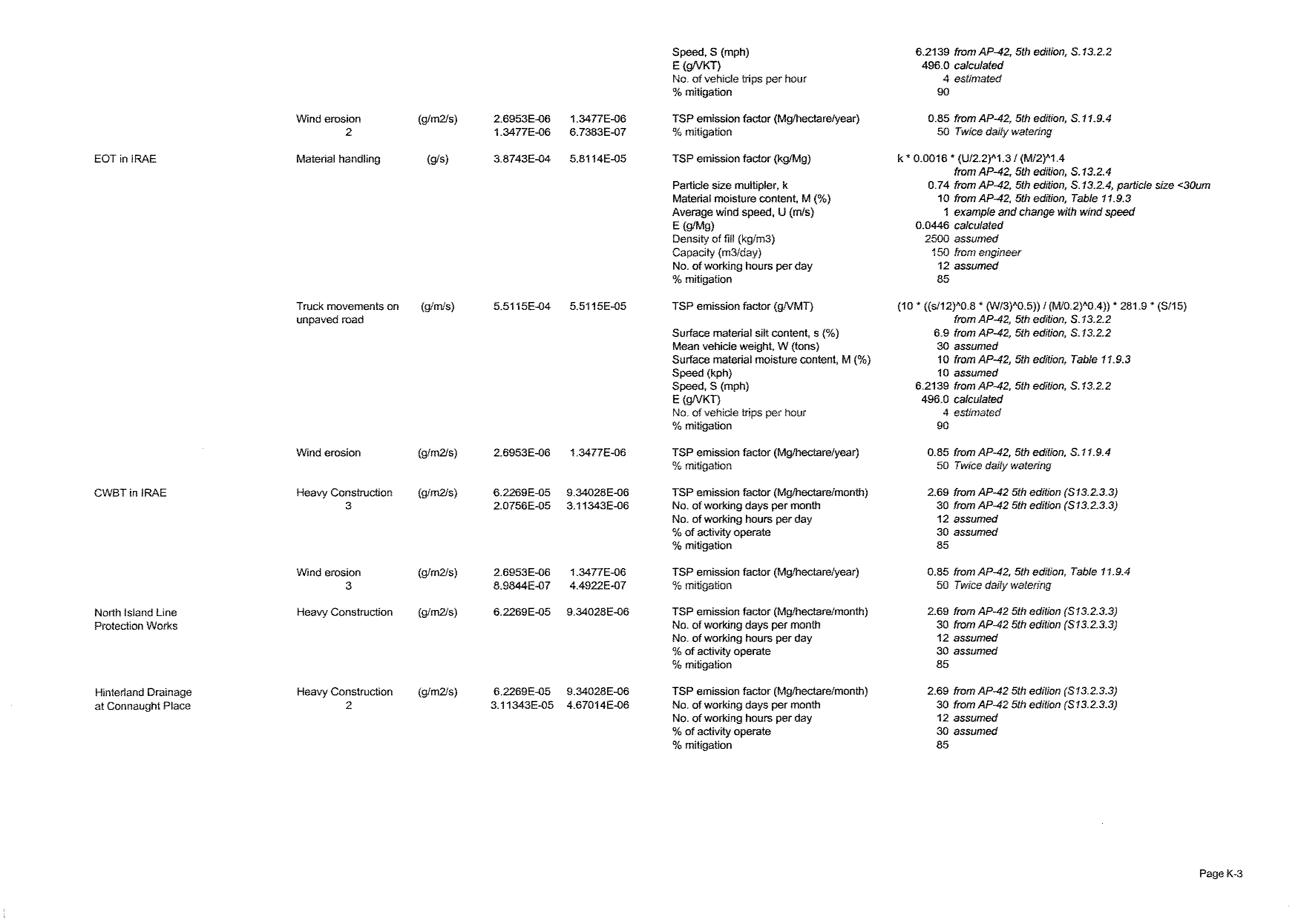
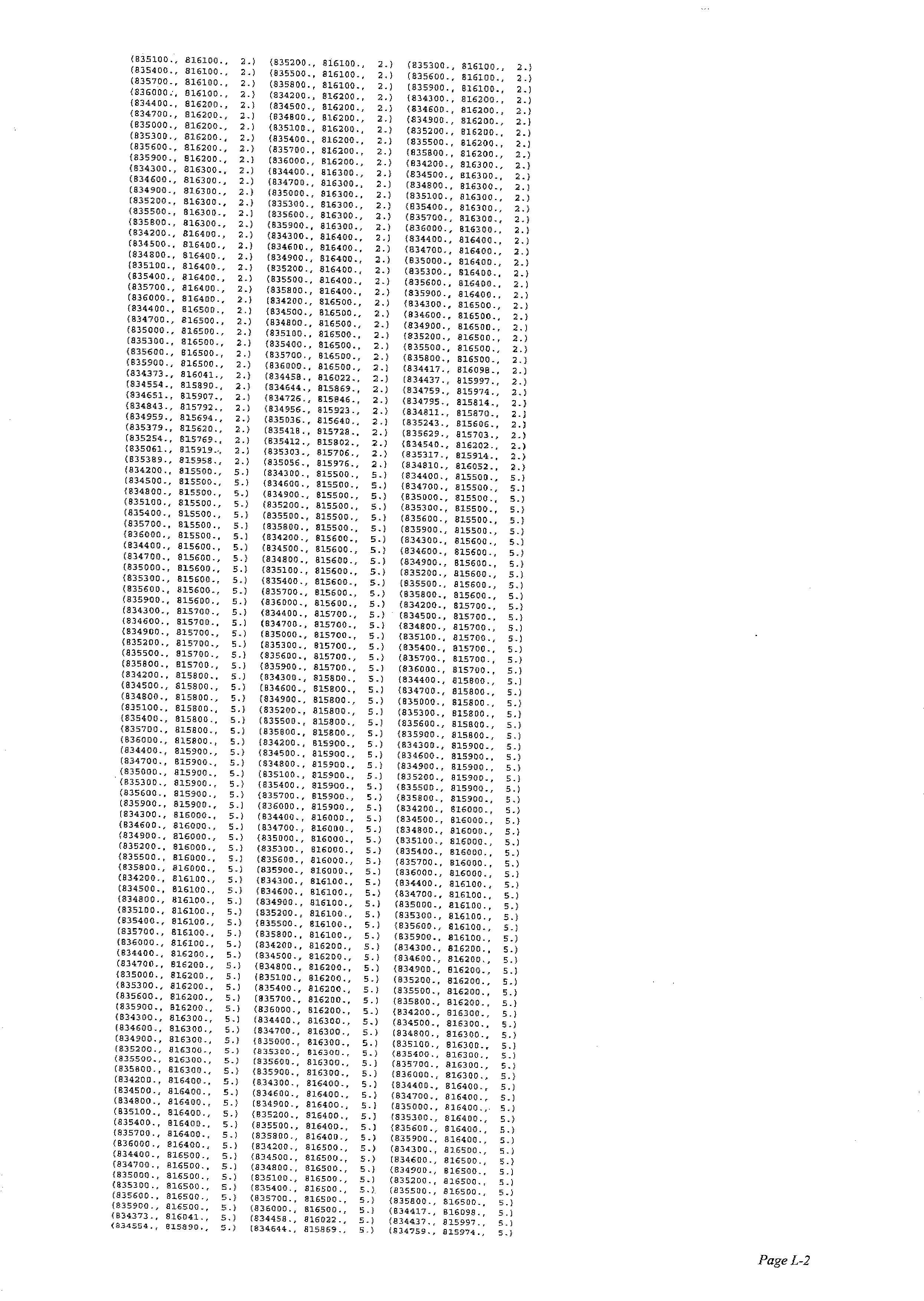
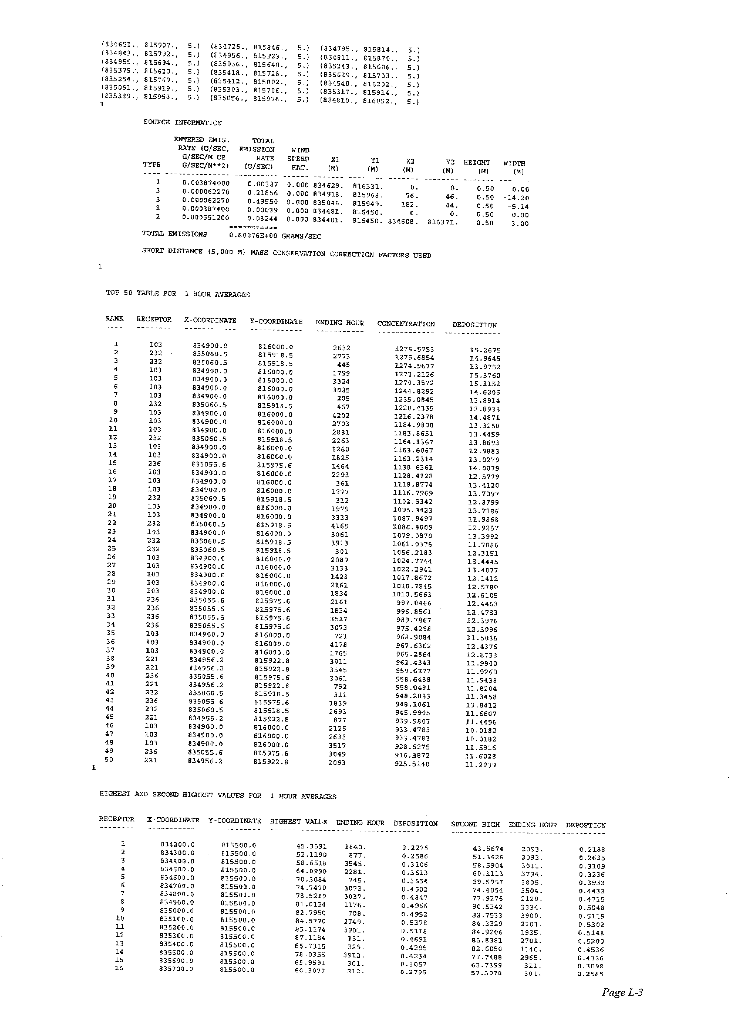
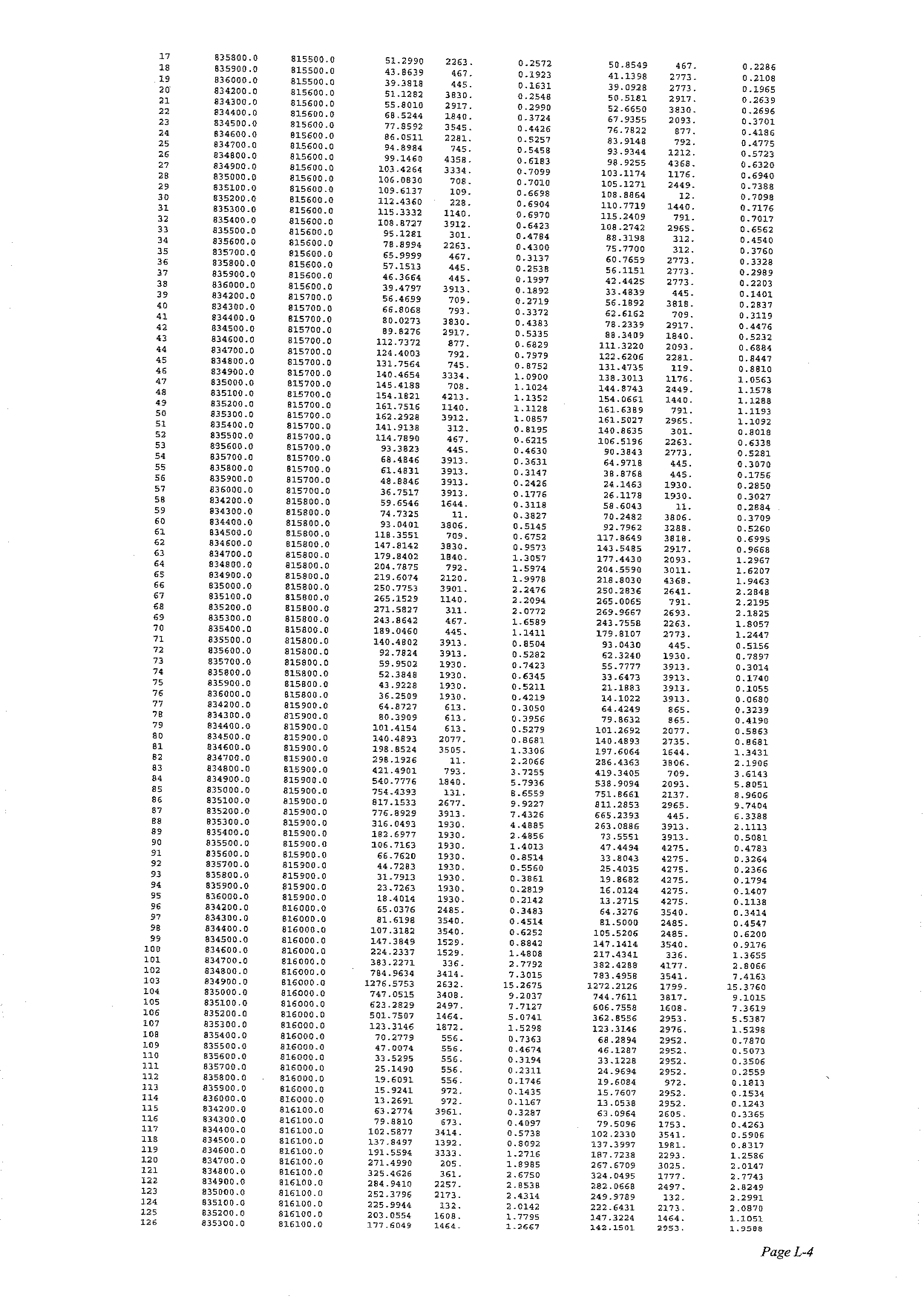
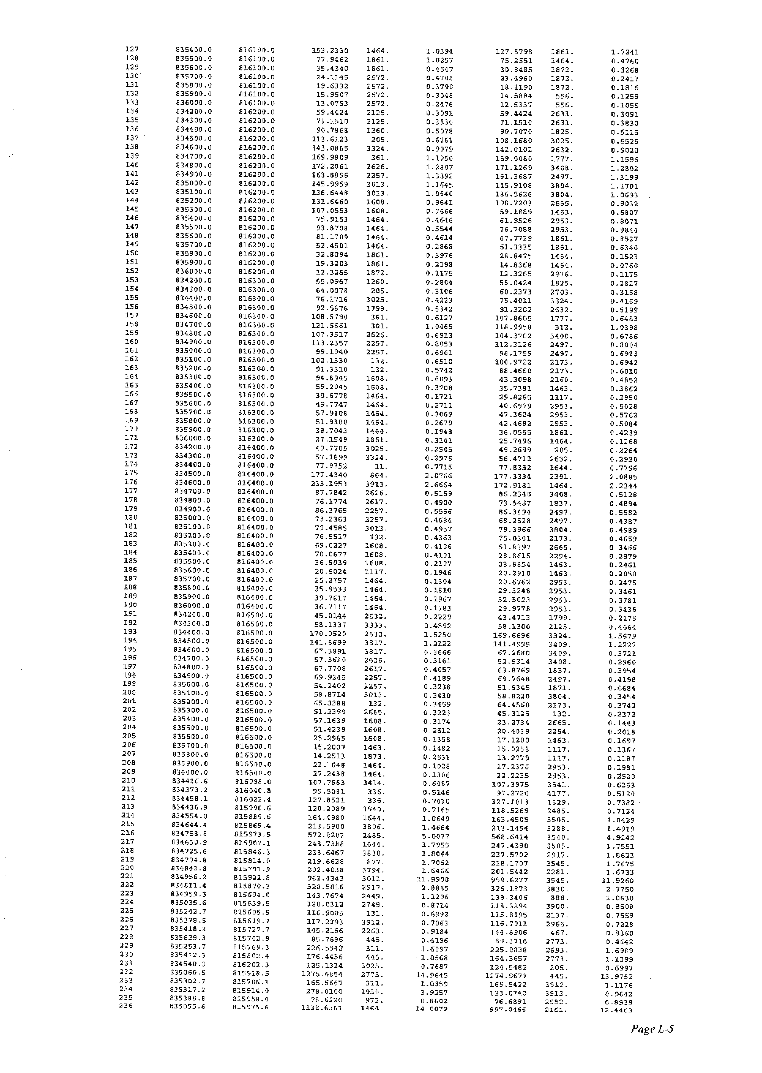
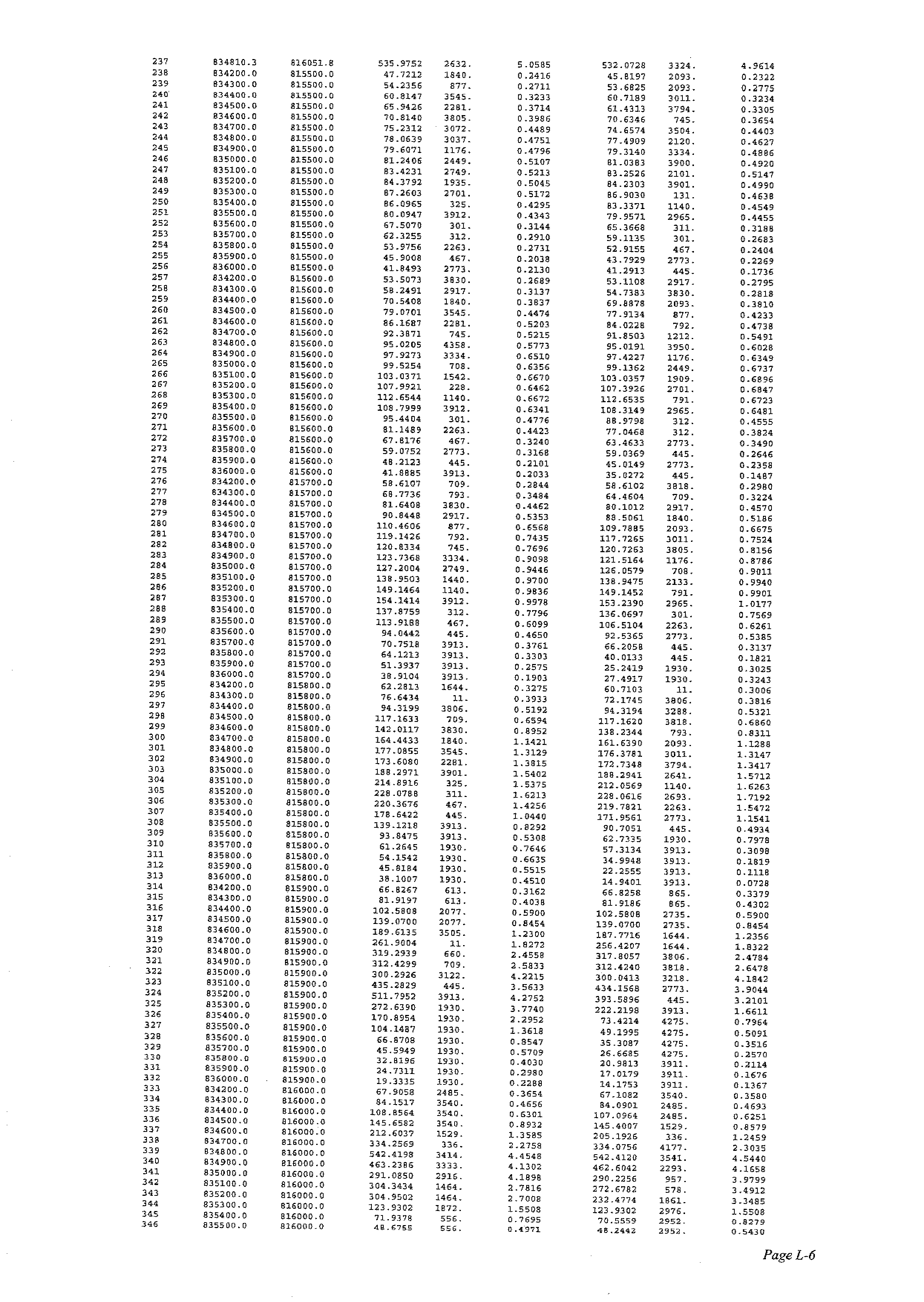
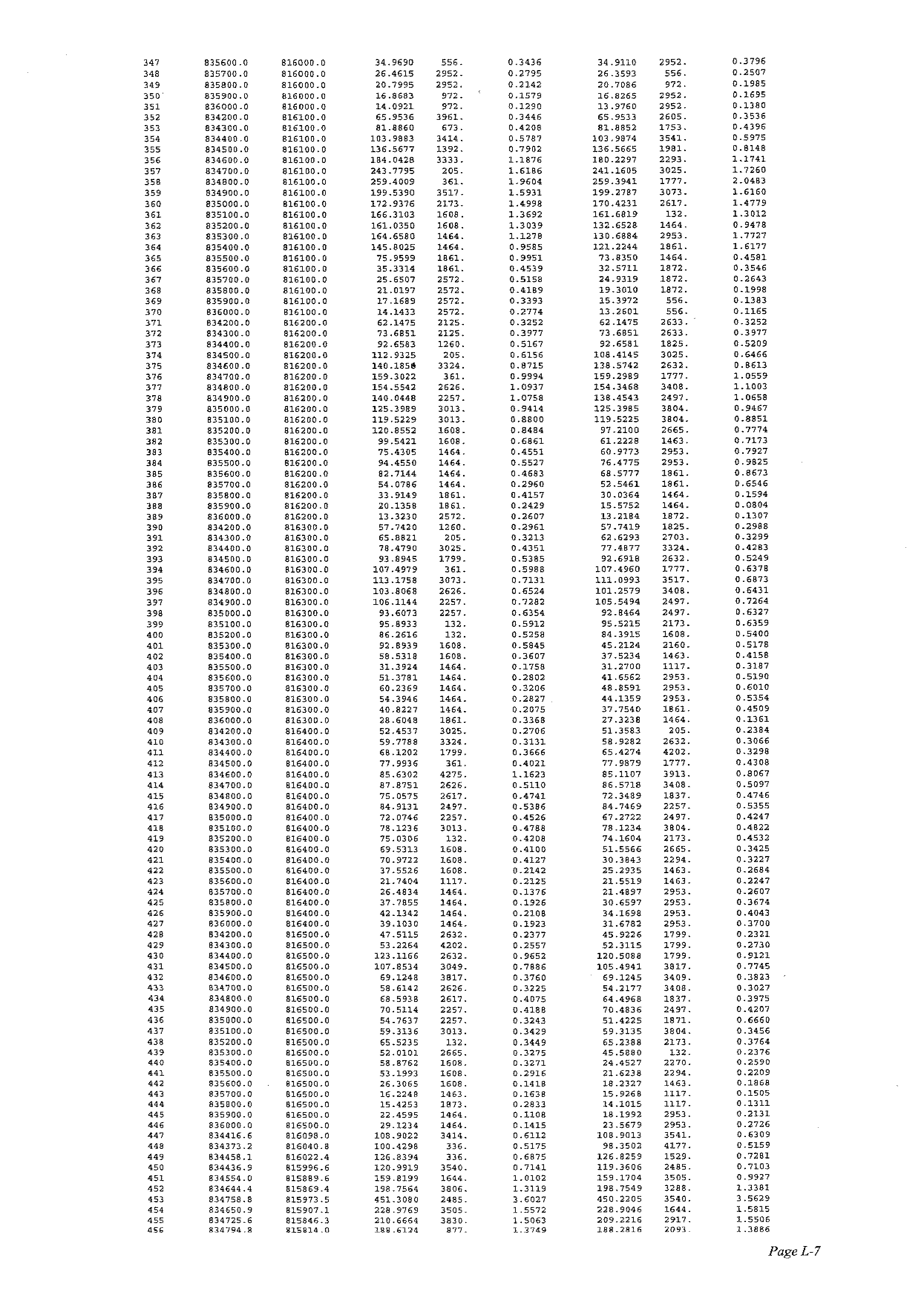
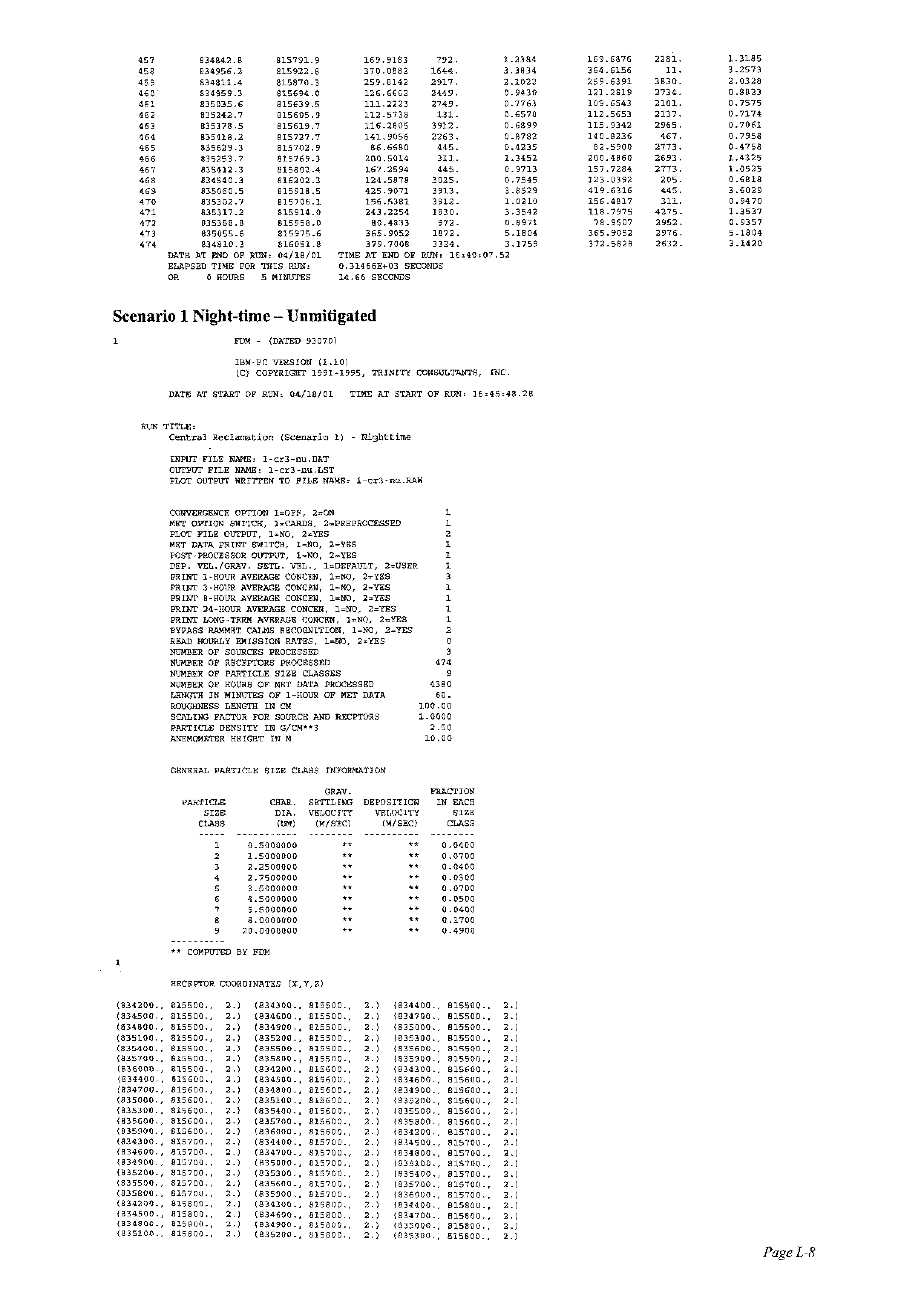
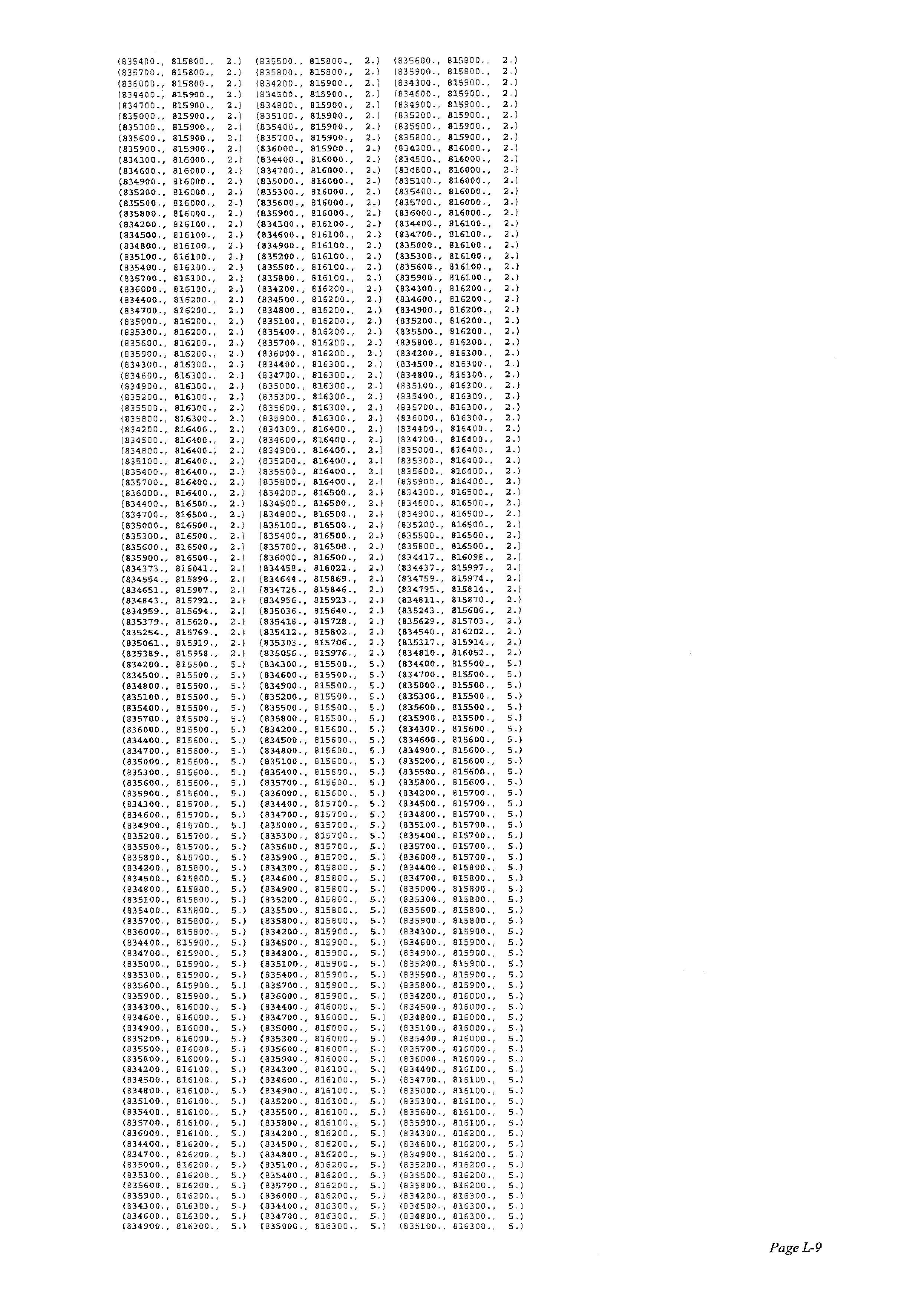
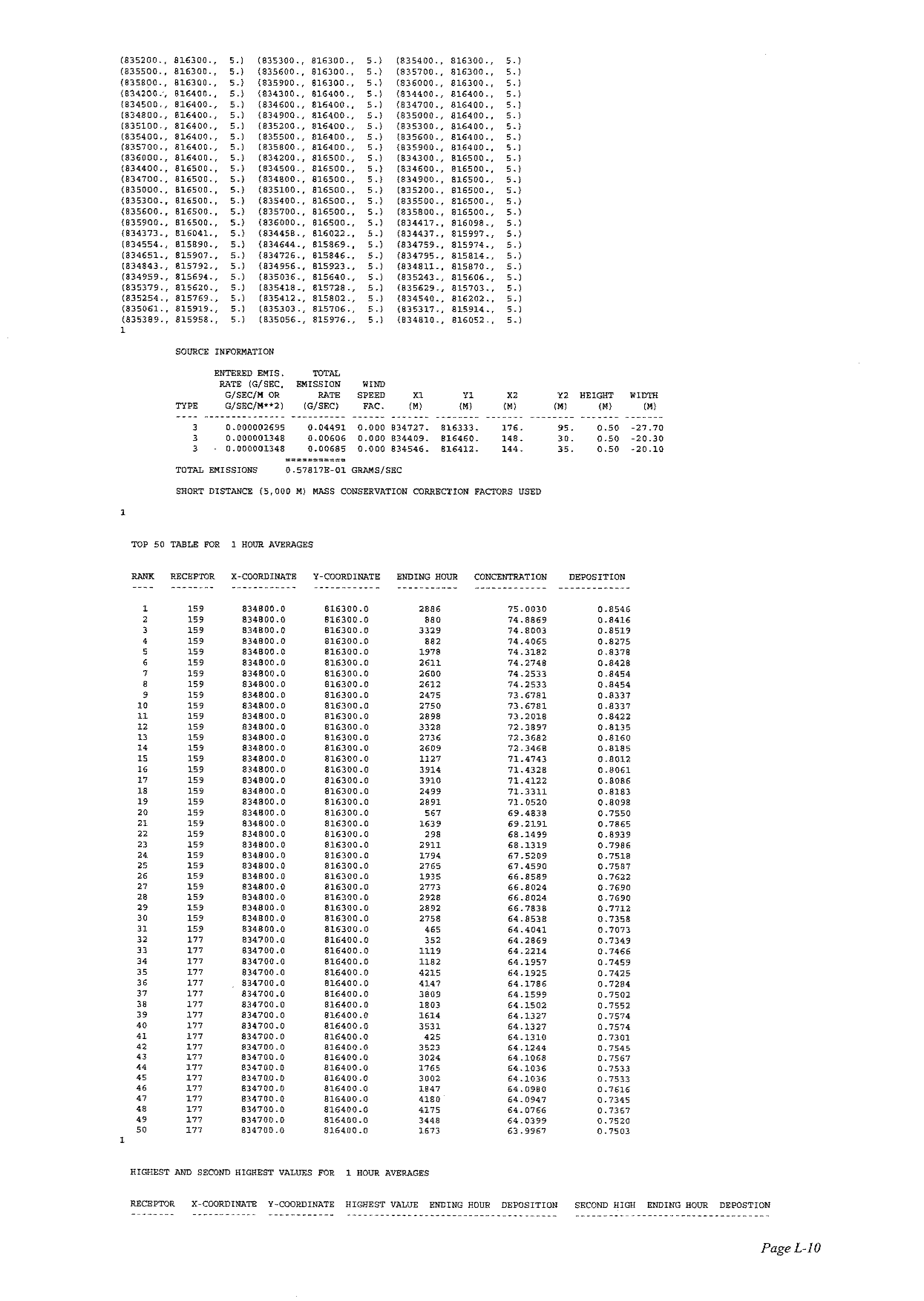
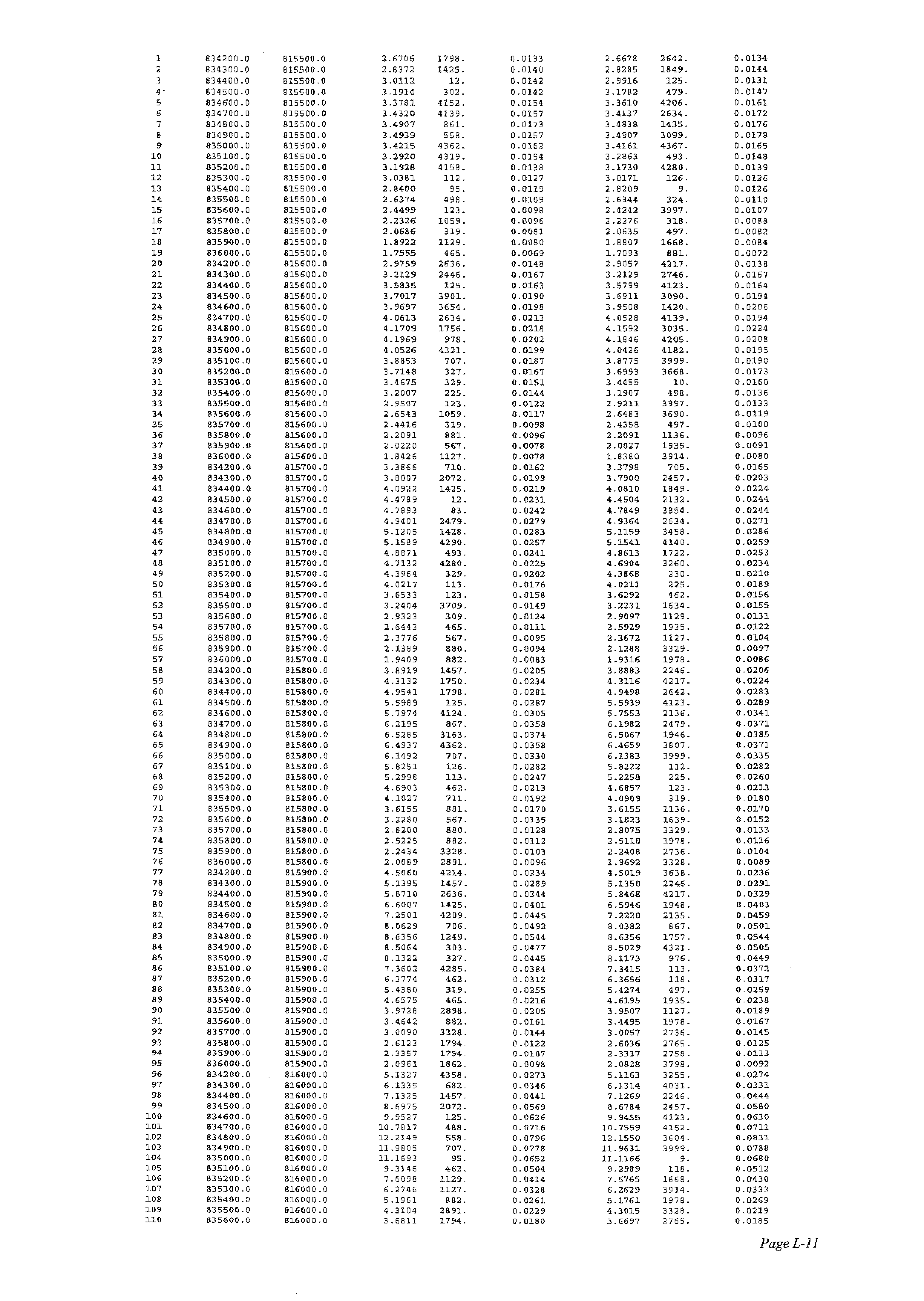
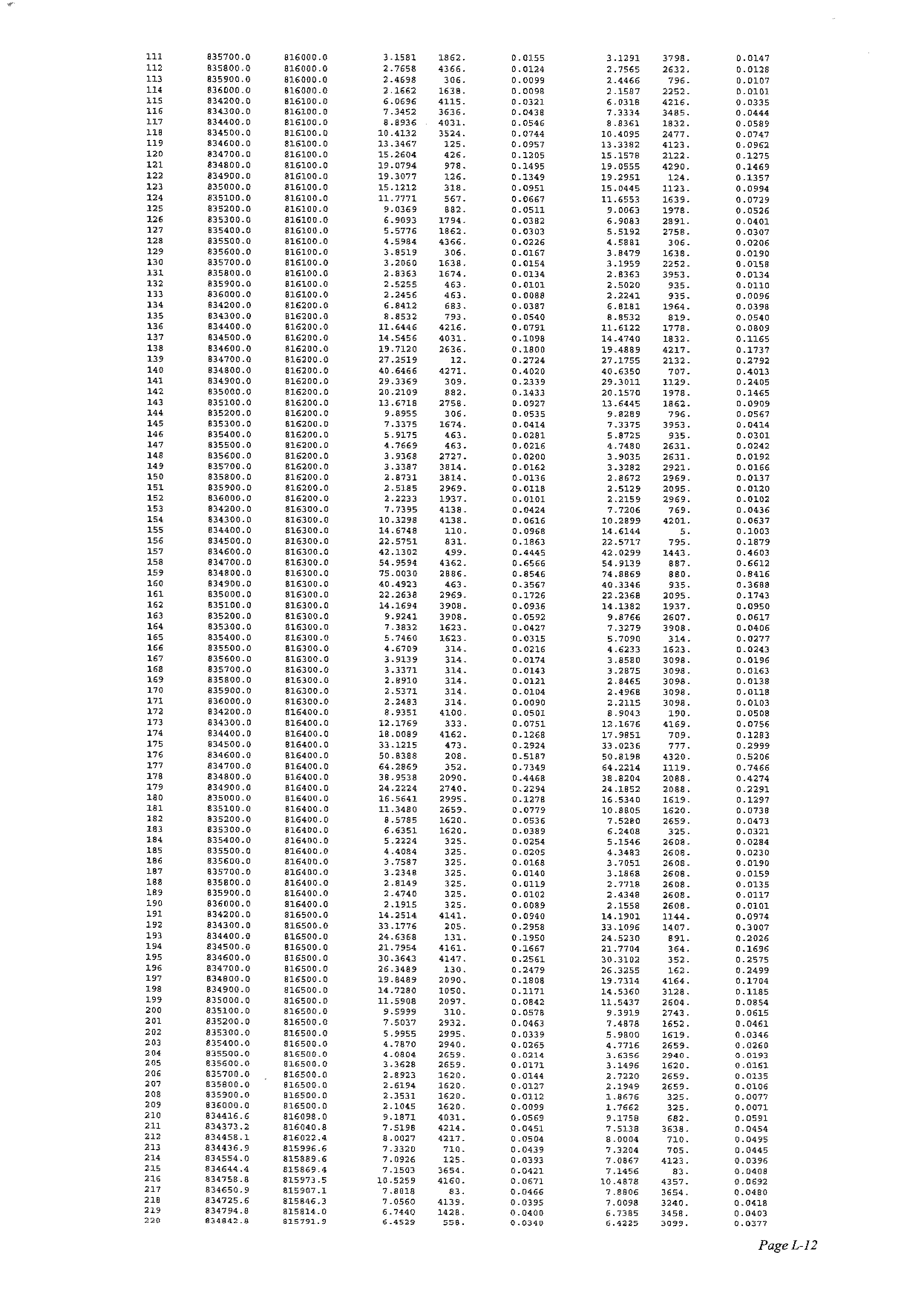
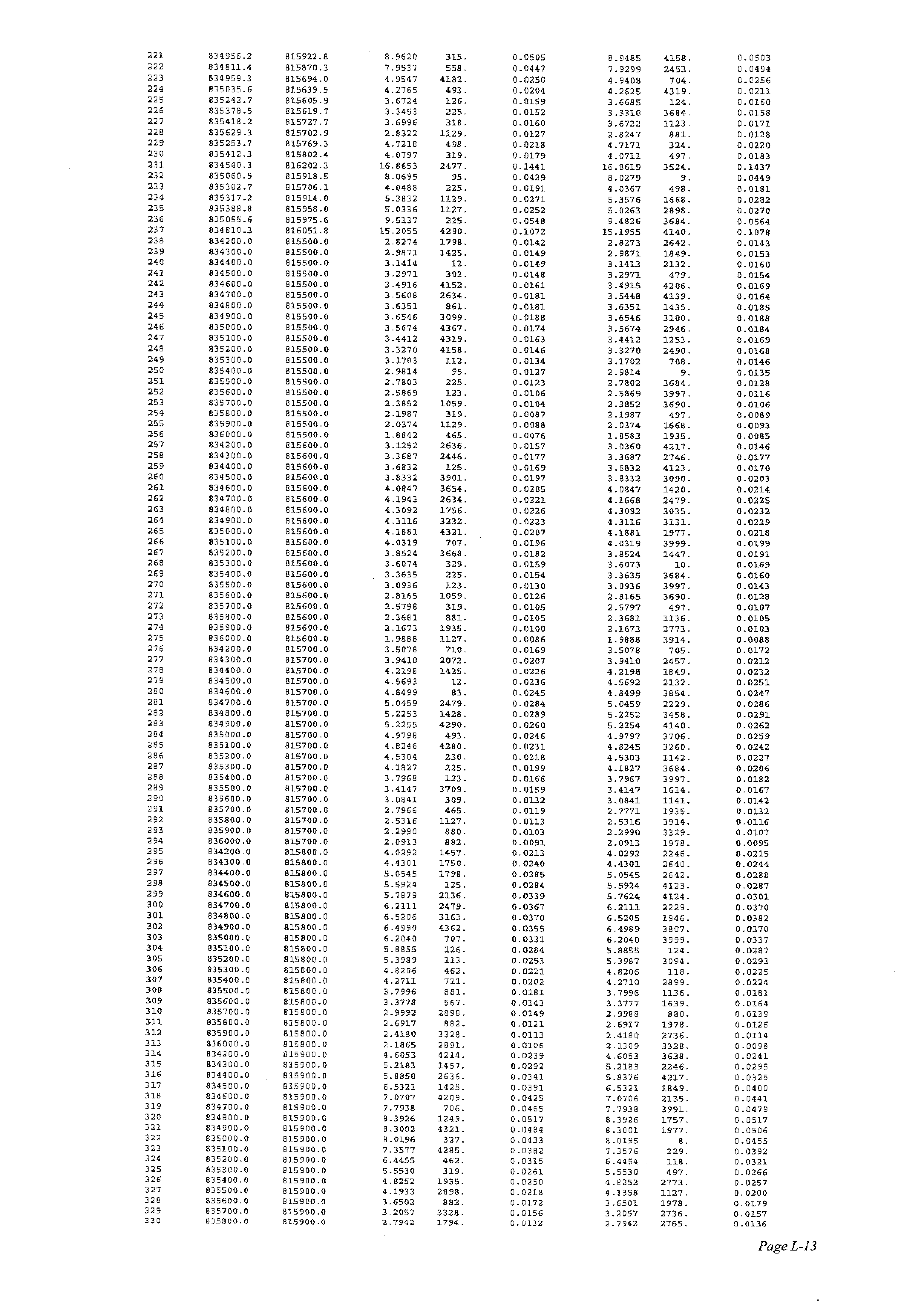
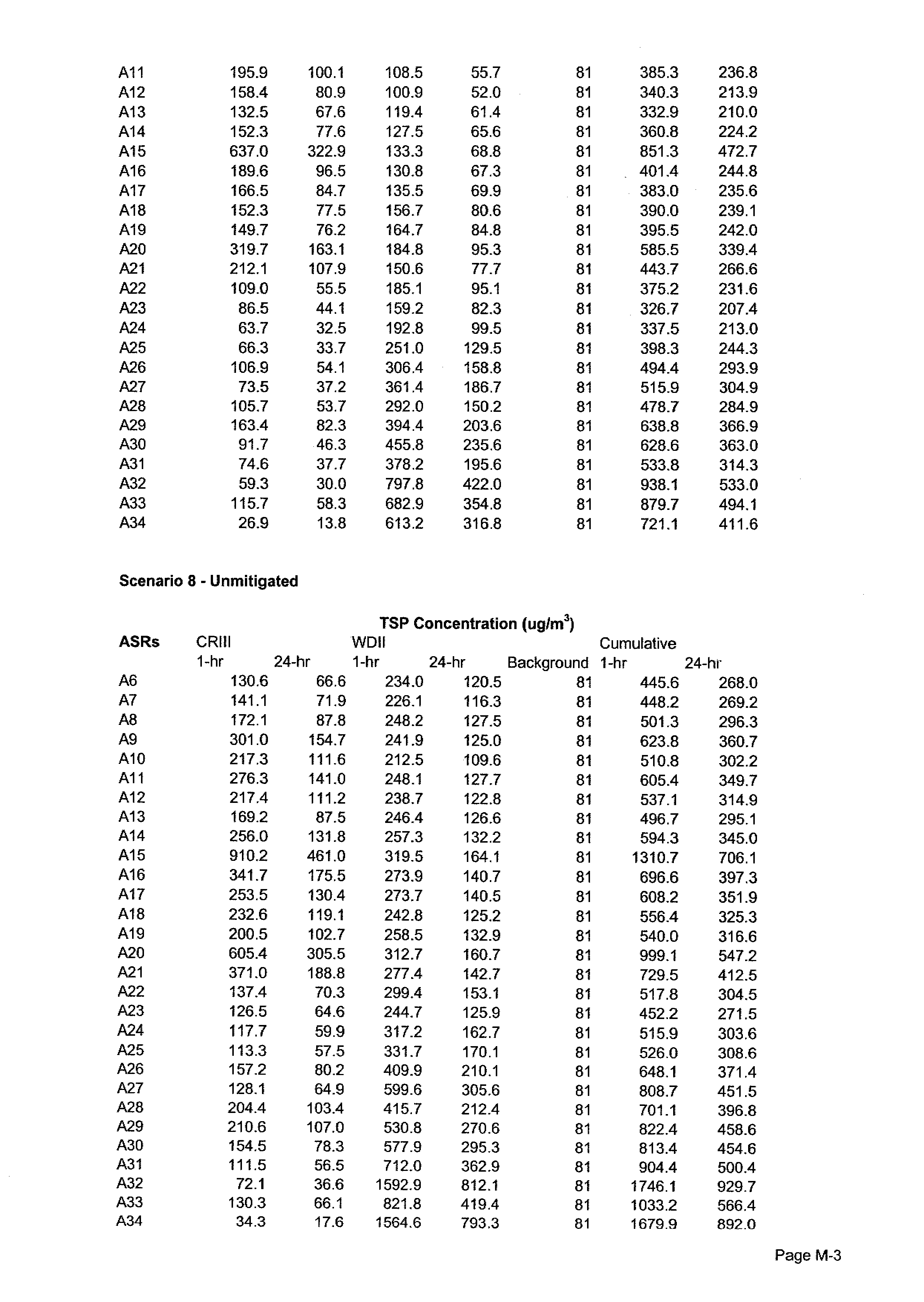
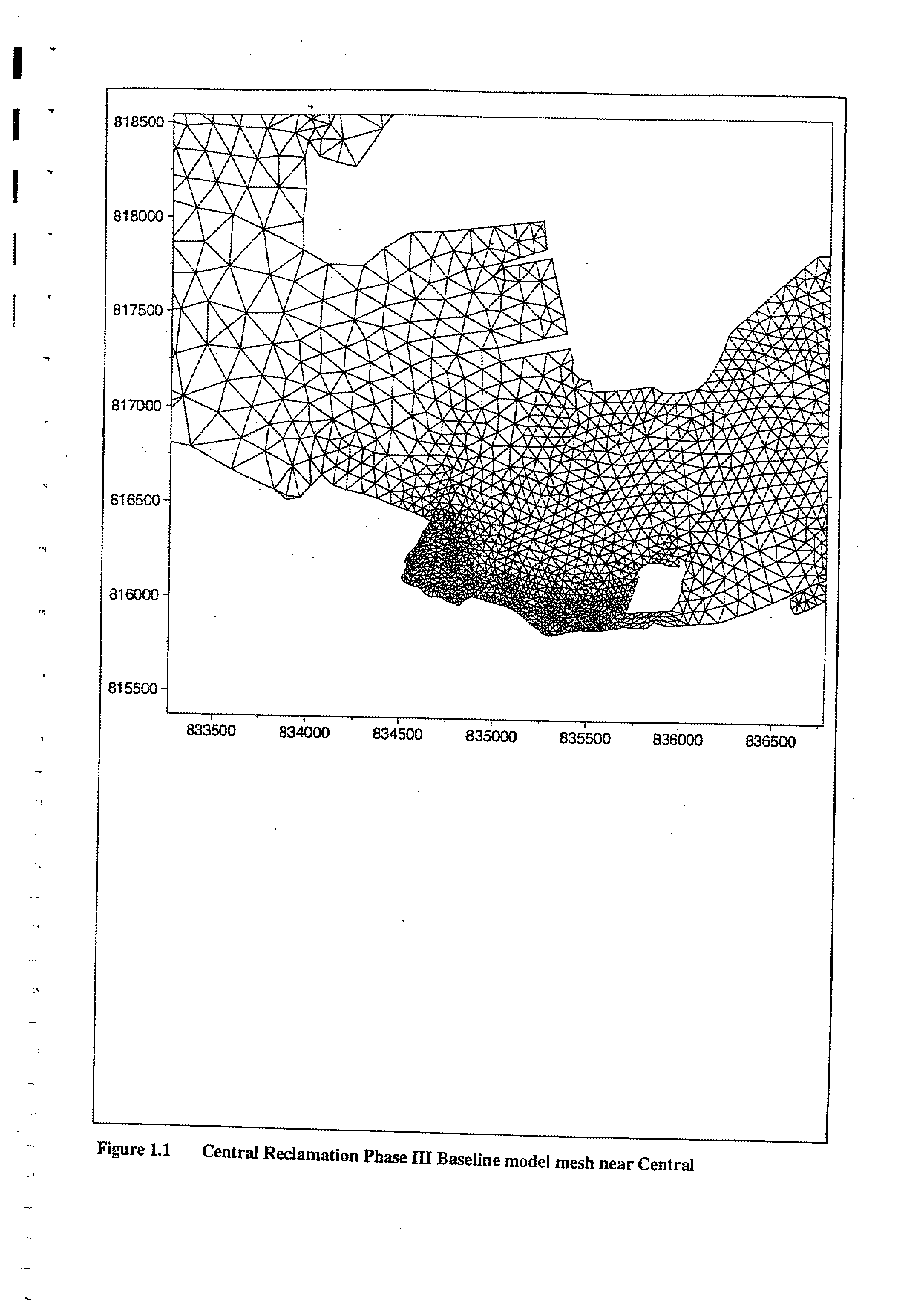
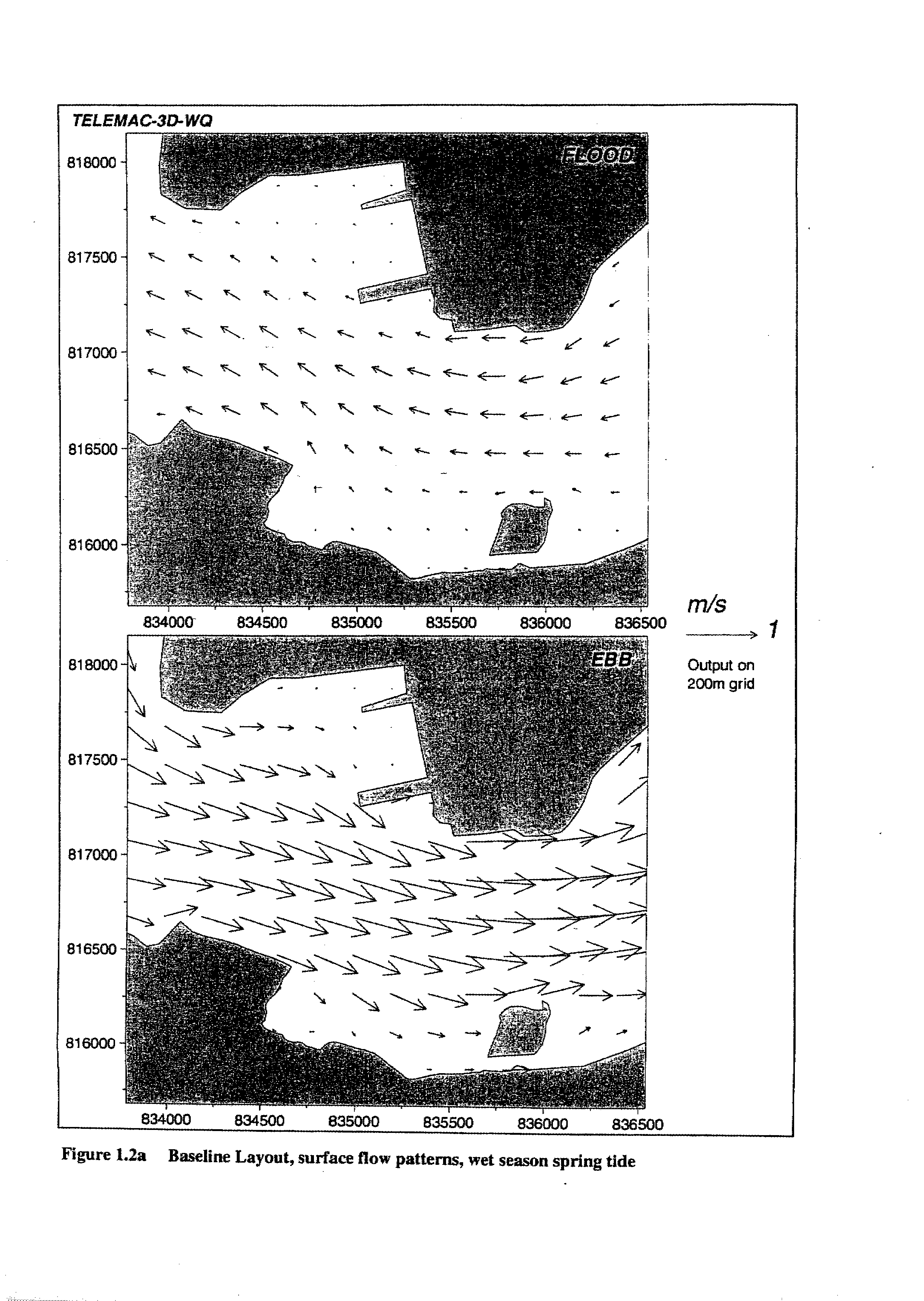
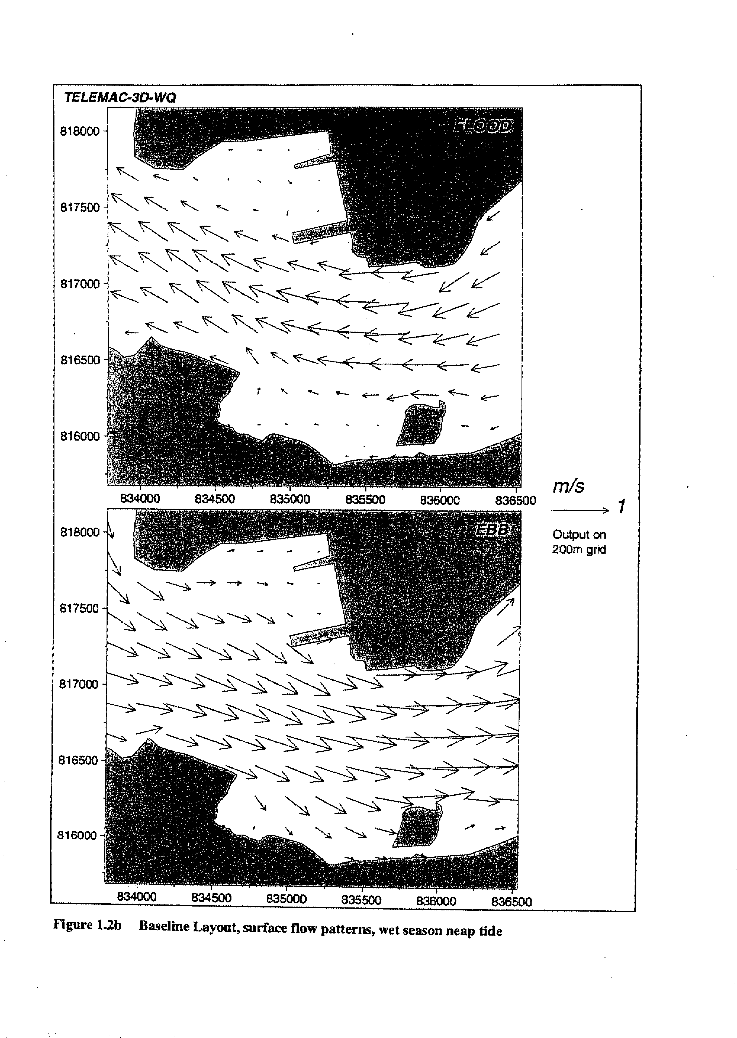
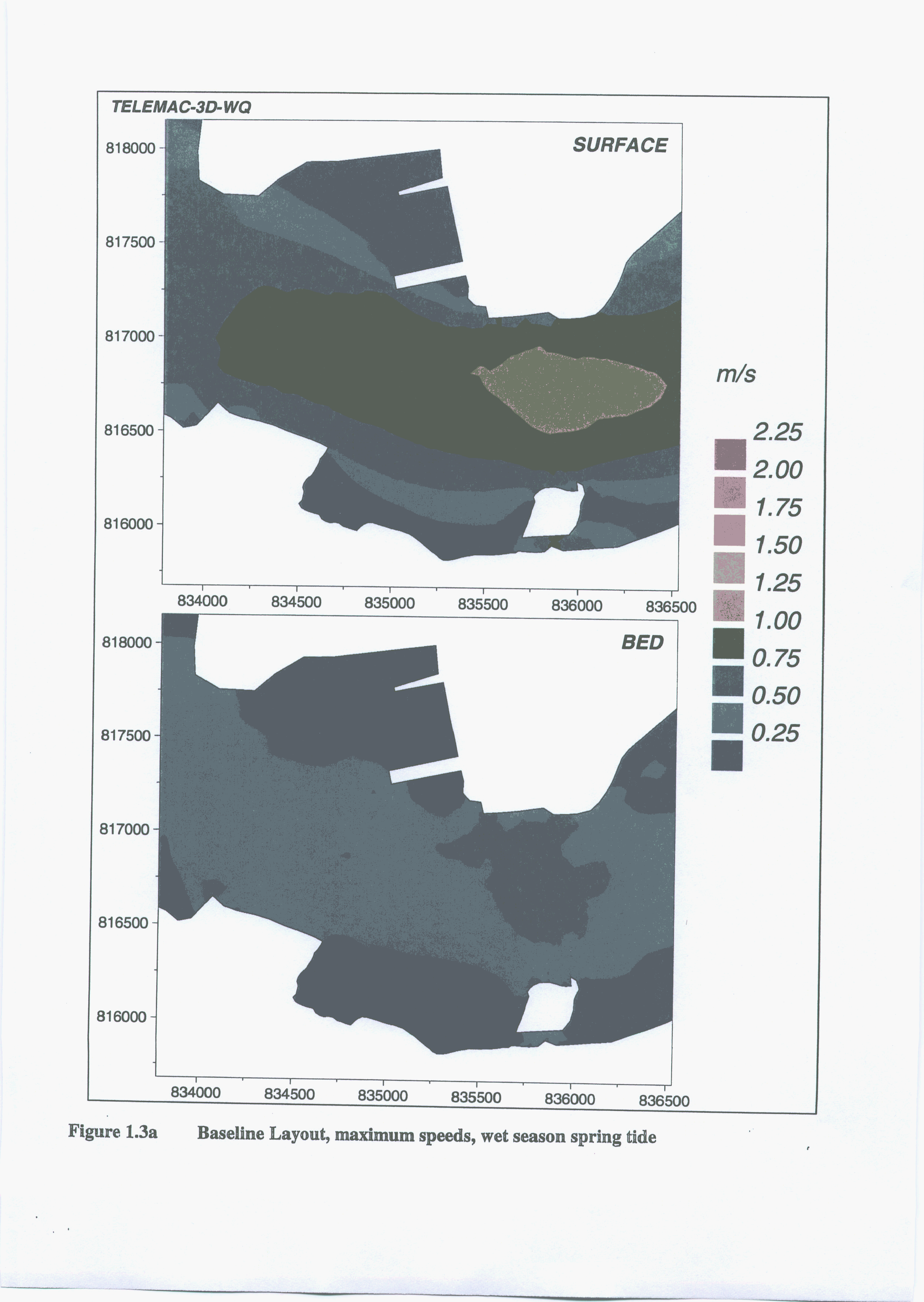
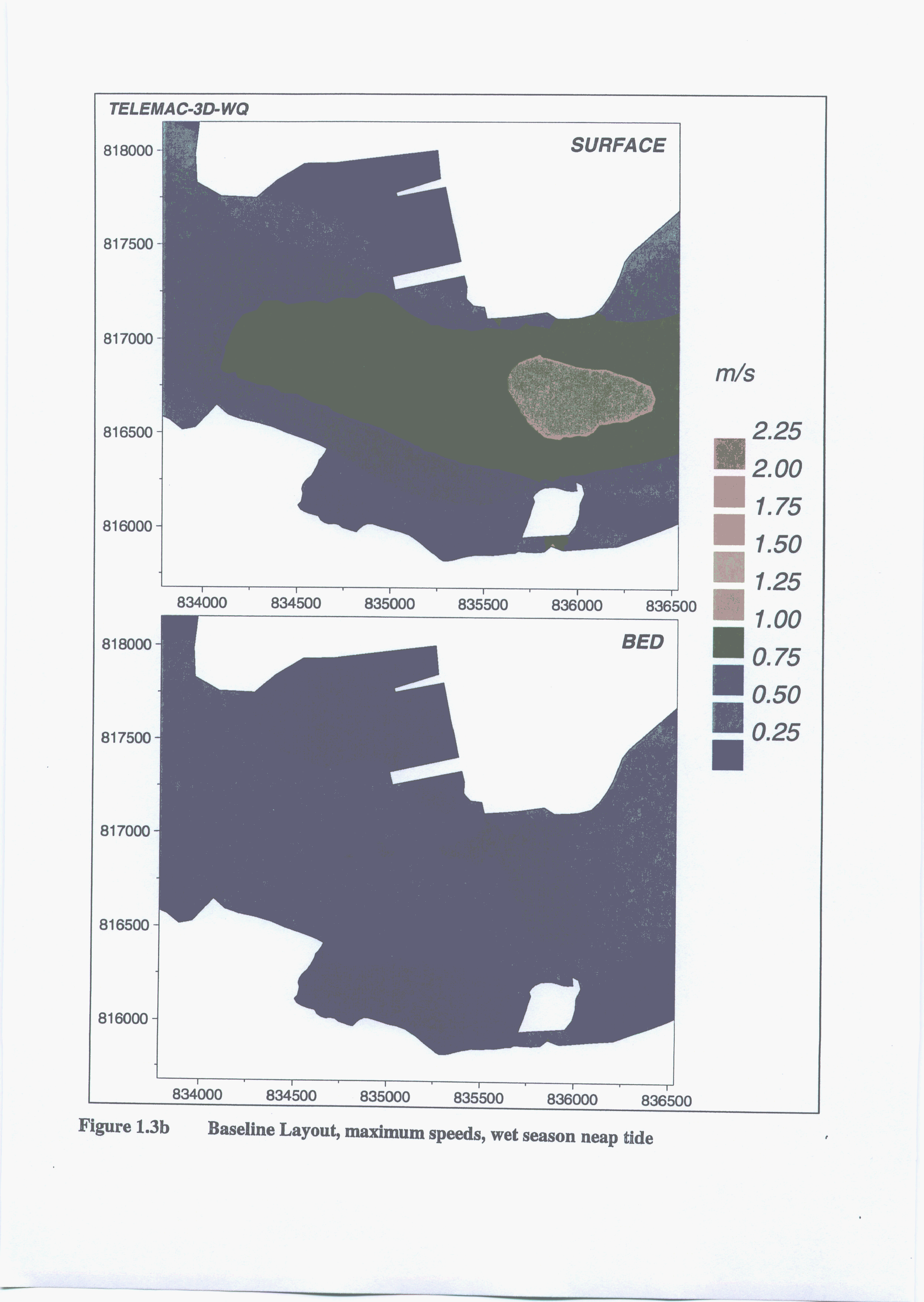
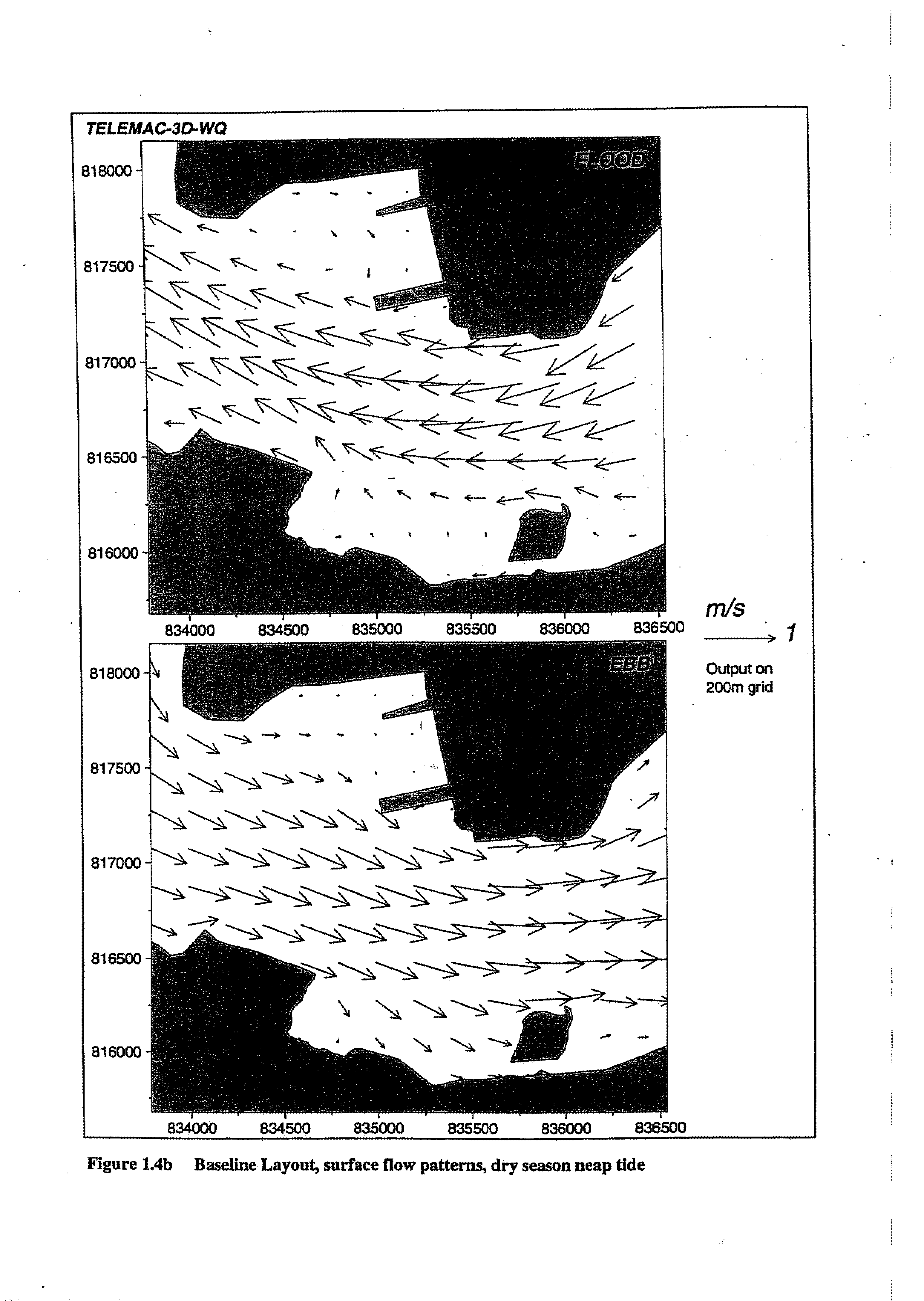
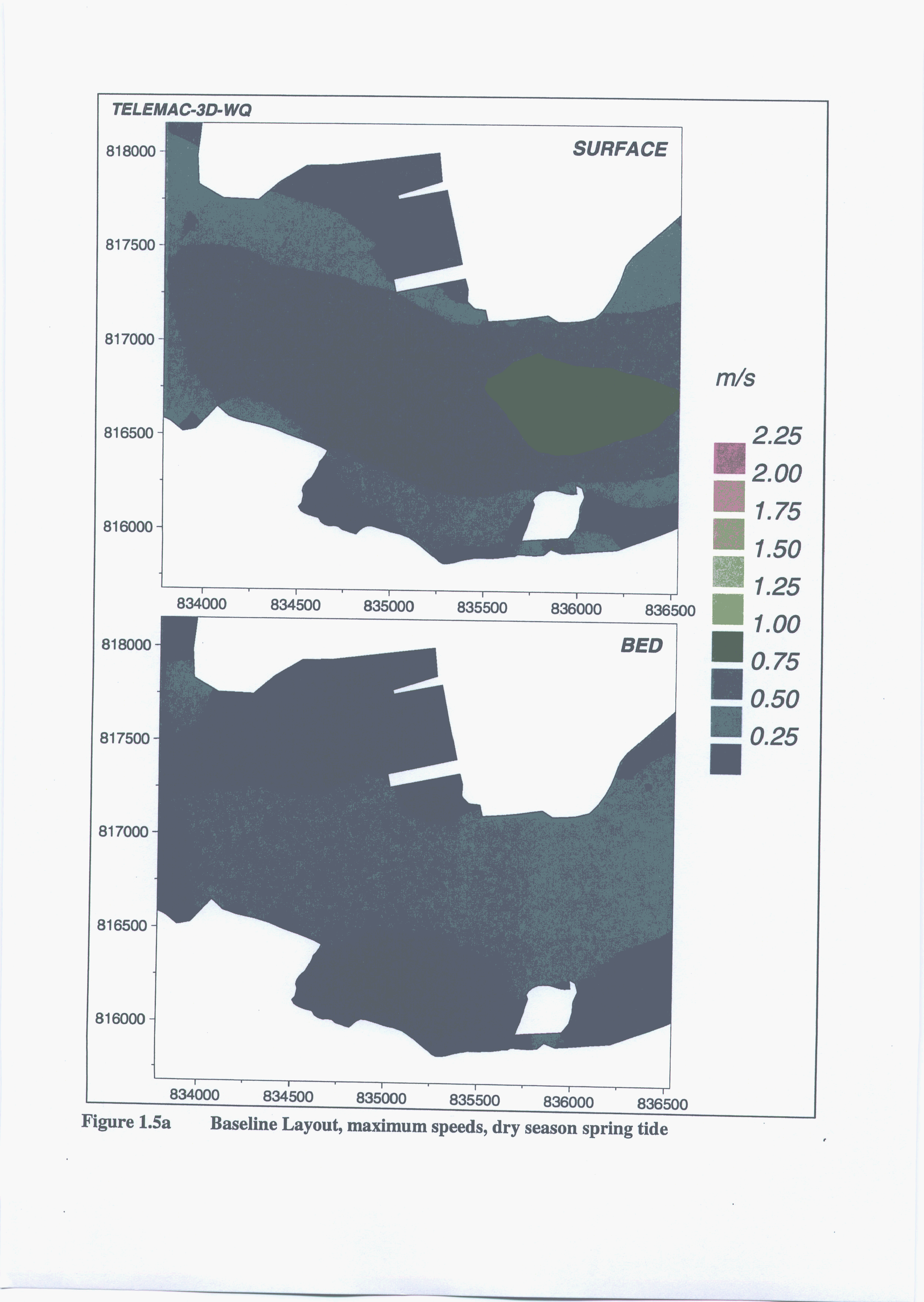
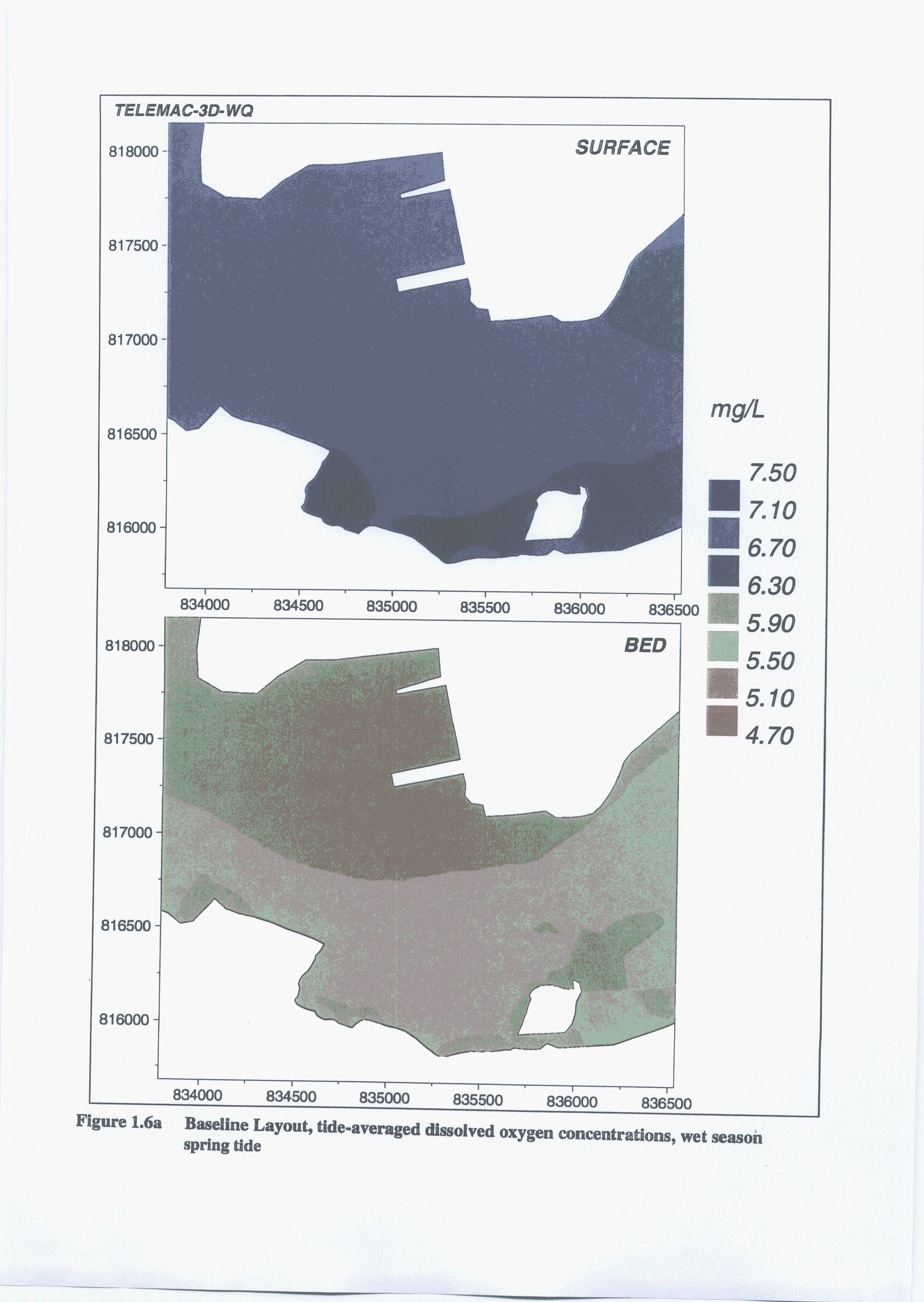
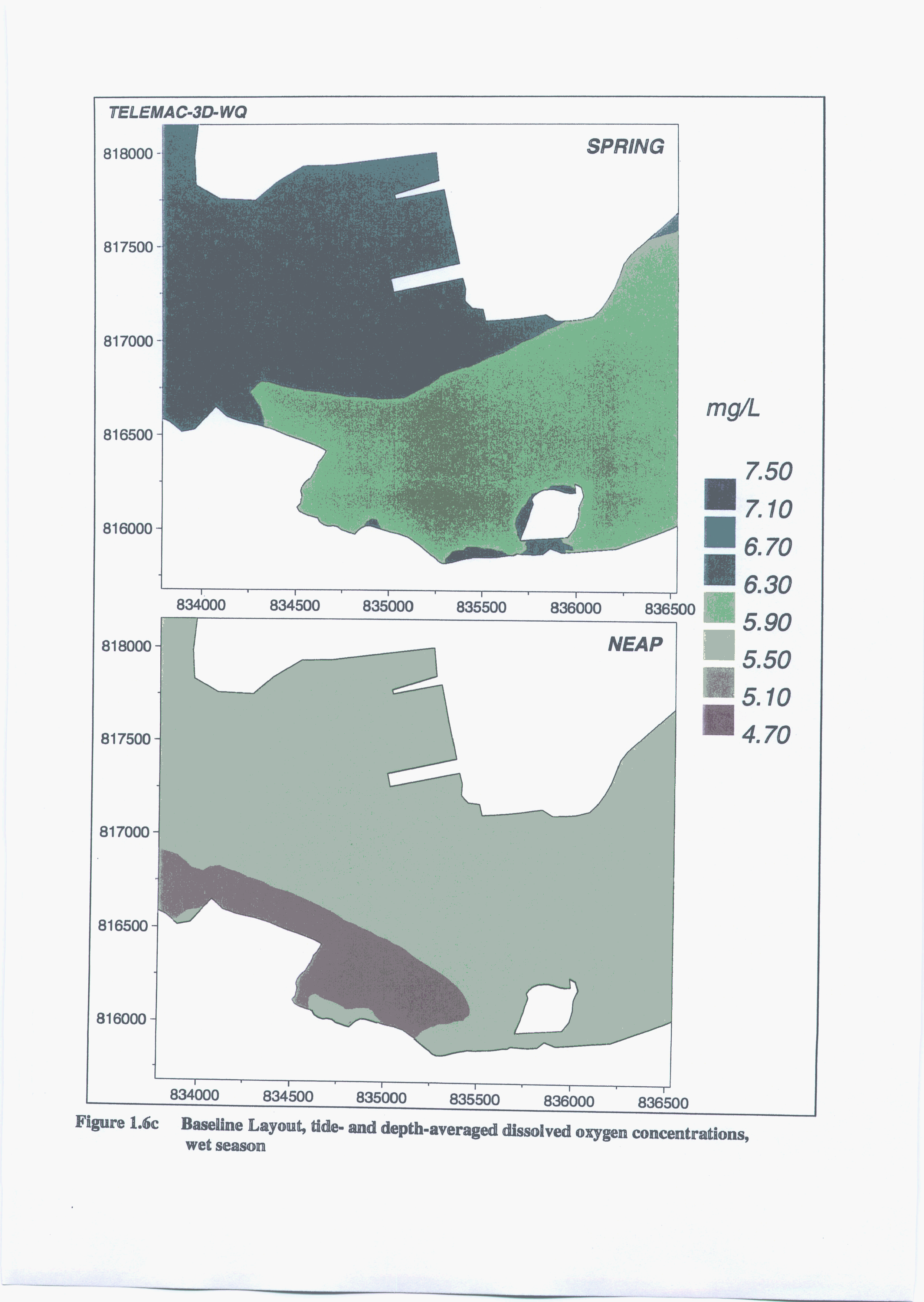
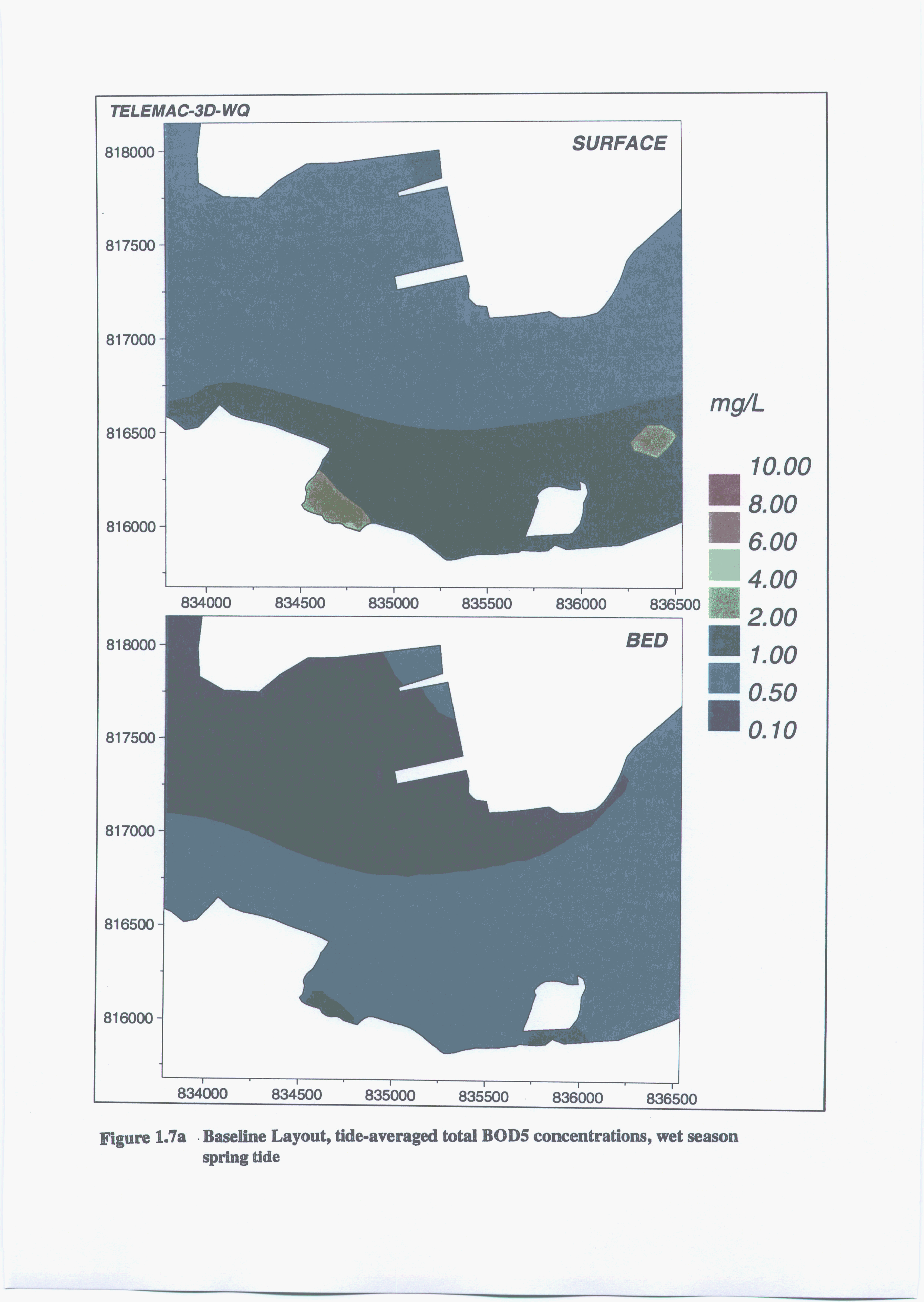
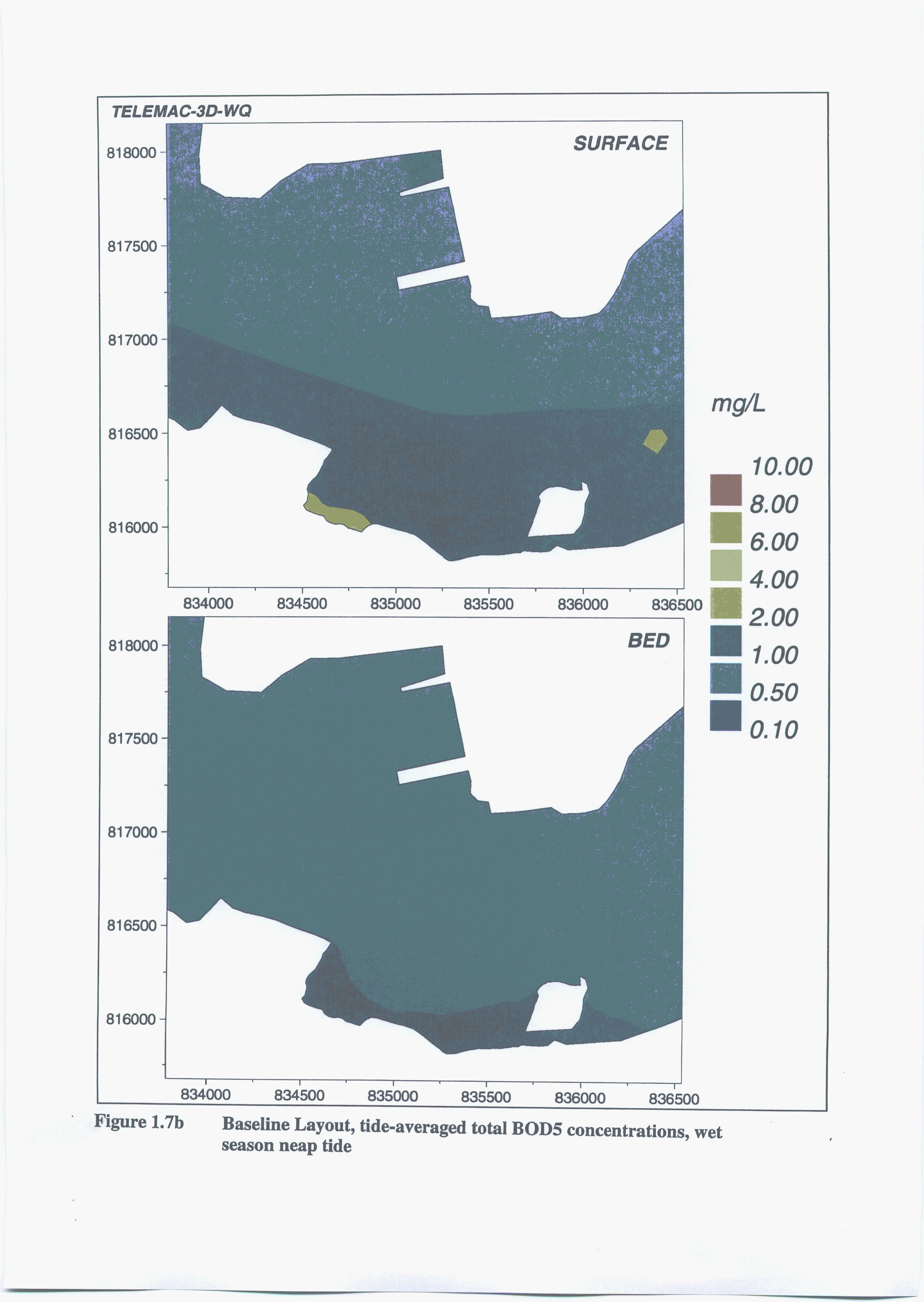
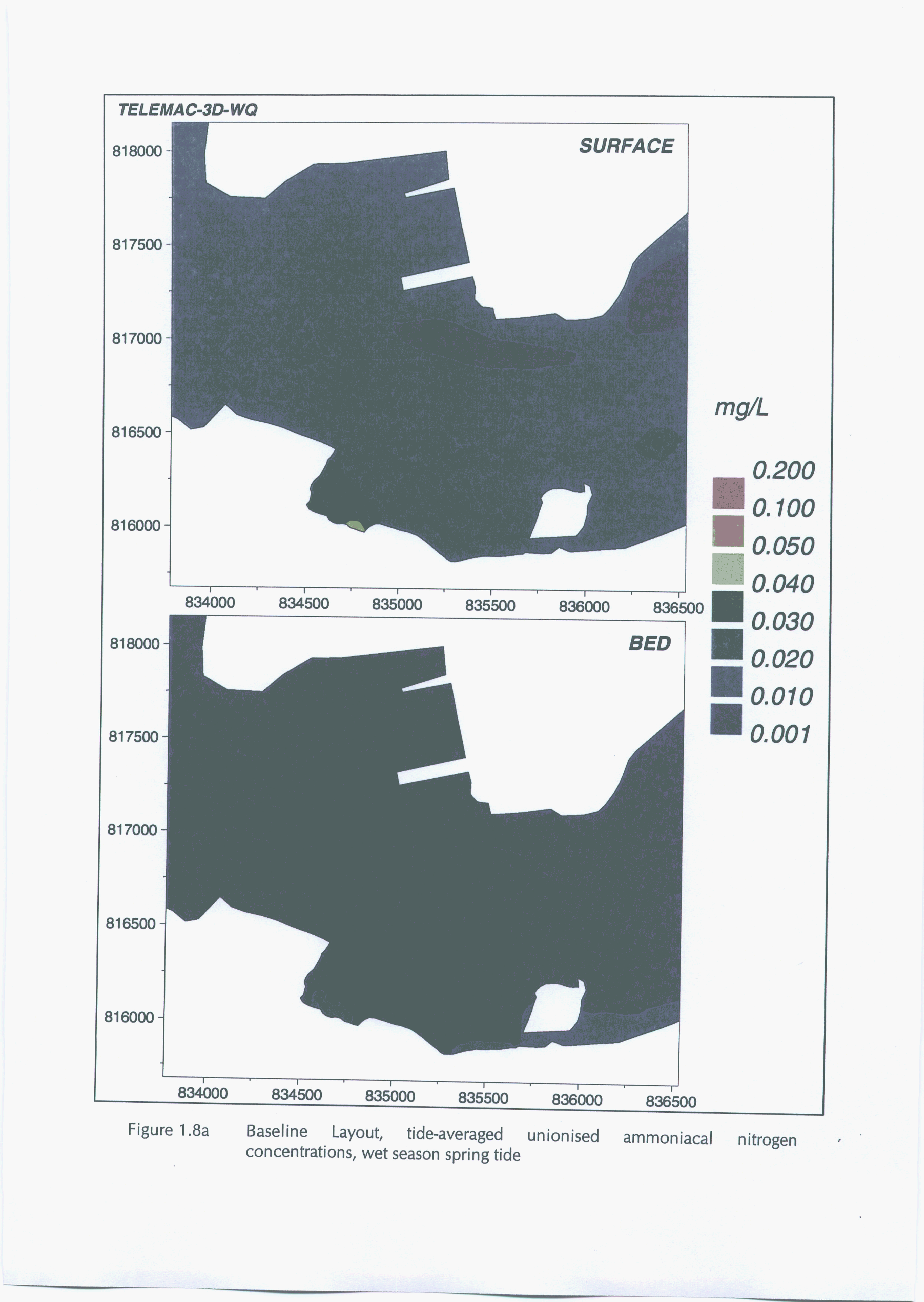
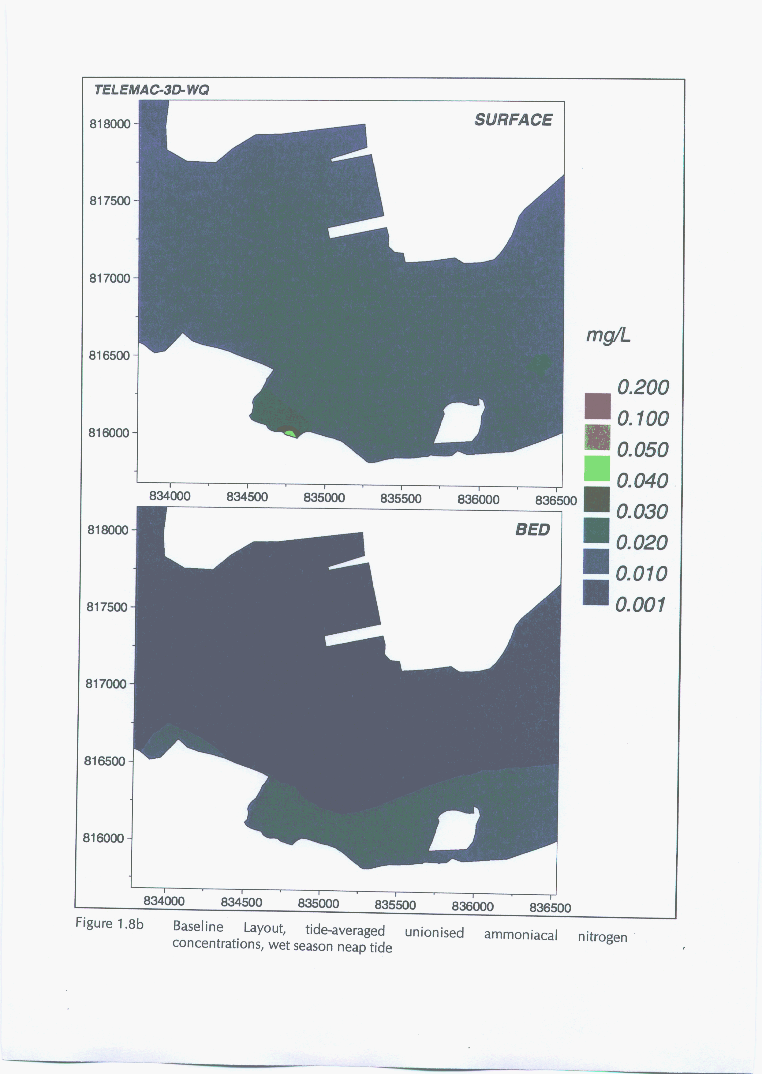
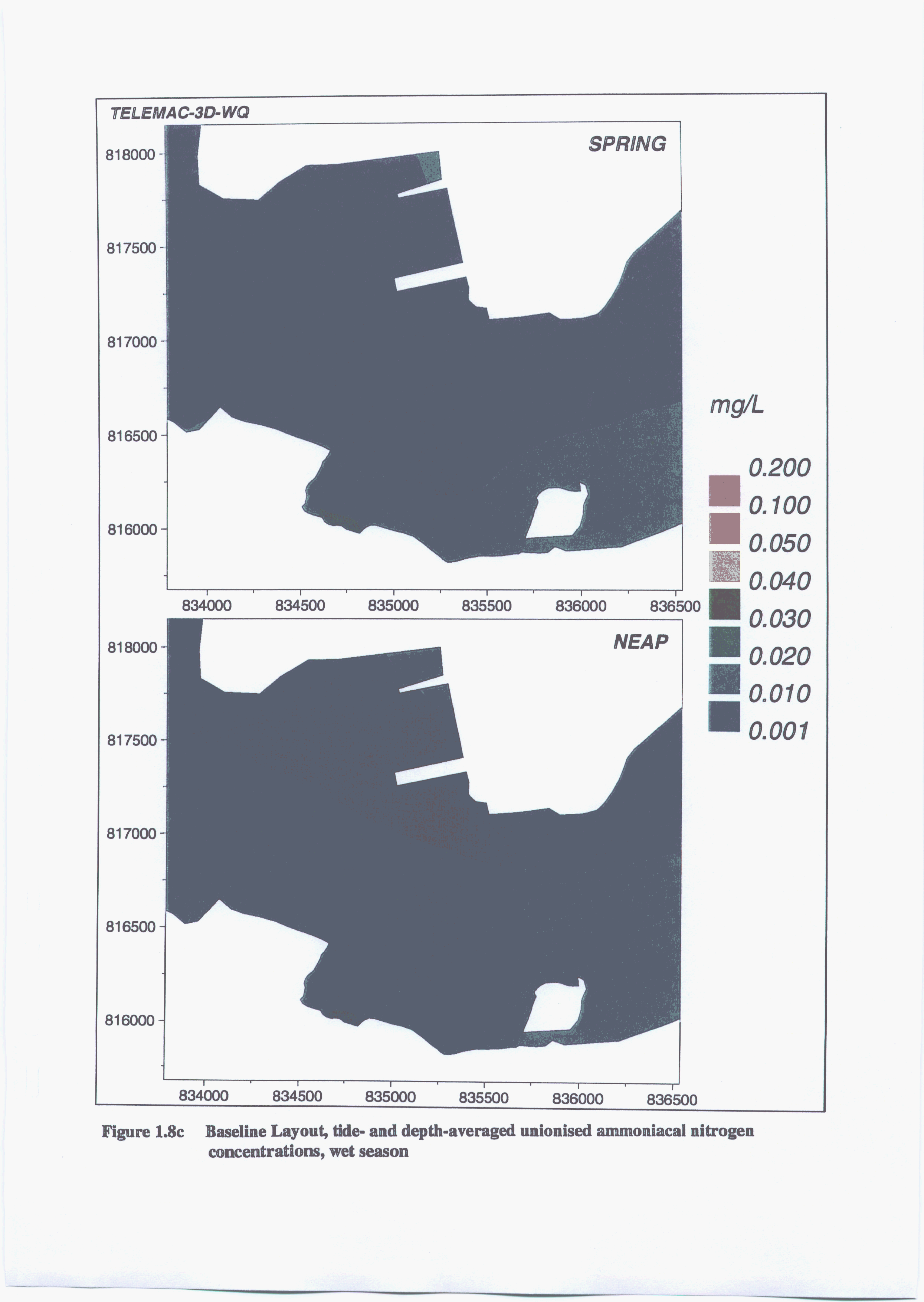
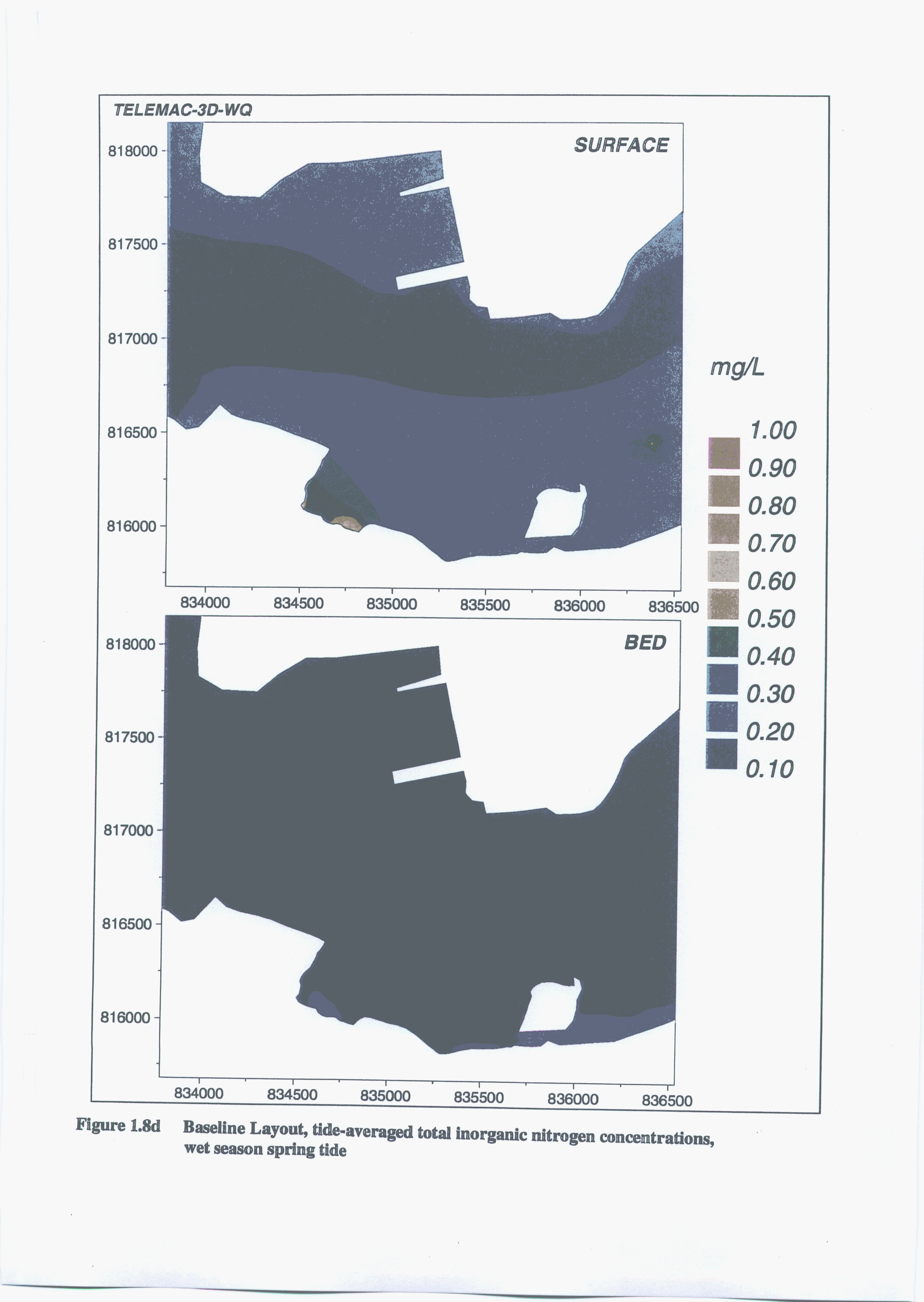
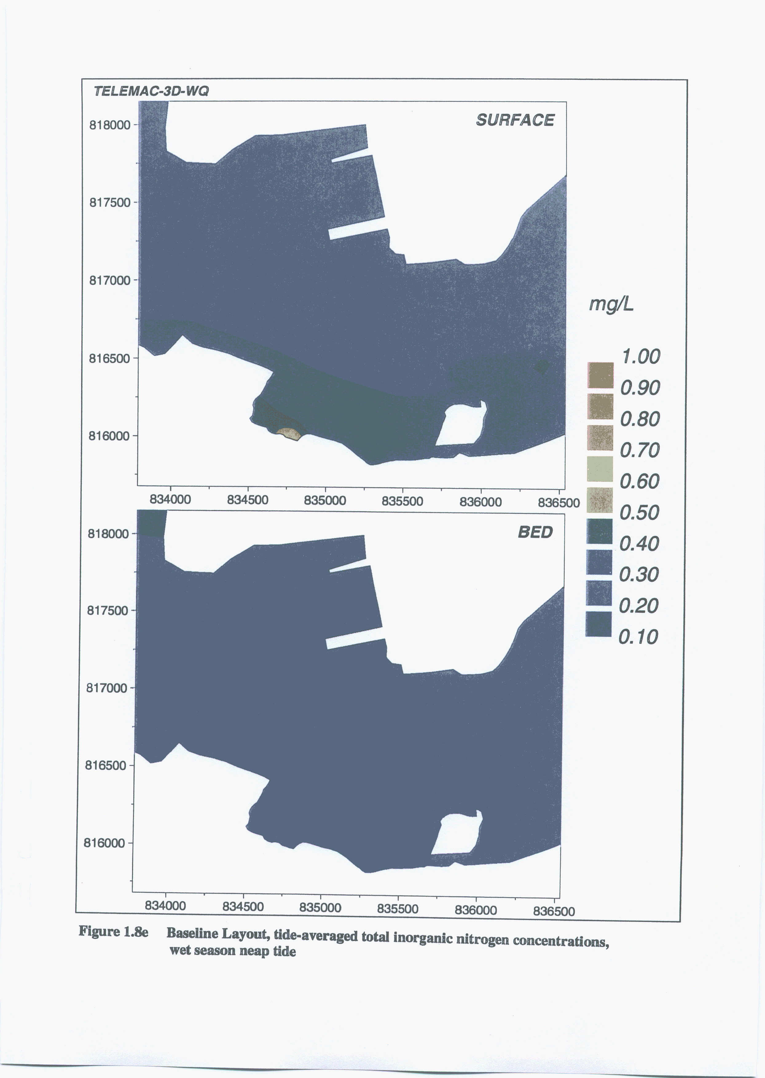
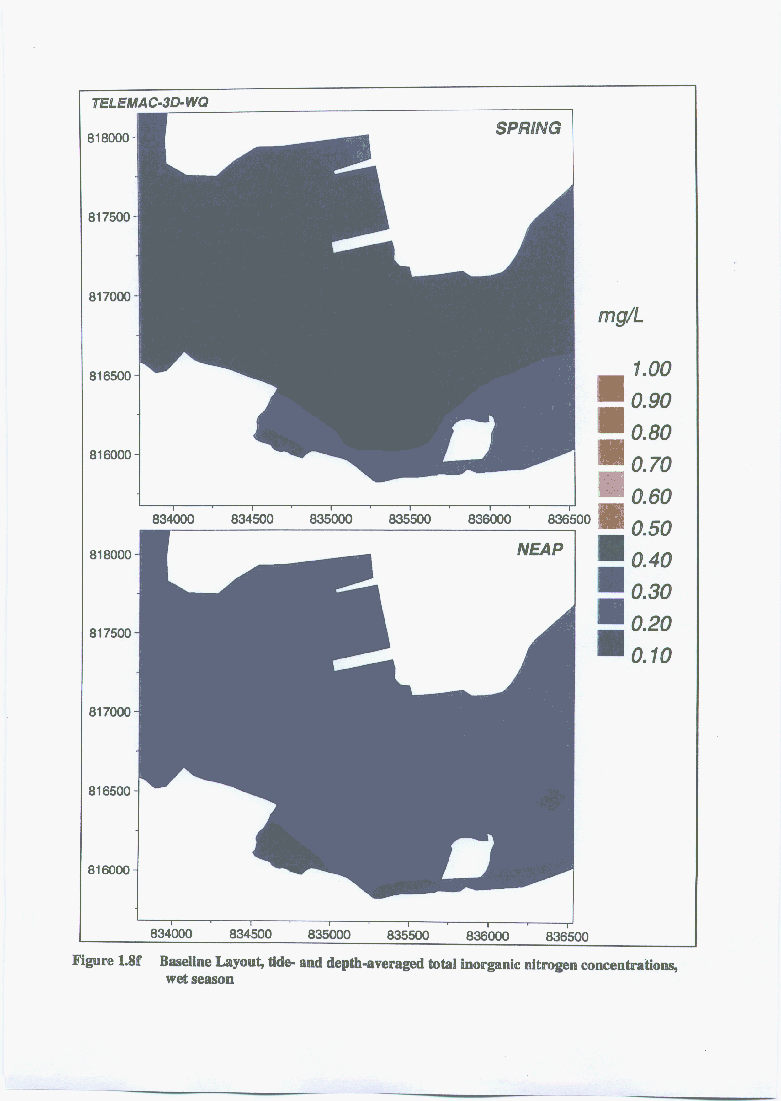
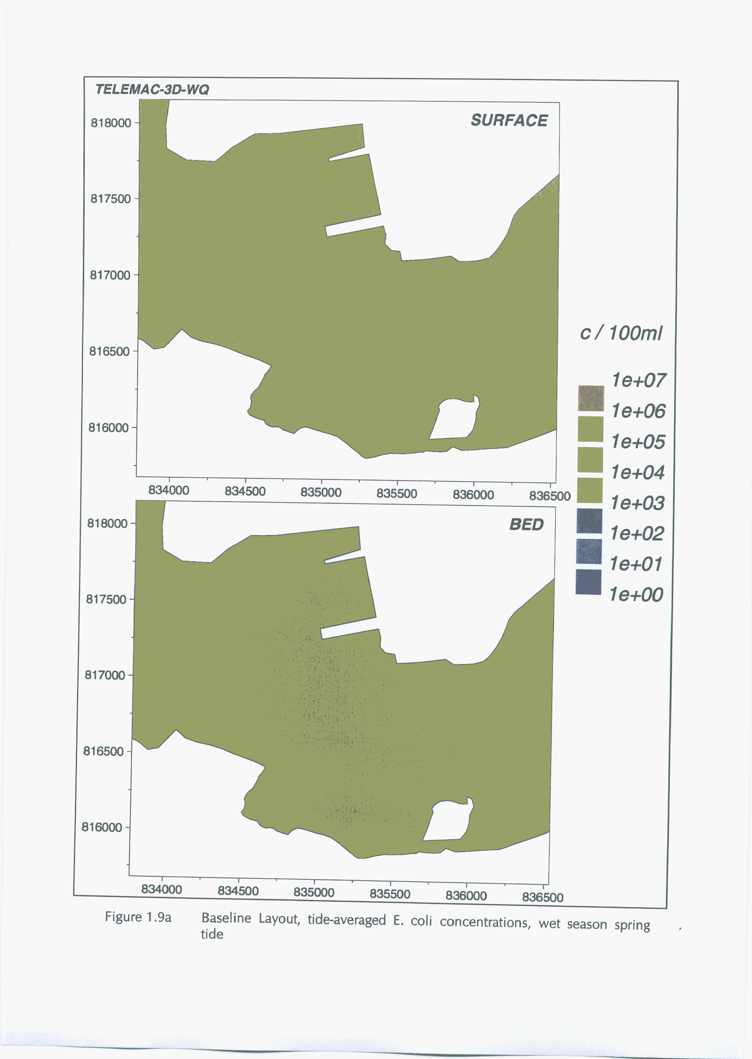
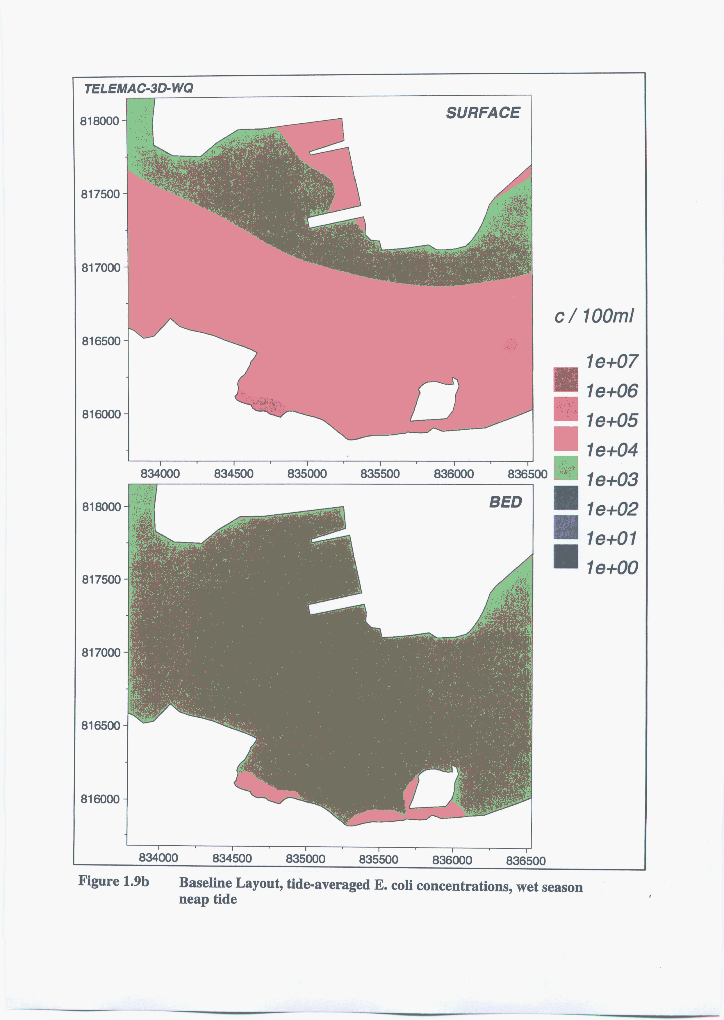
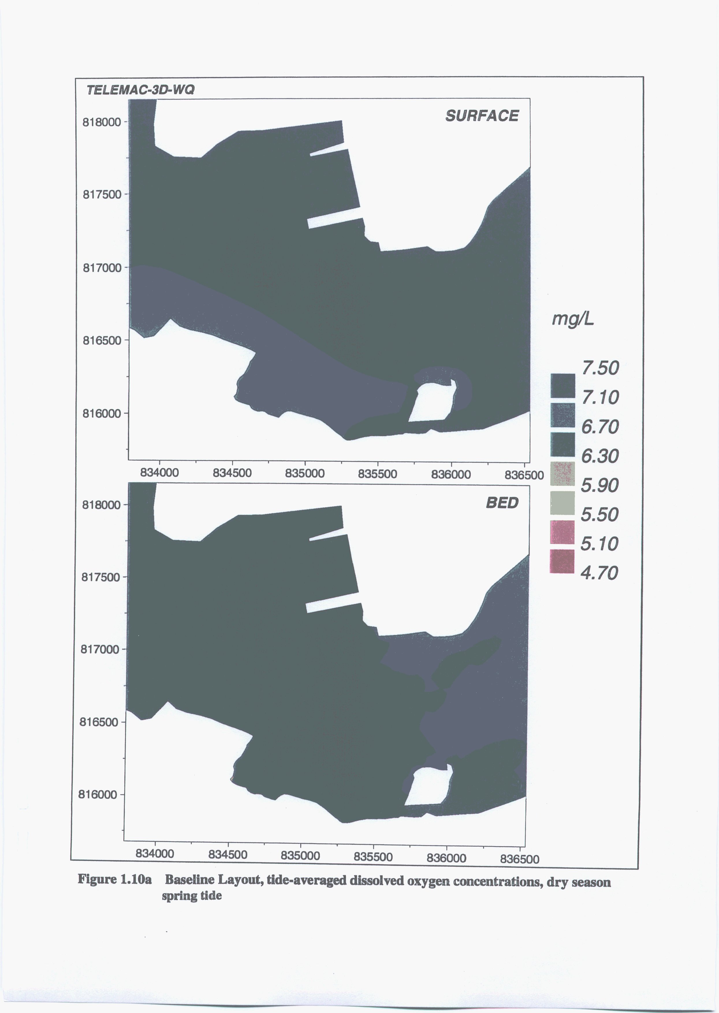
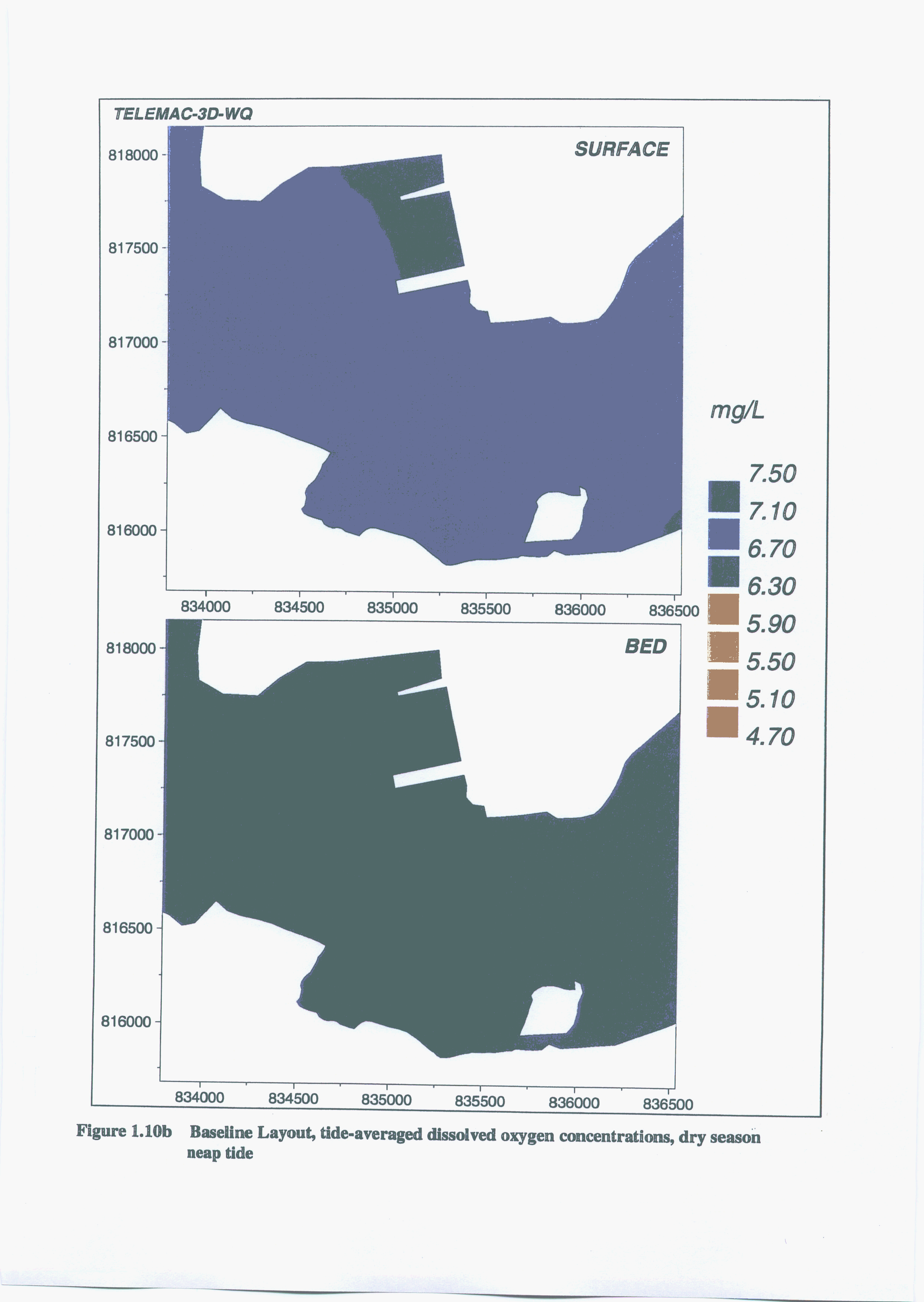
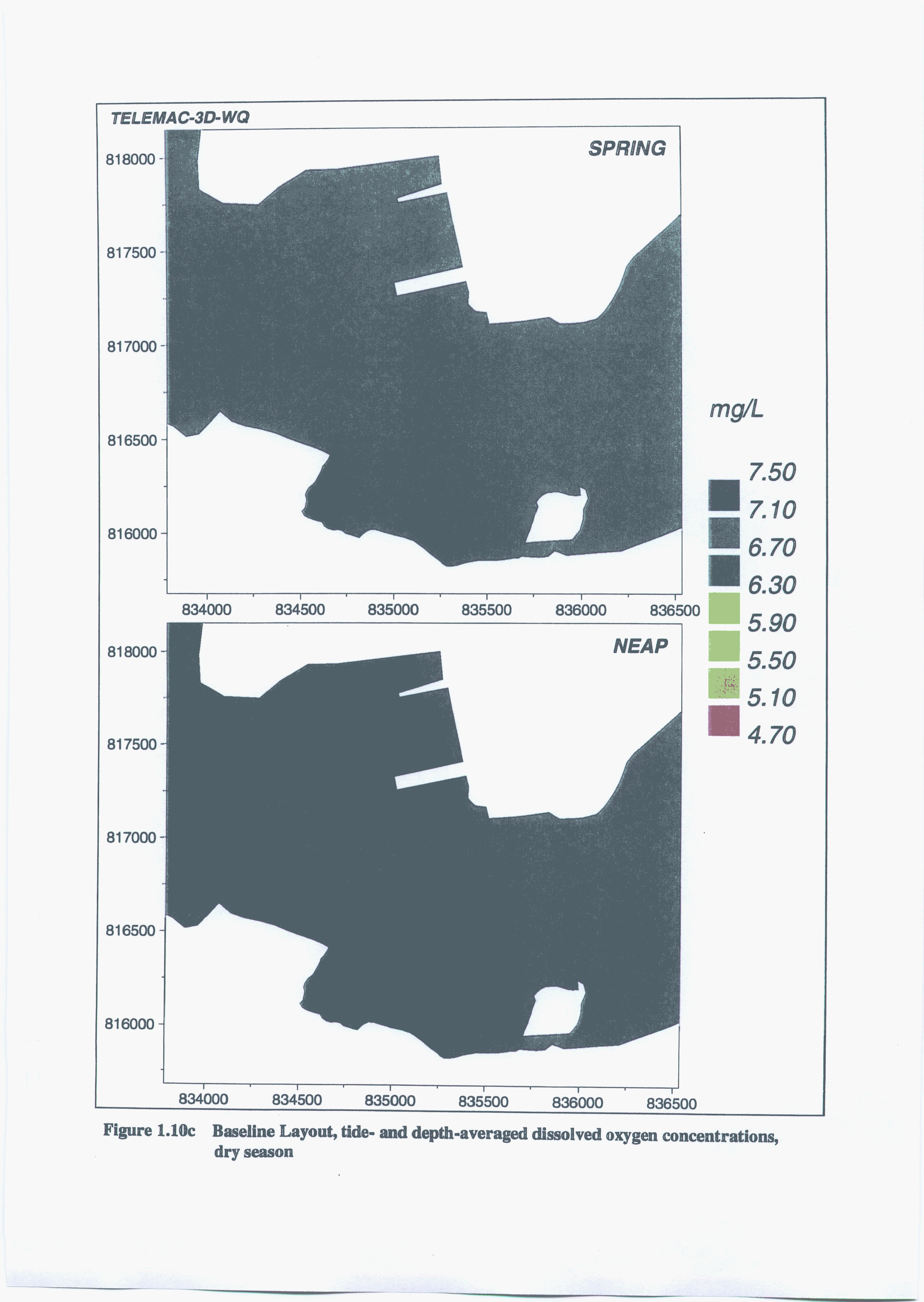
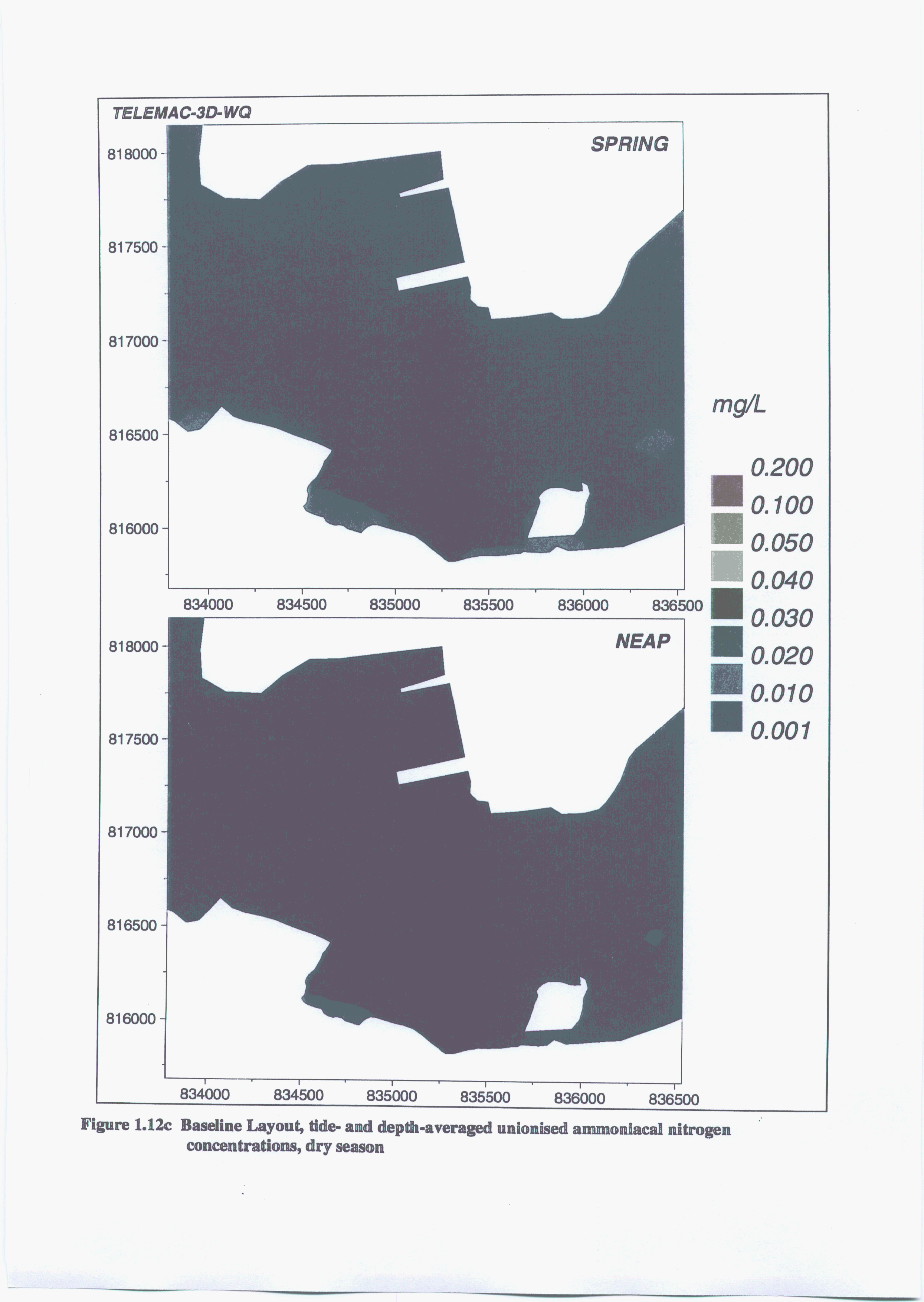
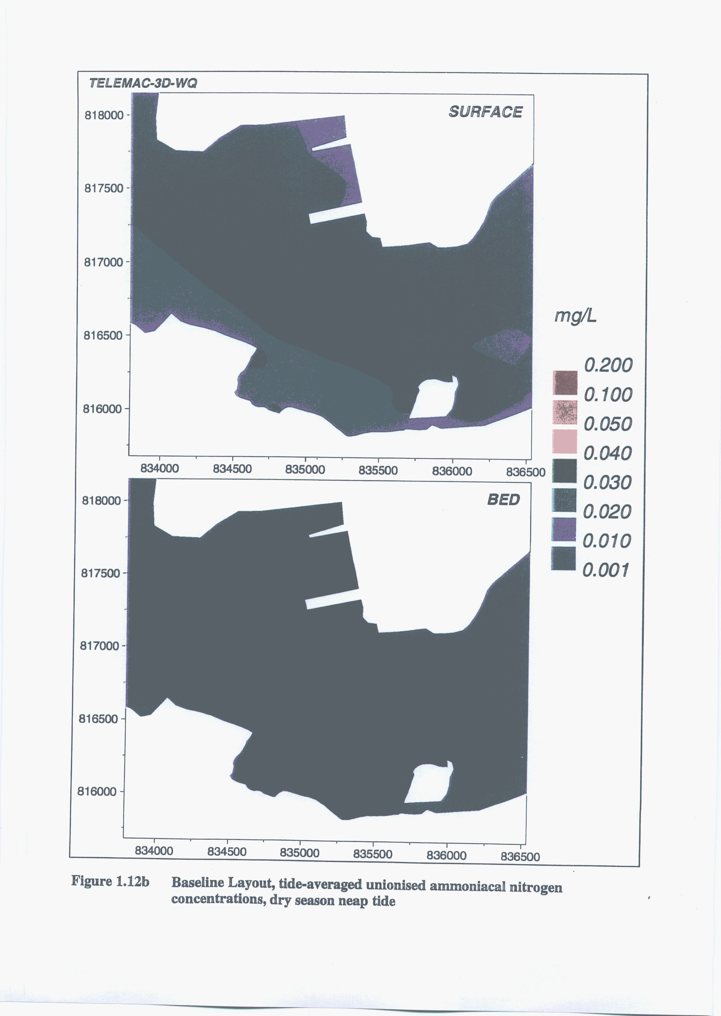
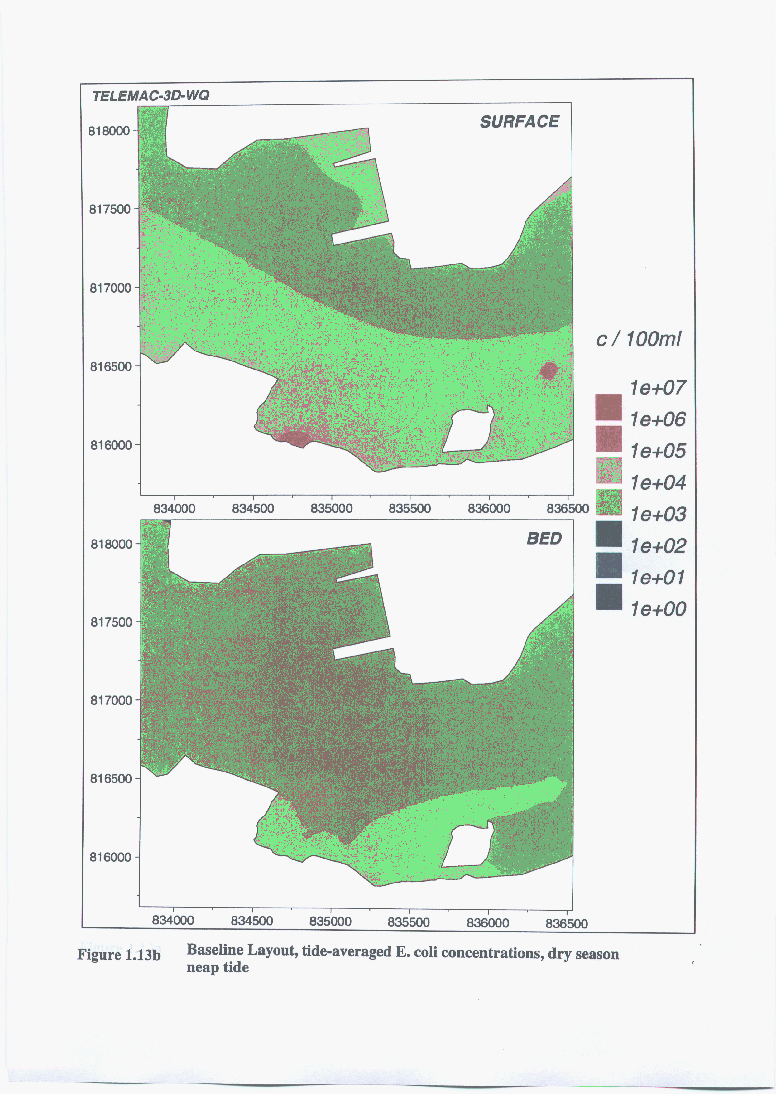
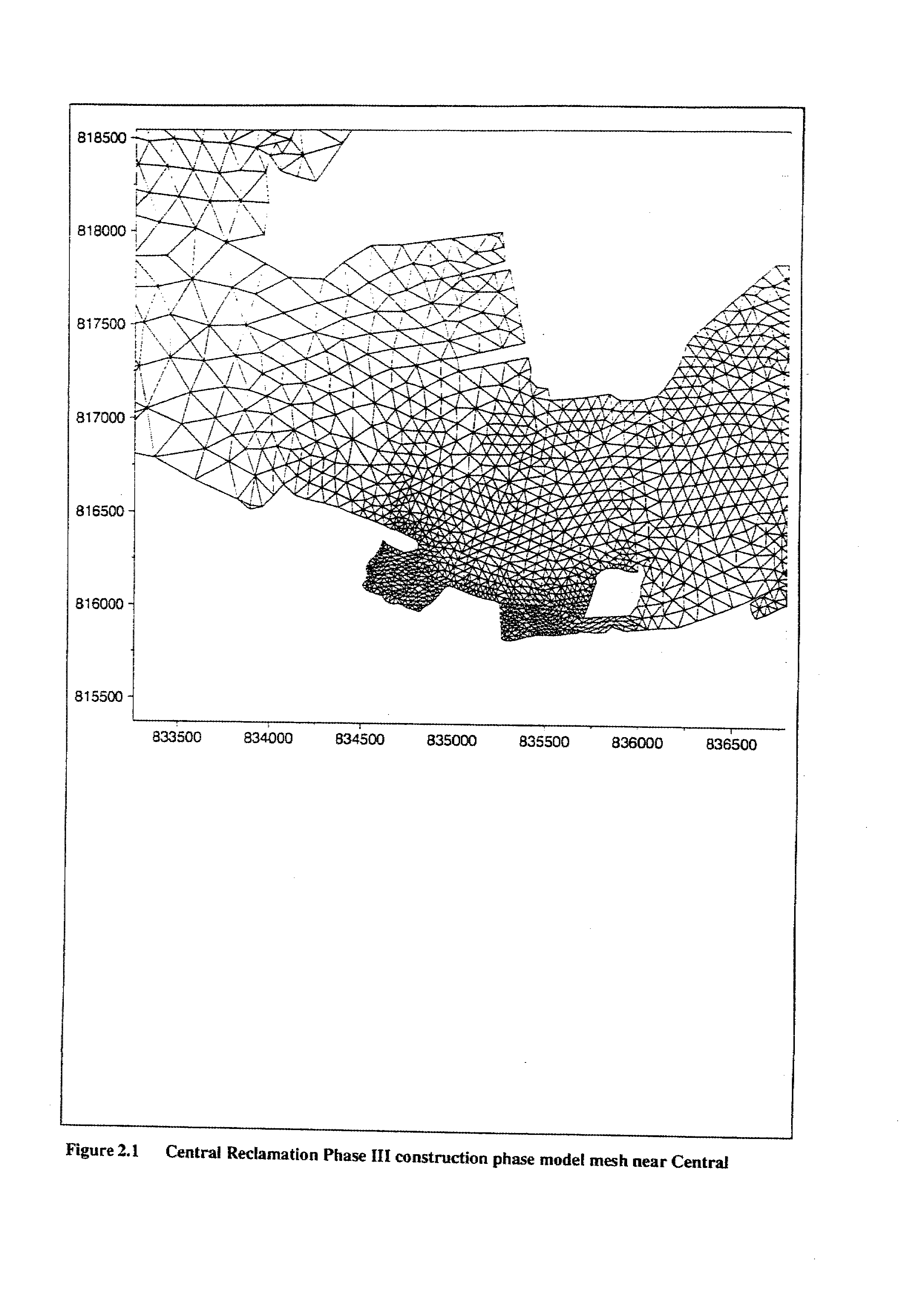
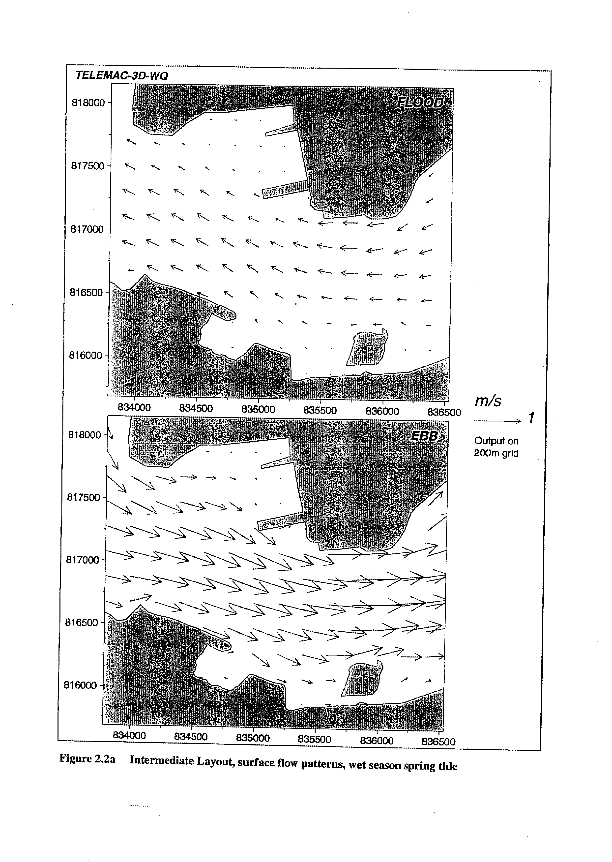
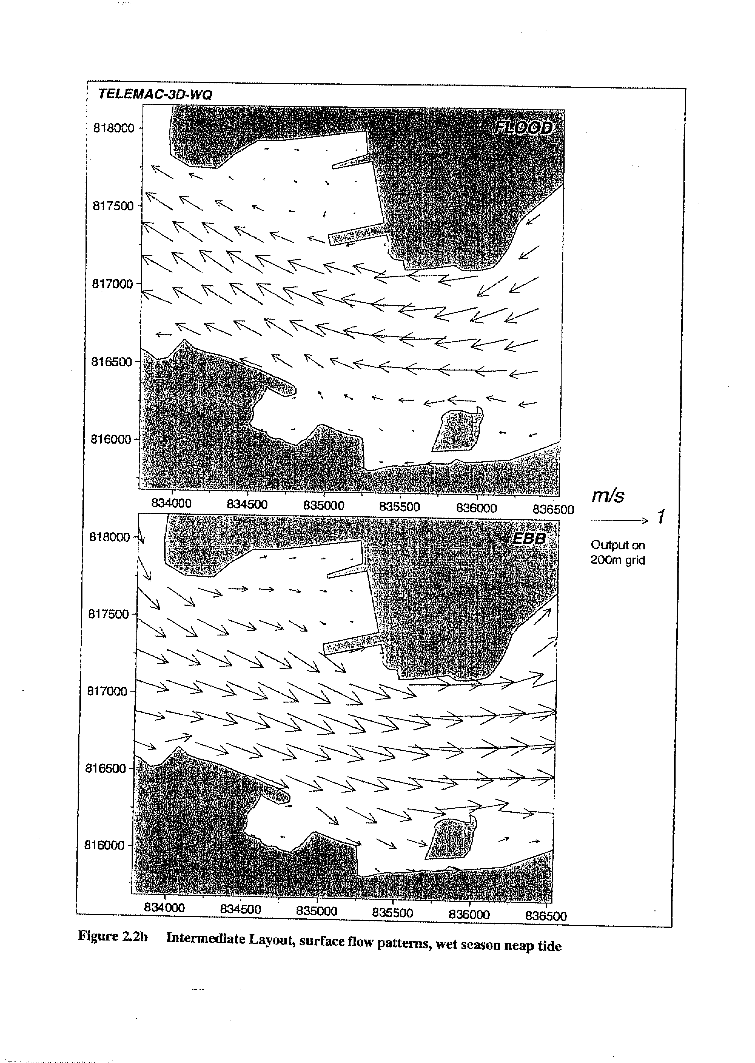
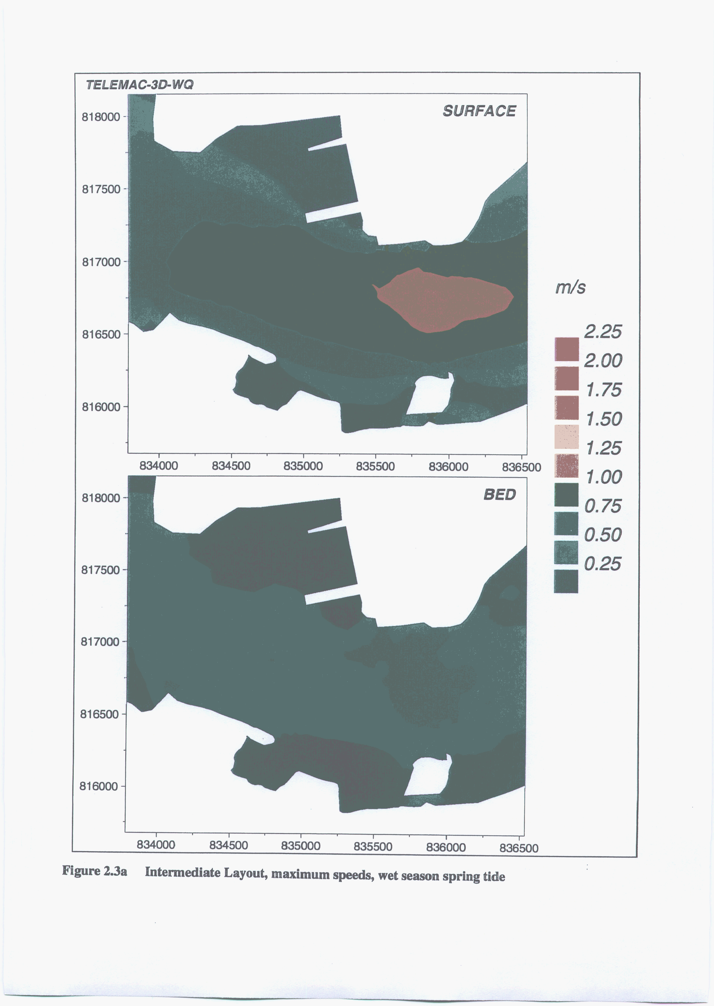
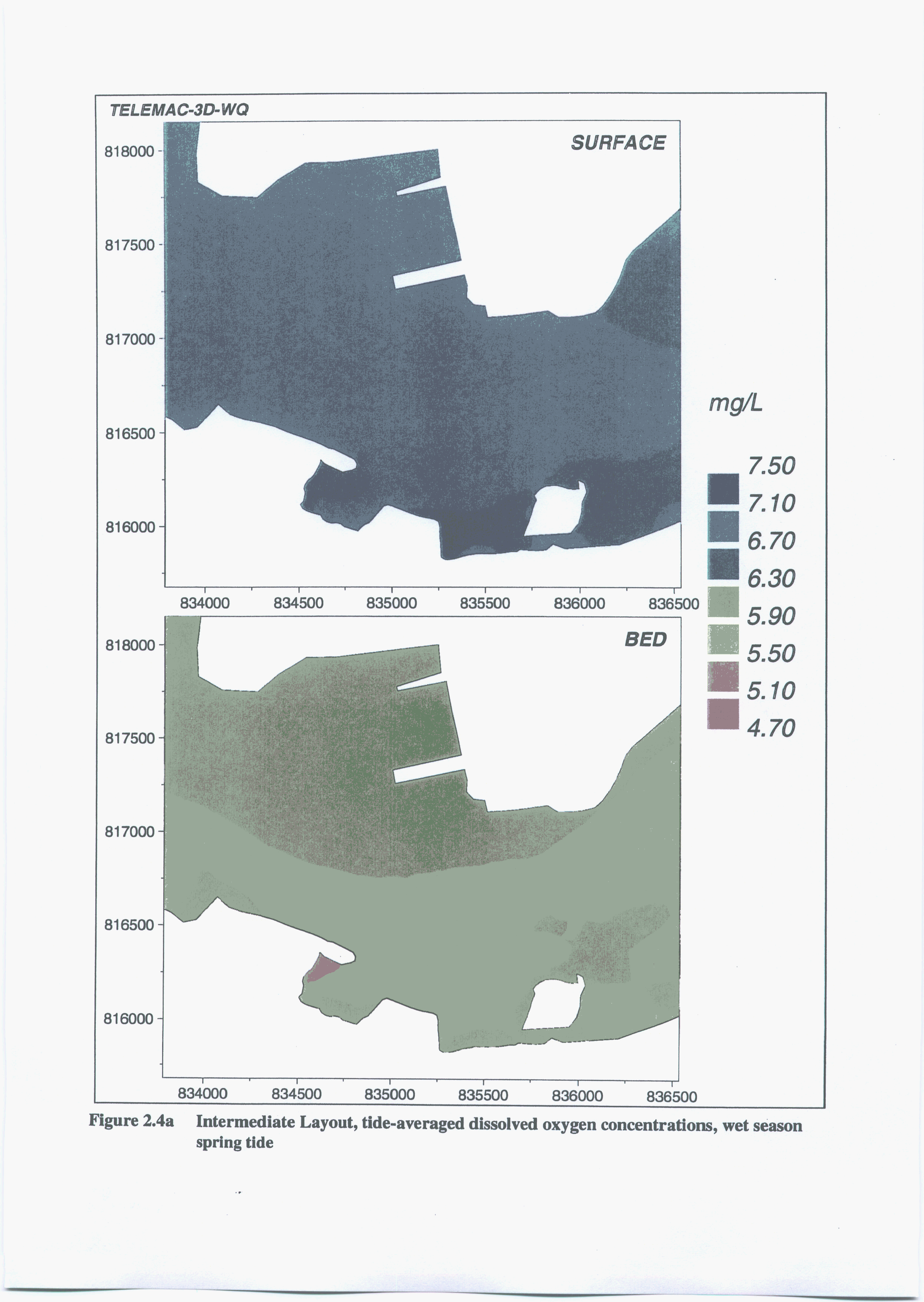
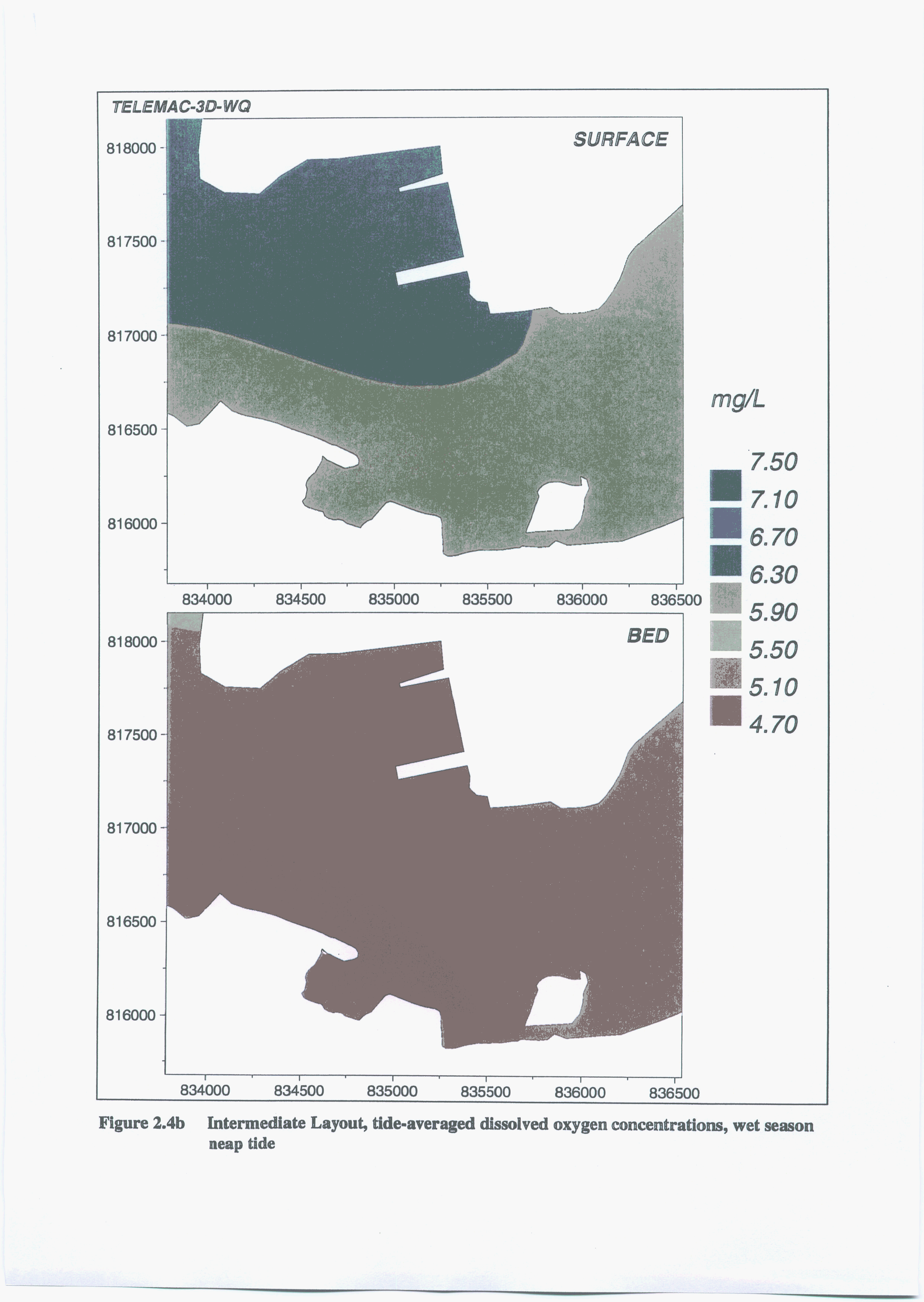
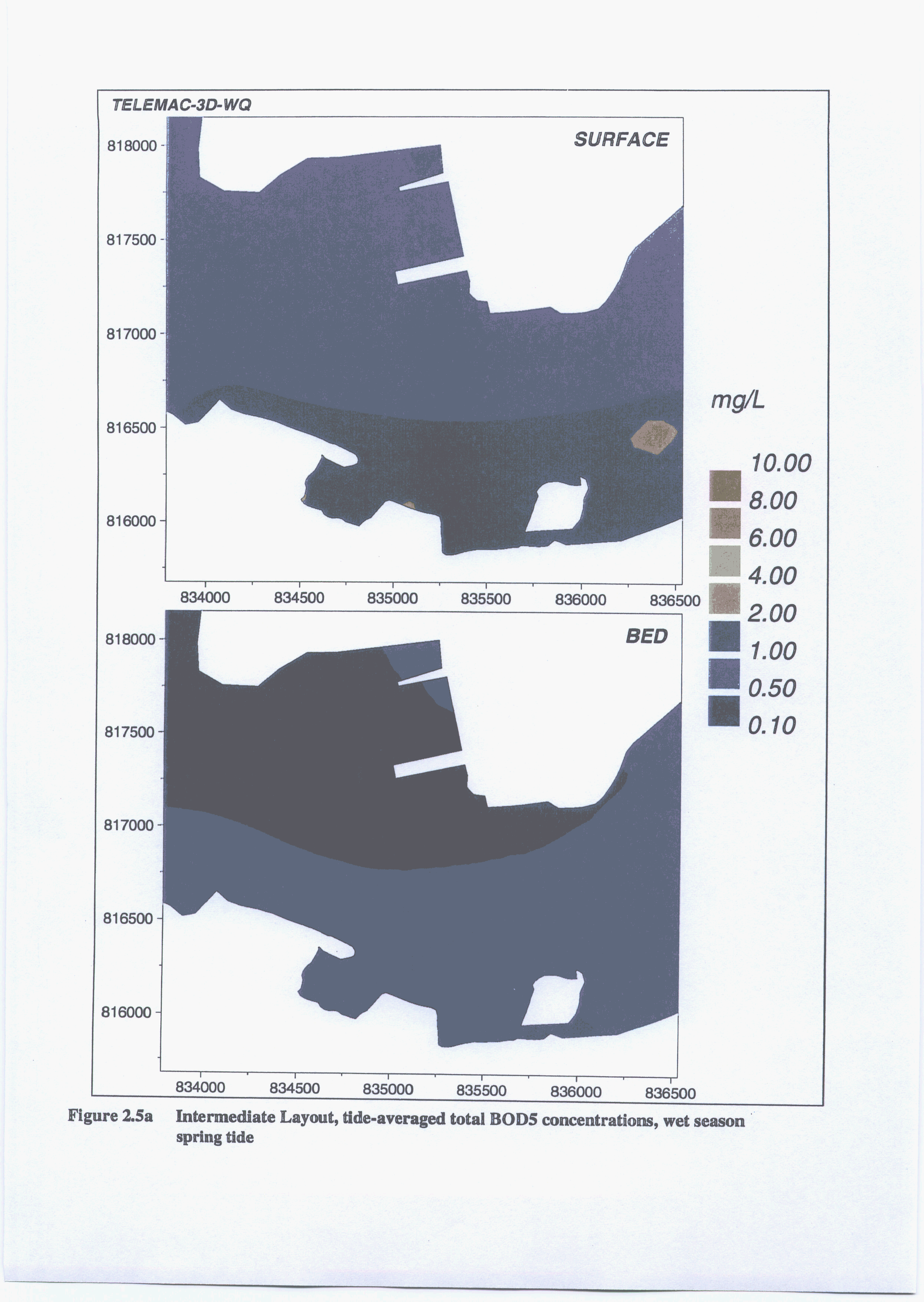
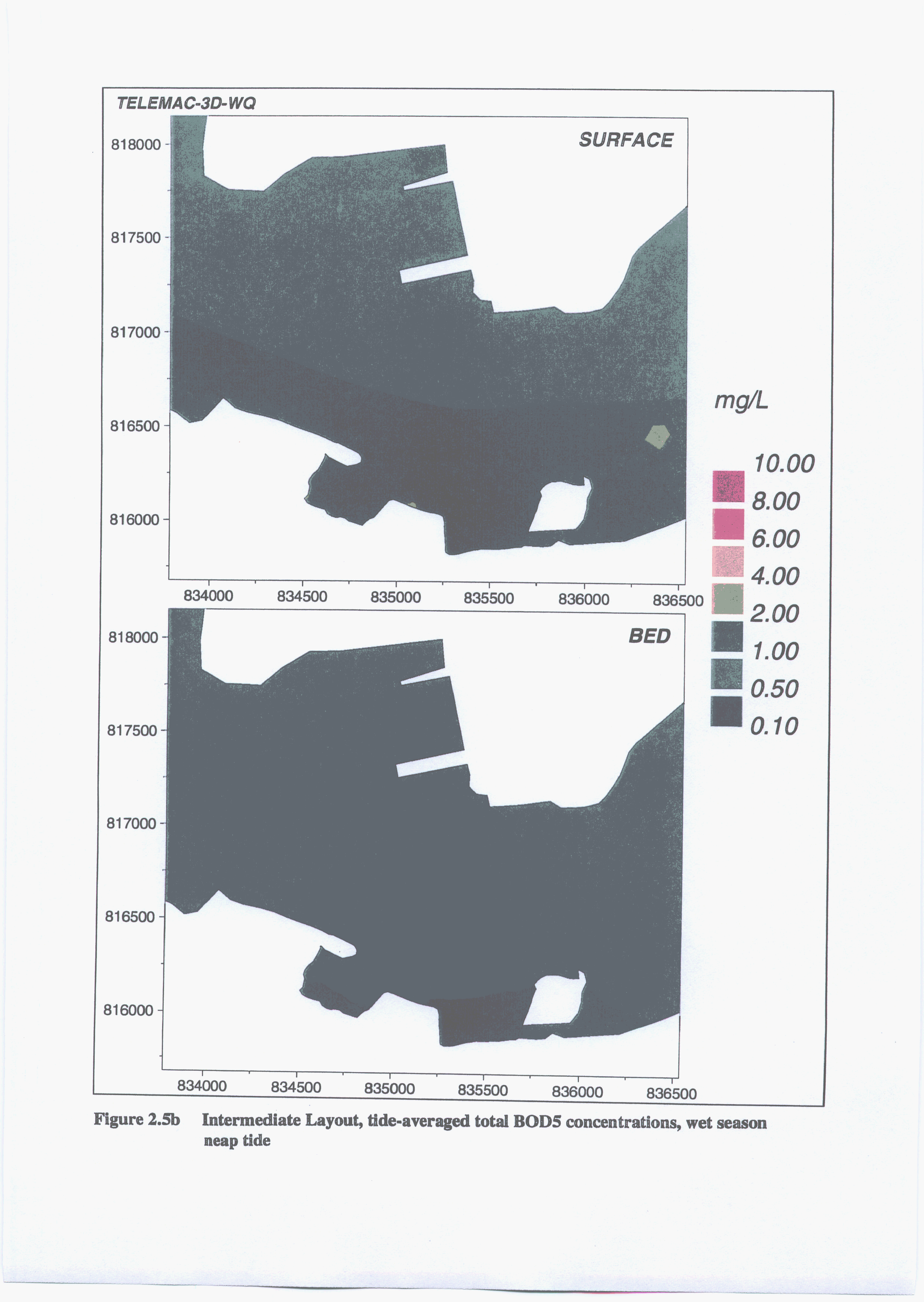
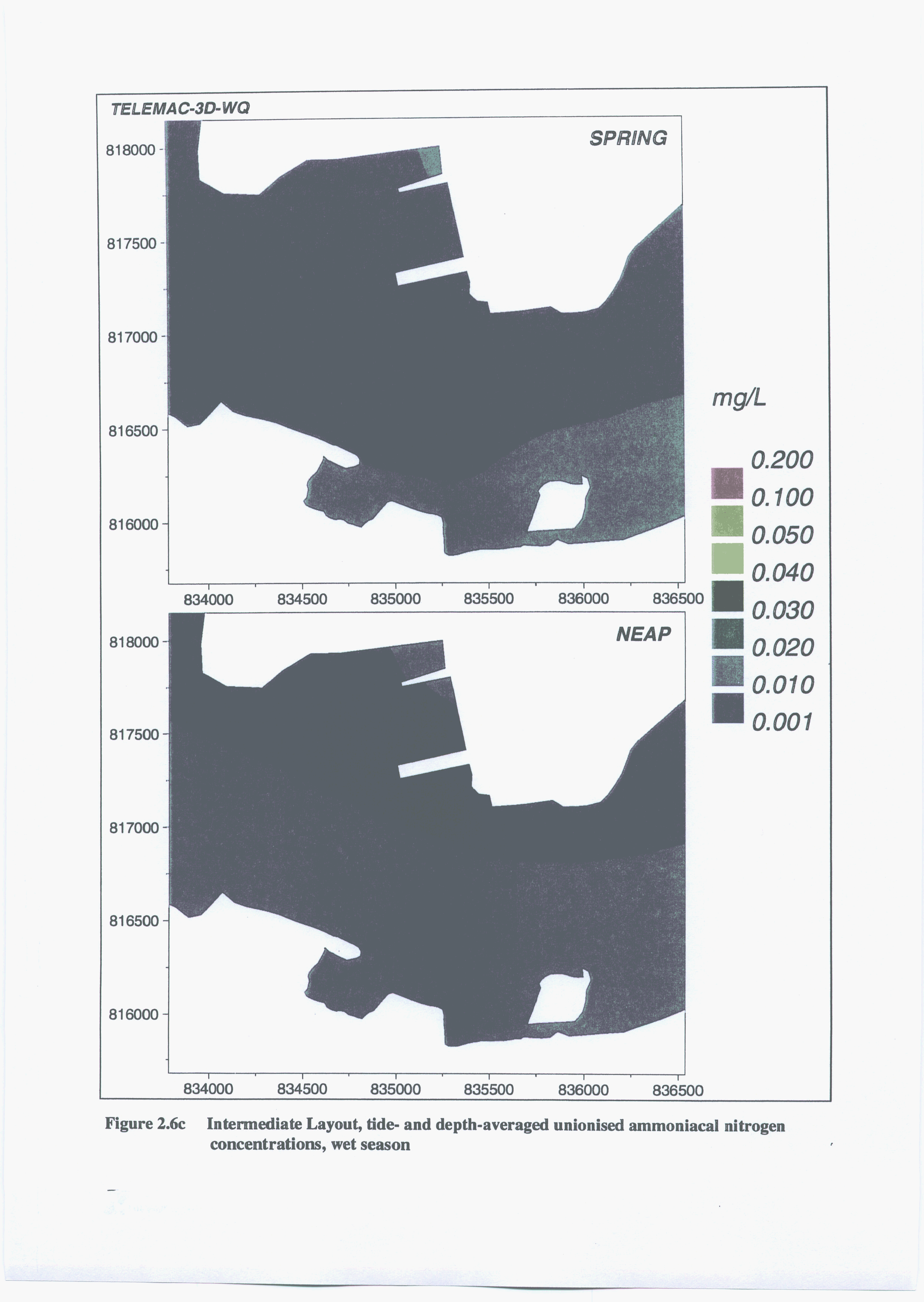
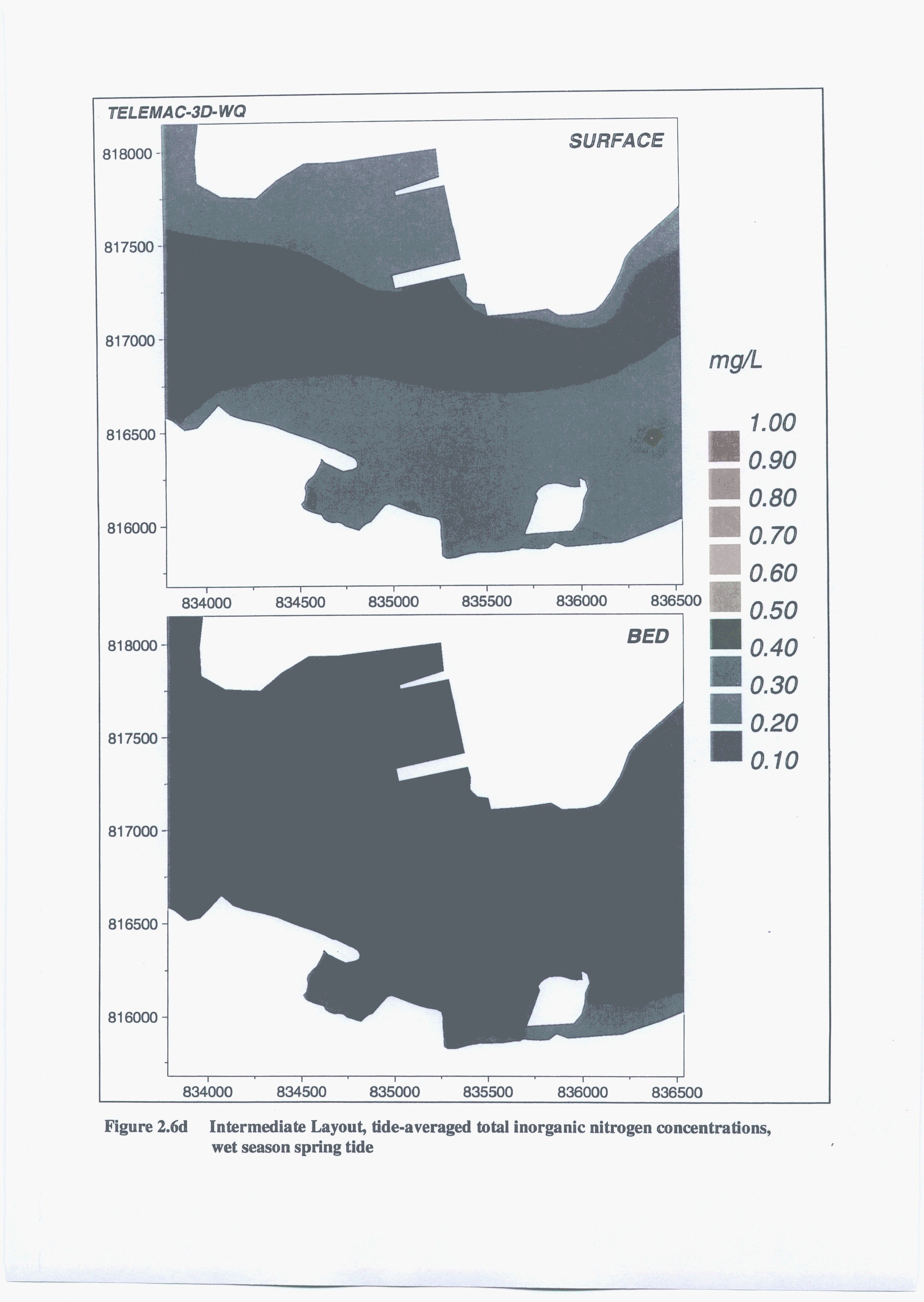
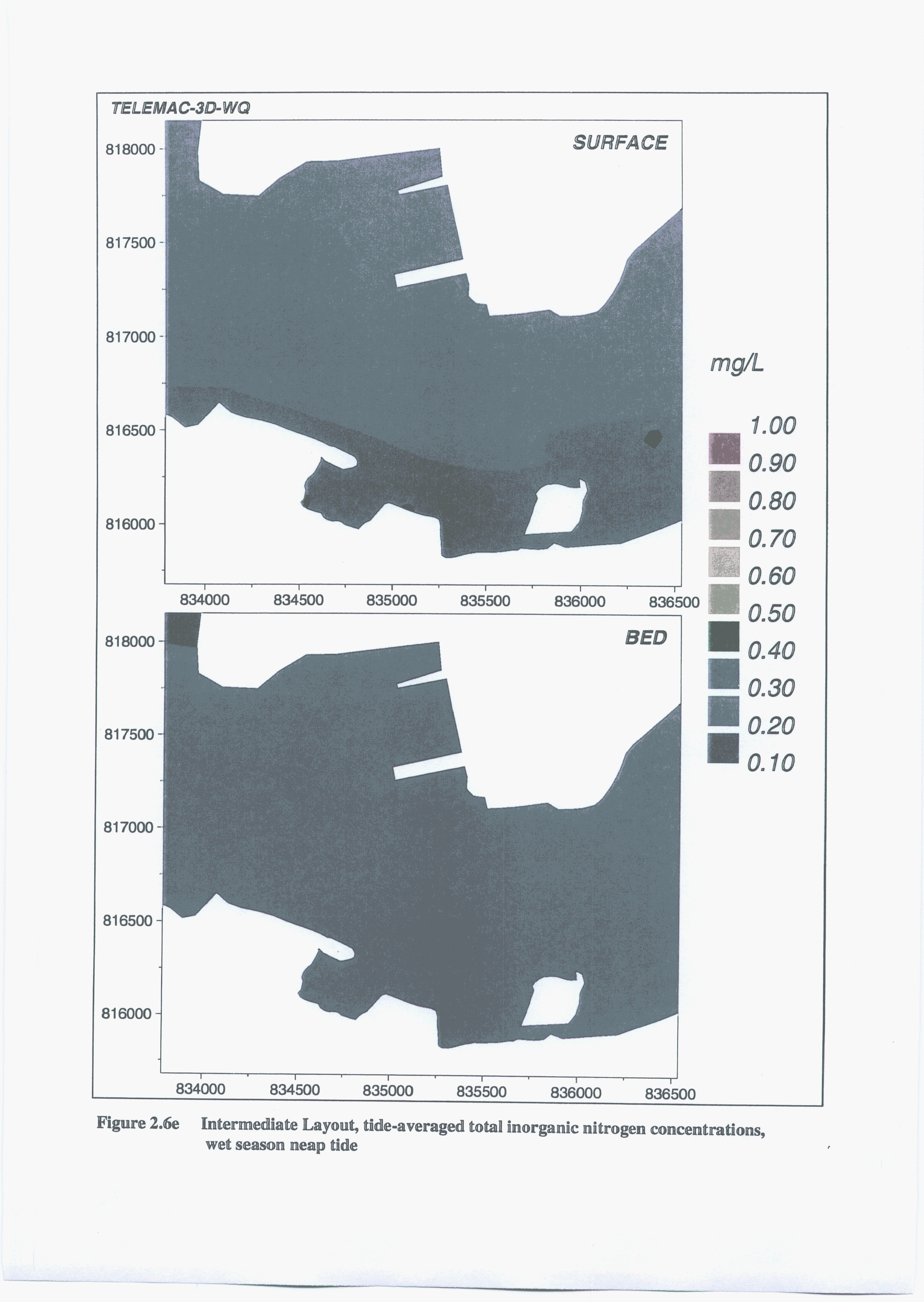
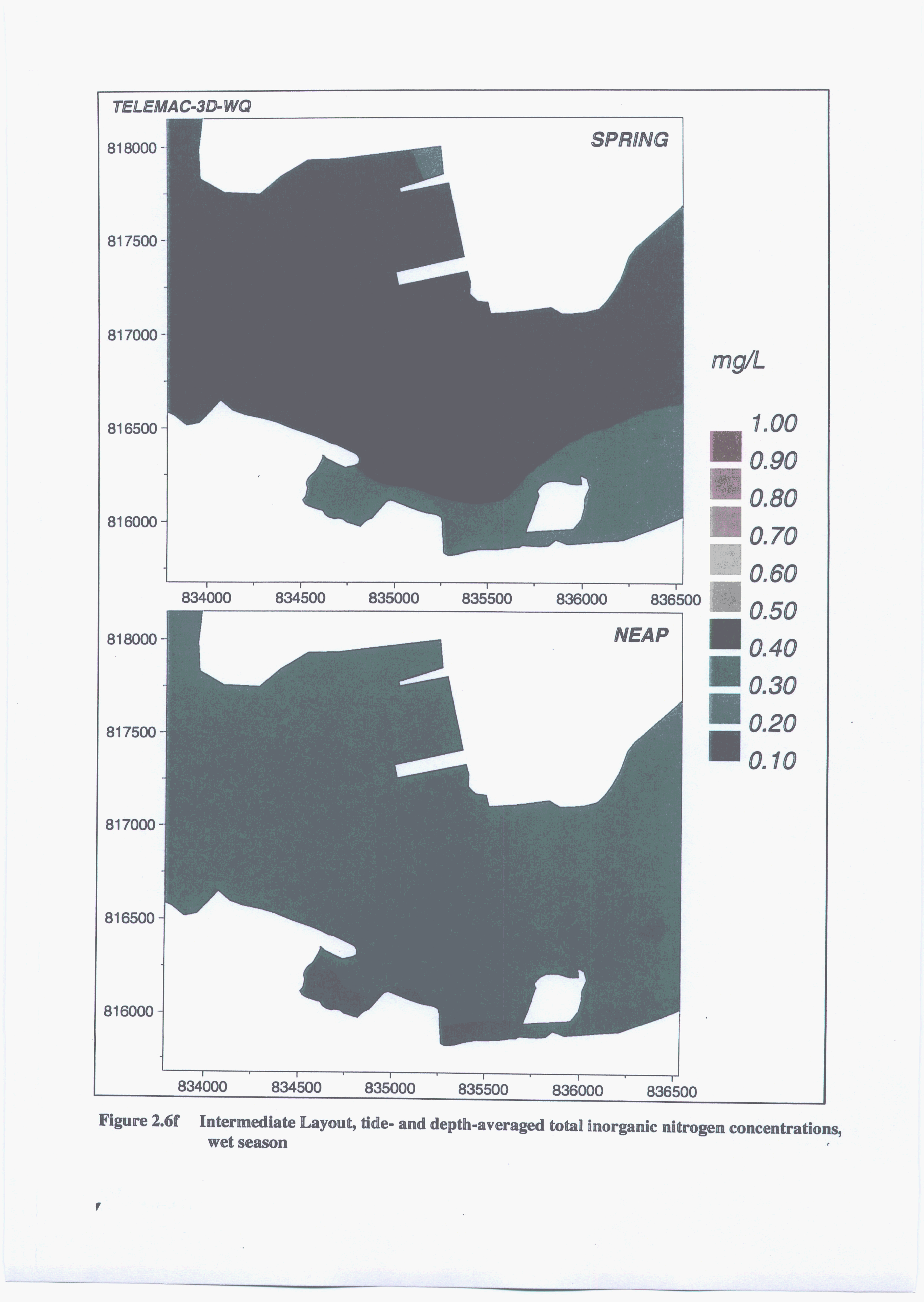
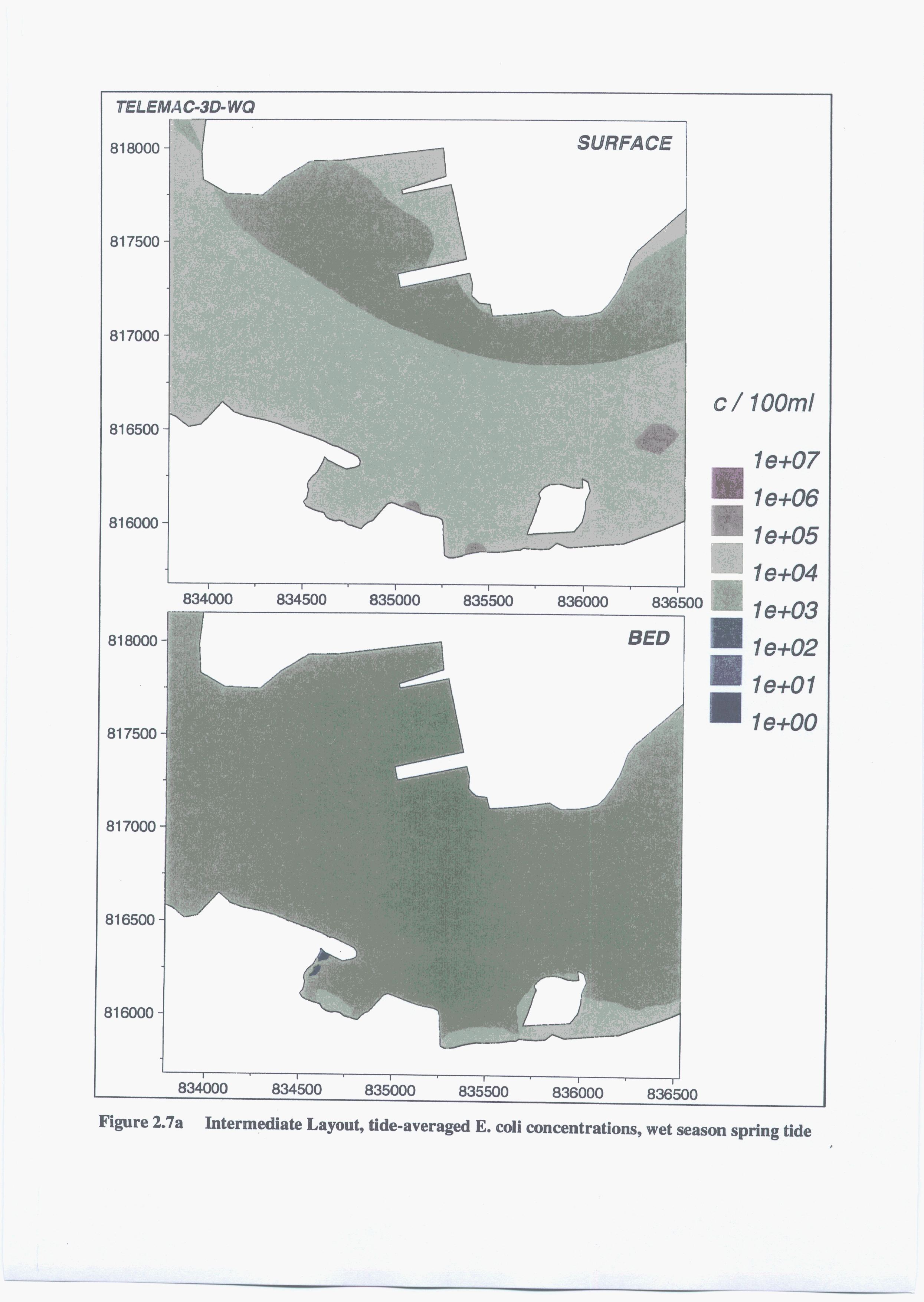
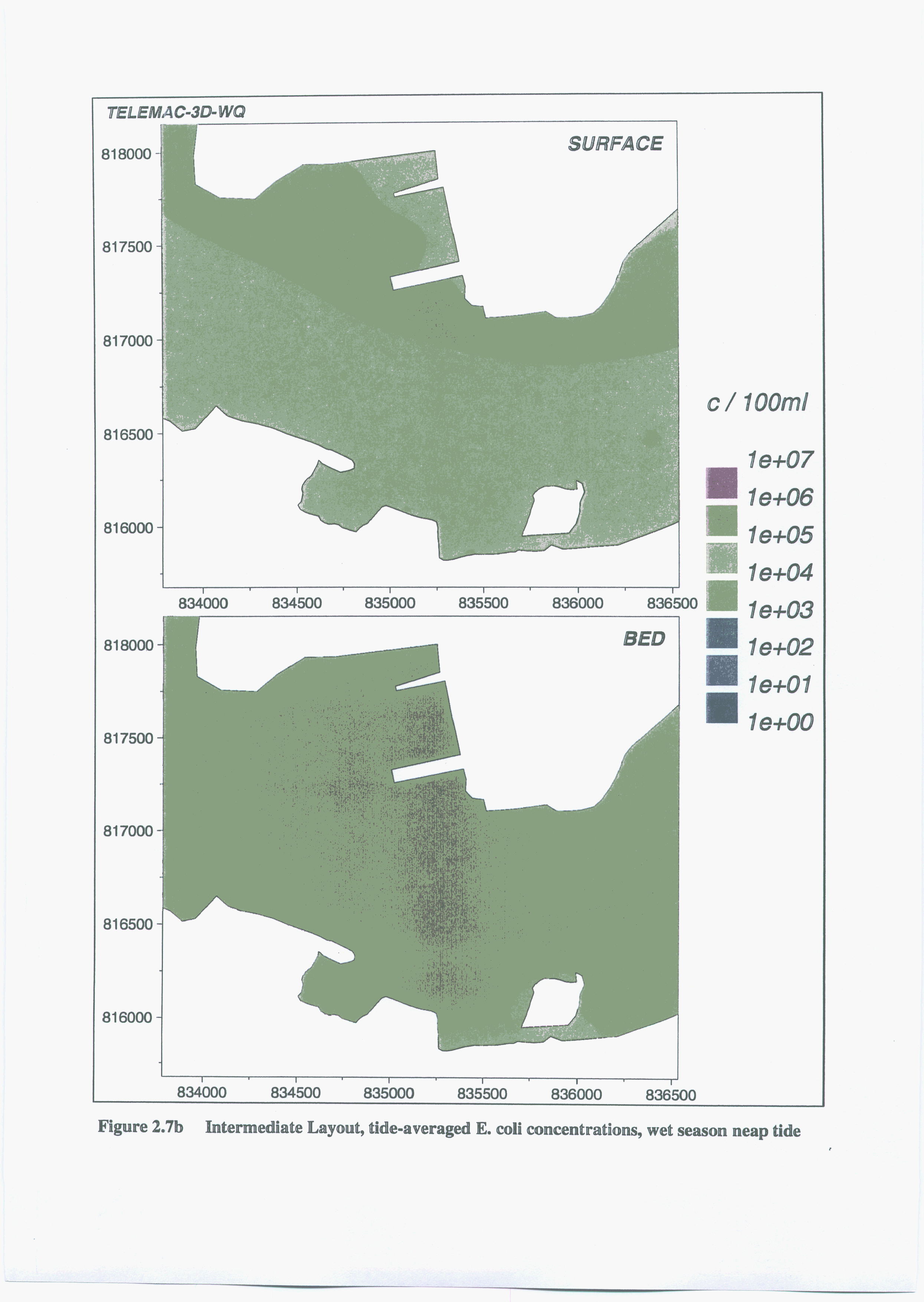
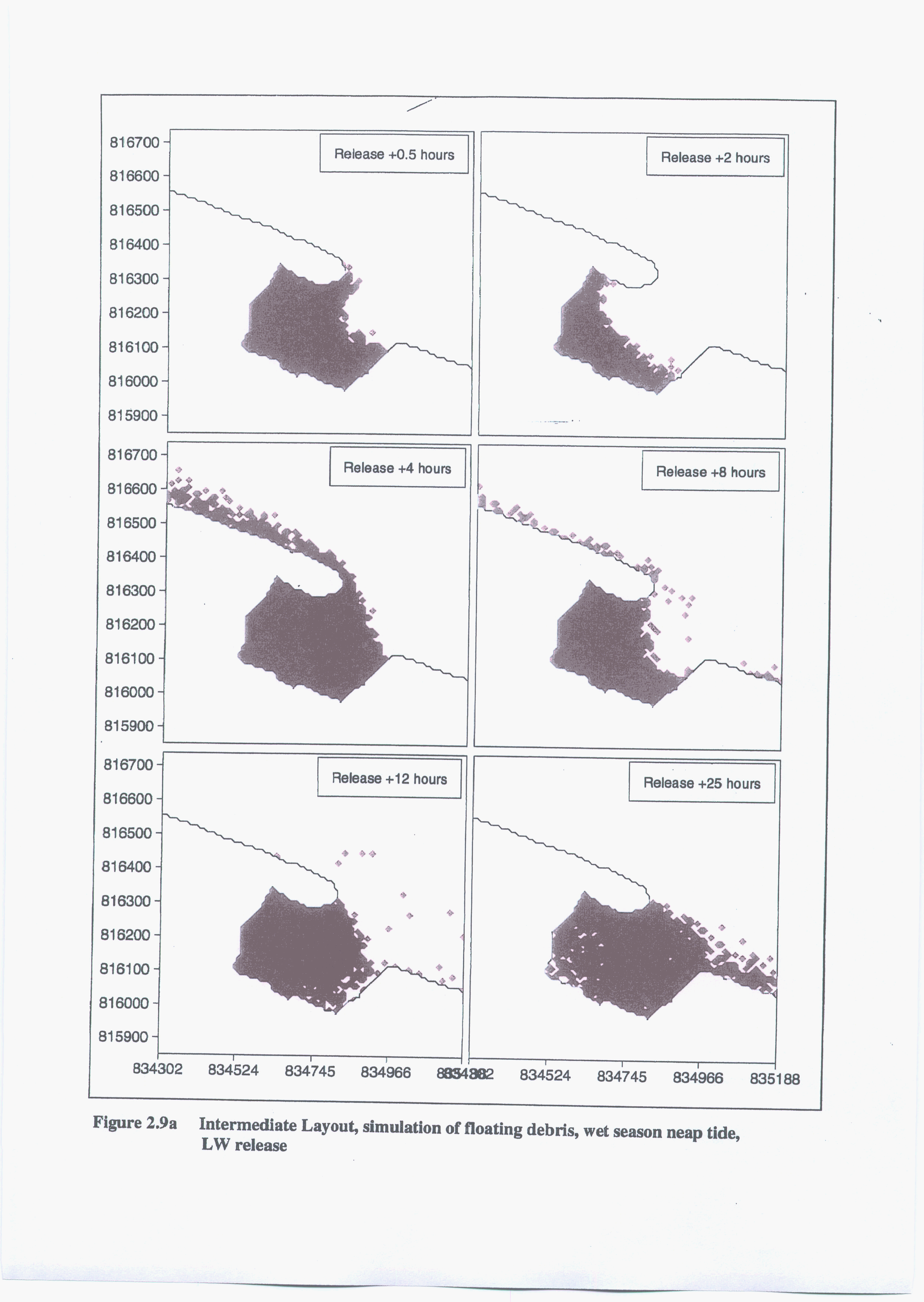
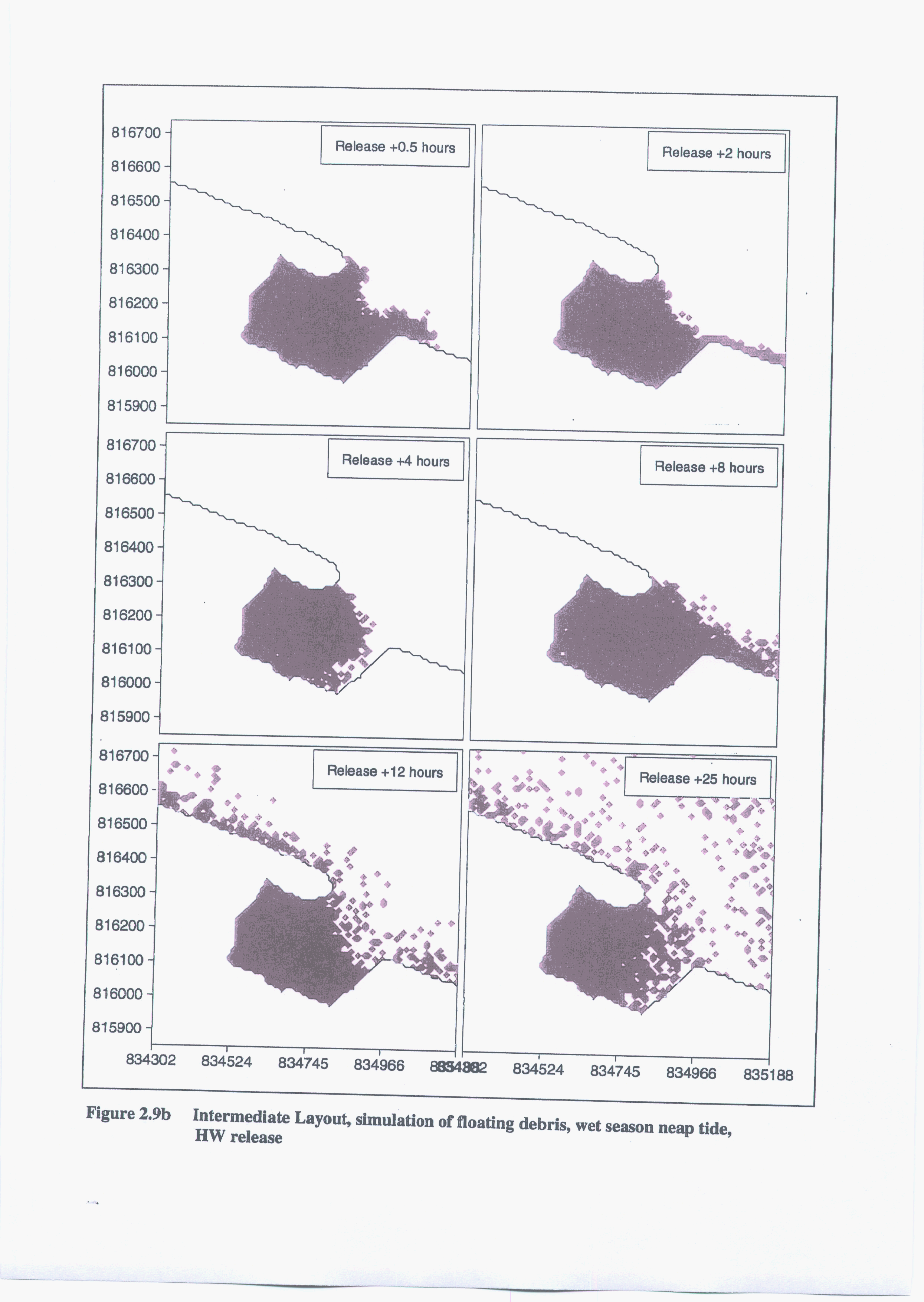
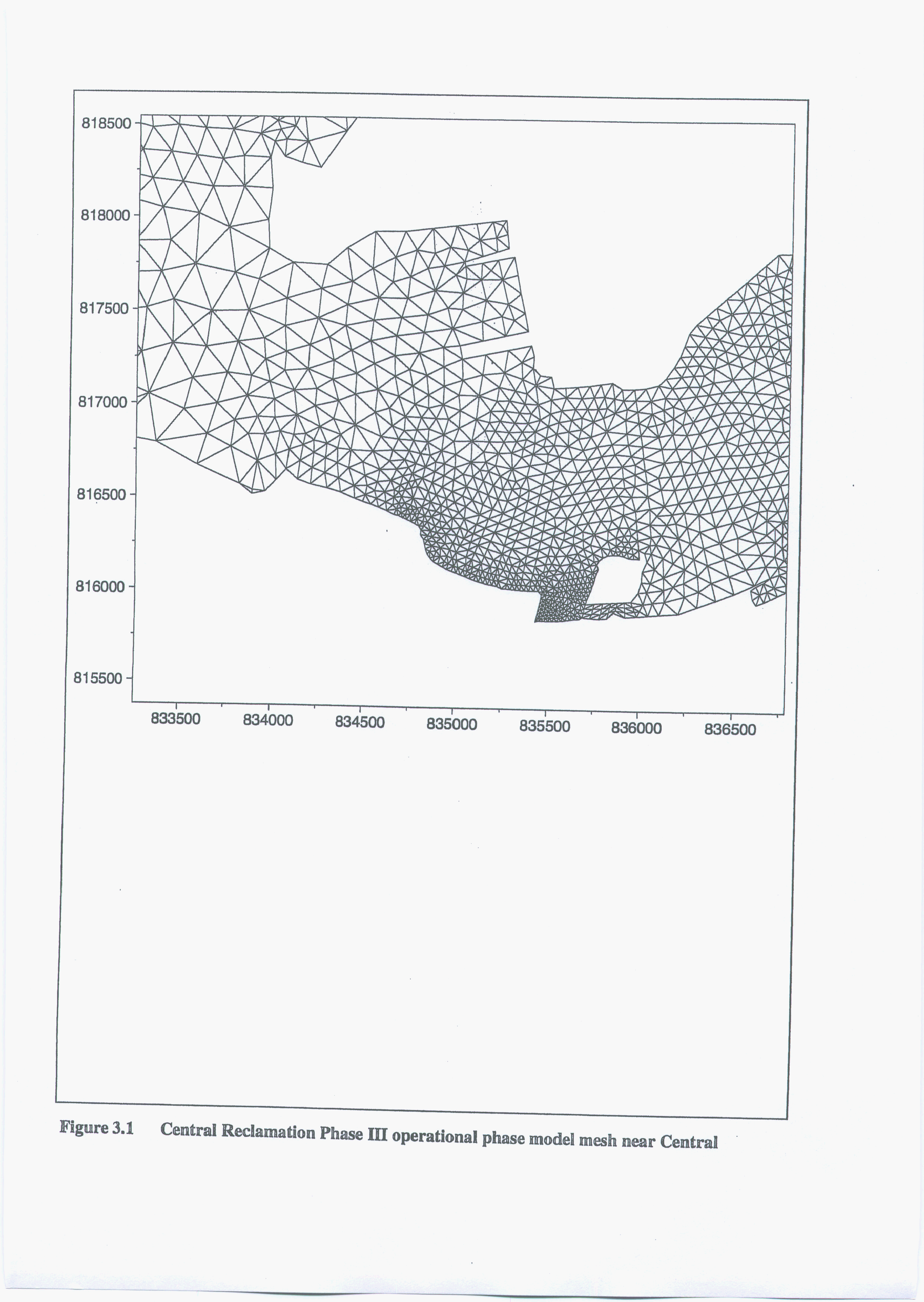
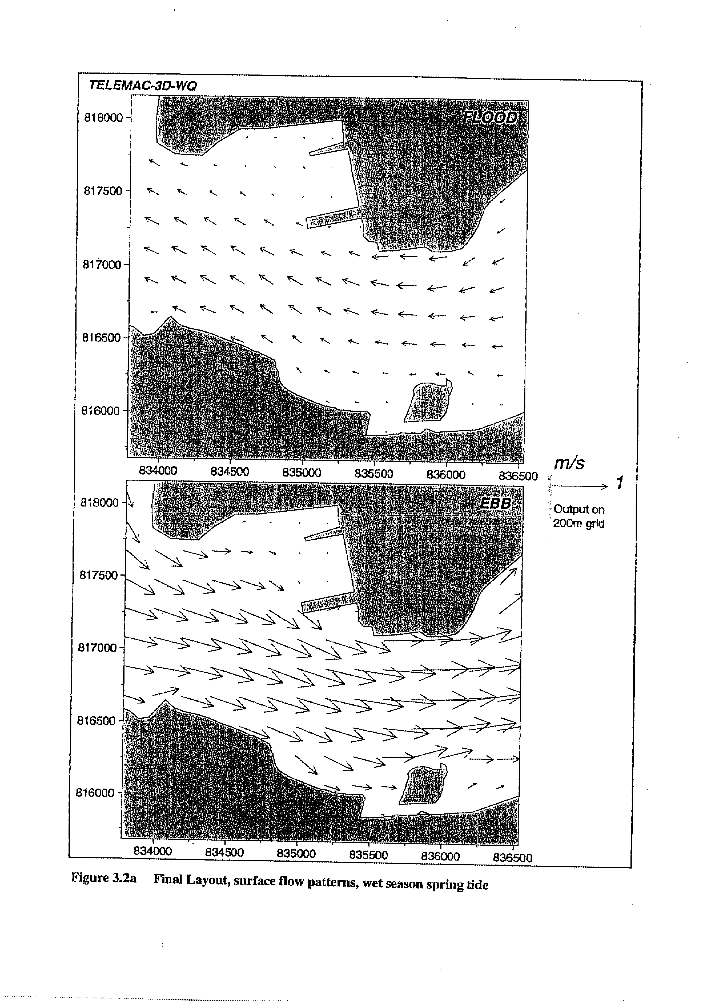
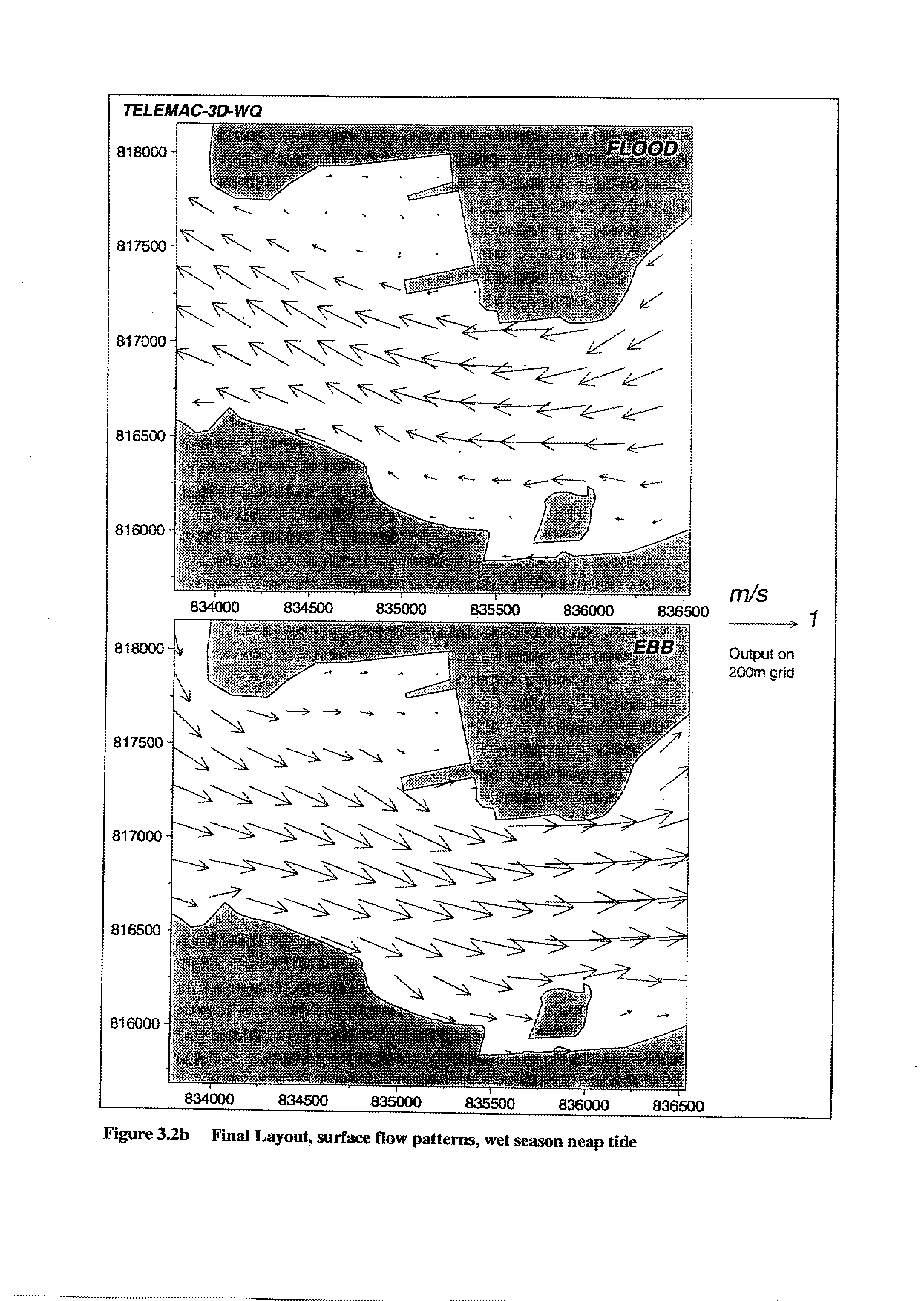
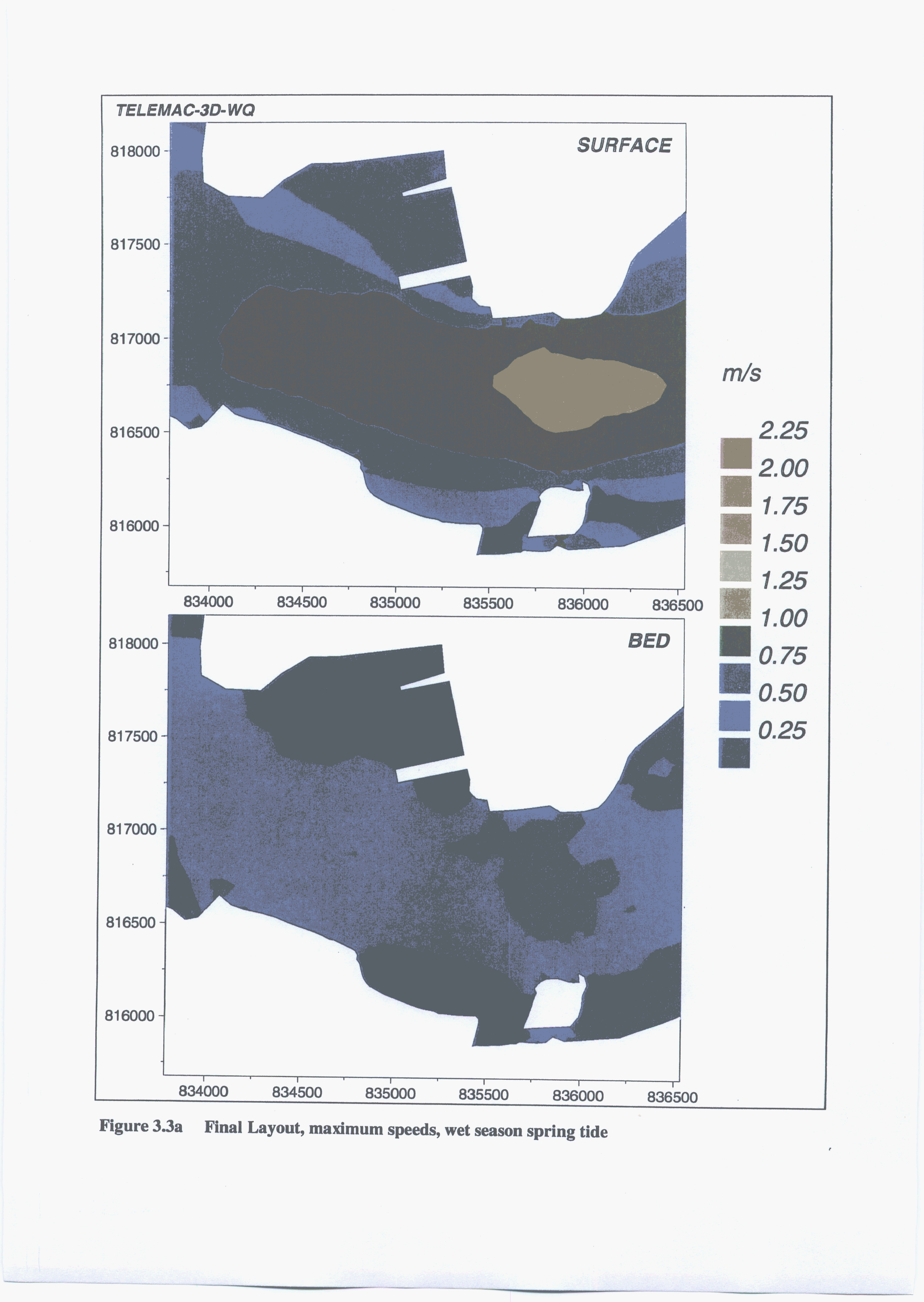
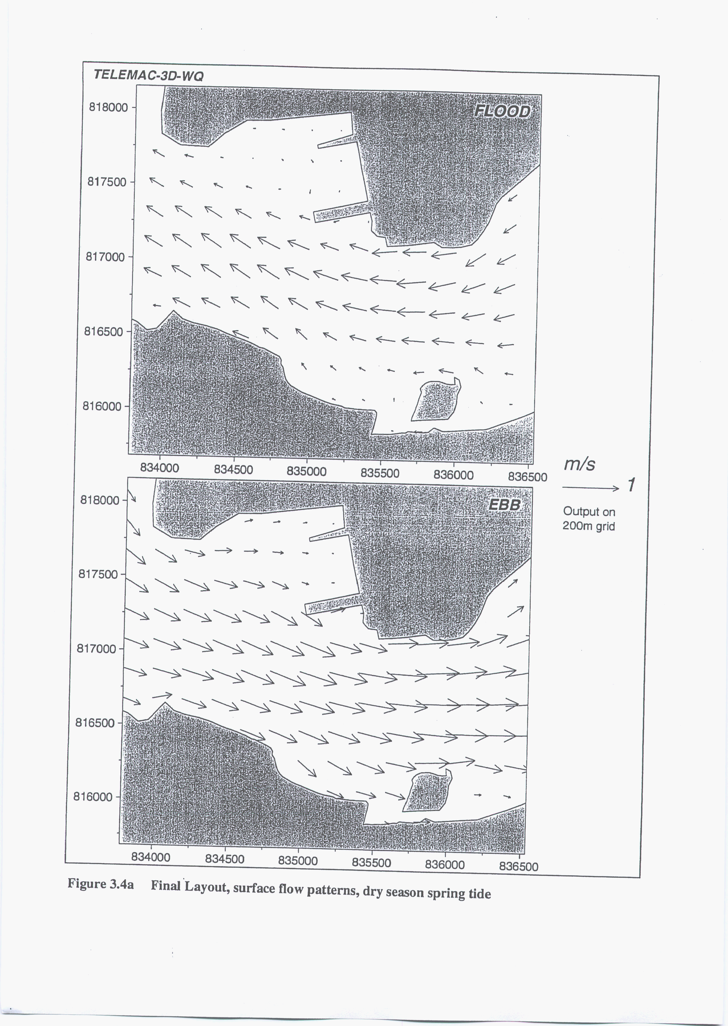
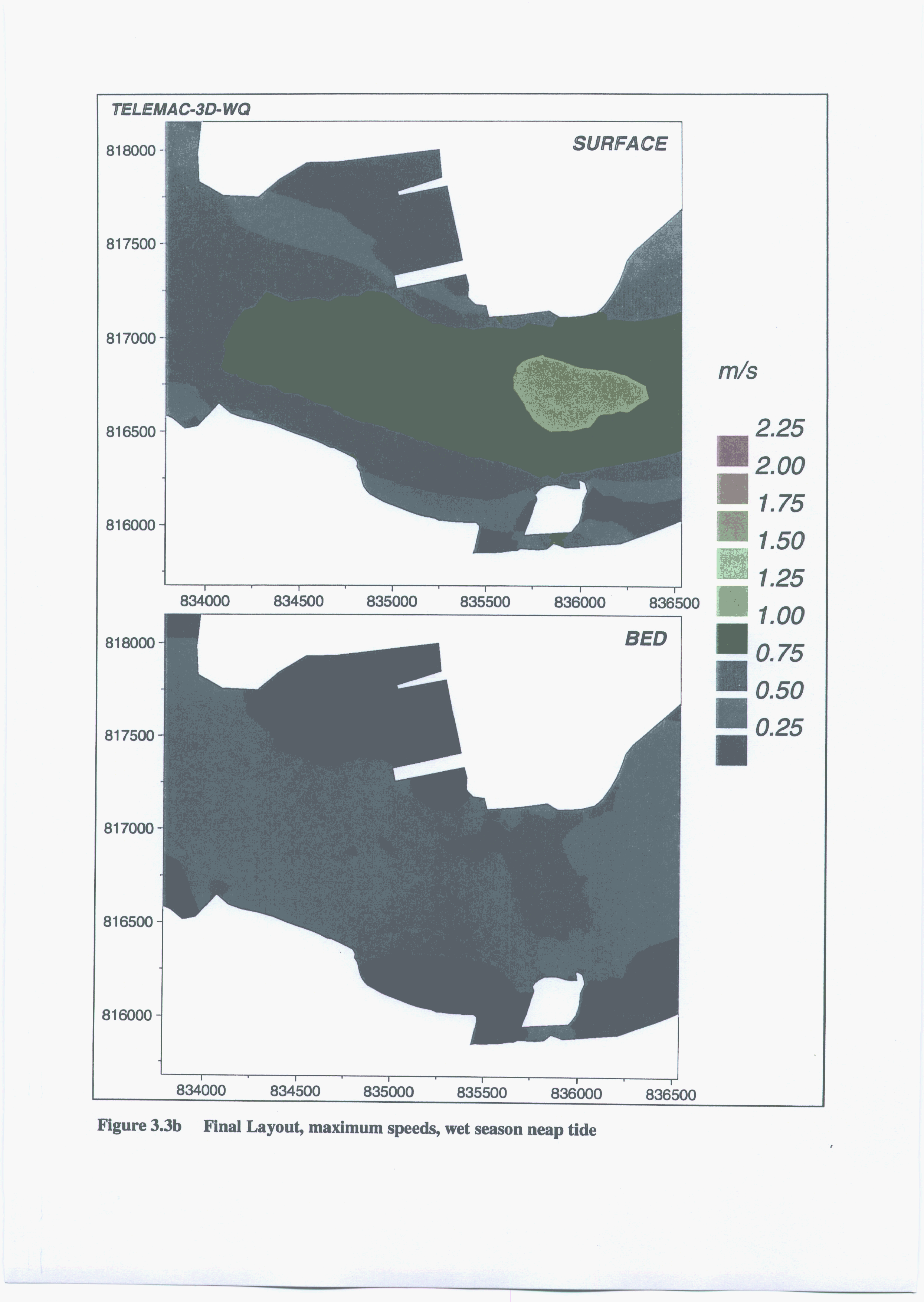
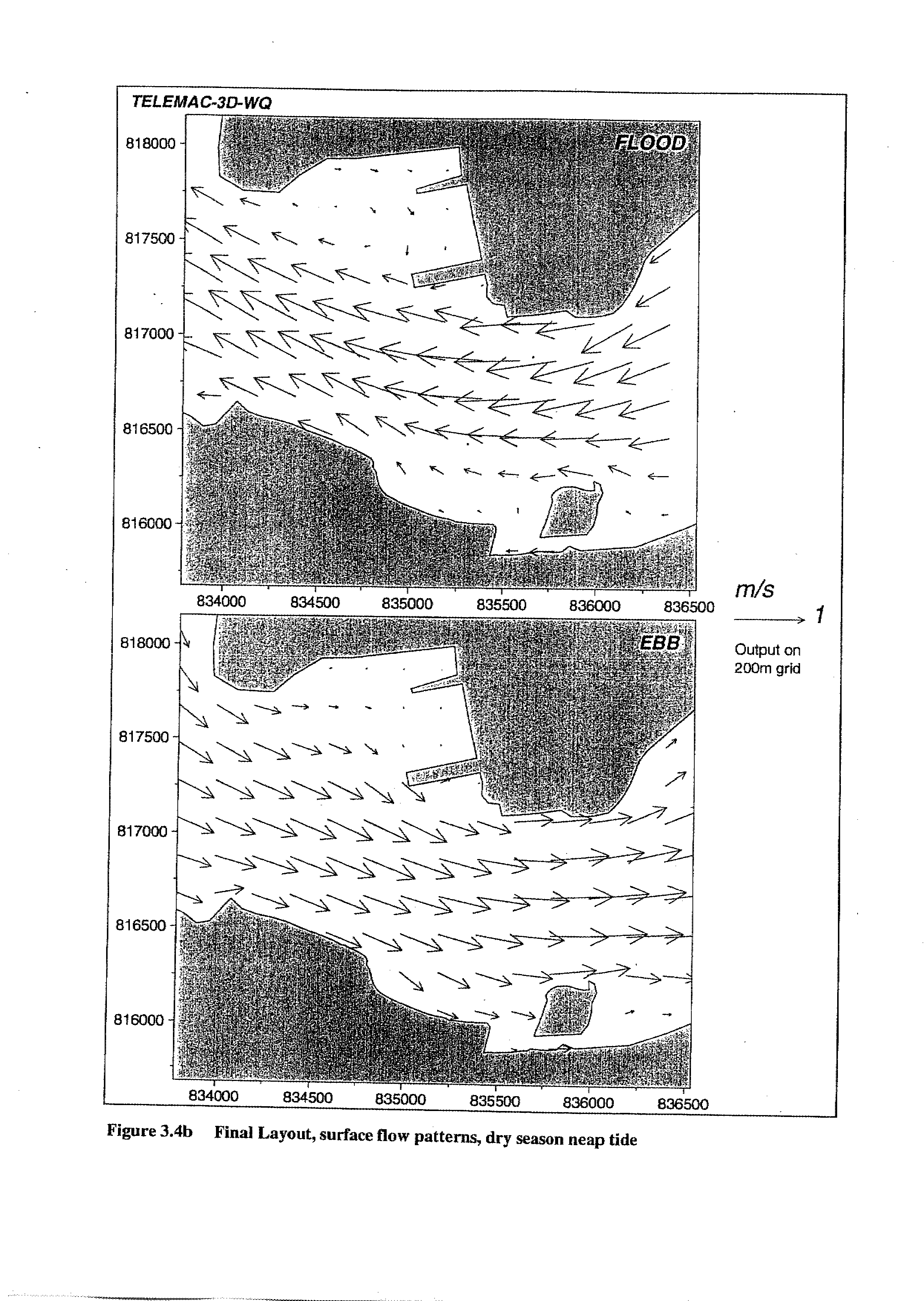
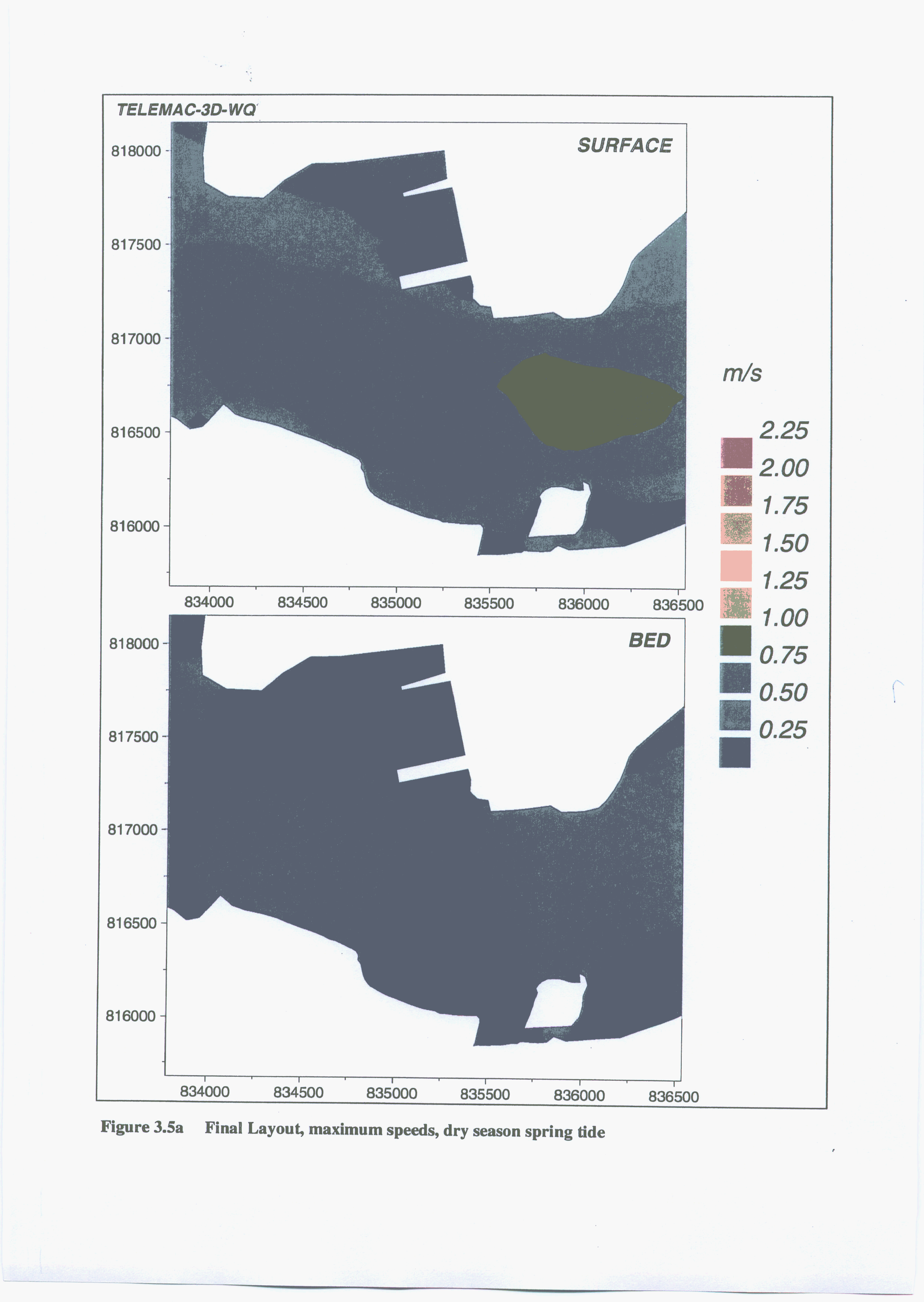
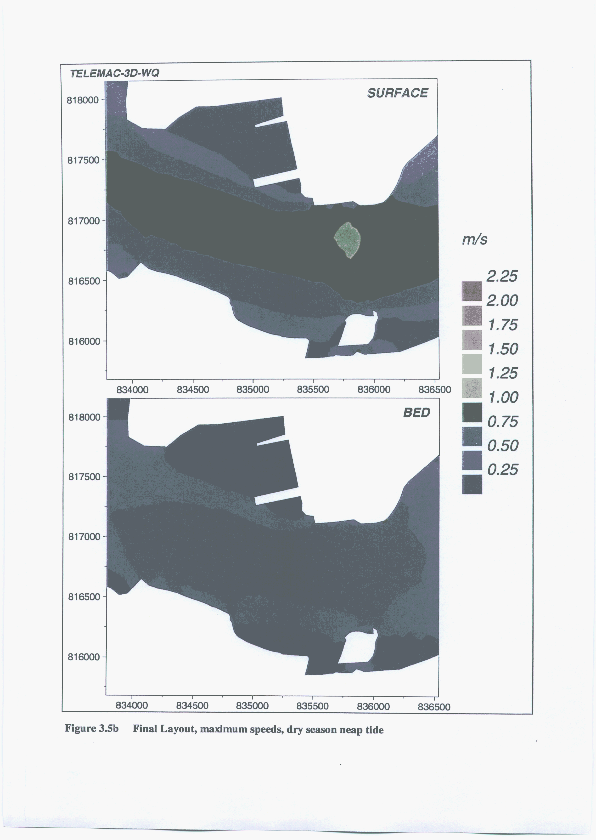
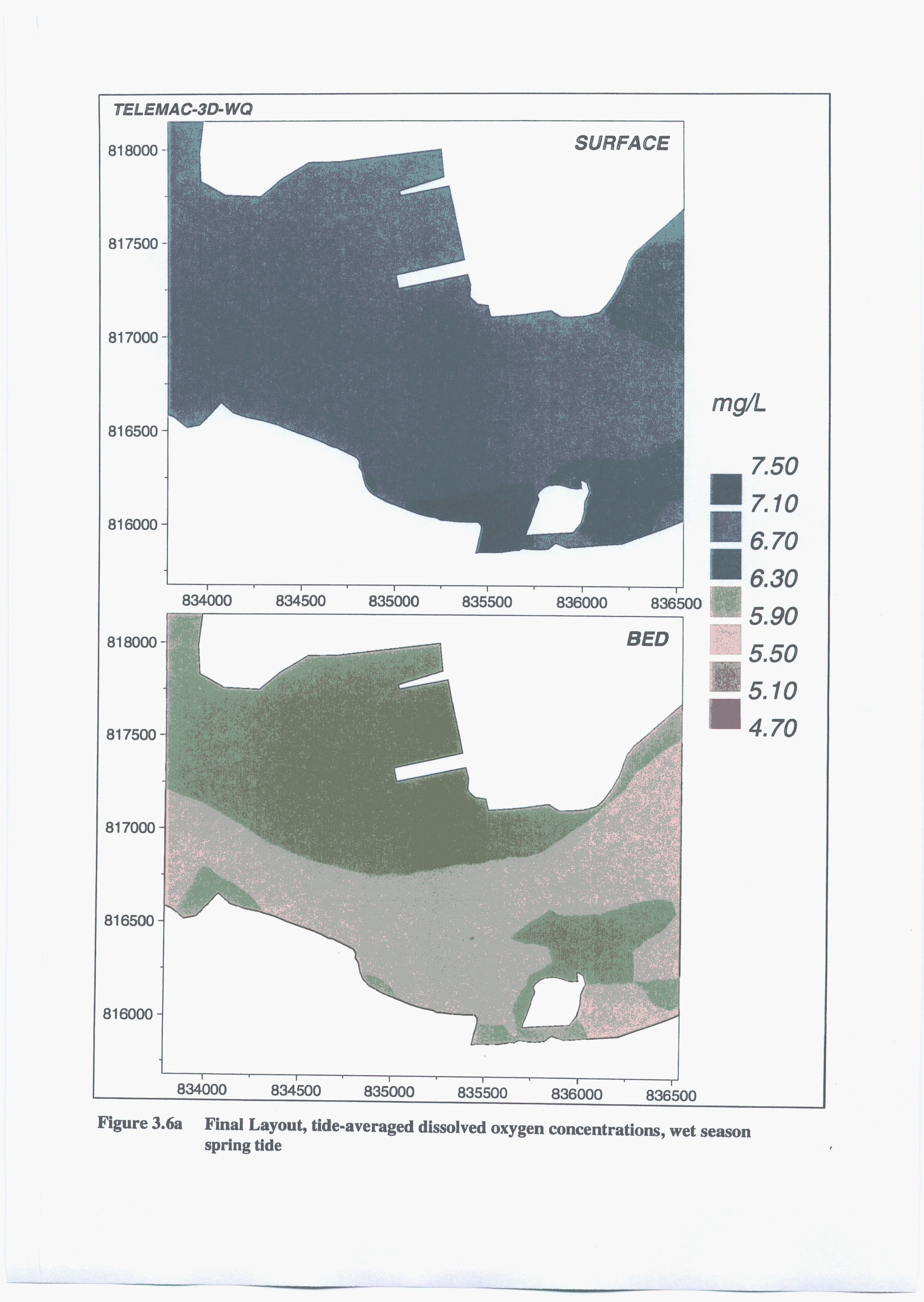
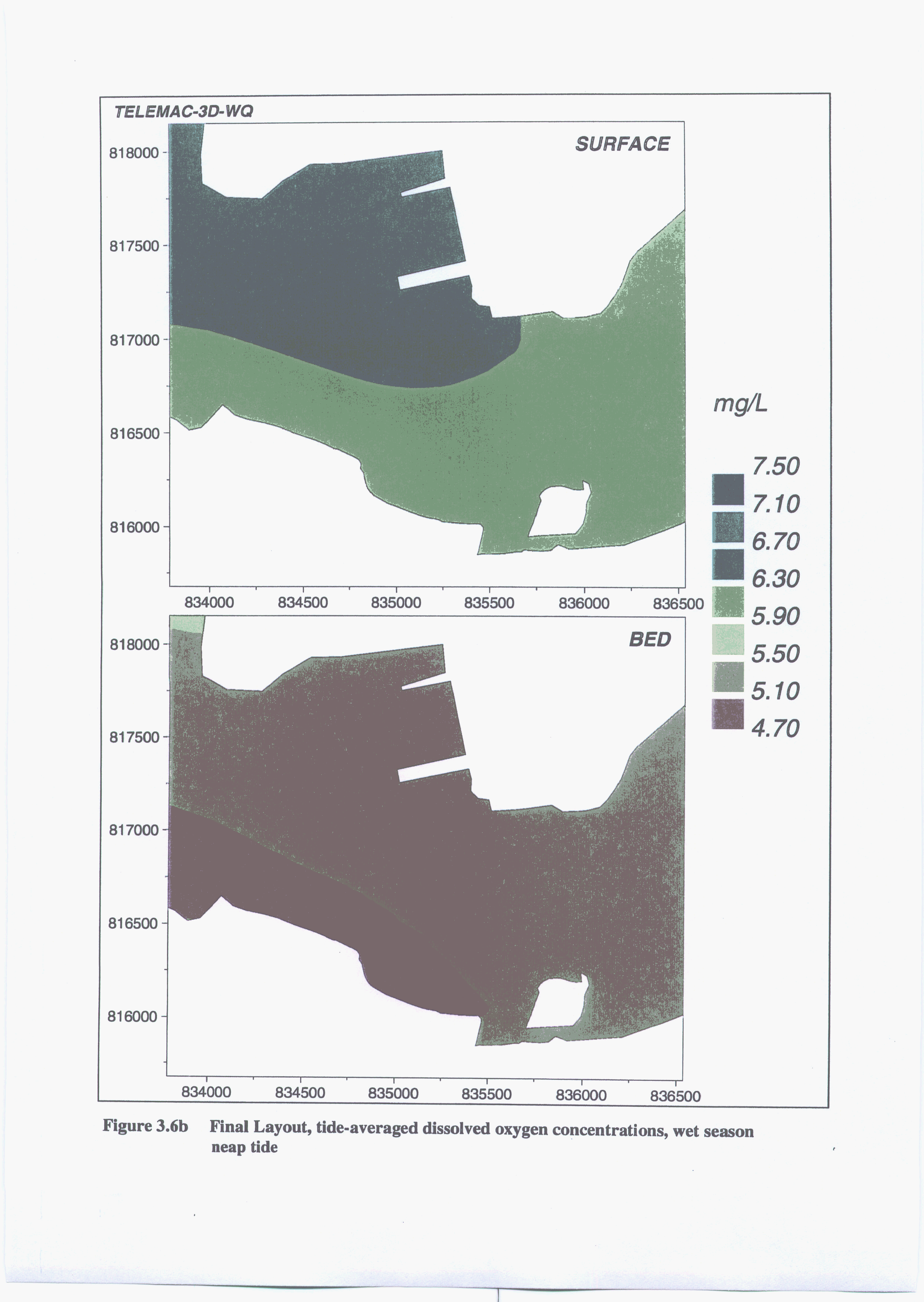
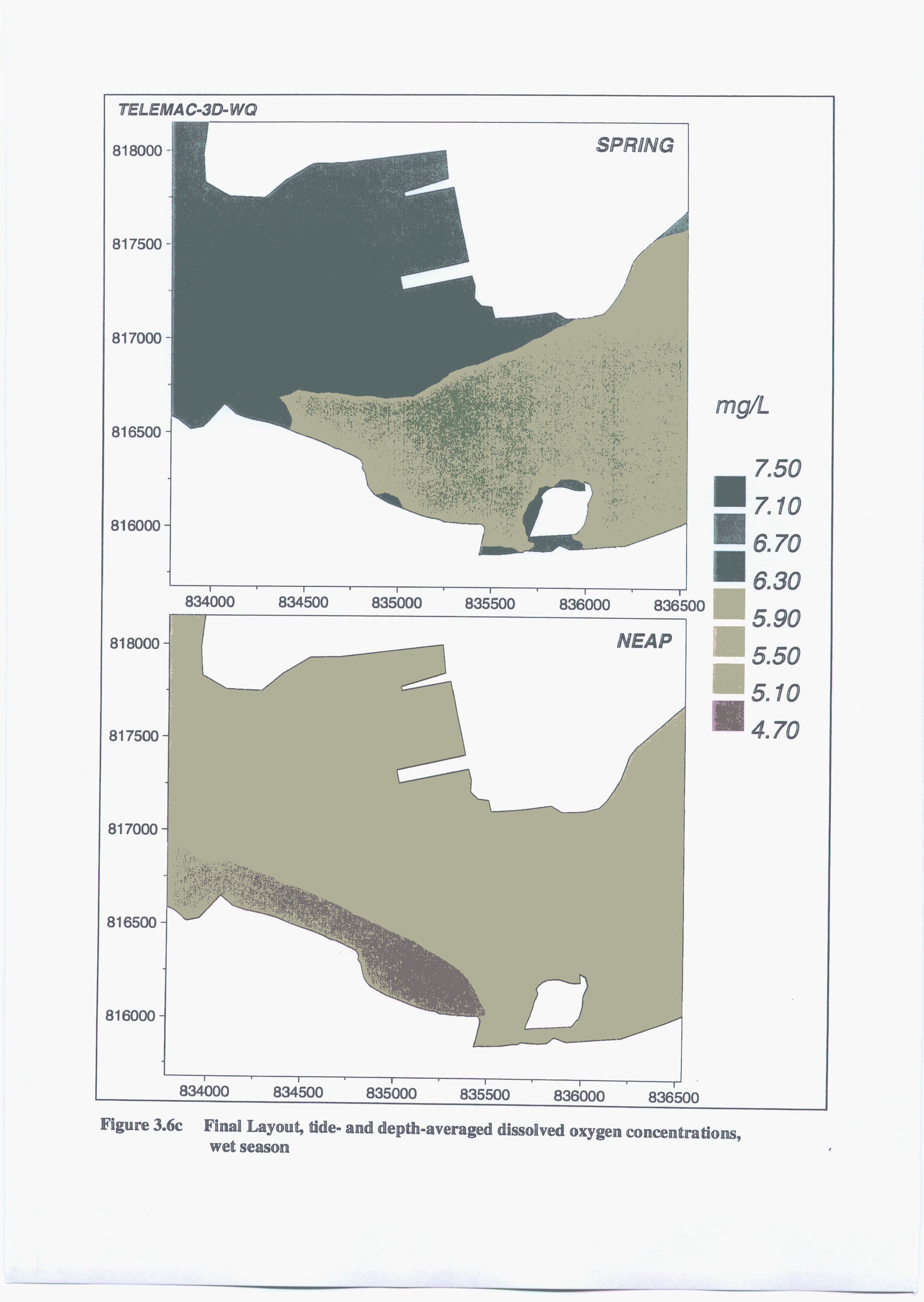
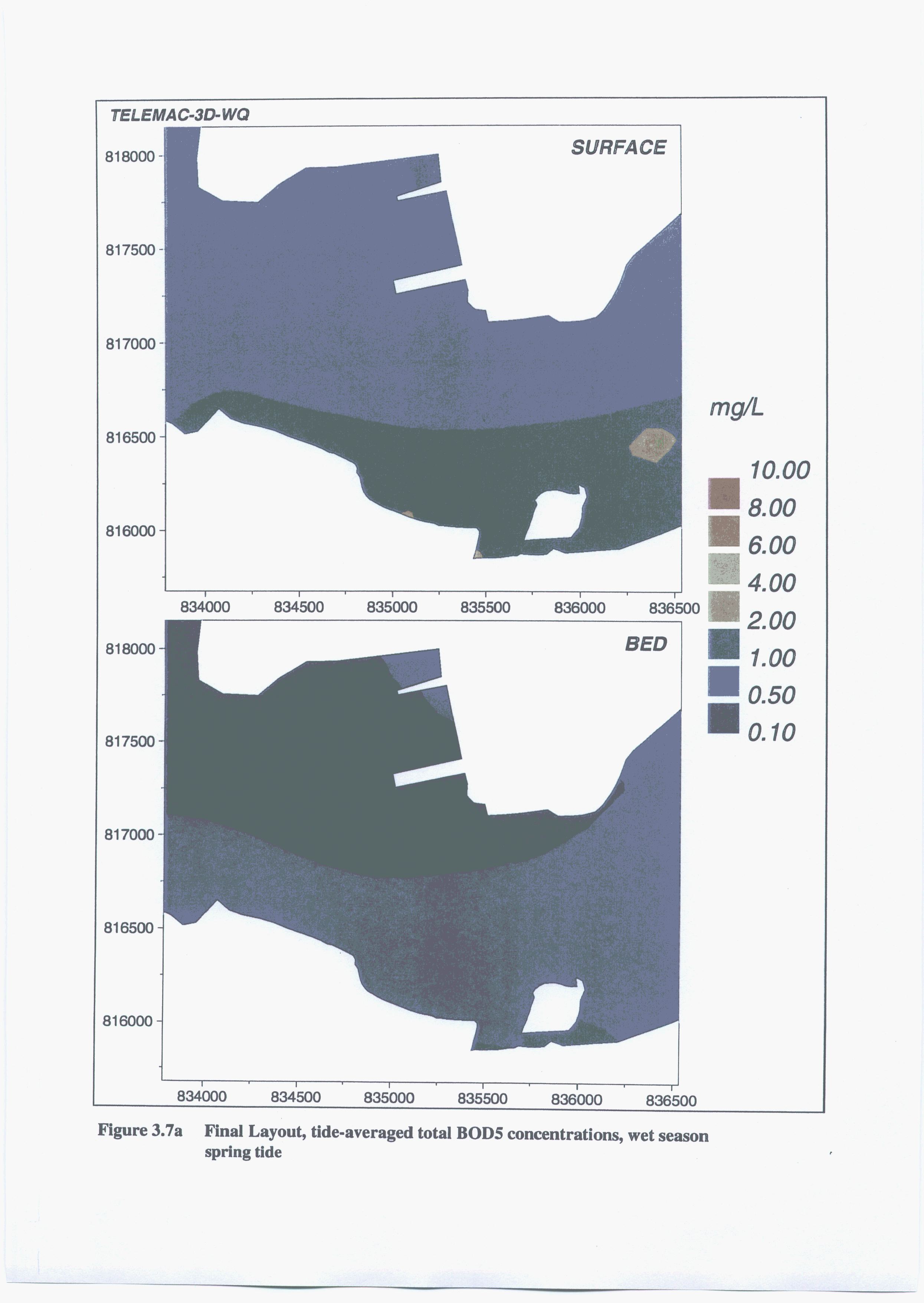
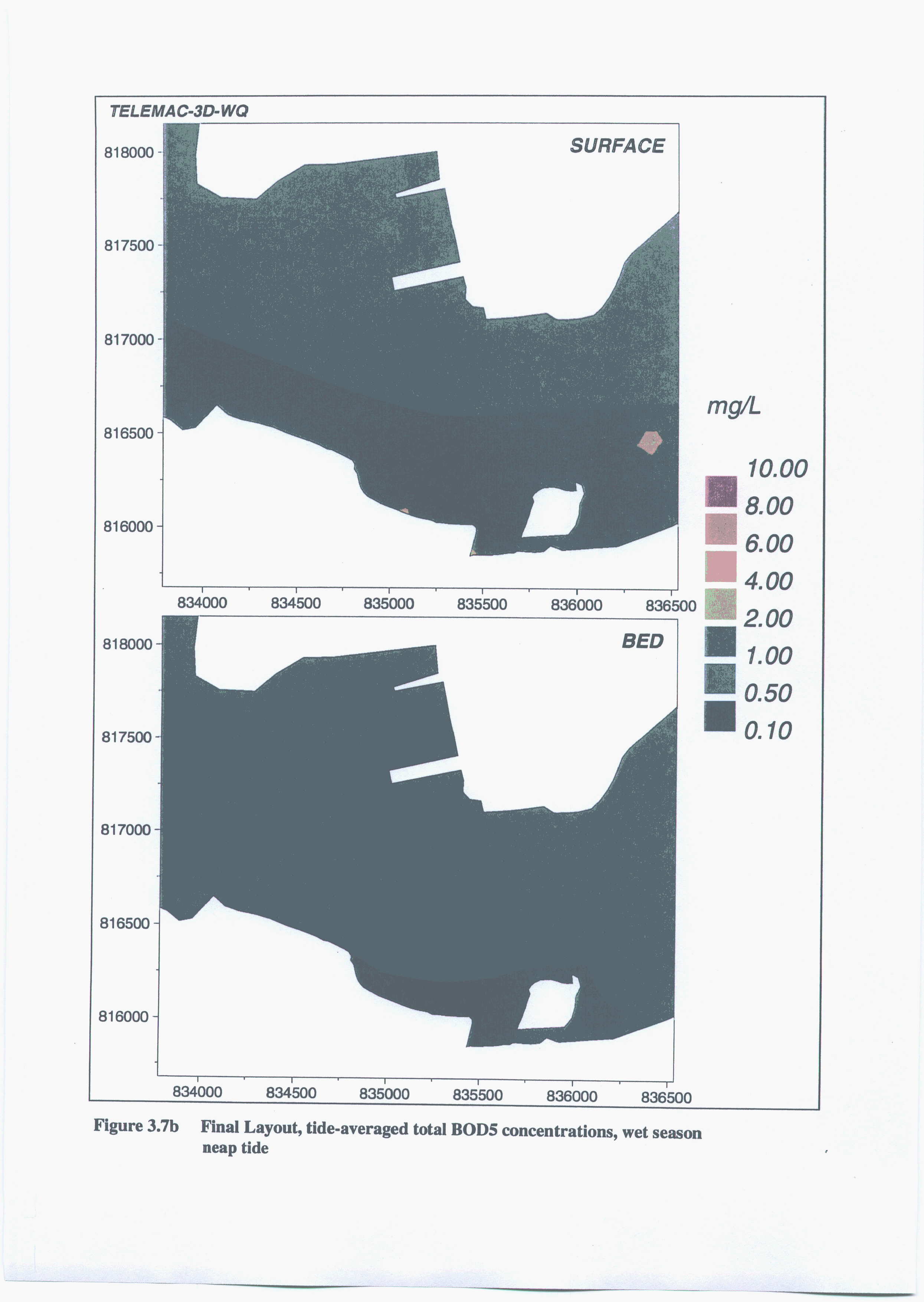
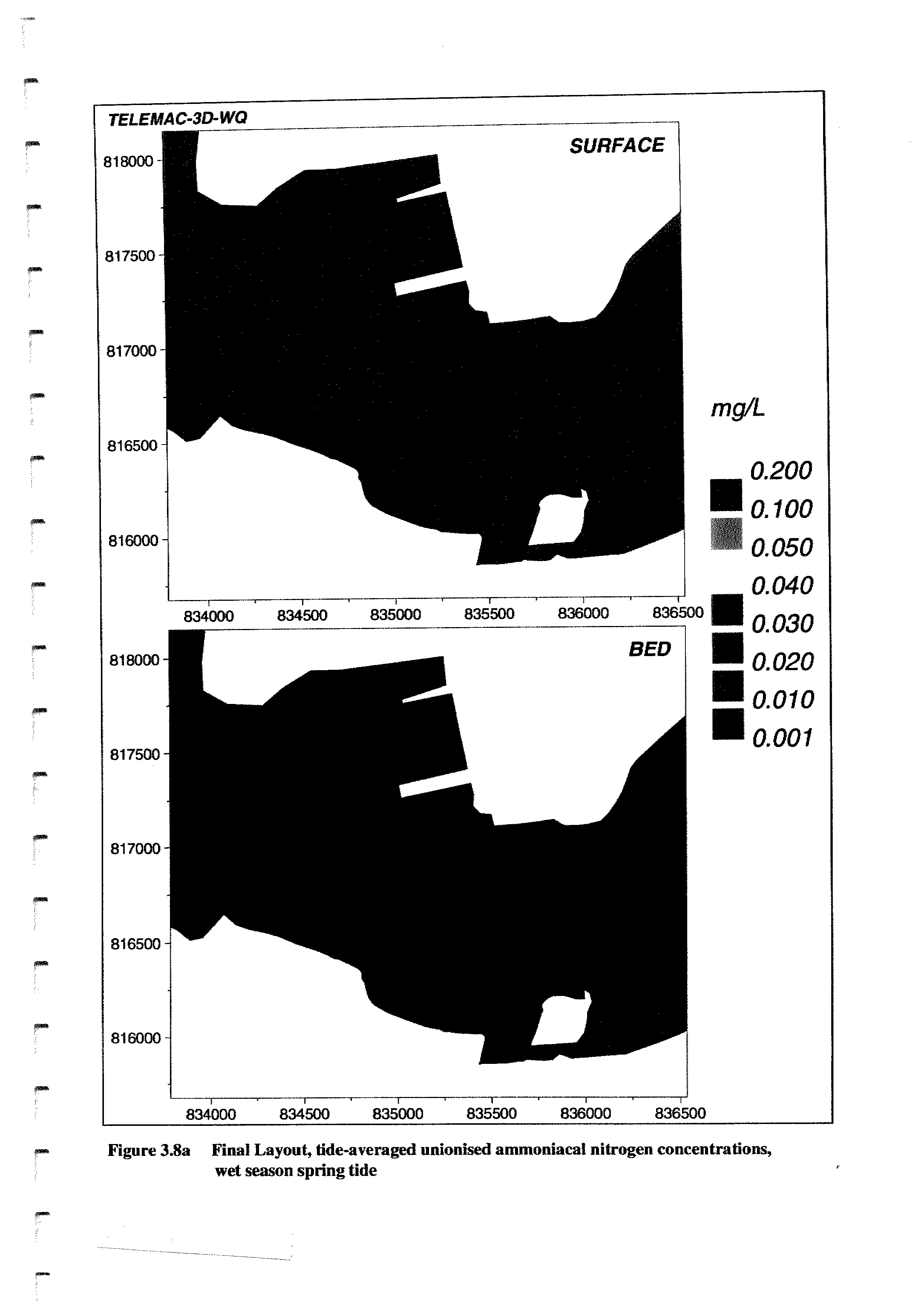
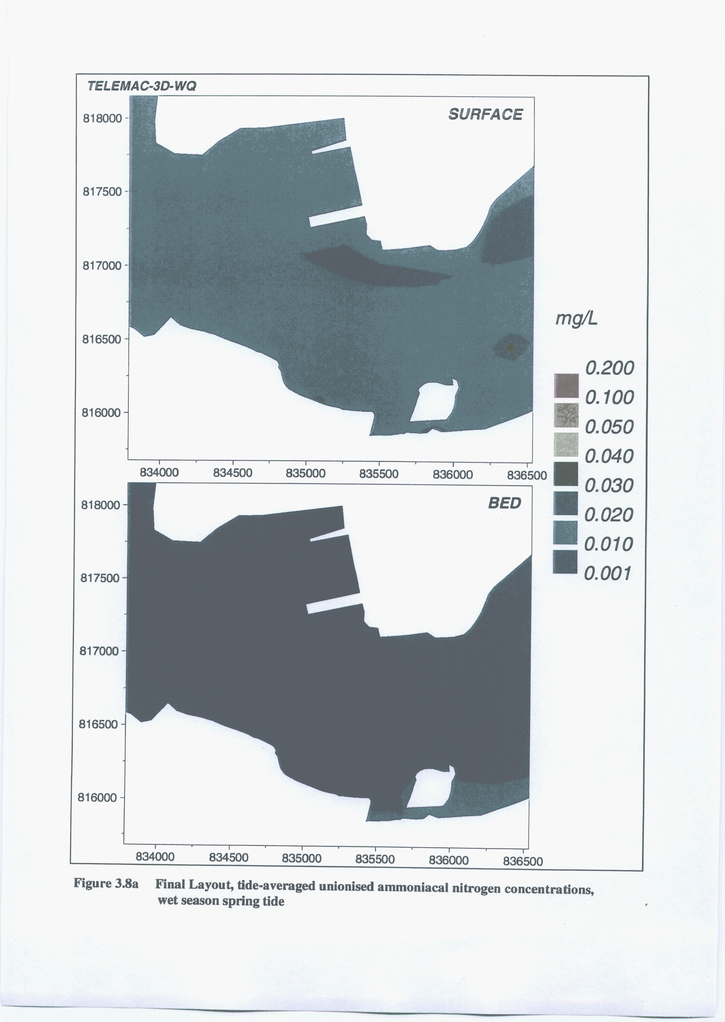
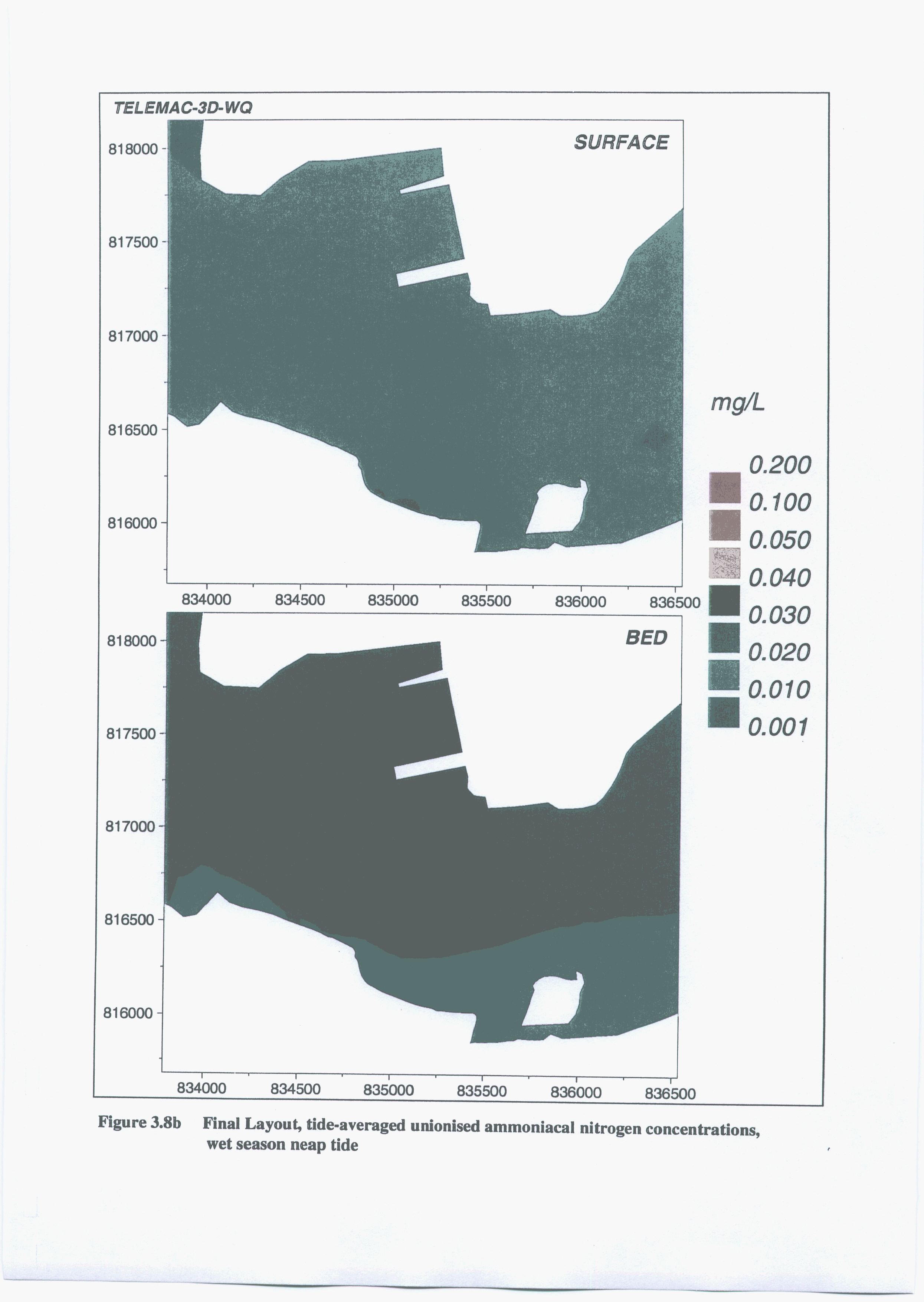
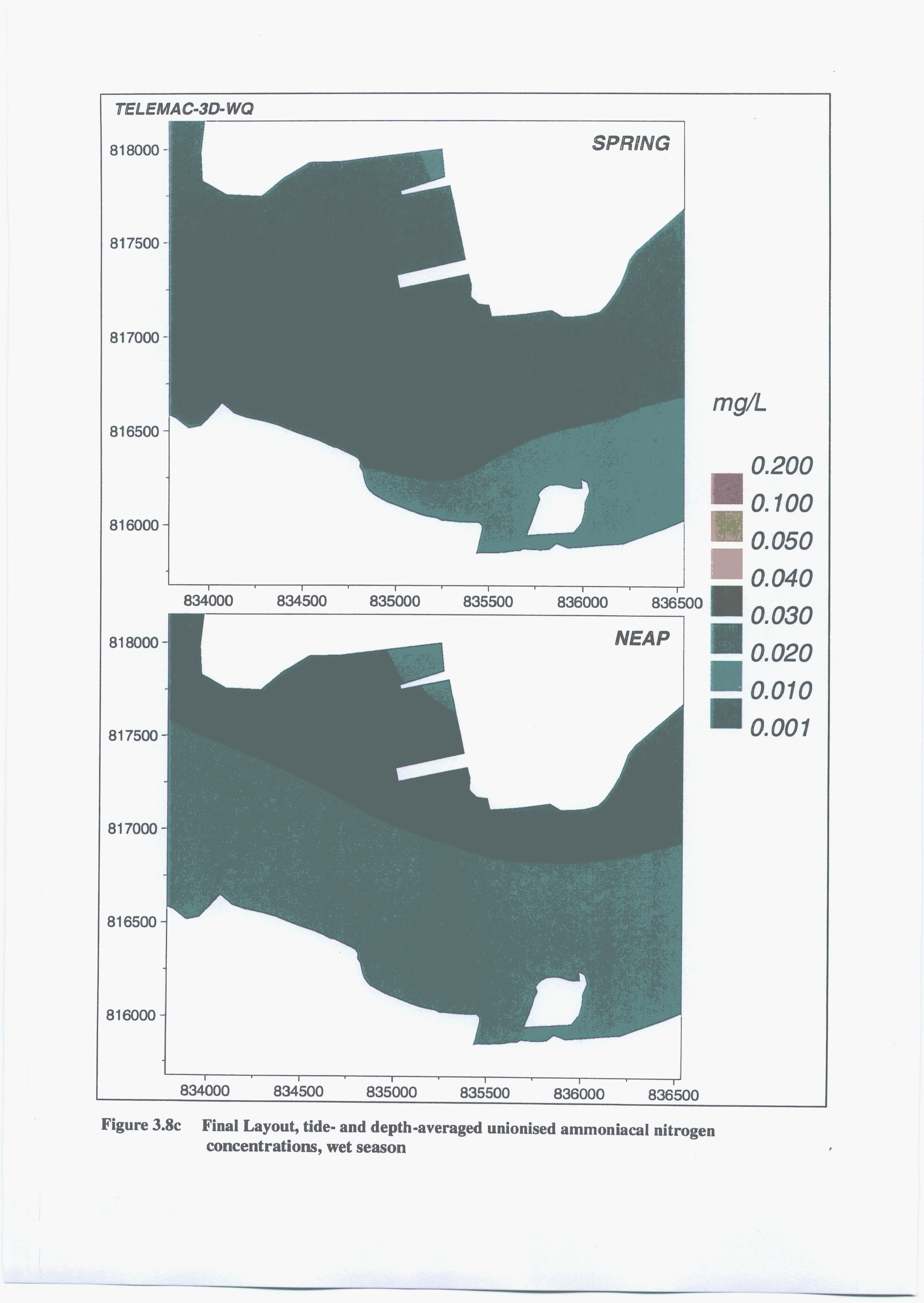
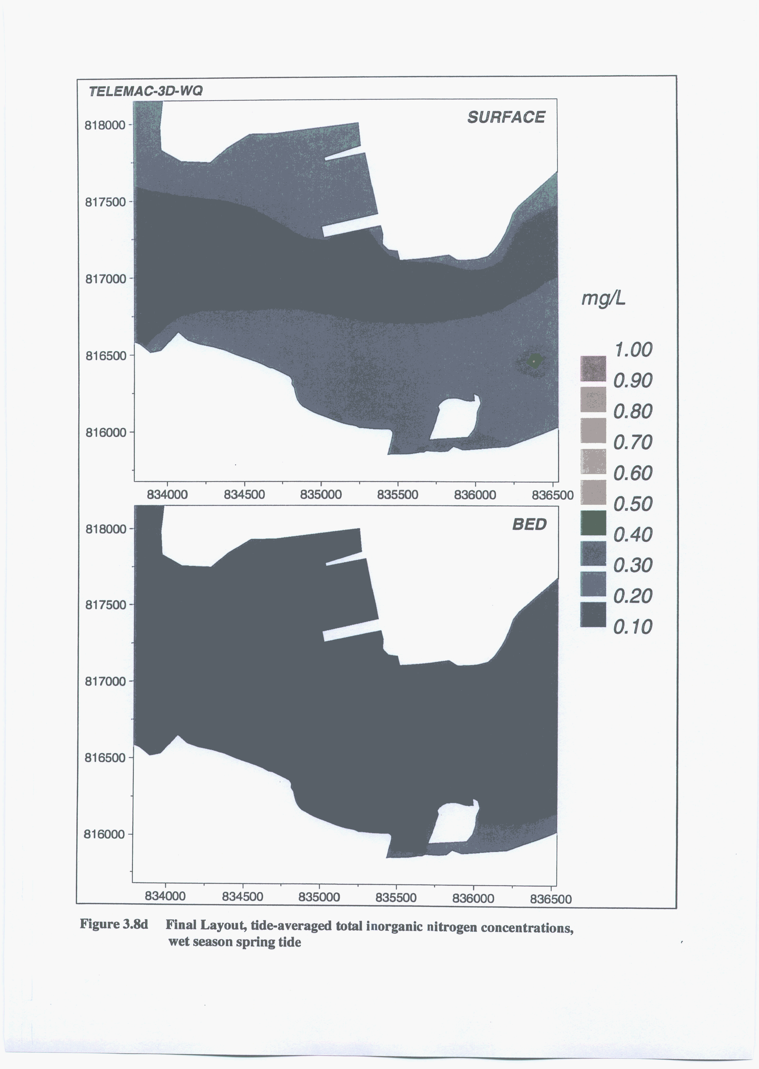
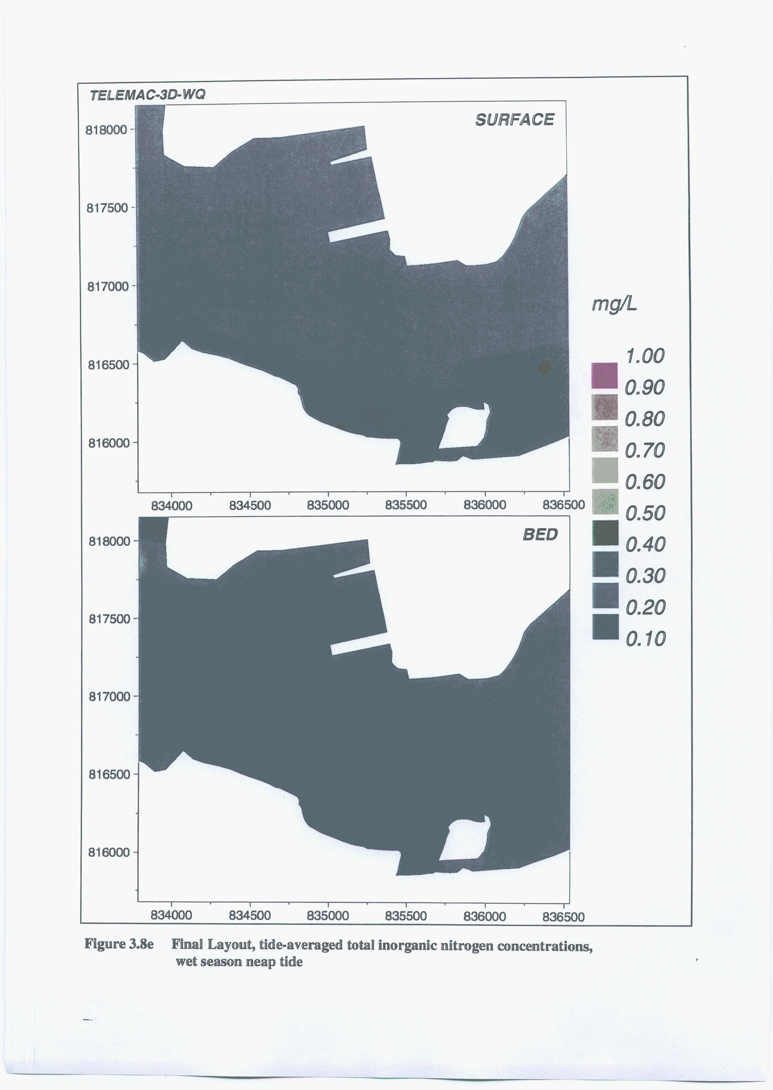
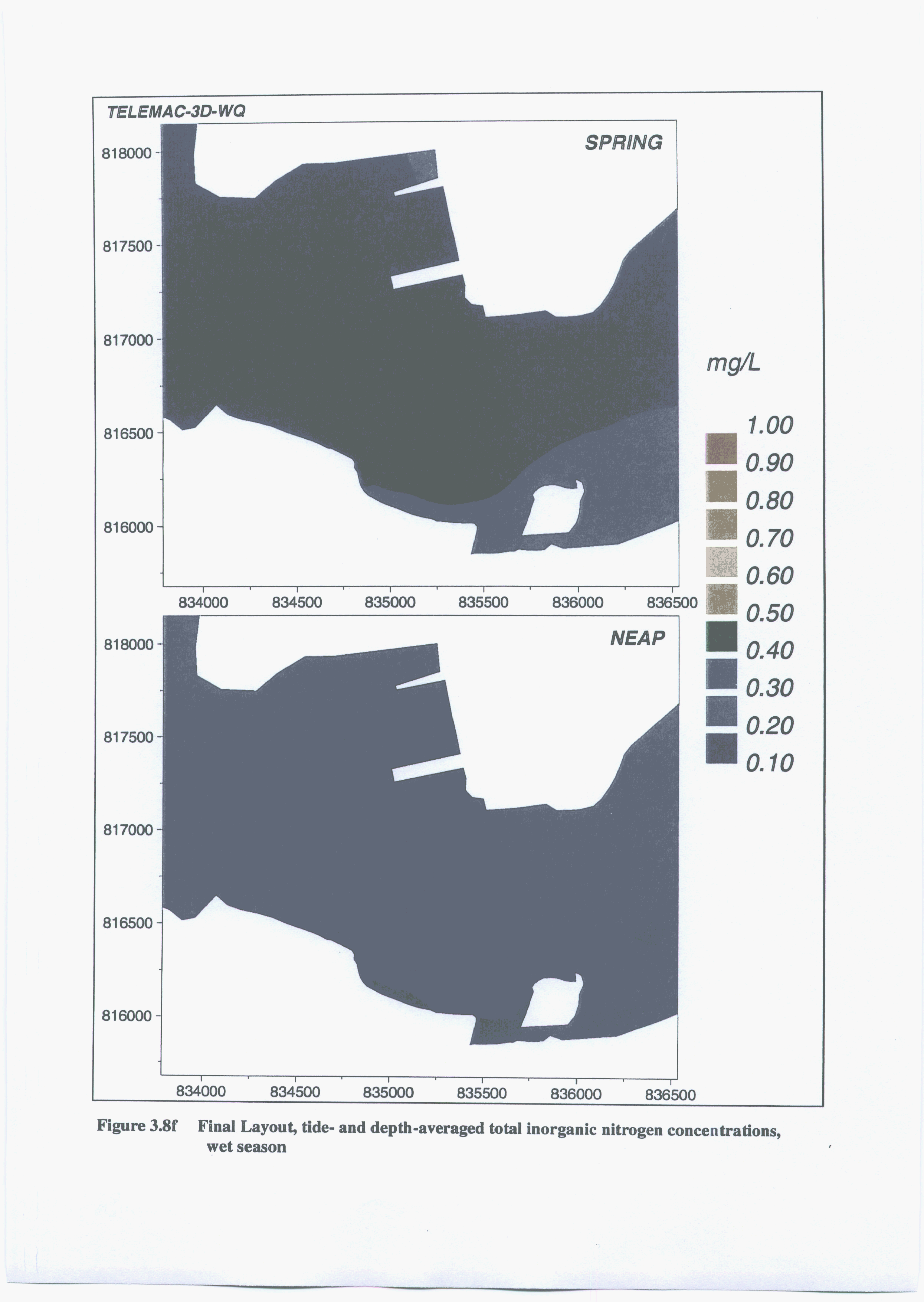
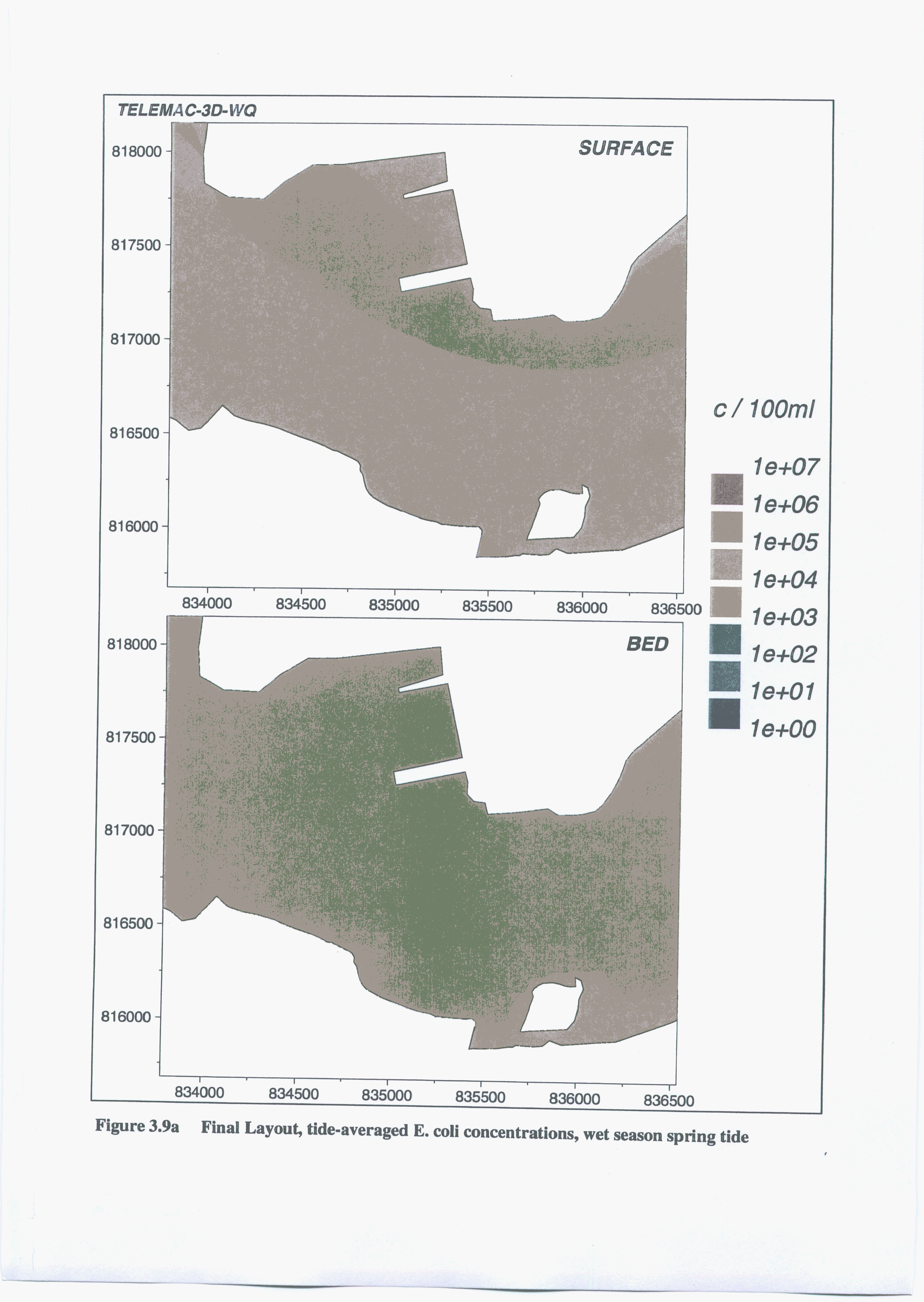
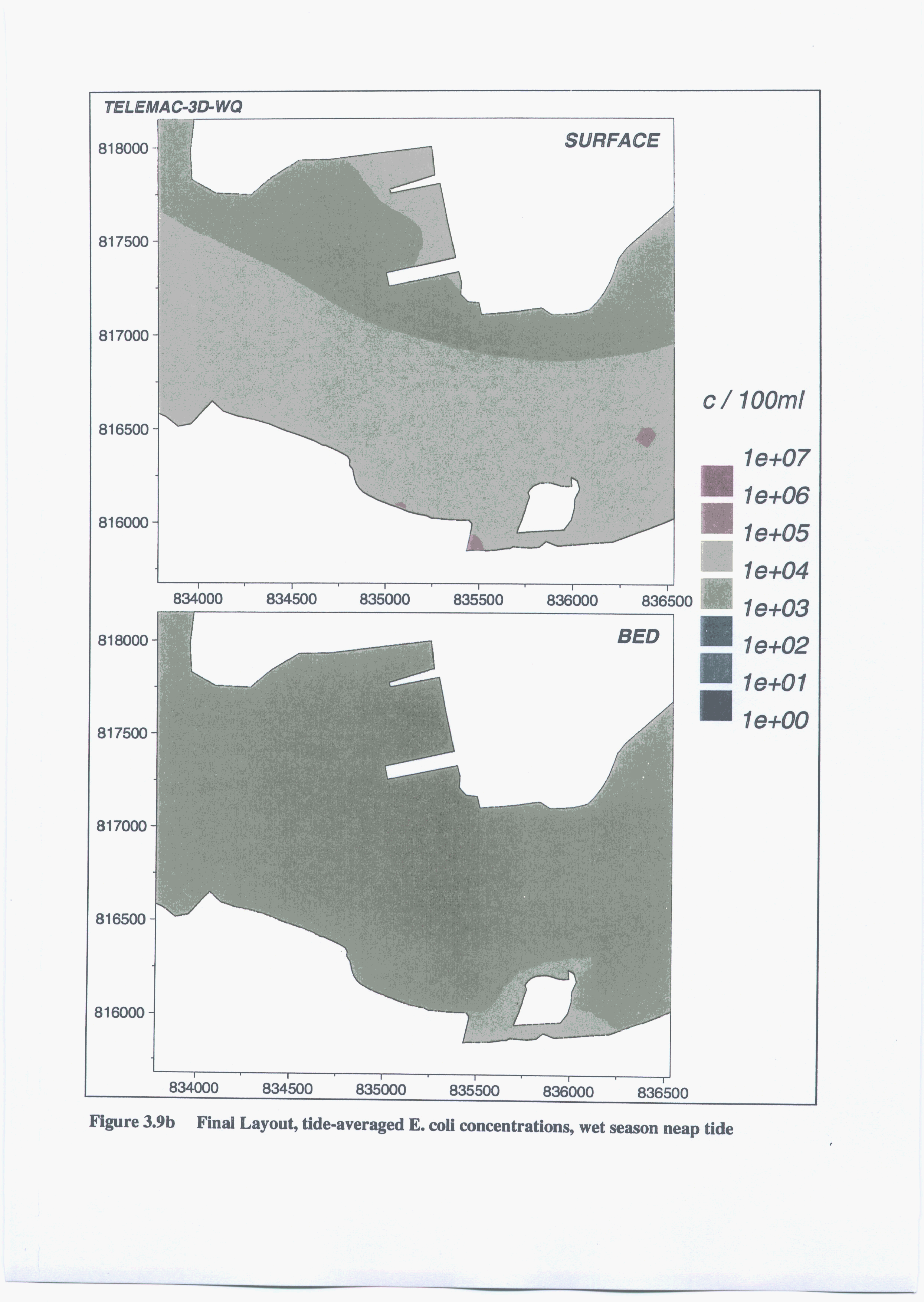
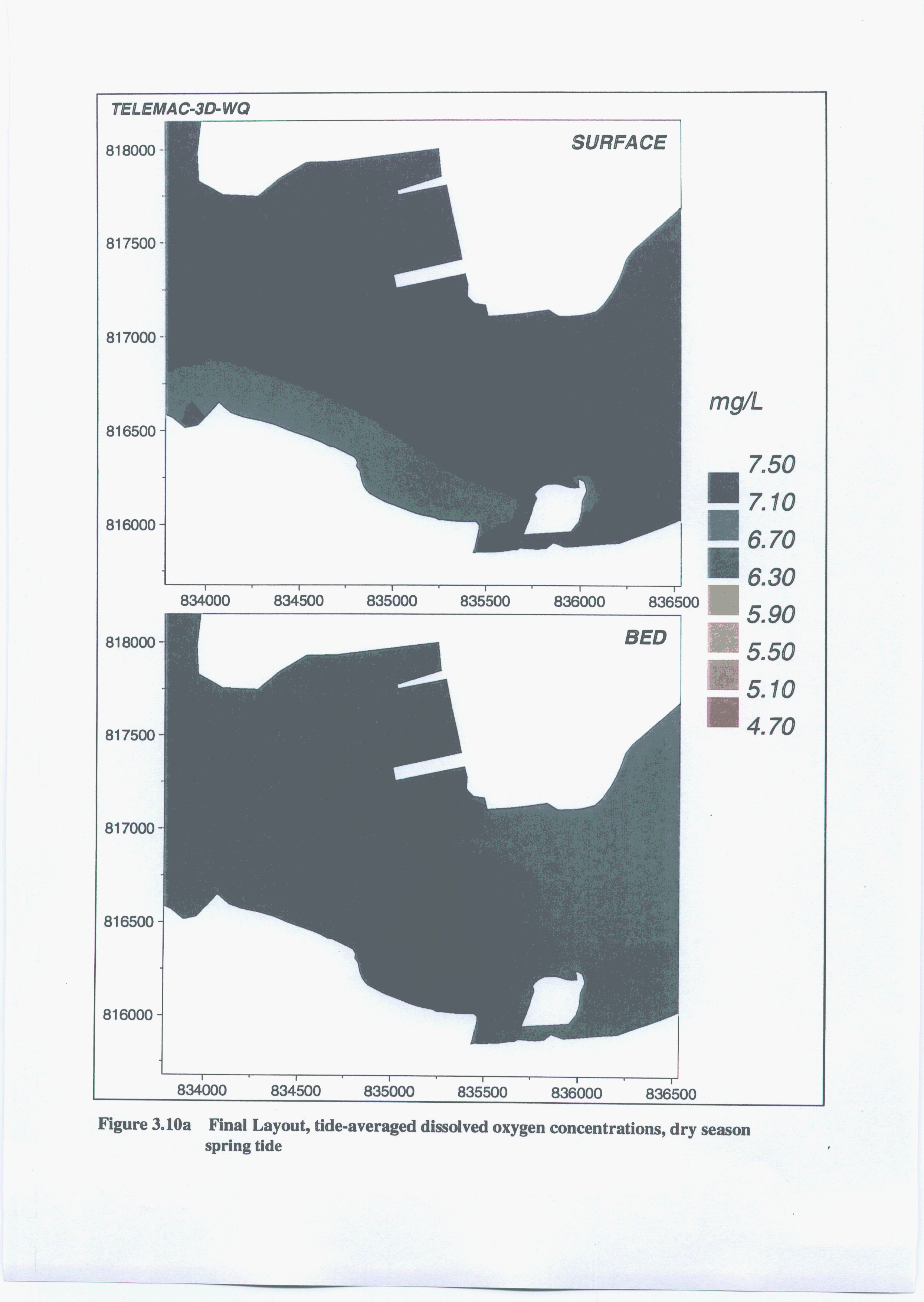
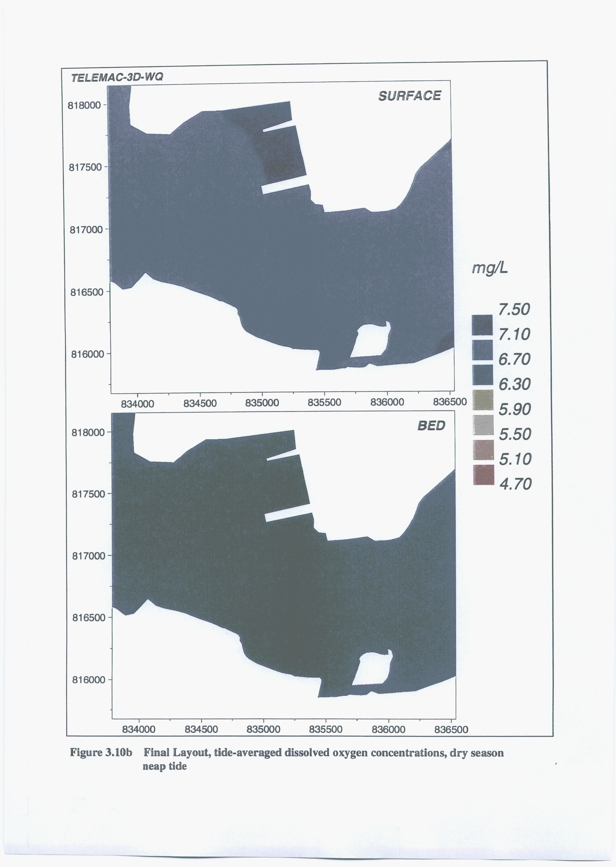
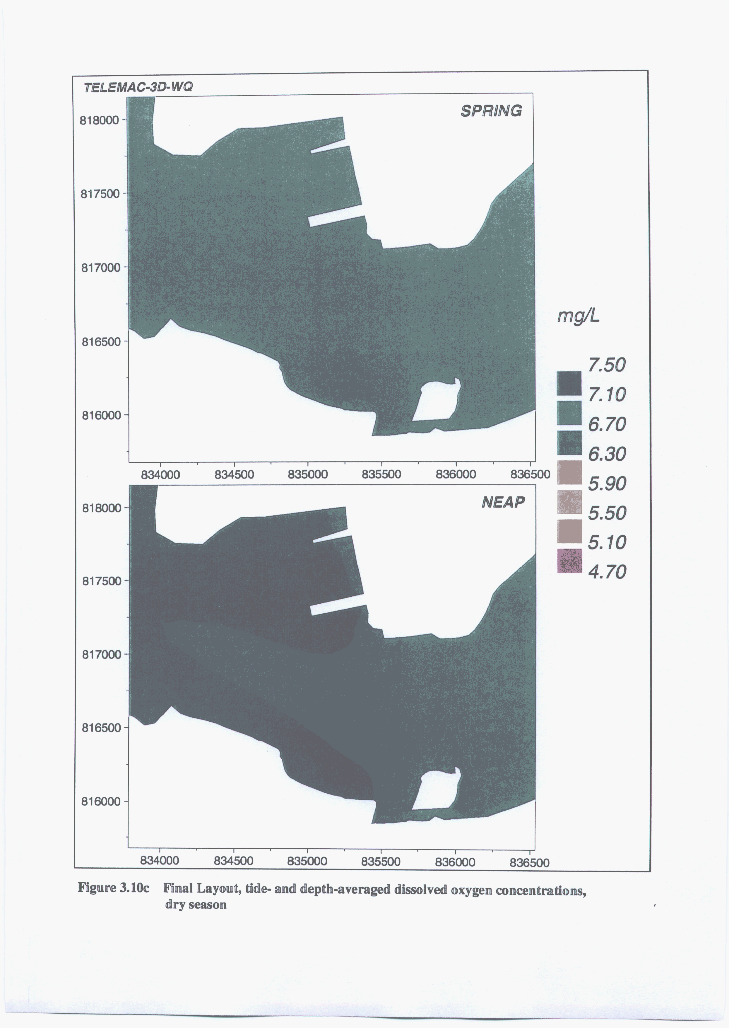
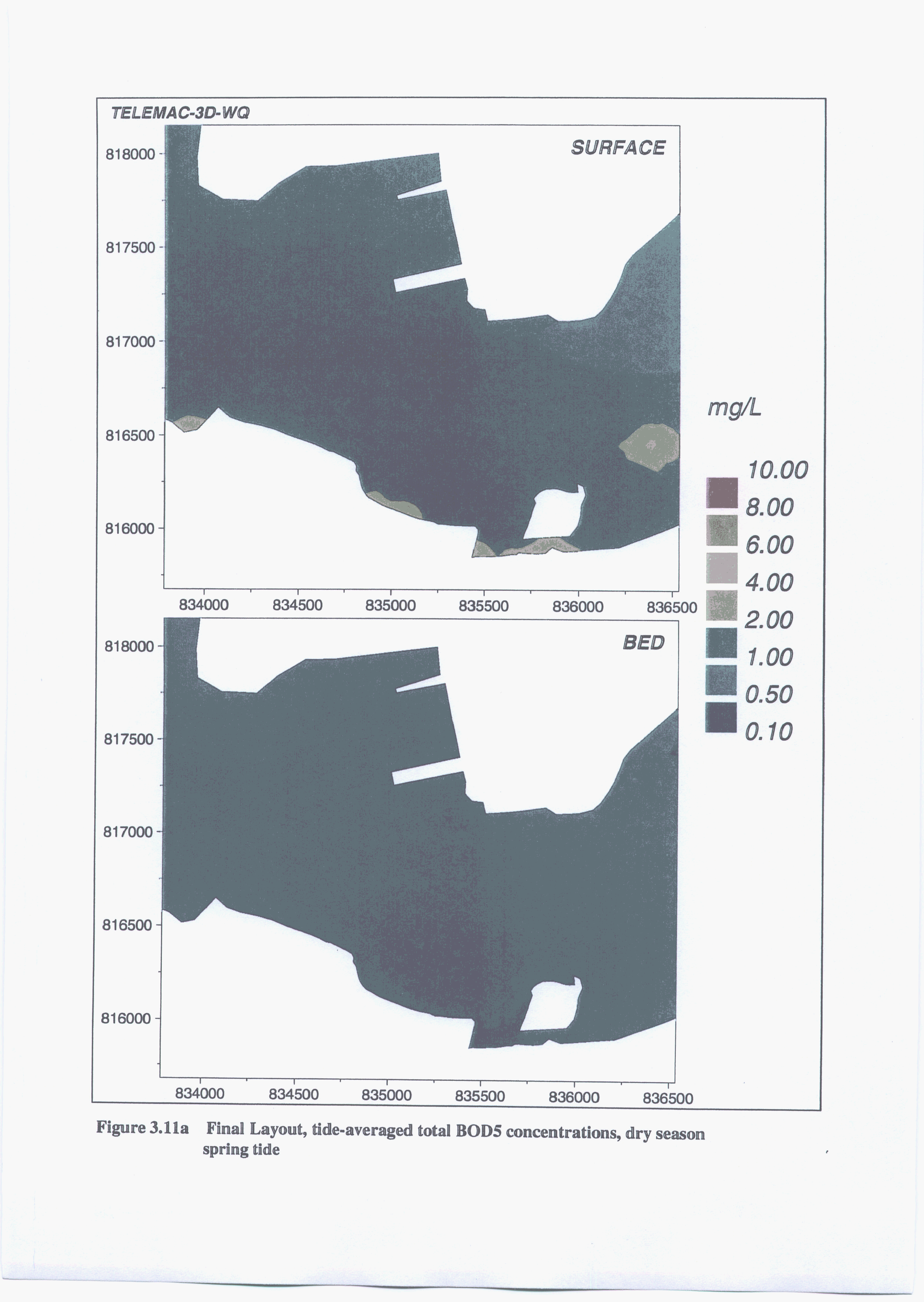
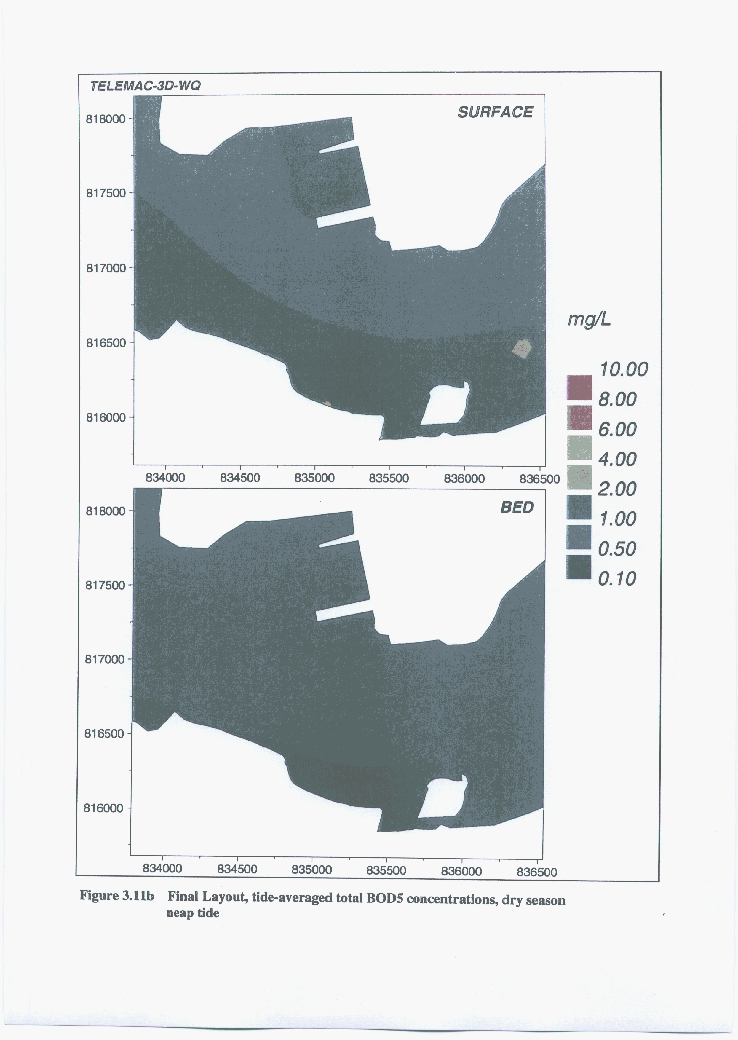
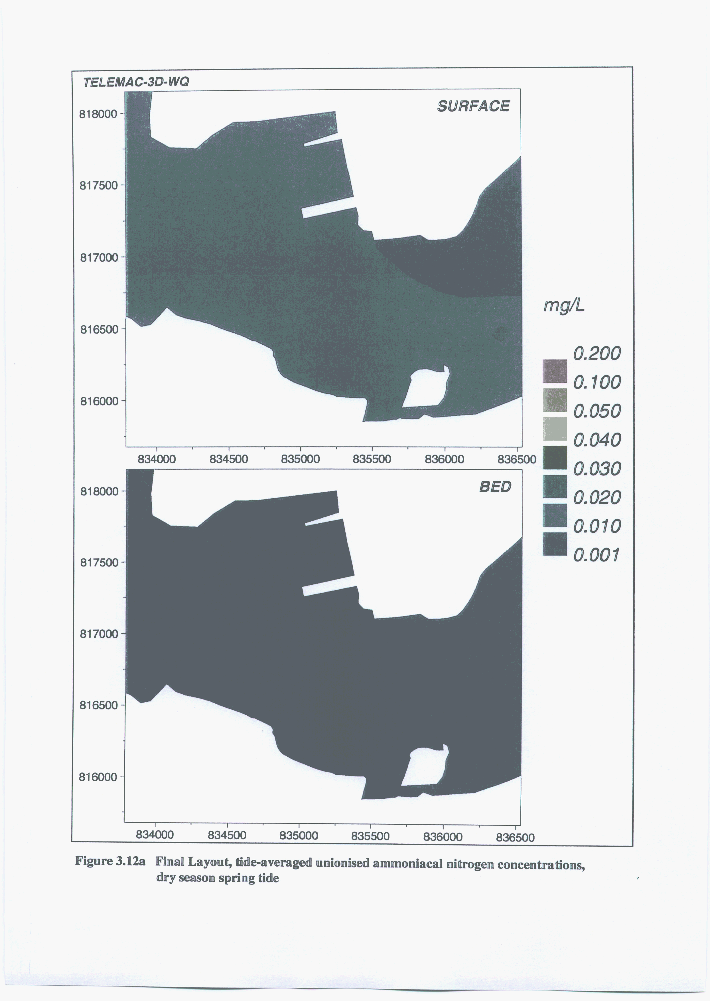
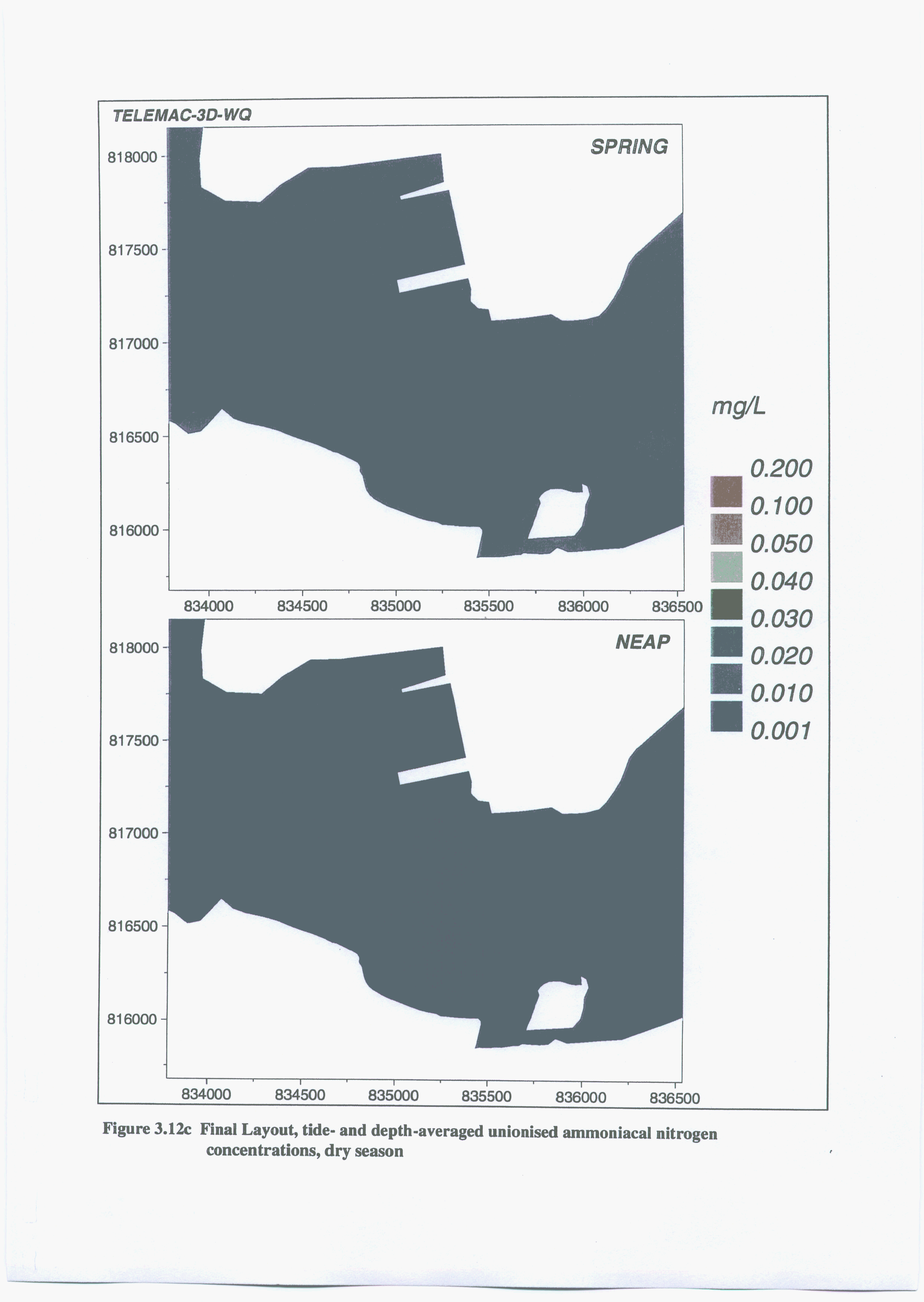
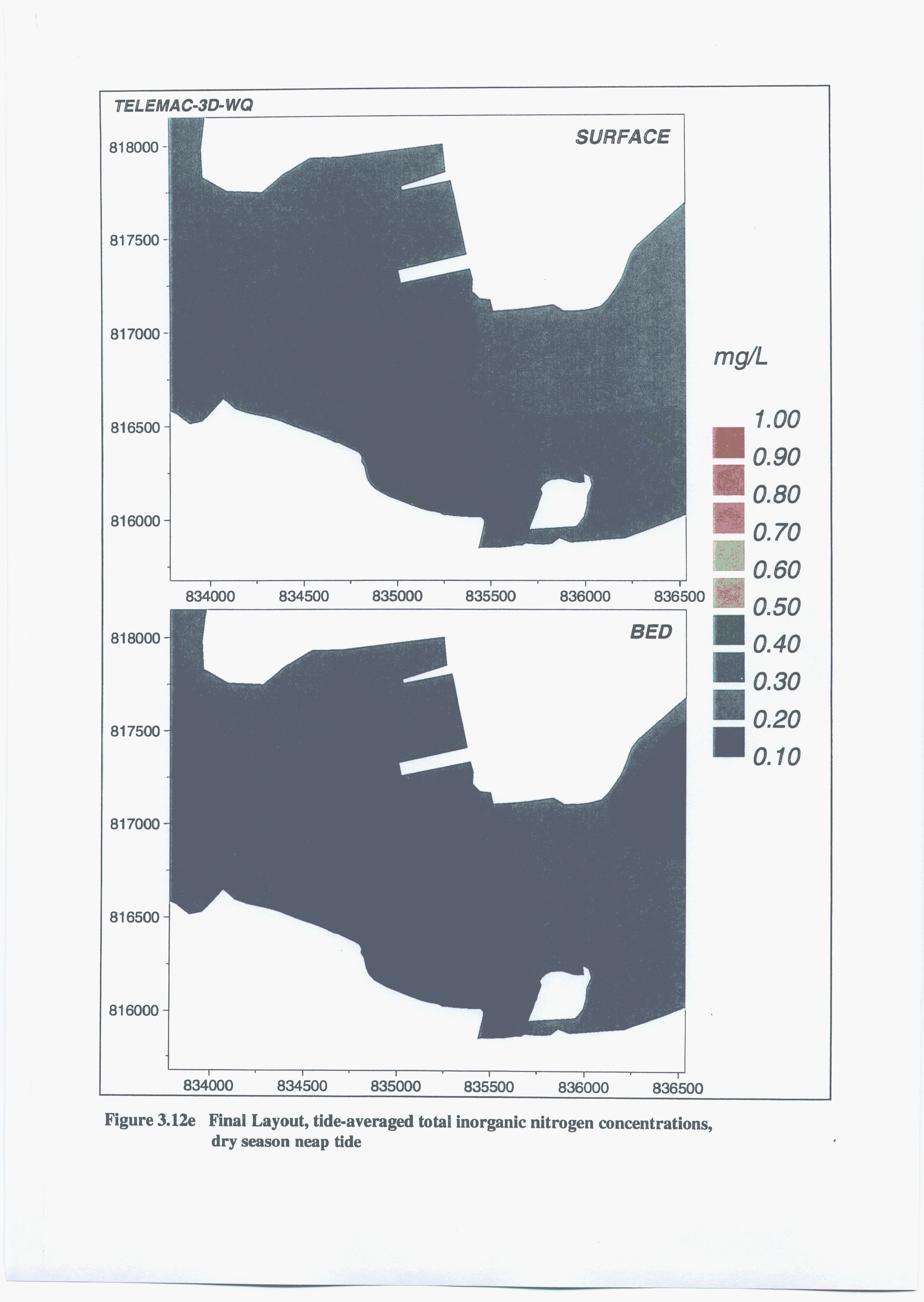
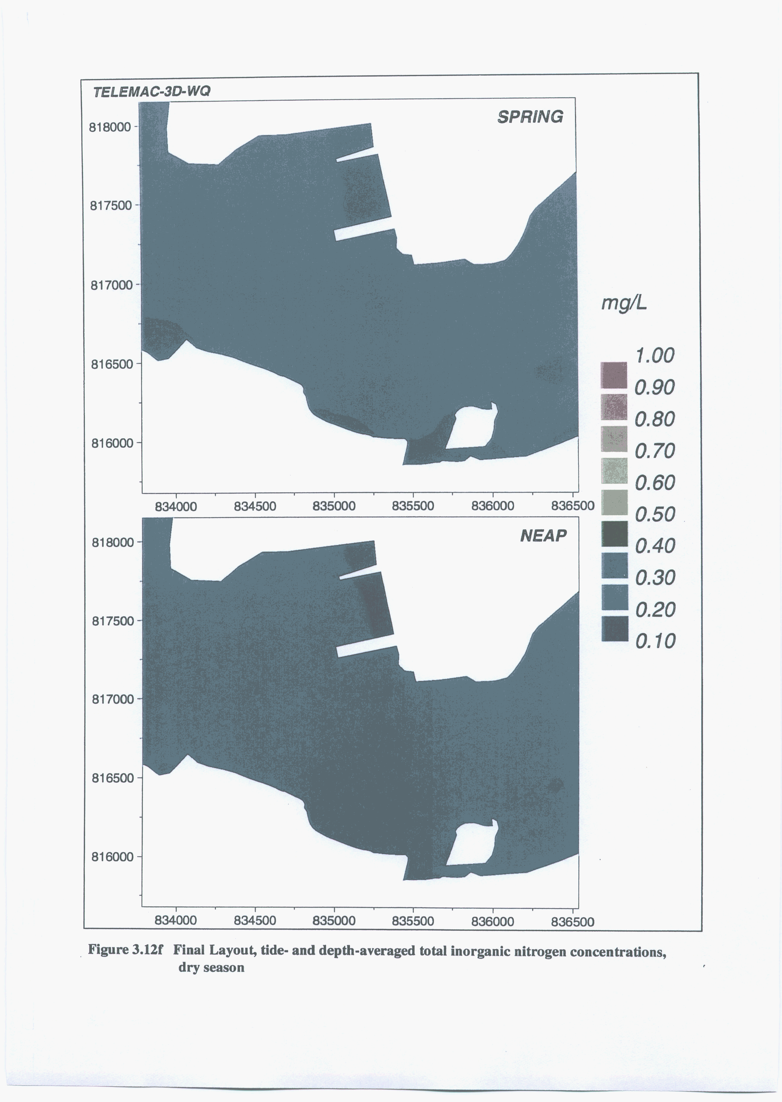
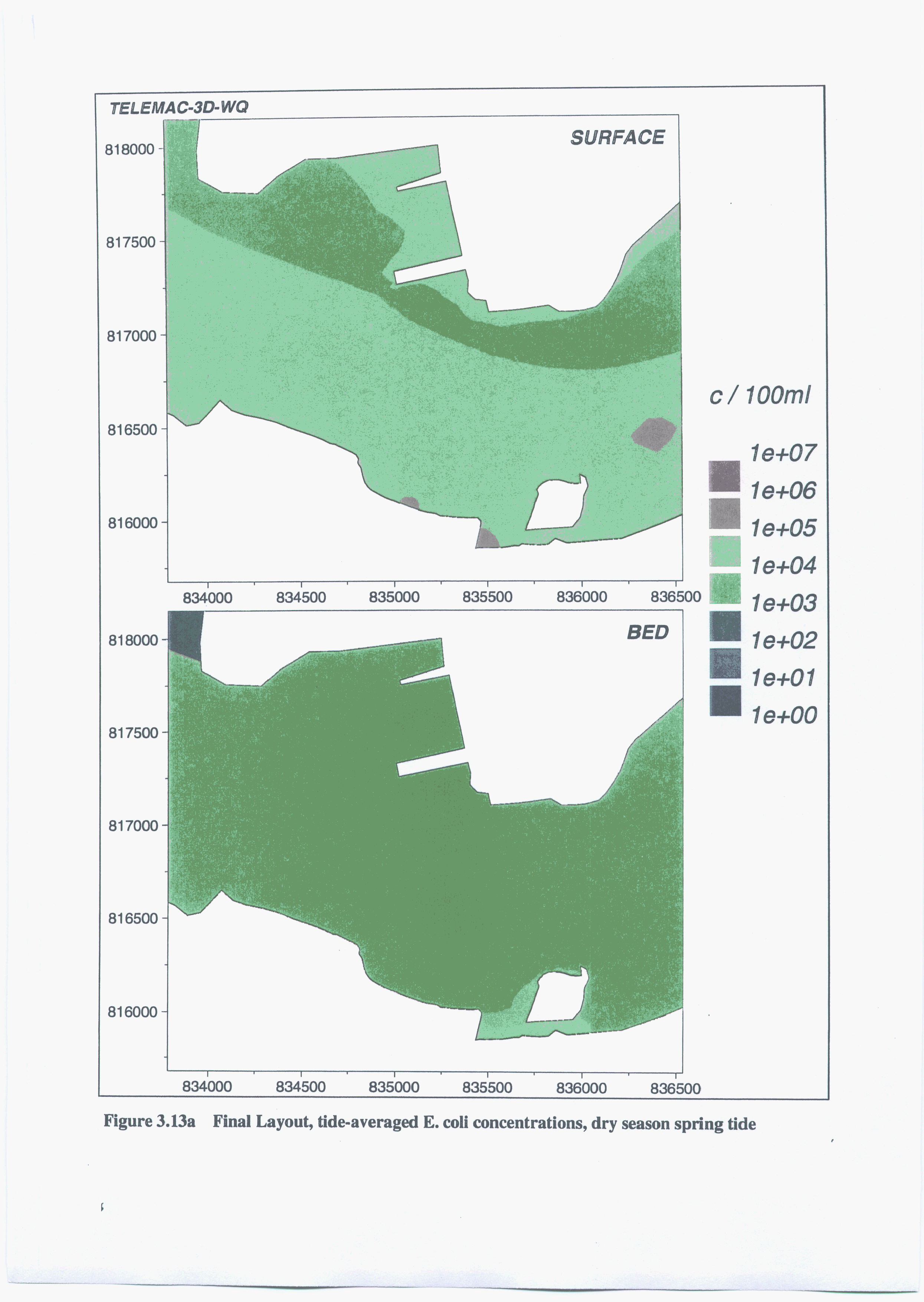
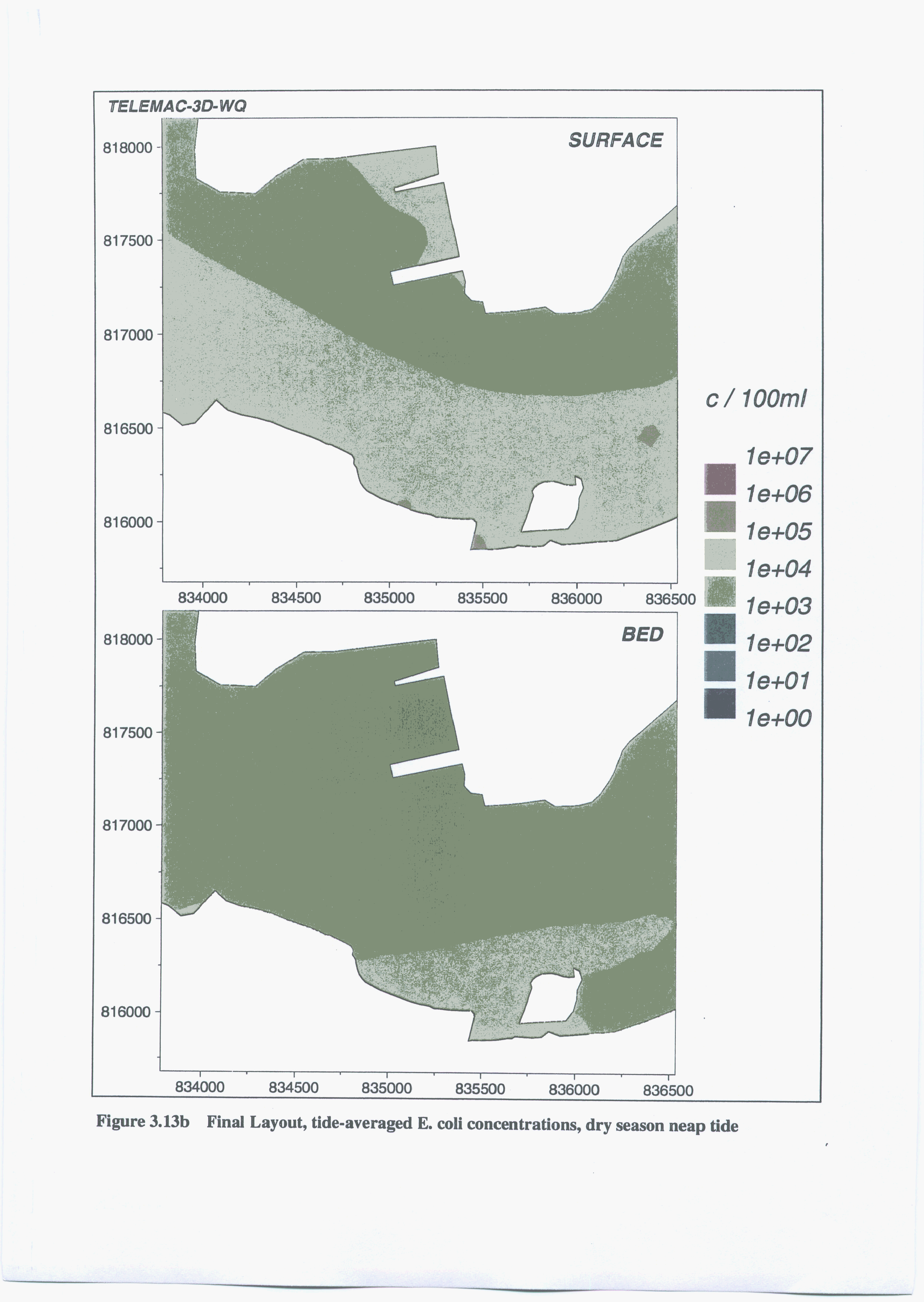
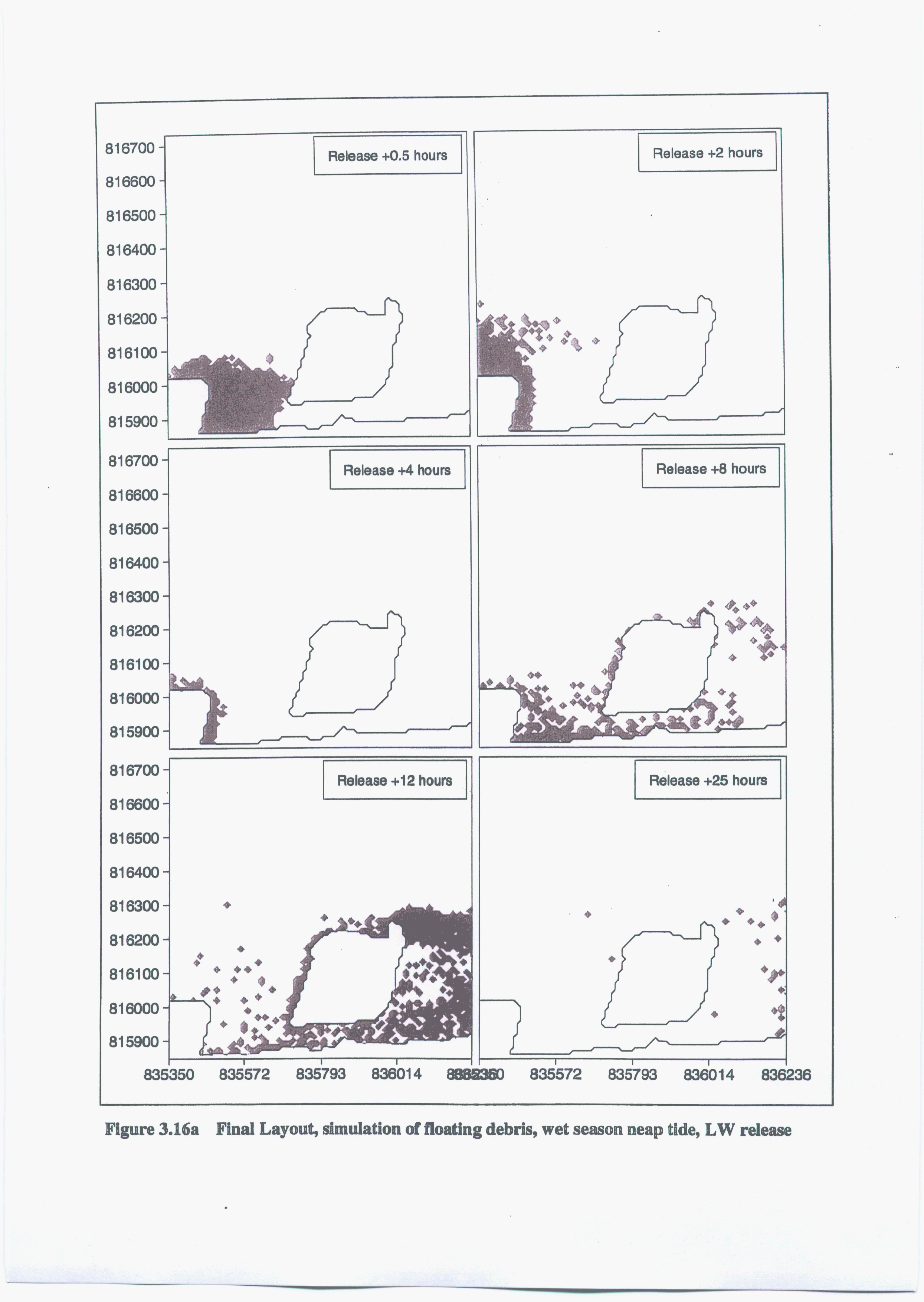
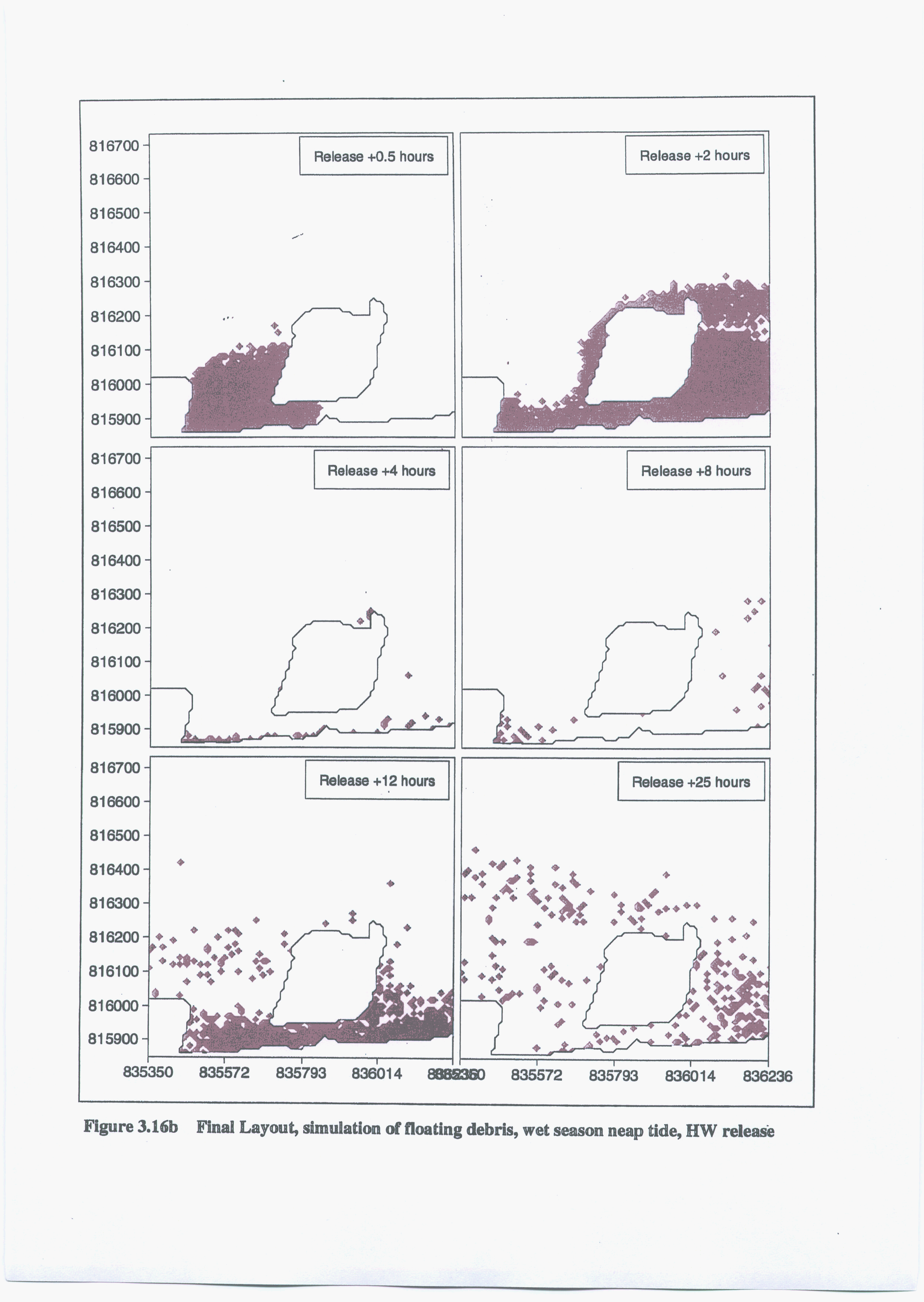
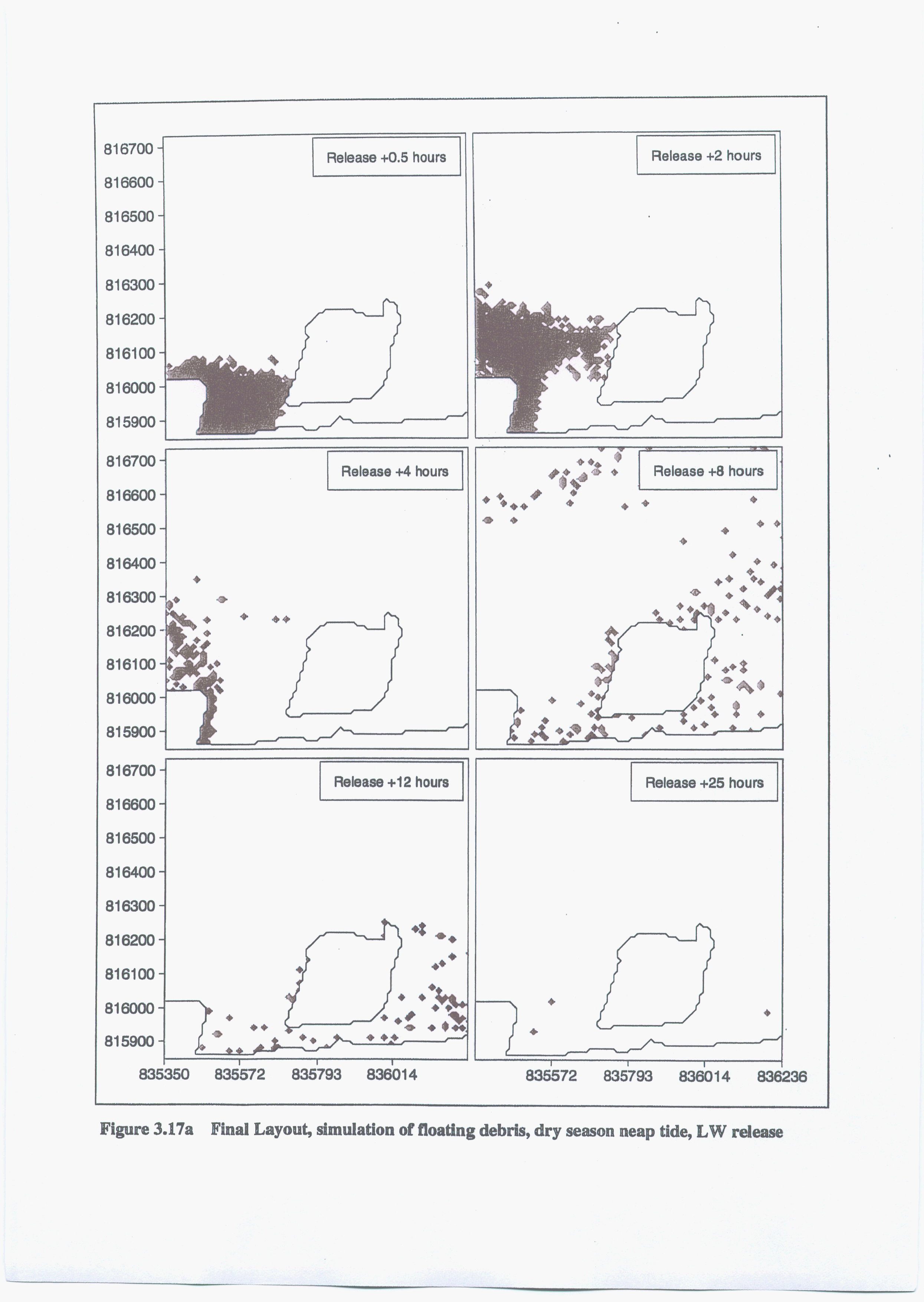
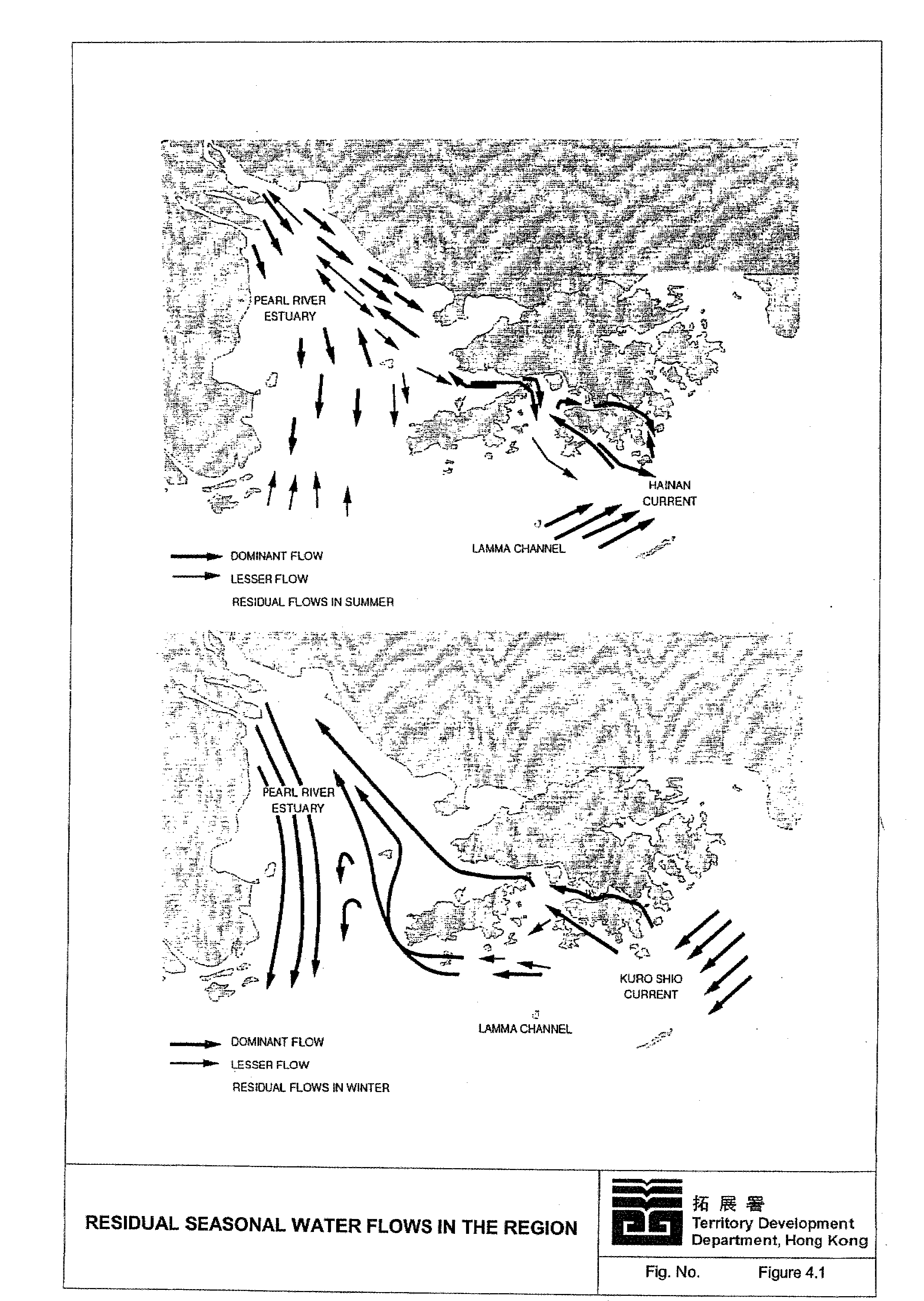
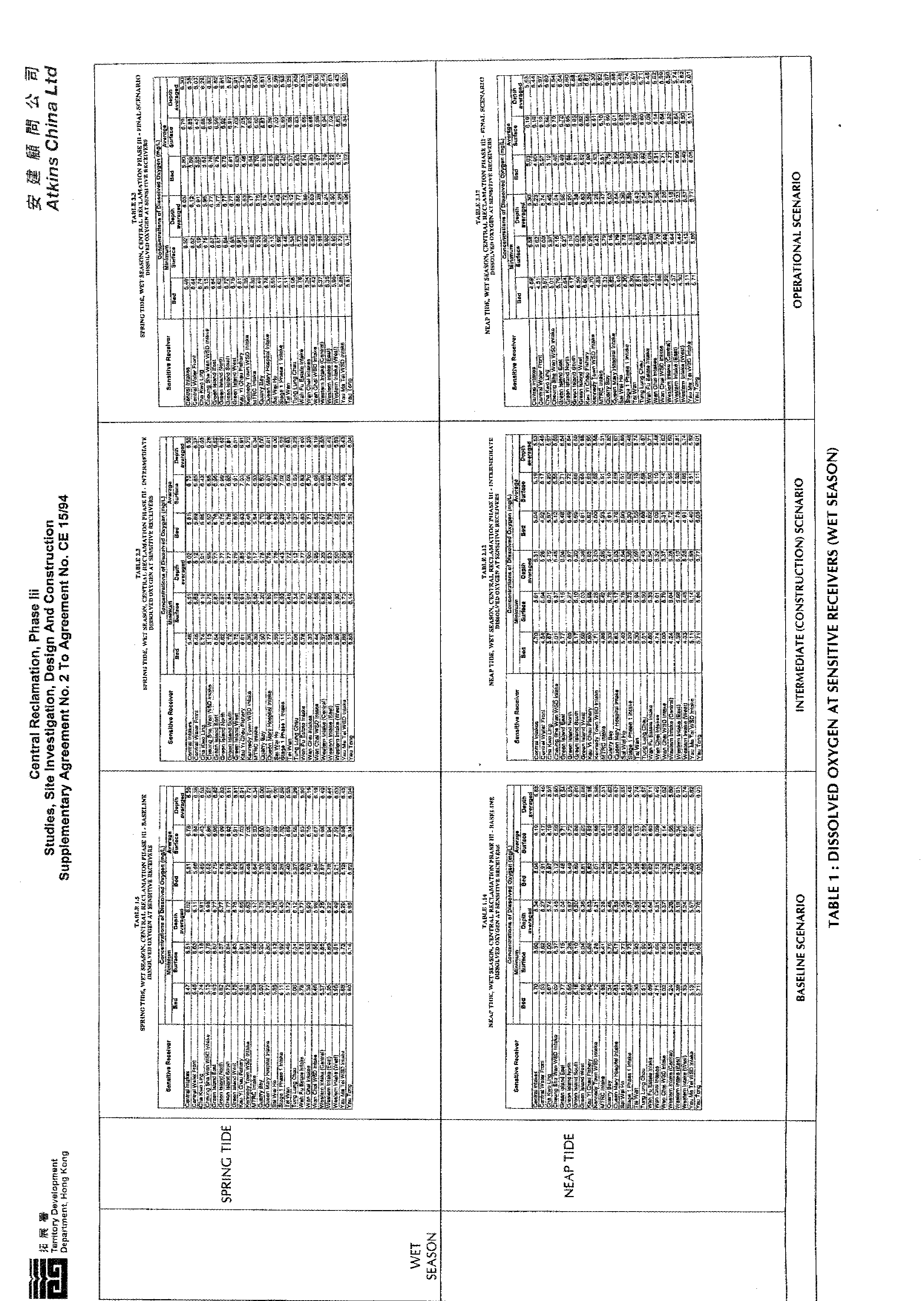
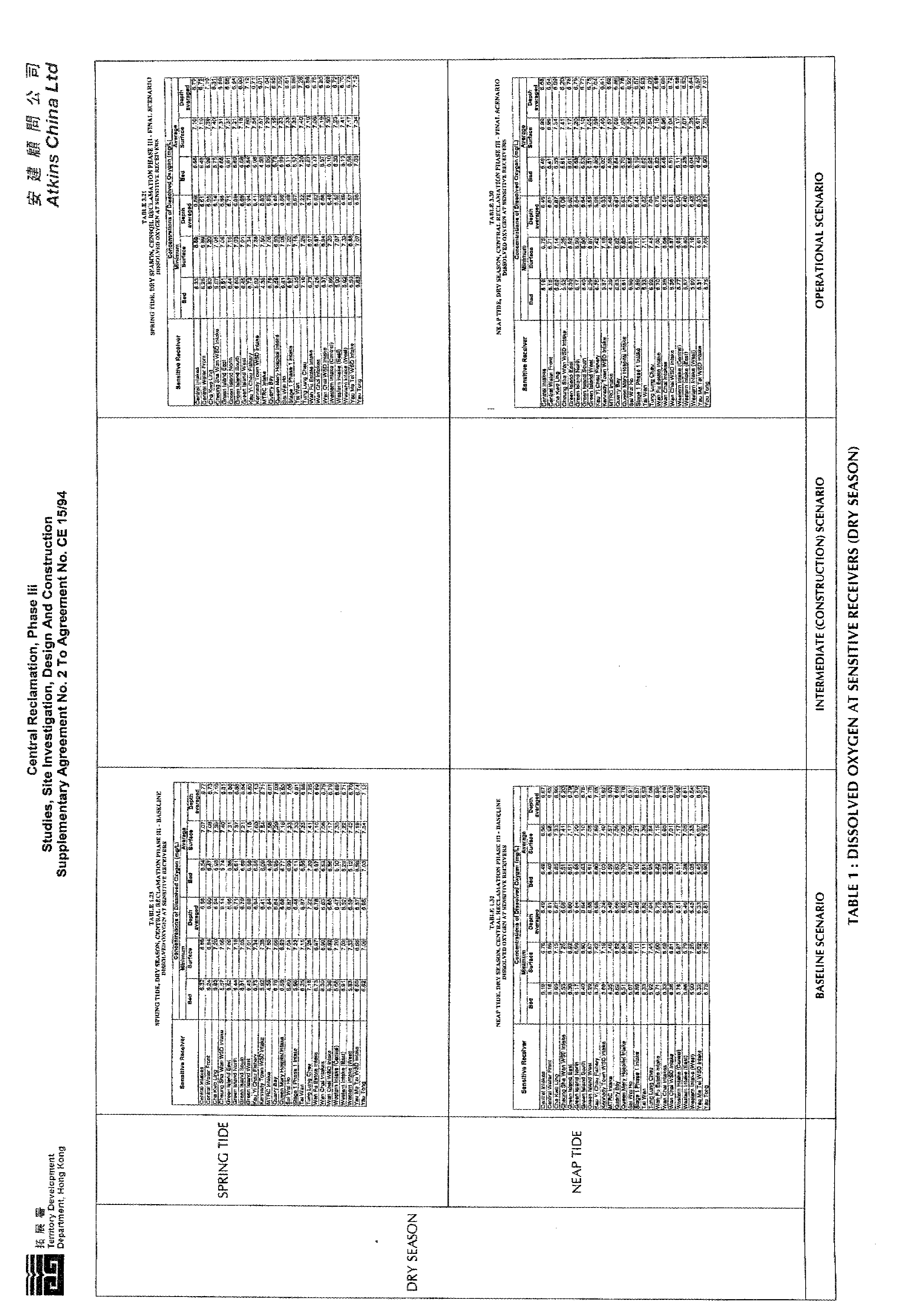
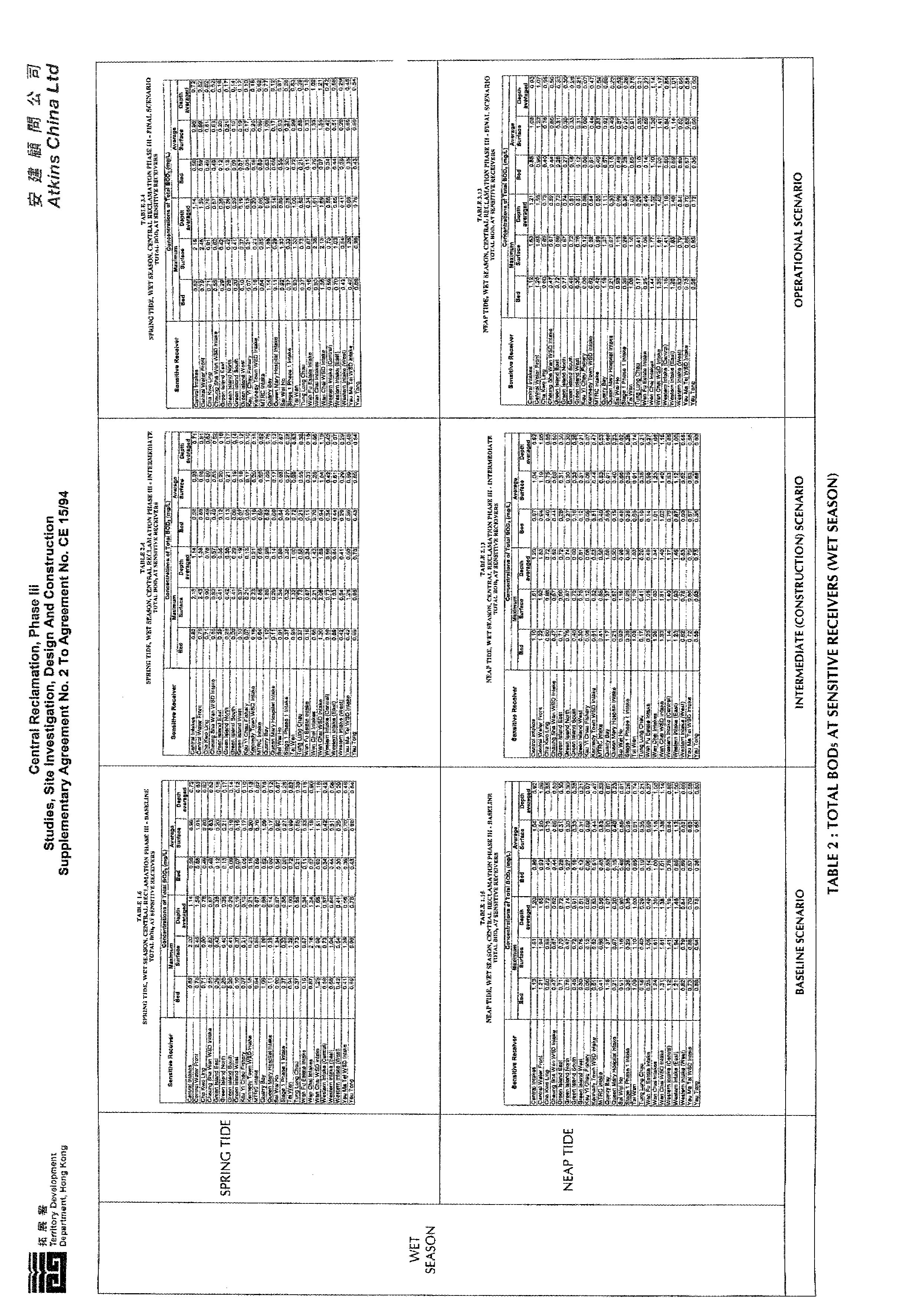
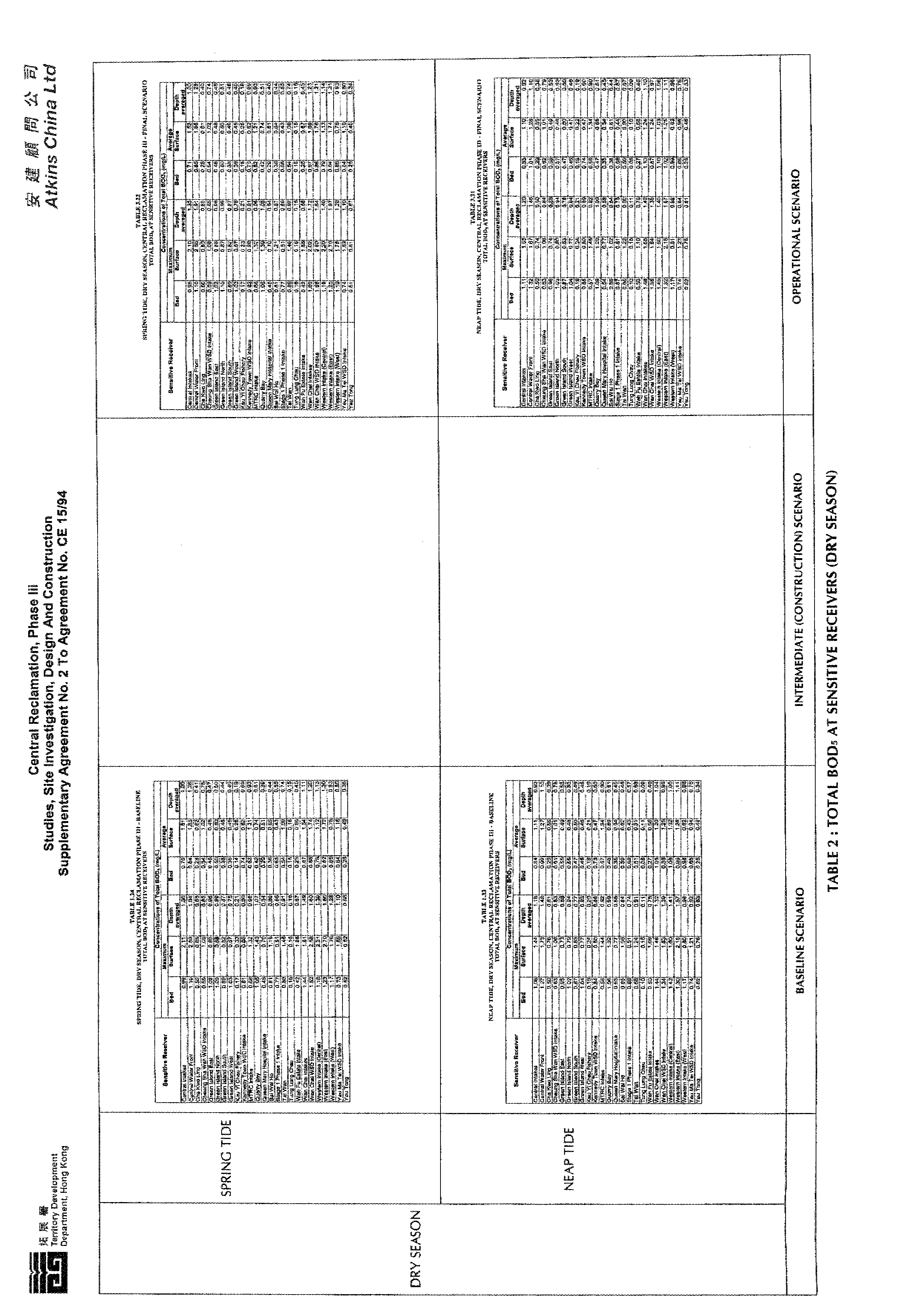
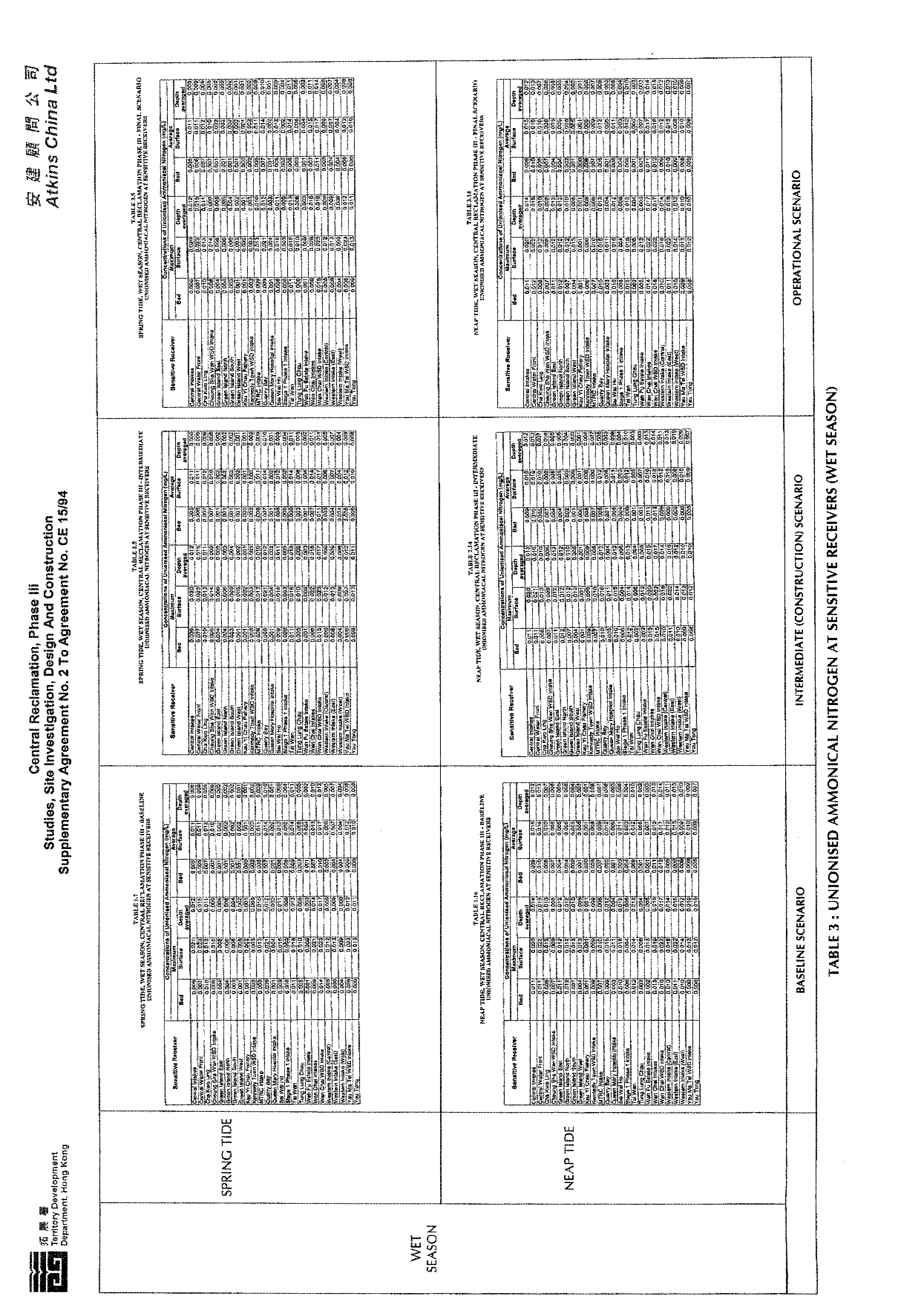
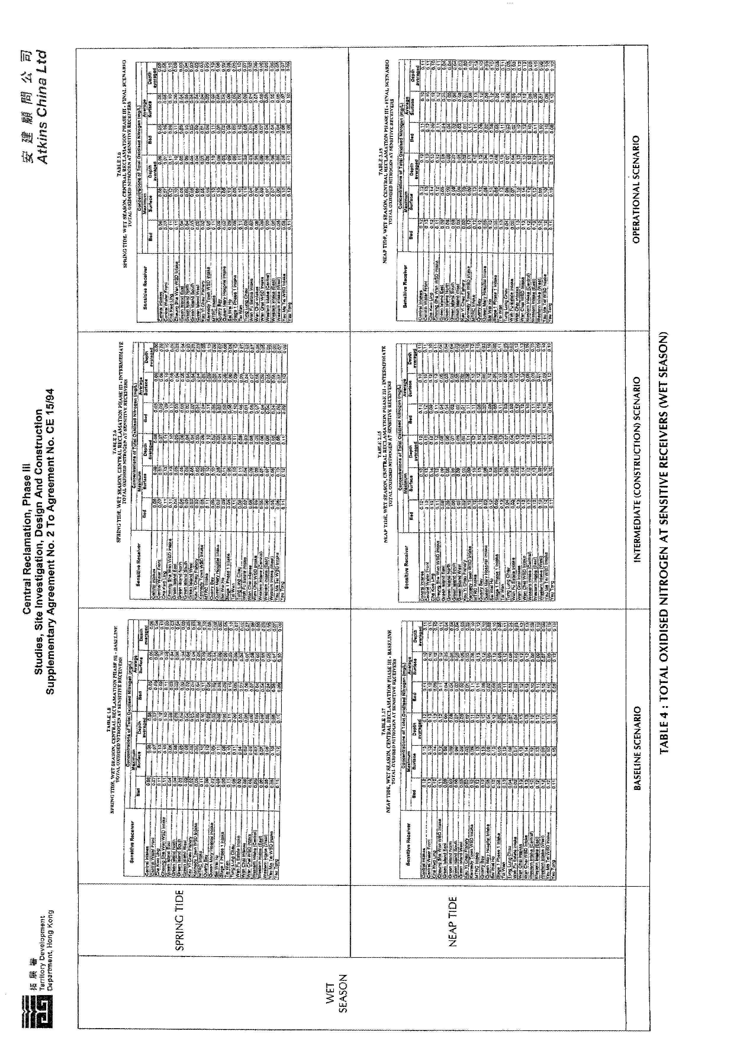
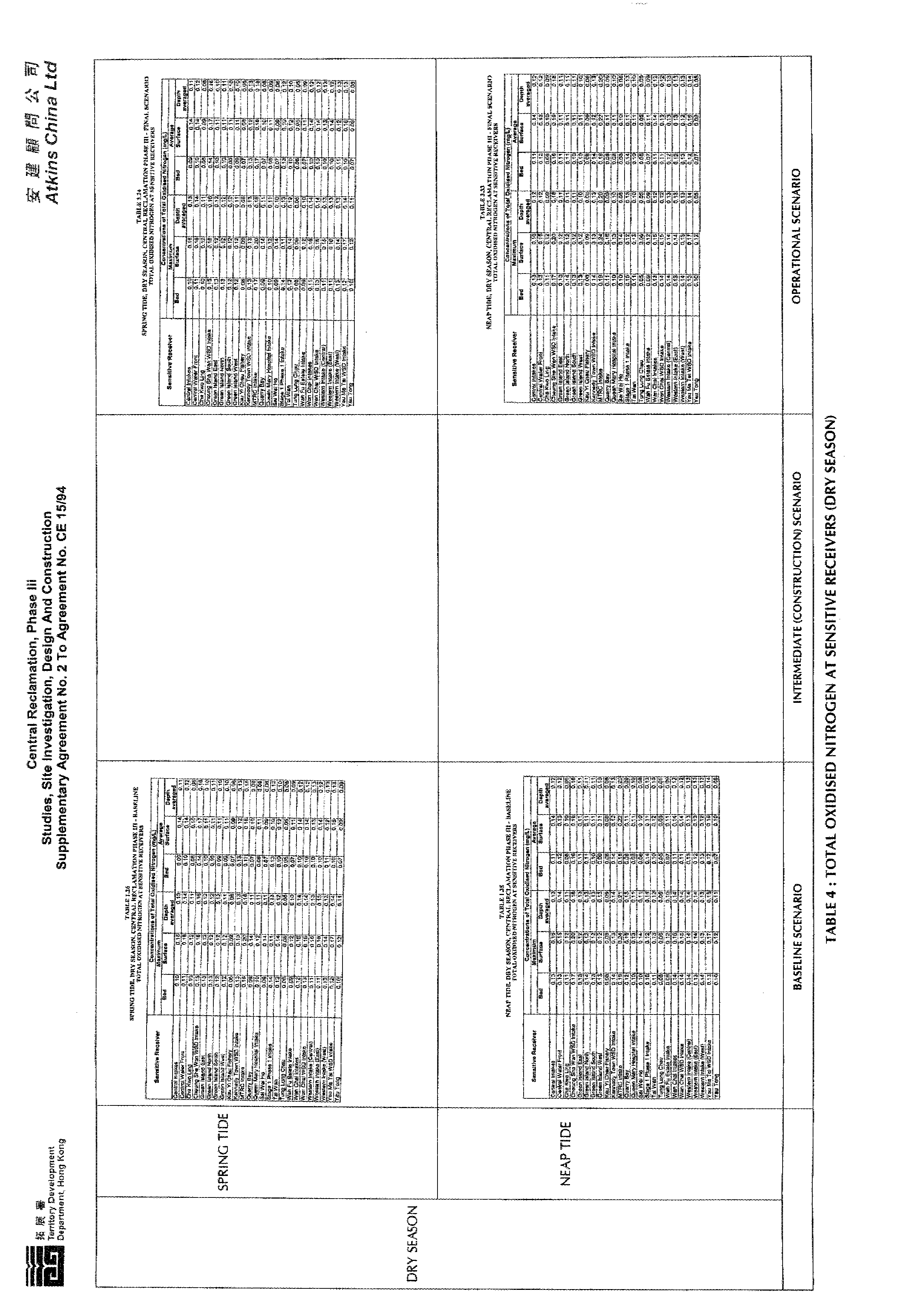
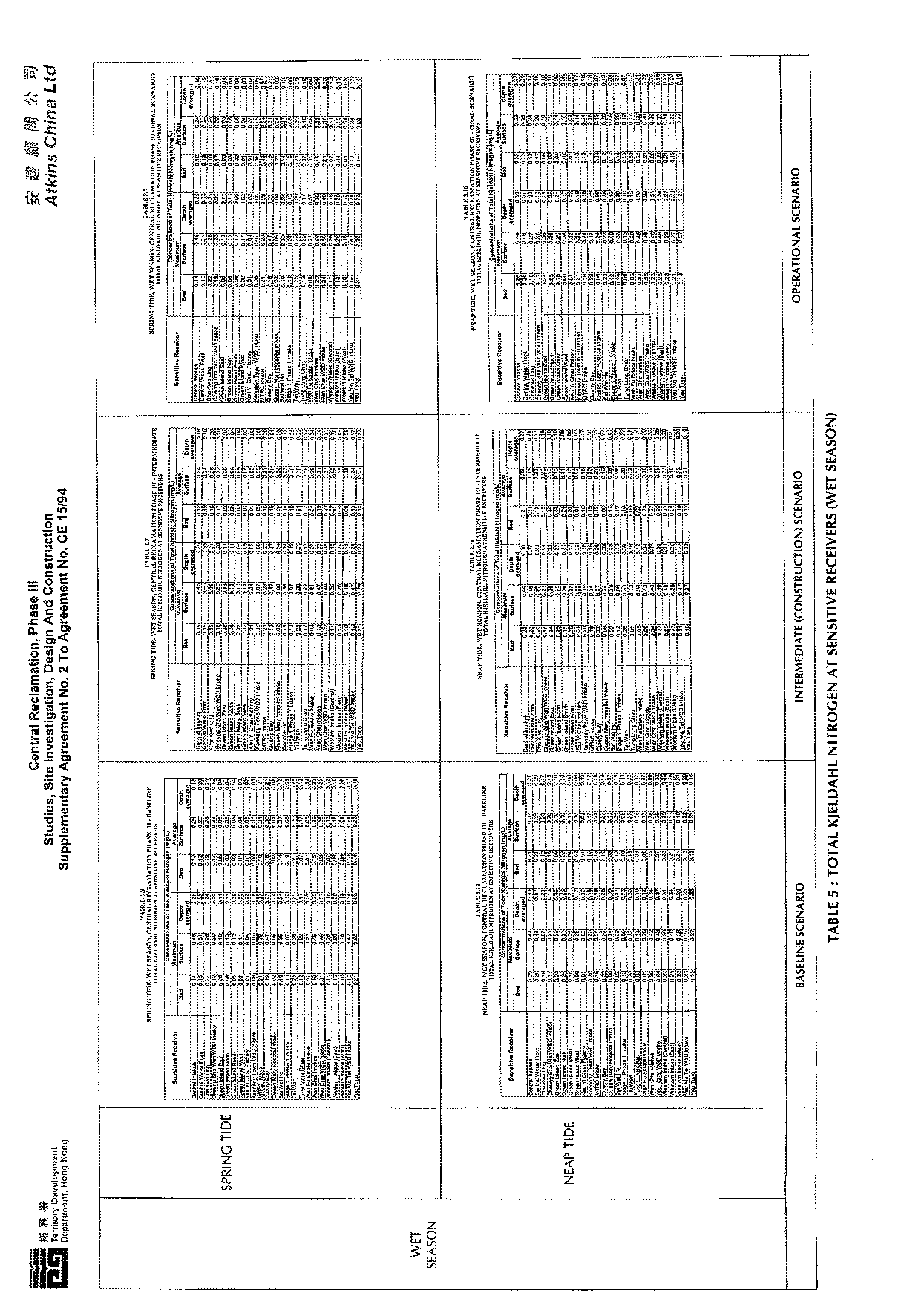
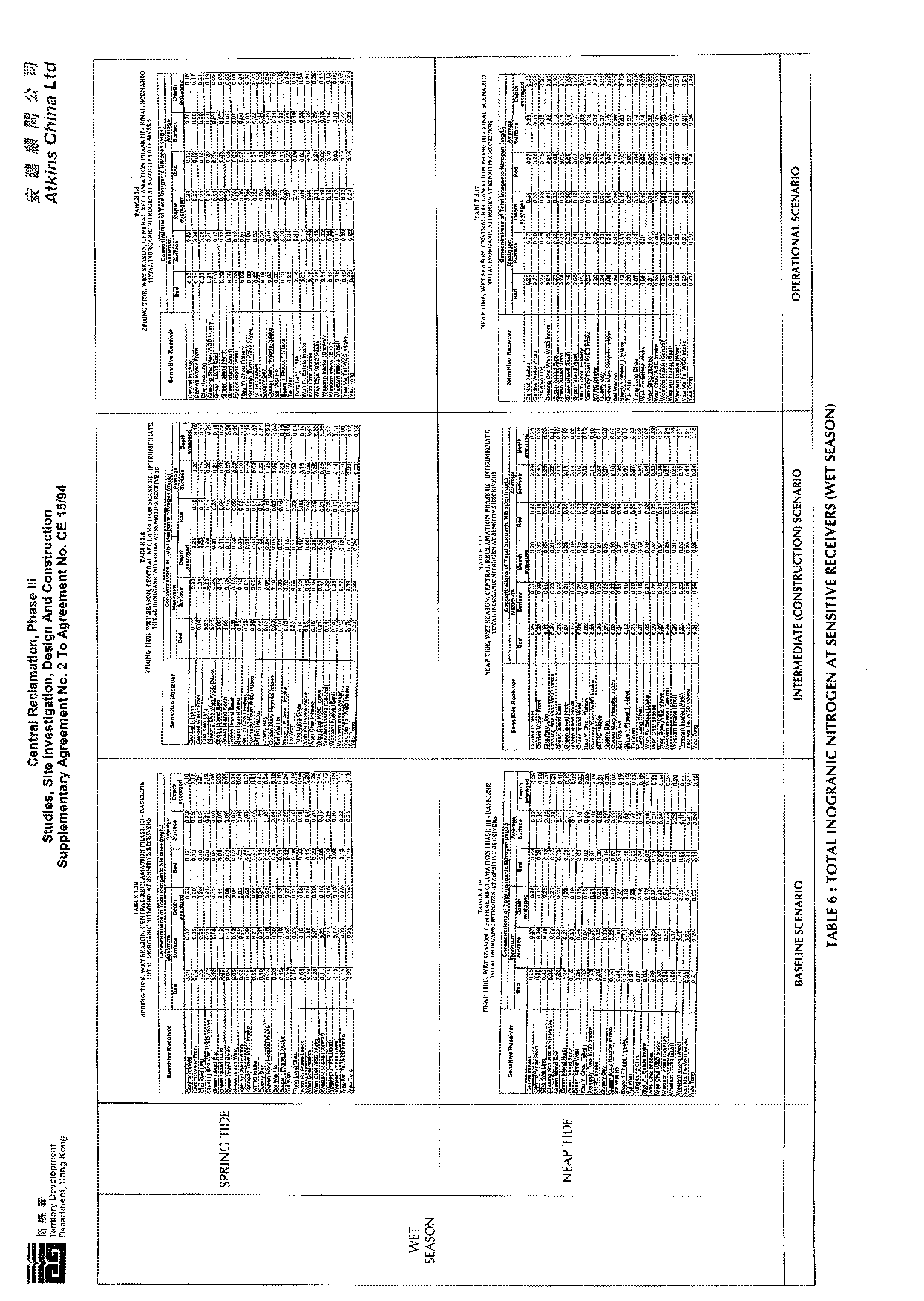
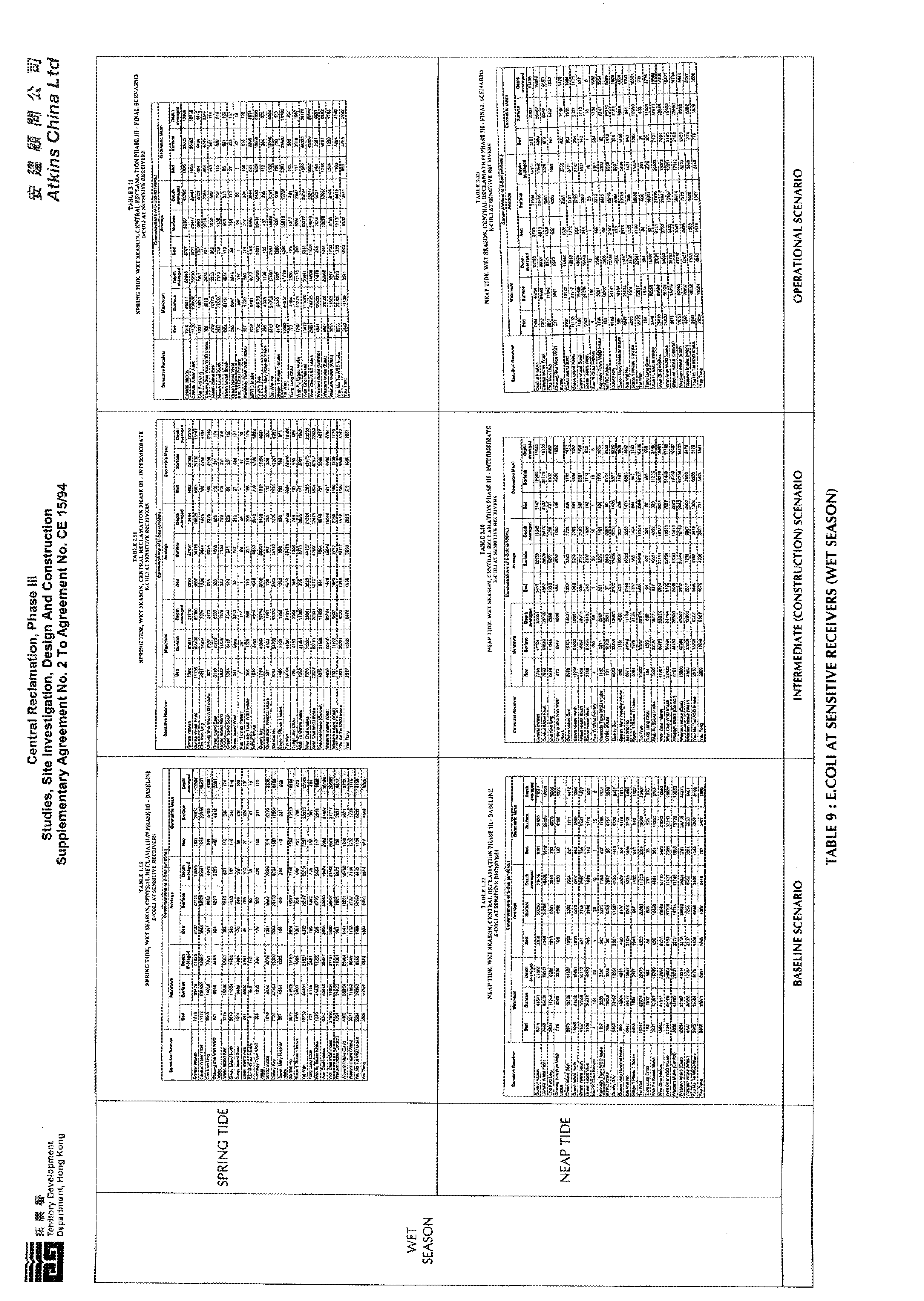
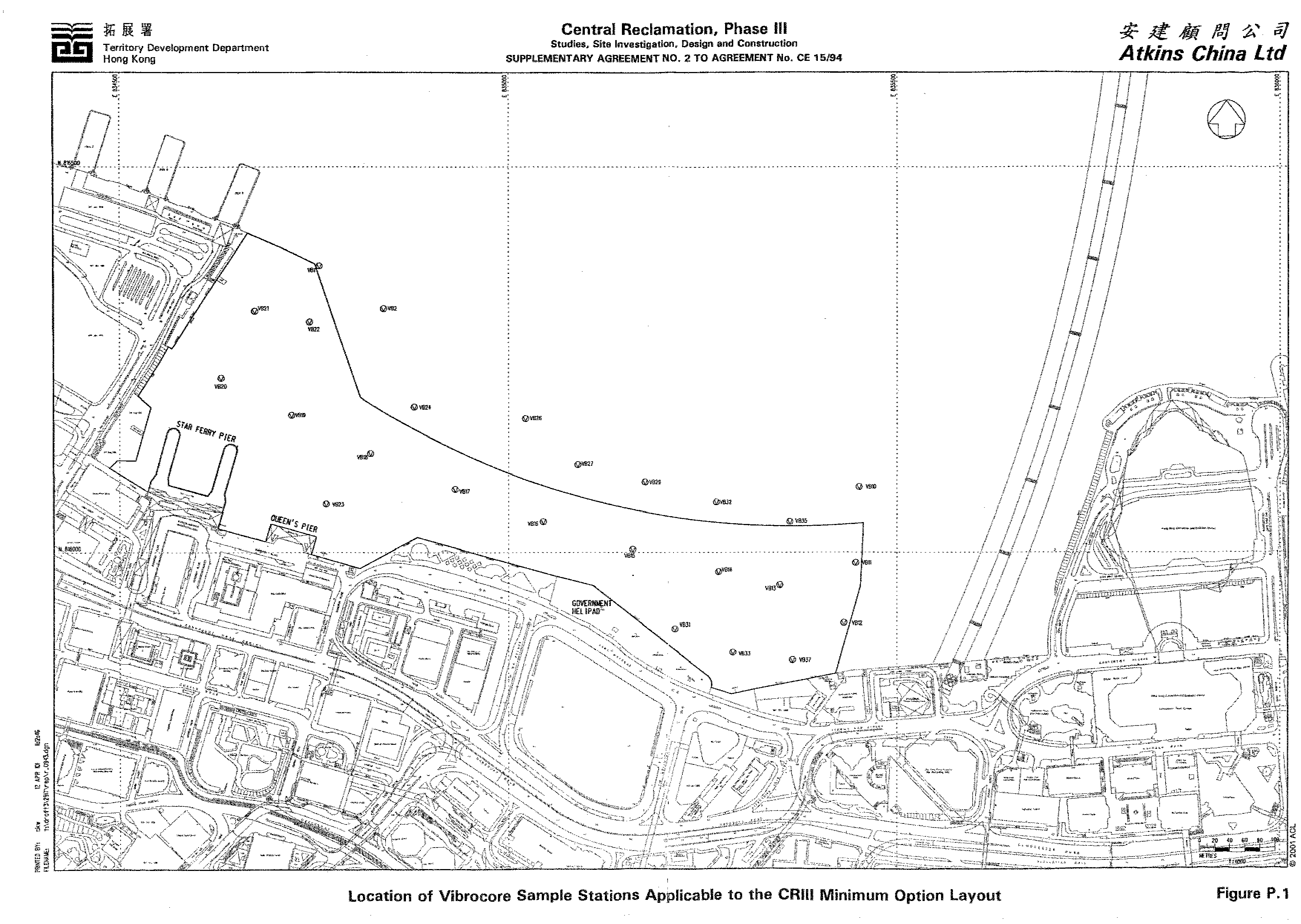
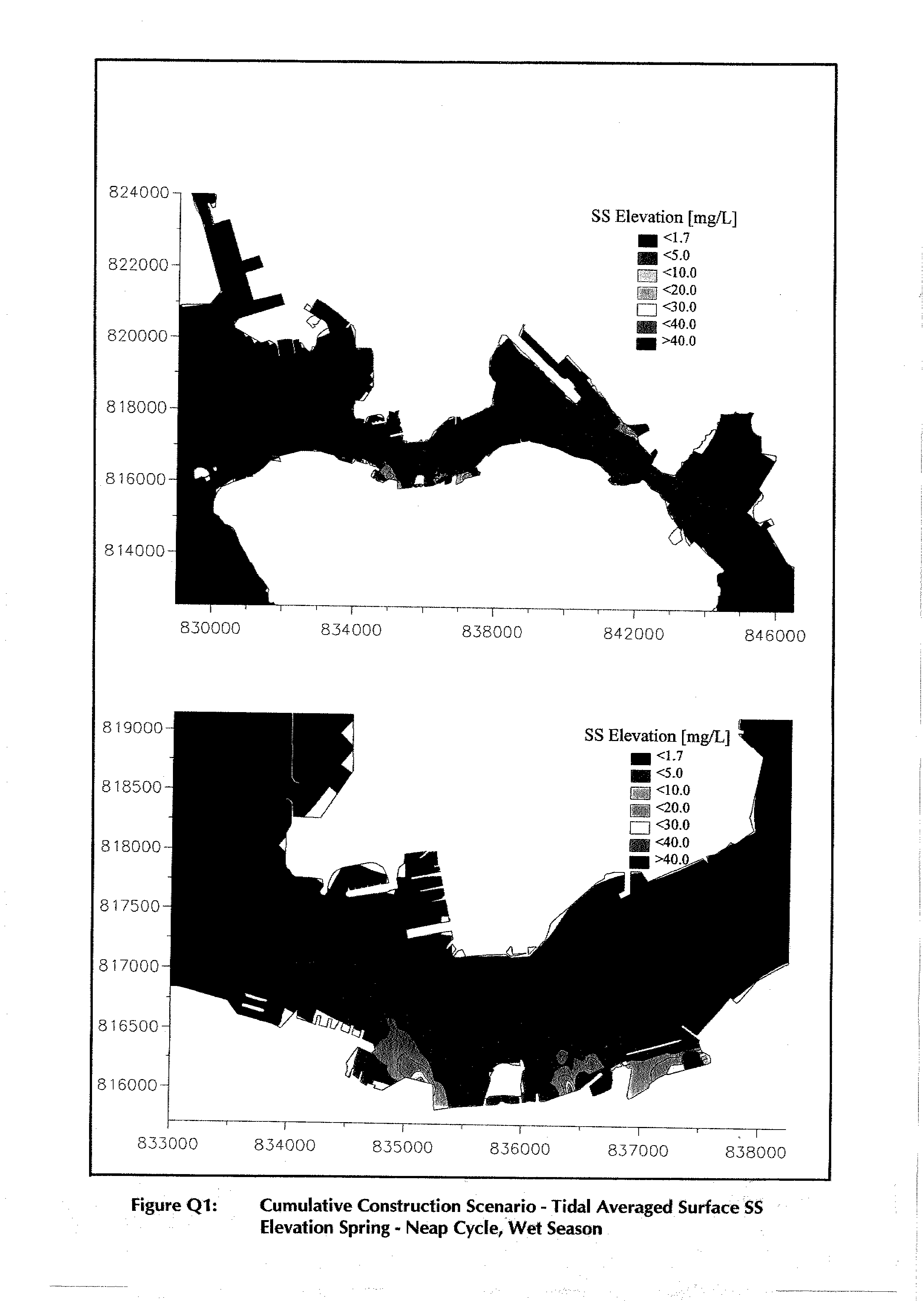
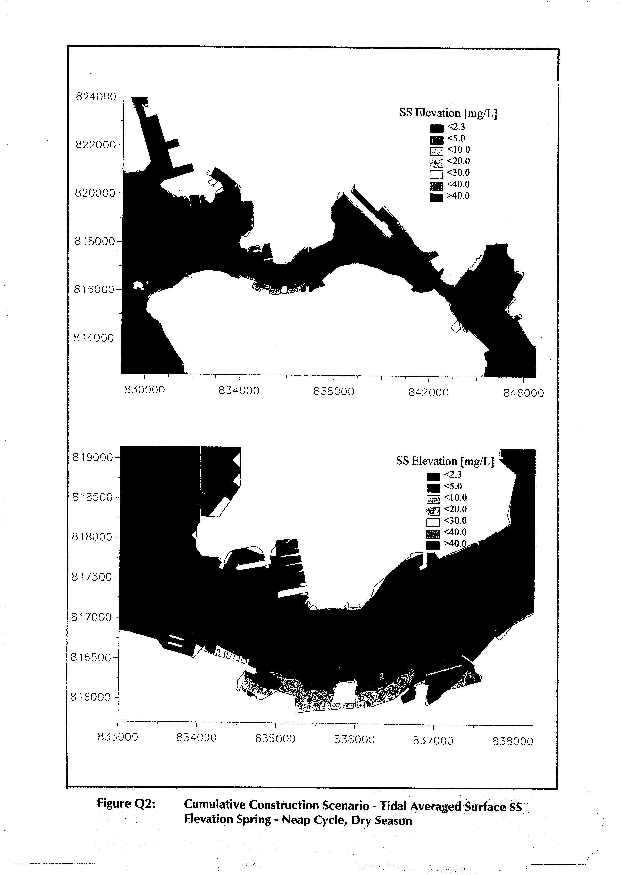
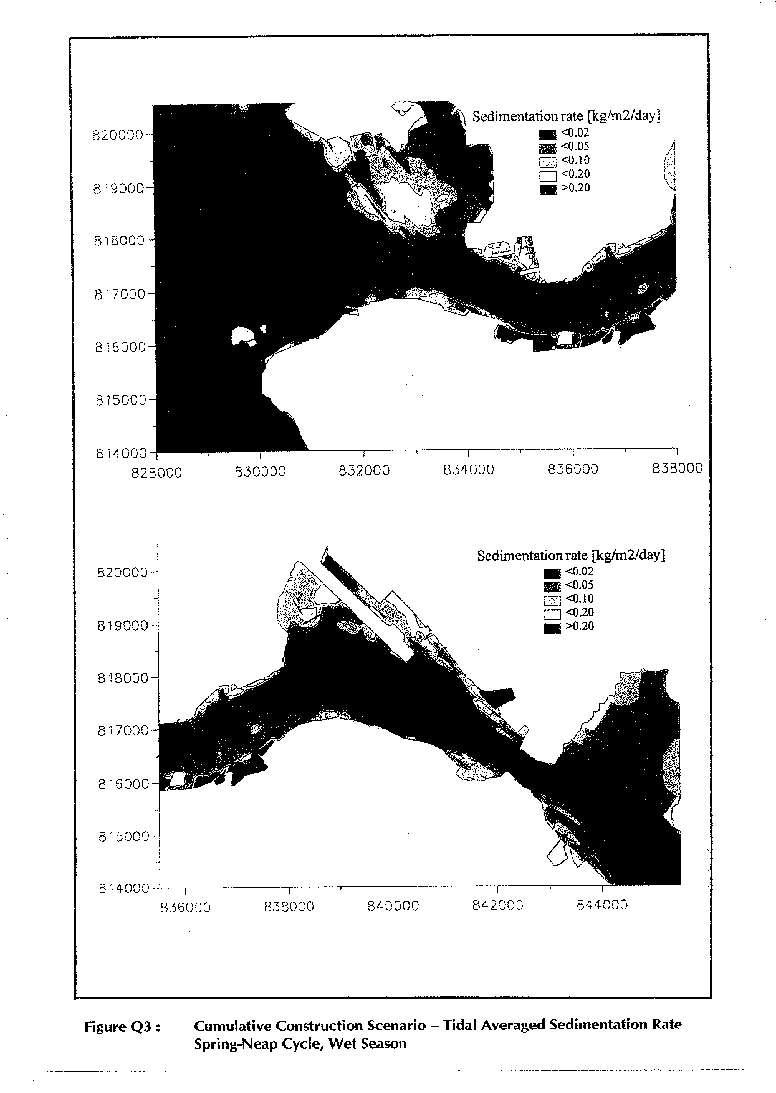
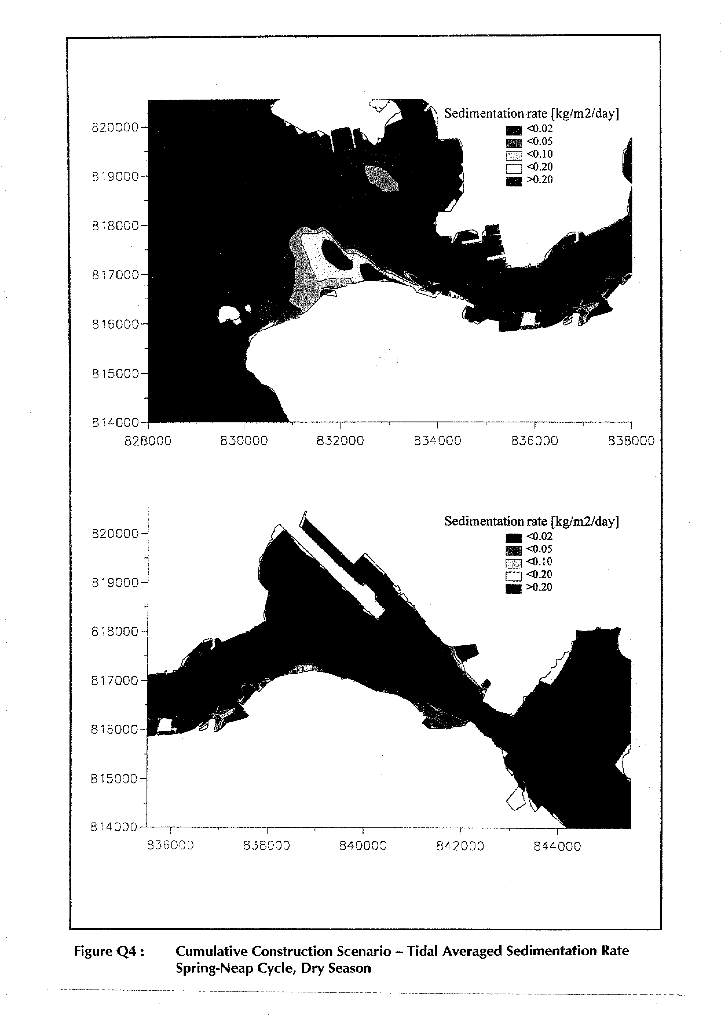
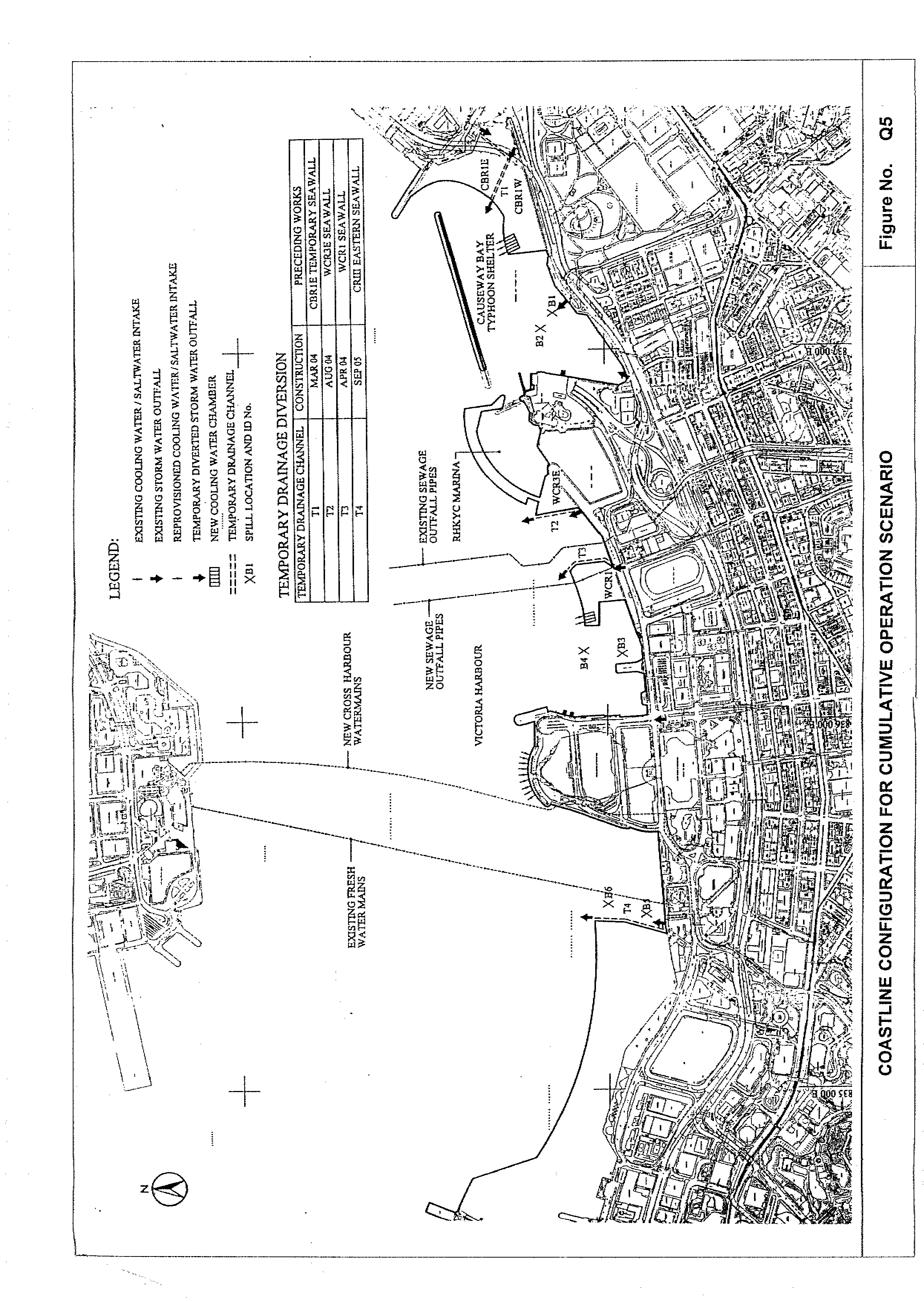
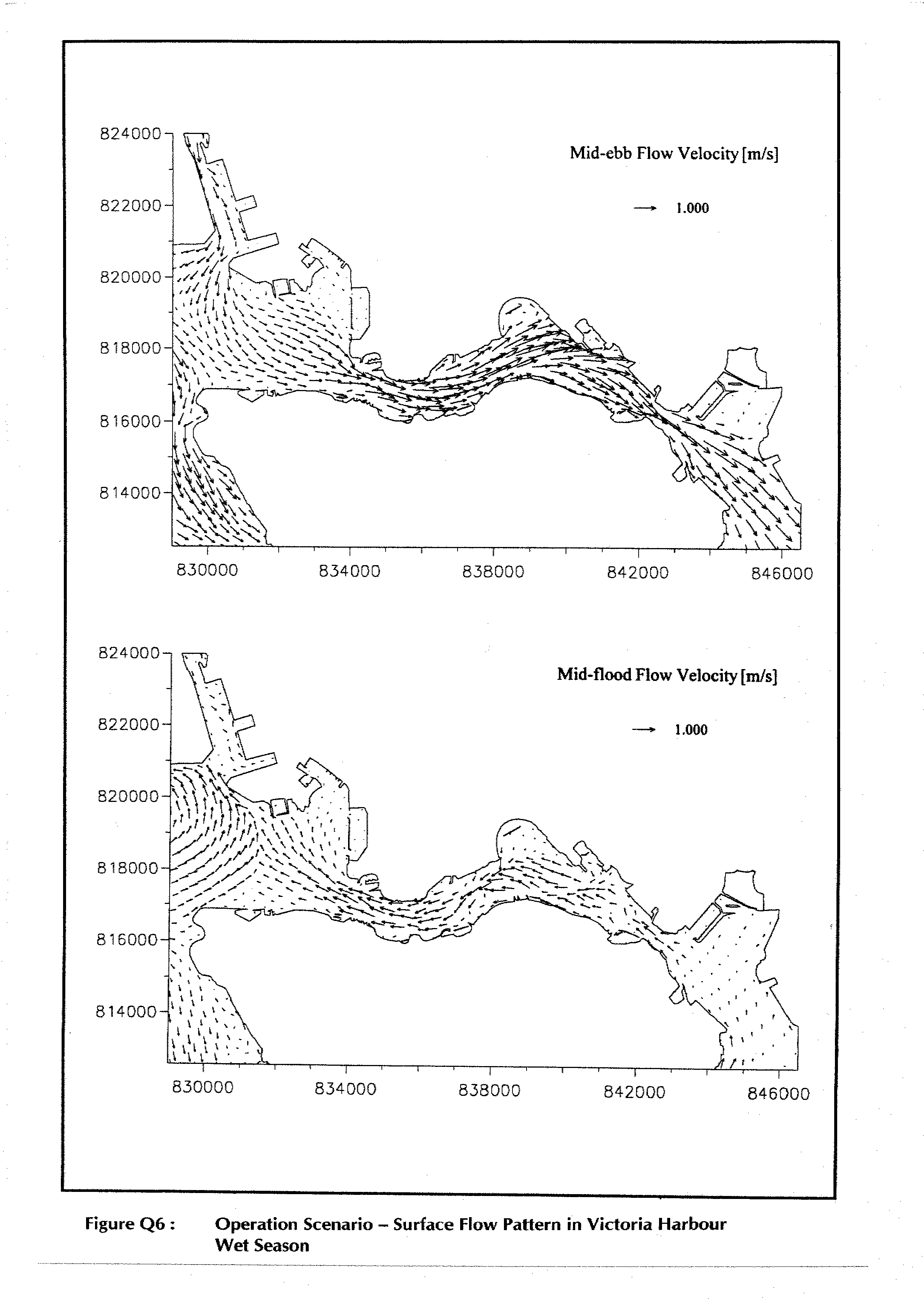
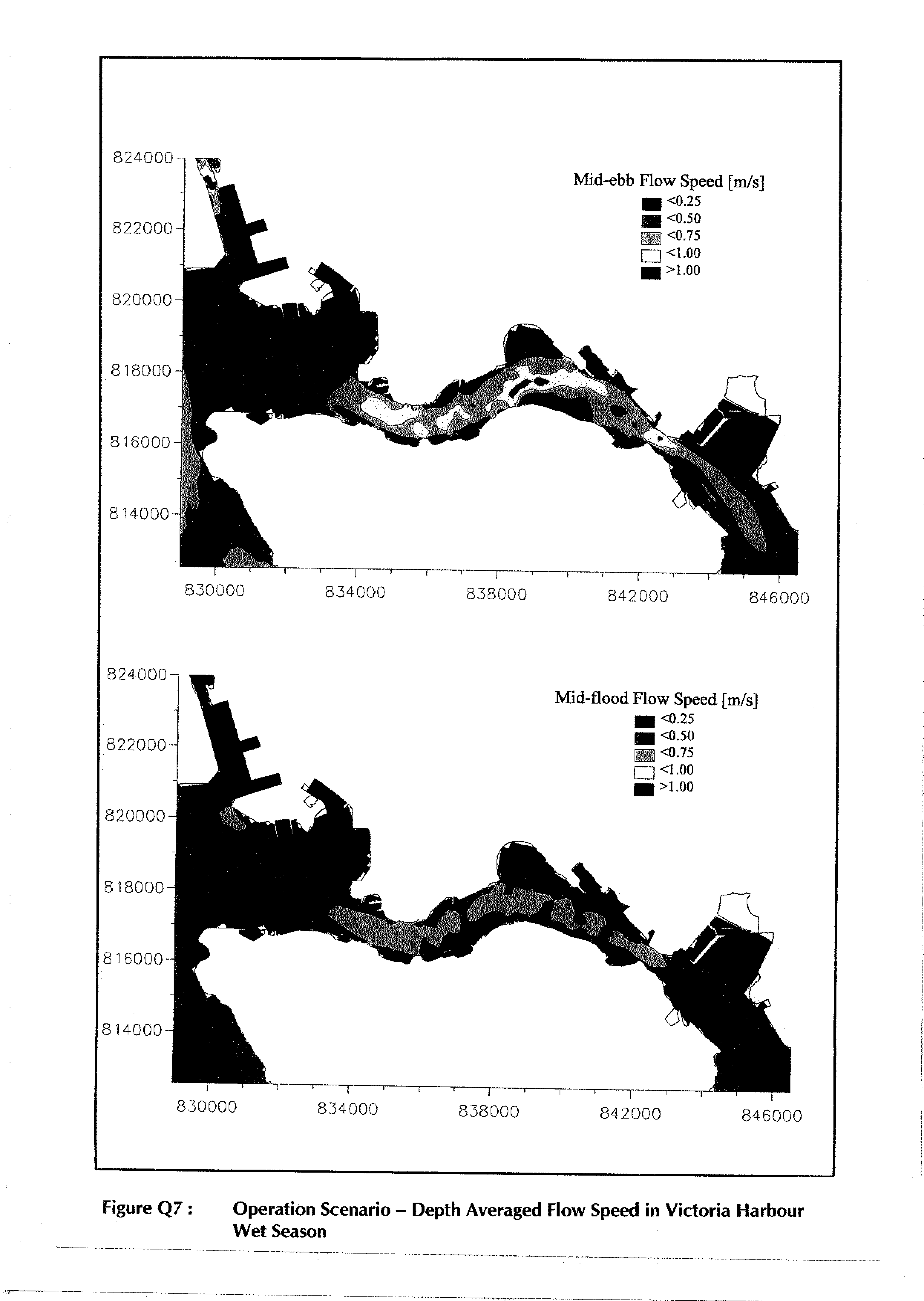
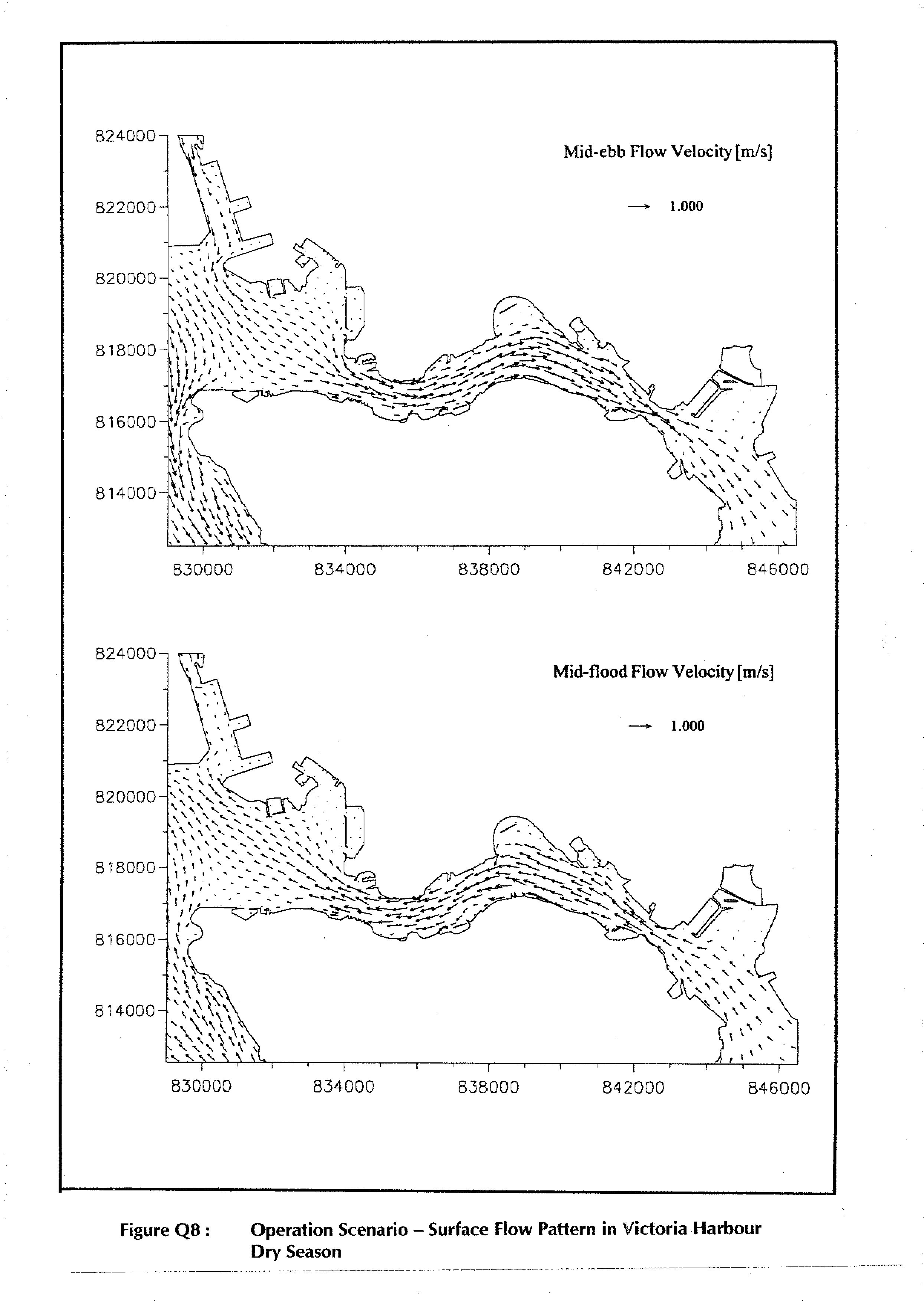
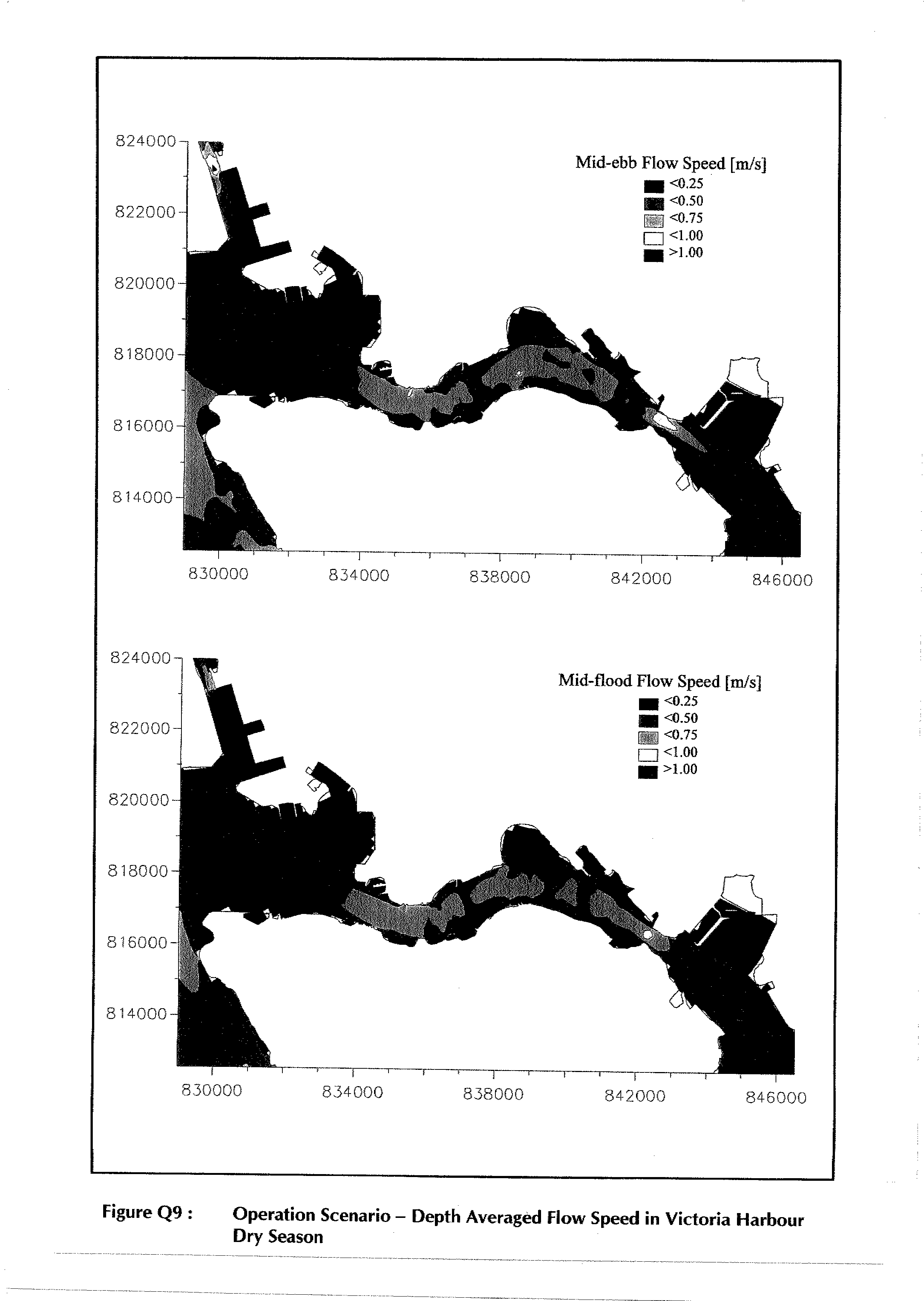
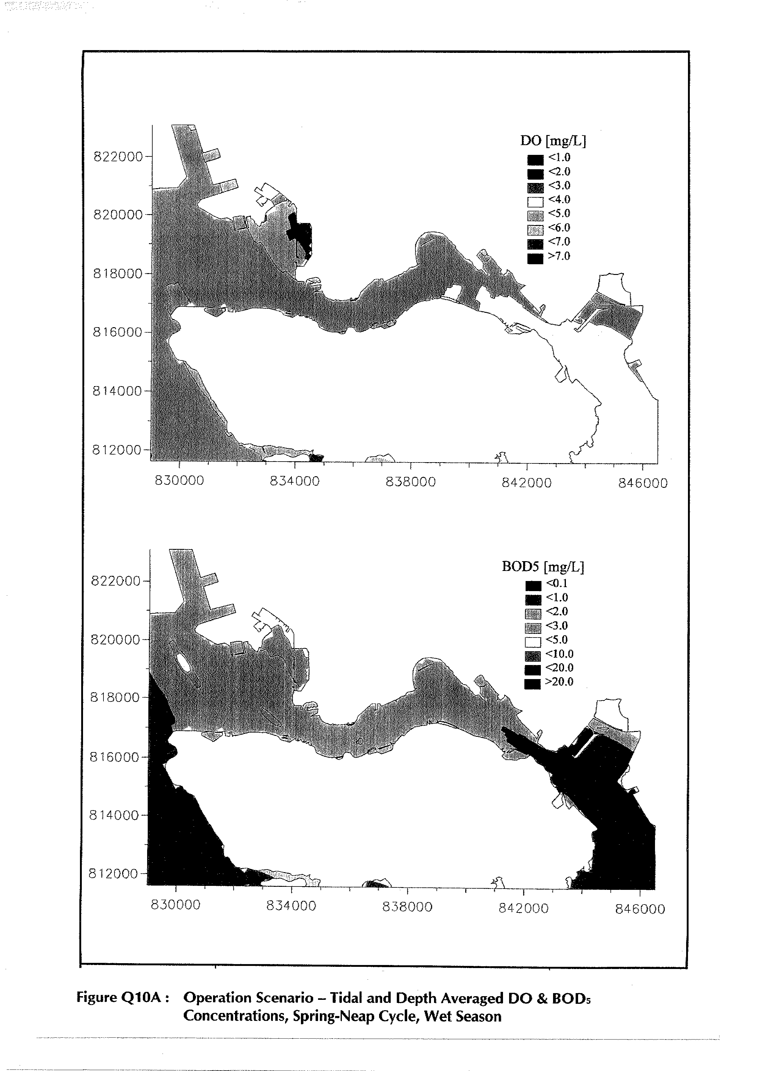
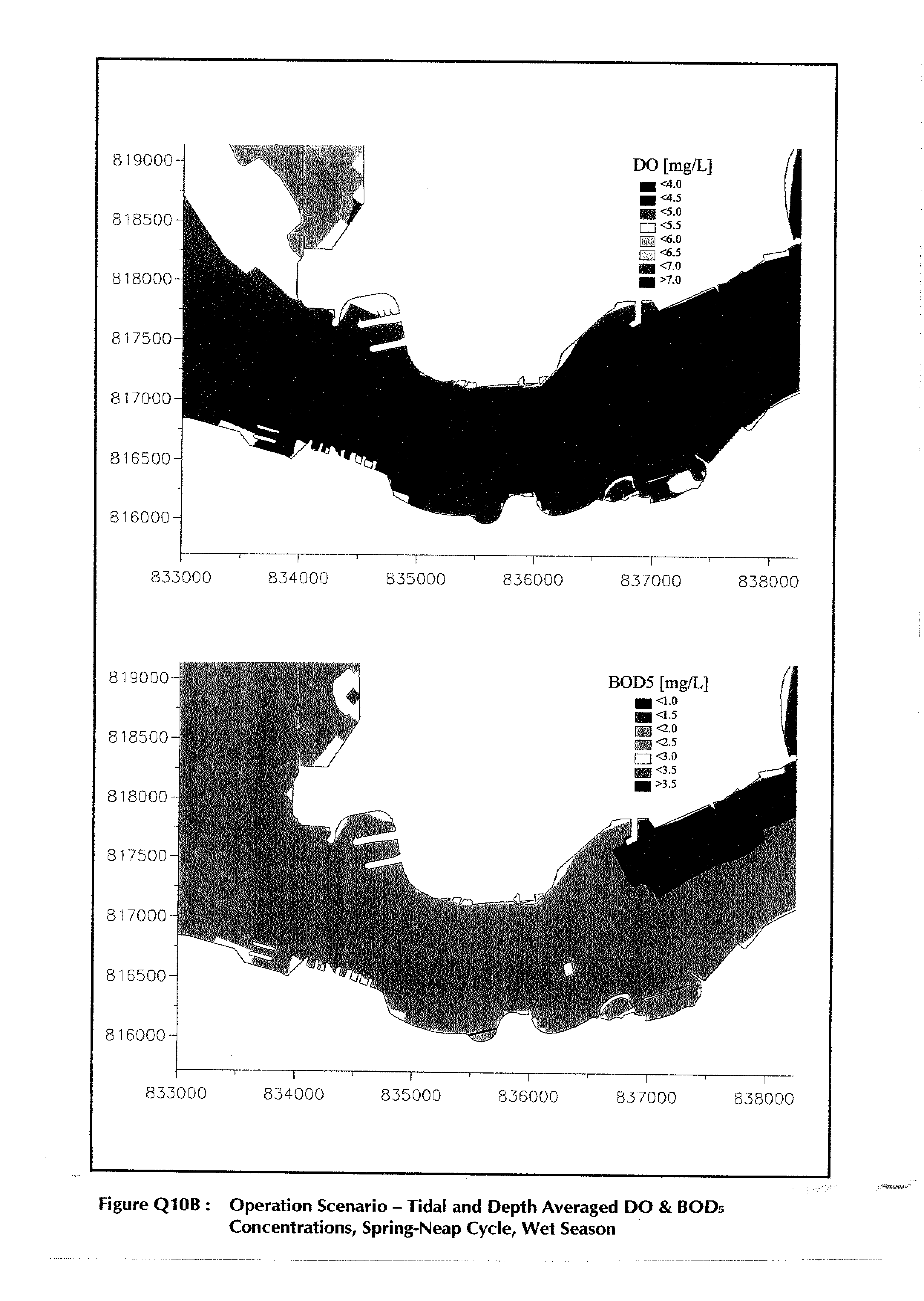
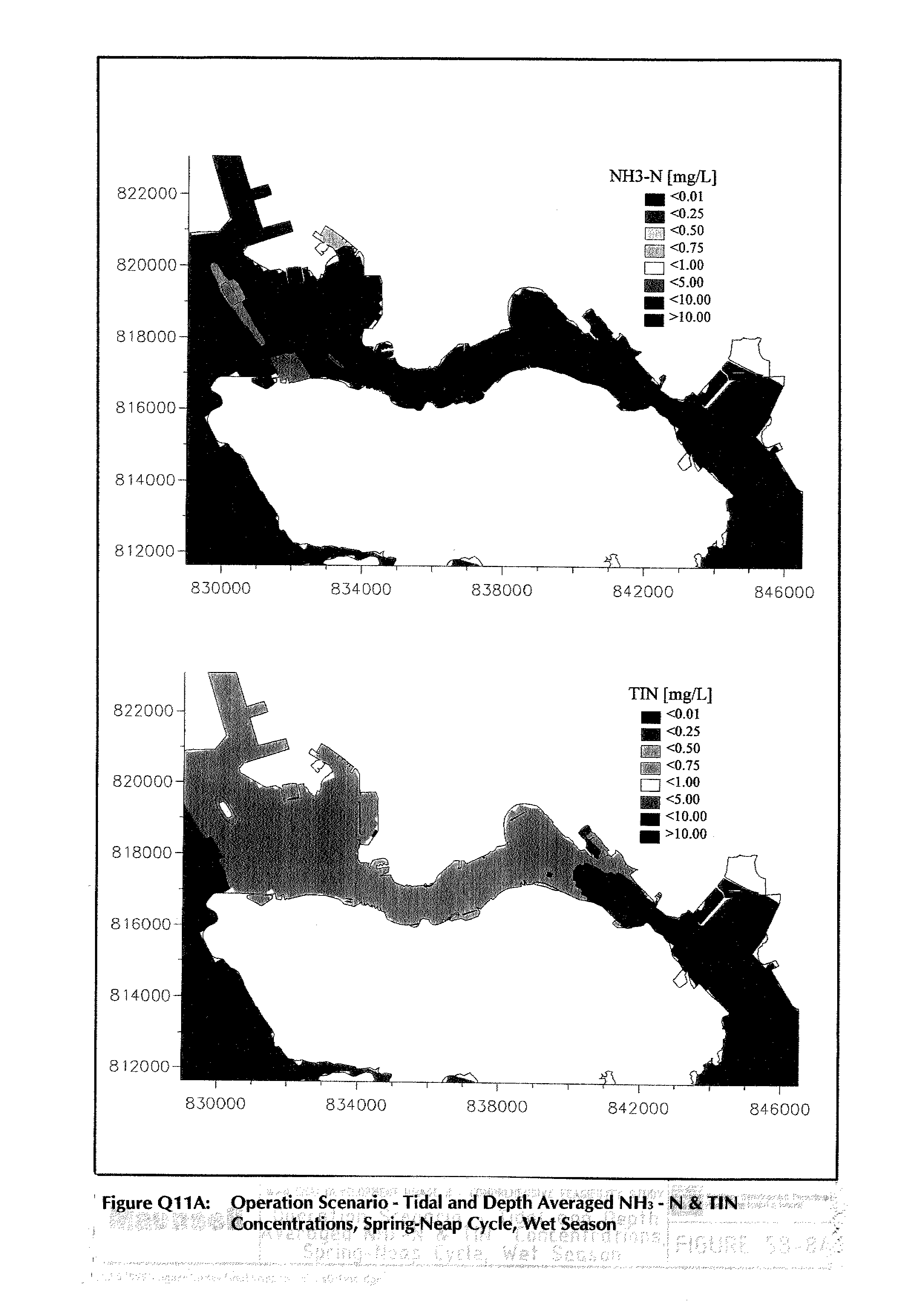
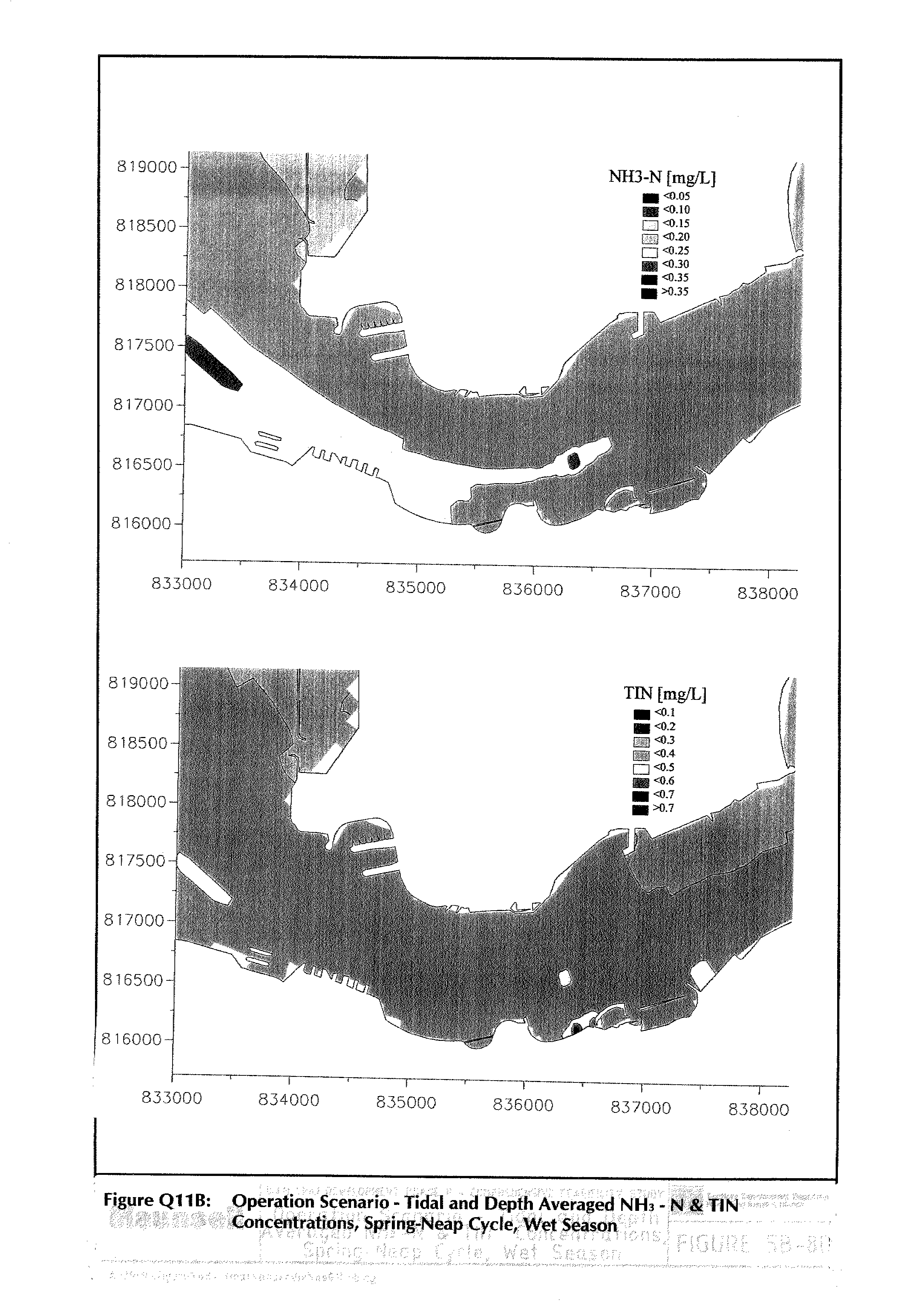
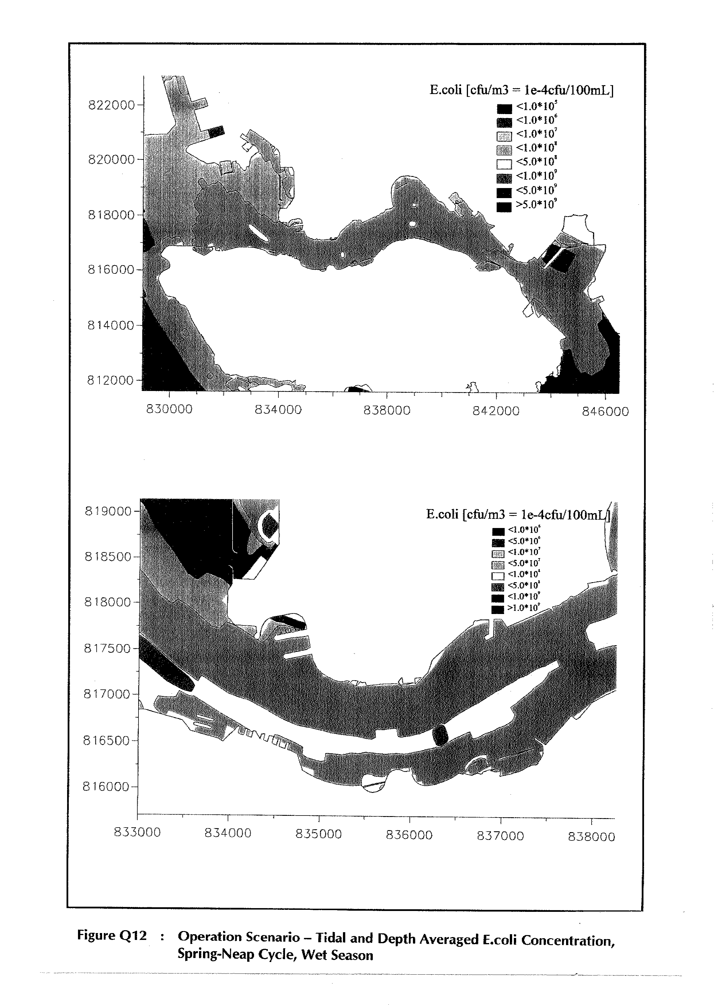
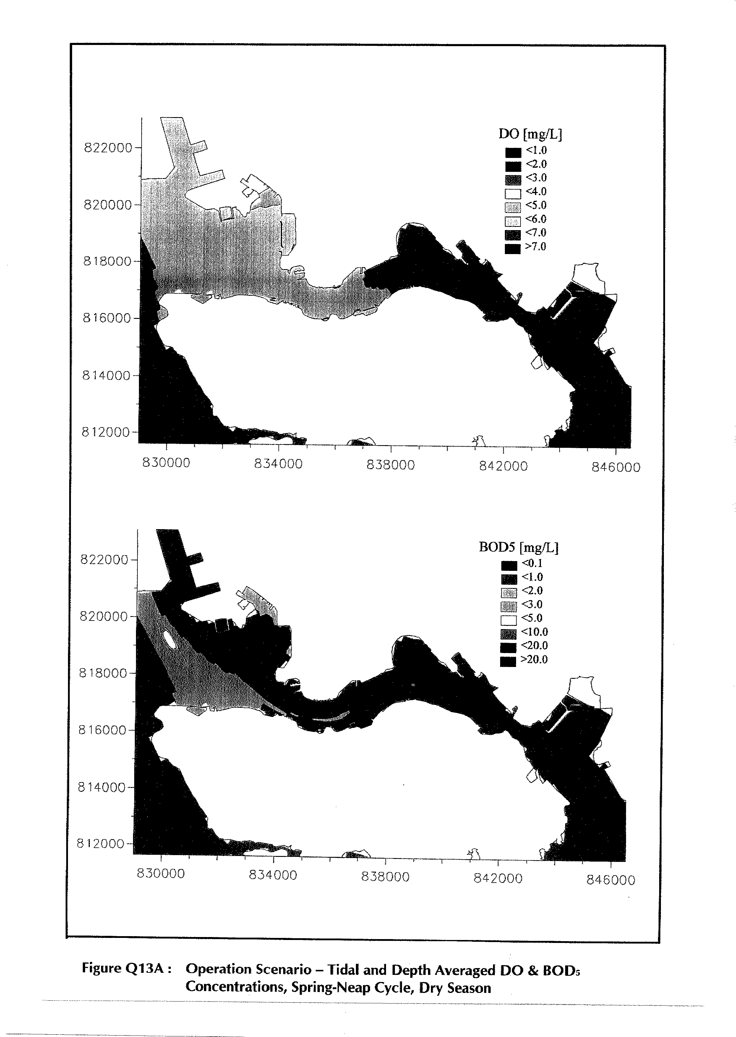
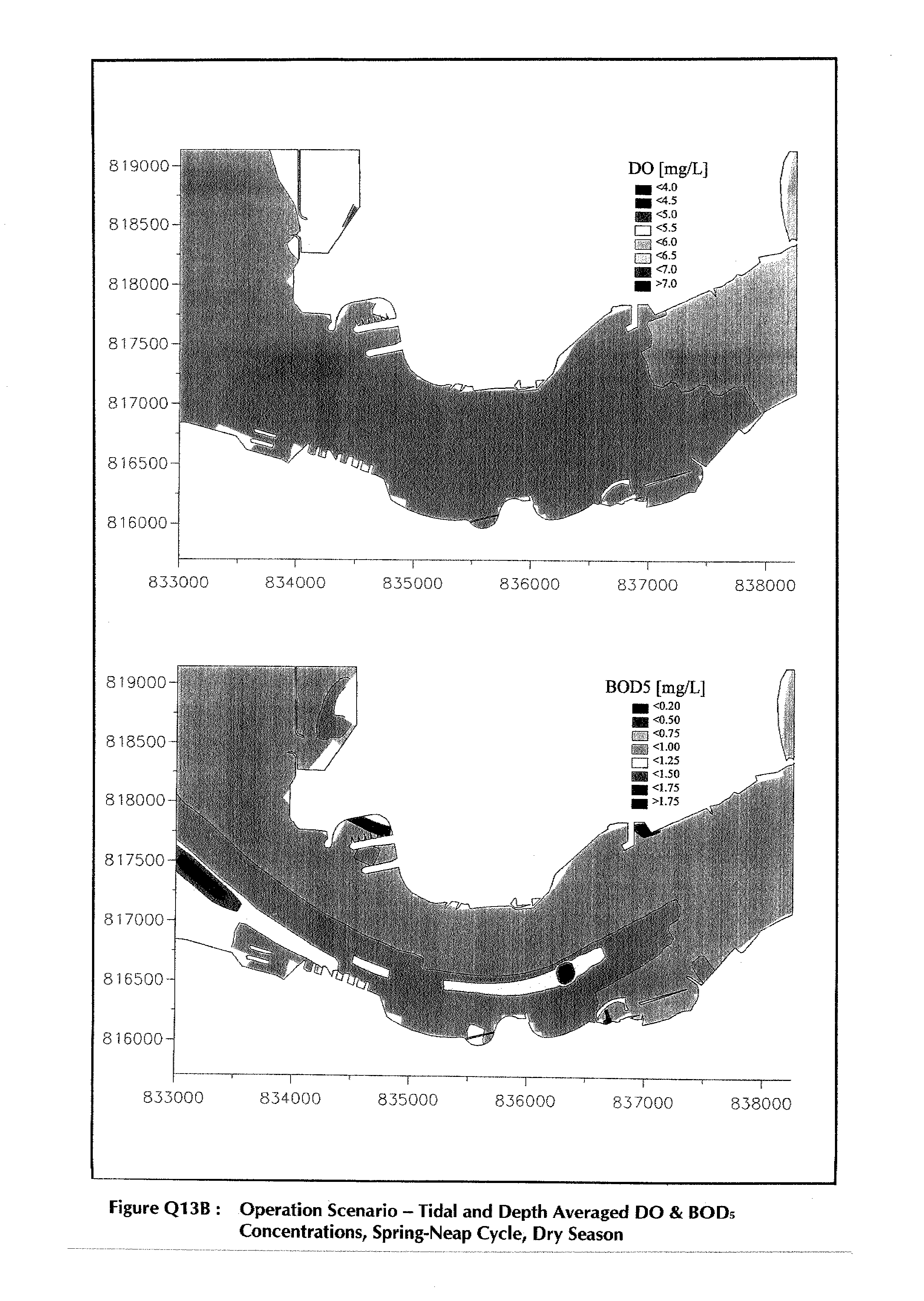
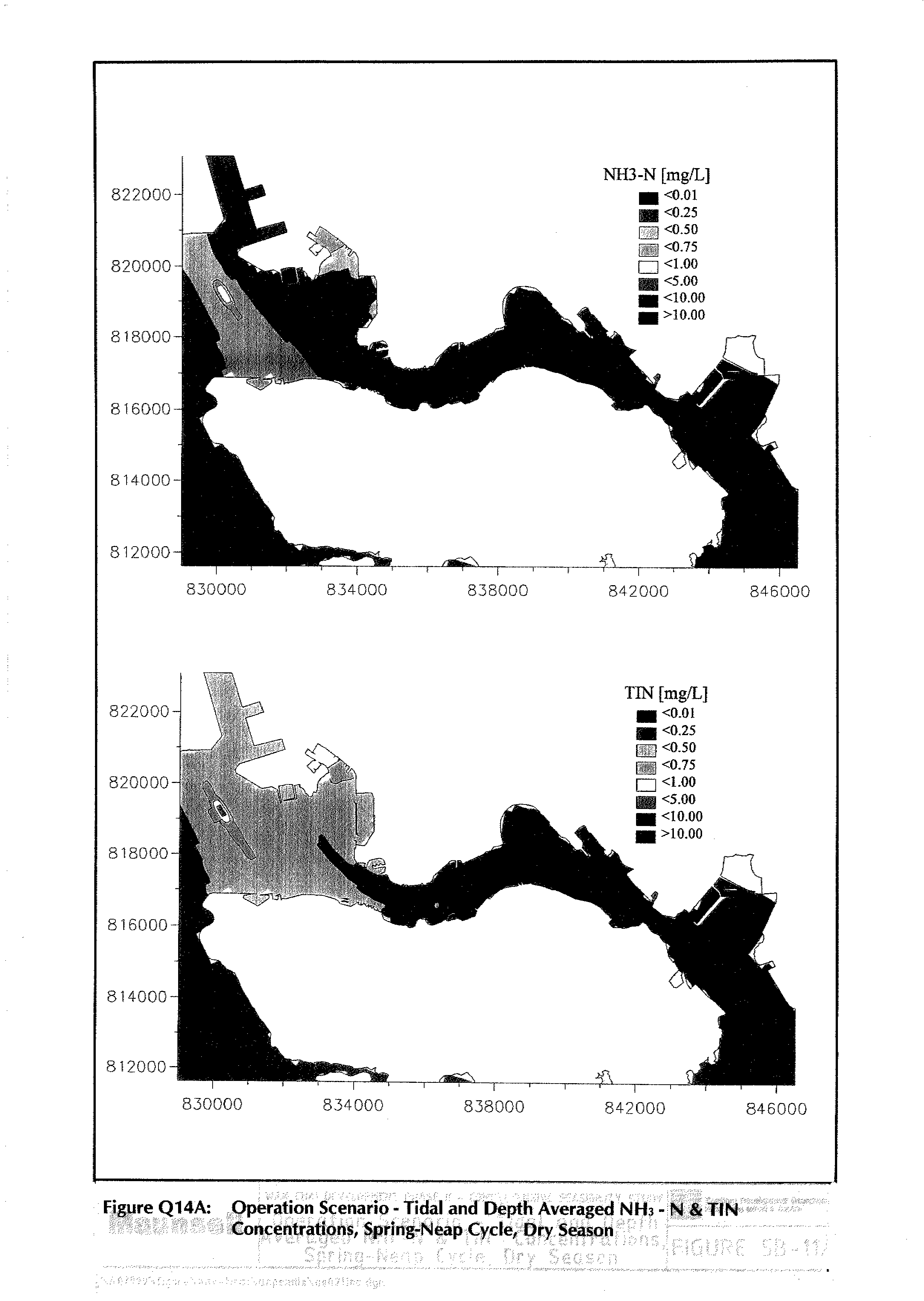
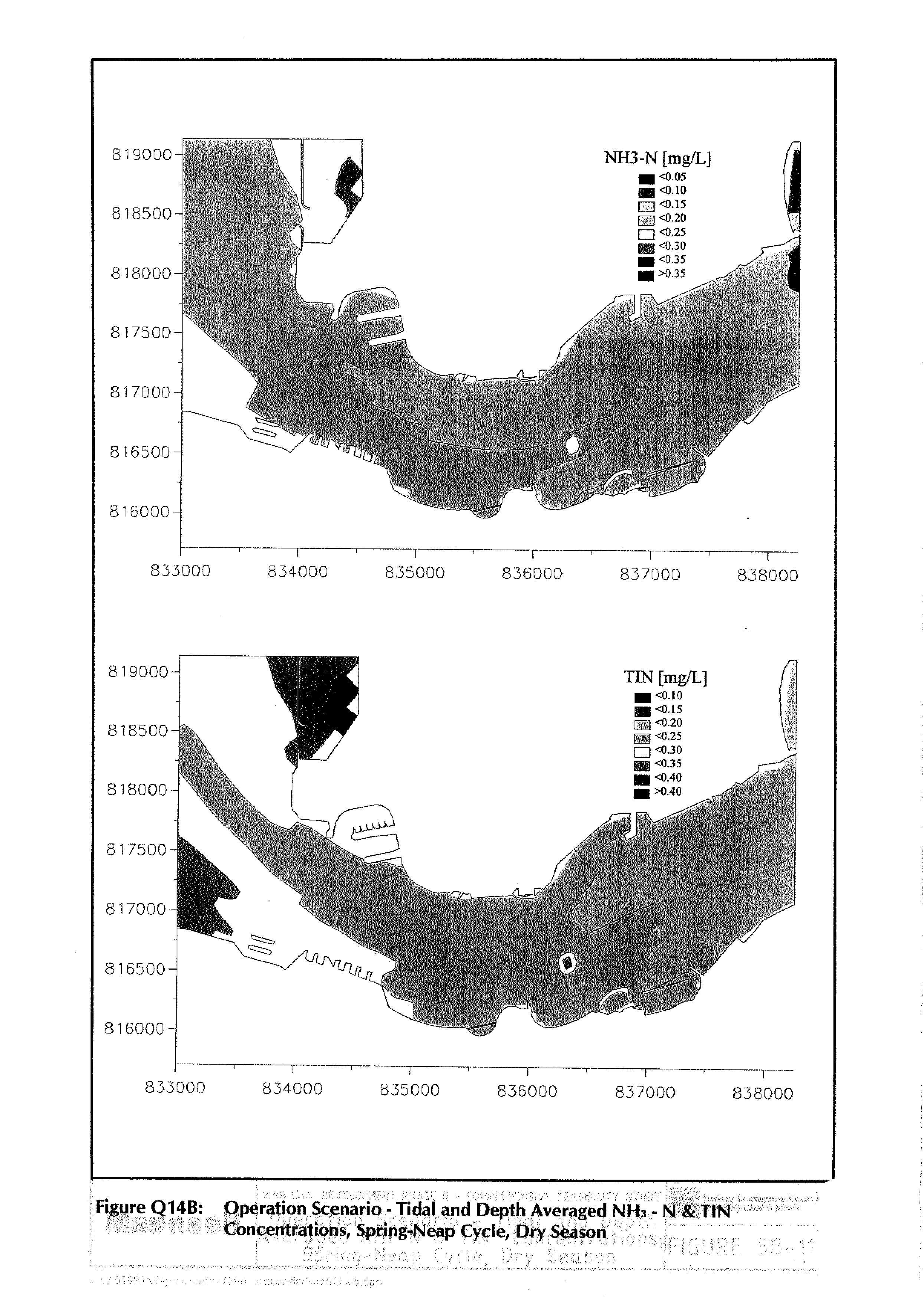
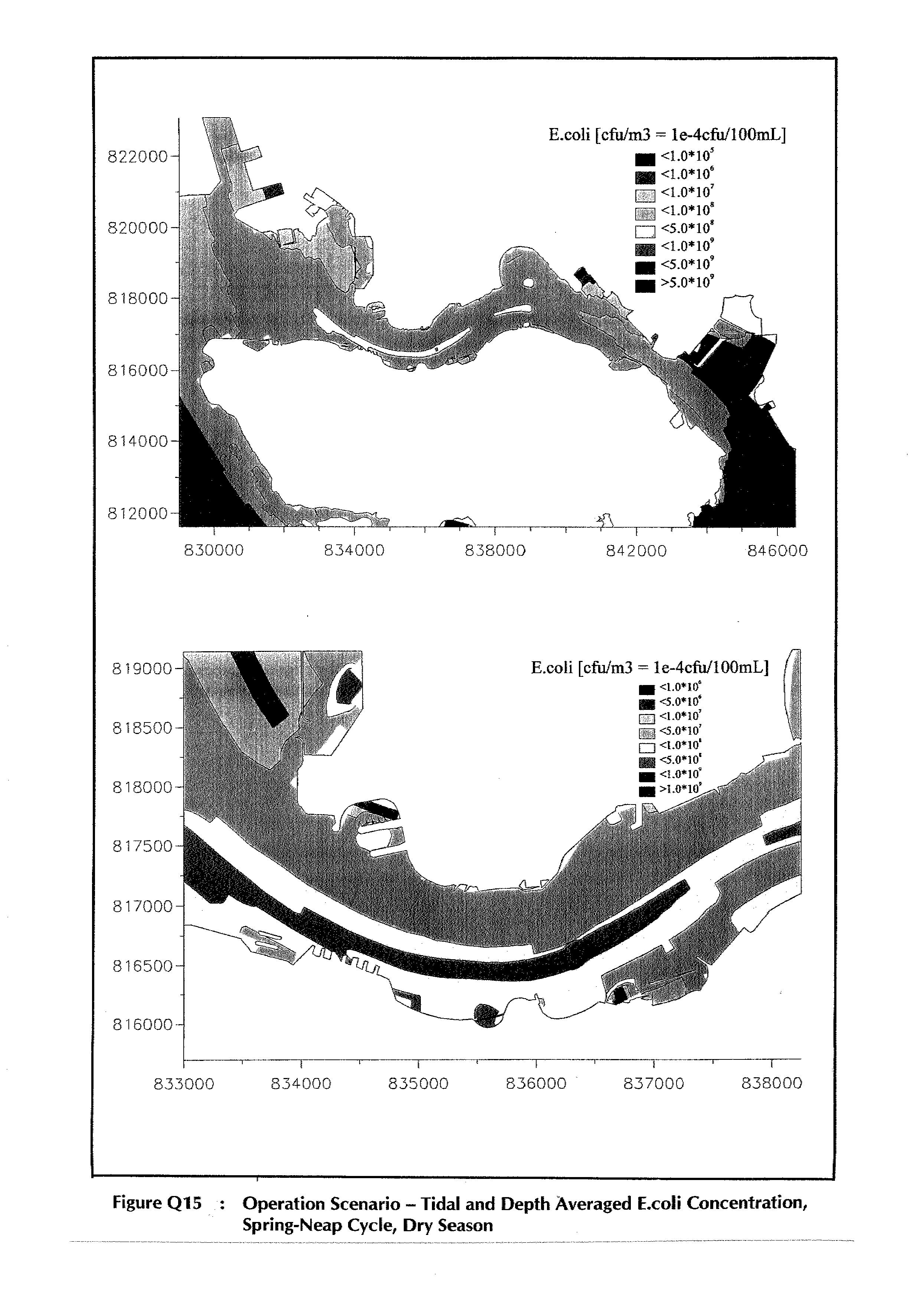
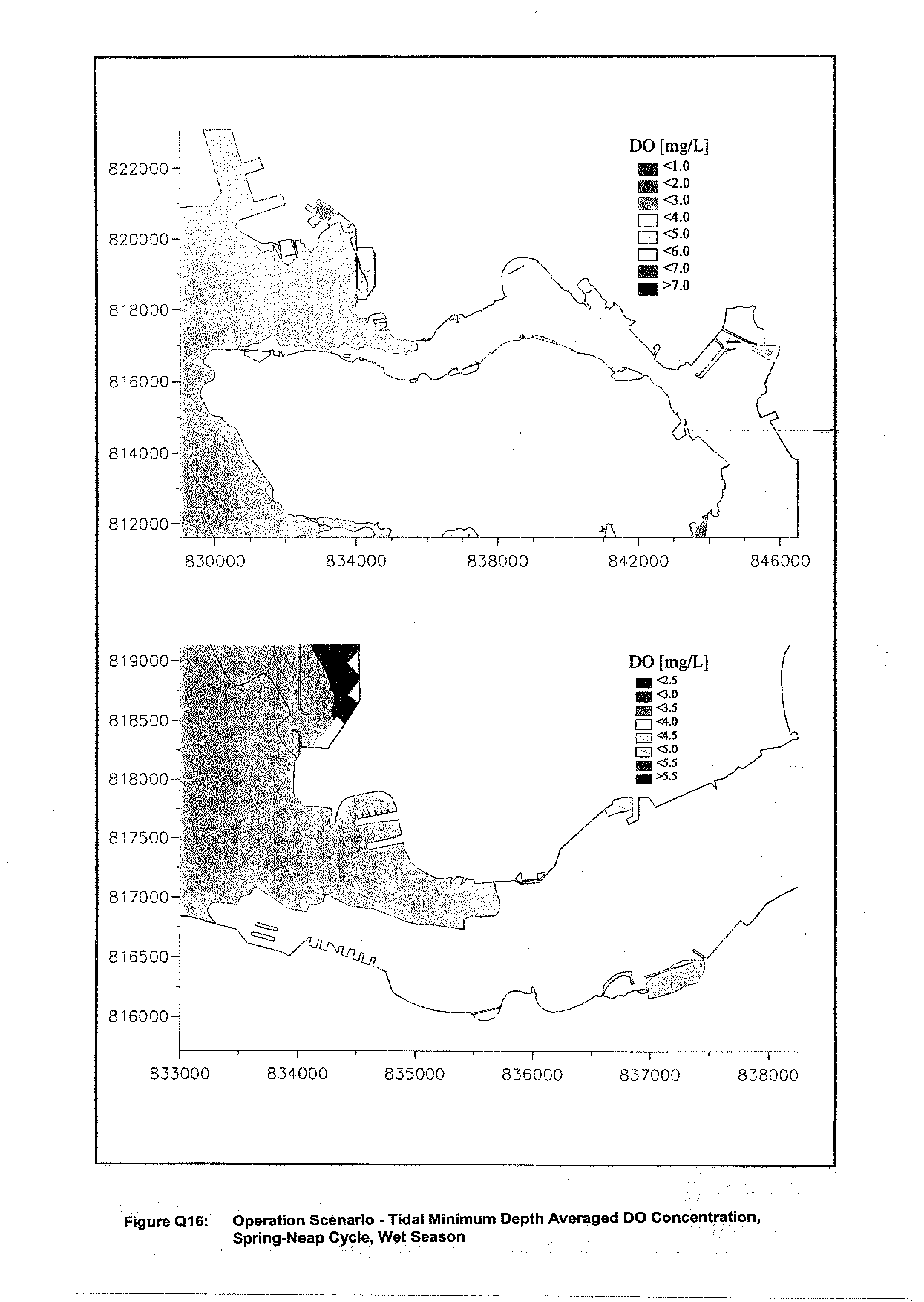
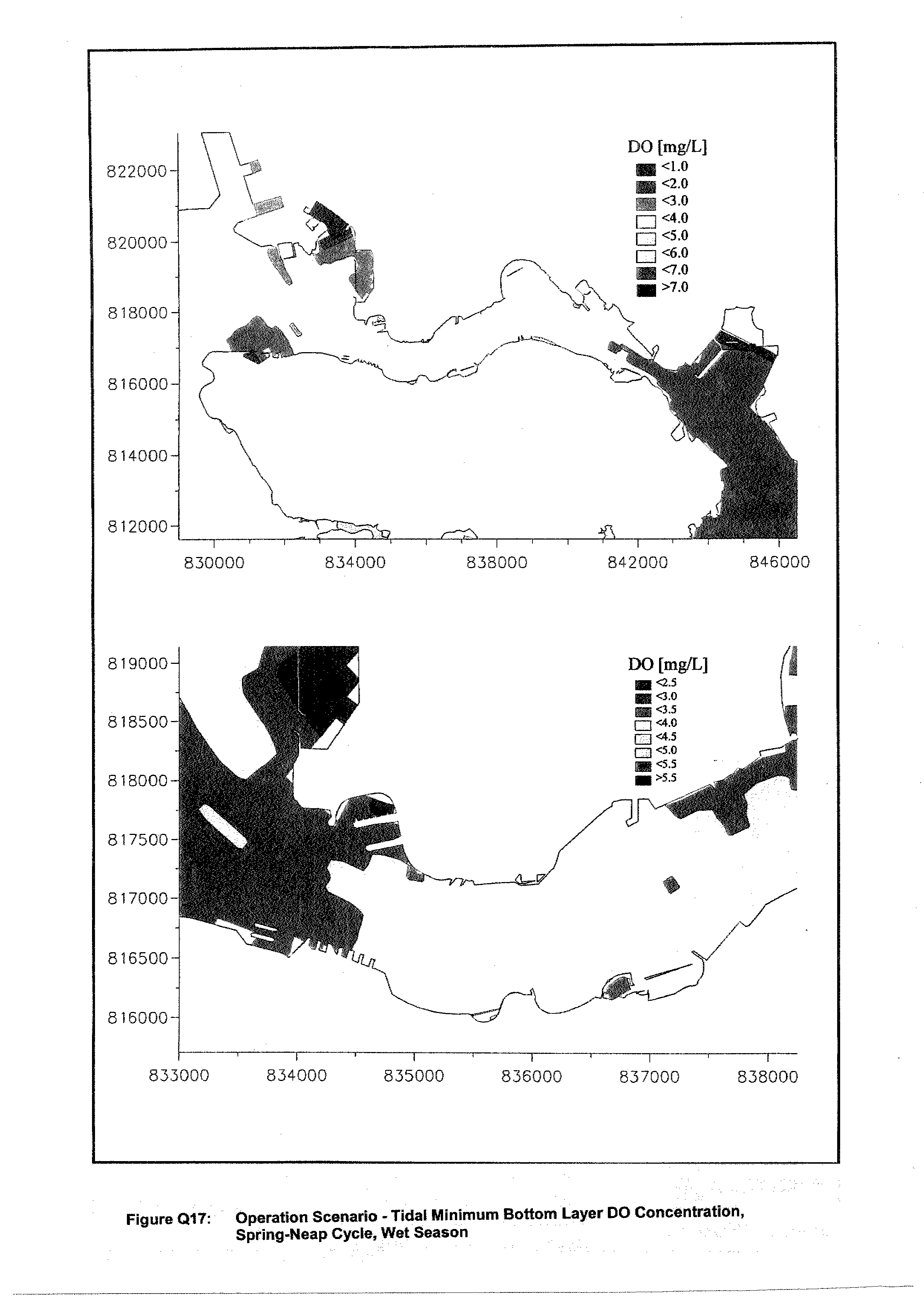
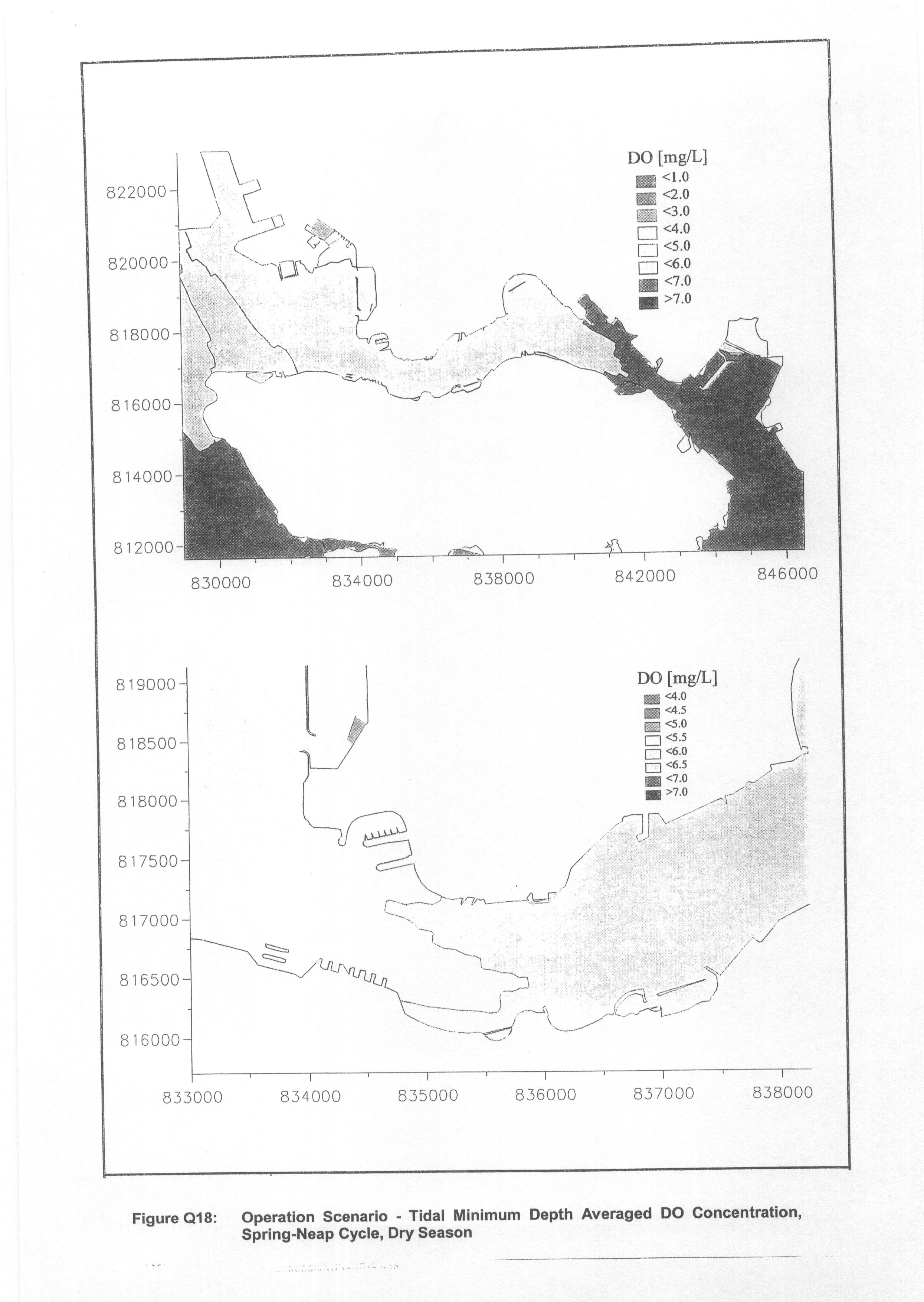
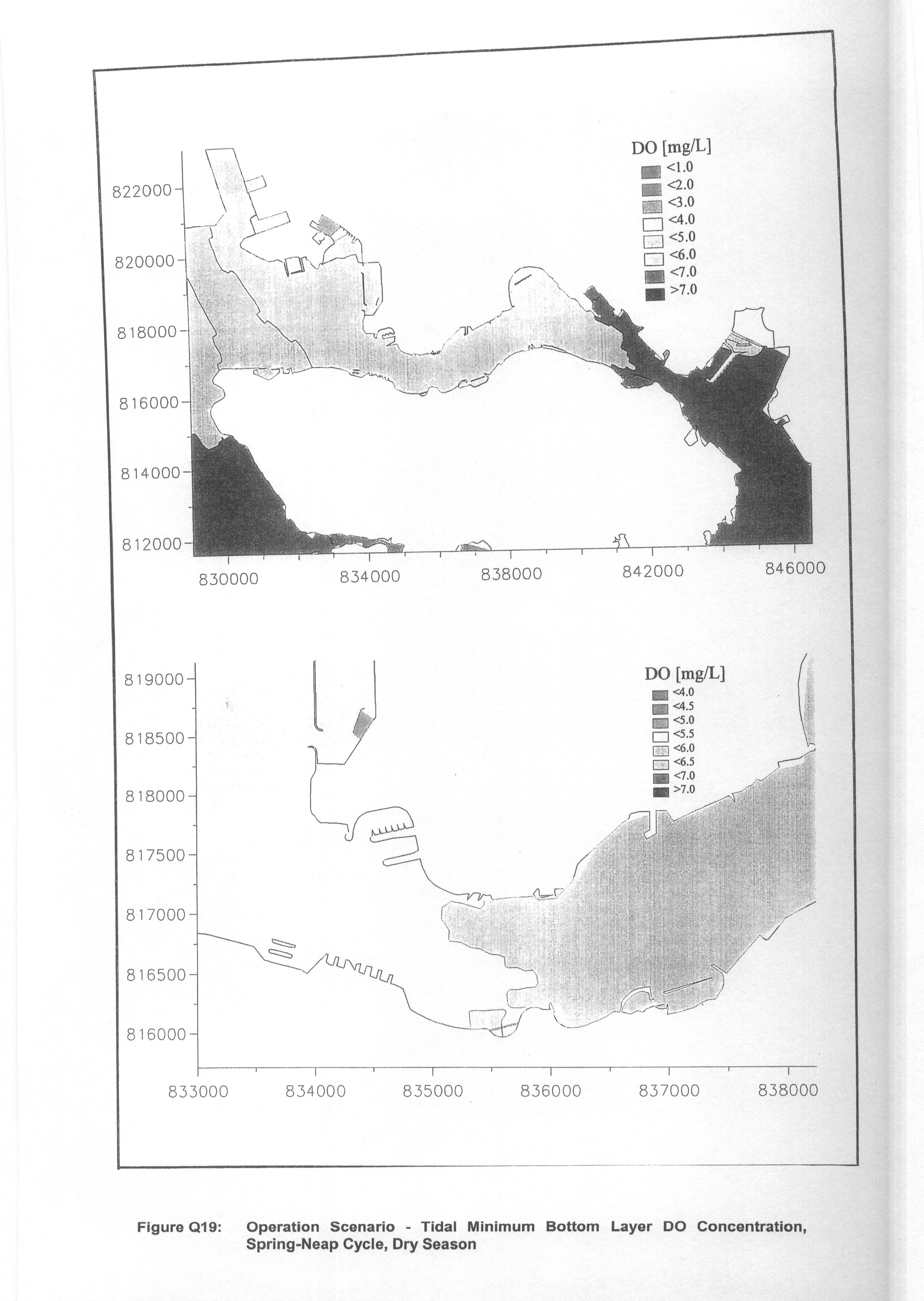
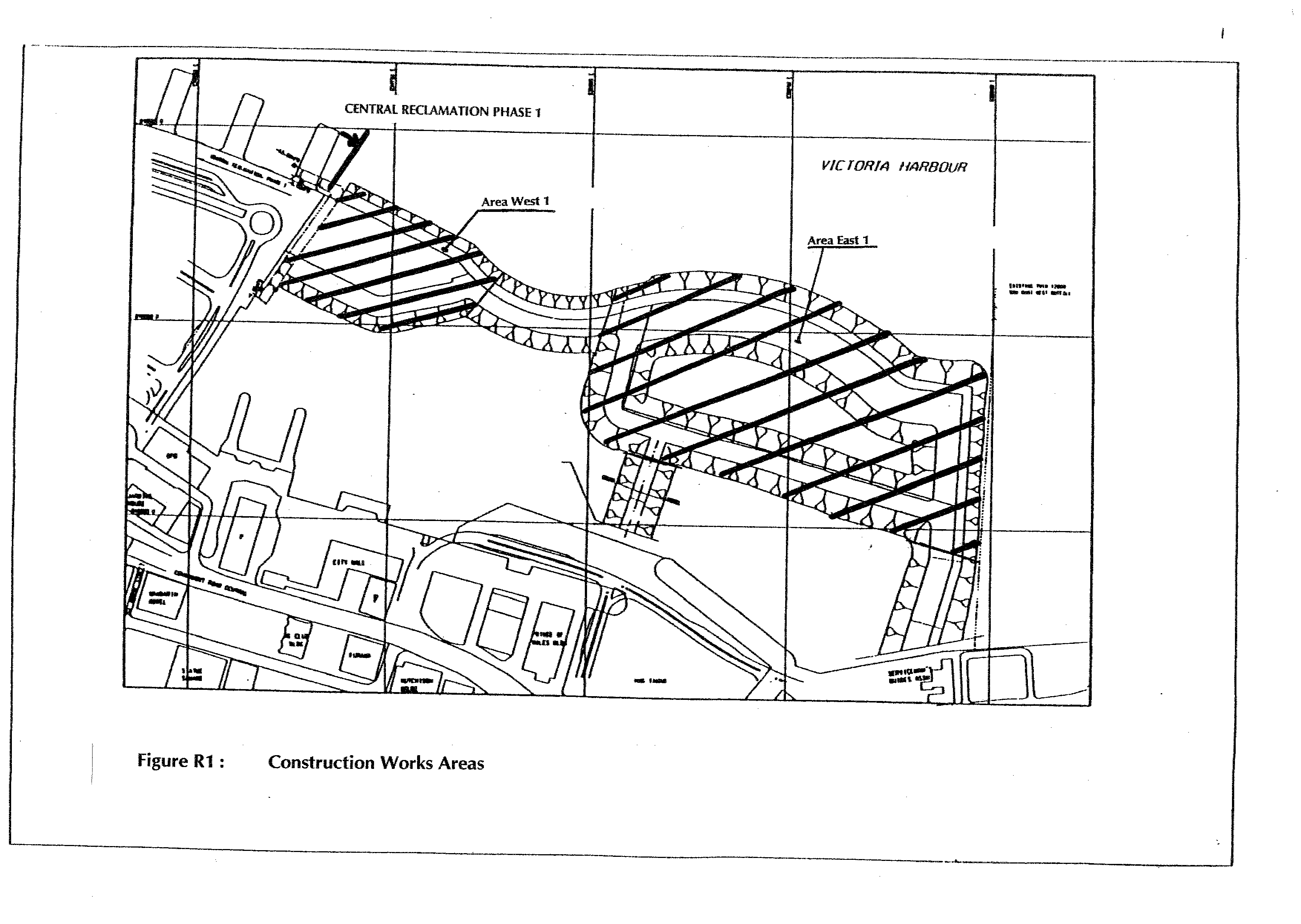
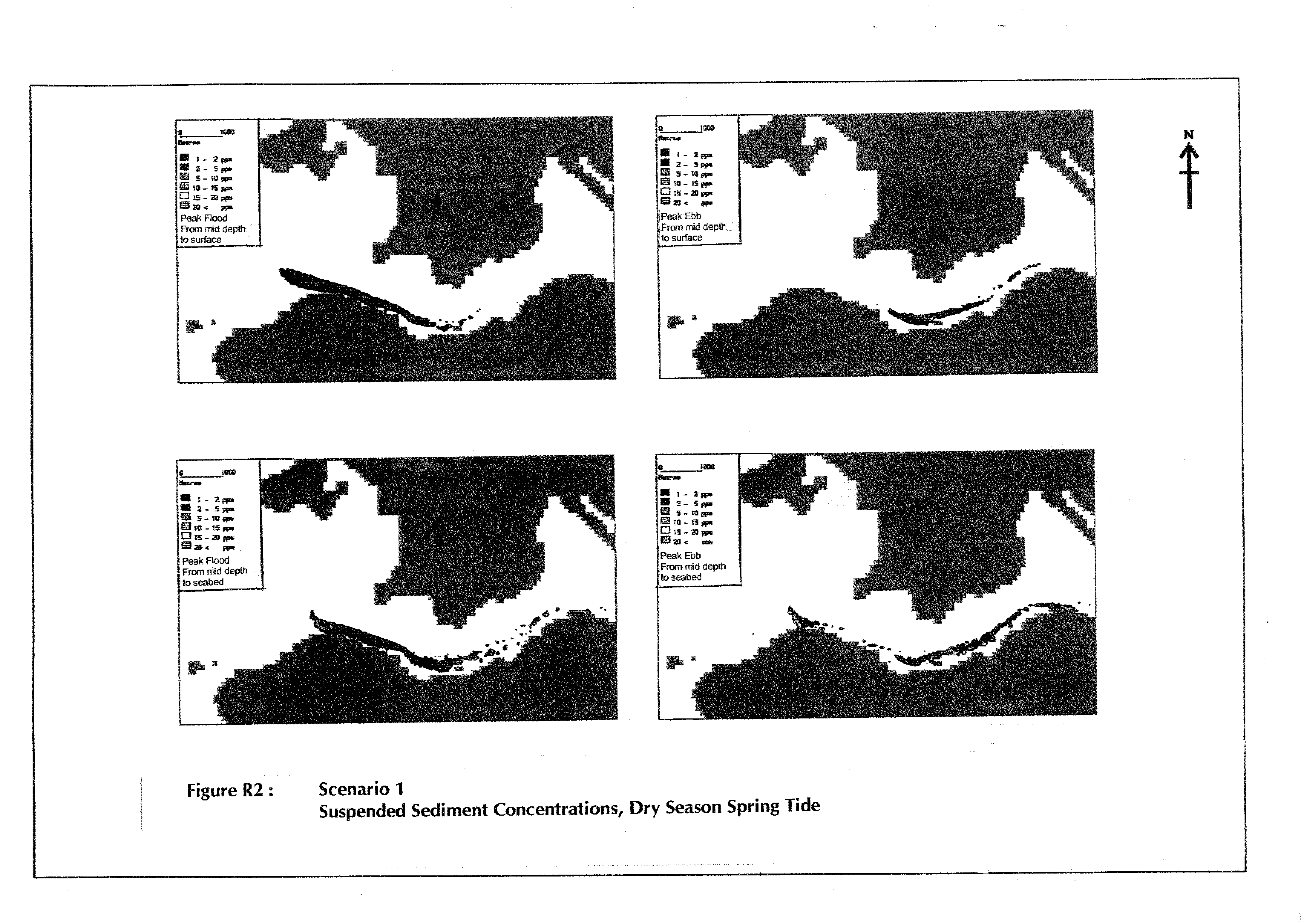
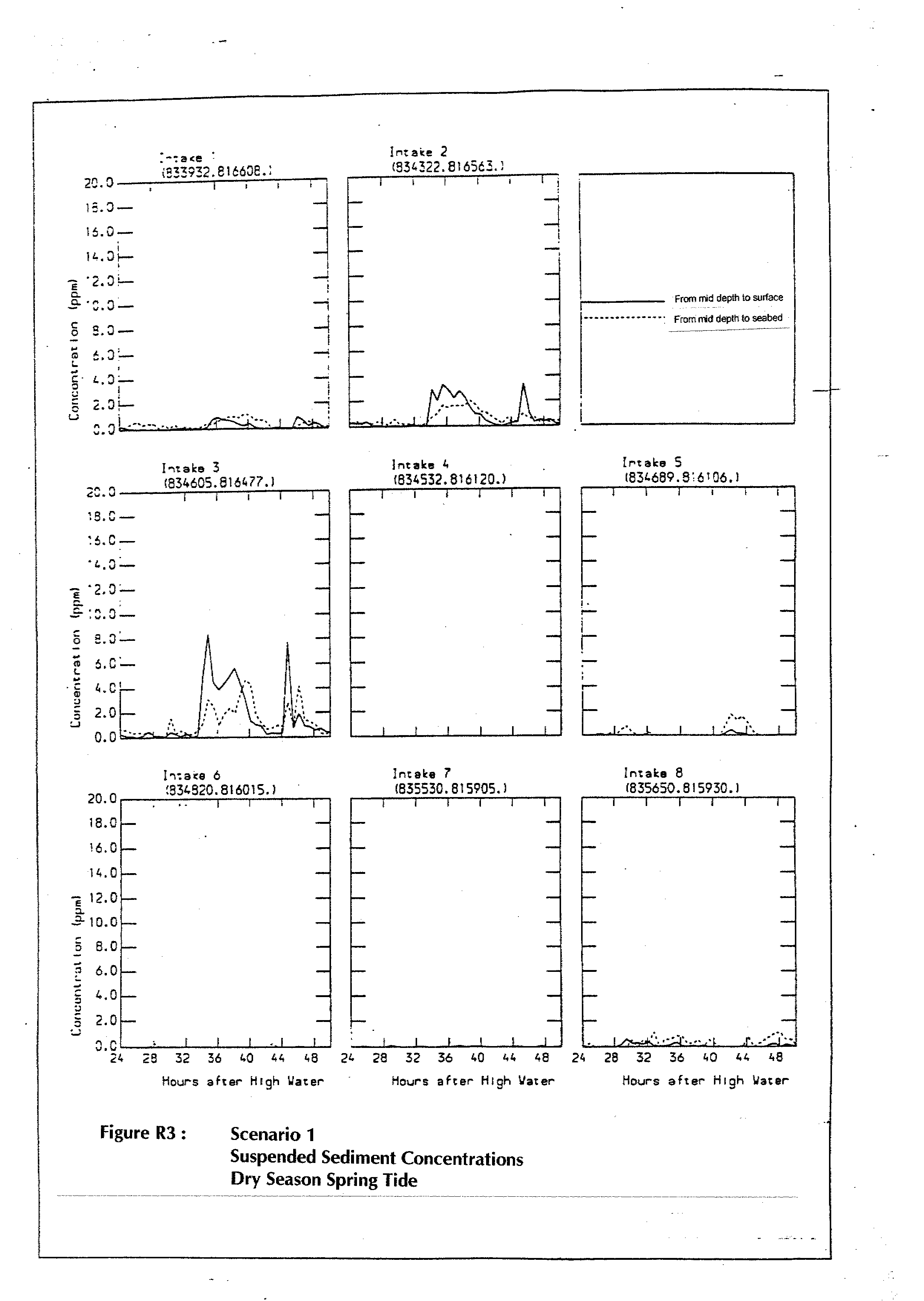
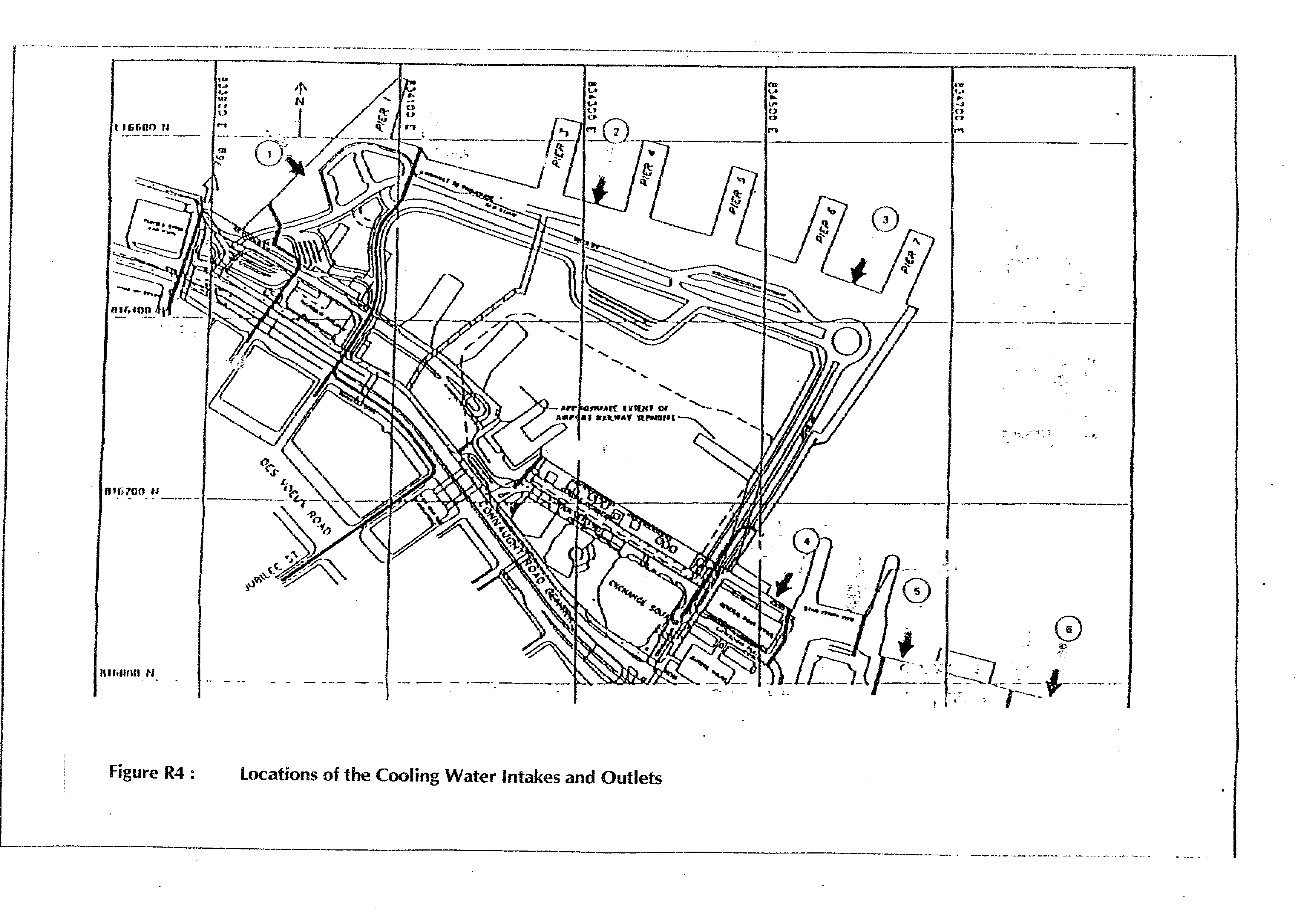
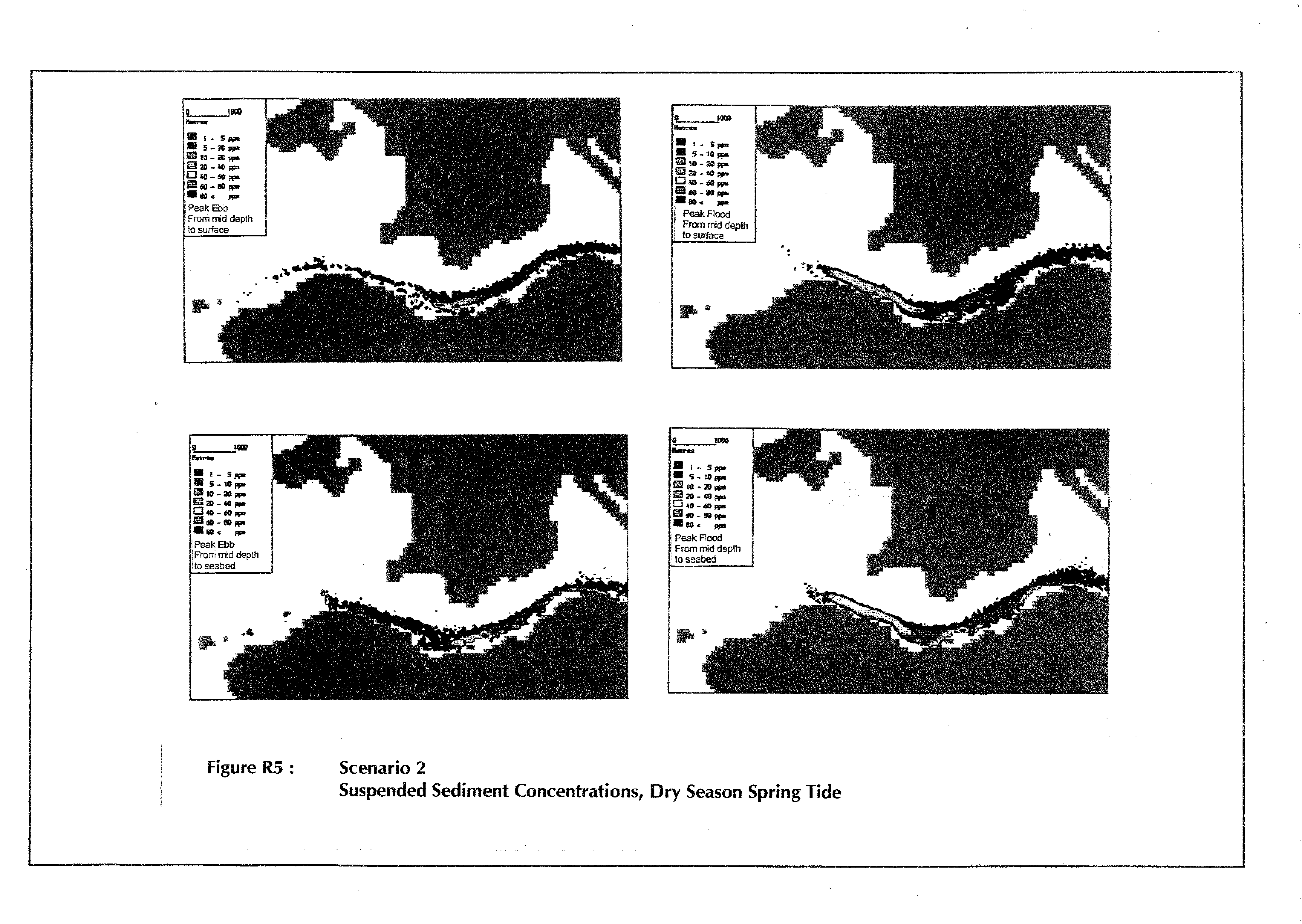
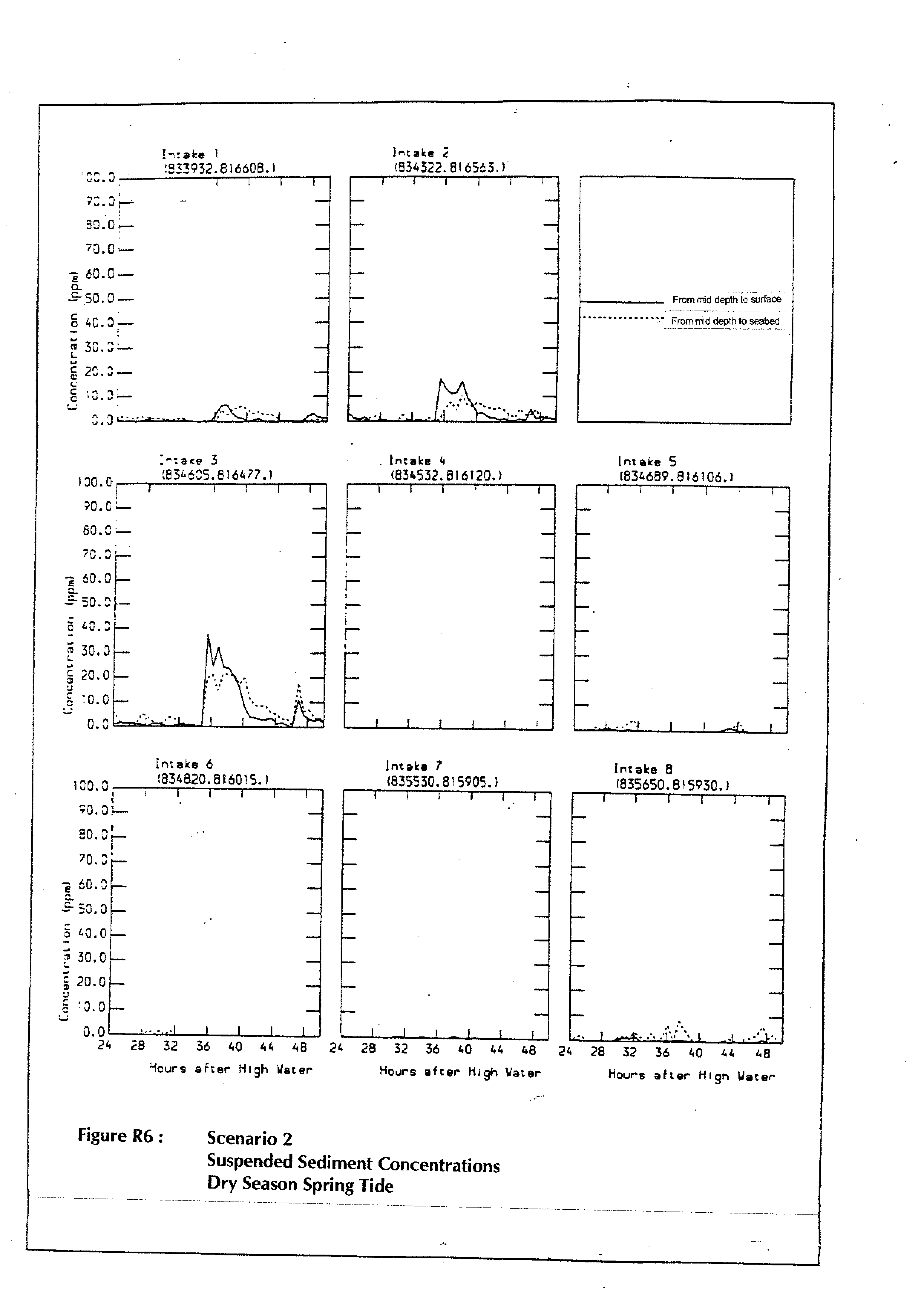
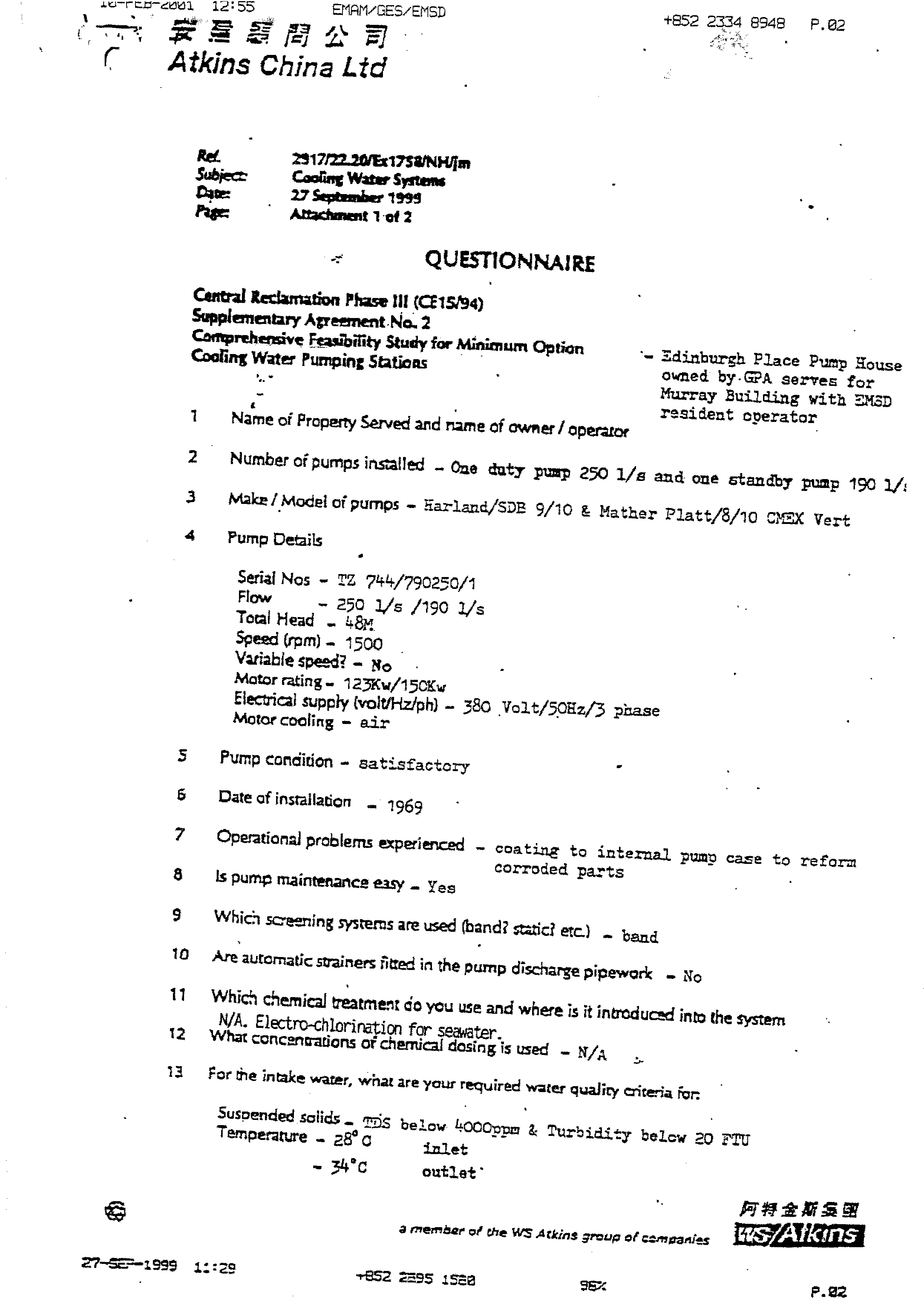
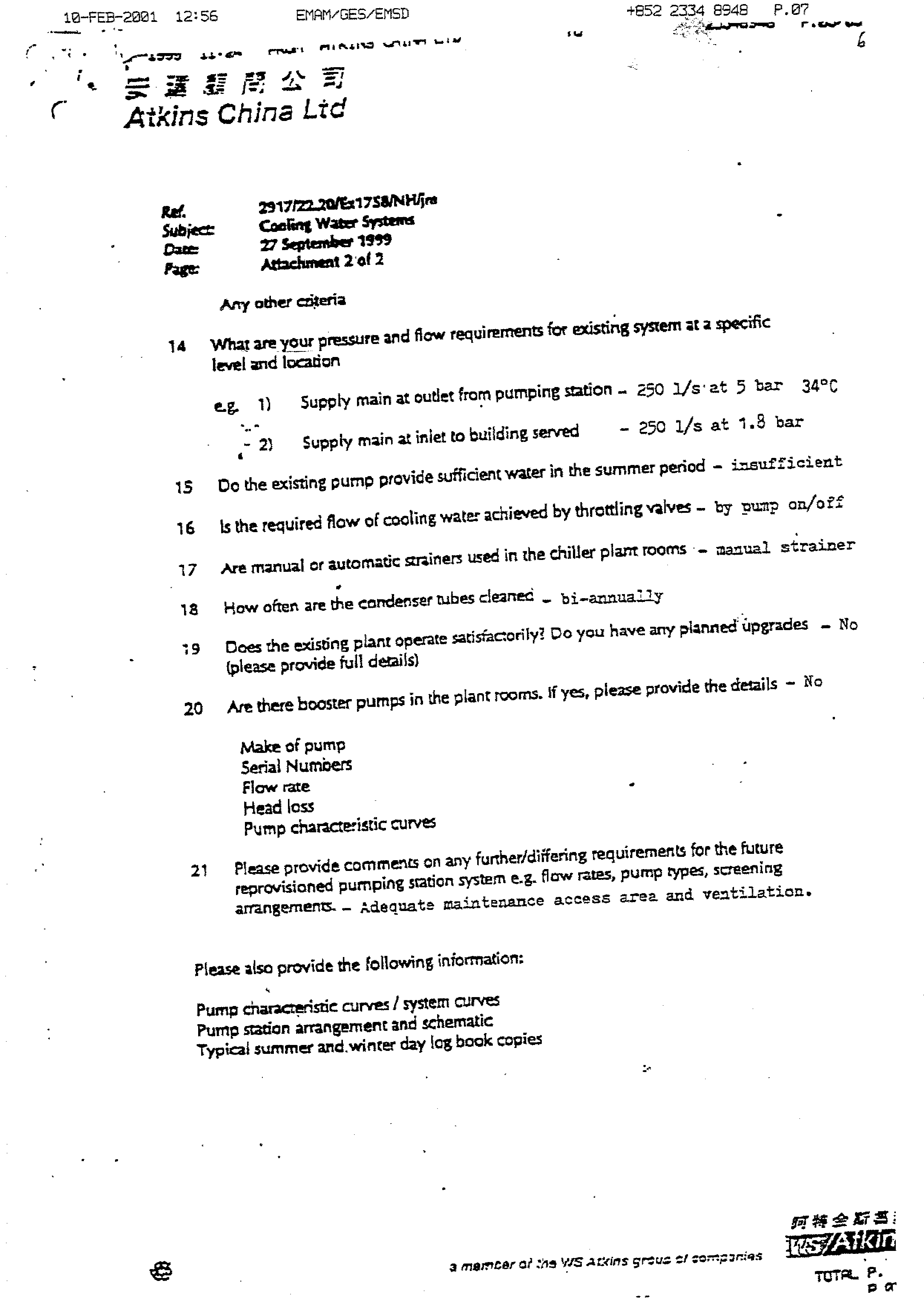
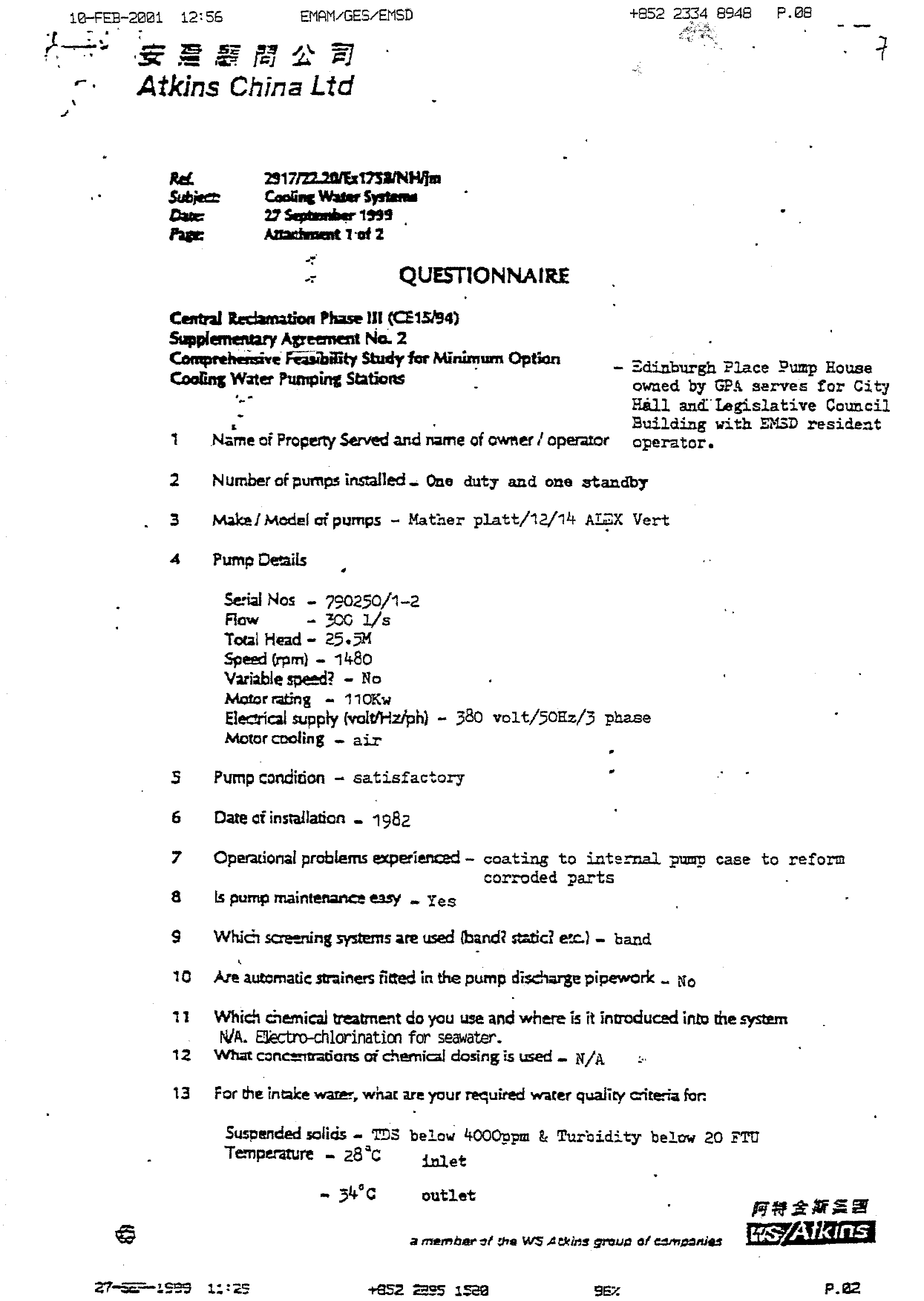
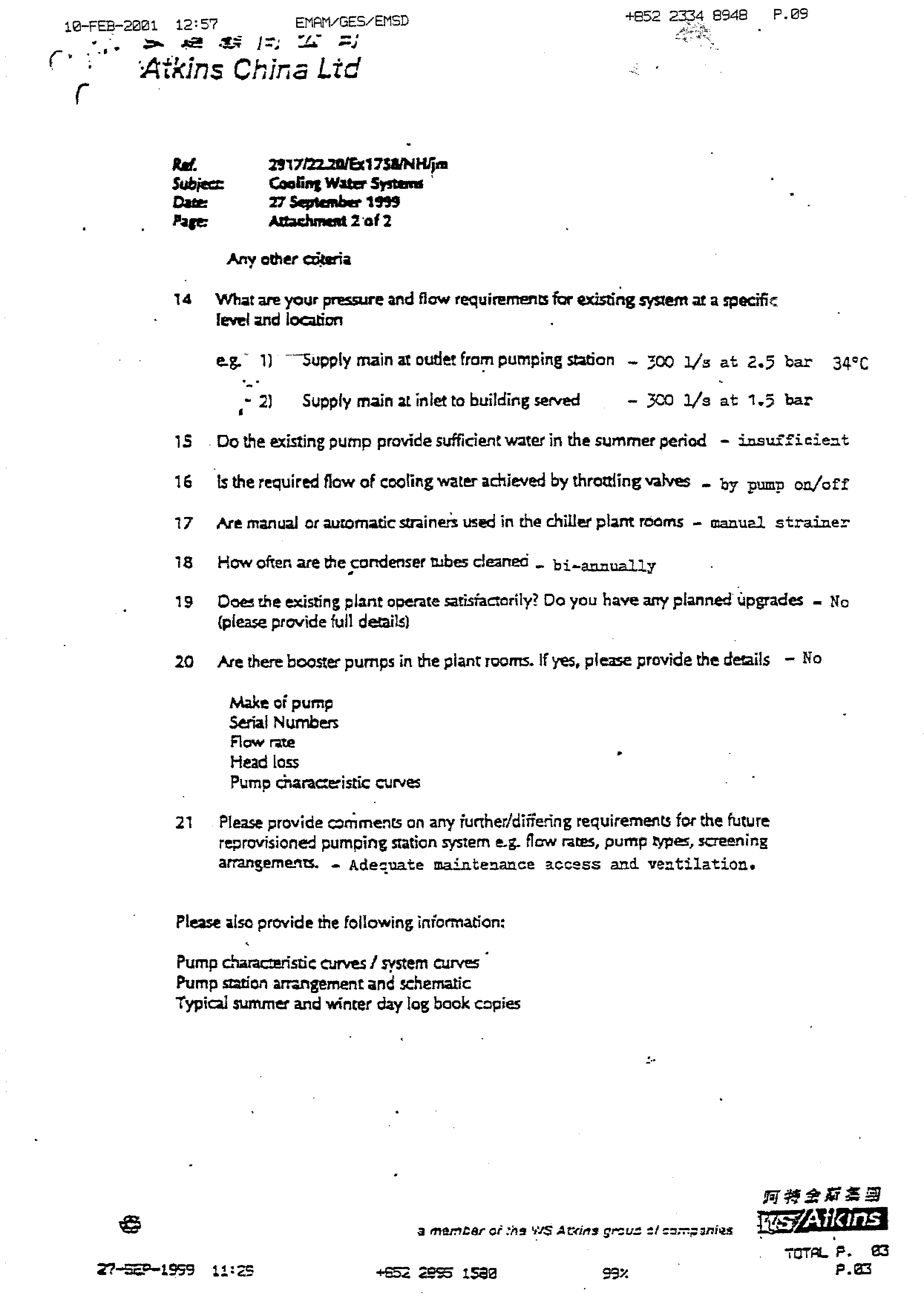
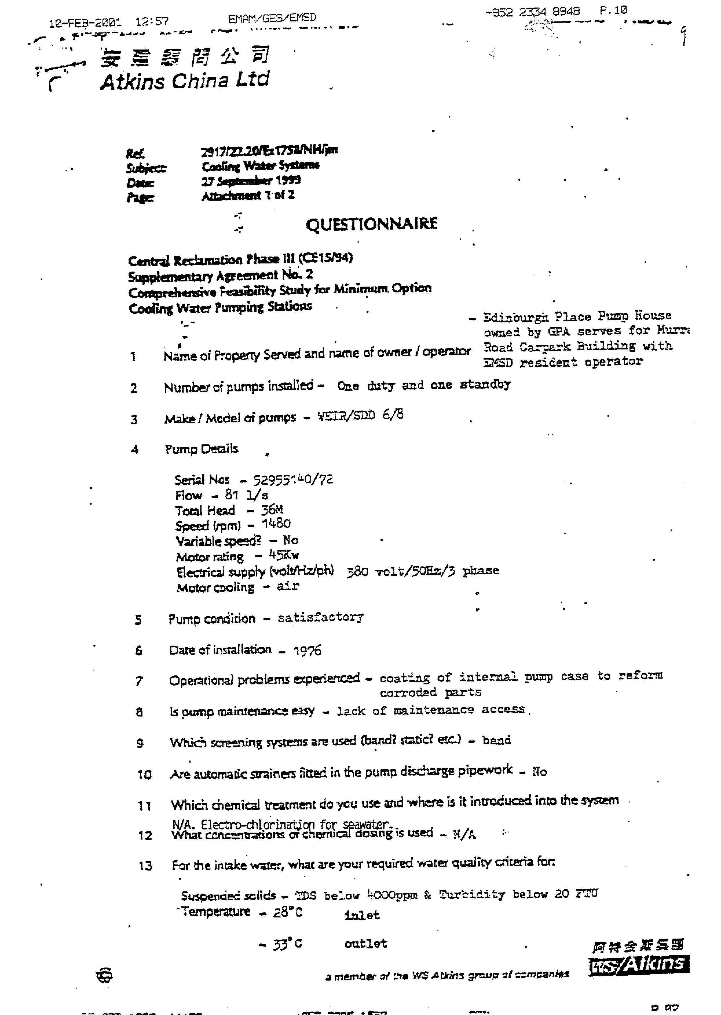
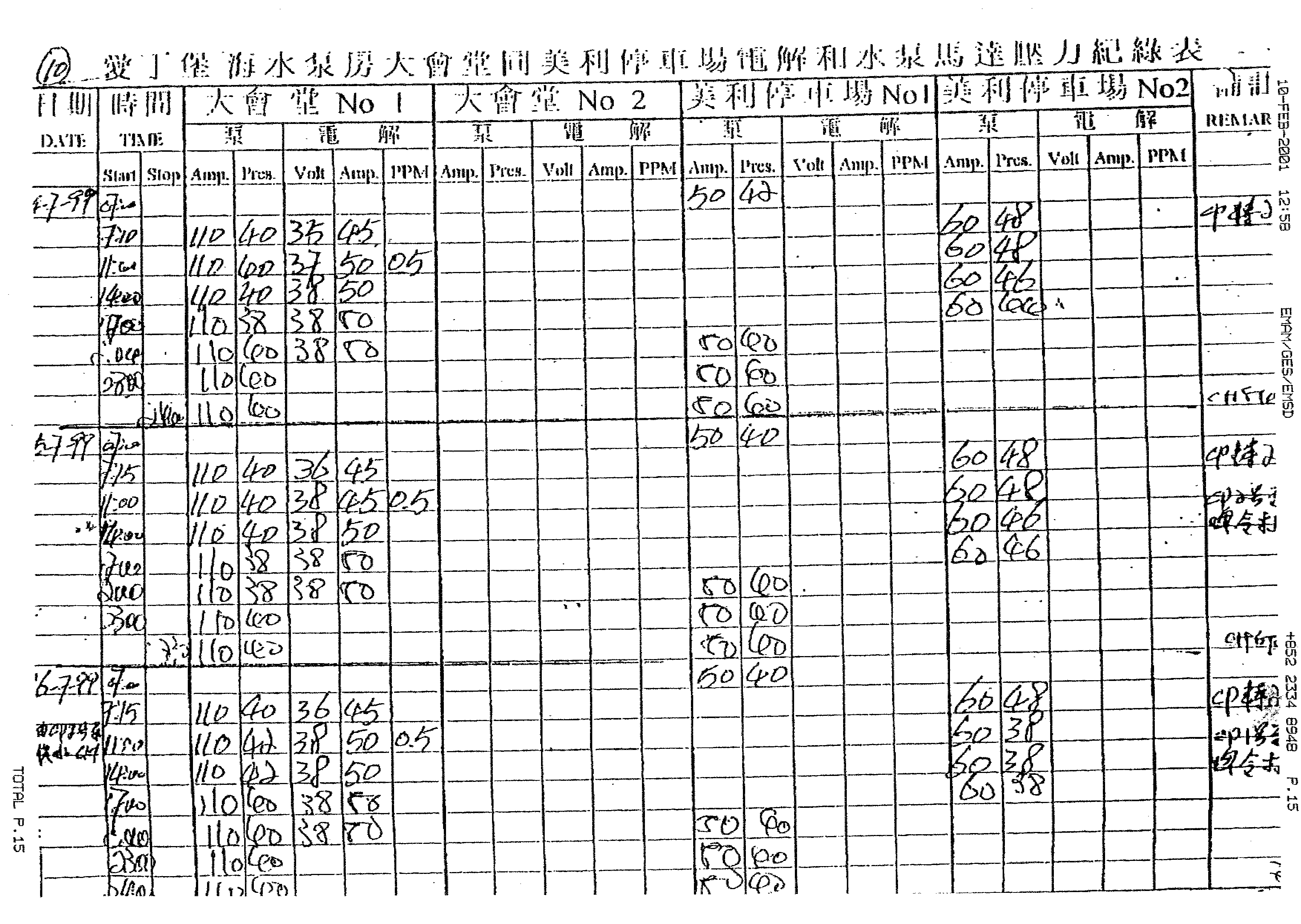
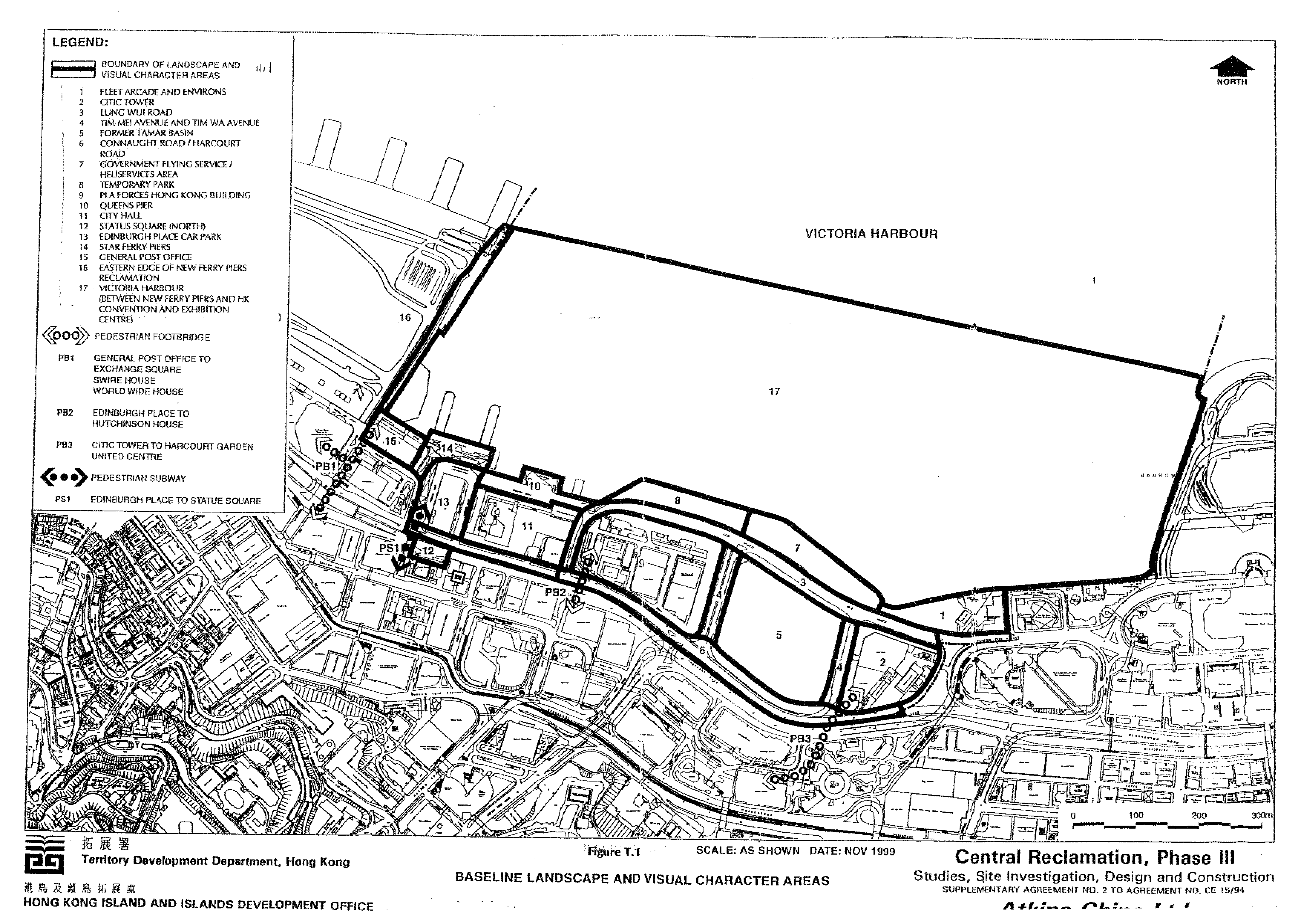
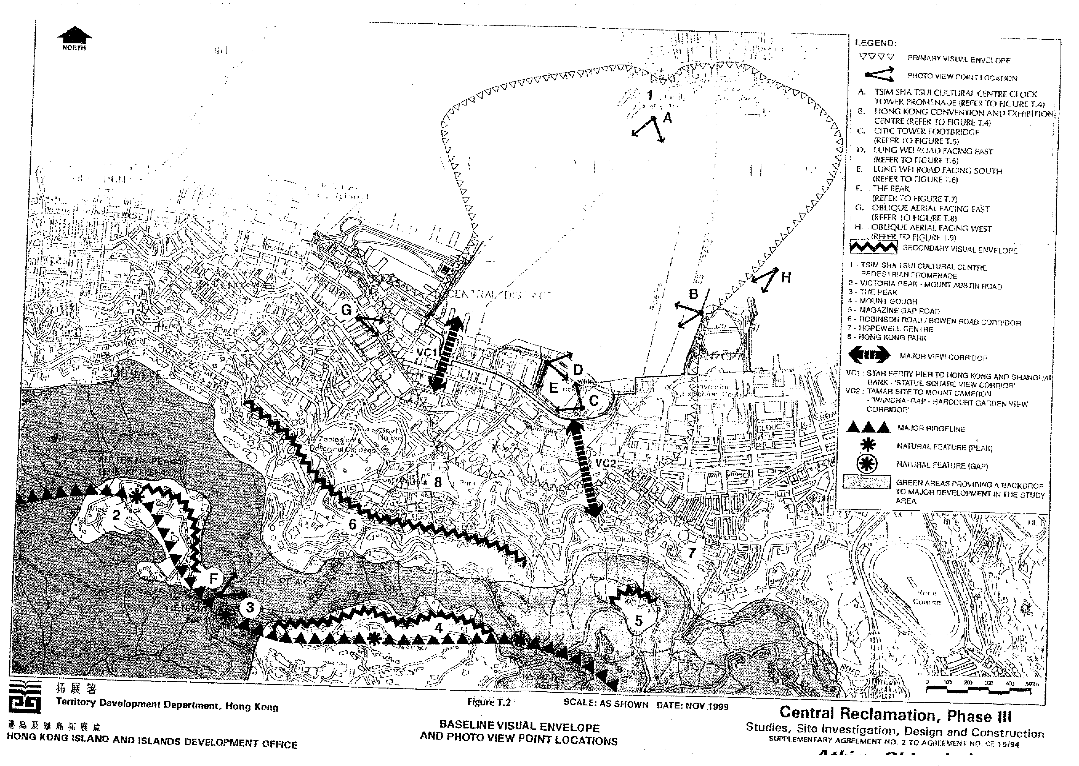
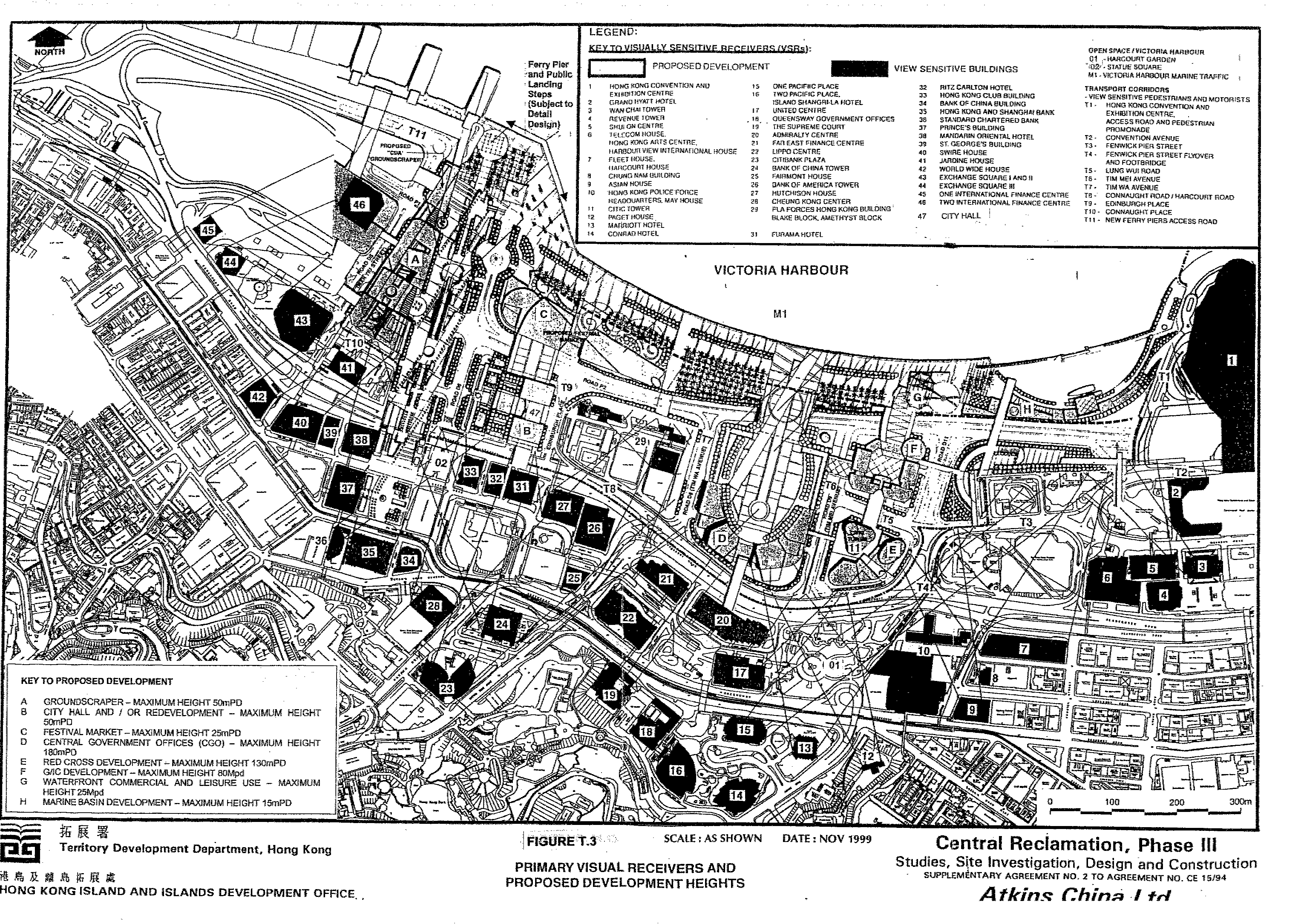
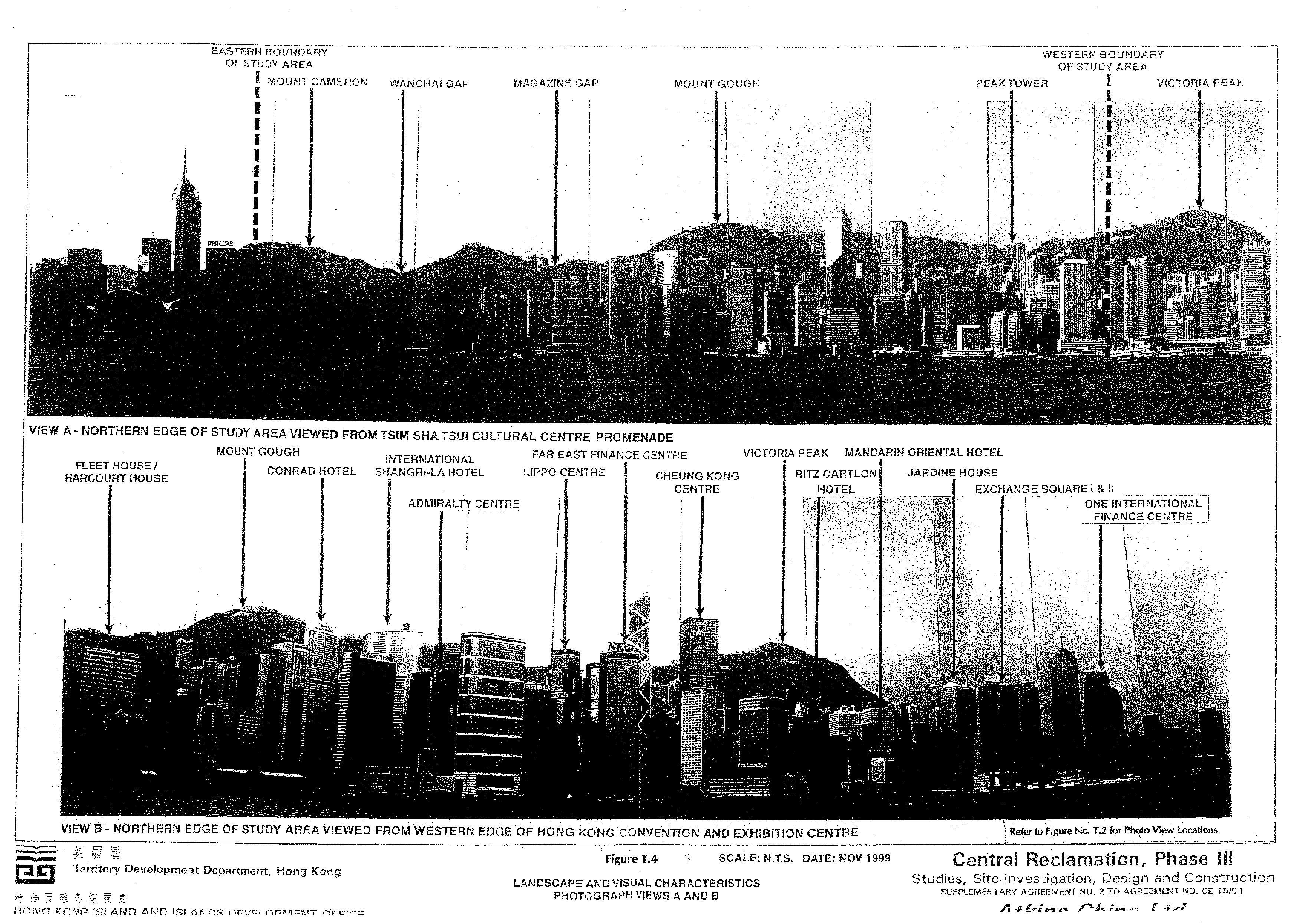
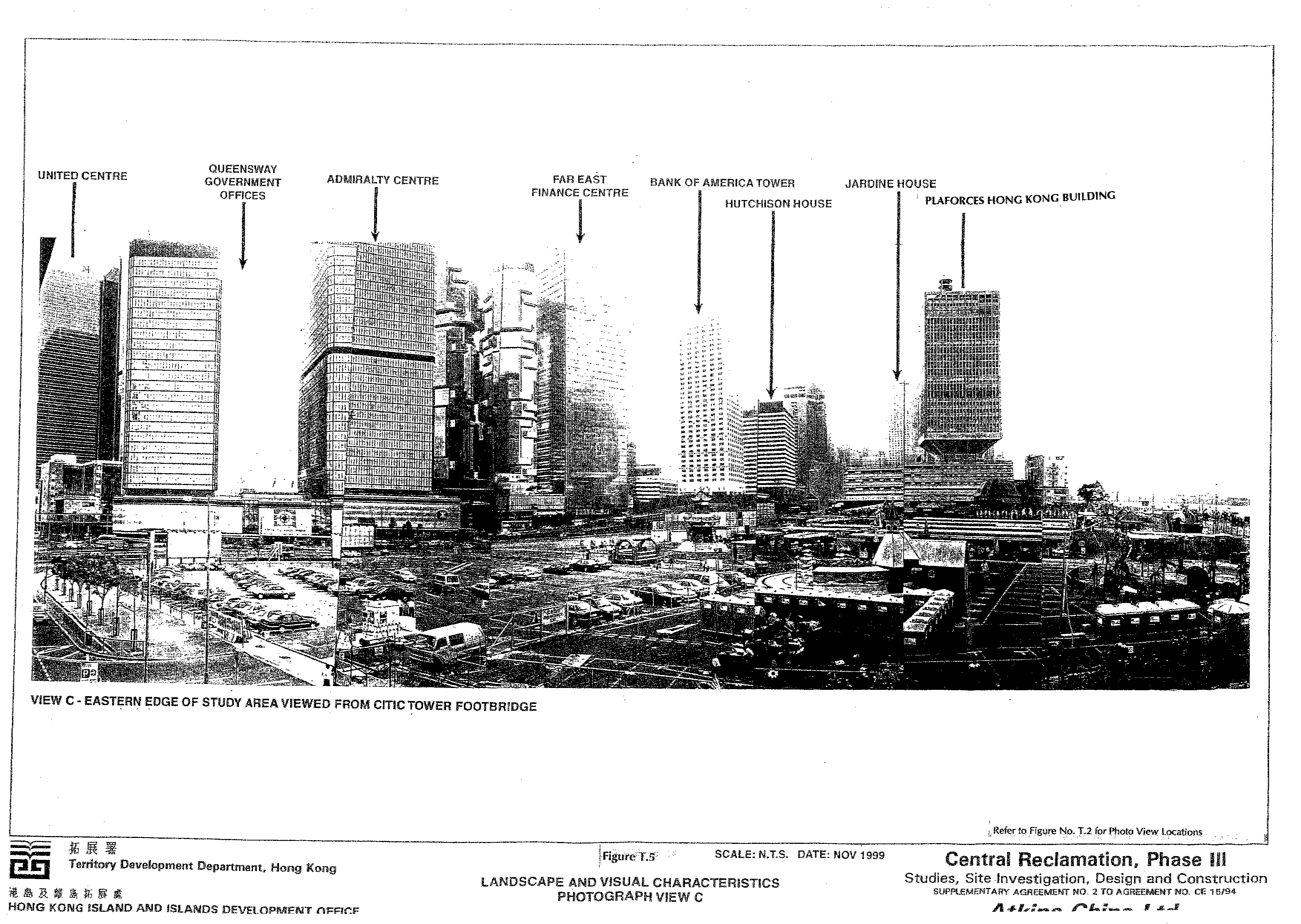
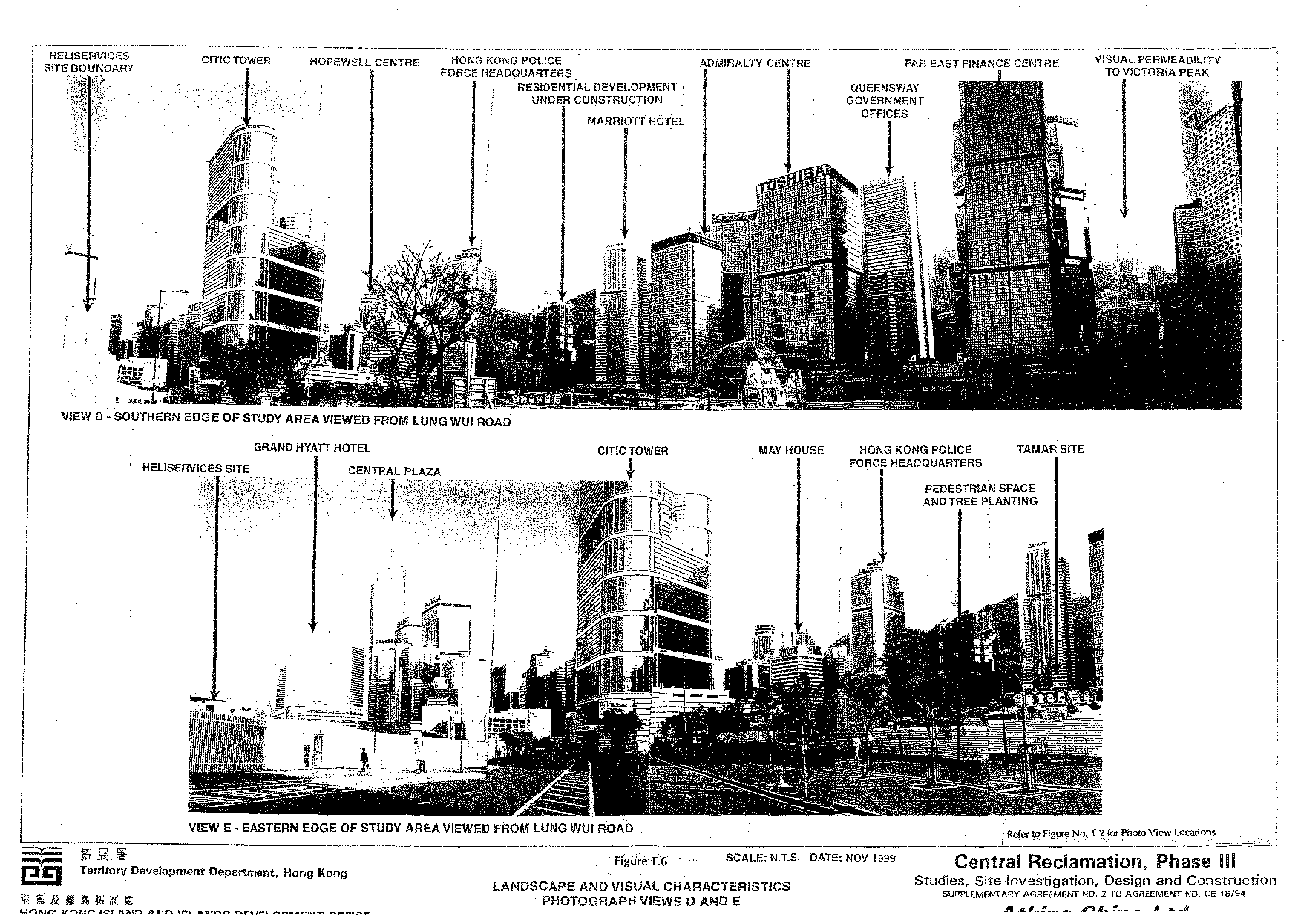
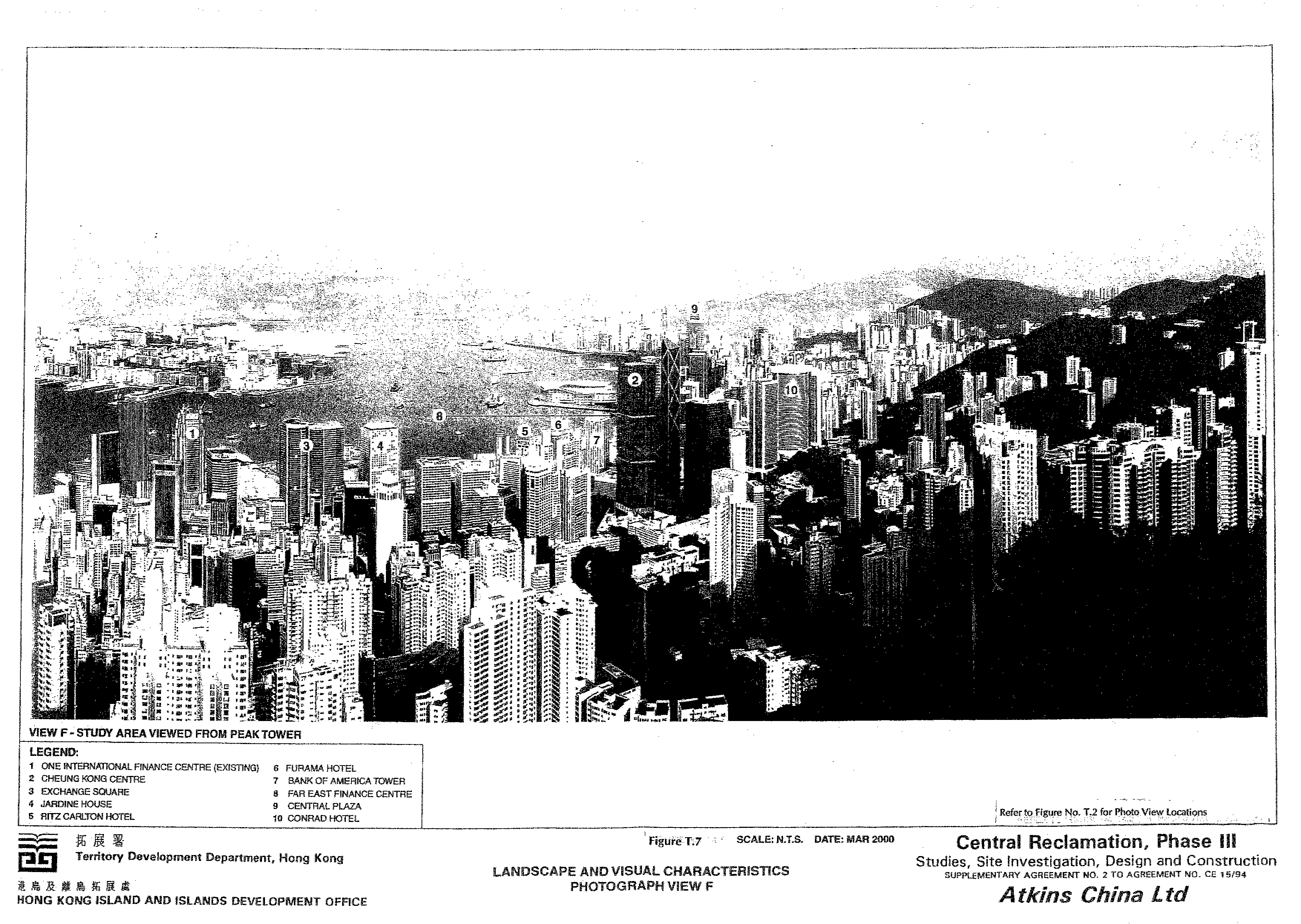
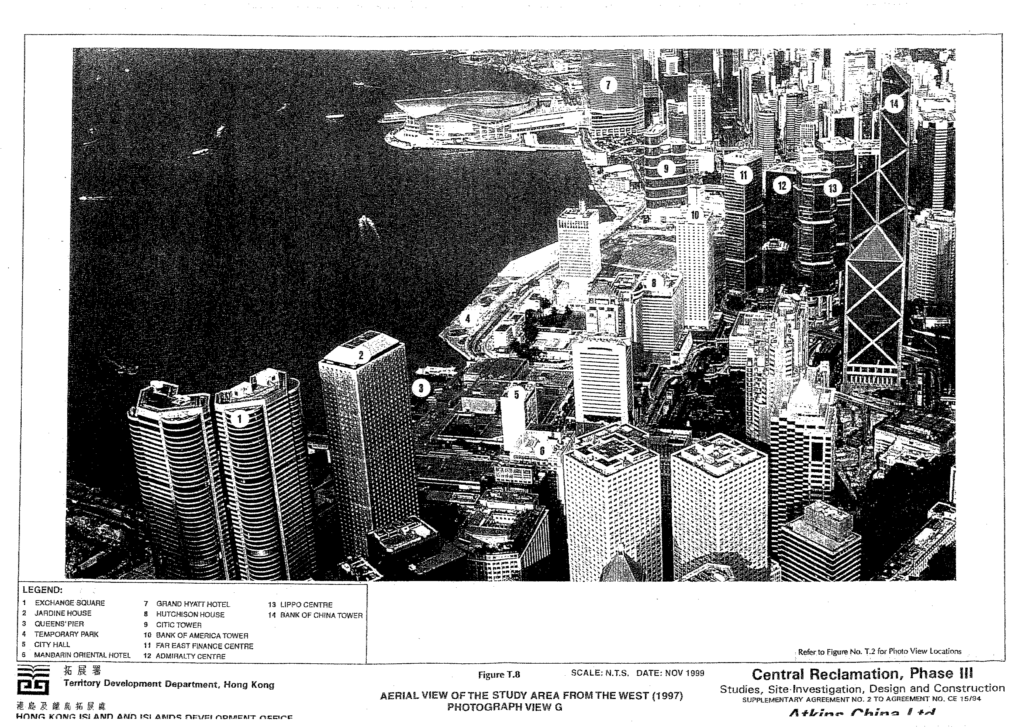
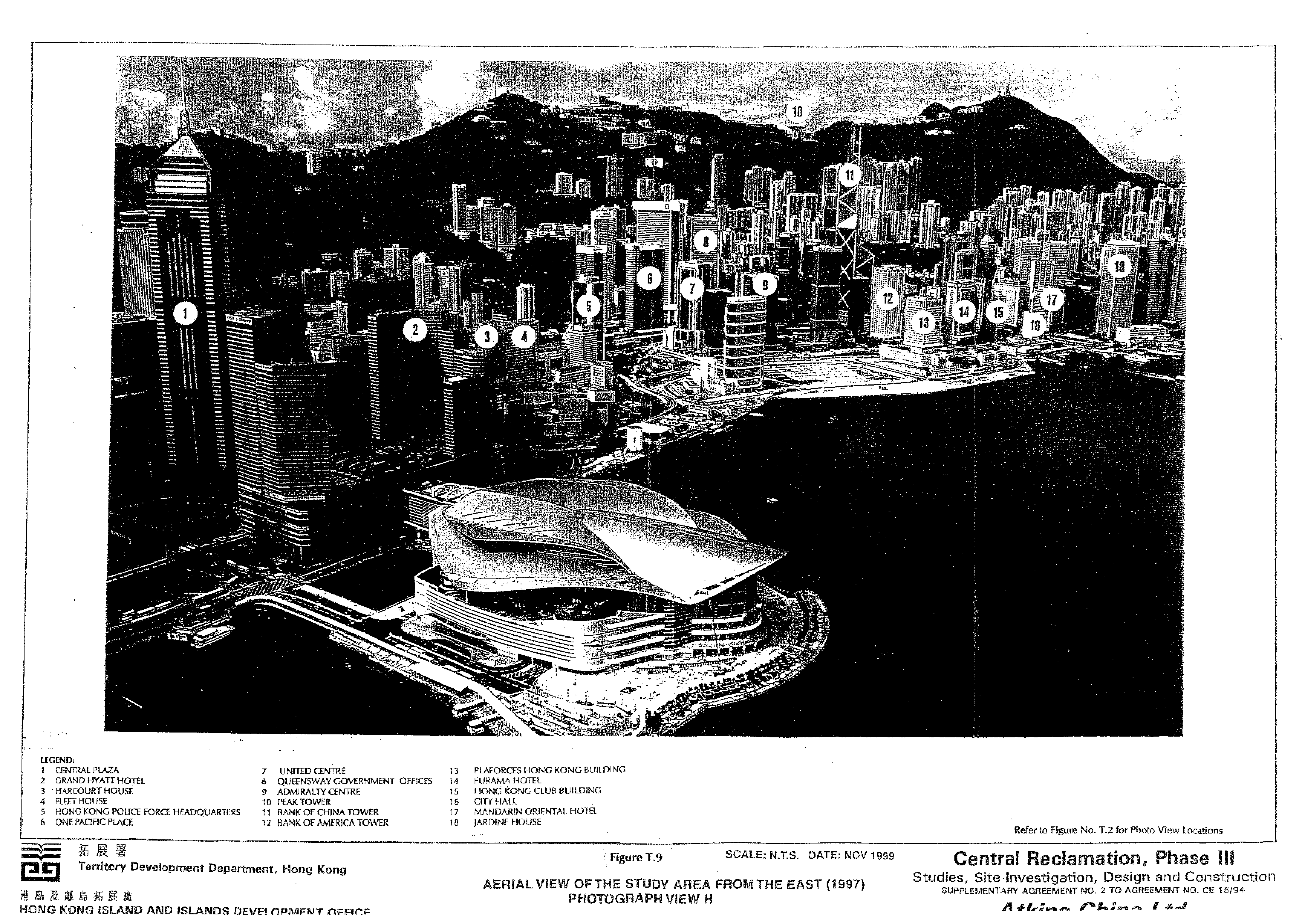
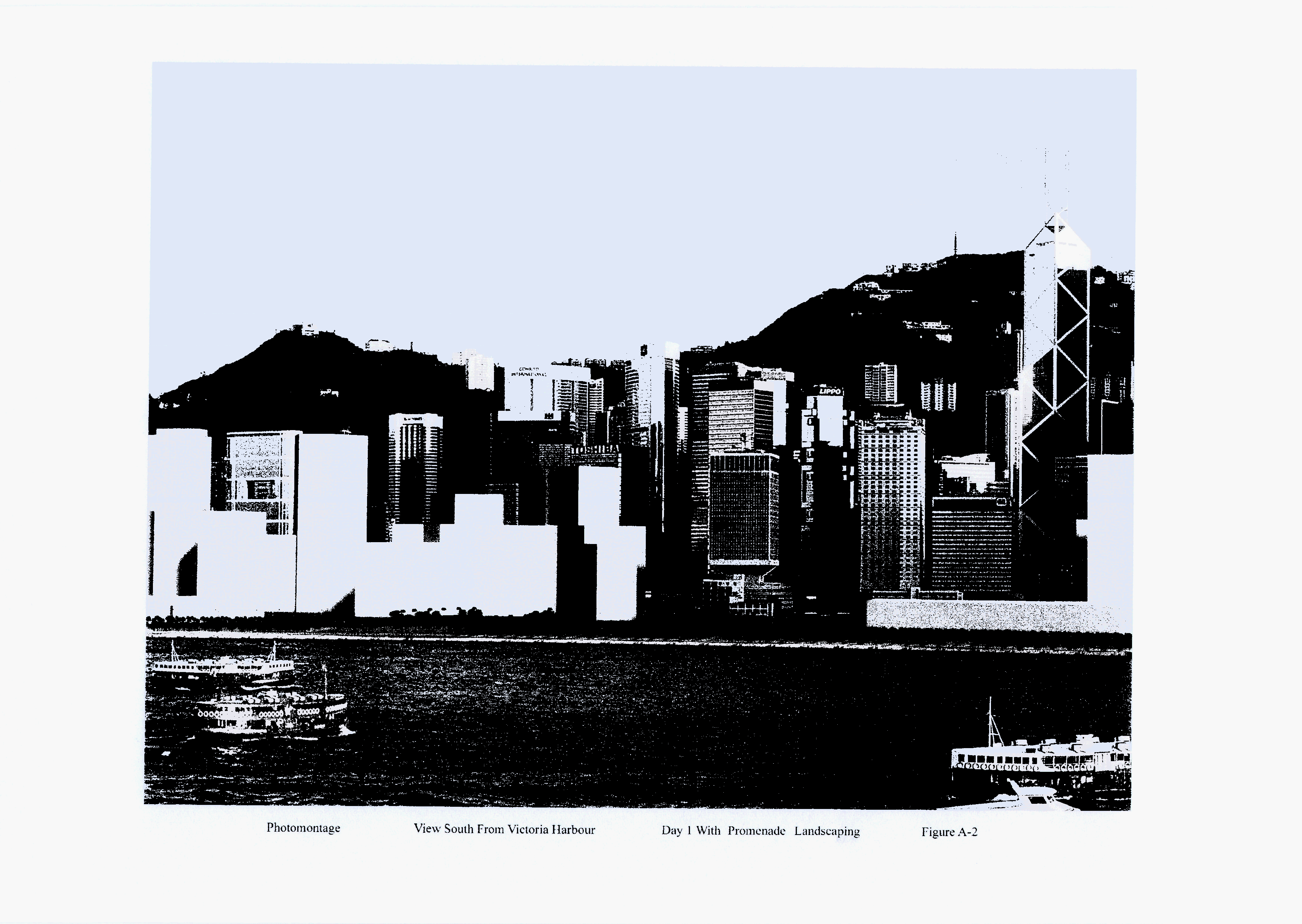
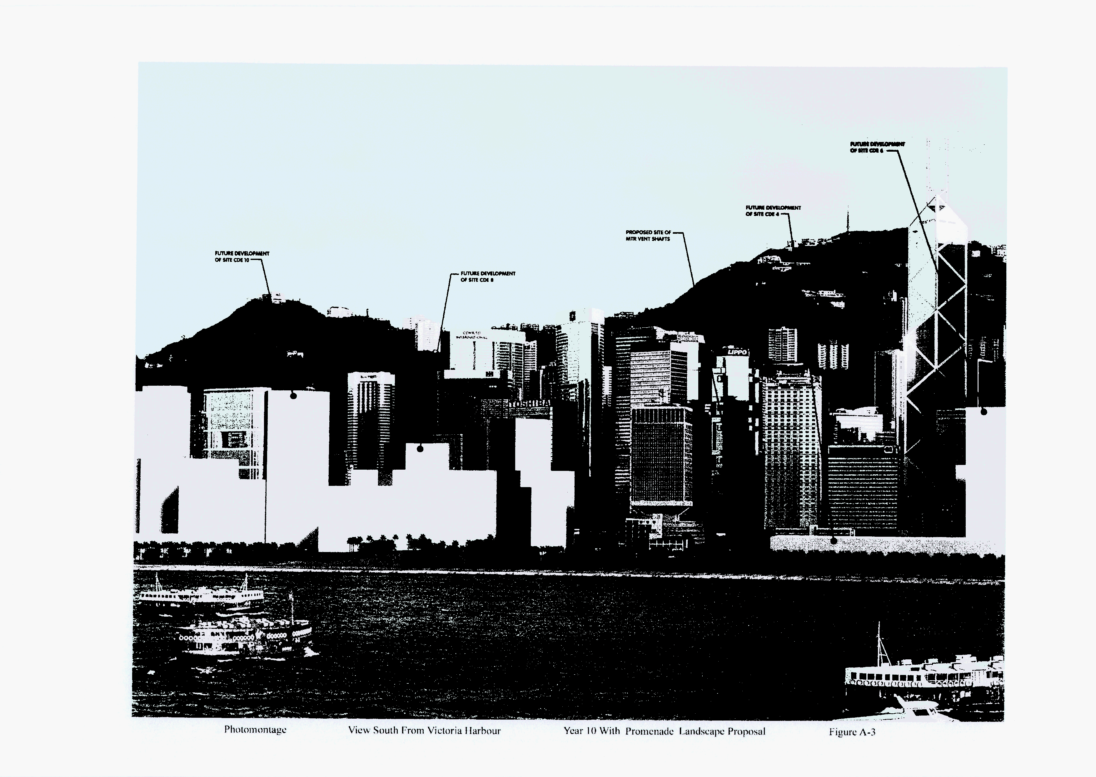
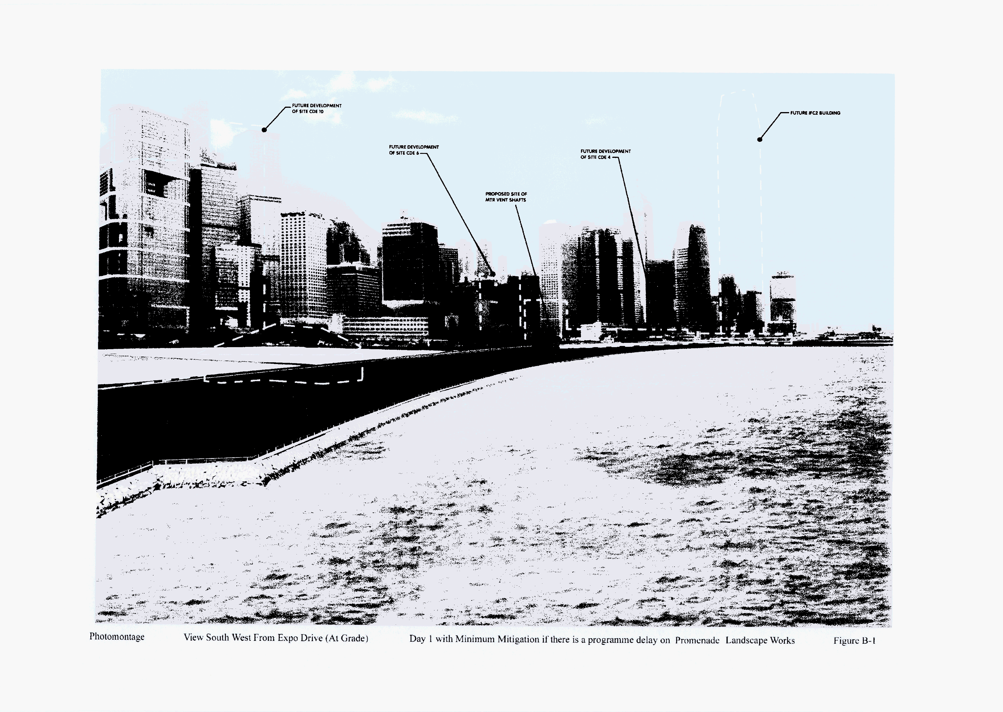
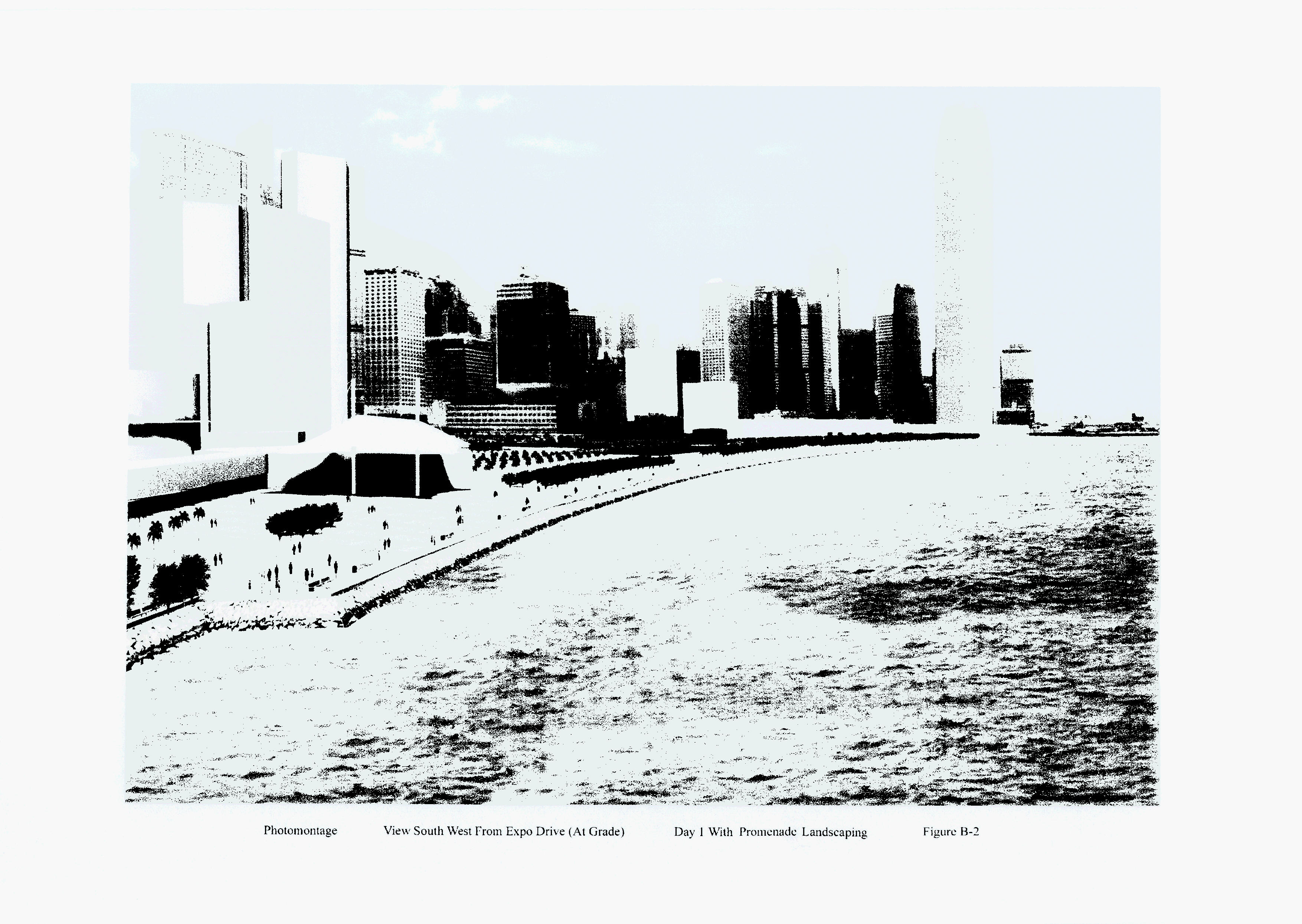
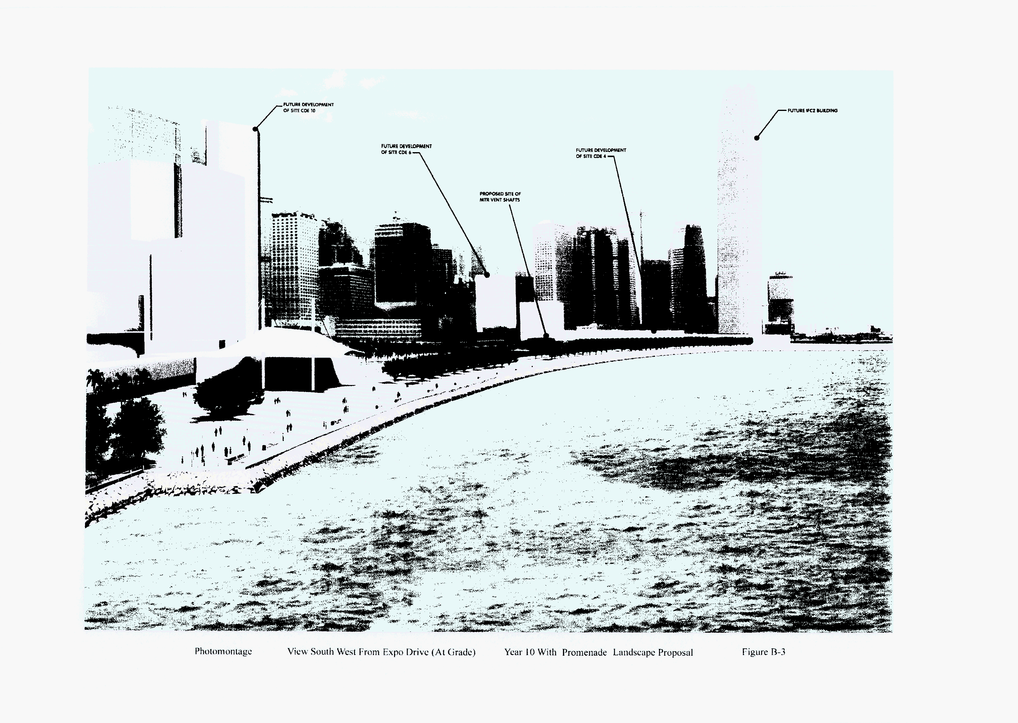
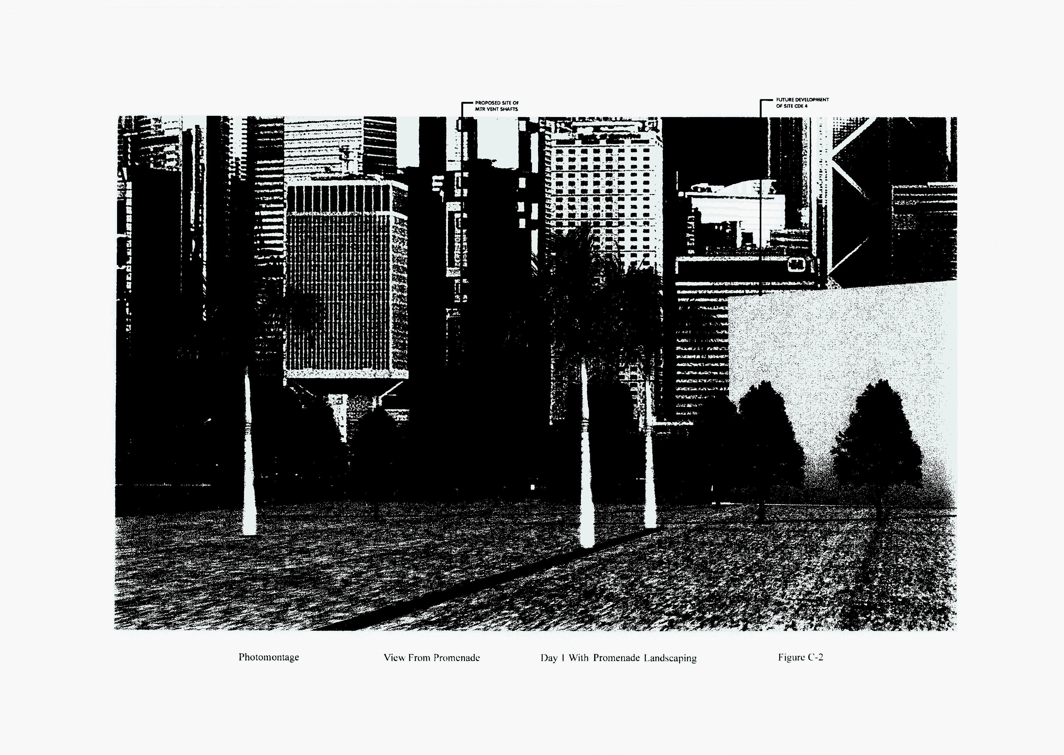
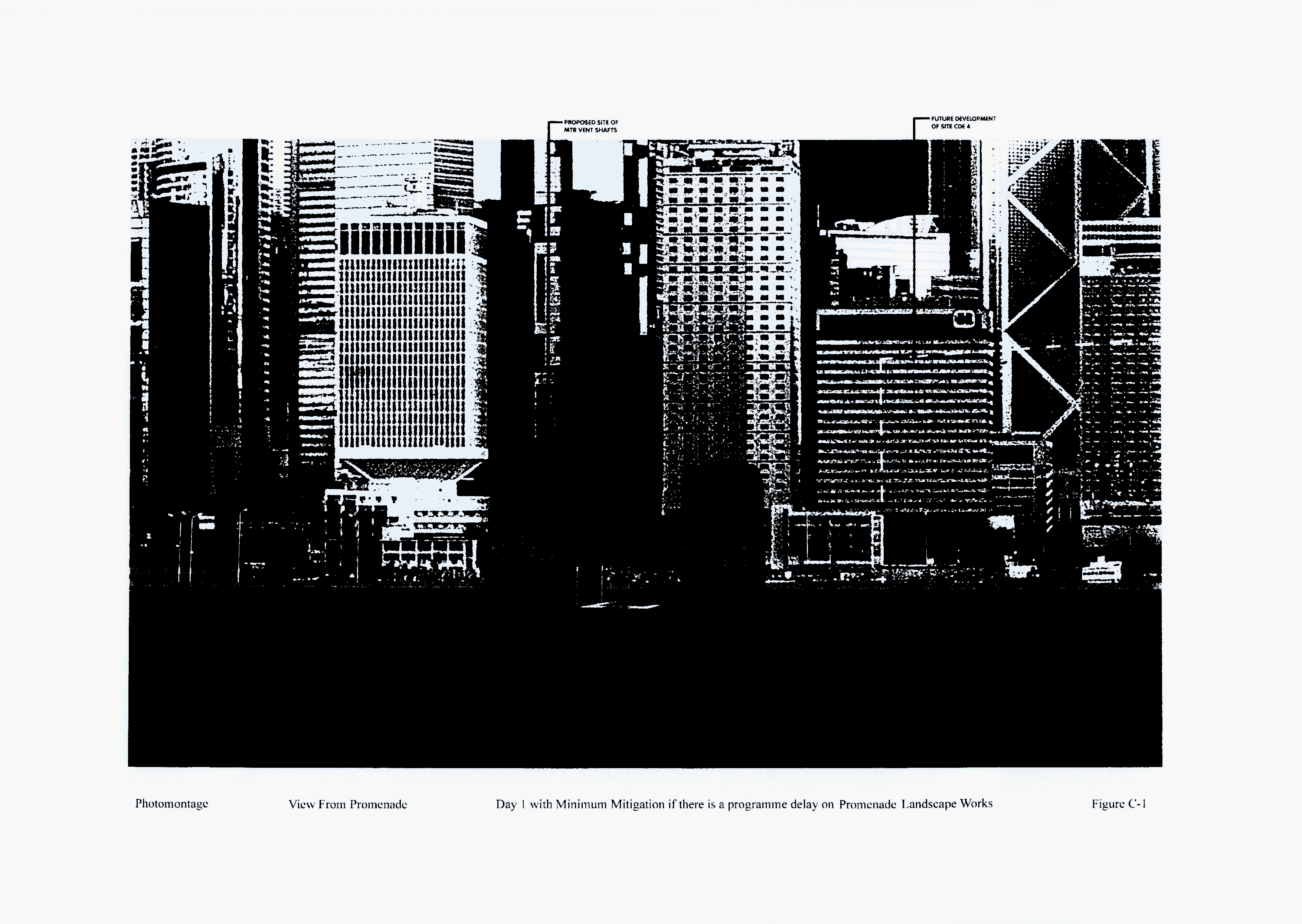
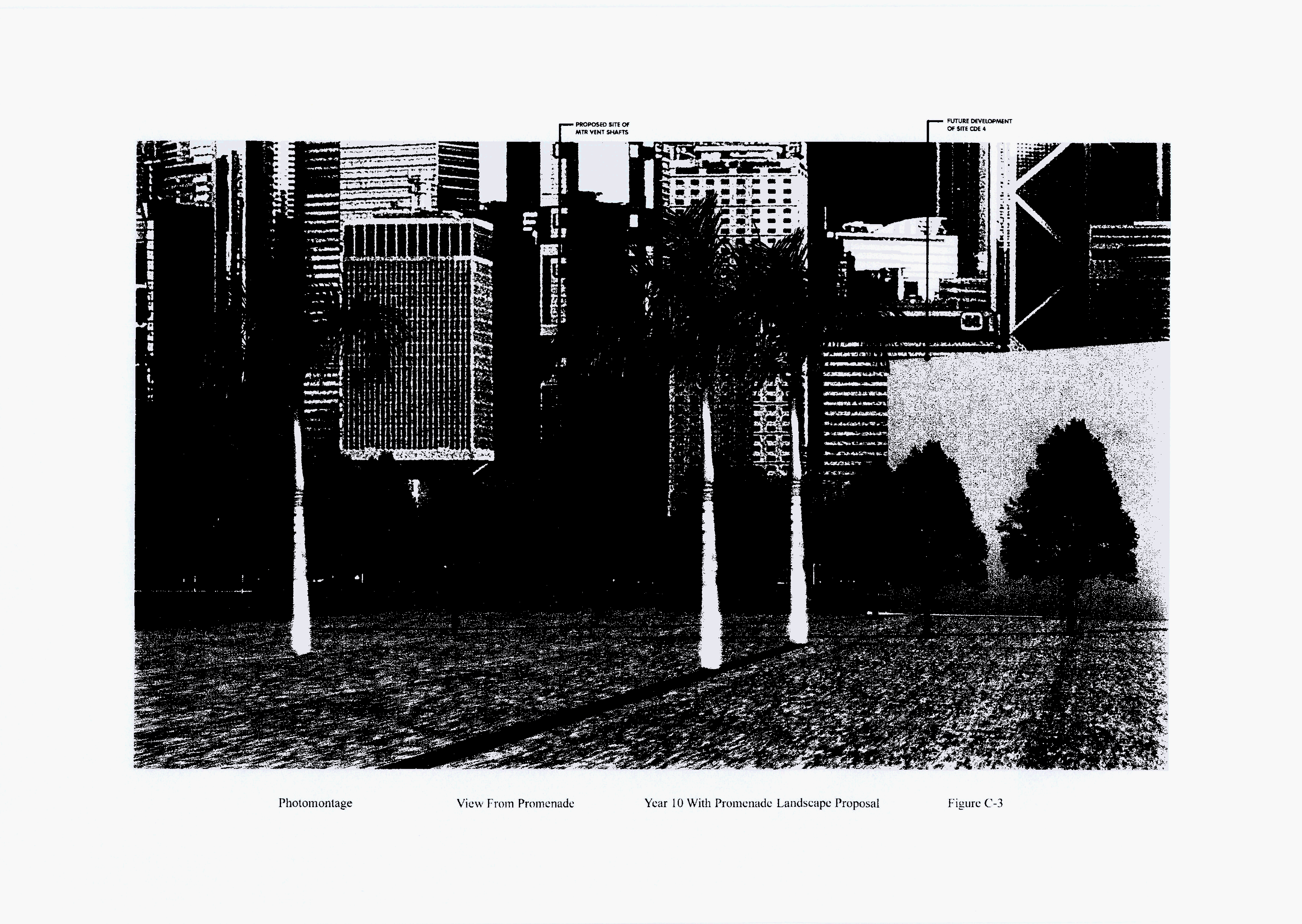
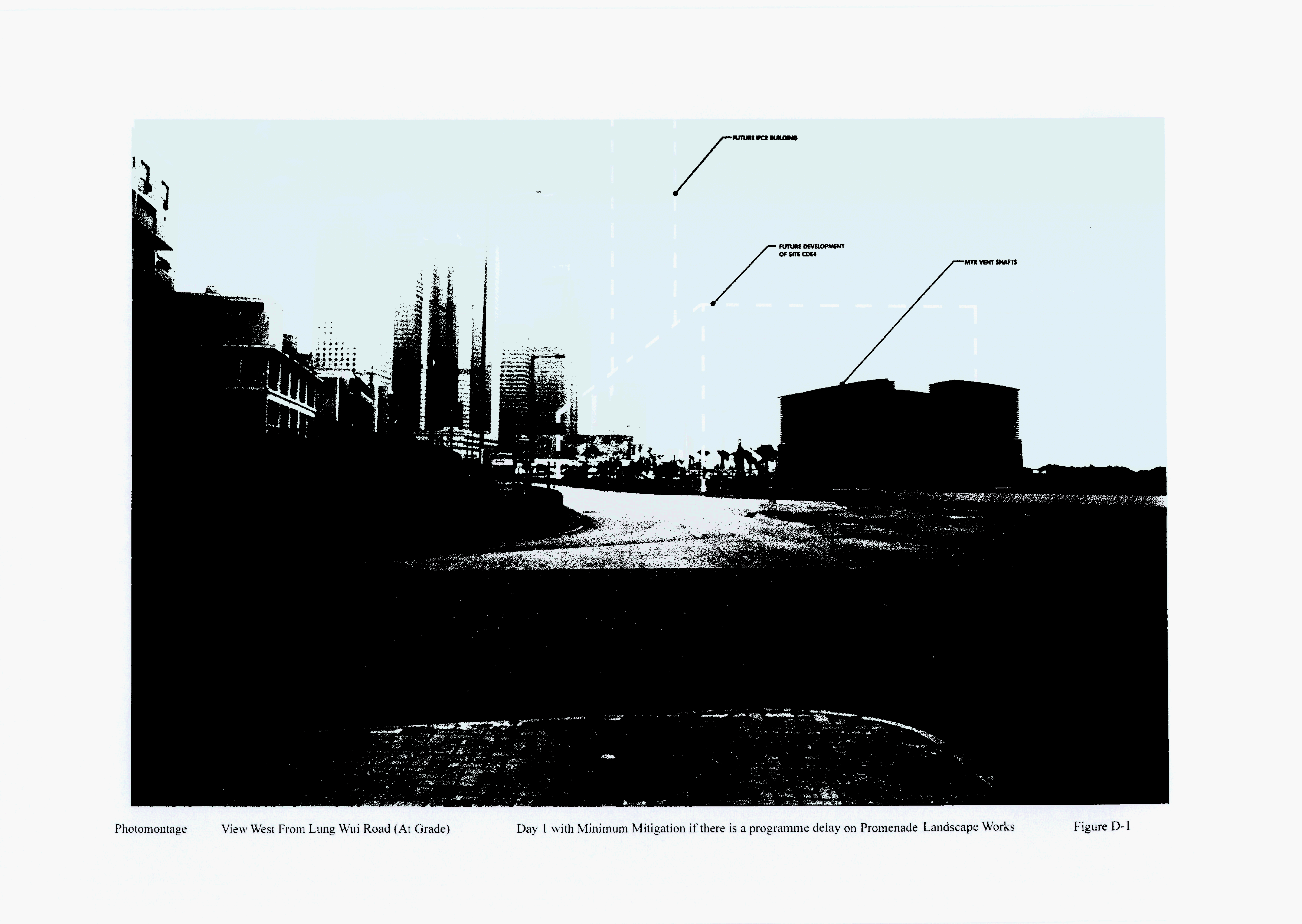
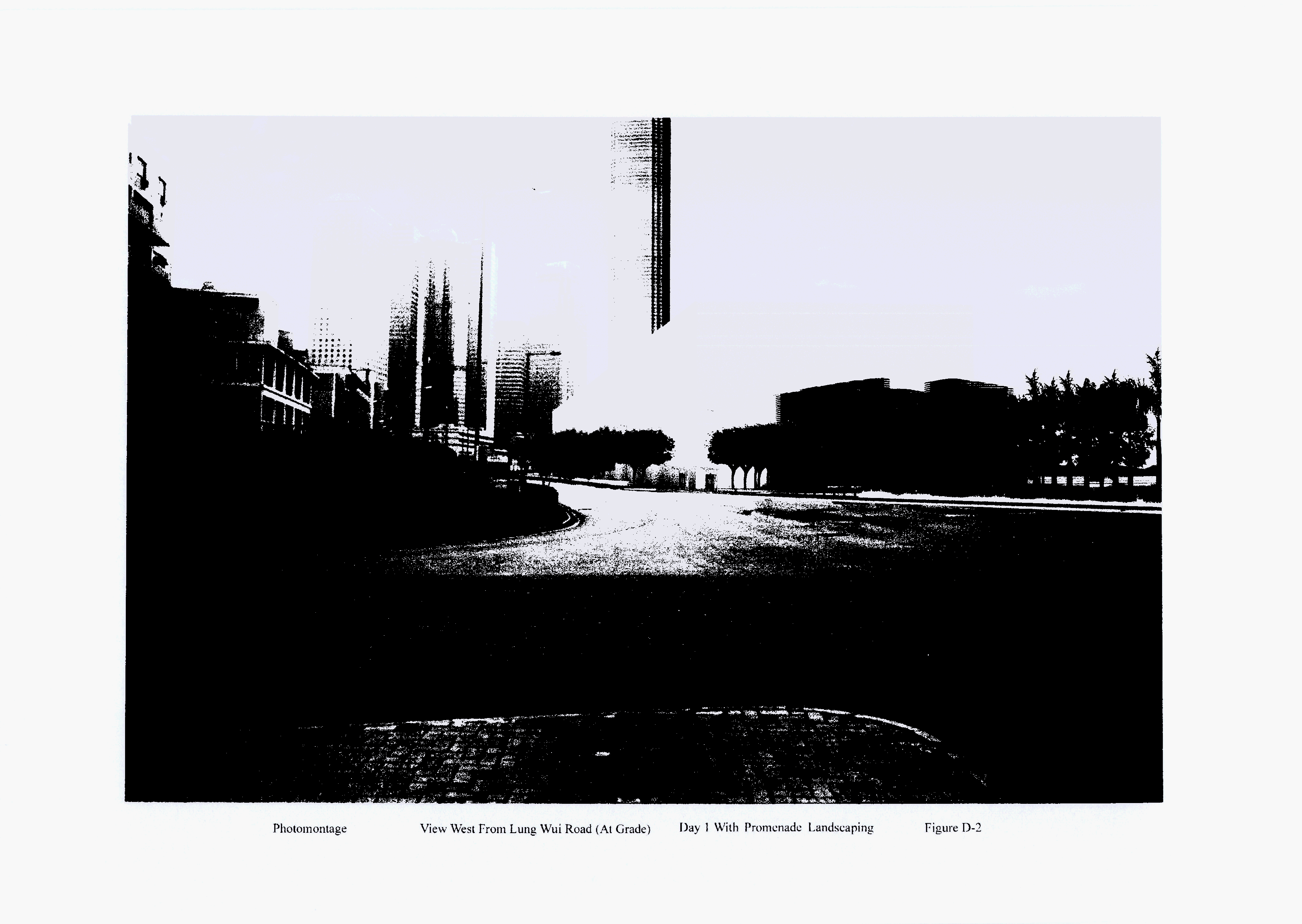
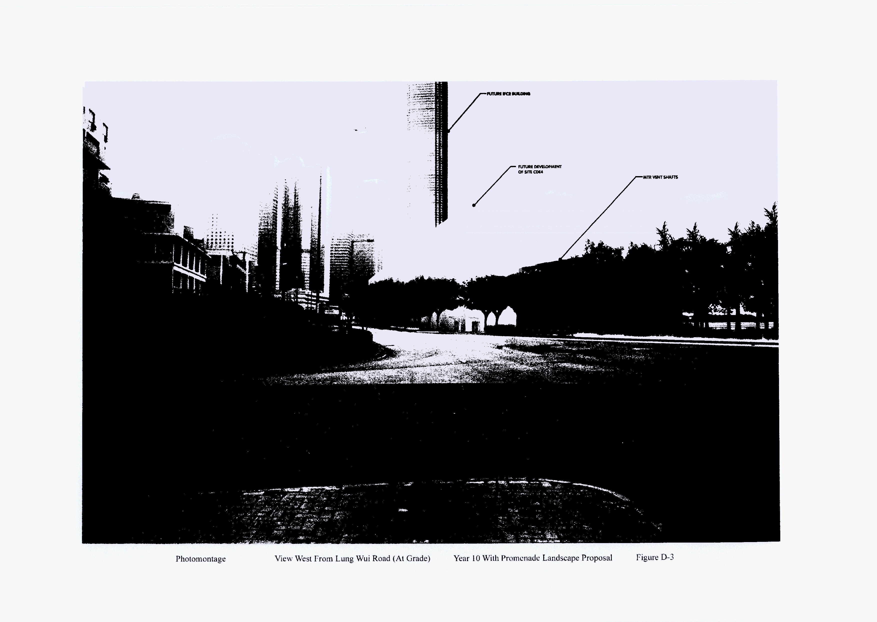
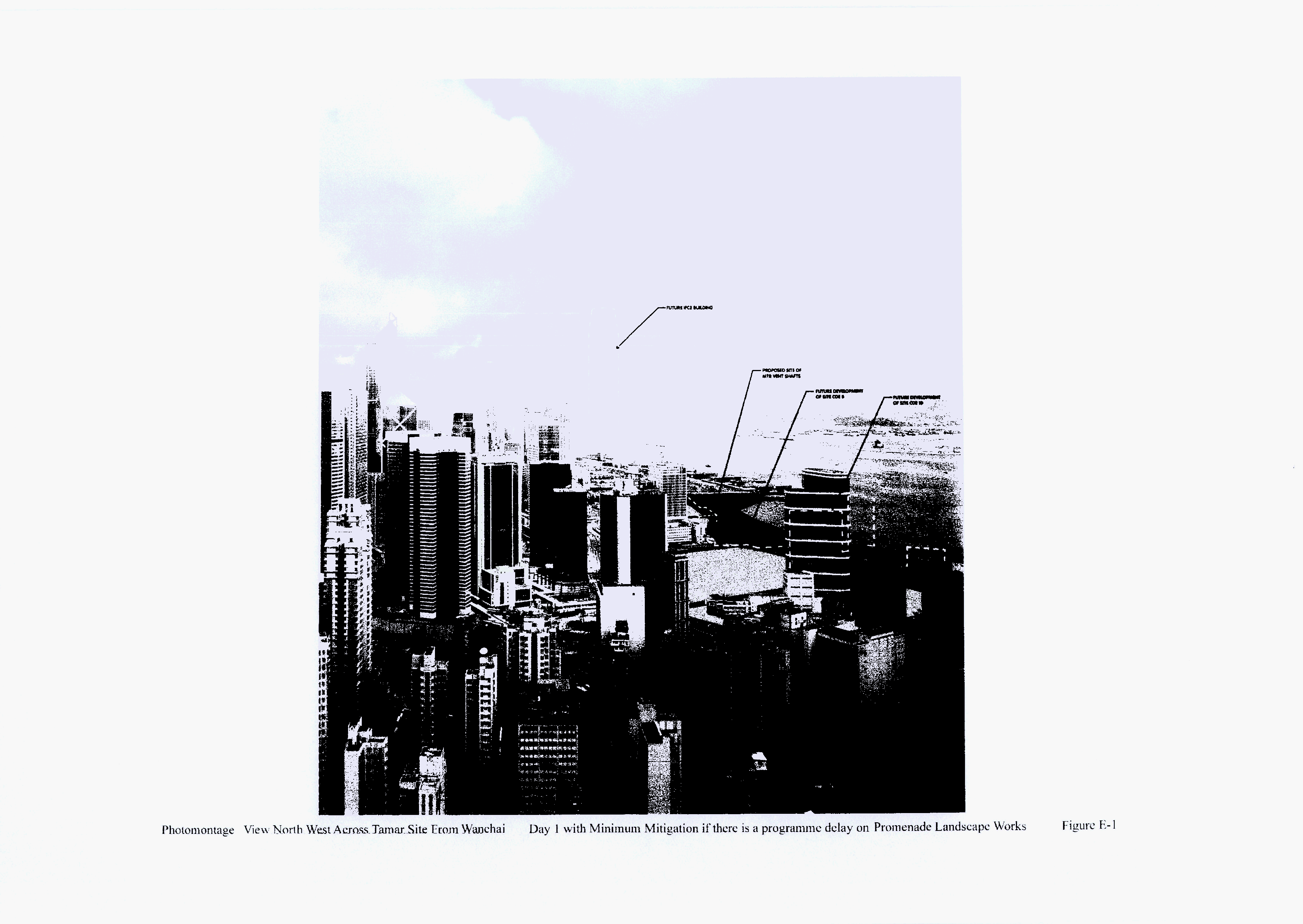
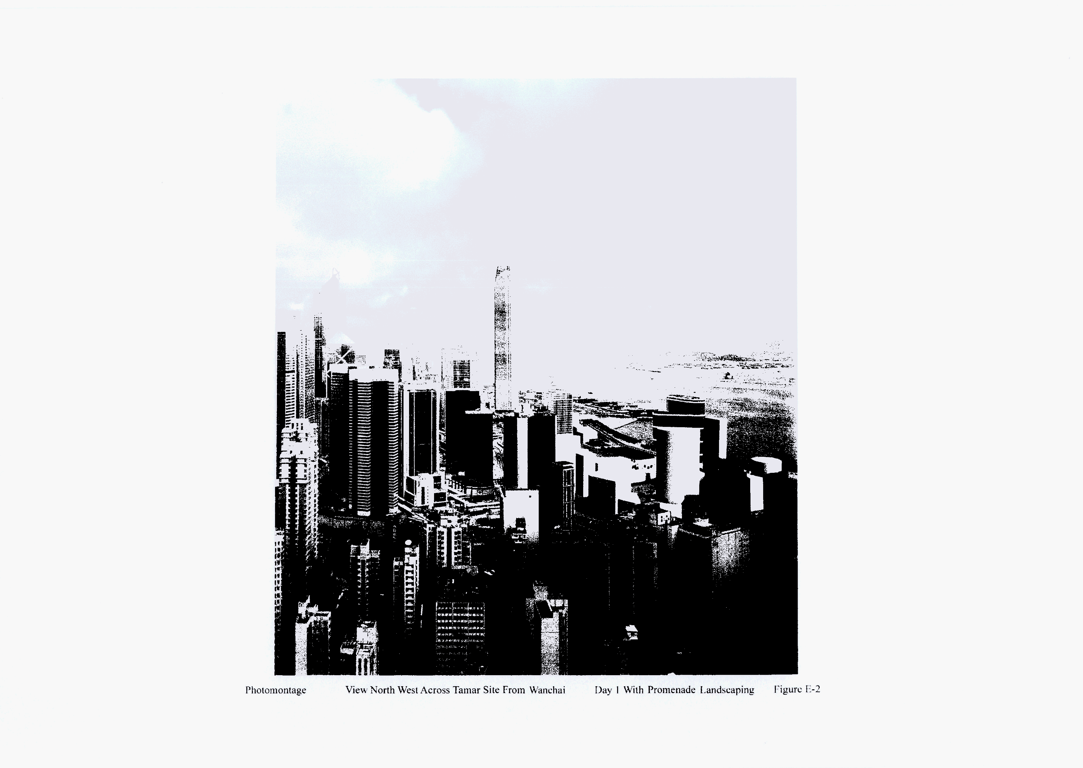
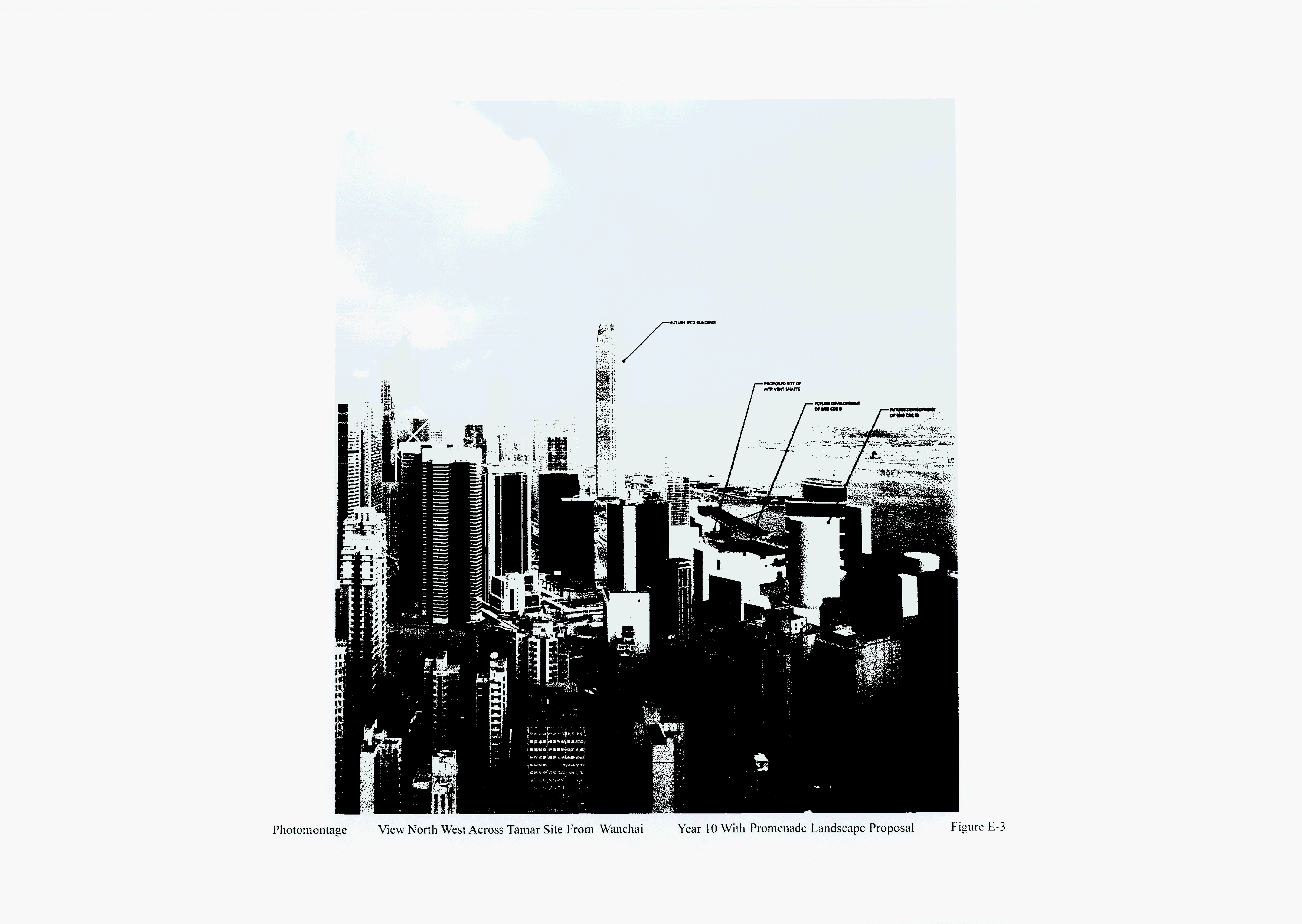
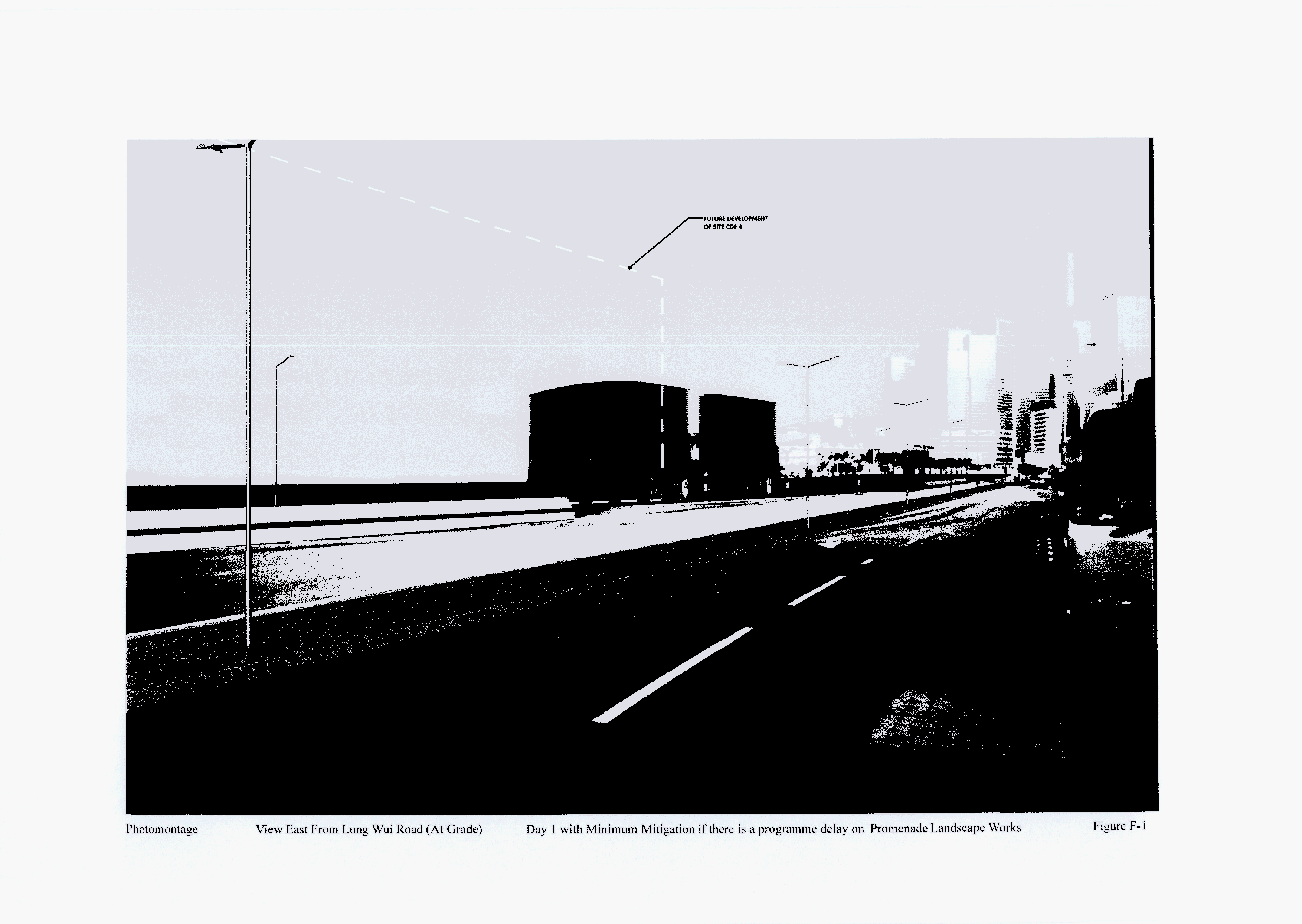
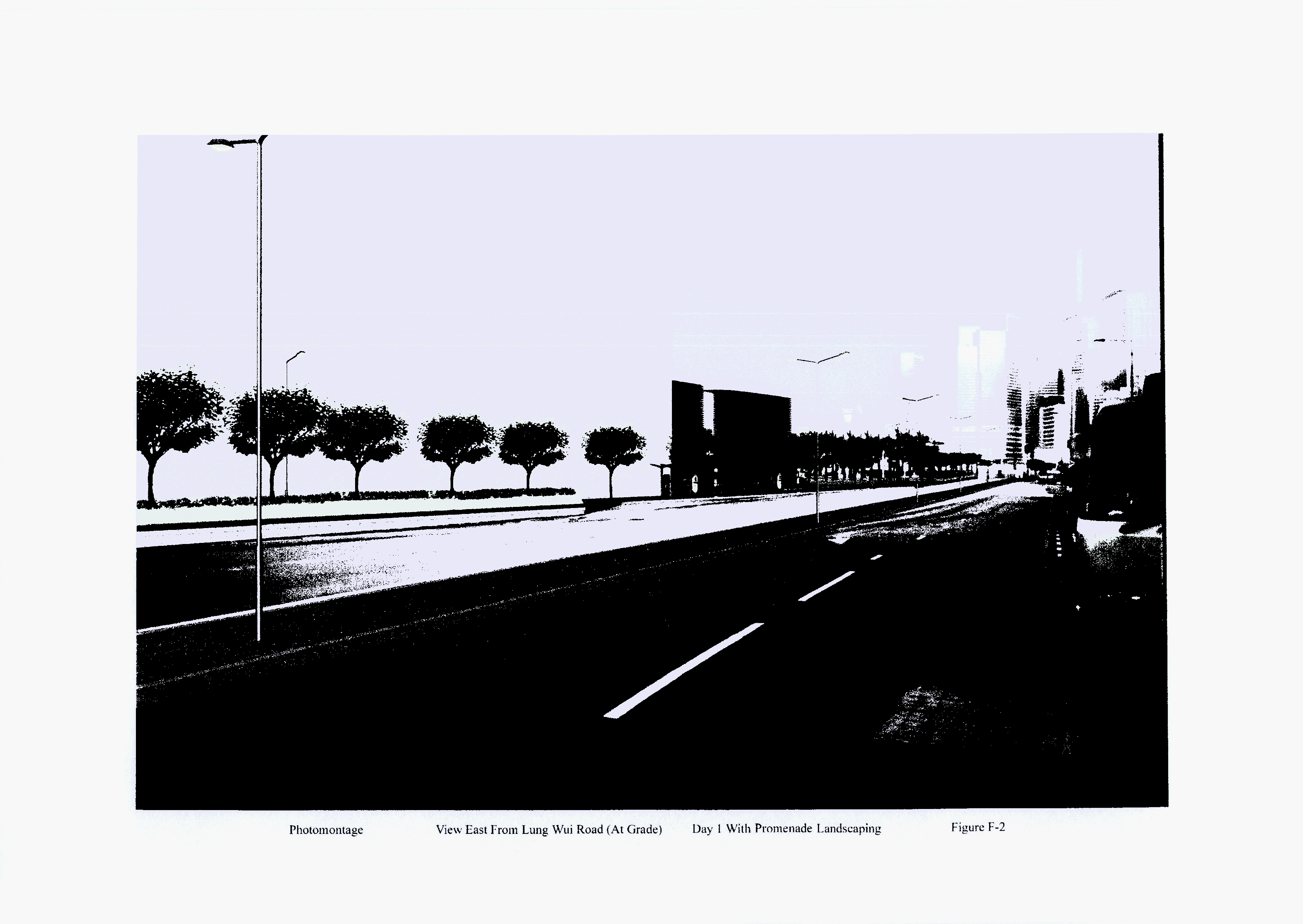
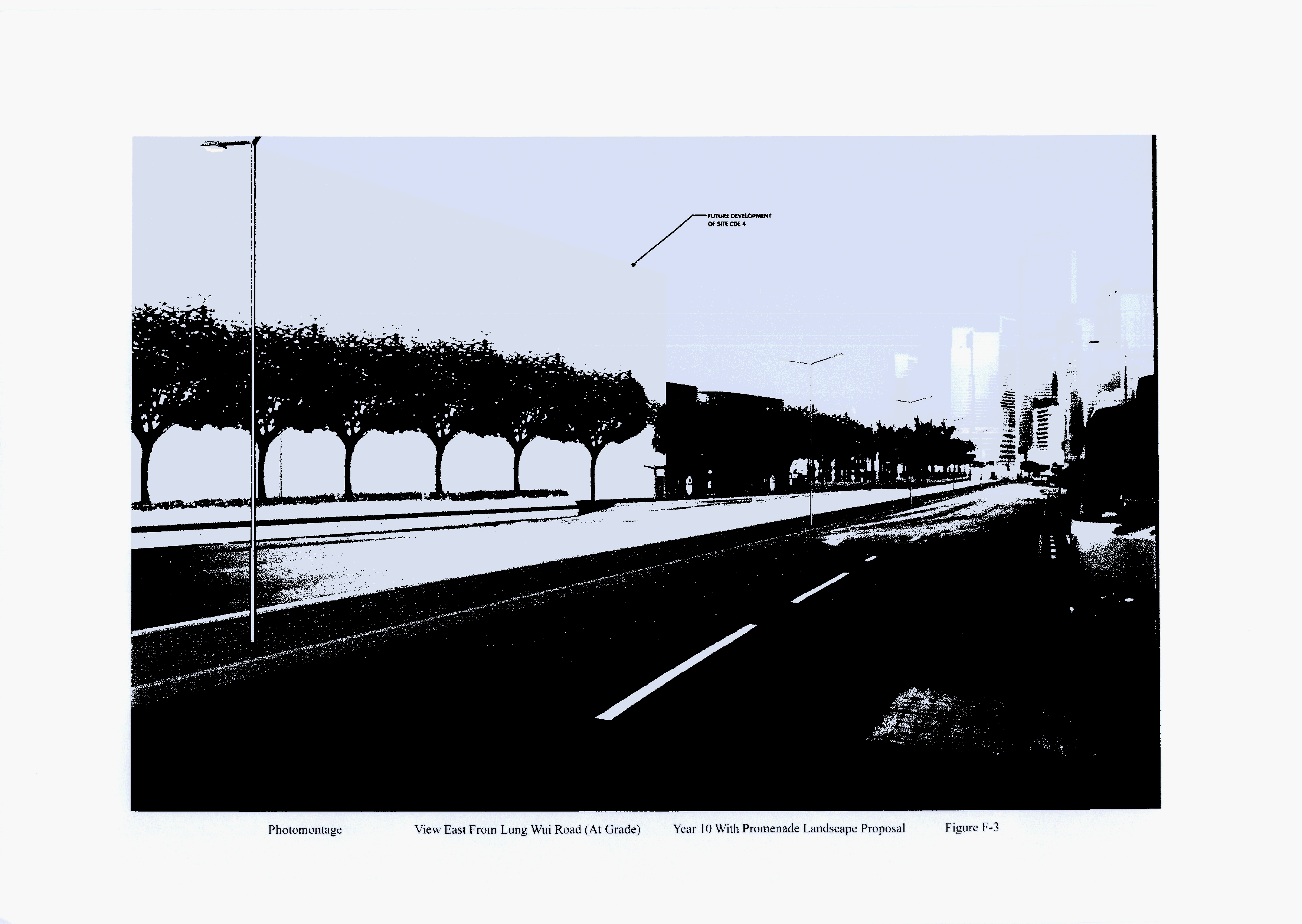