Agreement No.
CE 74/98
WAN CHAI
DEVELOPMENT PHASE II
COMPREHENSIVE
FEASIBILITY STUDY
ENVIRONMENTAL
IMPACT ASSESSMENT REPORT
CONTENTS
VOLUME
1 - TEXT
VOLUME
2 - FIGURES
VOLUME
3 - APPENDICES
ANNEX
A - CULTURAL HERITAGE SURVEY
1.1 Project Background
1.2 Objectives of the EIA Study
1.3 Considerations of Environmental Impact Assessment Ordinance
1.4 Structure of Final EIA Report
2.1 Site Location and Study Area
2.2 EIA Study Area
2.3 Project Requirements, Scope and Benefits
2.4 Project Design
2.5 Construction Methods and Engineering Requirements
2.6 Operation of the Project
2.7 Works Programme
2.8 Related Projects
3. AIR QUALITY
3.1 Introduction
3.2 Environmental Legislation, Policies, Plans, Standards and Criteria
3.3 Description of the Environment
3.4 Sensitive Receivers
3.5 Assessment Methodology
3.6 Identification of Environmental Impacts
3.7 Prediction and Evaluation of Environmental Impacts
3.8 Mitigation of Adverse Environmental Impacts
3.9 Evaluation of Residual Impacts
3.10 Environmental Monitoring and Audit
3.11 Conclusion
4 NOISE
4.1 Introduction
4.2 Environmental Legislation, Policies, Plans, Standards and Criteria
4.3 Description of the Environment
4.4 Sensitive Receivers
4.5 Assessment Methodology
4.6 Identification of Environmental Impacts
4.7 Prediction and Evaluation of Environmental Impacts
4.8 Mitigation of Adverse Environmental Impacts
4.9 Evaluation of Residual Impacts
4.10 Construction Activities during Restricted Hours
4.11 Environmental Monitoring and Audit
4.12 Conclusion
5 HYDRODYNAMICS,
WATER AND SEDIMENT QUALITY IMPACTS
5.1 Introduction
5.2 Environmental Legislation, Policies, Plans, Standards and Criteria
5.3 Description of the Environment
5.4 Water Sensitive Receivers
5.5 Assessment Methodology
5.6 Identification of Environmental Impact
5.7 Prediction and Evaluation of Environmental Impacts
5.8 Mitigation of Adverse Environmental Impacts
5.9 Evaluation of Residual Impacts
5.10 Environmental Monitoring and Audit
5.11 Conclusion
6.1 Introduction
6.2 Environmental Legislation, Policies, Plans, Standards and Criteria
6.3 Assessment Methodology
6.4 Baseline Conditions
6.5 Identification of Potential Sources of Impact
6.6 Prediction and Evaluation of Environmental Impacts
6.7 Mitigation Measures
6.8 Evaluation of Residual Impacts
6.9 Environmental Audit
6.10 Conclusion
7.1 Introduction
7.2 Environmental Legislation, Policies, Plans, Standards and Criteria
7.3 Existing Land Contamination Condition
7.4 Identification of Sensitive Receivers
7.5 Description of the Environment
7.6 Assessment Methodology
7.7 Identification of Potential Environmental Impacts
7.8 Prediction and Evaluation of Environmental Impacts
7.9 Mitigation Measures for Land Contamination
7.10 Mitigation Measures for Workers’ Health and Safety
7.11 Environmental Monitoring and Audit Requirements
7.12 Conclusion
8.1 Introduction
8.2 Environmental Legislation, Policies, Plans, Standards and Criteria
8.3 Description of the Environment
8.4 Assessment Methodology
8.5 Identification of Environmental Impacts
8.6 Prediction and Evaluation of Environmental Impacts
8.7 Mitigation of Adverse Environmental Impacts
8.8 Environmental Monitoring and Audit
8.9 Conclusion
8.10 References
9.1 Introduction
9.2 Environmental Legislation, Policies, Plans, Standards and Criteria
9.3 Description of the Environment
9.4 Assessment Methodology
9.5 Identification of Environmental Impacts
9.6 Prediction and Evaluation of Environmental Impacts
9.7 Mitigation of Adverse Environmental Impact
9.8 Environmental Monitoring and Audit
9.9 Conclusion
9.10 References
10 LANDSCAPE
AND VISUAL IMPACT
10.1 Introduction
10.2 Scope and Content of Study
10.3 Review of the Planning and Development Control Framework
10.4 Summary of Views from Consultation Forums
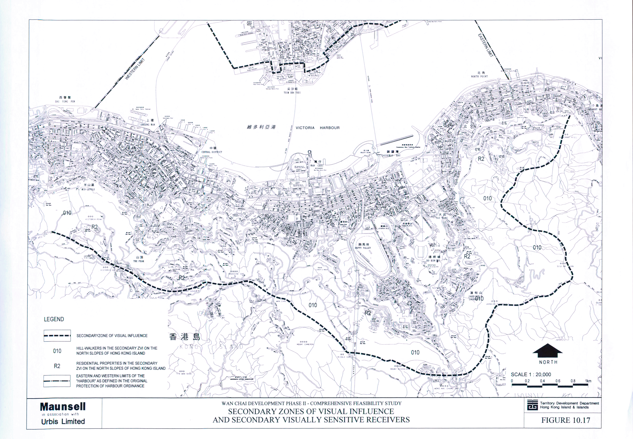
10.5 Baseline Review of the Existing Environment
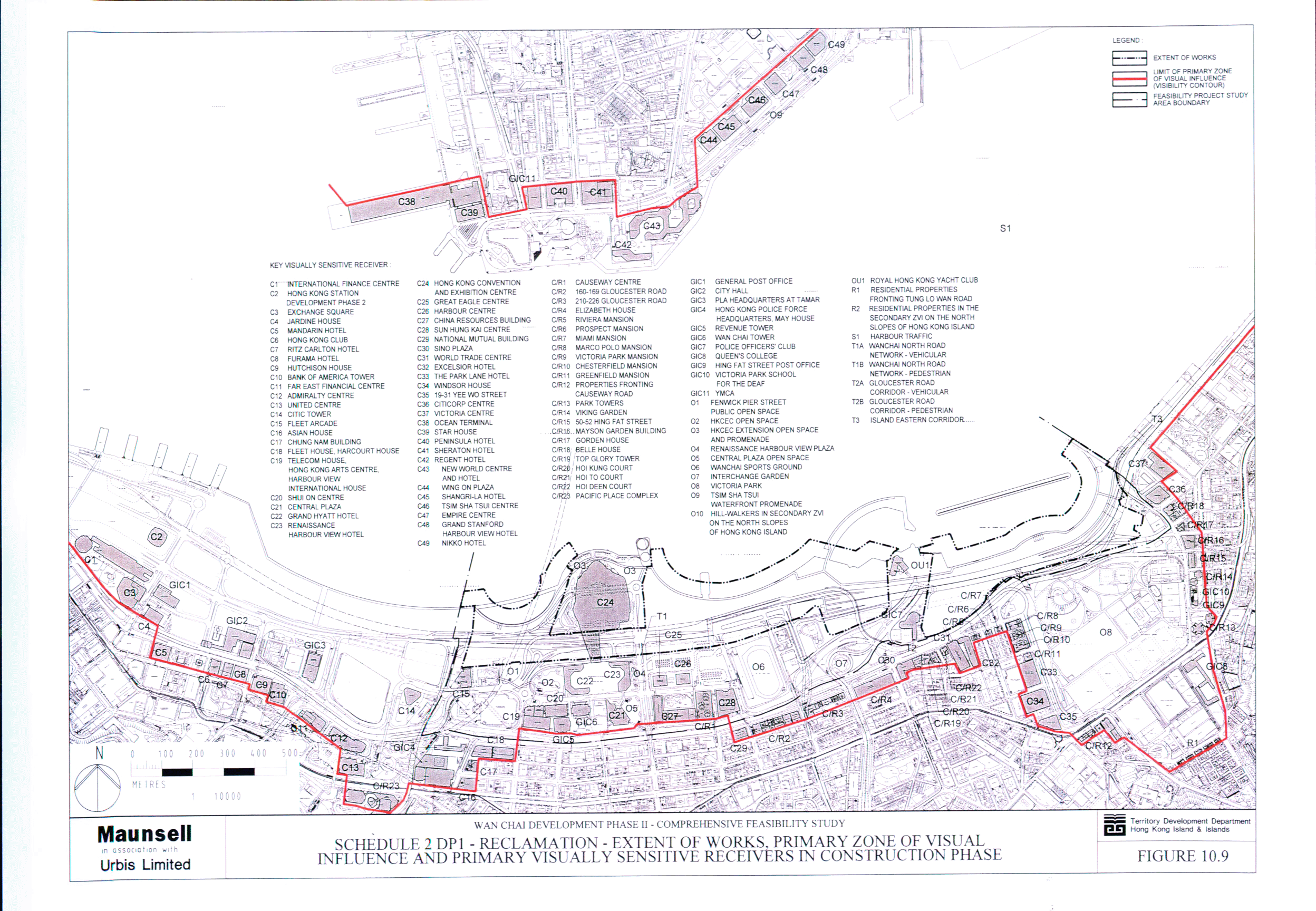
10.6 Designated Project 1 : Reclamation Works – Landscape and Visual Impact
Assessment
10.7 Designated Project 2 : WDII Major Roads – Landscape and Visual Impact
Assessment
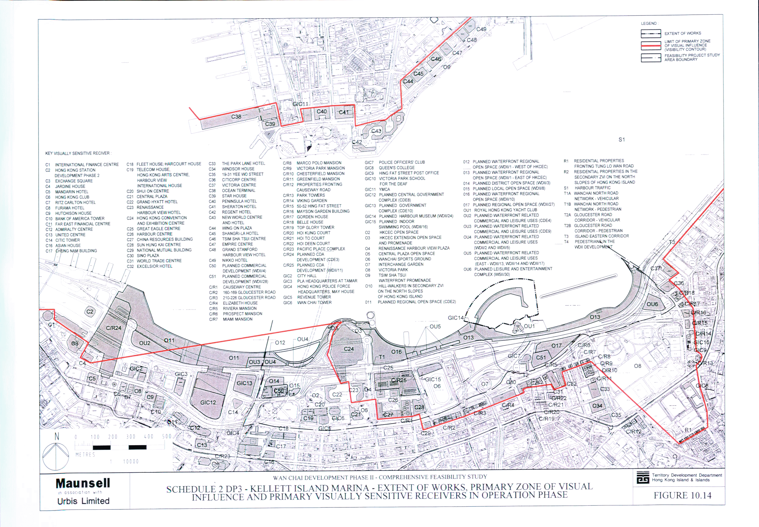
10.8 Designated Project 3 : Kellett Island Marina – Landscape and Visual Impact
Assessment
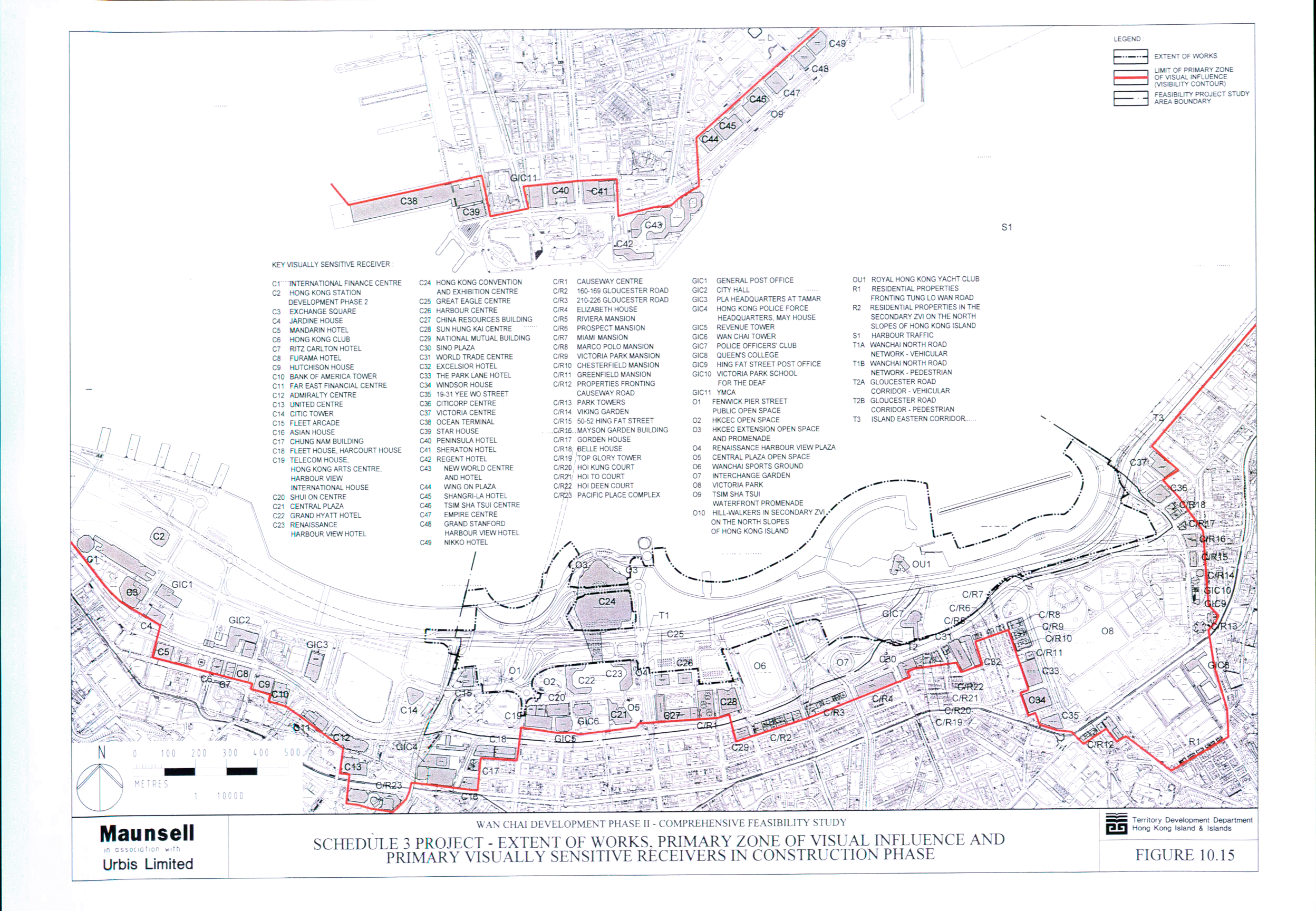
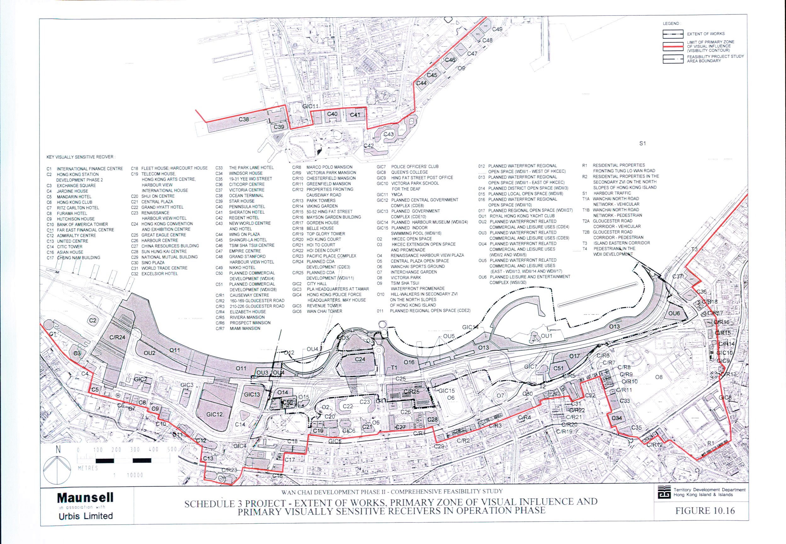
10.9 Schedule 3 Project : WDII Development – Landscape and Visual Impact
Assessment
10.10 Conclusion
11.1 Introduction
11.2 Assessment Methodology and Criteria
11.3 Calculation of Potential Gas Emissions
11.4 Evaluation of Significance of Potential Gas Emissions
11.5 Mitigation Measures and Further Work
11.6 Conclusion
12 ENVIRONMENTAL
MONITORING AND AUDIT
12.1 Introduction
12.2 Air Quality Impact
12.3 Noise Impact
12.4 Water Quality Impact
12.5 Waste Management
12.6 Land Contamination
12.7 Terrestrial Ecology
12.8 Marine Ecology
12.9 Landscape and Visual
12.10 Biogas
13 CONCLUSION
13.1 Introduction
13.2 Air Quality Impact
13.3 Noise Impact
13.4 Hydrodynamics, Water and Sediment Quality Impacts
13.5 Waste Management
13.6 Land Contamination
13.7 Terrestrial Ecology
13.8 Marine Ecology
13.9 Landscape and Visual
13.10 Biogas
13.11 Environmental
Monitoring and Audit
13.12 Overall Conclusion
14 IMPLEMENTATION
SCHEDULE OF THE PROPOSED MITIGATION MEASURES
VOLUME
2 -
FIGURES
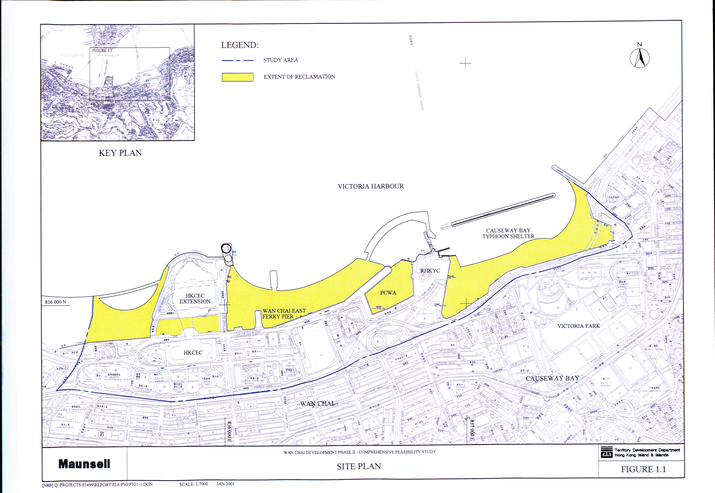
Figure 1.1 Site Plan
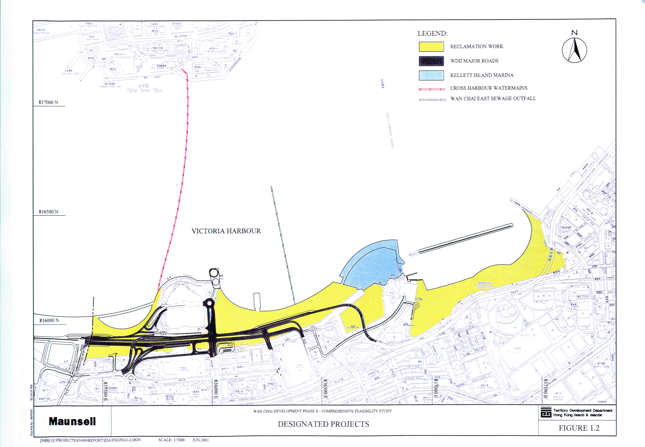
Figure 1.2 Designated Projects
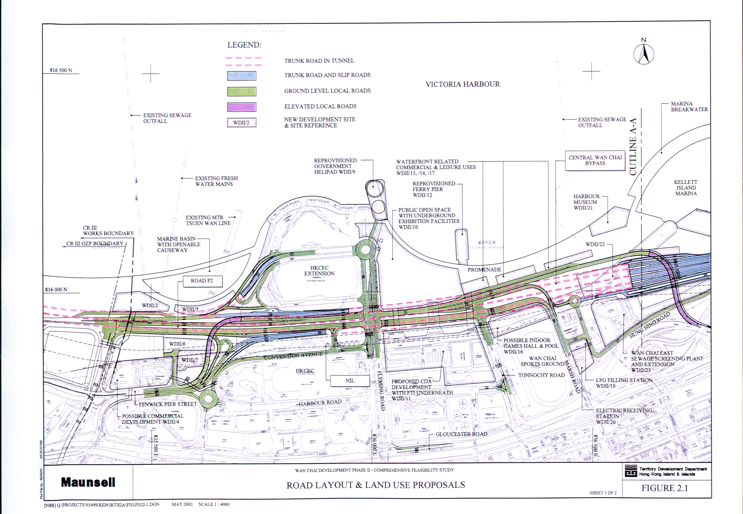
Figure 2.1 Road Layout & Land Use Proposals (Sheet
1 of 2)
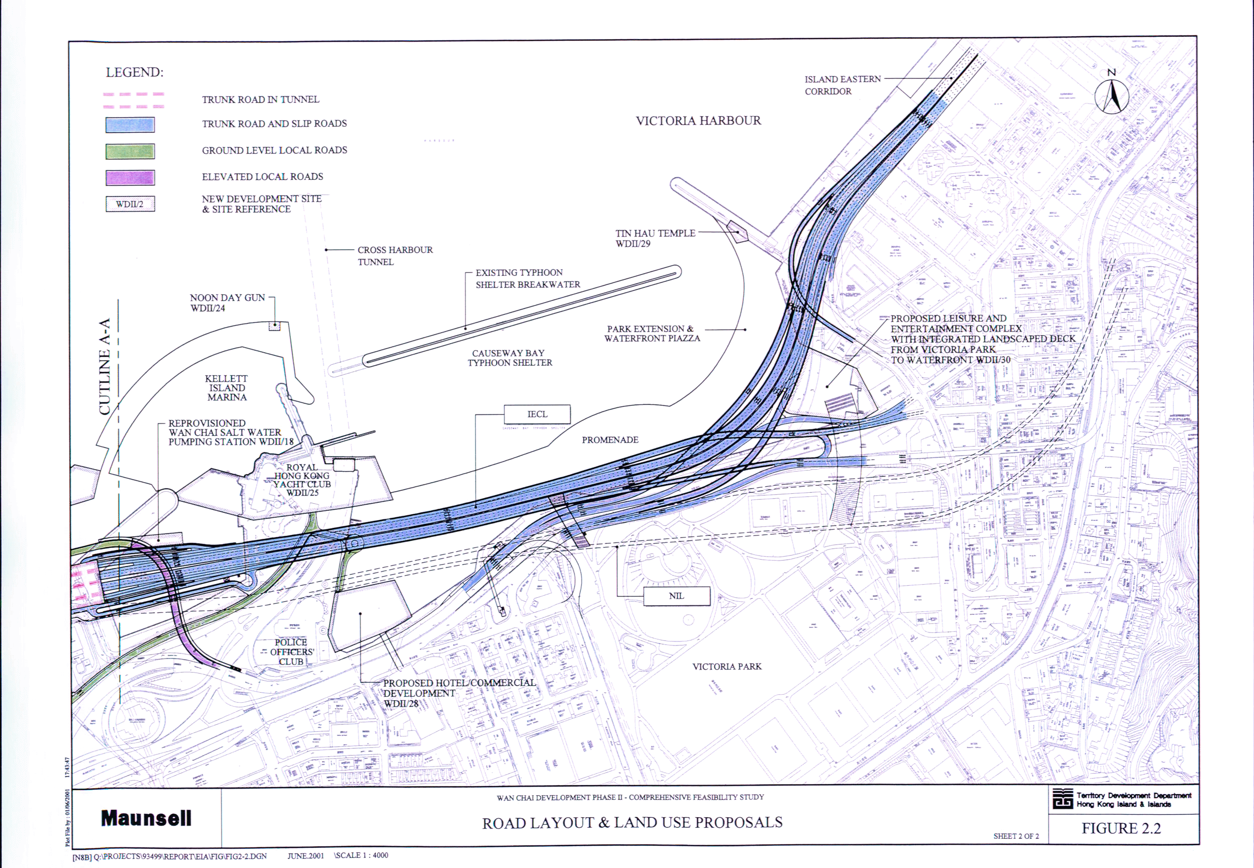
Figure 2.2 Road Layout & Land Use Proposals (Sheet
2 of 2)
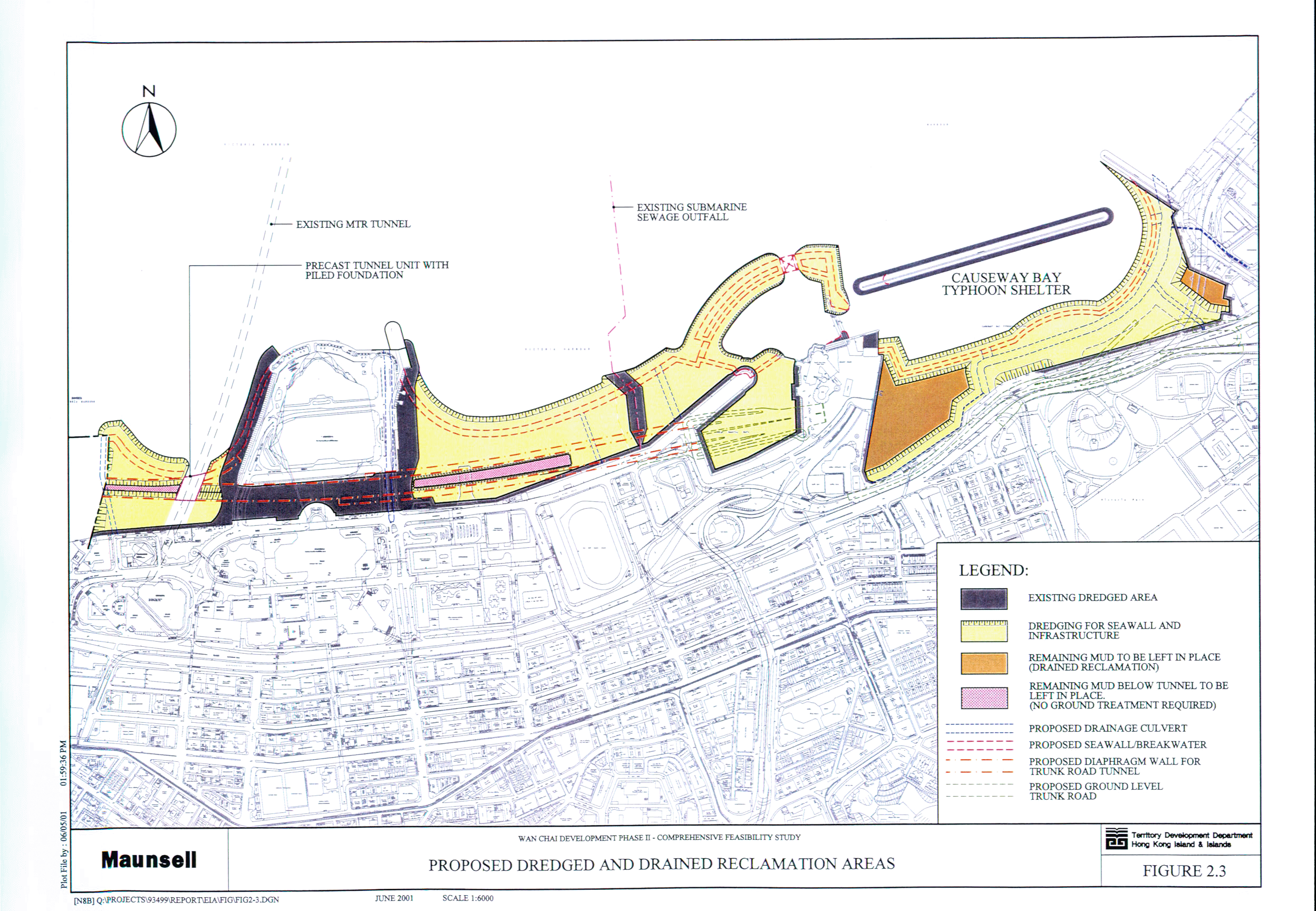
Figure 2.3 Proposed Dredged and Drained Reclamation
Areas
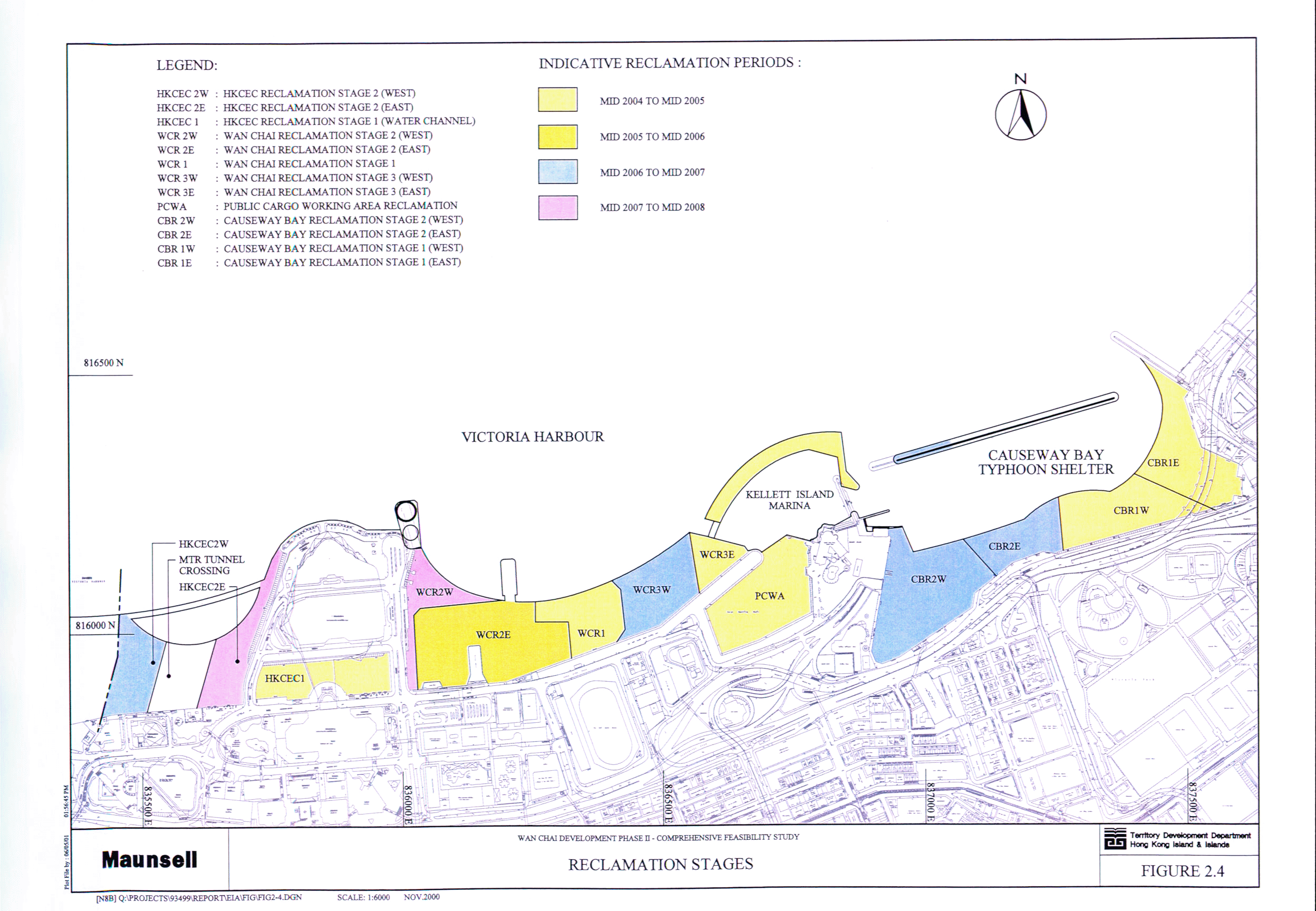
Figure 2.4 Reclamation Stages
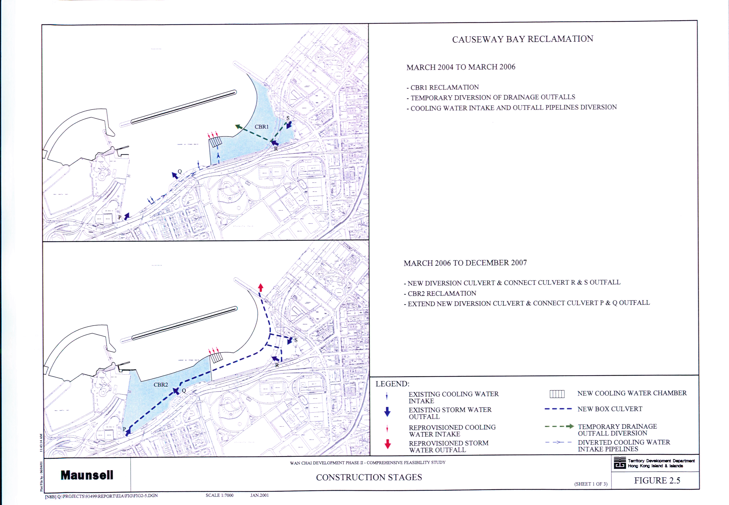
Figure 2.5 Construction Stages (Sheet 1 of 3)
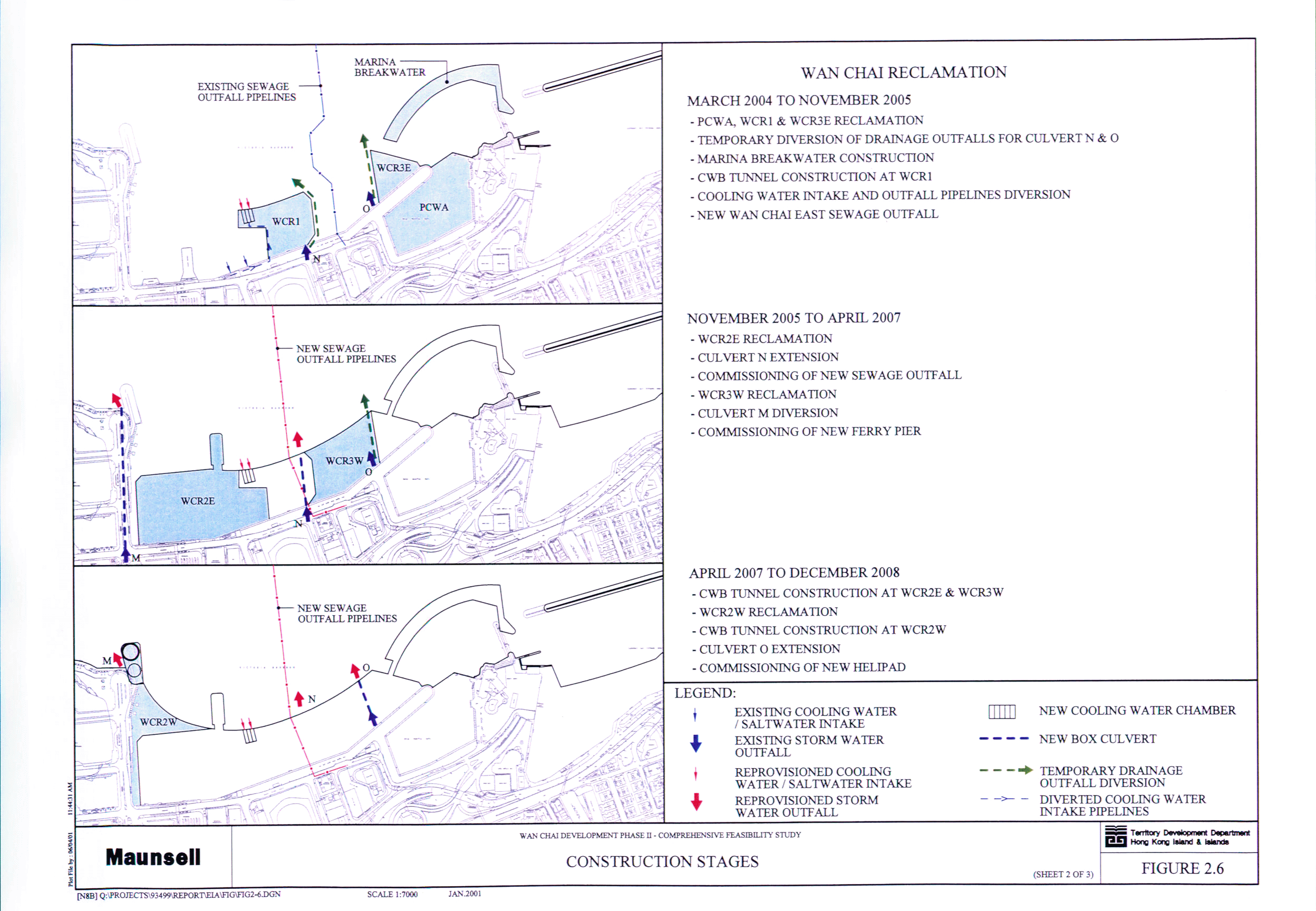
Figure 2.6 Construction Stages (Sheet 2 of 3)
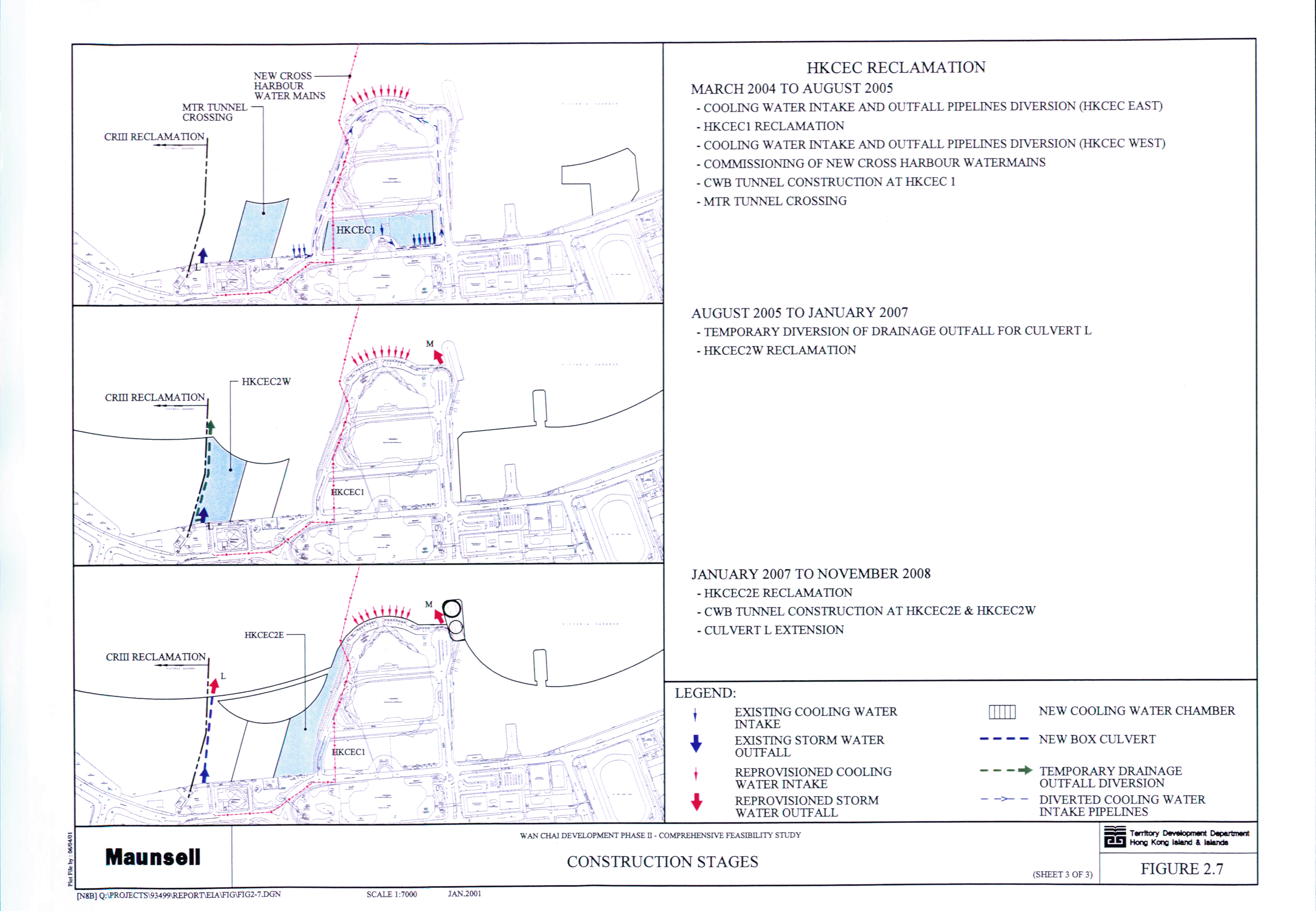
Figure 2.7 Construction Stages (Sheet 3 of 3)
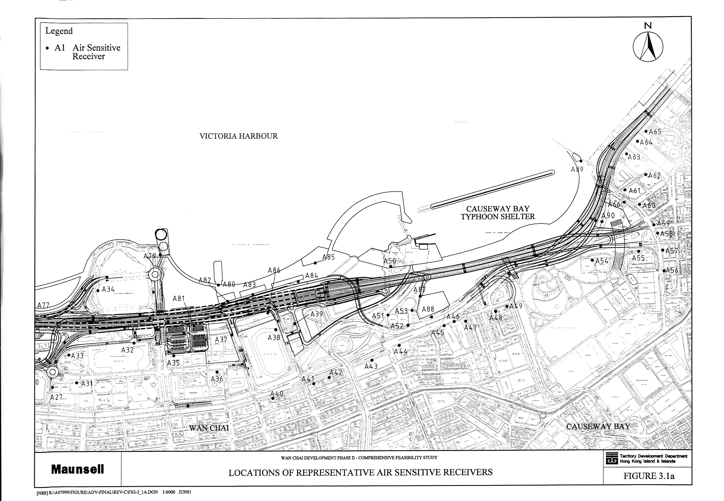
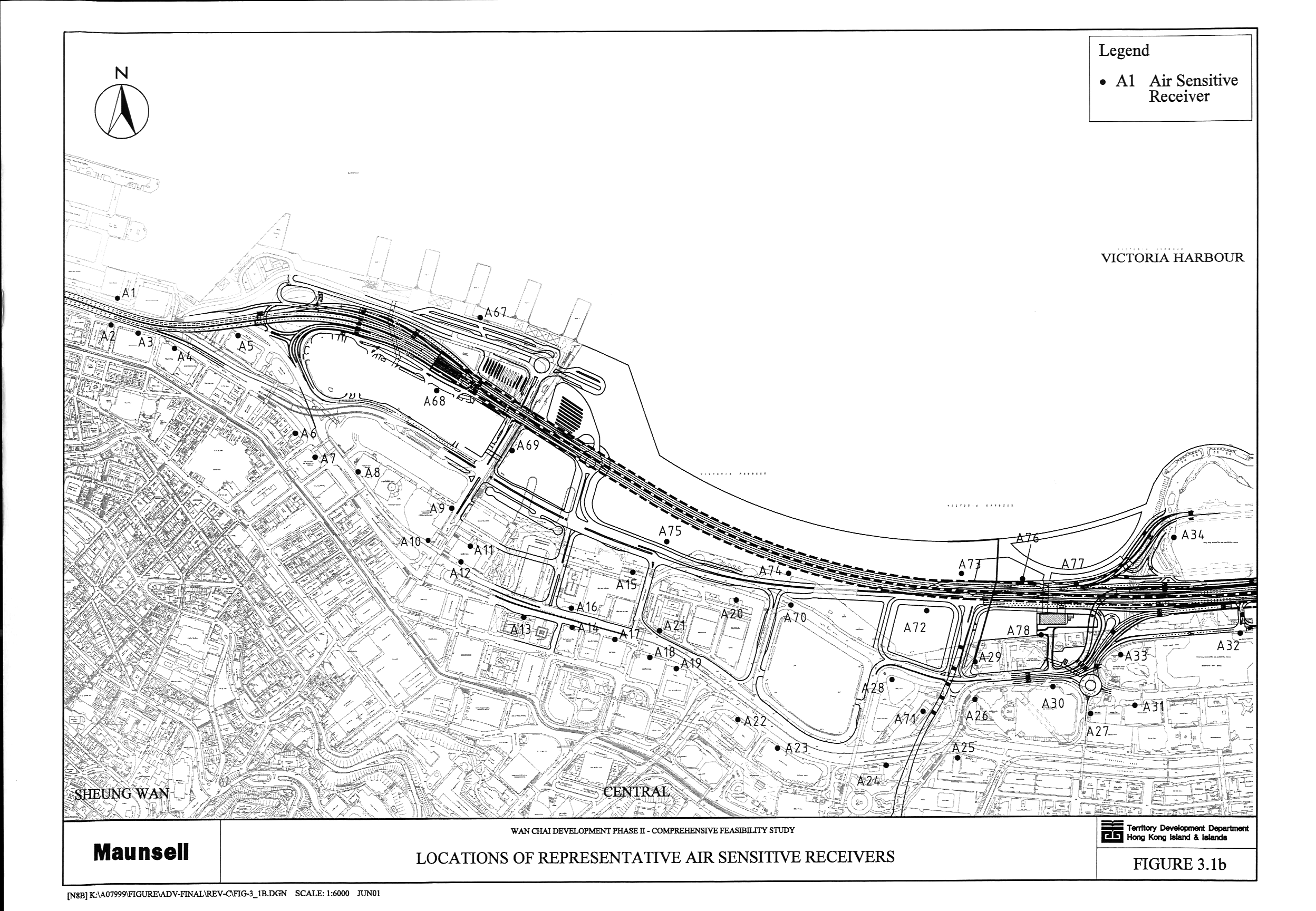
Figure 3.1 Locations
of Representative Air Sensitive Receivers (a, b)
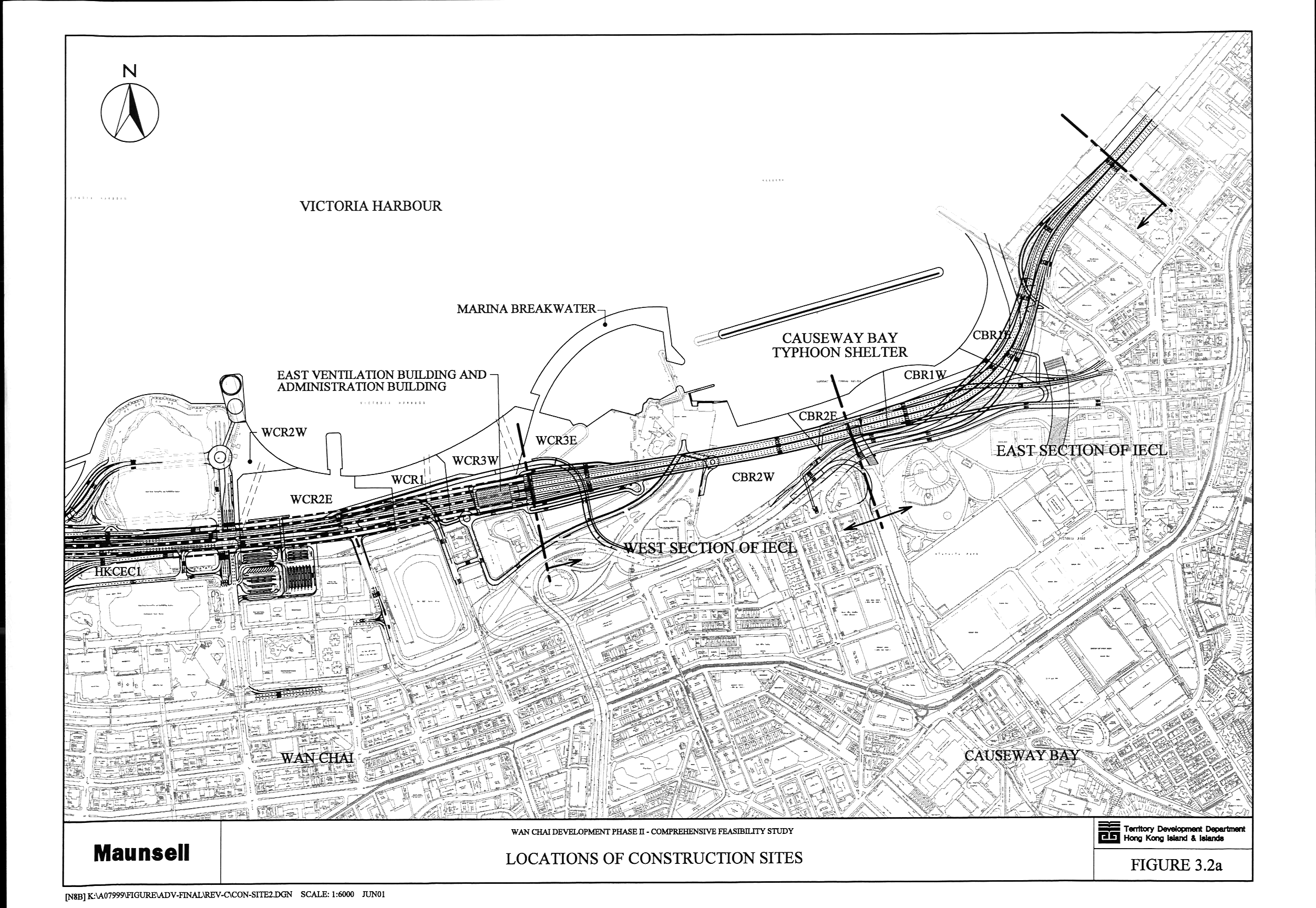
Figure 3.2 Locations
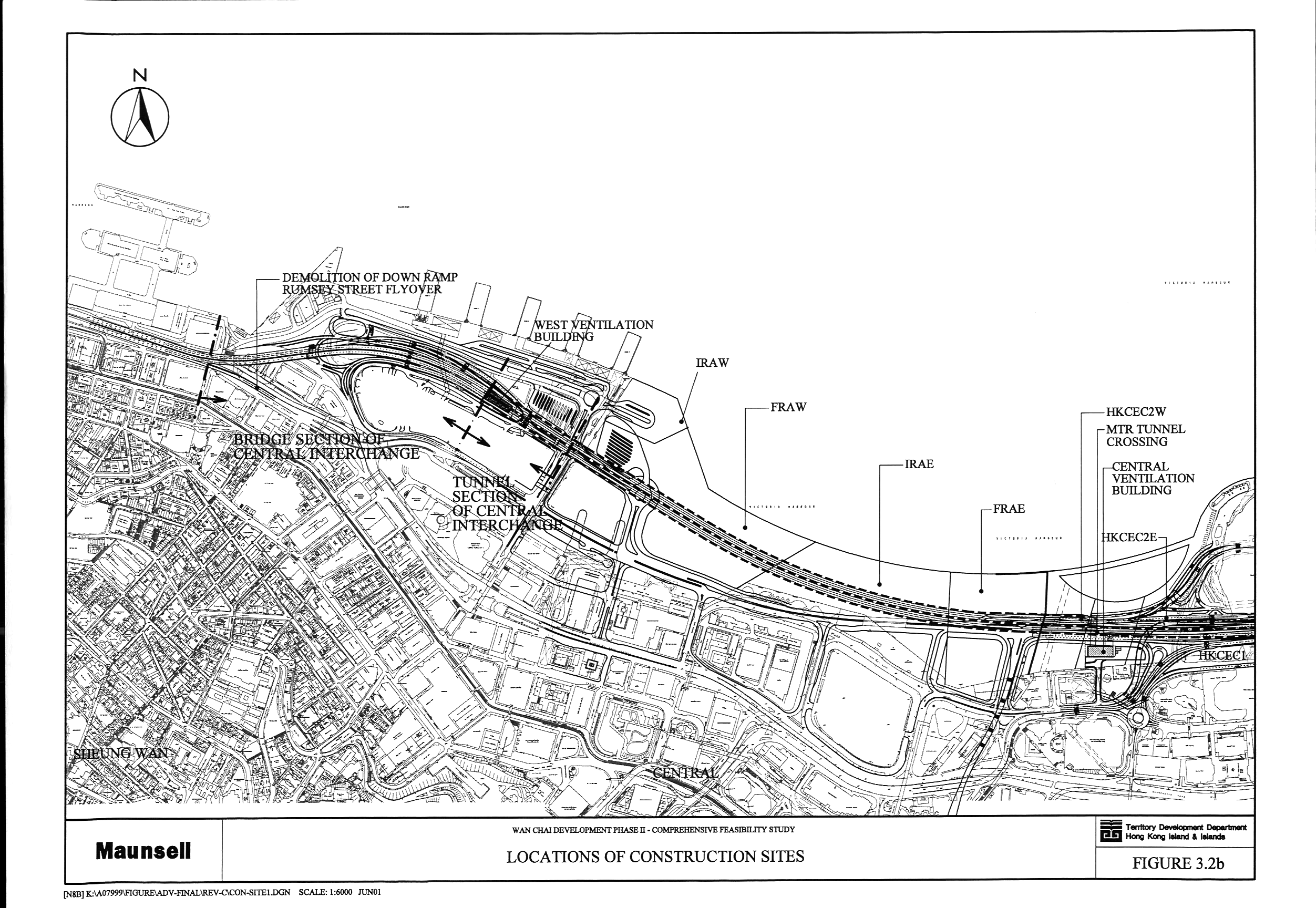
of Construction Sites (a, b)
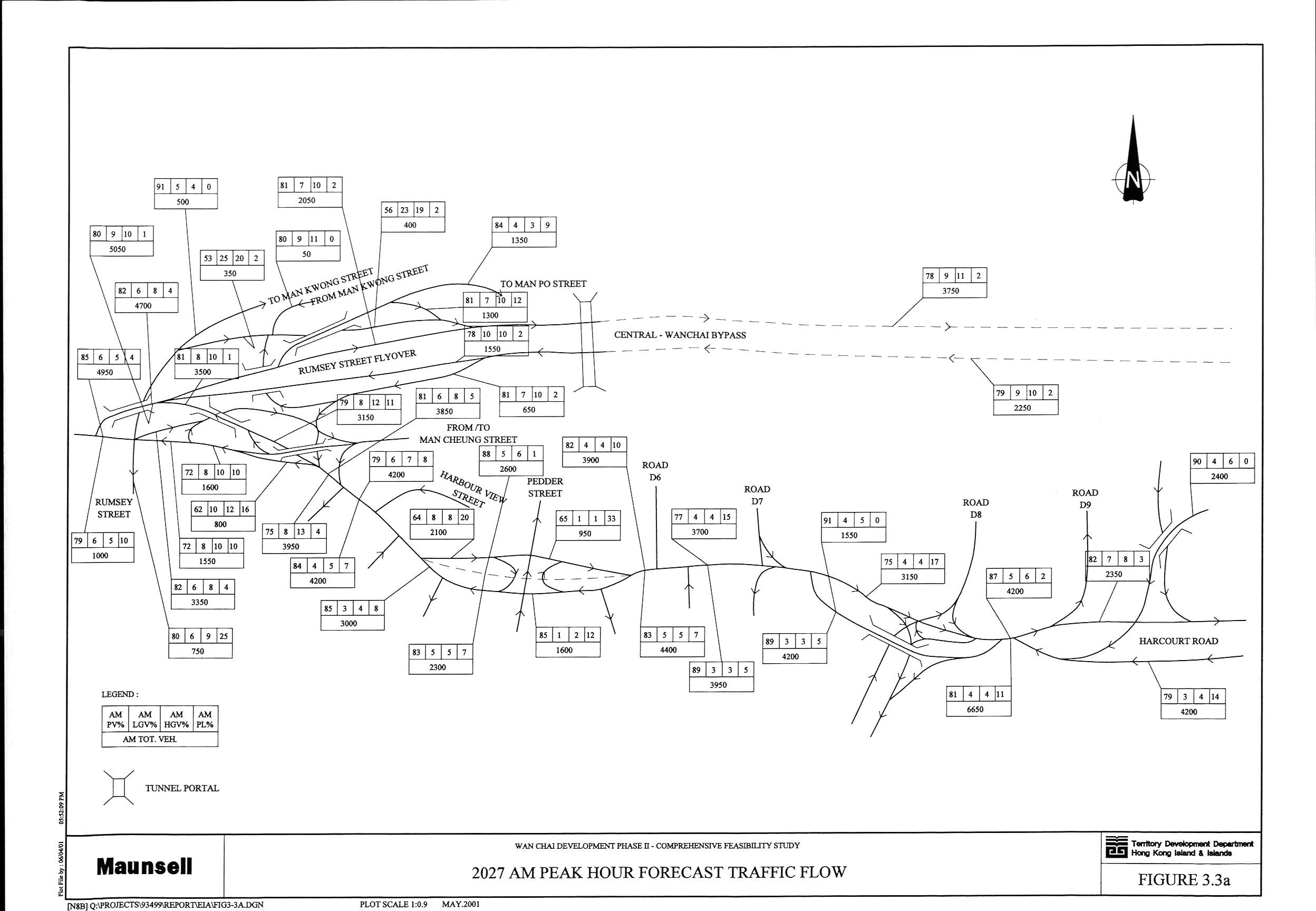
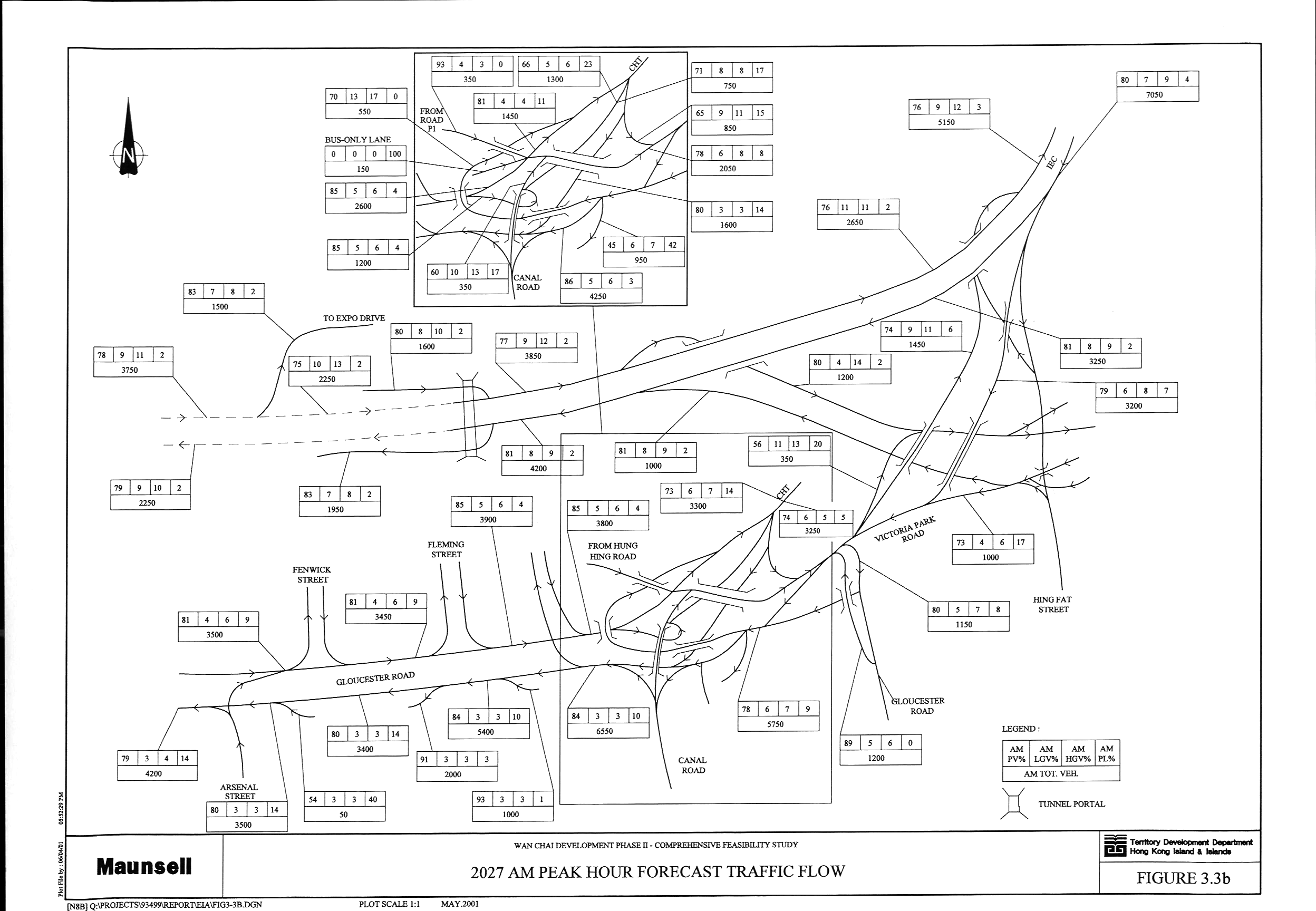
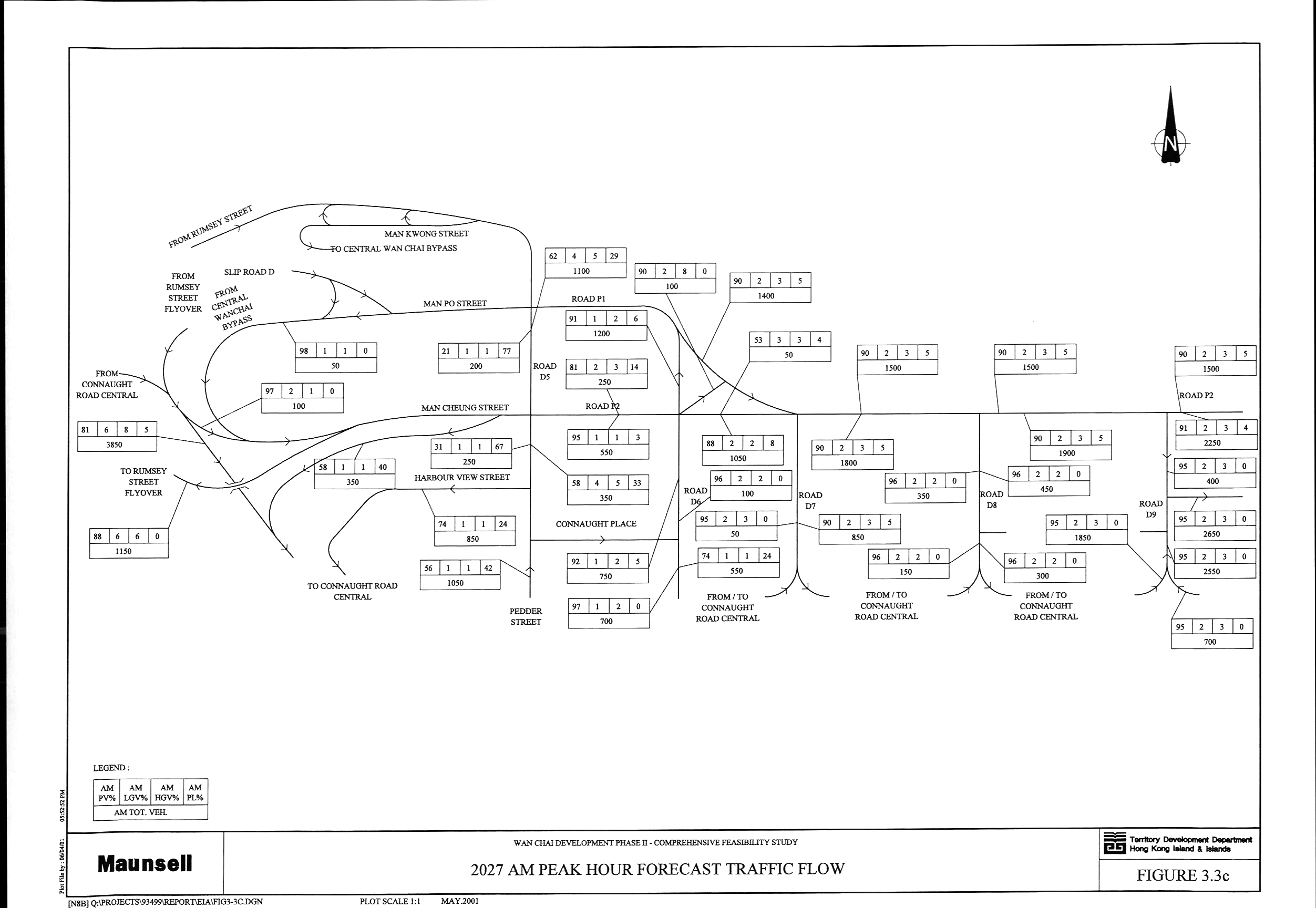
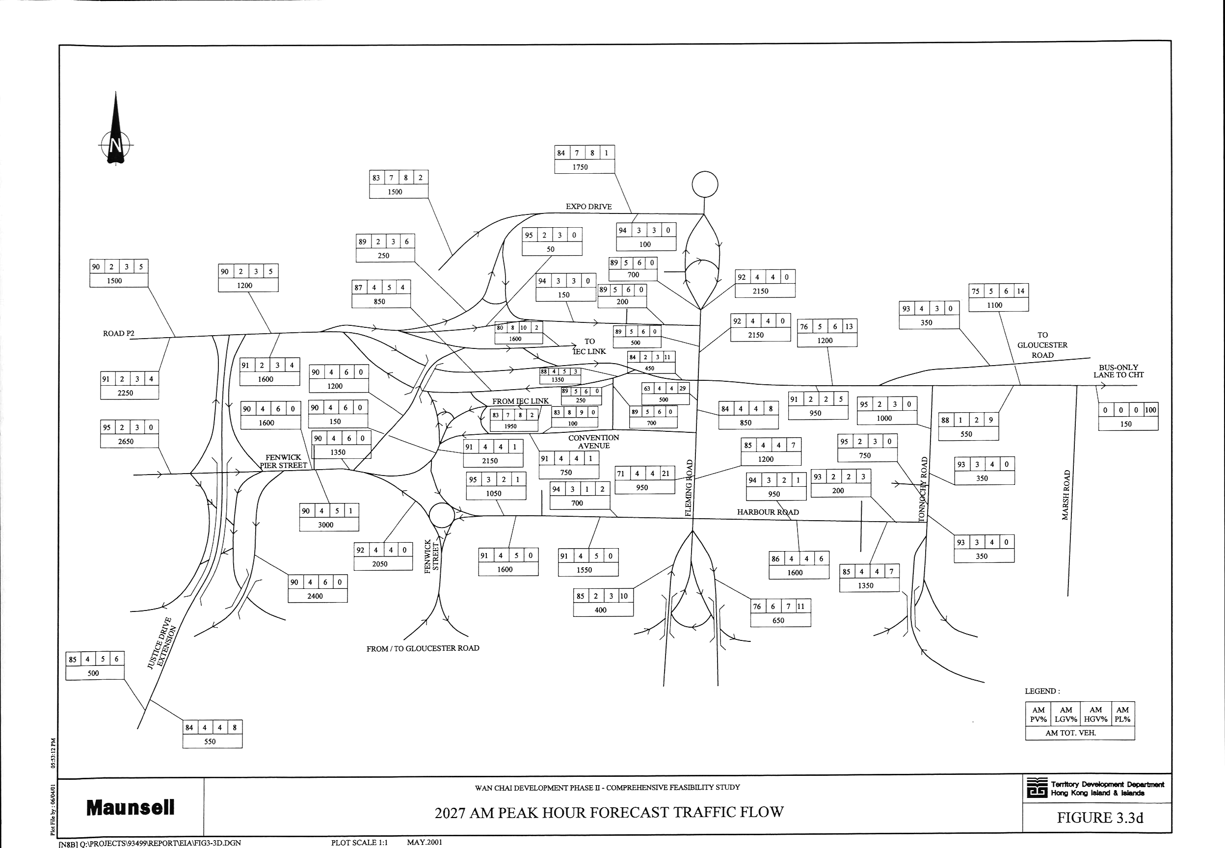
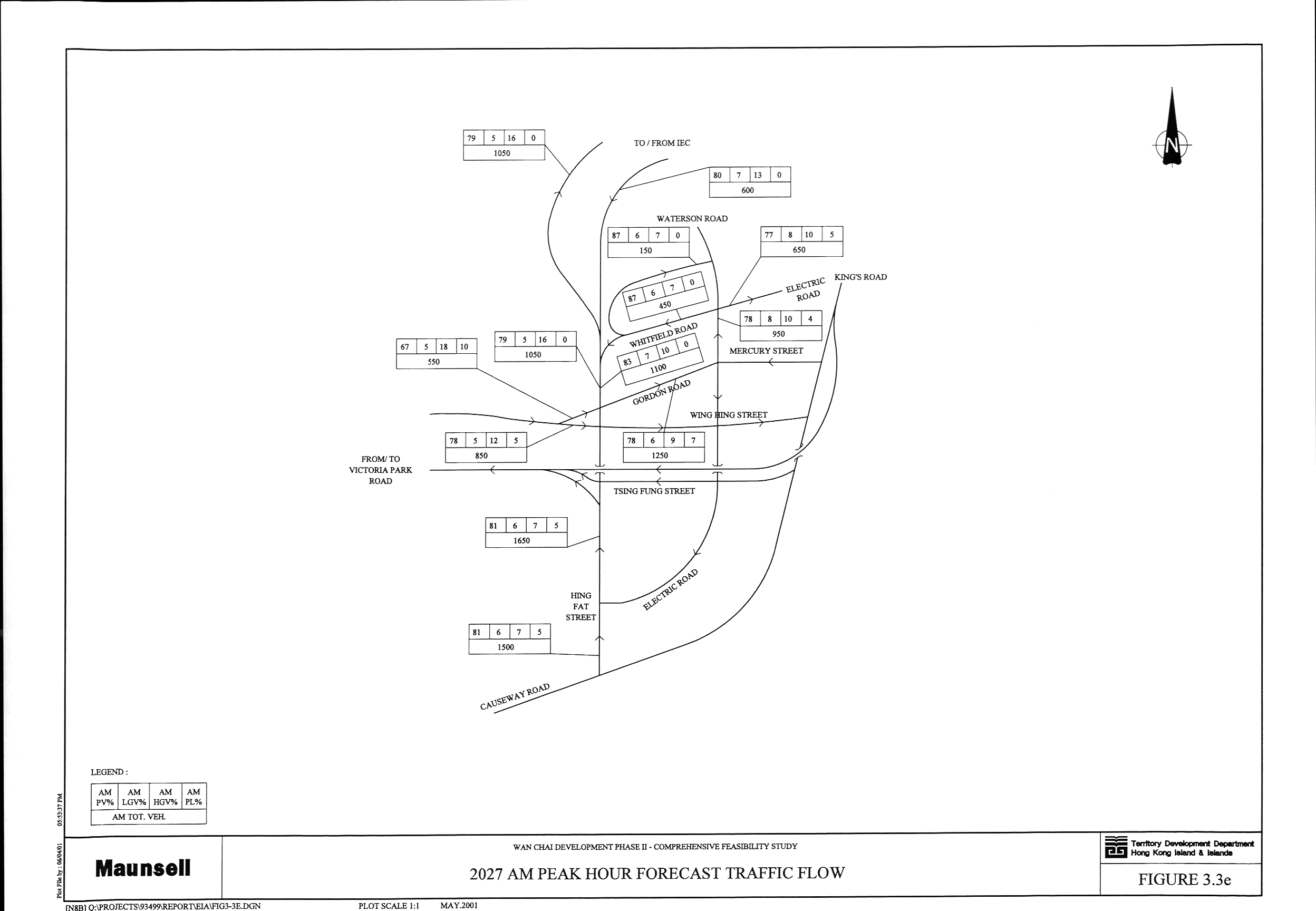
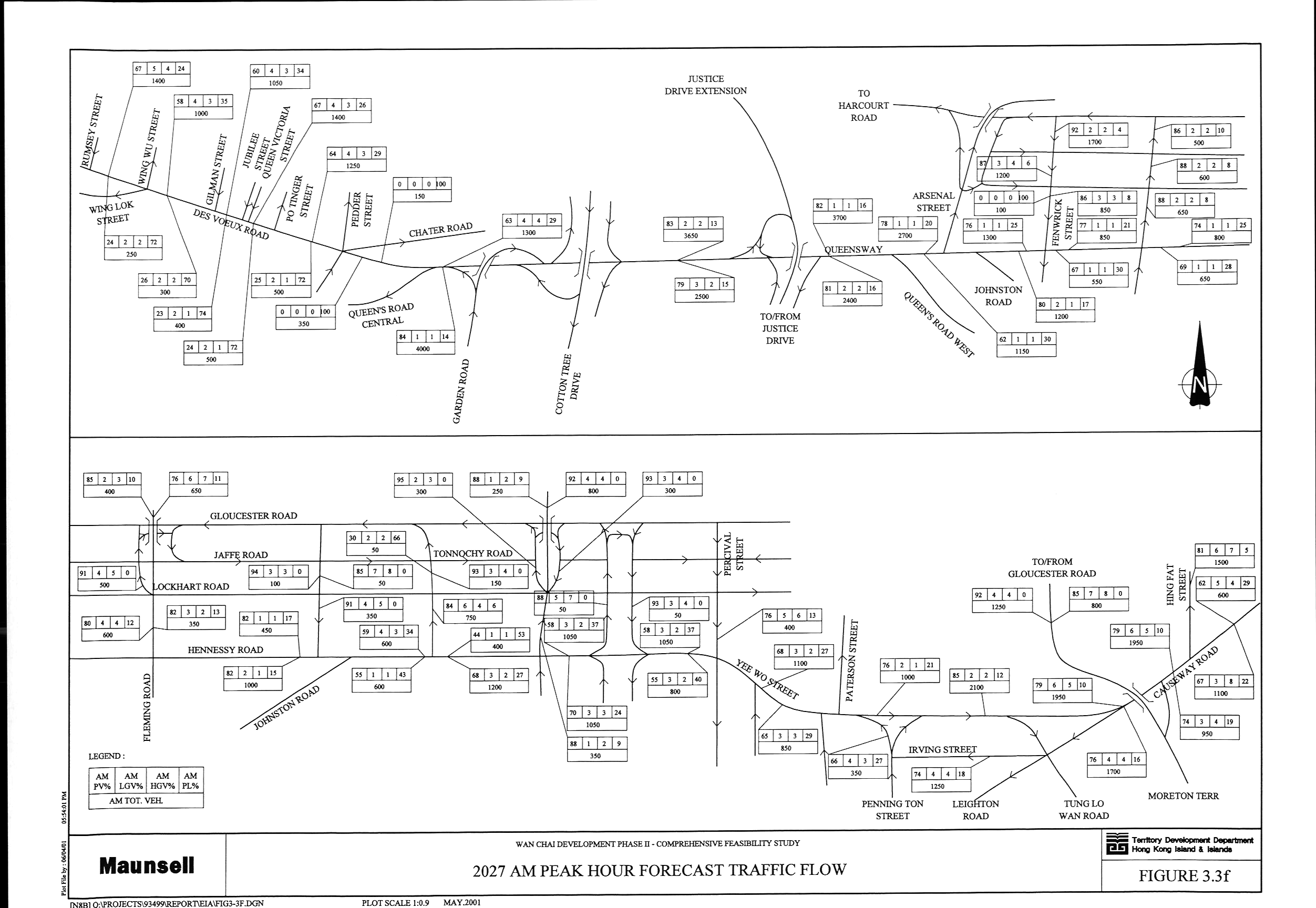
Figure 3.3 2027
AM Peak Hour Forecast Traffic Flow (a, b, c, d, e, f)
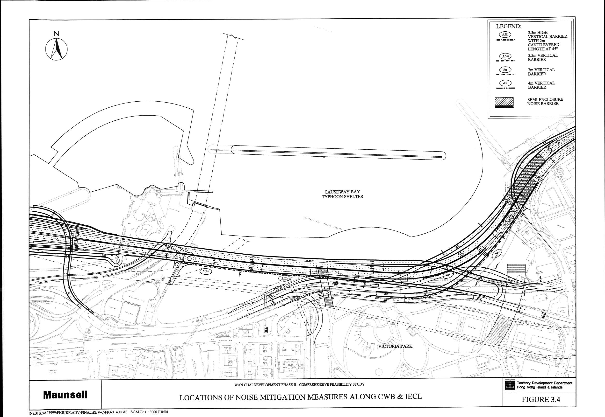
Figure 3.4 Locations of Noise Mitigation Measures along
CWB & IECL
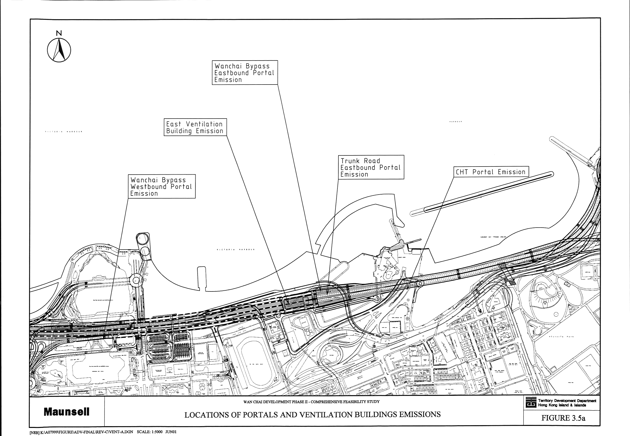
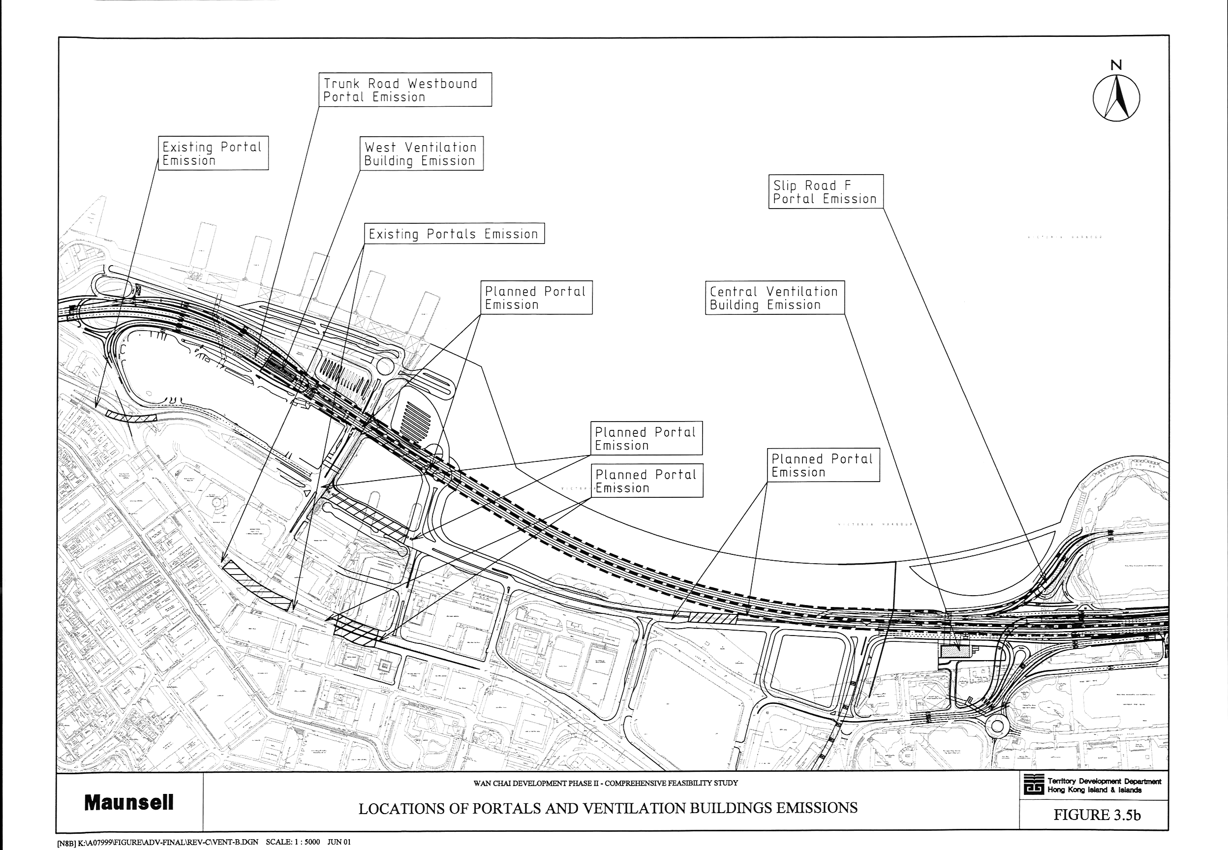
Figure 3.5 Locations
of Portals and Ventilation Buildings Emissions (a,
b)
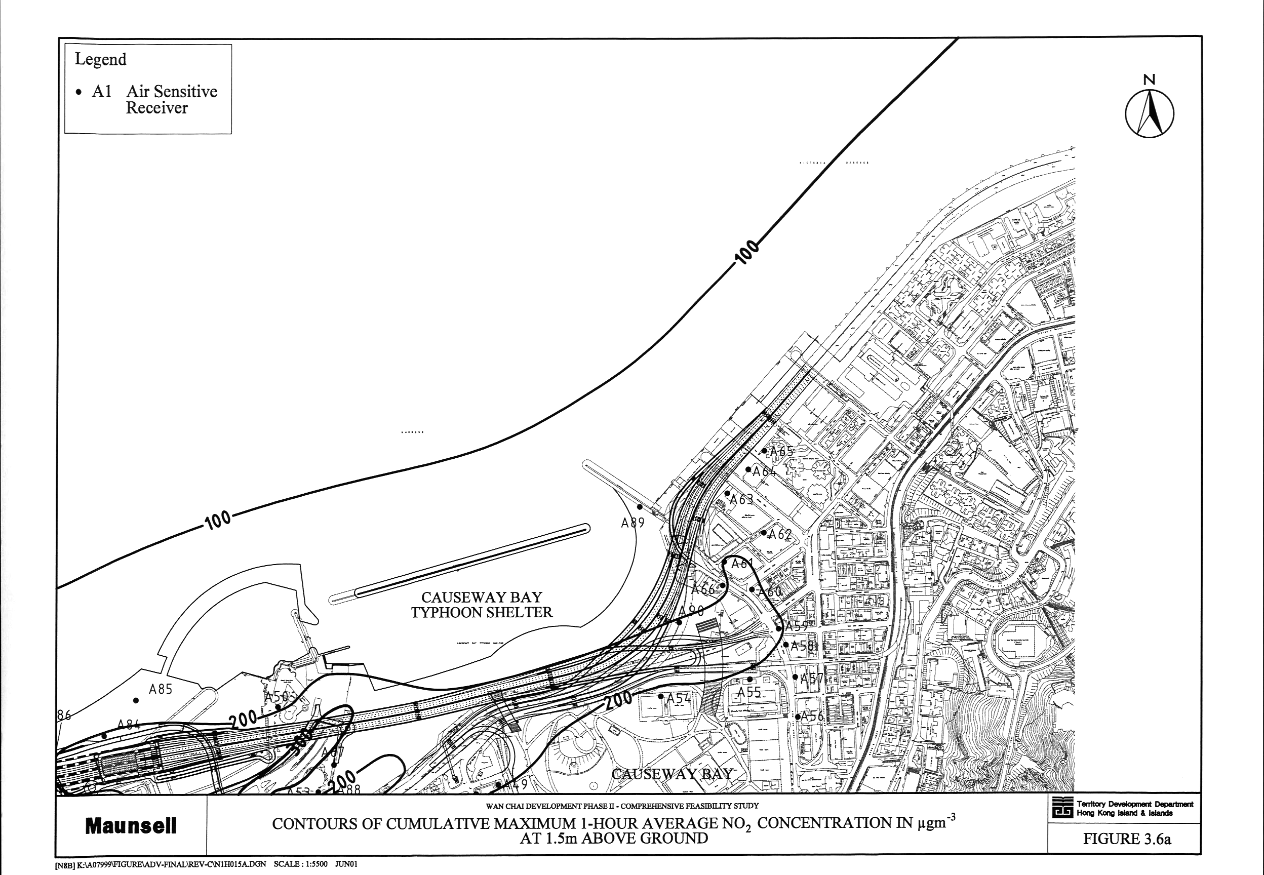
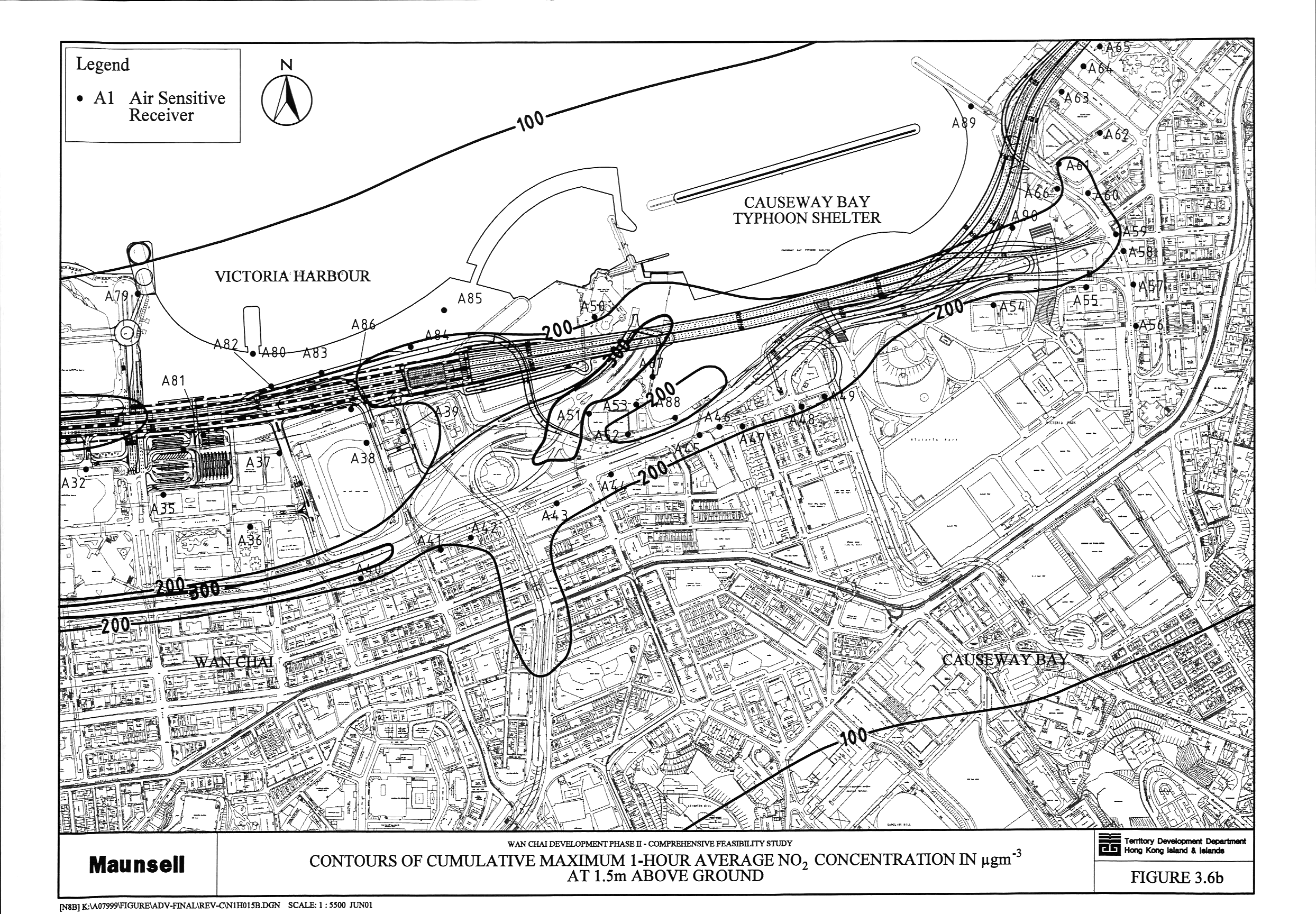
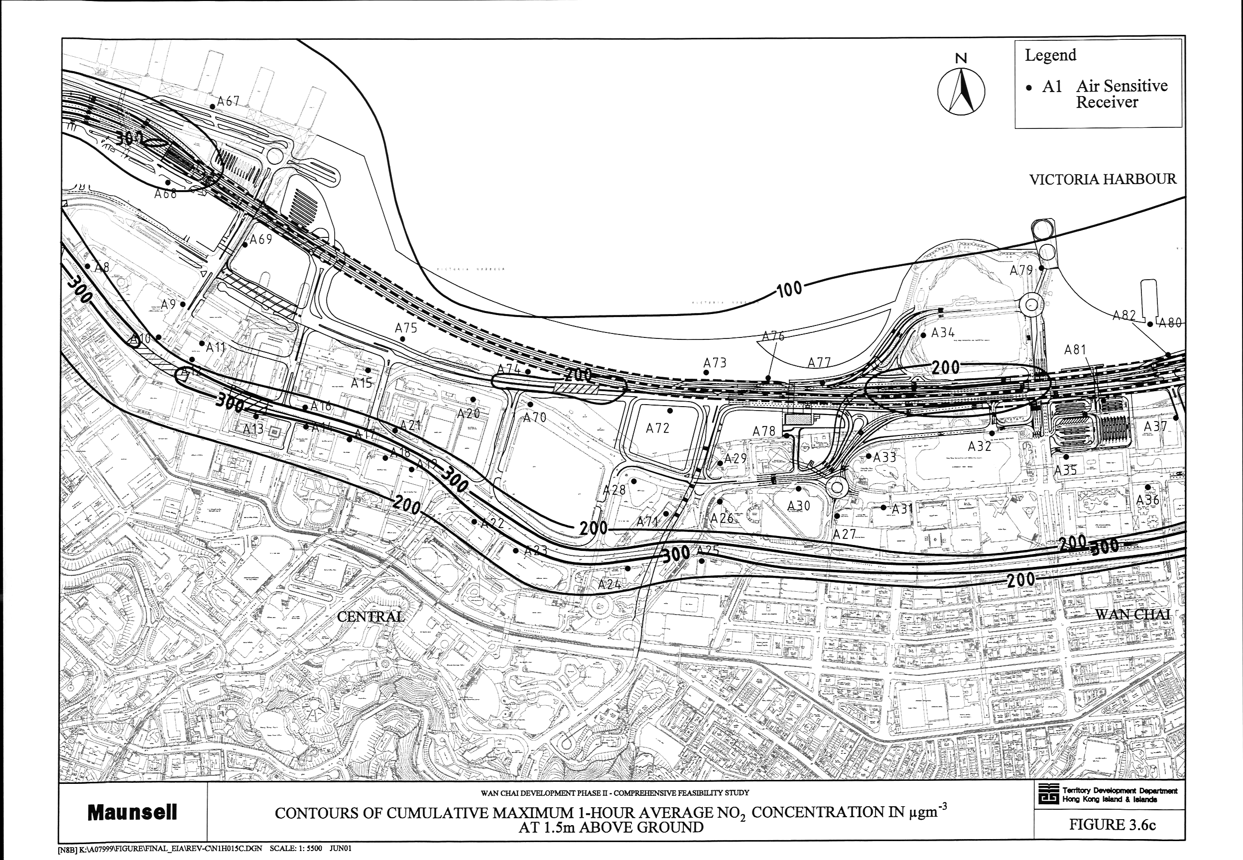
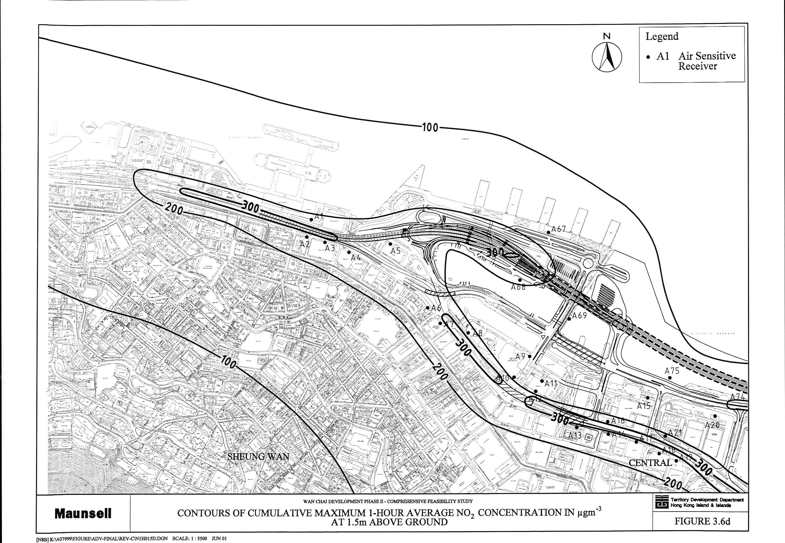
Figure 3.6 Contours
of Cumulative Maximum 1-Hour Average NO2 Concentration in mg m-3 at 1.5 m above Ground (a,
b, c, d)
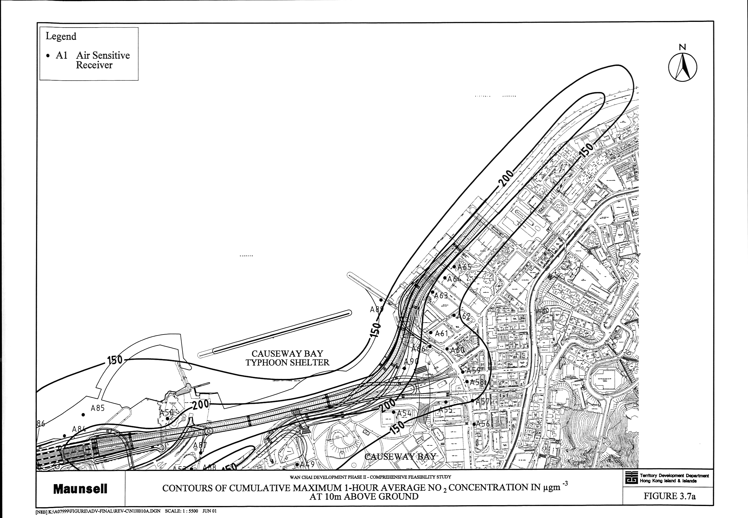
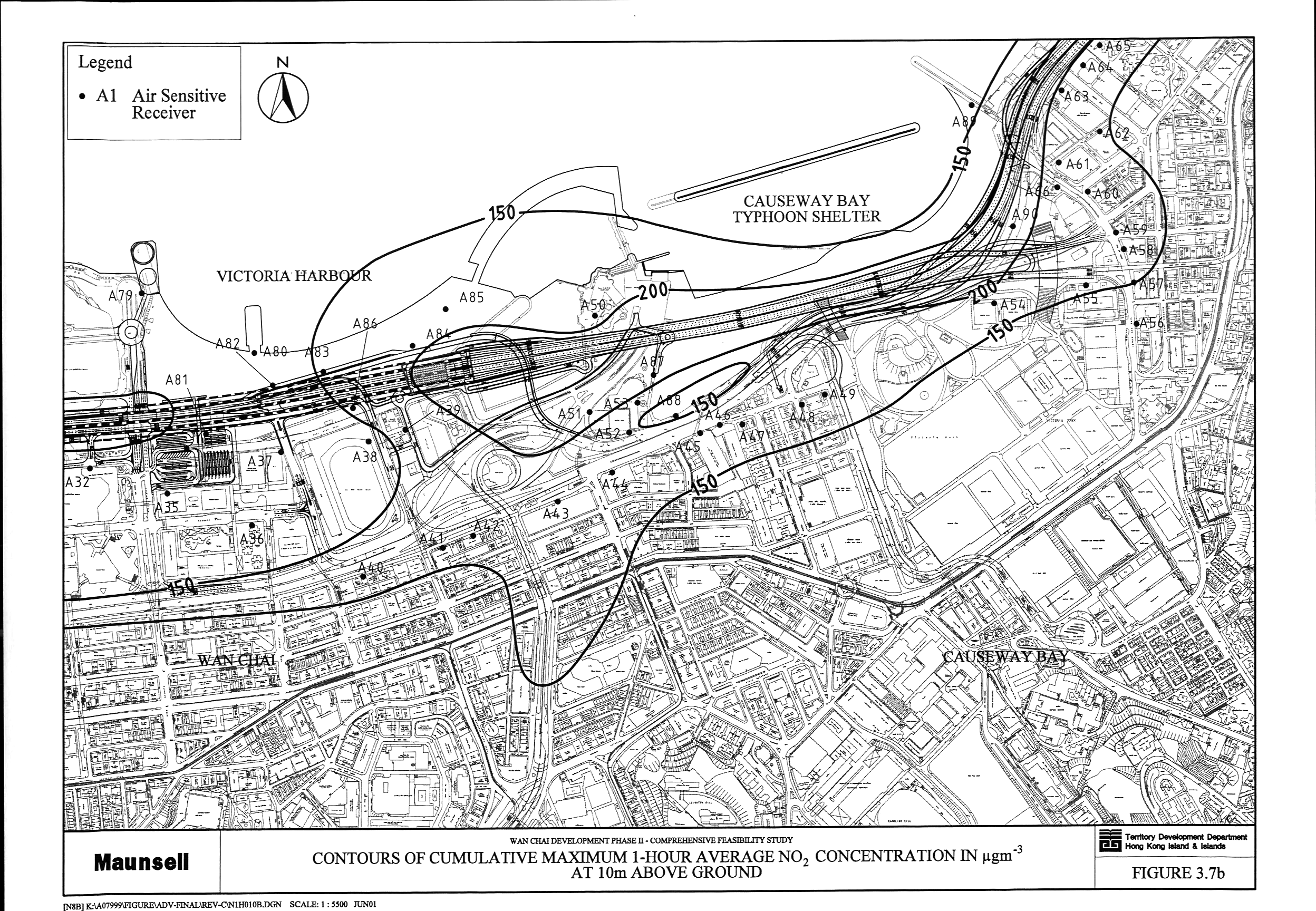
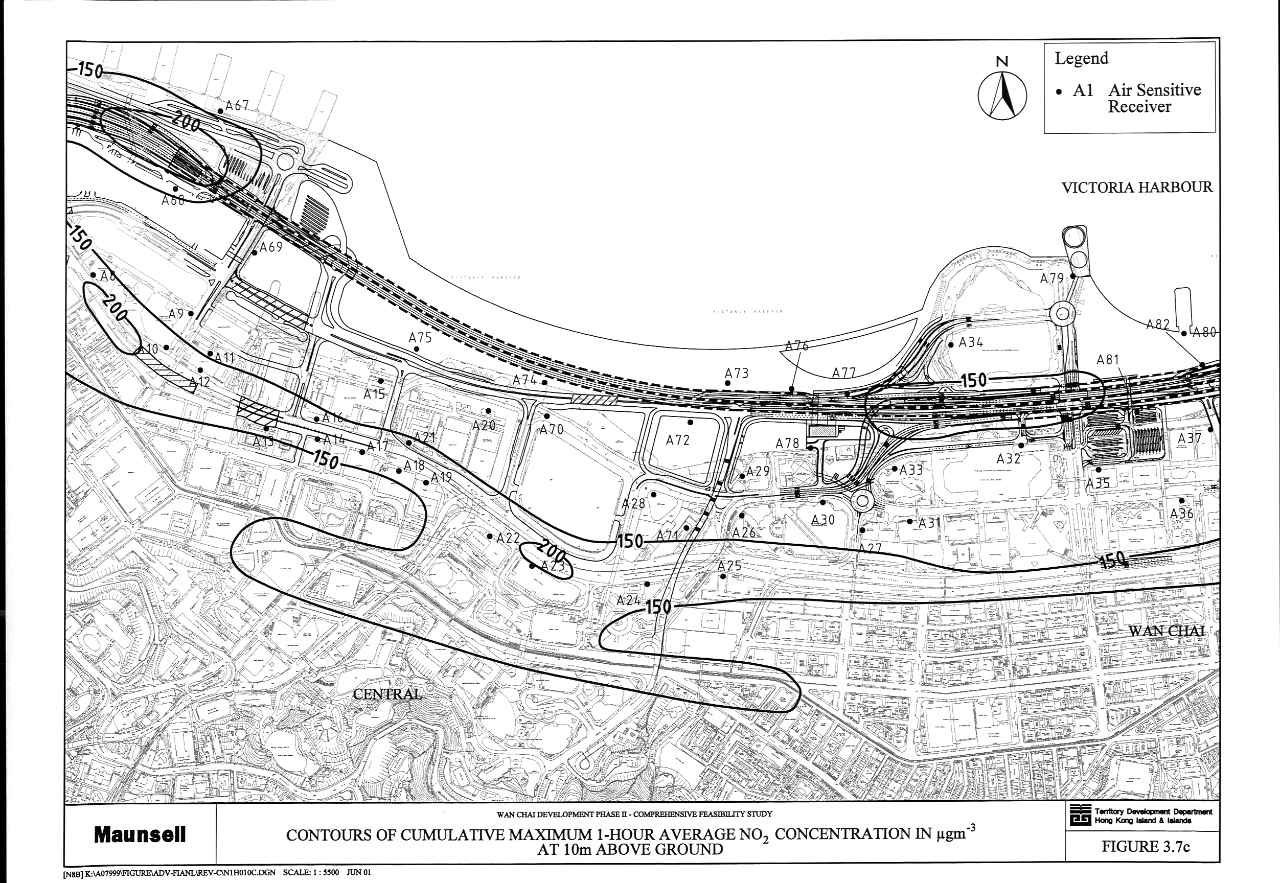
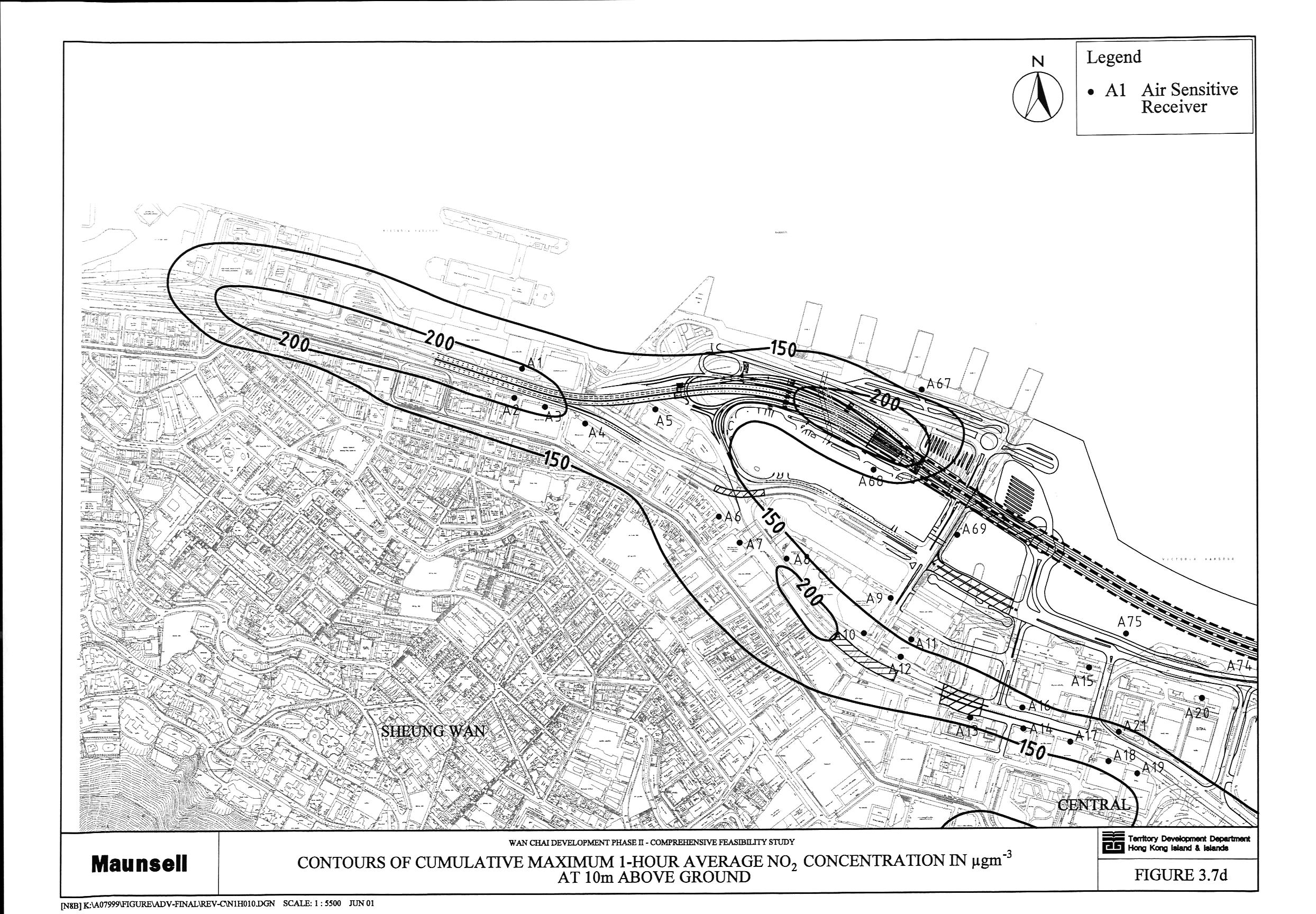
Figure 3.7 Contours
of Cumulative Maximum 1-Hour Average NO2 Concentration in mg m-3 at 10 m above Ground (a,
b, c, d)
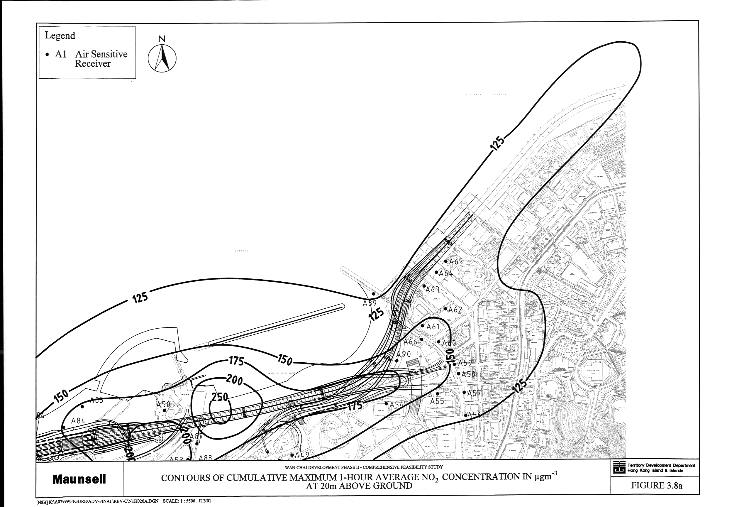
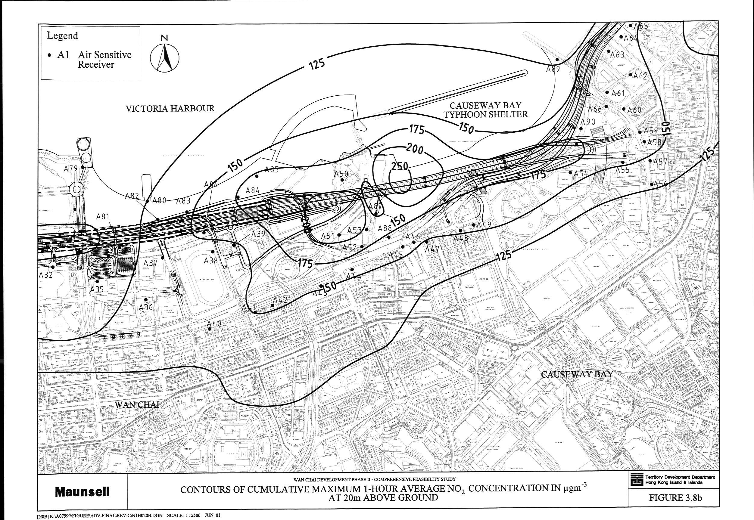
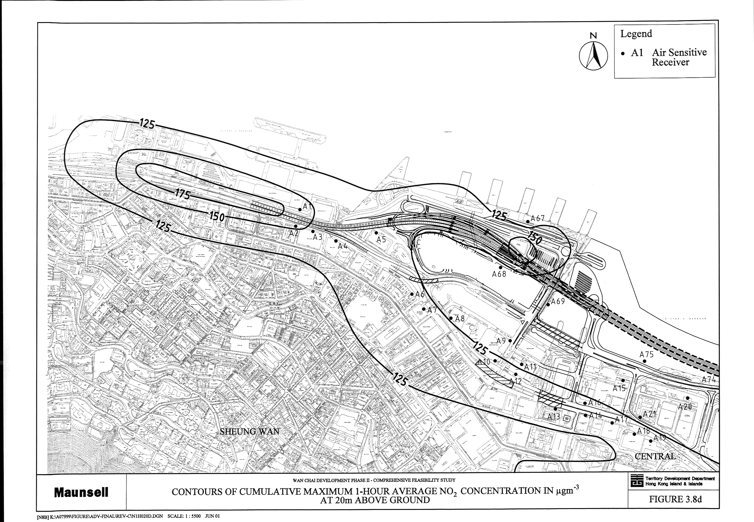
Figure 3.8 Contours
of Cumulative Maximum 1-Hour Average NO2 Concentration in mg m-3 at 20 m above Ground (a,
b, c, d)
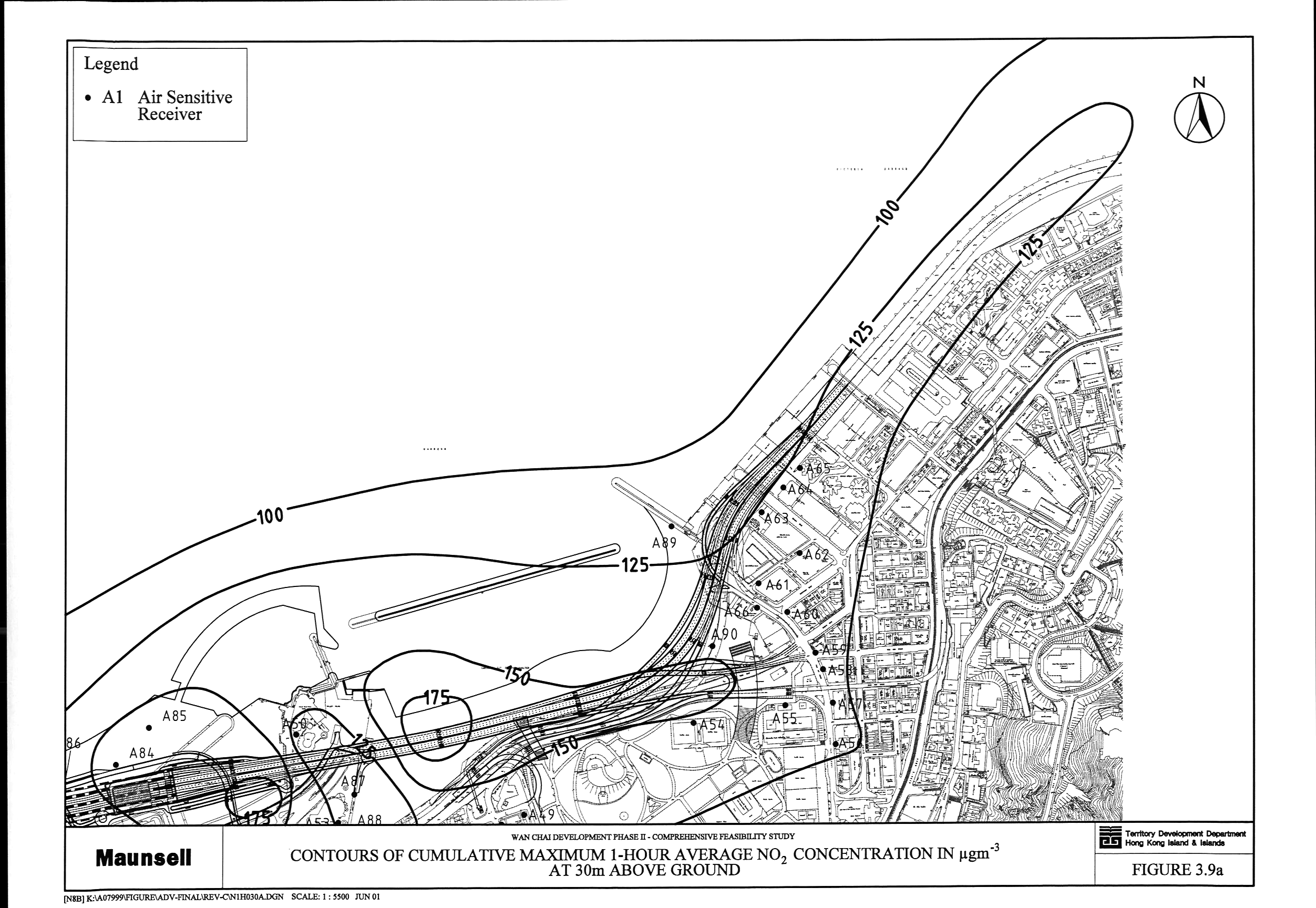
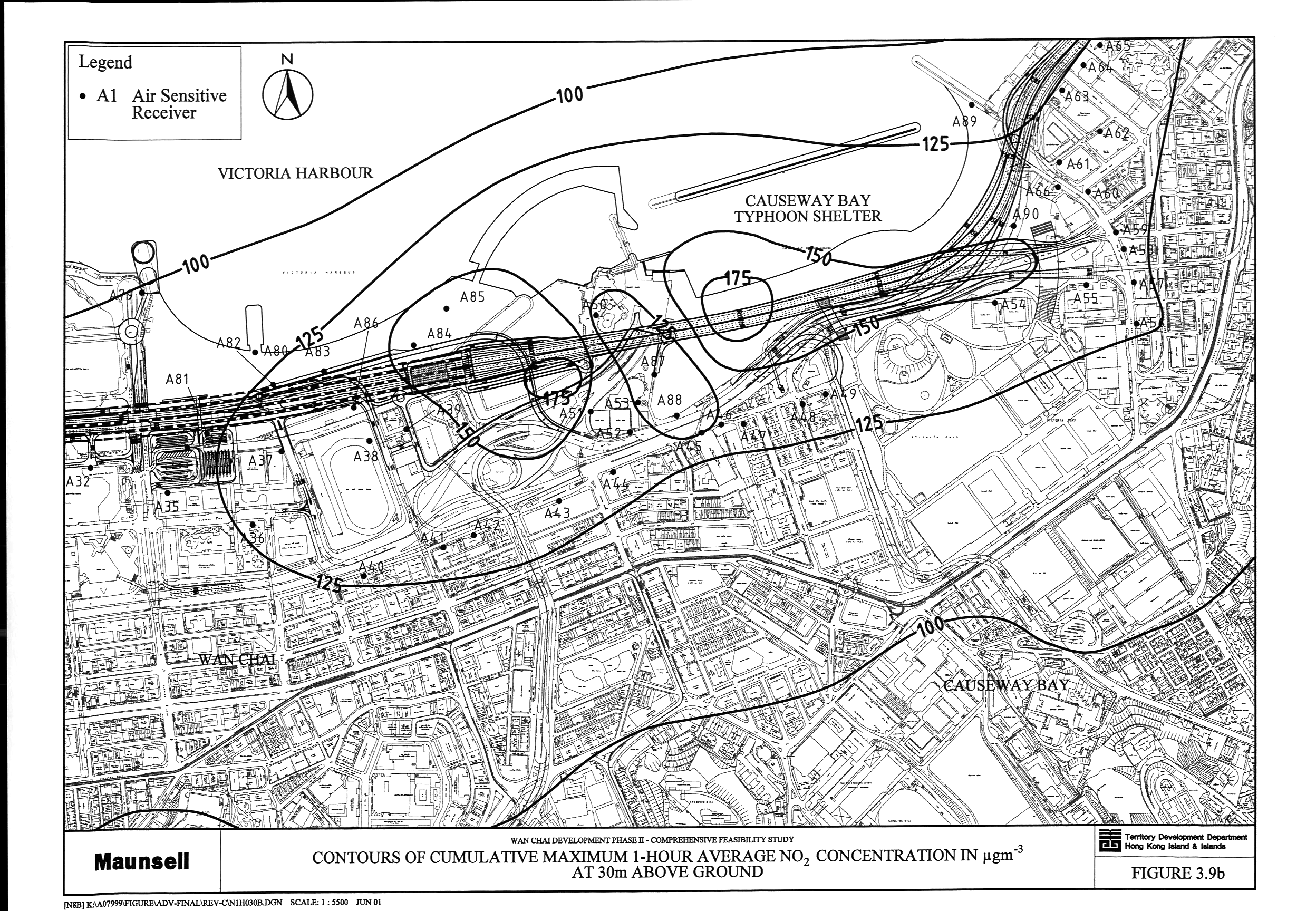
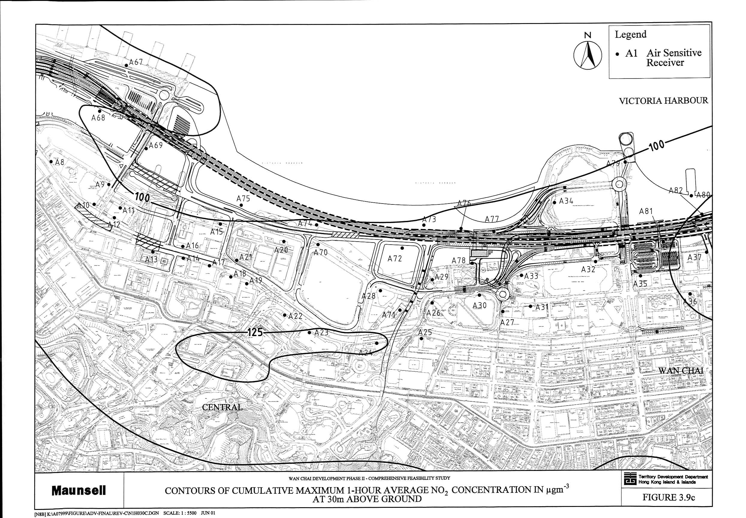
Figure 3.9 Contours
of Cumulative Maximum 1-Hour Average NO2 Concentration in mg m-3 at 30 m above Ground (a,
b, c, d)
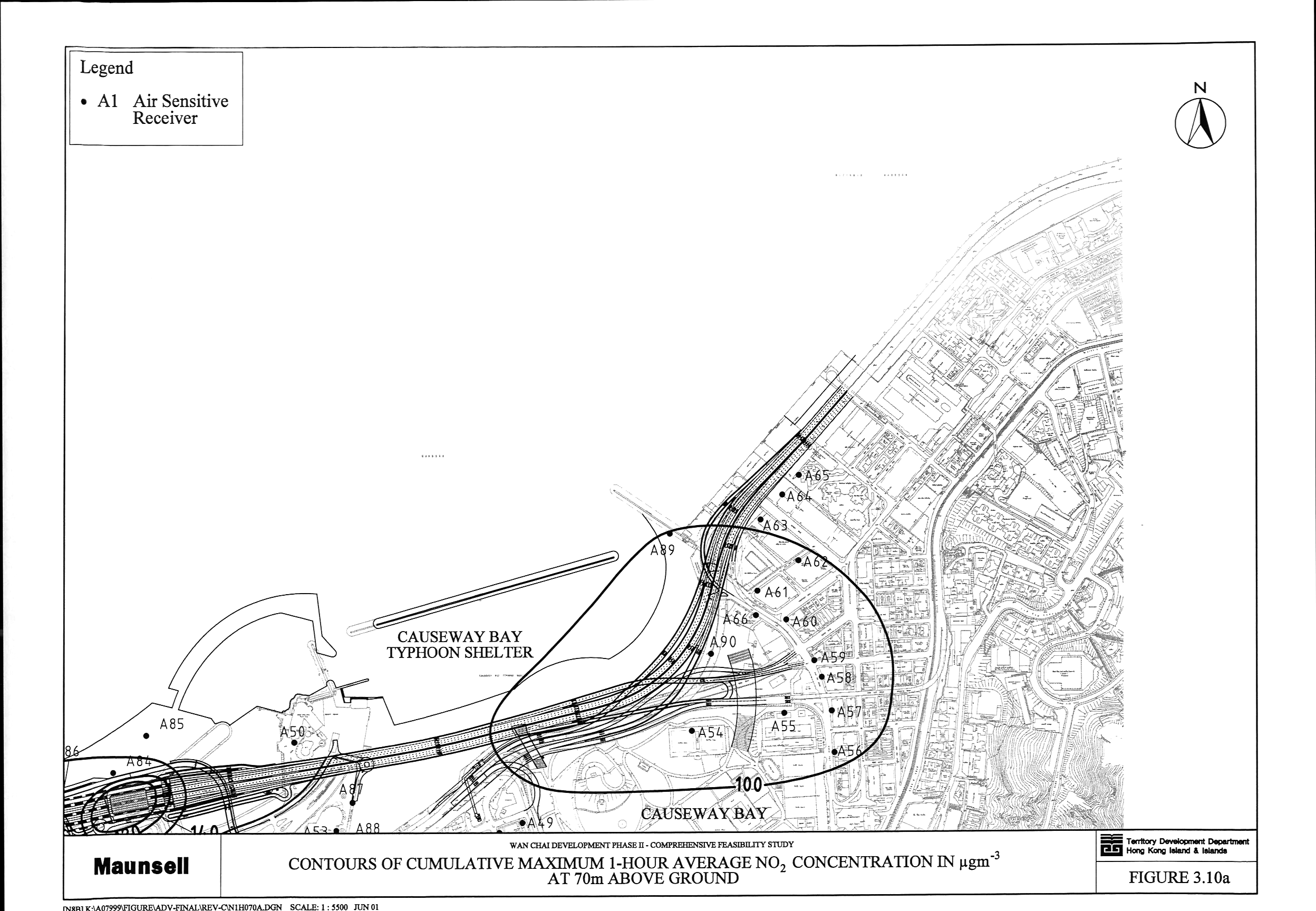
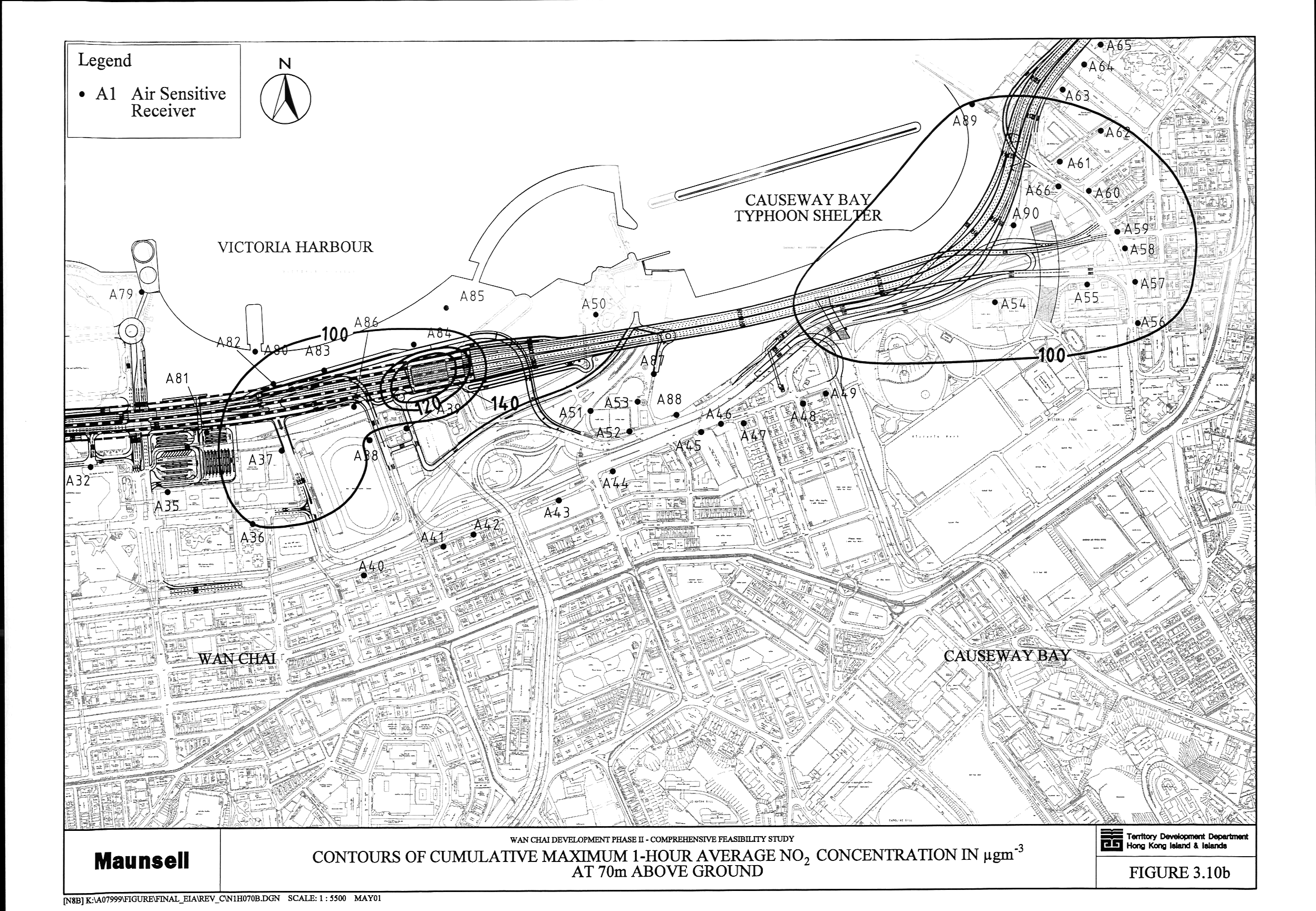
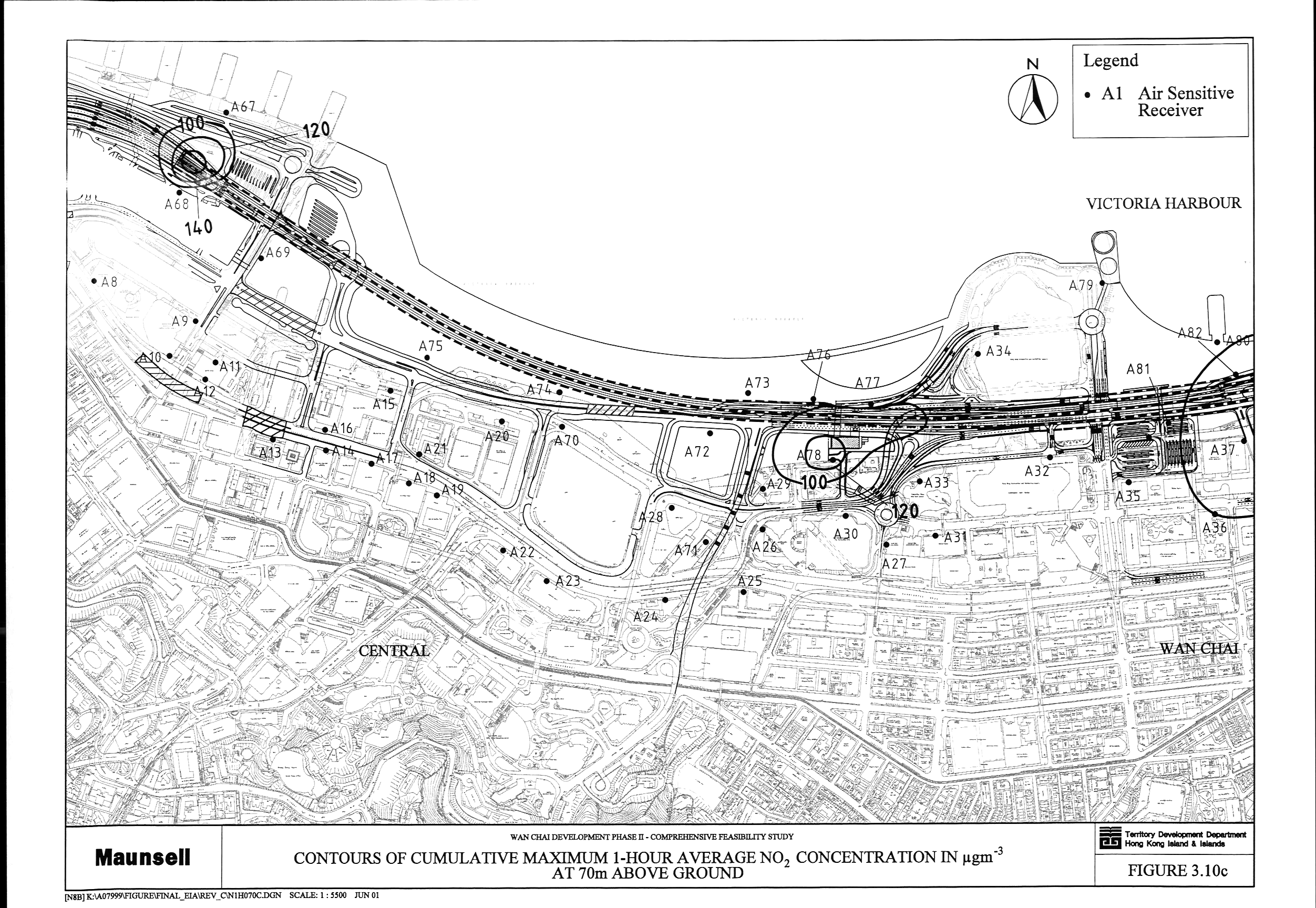
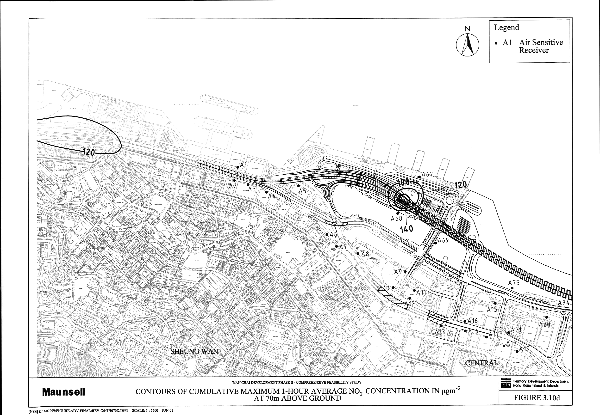
Figure 3.10 Contours
of Cumulative Maximum 1-Hour Average NO2 Concentration in mg m-3 at 70 m above Ground (a,
b, c, d)
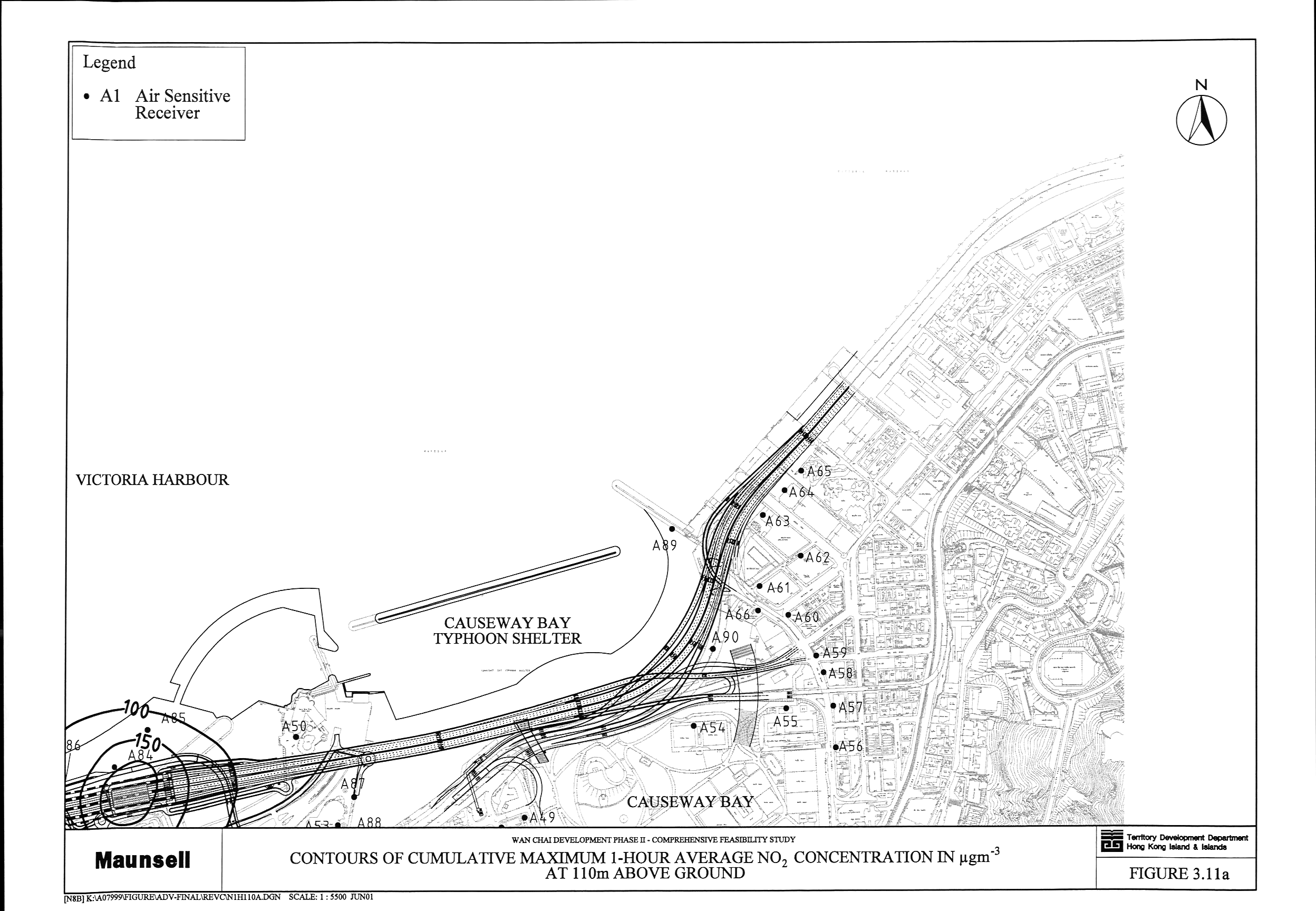
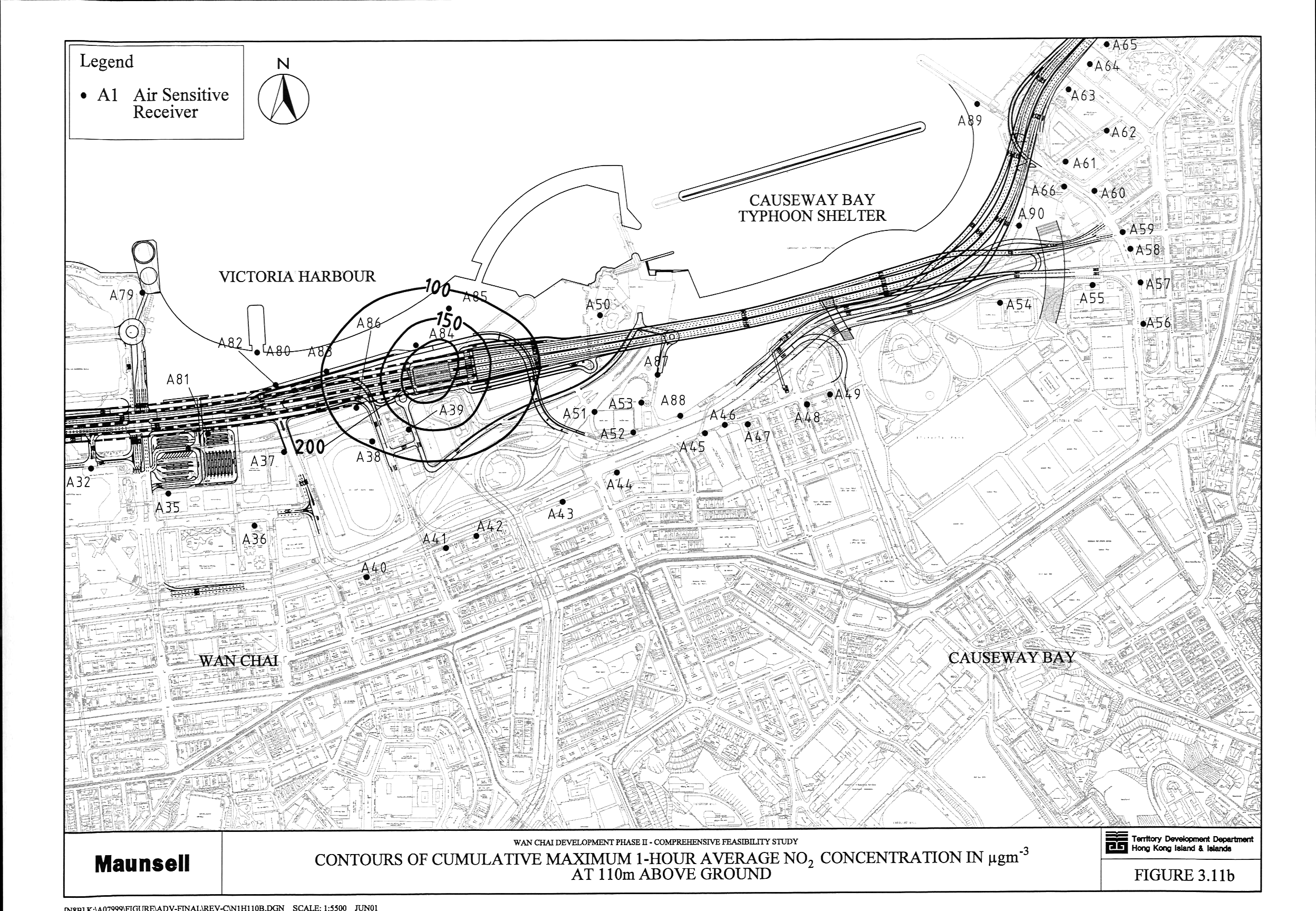
Figure 3.11 Contours
of Cumulative Maximum 1-Hour Average NO2 Concentration in mg m-3 at 110 m above Ground (a,
b, c, d)
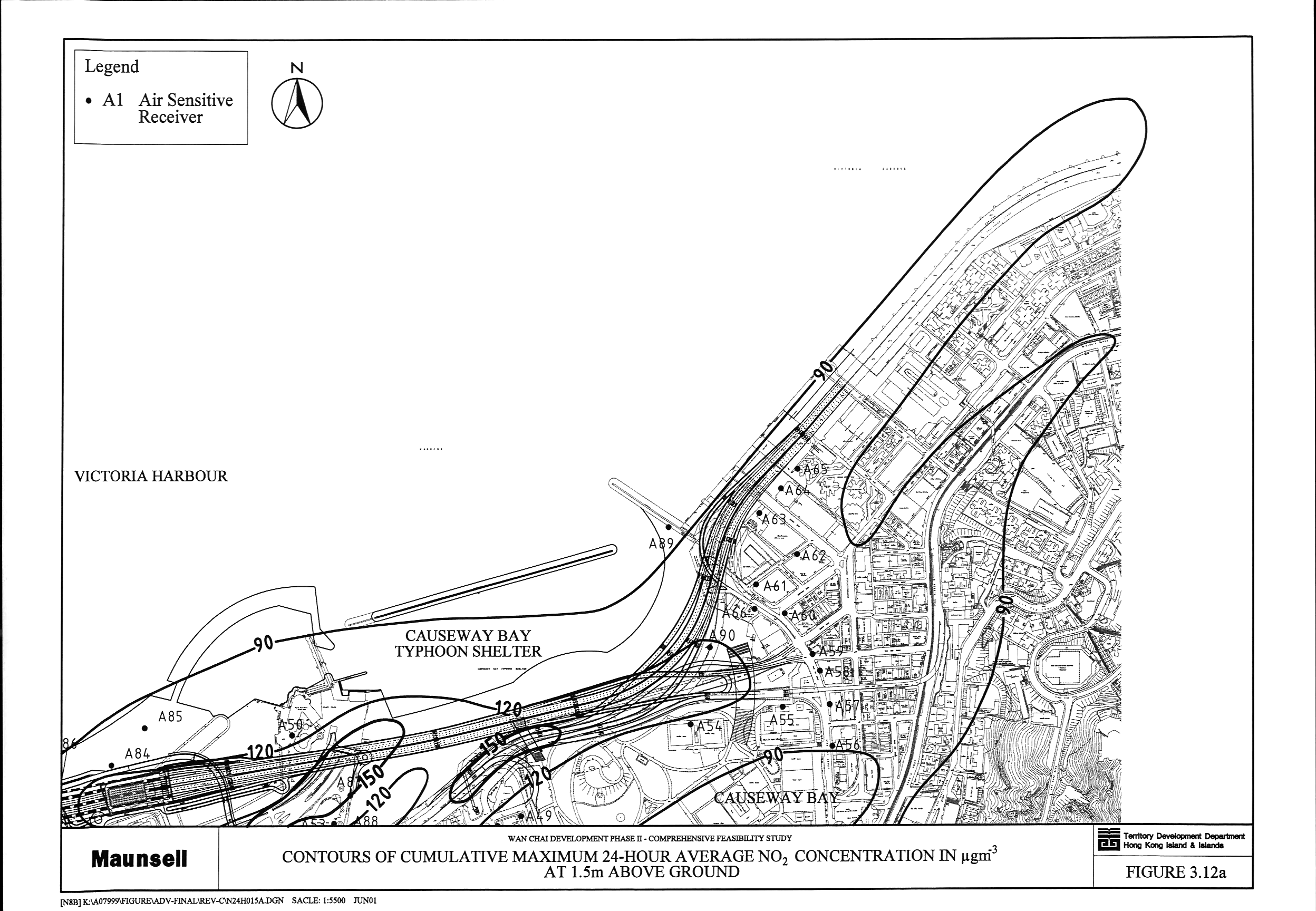
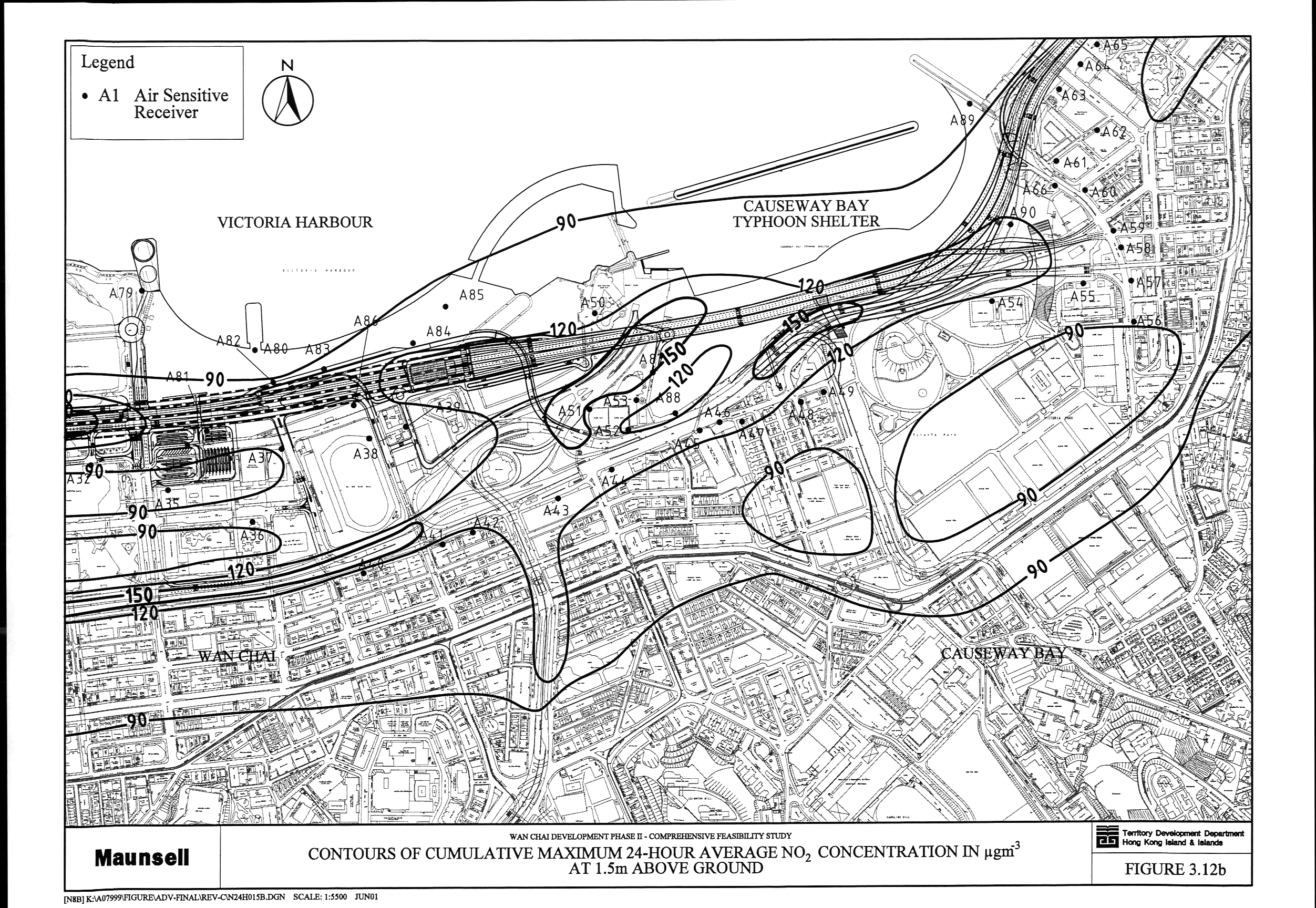
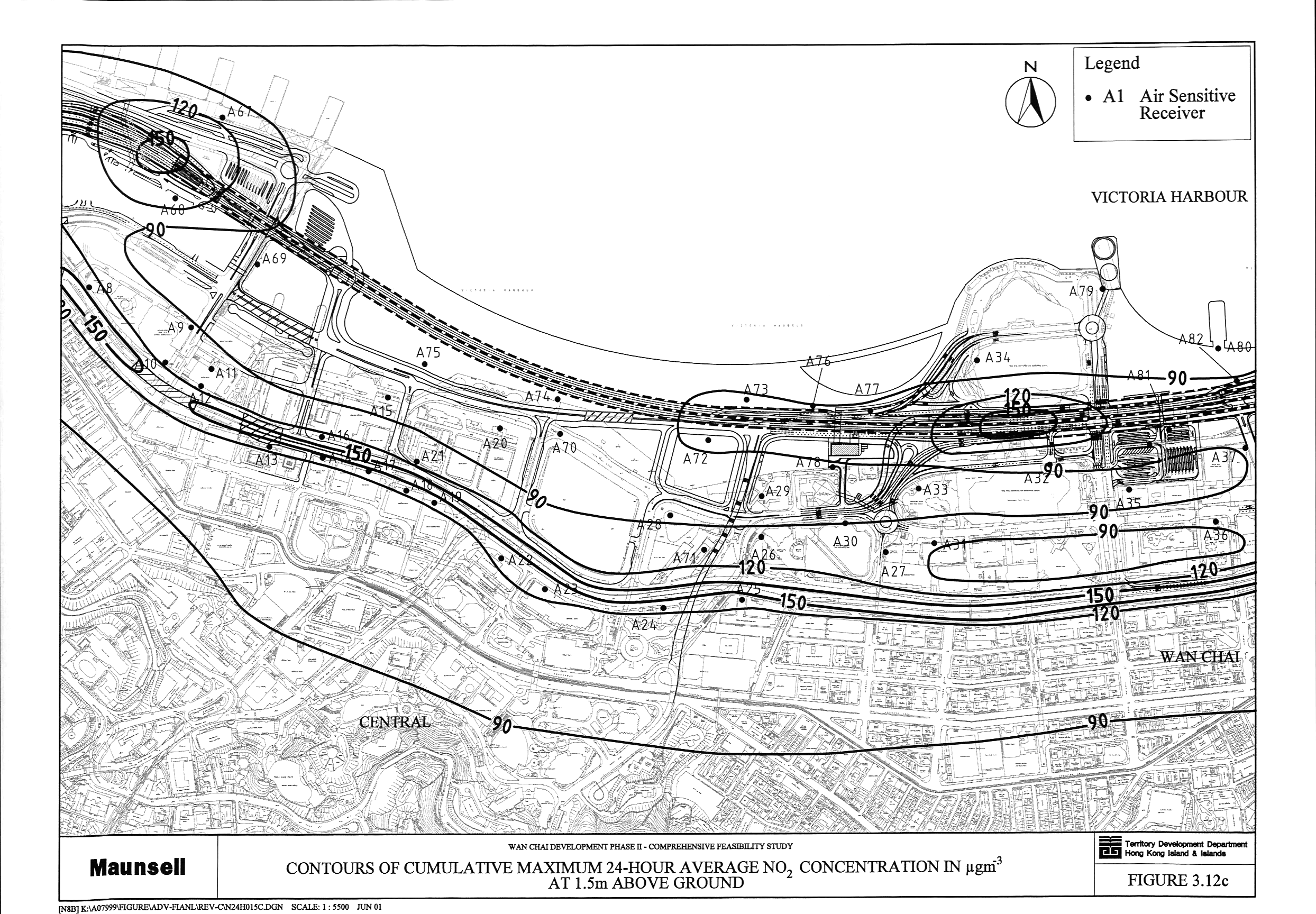
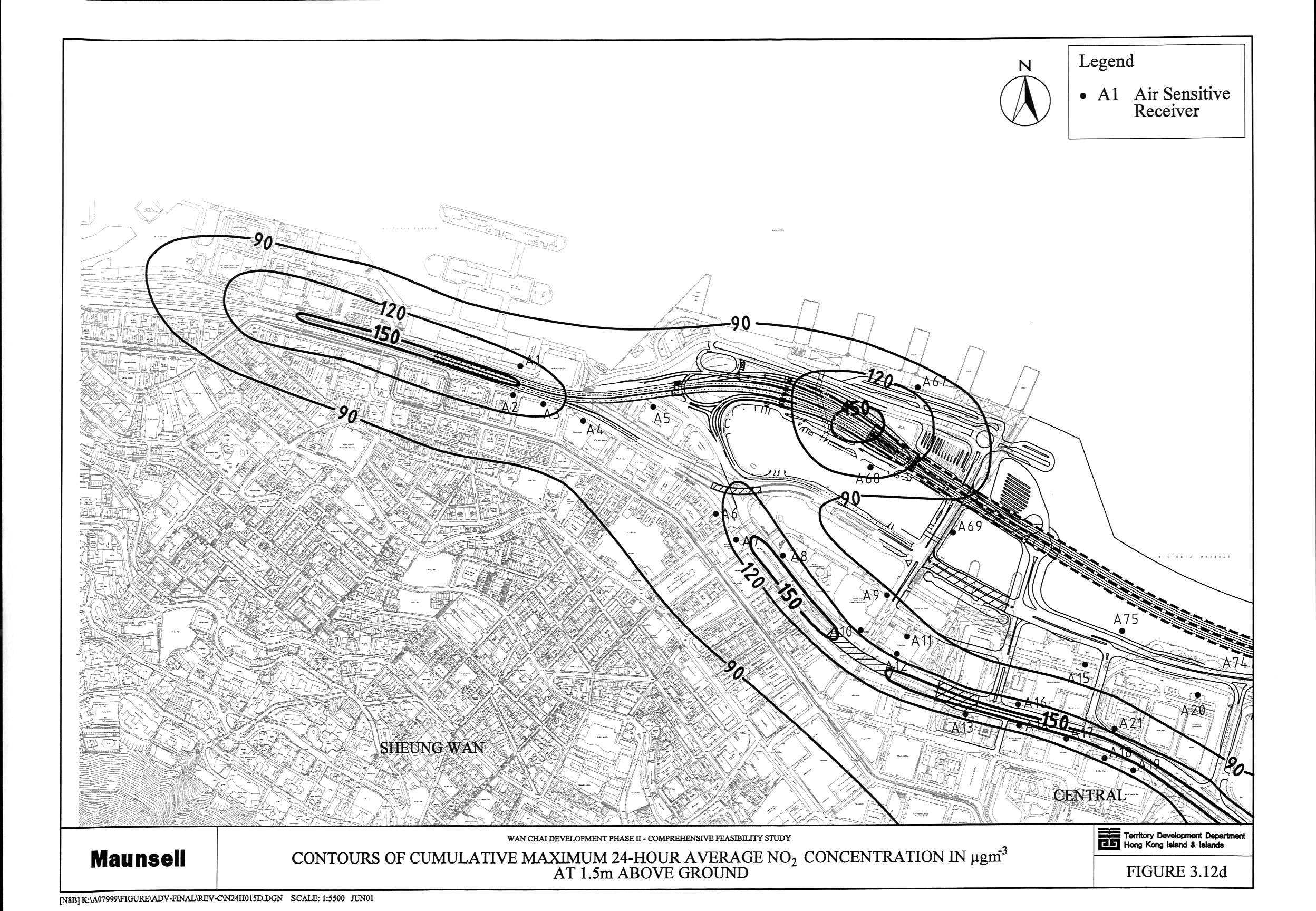
Figure 3.12 Contours
of Cumulative Maximum 24-Hour Average NO2 Concentration in mg m-3 at 1.5 m above Ground (a,
b, c, d)
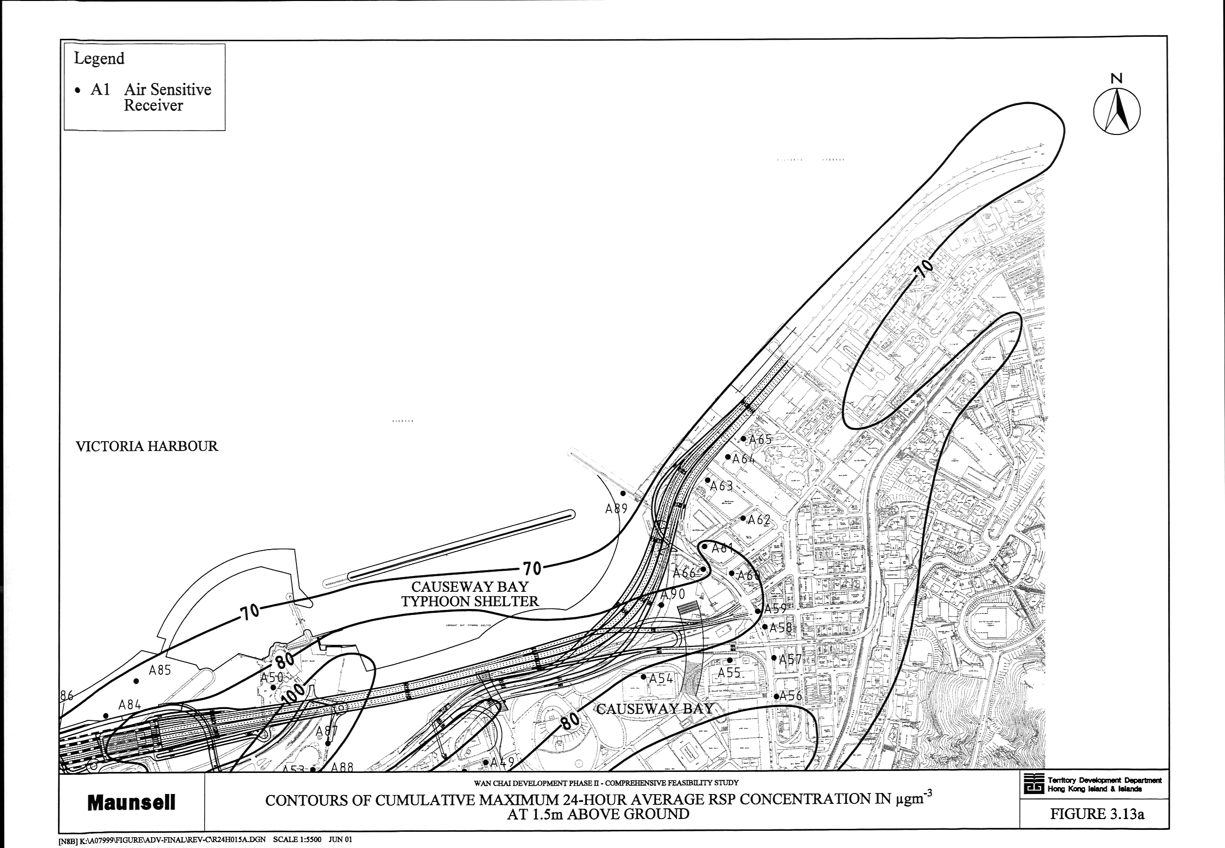
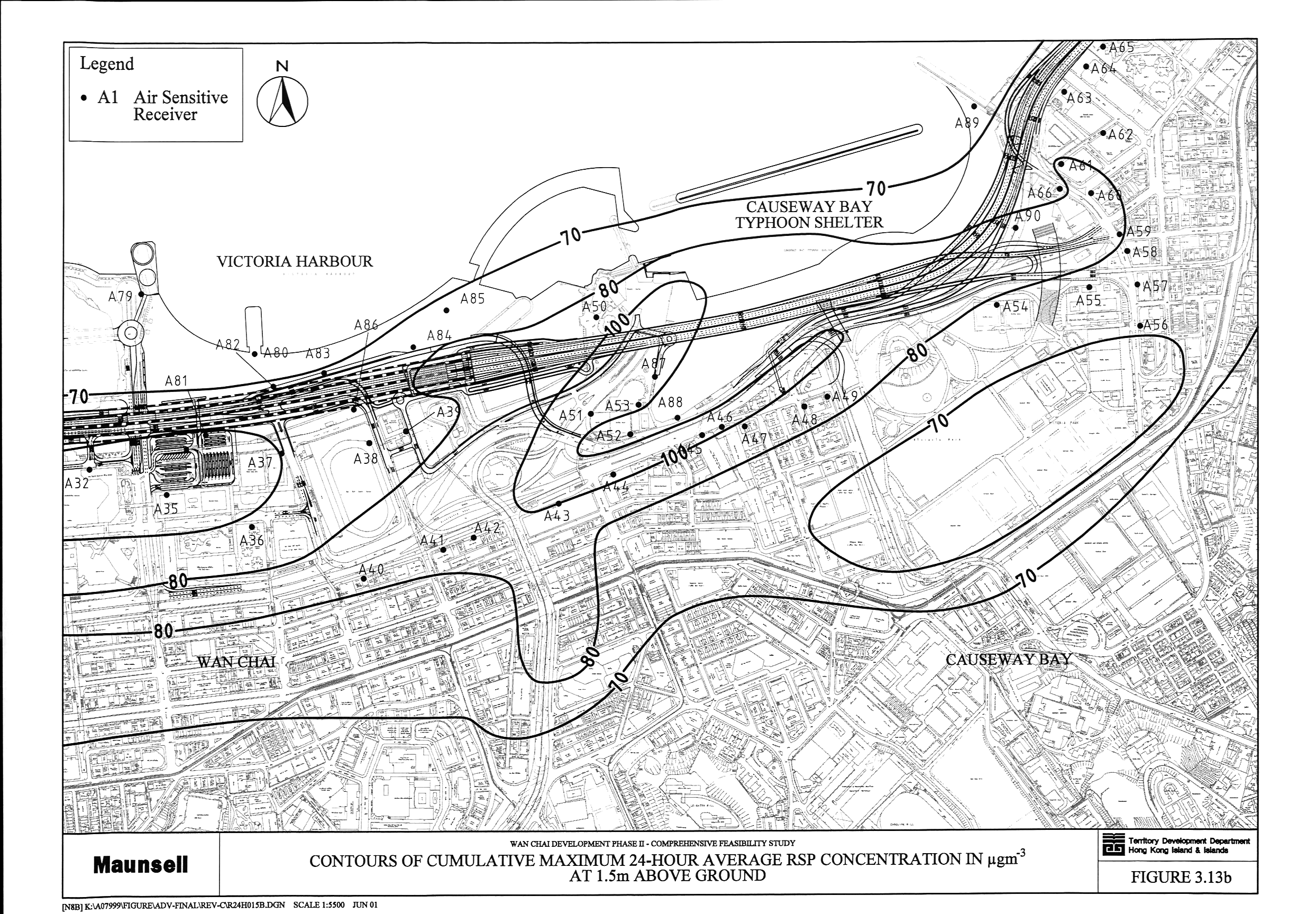
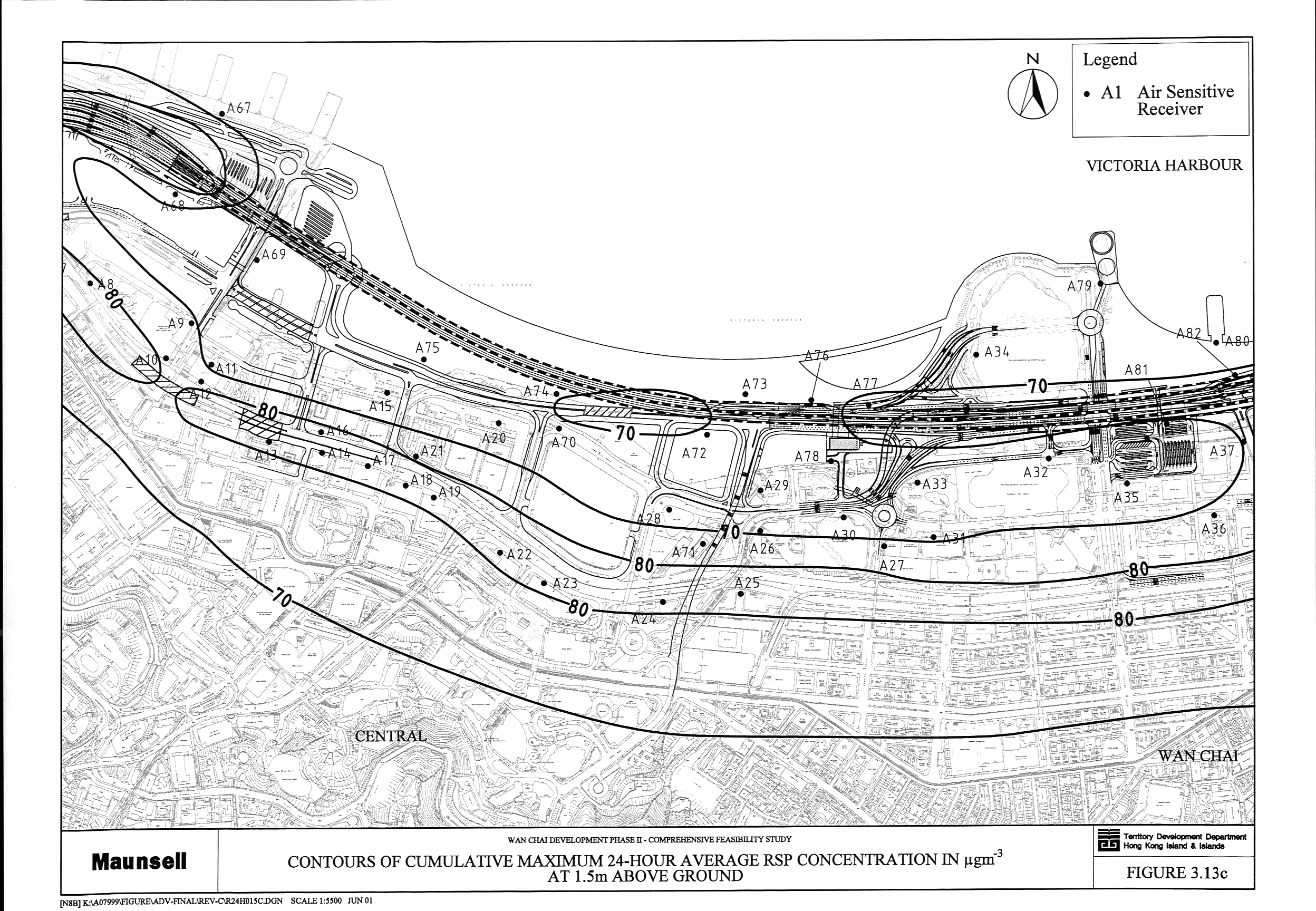
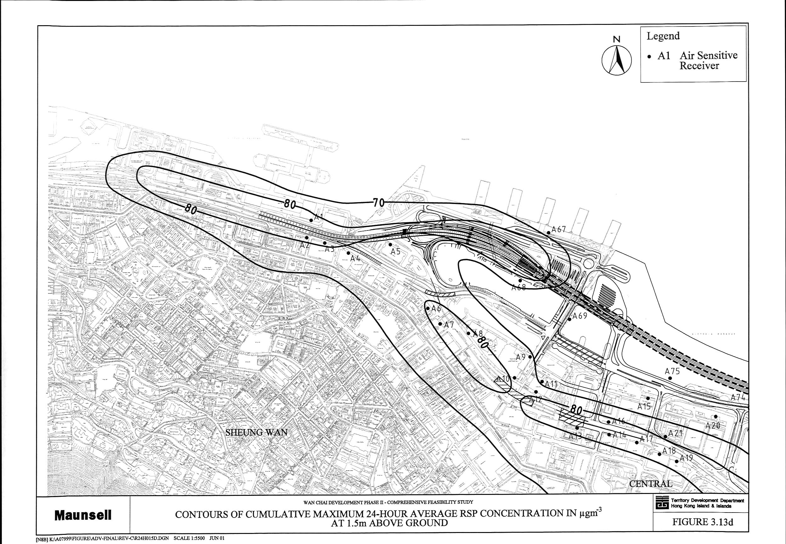
Figure 3.13 Contours
of Cumulative Maximum 24-Hour Average RSP Concentration in mg m-3 at 1.5 m above Ground (a,
b, c, d)
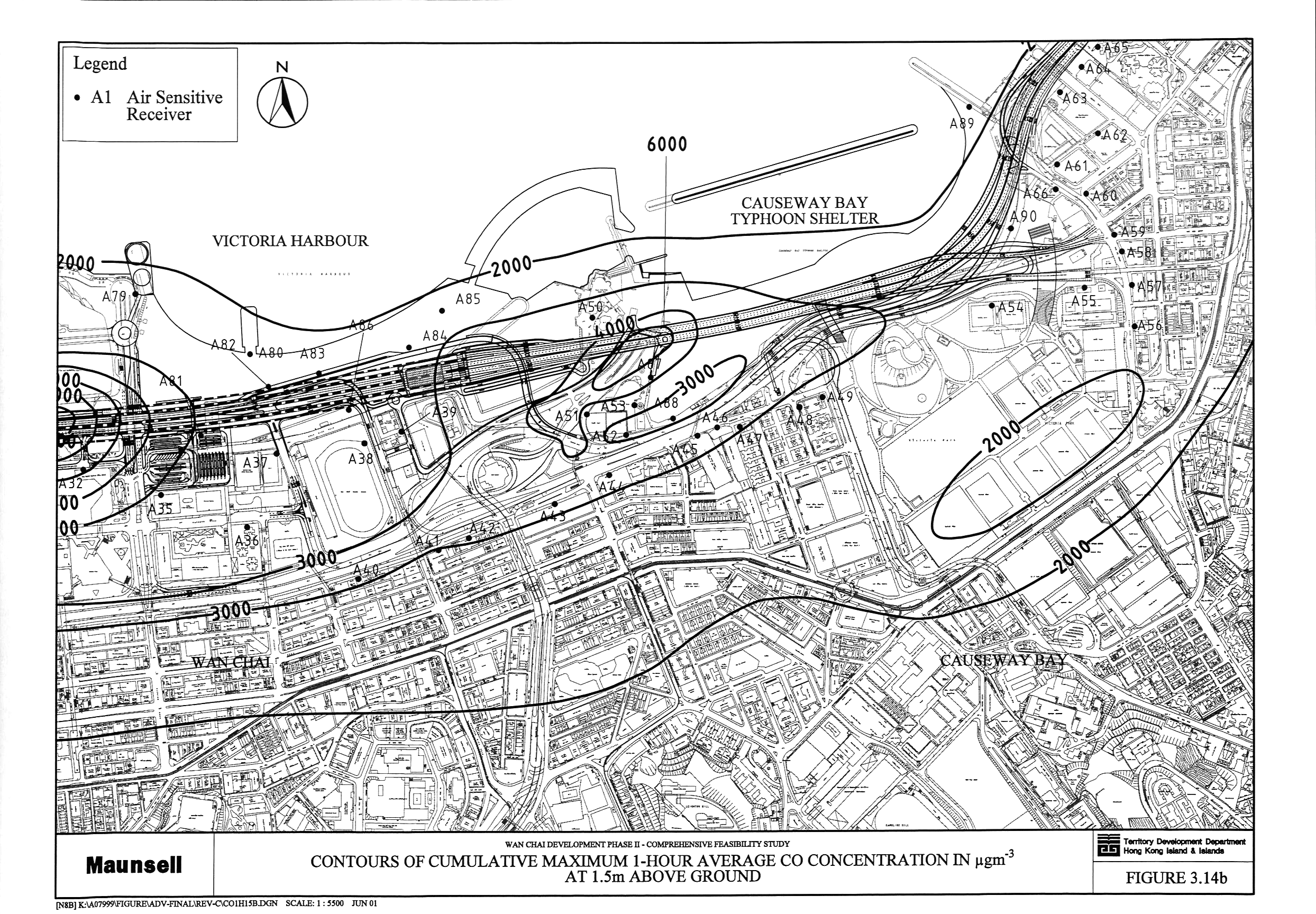
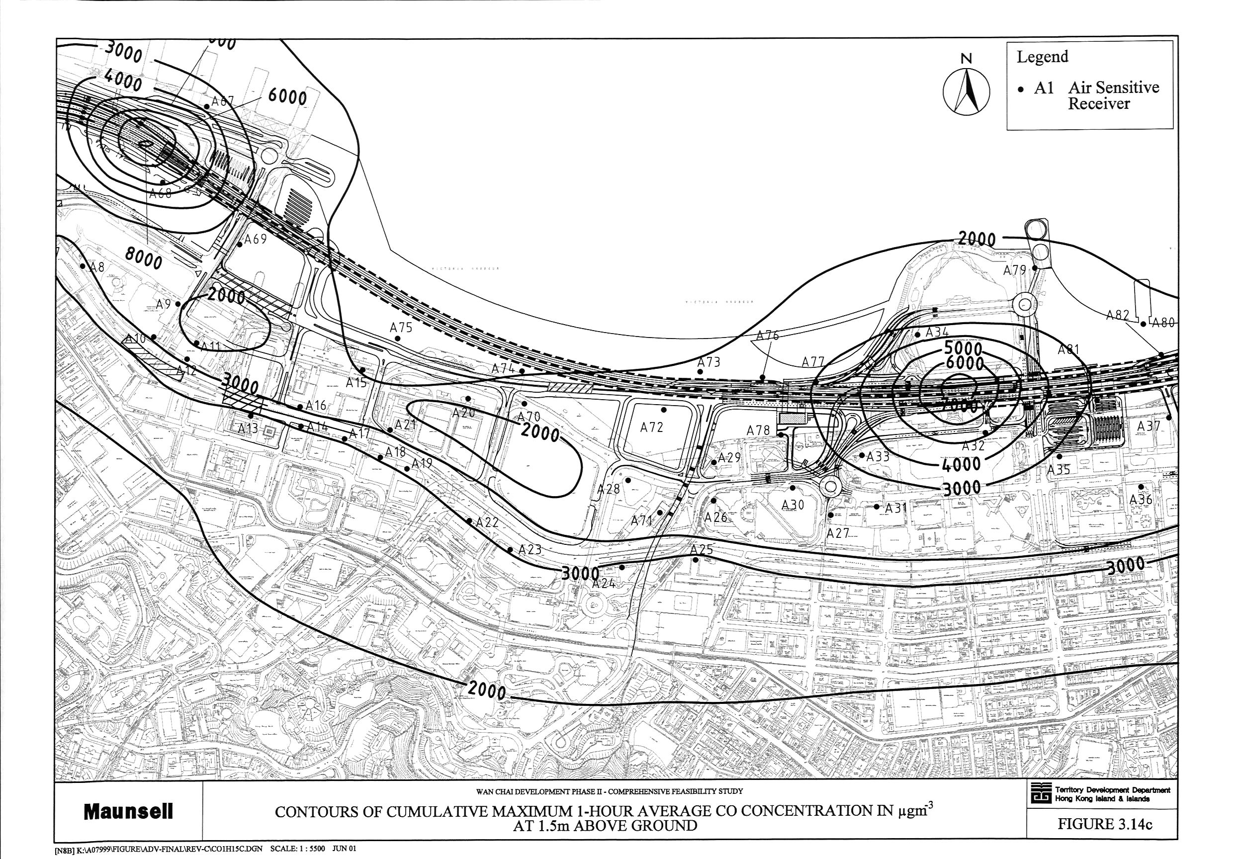
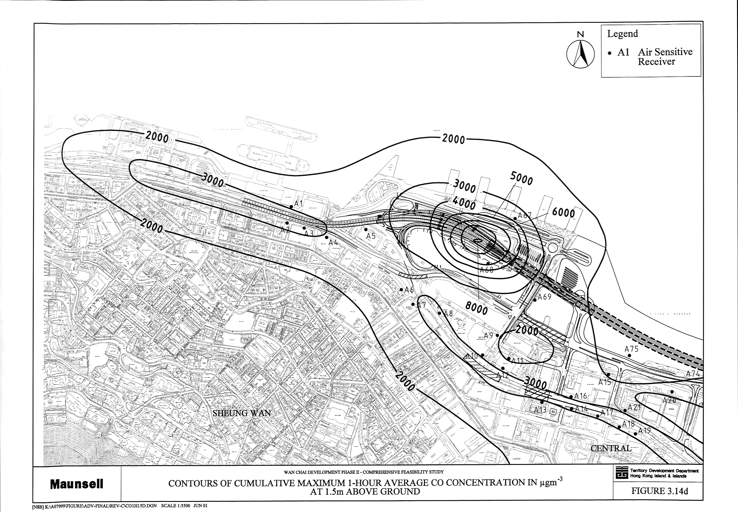
Figure 3.14 Contours
of Cumulative Maximum 1-Hour Average CO Concentration in mg m-3 at 1.5 m above Ground (a,
b, c, d)
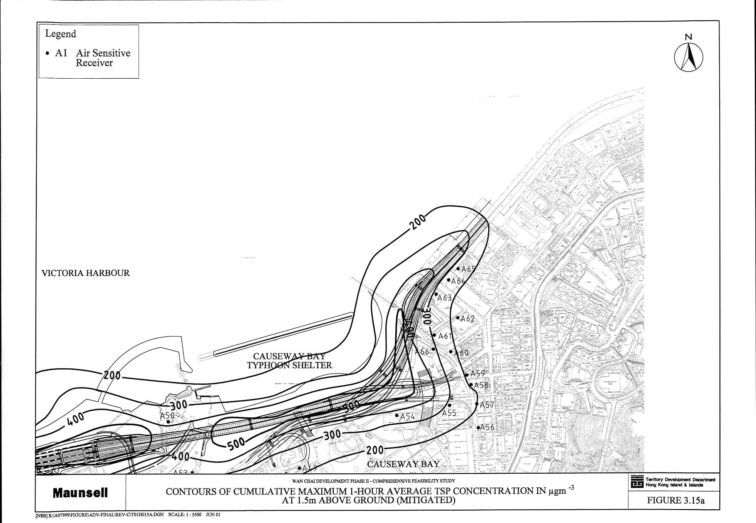
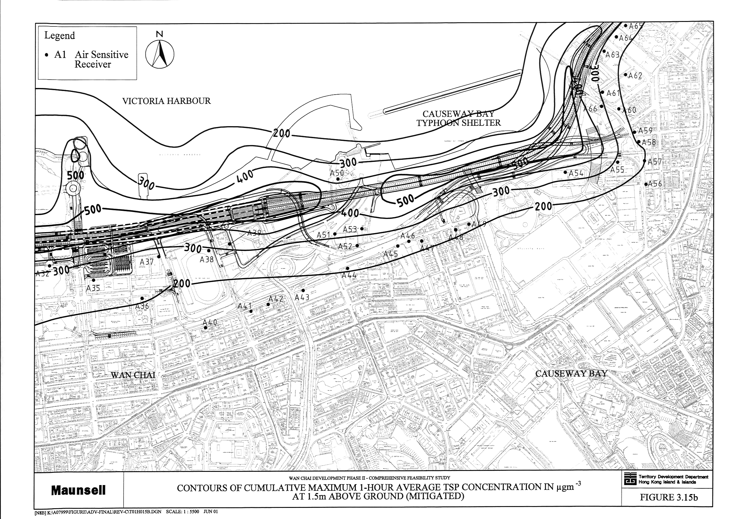
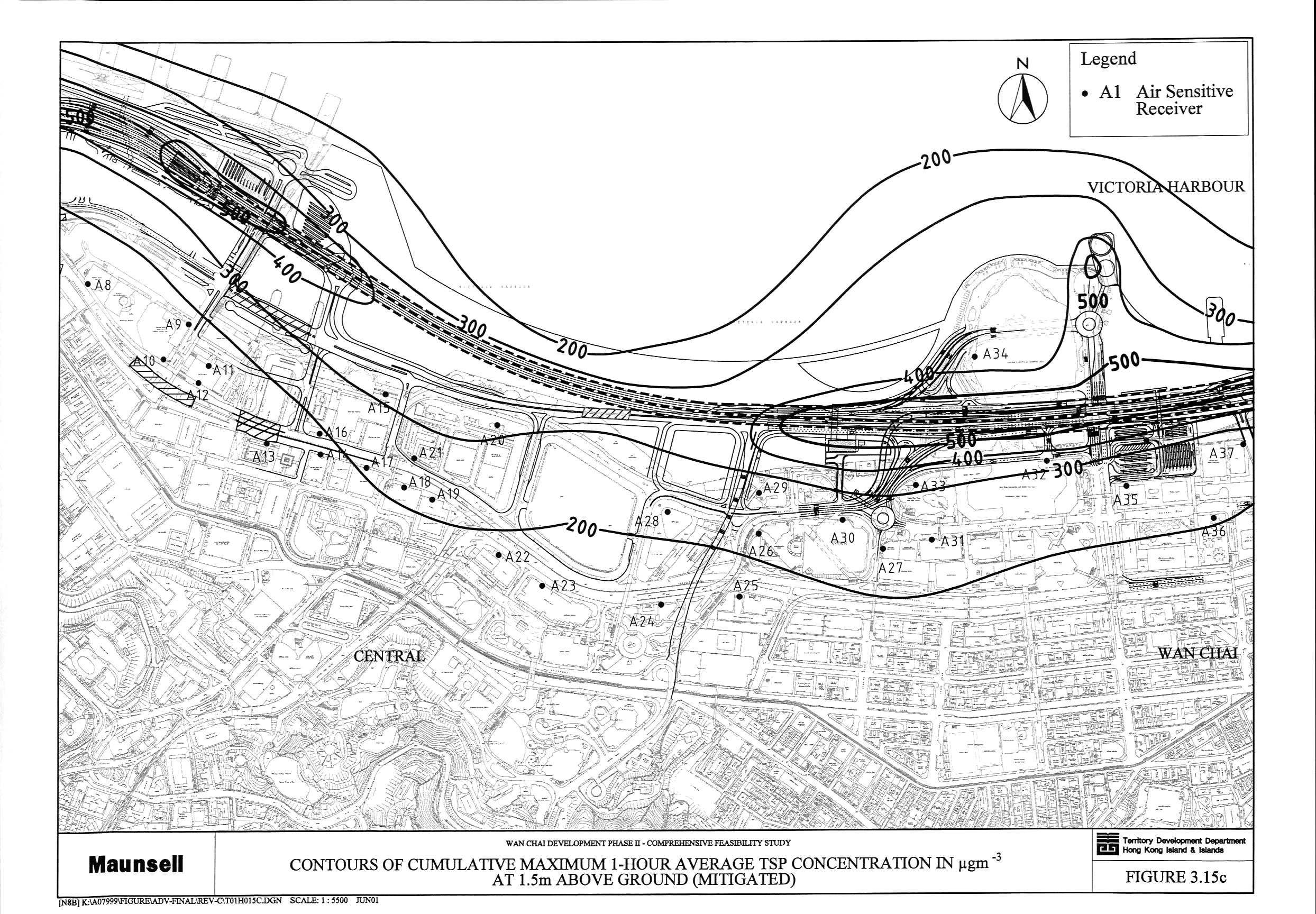
Figure 3.15 Contours
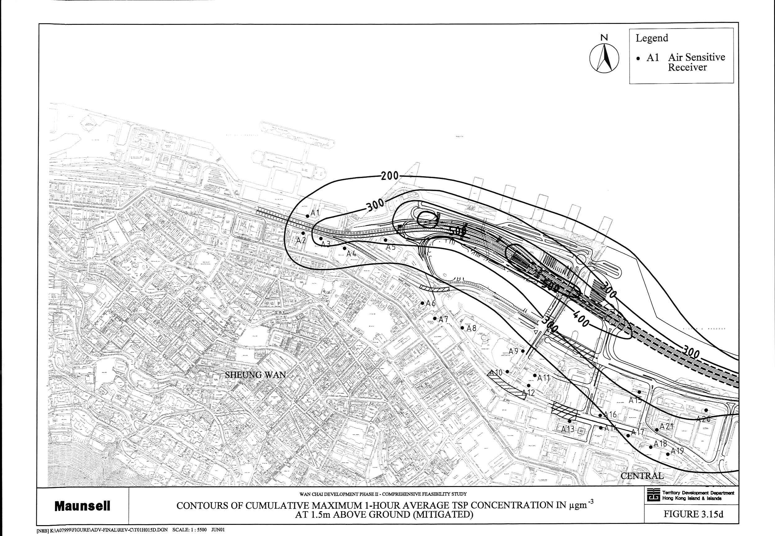
of Cumulative Maximum 1-Hour Average TSP Concentration in mg m-3 at 1.5 m above Ground
(Mitigated) (a, b, c, d)
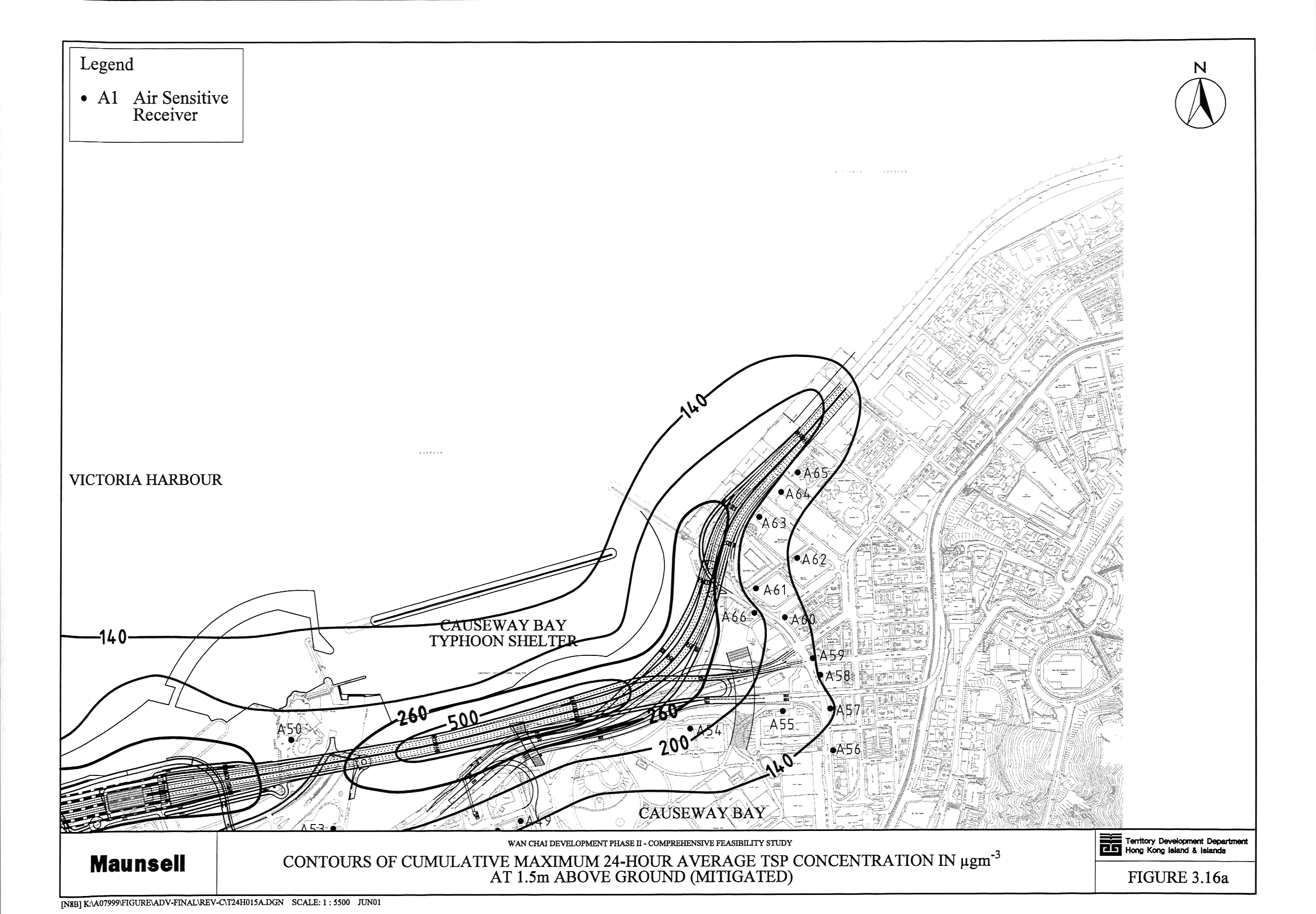
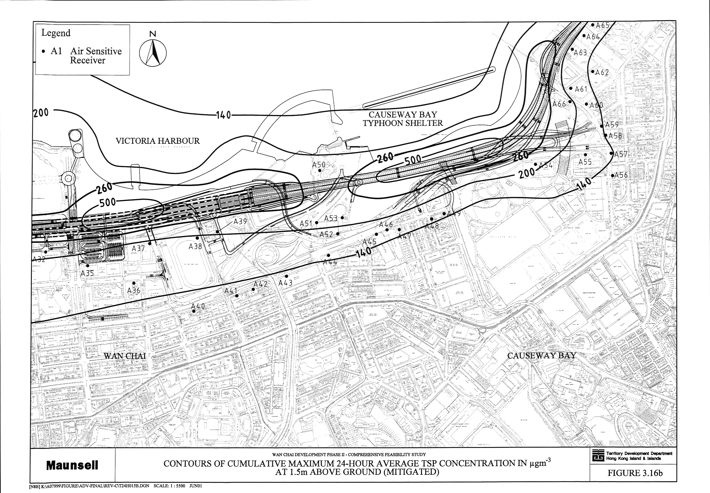
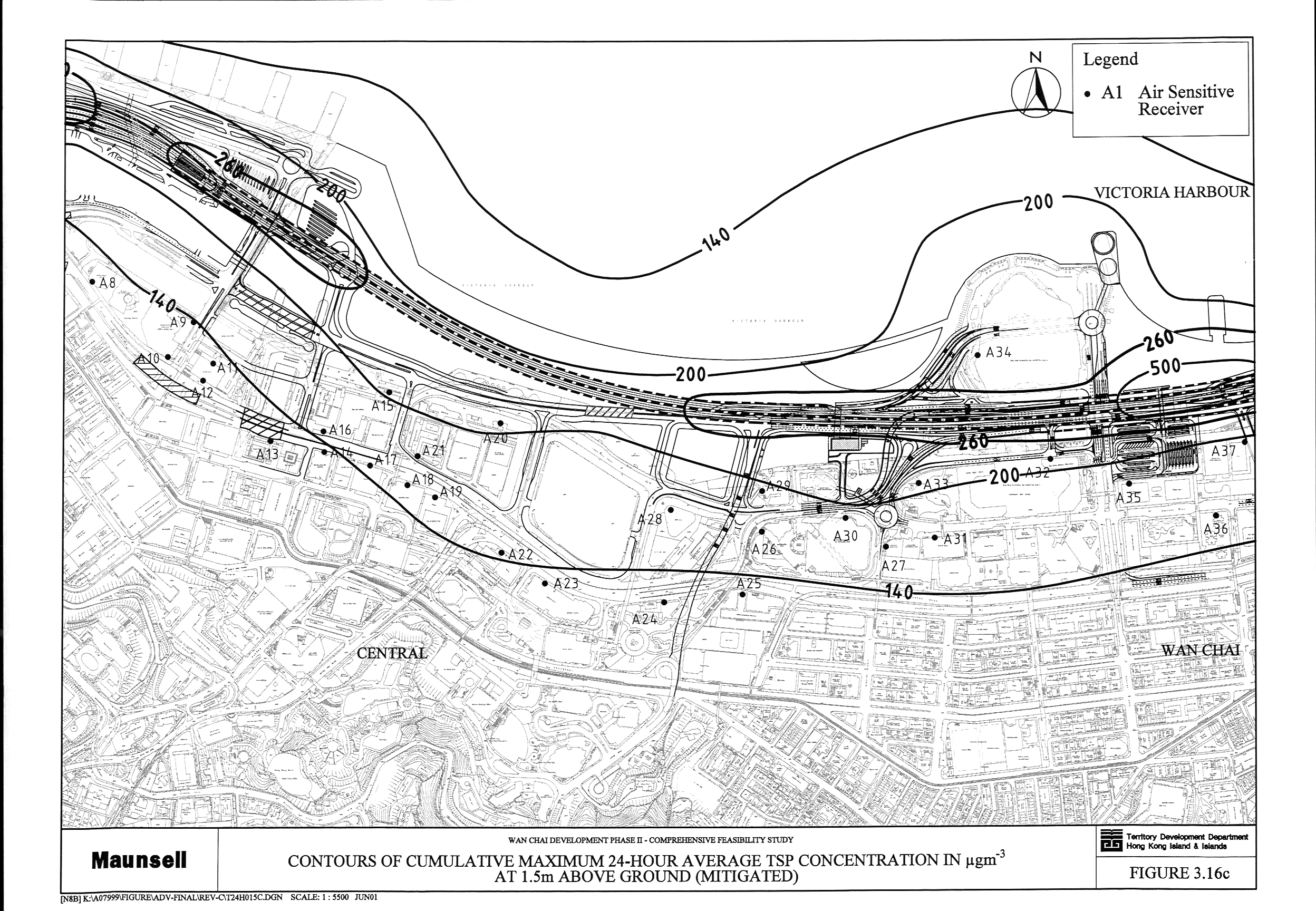
Figure 3.16 Contours
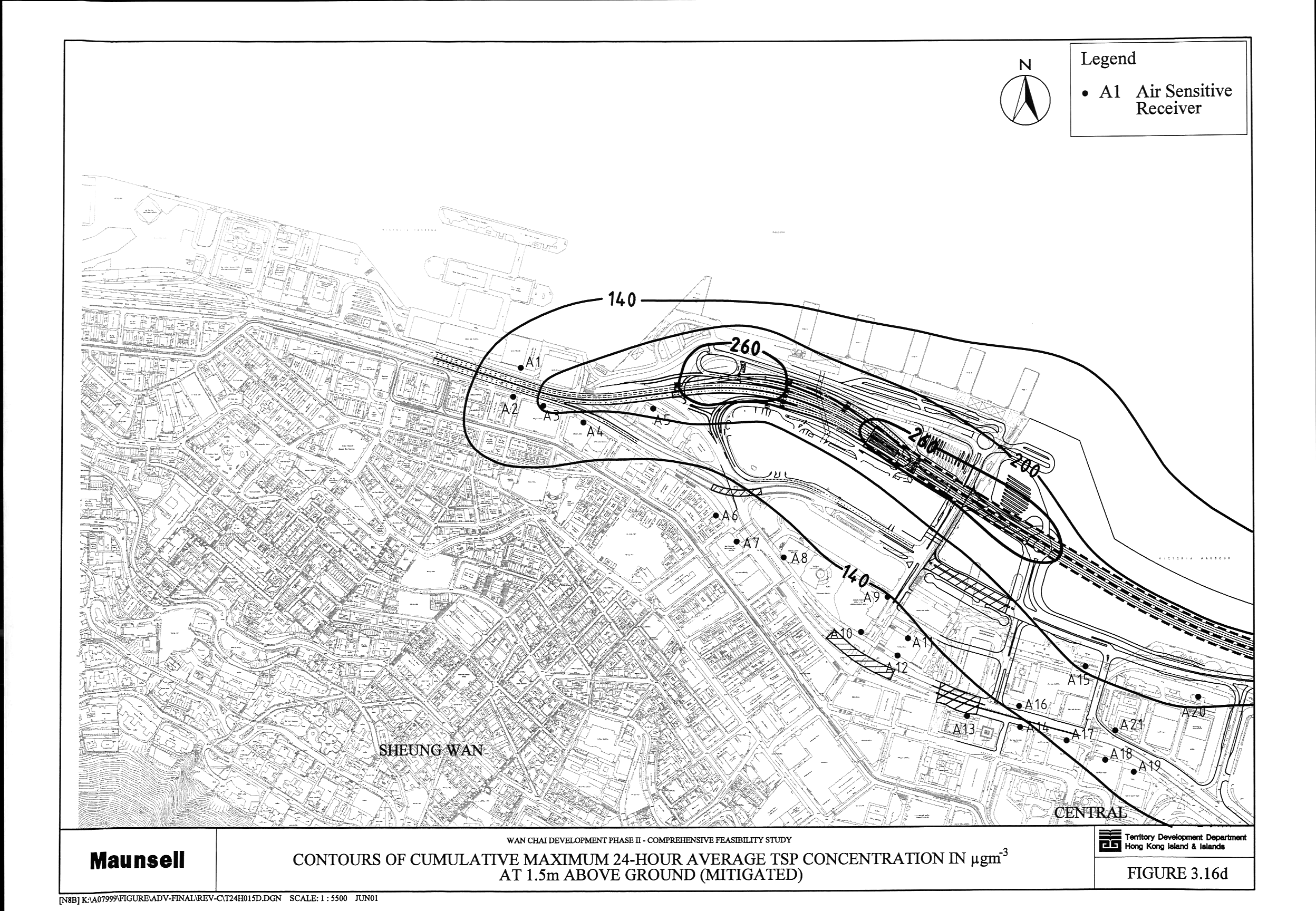
of Cumulative Maximum 24-Hour Average TSP Concentration in mg m-3 at 1.5 m above Ground
(Mitigated) (a, b, c, d)
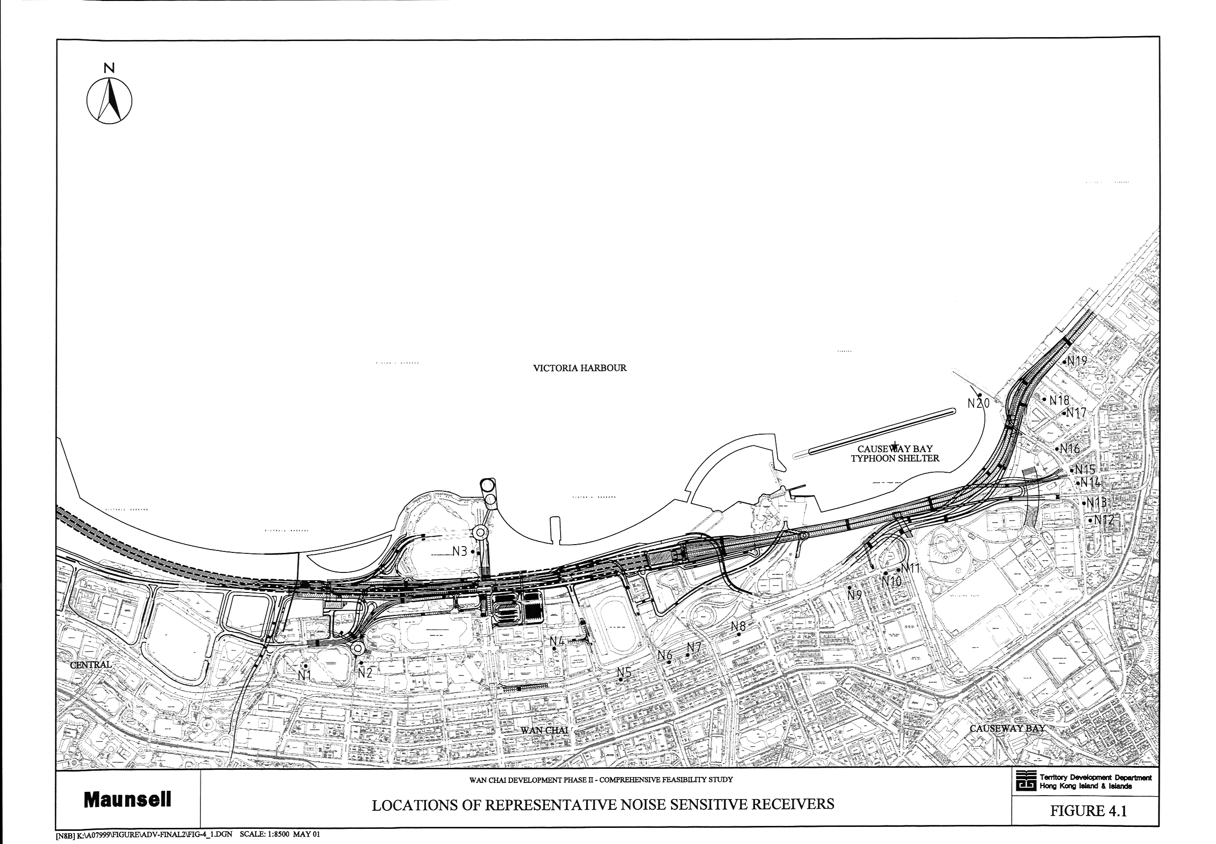
Figure 4.1 Locations of Representative Noise Sensitive
Receivers
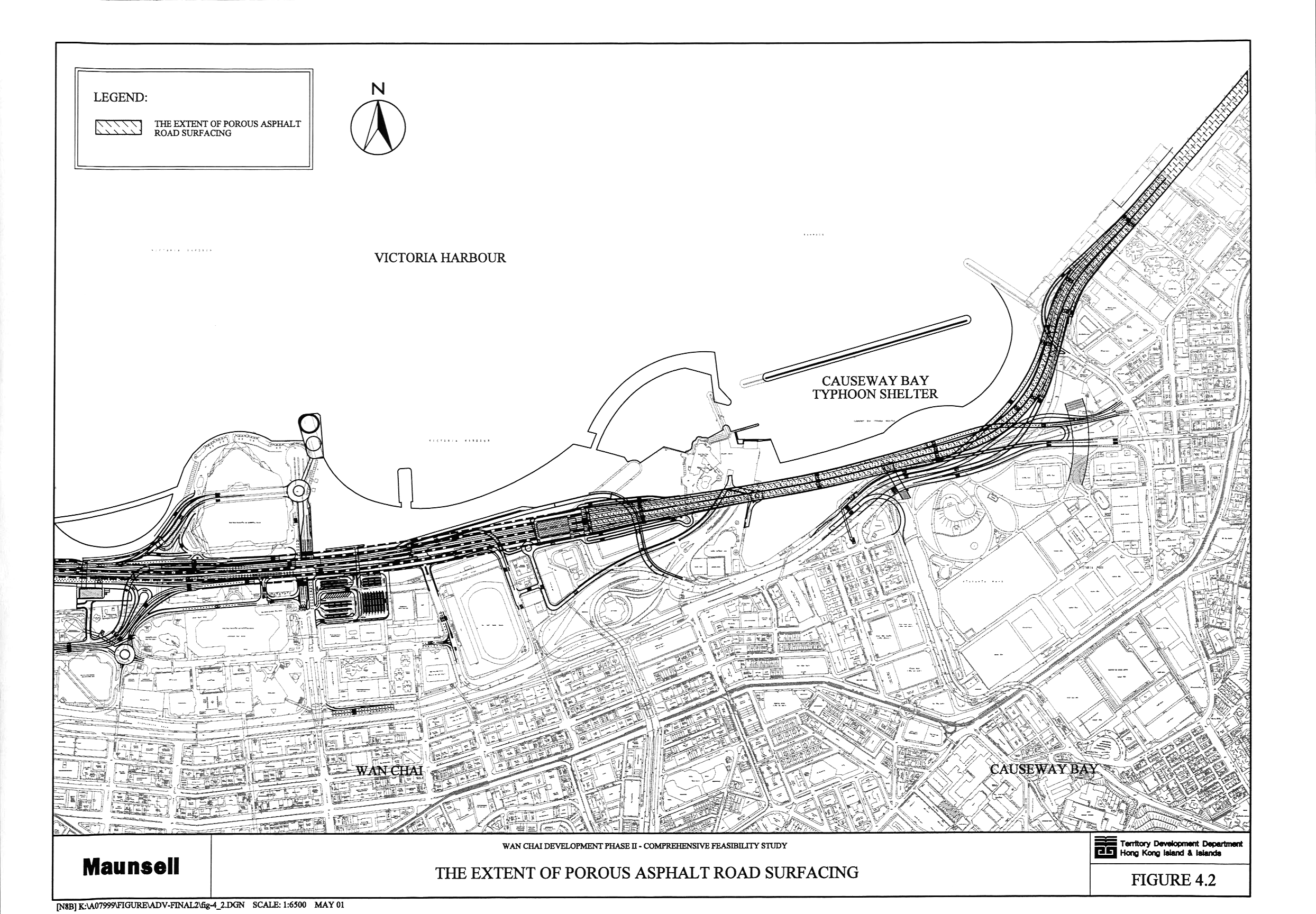
Figure 4.2 The Extent of Porous Asphalt Road Surfacing
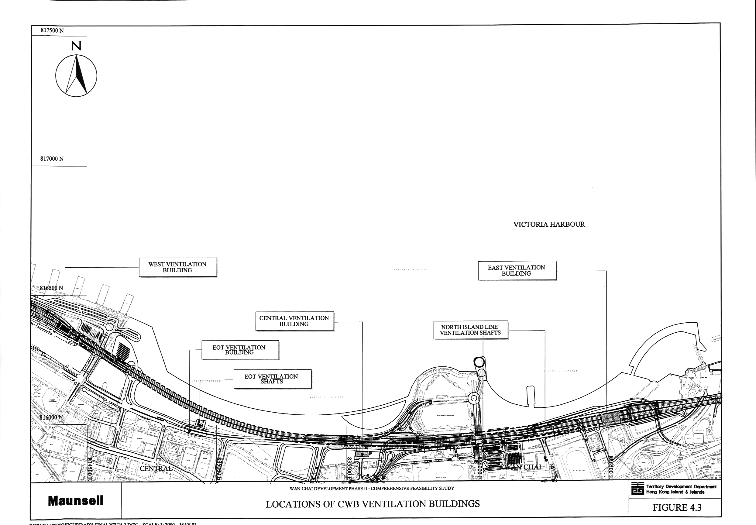
Figure 4.3 Locations of Ventilation Buildings
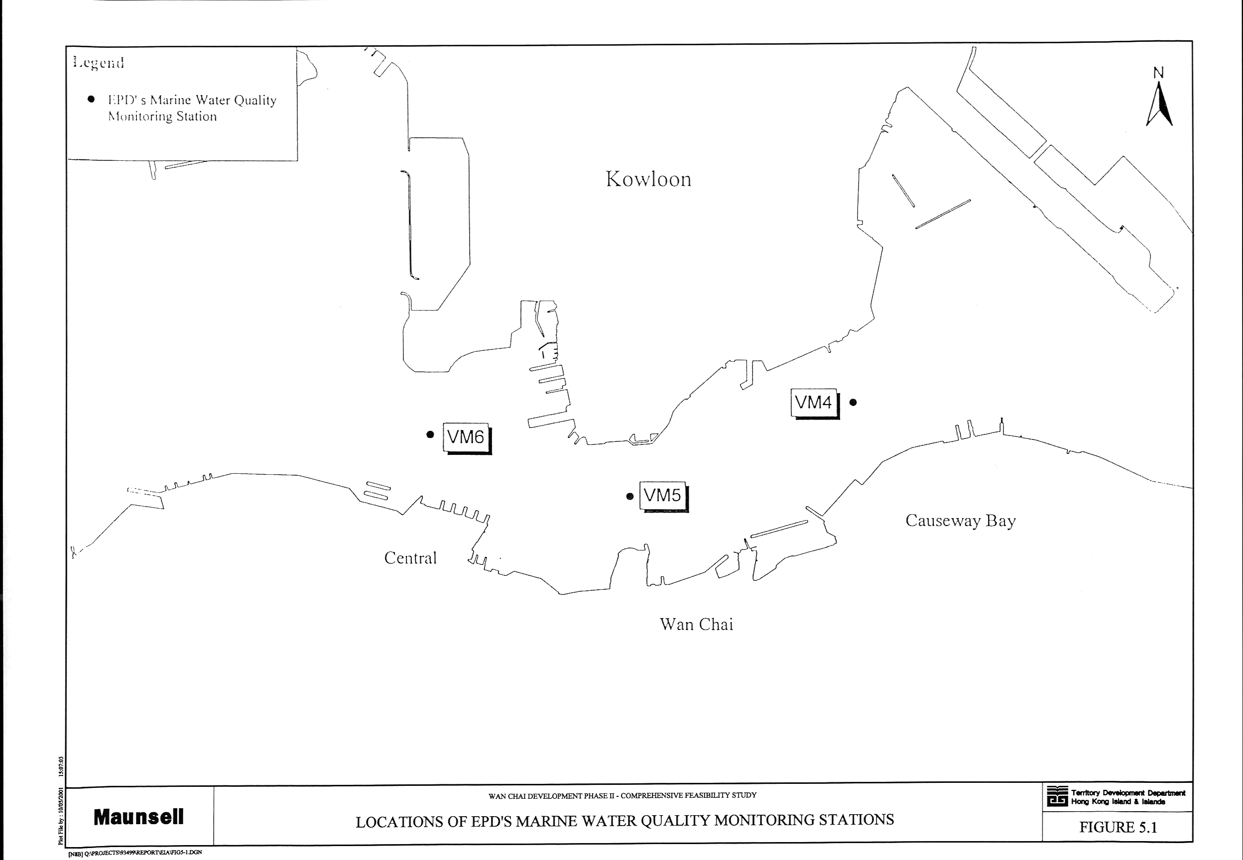
Figure 5.1 Locations of EPD’s Marine Water Quality
Monitoring Stations
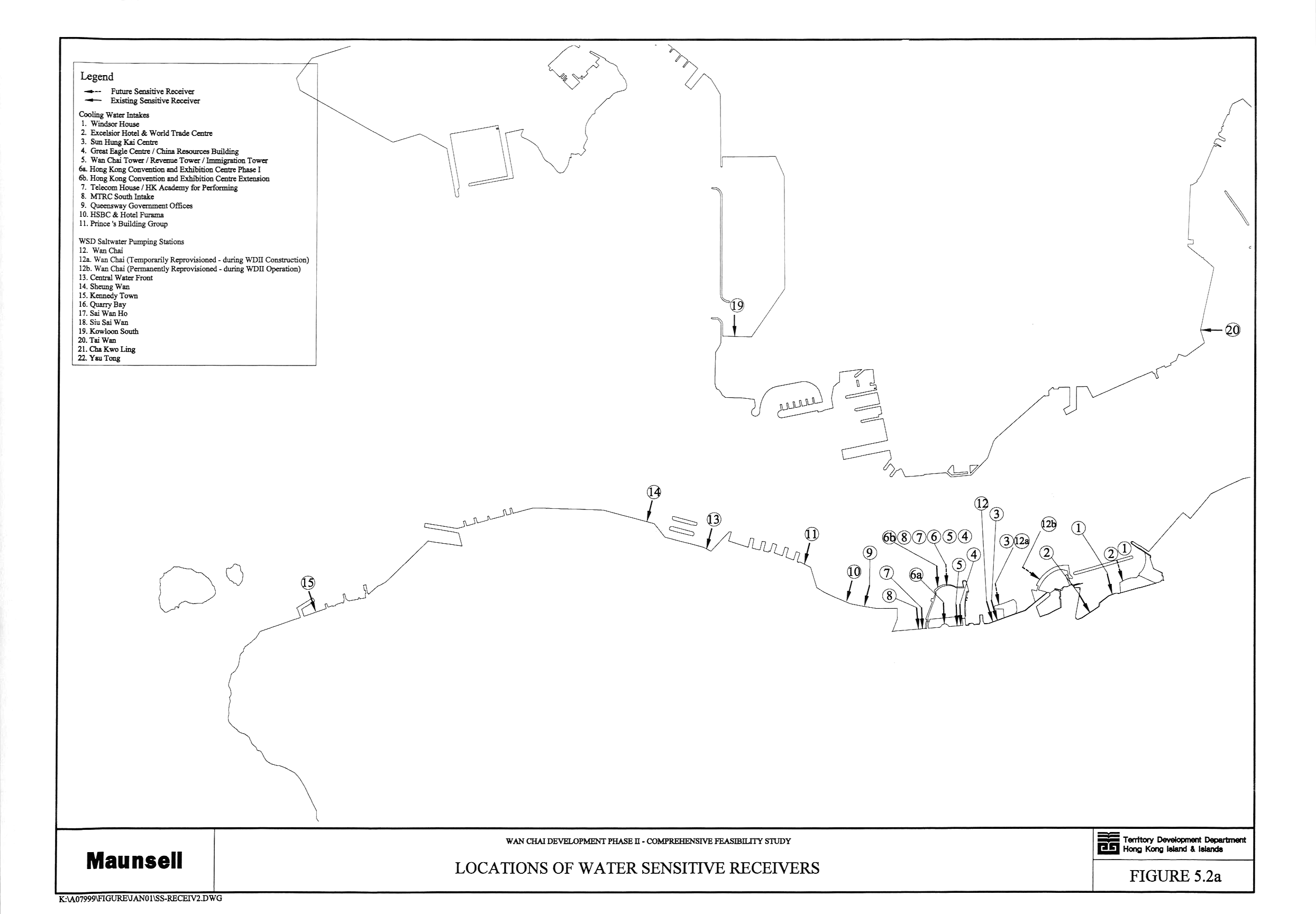
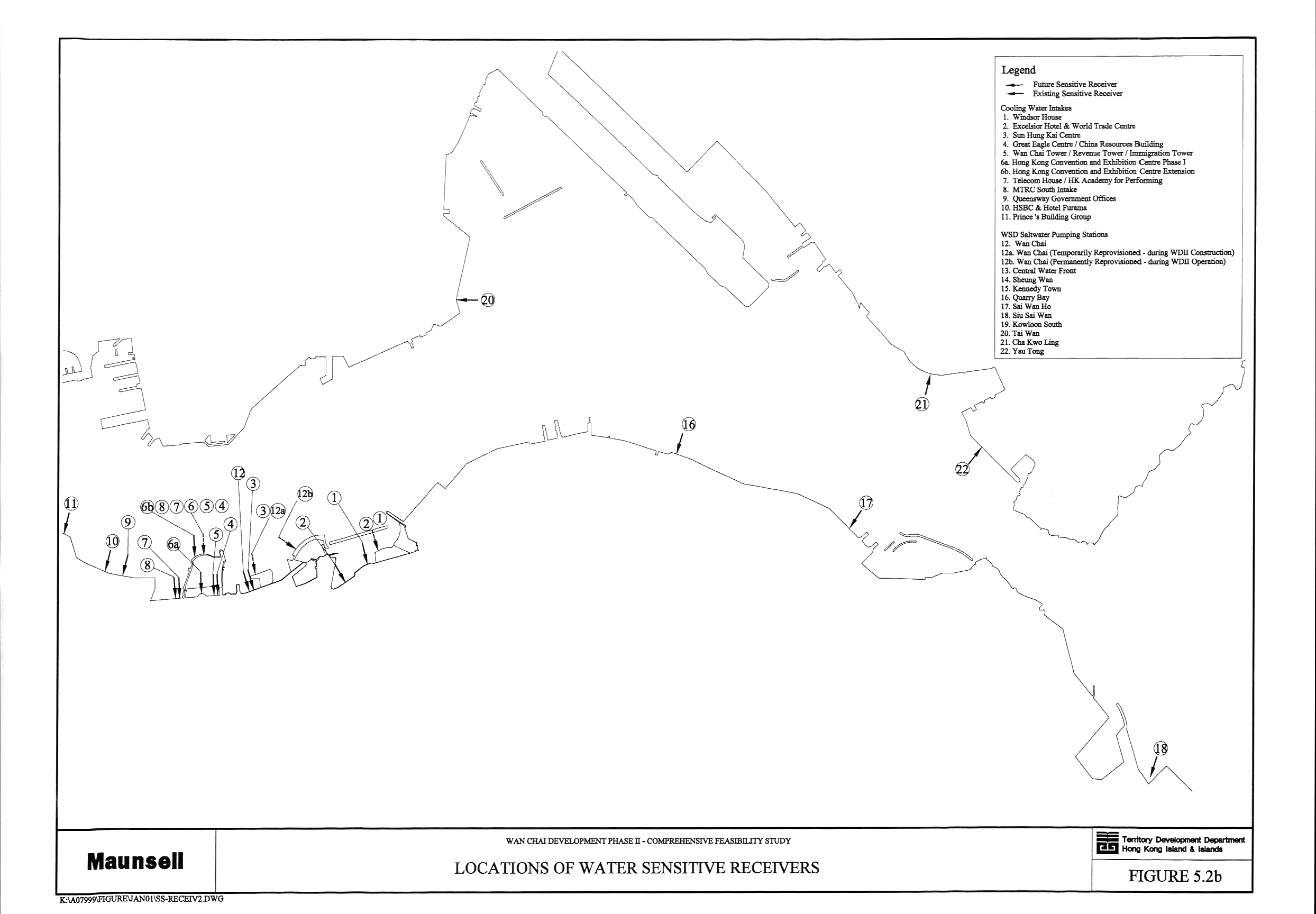
Figure 5.2 Locations of Water Sensitive
Receivers (a, b)
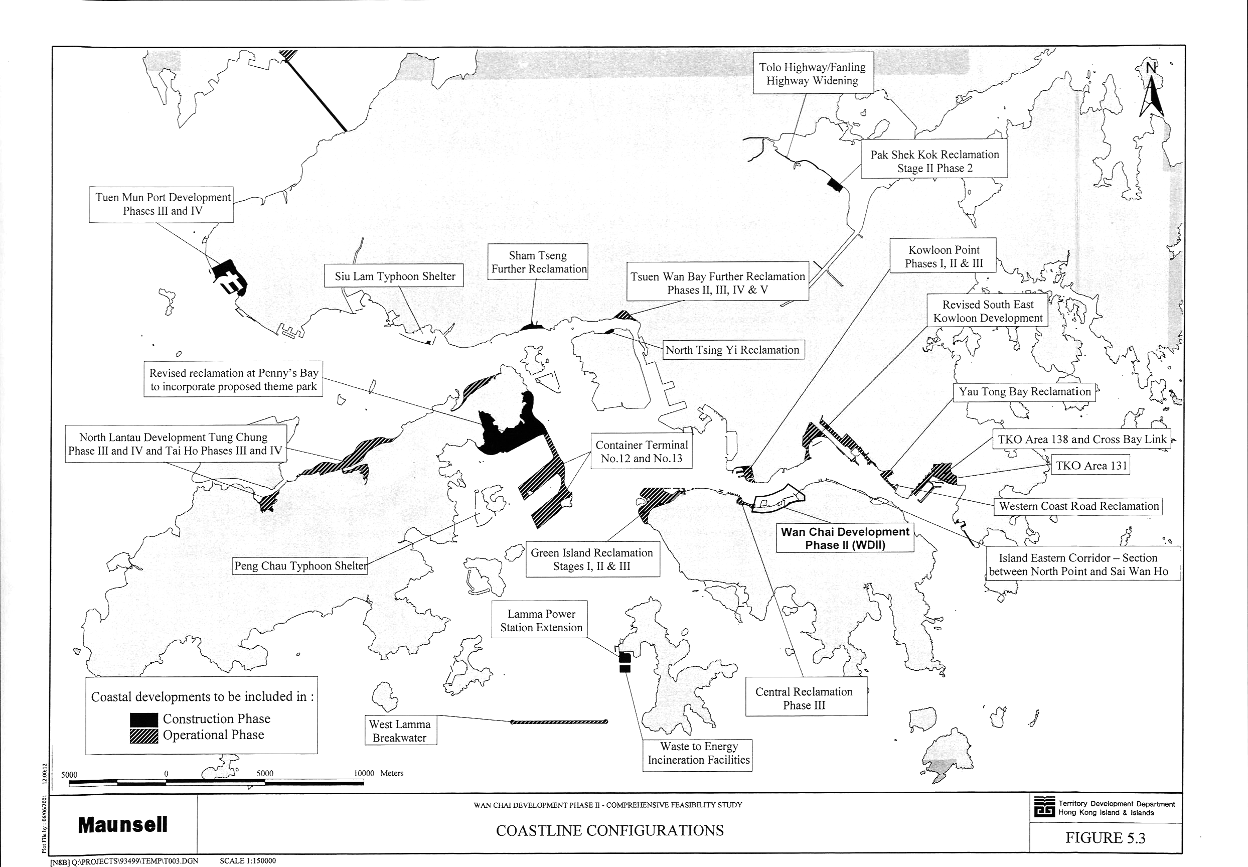
Figure 5.3 Coastline Configurations
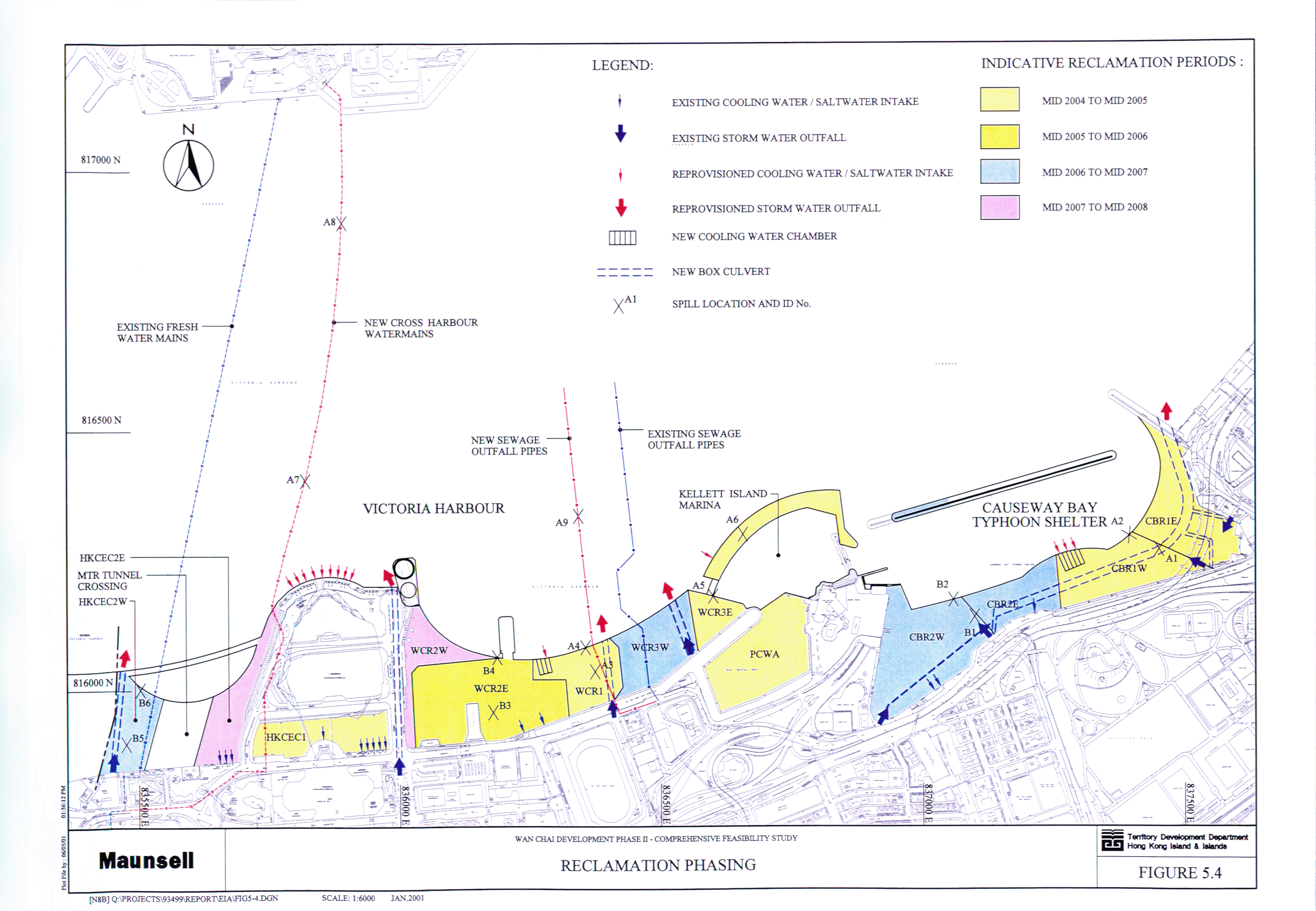
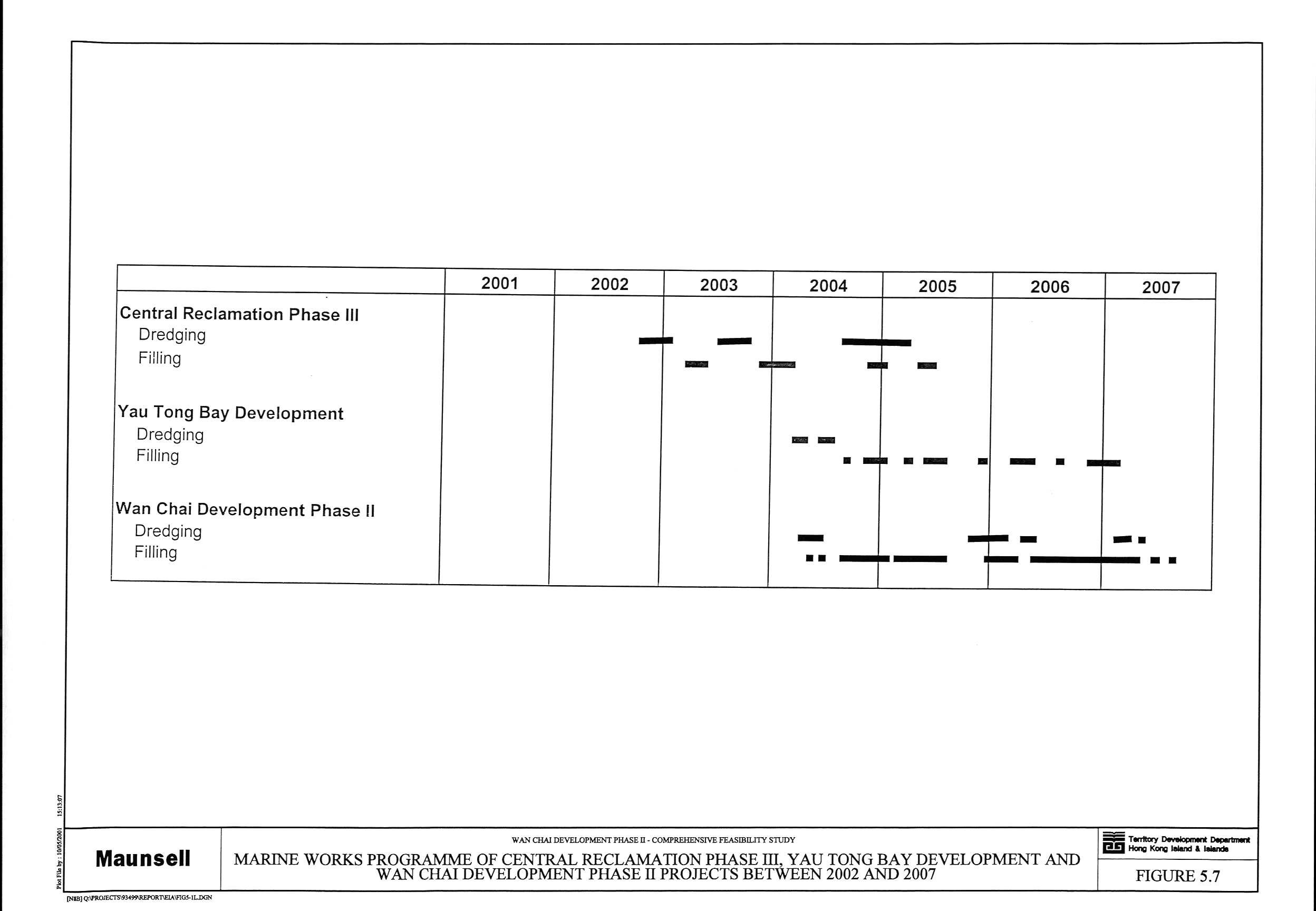
Figure 5.4 Reclamation Phasing
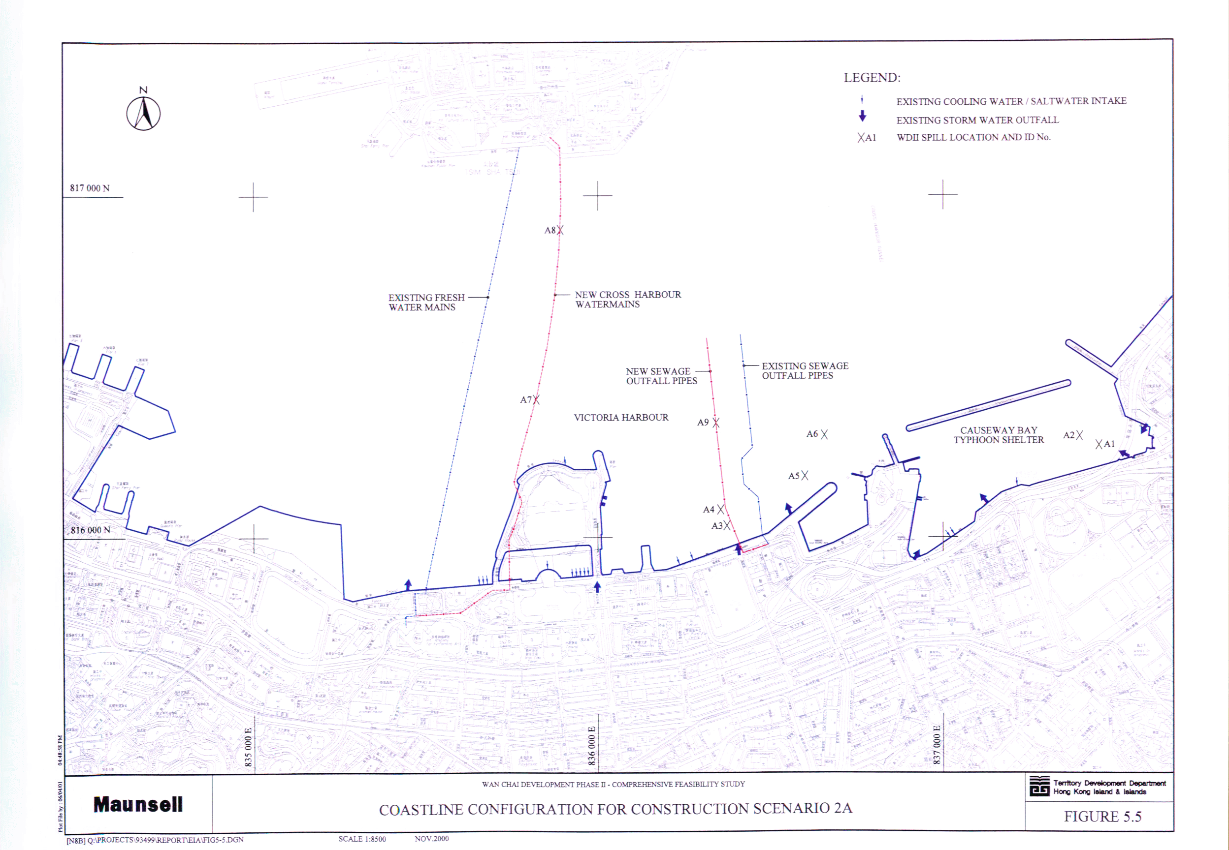
Figure 5.5 Coastline Configuration for Construction
Scenario 2A
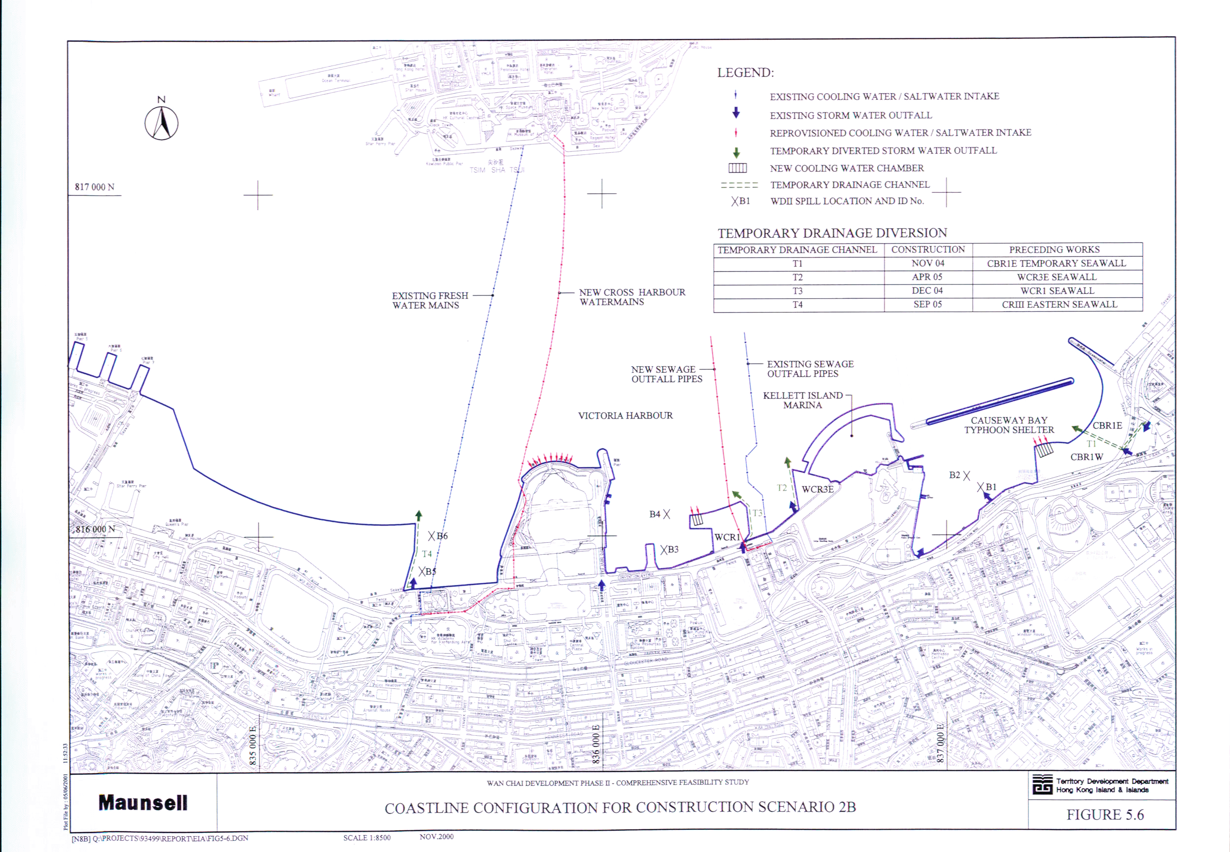
Figure 5.6 Coastline Configuration for Construction
Scenario 2B
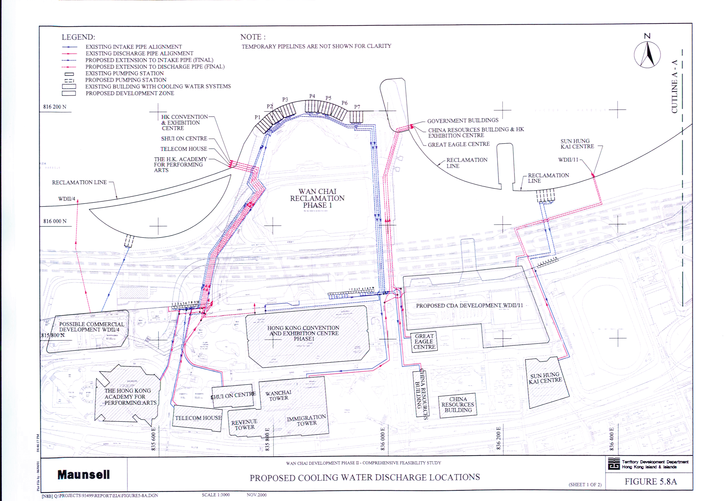
Figure 5.8A Proposed
Cooling Water Discharge Locations (Sheet 1 of 2)
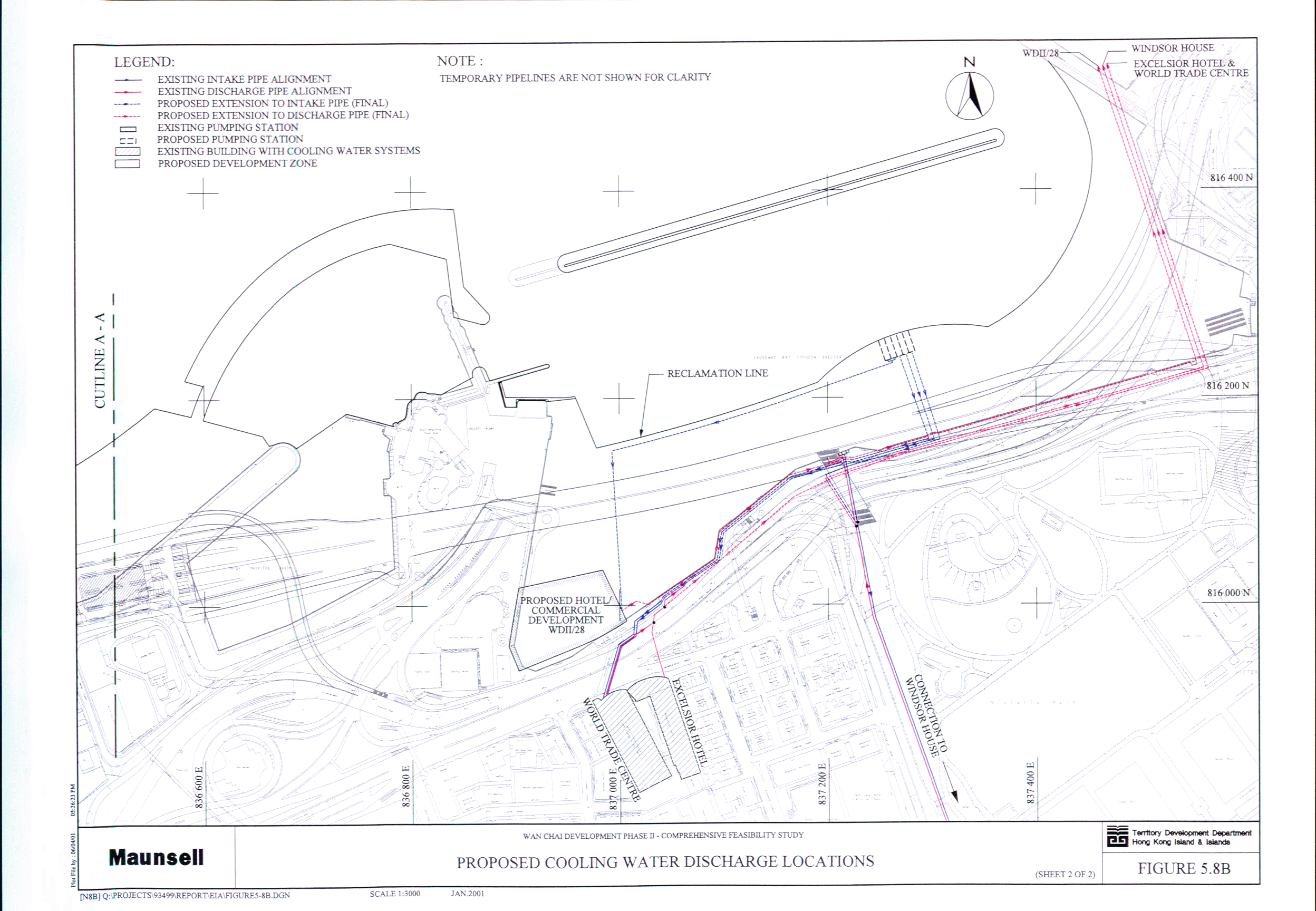
Figure 5.8B Proposed
Cooling Water Discharge Locations (Sheet 2 of 2)
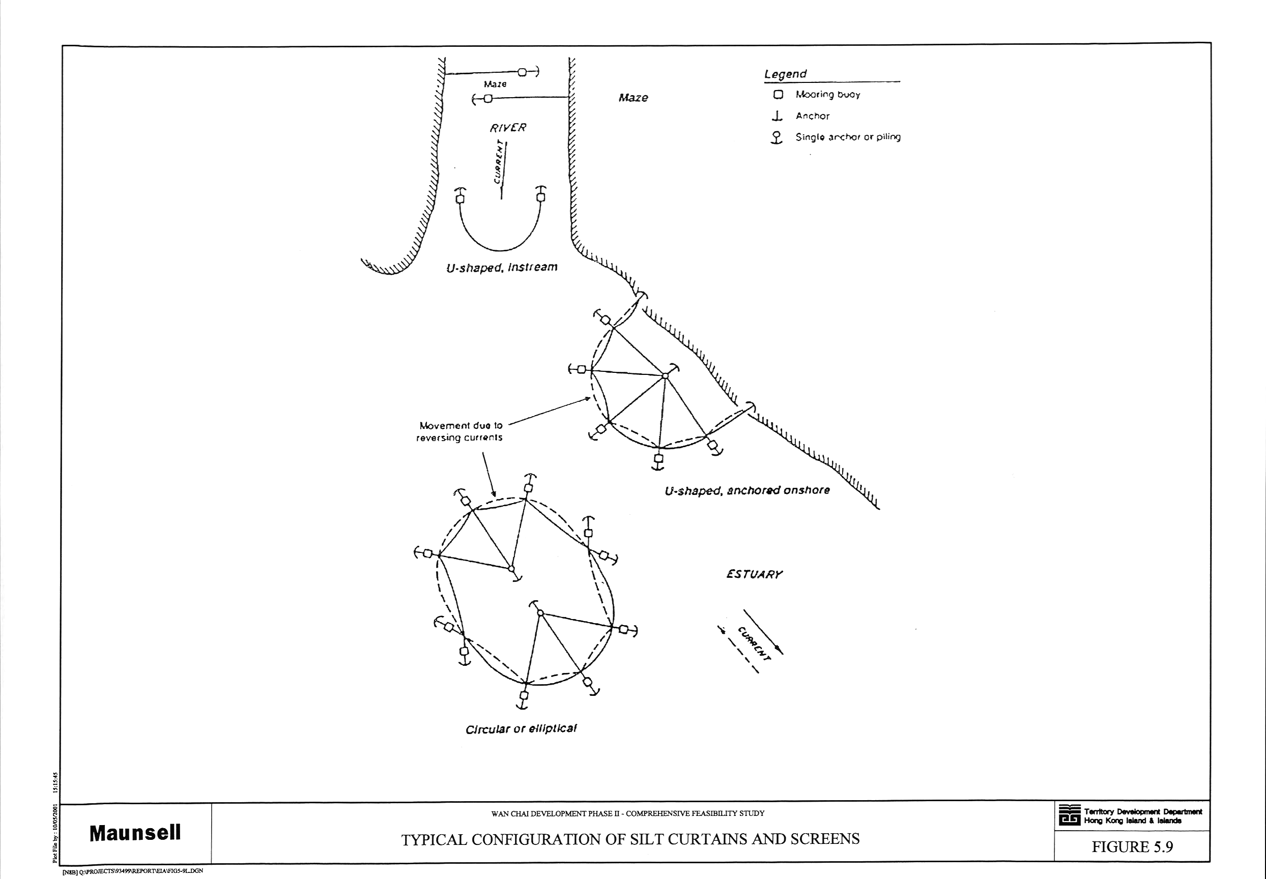
Figure 5.9 Typical Configuration of Silt Curtains and
Screens
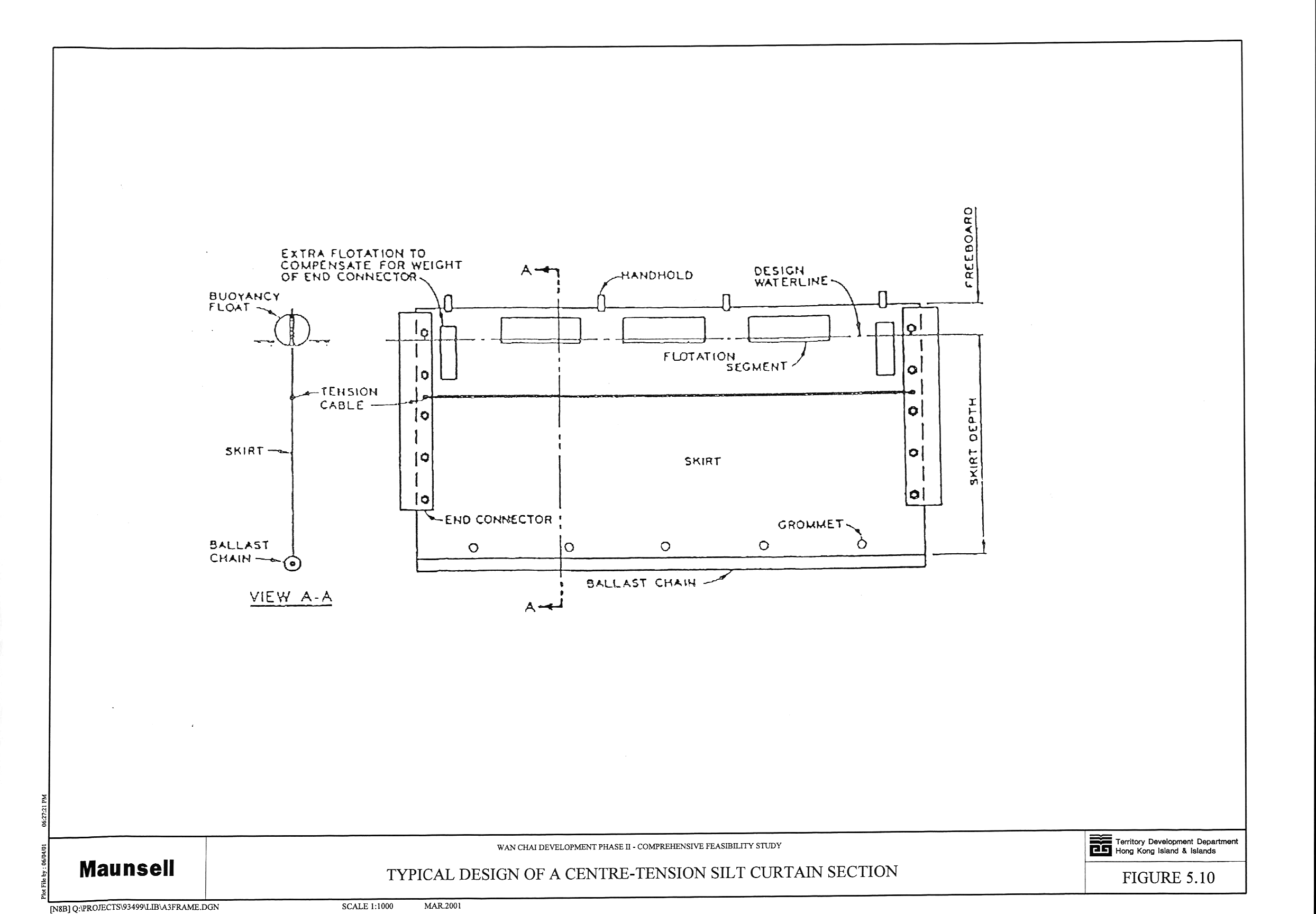
Figure 5.10 Typical
Design of a Centre-Tension Silt Curtain Section
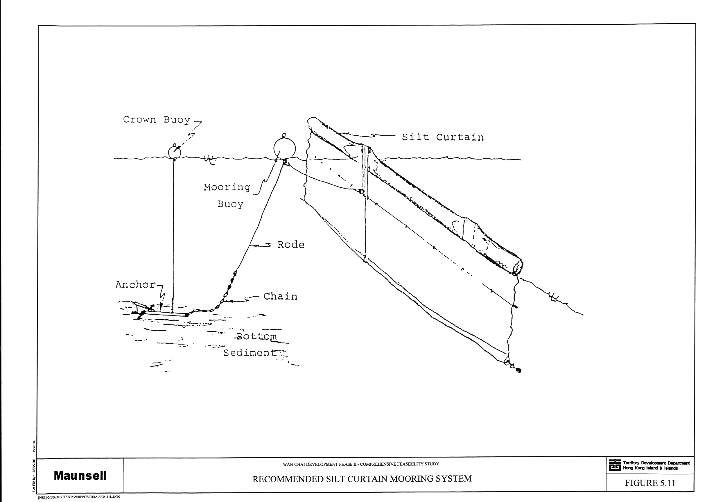
Figure 5.11 Recommended
Silt Curtain Mooring System
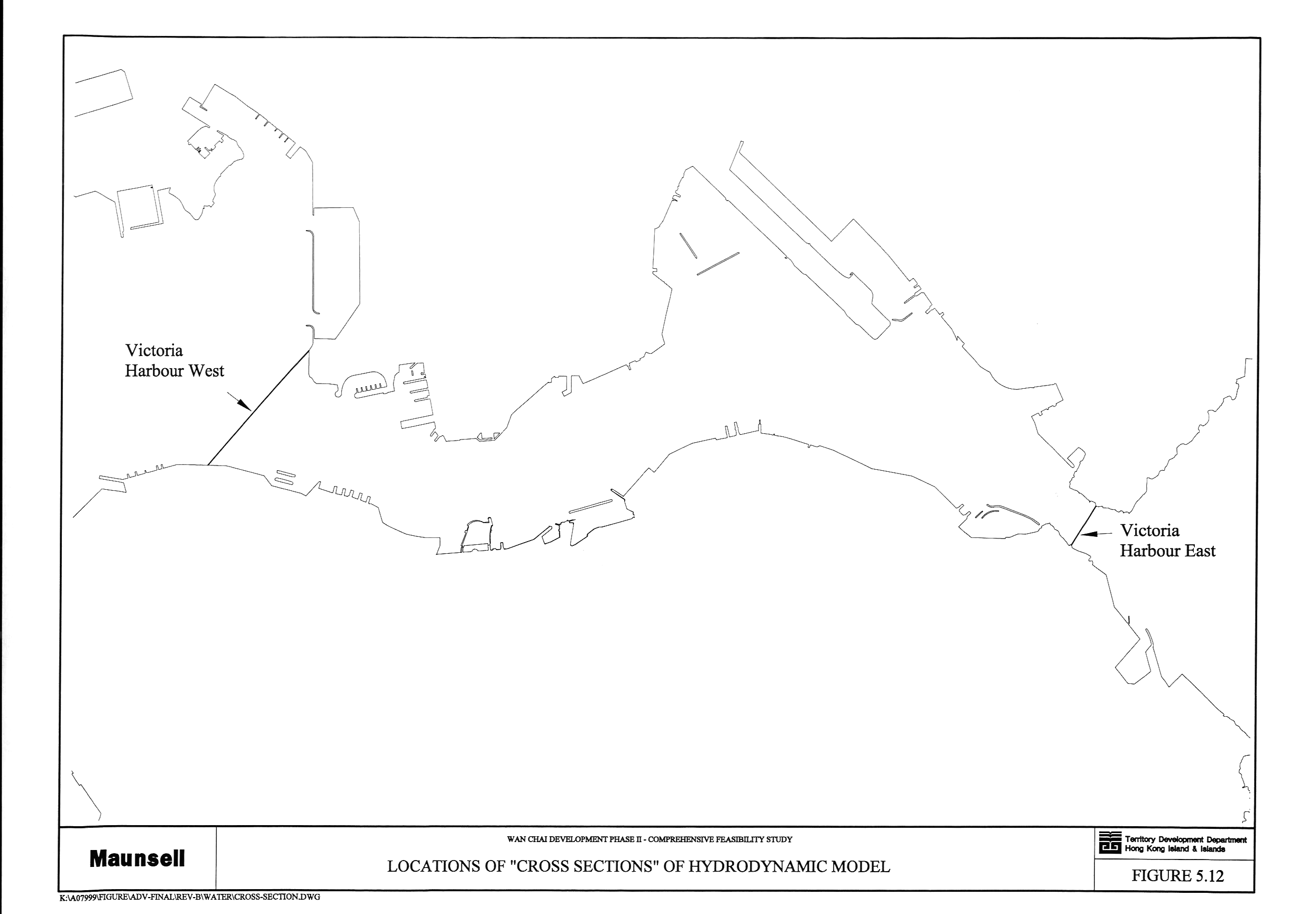
Figure 5.12 Locations
of “Cross Sections” of Hydrodynamic Model
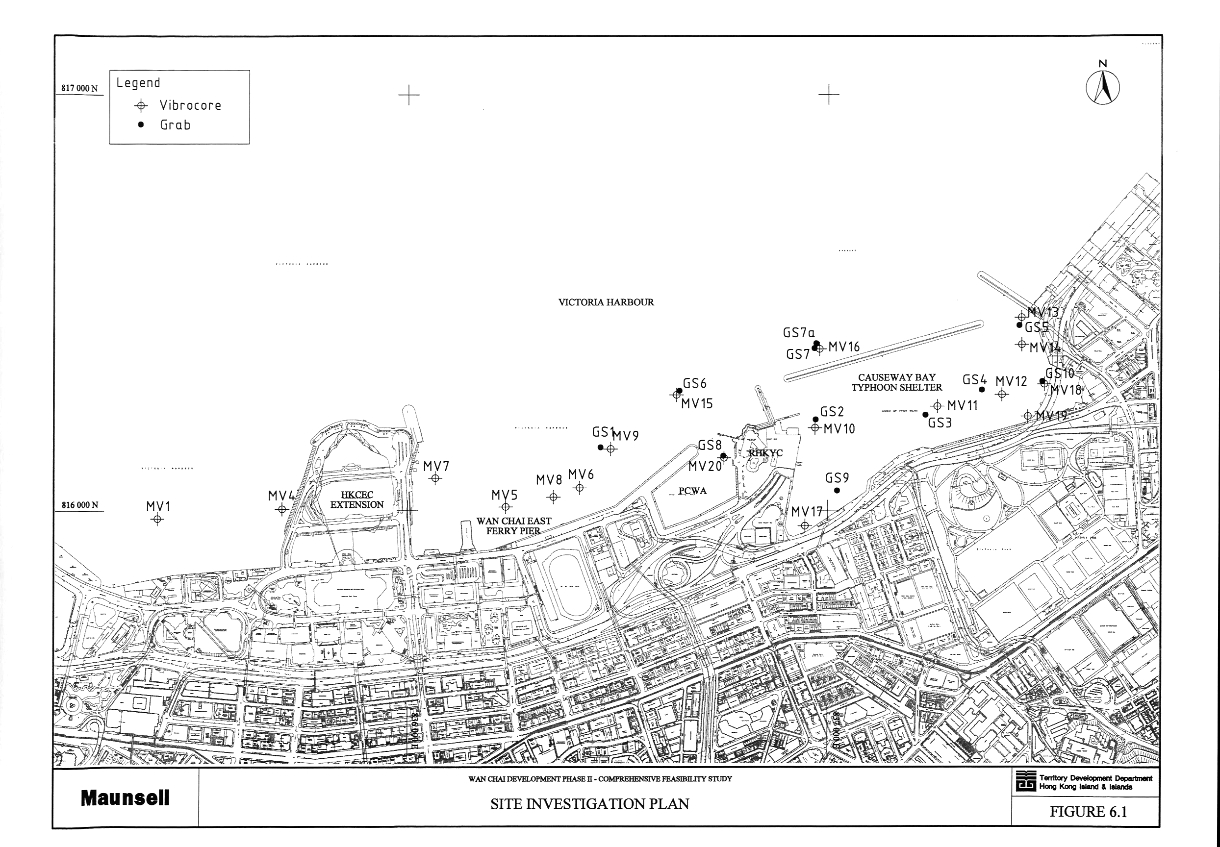
Figure 6.1 Site Investigation Plan
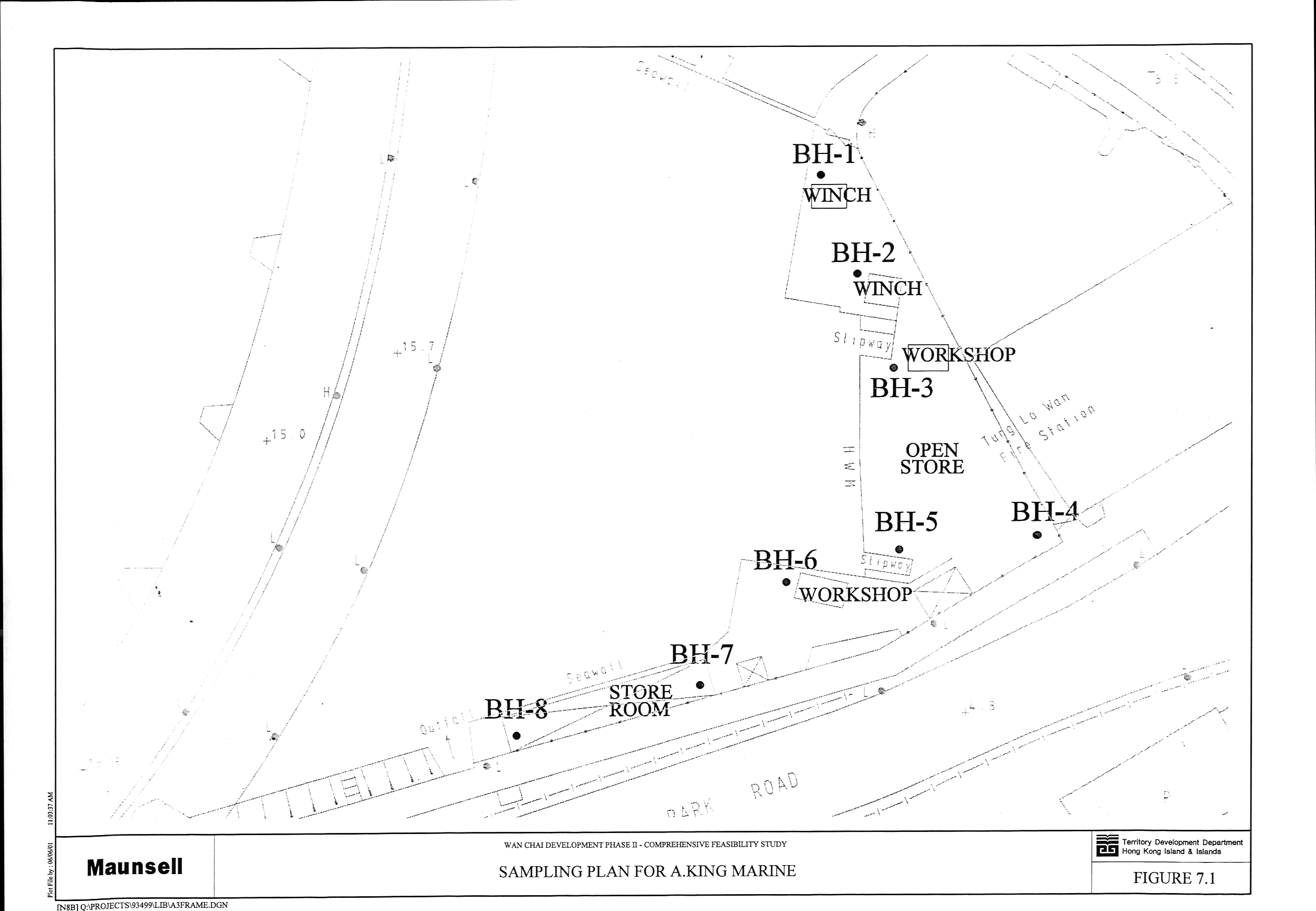
Figure 7.1 Sampling Plan for A King Marine
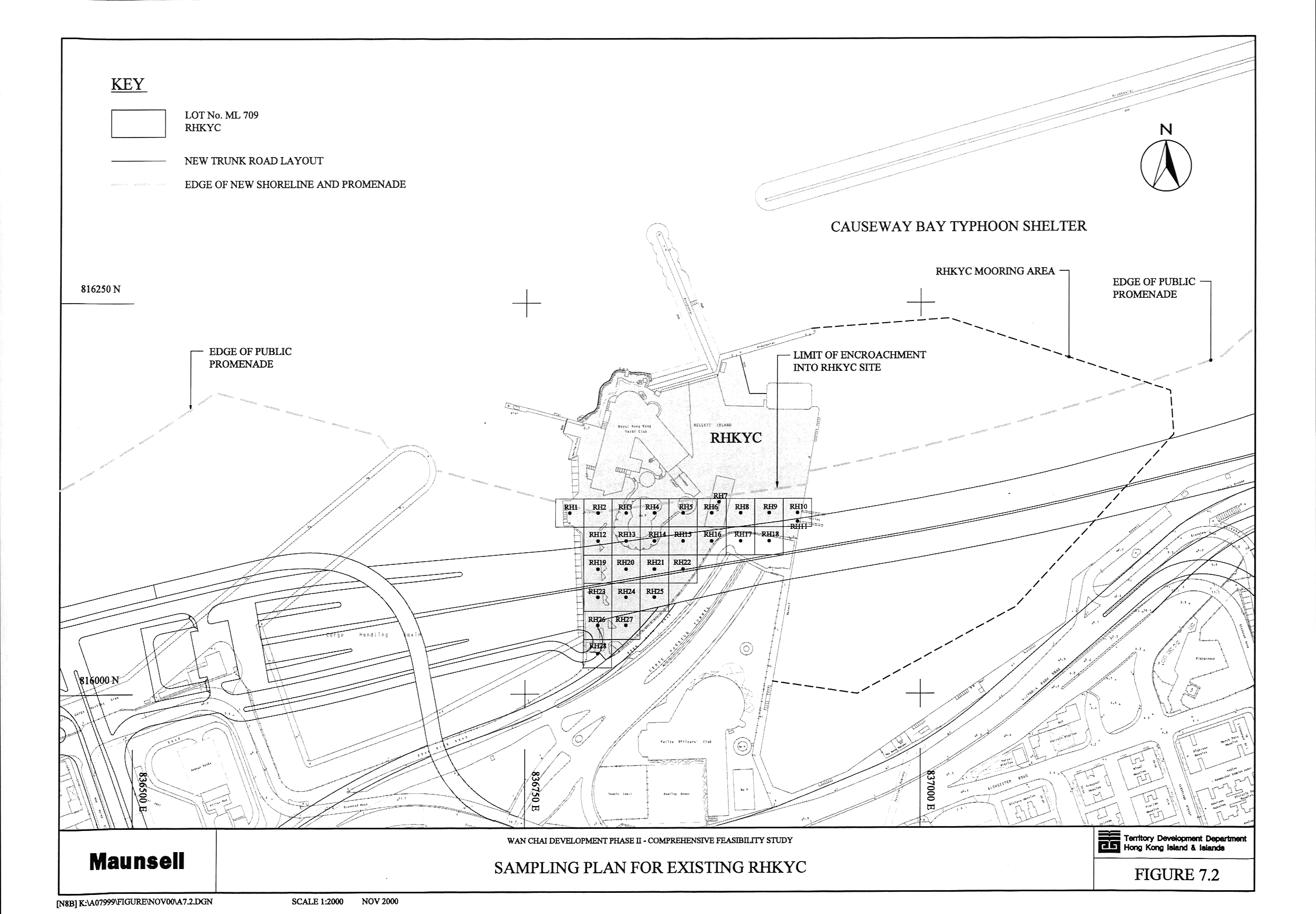
Figure 7.2 Sampling Plan for Existing RHKYC
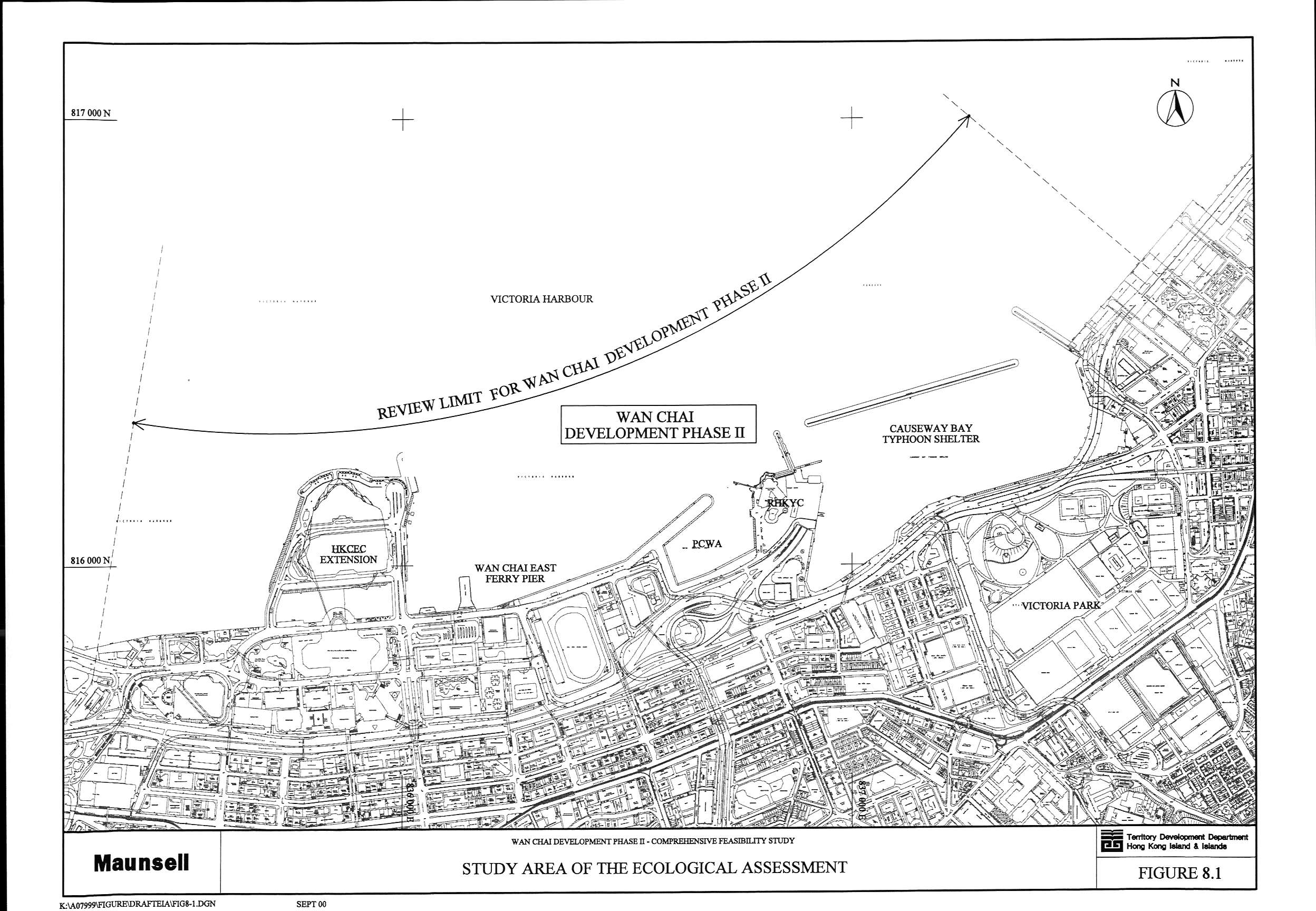
Figure 8.1 Study Area of the Ecological Assessment
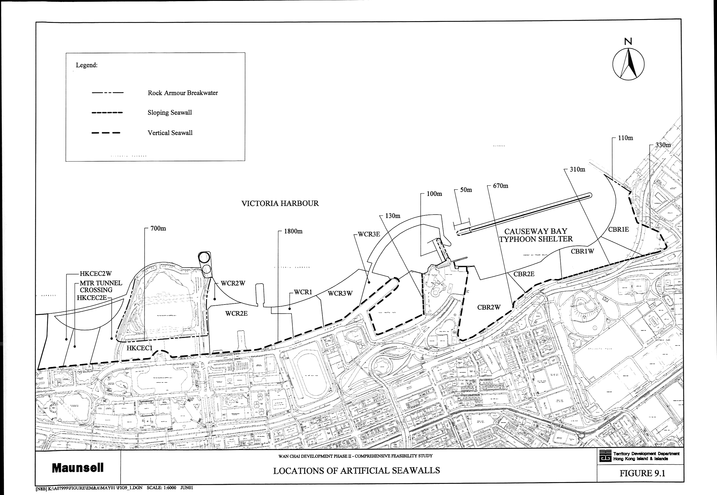
Figure 9.1 Locations of Artificial Seawalls
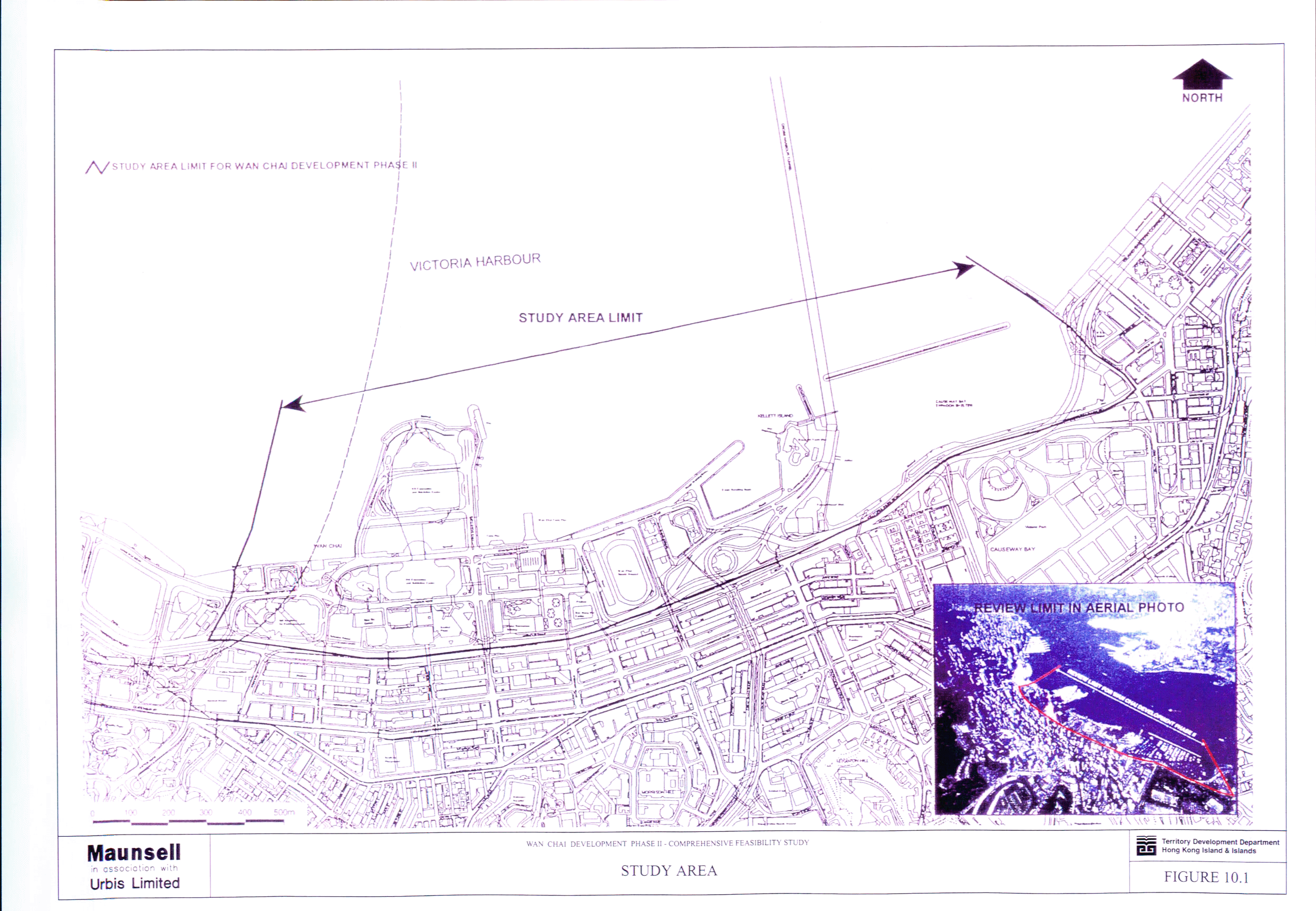
Figure 10.1 Study Area
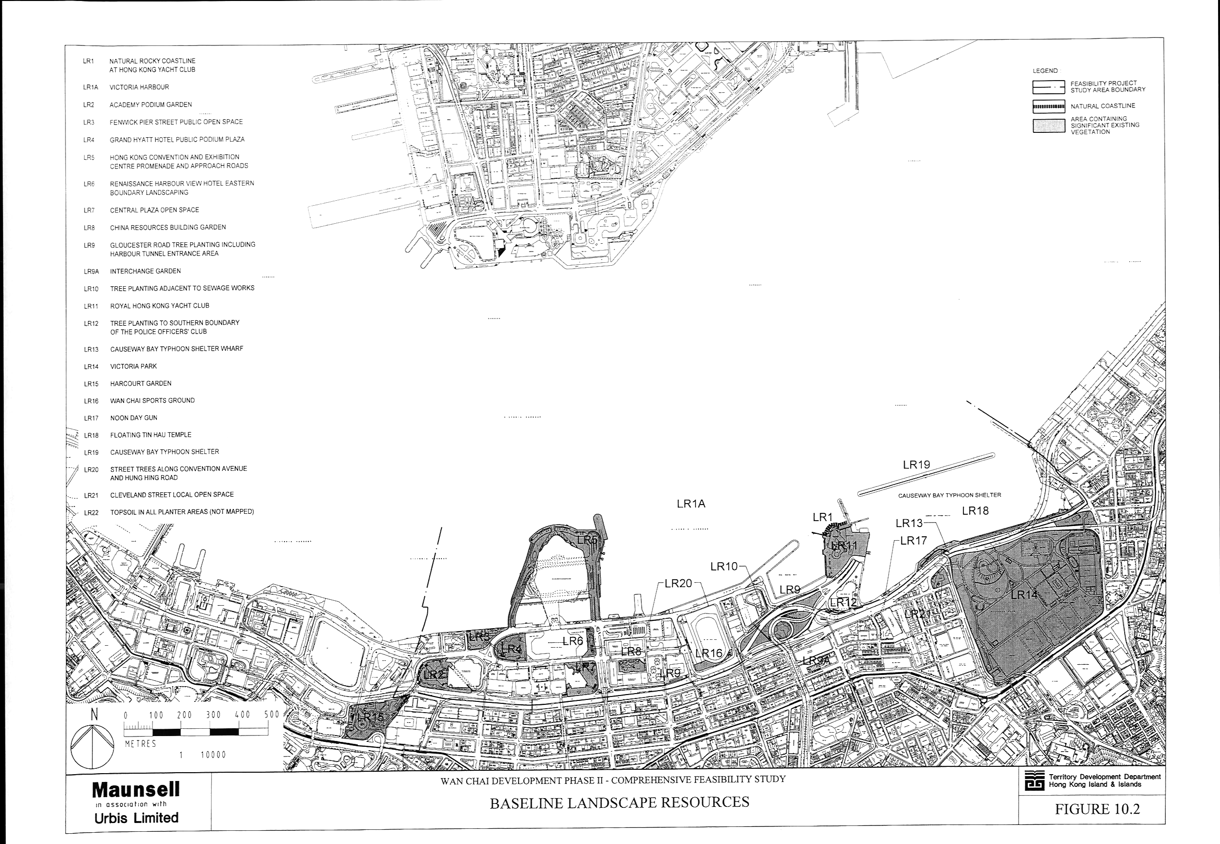
Figure 10.2 Baseline Landscape Resources
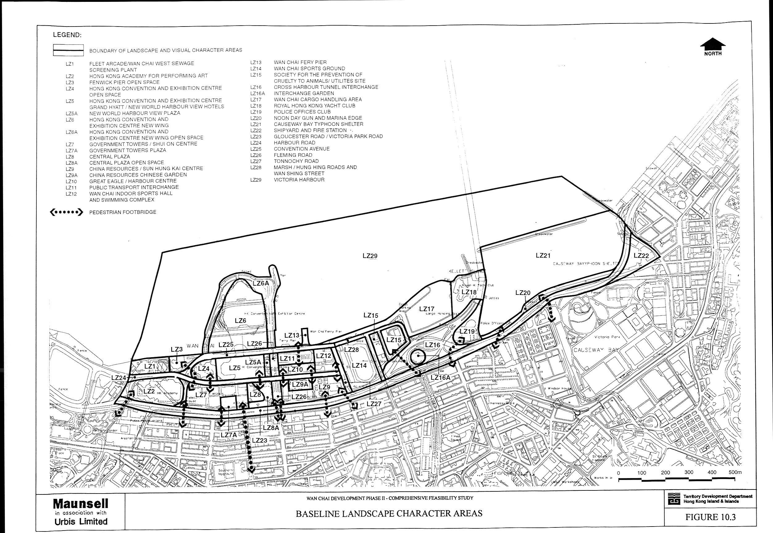
Figure 10.3 Baseline Landscape Character Areas
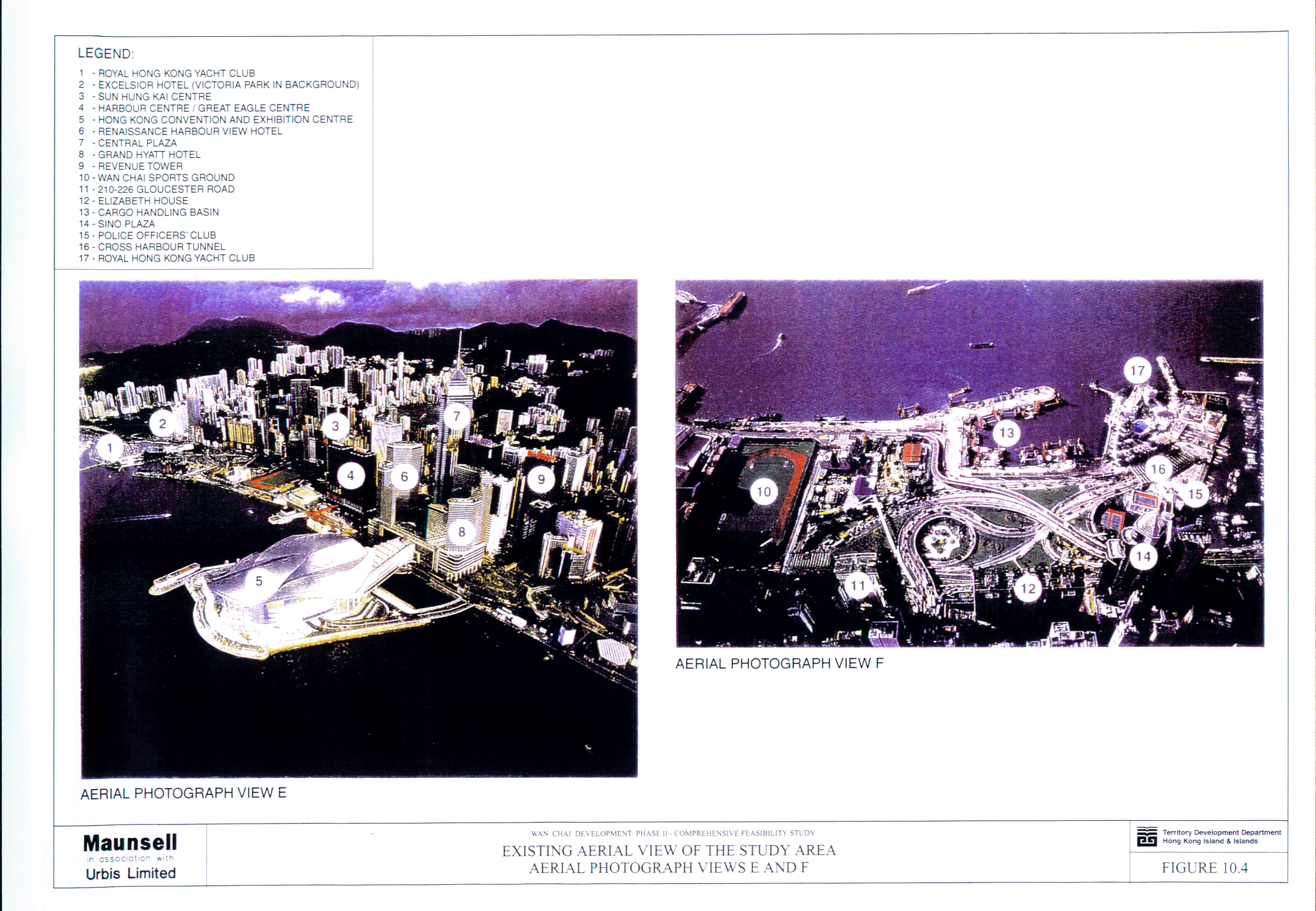
Figure 10.4 Existing Aerial View of the Study Area -
Aerial Photograph Views E and F
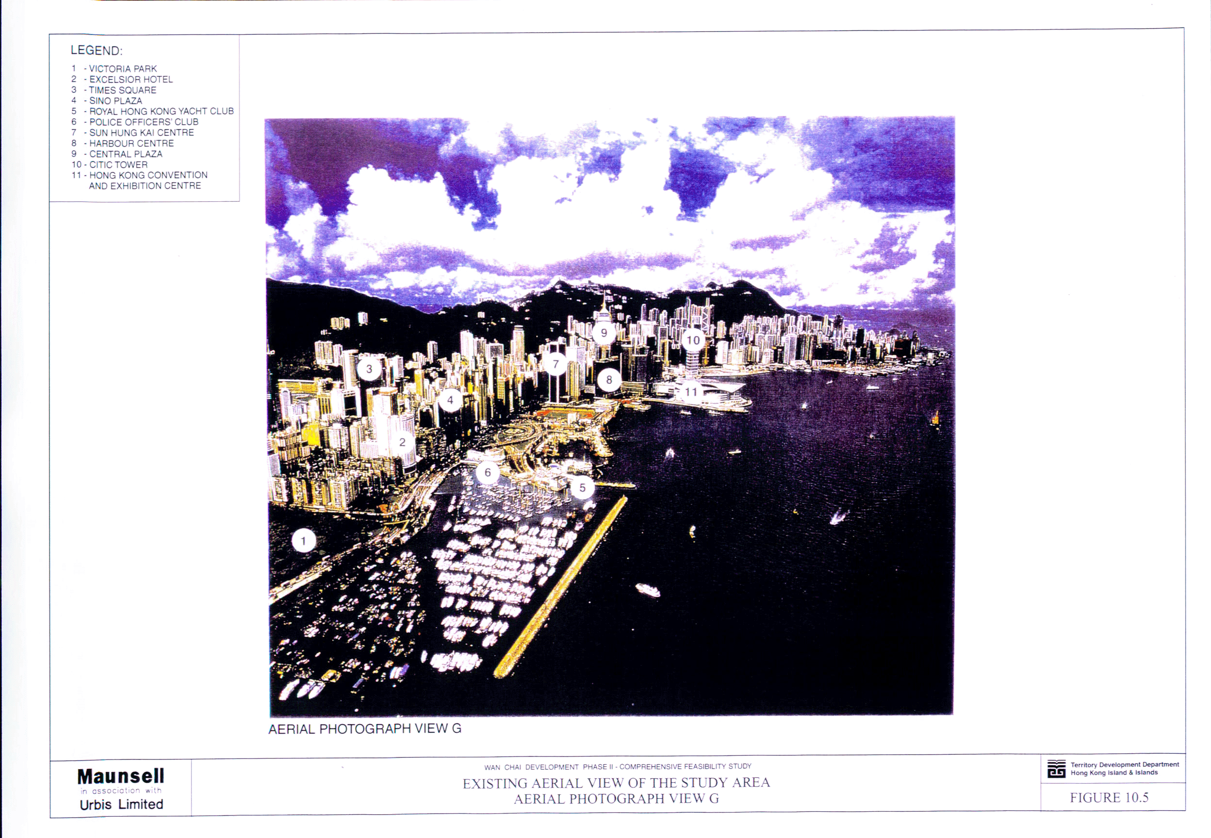
Figure 10.5 Existing Aerial View of the Study Area -
Aerial Photograph View G
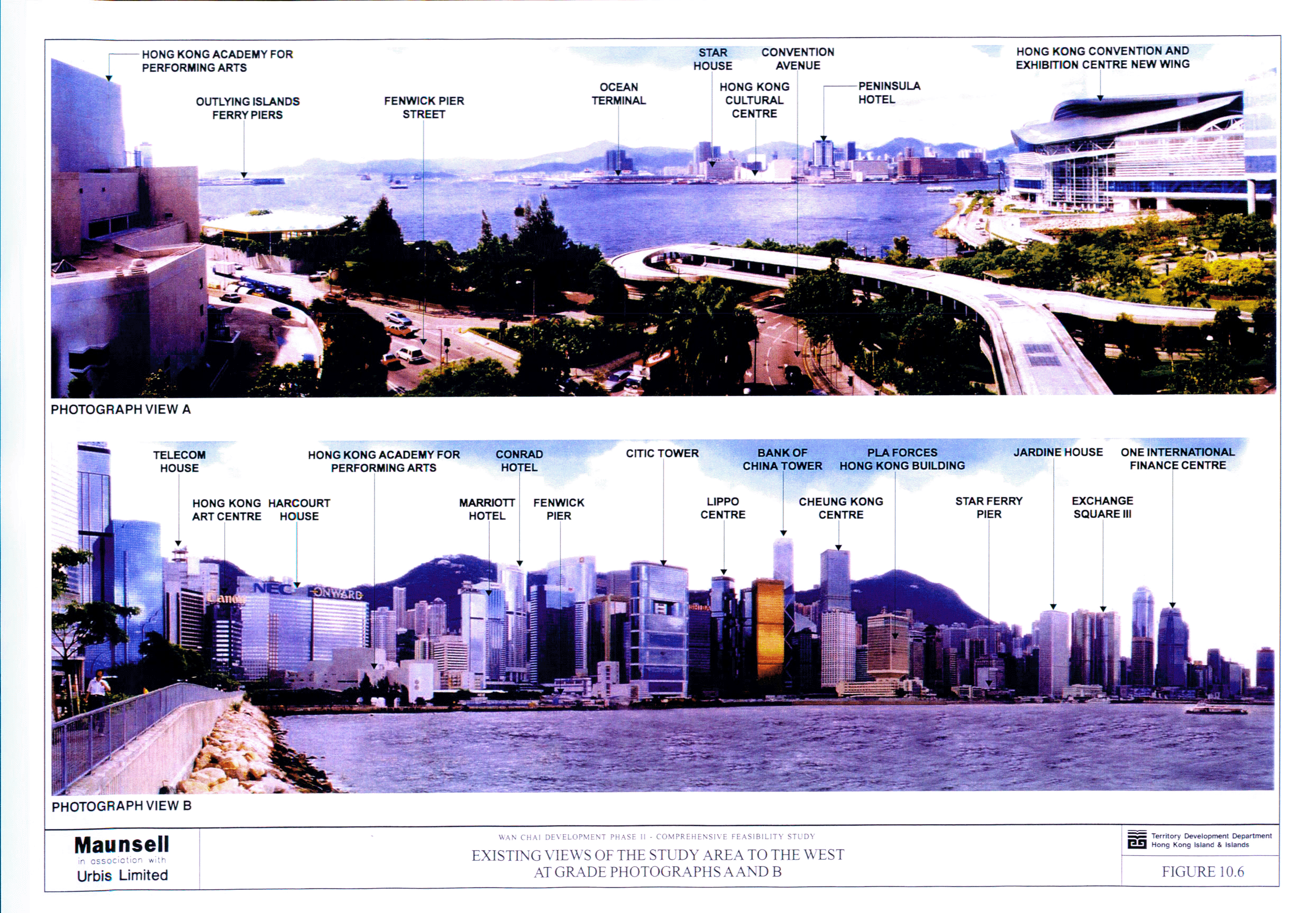
Figure 10.6 Existing Views of the Study Area to the West
- At Grade Photographs A and B
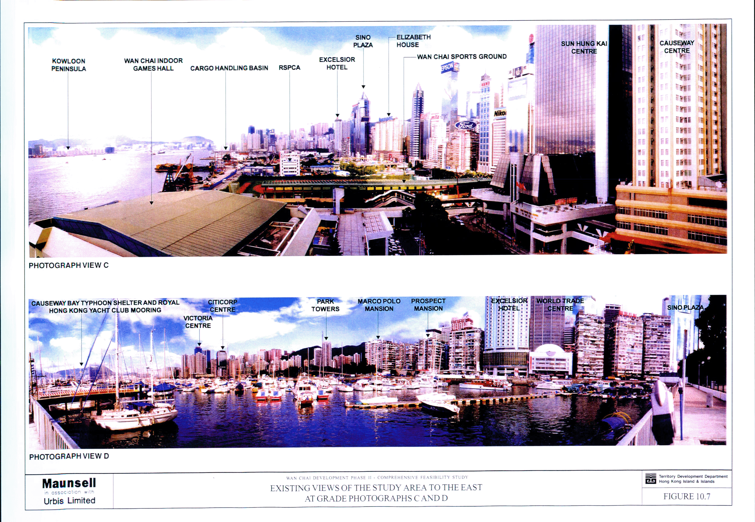
Figure 10.7 Existing Views of the Study Area to the East
- At Grade Photographs C and D
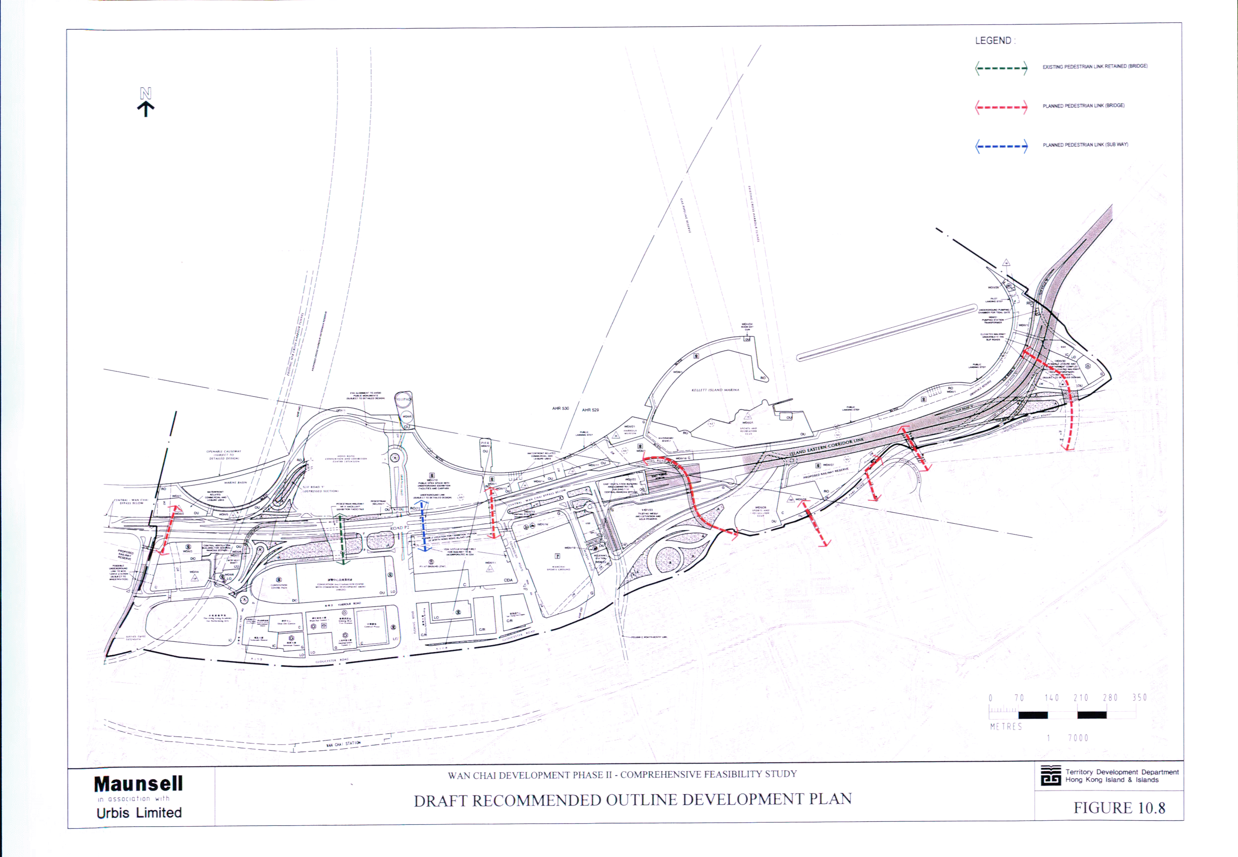
Figure 10.8 Draft Recommended Outline Development Plan
Figure 10.17 Secondary Zones of Visual Influence and
Secondary Visually Sensitive Receivers
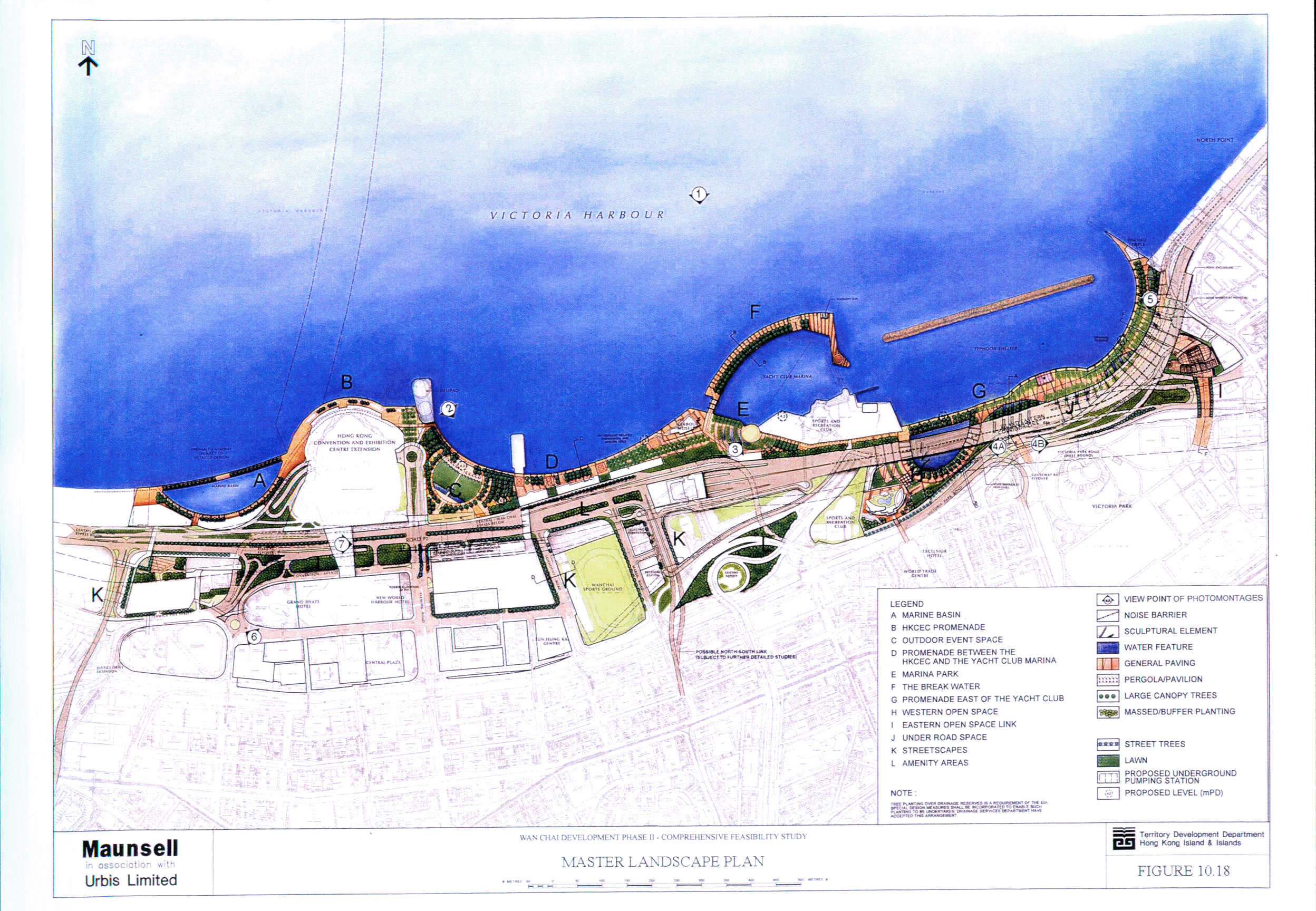
Figure 10.18 Master Landscape Plan
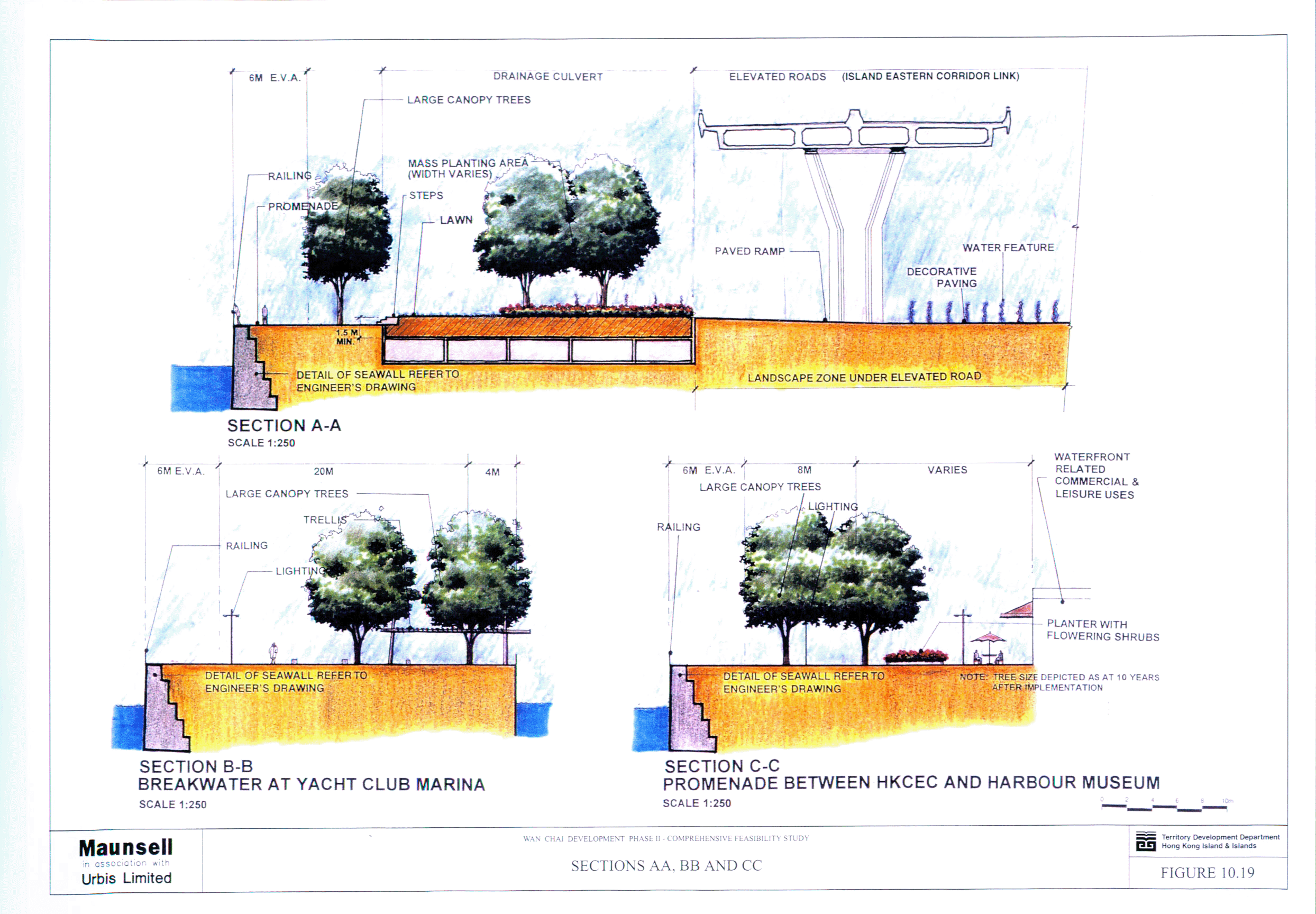
Figure 10.19 Sections AA, BB and CC
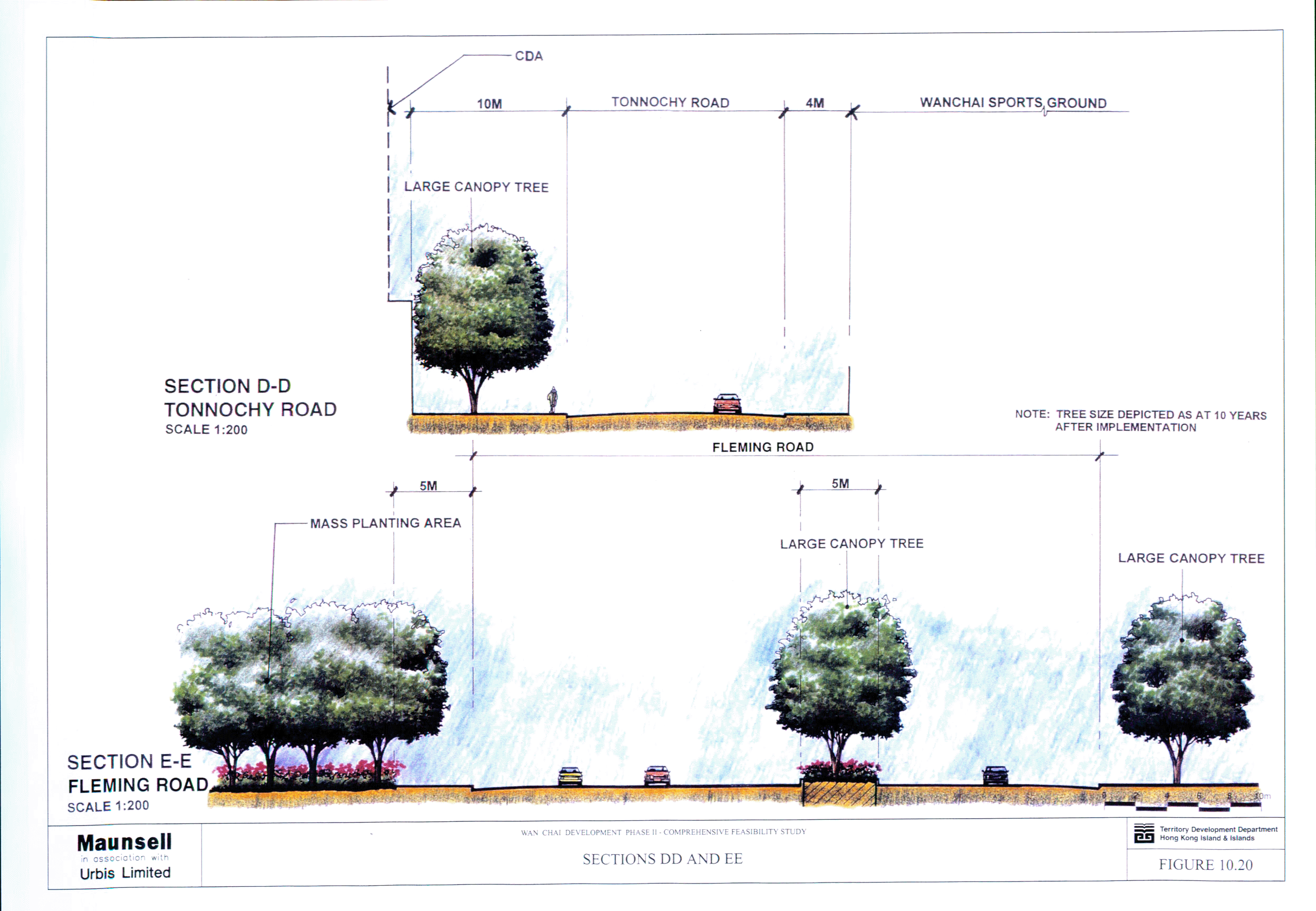
Figure 10.20 Sections DD and EE
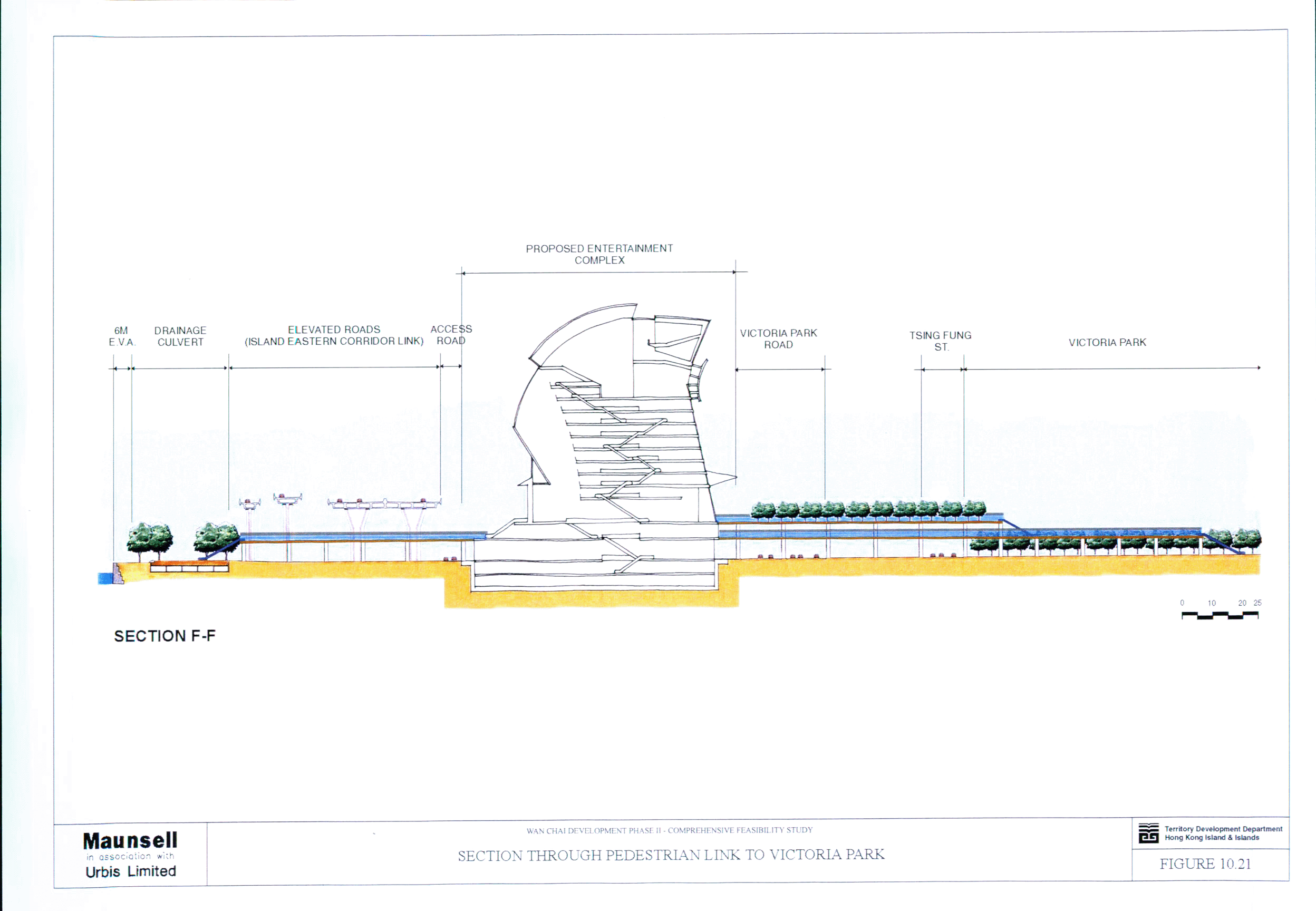
Figure 10.21 Section through Pedestrian Link to Victoria
Park
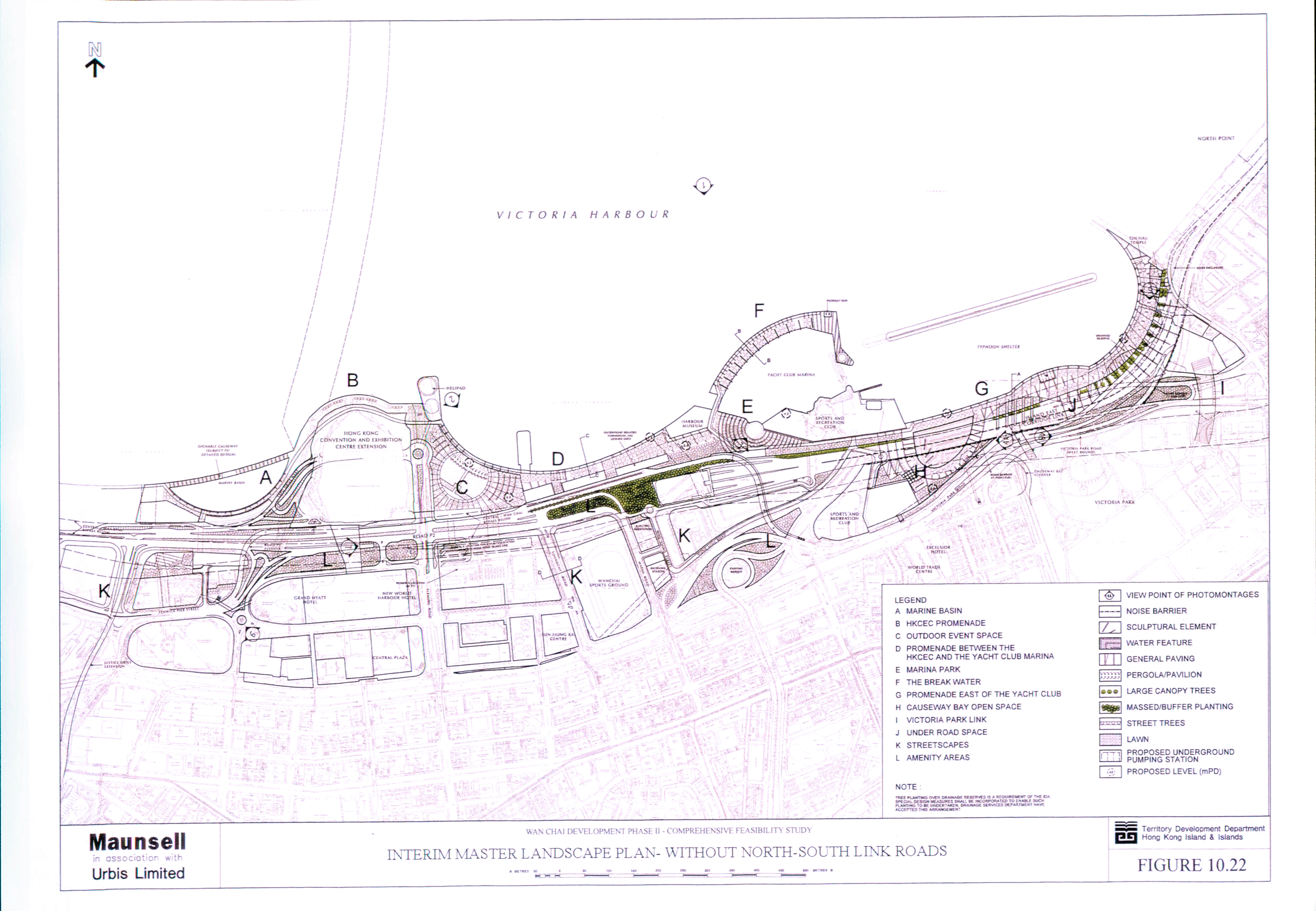
Figure 10.22 Interim Master Landscape Plan - without
North-South Link Roads
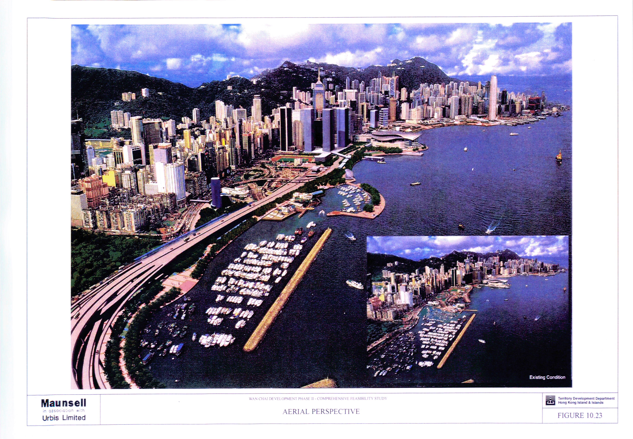
Figure 10.23 Aerial Perspective
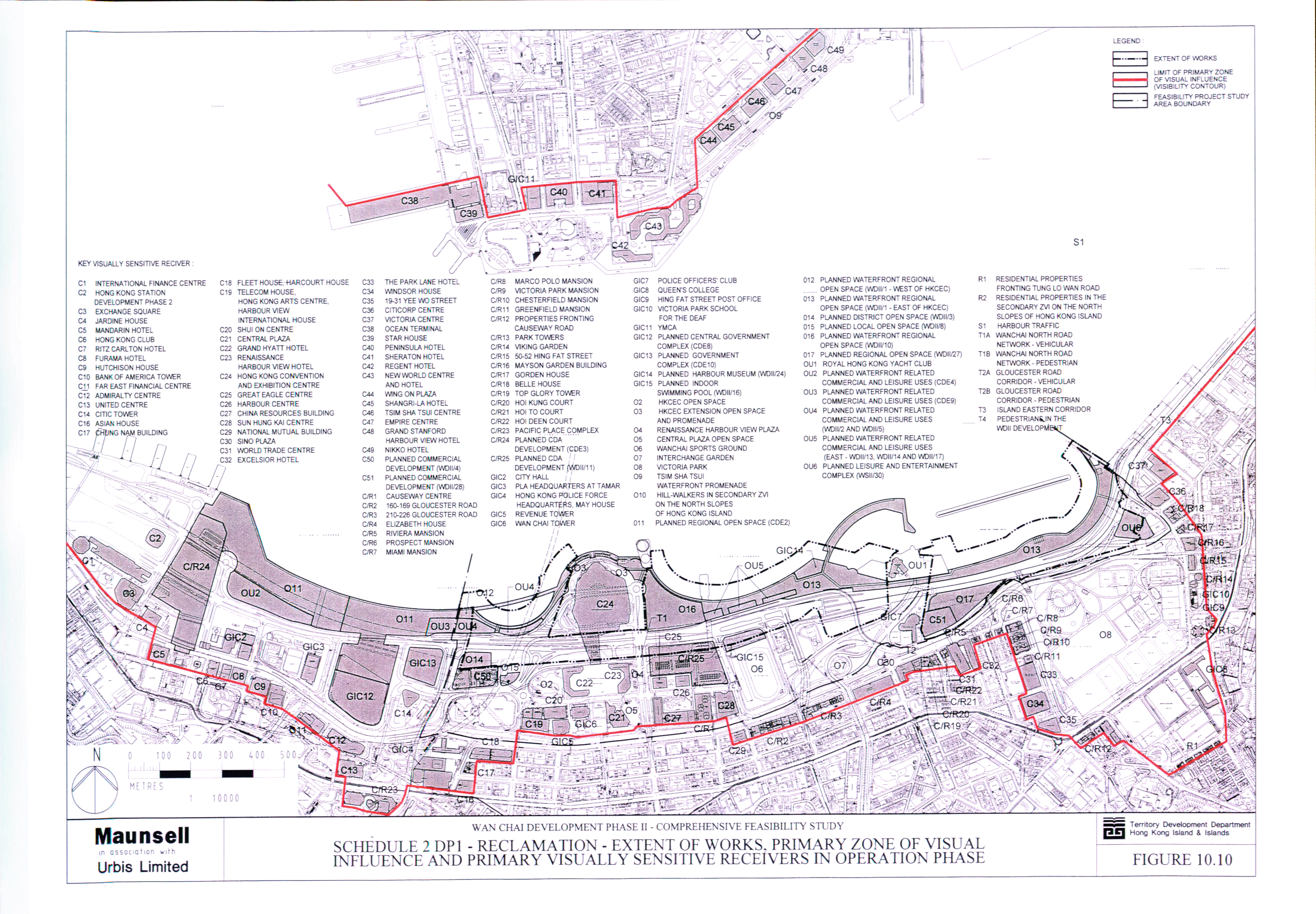
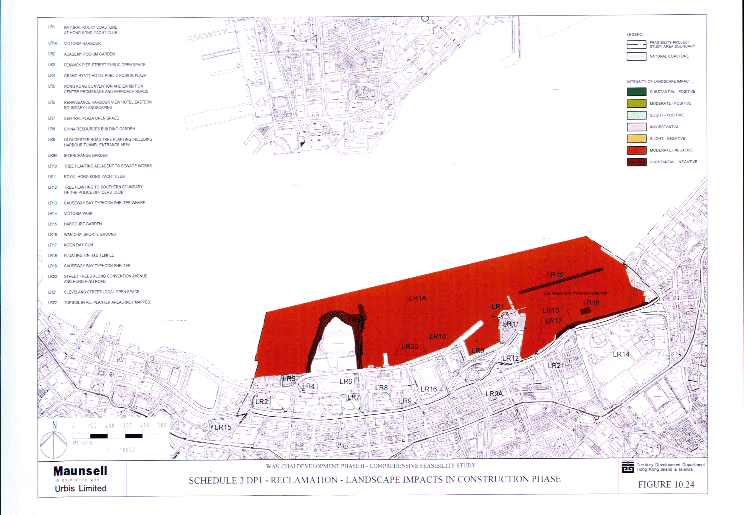
Figure 10.24 Schedule 2 DP1 – Reclamation - Landscape
Impacts in Construction Phase
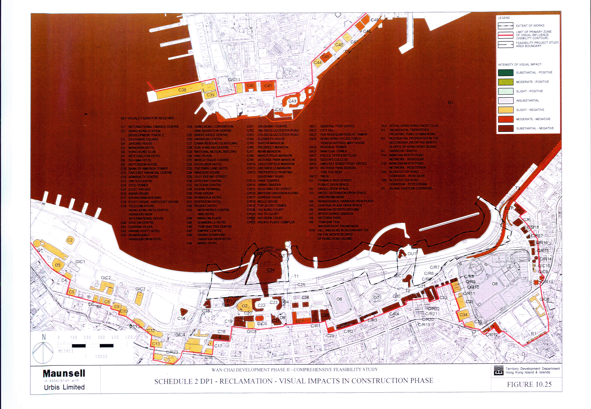
Figure 10.25 Schedule 2 DP1 – Reclamation - Visual
Impacts in Construction Phase
Figure 10.26 Schedule 2 DP1 – Reclamation - Visual
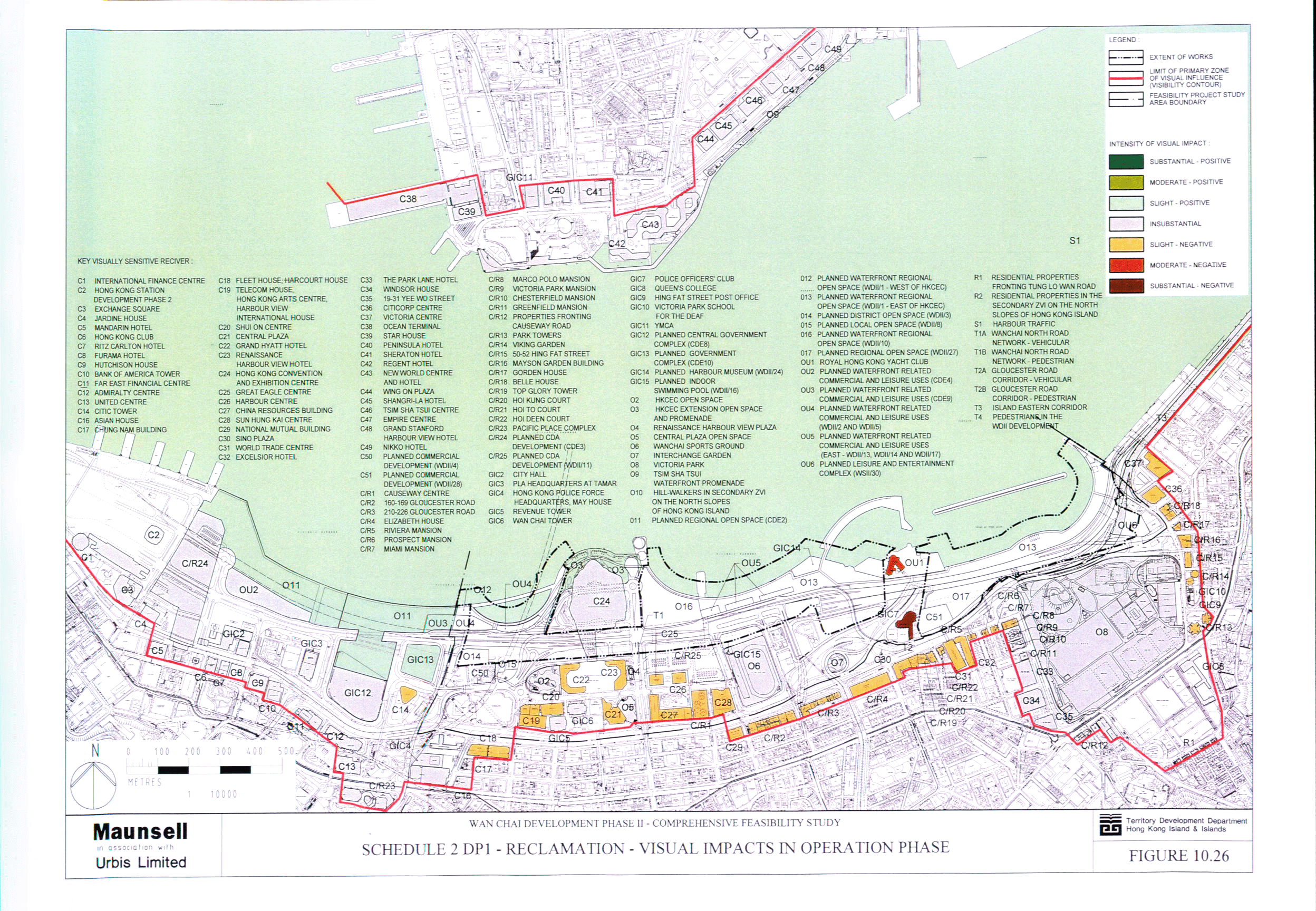
Impacts in Operation Phase
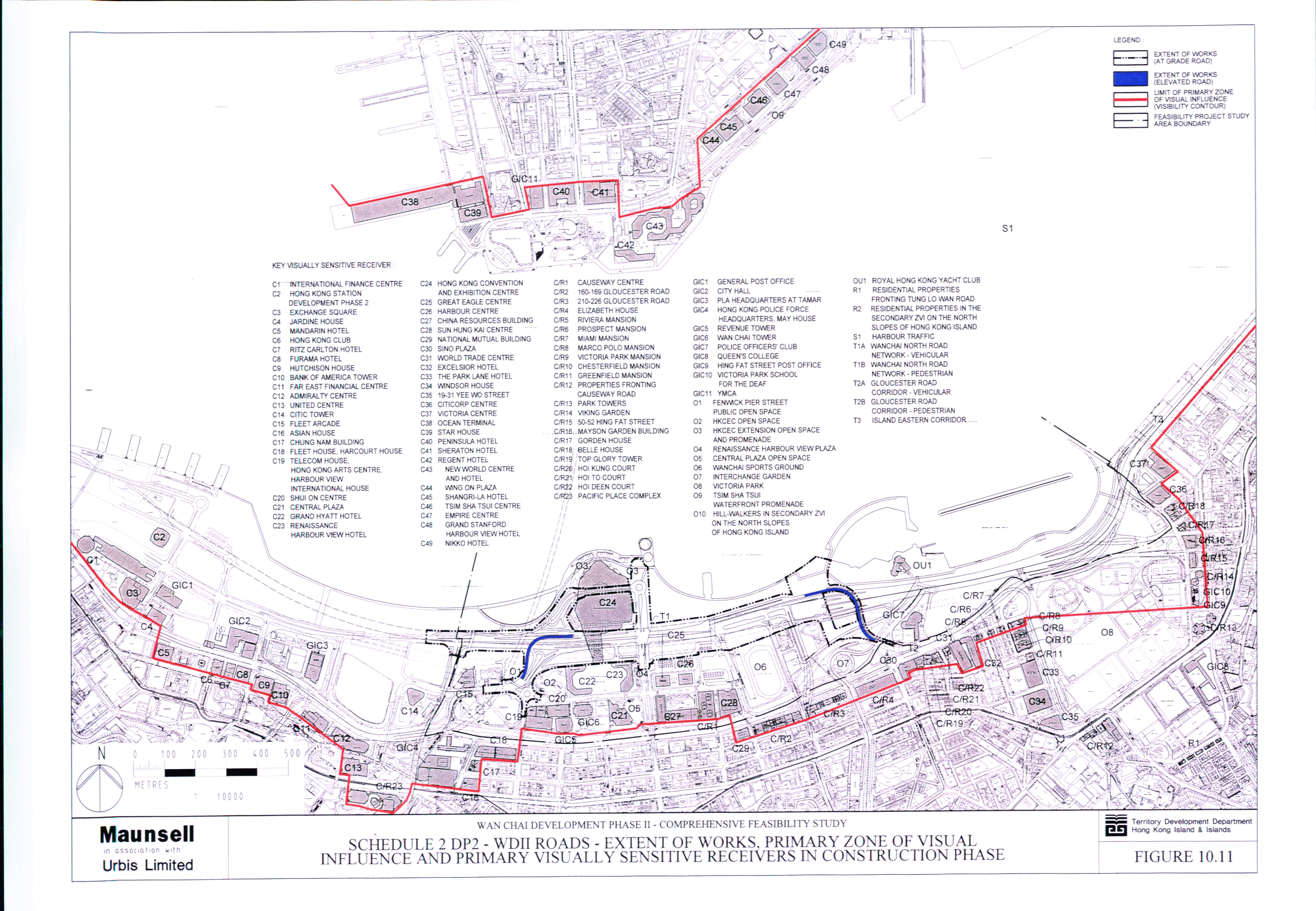
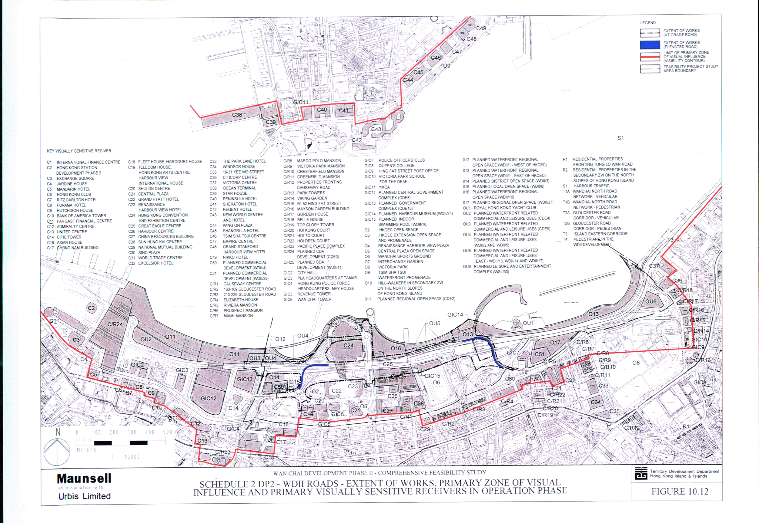
Figure 10.27 Schedule 2 DP2 - WDII Major Roads -
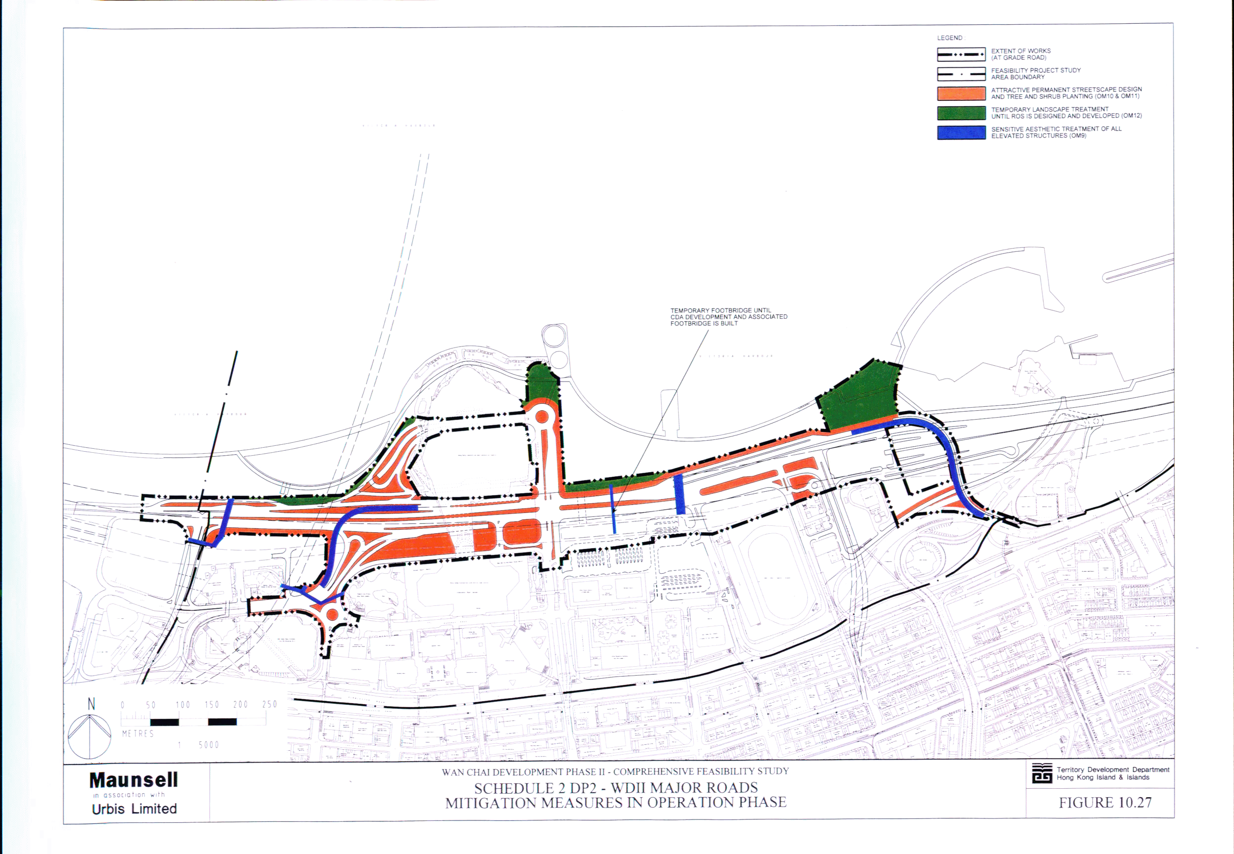
Mitigation Measures in Operation Phase
Figure 10.28 Schedule 2 DP2 - WDII Major Roads -
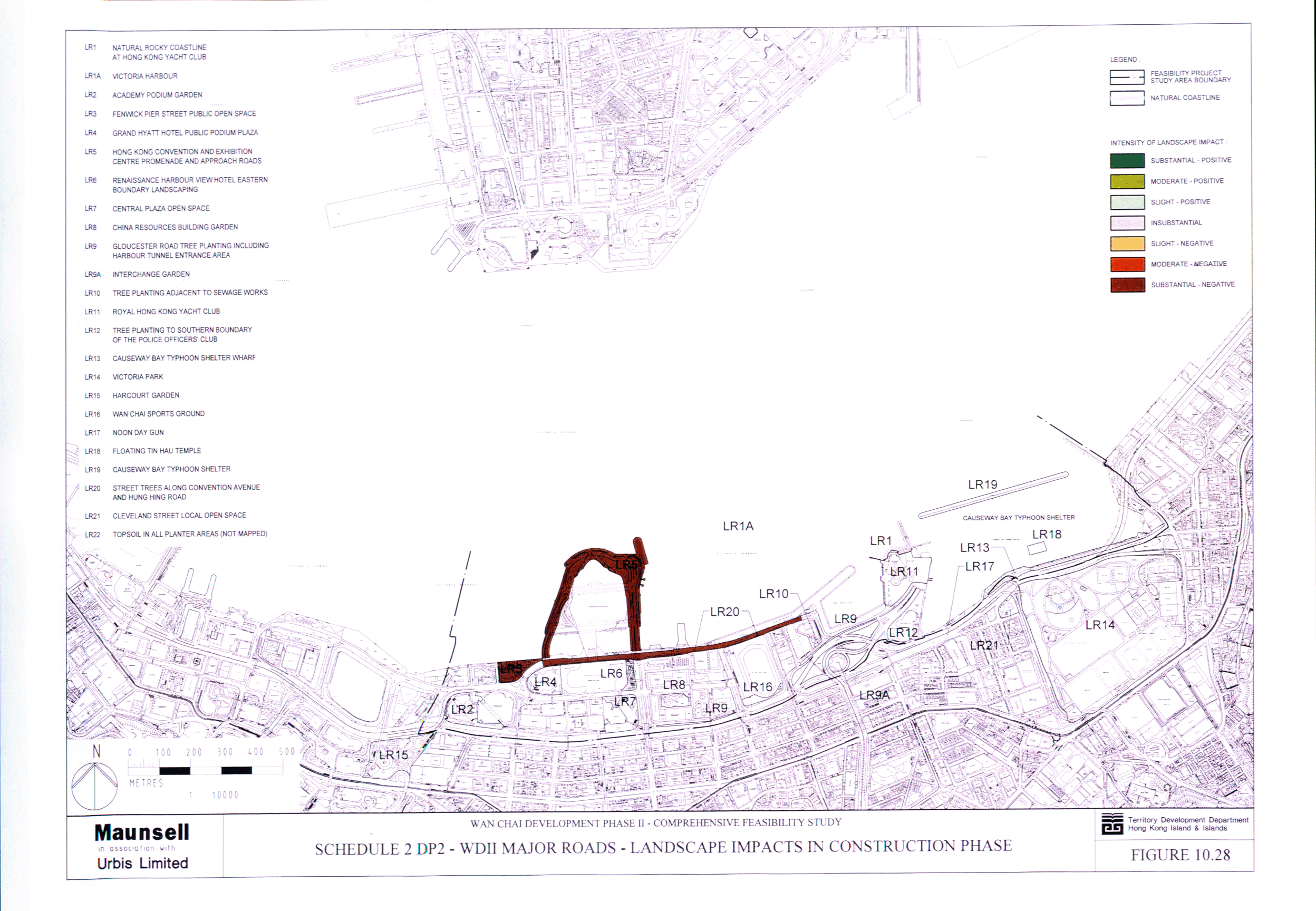
Landscape Impacts in Construction Phase
Figure 10.29 Schedule 2 DP2 - WDII Major Roads - Visual
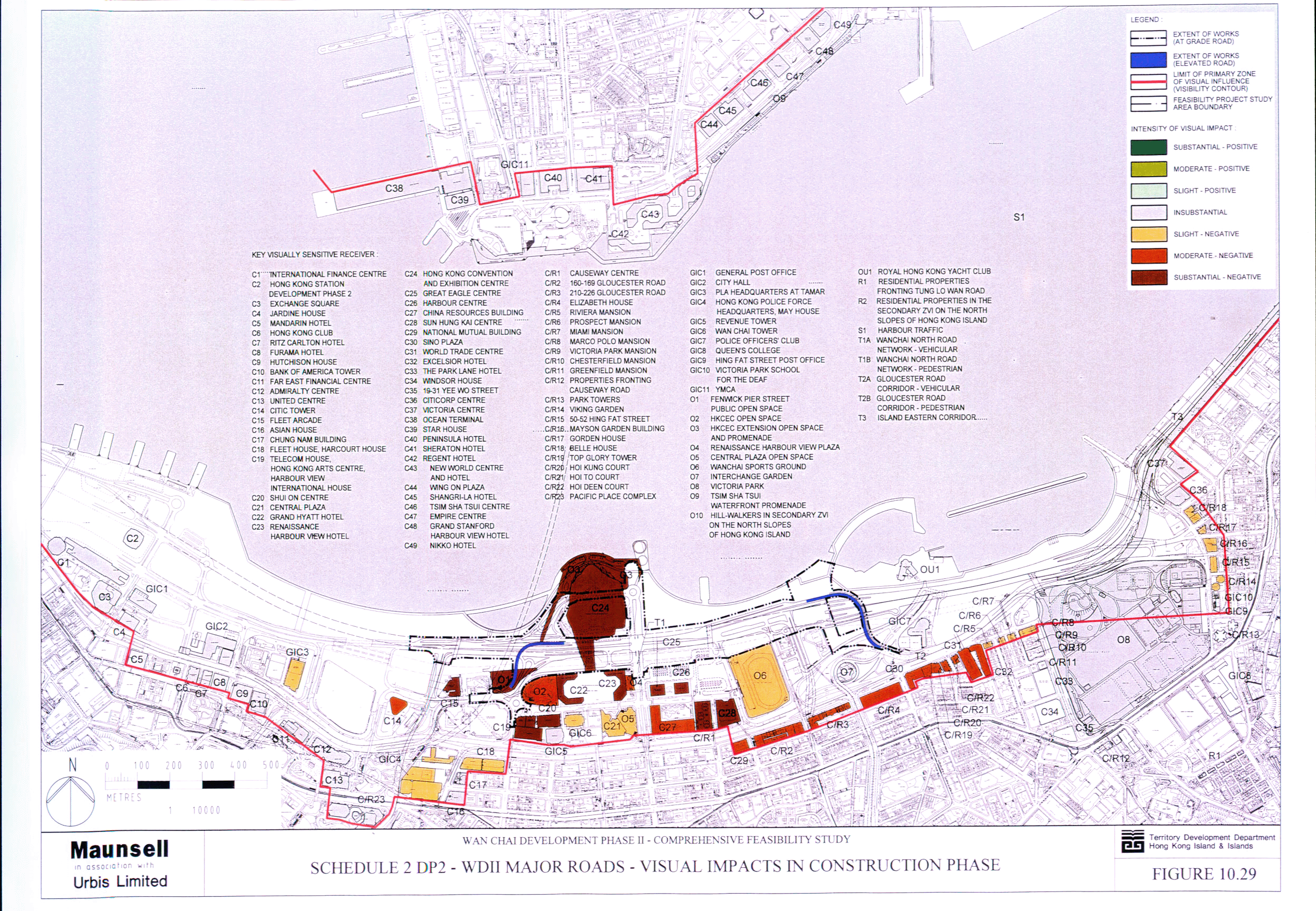
Impacts in Construction Phase
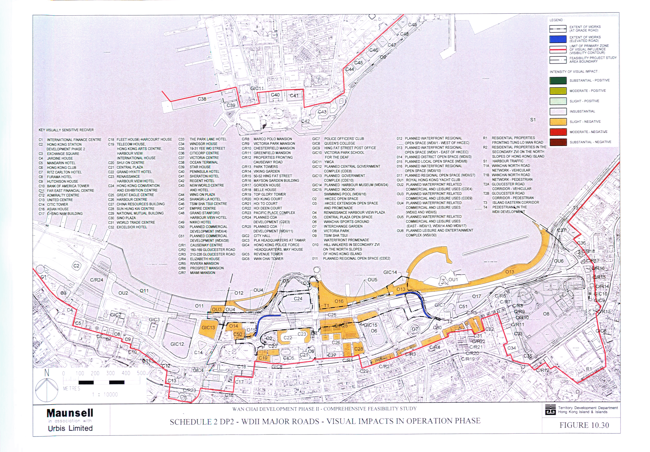
Figure 10.30 Schedule 2 DP2 - WDII Major Roads - Visual
Impacts in Operation Phase
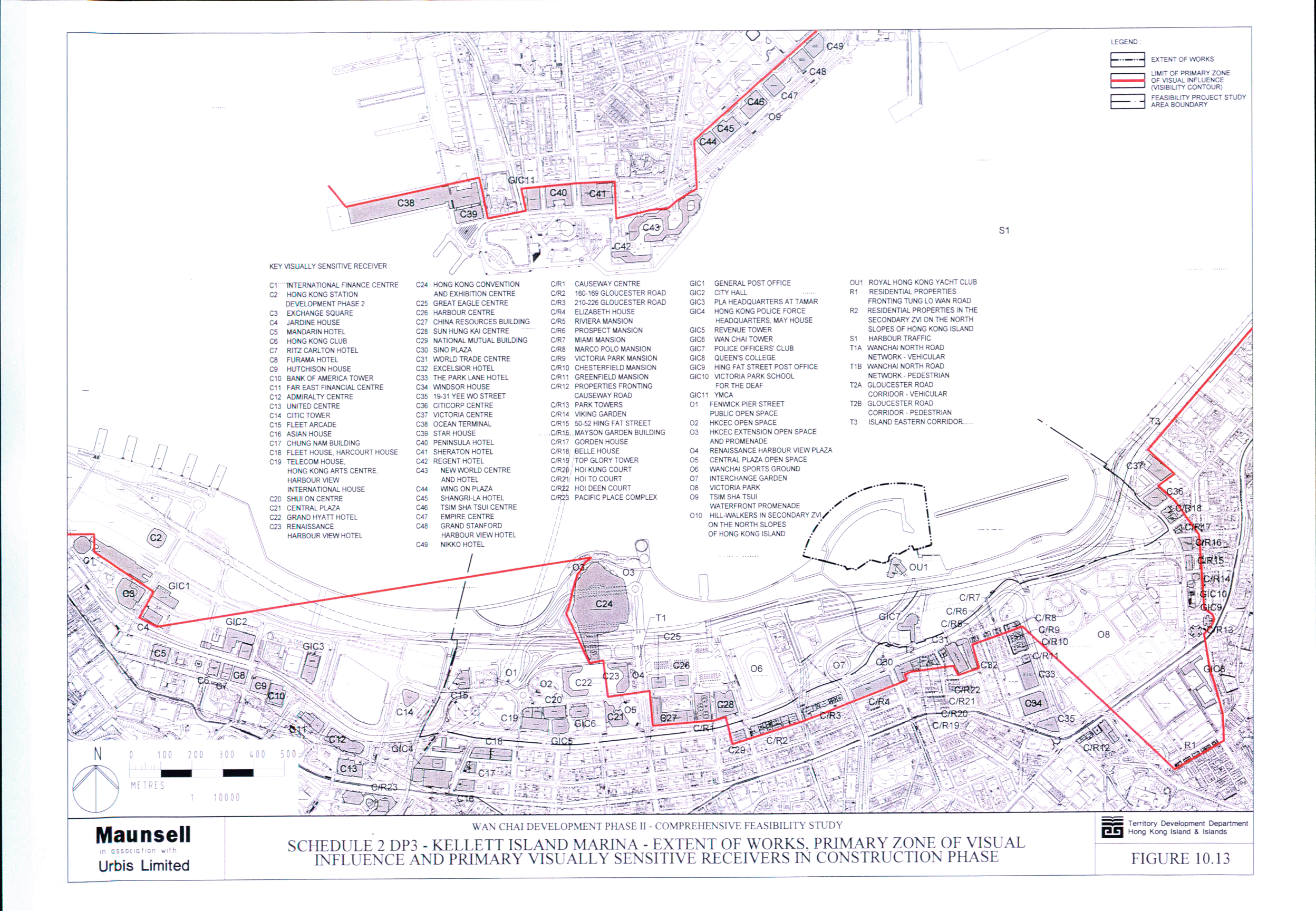
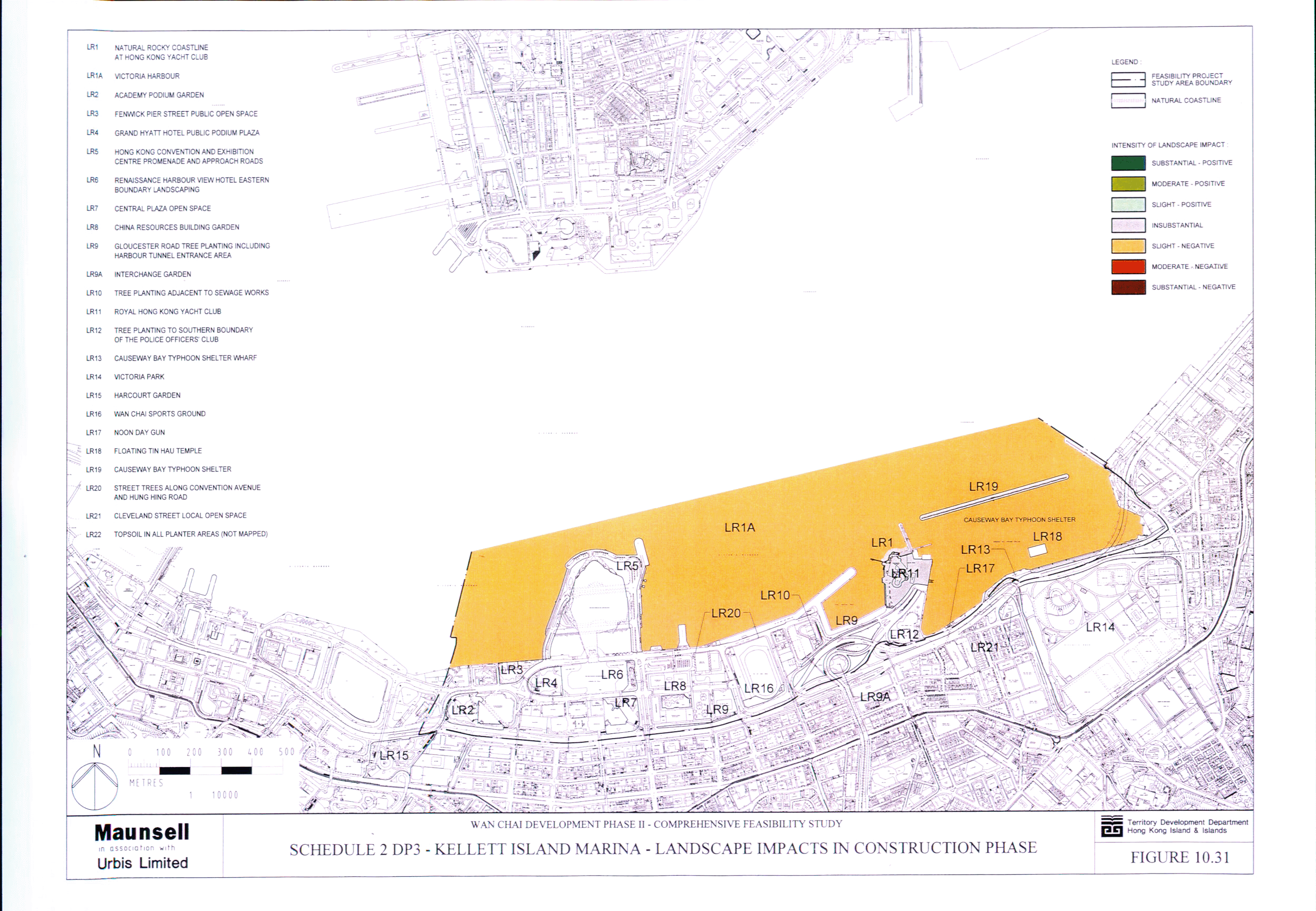
Figure 10.31 Schedule 2 DP3 - Kellett Island Marina -
Landscape Impacts in Construction Phase
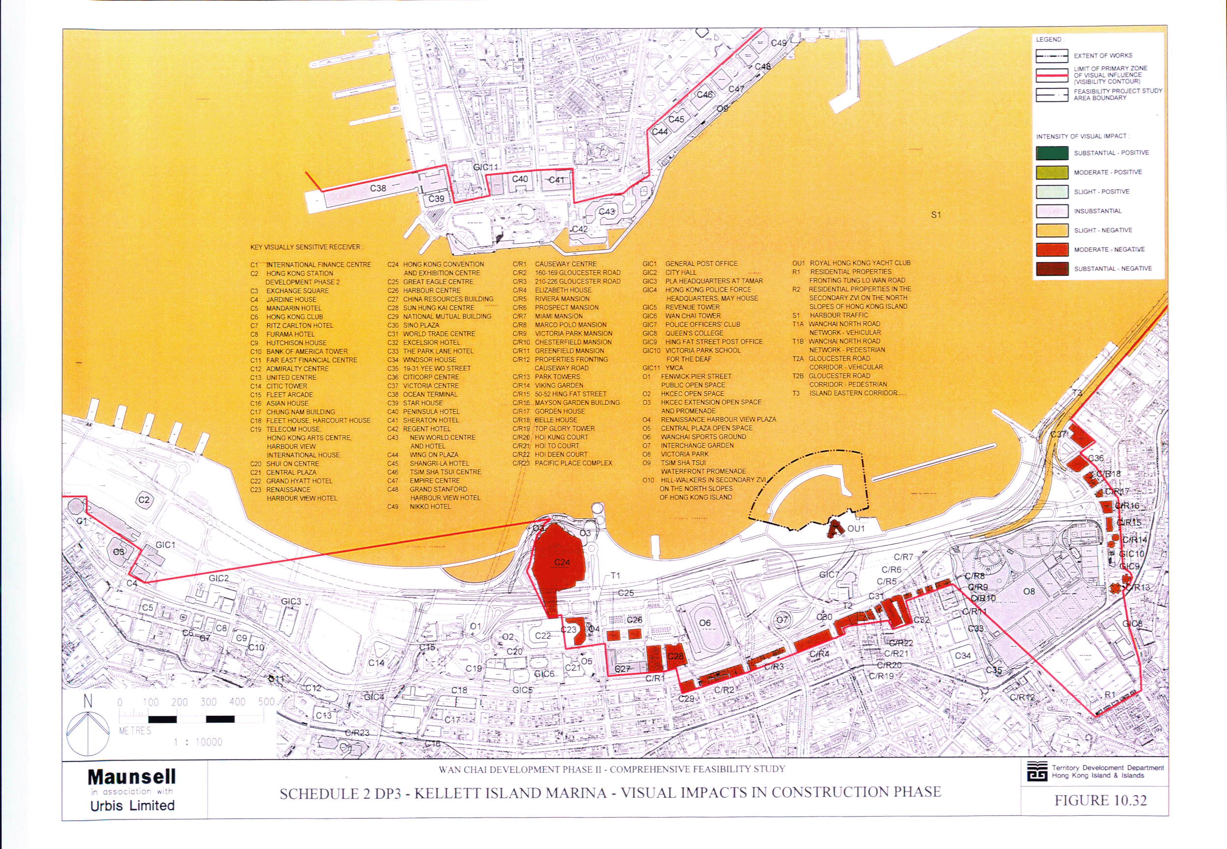
Figure 10.32 Schedule 2 DP3 - Kellett Island Marina - Visual
Impacts in Construction Phase
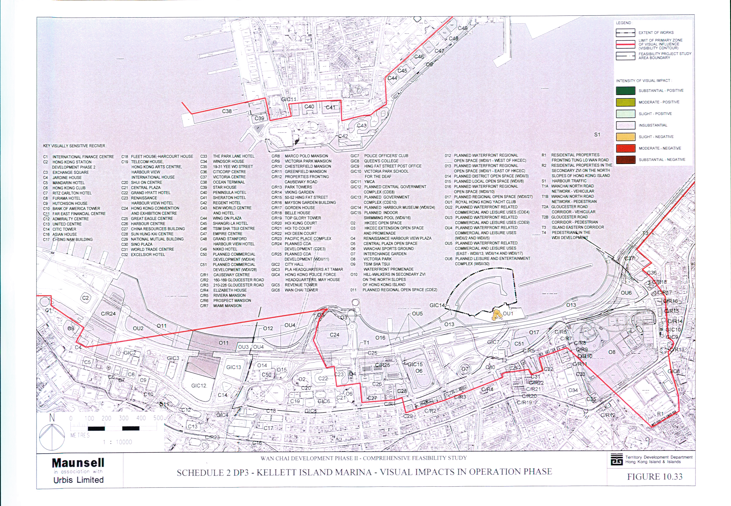
Figure 10.33 Schedule 2 DP3 - Kellett Island Marina -
Visual Impacts in Operation Phase
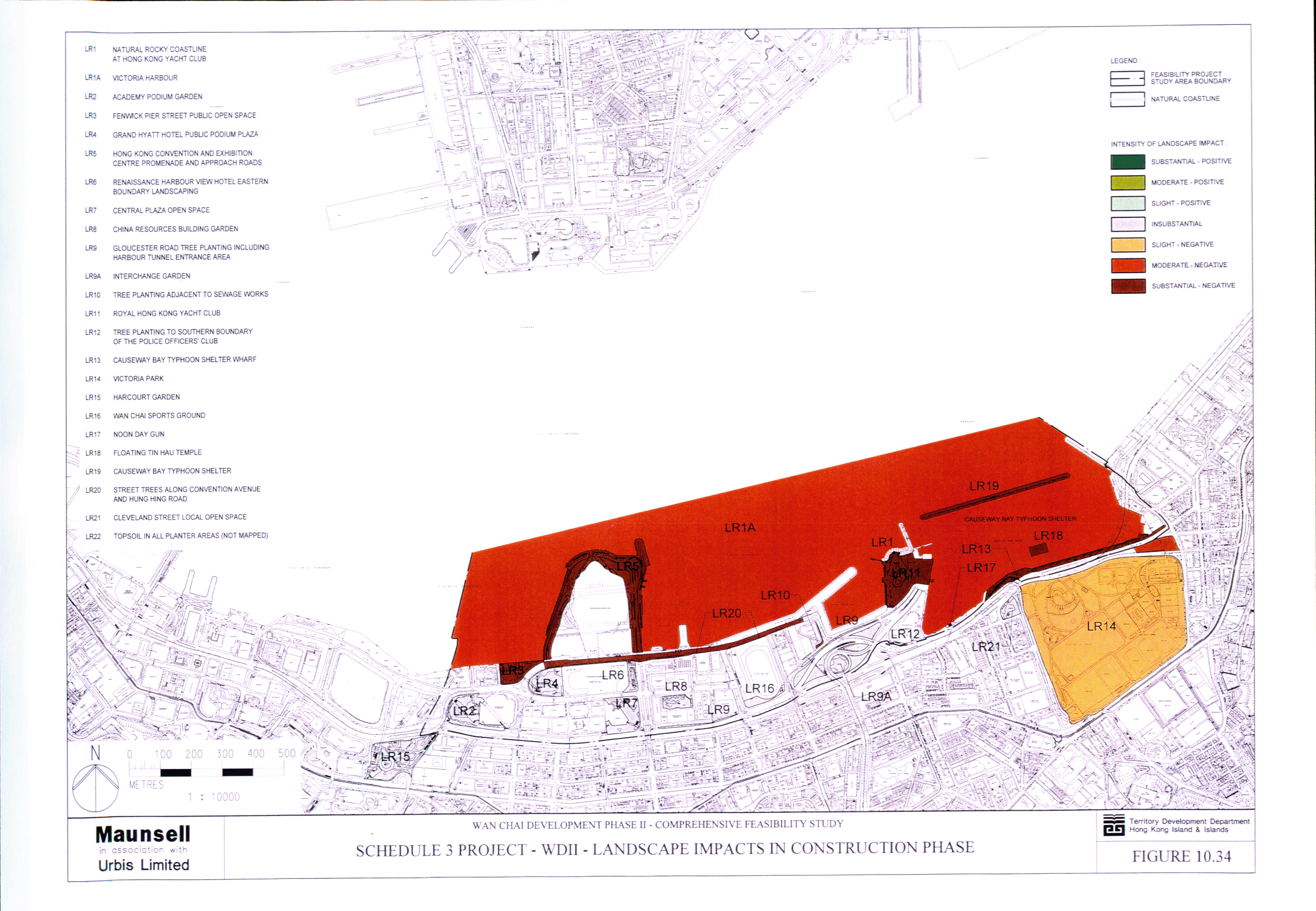
Figure 10.34 Schedule 3 Project - WDII - Landscape
Impacts in Construction Phase
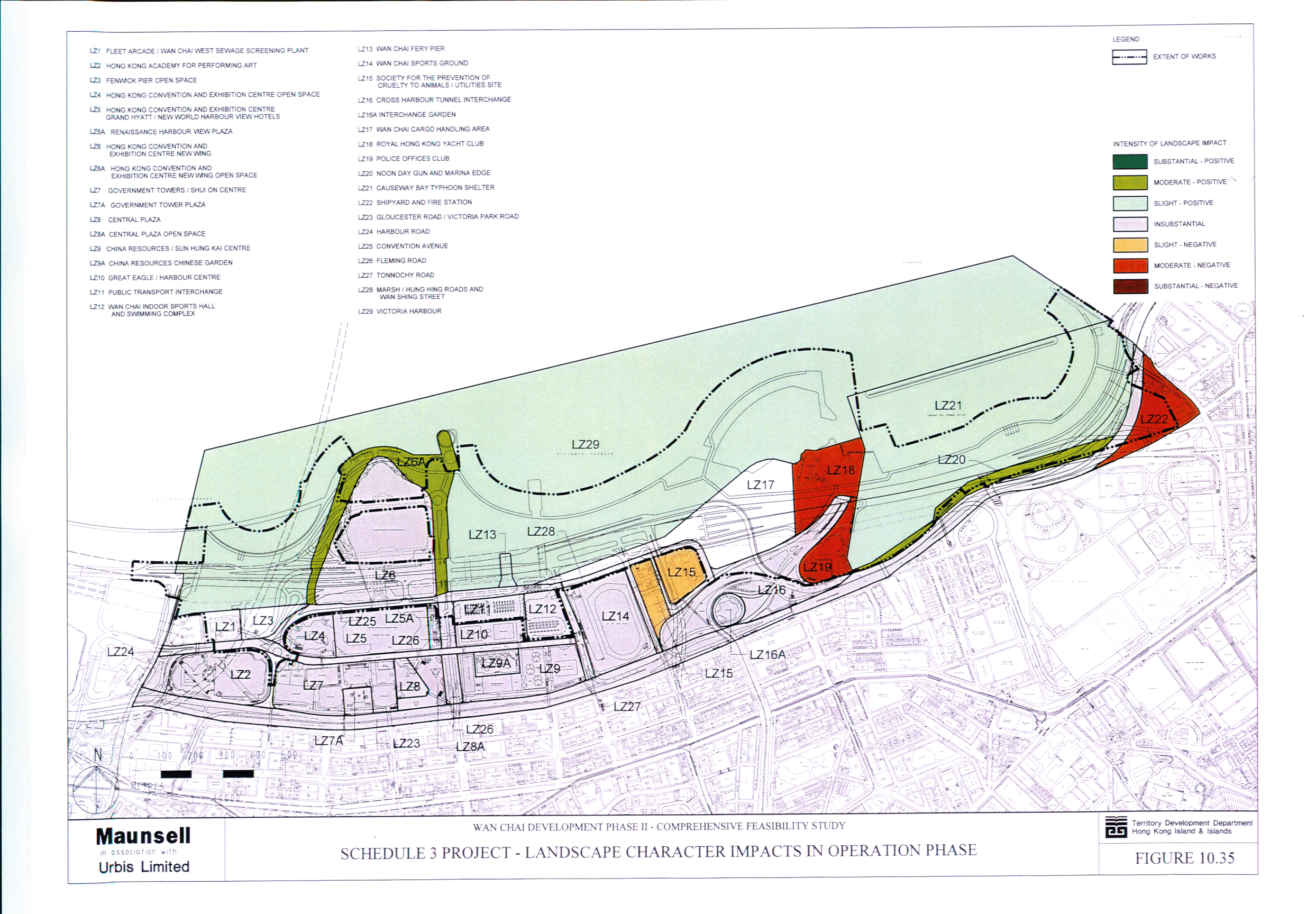
Figure 10.35 Schedule 3 Project - WDII - Landscape
Character Impacts in Operation Phase
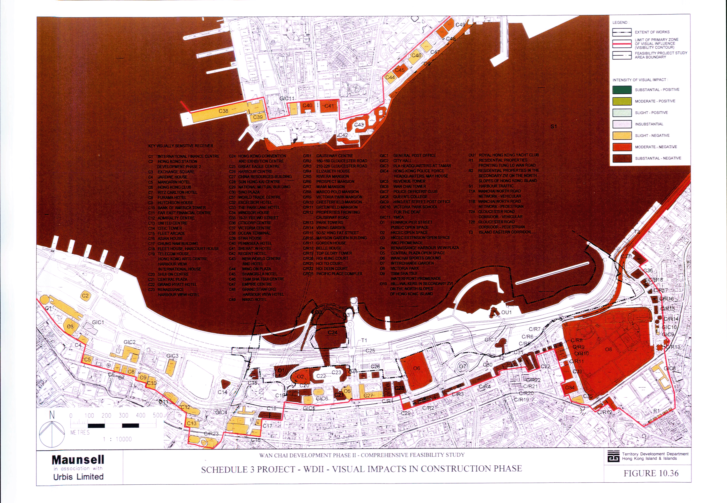
Figure 10.36 Schedule 3 Project - WDII - Visual Impacts
in Construction Phase
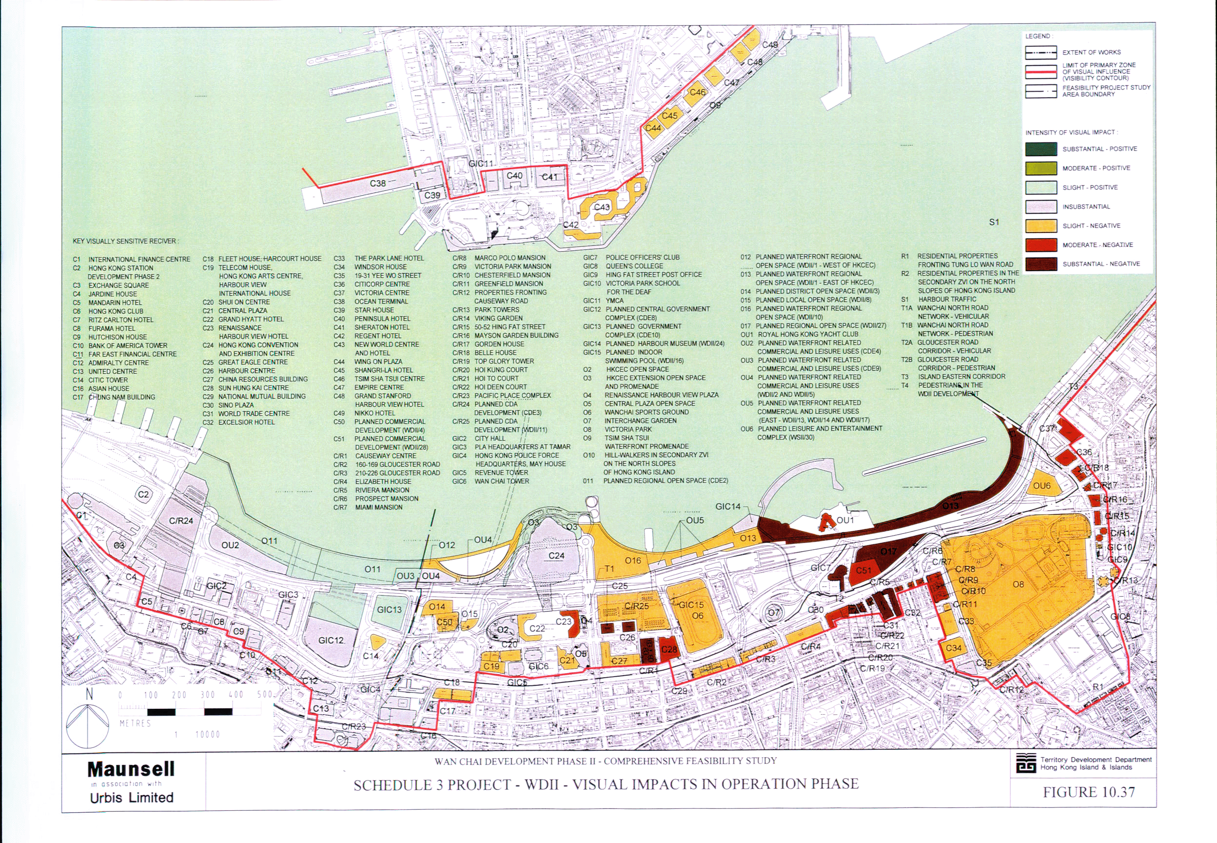
Figure 10.37 Schedule 3 Project - WDII - Visual Impacts
in Operation Phase
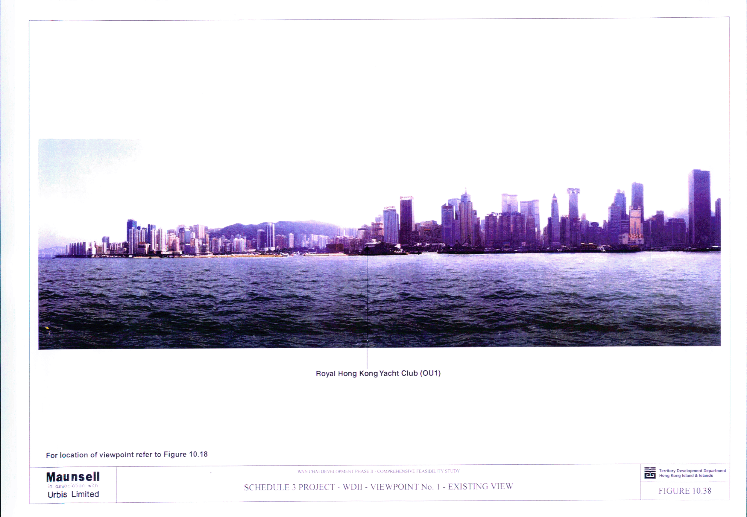
Figure 10.38 Schedule 3 Project - WDII - Viewpoint No. 1
- Existing View
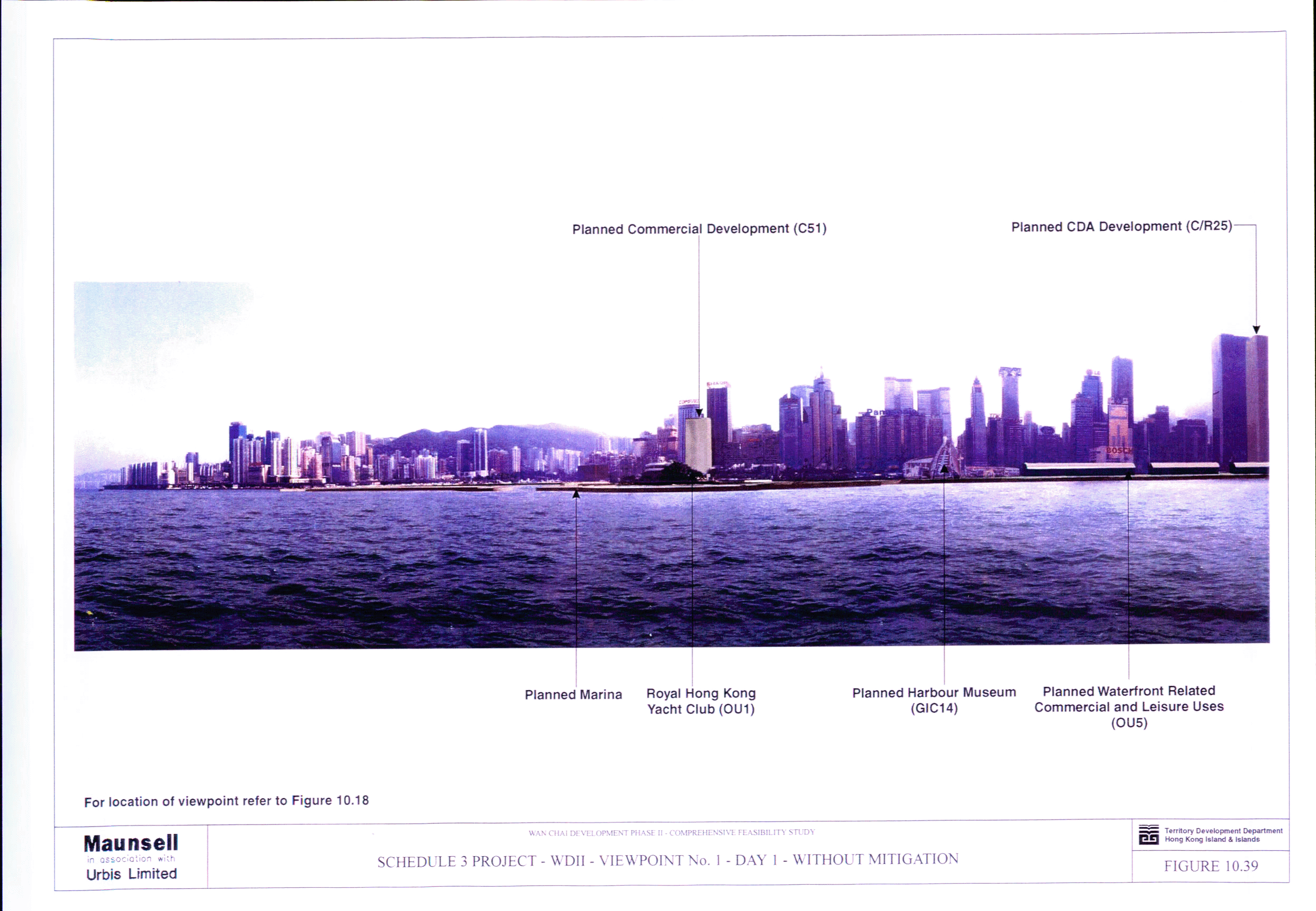
Figure 10.39 Schedule 3 Project - WDII - Viewpoint No. 1
- Day 1 - Without Mitigation
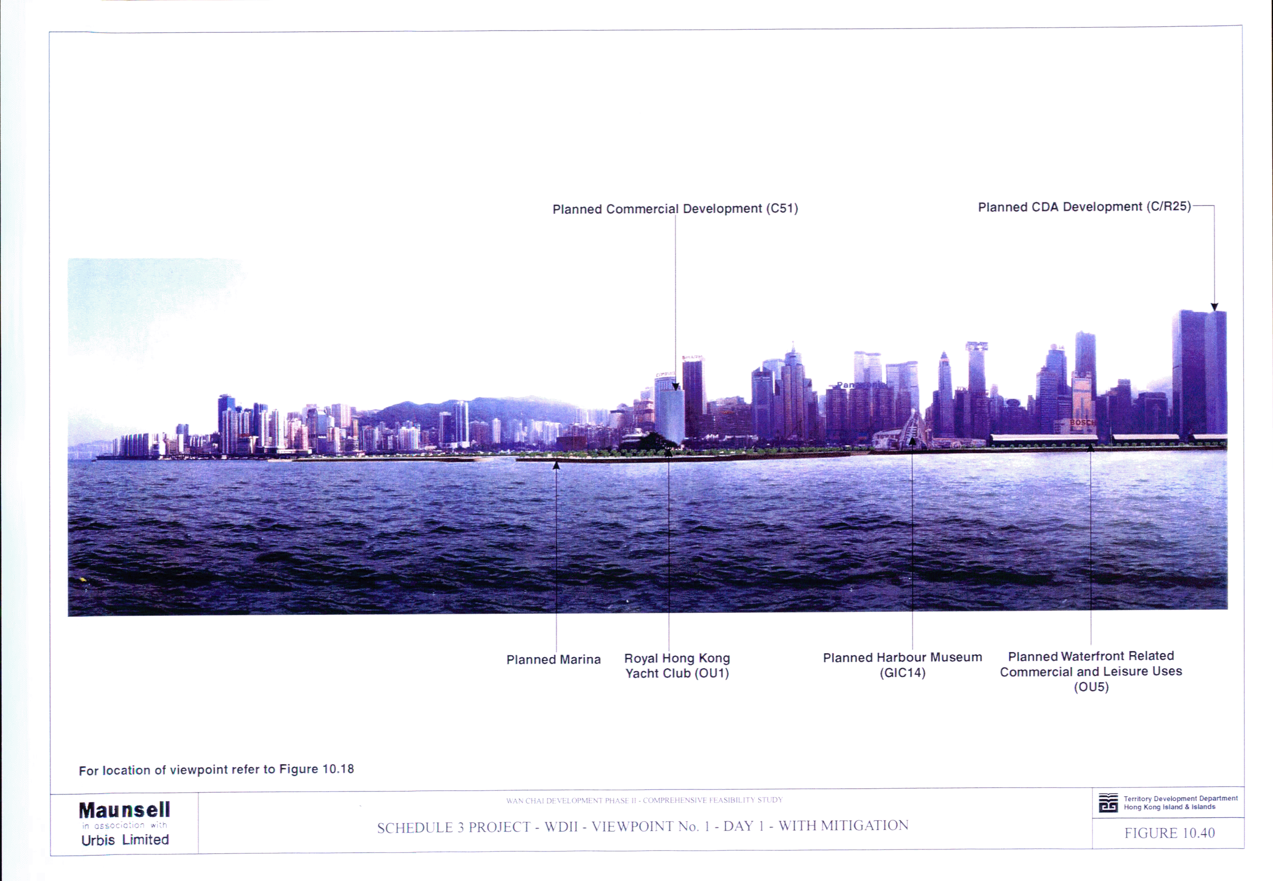
Figure 10.40 Schedule 3 Project - WDII - Viewpoint No. 1
- Day 1 - With Mitigation
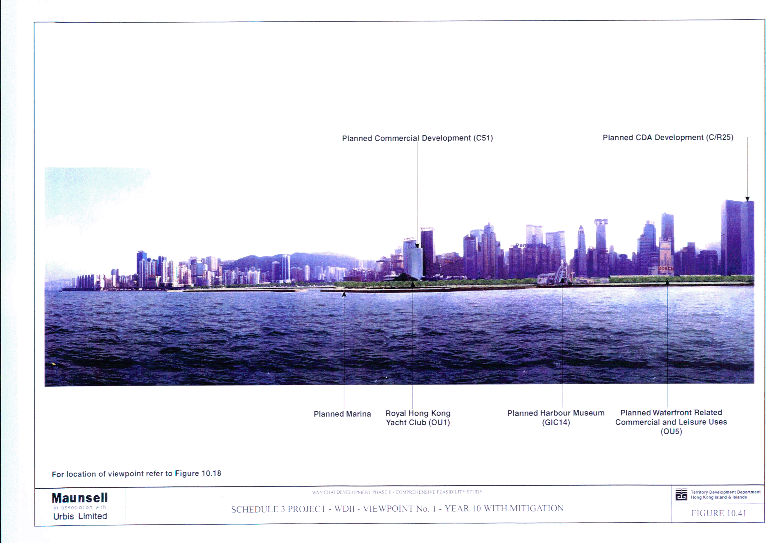
Figure 10.41 Schedule 3 Project - WDII - Viewpoint No. 1
- Year 10 - With Mitigation
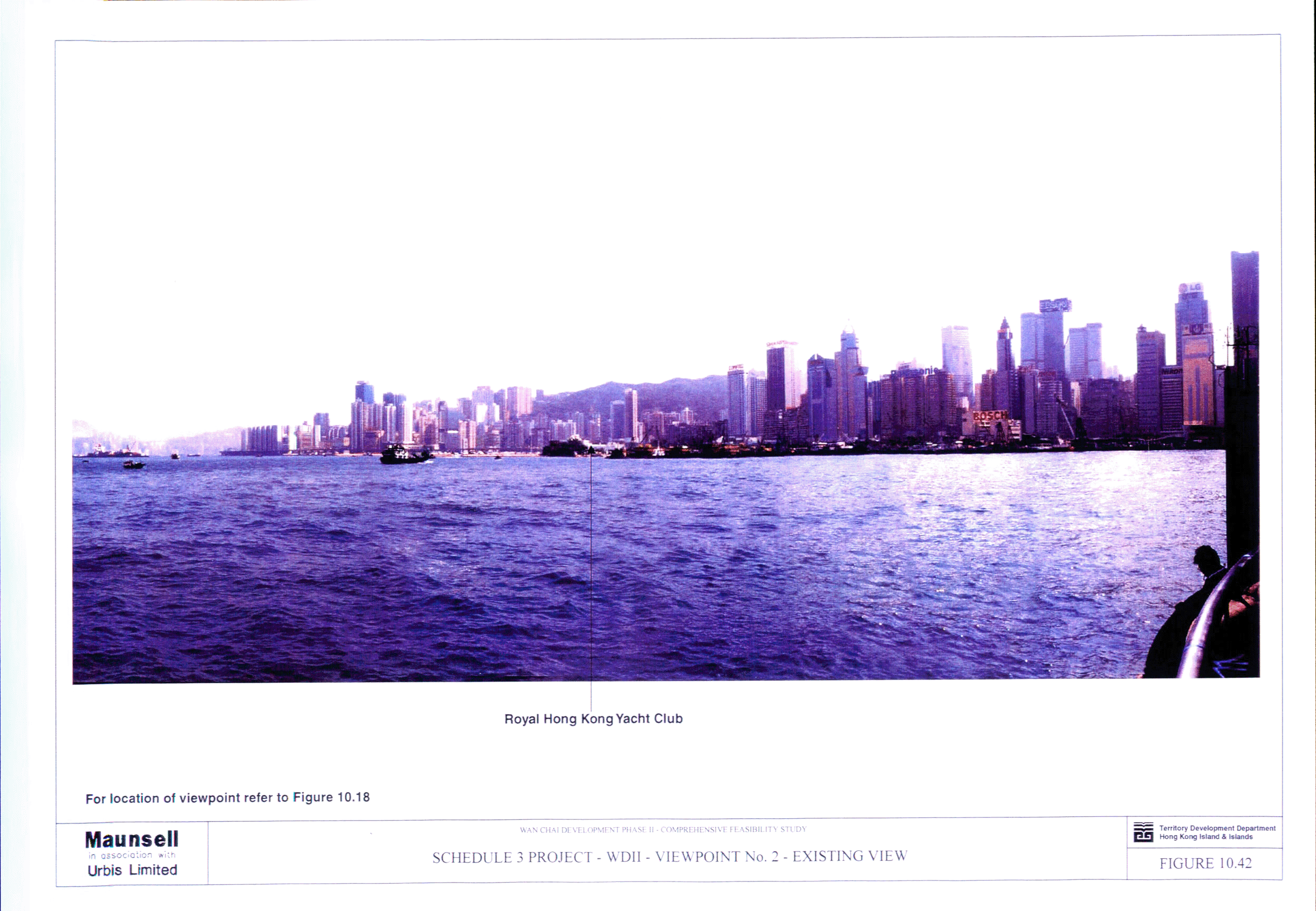
Figure 10.42 Schedule 3 Project - WDII - Viewpoint No. 2
- Existing View
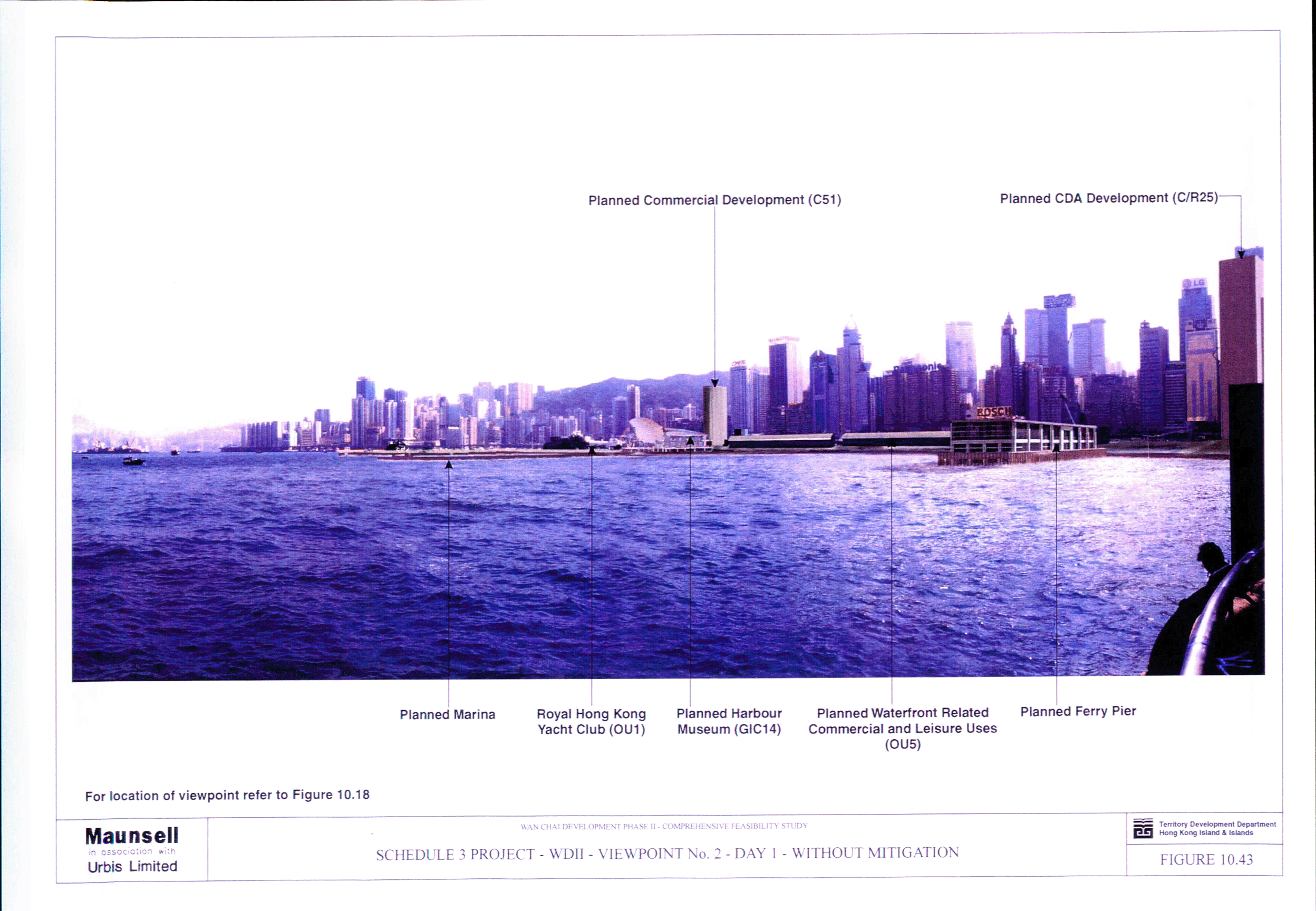
Figure 10.43 Schedule 3 Project - WDII - Viewpoint No. 2
- Day 1 - Without Mitigation
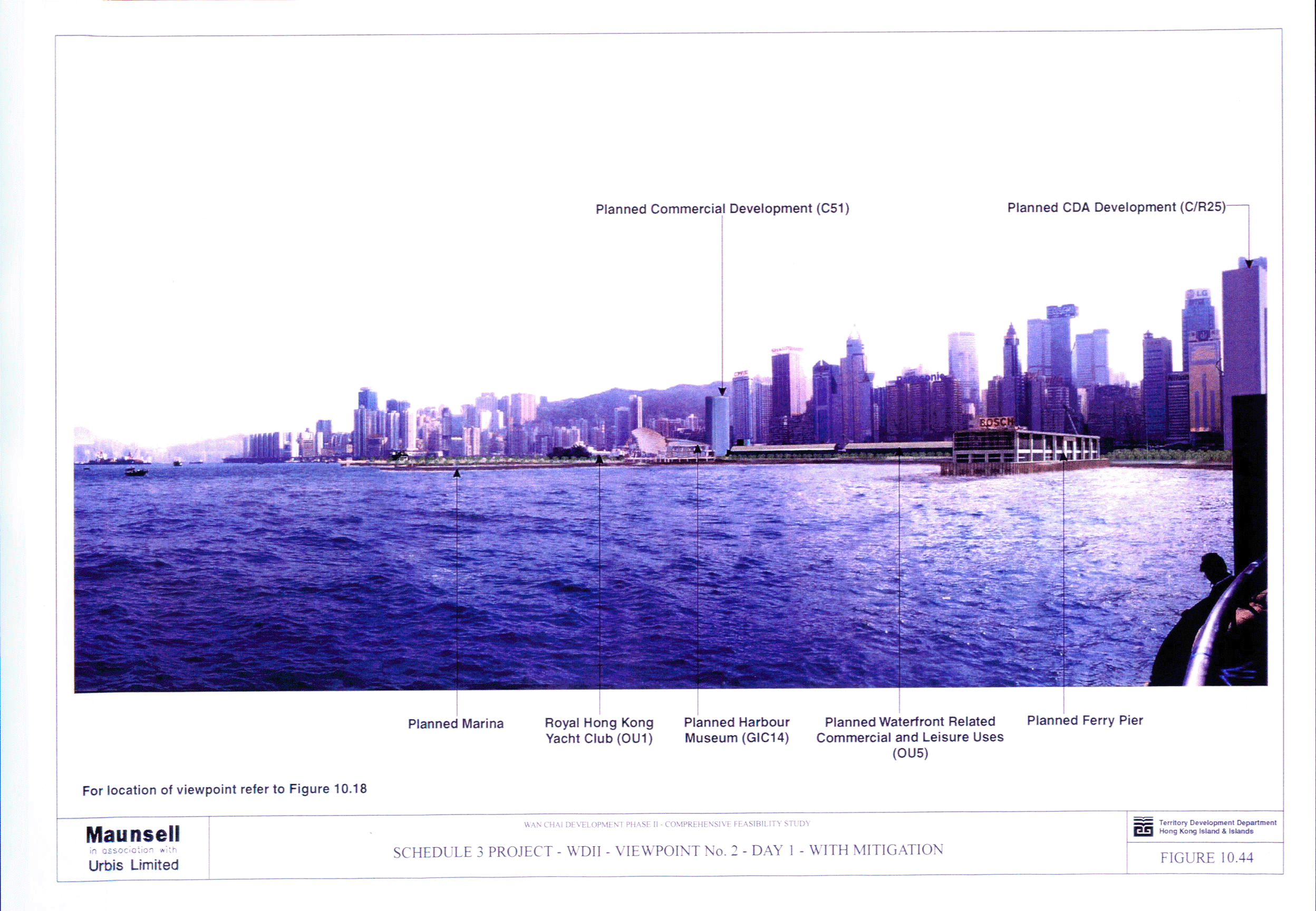
Figure 10.44 Schedule 3 Project - WDII - Viewpoint No. 2
- Day 1 - With Mitigation
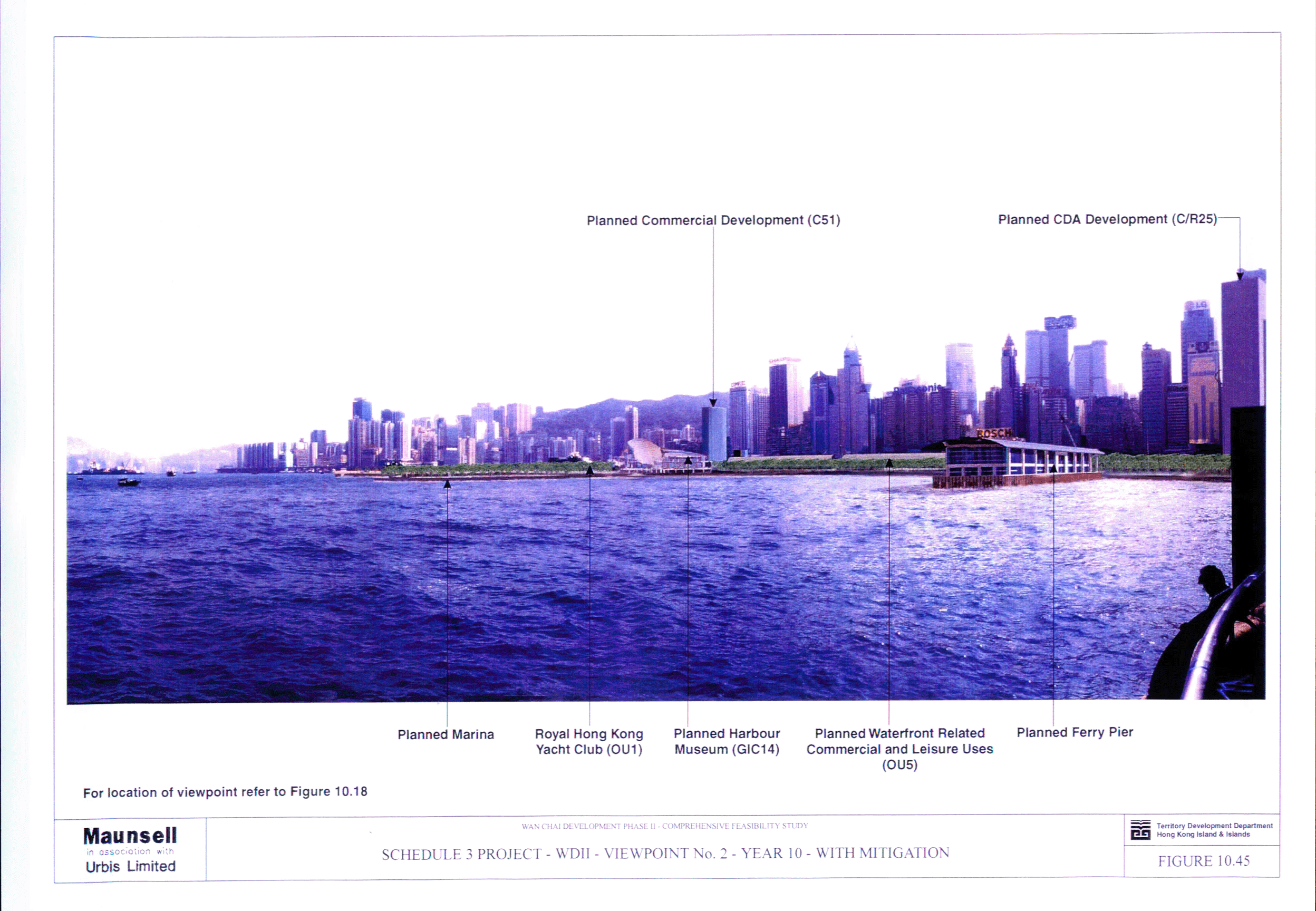
Figure 10.45 Schedule 3 Project - WDII - Viewpoint No. 2
- Year 10 - With Mitigation
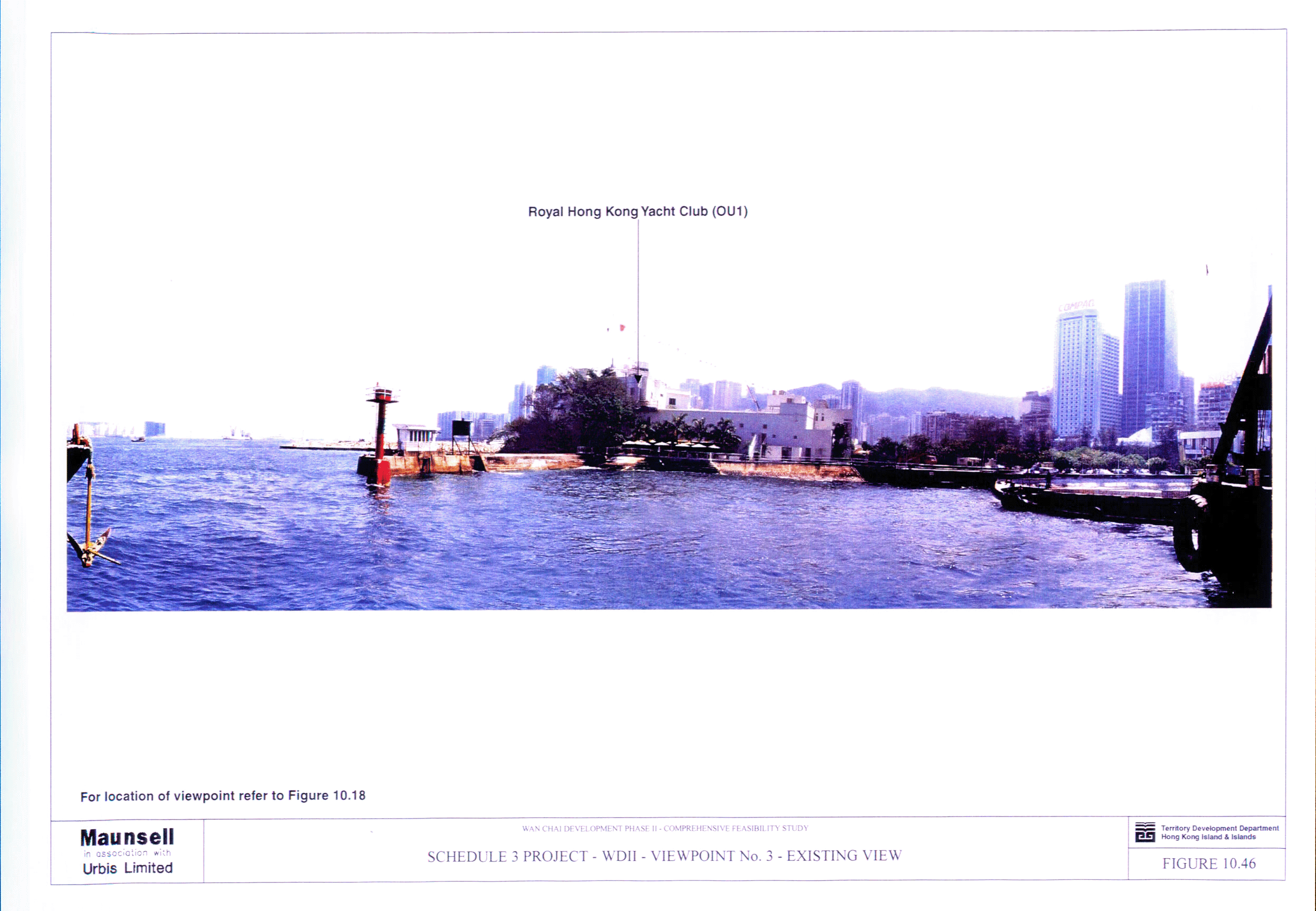
Figure 10.46 Schedule 3 Project - WDII - Viewpoint No. 3
- Existing View
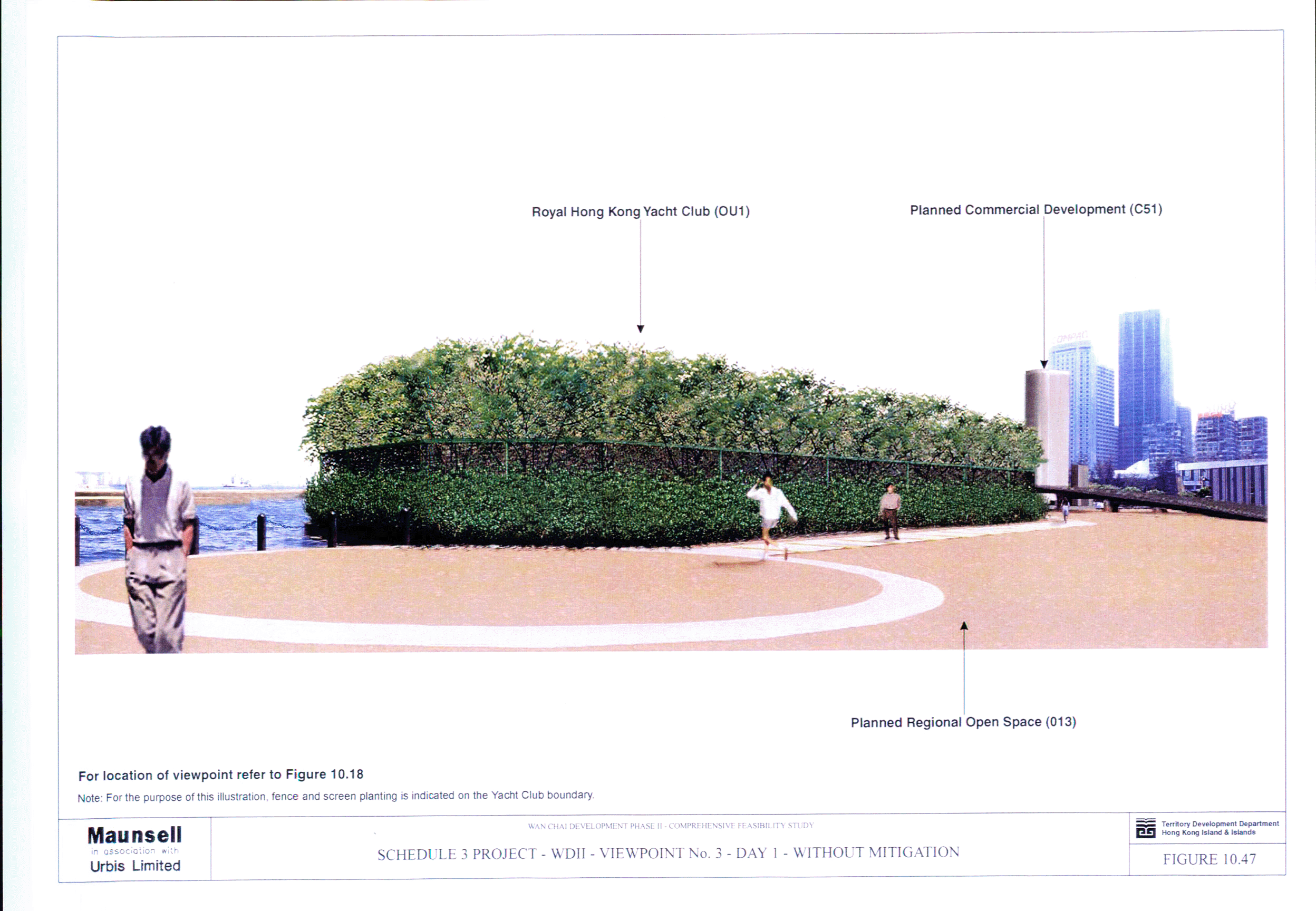
Figure 10.47 Schedule 3 Project - WDII - Viewpoint No. 3
- Day 1 - Without Mitigation
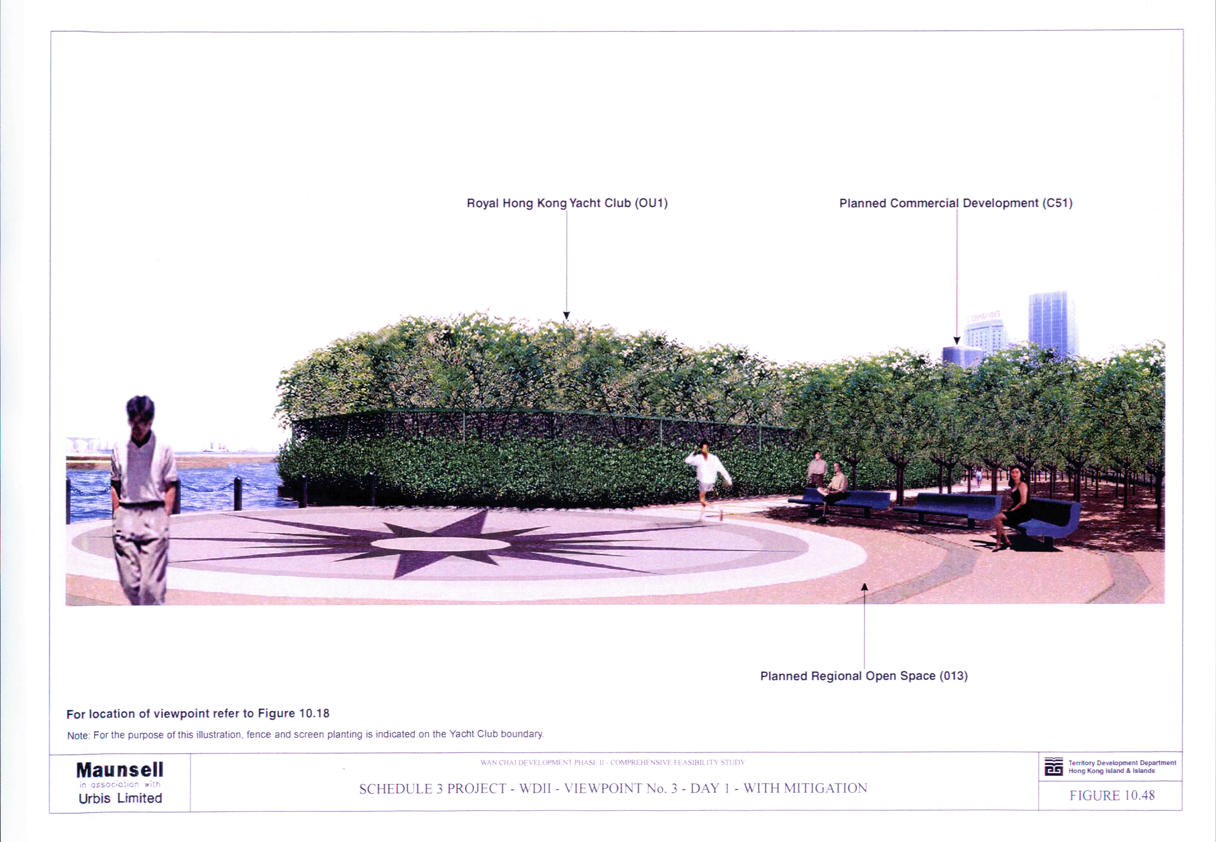
Figure 10.48 Schedule 3 Project - WDII - Viewpoint No. 3
- Day 1- With Mitigation
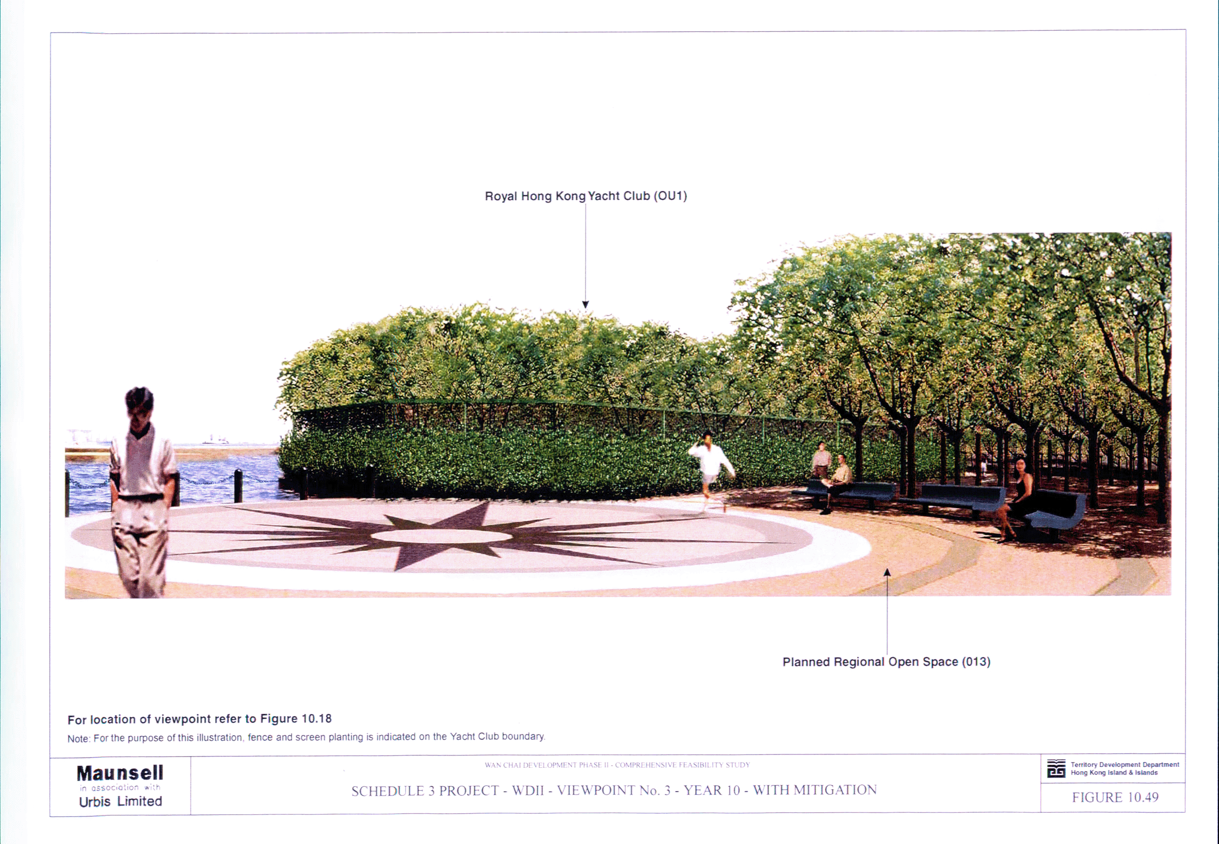
Figure 10.49 Schedule 3 Project - WDII - Viewpoint No. 3
- Year 10 - With Mitigation
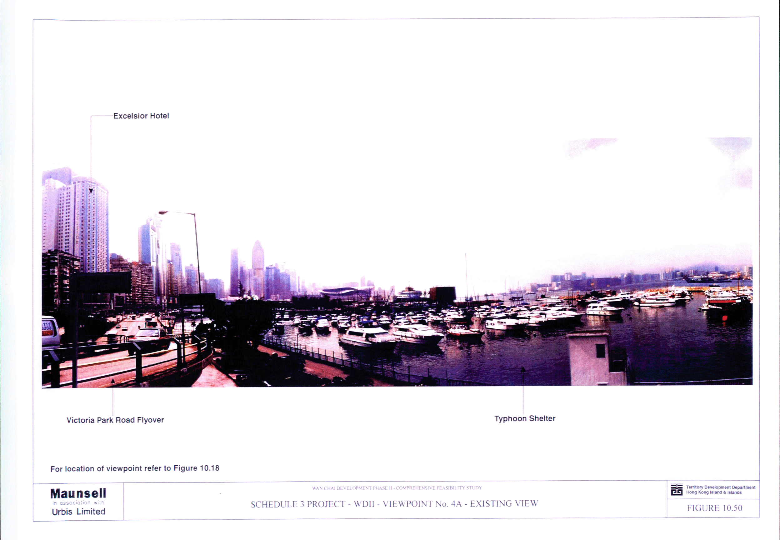
Figure 10.50 Schedule 3 Project - WDII - Viewpoint No. 4A
- Existing View
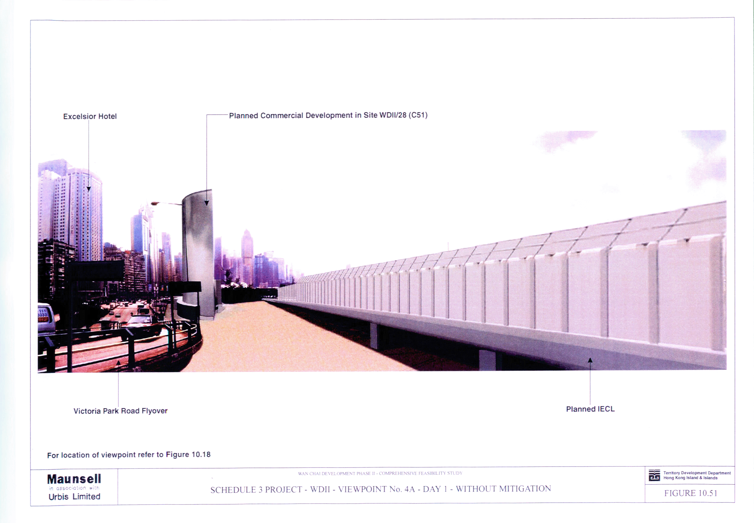
Figure 10.51 Schedule 3 Project - WDII - Viewpoint No. 4A
- Day 1 - Without Mitigation
Figure 10.52 Schedule 3 Project - WDII - Viewpoint No. 4A
- Day 1 - With Mitigation
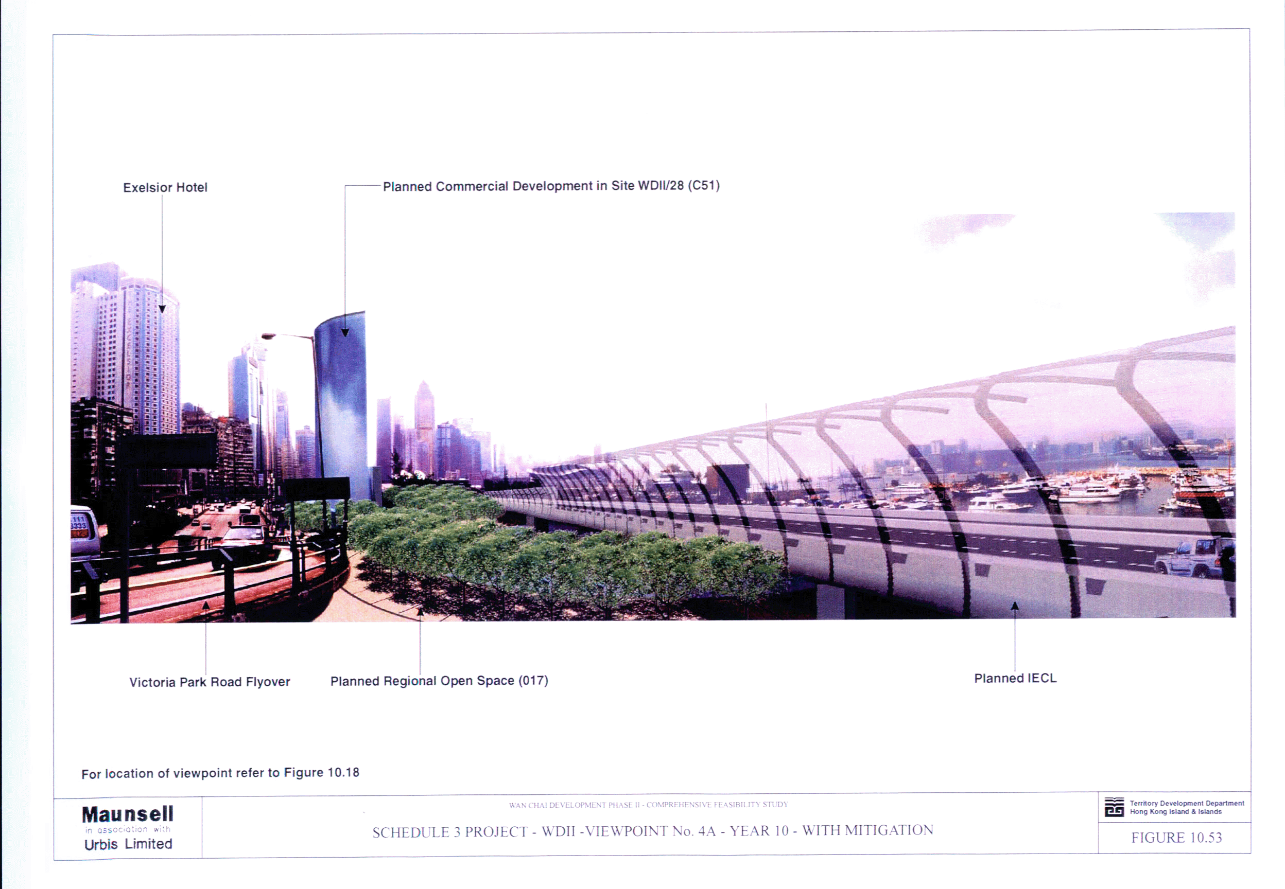
Figure 10.53 Schedule 3 Project - WDII - Viewpoint No. 4A
- Year 10 - With Mitigation
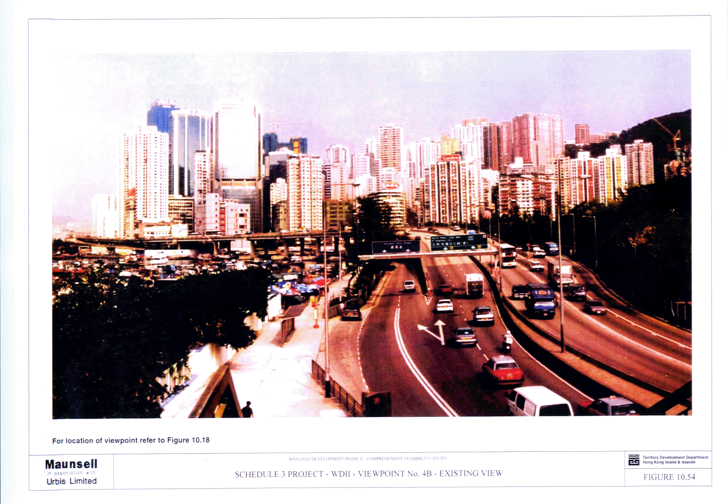
Figure 10.54 Schedule 3 Project - WDII - Viewpoint No. 4B
- Existing View
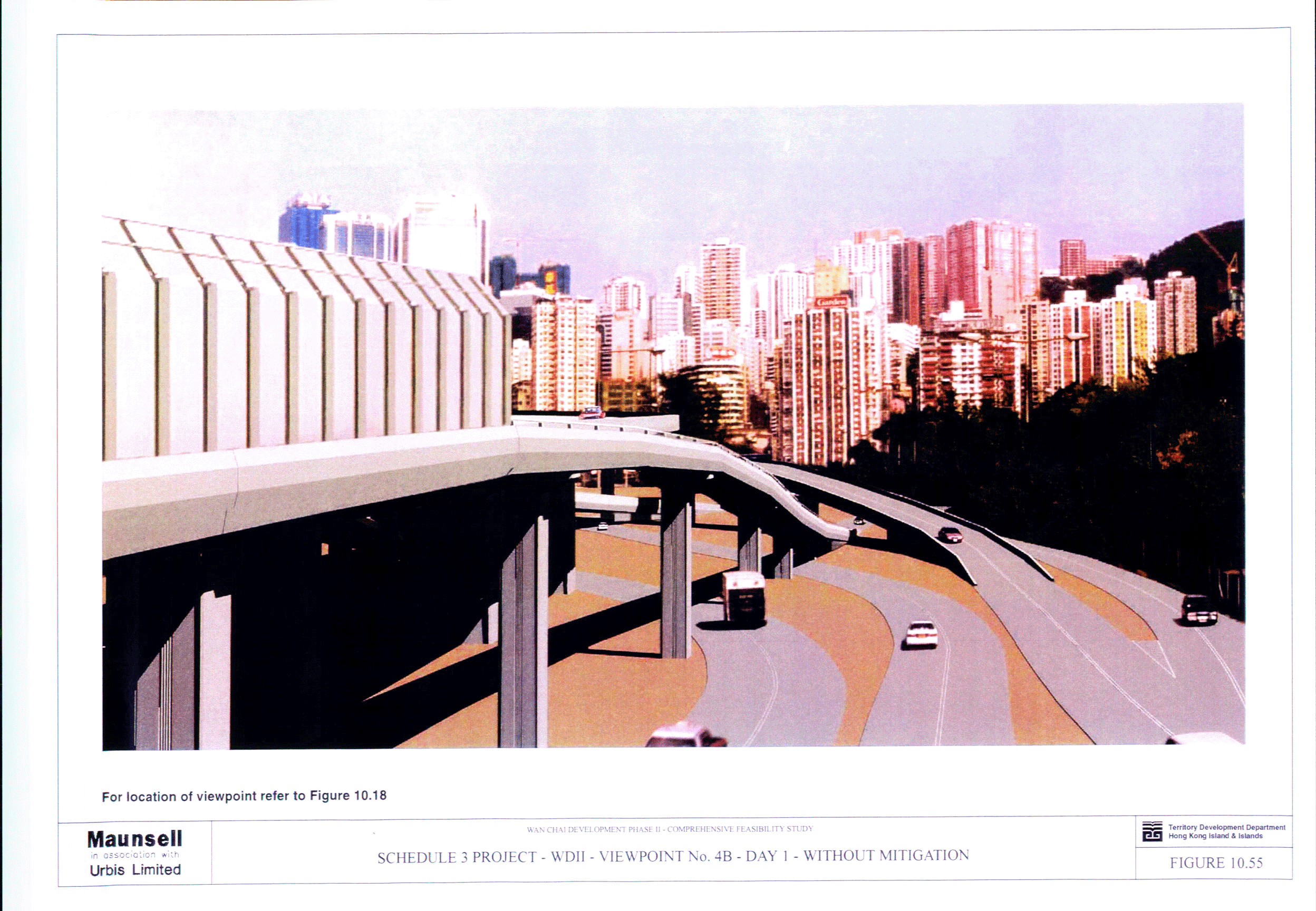
Figure 10.55 Schedule 3 Project - WDII - Viewpoint No. 4B
- Day 1 - Without Mitigation
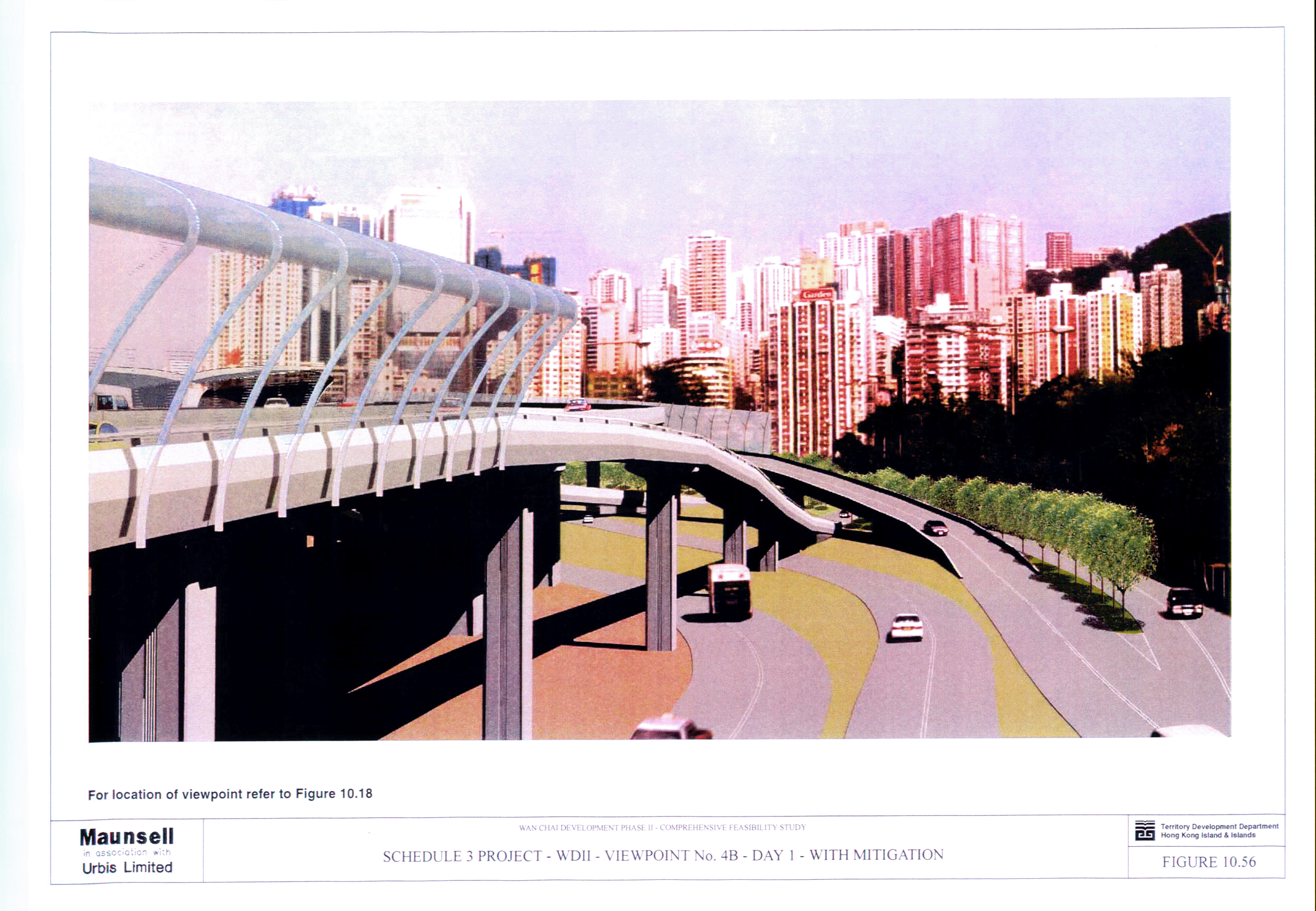
Figure 10.56 Schedule 3 Project - WDII - Viewpoint No. 4B
- Day 1 - With Mitigation
Figure 10.57 Schedule 3 Project - WDII - Viewpoint No. 4B
- Year 10 - With Mitigation
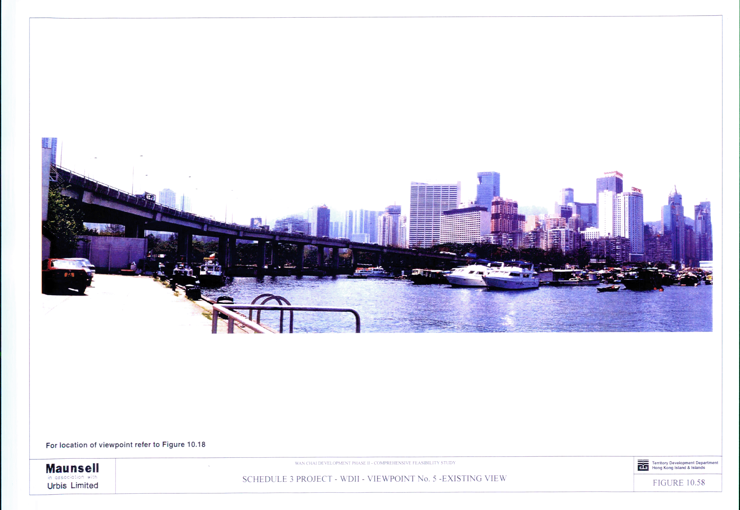
Figure 10.58 Schedule 3 Project - WDII - Viewpoint No. 5
- Existing View
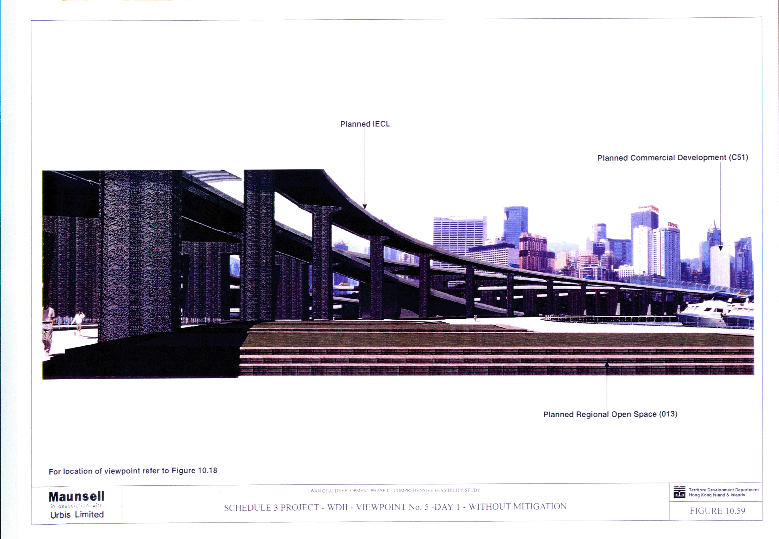
Figure 10.59 Schedule 3 Project - WDII - Viewpoint No. 5
- Day 1 - Without Mitigation
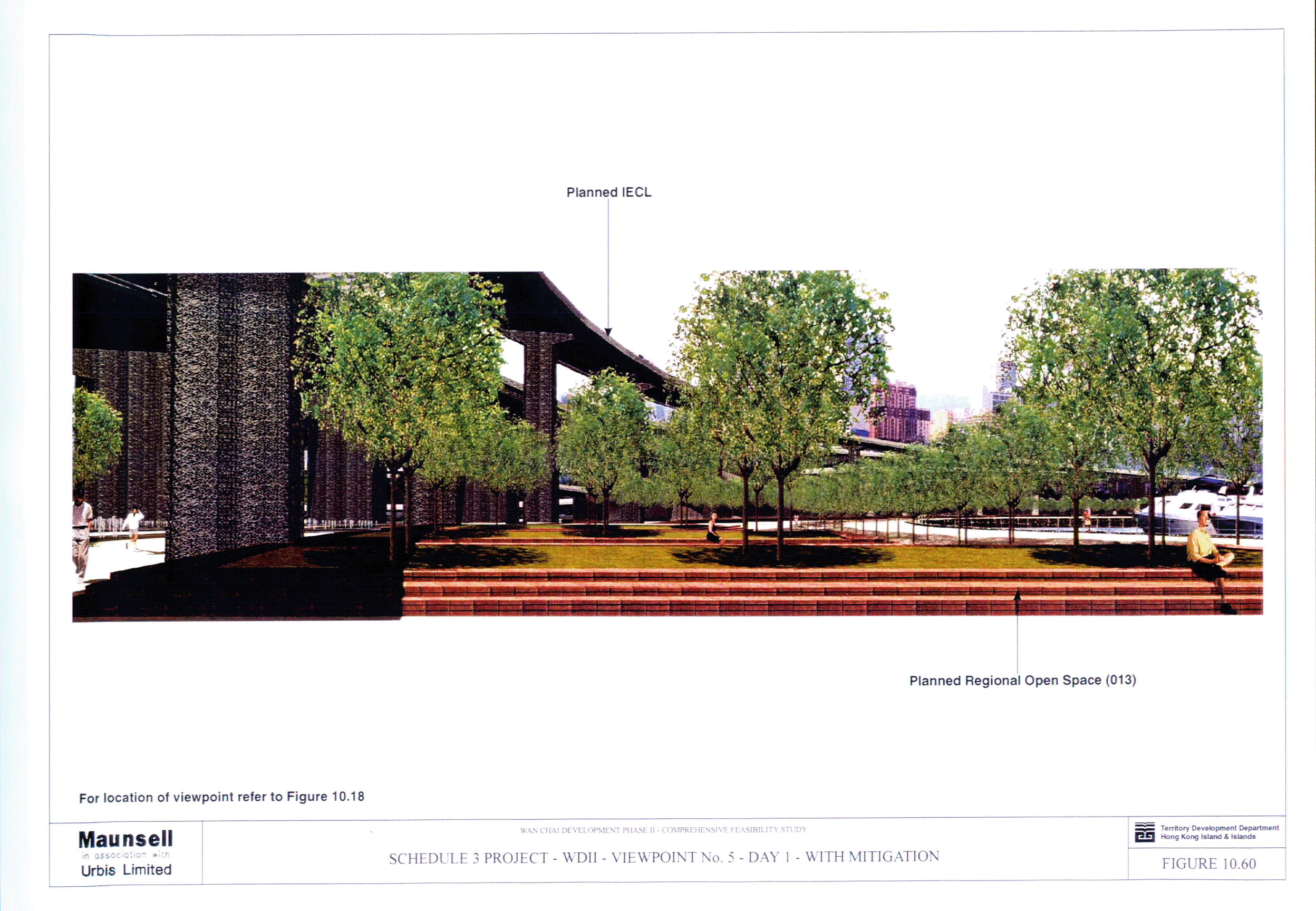
Figure 10.60 Schedule 3 Project - WDII - Viewpoint No. 5
- Day 1 - With Mitigation
Figure 10.61 Schedule 3 Project - WDII - Viewpoint No. 5
- Year 10 - With Mitigation
Figure 10.62 Schedule 2 DP2 - WDII Major Roads -
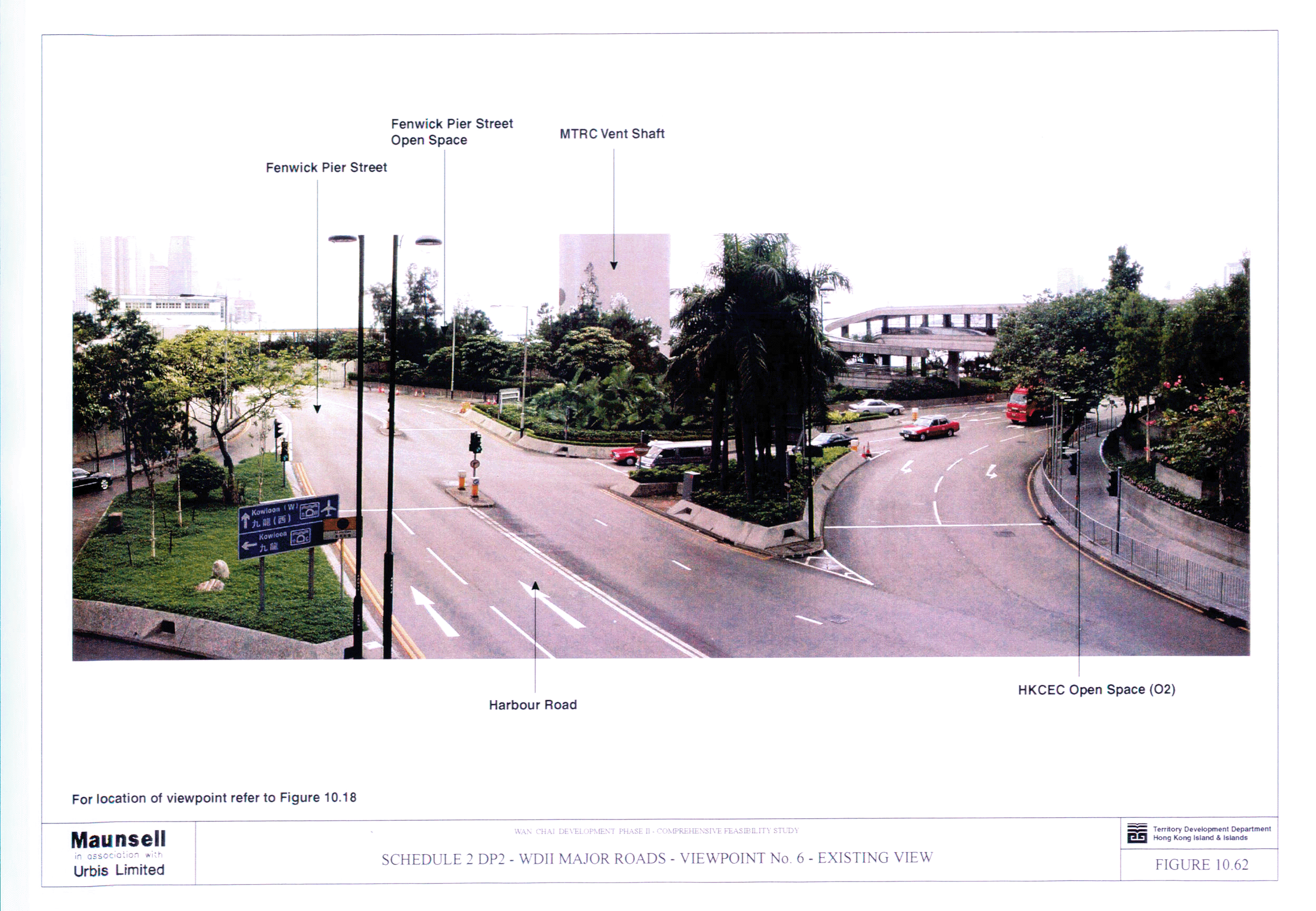
Viewpoint No. 6 - Existing View
Figure 10.63 Schedule 2 DP2 - WDII Major Roads -
Viewpoint No. 6 - Day 1 - Without Mitigation
Figure 10.64 Schedule 2 DP2 - WDII Major Roads -
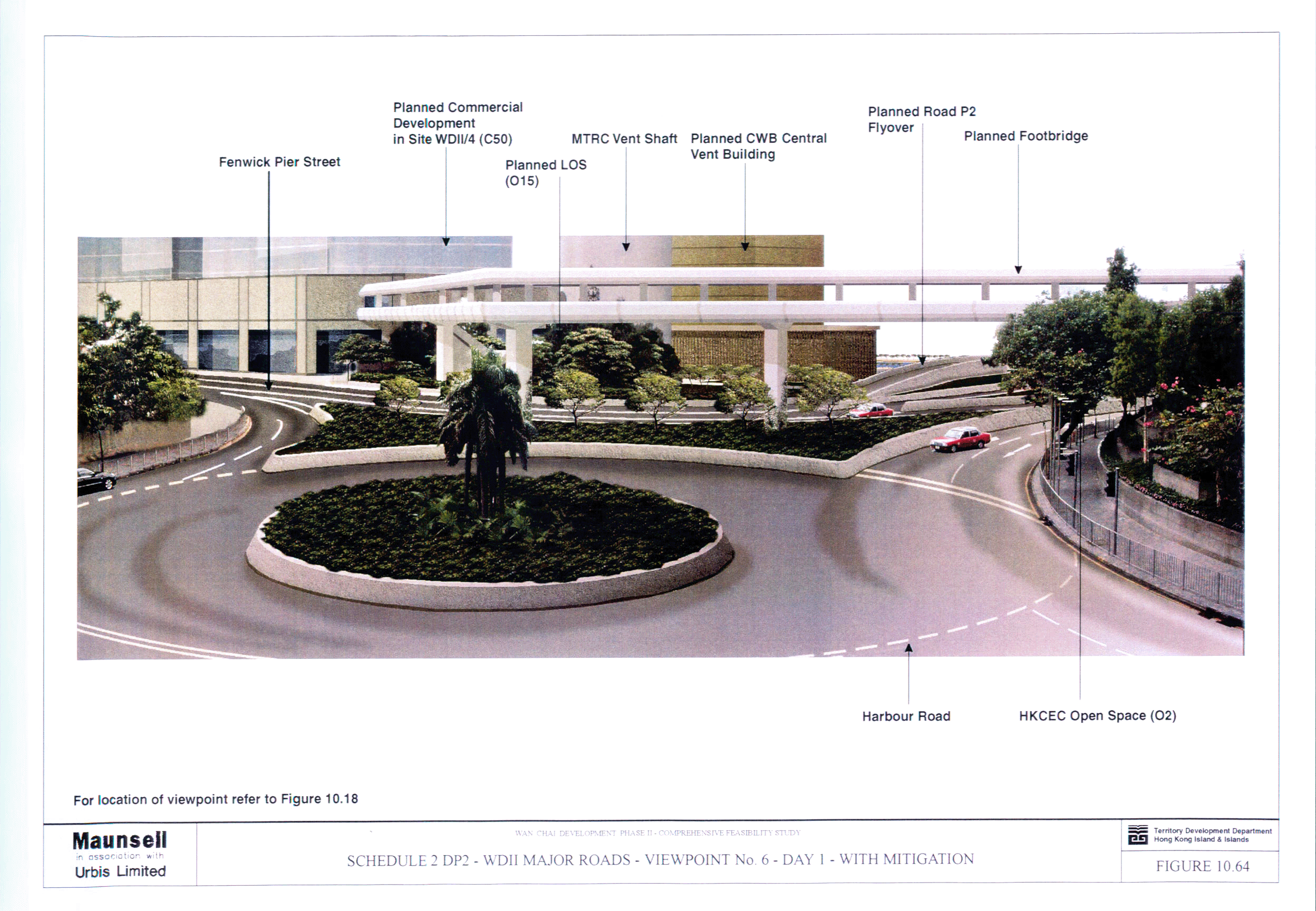
Viewpoint No. 6 - Day 1 - With Mitigation
Figure 10.65 Schedule 2 DP2 - WDII Major Roads -
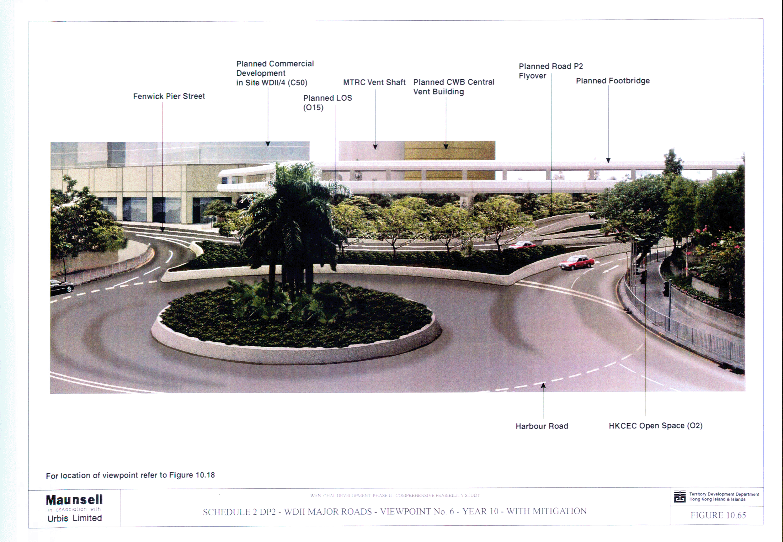
Viewpoint No. 6 - Year 10 - With Mitigation
Figure 10.66 Schedule 2 DP2 - WDII Major Roads -
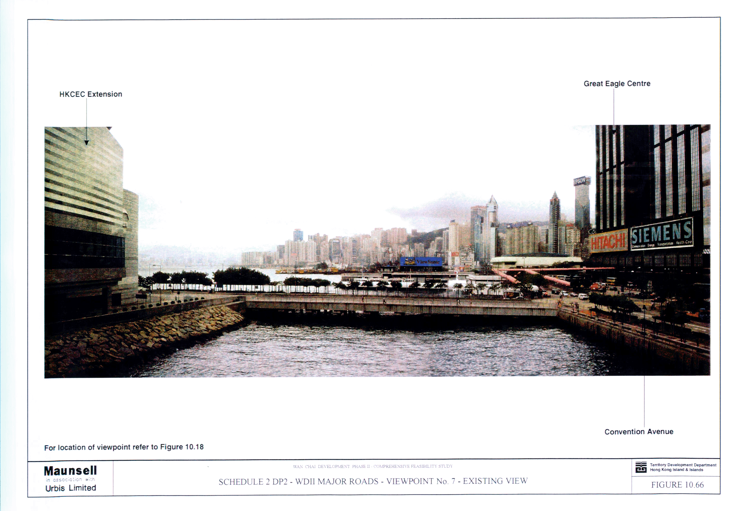
Viewpoint No. 7 - Existing View
Figure 10.67 Schedule 2 DP2 - WDII Major Roads -
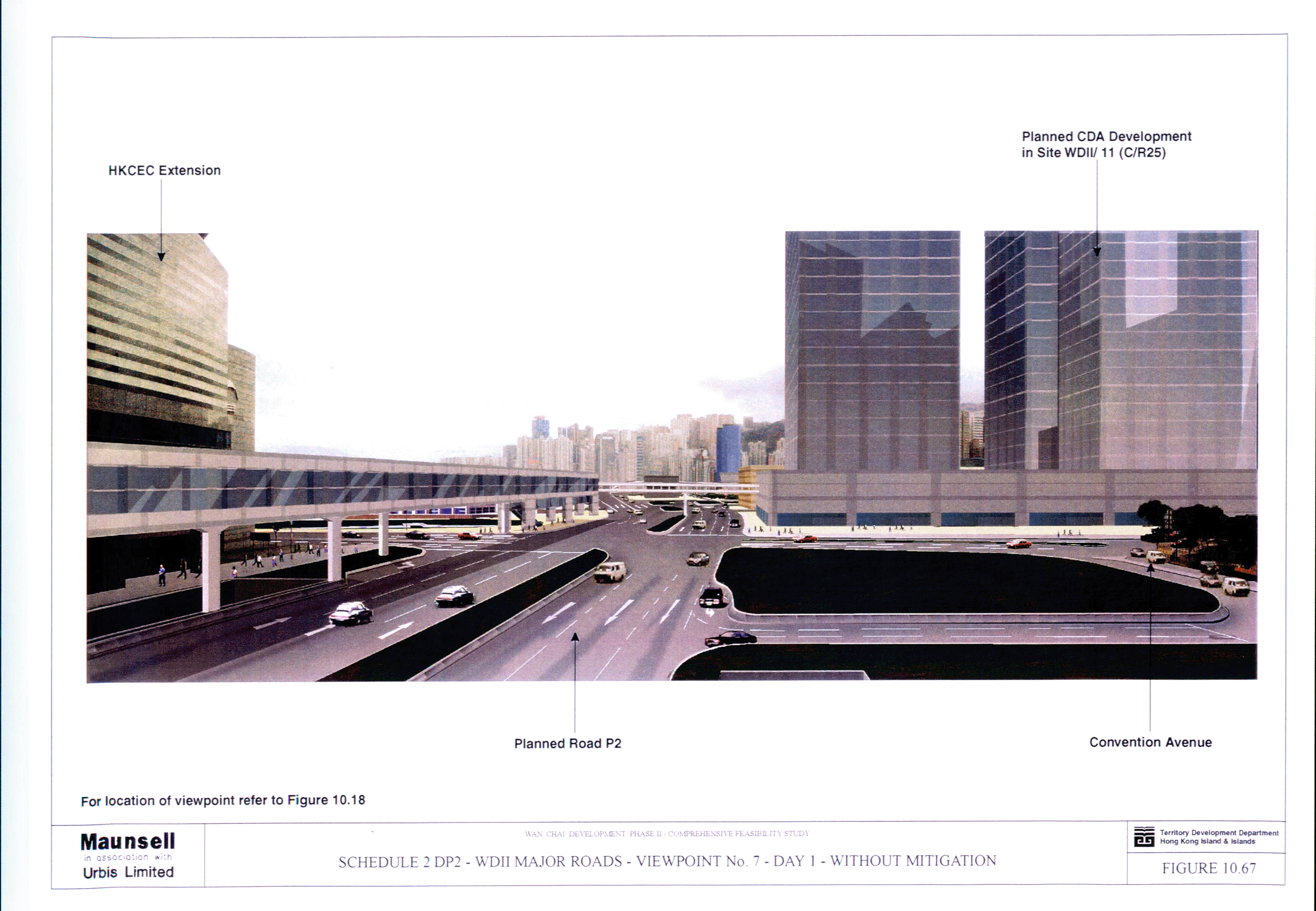
Viewpoint No. 7 - Day 1 - Without Mitigation
Figure 10.68 Schedule 2 DP2 - WDII Major Roads -
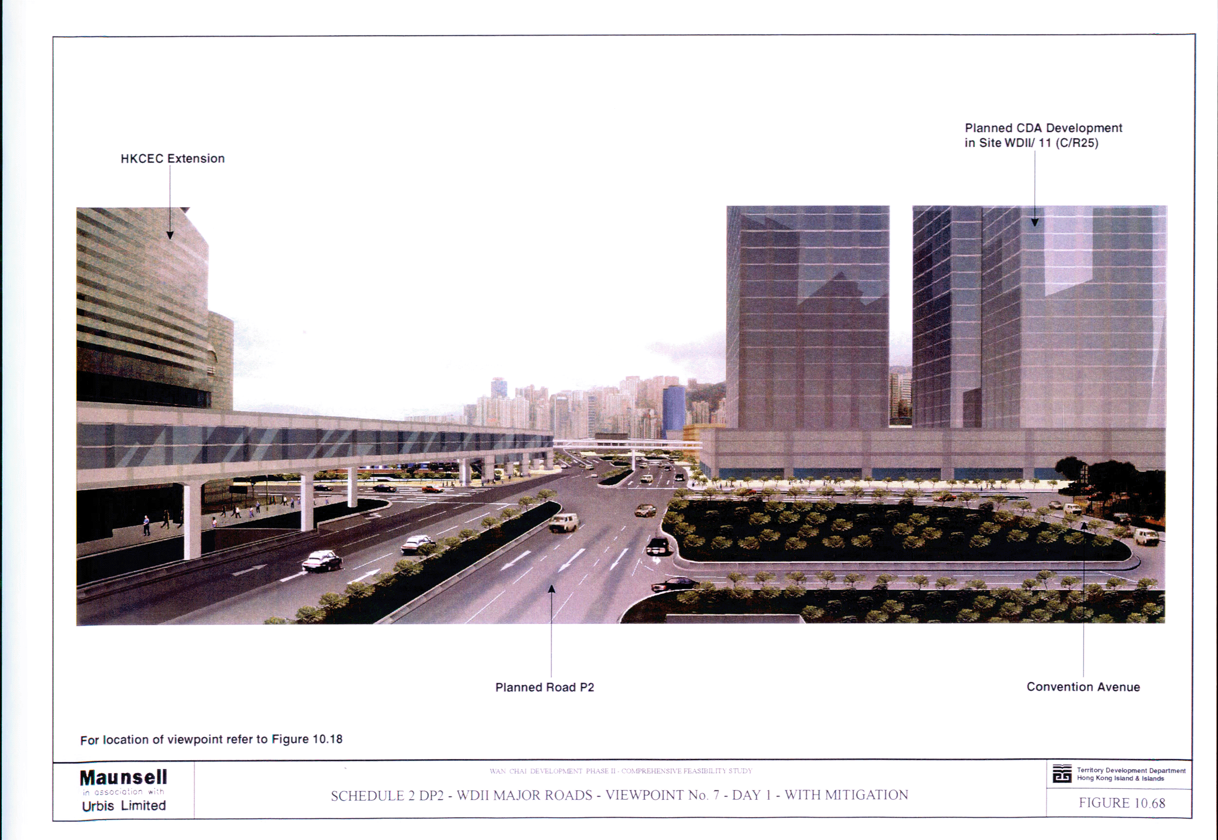
Viewpoint No. 7 - Day 1 - With Mitigation
Figure 10.69 Schedule 2 DP2 - WDII Major Roads -
Viewpoint No. 7 - Year 10 - With Mitigation
VOLUME 3 -
APPENDICES
Appendix 2.1 Wan Chai Development Phase
II: Construction Programme
Appendix 3.1 Summary of Major Dust
Generating Activities
Appendix 3.2 Calculation of Dust Emission
Factors
Appendix 3.3 Sample Computer Output of FDM
Calculation
Appendix 3.4 Calculation of Emission Factor
in Year 2027 (Open Road)
Appendix 3.5 Sample Computer Output of
CALINE4 Calculation
Appendix 3.6 Calculation of Emission Factor
in Year 2027 (Portal)
Appendix 3.7 Sample Computer Output of
ISCST3 Calculation
Appendix 3.8 Dust Levels from Different
Construction Activities (Unmitigated)
Appendix 3.10 Dust Levels from Different
Construction Activities (Mitigated)
Appendix 4.1 Locations of ‘New’ Roads
Appendix 4.2 Powered Mechanical Equipment
(PME) for Different Construction Tasks during Normal Daytime Working Hours
Appendix 4.3 Detail Calculation and Results
of Construction Noise Impacts During Normal Daytime Working Hours
Appendix 4.4 Powered Mechanical Equipment
(PME) for Different Construction Tasks During Restricted Hours
Appendix 4.5 Detail Calculation and Results
of Construction Noise Impacts During Restricted Hours
Appendix 4.6 Traffic Noise Assessment
Results
Appendix 4.7 Sample Output File
Appendix 4.8 Ventilation Shaft Noise
Assessment
Appendix 4.9 Endorsed Letter for Traffic
Flow Year 2027 from Transport Department
Appendix 4.10 Helicopter Noise Assessment
Appendix 5.1 Pollution Loading Inventory for
Water Quality Modelling
Appendix 5.2 Sea Level and Rainfall
Observations 1995 to 1999
Appendix 5.3 Water Quality Modelling
Results: Construction Scenarios
Appendix 5.4 Predicted Suspended Solids
Concentrations at Water Sensitive Receivers for Construction Scenario 2B
Appendix 5.5 Temporal Variations of SS
Elevations at the Various Water Sensitive Receivers during Construction Phase
Appendix 5.6 Water Quality Modelling
Results: Interim Construction Stage
Appendix 5.7 Hydrodynamic and Water Quality
Modelling Results: Baseline Scenario
Appendix 5.8 Hydrodynamic and Water Quality
Modelling Results: Operation Scenario
Appendix 7.1 Contamination Assessment Plan –
A King Marine and the Royal Hong Kong Yacht Club
Appendix 8.1 Wan Chai Development Phase
II: Study and Adjacent Area Bird
Species List
Appendix 9.1 Wan Chai Development Phase
II: Study and Adjacent Area Species
List
ANNEX A -
CULTURAL HERITAGE SURVEY