Section Contents Pages.
1. INTRODUCTION
1-1
2. PROJECT DESCRIPTION
2-1
3. AIR QUALITY
3-1
4. NOISE
4-1
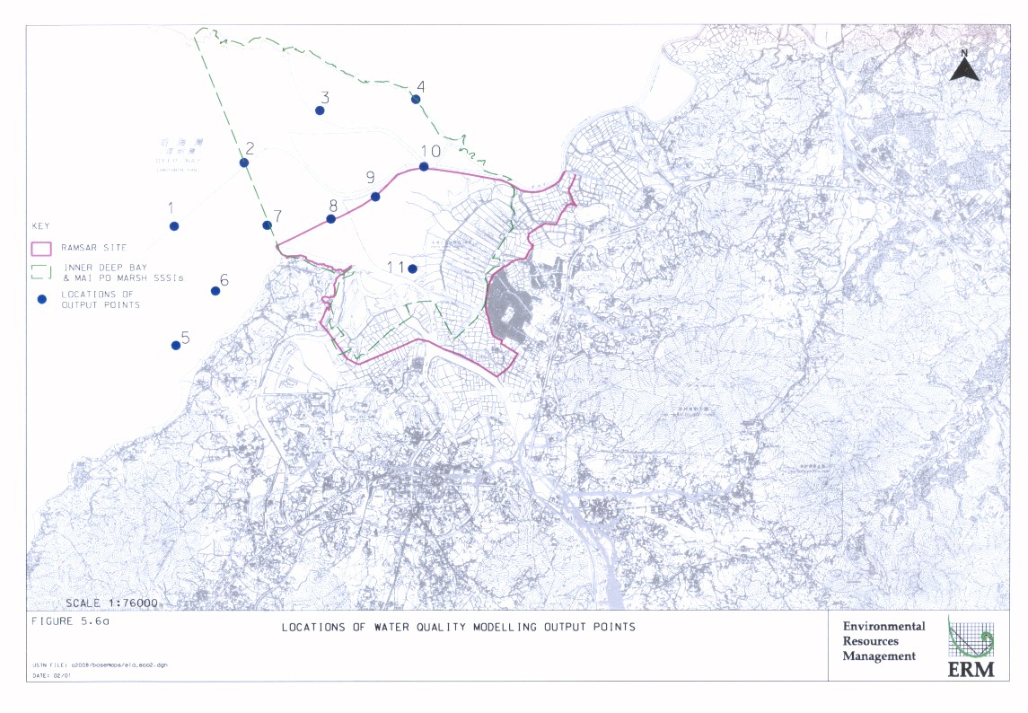
5. WATER QUALITY 5-1
6. WASTE MANAGEMENT 6-1
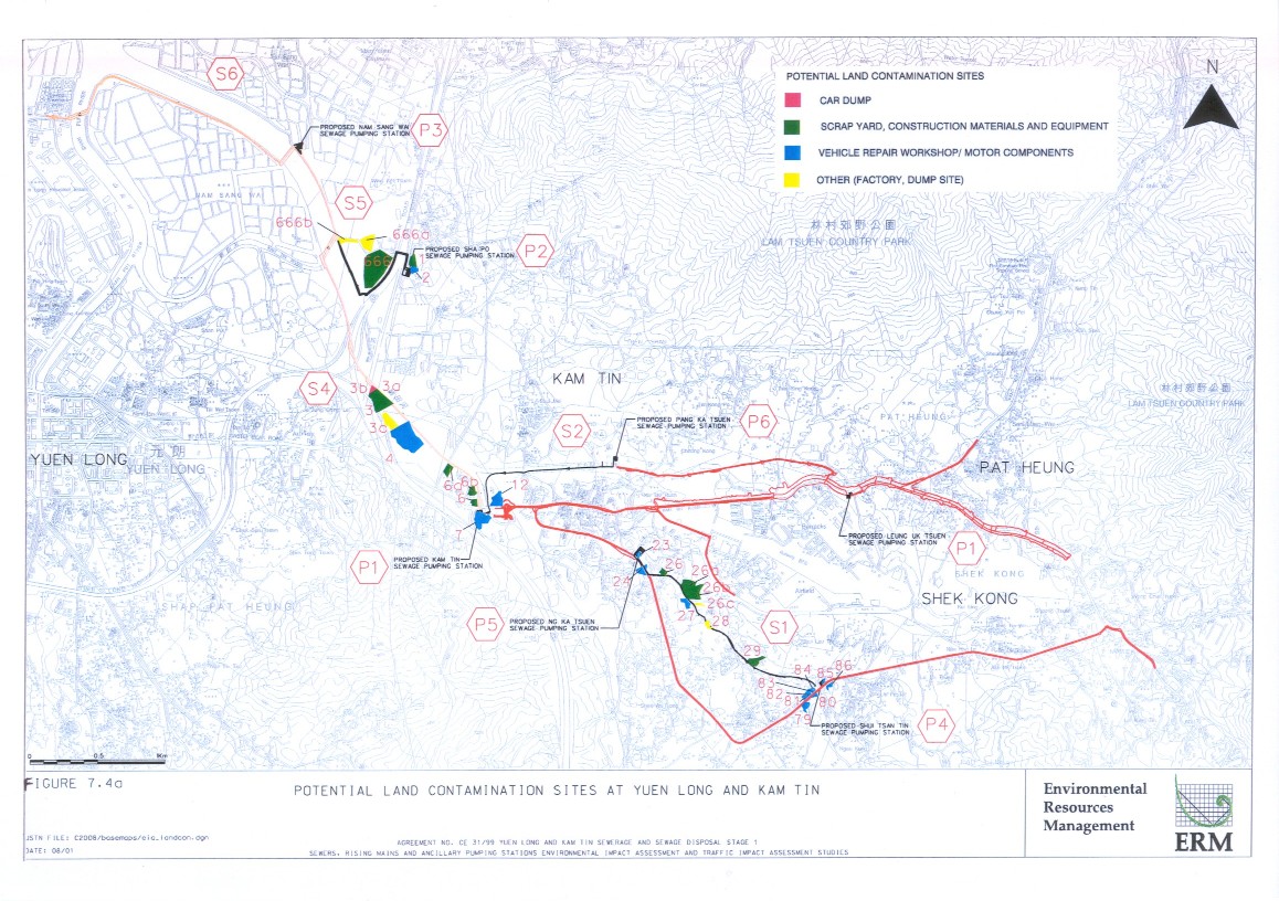
7. LAND CONTAMINATION 7-1
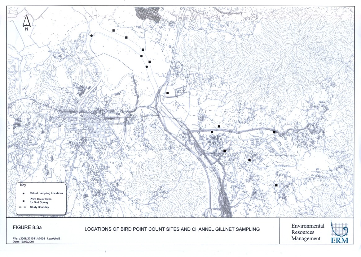
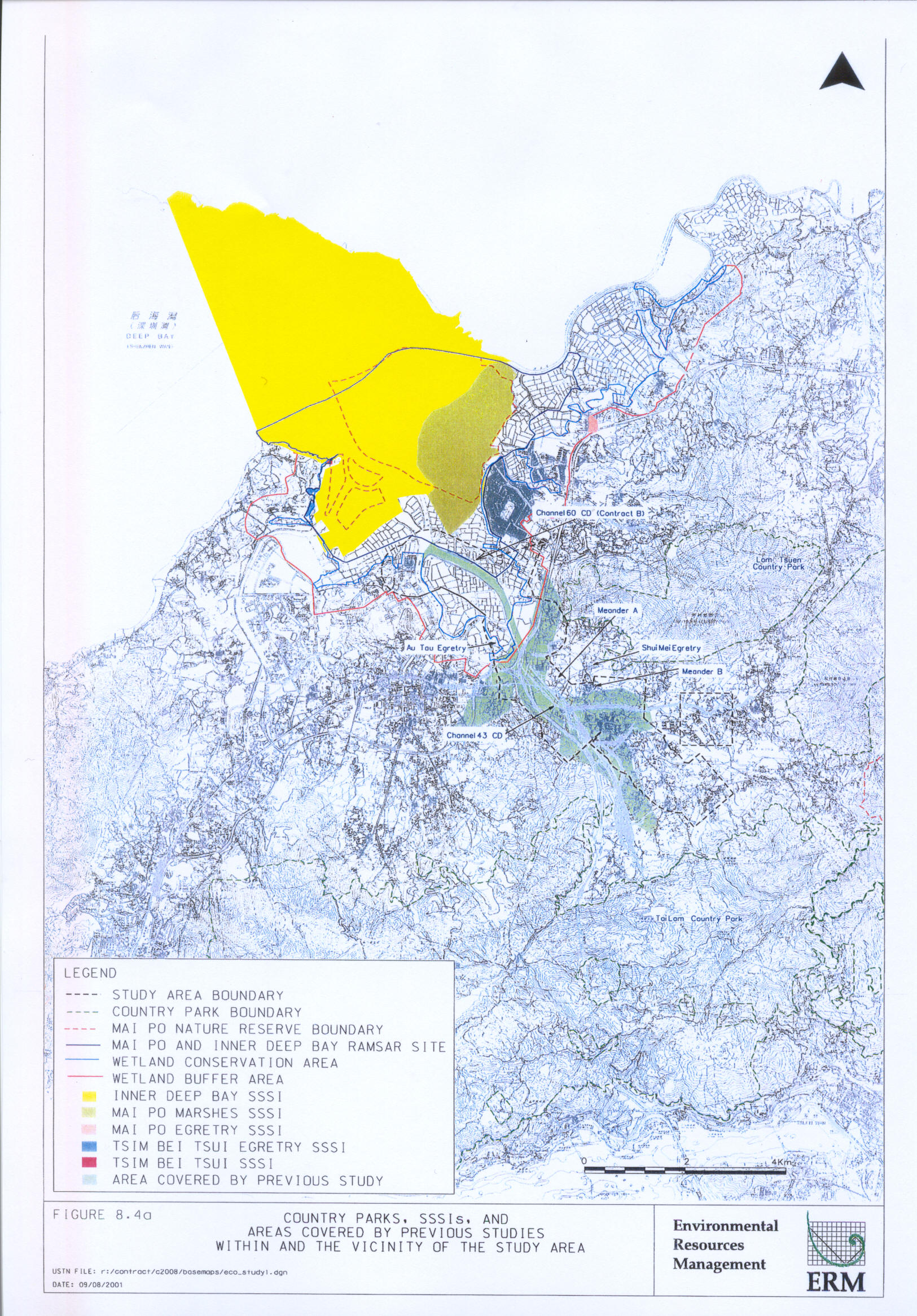
8. ECOLOGY 8-1
9. FISHERIES 9-1
10. CULTURAL HERITAGE 10-1
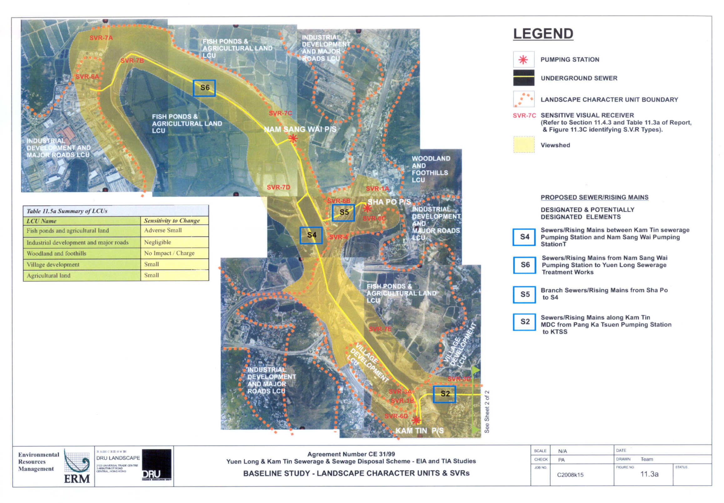
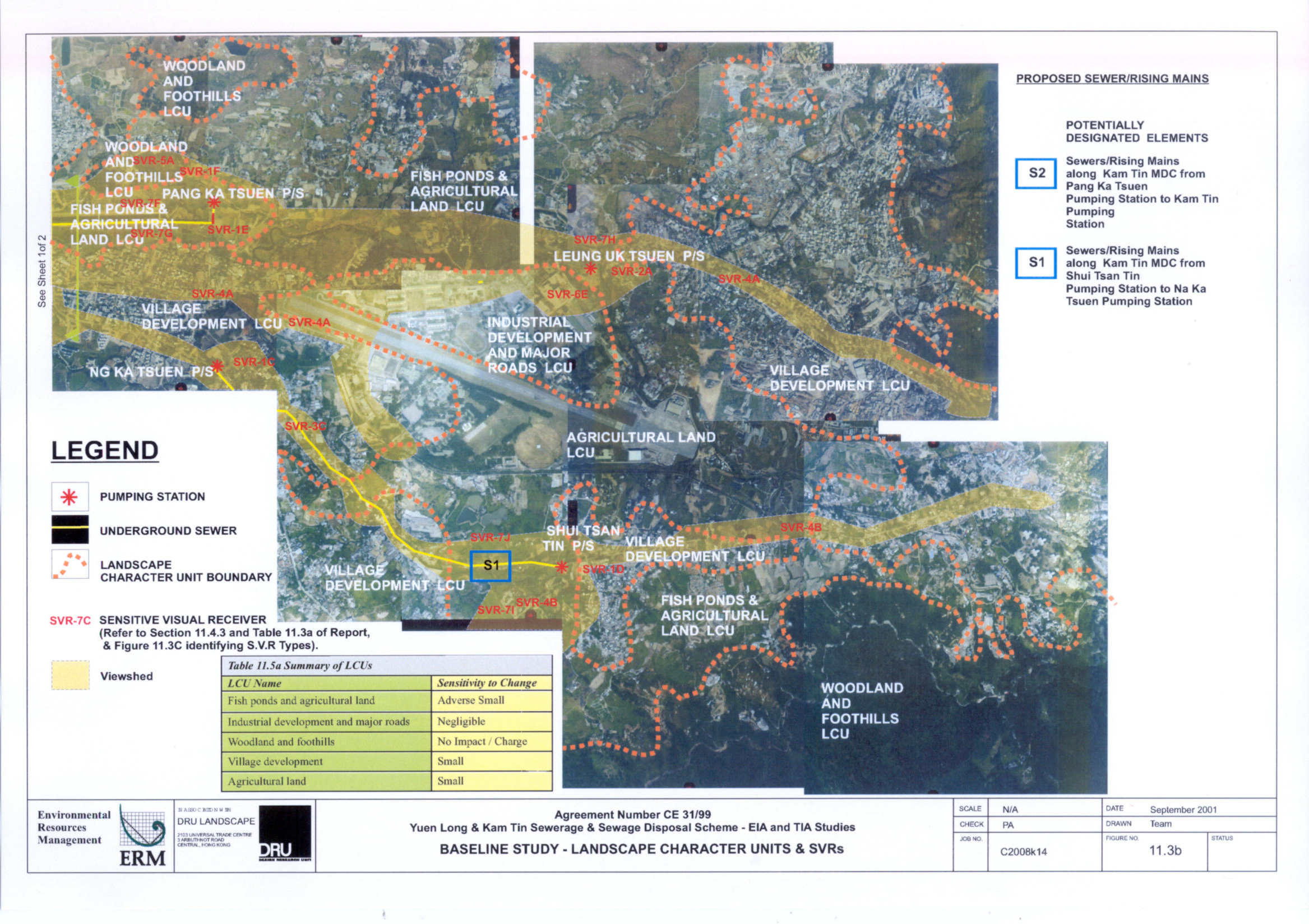
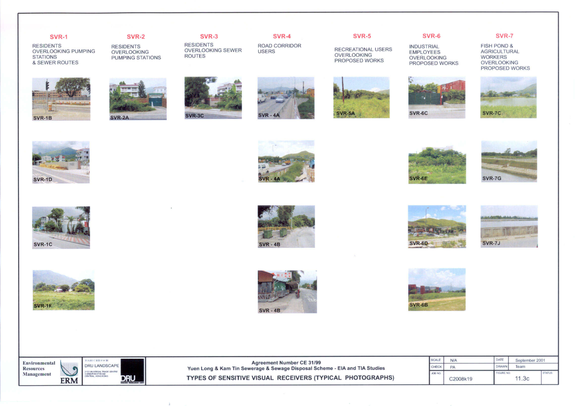
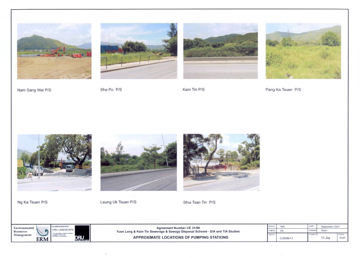
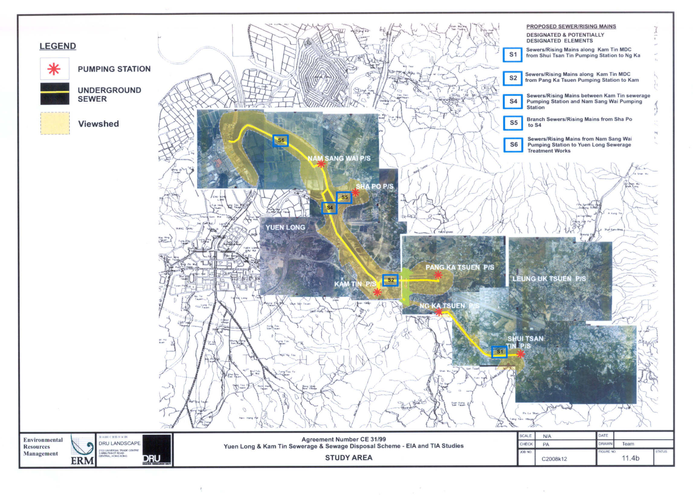
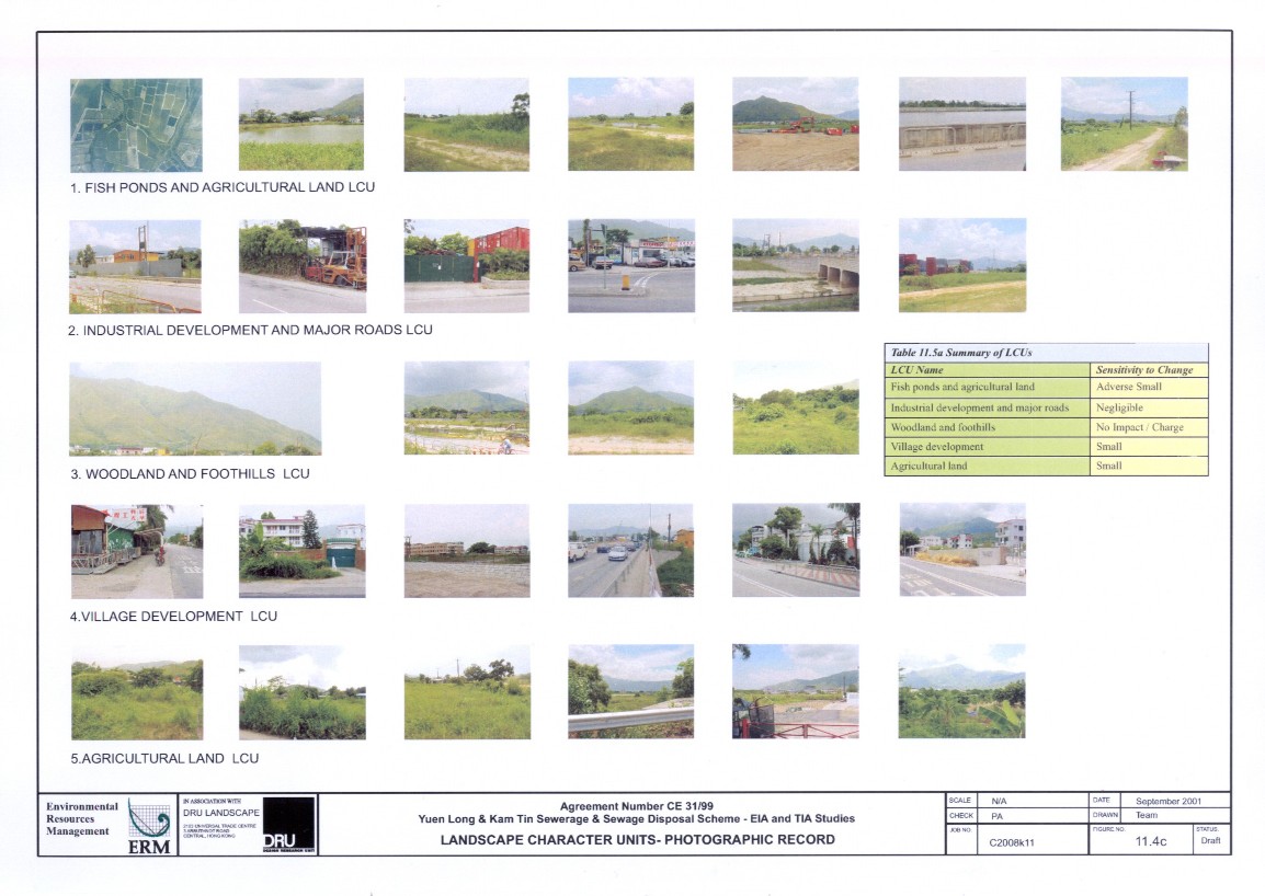
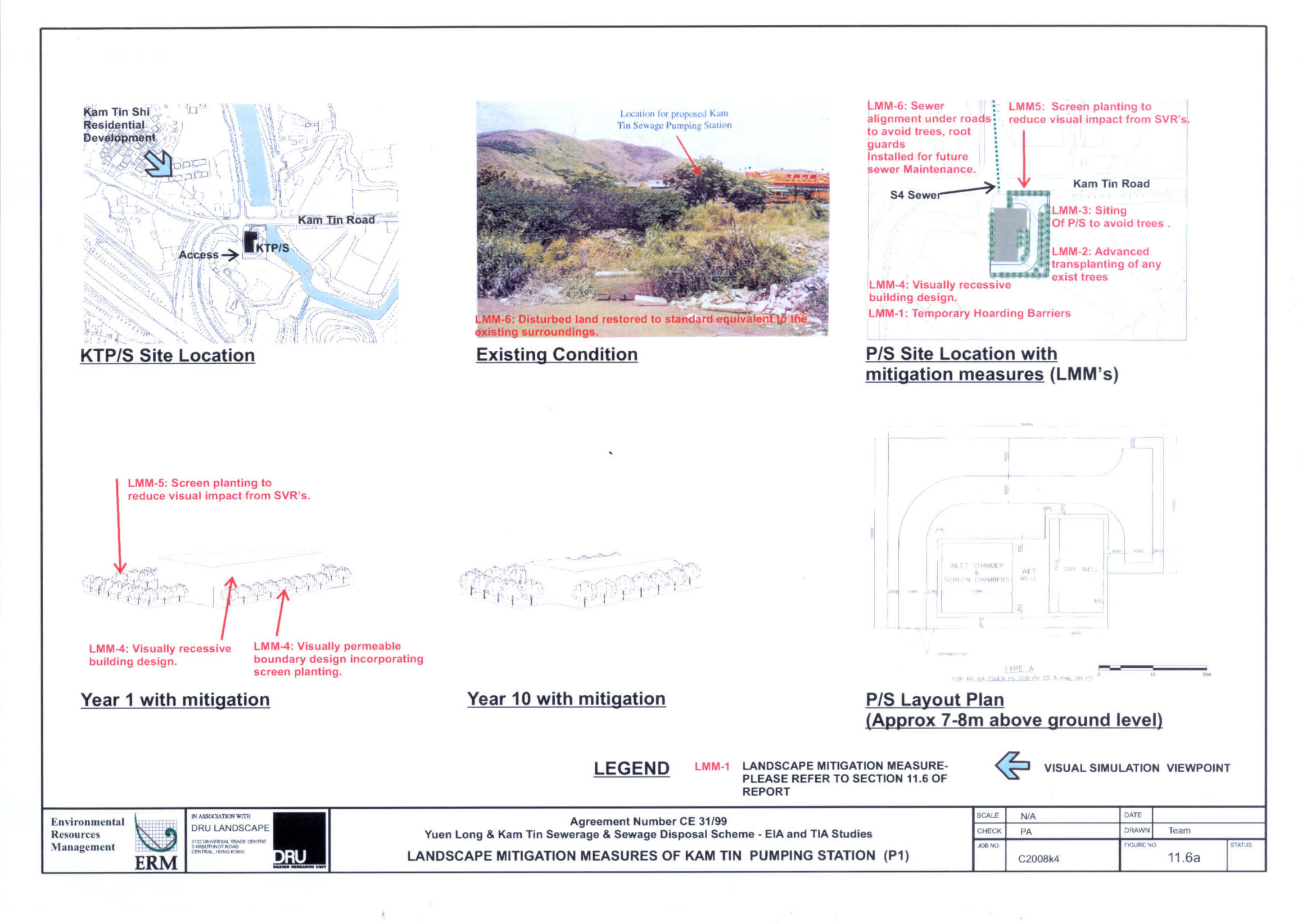
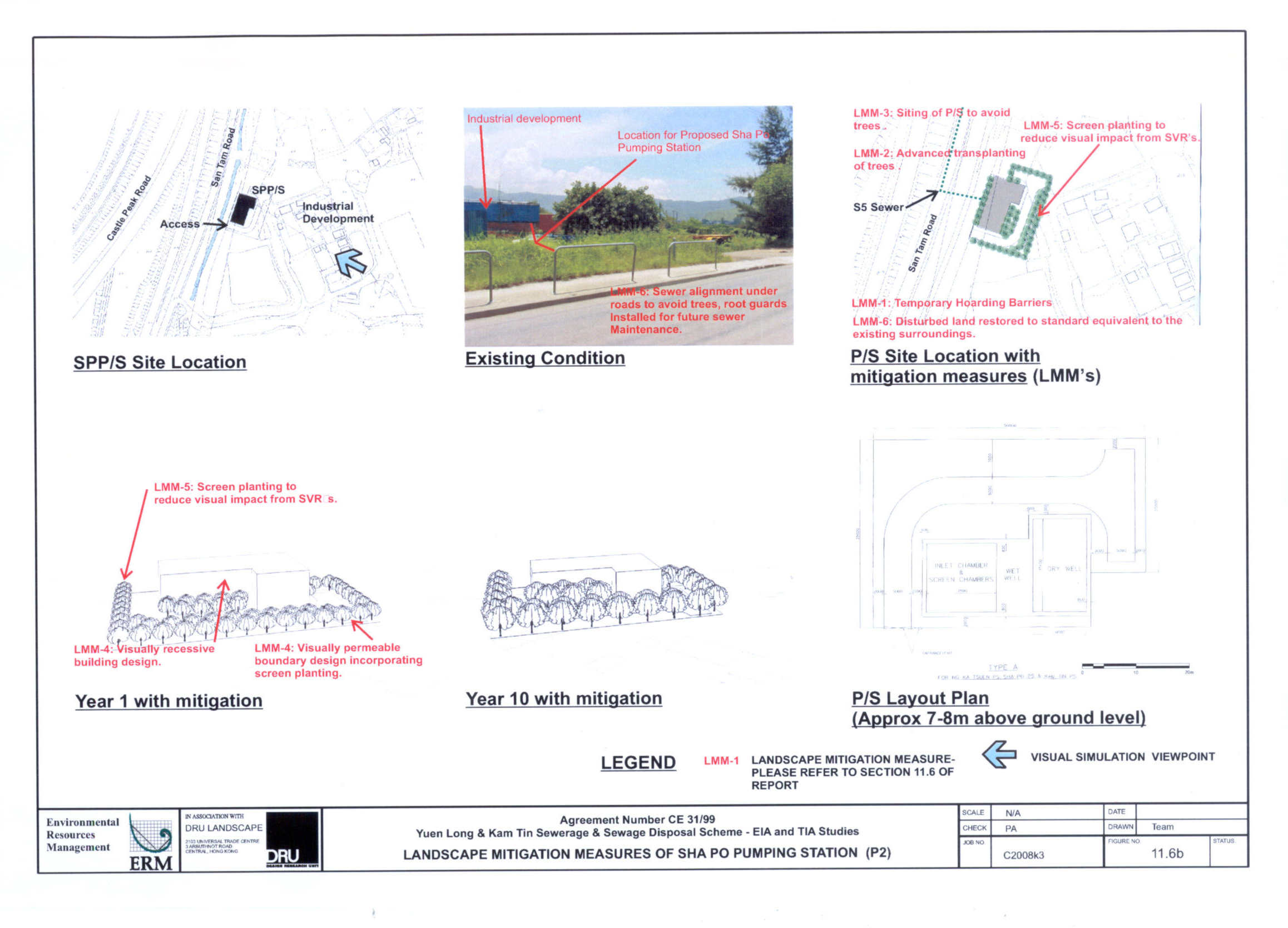
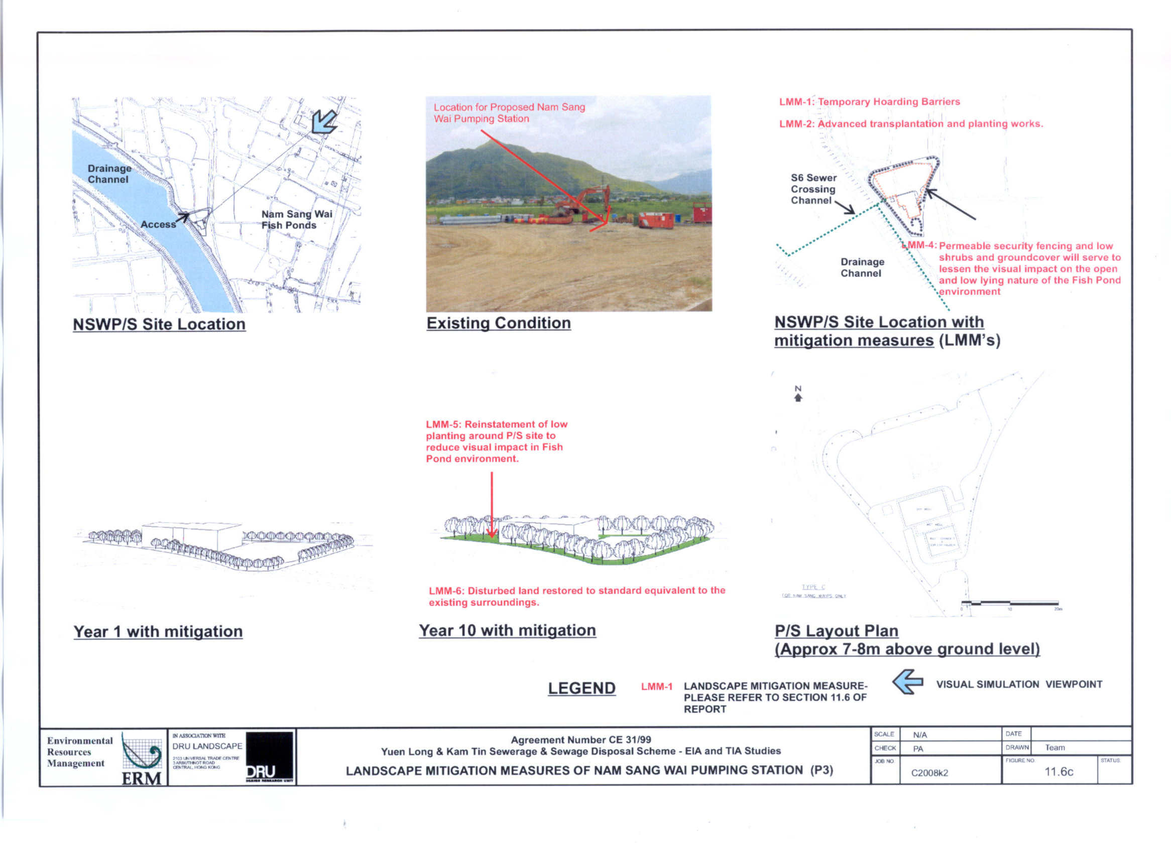
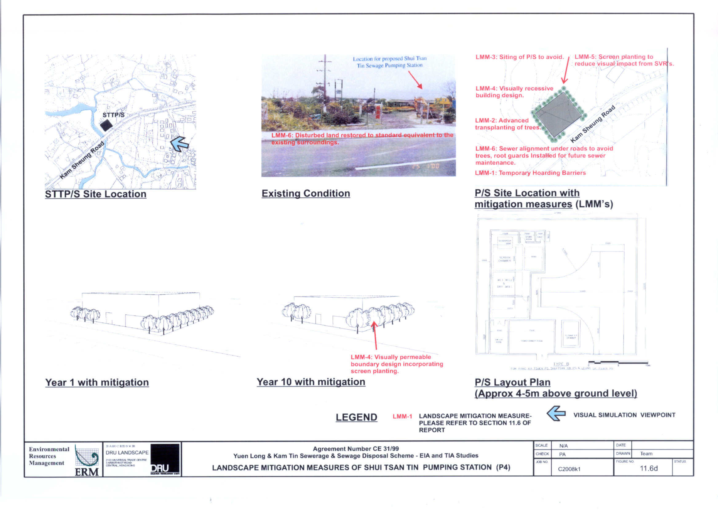
11. LANDSCAPE AND VISUAL IMPACT ASSESSMENT 11-1
12. ENVIRONMENTAL MONITORING AND
AUDIT
12-1
13. CONCLUSIONS
13-1
List of Figure for Report
ANNEXES
|
Annex A |
|
|
Annex B |
|
|
Annex C |
|
|
Annex D |
|
|
Annex E |
|
|
Annex F1 |
|
|
Annex F2 |
Location Maps
and Photographics Records of Identified Historical Building and Features |
|
Annex G |
|
|
|
|
List of figure for Annexs
|
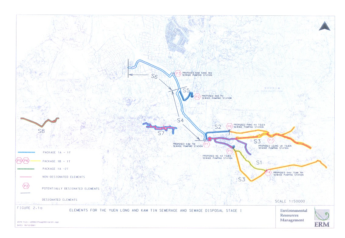
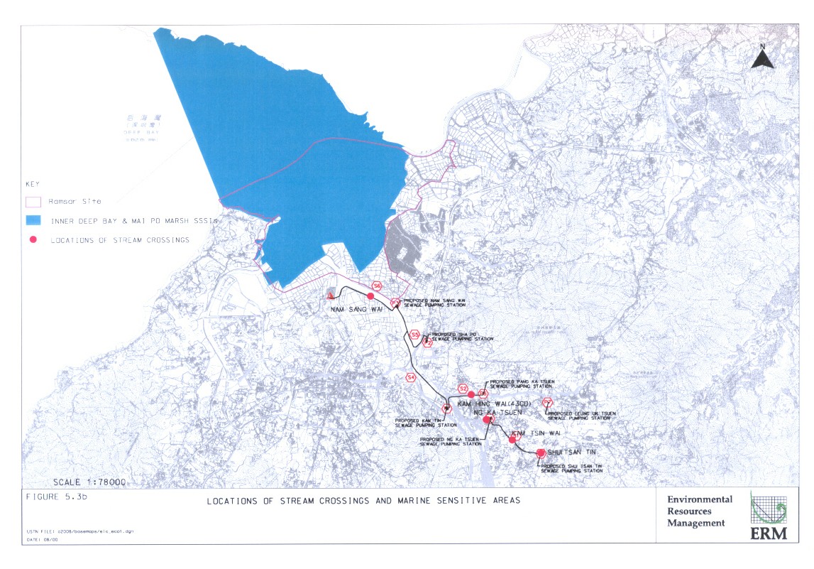
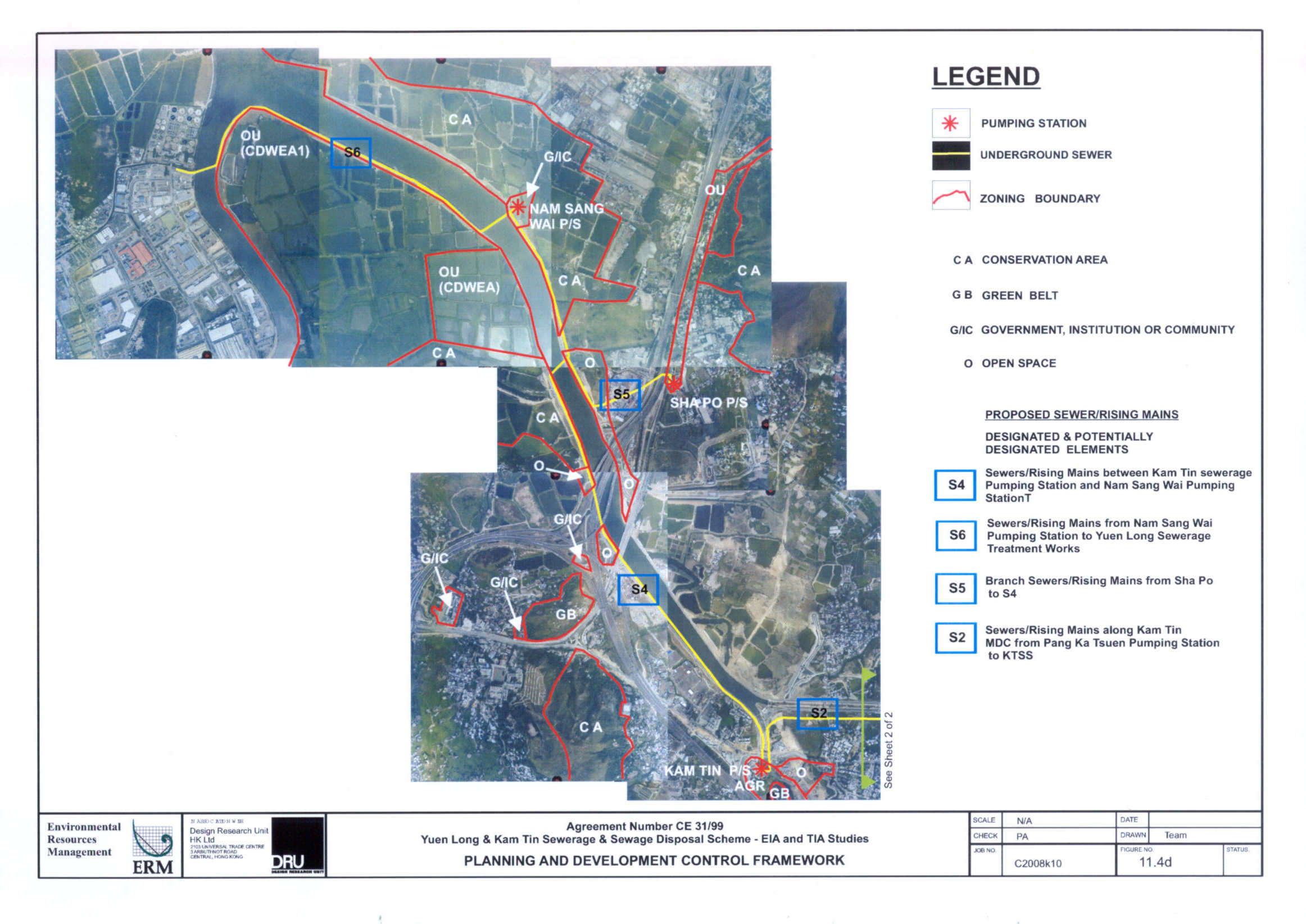
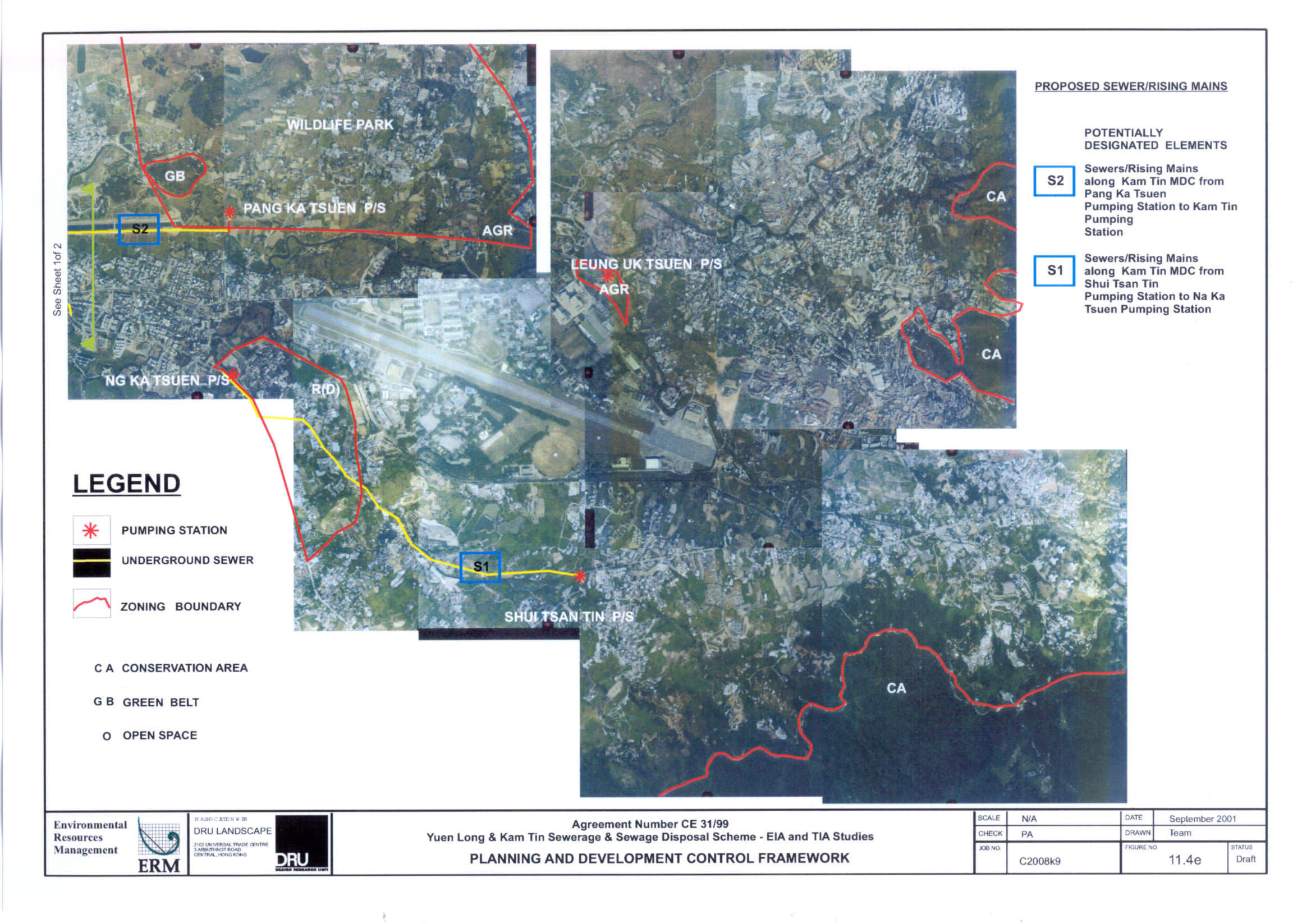
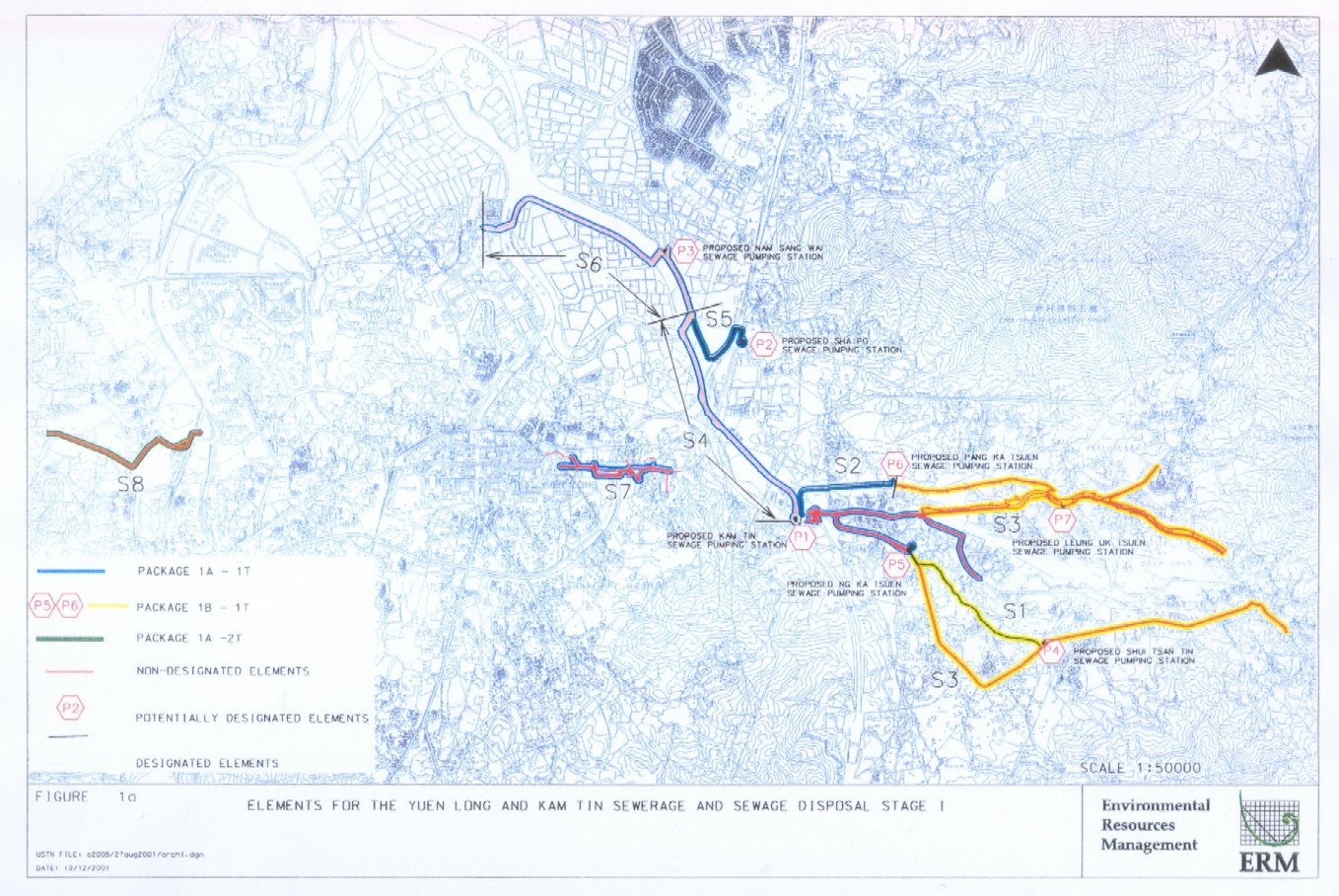
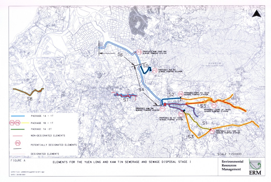
Figure 1a |
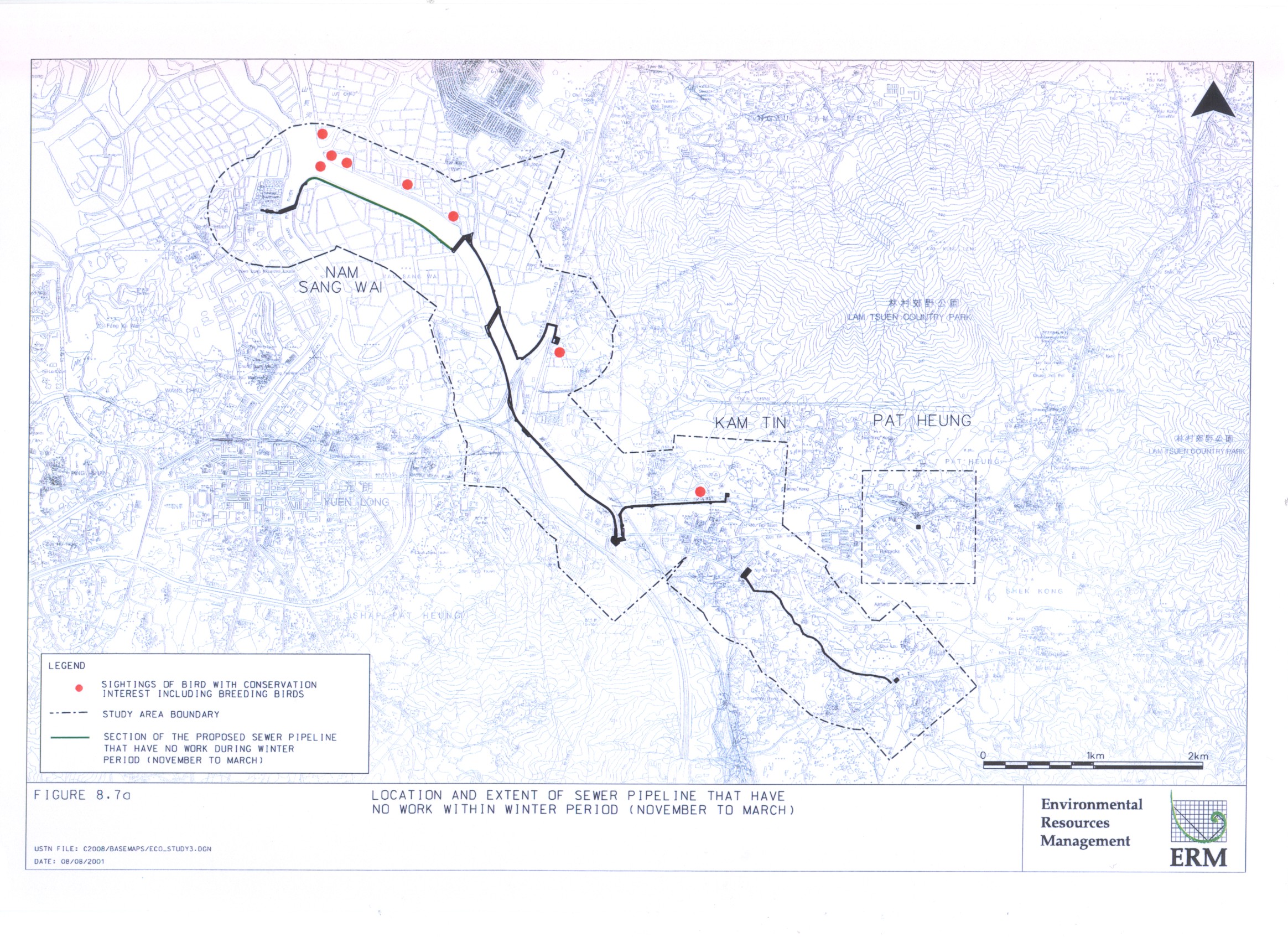
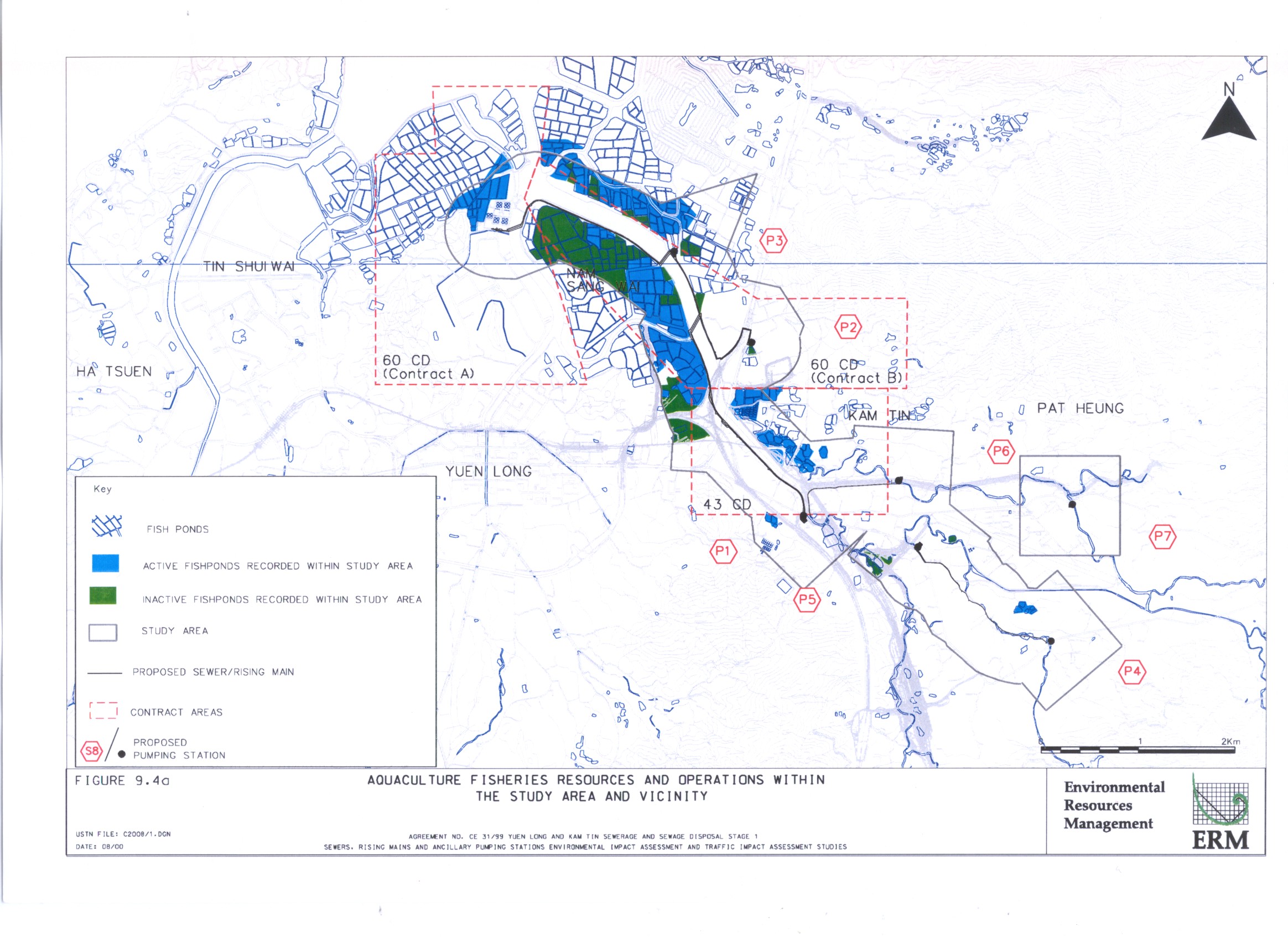
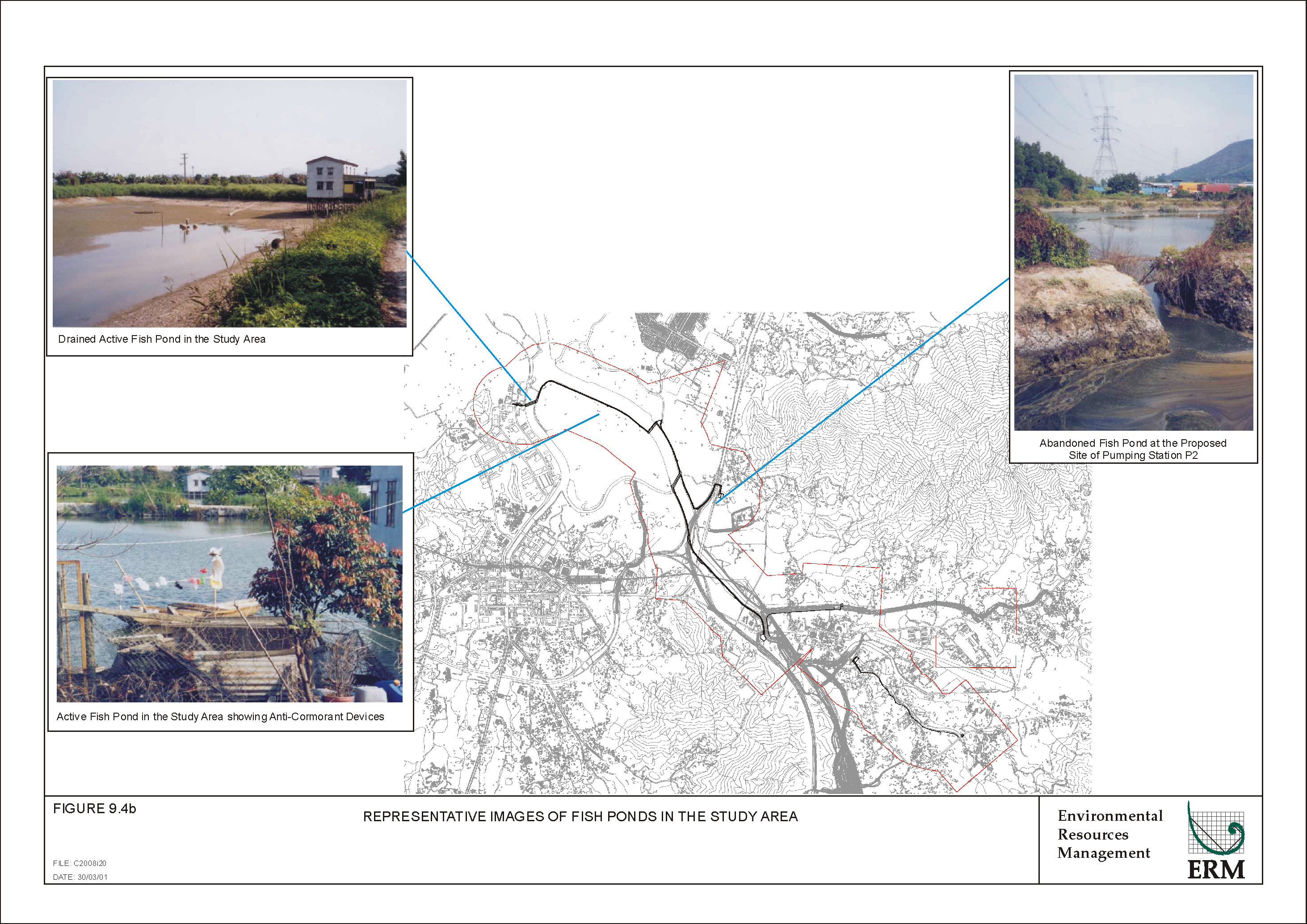
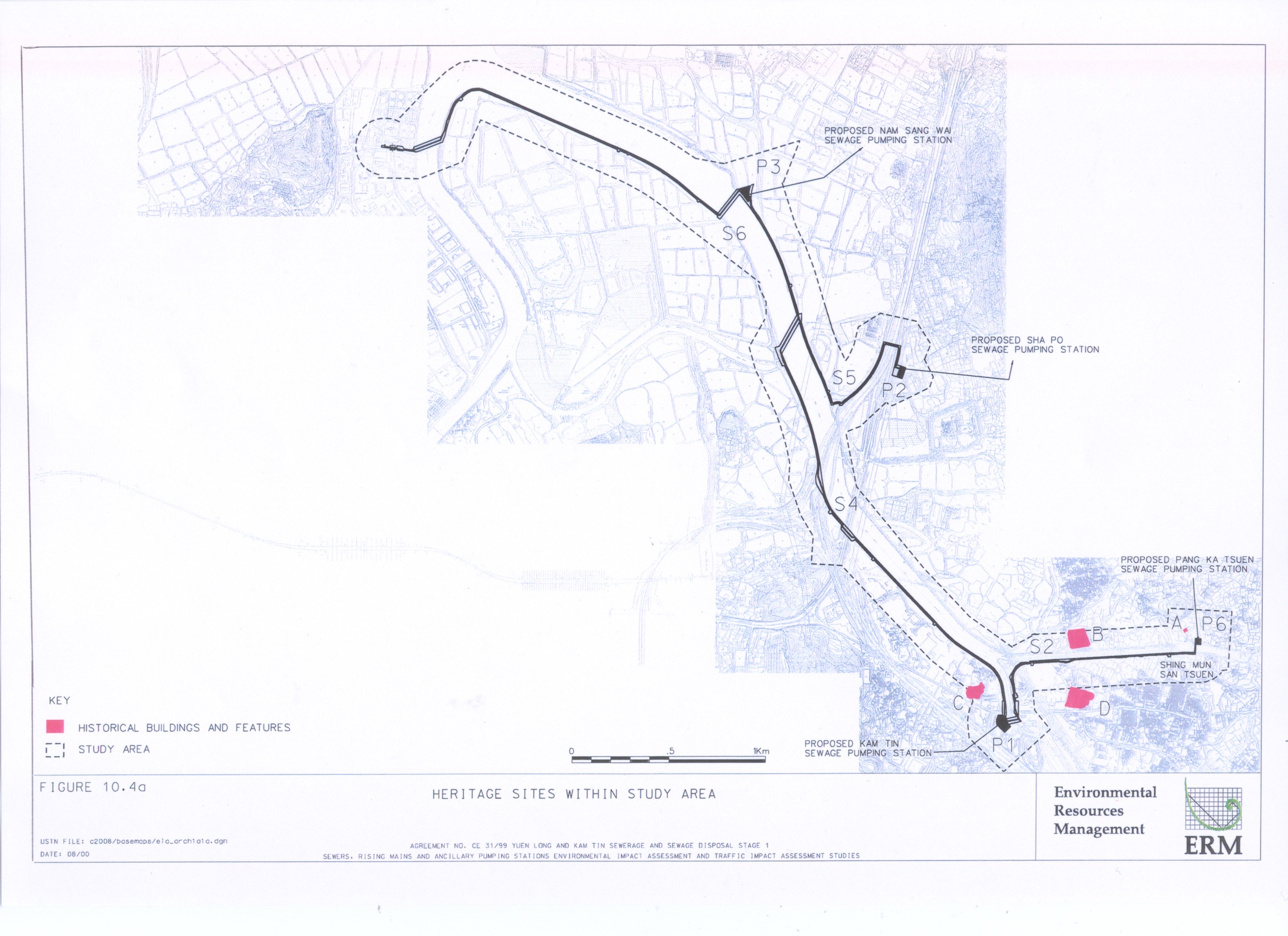
Elements for the yuen long and kam tin sewerage dosposal stage I |
|
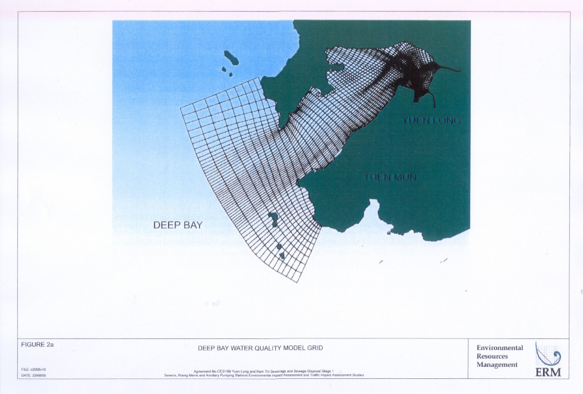
Figure 2a |
|
|
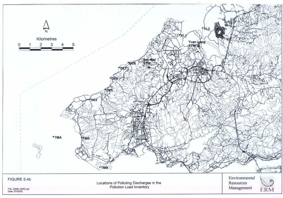
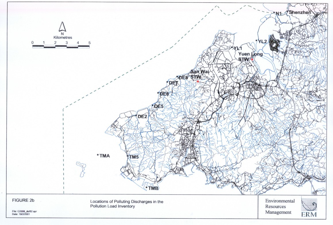
Figure 2b |
Location of polluting discharges in the
Pollution load Inventory |
|
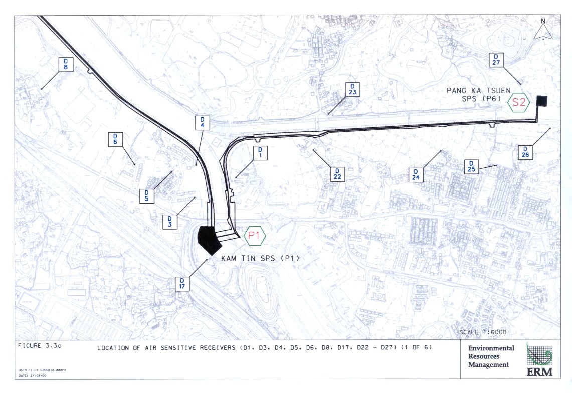
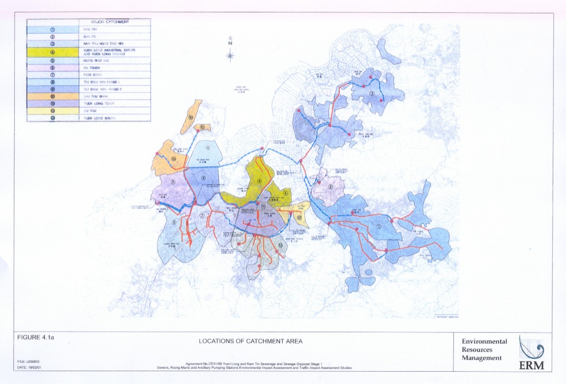
Figure
4.1a |
|
|
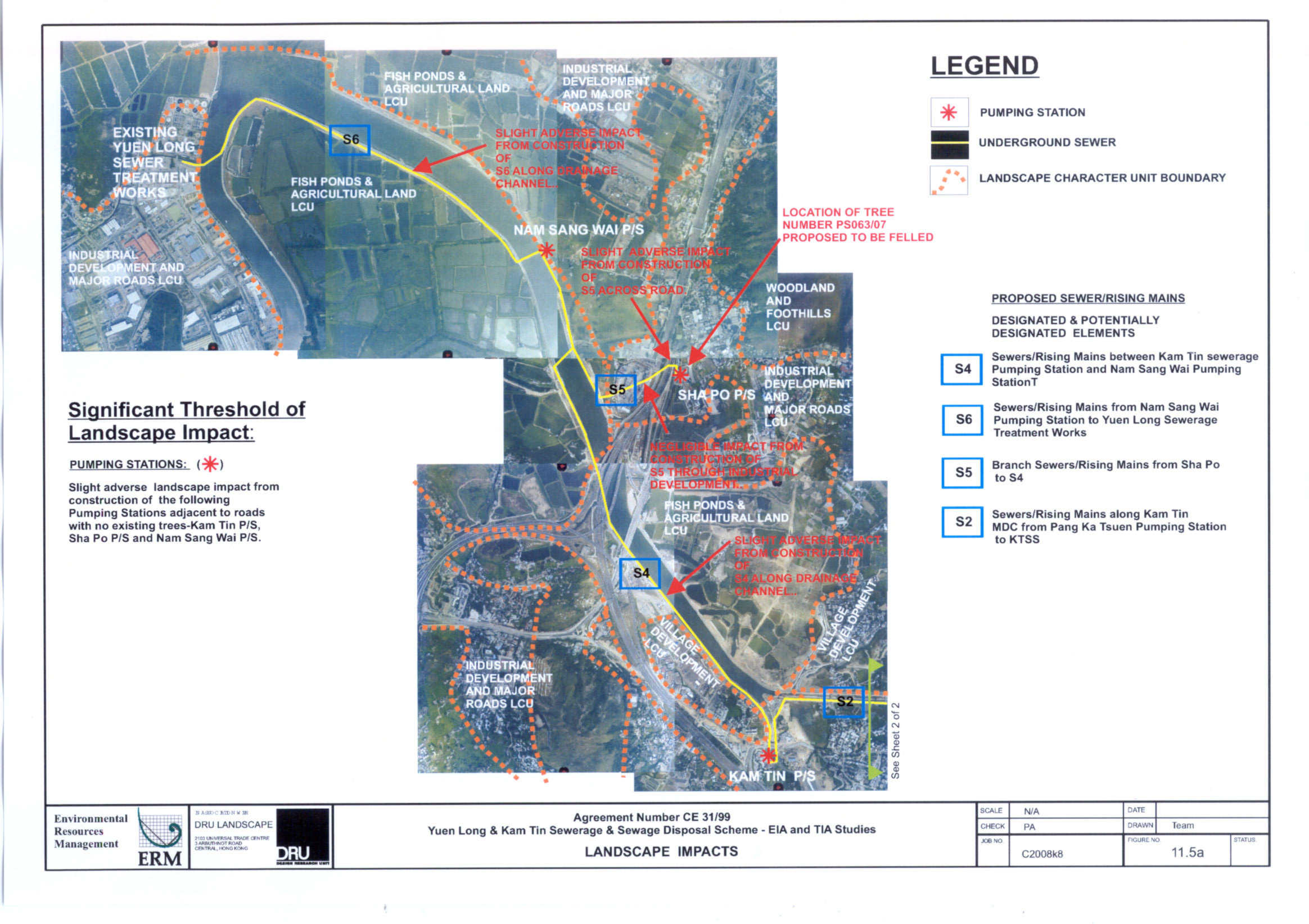
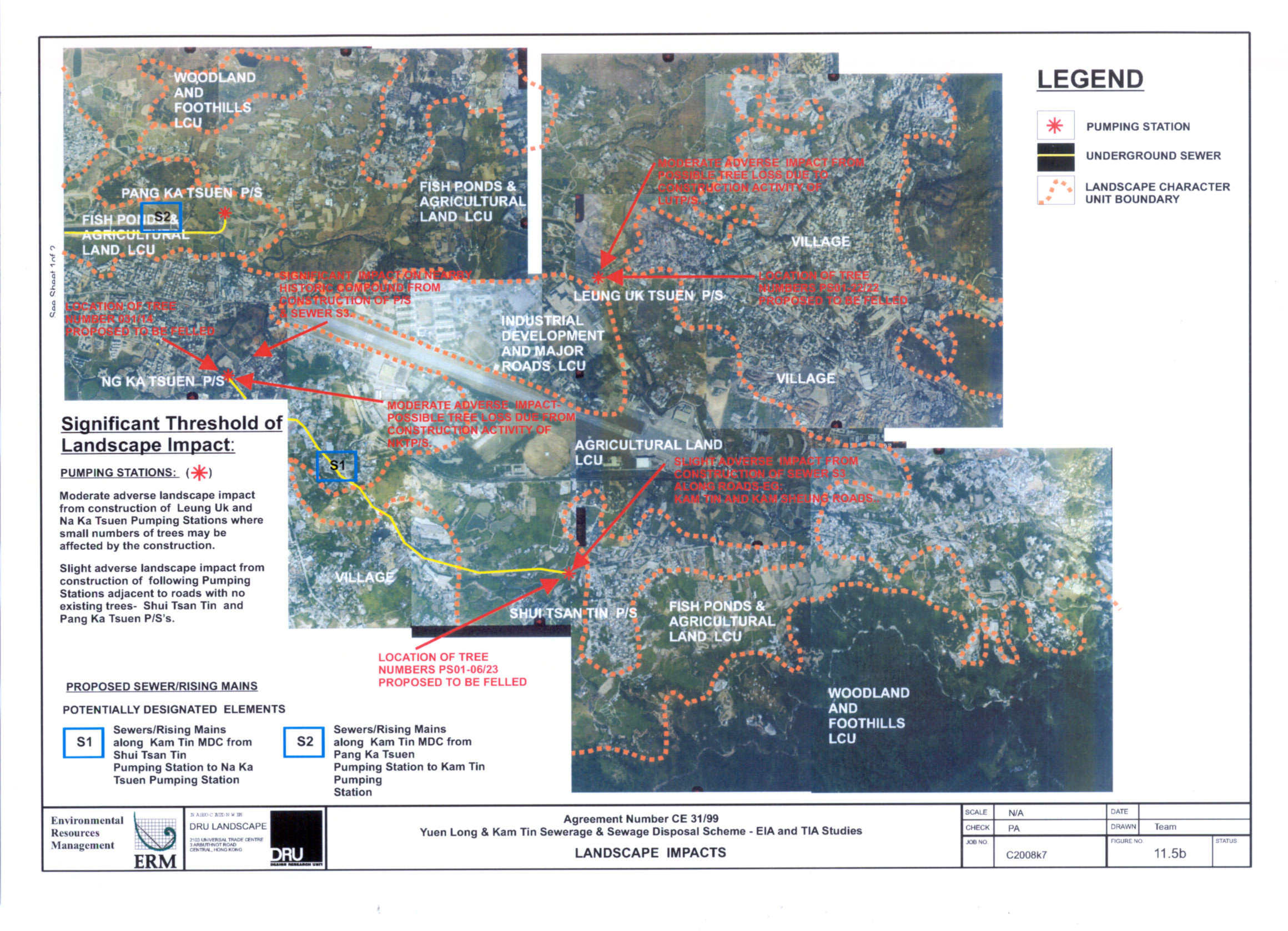
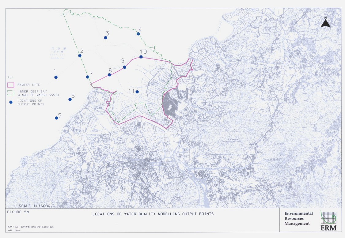
Figure 5a |
|
|
Annex B2 |
|
|
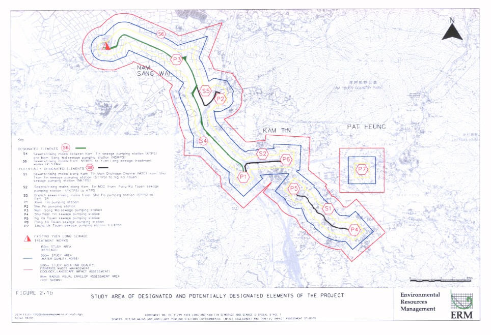
Figure A |
Elements for the yuen long and kam tin sewerage and sewage
dIsposal stage I |
|
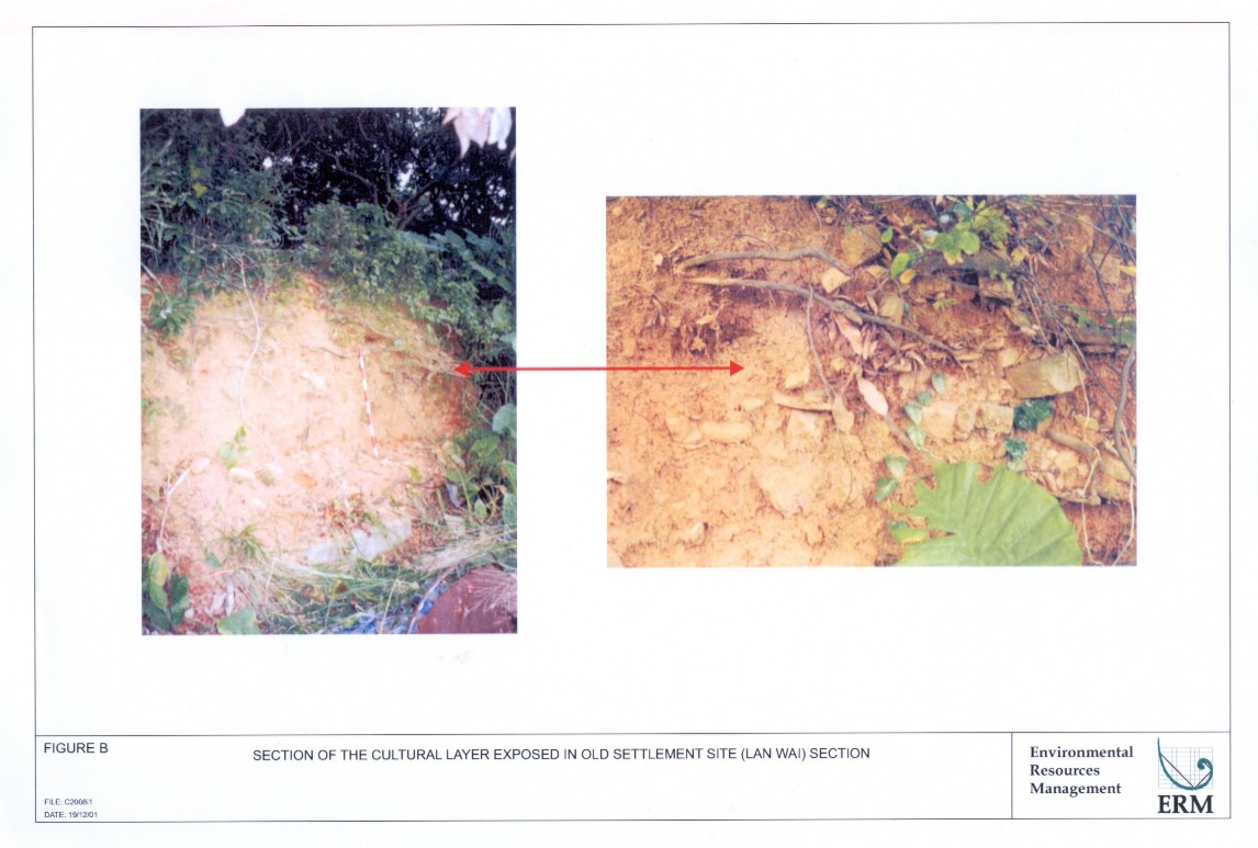
Figure B |
Section of the cultural layer exposed in
old settlement site (lan wai) section |
|
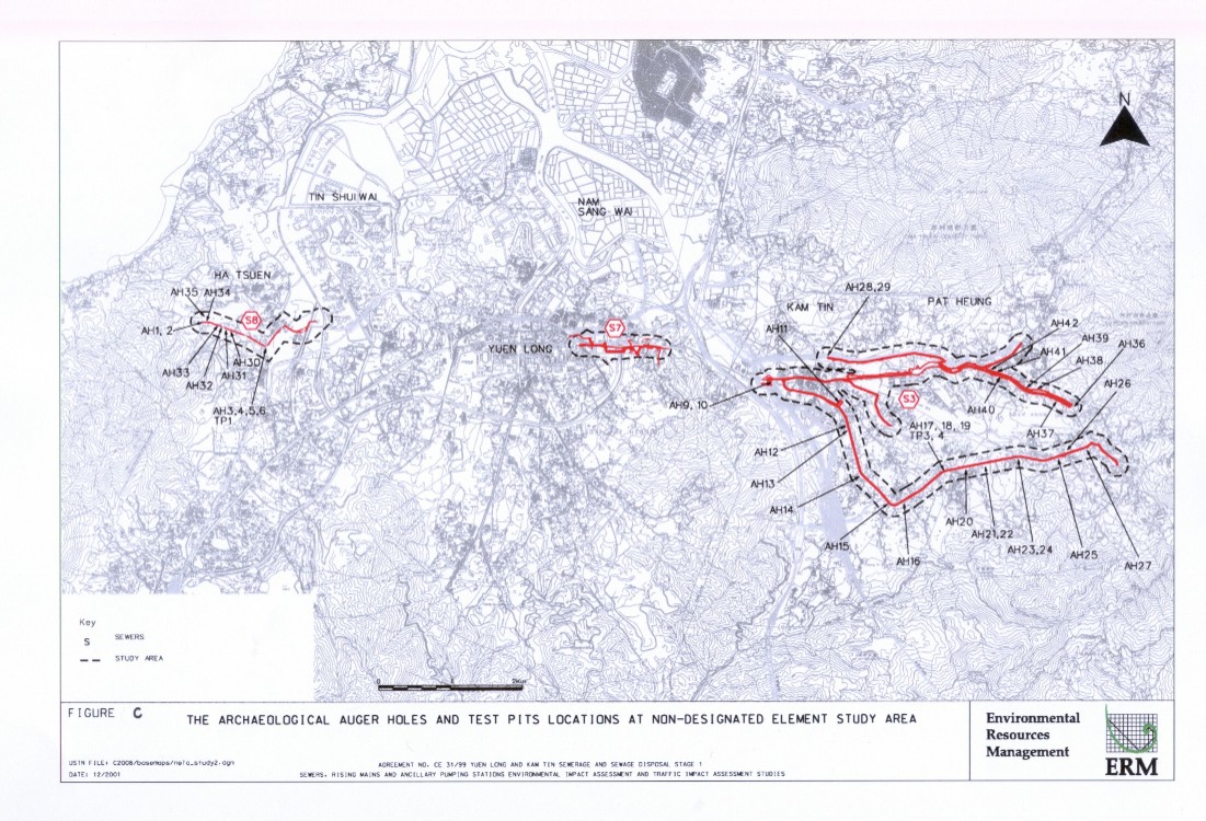
Figure C |
The archaeological auger holes and test
pits locations at non-designated elements study ares |
|
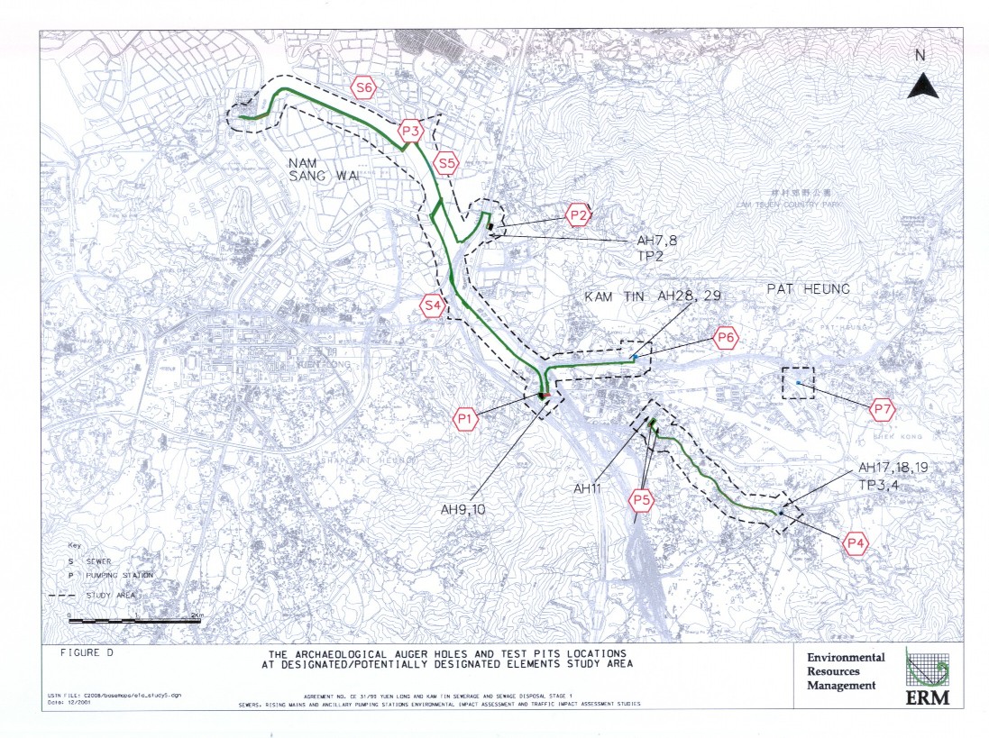
Figure D |
|
|
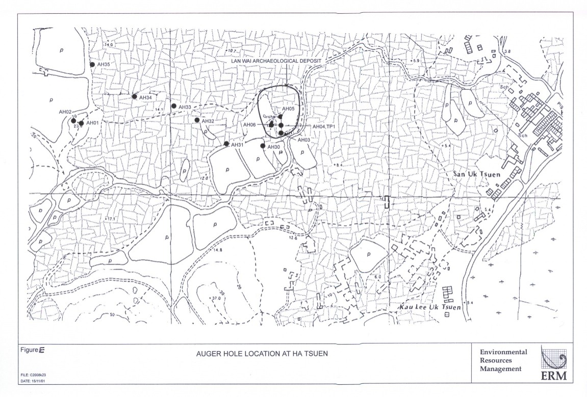
Figure E |
|
|
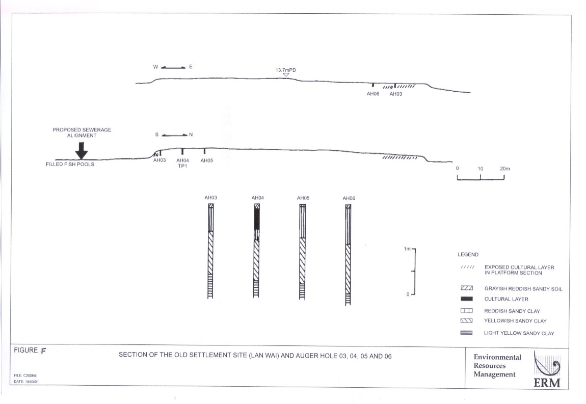
Figure F |
Section of the old settlement site (lan
wal) and auger hole 03, 04, 05 and 06 |
|
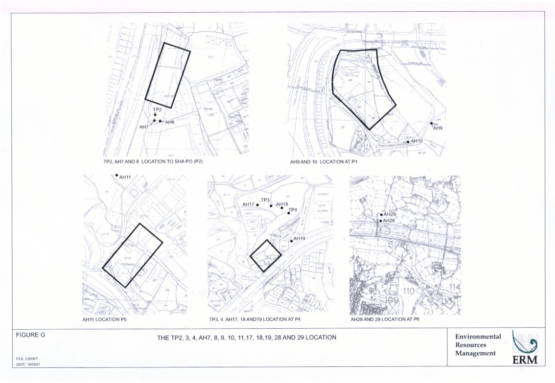
Figure G |
The tp2, 3, 4, ah7, 8, 9, 10, 11, 17,
18, 19, 28 and 29 location |
|
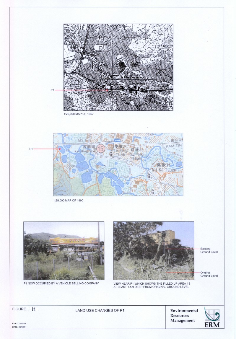
Figure H |
|
|
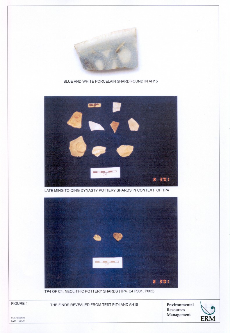
Figure I |
|
|
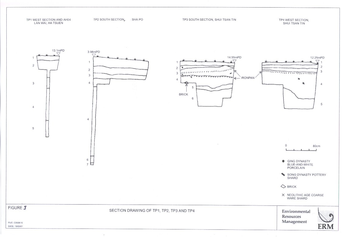
Figure J |
|
|
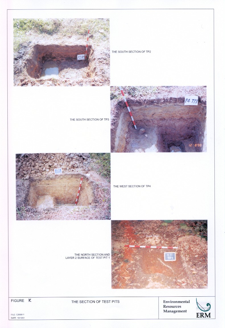
Figure K |
|
|
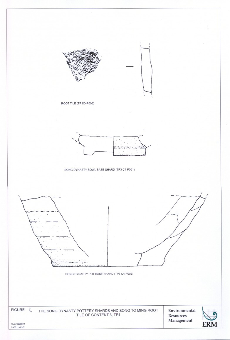
Figure L |
The song dynasty pottery shards and song
to ming root tile of content 3, tp4 |
|
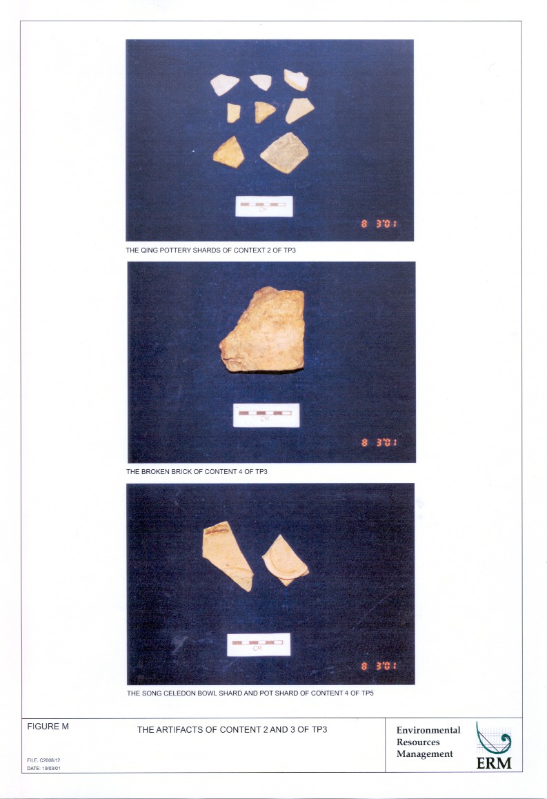
Figure M |
|
|
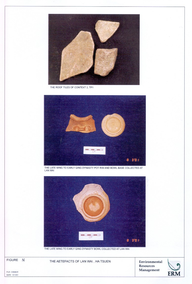
Figure N |
|
|
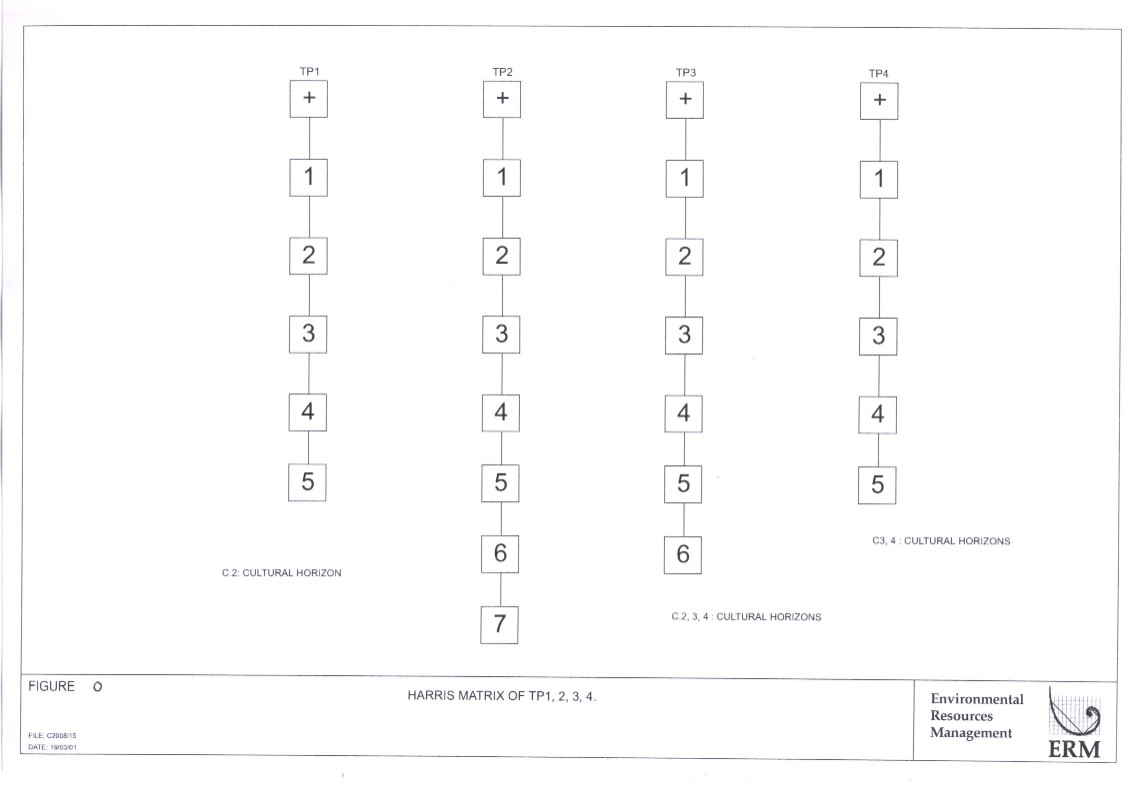
Figure O |
|
|
Annex F2 |
Location
Maps and Photographic Records of Identified Historical Building and Features |
|
|
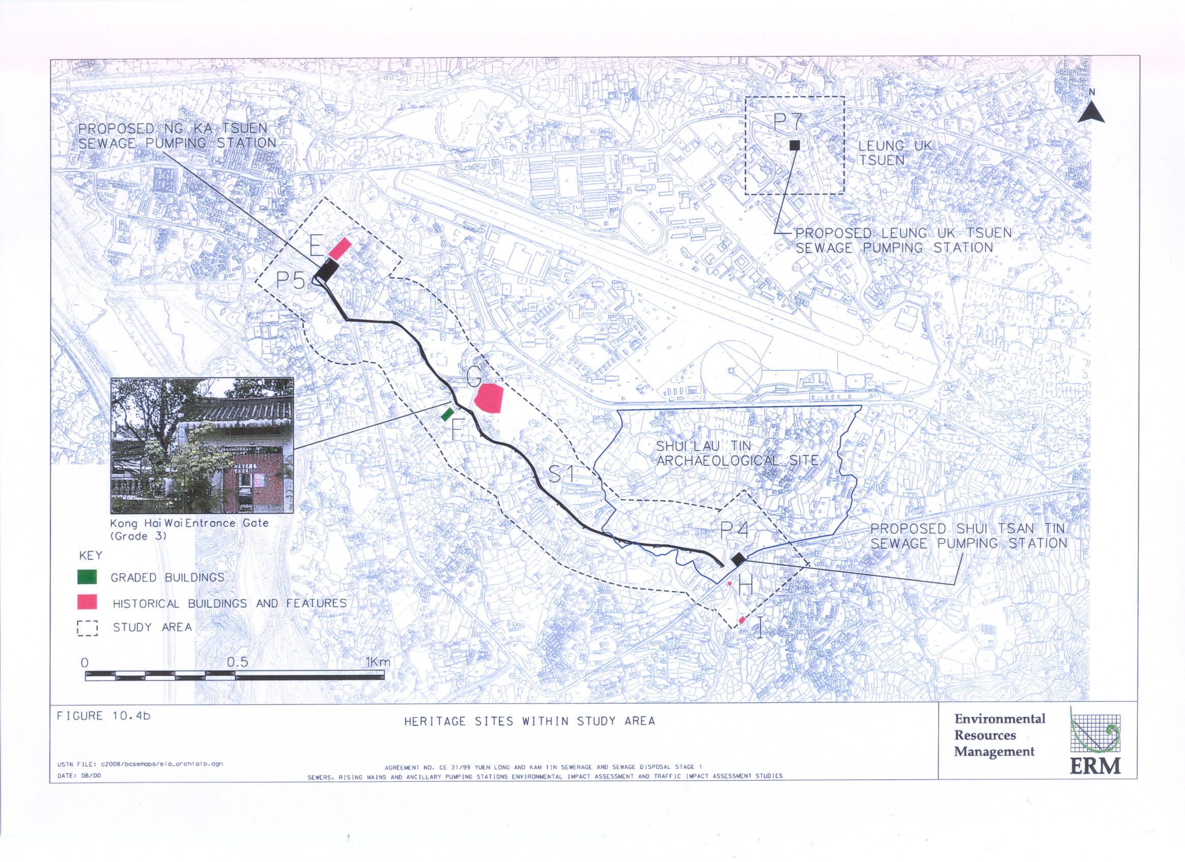
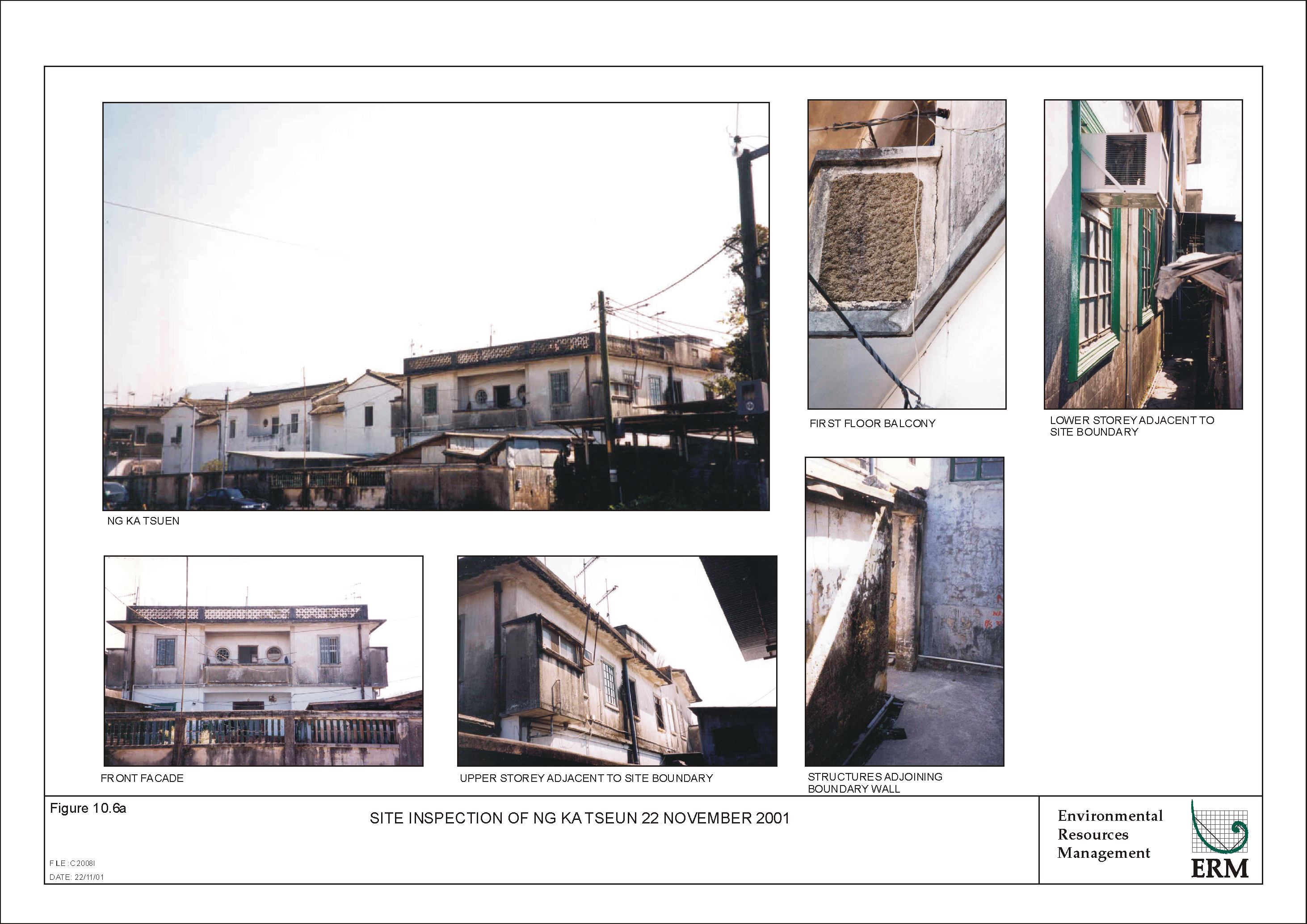
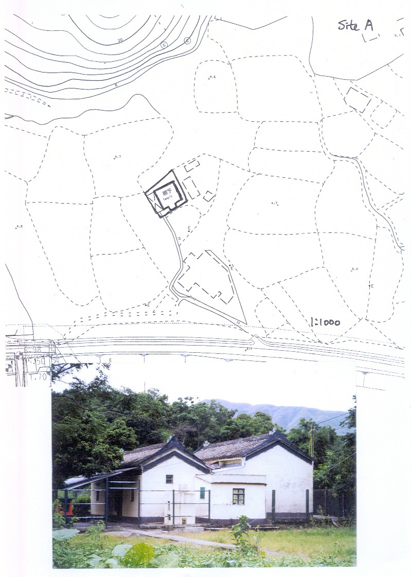
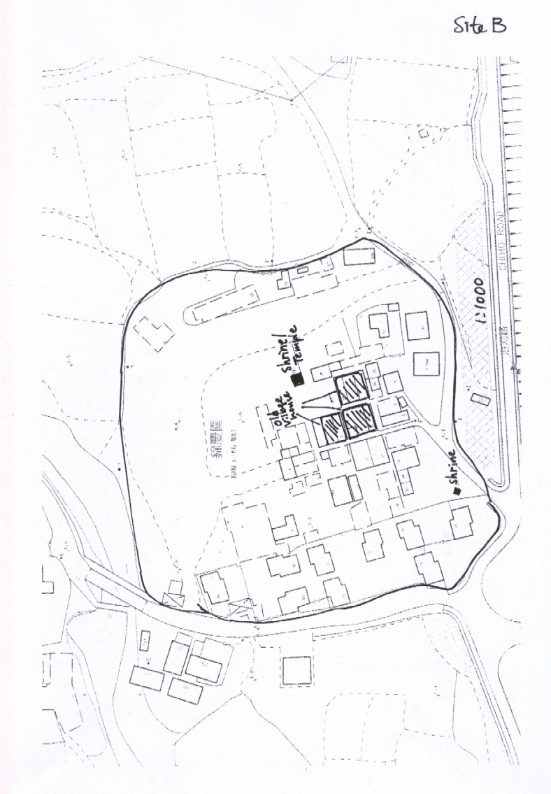
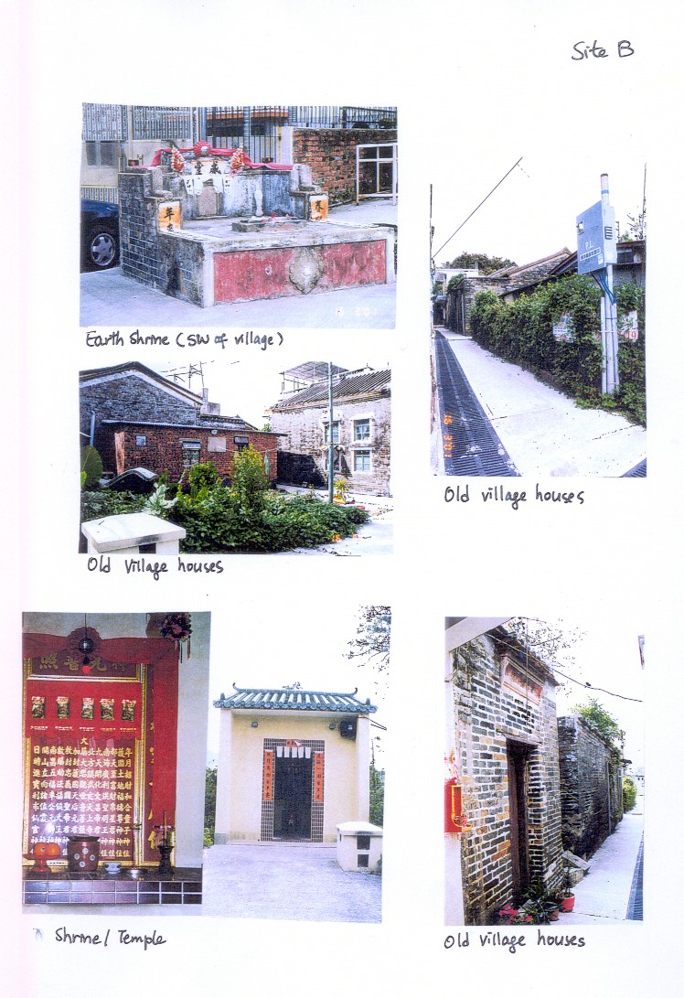
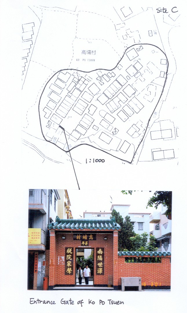
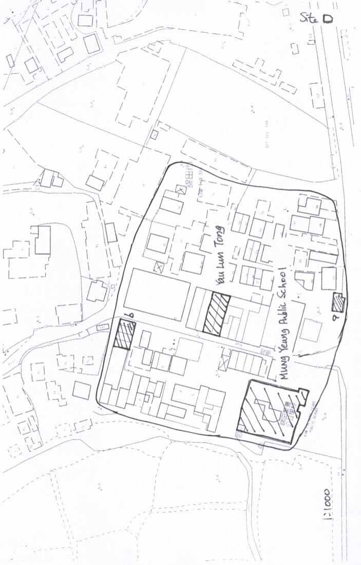
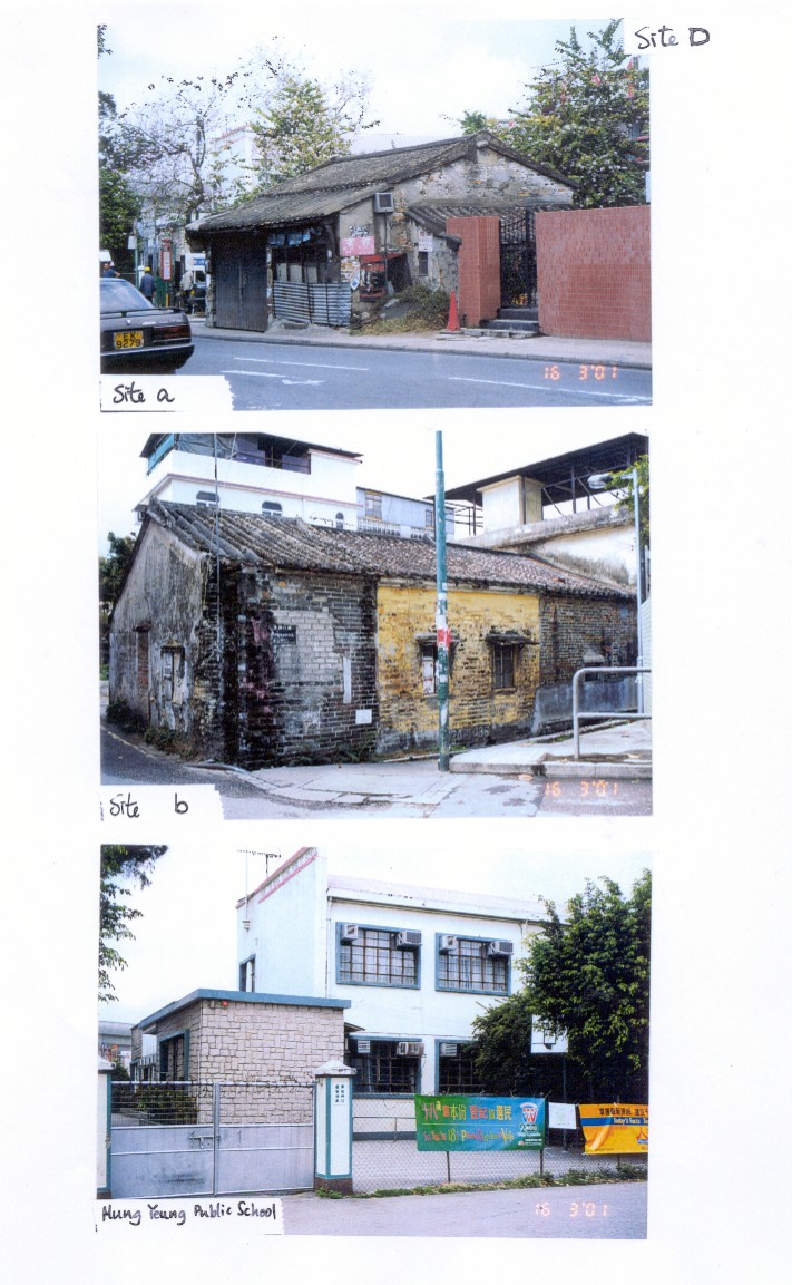
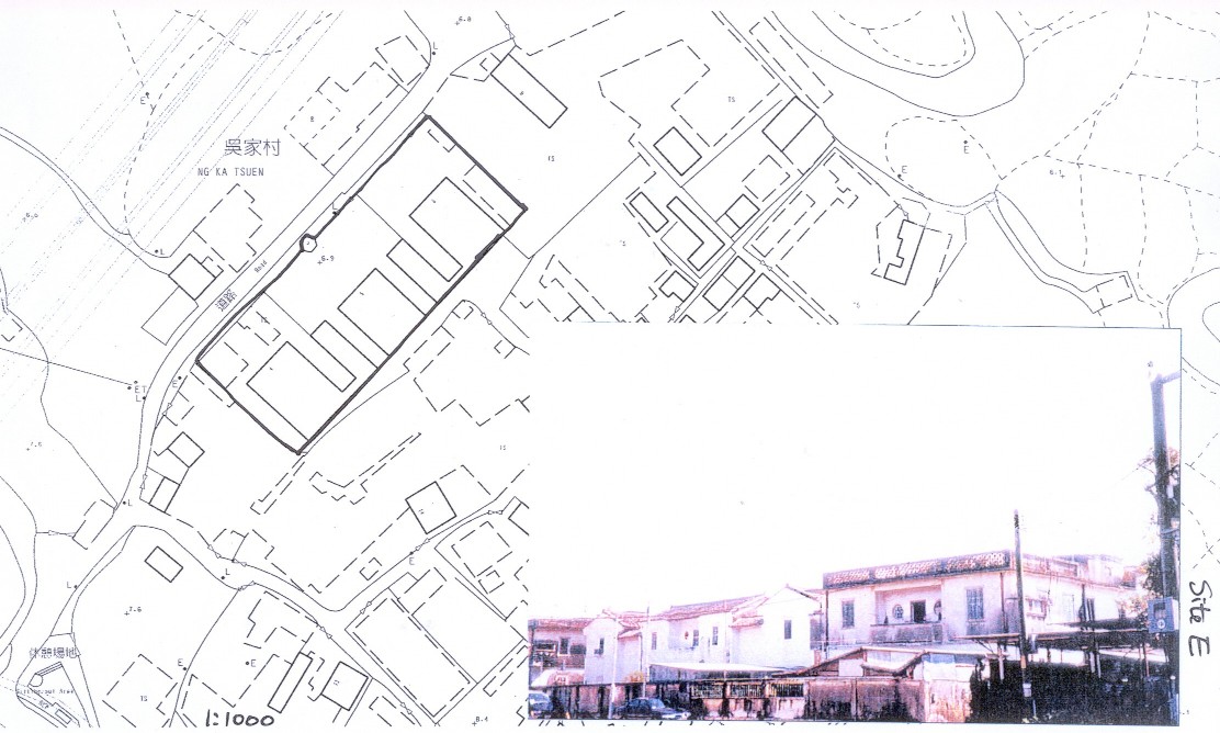
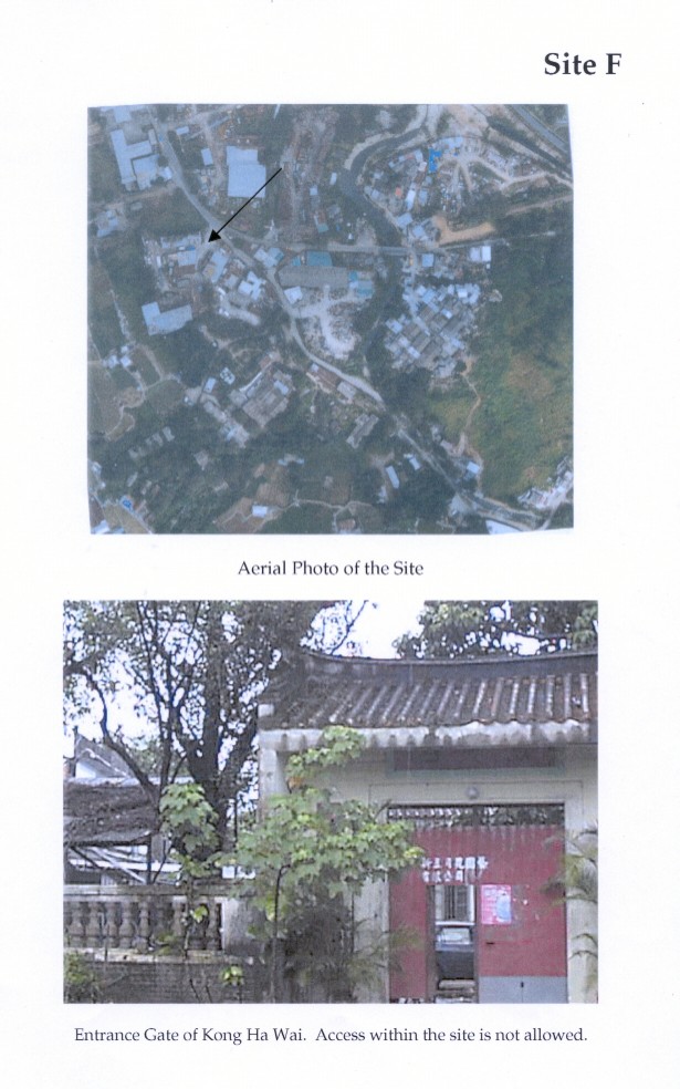
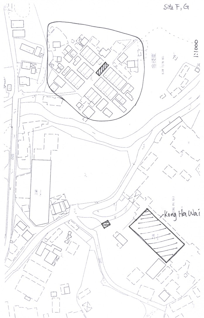
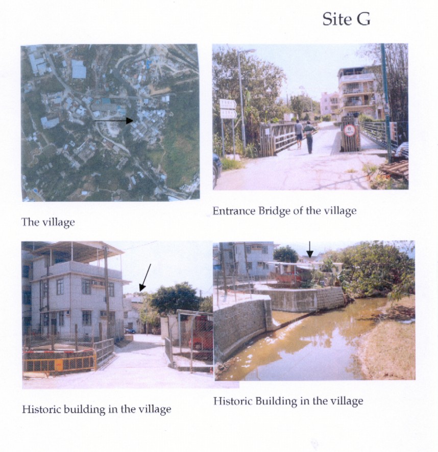
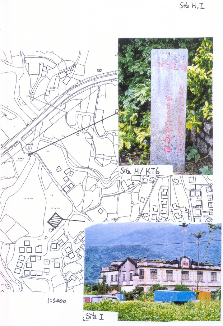
SitE A, Site B, Site B1, Site C, Site D, Site D1, Site E, Site F, Site F&G,
Site G, Site H & I |
|
|
|