LIST OF FIGURES
|
|
|
|
Figure 2.1
|
Location of the
Alignment and Extent of the Works
|
Figure 2.2
|
Yuen Long Highway Widening Project Implementation Programme –
Construction Stage Details
Sheet 1, 2,
3
|
Figure 2.3
|
Typical
Section of Yuen Long Highway
Sheet
1, 2,
3, 4,
5
|
Figure 2.4
|
Works Areas
|
Figure 3.1
|
District
Zoning Adjacent to Yuen Long Highway
Sheet
1, 2,
3, 4,
5, 6
|
Figure 3.2
|
Locations
of Noise Sensitive Receivers
Key, Sheet 1,
2, 3,
4, 5,
6, 7,
8, 9,
10, 11,
12, 13,
14
|
Figure 3.3 a
|
Projected
Traffic Flows in Year 2021
|
Figure 3.3 b
|
Projected
Traffic Flows in Year 2021 – CE 66/96 Planning and Development Study on
NWNT
|
Figure 3.3 c
|
Projected
Traffic Flows in Year 2021 (Fu Tei Interchange)
|
Figure 3.4
|
Proposed
Noise Mitigation Measures
Sheet 1, 2,
3, 4,
5, 6,
7, 8
|
Figure 3.5
|
Typical Section
of Noise Barrier
|
Figure 4.1
|
Annual Wind Roses
for Automatic Weather Stations in 2000
|
Figure 4.2
|
Pollutant
Isopleths – NO2 (1 hour)
|
Figure 4.3
|
Pollutant
Isopleths – NO2 (24 hours)
|
Figure 4.4
|
Pollutant
Isopleths – RSP (24 hours)
|
Figure 4.5
|
Locations
of Air Sensitive Receivers
Key, Sheet 1,
2, 3,
4, 5,
6, 7,
8, 9,
10, 11,
12, 13,
14
|
Figure 5.1
|
Water Sensitive
Receivers and EPD Routine Water Quality Monitoring Locations
|
Figure 7.1
|
Potentially
Contaminated Land Uses
|
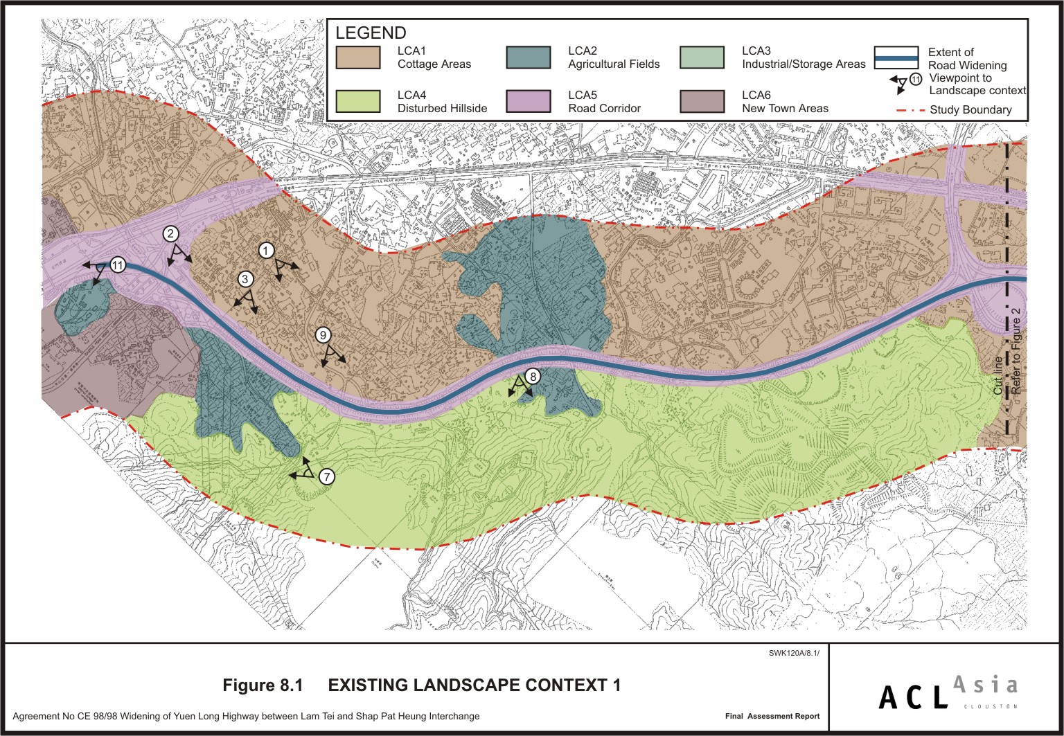
Figure 8.1
|
Existing
Landscape Context 1
|
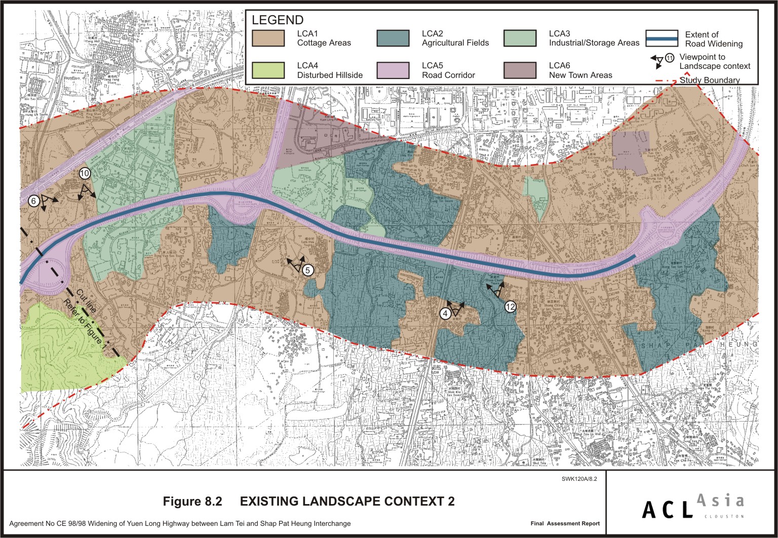
Figure 8.2
|
Existing
Landscape Context 2
|
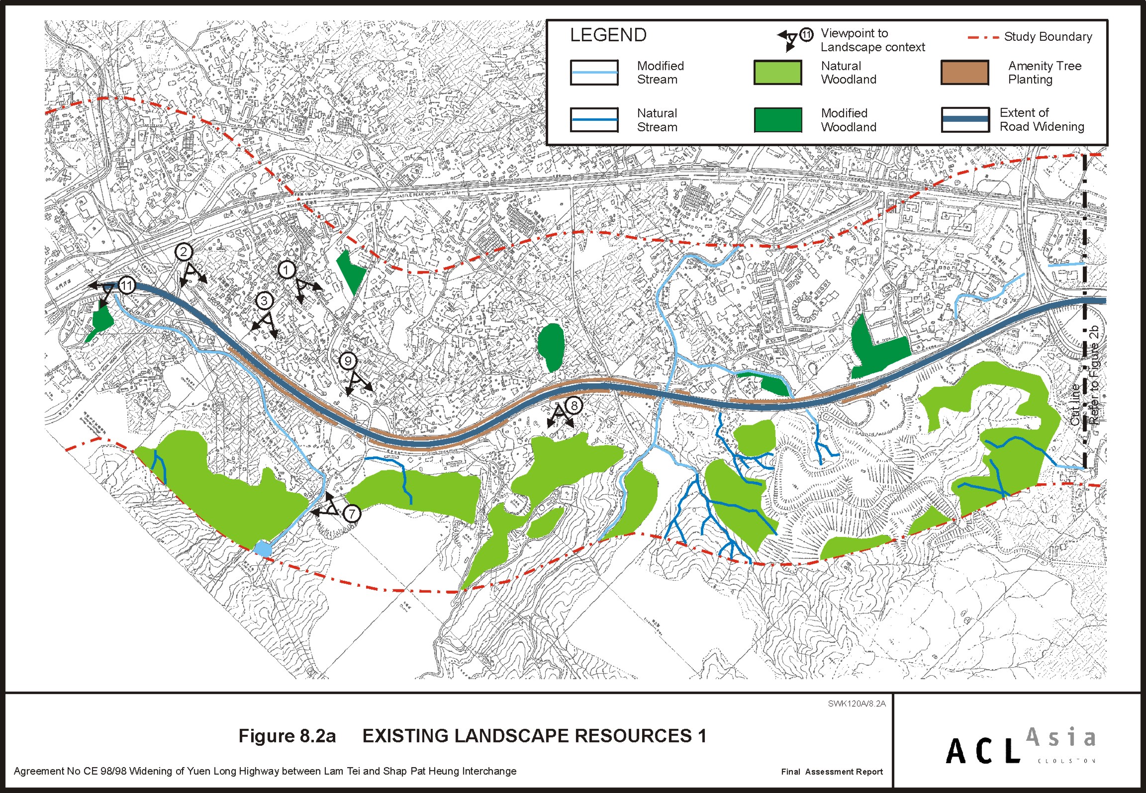
Figure 8.2 a
|
Existing
Landscape Resources 1
|
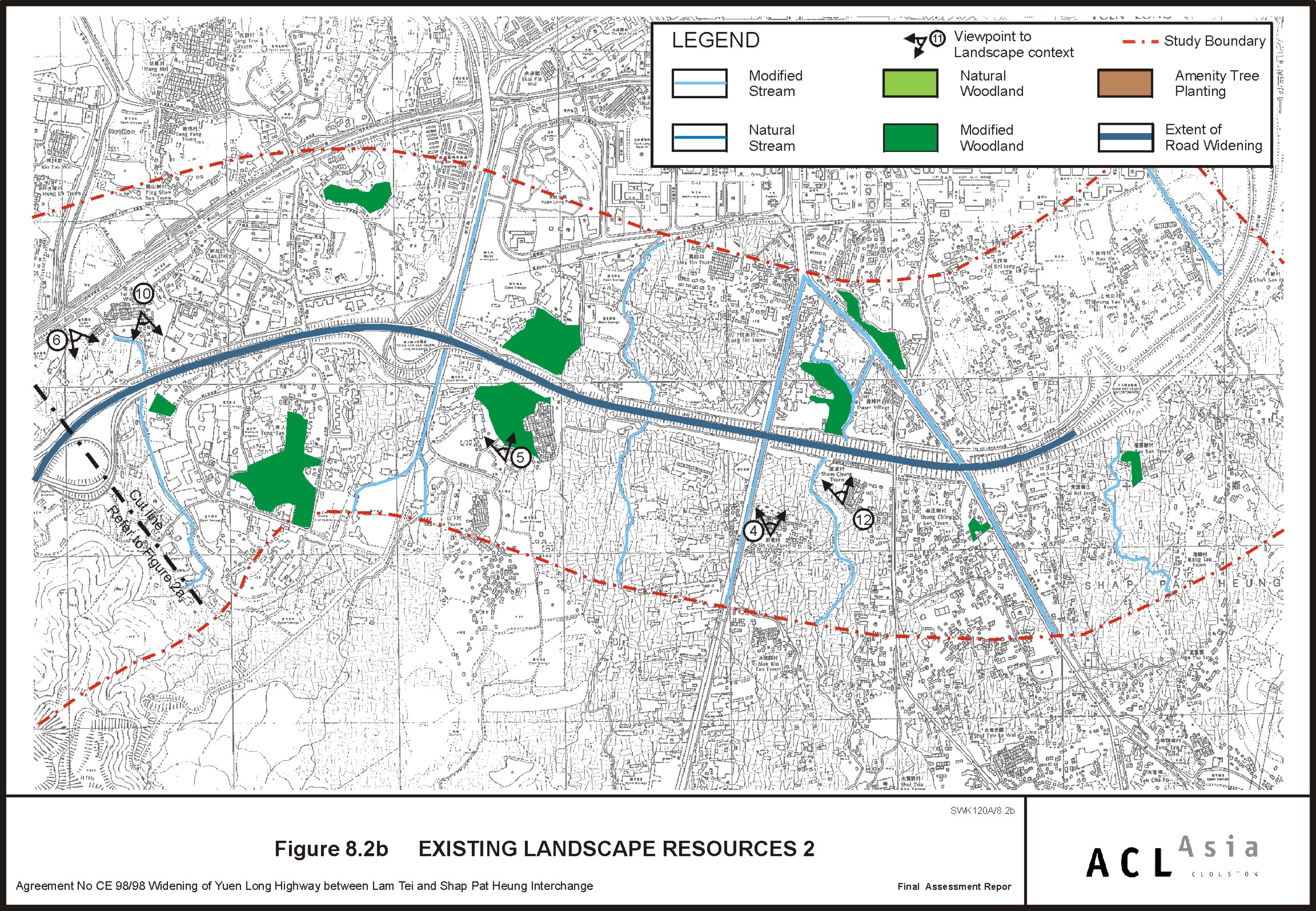
Figure 8.2 b
|
Existing
Landscape Resources 2
|
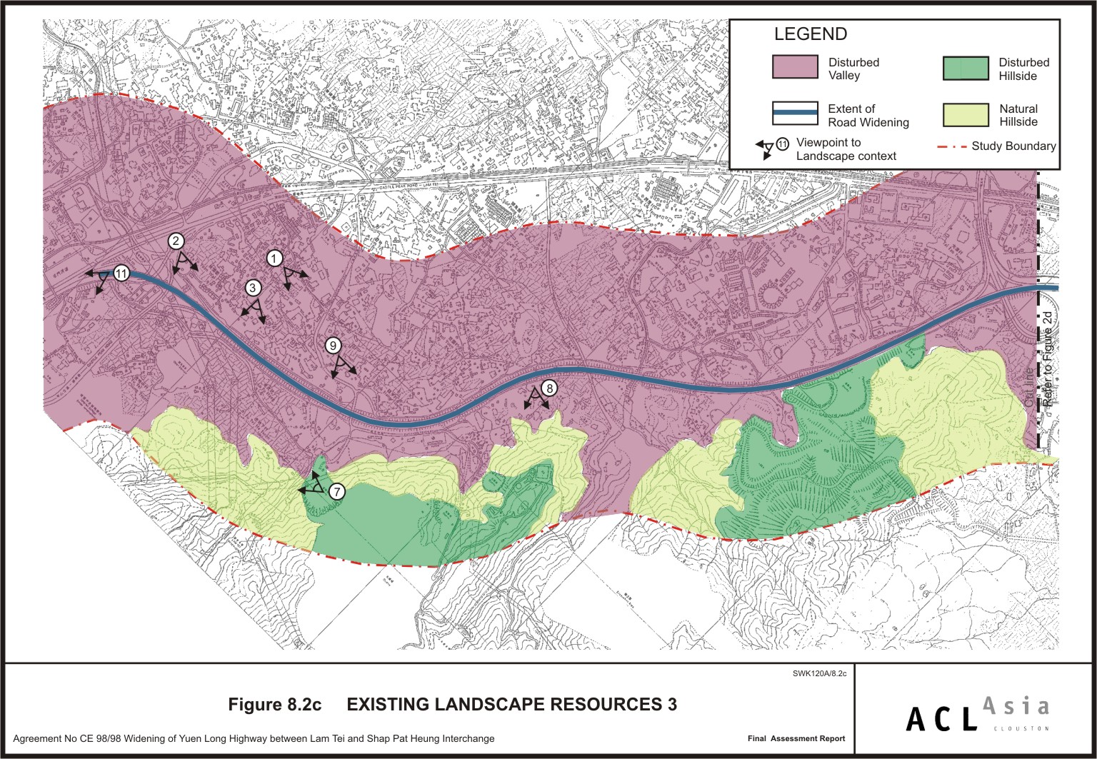
Figure 8.2 c
|
Existing
Landscape Resources 3
|
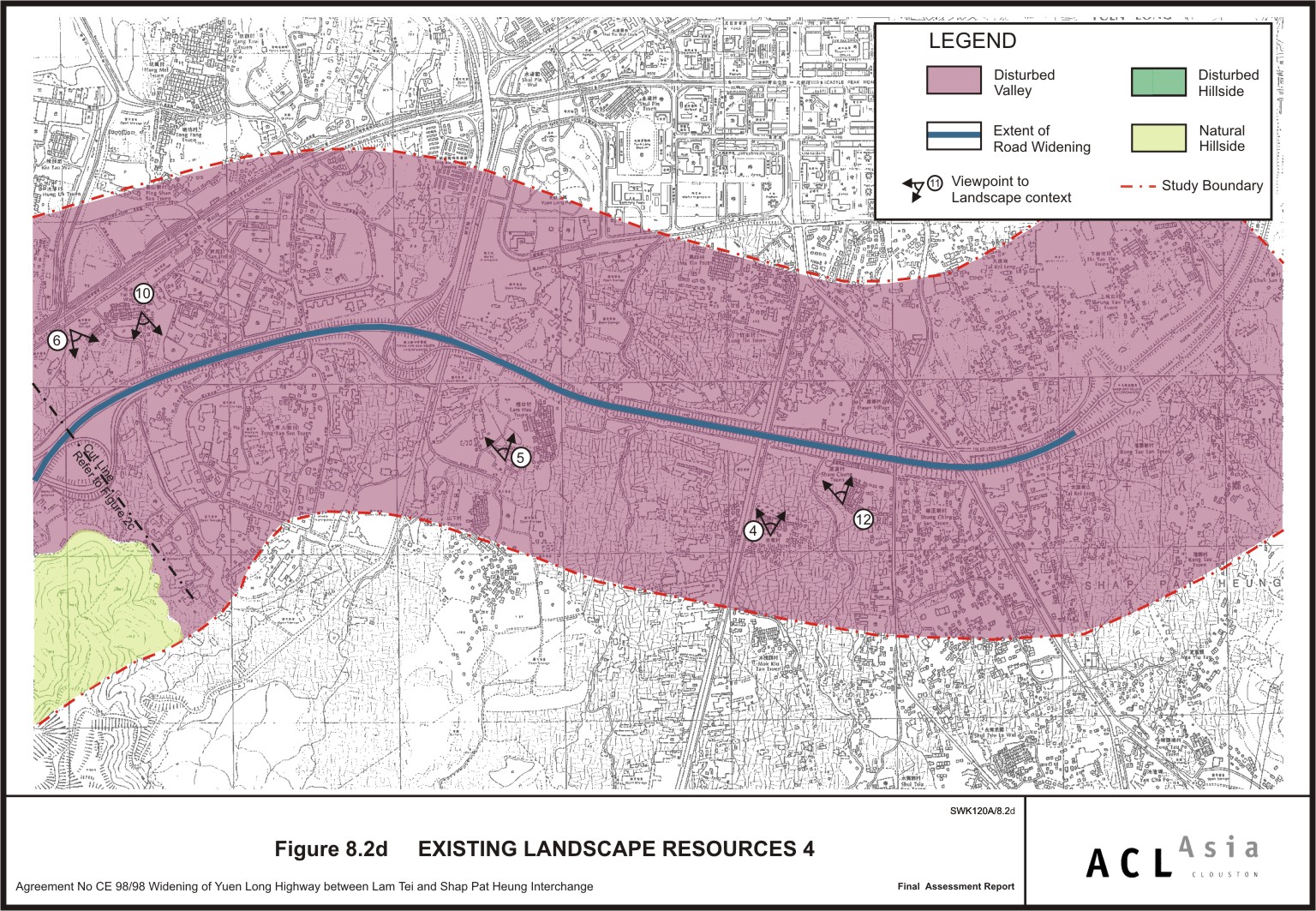
Figure 8.2 d
|
Existing
Landscape Resources 4
|
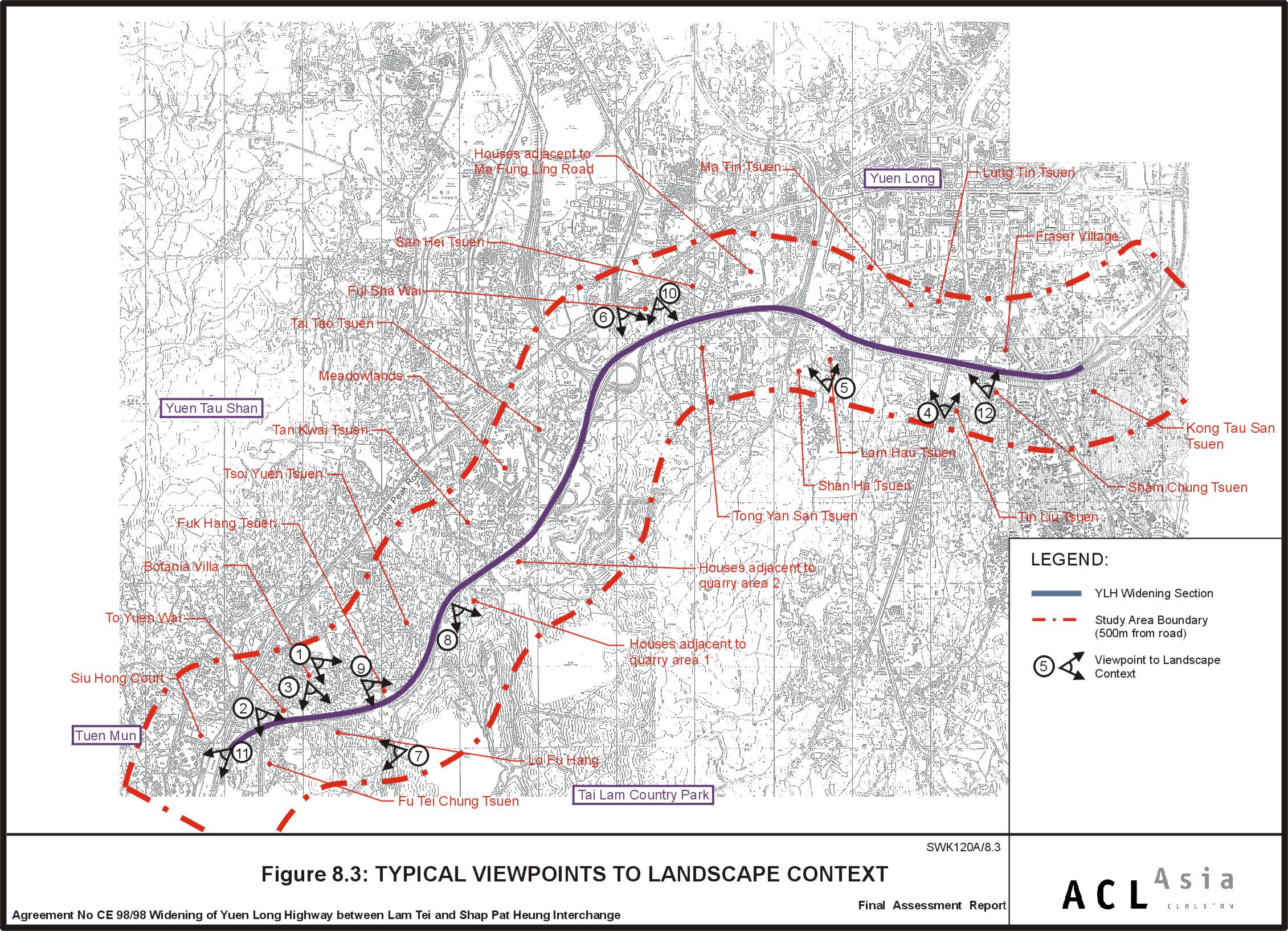
Figure 8.3
|
Typical
Viewpoints to Landscape Context
|
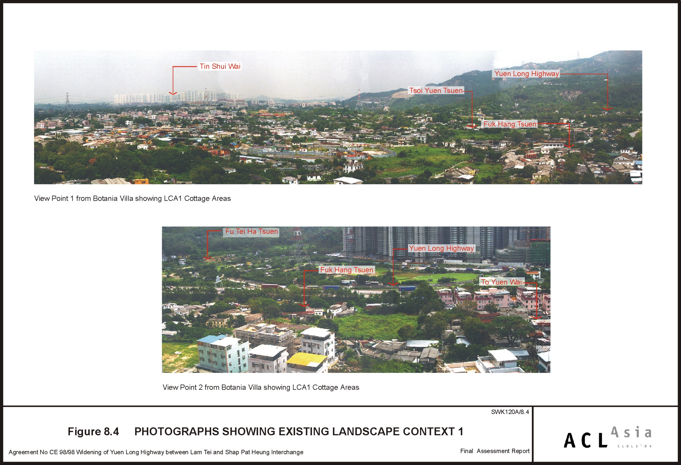
Figure 8.4
|
Photographs
Showing Existing Landscape Context 1
|
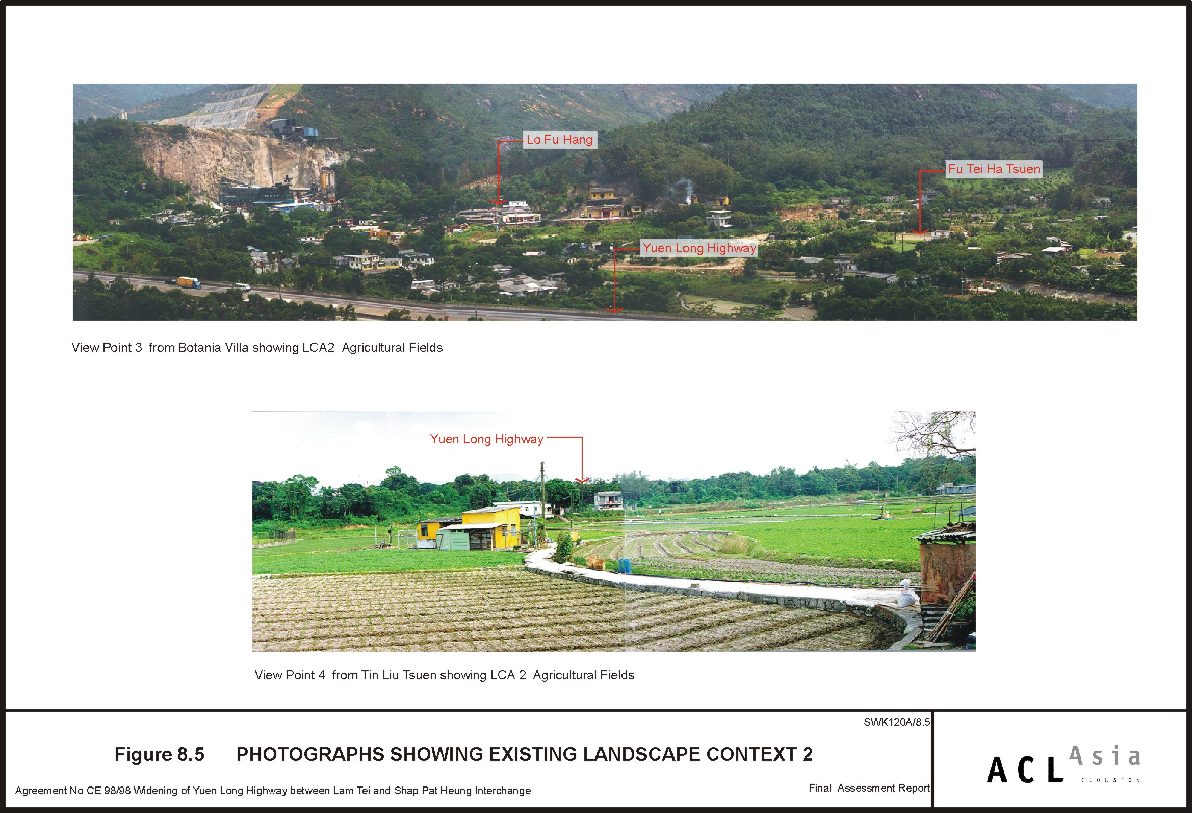
Figure 8.5
|
Photographs
Showing Existing Landscape Context 2
|
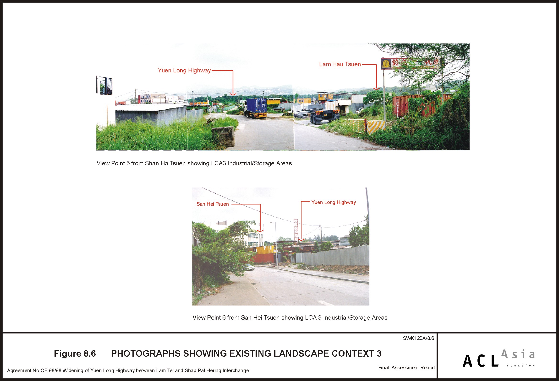
Figure 8.6
|
Photographs
Showing Existing Landscape Context 3
|
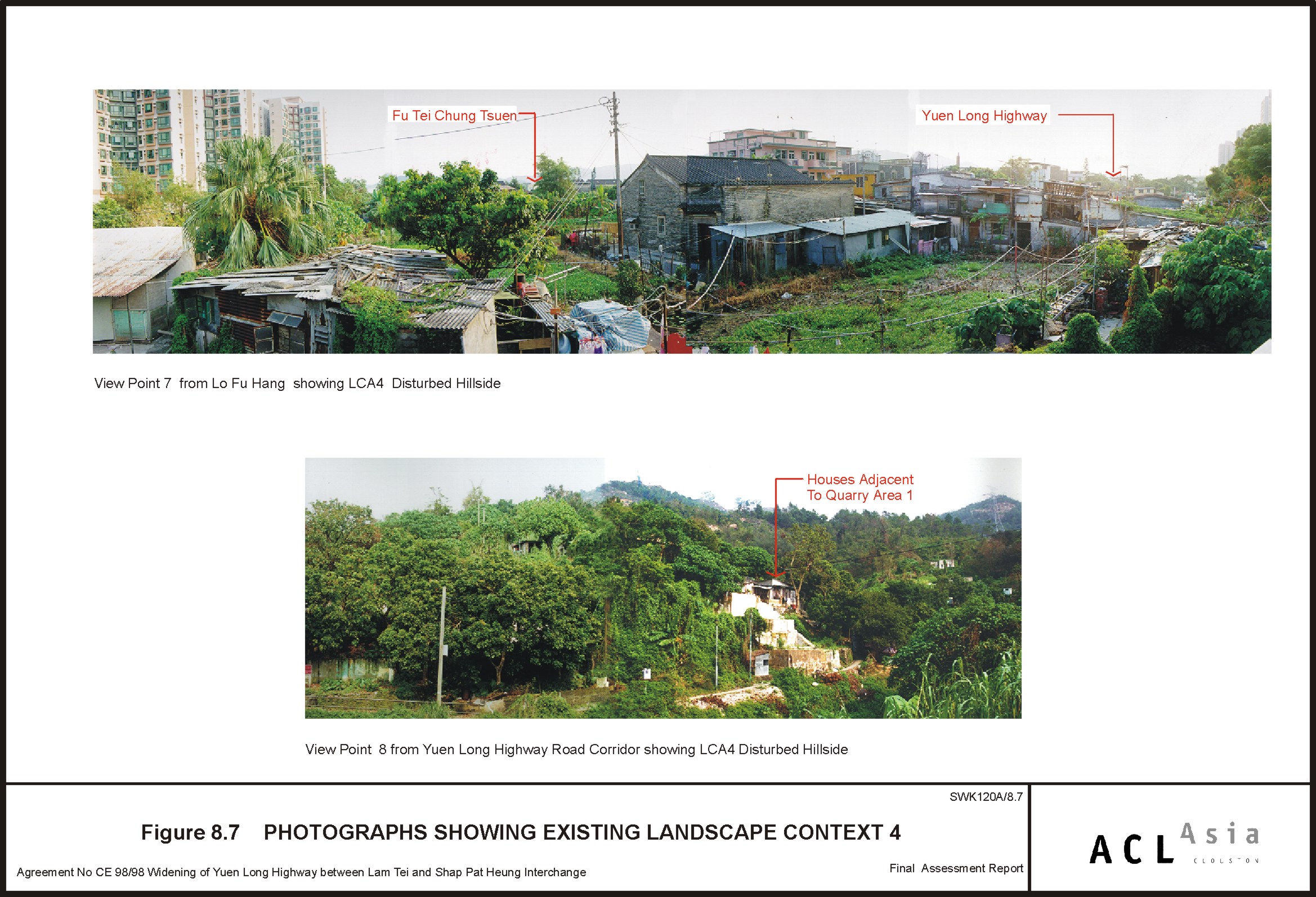
Figure 8.7
|
Photographs
Showing Existing Landscape Context 4
|
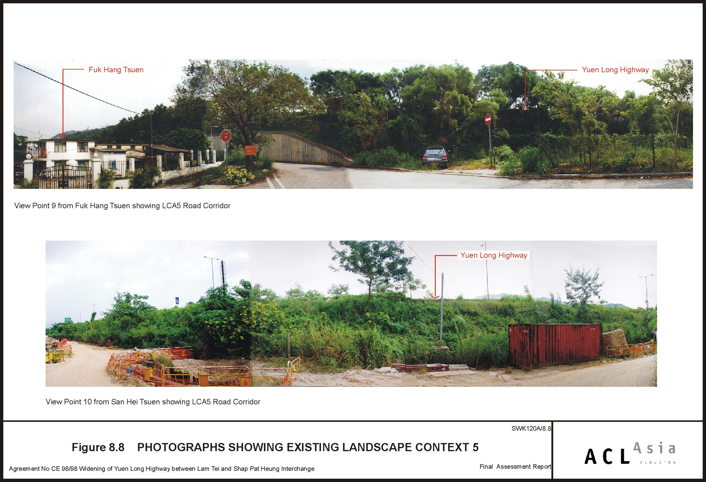
Figure 8.8
|
Photographs
Showing Existing Landscape Context 5
|
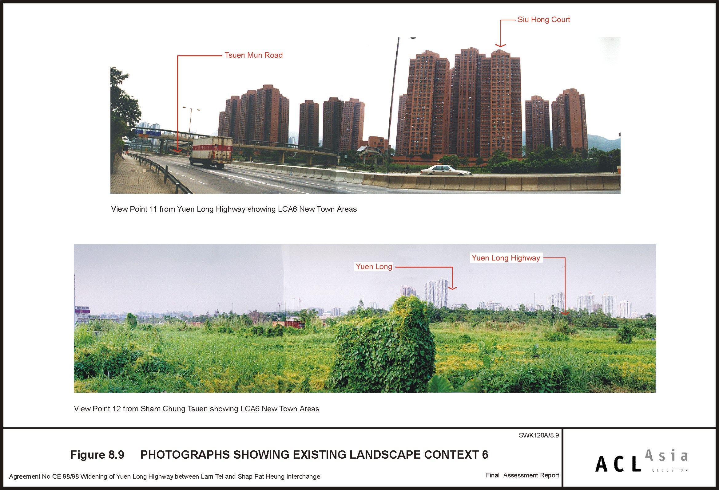
Figure 8.9
|
Photographs
Showing Existing Landscape Context 6
|
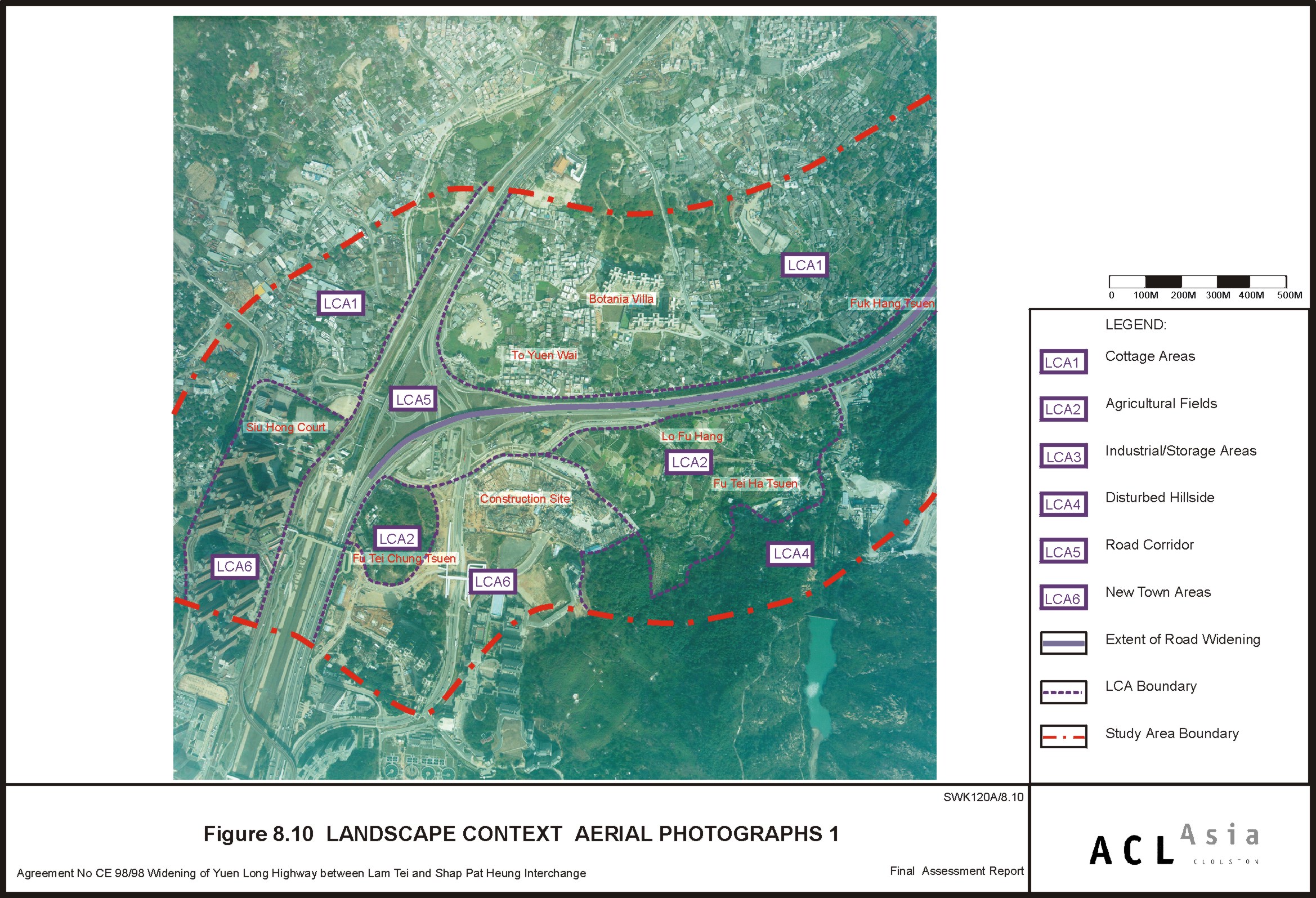
Figure 8.10
|
Landscape
Context Aerial Photographs 1
|
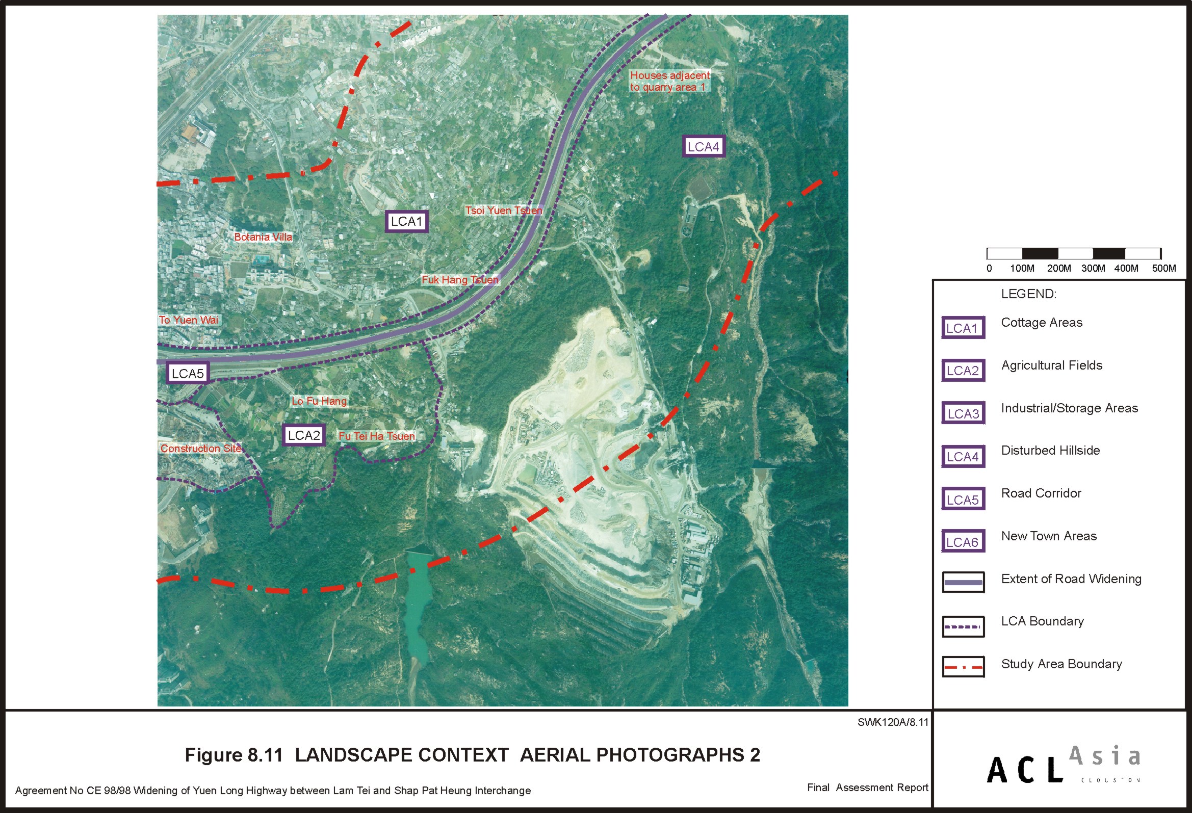
Figure 8.11
|
Landscape
Context Aerial Photographs 2
|
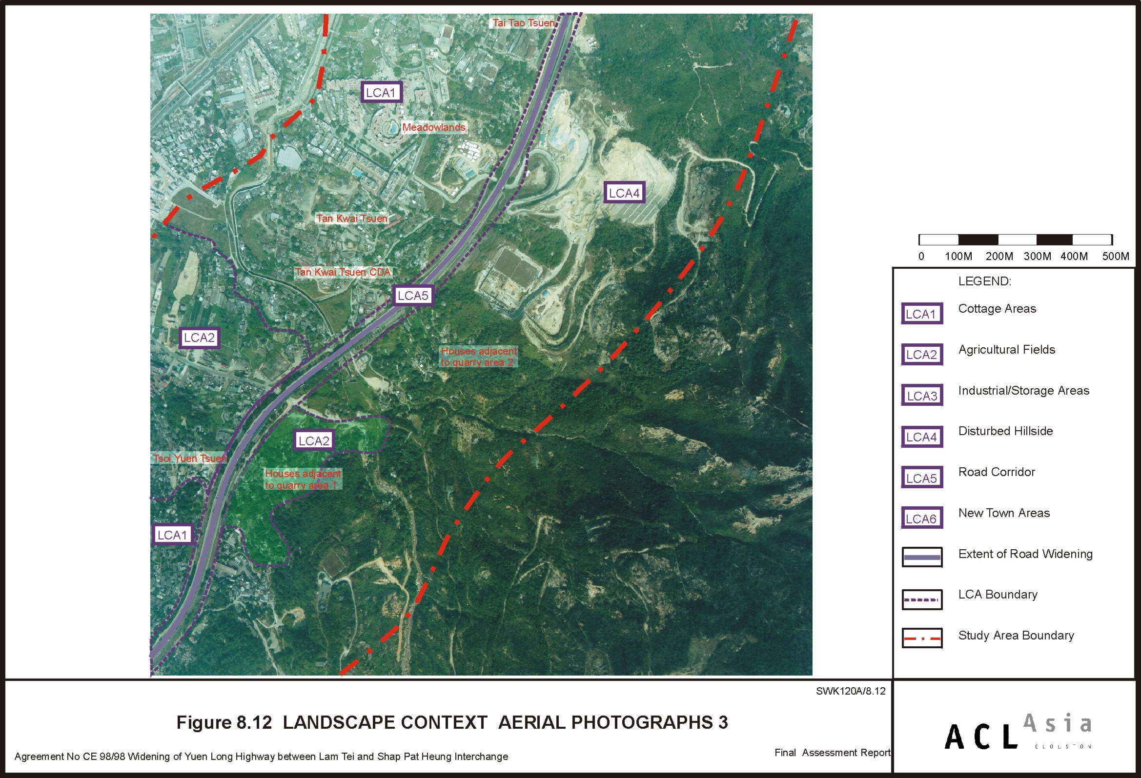
Figure 8.12
|
Landscape
Context Aerial Photographs 3
|
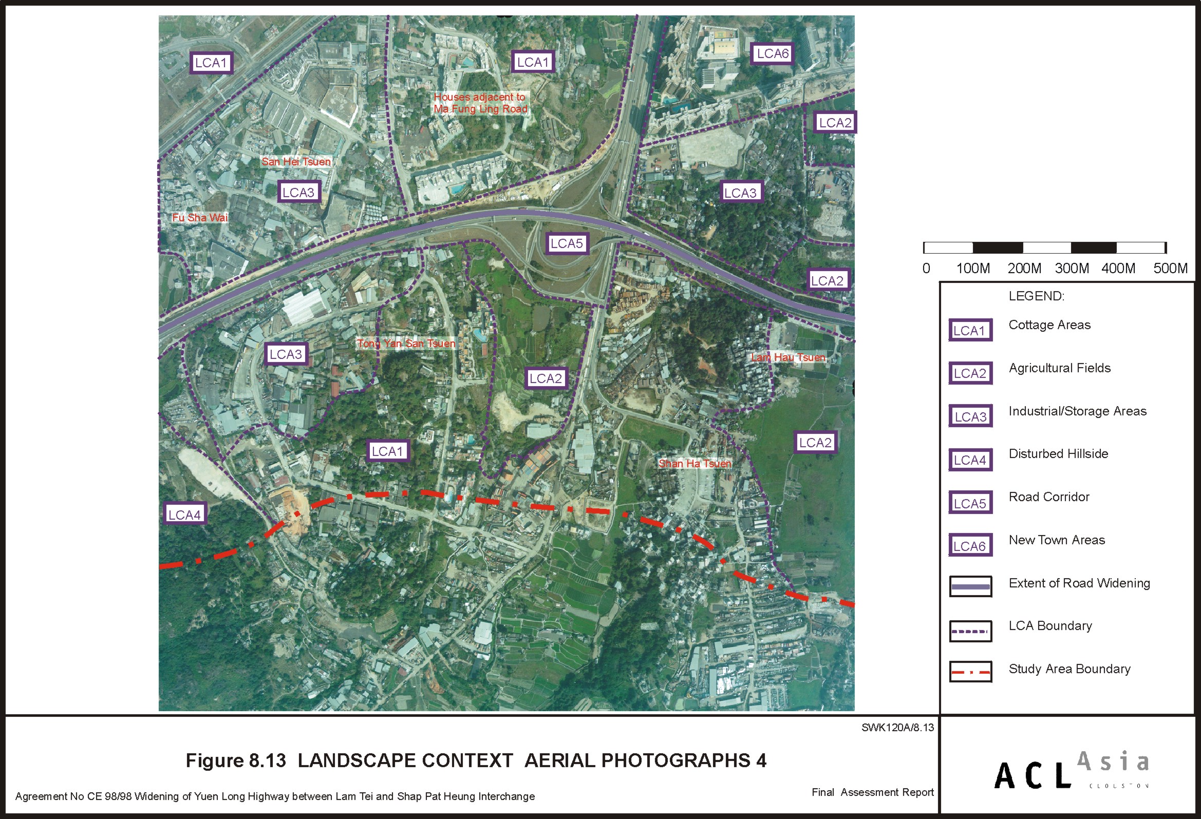
Figure 8.13
|
Landscape
Context Aerial Photographs 4
|
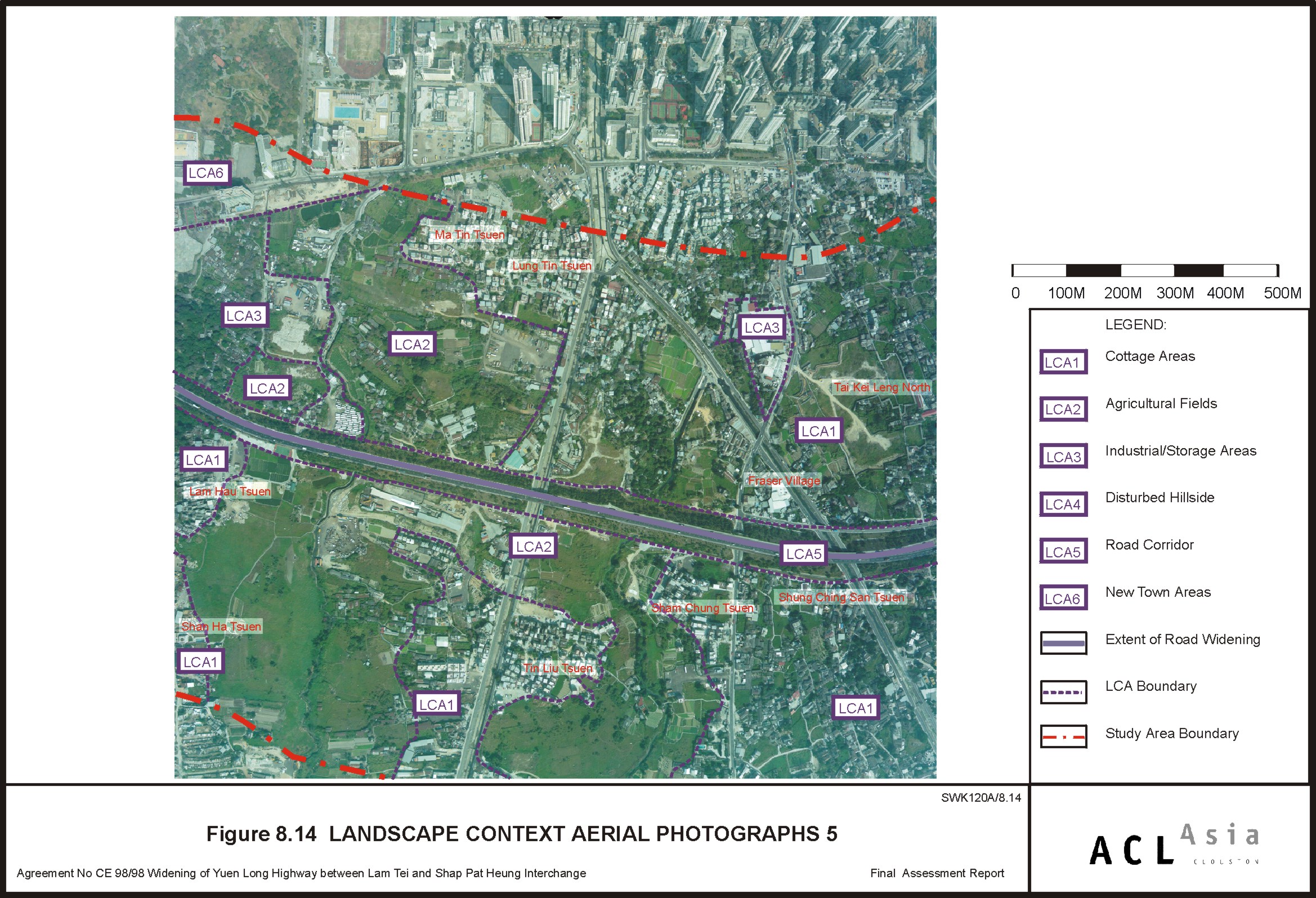
Figure 8.14
|
Landscape
Context Aerial Photographs 5
|
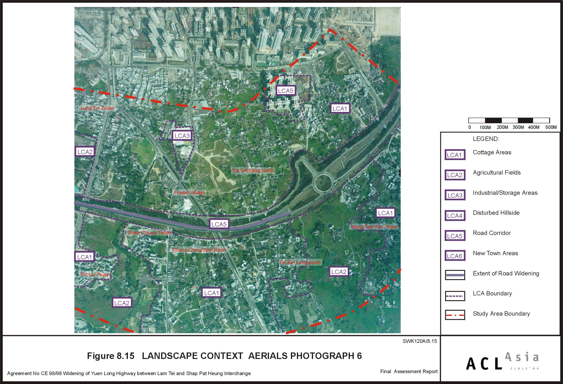
Figure 8.15
|
Landscape
Context Aerial Photographs 6
|
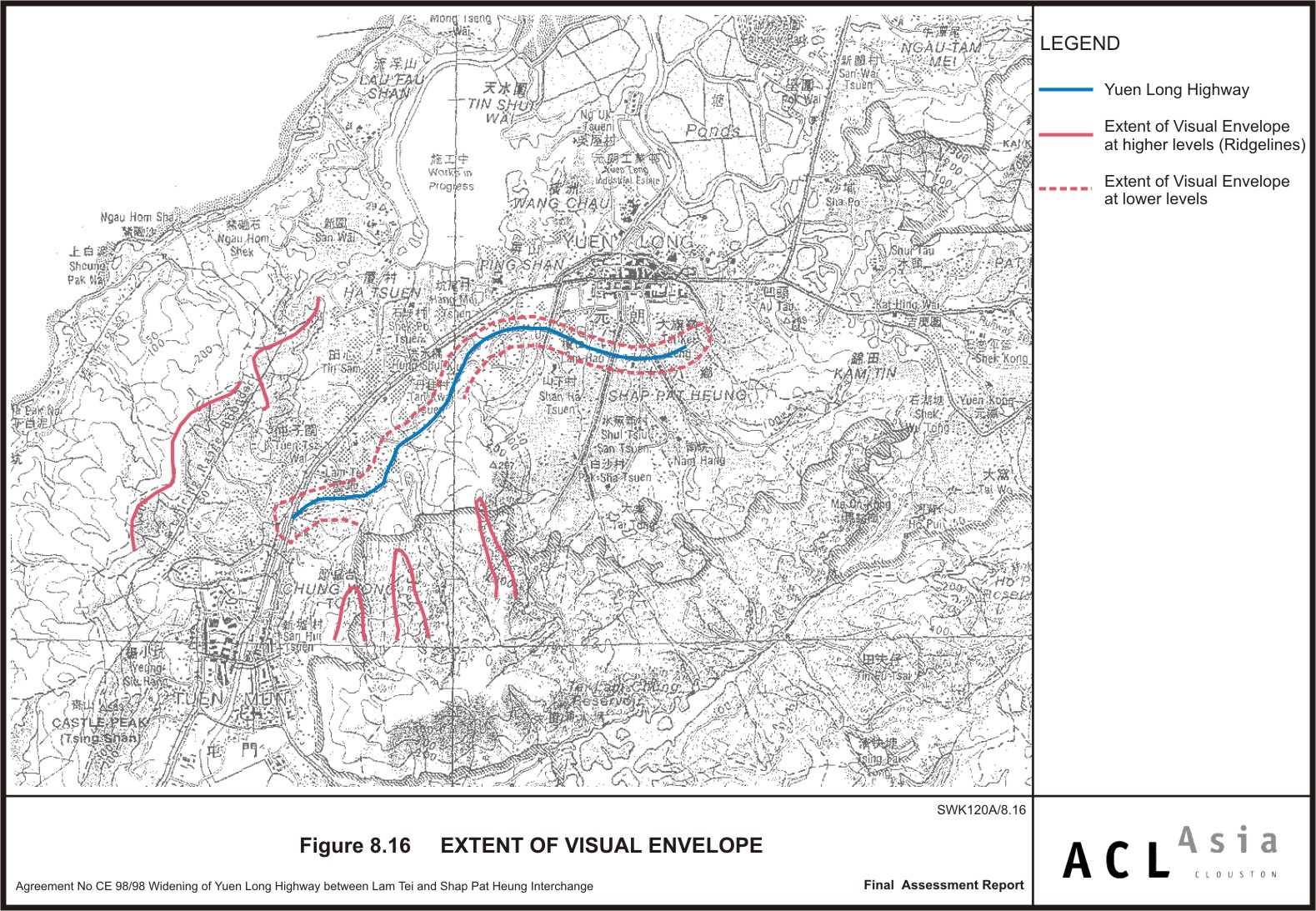
Figure 8.16
|
Extent of Visual
Envelope
|
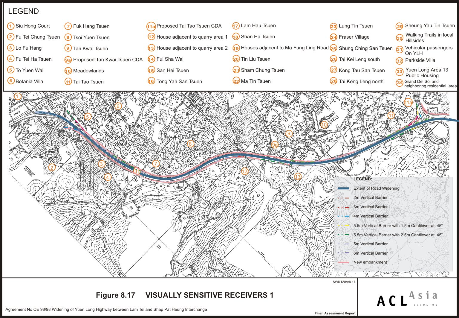
Figure 8.17
|
Visually
Sensitive Receivers 1
|
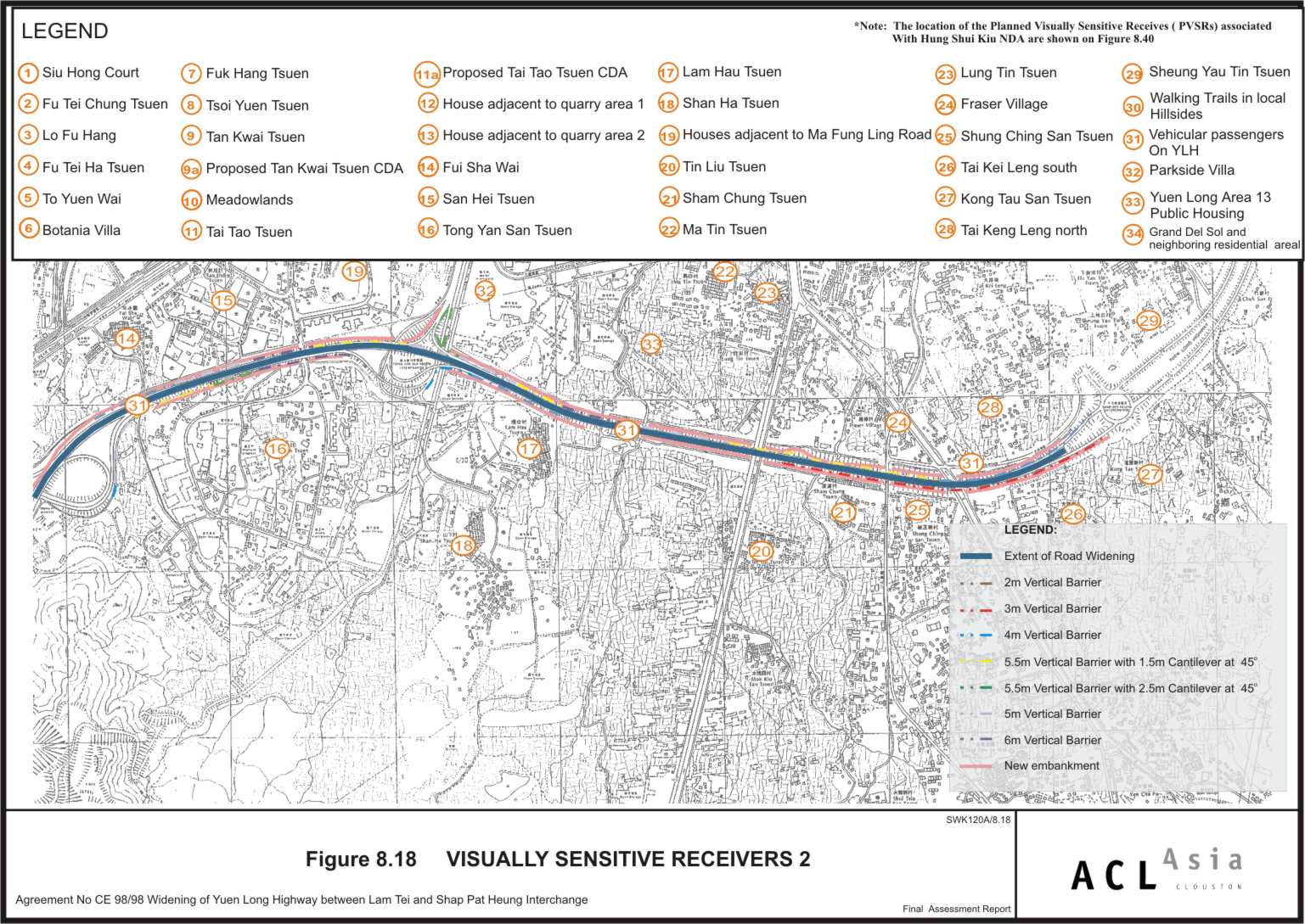
Figure 8.18
|
Visually
Sensitive Receivers 2
|
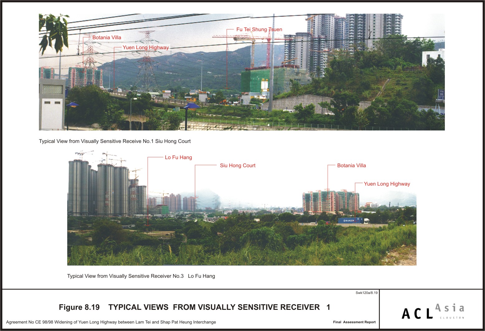
Figure 8.19
|
Typical Views
from Visually Sensitive Receiver 1
|
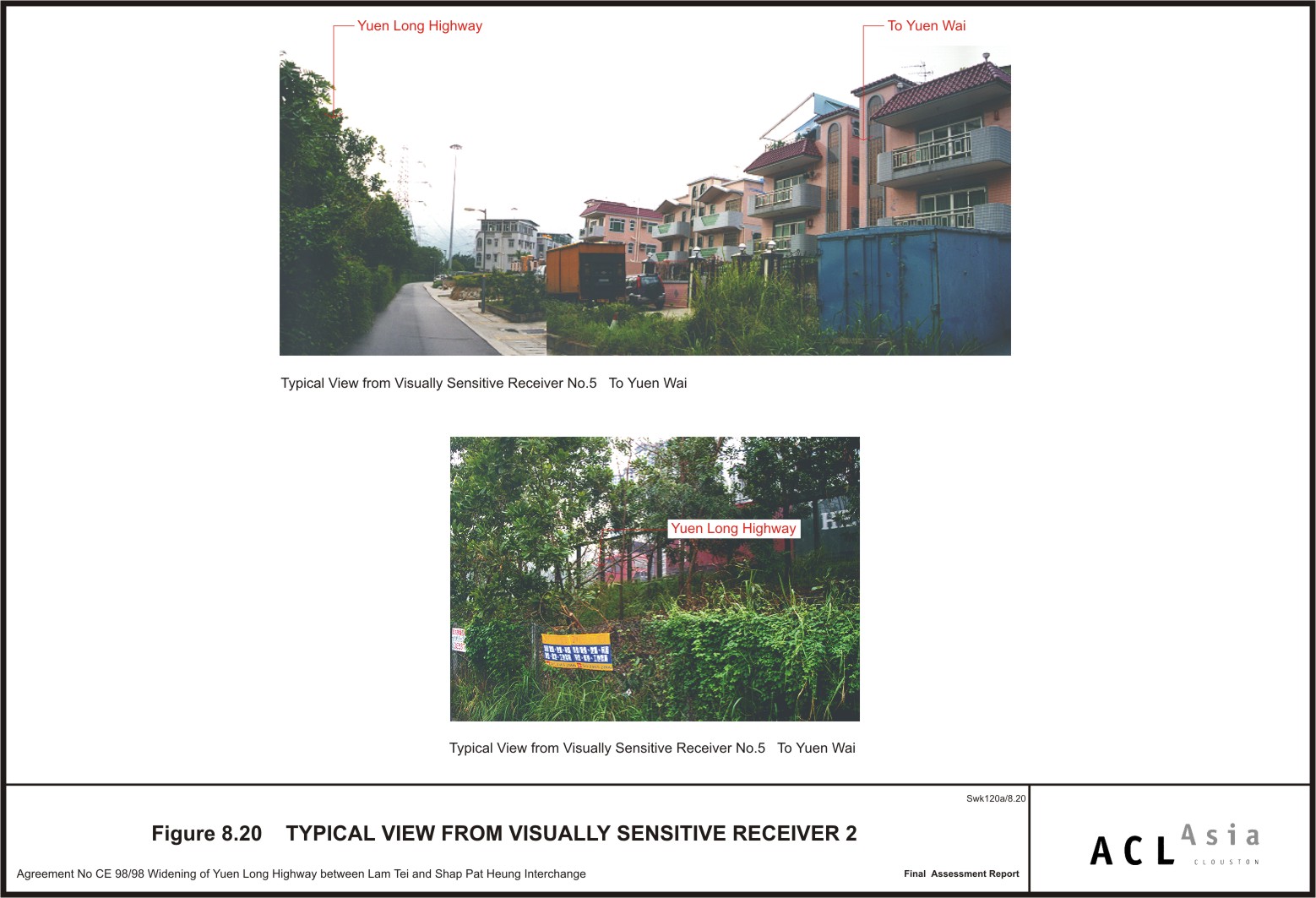
Figure 8.20
|
Typical Views
from Visually Sensitive Receiver 2
|
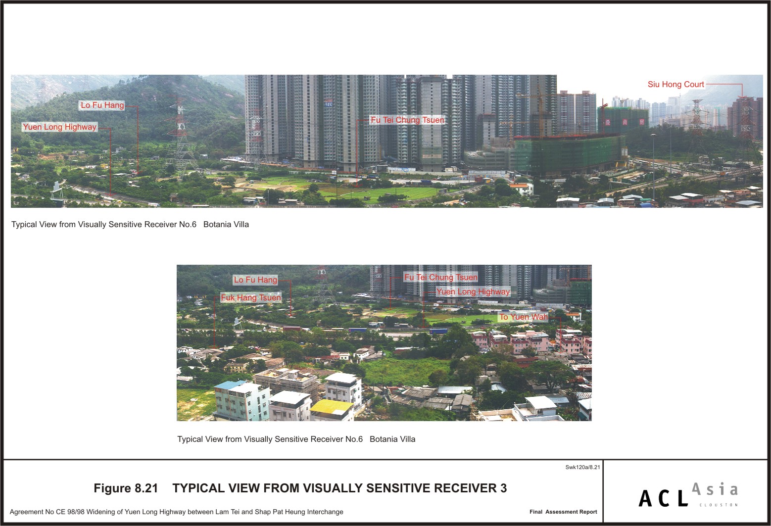
Figure 8.21
|
Typical Views
from Visually Sensitive Receiver 3
|
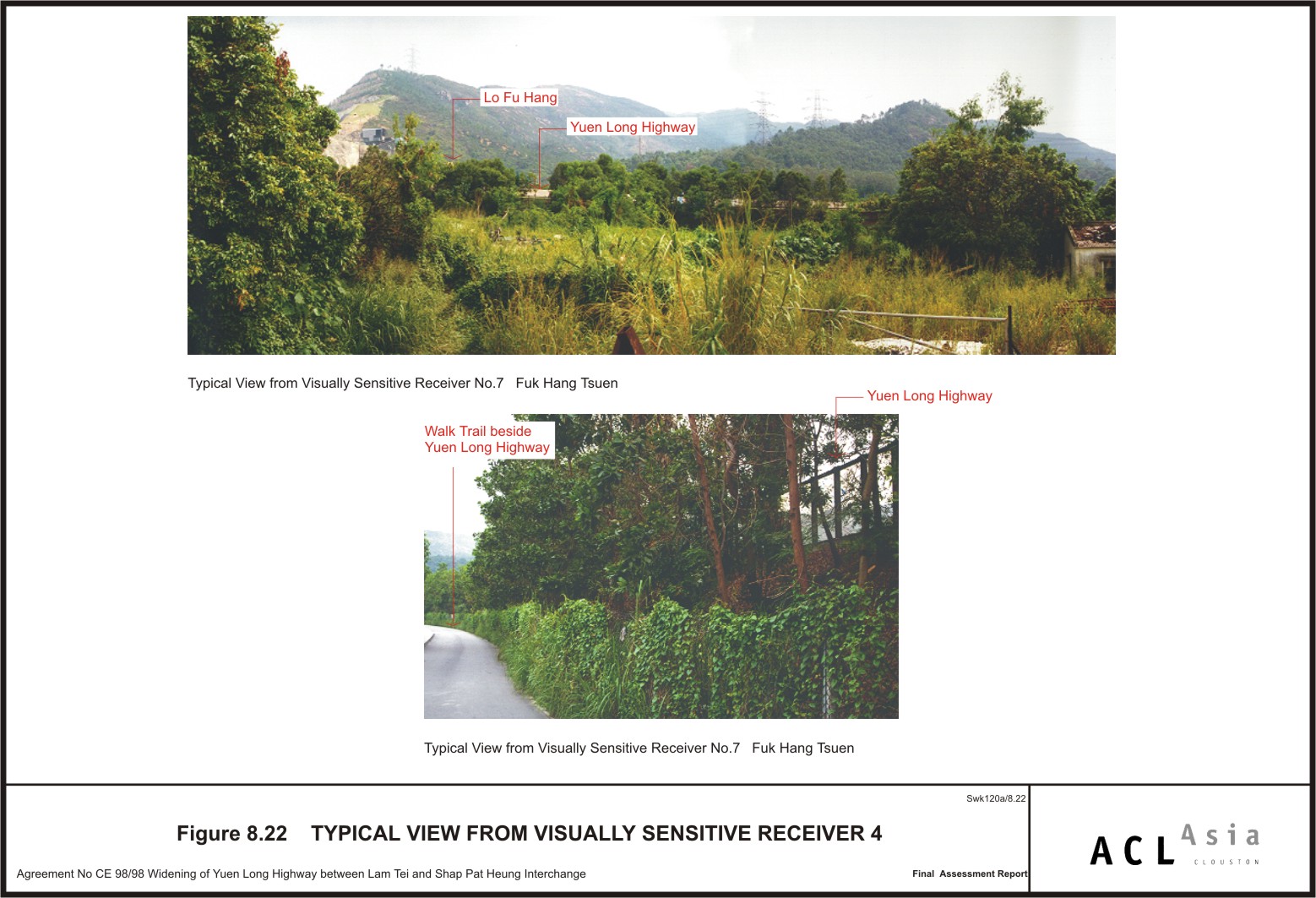
Figure 8.22
|
Typical Views
from Visually Sensitive Receiver 4
|
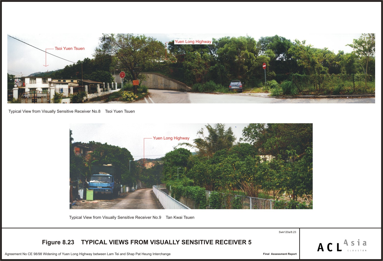
Figure 8.23
|
Typical Views
from Visually Sensitive Receiver 5
|
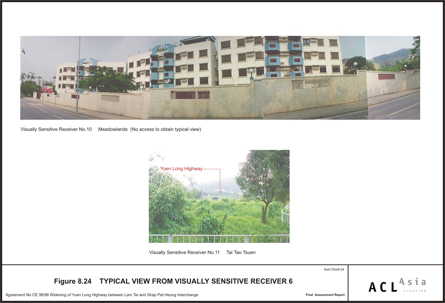
Figure 8.24
|
Typical Views
from Visually Sensitive Receiver 6
|
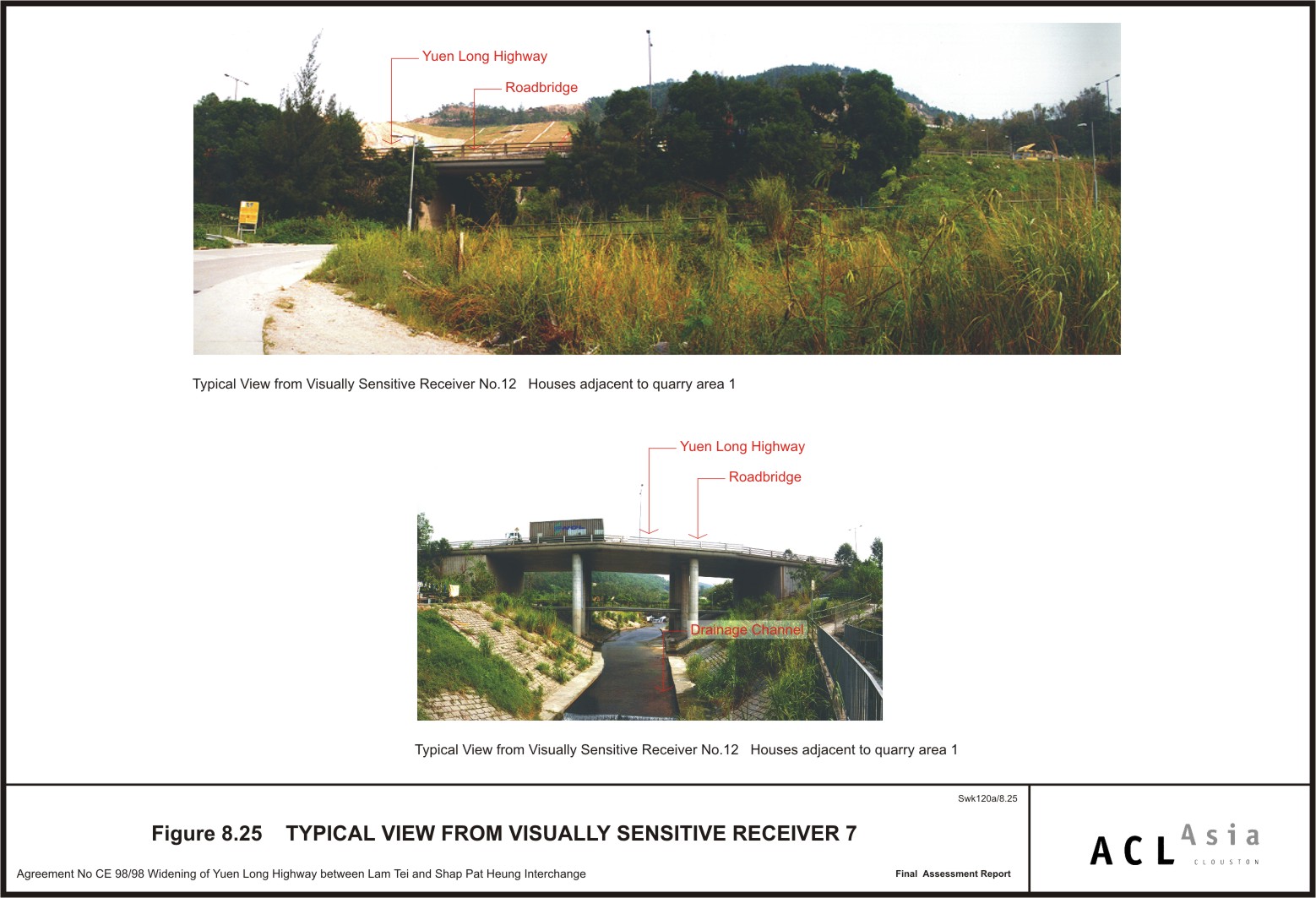
Figure 8.25
|
Typical Views
from Visually Sensitive Receiver 7
|
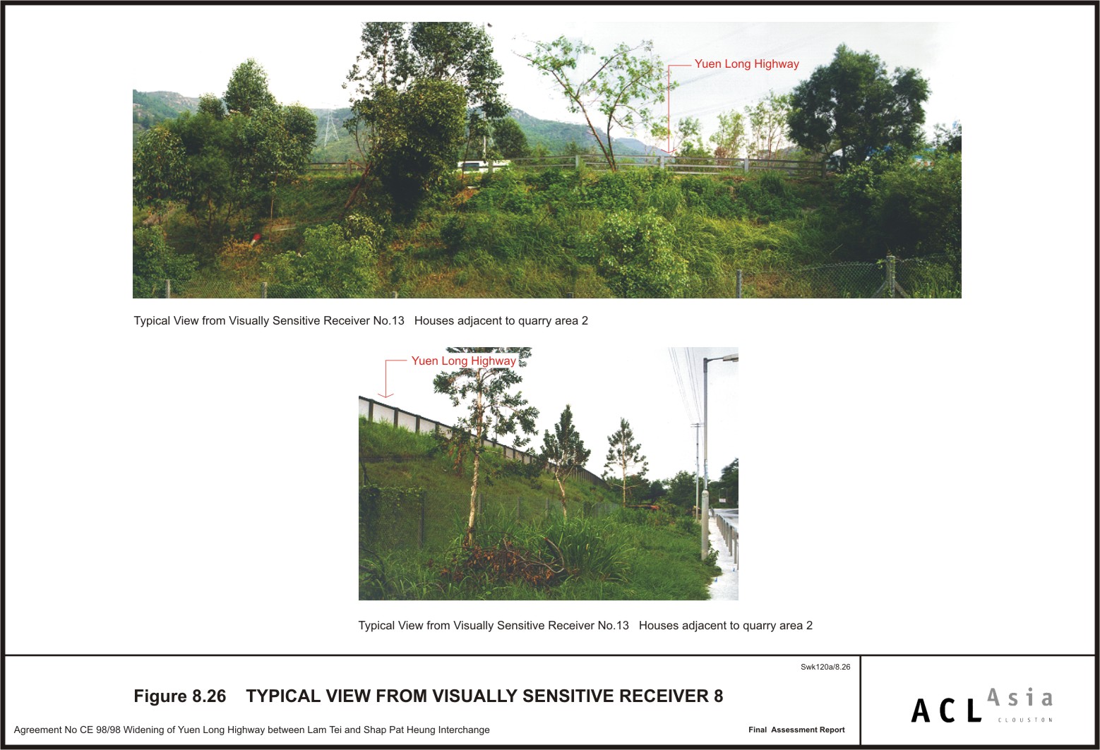
Figure 8.26
|
Typical Views
from Visually Sensitive Receiver 8
|
Figure 8.27
|
Typical Views
from Visually Sensitive Receiver 9
|
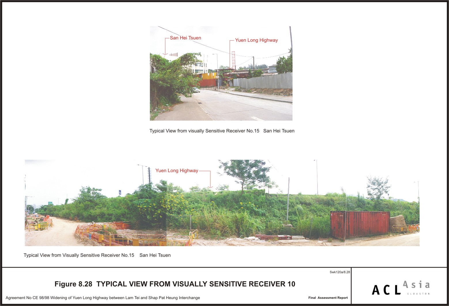
Figure 8.28
|
Typical Views
from Visually Sensitive Receiver 10
|
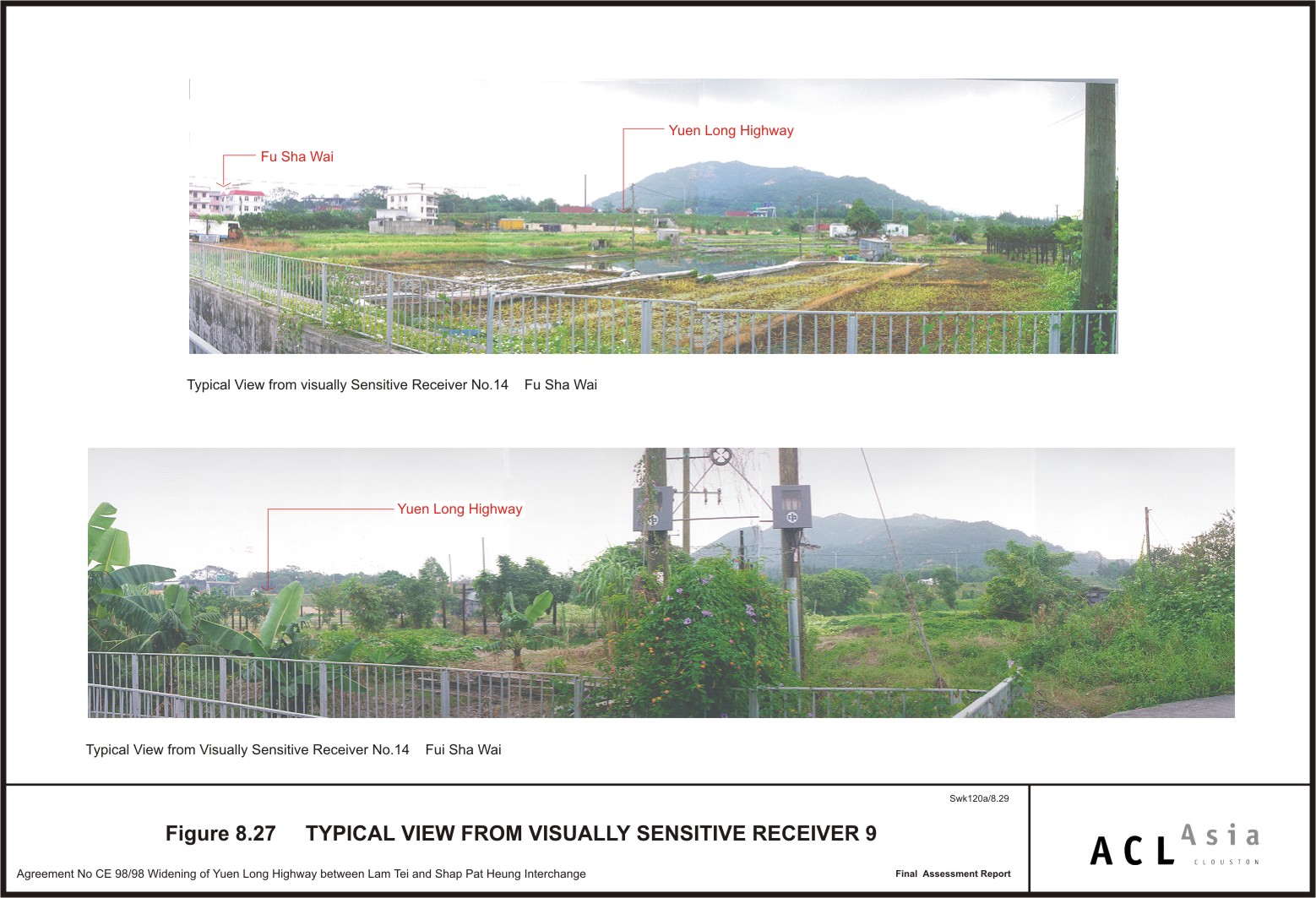
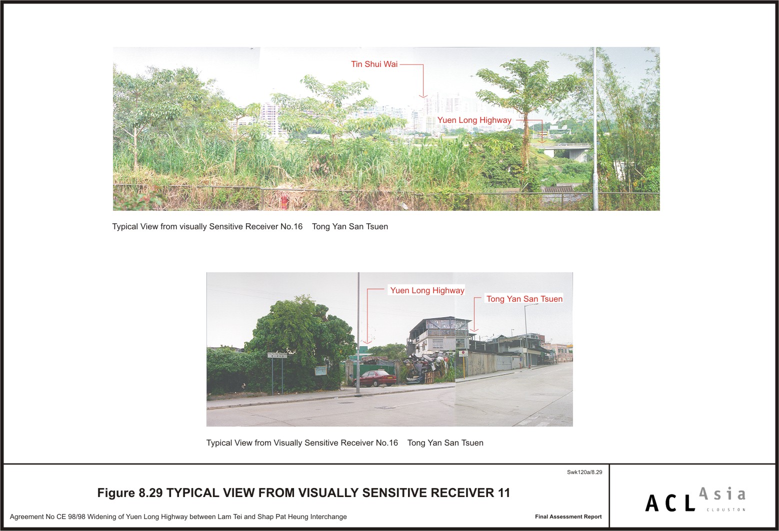
Figure 8.29
|
Typical Views
from Visually Sensitive Receiver 11
|
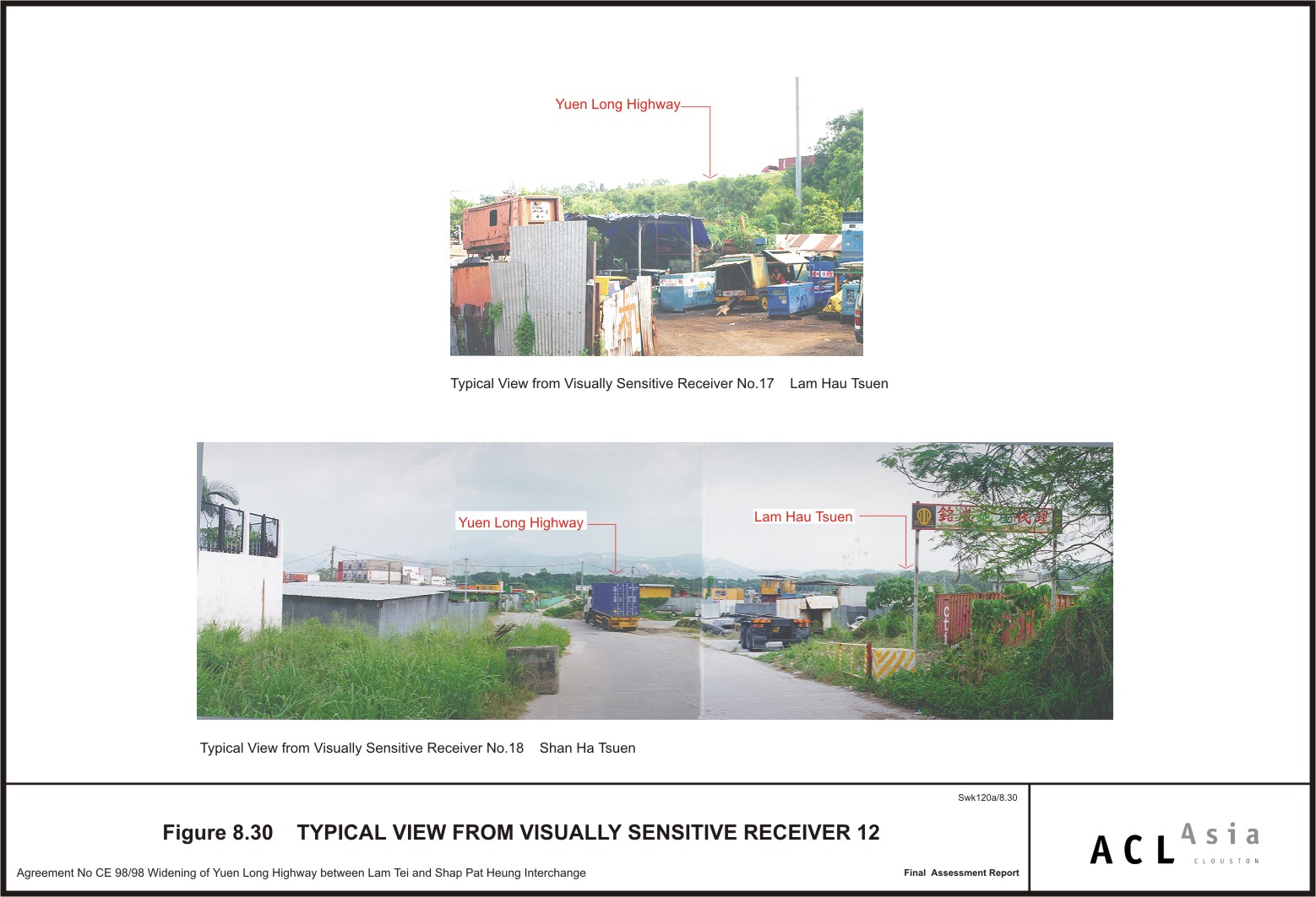
Figure 8.30
|
Typical Views
from Visually Sensitive Receiver 12
|
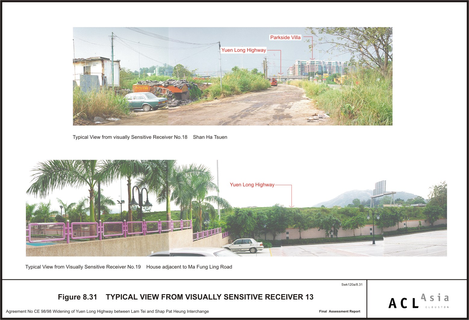
Figure 8.31
|
Typical Views
from Visually Sensitive Receiver 13
|
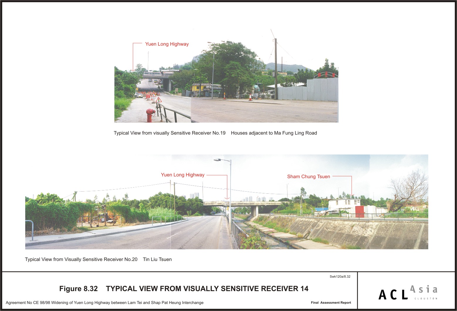
Figure 8.32
|
Typical Views
from Visually Sensitive Receiver 14
|
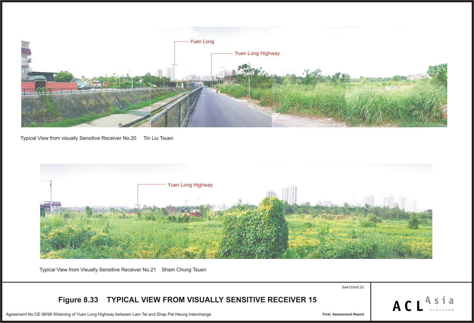
Figure 8.33
|
Typical Views
from Visually Sensitive Receiver 15
|
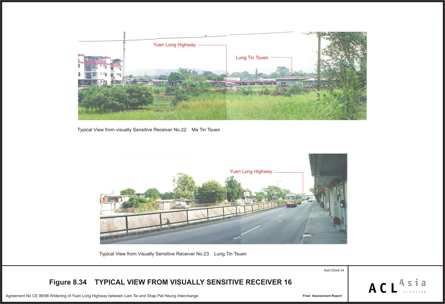
Figure 8.34
|
Typical Views
from Visually Sensitive Receiver 16
|
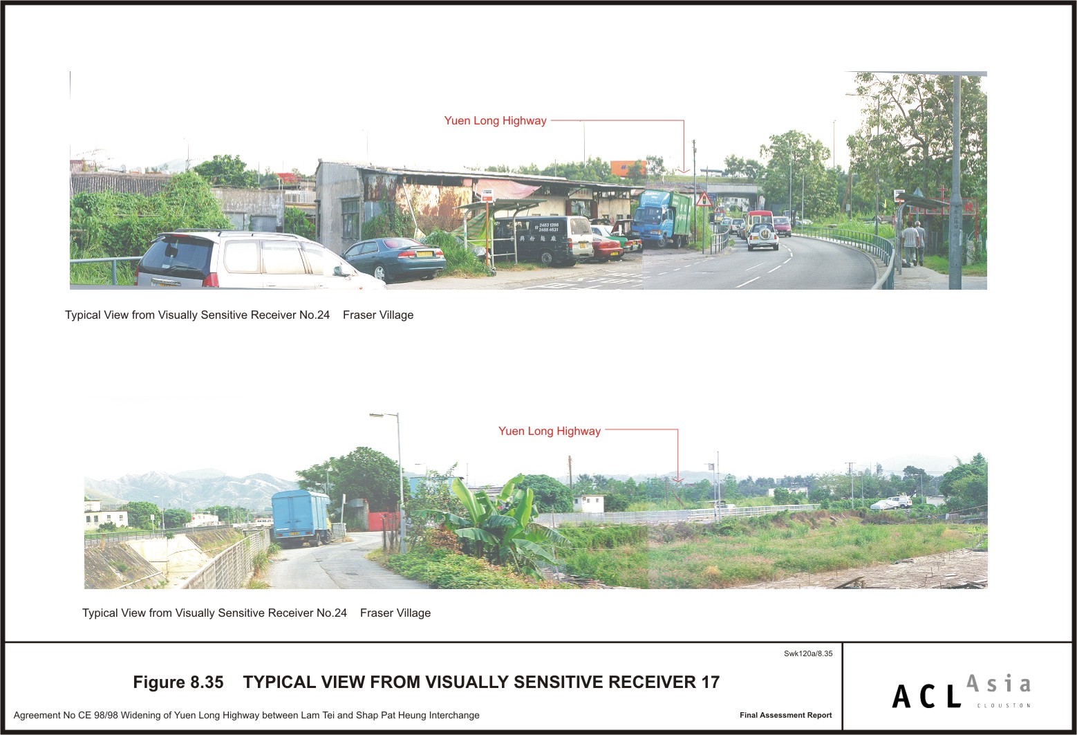
Figure 8.35
|
Typical Views
from Visually Sensitive Receiver 17
|
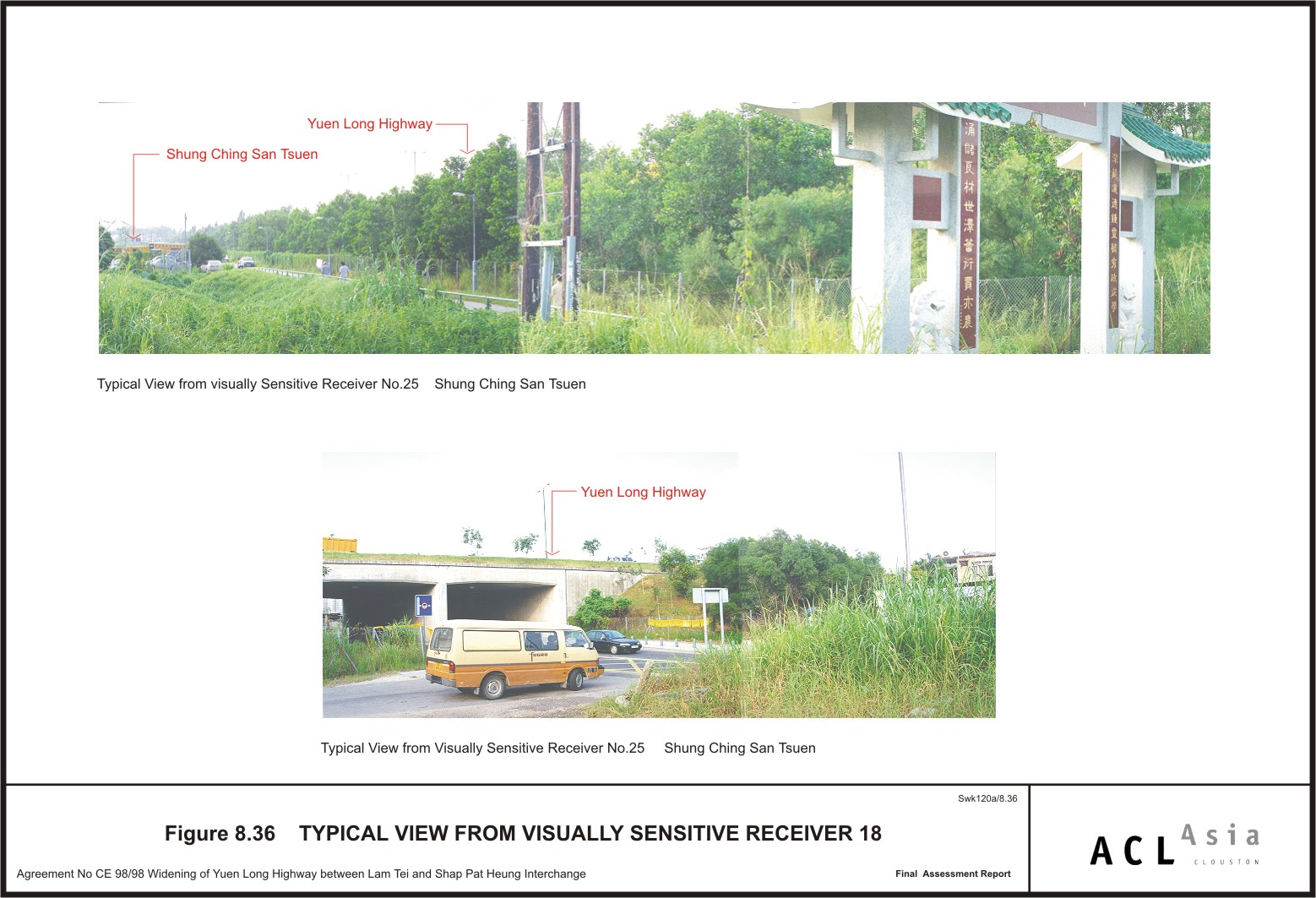
Figure 8.36
|
Typical Views
from Visually Sensitive Receiver 18
|
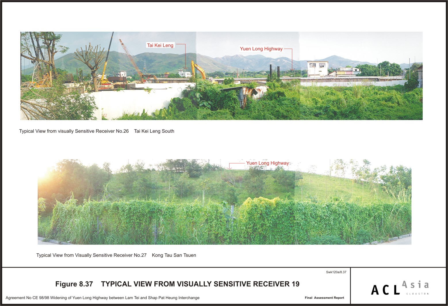
Figure 8.37
|
Typical Views
from Visually Sensitive Receiver 19
|
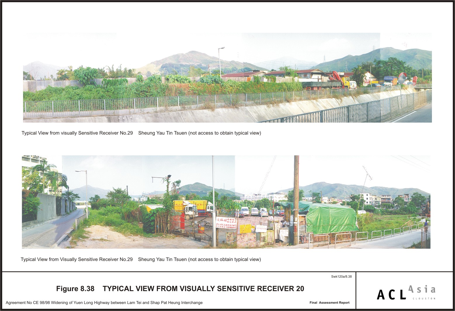
Figure 8.38
|
Typical Views
from Visually Sensitive Receiver 20
|
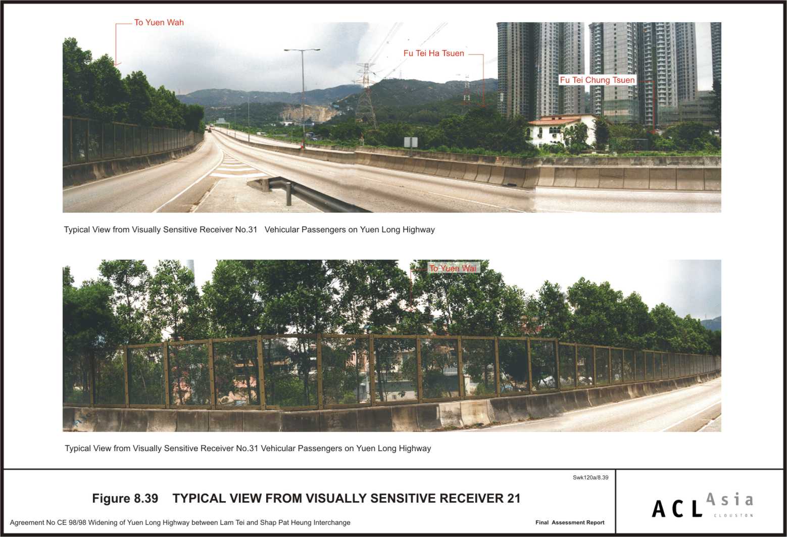
Figure 8.39
|
Typical Views
from Visually Sensitive Receiver 21
|
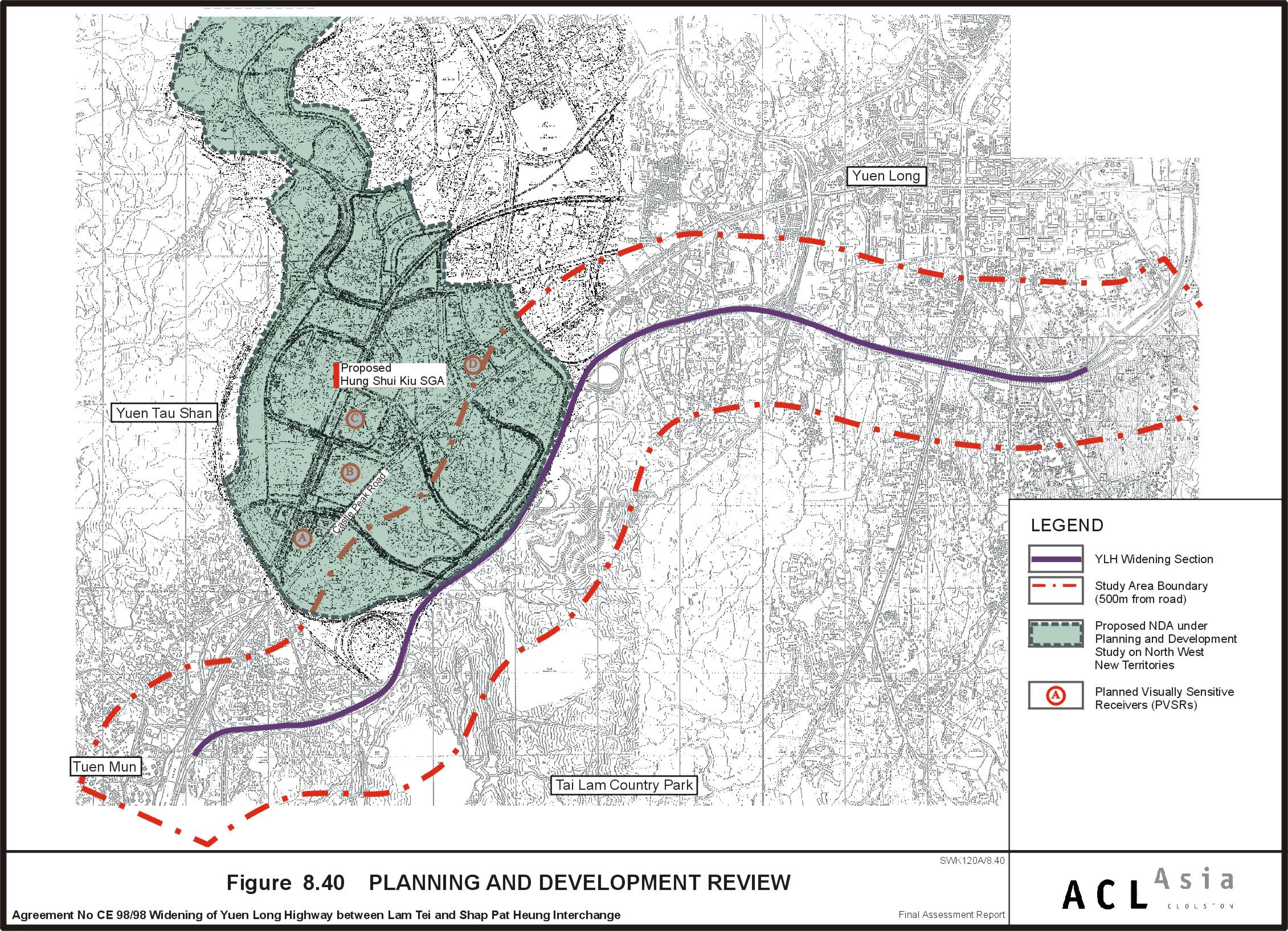
Figure 8.40
|
Planning and
Development Review
|
Figure 8.41
|
Key Plan of
Conceptual Landscape Proposal
|
Figure 8.42
|
Conceptual
Landscape Proposal (Sheet 1 of 21)
|
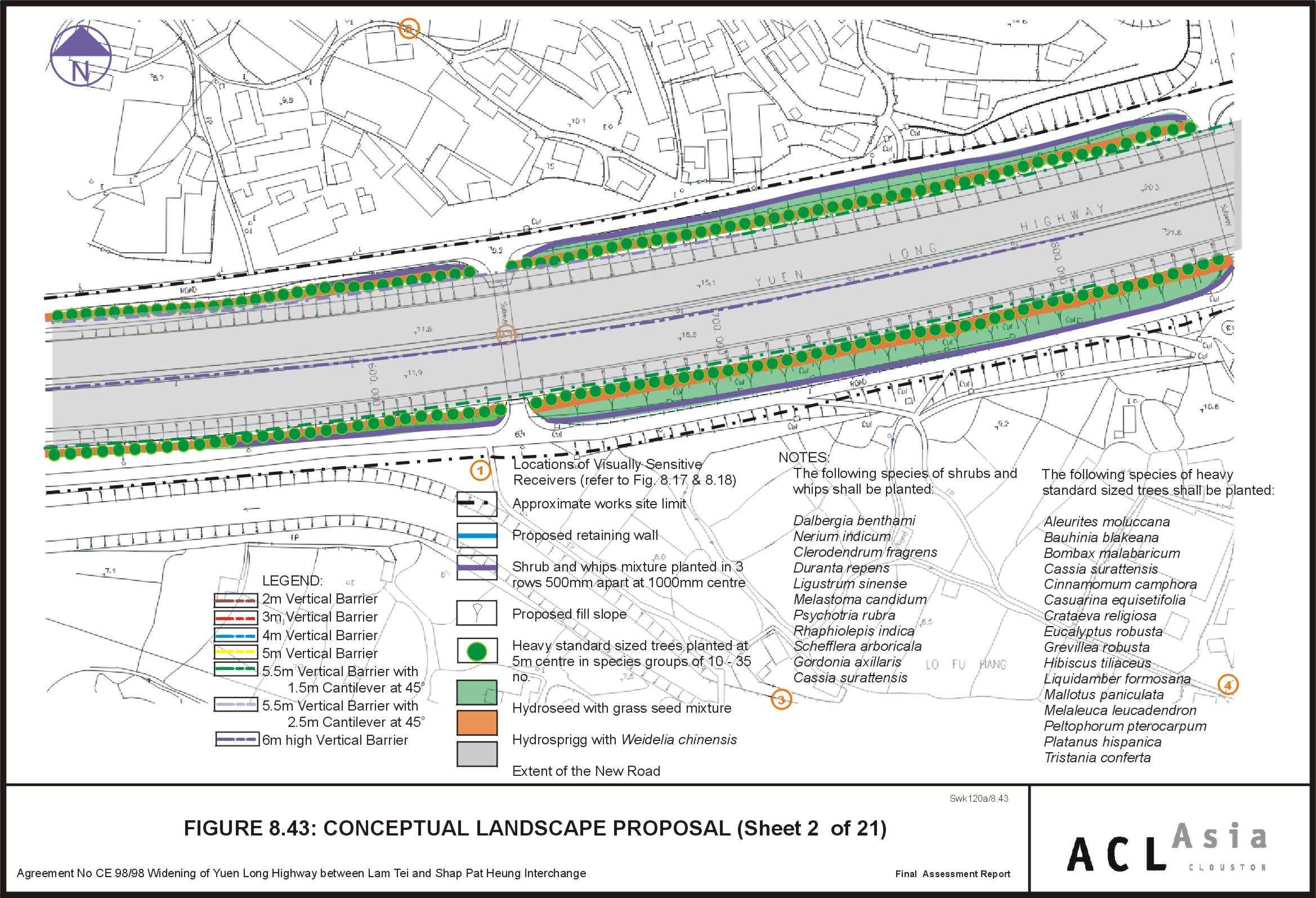
Figure 8.43
|
Conceptual
Landscape Proposal (Sheet 2 of 21)
|
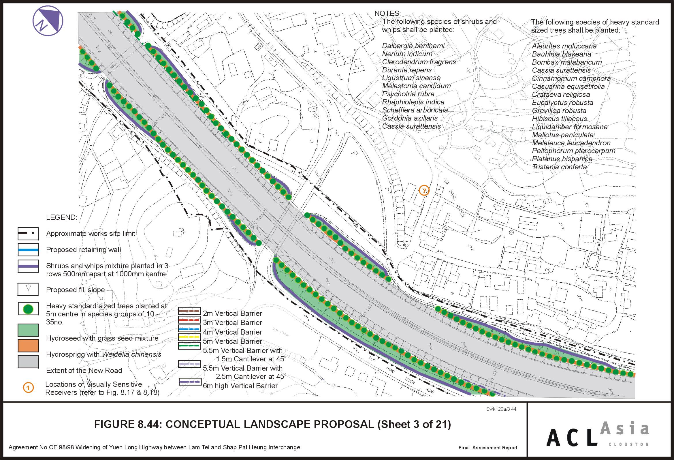
Figure 8.44
|
Conceptual
Landscape Proposal (Sheet 3 of 21)
|
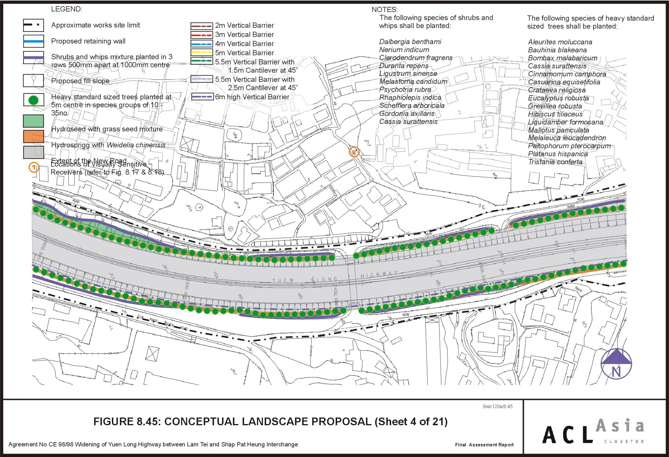
Figure 8.45
|
Conceptual
Landscape Proposal (Sheet 4 of 21)
|
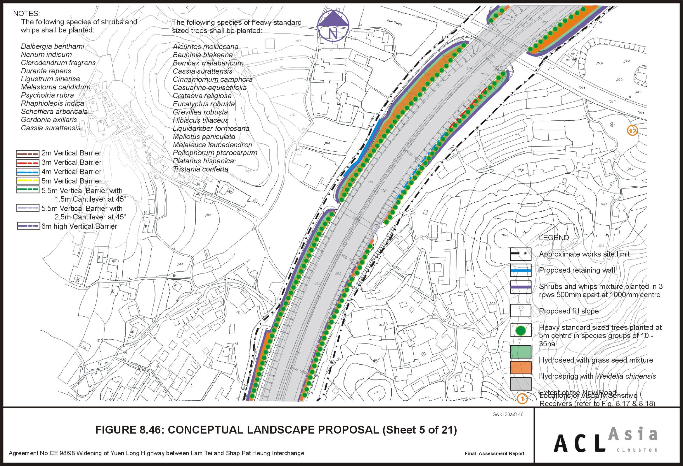
Figure 8.46
|
Conceptual
Landscape Proposal (Sheet 5 of 21)
|
Figure 8.47
|
Conceptual
Landscape Proposal (Sheet 6 of 21)
|
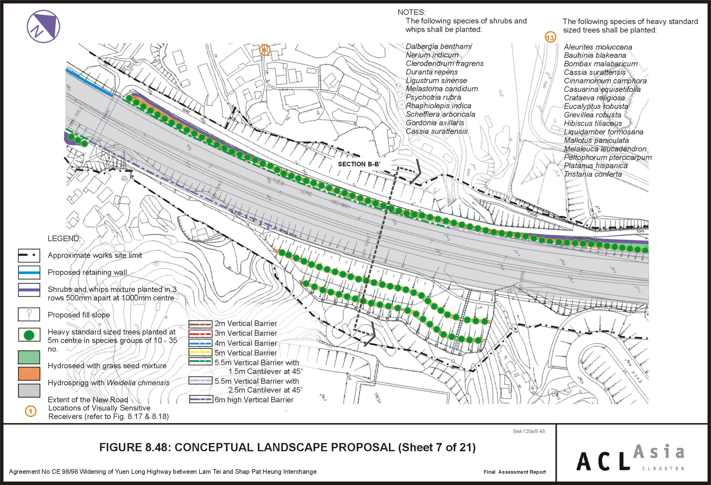
Figure 8.48
|
Conceptual
Landscape Proposal (Sheet 7 of 21)
|
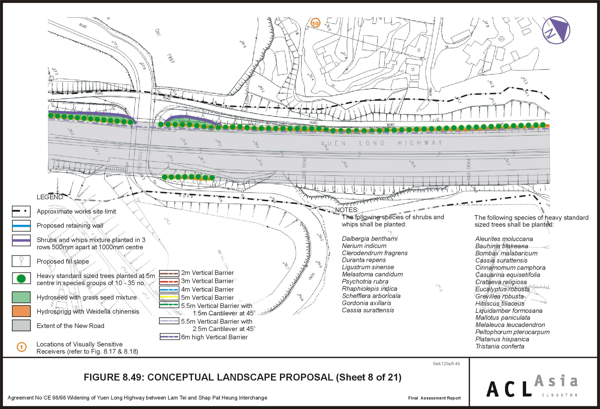
Figure 8.49
|
Conceptual
Landscape Proposal (Sheet 8 of 21)
|
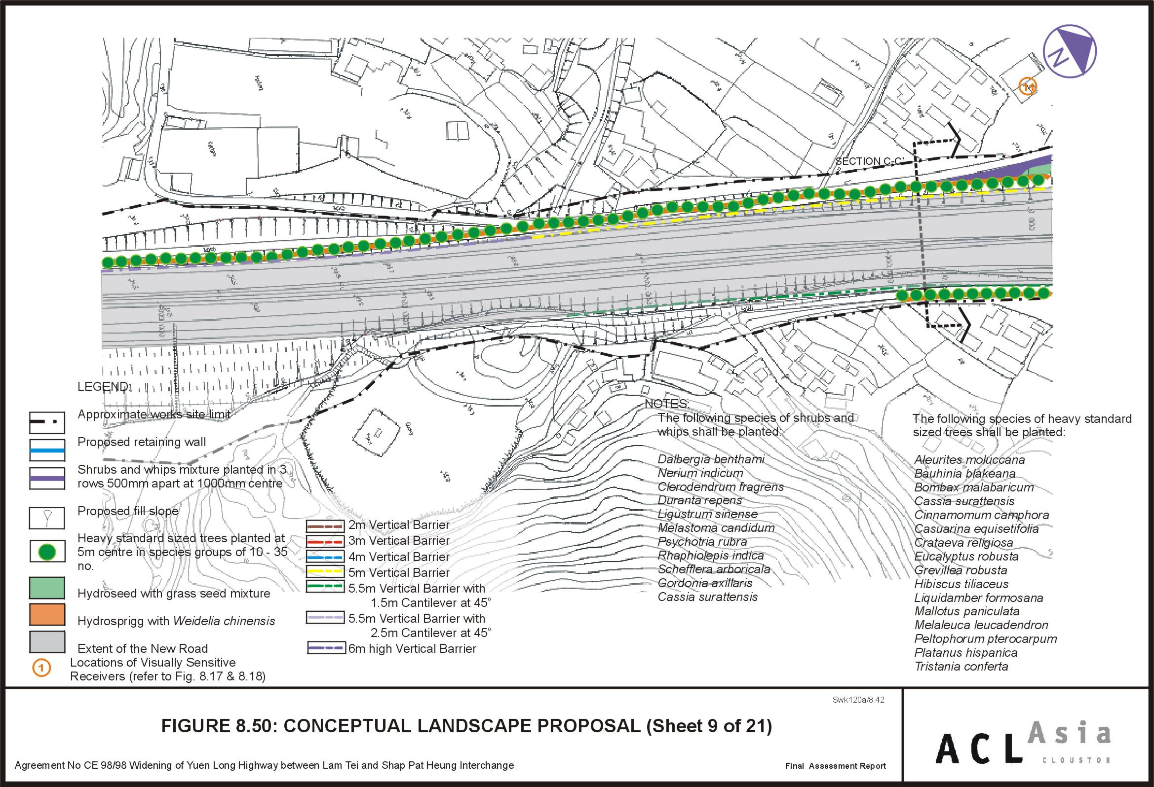
Figure 8.50
|
Conceptual
Landscape Proposal (Sheet 9 of 21)
|
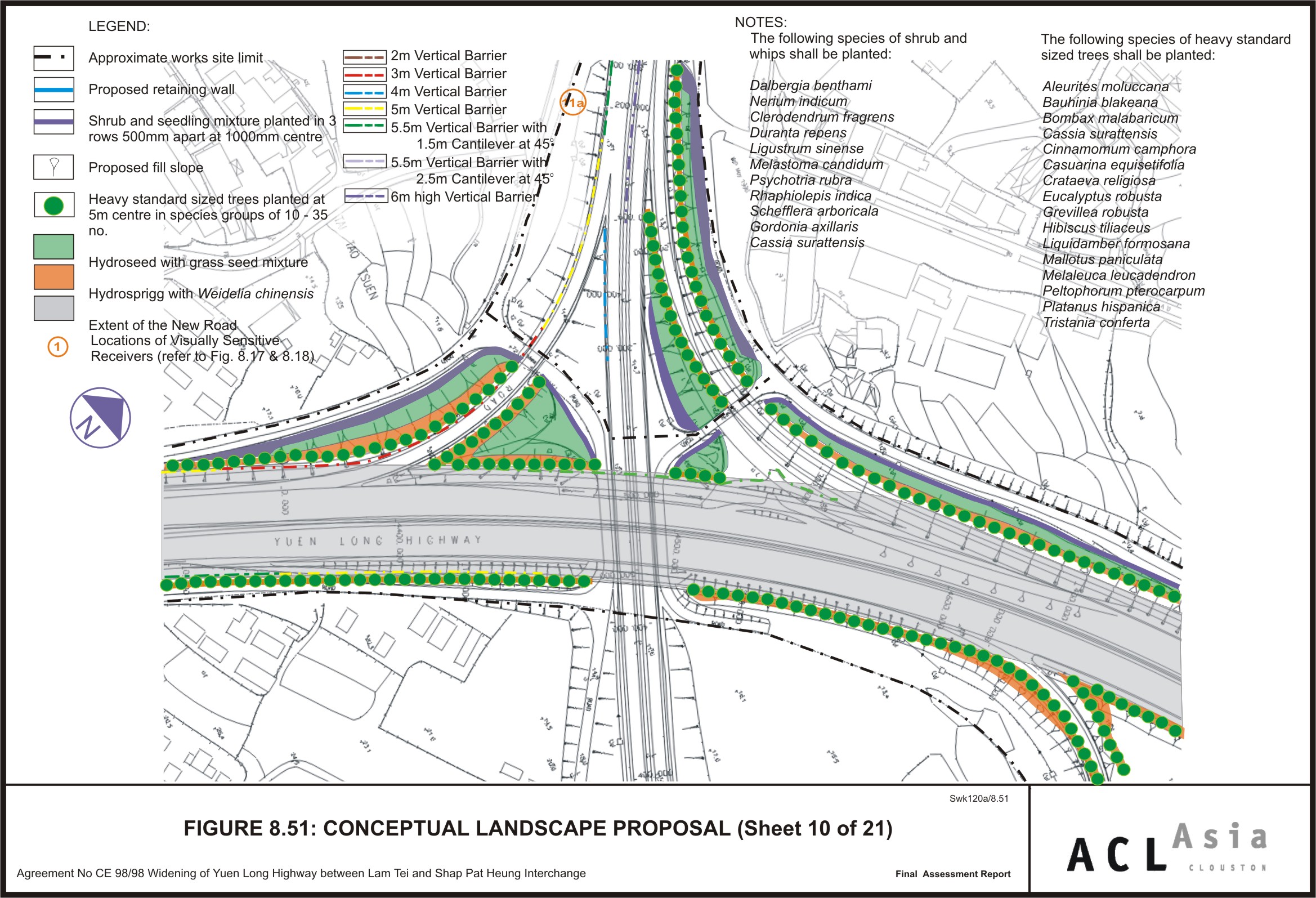
Figure 8.51
|
Conceptual
Landscape Proposal (Sheet 10 of 21)
|
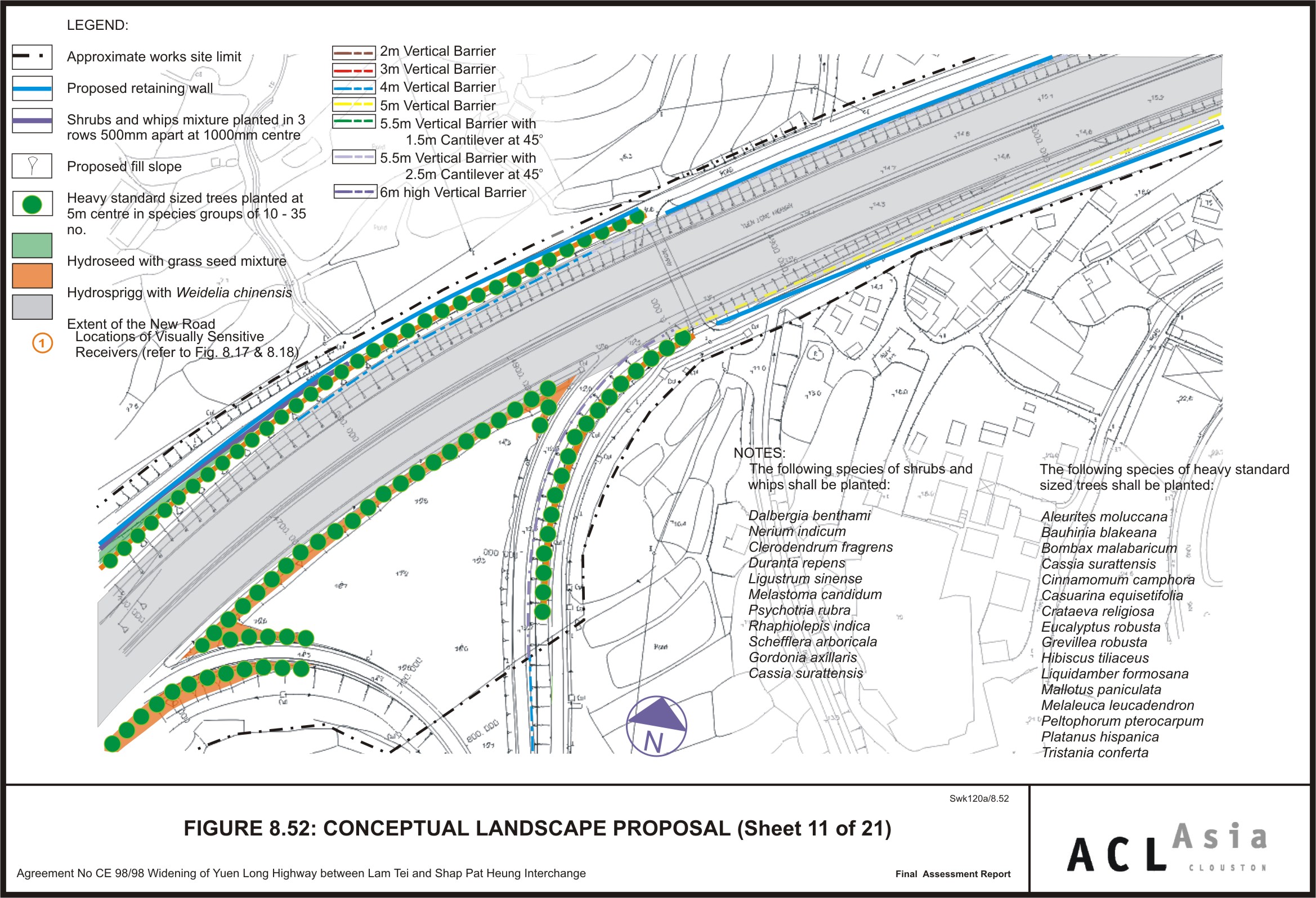
Figure 8.52
|
Conceptual
Landscape Proposal (Sheet 11 of 21)
|
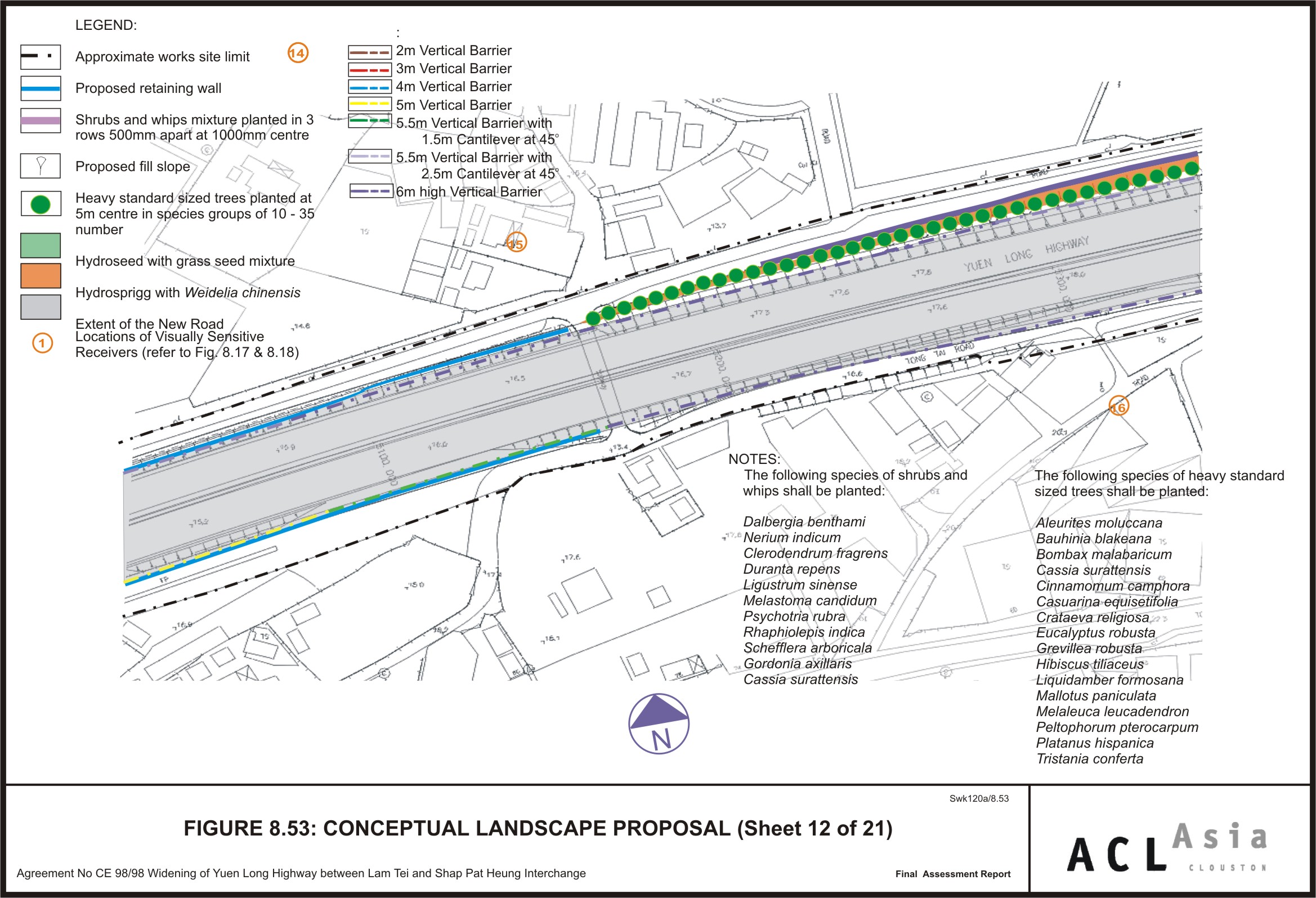
Figure 8.53
|
Conceptual
Landscape Proposal (Sheet 12 of 21)
|
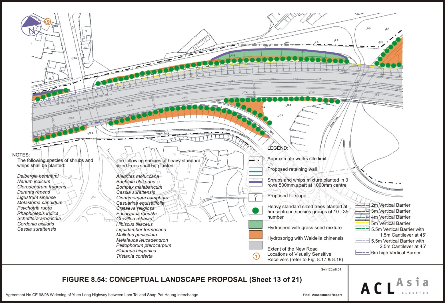
Figure 8.54
|
Conceptual
Landscape Proposal (Sheet 13 of 21)
|
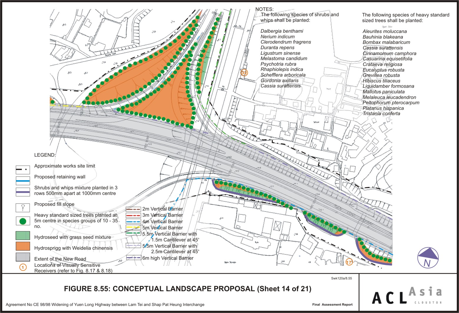
Figure 8.55
|
Conceptual
Landscape Proposal (Sheet 14 of 21)
|
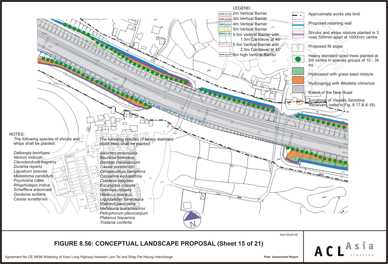
Figure 8.56
|
Conceptual
Landscape Proposal (Sheet 15 of 21)
|
Figure 8.57
|
Conceptual
Landscape Proposal (Sheet 16 of 21)
|
Figure 8.58
|
Conceptual
Landscape Proposal (Sheet 17 of 21)
|
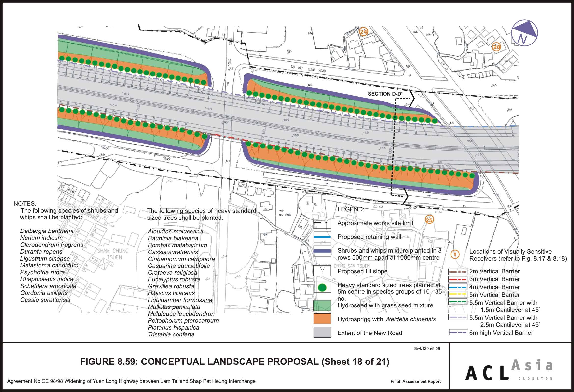
Figure 8.59
|
Conceptual
Landscape Proposal (Sheet 18 of 21)
|
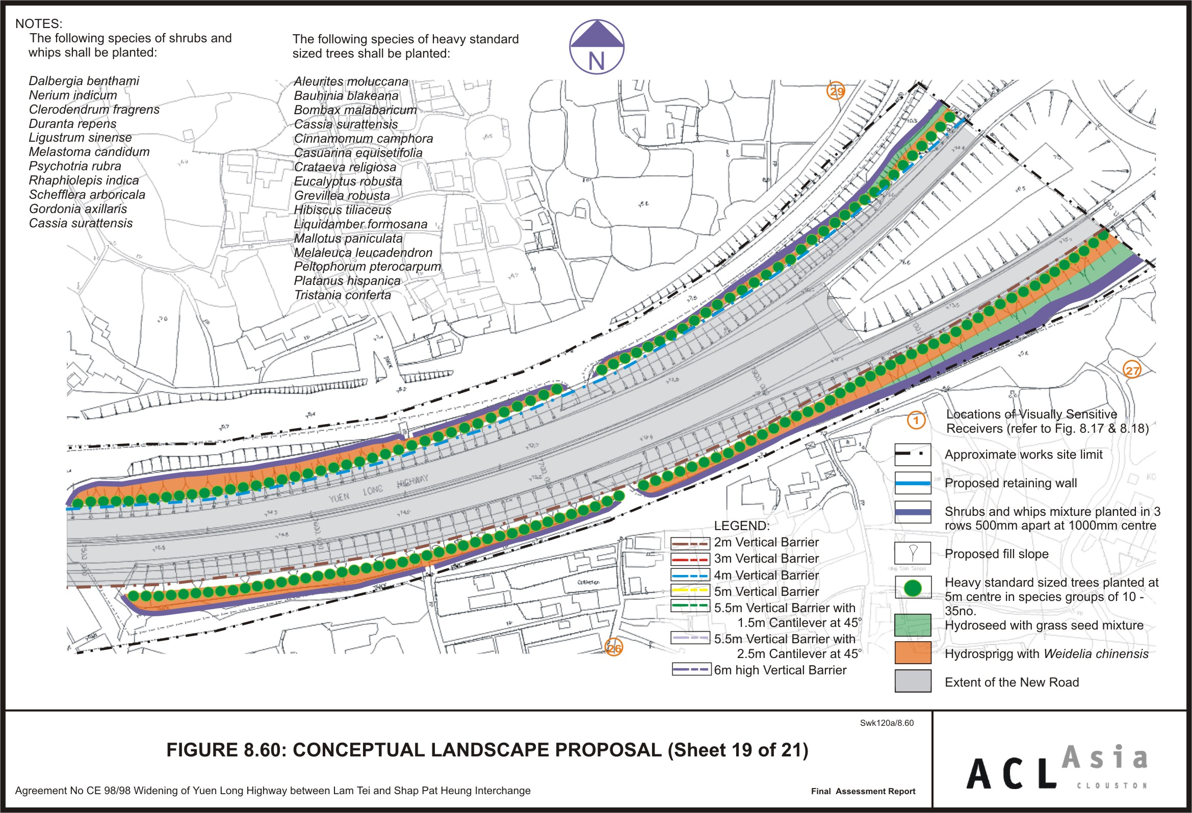
Figure 8.60
|
Conceptual
Landscape Proposal (Sheet 19 of 21)
|
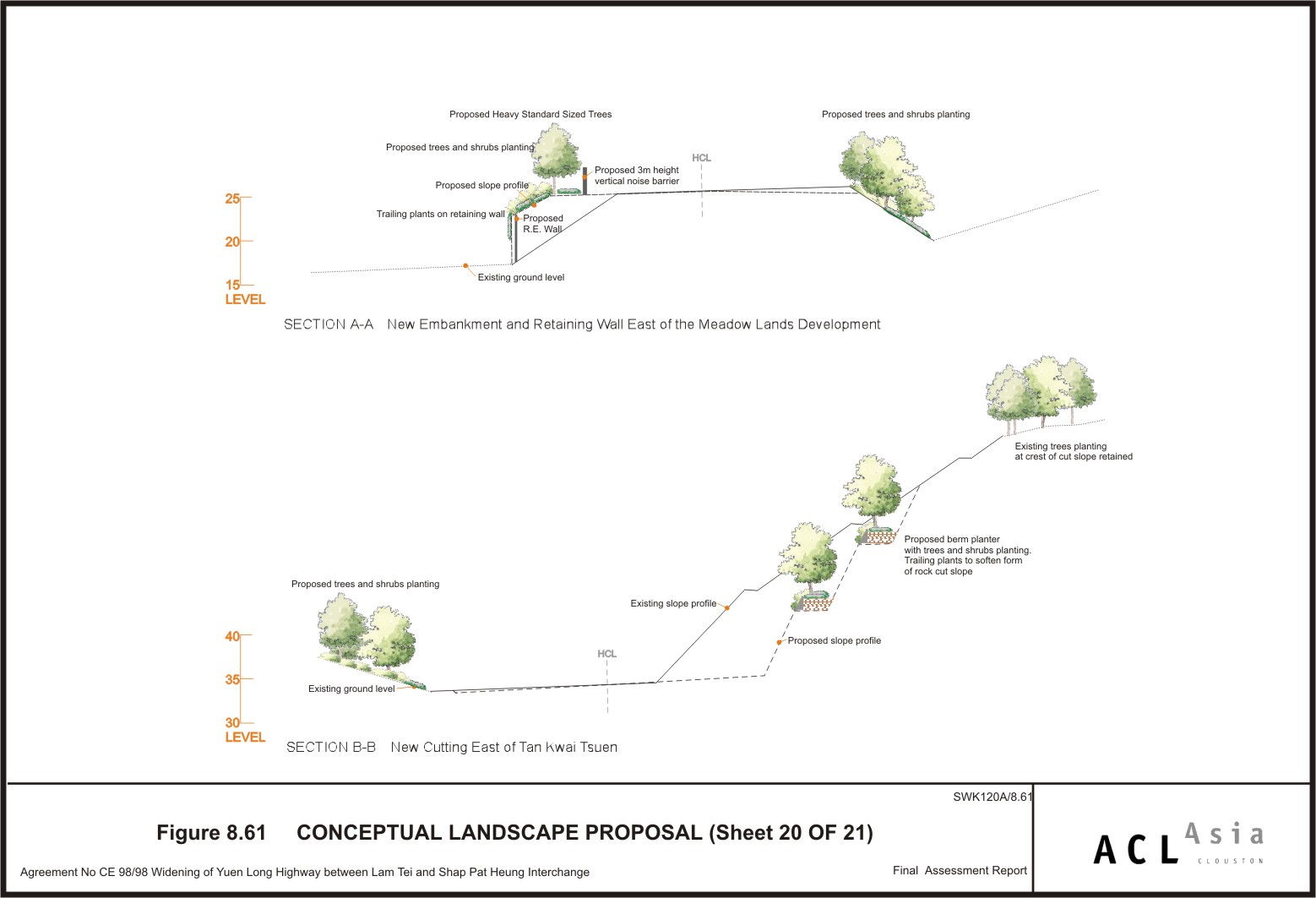
Figure 8.61
|
Conceptual
Landscape Proposal (Sheet 20 of 21)
|
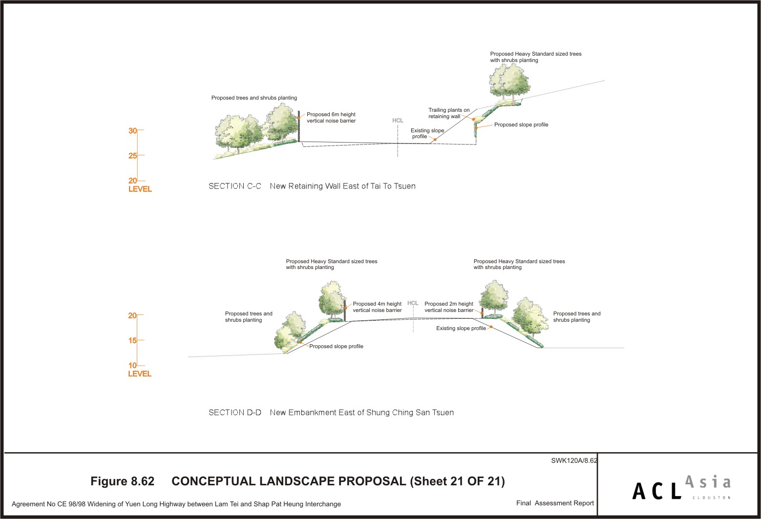
Figure 8.62
|
Conceptual
Landscape Proposal (Sheet 21 of 21)
|
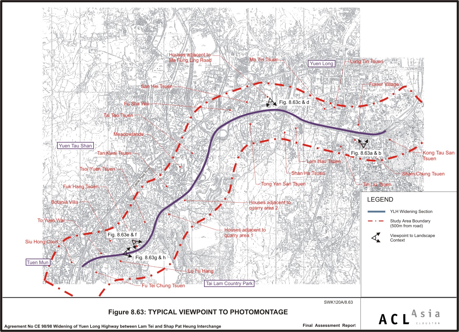
Figure 8.63
|
Typical
Viewpoints to Photomontages
|
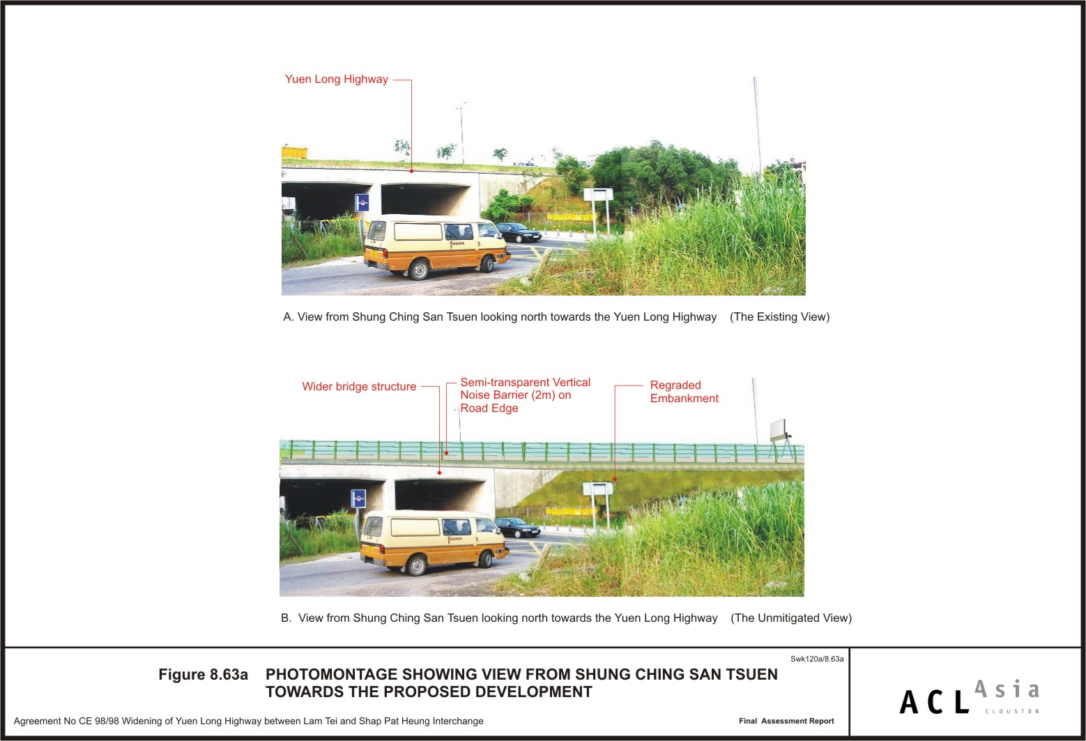
Figure 8.63a
|
Photomontage
showing view from Shung Ching San Tsuen towards the Proposed Development
|
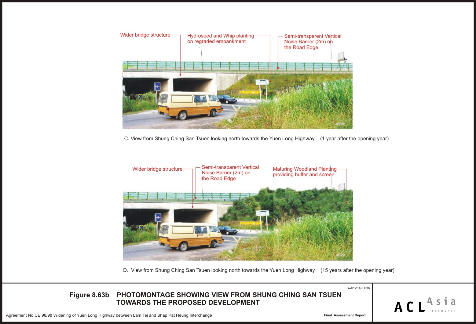
Figure 8.63b
|
Photomontage
showing view from Shung Ching San Tsuen towards the Proposed Development
|
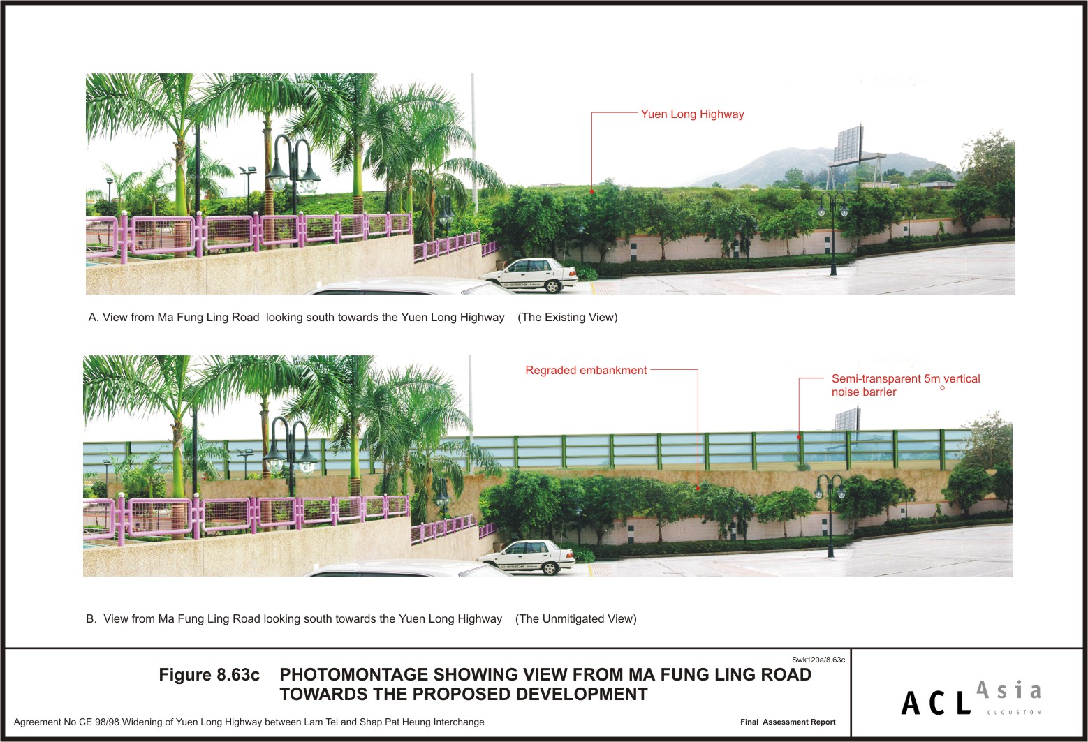
Figure 8.63c
|
Photomontage
showing view from Ma Fung Ling Road towards the Proposed Development
|
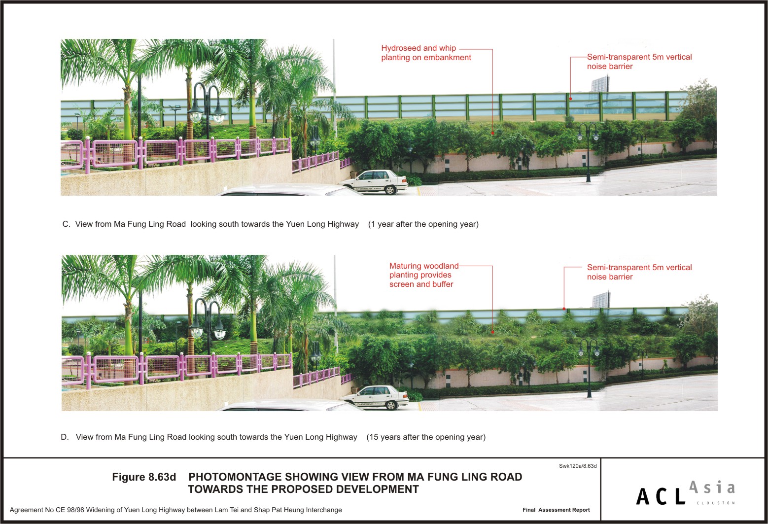
Figure 8.63d
|
Photomontage
showing view from Ma Fung Ling Road towards the Proposed Development
|
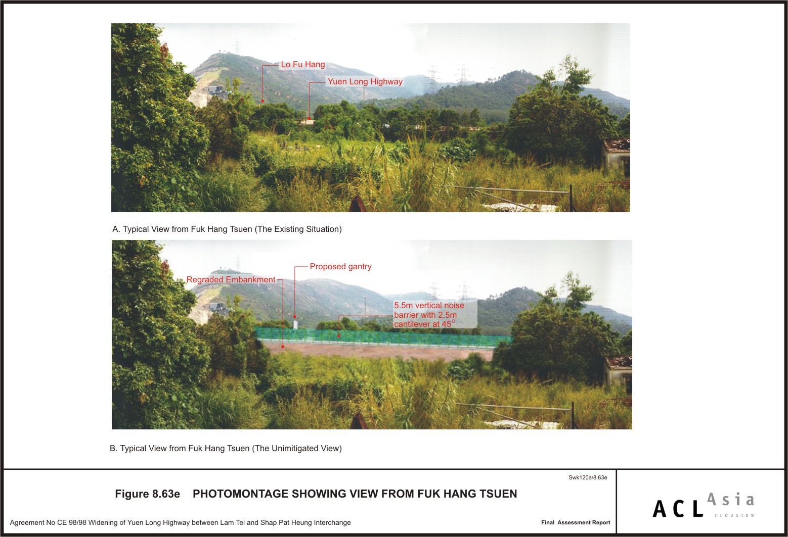
Figure 8.63e
|
Photomontage
showing view from Fuk Hang Tsuen
|
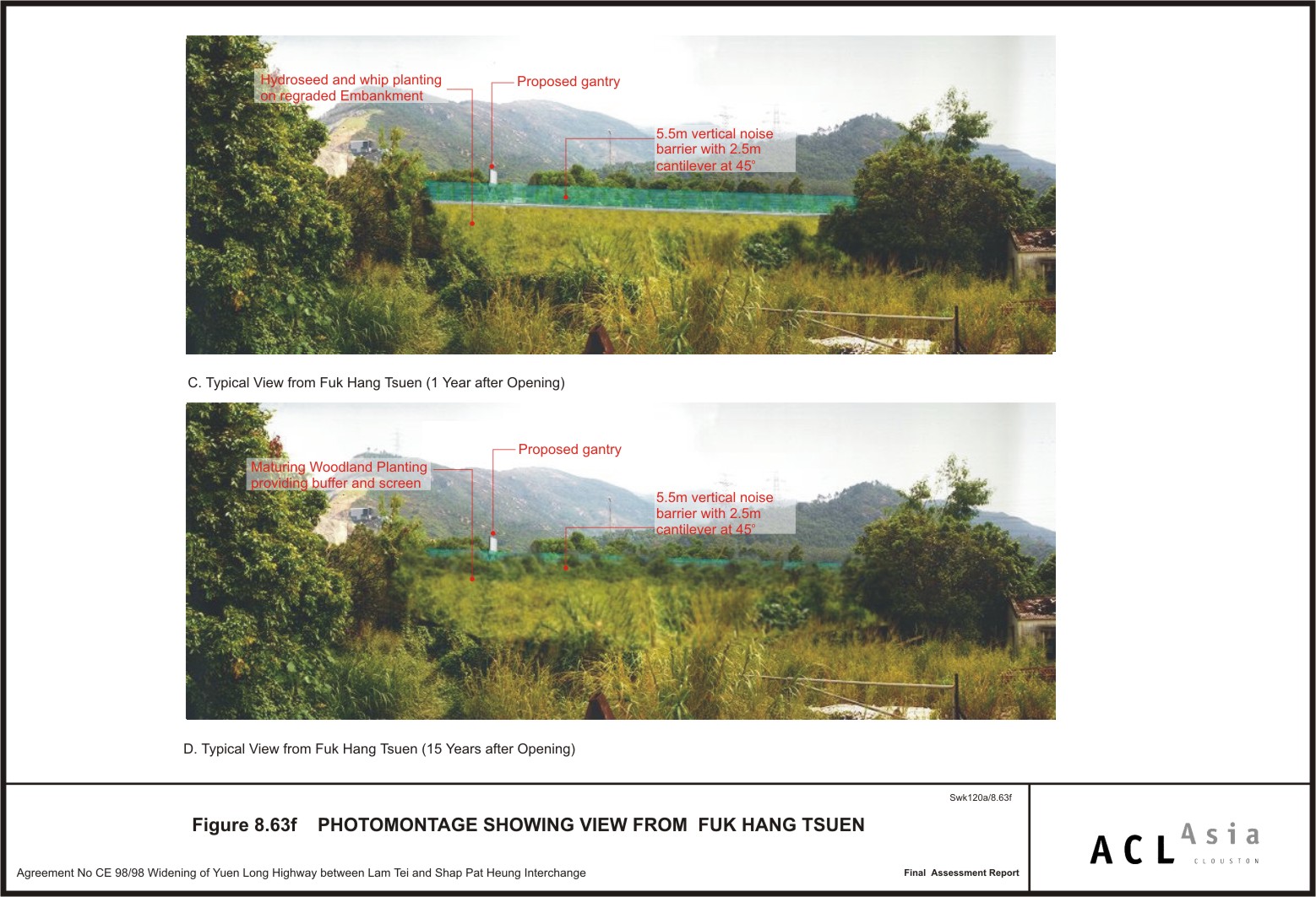
Figure 8.63f
|
Photomontage
showing view from Fuk Hang Tsuen
|
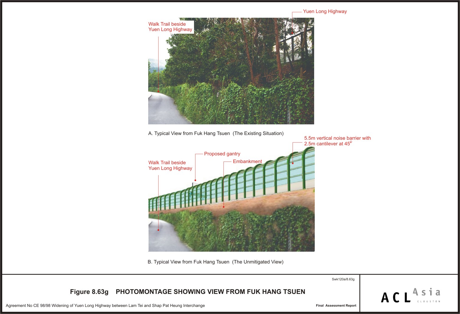
Figure 8.63g
|
Photomontage
showing view from Fuk Hang Tsuen
|
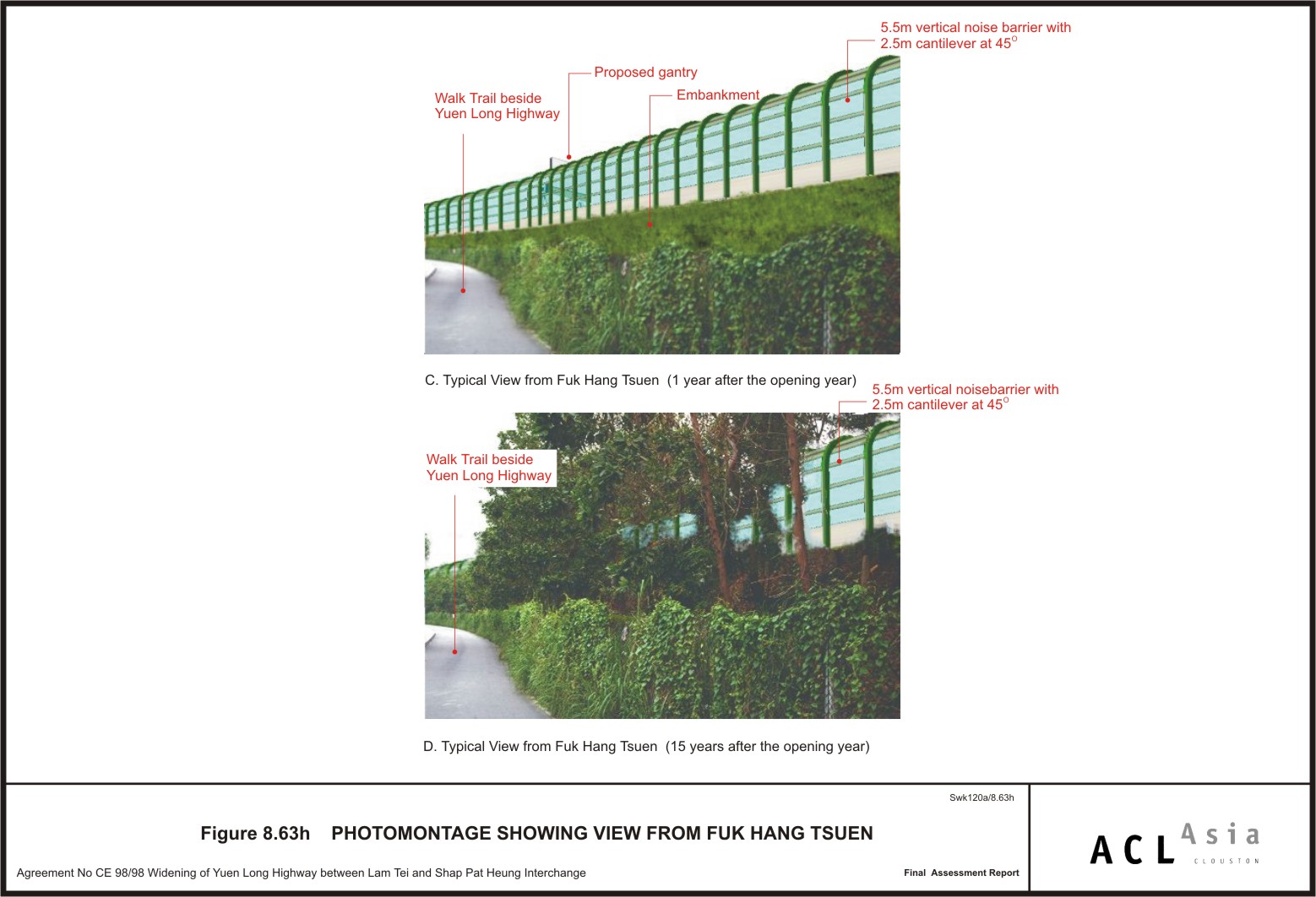
Figure 8.63h
|
Photomontage
showing view from Fuk Hang Tsuen
|
Figure 9.1
|
Villages Adjacent
to the Yuen Long Highway Alignment
|
Figure 9.2
|
The Yuen Long
Highway and Shung Ching San Tsuen, Sham Chung and Tin Liu Villages
|
Figure 9.3
|
The Yuen Long
Highway and Lam Hau and Ma Tin Villages
|
Figure 9.4
|
The Yuen Long
Highway and To Yuen Wai Village
|
|
|
|
