CONTENTS
Page
Volume 1 of 5 (Part 1)
1.
INTRODUCTION
1-1
2.
DESCRIPTION
OF THE PROJECT
2-1
3.
HYDROLOGY
IMPACT ASSESSMENT
3-1
4.
ECOLOGY
IMPACT ASSESSMENT
4-1
5.
FISHERIES
IMPACT ASSESSMENT
5-1
6.
AIR
QUALITY IMPACT ASSESSMENT
6-1
7.
NOISE
IMPACT ASSESSMENT
7-1
Volume 2 of 5 (Part 2)
8.
WATER
QUALITY IMPACT ASSESSMENT
8-1
9.
WASTE
IMPACT ASSESSMENT
9-1
10.
CONTAMINATED
LAND ASSESSMENT
10-1
11.
CULTURAL
HERITAGE IMPACT ASSESSMENT
11-1
12.
LANDSCAPE
AND VISUAL IMPACT ASSESSMENT
12-1
13.
CONSTRUCTION
METHODS, PROGRAMME &
13-1
14.
LAND
USE & URBAN PLANNING IMPLICATION FOR SPUR LINE
14-1
15.
ENVIRONMENTAL
MONITORING AND AUDIT REQUIREMENTS
15-1
16.
CONCLUSIONS
AND RECOMMENDATIONS
16-1
Appendices
Volume 3 of 5 (Part 1)
A Environmental legislation and planning guidelines
A2.1 Evaluation of alternative alignment options
A3.1 Geological assessment details for hydrological impact assessment
A3.1c Data field sheet at exiting pump well Wm2A observation wells Sp1, Sp2 & Sp3 and reference point ‘S2” on the bridge
A3.1d Permeability test results
A3.1e
Location plans of proposed
tunnel alignment at
A3.1f Seep/w modelling results and diagrams
A3.2 Additional hydrology issues
A4.1 Ecological baseline report for spur line alignment
Volume 4 of 5 (Part 2)
A4.2 Draft habitat creation management plan for Lok Ma Chau Fishponds Compensation area
A4.3 Comparison of HKBWS Waterfowl Data for San Tin / Lok Ma Chau Ramsar Site (1999/2000) and Data from Baseline Report (2000/2001)
A4.5 Cases of Successful Habitat Enhancement for Species
A5.1 Glossary for Fisheries Impact Assessment
A7.1 Construction Noise Calculations
A7.1a Worst case construction noise assessment scenario, their relevant construction activities and predicted noise levels due to each activity
A7.1b
Equipment
schedule and sound power levels of construction activities identified under
the worst case scenario
A7.1c Provisional construction equipment schedule and preliminary construction programme for all works between CH30+227
A7.1d Summary of Predicted Construction Noise Levels at Representative Noise Sensitive Receivers
A7.2 Operational noise assessment details
A7.2a Design speed profile of trains on east rail and spur line
A7.2b Procedures for airborne noise calculations of EMU train noise an description of a sample calculation for RNSR 2-1
A7.2c Breakdown of future unmitigated and mitigated rail nose levels
A7.2d Proposed speed profile of trains on east rail and spur line
A8.1 Effluent Quality for Treatment Plant at West Rail Contract DB320
A10.1 Contaminated assessment plan
A10.1a Contaminated land site survey details
A11.1a Cultural heritage assessment detail
List of figures
Volume
5 of 5
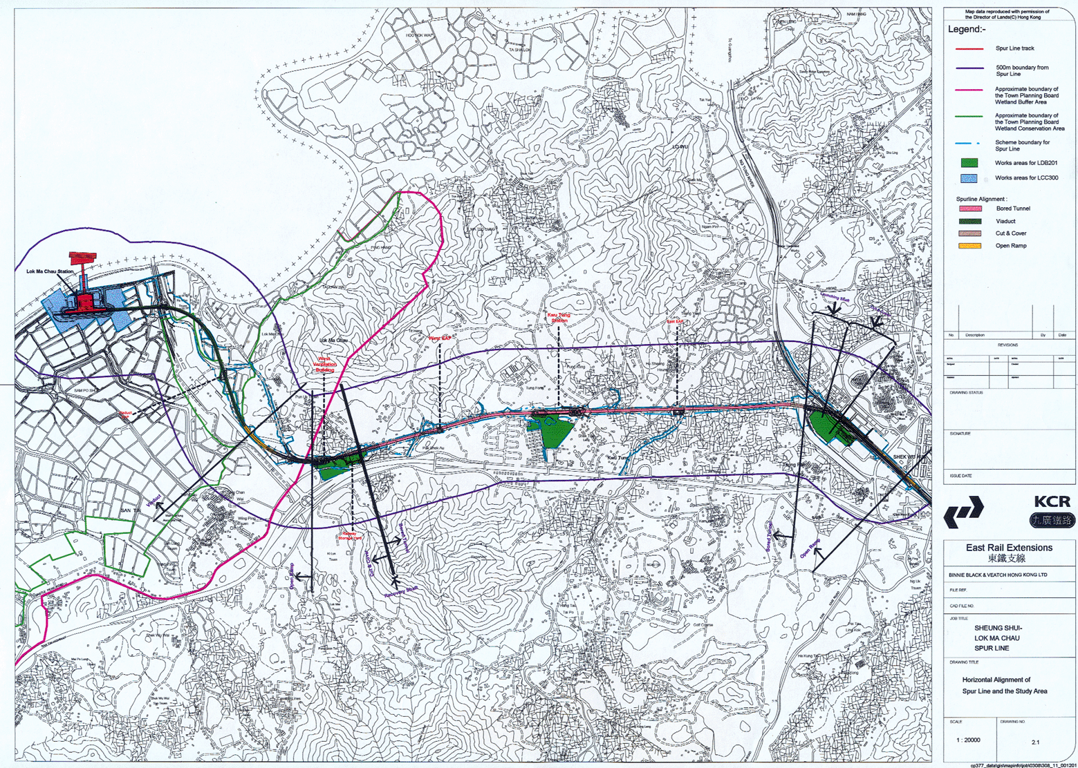
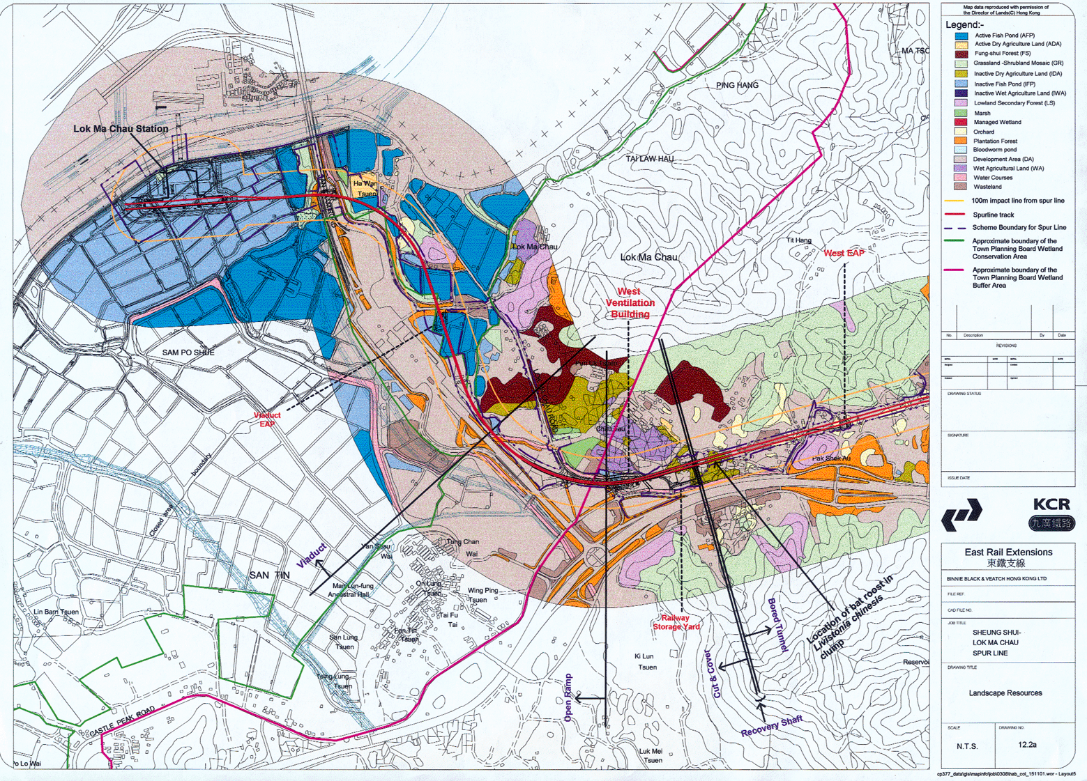
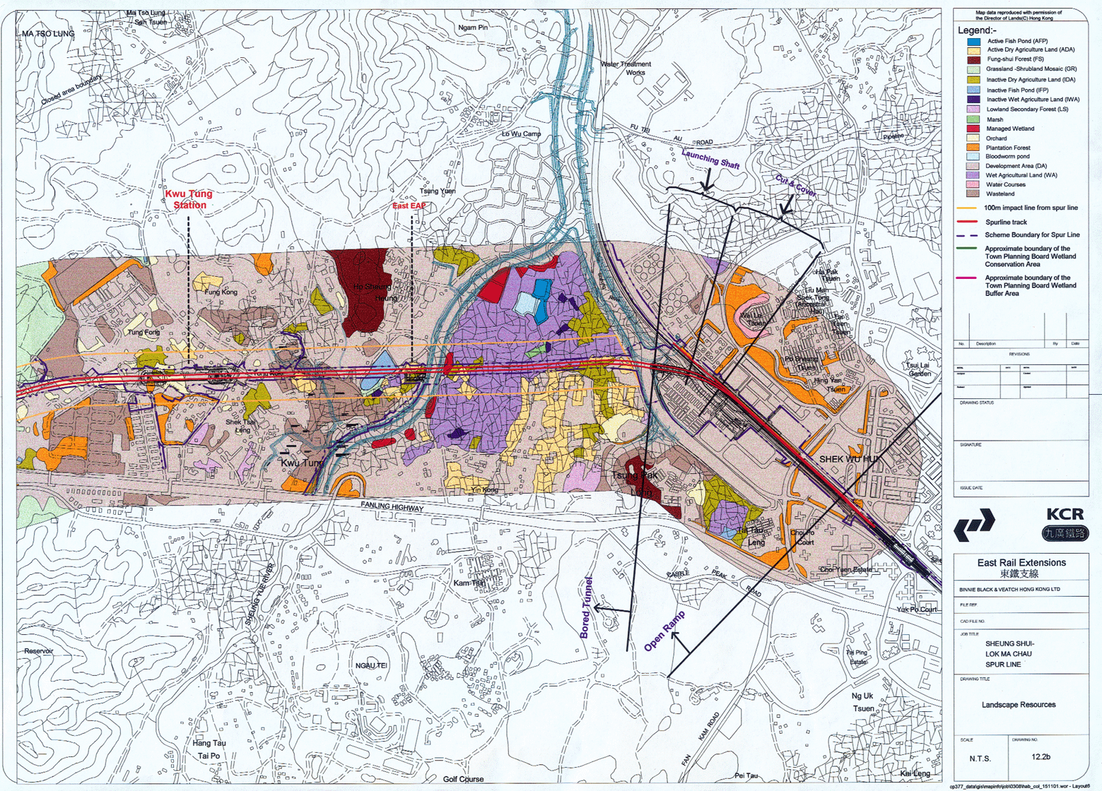
2.1 Horizontal Alignment of Spur Line and the Study Area
2.2 Vertical Profile of Spur Line
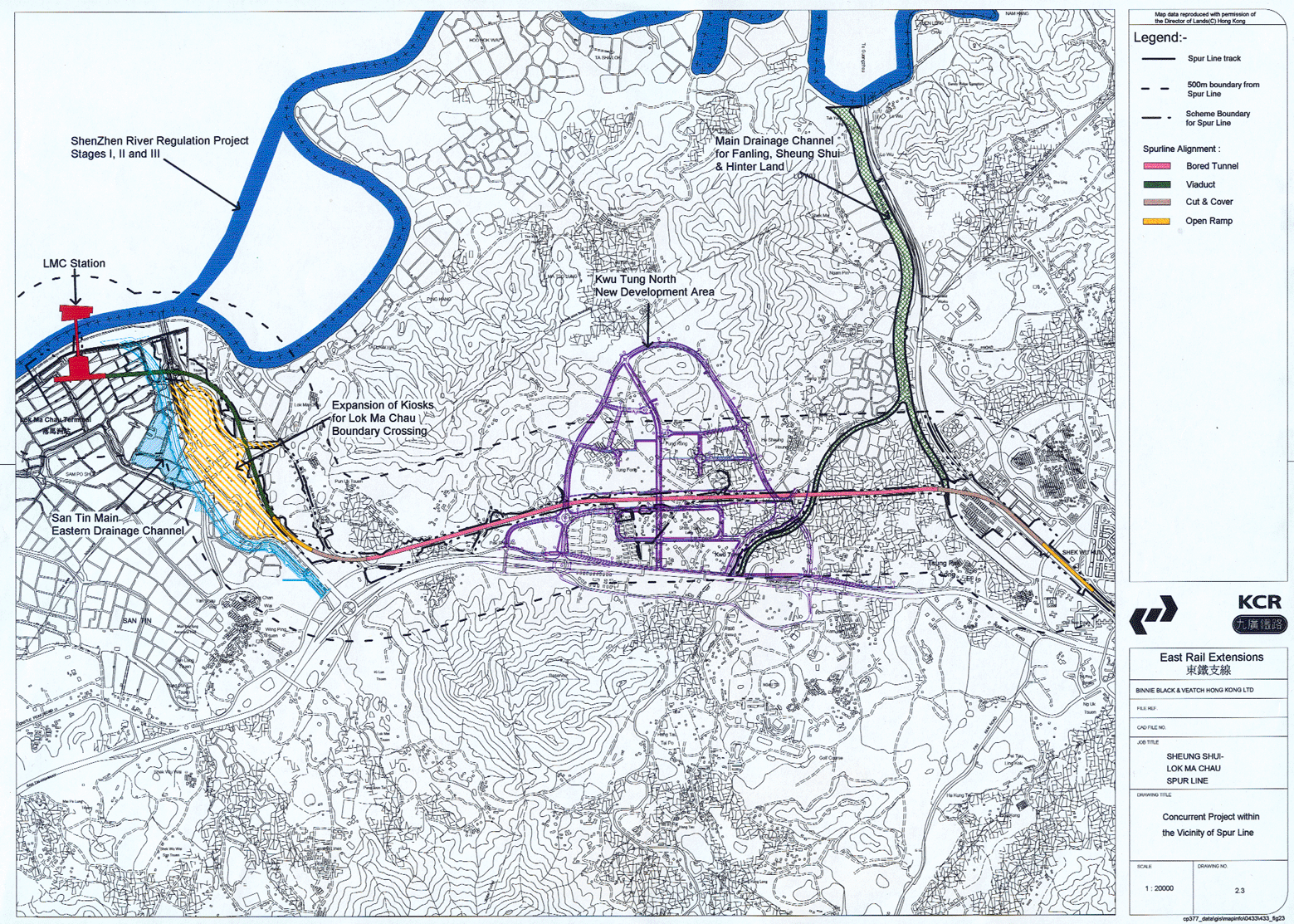
2.3 Concurrent Projects within the vicinity of Spur Line
2.4 Locations of alternative alignment considered under the PPFs with the environmentally preferred alignment high lighted
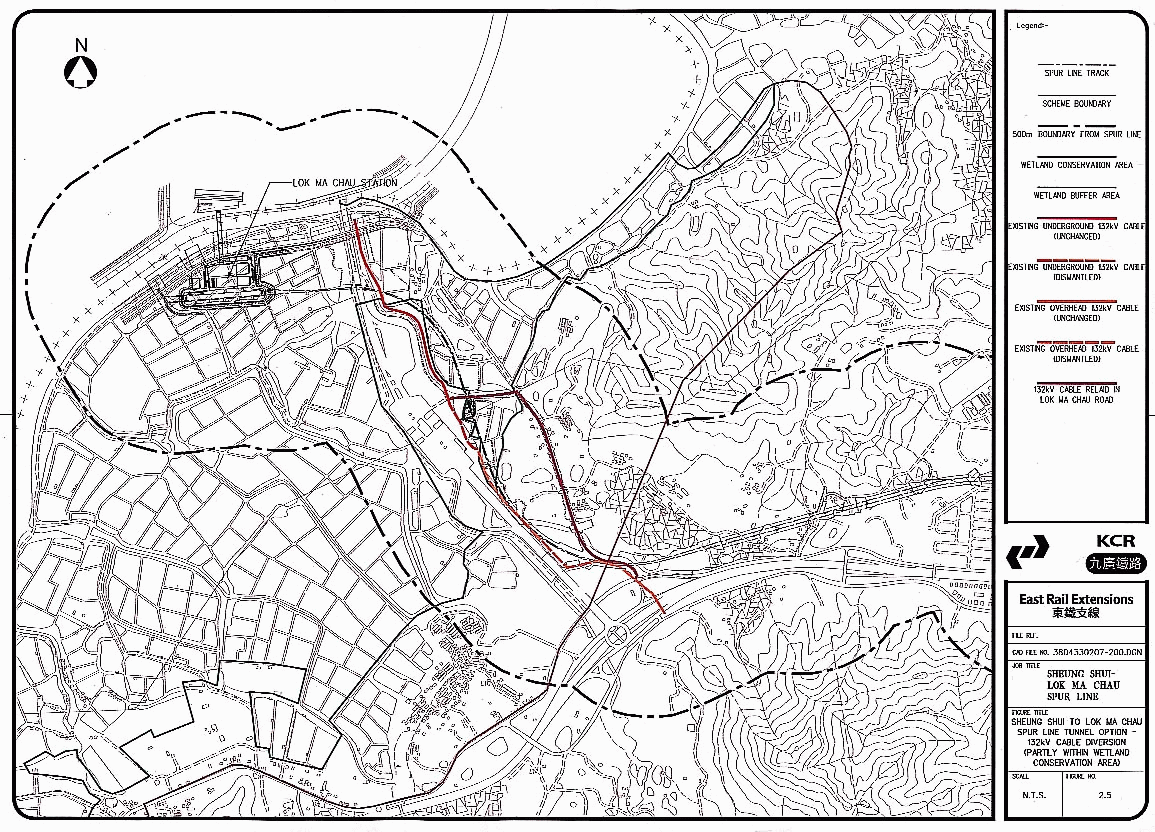
2.5 Sheung Shui to LMC Spur Line tunnel option - 132kV cable diversion (partly within wetland conservation area)
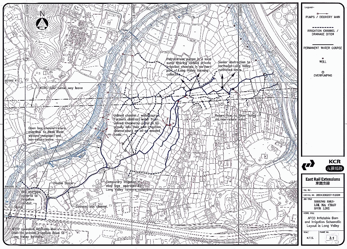
3.1
AFCD Inflatable Dam and Irrigation Schematic Layout in
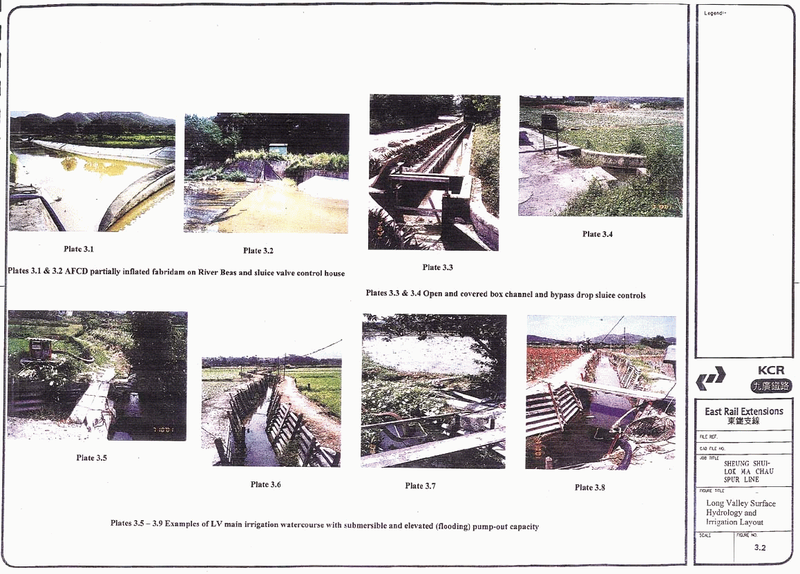
3.2
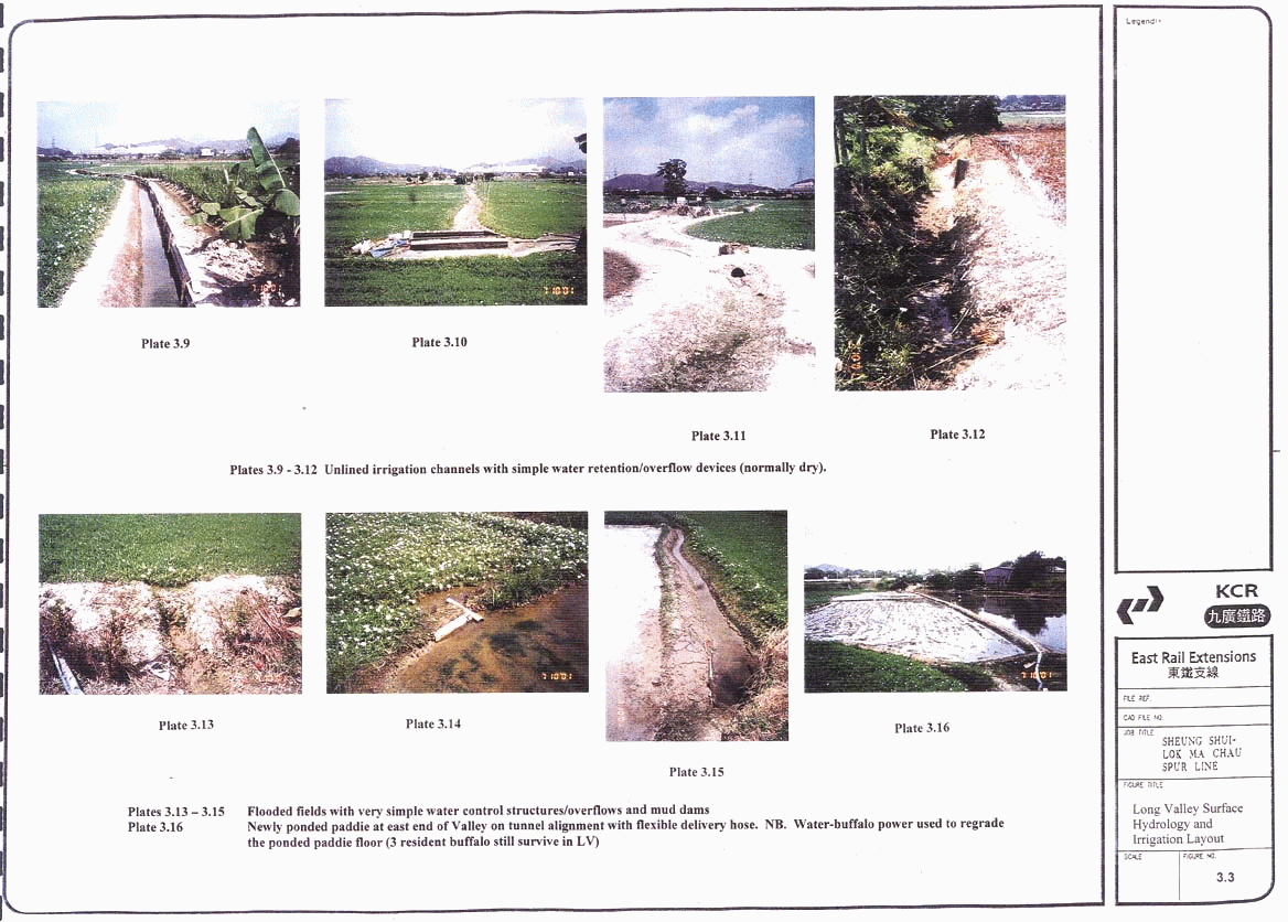
3.3
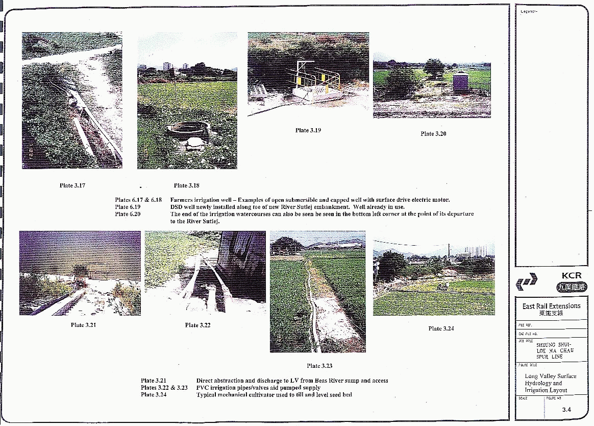
3.4
3.5
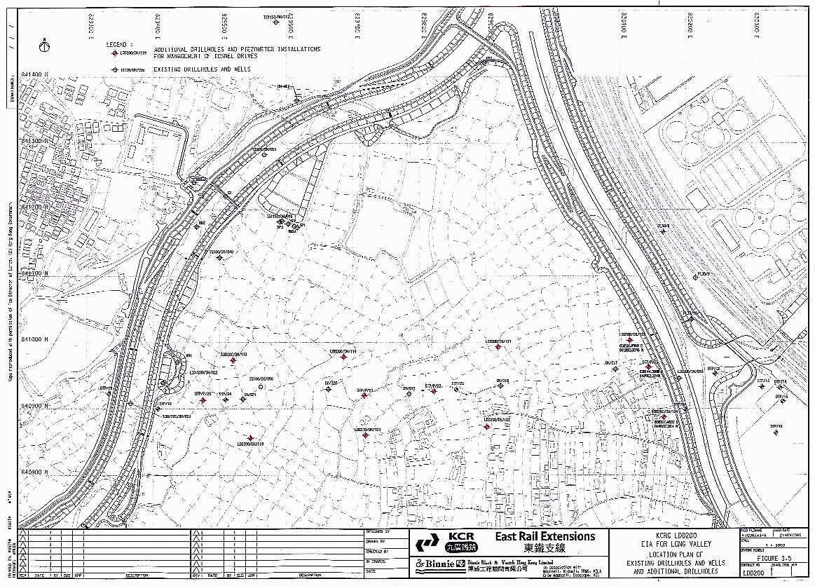
Location Plan of Existing Drillholes
and Wells and Additional Drillholes
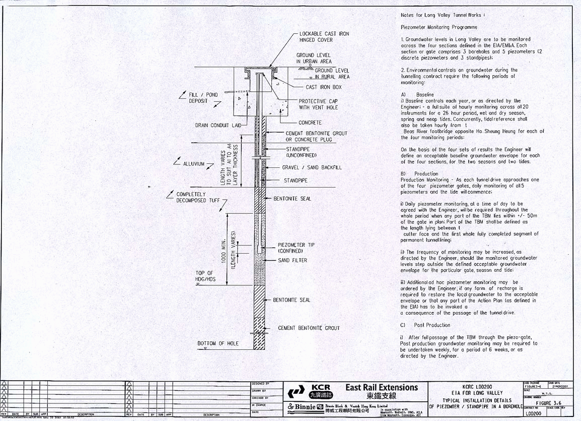
3.6
Typical installation details of Piezomter
/ Standpipe in a Borehole
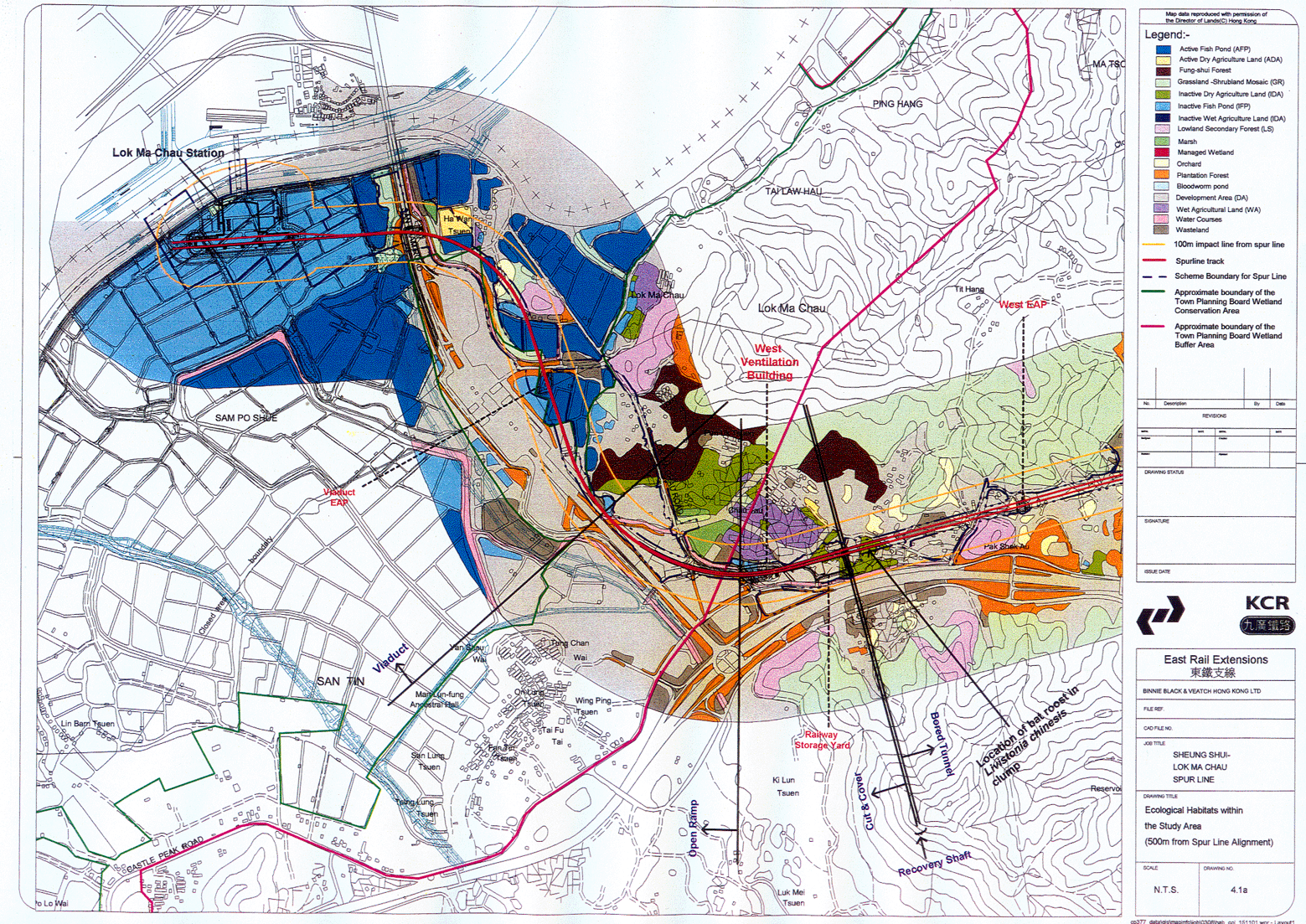
4.1a Ecological Habitats within the Study Area (500 m from Spur Line Alignment)
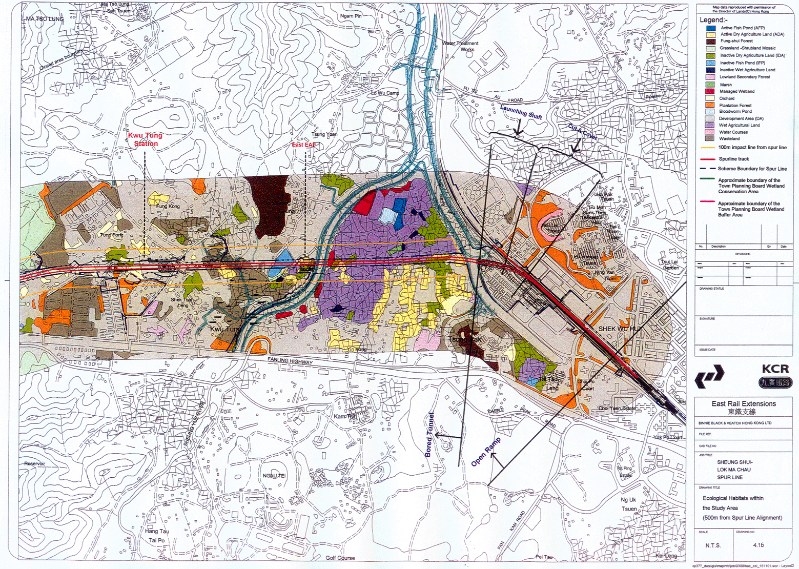
4.1b Ecological Habitats within the Study Area (500 m from Spur Line Alignment)
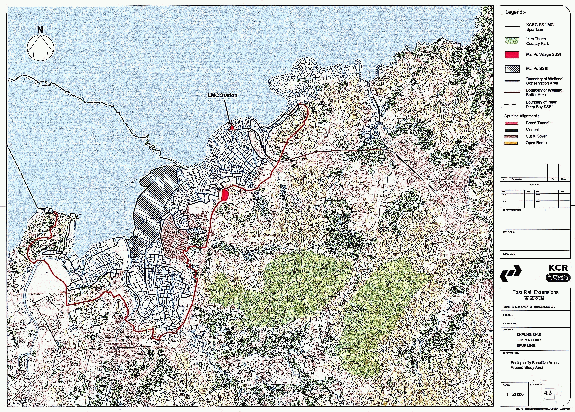
4.2 Ecologically Sensitive Areas Around Study Area
4.3 Disturbance Impact Zone from Spur Line and Other Projects in Lok Ma Chau Area
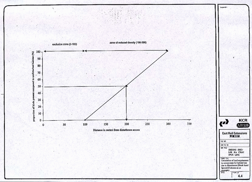
4.4
Calculation of land requirement
to compensate for habitat loss due to disturbance (Black faced Spoonbill
chosen as an example)
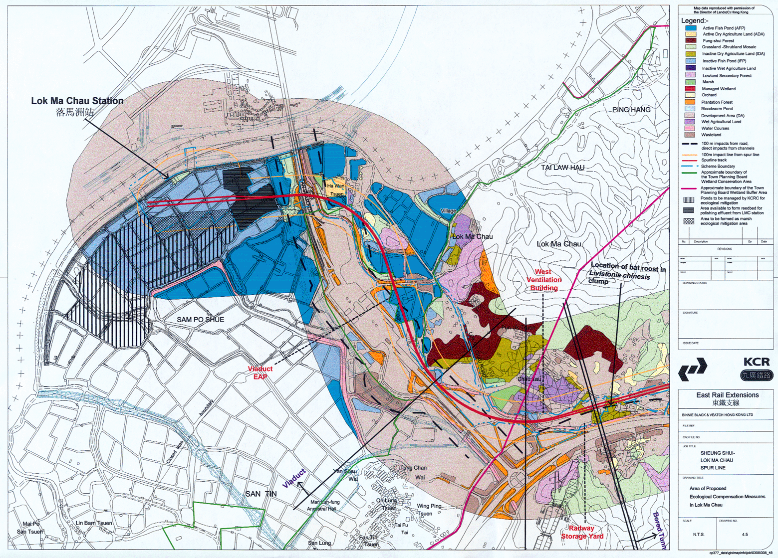
4.5 Area of Proposed Ecological Compensation Measures in Lok Ma Chau
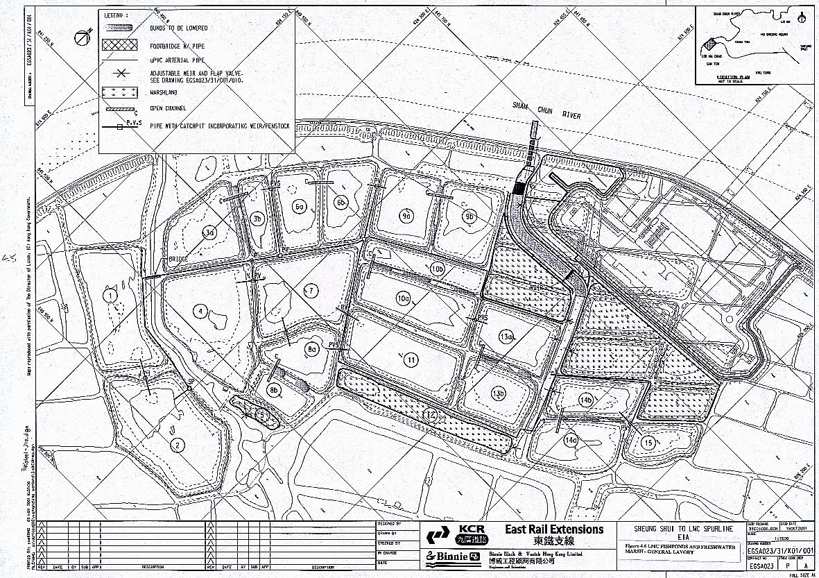
4.6 LMC Fishponds and Freshwater Marsh – General Layout
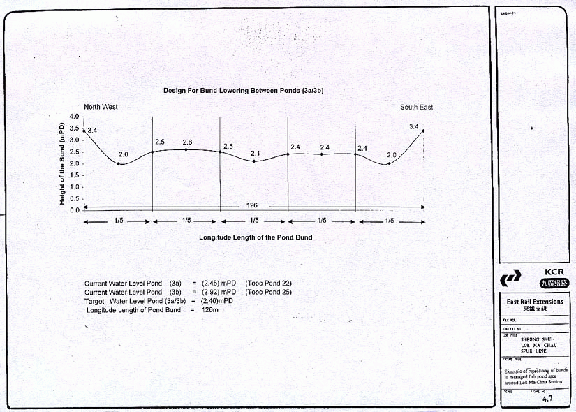
4.7
Example of reprofiling of bunds in
managed fish pond area around Lok Ma Chau Station
4.8 Freshwater Marsh – south of the LMC station showing contours
4.9 Planting plans
4.10a Pre-construction enhancement and current situation showing disturbance zones of current infrastructure
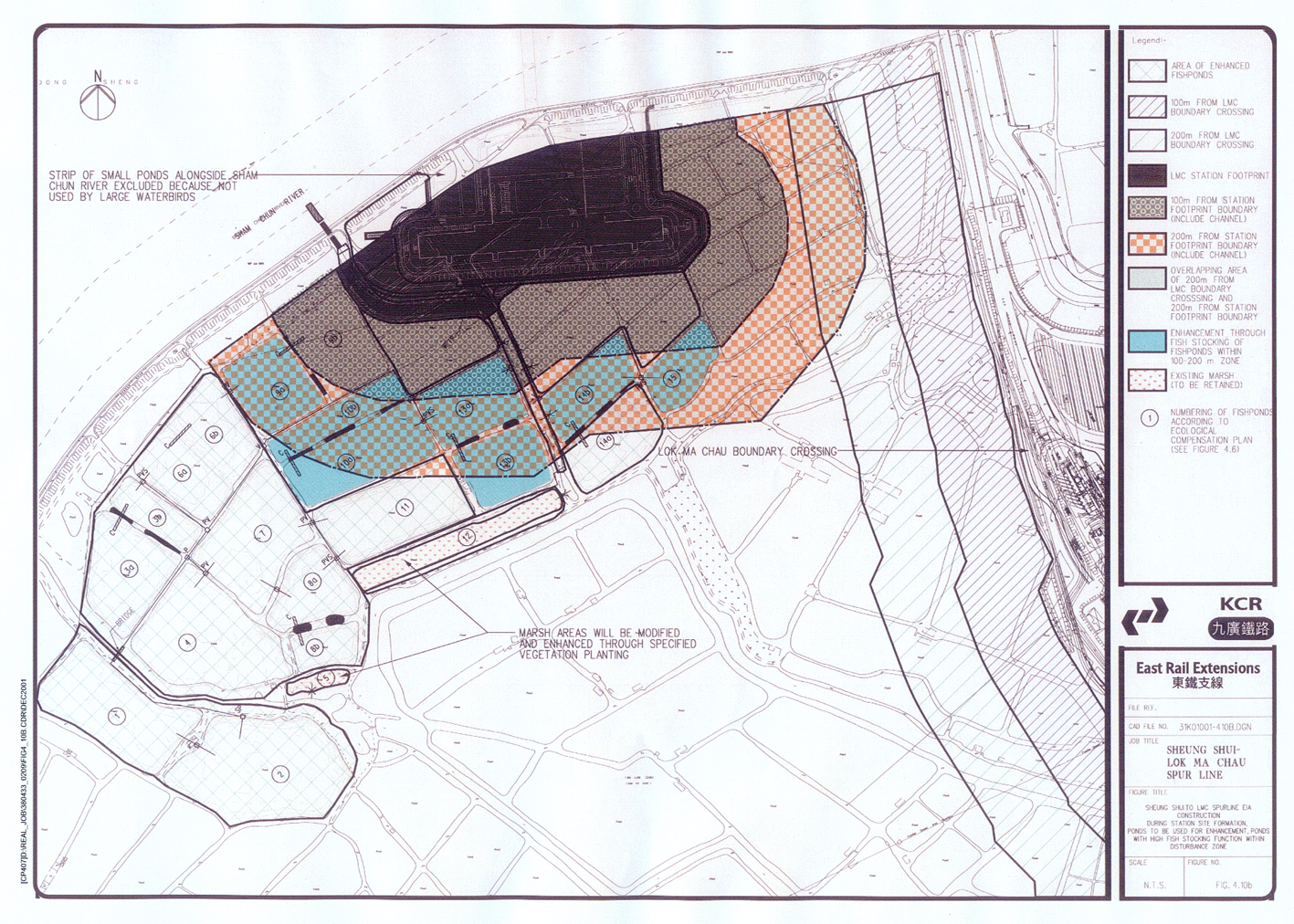
4.10b During Station site formation, ponds to be used for enhancement, ponds with high fish stocking function within disturbance zone
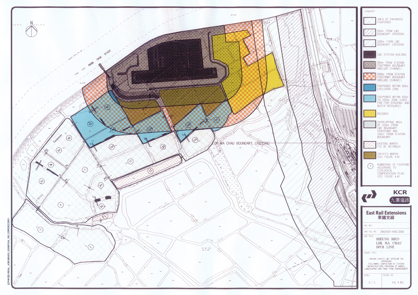
4.10c Operation - Following completion of station infrastructure, creation of marsh, landscaping and final pond enhancement
6.1
Representative NSR and ASR (sheet 1 to 5 of 5)
6.2
Topographic features of the Deep Bay Airshed
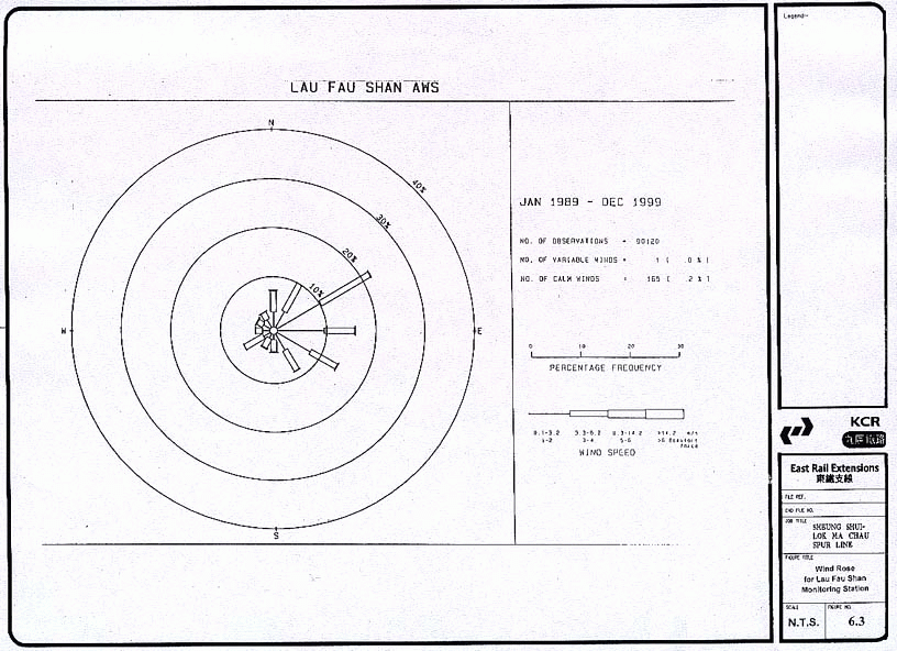
6.3
Wind Rose for Lau Fau Shan Monitoring Station
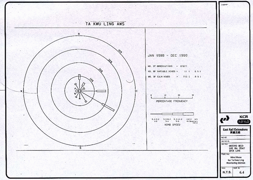
6.4
Wind Rose for Ta Kwu Ling Monitoring Station
7.1 Construction phase representative NSR & locations of construction phase noise barriers (sheet 1 to 5 of 5)
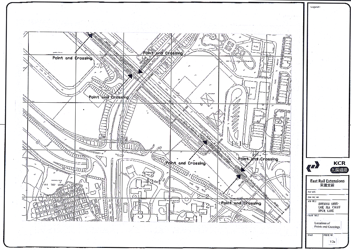
7.2a Locations of Point and Crossing
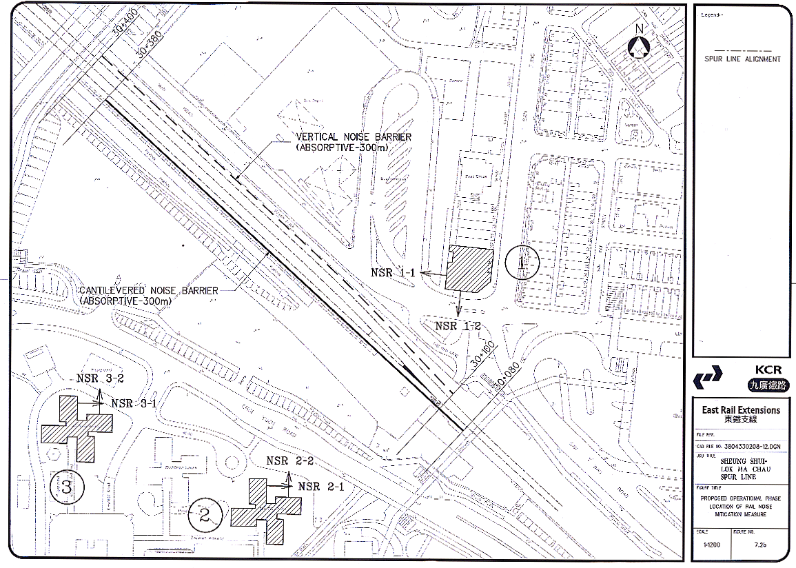
7.2b Proposed Operational Phase Location of Rail Noise Mitigation Measure
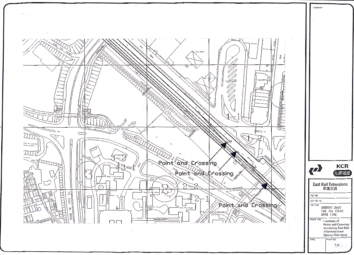
7.2c Locations of Point and Crossing on Existing East Rail Alignment (Near Sheung Shui)
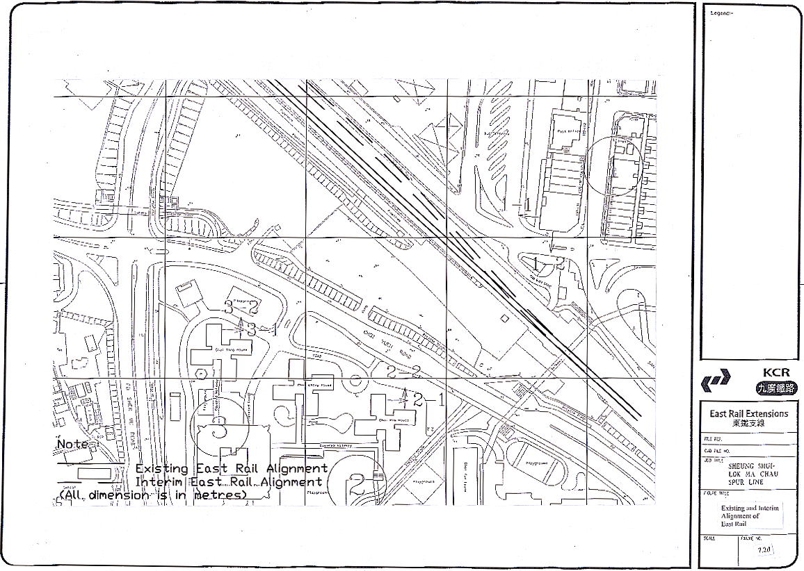
7.2d Existing and Interim Alignment of East Rail
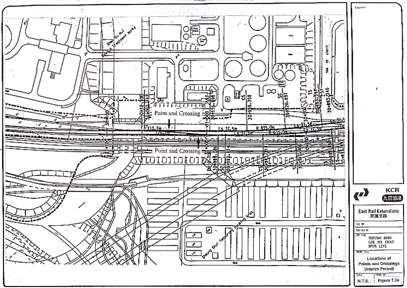
7.2e Locations of Points and Crossing (Interim Period)
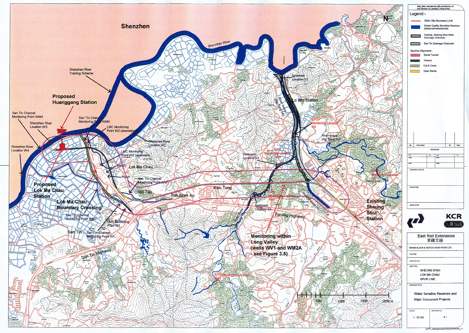
8.1 Water sensitive receivers and major concurrent projects
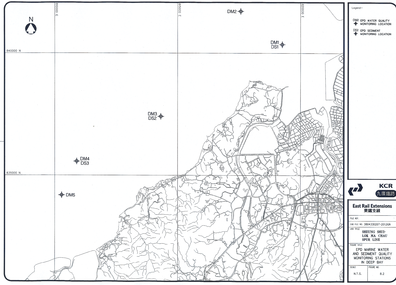
8.2
EPD marine water and sediment quality monitoring stations
in
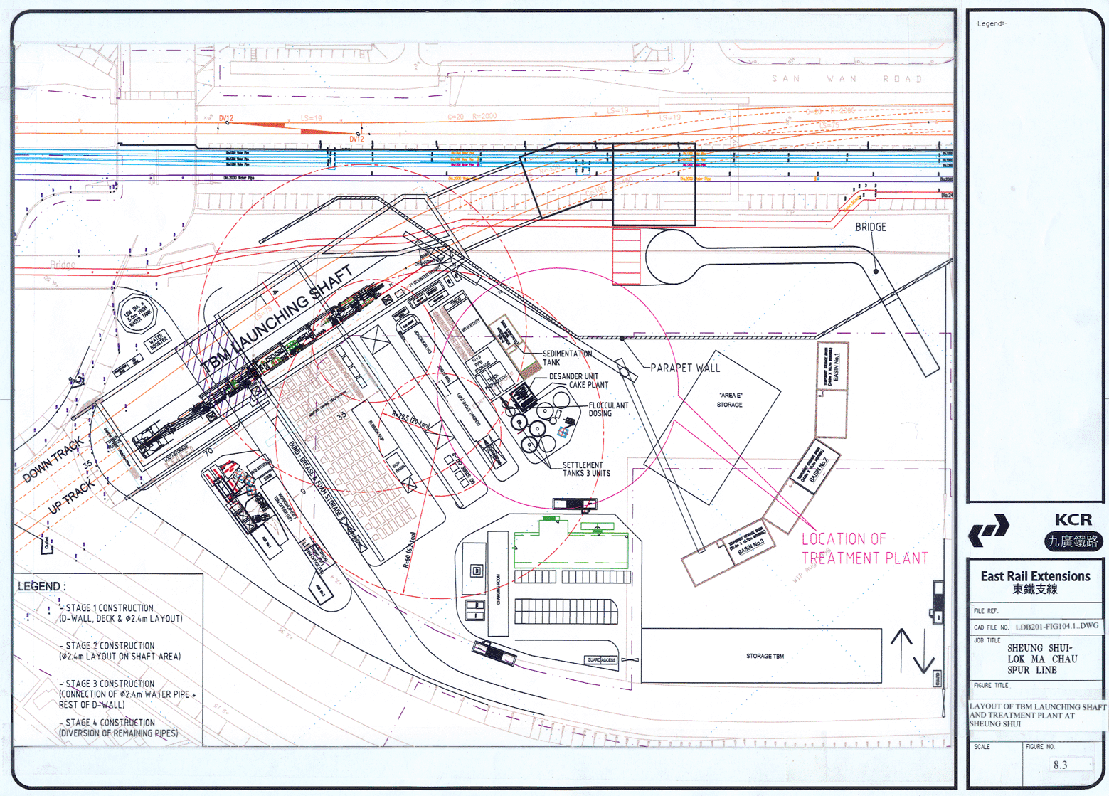
8.3 Layout of treatment plant of launching shaft works area in Sheung Shui
8.4 Location of reedbed proposed for effluent polishing
8.5 Proposed layout for reedbed
9.1 Geological profile along Spur Line Alignment
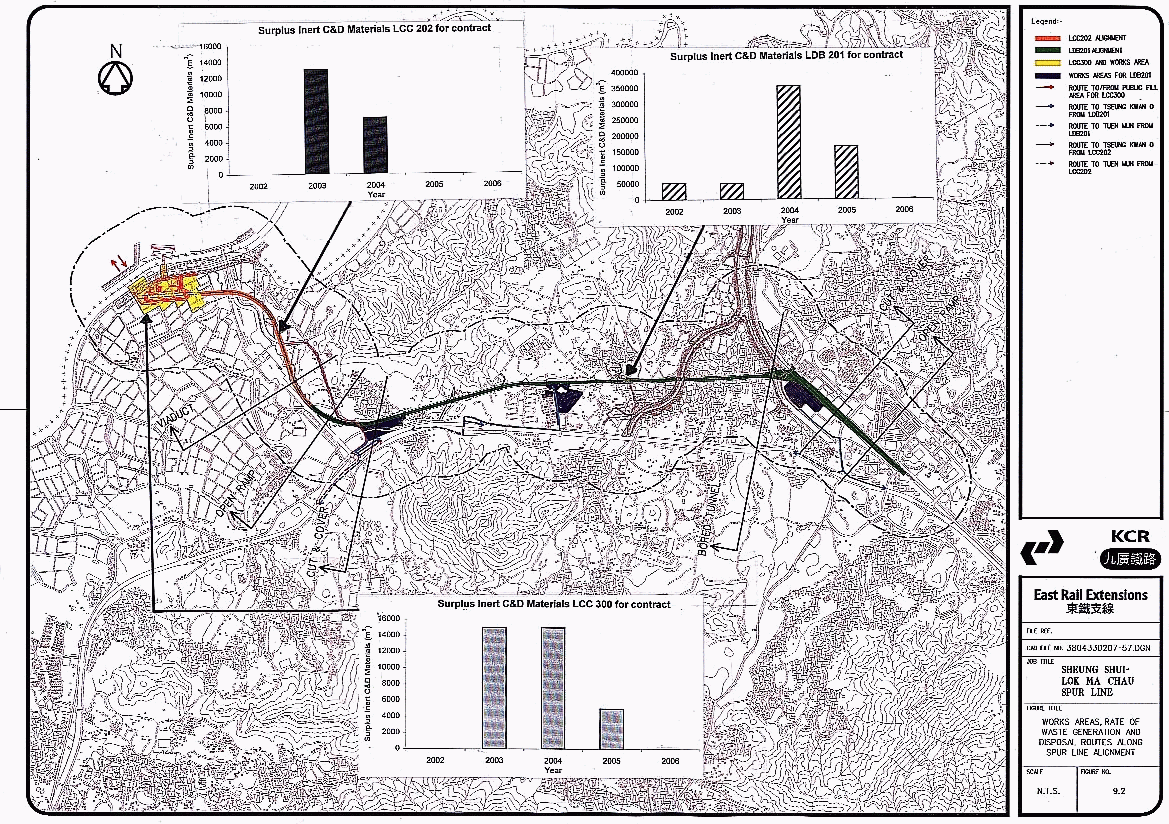
9.2 Works areas, rate of waste generation & disposal routes Spur Line alignment.
10.1 Sites identified as having potentially contaminated land (sheet 1 of 4)
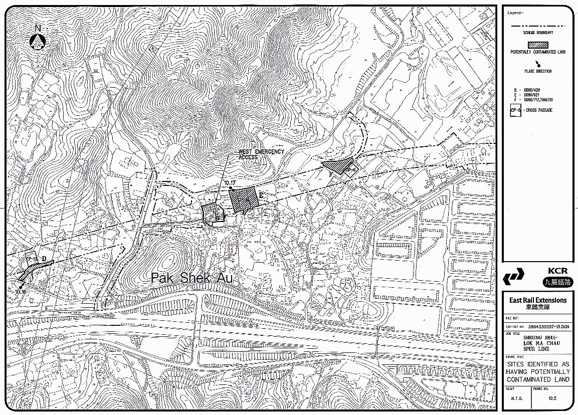
10.2 Sites identified as having potentially contaminated land (sheet 2 of 4)
10.3 Sites identified as having potentially contaminated land (sheet 3 of 4)
10.4 Sites identified as having potentially contaminated land (sheet 4 of 4)
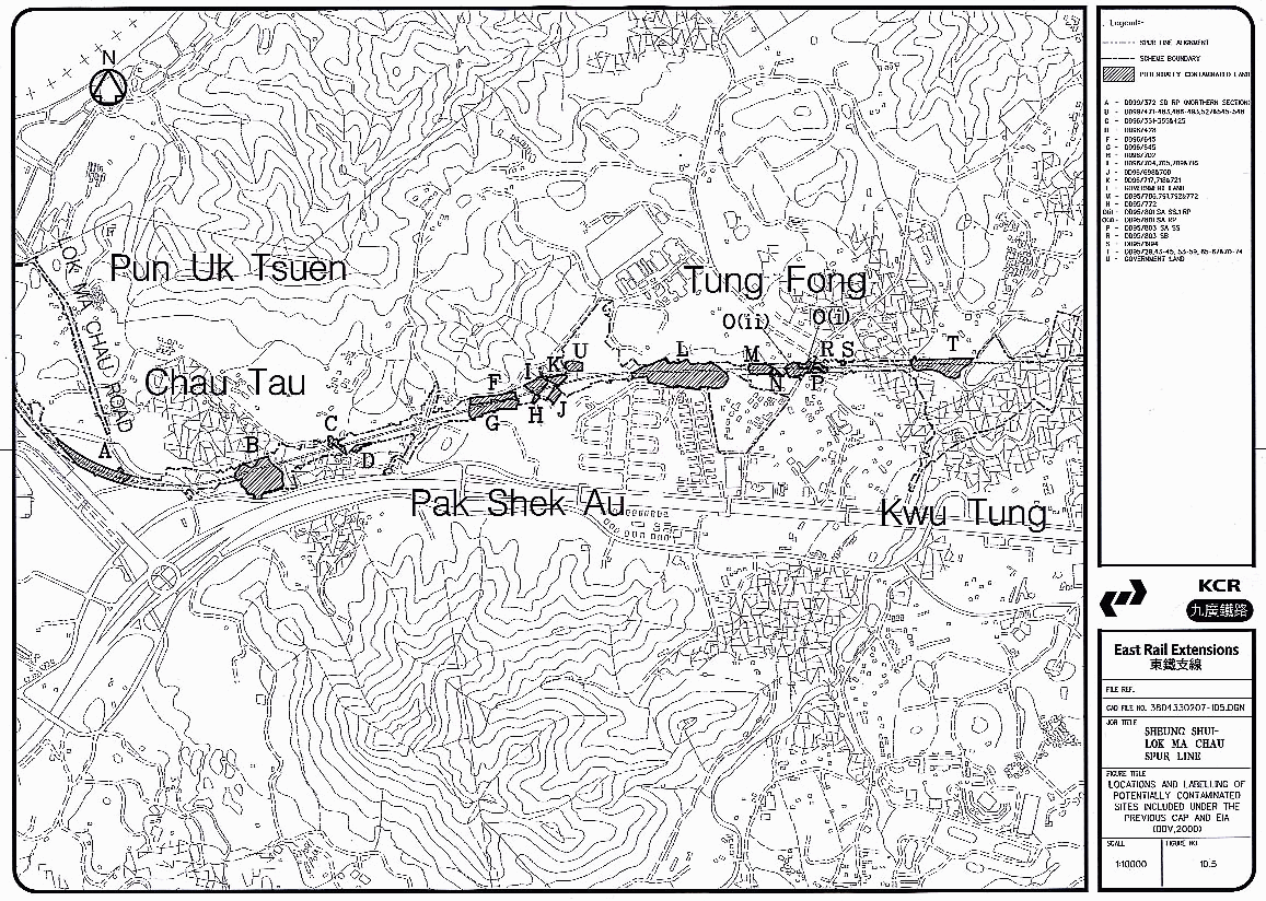
10.5 Locations & Labelling of potentially contaminated sites included under the previous cap & EIA (BBV, 2000)
10.6 Proposed boreholes and trial pits for contamination assessment plan (CAP)
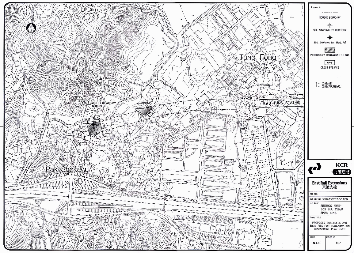
10.7 Proposed boreholes and trial pits for contamination assessment plan (CAP)
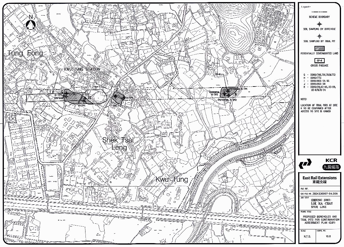
10.8 Proposed boreholes and trial pits for contamination assessment plan (CAP)
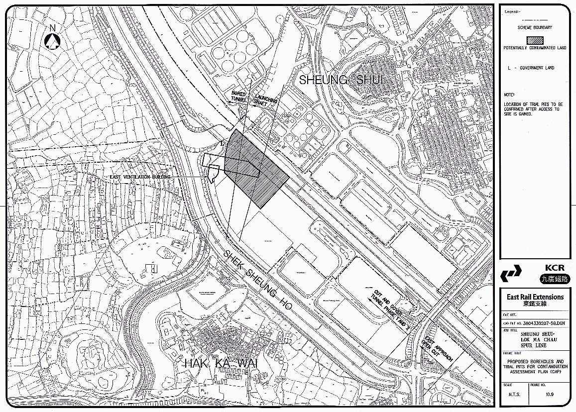
10.9 Proposed boreholes and trial pits for contamination assessment plan (CAP)
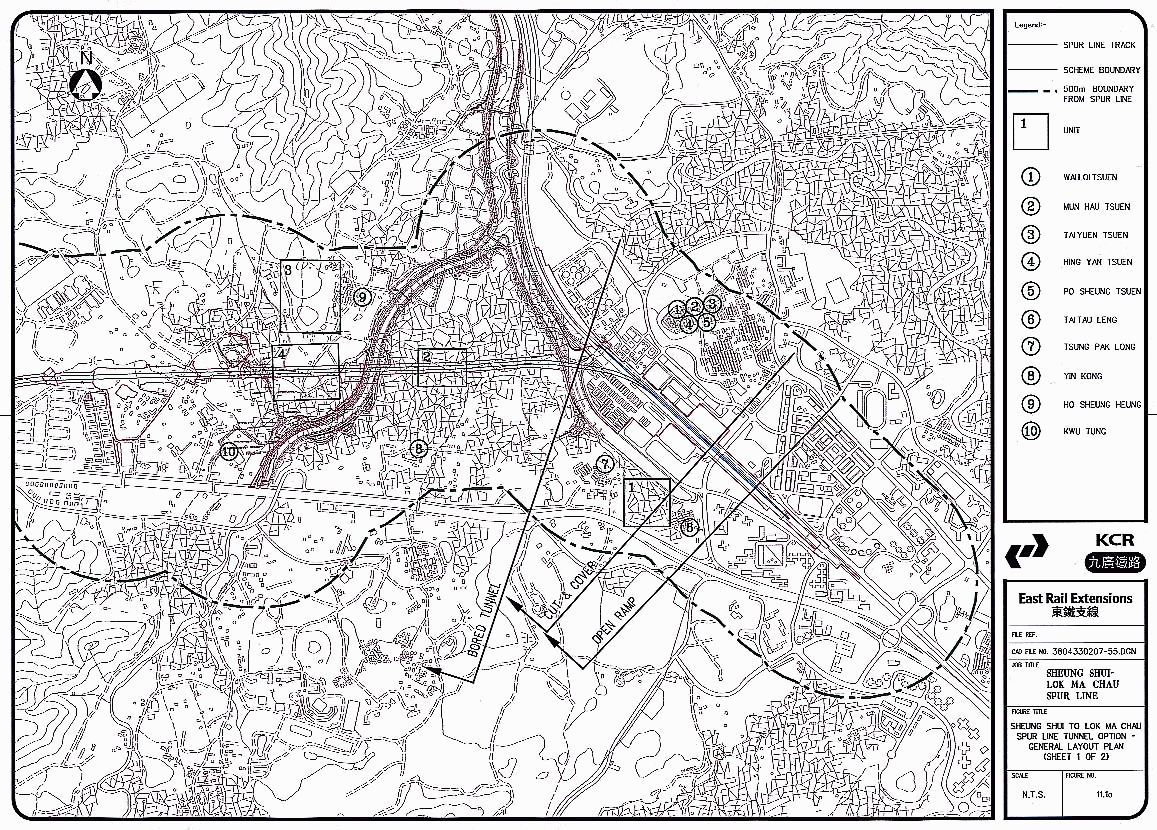
11.1a Spur Line alignment showing study units for cultural heritage assessment
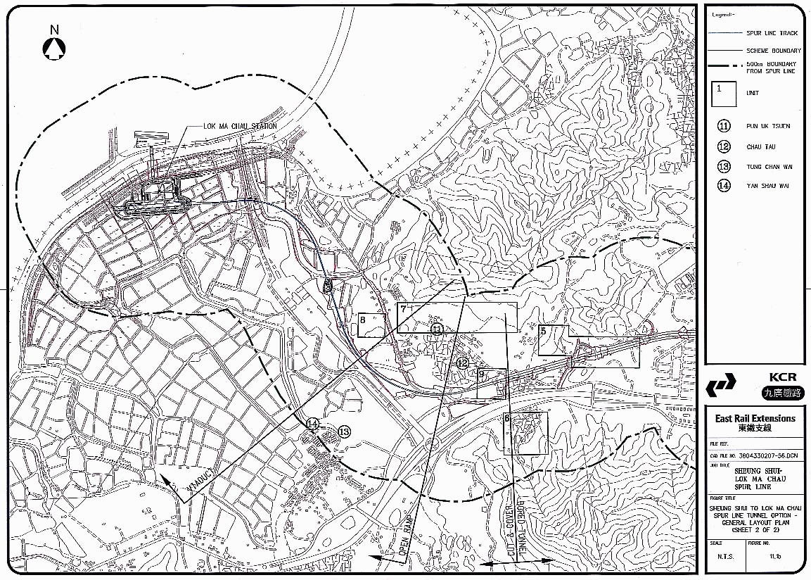
11.1b Spur Line alignment showing study units for cultural heritage assessment
11.2
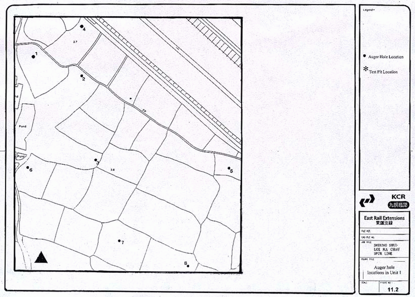
Auger hole locations in Unit 1
11.3
Test pit #4 and auger hole locations in Unit 2
11.4
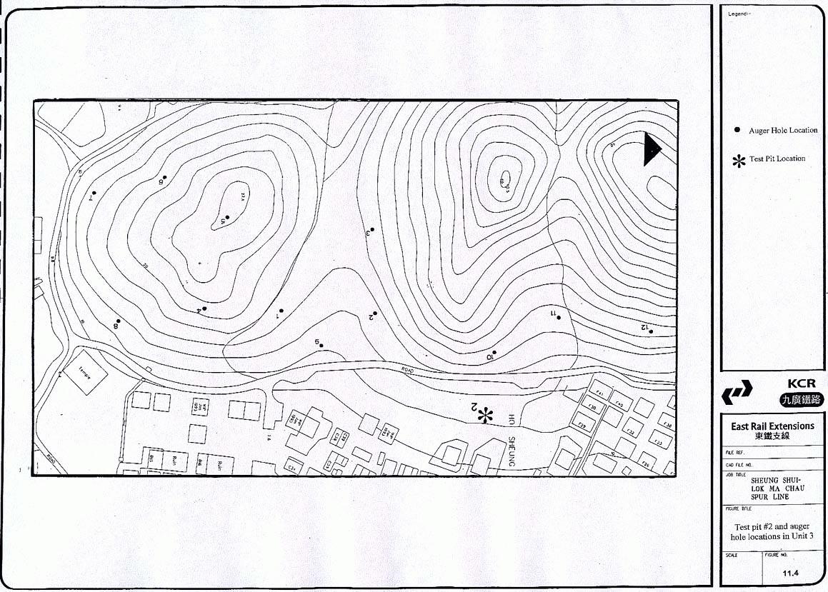
Test pit #2 and auger hole locations in Unit 3
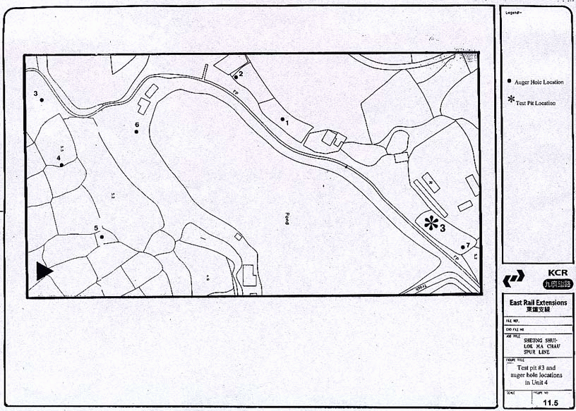
11.5
Test pit #3 and auger hole locations in Unit 4
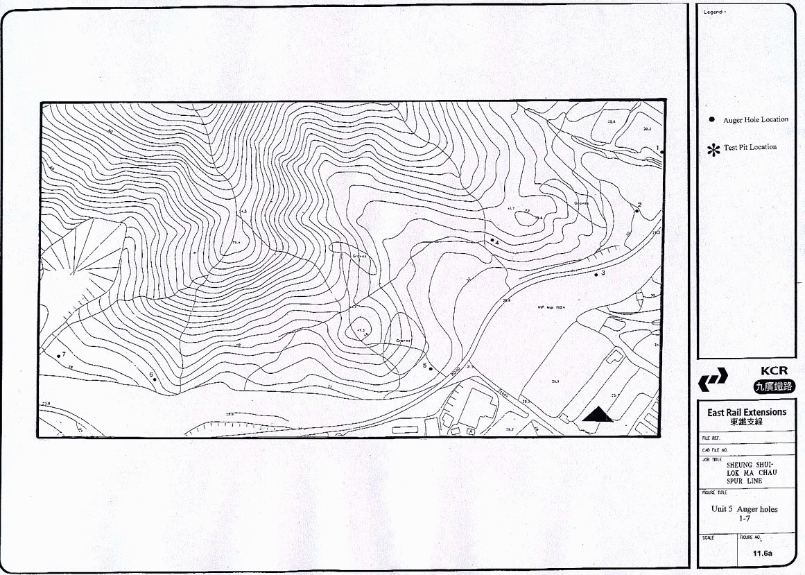
11.6a
Unit 5 Auger holes 1-7
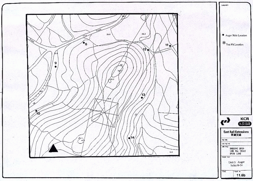
11.6b
Unit 5 Auger holes 8-14
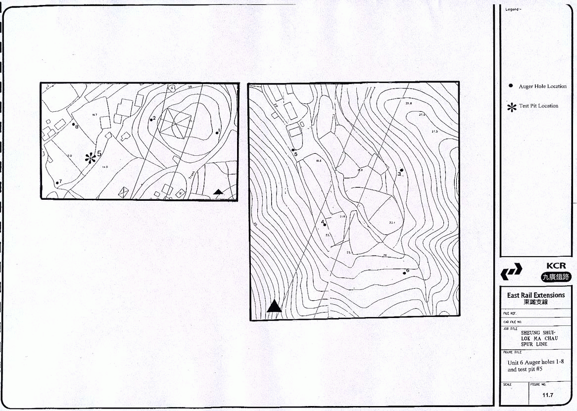
11.7
Unit 6 Auger holes 1-8 and test pit #5
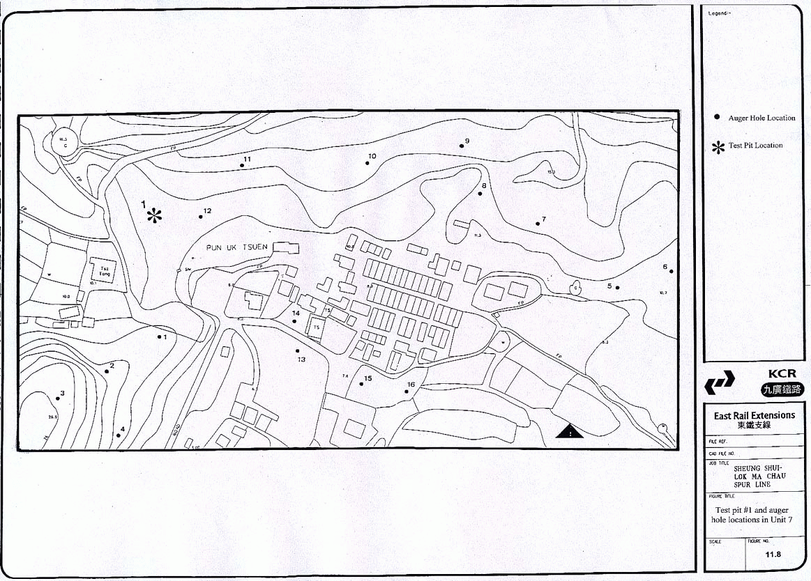
11.8
Test pit #1 and auger hole locations
in Unit 7
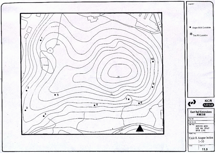
11.9
Unit 8 Auger holes 1-10
11.10
Unit 9 Auger holes 1-4
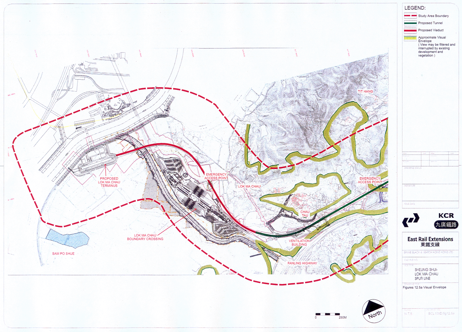
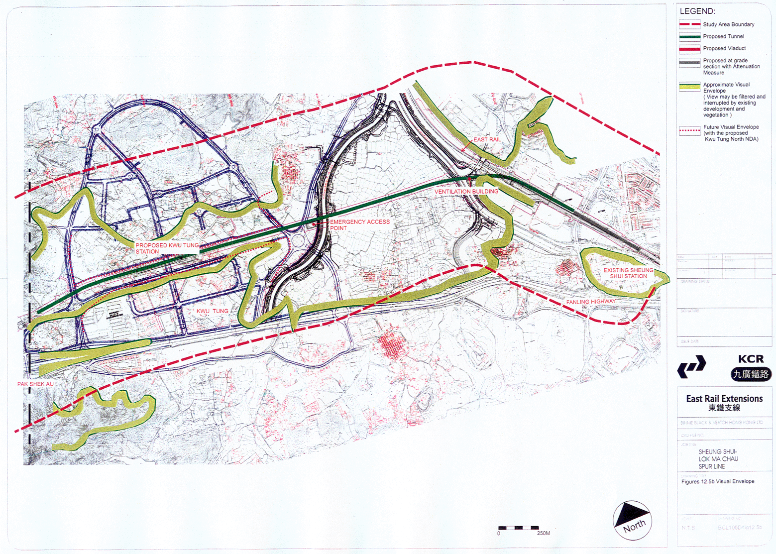
12.1 Location plan
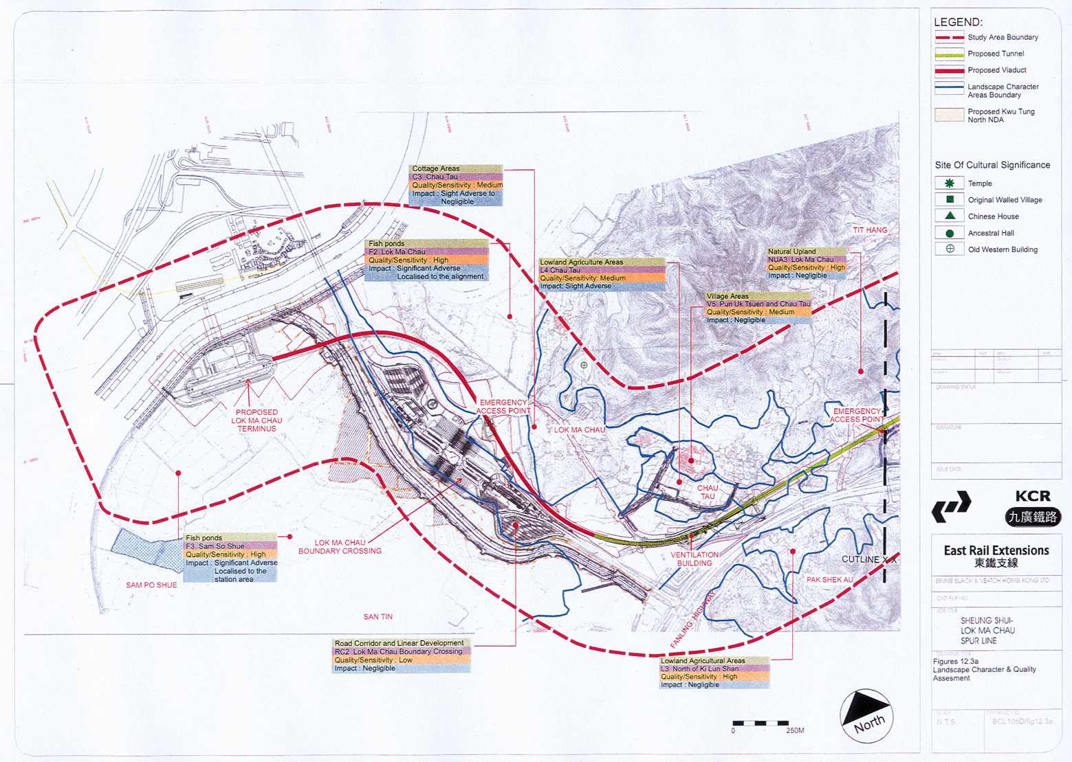
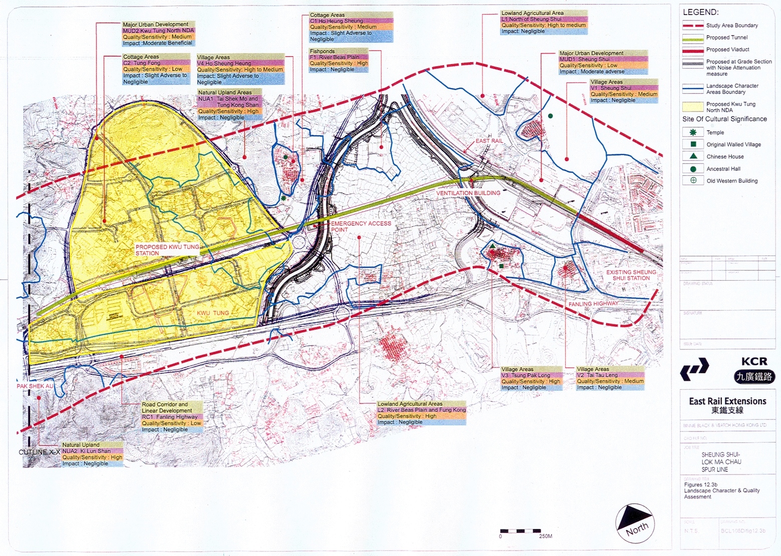
12.3a-b Landscape character & quality assessment
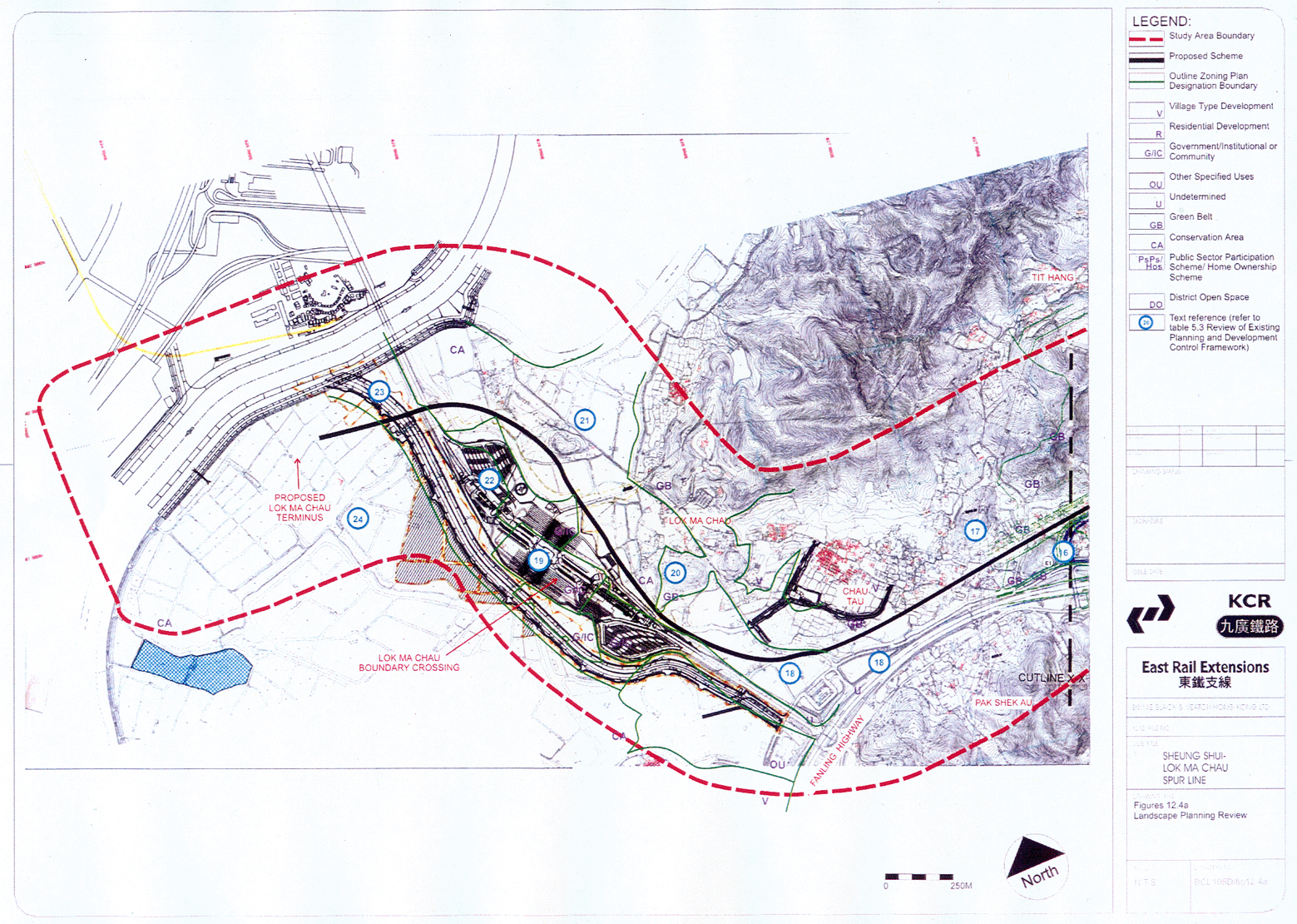
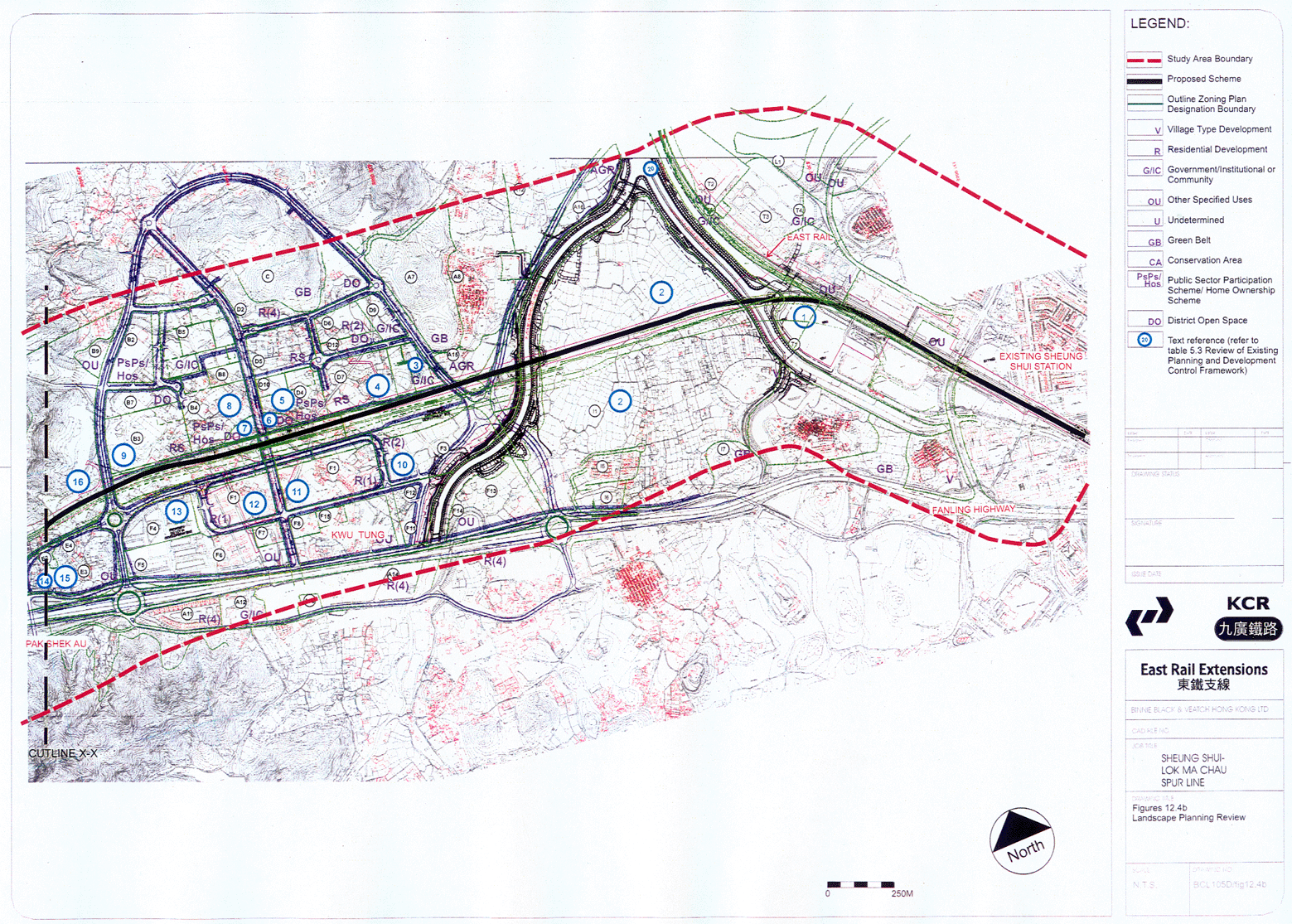
12.4a-b Landscape planning review
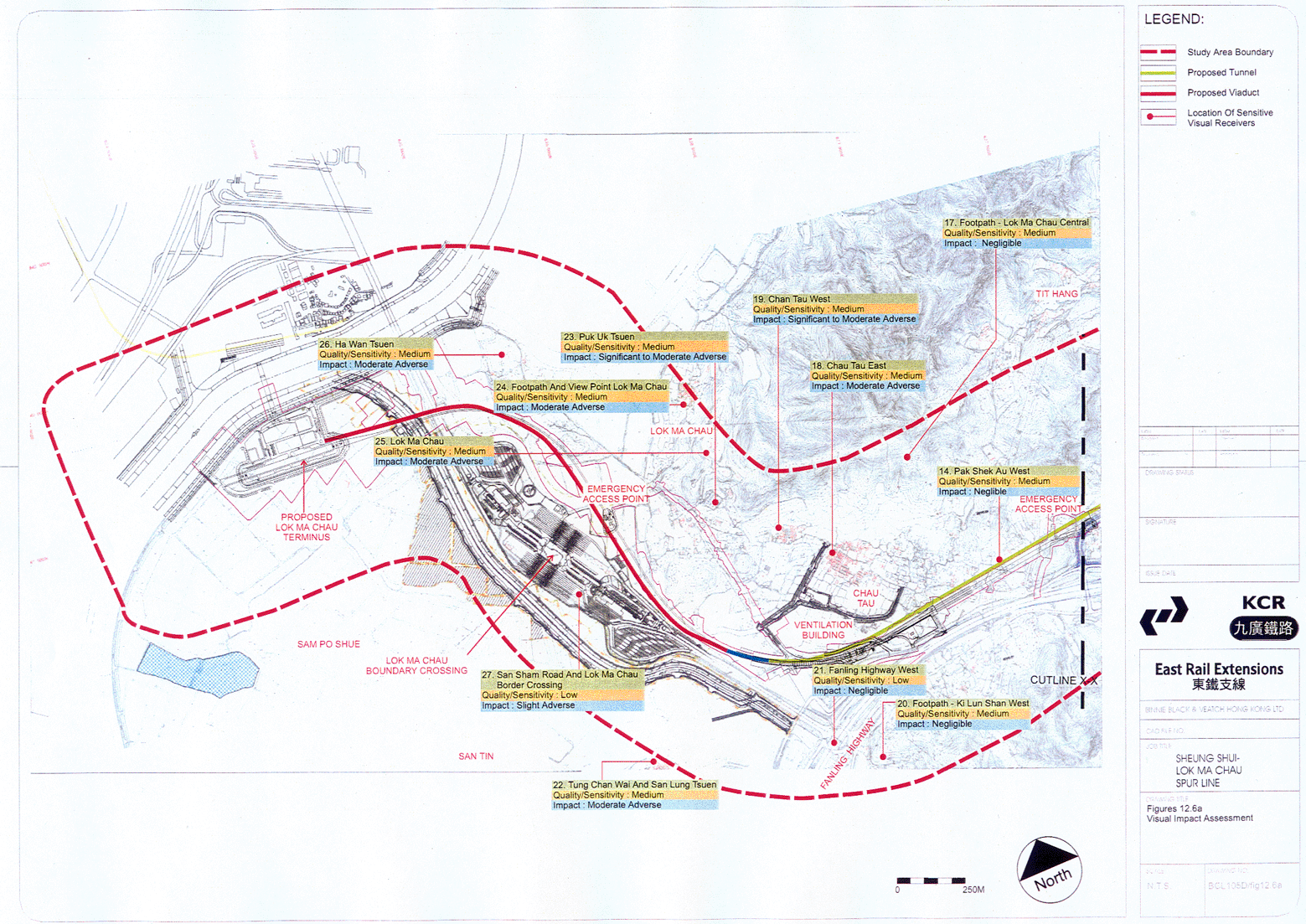
12.6a-b Visual impact assessment
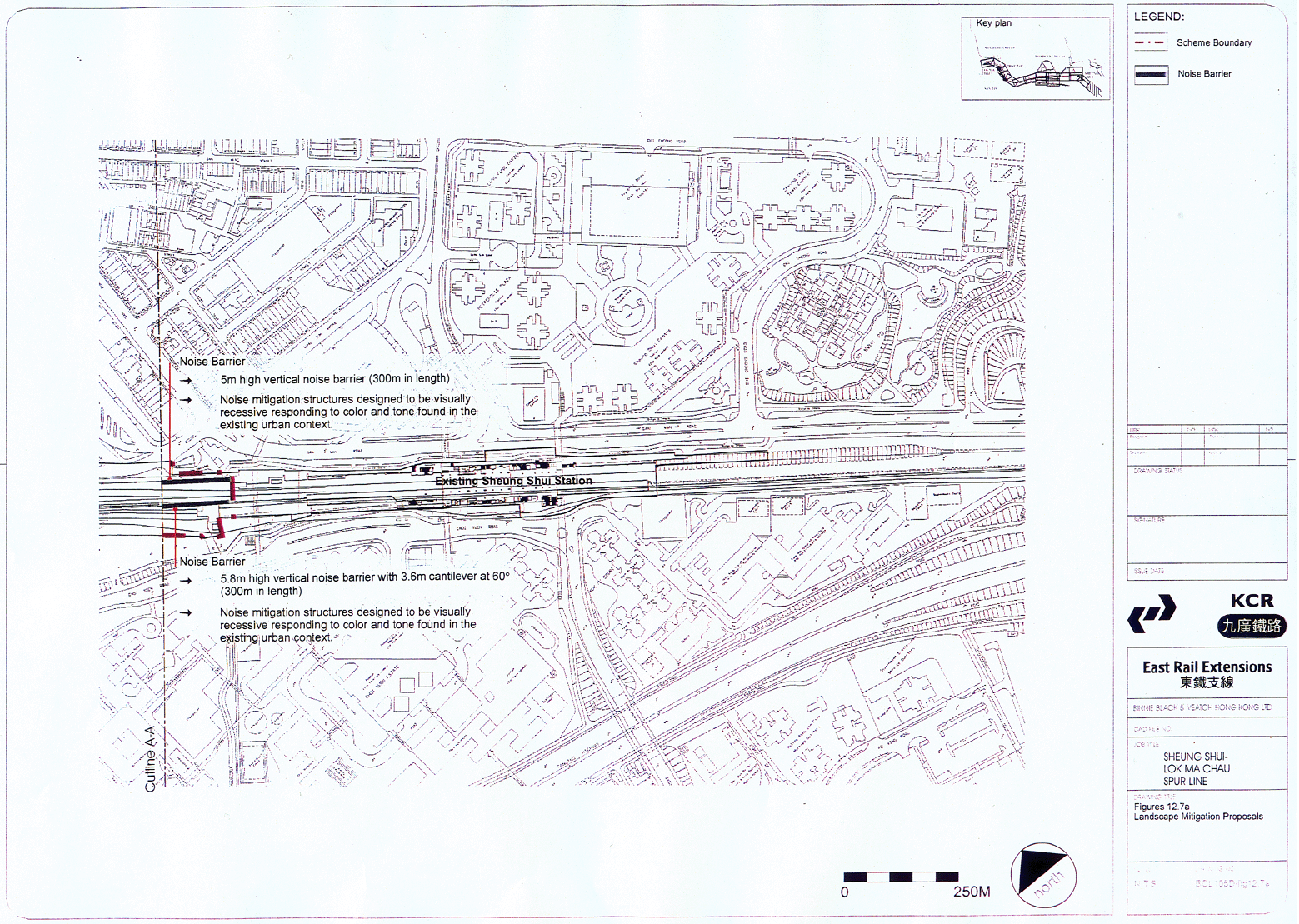
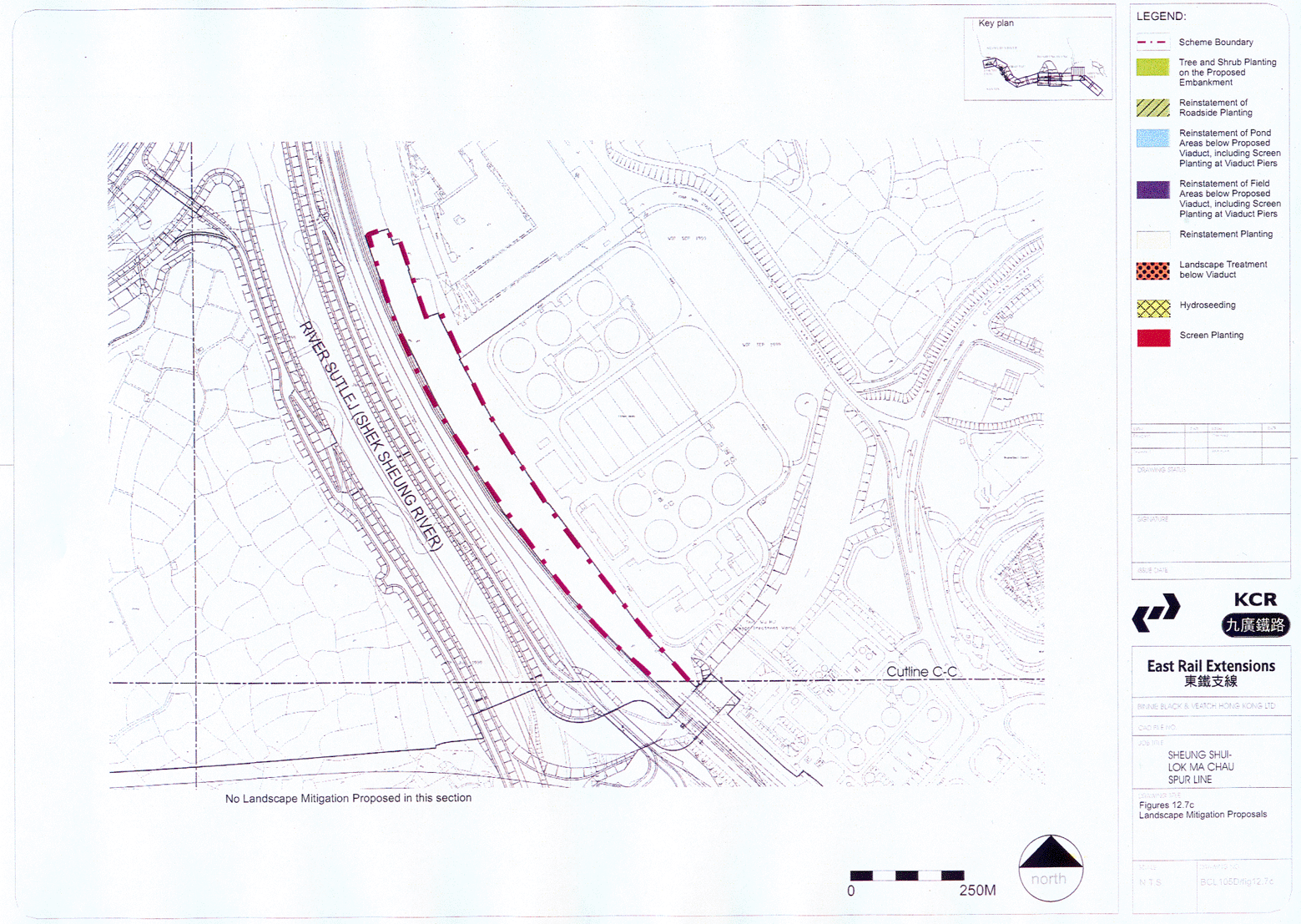
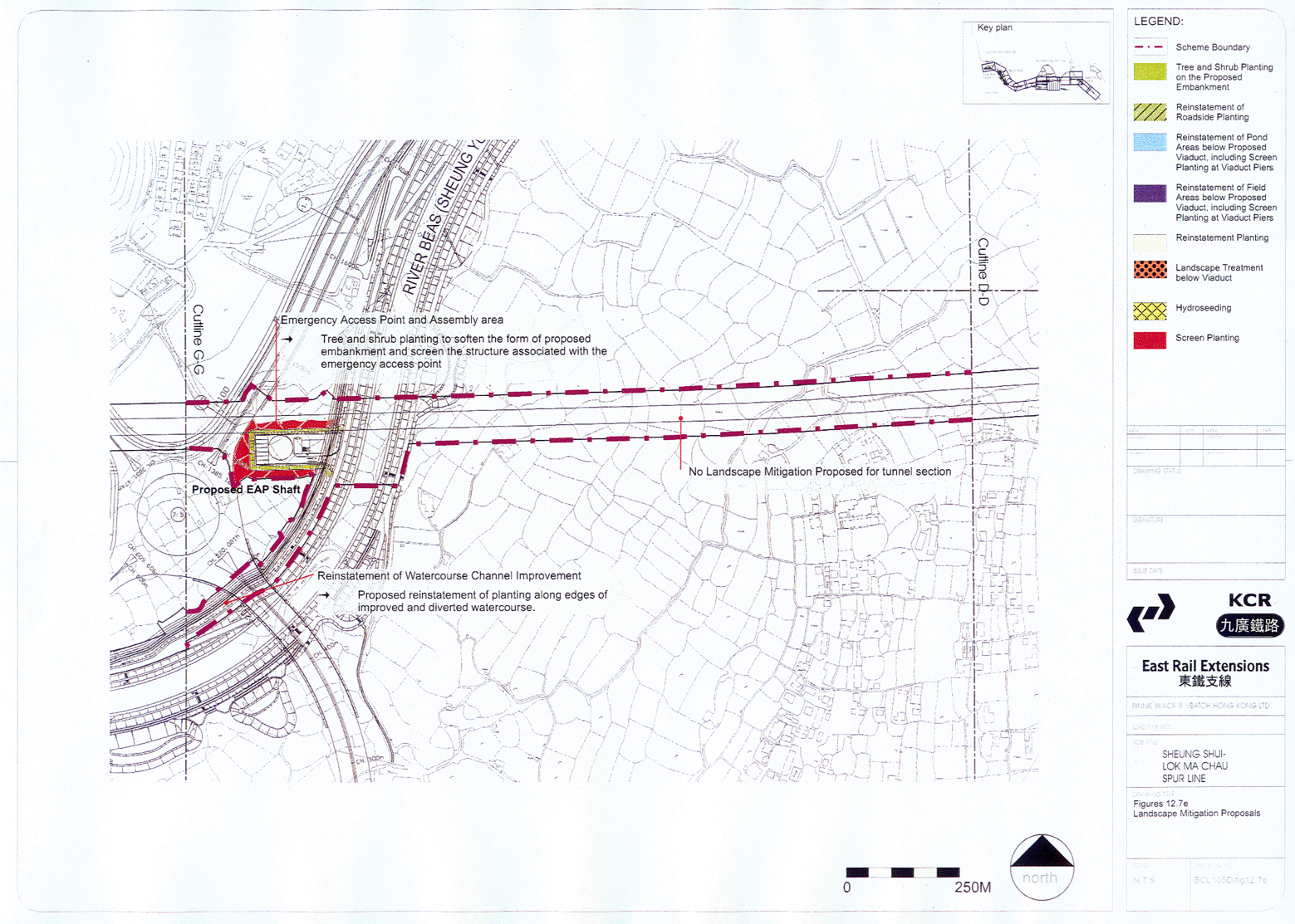
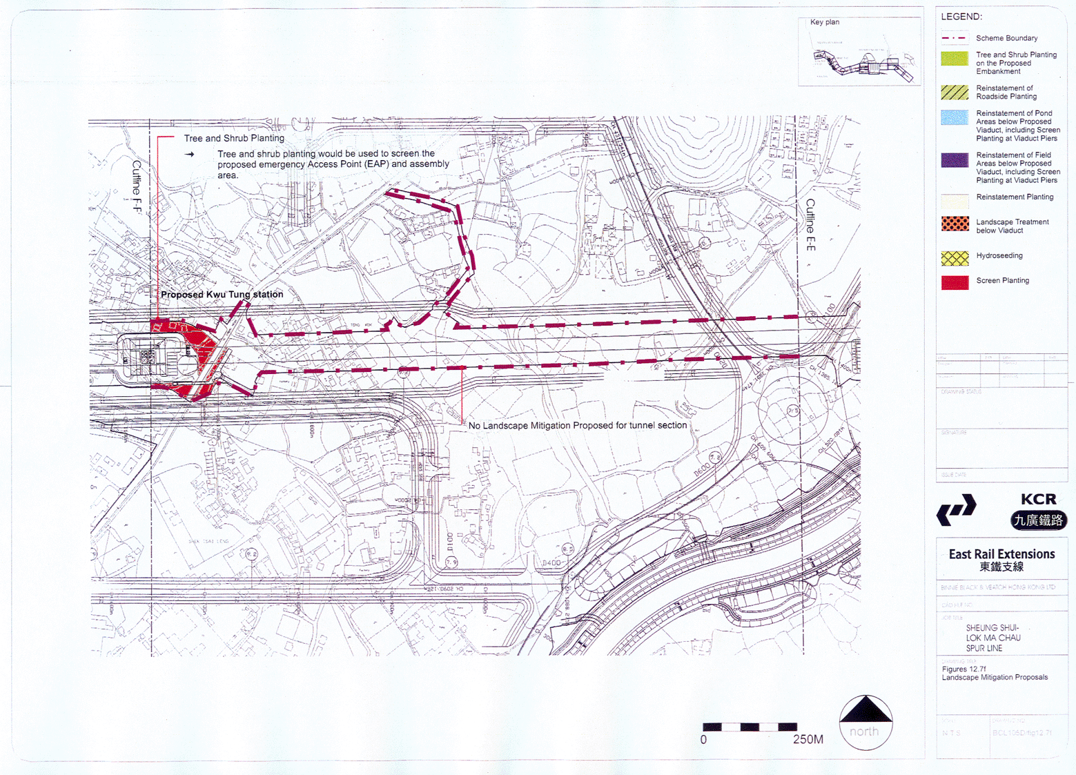
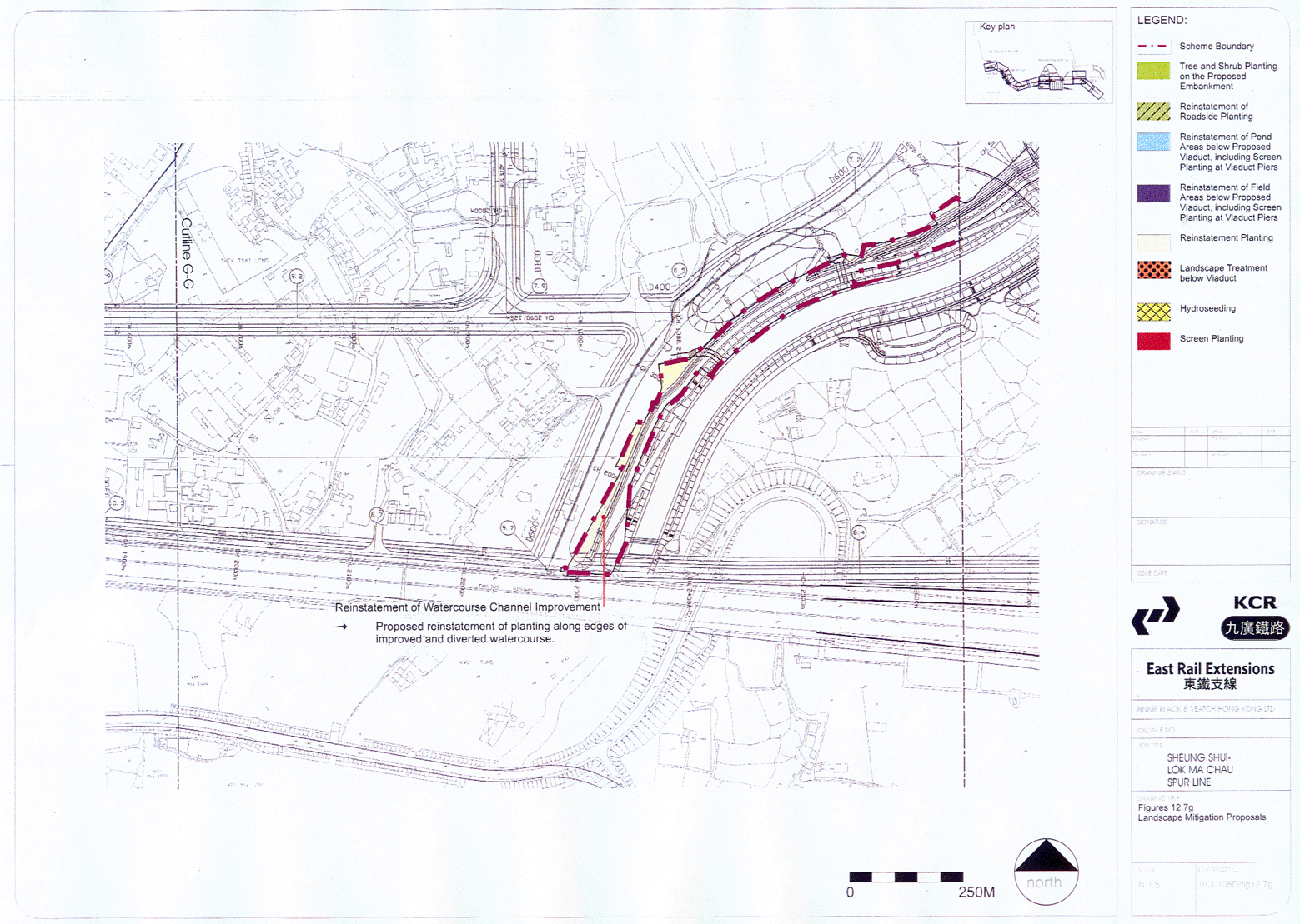
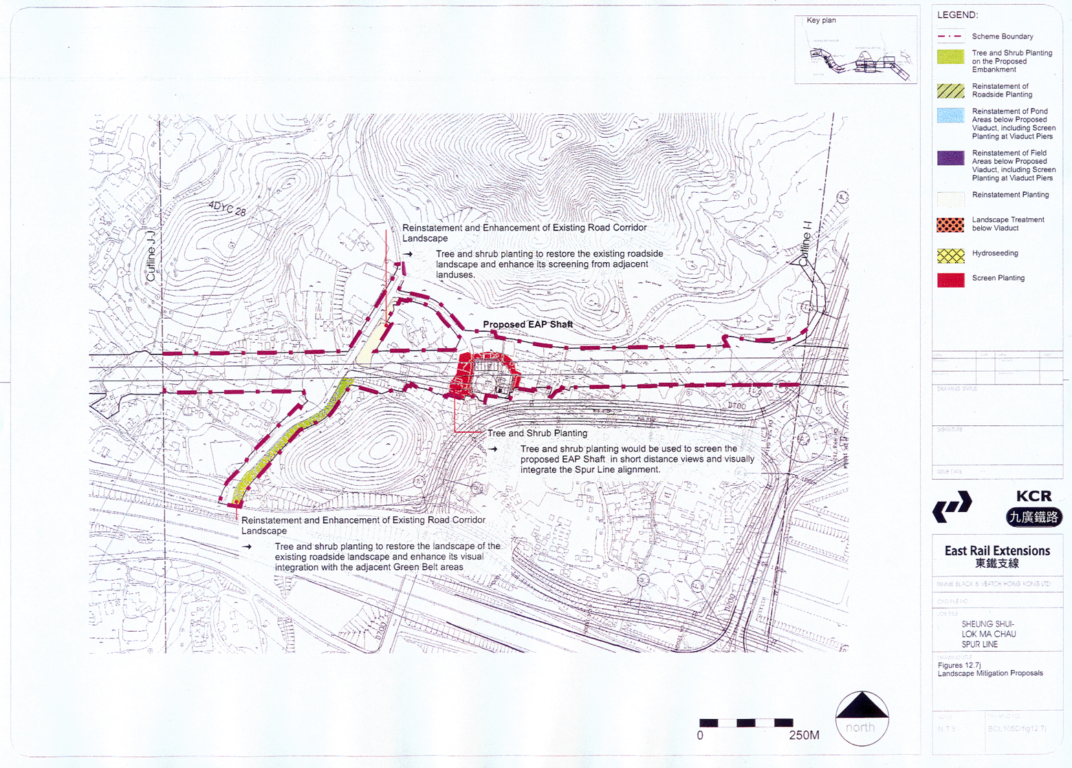
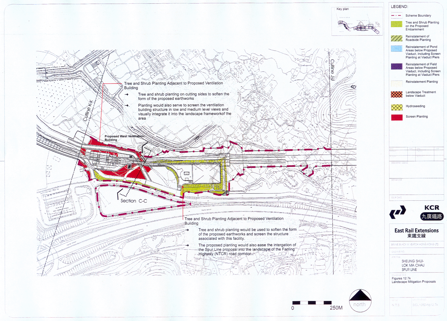
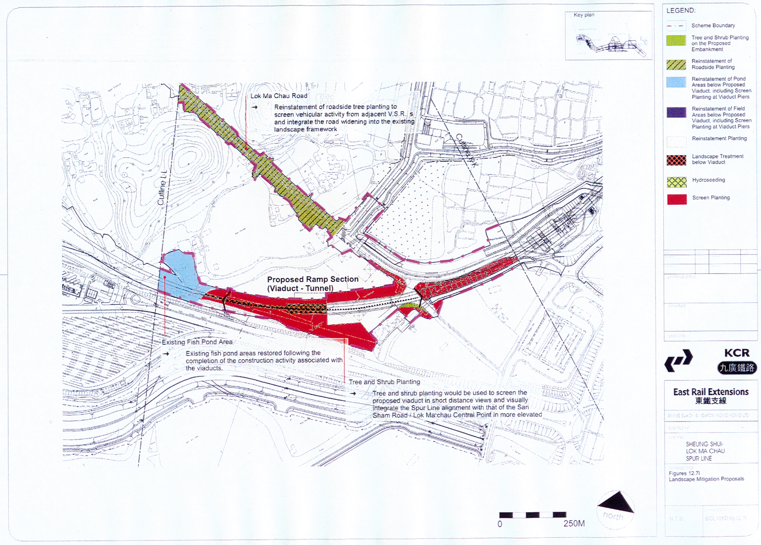
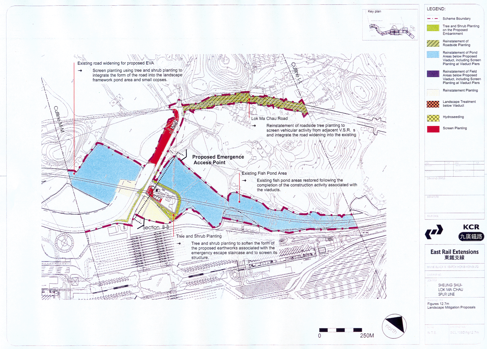
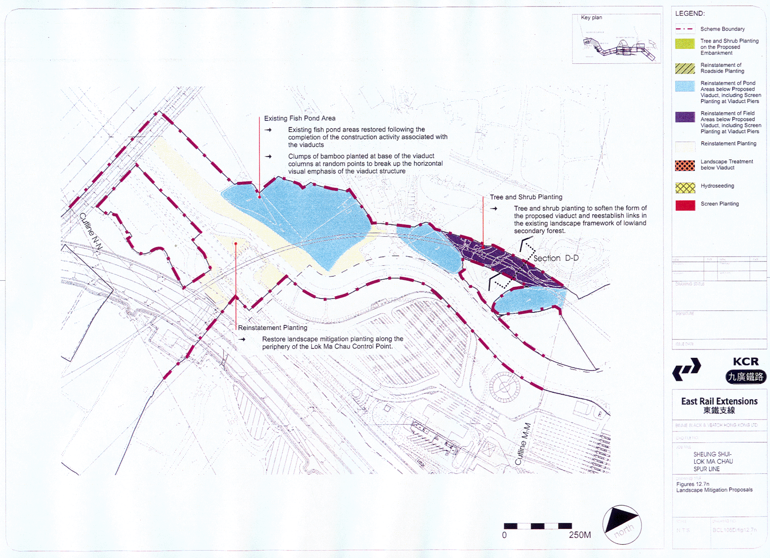
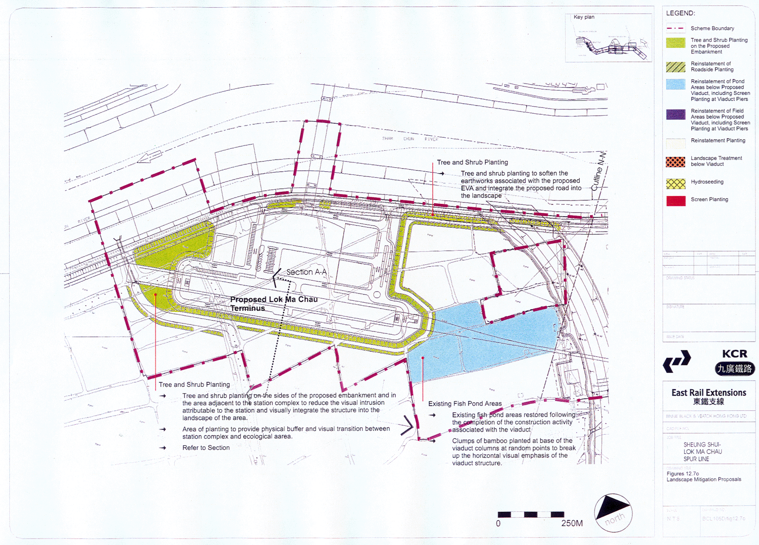
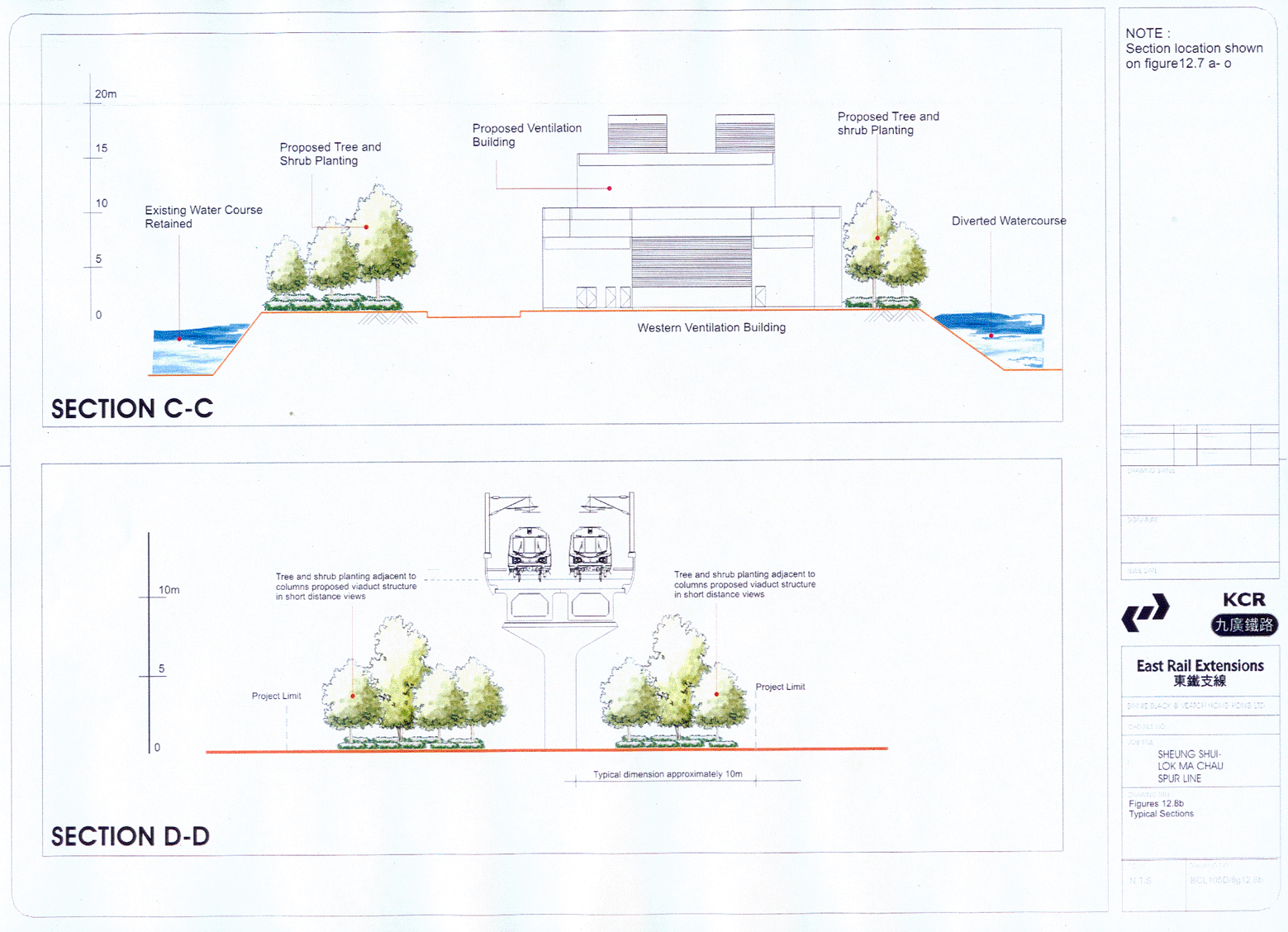
12.7a, b, c, d, e, f, g, h, i, j, k, l, m, n, o Landscape mitigation proposals
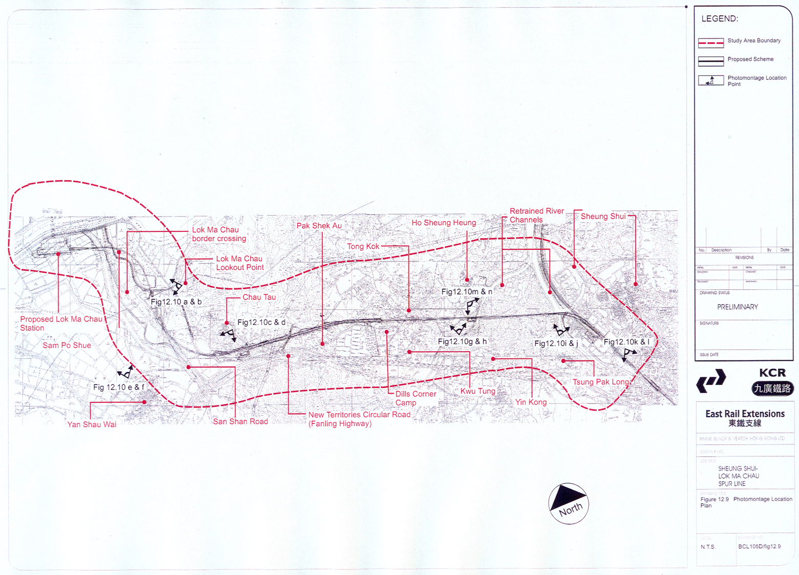
12.9 Photomontage location plan
12.10a-b Photomontages
showing view from Lok Ma Chau Lookout Point towards the proposed
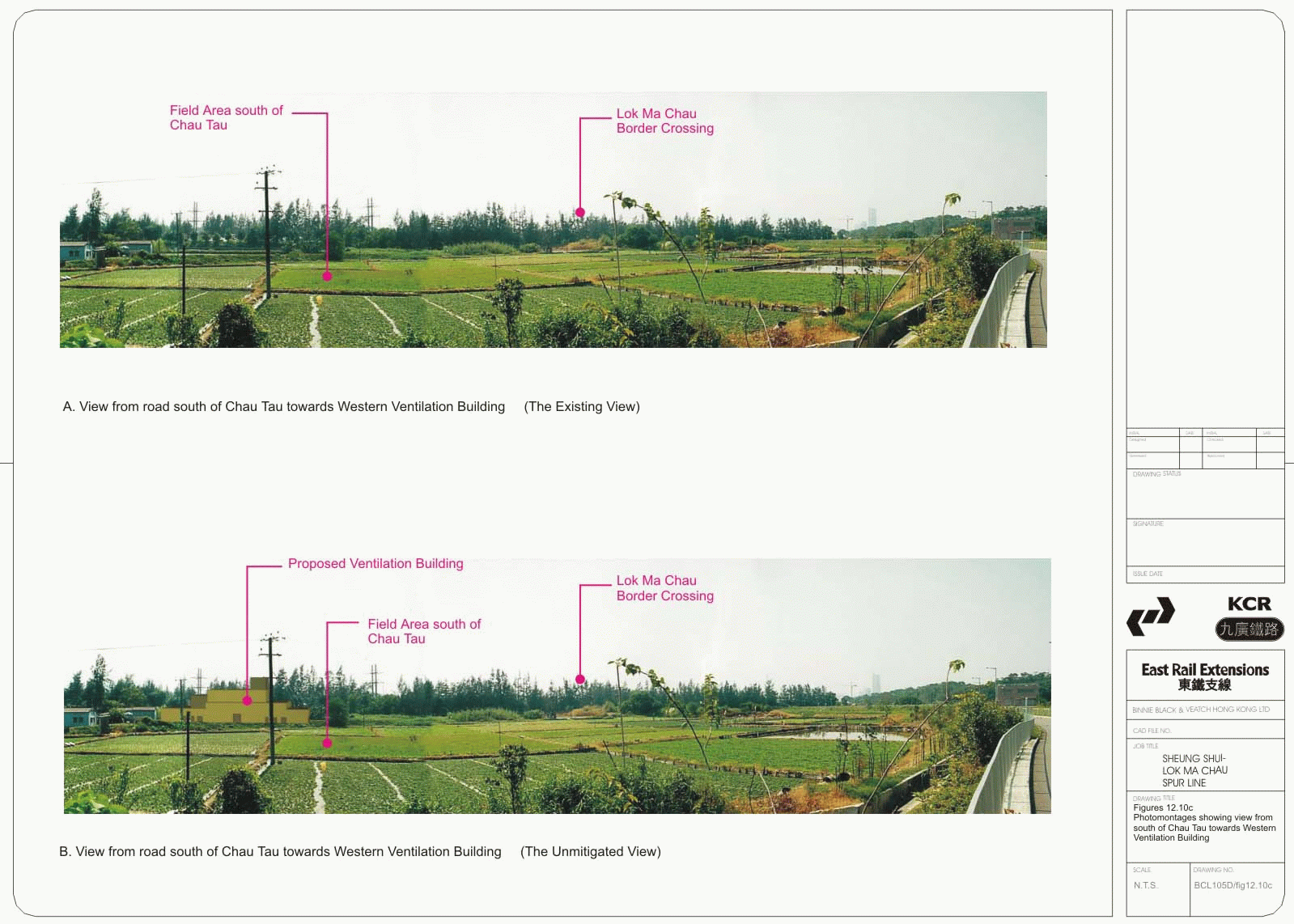
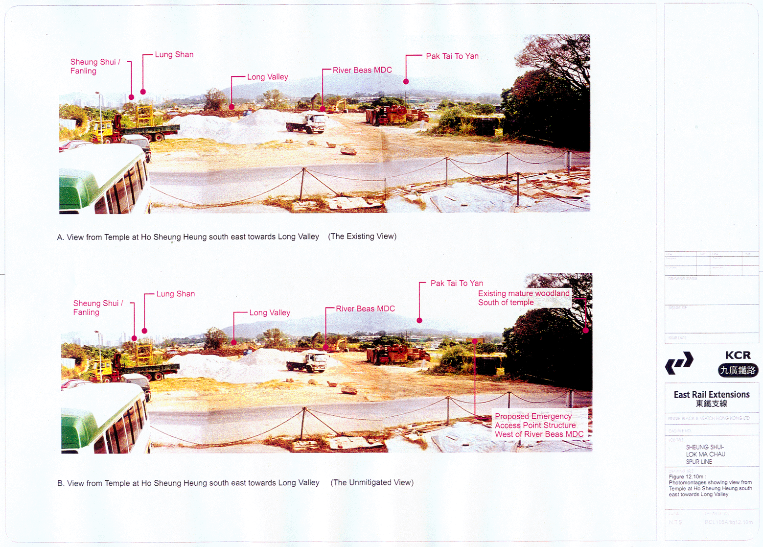
12.10c
Photomontages showing view from road south of Chau Tau towards
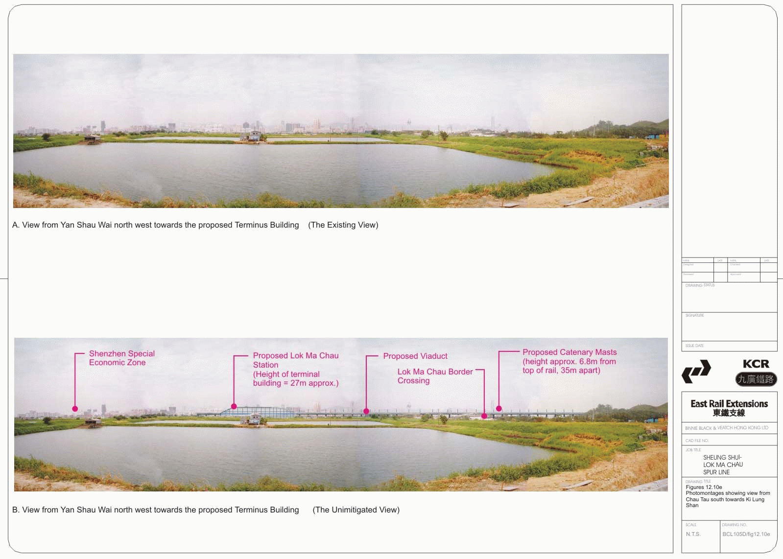
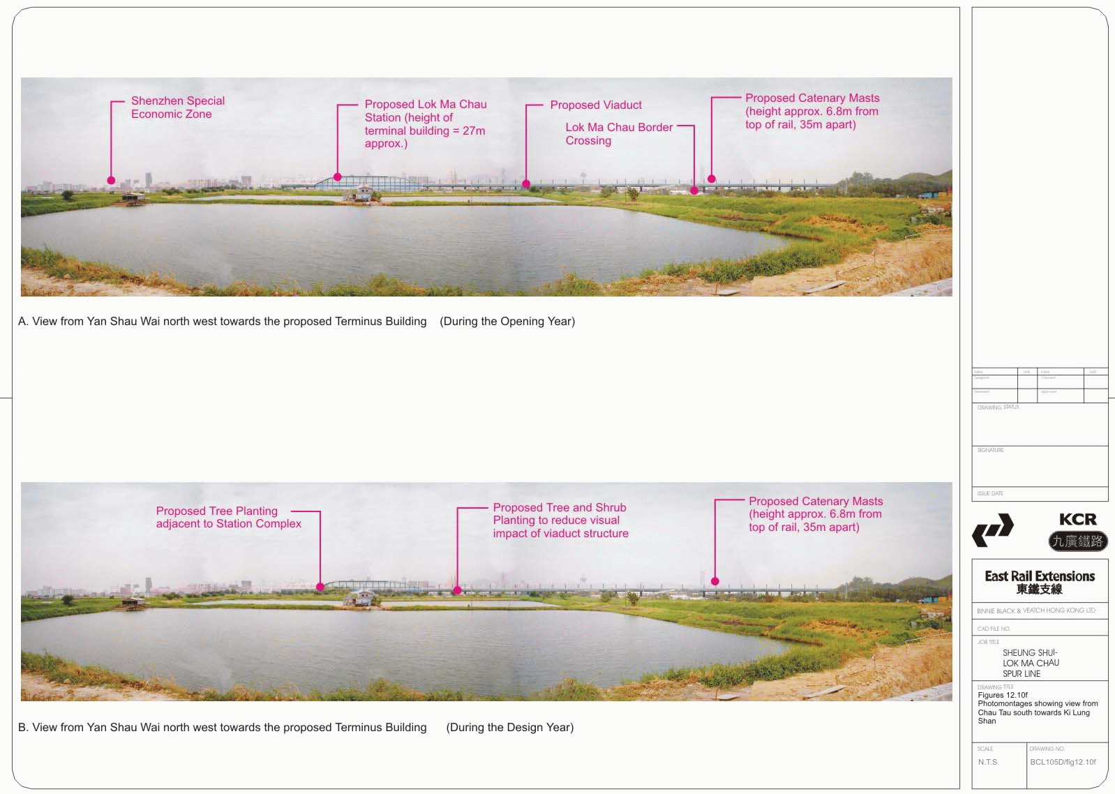
12.10d, e, f Photomontages showing view from Chau Tau south towards Ki Lung Shan
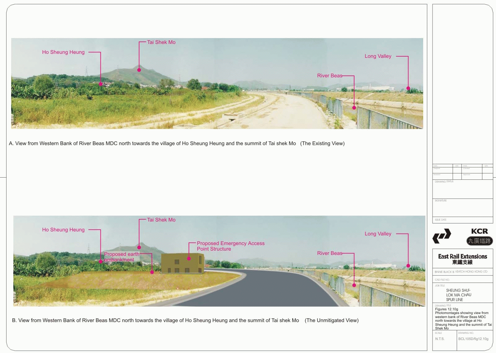
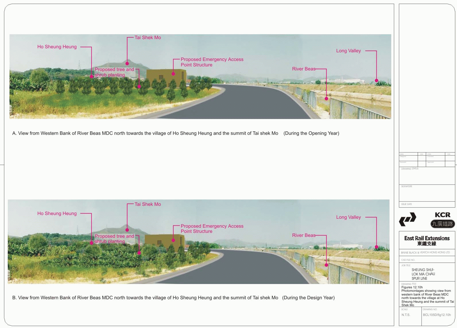
12.10g-h Photomontages
showing view from western bank of River Beas MDC north towards the
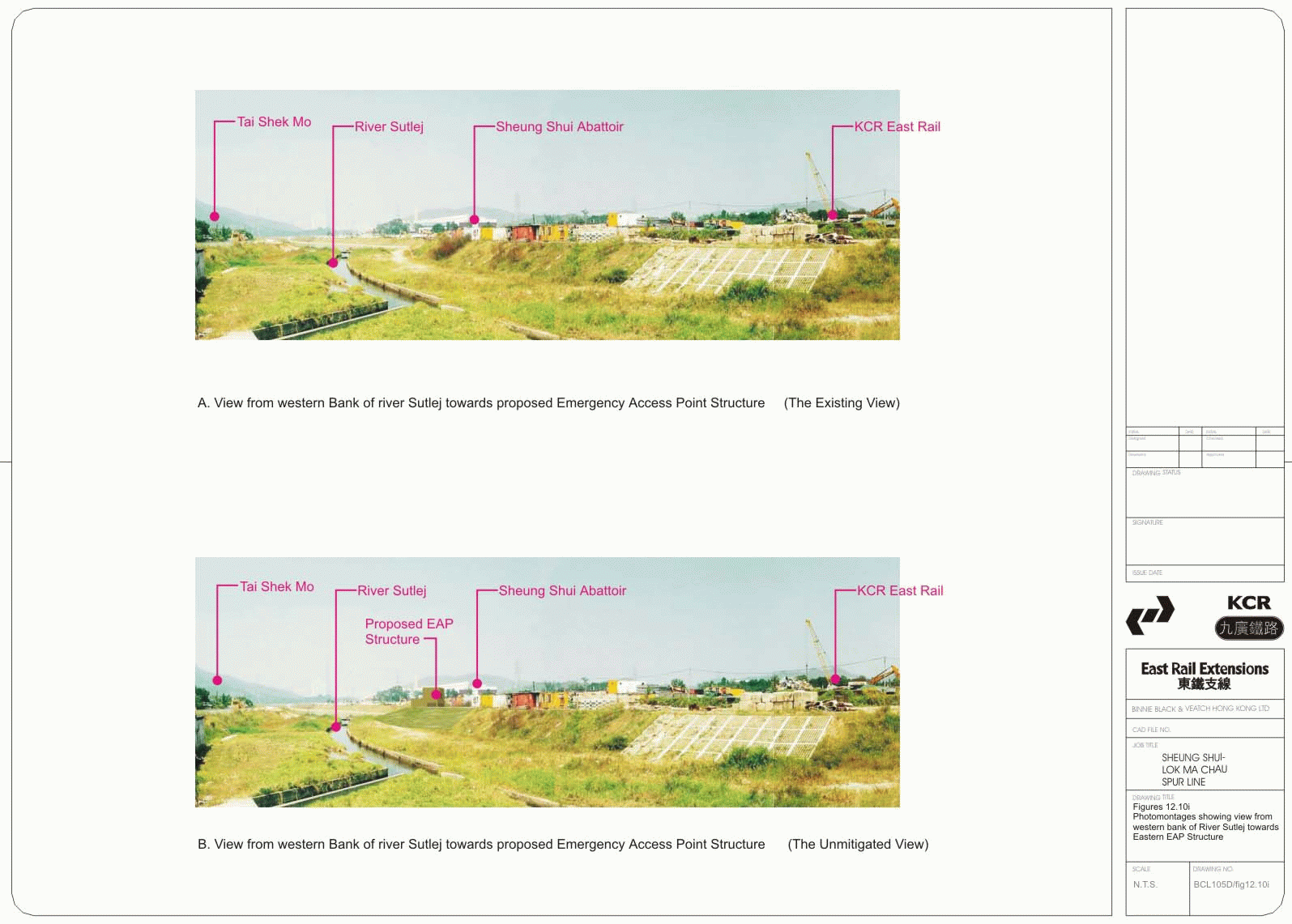
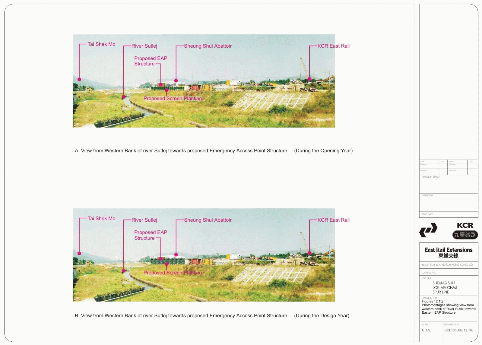
12.10i-j Photomontages
showing view from western bank of River Sutlej towards
12.10k-l Photomontages
showing view from
12.10m-n Photomontages showing
view from
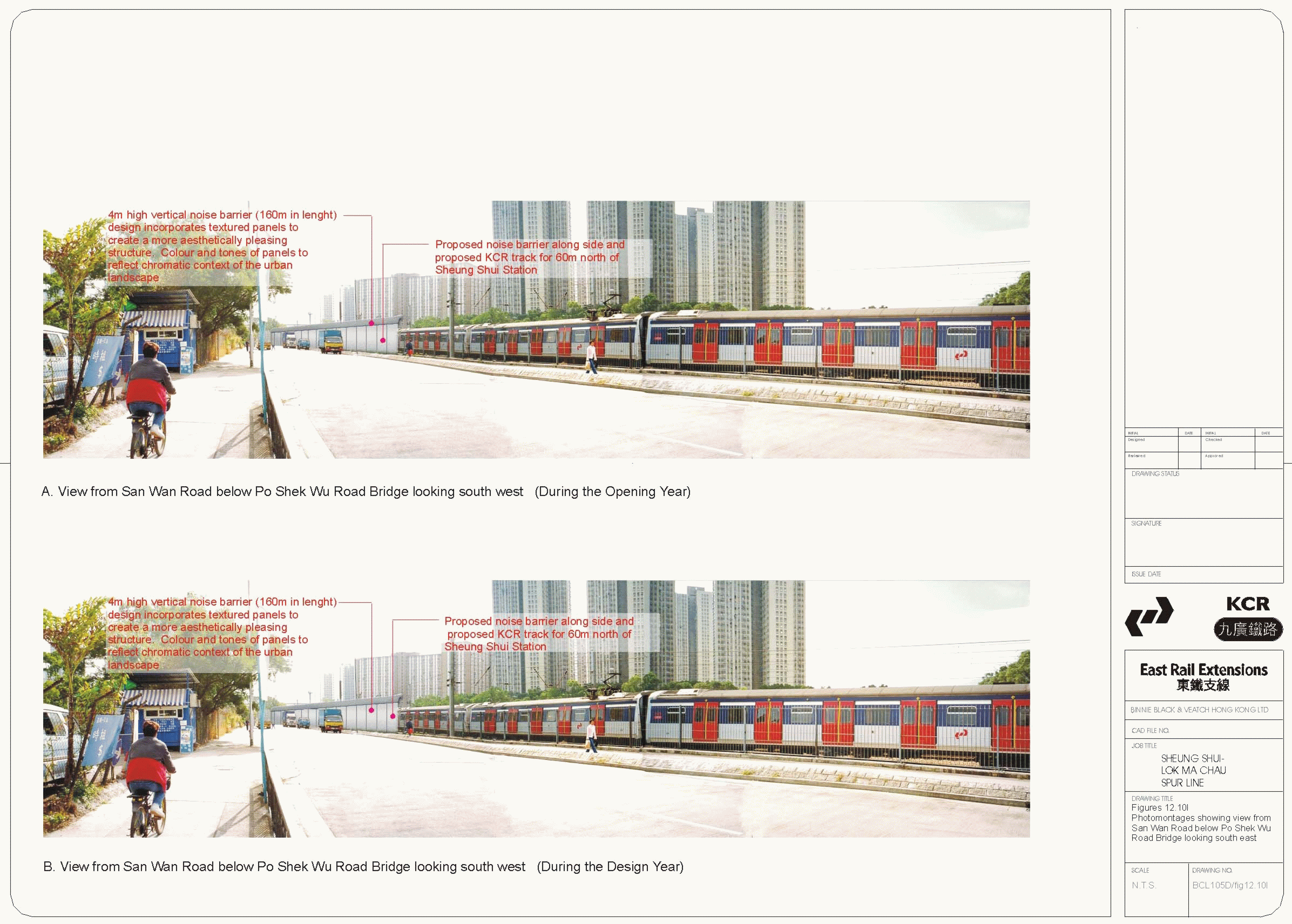
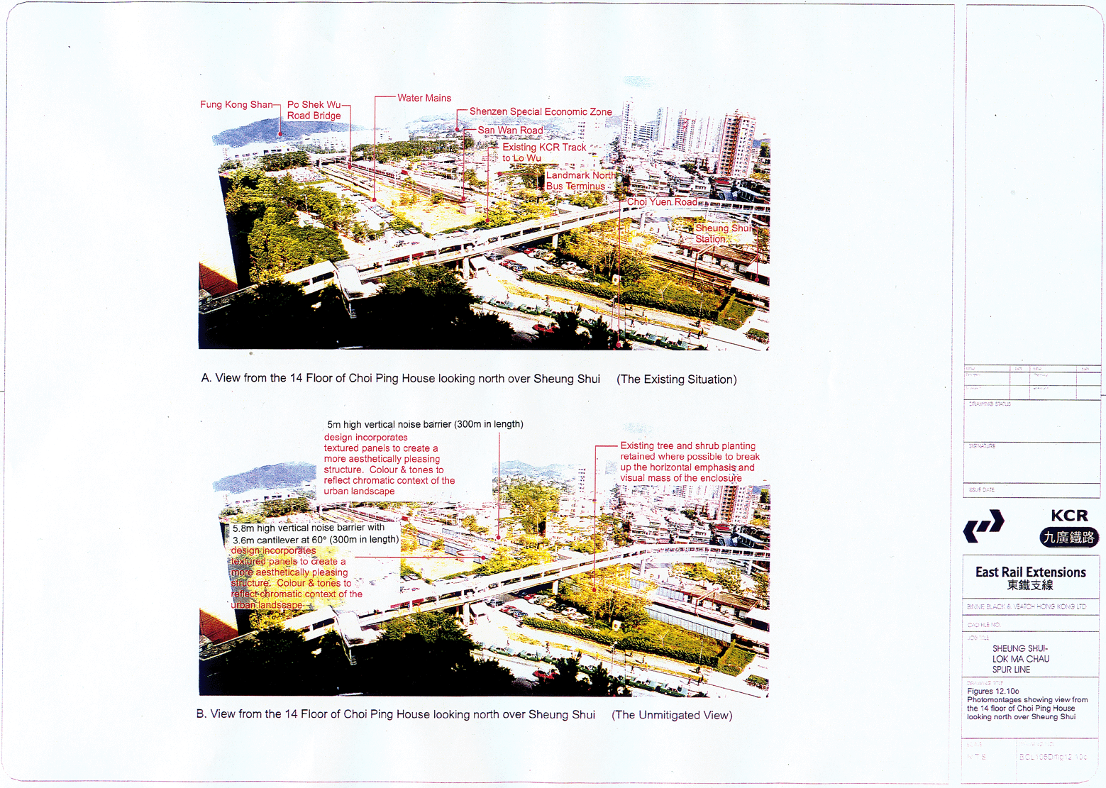
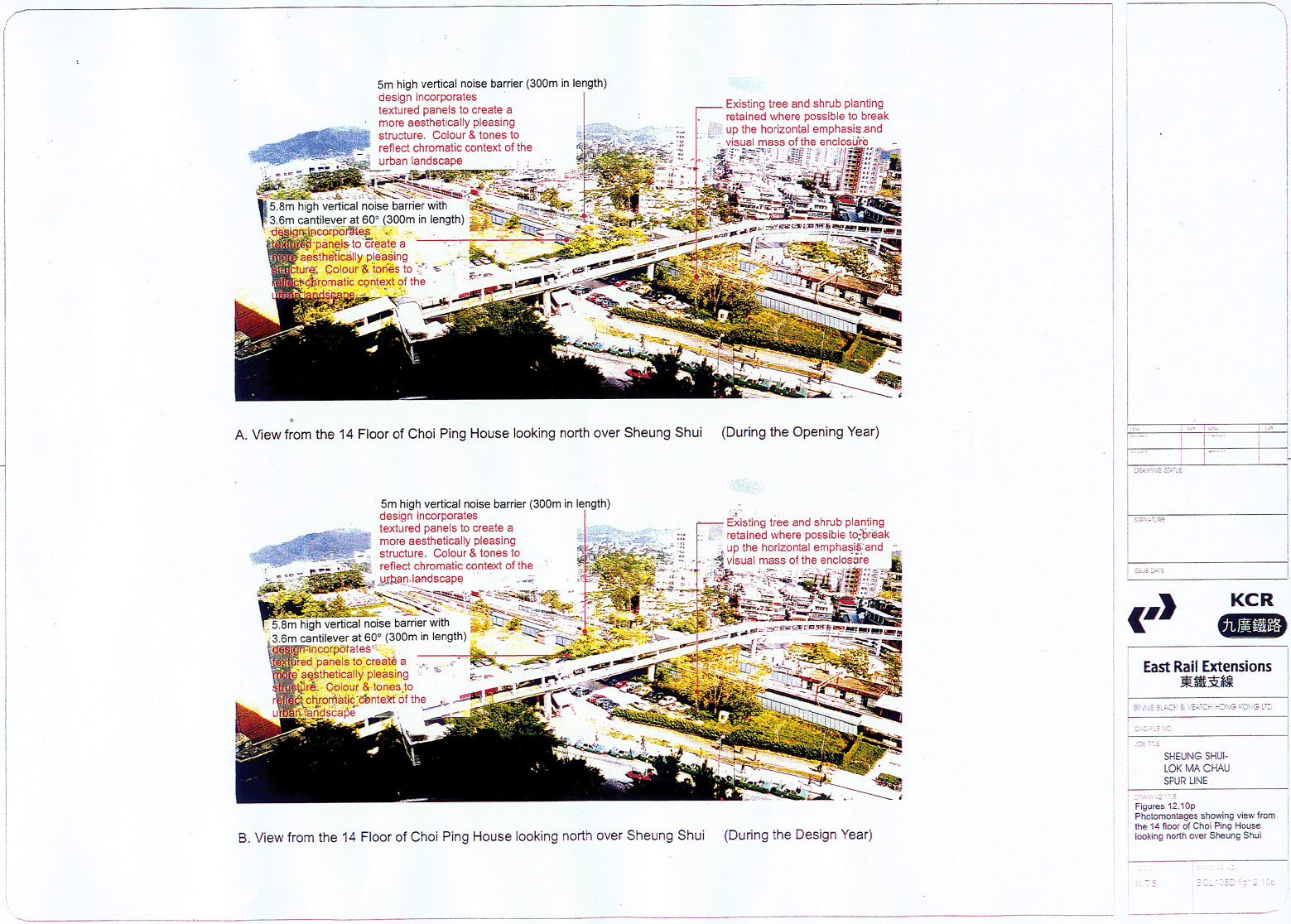
12.10o-p Photomontages showing view from the 14th floor of Choi Ping House looking north over Sheung Shui
13.1 LMC Spur Line overall construction programme
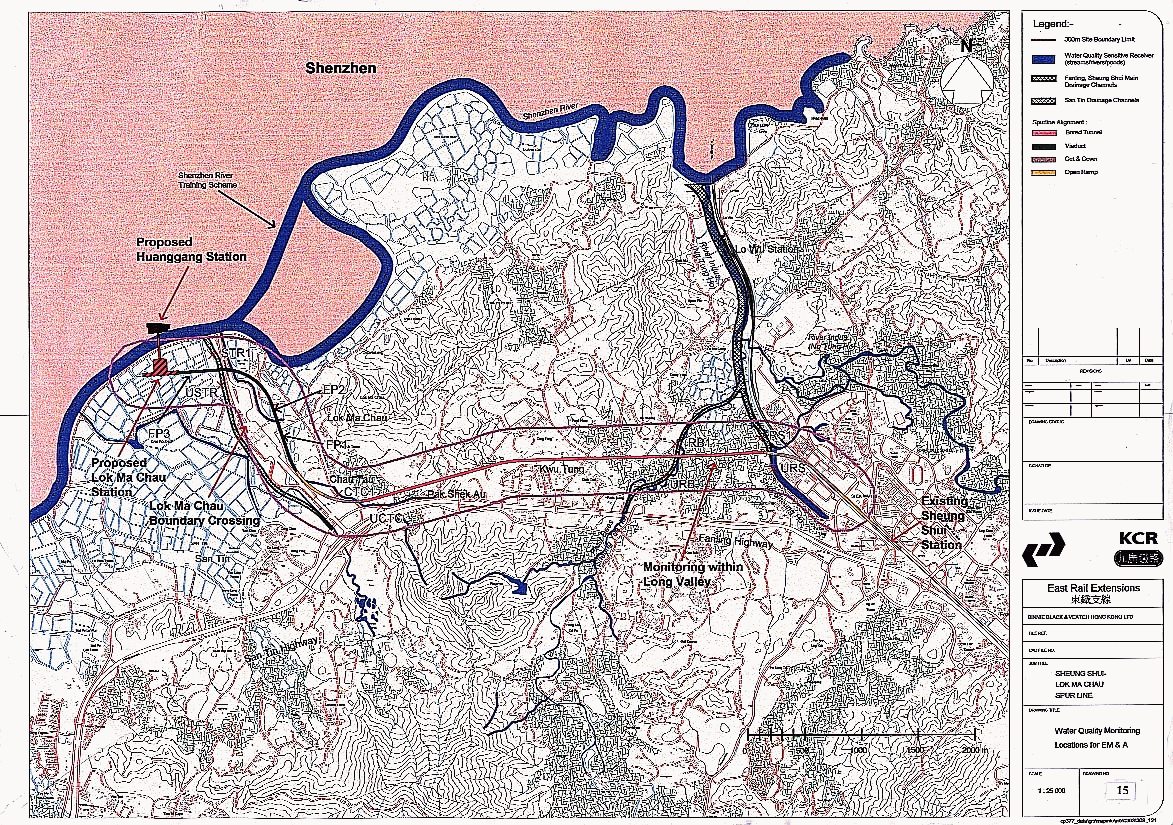
15.1 Water quality monitoring
Volume 1 of 5 (Part 1)
Table 1.1 Environmental Issues Addressed in this EIA report
Table 2.1 Key Elements of the Spur Line Scheme with Chainages
Table 2.2 Preliminary Summary Construction Programme
Table 2.3 Construction
Sequence –
Table 2.4 Comparison of Environmental Impacts Related to Vertical Alignment Options
Table 2.5 Comparison of Vertical Alignment Selection within Engineering Constraints
Table 3.1 Borehole and
Soil Testing Information in
Table 3.2 Examples of TBM Tunnel Projects Worldwide
Table 3.3
Table 4.1 Coverage of Different Habitat Types within the Study Corridor
Table 4.2 Species of
Conservation Importance that are known or likely to occur in Significant
Number within 500 m of the
Table 4.3 Mammal Species of Conservation Importance Recorded within the Study Area
Table 4.4 Species of Conservation Importance occuring within 500 m of the Spur Line during the Baseline Surveys and their Distribution within the Study Area
Table 4.5 Species of Conservation Concern Recorded during the Baseline Surveys. Species Regularly Recorded are shown in Bold.
Table 4.6 Species of Conservation Importance occurring within 500 m of the Spur Line and their Distribution within 500 m of the Spur Line and their distribution with respect with respect to habitat type
Table 4.7 Reptiles and Amphibians of Conservation Importance Recorded in the Study Area. Species recorded during Baseline Survey from April 2000 – May 2001
Table 4.8 The Location,
Larval Food Plant and Status in
Table 4.9 Ecological Evaluation of Fung-shui Forests within the Study Area
Table 4.10 Ecological Evaluation
of
Table 4.11 Ecological Evaluation
of
Table 4.12 Ecological Evaluation of Orchard
Table 4.13 Ecological Evaluation
of
Table 4.14 Ecological Evaluation
of
Table 4.15 Ecological Evaluation
of Inactive
Table 4.16 Ecological Evaluation
of Inactive
Table 4.17 Ecological Evaluation of Managed Wetland
Table 4.18 Ecological Evaluation of Active Fish Ponds
Table 4.19 Ecological Evaluation of Inactive Fish Ponds
Table 4.20 Ecological Evaluation of Bloodworm Ponds
Table 4.21 Ecological Evaluation of Marsh
Table 4.22 Ecological Evaluation of Water Courses
Table 4.23 Grassland-shrubland Mosaic
Table 4.24 Ecological Evaluation of Wasteland
Table 4.25 Ecological Evaluation of Developed Area
Table 4.26 Summary of Habitat Evaluations
Table 4.27 Long-term Habitat Loss due to Permanent Structures and the Viaduct “Shadow”
Table 4.28 Predicted Disturbance Impacts of the Railway and Station on Species of Conservation Importance Regularly occurring at Lok Ma Chau
Table 4.29 Habitats and Areas within Defined Bands around Lok Ma Chau Station
Table 4.30 Locations of Habitats of Moderate or high Ecological Value where Adverse Construction Impacts are possible
Table 4.31 Initial Assessment of
Potential Ecological Impacts on
Table 4.32 Initial Assessment of Potential Ecological Impacts on Agricultural Habitats from the Construction of the Spur Line
Table 4.33 Initial Assessment of Potential Ecological Impacts on Fishpond and Pond Habitats from the Construction of the Spur Line
Table 4.34 Locations of Habitats of Moderate or High Ecological Value where Adverse Operational Impacts are possible
Table 4.35 Initial Assessment of
Potential Ecological Impacts on
Table 4.36 Initial Assessment of Potential Ecological Impacts on Agricultural Habitats from the Operation of the Spur Line
Table 4.37 Initial Assessment of Potential Ecological Impacts on Fish Pond and Pond Habitats from the Operation of the Spur Line
Table 4.38 Summary of Major Committed Projects Adjacent to the Spur Line
Table 4.39 Land Requirement to Compensation for Habitat Loss for Large Waterbirds during Construction Stage
Table 4.40 Land Requirement to Compensation for Habitat Loss for Large Waterbirds during Operation Stage
Table 4.41 Summary of Habitat Requirement for Target Bird Species of Conservation Importance at Lok Ma Chau
Table 4.42 Targets for Non-avian Species at Lok Ma Chau
Table 4.43 Comparison of Functional Values of Habitats before and after Construction of Lok Ma Chau Spur Line
Table 4.44 Land Requirement for Compensatory Habitat Provision and other Creation of Habitats of Ecological Value
Table 4.45 The Overall Levels of Compensation Predicted from Compensation Measures for Species of Conservation Importance that were recorded during the Baseline Surveys in the Lok Ma Chau Fishpond Area
Table 4.46 Proposed Mitigation Measures and Predicted Residual Impacts
Table 5.1 Area and Percentage Coverage of Ecological Habitats within the Study Corridor Including Values for Active and Inactive Fish Ponds
Table 5.2 Common Vegetation Frequently found Growing on Bunds of Fish Ponds
Table 5.3
Total Area of Fish Ponds in
Table 5.4 Species of Fish Commonly Reared in Poly Culture and Mon Culture Fish Ponds
Table 5.5 Recommended Water Quality Standard for Refilling Fish Ponds
Table 5.6 Countries from which Fish Fry and Fingerlings are Imported
Table 5.7 Feed Types Added to Polyculture Fish Ponds
Table 5.8 Production Period and Typical Market Size of Fish Reared in Polyculture Systems
Table 5.9 Species of Trash Fish that are Commonly Found in Fish Ponds
Table 5.10 Summary of the Potential Financial Loss per Hectare due to Predation by Birds
Table 5.11 Typical Weight of Fish Harvested per hectare of Fish Pond and Corresponding Market Value of Fish
Table 5.12 Evaluation of the Environmental and Socio-Economic Importance of Fish Ponds Aquaculture Practices in the Sheung Shui – Lok Ma Chau Area
Table 5.13 Long-term Estimated Direct Habitat Loss (ha) as a Result of the Construction of the Spur Line
Table 5.14 Summary of the Potential Loss of Production and Revenue Attributed to the Loss of Fish Ponds within the Study Area
Table 6.1 Hong Kong Air Quality Objectives (AQOs)
Table 6.2 Representative Air Sensitive Receivers
Table 6.3 Air Pollutants Concentrations at Yuen Long EPD Station (2000)
Table 6.4 Air Pollutants
Concentrations at Tai
Table 6.5 Estimated Material Quantities for the Spur Line
Table 6.6 Summary of Major Committed Projects adjacent to the Spur Line
Table 7.1 Details of Representative Noise Sensitive Receivers
Table 7.2 The Highest Unmitigated Worst Case Predicted Noise Levels at Each RNSR and Comparison with Noise Assessment Criteria
Table 7.3 Limits of Maximum Sound Power Levels Allowed for Construction Activities at Various Locations of Spur Line
Table 7.4 The Predicted Mitigated Noise Levels at Each RNSR during Worst Case Scenarios and Comparison with Noise Assessment Criteria
Table 7.5 Details of Representative Noise Sensitive Receivers
Table 7.6 Offsets Adopted in Estimating Noise Source Location
Table 7.7 Location of Point and Crossings (Future East Rail and Spur Line)
Table 7.8 Major Railway Parameters
Table 7.9 Comparison
of the Predicted Unmitigated Night-time (
Table 7.10 Comparison of the Predicted
Unmitigated Daytime (
Table 7.11 Comparison of the Predicted
Mitigated Night-time (
Table 7.12 Locations of Points and Crossings (Existing ER)
Table 7.13 Difference between Mitigated and Unmitigated East Rail / Spur Line and Existing East Rail, dB(A) (Night Time Period, 2300-0700)
Table 7.14 Points and Crossings of
Interim ER
Table 7.15 Difference between Interim East Rail and Night Time Railway Noise Criteria, dB(A)
Table 7.16 Design Noise Limits at
Exits/Entrances of
Volume 2 of 5 (Part 2)
Table 8.1 Summary Water
Quality Data for River
Table 8.2 Summary Water
Quality Data for River
Table 8.3 Sediment Quality
in River
Table 8.4 Elutriate
Test Results for Sediment from River
Table 8.5 Groundwater
Quality Data for Wells in
Table 8.6 Field Observation at Water Courses in Kun Tung and Chau Tau Area
Table 8.7 Water Quality in Watercourses and Unmanaged Ponds Alongside Lok Ma Chau Boundary Crossing (Binnie 1999)
Table 8.8 Sediment Quality in Unmanaged Ponds Alongside Lok Ma Chau Boundary Crossing (Binnie 1999)
Table 8.9 Water Quality in San Tin Channel (unpublished data, 2000)
Table 8.10 Water Quality Data for
Table 8.11 Sediment Quality Data
for
Table 8.12 Elutriate Test Results
for Sediment form
Table 8.13 Monitoring Results from
Table 8.14 Monitoring Results from Outer Zone of Deep Bay in Recent Years (EPD Marine 1996, 1997, 1998, 1999)
Table 8.15 Metal Concentrations in Sediment
in EPD Monitoring Locations in
Table 8.16 Summary of Construction Activities and Potential Impacts
Table 8.17 Summary of Mitigation Measures for Construction Impacts
Table 8.18 Summary of Type of Pollutants in Run-off from Railway Lines, their Potential Environmental Effects and Relative Significance in Spur Line Operation
Table 8.19 Daily Volume and Concentration of Sewage Generated at Lok Ma Chau Station
Table 8.20 Discharge Standards for Effluents Discharged into Group B Inland Waters
Table 8.21 Comparison of Removal Efficiency Between Surface Water Flow and Sub-surface Water Flow Reedbed Systems
Table 8.22 Comparison of requirements of Surface Water Flow and Sub-surface Water Flow Reedbed Systems
Table 8.23 Assumed BOD5 Concentrations in San Tin River for Reedbed Treatment Assessment
Table 8.24 A Possible Pumping Regime Scenario to Maintain HRT in Reduced Area Reedbed
Table 8.25 Summary of Major Projects Adjacent to the Spur Line
Table 8.26 Summary of Mitigation Measures for Construction Impacts
Table 9.1 Locations of Construction Activities and Amounts of Material to be Exported or Imported
Table 9.2 Summary of C&D Materials for the Spur Line Project
Table 9.3 Yearly Quantities of Surplus Inert C&D Materials
Table 9.4 Yearly Quantities of Fill Requirements
Table 9.5 Materials Quantities and Balance During Construction of Spur Line
Table 9.6 Construction Wastes Arising as a Result of Proposed Works
Table 9.7 Construction Waste Types and their Potential for Recycling or re-use
Table 9.8 Responsibilities for waste Collection, Recycling and Disposal during the Construction Phase
Table 9.9 Summary of Potential Waste Types and Disposal Options during Operational Phase
Table 10.1
Table 10.2 Findings of Desktop Study and Site Visits and the likely Potential for Contamination
Table 10.3 Criteria for Adoption of Full-scale or Simplified Site Investigation
Table 10.4 Lots along the Spur Line and Potential Contaminating Landuses
Table 10.5 Activities found along the Spur Line and their likely Associated Contaminants
Table 10.6 Detection Limits of Parameters to be analyzed
Table 10.7 Preliminary Site Investigation Results
Table 10.8 Remediation techniques that could be at Sites along the Spur Line
Table 10.9 Main Activities at Each Site, Contaminants likely to be Present and Possible Maximum Extent of Contamination
Table 11.1 Summary of the Archaeological findings in each Evaluation Unit
Table 11.2 Summary of Potential Impacts on Identified Resources within the Alignment
Table 11.3 Distance, Orientation, Existing Landscapes between Villages and the Proposed Alignment
Table 11.4 Nature and Extent of Potential Impacts on Historical Villages and Mitigation Recommendations
Table 11.5 Distance, Orientation and Development between AMO Highlighted historical Buildings and the Proposed Alignment
Table 11.6 Potential Impacts and Mitigation Measures for the Building highlighted by AMO
Table 12.1 Existing Landscape Resources and Predicted Impacts
Table 12.2 Existing Landscape Character and landscape Impacts
Table 12.3 Review of Existing Planning and Development Control Framework
Table 12.4 Visually Sensitive Receivers and Visual Impacts
Table 12.5 Outline Implementation Programmes for Concurrent Projects
Table 12.6 Summary of the Major Committed Projects Adjacent to the Spur Line
Table 12.7 Provisional Programme for Landscape Works
Table 12.8 Implementation, Management and Maintenance of the Landscape Works
Table 12.9 Summary of Impacts on Existing Landscape Resources
Table 12.10 Summary of Impact on Landscape Character
Table 12.11 Summary of Impact on Existing and Future Landscape Planning Framework
Table 12.12 Summary of Impact on Visually Sensitive Receivers
Table 13.1 Construction Methods, Programme and Degree to which the Technology is Proven
Table 15.1 Air Quality Monitoring Stations
Table 15.2 Construction Noise Monitoring Stations
Table 15.3 Proposed Monitoring Locations for Water Quality during Construction of Spur Line
Table 15.4 Recommended Frequencies for Monitoring Water Quality
Table 15.5 ISO 14001 Certification of KCRC Departments
Table 15.6 Implementation Schedule
PLATES
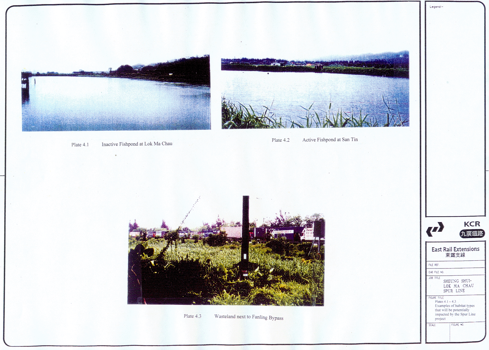
4.1-4.3 Example of Habitat Types that will be Potentially Impacted by the Spur Line Project
10.1-10.29 Photographic Record of Potentially Contaminated Sites along Spur Line Alignment