9.0.0.1 Culture heritage impact for DBL could be divided into two aspects: the historical building and graves, and the archaeology. The main concern is the encroachment of potential sites by the proposed alignment. Early stages of this Project have already fine-tuned this proposed alignment to avoid identified sites as far as possible.
9.1 Legislation, Policies, Plans, Standards and Criteria
9.1.0.1 The Environmental Impact Assessment Ordinance (EIAO) (Cap. 499), implemented in April 1998, lists cultural heritage sites among the "sensitive receivers" that should be considered in carrying out an EIA for any project. Under the accompanying Technical Memorandum (TMEIA) issued under Section 16 of the EIAO, the technical scope of assessment to be undertaken under the new provisions has been defined. Annexes 10 and 19 of the TMEIA specify that cultural heritage sites (which include historical, archaeological and architectural sites) shall be given a general presumption in favour of preservation, that adverse impacts on such sites shall be kept to a minimum, and that total destruction must be taken as the last resort after all alternatives have been considered.
9.1.0.2 The Antiquities and Monuments Ordinance (A&MO) of 1976 provides for the protection of important sites of archaeological or historical interest by declaration as monuments; it grants to Government the ownership of all relics (artifacts made prior to 1800) found in Hong Kong after the enactment of the A&MO; and it provides control over the excavation and search for relics though a licensing system.
9.1.0.3 In addition to the EIAO and A&MO, there are administrative mechanisms intended to provide some additional protection to buildings and sites of historical or archaeological interest. Most known archaeological sites are listed as "Special Sites of Archaeological Interest" (SSAI's), a number of important buildings are listed as "Deemed Monuments", and many other buildings are graded according to their perceived heritage value. Although there are no statutory provisions for the protection of SSAI's, Deemed Monuments and graded buildings, the Government has administrative procedures which require consideration to be given to the preservation of these sites or structures.
9.1.0.4 Contracts for most public works projects also require that the contractor takes steps to preserve any antiquity discovered during the course of the works and report such discovery immediately to the appropriate department. Contracts for consultancy studies require that due consideration be given to the preservation of all heritage sites.
9.1.0.5 The Antiquities and Monuments Office (AMO) of Leisure and Cultural Services Department (LCSD) has also assigned grades to buildings of historic interest ranging from the most valued buildings at Grade 1 down to Grade 3. This classification is for AMO internal reference and has no statutory protection power. Although there are no statutory provisions for the protection of Sites of Historical Interest, Deemed Monuments and Graded Buildings in Hong Kong, the Government has administrative procedures which state that consideration must be given to protect listed and locally designated historic buildings and sites of cultural interest. Surveys commissioned by Government have provided considerable data on archaeological sites and historical structures, but detailed impact assessment is still required for projects which will involve large-scale construction or landscaping works. Although Section 11 (and its relevant sub-sections) of the A&MO require any person who discovers an antiquity or supposed antiquity to report the discovery to the Antiquities Authority, there is a need to ensure that the potential impact of any project on all archaeological and historical resources, including sites or features that may be at present unknown, is assessed prior to the commencement of actual construction. Section 19 of the TMEIA states that "there is no quantitative standard in deciding the relative importance of these sites, but in general, sites of unique archaeological ... value will be considered as highly significant." Determining whether an archaeological site has unique value is very difficult without total excavation. Systematic testing of a site would normally be needed to obtain an indication of its value, but even after such testing the true significance of a site may still not be clear. Rescue excavation would be required in any area of a site that has to be destroyed.
9.1.0.6 Important considerations in determining the type of archaeological investigation that may be needed in an EIA are: the indications from existing data and topography as to the potential of a site; the degree to which a site has been disturbed already, and the degree to which the site will be impacted by the proposed development. The possible existence of sites or features that may not be known should also be assessed prior to the commencement of actual construction.
9.2 Description of
Environment
9.2.1 Historical Building and Graves
9.2.1.1 The cultural features in the Study Area include the Chung Shan Cemetery (Permitted Burial Ground No. 22), the Tsing Chuen Wai Village, the Chan Clan Cemetery and its Fung Shui Woodland at Tai Tau Shan, the Tang Clan cemeteries in three locations.
The Chung Shan Cemetery(Permitted Burial Ground No.22)
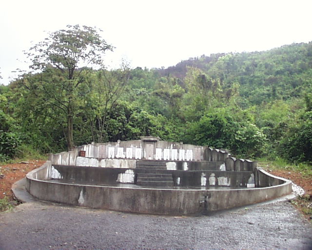
9.2.1.2 Chung Shan is a small hill covered with pine trees. It is located 2 km to the east of the Nai Wai village in Lam Tei area and about 50 m in height. The cemetery, located on the western slope of the hill, is shared by the residents of several villages in its west, including Nai Wai, Shun Fung Wai and Tuen Tsz Wai. Currently in the cemetery, there are 36 graves belonging to the Tao clan, and 44 to other clans. Figure 9.1 shows the distribution of graves at the Chung Shan Cemetery. The location of Chung Shan Cemetery (Permitted Burial Ground No.22) is shown in Figure 9.30. The picture shown in Figure 9.2 is a section of the Tao Clan Cemetery at Chung Shan Grave. Figure 9.3 shows the gate of Nai Wai Village. A list of graves at the Tao Clan Cemetery is presented in Table 9.1.
[FrontPage Image Map Component]
Figure 9.1 Distribution of Graves at the Chung Shan Cemetery (Permitted Burial Ground No. 22)
Figure 9.2 A Section of the Tao Clan Cemetery at Chung Shan
- Grave
Table 9.1 Indicative List of Graves at the Tao Clan Cemetery (Incomplete)
|
Grave No. |
Type of Grave |
Location |
Level MPD |
Description ( in Chinese) |
Reference Number |
|
|
N |
E |
|||||
|
Tao1 |
Brick/Cement |
830 743 |
817 143 |
24 |
泥圍村寶安陶門吳禮品墓 |
G3 |
|
Tao2 |
Earthen Mound |
830 731 |
817 158 |
28 |
泥圍村寶安陶君庚堯墓 |
G12 |
|
Tao3-9 |
Urns in Brick/Cement (7) |
830 739 |
817 167 |
29 |
十九世祖考德良陶公墓 十八世祖考安合陶公墓 妣孺人鄧氏墓 十九世祖考如興陶公合葬 墓 妣孺人李氏合葬墓 妣孺人劉氏合葬墓 二十世祖考松茂陶公合葬 墓 |
G14 |
|
Tao10 |
Urns in Brick/Cement |
830 741 |
817 172 |
30 |
陶公吉祥墓 |
G15 |
|
Tao11 |
Brick/Cement |
830 725 |
817 147 |
26 |
陶門鍾氏有墓 |
G18 |
|
Tao12 |
Brick/Cement |
830 722 |
817 156 |
28 |
顯妣陶門鍾有夫人¡B 顯妣陶門李群妹夫人與 顯妣陶門鄧火蓮夫人合葬墓 |
G21 |
|
Tao13 |
Brick/Cement |
830 699 |
817 179 |
36 |
十八世故兄諱先公陶老夫人墓 |
G24 |
|
Tao14 |
Brick/Cement |
830 729 |
817 184 |
35 |
皇清顯祖考邦盛陶公與 皇清顯祖妣鄧氏孺人合葬墓 |
G25 |
|
Tao15 |
Earthen Mound |
830 750 |
817 169 |
28 |
泥圍村陶門鄧然墓 |
G27 |
|
Tao16 |
Earthen Mound |
830 758 |
817 158 |
26 |
泥圍村寶安陶公潻財墓 |
G30 |
|
Tao17 |
Earthen Mound |
830 760 |
817 164 |
26 |
泥圍村陶公枝復墓 |
G31 |
|
Tao18 |
Urn in Earthen Mound |
830 756 |
817 172 |
28 |
陶君潻與 陶門鄧達英合葬墓 |
G33 |
|
Tao19 |
Brick/Cement |
830 761 |
817 172 |
28 |
泥圍村陶門楊氏墓 |
G35 |
|
Tao20 |
Earthen Mound |
830 769 |
817 176 |
28 |
寶安陶門陳桂夫墓 |
G39 |
|
Tao21-33 |
Urns in Brick/Cement (7) |
830 762 |
817 168 |
27 |
祖考陶太公墓 祖妣陶太婆墓 及無名氏墓 |
G40 |
|
Tao34 |
Brick/Cement |
830 769 |
817 172 |
26 |
泥圍陶門莫氏墓 |
G41 |
|
Tao35 |
Brick/Cement |
830 766 |
817 184 |
29 |
屯門坭圍陶公土鄰墓 |
G43 |
|
Tao36 |
Urn |
830 747 |
817 170 |
29 |
陶門余氏墓 |
U8 |
The Dating of the Cemetery
9.2.1.3 According to the epitaphs of the existing gravestones, most of the graves are dated to the 19th and 20th century.
Types of Grave Structure
9.2.1.4 Based on the material and shape of grave structure above the ground, the graves in the Chung Shan cemetery can be classified into three types:
Type A: Graves with brick and cement structure. Graves of this type are generally oval in shape, with 4 m to 5 m in width and 5 m to 10 m in length. All of the graves in this category have gravestone erected in the back, and some of them also have a "Fung Shui Pond" built in the front. There are both single burials and joint burials in this type, and of the latter, there are both burials for couples and burials for multiple persons. The joint burials are obviously secondary burials.
Type B: Graves with earthen mound. Graves of this type are smaller than Type A, usually 3 m x 2 m in size. Like Type A, graves of Type B are all associated with gravestone, but different from Type A, all of the graves in this type are primary burials for a single person.
Type C: Graves of pottery urn. Some of the funerary urns are associated with gravestone. On the cement or earthen platform, a few urns are placed alone, but in the most cases, multiple urns are arranged together in rows. Some urns are placed within the boundary of either Type A or Type B graves. All urn graves must be secondary burials, with bones placed in the urn long time after the death of a person. The funerary urns that are arranged together should belong to the same clan.
The Tsing Chuen Wai Village
9.2.1.5 The village of Tsing Chuen Wai ("walled with grey bricks") is located 350 m to the northwest of the Mui Fat Tsz, and, counting from the remaining old wall, 150 m to the DBL in the east. The most part of the old walls has been destroyed and only corner of the old walls is still remaining now. This corner is 6 m in height, 8 m in length towards southeast and 7 m towards northeast, and there are five loopholes left on the southeastern wall
9.2.1.6 The size of the wall bricks is generally
29 cm x 13 cm x 7 cm, the typical size of bricks made in Hong Kong area during
the Ming period (late 14th to middle 17th century). Most of the bricks are grey
in colour and showing high quality of making and firing. Unfortunately, however,
many cracks can be observed on both sides of the remaining corner, and the
bricks on the lower part of the southeastern wall are also severely damaged. The
locations of Tsing Chuen Wai and Hai Wai are indicated in Figure 9.4. Pictures
of Tsing Chuen Wai are shown in Figures 9.5 and 9.6.
[FrontPage Image Map Component]
Figure 9.5 Front View of the Old Wall at Tsing Chuen Wai
Figure 9.6 Southeastern Corner of the Old Wall at Tsing Chuen Wai
9.2.1.7 Because the clear characteristics of the bricks, the remaining corner of the walls in this village should be dated to the Ming period, and, therefore, the whole village should also be dated back to the Ming period.
9.2.1.8 According to a legend in this area, the Tao clan migrated to this place from the southern part of today's Jiangxi Province. The migrants first built the village of Nai Wai, then spread around and built Tsing Chuen Wai, Tuen Tsz Wei and Sha Kong Wai.
The Chan Clan Cemetery and its Fung Shui Woodland at Tai Tau Shan
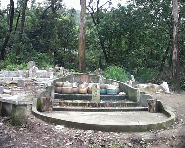
9.2.1.9 Tai Tau Shan (Big Head Hill), also called Yuen Tau Shan (Round Head Hill) by the locals, is located about 2 km to the southwest of the Tin Sam Tsuen (??? ) in Hung Shui Kiu area. The cemetery district is mainly distributed on the eastern slope of hill. Most of the graves in this cemetery, around 100 in total, belong to the Chan clan members residing in Tin Sam Tsuen, and the rest belong to people bearing other surnames. The location of the Chan Clan Cemetery is indicated on Figure 9.7. Pictures of the Chan Clan Cemetery are shown in Figures 9.8 and 9.9.
9.2.1.10 At the southern end of the hill and relatively separated from other graves of the Chan clan cemetery is the Fung Shui Woodland. Because the graves within the Fung Shui Woodland belong to a family branch of the Chan clan, the Fung Shui Woodland should be considered as part of the Chan clan cemetery at Tai Tau Shan.
9.2.1.11 The Fung Shui Woodland occupies an area of about 0.4 square km, covering this area with flourishing trees of pine and cypress, as well as tall bamboo bushes. The evergreen vegetation and the clean water streams in the woodland form an unusual natural setting that can probably be interpreted with an extraordinary geomantic omen.
9.2.1.12 There are only a small number of graves in the Fung Shui Woodland and they all belong to the Chan clan. These graves are all exquisitely constructed. For example, the grave of Chan Kwai Wah, the ancestor of the Chan clan 21 generations back, is not only built very tall with cement, but also decorated with a lawn of 5 m x 10 m surrounding the grave. Figures 9.10 to 9.13 show the Fung Shui Woodland of Chan Clan Cemetery.
The Chan Clan Cemetery and the History of the Fung Shui Woodland
9.2.1.13 According to the members of the Chan clan, their
ancestors migrated to this area and resided in Tin Sam Tsuen about 250 years
ago, and the Chan clan has since used this place as the clan cemetery. The clan
cemetery is still maintained by the assigned clan members. Based on the
descriptions of the gravestones, the genealogy of the Chan clan can be traced
back four to five generations, but the accurate dating of the graves in the
cemetery is unknown at the this stage.
Figure 9.8 The Chan Clan Cemetery at Tai Tau Shan
Figure 9.9 Grave of Chan Lien Fong and His Wife at Tai Tau Shan
[FrontPage Image Map Component]
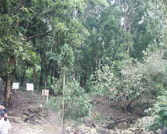
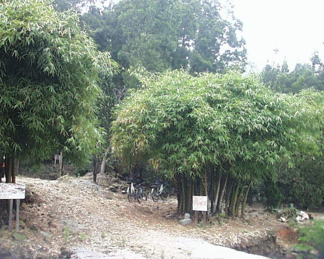
Figure 9.12 Section of the Chan Clan Fung Shui Woodland
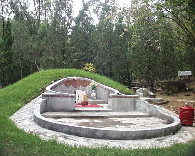
Figure 9.13 The Grave of Chan Kwai Wah in the Chan Clan Fung Shui Woodland
The Tang Clan Cemetery
The Tang Clan and Its Cemeteries
9.2.1.14 The Tang clan is the largest one of the five leading clans in the New Territories. According to historical texts, the ancestors of the Tang clan migrated to the New Territory in the early Song of the tenth century and first resided in the Kam Tin (錦田) area. After nine generations, some members of the Tang clan further moved to Ha Tsuen (廈村). Through time and with population growth, the Tang clan spread in surrounding places and built up new villages, including Tung Tau Tsuen (東頭村), Sai Tau Tsuen (西頭村), Sai Kong Wai (錫降圍), and Tse Tin Tsuen (紫田村).
9.2.1.15 The Tang clan cemeteries are naturally distributed in the nearby locations. As of today, a series of the Tang cemeteries can be found in the large region from the north of the San Shang Tsuen (新生村) to the extended hills of the Castle Hill (青山) in the Lau Fau Shan (流浮山) area. Some non-Tang families are also permitted to be buried in these cemeteries because they have lived in this area very long, and maintained good relations with the Tangs.
9.2.1.16 The northern section of the DBL is almost parallel with the distribution of some Tang cemeteries (Table 9.2). These cemeteries can be grouped in three locations, and the following discusses the conditions of the graves, the impact to the graves and our recommendation of mitigation measures for each location respectively.
Table 9.2 Indicative List of Graves of the Tang Clan Cemeteries
|
Grave Number |
Type of Grave |
Location |
Level mPD |
Description ( in Chinese) |
Reference Number |
|
|
N |
E |
|||||
|
1 |
Formal |
834 250 |
815 890 |
31 |
廿三世祖考疊全鄧公之墓 |
|
|
廿三世祖妣孺人樊氏 |
||||||
|
廿三世祖妣孺人黃氏 |
FG/G1 |
|||||
|
2 |
Formal |
834 190 |
816 020 |
25 |
鄧母黃氏夫人墓 |
FG/G2 |
|
3 |
Formal(2) |
834 180 |
816 020 |
26 |
廿六世祖考鄧公祖蔭之墓 |
FG/G4,5 |
|
4 |
Clan |
834 240 |
816 040 |
26 |
新屋村廿世祖考鄧太公郁萬之墓 |
|
|
新屋村廿世祖妣鄧太母周氏之墓 |
CG/G6 |
|||||
|
5 |
Clan |
834 230 |
816 030 |
28 |
廿二世祖考桂開鄧公之墓 |
|
|
廿二世祖考植生鄧公之墓 |
CG/G6A |
|||||
|
6 |
Formal |
834 220 |
816 020 |
29 |
顯考鄧公植添太府君之墓 |
FG/G6B |
|
7 |
Clan & Formal Graves |
834 430 |
815 890 |
32 |
廿三世祖考伙良鄧公之墓 |
|
|
834 420 |
廈村巷尾村鄧門蔡氏之墓 |
CG/7/29,30 |
||||
|
8 |
Blood |
834 420 |
27 |
廈村祥降圍鄧公石興之墓 |
FG/7/29.31 |
|
|
9 |
Earth Clan |
834 420 |
815 920 |
26 |
民顯廿二世祖考諱牛穩鄧公之墓 |
|
|
民顯廿二世祖考妣孺人葉氏之墓 |
ECG/7/36 |
|||||
|
10 |
Earth |
834 410 |
815 920 |
25 |
民顯廿三世祖考諱疊福鄧公仝墓 |
|
|
民顯廿三世祖考諱鳳全鄧公仝墓 |
G/7/37 |
|||||
|
11 |
Formal |
834 400 |
815 860 |
37 |
廿四世顯祖考牛基鄧公墓 |
FG/8/8,9 |
|
12 |
Earth |
834 410 |
815 870 |
36 |
鄧柱恒君之墓 |
G/8/11 |
|
13 |
Earth |
834 400 |
815 870 |
35 |
廈村巷尾村鄧門梁妹之墓 |
G/8/12 |
|
14 |
Formal |
834 140 |
816 180 |
20 |
廿三世祖考鄧公水泉之墓 |
|
|
廿三世祖妣張氏孺人之墓 |
FG/G7 |
|||||
|
15 |
Clan |
834 170 |
816 290 |
22 |
廿四世顯祖考鄧太公長達府君之墓 |
|
|
廿二世顯祖考鄧太公英福府君之墓 |
||||||
|
廿一世顯祖考鄧太公牛福府君之墓 |
||||||
|
廿三世顯祖考鄧太公伏金府君之墓 |
||||||
|
廿三世顯祖妣鄧太母鄭氏孺人之墓 |
||||||
|
廿四世顯祖考鄧太公木興府君之墓 |
CG/G10 |
|||||
|
16 |
Grave(2) |
833 790 |
816 440 |
25 |
廈村鄧門何氏之墓 |
|
|
廈村鄧門楊氏之墓 |
G/G22 |
|||||
|
17 |
Formal |
833 800 |
816 410 |
24 |
廿四世祖考葵大鄧公之墓 |
|
|
廿四世祖妣孺人鍾氏之墓 |
FG/G23 |
|||||
|
18 |
Formal |
833 840 |
816 560 |
20 |
廈村鄉鍚降圍鄧公之墓 |
FG/G36 |
|
20 |
Clan |
833 860 |
816 590 |
16 |
廿二世祖考天瑞鄧公之墓 |
|
|
廿二世祖妣孺人鍾氏之墓 |
CG/G39 |
|||||
|
21 |
Blood |
834 120 |
816 190 |
22 |
廈村鄧公照盛 |
G/8/30 |
|
22 |
Formal |
834 100 |
816 210 |
22 |
廈村鄧公之墓 |
FG/9/4 |
|
23 |
Formal |
834 030 |
816 230 |
22 |
廈村鄉鍚降圍鄧公之墓 |
FG/9/8 |
|
24 |
Formal |
834 030 |
816 230 |
22 |
廈村鄉鍚降圍鄧公之墓 |
FG/9/9 |
|
25 |
Clan |
833 800 |
816 420 |
24 |
廿二世祖考清國學生諱鍚良鄧公之墓 |
|
|
廿二世祖妣淑德孺人原配者蔡氏之墓 |
||||||
|
廿二世祖妣淑德孺人繼室者劉氏之墓 |
CG/10/3,4 |
|||||
|
26 |
Blood |
833 770 |
816 470 |
24 |
鄧門黃水嬌之墓 |
G/10/8 |
|
27 |
Urns in Grave(5) |
833 780 |
816 450 |
26 |
鄧公列位之墓 |
UG/10/9 |
|
28 |
Earth |
833 770 |
816 450 |
27 |
建寧鄧公墓 |
G/10/10 |
|
29 |
Urns in Grave (4) |
833 880 |
816 610 |
16 |
鄧公鍚鵬 |
|
|
鄧公滿堂 |
||||||
|
鄧公廣 |
||||||
|
鄧公陳氏 |
UG/10/21 |
|||||
|
30 |
Blood |
833 870 |
816 610 |
17 |
廈村鍚降圍鄧門容愛之墓 |
G/10/22 |
|
31 |
Urn in Grave |
833 900 |
816 650 |
16 |
廿四世祖考鄧公 |
UG/10/26 |
|
32 |
Formal |
833 890 |
816 630 |
17 |
鄧公美壽之墓 |
FG/10/30 |
|
33 |
Clan |
833 780 |
816 340 |
28 |
廿一世祖考章華鄧公之墓 |
|
|
廿一世祖妣張氏孺人之墓 |
||||||
|
廿二世祖考秀文鄧公之墓 |
||||||
|
CG/G29 |
廿二世祖妣李氏孺人之墓 |
|||||
|
34 |
Grave |
833 780 |
816 320 |
27 |
鄧公英福之墓 |
G/G30 |
|
35 |
Clan(2) |
833 950 |
816 140 |
27 |
十七世祖考文會鄧公仝墓 |
|
|
十七世祖妣黃氏孺人仝墓 |
||||||
|
十八世祖考鄧公仝墓 |
||||||
|
十八世祖妣袁氏孺人仝墓 |
||||||
|
明十二世祖 |
||||||
|
明廿二世祖 |
CG/9/13,14,15 |
|||||
|
36 |
Clan |
833 670 |
816 190 |
34 |
廿二世祖鄧門孺人何氏仝墓 |
|
|
廿二世祖鄧門孺人林氏仝墓 |
CG/9/17,18 |
|||||
|
37 |
Blood |
833 670 |
816 150 |
34 |
鍚降圍鄧公彥文之墓 |
FG/9/20 |
|
38 |
Clan |
833 670 |
816 160 |
32 |
一十世祖鄧門孺人黃氏之墓 |
CG/9/22.23 |
|
39 |
Formal |
833 800 |
816 380 |
28 |
廿五世祖考兆全鄧公之墓 |
FG/9/28 |
|
40 |
Formal |
833 800 |
816 350 |
27 |
鍚降圍鄧門張氏之墓 |
FG//9/36 |
|
41 |
Formal |
833 800 |
816 350 |
27 |
鍚降圍鄧公永祥之墓 |
FG//9/37 |
|
42 |
Formal |
833 520 |
816 610 |
17 |
廈村鍚降圍鄧門祖妣之墓 |
FG/G14 |
|
43 |
Formal |
833 620 |
816 650 |
15 |
廿五世鄧門先母黃氏孺人之墓 |
FG/G14B |
|
44 |
Clan |
833 560 |
816 530 |
25 |
南陽堂上鄧氏歷代祖先之墓 |
CG/G15 |
|
廿四世祖考添來鄧公之墓 |
||||||
|
廿四世祖妣黃氏孺人之墓 |
||||||
|
廿一世祖考注壽鄧公之墓 |
||||||
|
廿一世祖妣杜氏孺人之墓 |
||||||
|
廿二世祖考社祐鄧公之墓 |
||||||
|
廿二世祖妣陶氏孺人之墓 |
||||||
|
廿二世祖考健盛鄧公之墓 |
||||||
|
廿二世祖妣陳氏孺人之墓 |
||||||
|
廿三世祖考華新鄧公之墓 |
||||||
|
廿三世祖妣林氏孺人之墓 |
||||||
|
廿三世祖考木生鄧公之墓 |
||||||
|
廿三世祖妣陳氏孺人之墓 |
||||||
|
廿四世祖考永香鄧公之墓 |
||||||
|
廿四世祖考發仔鄧公之墓 |
||||||
|
廿四世祖考惠賀鄧公之墓 |
||||||
|
廿五世祖考樹盛鄧公之墓 |
||||||
|
顯考鄧公延之墳墓 |
||||||
|
顯考鄧公水容之墓 |
||||||
|
顯妣鄧門林士媽墓 |
||||||
|
45 |
Formal |
833 650 |
816 500 |
30 |
廿四世祖鄧門李氏孺人之墓 |
FG/G17 |
|
46 |
Urn |
833 650 |
816 670 |
18 |
鄧門李氏之墓 |
U/1/14 |
|
47 |
Brick tomb |
833 640 |
816 670 |
23 |
十九世鄧門李氏儒人之墓(清光緒30年) |
001-D |
|
48 |
Formal |
833 660 |
816 660 |
25 |
15世祖先鄧公之墓 |
002-D |
|
49 |
Formal |
833 670 |
816 690 |
28 |
寶安鄧門李氏碑土墳 |
003-D |
|
50 |
Clan |
833 670 |
816 700 |
23 |
鄧 24-25 世祖合墓 |
004-D |
|
24世祖福德公之墓 |
||||||
|
24世祖妣淑德文氏孺人 |
||||||
|
24世祖考處士芳池鄧公之墓 |
||||||
|
25世祖考處士錫熊鄧公 |
||||||
|
25世祖妣淑德林氏孺人 |
||||||
|
51 |
Formal |
833 630 |
816 750 |
20 |
21世祖考創祥鄧公 |
005-D |
|
21世祖妣孺人李氏之墓 |
||||||
|
52 |
Formal |
833 620 |
816 760 |
24 |
25世祖考平善鄧公 |
006-D |
|
25世祖妣李氏 |
||||||
|
53 |
Formal |
833 620 |
816 740 |
17 |
15世祖考鄧公 |
007-D |
|
15世祖妣溫氏 |
||||||
|
54 |
Formal |
833 590 |
816 730 |
16 |
鄧門麥氏之墓 |
008-D |
|
55 |
Formal |
833 610 |
816 730 |
14 |
24世祖考泰林鄧公 |
009-D |
|
24世祖妣梁氏 |
||||||
|
56 |
Formal |
833 590 |
816 780 |
15 |
24世祖考觀頤鄧公 |
010-D |
|
24世祖妣吳氏¡B劉氏¡B石氏合墓 |
||||||
|
57 |
Formal |
833 690 |
816 730 |
16 |
22世祖考天瑞鄧公之墓 |
011-D |
|
22世祖妣孺人鐘氏之墓 |
||||||
|
58 |
Formal |
833 710 |
816 730 |
17 |
20世祖妣鄧母鄭氏之墓 |
012-D |
|
59 |
Formal |
833 700 |
816 730 |
18 |
16世祖鄧公之墓 |
013-D |
|
60 |
Formal |
833 710 |
816 740 |
19 |
23世祖鄧加喜,鄧土財之墓 |
014-D |
|
61 |
Clan |
833 710 |
816 750 |
16 |
23世祖鄧廣佑 |
015-D |
|
24世祖鄧滿堂 |
||||||
|
25世祖鄧錫朋合墓 |
||||||
|
62 |
Formal |
833 720 |
816 750 |
17 |
24世祖考鄧金富 |
016-D |
|
24世祖妣張氏合墓 |
||||||
|
63 |
Formal |
833 740 |
816 770 |
16 |
22,23,24世祖鄧氏先人合墓 |
017-D |
Location I
9.2.1.17 Location I refers to the Tang cemetery to the north of the San Sang Tsuen (???) from 833500N to 833900N. This cemetery is located on the hills flanking the road leading to the Ling To Monastery (???). Graves are densely distributed in this cemetery, including over 30 graves of the Tang clan and near 100 of other surnames.
9.2.1.18 The designed route will directly crush around ten graves of the Tang Clan, including one large collective grave and graves dating to the 19th century. The construction will also affect indirectly five to six other graves. The location and pictures of Tang Clan Cemetery in Location I are shown in Figures 9.14 to 9.16. According to our interview with the locals, however, the government has paid them to remove the graves, further preservation of the affected graves in this location thus becomes unnecessary. We still suggest, however, that the graves removed from this location be recorded in detail.
Location II
9.2.1.19 Location II refers to the Tang Clan cemetery to the west of Ha Tsuen (??) from 834000N to 834200N. The cemetery is small, containing around 20 graves of the Tang clan. The designed DBL will pass by this cemetery, but the construction will not affect these graves with an exception of one or two, because the cemetery is located on the level ground in the hill. The affected graves can be relocated within the cemetery. The location and picture of Tang Clan Cemetery in Location II and III are shown in Figures 9.17 and 9.18.
Location III
9.2.1.20 Location III refers to the Tang clan cemetery to the northwest of Ha Tsuen (??) from 834200 N to 834400 N. This location is only about 100 m away from Location II, and it is thus highly likely that both belong to the same cemetery originally, but many graves between these two locations have been removed or destroyed later by the construction of the sewage treatment plant and cargo holding place in this area.
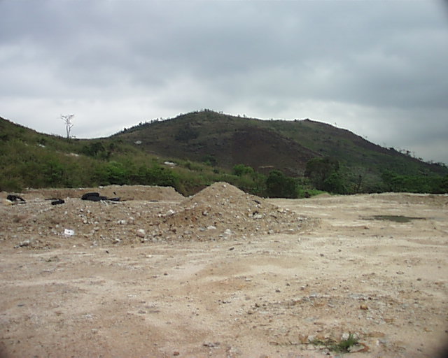
9.2.1.21 The crushing of the graves in Location III has been continuing. According to the "Existing Graves Survey Report" from Arup, there were over ten graves in this location during the last survey, but only about five or six are left now. Furthermore, these remaining graves have already been damaged by the newly built parking platform in the cargo holding place (Figure 9.19). Considering that this cemetery has almost been destroyed already, there is no need to apply any mitigation measures on this cemetery, except the recording the remaining graves when they are removed.
Figure 9.15 Collective Grave of Tang Clan Ancestors in Location I
Figure 9.16 The Grave of the 19th Generation Ancestor of the Tang Clan in Location I
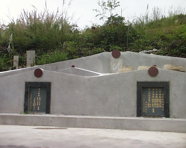
Figure 9.18 Collective Grave of the Tang Clan in Location II
Figure 9.19 The Newly Built Platform in Location III Which
Has Crushed Tang Clan Graves
9.2.2 Archaeology
9.2.2.1 The proposed DBL alignment stretches about 5 kilometers long in the western New Territories from the Deep Bay coast at Ngau Hom Shek in north to Yuen Long Highway at Lam Tei in south (Figure 9.20). After passing over the hills in its northern section, the designed road generally runs along the base of the hills, where debris flow deposits and terraced alluvia were shaped during the Pleistocene. Occasionally, the road takes the rim of the plains that were gradually formed up during the Holocene (Figure 9.21).
9.2.2.2 Previous archaeological investigations in the New Territories have revealed that the distribution of archaeological settlements had gradually shifted downwards through time. Generally, the Neolithic and Bronze Age sites were located along the low-altitude hillocks and early Holocene seashores. Largely based on an agricultural economy, the historical settlements since the Tang - Song time began occurring on the lowlands although they might also be built on the prehistoric deposits. Up to the Ming - Qing time, the sites were basically distributed at the same locations of today's villages in the plain areas. This site distribution patterning suggests that, except the hilly area in the northern section, the most part of the DBL alignment require a thorough search for archaeological deposits of different time periods from the Neolithic to the Qing dynasty.
9.3.0.1 The scope of the 2001 archaeological survey was usually within or close to the impact zone, which was presumably 30 meters to each side of the alignment in general. At some locations, the survey reached a range far beyond the alignment to identify the boundary of a potential archaeological site. The target of the field survey was primarily underground archaeological deposits. A few landscape features, however, were also encountered during the survey and presented in this report.
9.3.0.2 Four methods of field work were applied during the survey: field walking, augering, test pit excavating and slope face cutting. The field walking covered the entire works area despite some places were expected with low archaeological potential. Past experiences can be informative, but archaeological field work often results in unexpected discoveries.
9.3.0.3 Augering is an effective method to reveal the types of soil and the stratigraphy of deposits at a location. The data from augering, when combined with information from other survey methods, can help discover and define archaeological deposits such as a site or a feature. During the 2001 survey along the DBL, augering was conducted with a combined use of a shovel and an auger of 1.6 meters in length and 10 centimeters in diameter. The shovel was used to clear away the obstacles of top layers, and the auger to reach a much deeper depth.
9.3.0.4 Test pit excavation was conducted during this survey to confirm archaeological deposits at a location within the impact zone rather than to reveal full-scale archaeological data as in research question oriented excavations. The size of the test pits opened, therefore, was small and it varied from 1 x 1 meter to 2 x 2 meters.
9.3.0.5 Slope face cutting is a method between augering and test pit excavation regarding the cost and the quality and quantity of data retrieving of the field work. During this survey, face cuts were often made on hillock or terrace slopes, especially when the top of the slopes was occupied by buildings or covered by a dense vegetation.
9.3.0.6 In this report, the information on and from the augering, test pit
excavating and slope face cutting is recorded in Table 1 - 3. The augers, test
pits and face cuts are grouped into specific locations and, for the convenience
of presentation, these locations are further organized into four geographic
areas: Ngau Hom Shek (NHS), Sewage Treatment Plant (WTP), Tsing Chuen Wai (TCW)
and Lam Tei (LT). The archaeological work conducted in each of the four areas is
illustrated in Figures 9.22, 9.24, 9.25 and 9.28 respectively.
9.3.0.7 The major results of this survey in each of the four areas are reported in the following chapters. For each area, the report first introduces the known archaeological sites and previous archaeological works, then it describes the significant discoveries of this survey, and at the end it summarizes the chapter with an assessment of the impact on archaeological heritage and a recommendation of mitigation measures.
9.4
Identification, Prediction and Evaluation of Potential Impacts
9.4.1 Historical Buildings and Graves
The Chung Shan Cemetery (Permitted Burial Ground No. 22)
9.4.1.1 The impacts of the DBL project are direct and severe to the Chung Shan cemetery. The actual number of graves affected would depend on the locations of foundation structures. However, the entire cemetery setting, if considered as a single unit, would be affected with the DBL traversing above the graves.
9.4.1.2 The Chung Shan cemetery is deemed to be of historical and cultural significance. This argument is based on the following reasons.
The Long Lasting Tao Clan and Its Cemetery at Chung Shan
9.4.1.3 Recent archaeological surveys have discovered several residential sites dating to the Song period (middle 10th to late 13th century) in the Yuen Long and Tuen Mun area. The burials of the Song period, however, have not yet been found in Hong Kong.
9.4.1.4 The single largest group of graves in the Chung Shan cemetery belongs to the Tao clan, and the Tao clan has a very long genealogical history. The Tao Clan Shrine in Tuen Tsz Wai is called "Hall of Five Willow Trees" (五柳堂). According to the inscription on the shrine tablet, the ancestor of the Tao clan can be traced back to the famous poet Tao Yuanming in the Eastern Jin period (late 4th to early 5th century), and Tao named his own house as the Hall of Five Willow Trees, which therefore became the name of clan shrine adopted by all his offspring. Also according to the shrine tablet, the Tao clan first resided in the village of Nai Wai in Yuen Long in the time of late Song and early Yuan (late 13th century), then gradually spread in today's New Territories. The walled villages Tsing Chuen Wai and Nai Wai in Yuen Long as well as Sha Kong Wai in Ha Tsuen were all built by the Tao clan. We interviewed several Tao clan members who came to pay respect to their ancestors during the Ching Ming Festival, and they claimed that the Chung Shan cemetery has been used as the clan cemetery for over 800 years.
The Tao Clan Cemetery as an Integral part of the Tao Clan Cultural Sphere
9.4.1.5 The Tao clan has lived in Yuen Long for over 800 years and has become one of the largest clans in the New Territories. The Tao clan has contributed to the development of local economy and culture through time.
9.4.1.6 The Tao clan has built walled villages like Nai Wai, Tsing Chuen Wai and Siu Tuen Wai, and these villages have undergone a history of several centuries; the Tao clan has built its long lasting ancestral shrine, and the shrine is still preserved well. Together with the walled villages and the shrine, the Tao clan cemetery is integrated into a full-aspect cultural sphere in this area that has been developed and treasured by people of the Tao clan through history.
The Tsing Chuen Wai Village
9.4.1.7 Tsing Chuen Wai is on the list of known archaeological sites. Construction and operation of the project therefore should not cause any negative effects, directly or indirectly, on the remaining part of the Tsing Chuen Wai village. Potential impact of vibration and shocks caused by construction activities on the wall, therefore, should be taken into consideration.
9.4.1.8 Construction of the DBL foundation would be by bored piling. Vibration during bored piling should be considerably less than percussive piling. In view of the distance (about 150 meters) of the Tsing Chuen Wai site from the DBL alignment, vibration during construction is not expected to cause any negative effects on the wall at Tsing Chuen Wai.
The Chan Clan Cemetery and its Fung Shui Woodland at Tai Tau Shan
9.4.1.9 The proposed DBL is now revised to avoid the Chan Clan Cemetery and its Fung Shui Woodland by shifting towards HSKNDA. No direct impact would be expected for these two sites.
The Cheung Clan Cemetery
9.4.1.10 The Cheung clan cemetery includes a large amount of graves belonging to multiple generations of the Cheung clan and has been regularly visited by living members of the Cheung clan. Because of the perception of the tight bounding to their ancestors, the living members of Cheung clan objected a proposal to relocate the graves for the old DBL scheme. Consequently, the alignment has to shift towards HSKNDA and no direct impact would be expected for these the cemetery.
Other Historical Buildings
9.4.1.11 In the letter addressed to Arup on 21 January 2000 (LCSD
Ref: 29 in LCSD AM 81/3/25), the AMO specified 12 historical buildings and
historic villages nearby the DBL working area that should not be disturbed by
the construction. After checking the locations of these sites, however, we have
realized that the DBL project will not cause damaging impact to these sites
because they are all roughly at least 200 metres away from the alignment of the
DBL. Table 9.4 lists the name, location, bearing and distance from DBL, and
impact assessment of the 12 buildings and villages.
Table 9.4 Other Identified Historical Buildings
|
Item No.
|
Historical Buildings and Historic Villages |
Chinese Name |
Location |
Bearing and Distance from DBL (m) |
Impact |
|
|
N |
E |
|||||
|
1 |
Ling To Monastery |
靈渡寺 |
833 500 |
816 000 |
240m SW |
No |
|
2 |
San Sang Tsuen |
新生村 |
833 400 |
817 000 |
350m E |
No |
|
3 |
Sun Fung Wai |
順風圍 |
831 700 |
816 900 |
350m NE |
No |
|
4 |
Nai Wai |
坭圍 |
831 550 |
816 900 |
270m NE |
No |
|
5 |
Tsing Chuen Wai |
青磚圍 |
831 485 |
816 250 |
180m SW |
No |
|
6 |
Sam Shing Kung, Tuen Tsz Wai |
屯子圍三聖宮 |
831 225 |
815 920 |
500m SW |
No |
|
7 |
Tao Ancestral Hall, Tuen Tsz Wai |
屯子圍陶氏宗祠 |
831 225 |
815 900 |
500m SW |
No |
|
8 |
Mui Fat Tsz |
妙法寺 |
831 200 |
816 400 |
200m SW |
No |
|
9 |
Nam On Fat Tong, Fu Tei Ha Tsuen |
虎地下村南安佛堂 |
830 475 |
816 925 |
240m S |
No |
|
10 |
Fu Tei Ha Tsuen |
虎地下村 |
830 475 |
816 925 |
216m S |
No |
|
11 |
Fat Din, Ching Leung Fat Yuen |
清涼法苑佛殿 |
830 100 |
816 050 |
350m S |
No |
|
12 |
Ching Yan Siu Chuk, Ching Leung Fat Yuen |
清涼法苑清隱小築 |
830 050 |
816 100 |
400m S |
No |
9.4.2 Archaeology
9.4.2.1 The sites of cultural heritage with archaeological significance are identified in the following paragraphs and impacts due to DBL are evaluated.
Ngau Hom Shek Area
9.4.2.2 The Ngau Hom Shek area refers to the northernmost section of the proposed DBL alignment. This section is mainly a large deserted river course embraced by hill ridges in the back and flanked by small terraced hillocks on both sides (Figure 9.22).
Previous Archaeological Works
9.4.2.3 This area is located within the boundary of the Ngau Hom Shek Archaeological Site defined by the Antiquities and Monuments Office (AMO). This site was first identified by Dr. Bard of the AMO in 1978 (1). Afterwards, a small-scale survey was conducted on the site in 1994 for a drainage project (2). During the territory wide archaeological survey in 1997, two test pits were excavated in the area to the west of the DBL alignment and a Fu Tei Au Hill Site was found with stone implements and geometric pottery dating to the Early Bronze Age (3). During a reinvestigation of the site in 1999, both Bronze Age remains and earlier Neolithic deposits were discovered at the Fu Tei Au Hill Site and the range of the site was redefined as large as over 30,000 square metres (4).
9.4.2.4 It seems that the Ngau Hom Shek Archaeological Site is composed of several independent site areas or specific sites. Besides the Fu Tei Au Hill Site, the 1997 survey also found coarse red ware and geometric pottery on the beach but inferred after digging six test pits that the beach site had been totally destroyed. During an archaeological survey in 2001 for the proposed landing point of Shenzhen Western Corridor, a site of cultural heritage with archaeological significance was identified in the area of Option AB on the seashore to the east of the DBL alignment and it was named the Ngau Hom Shek Beach Site (5) (Figure 9.22).
9.4.2.5 At the Ngau Hom Shek Beach Site, many pieces of lithic and ceramic remains were spotted on the beach. The lithic remains almost all belong to a jue-ring making workshop, including pounding tools like hammer and circular flakes as the waste or unfinished products from the process of ring making. The ceramic remains include both pottery ware with geometric patterns and the celadon stoneware. The patterns of geometric design include bold zigzag pattern, fine zigzag pattern, small and bold net patterns, lozenge with raised dot pattern and bold cord pattern.
9.4.2.6 The Ngau Hom Shek Beach Site is now largely occupied by a piggery on the top and the surface is almost entirely covered by either piggery structures or a cement layer. Augering at some accessible spots, however, yielded Song celadon pieces from almost every hole. Based on the distribution of artifacts and deposit layers, the size of this site is estimated around 1,800 square metres.
9.4.2.7 Based on the characteristics of the geometric
patterns, the stone and pottery remains can be dated to the late Bronze Age, or
the Late Western Zhou and the Spring-and-Autumn period, from the 8th to the 5th
century B.C. The celadon stoneware can be dated to the Song dynasty of the 12th
- 13th century.
9.4.2.8 The area of Option AB to the immediate west to the DBL
alignment was occupied by groups of houses and patches of planted gardens when
the survey was conducted. Therefore, this area was not accessible for
archaeological survey at that time, especially for augering and test pit
excavation (Figure 9.22).
9.4.2.9 The area in question was not included in the boundary
of the Ngau Hom Shek Beach Site to its east because of the topographic features
of this location and the result of survey conducted in surrounding areas.
Topographically, the area in question was separated from the piggery by a short
steam which was originally connected to the old river course farther to the
south across Deep Bay Road. To the north and northwest of the area in question
was a deposit of beach sand not containing archaeological remains according to
the result of augering. To the west of the area in question were two large ponds
dug after the 1950s and the excavation of a test pit demonstrated that the
remaining land area between the ponds had also been disturbed.
9.4.2.10 It can be concluded based on above description that the coastal area to the immediate west to the DBL alignment is not part of the Ngau Hom Shek Beach Site and the archaeological potential of this area is low. It should be emphasized, however, that the possibility of identifying significant archaeological remains in this area cannot be completely excluded now because this area is indeed so close to the Ngau Hom Shek Beach Site and it has after all not been investigated.
The Ngau Hom Shek Hill Site
9.4.2.11 During the 2001 archaeological survey for DBL, a new hill site of cultural heritage with archaeological significance was identified on the flat top of a terrace to the east of the alignment and it was named the Ngau Hom Shek Hill Site (Figure 9.22, Plate 9.1 - 1). Two face cuts were made on the site. FC1 at the northern end of the site revealed a cultural layer C602 under the surface (Figure 9.23 - 1, Plate 9.1 - 2) and yielded two pieces of red sherds (Plate 9.1 - 3). FC2 at the southern end of the site exposed a stratigraphic profile similar to that of FC1 (Figure 9.23 - 2). From the first layer C604, 20 pieces of sherds dating to the Ming dynasty (1368 - 1644) were retrieved (Plate 9.1 - 4). From the second layer C605, a piece of red ware with the incised patterning of Double F plus circular dots was found (Plate 9.1 - 5).
9.4.2.12 Based on the geometric pattern of the red ware, the Ngau Hom Shek Hill Site can be dated to the Late Bronze Age, or the Late Western Zhou and the Spring-and-Autumn period, in the early half of the first millennium B.C. (6), (7).
9.4.2.13 The distribution of the Ngau Hom Shek Hill Site is now restricted to the top of the terrace. A series of auger holes applied on the lower tiers of the terrace revealed sterile deposits right under the vegetational surface. There might be some cultural deposits of both prehistoric and historical periods on the lower slopes originally, but they have been completely removed.
The Lowland Deposits
9.4.2.14 Augering along the northern base of the terrace also retrieved archaeological remains. Auger K18 pulled out a coarse ware sherd with the geometric pattern and a celadon piece (Plate 9.2 - 1) and K19 a celadon piece (Plate 9.2 - 2). The celadon pieces are the same kind as that found at the Ngau Hom Shek Beach Site mentioned above and the two augers are very close to the piggery. The location of the two augers, therefore, indicates the southern boundary of the beach site.
9.4.2.15 Auger K14 was placed within the impact zone along the old river course and it also retrieved celadon pieces from underground. Test pit T1 was then excavated to verify the nature of the deposit at this location (Figure 9.23 - 3, Plate 9.4 - 3). From the first layer C701 and second layer C702, Song - Yuen celadon pieces were found along with glazed wares and broken tiles (Plate 9.2 - 4, 5). In the underneath layer C703, however, a piece of blue-and-white porcelain was unearthed and it should be dated to the Ming dynasty (Plate 9.2 - 6). Under C703 was a muddy layer revealed by an auger. A series of augers applied along the old river course also found similar kind of muddy deposit containing no cultural remains.
9.4.2.16 In the strata of T1, the layer with Song celadon overlies that with Ming blue-and-white. This clearly demonstrates that the deposits at the location of T1 and surrounding area along the river course are not the result of a natural process of stratification through time but mixed or even inverted. It is very likely that the top layers of the old river course are removed from nearby slopes and piled up atop the mud.
Summary
9.4.2.17 The newly identified Ngau Hom Shek Hill Site is dated to the Bronze Age and probably still well preserved on the top of a hillock. This site is located slightly outside and above the impact zone of the proposed DBL, and the construction will not cause direct adverse impact to this site. It should be emphasized, however, the site area should be protected from the indirect impact potentially caused by the construction and facilities and activities related to the construction should be kept away from this site.
Sewage Treatment Plant Area
9.4.2.18 The Sewage Treatment Plant area groups a series of locations between Ngau Hom Shek and Tsing Chuen Wai, including the hill ridge to the back of Ngau Hom Shek, So Kwun Tsai (SKT), Hau Tsz Shan (HTS), Yuen Tau Shan (YTS), San Sang San Tsuen (SSST) and Sai Shan Tsuen (SST) (Figure 9.24).
Hill Ridge to the Back of Ngau Hom Shek
9.4.2.19 Behind the NHS area is a high hill ridge above a valley and the proposed alignment runs across the upper slopes of the ridge (Plate 9.3 - 1). The survey team found no archaeological remains but two unexploded bombs half-buried together on a slope (Hong Kong grid coordinates: N834,641; E815,701). The project proponent should report the bombs to the police and have them cleared away as soon as possible.
The Destroyed Site at So Kwun Tsai
9.4.2.20 The narrow access road connecting the proposed DBL runs along the base of a hillock named So Kwun Tsai (Plate 9.3 - 2). A site under the name of Tseung Kong Wai So Kwun Tsai Archaeological Site was identified on the SKT hillock in 1997 during the territory wide archaeological survey. Seven test pits were excavated on the site and two of them yielded geometric soft pottery (3). According to the survey report, right after the discovery and before the excavation in 1997, this site was completely demolished. Consequently, the following archaeological surveys in 1999 and 2000 resulted in no new discoveries (1), (4).
9.4.2.21 Currently, the top of the hillock is occupied by a parking place and the northern base area of the hillock has been scraped even for a temporary path, exposing sterile clay deposits at the surface. The 2001 survey did not observe any cultural remain at this location except some graves.
Hau Tsz Shan and Yuen Tau Shan
9.4.2.22 To the west of the WTP is a large piece of open land flanked by a hillock named Hau Tsz Shan to its east and hill ridges named Yuen Tau Shan to its back and west (Plate 9.3 - 3). Augering on the open land revealed an alluvial deposit containing no cultural remains. The survey atop the hill slopes did not result in any archaeological discovery either.
9.4.2.23 Two landscape features, however, were noticed on a lower slope of the Yuen Tau Shan. The first one was a deserted cistern in a rectangular shape, roughly 6 x 2.5 meters in size. The walls of the cistern were originally covered by a mortar layer and two ladders made of clay were placed in the middle of the cistern, extending from the short side to the bottom (Plate 9.3 - 4).
9.4.2.24 Down to the slope with the cistern was a natural stream course, but it was also protected by a mortar layer in between the rocks on the stream banks. The protected stream course stretched very long from the stream mouth to the inside of the valley and there were around a dozen of flower pots scattered on the banks (Plate 9.3 - 5).
9.4.2.25 The two features have been deserted for some time and the protection layer of the cistern and stream course are made of mortar instead of cement, the two features therefore probably are not made recently. But, judging from their shape, the flower pots related to the two features can not be dated too old either. The date of the use of the two landscape features is probably in the middle period of the past century.
Field to the Southeast of Sewage Treatment Plant
9.4.2.26 The large agricultural field to the southeast of the WTP is connected to a river course flanked by hill slopes (Plate 9.3 - 6). Near a dozen of auger holes were drilled at this location and revealed only bits of glazed and blue-and-white wares dating to the Qing time as the earliest. This field should be a sedimentary deposit of the river course and contained no significant archaeological remains.
San Sang San Tsuen
9.4.2.27 Eight augers and one face cut (FC3) were applied
along the base of a large hill near San Sang San Tsuen. The land of this
location was either occupied by house structures or scraped even at the top for
road construction or house platforms. No significant archaeological remains were
found at this location.
Sai Shan Tsuen
9.4.2.28 At the location of Sai Shan Tsuen is a large plain
area at the base of the hill. This area is now largely occupied by vegetable
gardens, pigeonries or chicken farms. As at the location of SSST, field walking
and augering in this place only encountered some small pieces of glazed and
blue-and-white wares or broken red tiles.
Summary
9.4.2.29 The archaeological remains are scarce and insignificant in the WTP area. The So Kwun Tsai Archaeological Site has been destroyed and the landscape features at Yuen Tau Shan are not valued either historically or architecturally. Therefore, no further mitigation measures are needed to be taken in this area.
Tsing Chuen Wai Area
9.4.2.30 The Tsing Chuen Wai area mainly includes a destroyed site at Tin Sam Tsuen (TST) and a site of cultural heritage with archaeological significance dated to the Ming dynasty at Tsing Chuen Wai (Figure 9.25).
The Destroyed Site at Tin Sam Tsuen
9.4.2.31 The proposed DBL runs along the base of the hills in the area between Sai Shan Tsuen and Tsing Chuen Wai and this area is largely occupied by a series of open storage facilities, houses and huts. Slightly outside the impact zone of the DBL and to the west of Tin Sam Tsuen is an agricultural field on a flat low terrace (Plate 9.4 - 1). The field walking at this location found several pieces of prehistoric artifacts, including a stone adze, a grindstone and a potsherd.
9.4.2.32 The stone adze is small in size, only 4.5 centimeters in total length. The adze is fully polished and shaped much wider at the blade than the other end. One side of the blade is broken (Plate 9.4 - 2). The shape of the adze is similar to that found at the Yung Long Archaeological Site and can be dated to the Late Neolithic period (8), (9).
9.4.2.33 The grindstone is broken at the both ends, which makes its original
shape unclear. The upper side of the stone is ground into two slanting surfaces
forming a straight sharp edge across the body. On both slanting surfaces,
grinding marks can be clearly observed by eyeball (Plate 9.4 - 3).
9.4.2.34 The surface of the broken sherd is impressed with a "cross inside net" pattern and it should be dated to the Warring States period of the 5th to 3rd century B.C., according to a recently excavated stratigraphic profile at the Youyugang site in Boluo County of Guangdong Province (7) (Plate 9.4 - 4).
9.4.2.35 The relics collected on the surface of Tin Sam Tsuen indicate that there should be a prehistoric archaeological site at this location originally. Over a dozen augers and two test pits were applied but the result was disappointing. The stratigraphic profiles from T2 (Figure 9.26 - 1, Plate 9.4 - 5) and T3 (Figure 9.26 - 2, Plate 9.4 - 6) were basically the same, both exposing sterile clay deposits right under the surface layer. The area within the proposed alignment and farther towards the hill slopes is largely occupied by house structures and storage facilities, and it is not entirely clear about the underneath deposits in that part of the location. Based on the observation of the strata of some exposed slopes, however, it is most likely that the original prehistoric site has been totally destroyed.
The Tsing Chuen Wai Site
9.4.2.36 The Tsing Chuen Wai site is located at an orchard on a low terraced slope at the base of the hills. A little farther to the east and south begins the continuous lowlands and plains. A stone path runs across the bottom of the terrace and a group of house structures stand on its top (Plate 9.5 - 1). This site was first identified by AMO under the territories-wide archaeological survey in 1997-1998 in Tuen Mun district. The survey was led by the archaeologists of Zhongshan University. Relics dated to Ming Dynasty (A.D. 1368-1644) were unearthed at the site. The site was further assessed in the 2000 archaeological survey for the DBL project, and it was dated to the period of the Song dynasty (1).
9.4.2.37 The most remarkable feature of the site is the piles of tiles stretching along the edges of the terrace tiers, either in a "L" shape (Plate 9.5 - 2) or showing a straight line (Plate 9.5 - 3, 5 - 4). To verify the nature and dating of the site, T6 was excavated with a size of 2 x 1.5 meters. Broken tiles were found all over the test pit in the second layer C724 (Plate 9.5 - 5), but after the dirt being moved away, tiles were found piled up more or less regularly like a wall (Figure 9.27 - 3, Plate 9.5 - 6). Apparently, the tiles were related to a house structure, but no other building components were found in the test pit.
9.4.2.38 The second layer C724 of T6 yielded several pieces of glazed or partially glazed wares, including guan-jar with two flat handles (Plate 9.6 - 1, 6 - 2) and grinding vessel (Plate 9.6 - 3). These wares were a low quality type, made for the daily use of the household.
9.4.2.39 Over 200 pieces of tiles were retrieved from C725, which was a context of archaeological feature distinguished from that of deposit layers. The tiles were fired red, grey or white, but the shape was basically the same. The size of the tiles was large, roughly 27.5 centimeters long and 22 centimeters wide at the base. The tiles were all slightly curved in contrast to the half-circular curved ones. The front or upper surface of the tiles was either roughly smashed (Plate 9.6 - 4) or carefully shaved (Plate 9.6 - 5), and the back or inner surface bore impression of textile sheet. Only one half of the side edges was smooth, a mark of the half-cutting method used when splitting tiles on the final stage of tile making.
9.4.2.40 The tiles are difficult to be dated accurately, for the similar style lasted from the Song to the Ming period. The dating of this site therefore has to depend upon the dating of co-existing remains. Context C725 did not yield other ceramic wares, but celadon and blue-and-white wares were found mixed with tiles in other contexts.
9.4.2.41 It has been confirmed from a previous survey that the morphology of the ring foot is a reliable factor to distinguish the Song - Yuen wares from the Ming wares. The ring foot of the Song - Yuen wares was roughly and irregularly shaved but that of the Ming wares was well shaped and made very thin (10).
9.4.2.42 According to this criterion, the celadon wares co-existing with the tiles should be dated to the Ming period rather the Song period, although some wares might be earlier than others (comparing Plate 9.7 - 1 and 7 - 2 with Plate 9.7 - 3). Further, the blue-and-white wares show clearly the decoration style of the Ming period (Plate 9.7 - 4, 7 - 5).
9.4.2.43 To verify the boundary of the village site at TCW, auger holes, face cuts and test pits were allocated widely in surrounding areas. As shown in the deposits of test pit T4 and T5 (Figure 9.27 - 1, 8 - 2), the Song ceramics were distributed in a large area but the tiles were only concentrated at the terrace slope with T6 and FC 5 - 7. The central area of the site is sized about 80 x 60 meters.
Summary
9.4.2.44 Tsing Chuen Wai is a site of cultural heritage with archaeological significance dating to the Ming period. The Ming deposits are right under the current surface layer and it is most likely that the original house structures have been destroyed, leaving only piles of tiles. It is unnecessary therefore to preserve the site, but a rescue excavation should be carried out by the project proponent before the commencement of the DBL construction.
Lam Tei Area
9.4.2.45 The Lam Tei area covers the southernmost section of
the DBL, which connects to Yuen Long Highway through the proposed Lam Tei
Interchange. This area includes Fu Tei Ha (FTH) with a destroyed archaeological
site, Tsoi Yuen Tsuen (TYT), Fuk Hang Tsuen (FHT), and the Lam Tei Site (Figure
9.28).
The Destroyed Site at Fu Tei Ha
9.4.2.46 During the 1997 territory wide archaeological survey, a site dated to the Song and Ming - Qing periods was identified on or near a hillock next to Yuen Long highway at Fu Tei Ha (11). This site has been severely disturbed after the survey and now occupied by a parking place on the top of the hillock. The 2000 archaeological survey for the DBL was conducted in the northern part of the site within the impact zone of the DBL but did not find any archaeological remains.
9.4.2.47 The 2001 archaeological survey applied 18 augers, five face cuts and one test pit in the site area and the focus was placed on the southern part of the site as suggested by the 2000 survey. But the result was also empty. The profiles of augers and face cuts showed only sterile deposits under the surface or disturbed layer (Plate 9.8 - 1, 8 - 2 and 8 - 3).
9.4.2.48 To confirm the conclusion of the 2000 survey that the Fu Tei Ha Archaeological Site had been totally destroyed, the survey team opened a test pit T7 at the eastern edge of the site area (Figure 9.29 - 1, Plate 9.8 - 4). The excavation did not change the situation and found nothing under the surface layer.
9.4.2.49 Far away from the identified Fu Tei Ha site, however, some archaeological remains were found on the surface, and two lithic implements were the most remarkable.
9.4.2.50 On the middle slope of Chung Shan in the back of the Lam Tei Quarry, a large stone axe was collected from the top of a garbage heap under the floor of a house structure. This axe is large in size, with a length of 11.3 centimeters and a width of 5.7 meters. It is rectangular in shape with a double-sided blade. The surfaces are polished smooth and the edges shaped extremely straight. On one side of the flat surfaces, small and narrow dents are carved and arranged into three vertical lines (Plate 9.8 - 5). Unfortunately, the team has not found anything else that can be related to the axe on the slope and the reason for the axe to be in this place remains unclear.
9.4.2.51 A heavy pounding tool in the shape of an axe was collected near the river to the south of the Fu Tei Ha site. The material of the axe is a natural pebble stone and this tool is slightly modified at the blade (Plate 9.8 - 6).
Tsoi Yuen Tsuen and Fuk Hang Tsuen
9.4.2.52 The two villages at Tsoi Yuen Tsuen and Fuk Hang Tsuen are located on lowland. The relatively high and dry lands are occupied by simply structured and densely distributed houses and the limited open fields with high underground water level were mostly cultivated as vegetable gardens. Besides some surface collection of Qing and 20th century remains like glazed or blue-and-white wares, the team did not find anything archaeologically significant.
The Lam Tei Site
9.4.2.53 A site of cultural heritage with archaeological significance was identified in a deserted storage yard in the middle of the impact zone at Lam Tei (Plate 9.9 - 1). Augering revealed broken tiles and glazed sherds first on the site and Test Pit T8 and T9 were excavated afterwards.
9.4.2.54 T8 is allocated on the eastern side of the site and the profile of T8 contains seven layers (Figure 9.29 - 2, Plate 9.9 - 2). Under the surface layer is a deposit of hard rammed fill, very likely the remains of the storage ground. Beneath the rammed fill are three layers of cultural deposits. The remains from the three layers are basically similar in style, including blue-and-white wares with animal, plant and flower motifs (Plate 9.9 - 3, 9 - 4 and 9 - 5) or Chinese characters (Plate 9.10 - 1, 10 - 2), and as well a large quantity of glazed or unglazed stoneware pieces and broken tiles (Plate 9.10 - 3, 10 - 4 and 10 - 5).
9.4.2.55 Under the cultural deposits was a thick layer of coarse sand atop greyish mud. The bottom deposits of T8 indicate that this location is close to the original coastal line or a wetland which has accumulated up during the Holocene period.
9.4.2.56 T9 is allocated on the western side of the site and more towards the hill base. The profile of T9 is therefore different from that of T8, especially the lower part of the deposits. There are only two layers of cultural deposits under the rammed fill, which are piled up on coarse sterile clay deposit (Figure 9.29 - 3, Plate 9.11 - 1, 11 - 2).
9.4.2.57 While the cultural deposit of T9 is thinner than that of T8, the amount of cultural remains from T9 is also relatively less than that from T8 (Table 3). The rammed fill contains a few pieces blue-and-white sherds, and one of them is special because it is unglazed at the bottom of the exterior and there is no sign of "se quan - unglazed ring" at the bottom of the interior (Plate 9.11 - 3). This layer of hard rammed fill also contains glazed or unglazed stoneware (Plate 9.11 - 4) and flat or curved tile sherds (Plate 9.11 - 5).
9.4.2.58 Among the small amount of remains from underneath cultural layer C740, one piece of artifact is remarkable. This piece is made of fired clay with pale reddish color and fine texture. This piece is already broken, but the remaining part clearly indicates that this piece is composed of two joined circles, very likely holding two thin and round sticks inside (Plate 9.12 - 1). The original function of this piece remains unknown but it is likely used as a structural component. Other remains from the two cultural layers include dozens of tile sherds, some blue-and-white pieces (Plate 9.12 - 2), and glazed or unglazed stoneware (Plate 9.12 - 3).
9.4.2.59 The size of the site, based on the result of augering, is roughly 80 x 40 meters. Judging from the strata of T8 and T9, this site is distributed along the slow slope of the hillfoot at the rim of a wetland. The blue-and-white remains from the two test pits bear unquestionable characteristics of the products of the Qing period (1644 - 1911) from the Wun Yiu kiln at Tai Po in the eastern New Territories (12), (13).
Summary
9.4.2.60 The Lam Tei Site consists of multiple layers of Qing deposits at the same location and it is therefore unique in Hong Kong archaeology. The large quantity of tile remains indicates residential structures at this location but the structures have most likely been demolished by later human activities. It is recommended therefore that a rescue excavation be conducted on the site by the project proponent before the commencement of the construction of the proposed DBL.
9.5 Mitigation of Adverse Impacts
9.5.1 Historical Building and Graves
9.5.1.1 Proposed mitigation measures to reduce cultural heritage impacts are described as below:
The Chung Shan Cemetery (Permitted Burial Ground No. 22)
9.5.1.2 Annex 10 of the EIAO-TM states that the criteria for evaluating impacts to sites of cultural heritage include:
9.5.1.3 Also according to 1.1.a.(IV) of the Criteria for Cultural Heritage Assessment issued by the AMO, Landscape features include sites of historical events or providing significant historical record or a setting for buildings or monuments of architectural or archaeological importance. Historic field patterns, tracks, fish ponds and cultural elements such as fung shui woodland and clan grave.
9.5.1.4 Therefore, it was considered to protect the Chung Shan cemetery as a site of historical landscape. However, this would require the route of the planned DBL to be adjusted to pass around the Chung Shan cemetery, in order to preserve this cemetery in its original setting. Since DBL is limited by the connection to the Route 10 alignment, the room for re-routing is limited. The following mitigation measures are therefore recommended to minimize the impacts:
9.5.1.5 The entire cemetery and each grave in the cemetery should be recorded in detail to the satisfaction of the AMO of the LCSD. The form of the recording should include written text, photographs, basic measurements and location plans. The content of the recording should include:
9.5.1.6 The recording should be undertaken by a qualified archaeologist and the results submitted to the AMO for study and record before the commencement of grave relocation.
The Tsing Chuen Wai Village
9.5.1.7 It is considered to take necessary measures to protect the site from indirect impact such as vibration on the old wall at Tsing Chuen Wai. Regarding this consideration, construction of the DBL foundation would be by bored piling and vibration during bored piling should be considerably less than percussive piling. In view of the distance (about 150 meters) of the Tsing Chuen Wai site from the DBL alignment, vibration during construction is not expected to cause any negative effects on the wall at Tsing Chuen Wai.
The Chan Clan Cemetery and its Fung Shui Woodland at Tai Tau Shan
9.5.1.8 The Chan clan cemetery at Tai Tau Shan should be
considered as a whole. The Fung Shui Woodland in the southern part of the
cemetery district is rare in Hong Kong and the originally designed construction
would crush nearly half of the graves in the cemetery, thus destroying the
wholeness of the cemetery. Therefore it was recommended to adjust the design of
the DBL to protect the entire setting of the Fung Shui Woodland and the
cemetery.
9.5.1.9 For the preservation of the cemetery and its fung shui woodland, the recommendations have now been incorporated into this proposed alignment. The alignment has been shifted eastwards and avoided being too close to the Chan clan cemetery and its fung shui woodland and there would be no direct impacts on these two sites, as shown in Figure 9.7.
9.5.2 Archaeology
9.5.2.1 Four sites of cultural heritage with archaeological significance have been identified at the locations within or very close to the direct impact zone of the propose DBL alignment, including the selected landing point of Shenzhen Western Corridor. The four sites are the Ngau Hom Shek Beach Site, the Ngau Hom Shek Hill Site, the Tsing Chuen Wai Site and the Lam Tei Site. The DBL, especially the location of pilecaps, should be designed to minimize the impact to the four sites of cultural heritage.
9.5.2.2 The western part of the Ngau Hom Shek Beach Site is located within the range of direct impact of DBL and the landing point of SWC. A rescue excavation therefore should be carried out in the project area with earthworks and building works in this area by the project proponent. The remaining part of the site will not be directly affected by the construction but it should be protected from potential indirect impact with a layer of soil (30 cm minimum) covered on the top.
9.5.2.3 This site is now almost entirely covered by a piggery
and no further archaeological work can be conducted unless the piggery is moved.
The total size of the rescue excavation at the Ngau Hom Shek Beach Site is
tentatively estimated 100 square metres (pending the specific design of
earthwork and building works). The average depth of cultural deposit is around
1.5 metres according to the result of augering on the site and the estimated
time length of field work for the rescue excavation is one month (based on an
assumption that one qualified archaeologist, four experienced field assistants
and eight labour workers are participated in the excavation; the same assumption
is also taken for the estimation of the time length of field work on other
sites).
9.5.2.4 As mentioned in 9.4.2.8 - 9.4.2.10, the coastal area
at Ngau Hom Shek to the immediate west to the DBL alignment is not accessible
for archaeological survey at this stage but the possibility of identifying
significant archaeological remains cannot be completely excluded, although the
archaeological potential of this area is low. It is recommended therefore to
conduct a further archaeological survey and, if necessary, to carry out a rescue
excavation in the project area with earthworks and building works by the project
proponent after land resumption and before the commencement of construction work
of the site. The areas where archaeological survey, rescue excavation and
protection from indirect impact are required in coastal Ngau Hom Shek are
indicated by Figure 9.31.
9.5.2.5 The archaeological survey and excavation at Ngau Hom Shek should be conducted by a qualified archaeologist who should apply for a Licence under the provision of the A& MO (Cap.53). The entire process of licence approval takes minimum two months after submitting the application. The programme and details of the archaeological works should be agreed with the AMO. The same requirement and time span of licence application also apply to rescue excavations at the Tsing Chuen Wai Site and the Lam Tei Site.
9.5.2.6 The Ngau Hom Shek Hill Site of the prehistoric period is located slightly outside and above the impact zone of the proposed DBL, the construction therefore will not cause direct adverse impact to this site (Figure 9.31). It should be emphasized, however, the site area should be protected from indirect impact potentially caused by the construction, and facilities and activities related to the construction should be kept away from this site during the entire process of construction.
9.5.2.7 The central area with concentrated deposit of tiles of the Tsing Chuen Wai Site of the Ming dynasty is around 4,800 square metres in size and this area is entirely located within the impact zone of the DBL alignment (Figure 9.32 - 1). A rescue excavation therefore should be carried out in the project area with earthworks and building works in this area by the project proponent before the construction of the site.
9.5.2.8 It is recommended to allocate three long test trenches along the traces of tiles on the tiers of the low terrace, with a size of 30 m x 3m, 20 m x 3m and 10 x 3 m, respectively. Besides, additional four square test pits of 5 m x 5 m will be allocated in other parts of the site. The total size of rescue excavation at this site is 280 square metres (potential part of the earthworks and building works) and the fieldwork is estimated taking two and half months.
9.5.2.9 The size of the Lam Tei Site is around 3,200 square metres and the site is entirely located within the impact zone of the DBL alignment (Figure 9.32 - 2). A rescue excavation therefore should be carried out in the project area with earthworks and building works in this area by the project proponent before the construction of the site.
9.5.2.10 It is recommended to allocate 20 small test pits of 2
m x 2 m first in the excavation to locate the central area of the site with
concentrated structural features. The initial test pits with important findings
will then be expanded. The total size of rescue excavation is estimated 200
square metres (potential part of the earthworks and building works) and
fieldwork will be completed within two months.
9.6 Definition and Evaluation of Residual Impacts
9.6.0.1 After taking necessary mitigation measures, archaeology and cultural heritage impacts would be reduced to acceptable levels. Residual impacts are considered to be not significant.
(1) W. Meacham, Deep Bay Link Archaeological Impact Assessment (Draft report, file in the Antiquities and Monuments Office, Hong Kong, 2000).
(2) Chiu S.T., "Major Achievements of Archaeological Rescue Projects Conducted in Hong Kong Since 1990", in Yeung C. T., Li W. L. ed., Archaeology in Southeast Asia (Hong Kong: The University Museum and Art Gallery of the University of Hong Kong, 1995), pp. 397 - 428.
(3) 古 物 古 蹟 辦 事 處 : « 全 港 文 物 普 查 1997 年 第 一 地 區 ( 元 朗 區 ) 工 作 報 告 » ( 香 港 古 物 古 蹟 辦 事 處 存 檔 , 1997)
(4) 古 物 古 蹟 辦 事 處 : « 元 朗 西 部 地 區 考 古 覆 查 工 作 報 告 » ( 香 港 古 物 古 蹟 辦 事 處 存 檔 , 1999)
(5) Hong Kong Institute of Archaeology, The 2001 Archaeological Survey & Assessment For the Proposed Landing Point of Shenzhen Western Corridor (Draft report, file in the Antiquities and Monuments Office, Hong Kong, 2002).
(6) P. R. Rogers, N. W. Leininger, S. Mirchandani, J. V. D. Bergh and E. A. Widdowson, Tung Wan Tsai: A Bronze Age and Han Period Coastal Site, Antiquities and Monuments Office Occasional Paper No. 3 (Government of Hong Kong, 1995).
(7) 廣 東 省 文 物 考 古 研 究 所 : < 廣 東 博 羅 銀 崗 遺 址 發 掘 簡 報 >, « 文 物 » , 1998 年 第 7期 , 頁17 – 30
(8) W. Meacham, "Middle and Late Neolithic at 'Yuen Long South'", Archaeology in Southeast Asia (The University Museum and Art Gallery of The University of Hong Kong, 1995), pp. 445 - 466.
(9) 香 港 古 物 古 蹟 辦 事 處 :« 香 港 涌 浪 新 石 器 時 代 遺 址 發 掘 簡 報 » , « 文 物 » , 1997 年 第 6 期 , 頁 35 – 53
(10) 中 港 考 古 研 究 室 : « 2000 年 元 朗 沙 洲 里¡B新 圍 及 東 頭 村 排 污 工 程 考 古 調 查 評 估 報 告 » ( 香 港 古 物 古 蹟 辦 事 處 存 檔 , 2000 )
(11) 中 山 大 學 考 古 隊 : « 香 港 屯 門 荃 灣 地 區 考 古 調 查 ¡B 發 掘 報 告 (1997 – 1998) ( 香 港 古 物 古 蹟 辦 事 處 存 檔 , 1998)
(12) 區 家 發 ¡B 周 世 榮 ¡B 曾 廣 億 ¡B 佟 寶 銘 ¡B 馬 恩 生 : « 香 港 大 埔 碗 窯 青 花 瓷 窯 址 調 查 及 研 究 » (香 港 區 域 市 政 局 , 1997 )
(13) 區 家 發 ¡B 周 世 榮 ¡B 曾 廣 億 等 : « 香 港 大 埔 碗 窯 青 花 瓷 窯 址 – 發 掘 及 研 究 » (香 港 文 化 博 物 館 , 2000 )