Contents
1 INTRODUCTION 1-1
1.1 Introduction 1-1
1.2 Background 1-1
1.3 Purpose and Objectives of this EIA Report 1-2
1.4 Structure of this Report 1-4
2 CONSIDERATION
OF ALTERNATIVES 2-1
2.1 Introduction 2-1
2.2 Consideration
of Alternative Alignment Options 2-2
2.3 Consideration
of Alternative Construction Methods and Works Sequences 2-6
2.4 Selection
of Preferred Scenario 2-8
3 PROJECT
DESCRIPTION 3-1
3.1 The
Project 3-1
3.2 Project
Design 3-1
3.3 Gas
Receiver Station Construction & Operation 3-3
3.4 Pipeline
Installation Methodology 3-4
3.5 Concurrent
Projects 3-9
3.6 Scoping
of Environmental Issues 3-10
3.7 Environmental
Conditions in Absence of the Project 3-14
4 WATER QUALITY
ASSESSMENT 4-1
4.1 Introduction 4-1
4.2 Legislative
Requirements and Evaluation Criteria 4-1
4.3 Baseline
Conditions and Water Quality Sensitive Receivers 4-4
4.4 Potential
Sources of Impact 4-14
4.5 Assessment
Methodology 4-15
4.6 Water
Quality Impact Assessment 4-17
4.7 Water
Quality Mitigation Measures 4-27
4.8 Residual
Environmental Impacts 4-29
4.9 Environmental
Monitoring & Audit 4-30
4.10 Conclusions 4-31
5 WASTE
MANAGEMENT ASSESSMENT 5-1
5.1 Introduction 5-1
5.2 Legislative
Requirements and Evaluation Criteria 5-1
5.3 Expected
Waste Arisings 5-5
5.4 Assessment
Methodology 5-6
5.5 Waste
Management Assessment 5-6
5.6 Mitigation
of Adverse Impacts 5-9
5.7 Residual
Environmental Impacts 5-13
5.8 Environmental
Monitoring and Audit 5-13
5.9 Conclusions 5-13
6 MARINE ECOLOGY
ASSESSMENT 6-1
6.1 Introduction 6-1
6.2 Legislative
Requirements and Evaluation Criteria 6-1
6.3 Existing
Conditions 6-1
6.4 Assessment
Methodology 6-5
6.5 Potential
Sources of Impact 6-6
6.6 Assessment
of Marine Ecological Impacts 6-13
6.7 Summary
of Mitigation Measures 6-14
6.8 Residual
Environmental Impacts 6-15
6.9 Cumulative
Impacts 6-15
6.10 Environmental
Monitoring and Audit 6-16
6.11 Conclusions 6-16
7 Fisheries
Impact Assessment 7-1
7.1 Introduction 7-1
7.2 Legislative
Requirements and Evaluation Criteria 7-1
7.3 Baseline
Conditions and Fisheries Sensitive Receivers 7-1
7.4 Fisheries
Impact Assessment Methodology 7-4
7.5 Identification
of Environmental Impacts 7-5
7.6 Assessment
of Environmental Impacts 7-8
7.7 Mitigation
of Adverse Environmental Impacts 7-9
7.8 Residual
Environmental Impacts 7-9
7.9 Environmental
Monitoring and Audit 7-10
7.10 Conclusions 7-10
8 HAZARD TO LIFE
ASSESSMENT 8-1
8.1 Introduction 8-1
8.2 Applicable
Regulations 8-1
8.3 Approach
and Methodology 8-2
8.4 Design
Description and Review 8-2
8.5 Hazard
Identification 8-3
8.6 Frequency
Analysis 8-6
8.7 Consequence
Analysis 8-8
8.8 Risk
Evaluation 8-9
8.9 Risk
Mitigation 8-13
8.10 Conclusions 8-14
9 landfill gas
impact assessment 9-1
9.1 Introduction 9-1
9.2 Procedures
and Guidlines 9-1
9.3 Previous
Studies Undertaken at the Shuen Wan Landfill 9-1
9.4 Scope
of this Study 9-2
9.5 Landfill
Gas Assessment Criteria and Methodology 9-3
9.6 Assessment
of Potential Risk 9-7
9.7 Recommended
Precautionary Measures for the Construction and Operation of the Project 9-14
9.8 Contractual
Obligations of the Successful Tenderer 9-17
9.9 Summary 9-18
10 AIR
QUALITY ASSESSMENT 10-1
10.1 Introduction 10-1
10.2 Legislative Requirements and Evaluation Criteria 10-1
10.3 Baseline Conditions and Air Quality Sensitive Receivers 10-2
10.4 Air Quality Impact Assessment 10-3
10.5 Mitigation of Adverse Air Quality Impacts 10-4
10.6 Residual Environmental Impacts 10-4
10.7 Environmental Monitoring and Audit 10-4
10.8 Conclusions 10-4
11 Cultural
Heritage Impact ASSESSMENT 11-1
11.1 Introduction 11-1
11.2 Legislative Requirements and Evaluation
Criteria 11-1
11.3 Assessment
Methodology 11-4
11.4 Baseline
Conditions 11-5
11.5 Potential
Sources of Impact 11-5
11.6 Impact Assessment 11-5
11.7 Mitigation
of Adverse Impacts 11-6
11.8 Conclusions 11-6
12 environmental
Monitoring and audit Measures 12-1
12.1 Introduction 12-1
12.2 Environmental
Management Plan 12-2
12.3 EM&A
Manual 12-3
12.4 Water
Quality 12-4
12.5 Waste
Management 12-5
12.6 Marine
Ecology 12-5
12.7 Fisheries 12-5
12.8 Landfill
Gas 12-6
12.9 Air
Quality 12-6
12.10 Cultural
Heritage 12-6
13 CONCLUSIONS
& Environmental Outcomes 13-1
13.1 Introduction 13-1
13.2 Water Quality 13-1
13.3 Waste
Management 13-2
13.4 Marine
Ecology 13-2
13.5 Fisheries 13-4
13.6 Hazard
to Life 13-4
13.7 Landfill
Gas Assessment 13-5
13.8 Air
Quality 13-5
13.9 Cultural
Heritage 13-5
13.10 Noise 13-6
13.11 Environmental
Monitoring and Audit (EM&A) 13-6
13.12 Environmental
Outcome 13-6
13.13 Overall
Conclusions 13-8
ANNEXES
Annex
A Route
Option Assessment Report
Annex
B Water Quality
Modelling and Assessment Information
Annex
C Marine Ecology Assessment
Annex
D Fisheries
Impact Assessment - Baseline Conditions
Annex
E Landfill Gas Monitoring Data
Annex
F Marine Archaeological Assessment Information
Annex
G Implementation
Schedule
Annex
H Waste
Management Plan
FIGURES
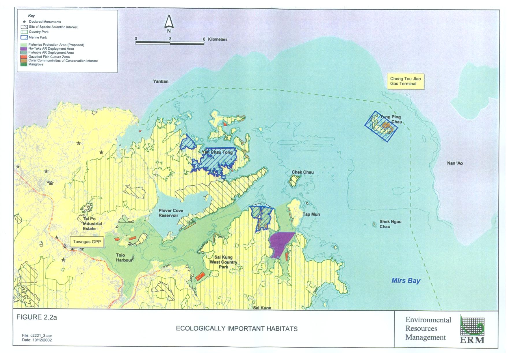
Figure 2.2a Ecologically
Important Habitats
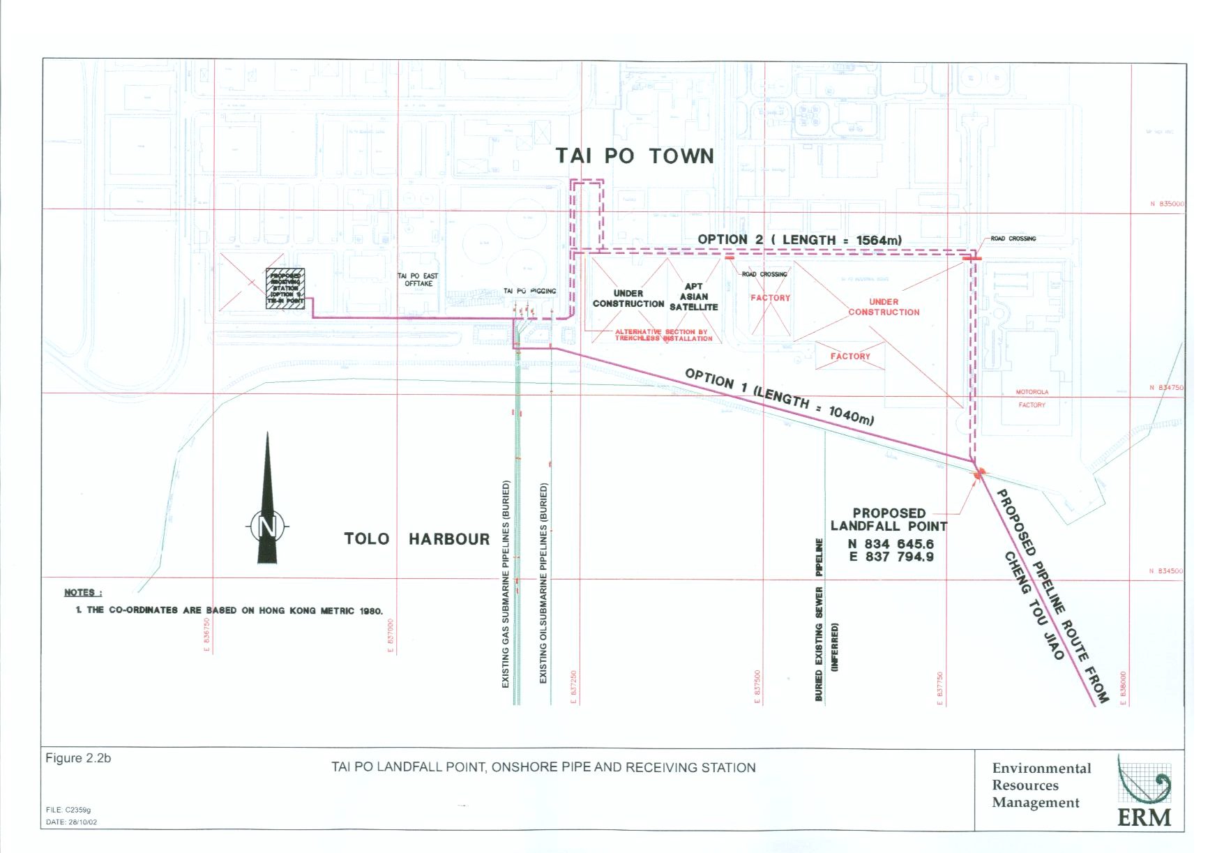
Figure 2.2b Tai
Po Landfall Point, Onshore Pipe and Receiving Station
Figure 2.3a Trench
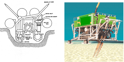
Jetting (Typical)
Figure 2.3b Injection
Jetting (Typical)
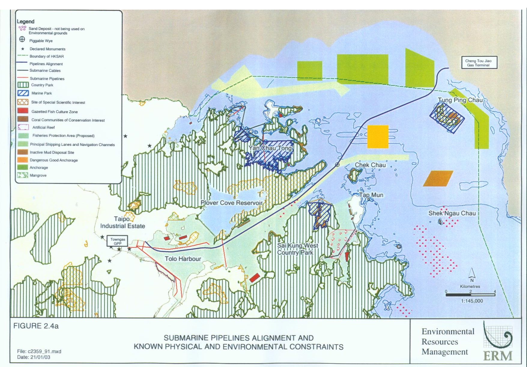
Figure 2.4a Submarine Pipelines Alignment and Known Physical and Environmental Constraints
Figure 3.2a Onshore
GRS Layout Plan and Details
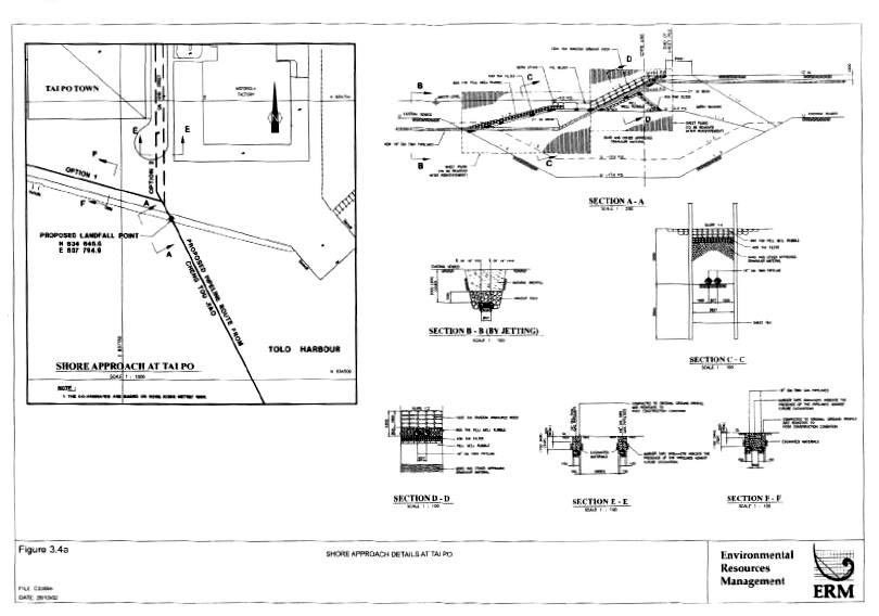
Figure 3.4a Shore
Approach Details at Tai Po
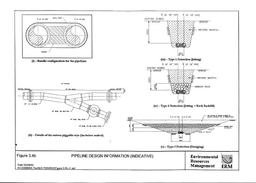
Figure 3.4b Pipeline
Design Information (Indicative)
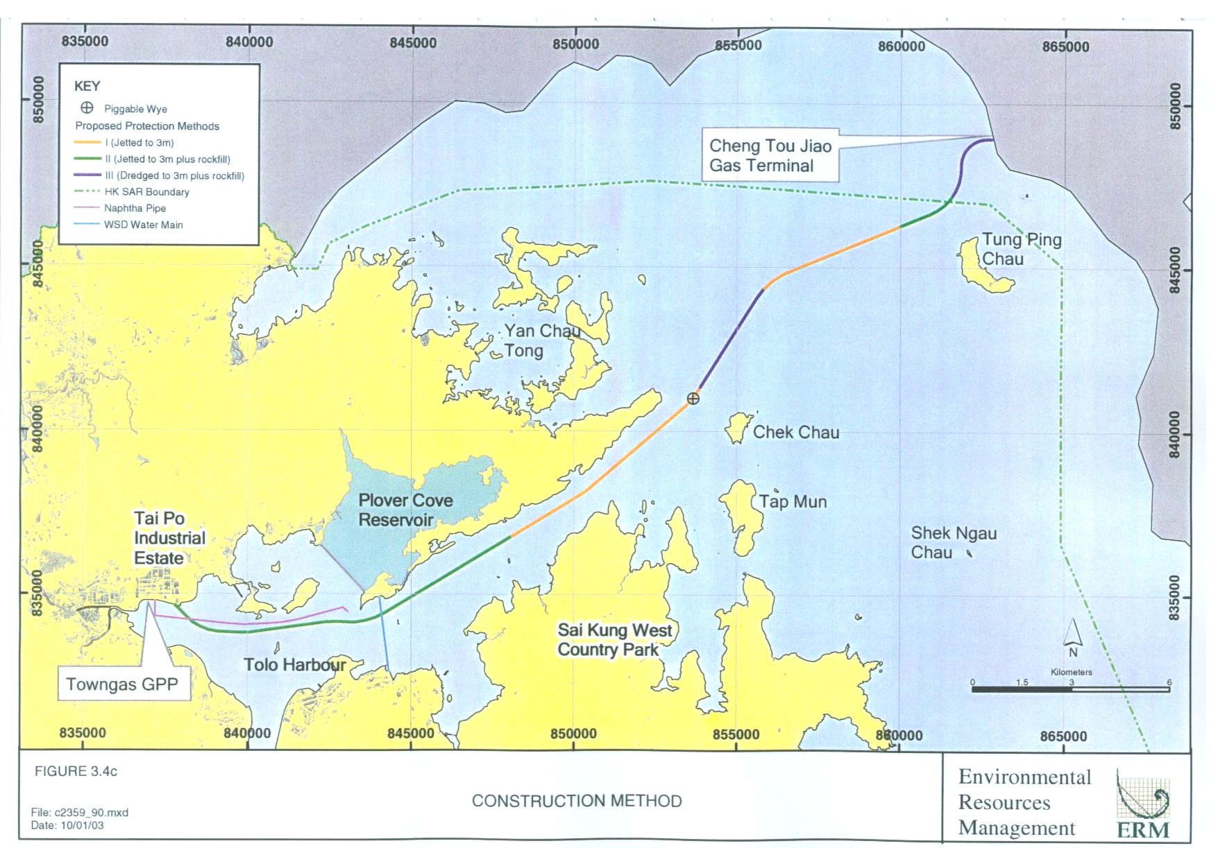
Figure 3.4c Construction
Method
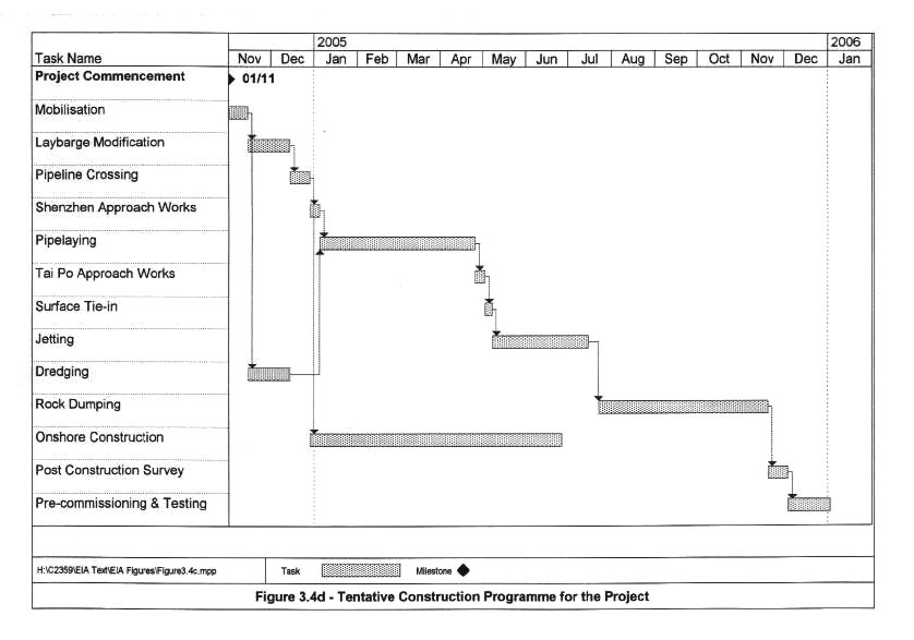
Figure 3.4d Tentative
Construction Programme for the Project
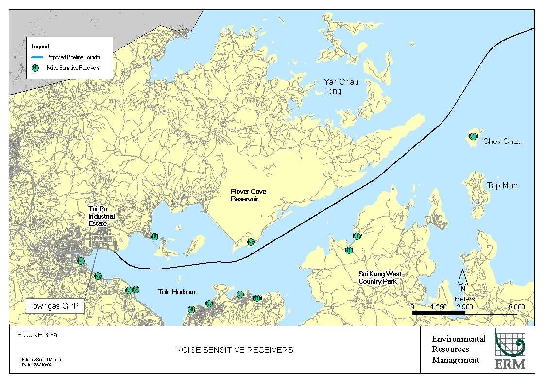
Figure 3.6a Noise
Sensitive Receivers
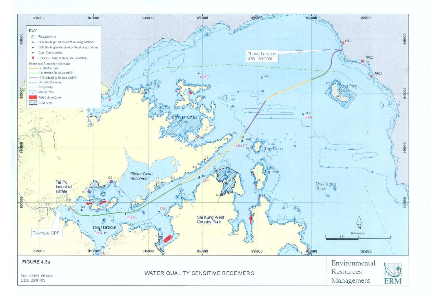
Figure 4.3a Water
Quality Sensitive Receivers
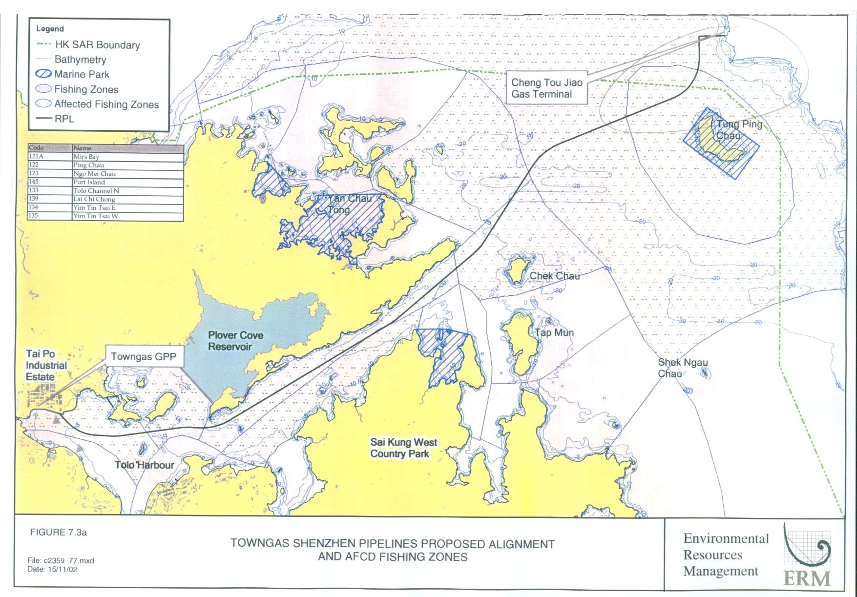
Figure 7.3a Towngas
Shenzhen Pipelines Proposed Alignment and AFCD Fishing Zones
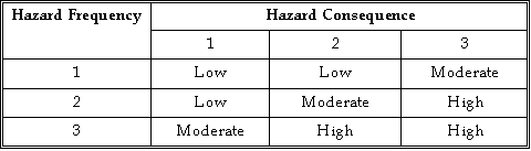
Figure 8.1 Risk
Assessment Matrix
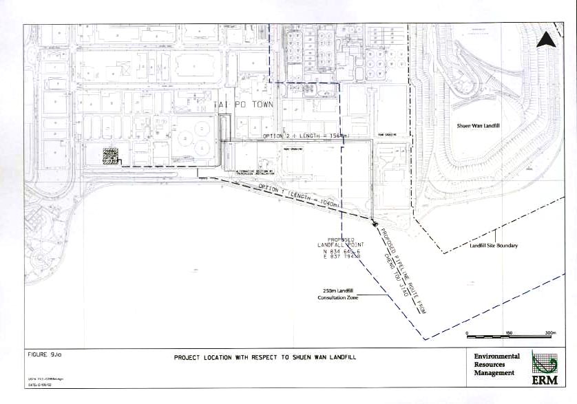
Figure 9.1a Project
Location with respect to Shuen Wan Landfill
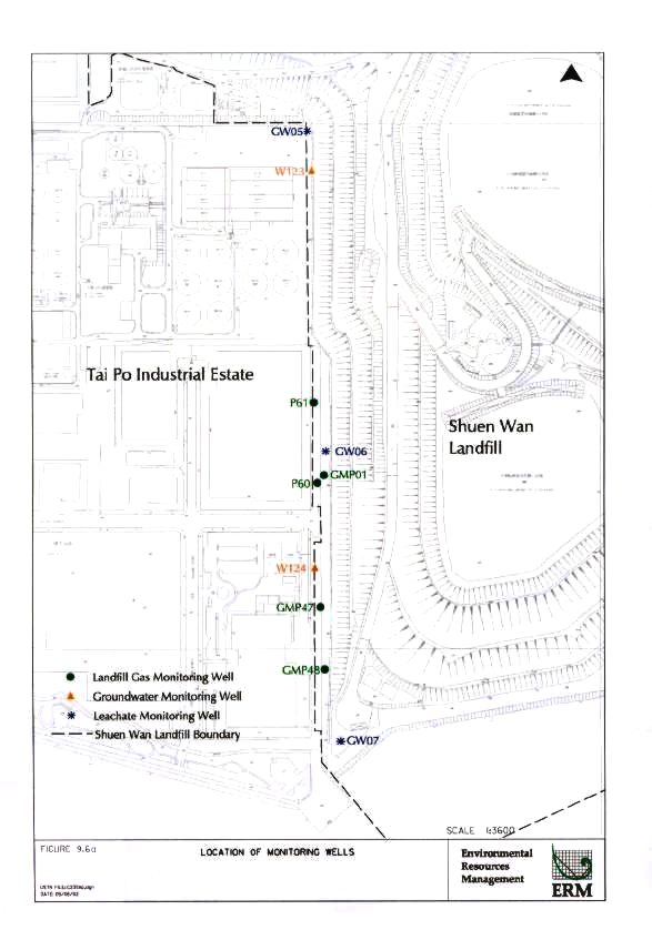
Figure 9.6a Location
of Monitoring Wells
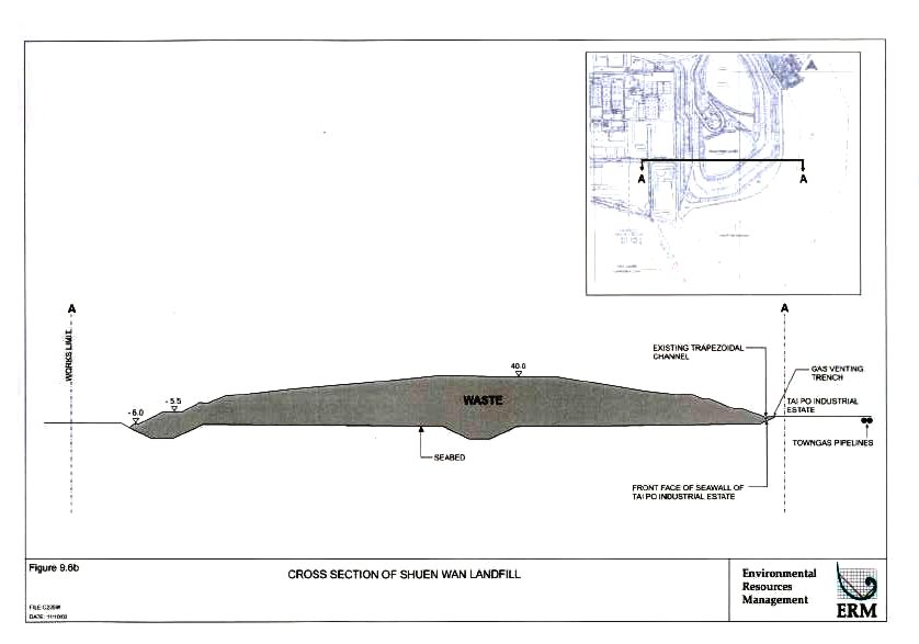
Figure 9.6b Cross
Section of Shuen Wan Landfill
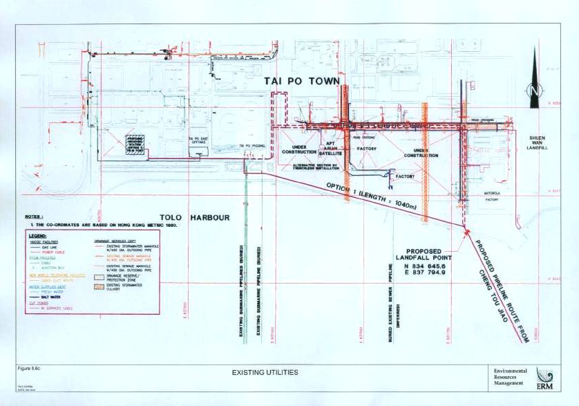
Figure 9.6c Existing
Utilities
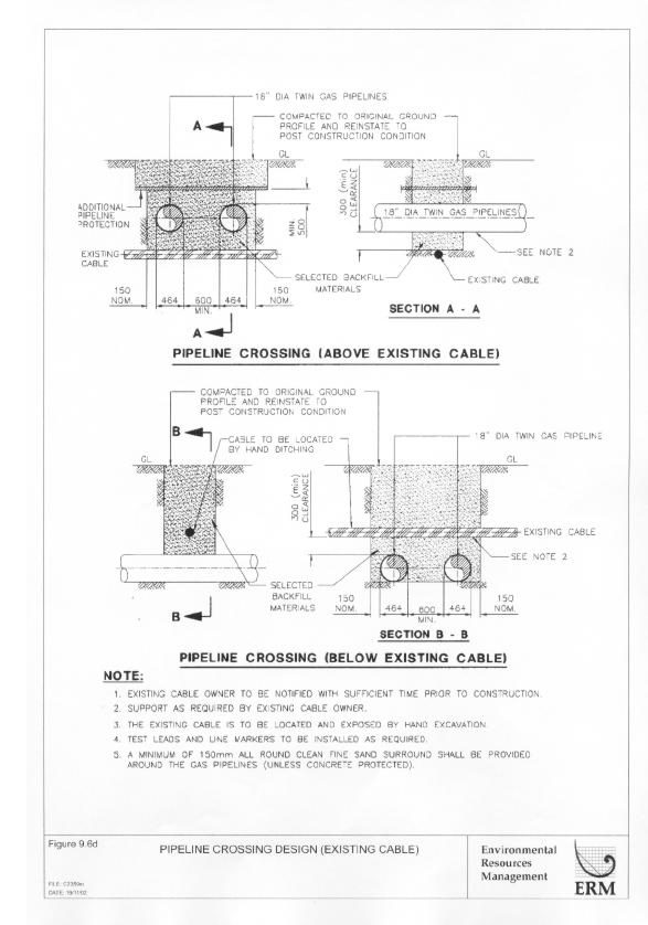
Figure 9.6d Pipeline
Crossing Design (Existing Cable)
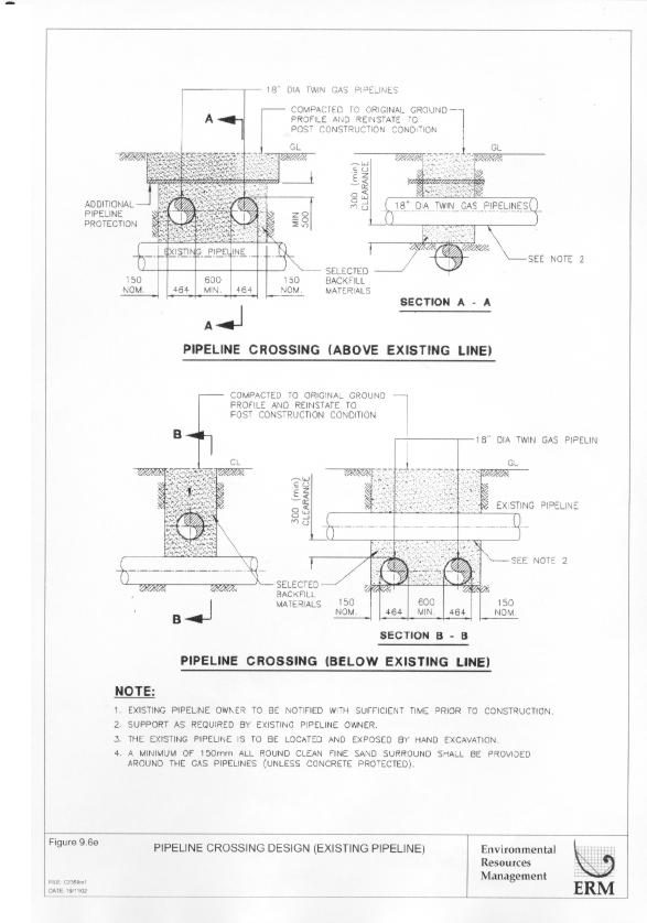
Figure 9.6e Pipeline
Crossing Design (Existing Pipeline)
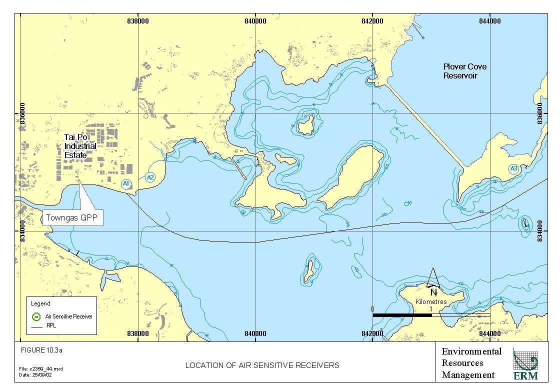
Figure 10.3a Location
of Air Sensitive Receivers
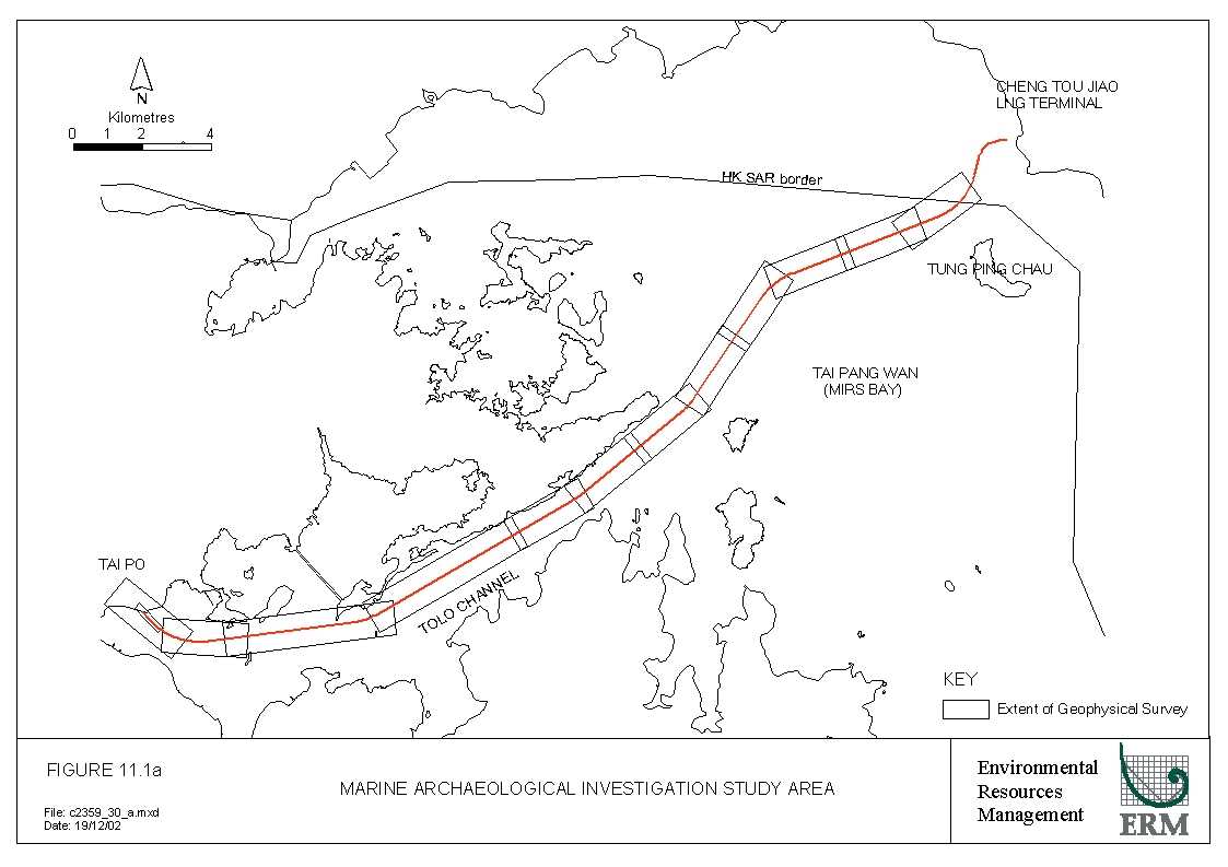
Figure 11.1a Marine
Archaeological investigation Study Area
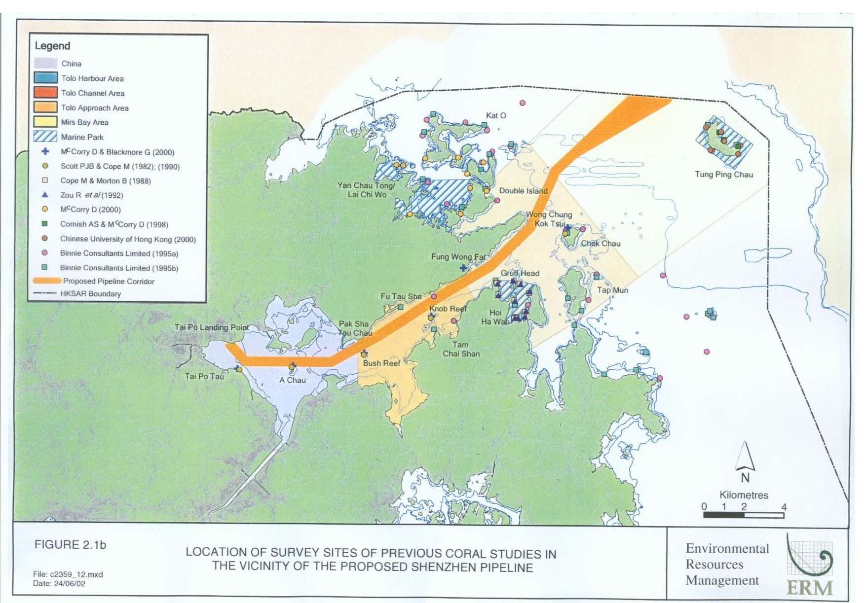
Annex A
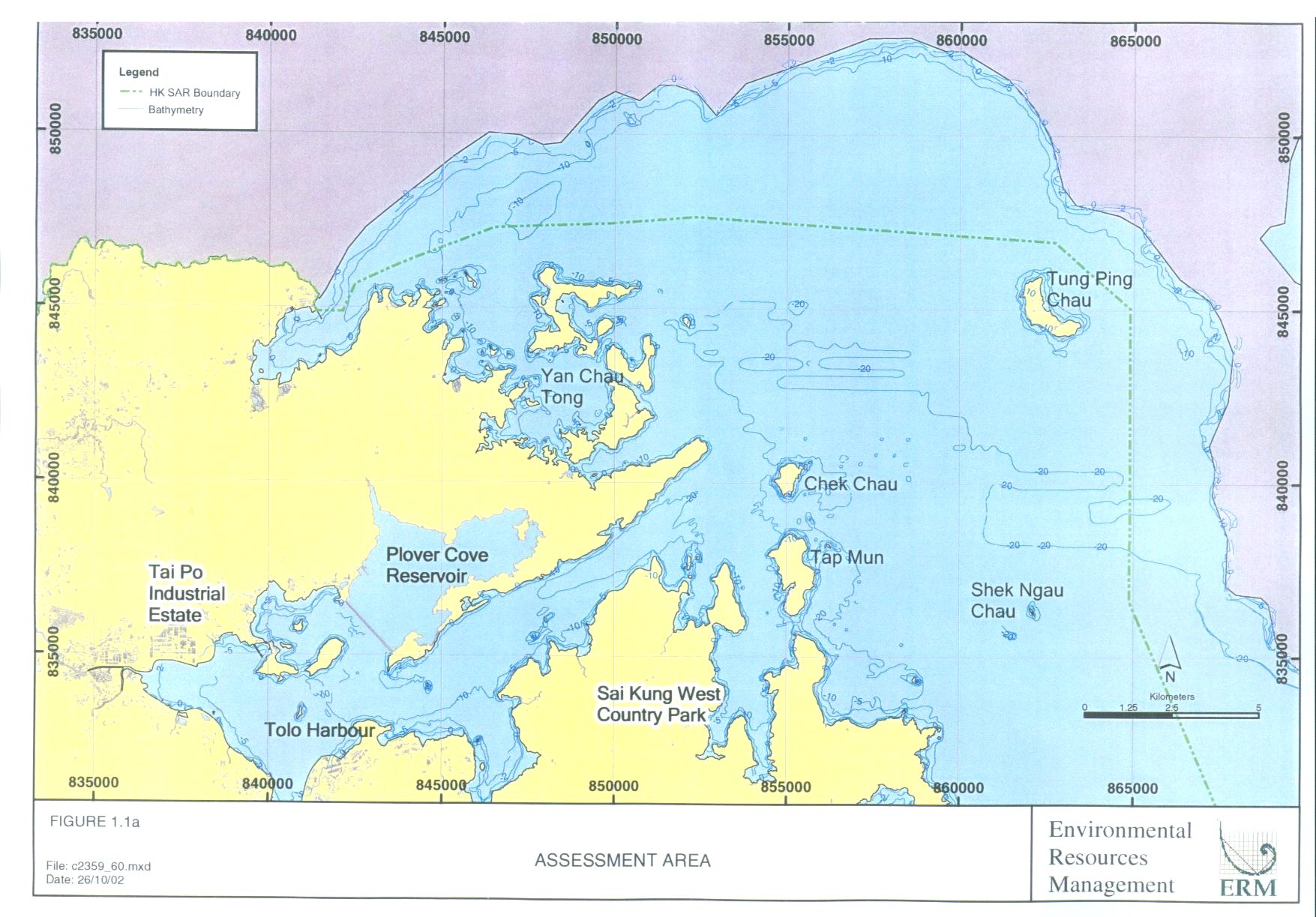
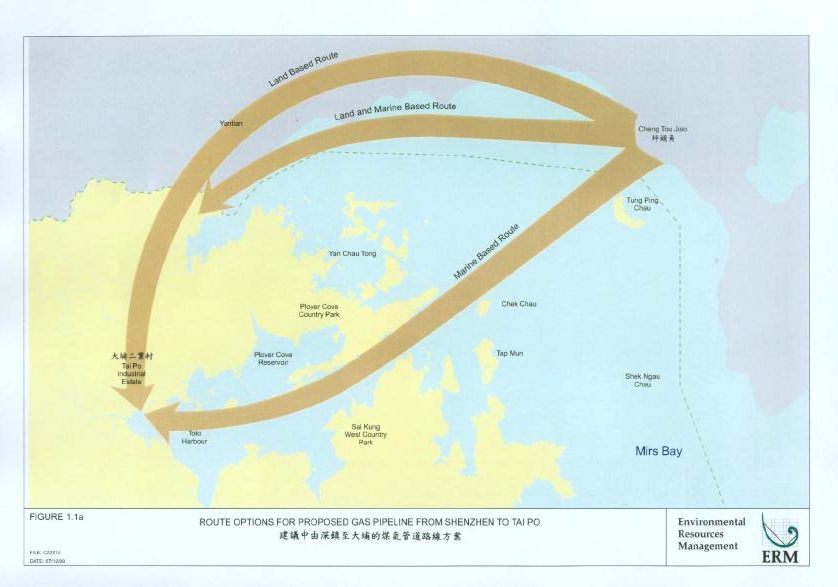
Figure 1.1a Route
Options for Proposed Gas Pipeline From Shenzhen to Tai Po
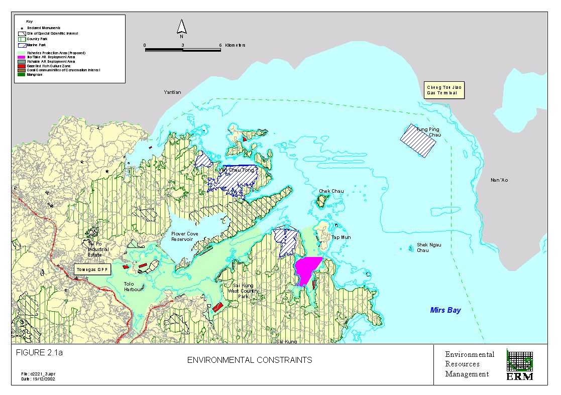
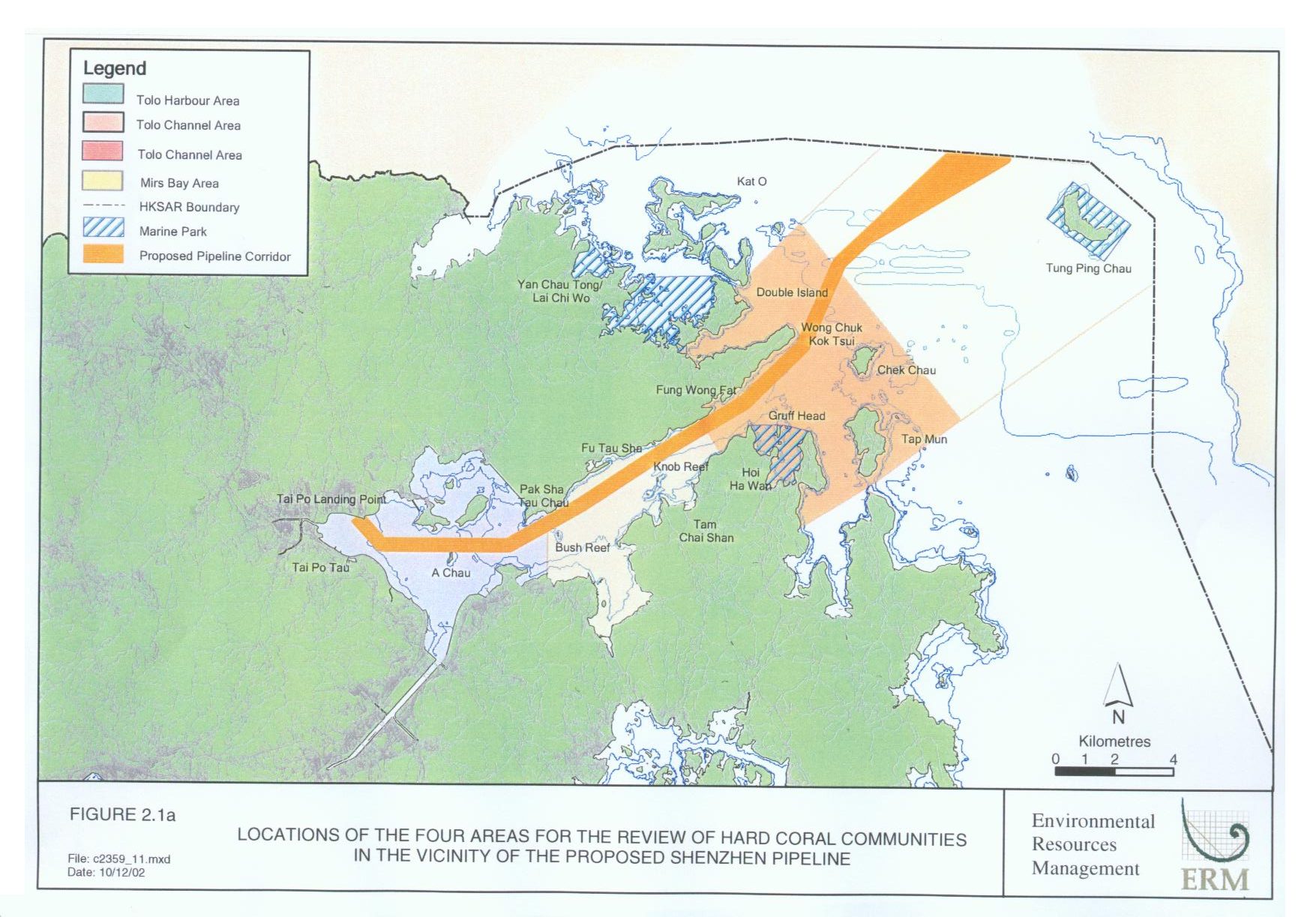
Figure 2.1a Environmental
Constraints
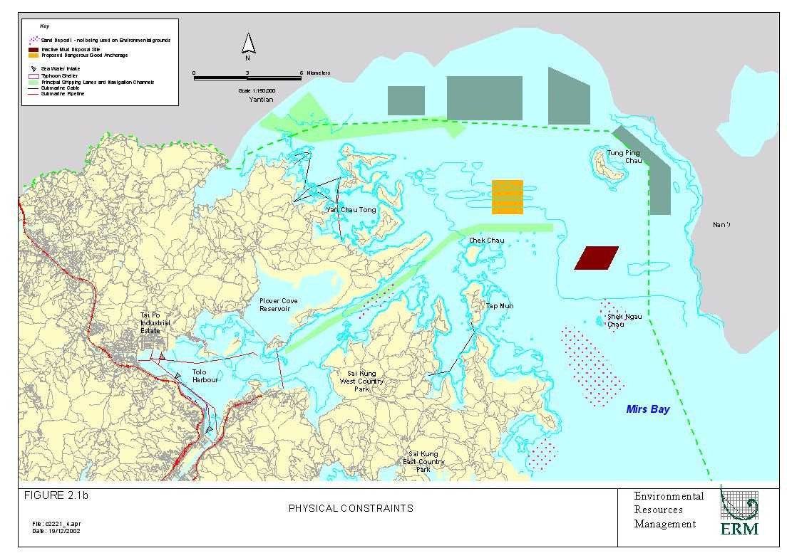
Figure 2.1b Physical
Constraints
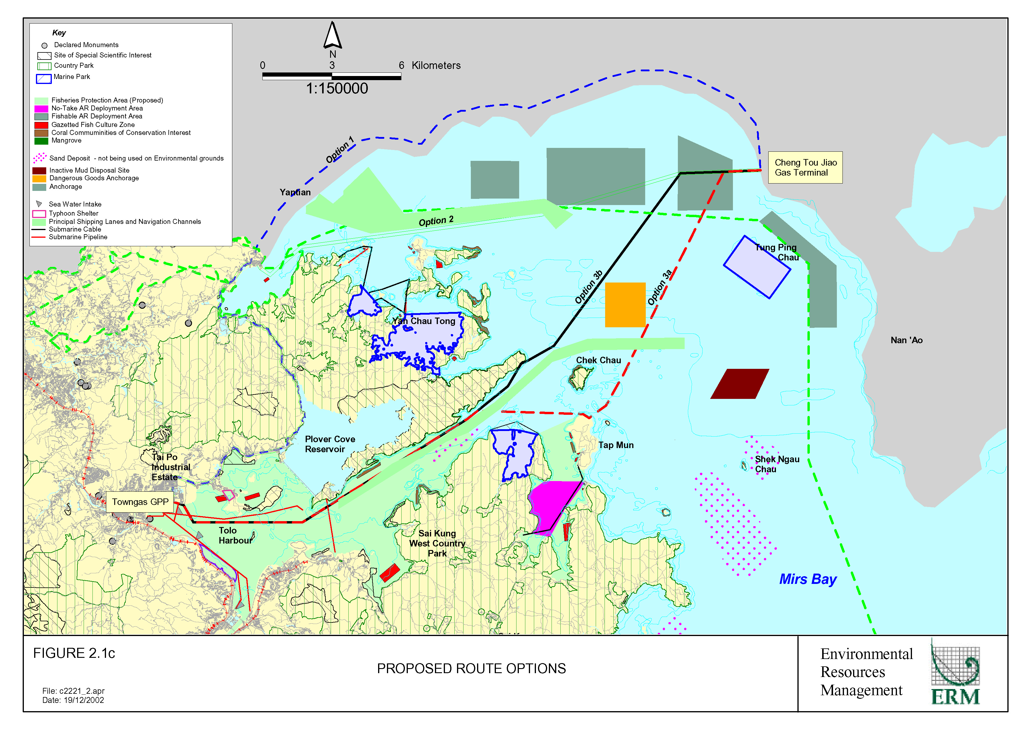
Figure
2.1c Proposed
Route Options
Figure
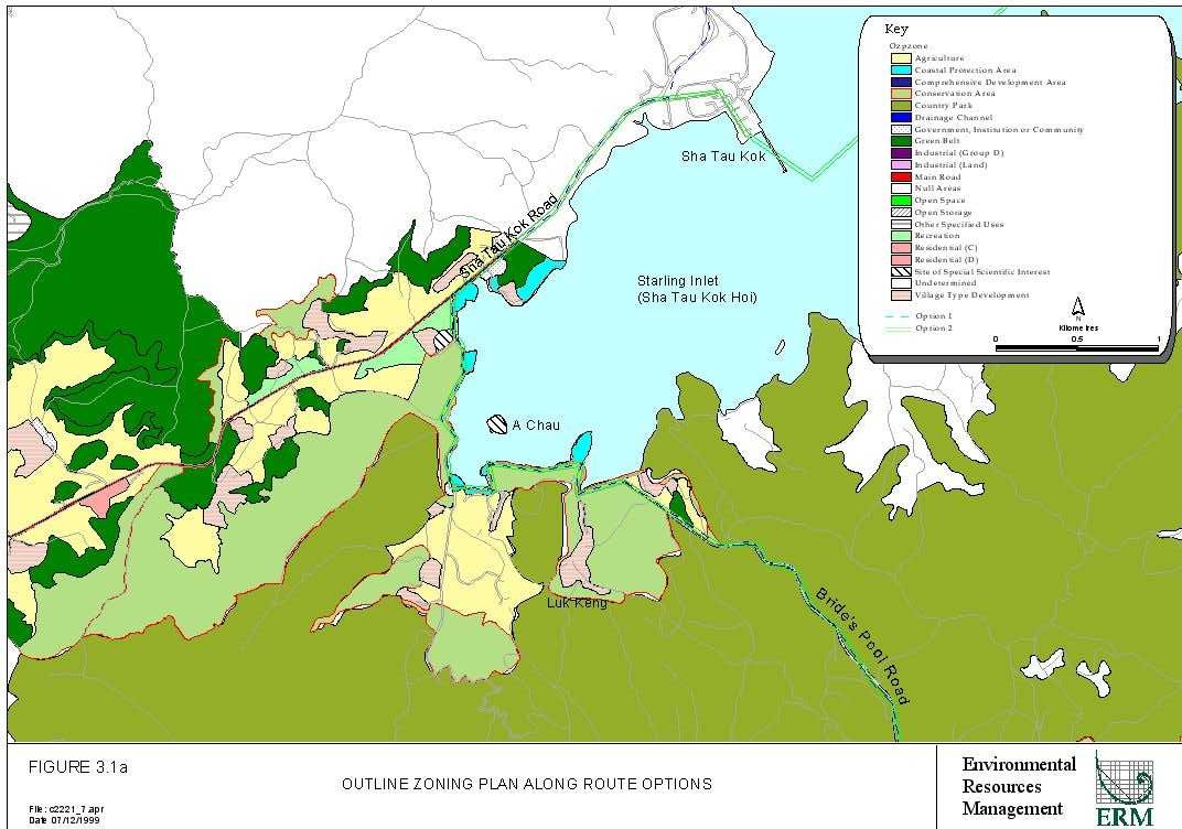
3.1a Outline
Zoning Plan Along Route Options
Figure
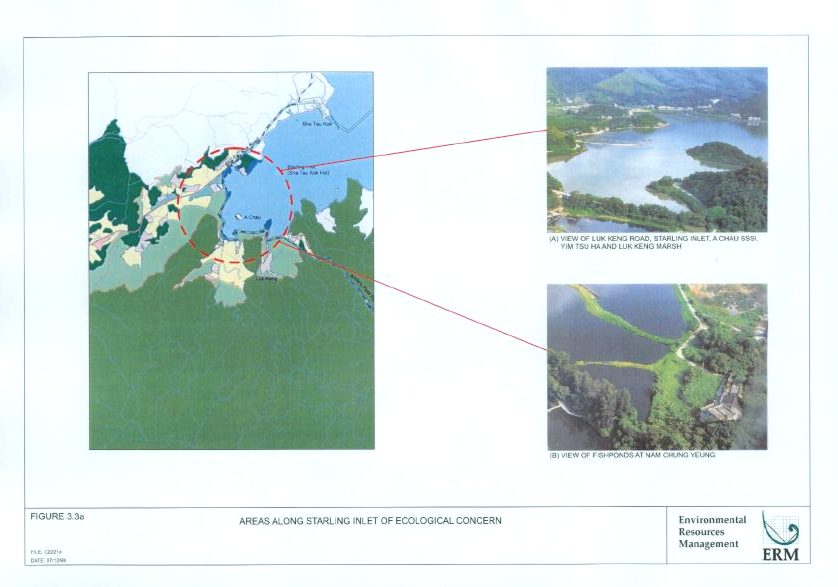
3.3a Areas
Along Starling Inlet of Ecological Concern
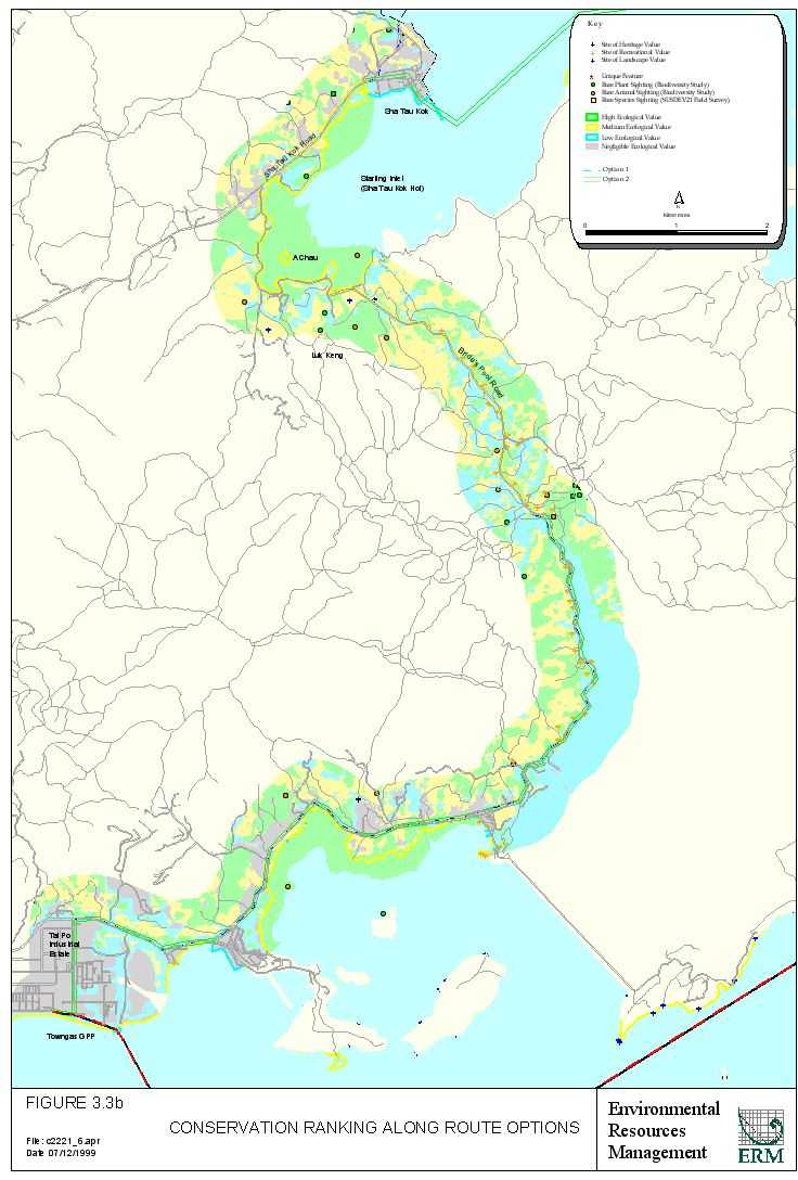
Figure
3.3b Conservation
Ranking Along Route Options
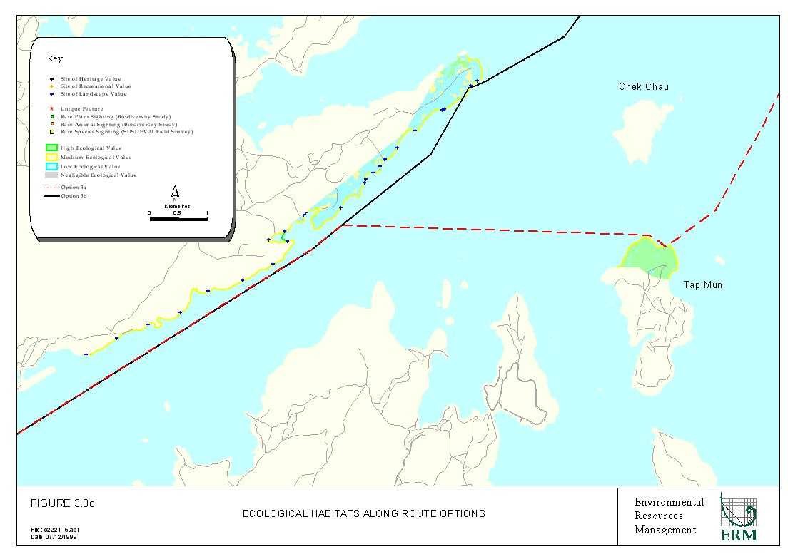
Figure
3.3c Ecological
Habitats Along Route Options
Figure
4.2a Frequency
Analysis Results
Annex B
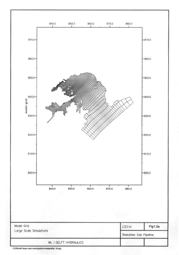
Figure
1.2a Model
Grid - Large Scale Simulations
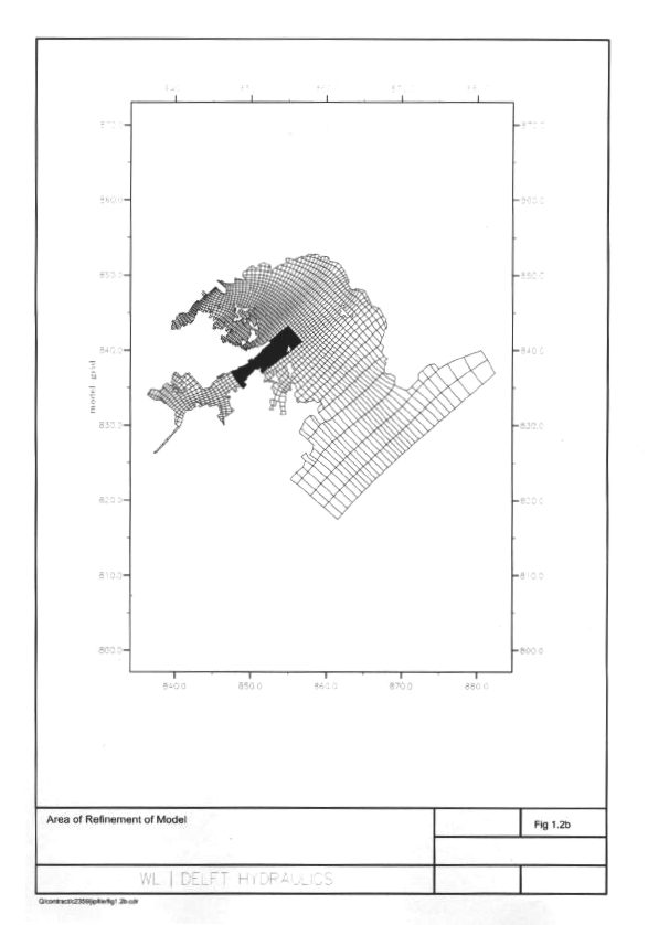
Figure
1.2b Area
of Refinement of Model
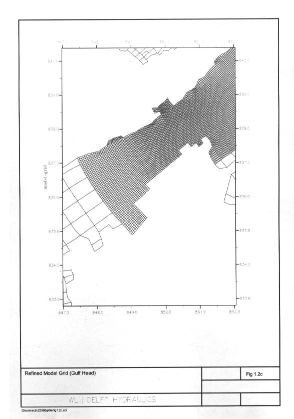
Figure
1.2c Refined
Model Grid (Guff Head)
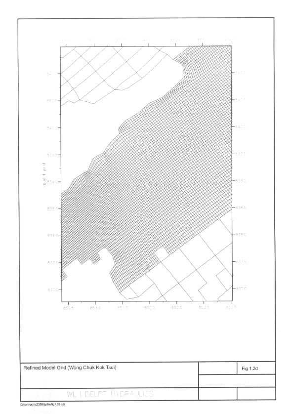
Figure
1.2d Refined
Model Grid (Wong Chuk Kok Tsui)
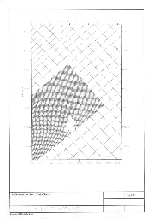
Figure
1.2e Refined
Model Grid (Chek Chau)
Figure
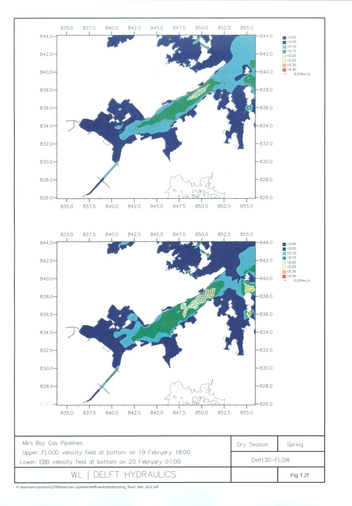
1.2f Vector
Plots for Tolo Harbour and Channel in Dry Season (Spring)
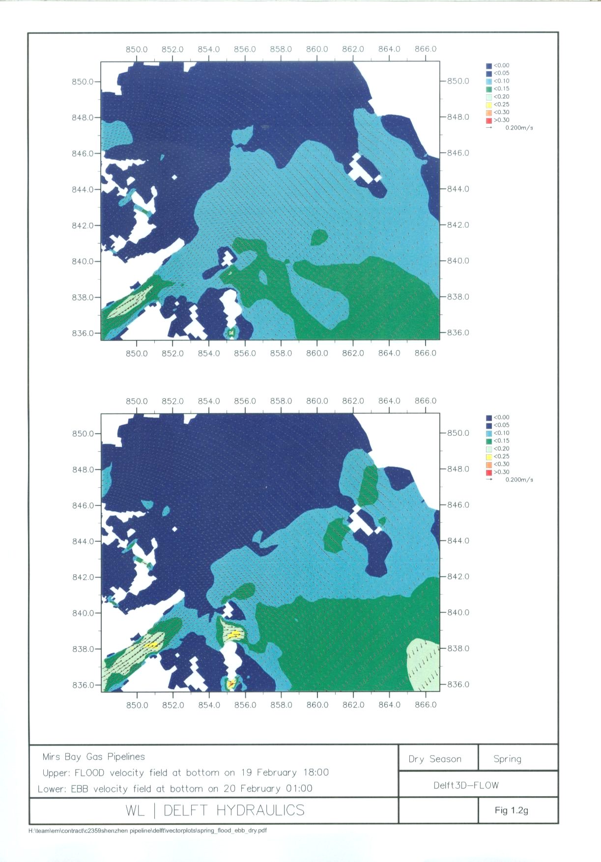
Figure 1.2g Vector
Plots for Mirs Bay in Dry Season (Spring)
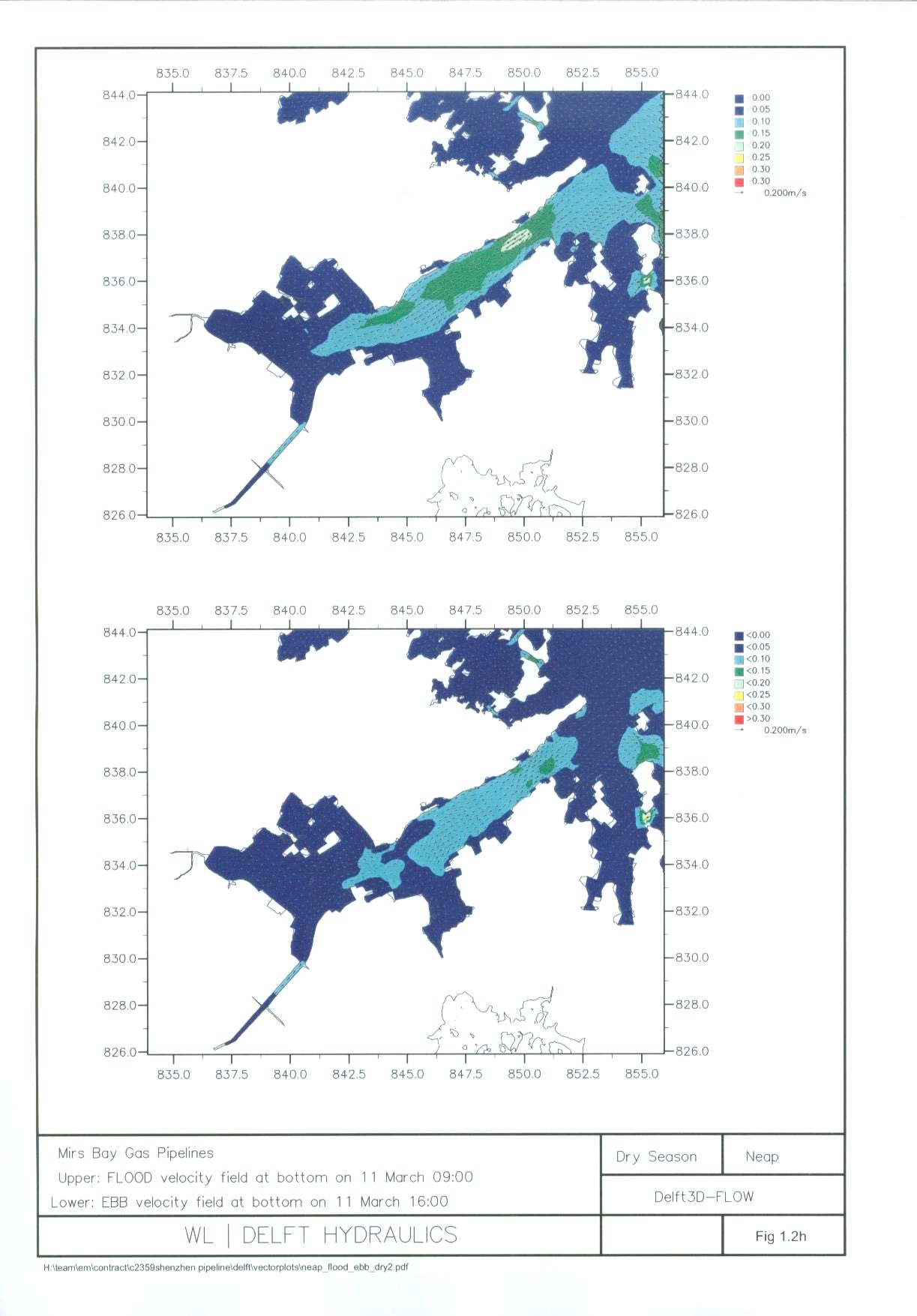
Figure
1.2h Vector
Plots for Tolo Harbour and Channel in Dry Season (Neap)
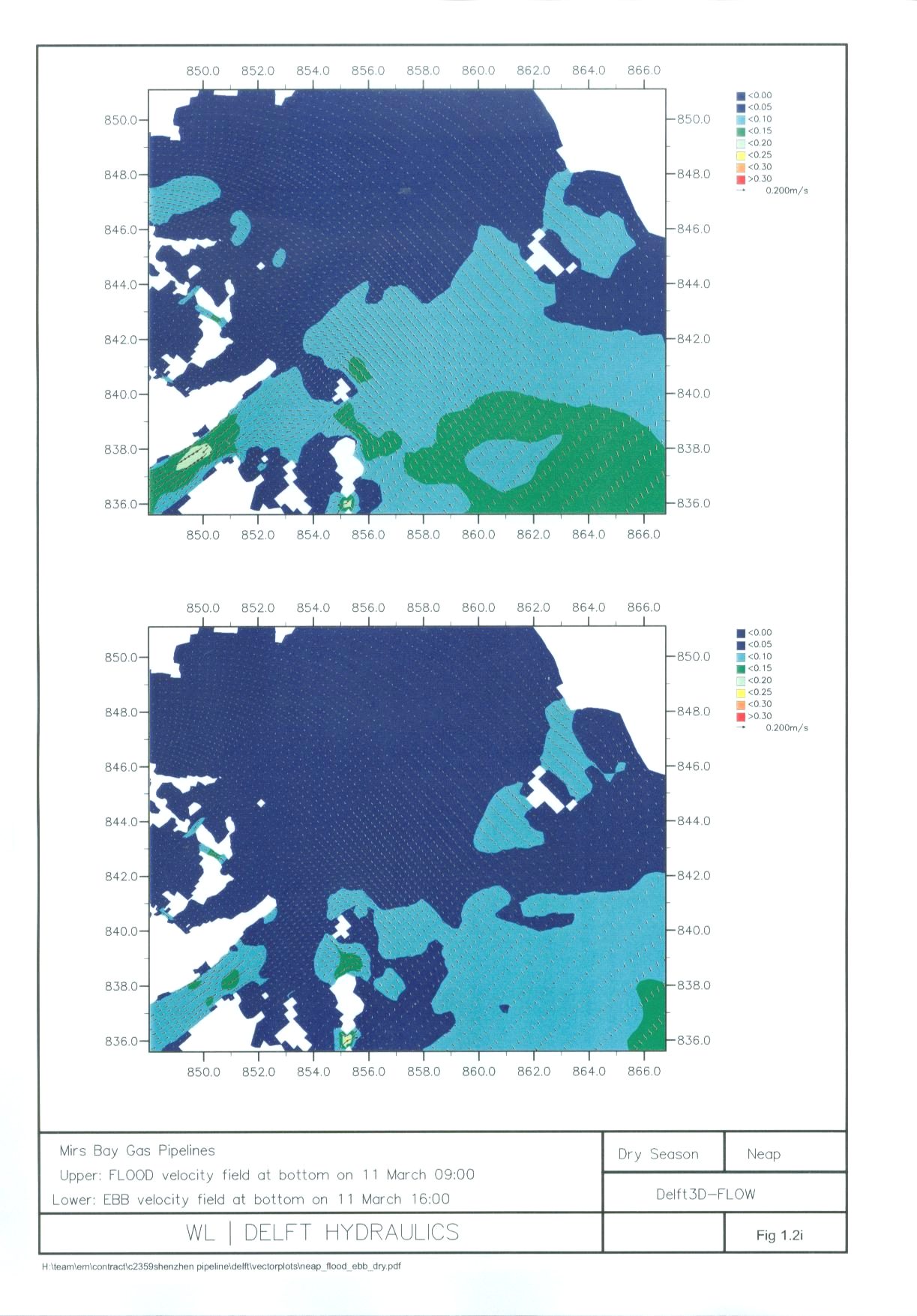
Figure
1.2i Vector
Plots for Mirs Bay in Dry Season (Neap)
Figure
1.2j Vector
Plots for Tolo Harbour and Channel in Wet Season (Spring)
Figure
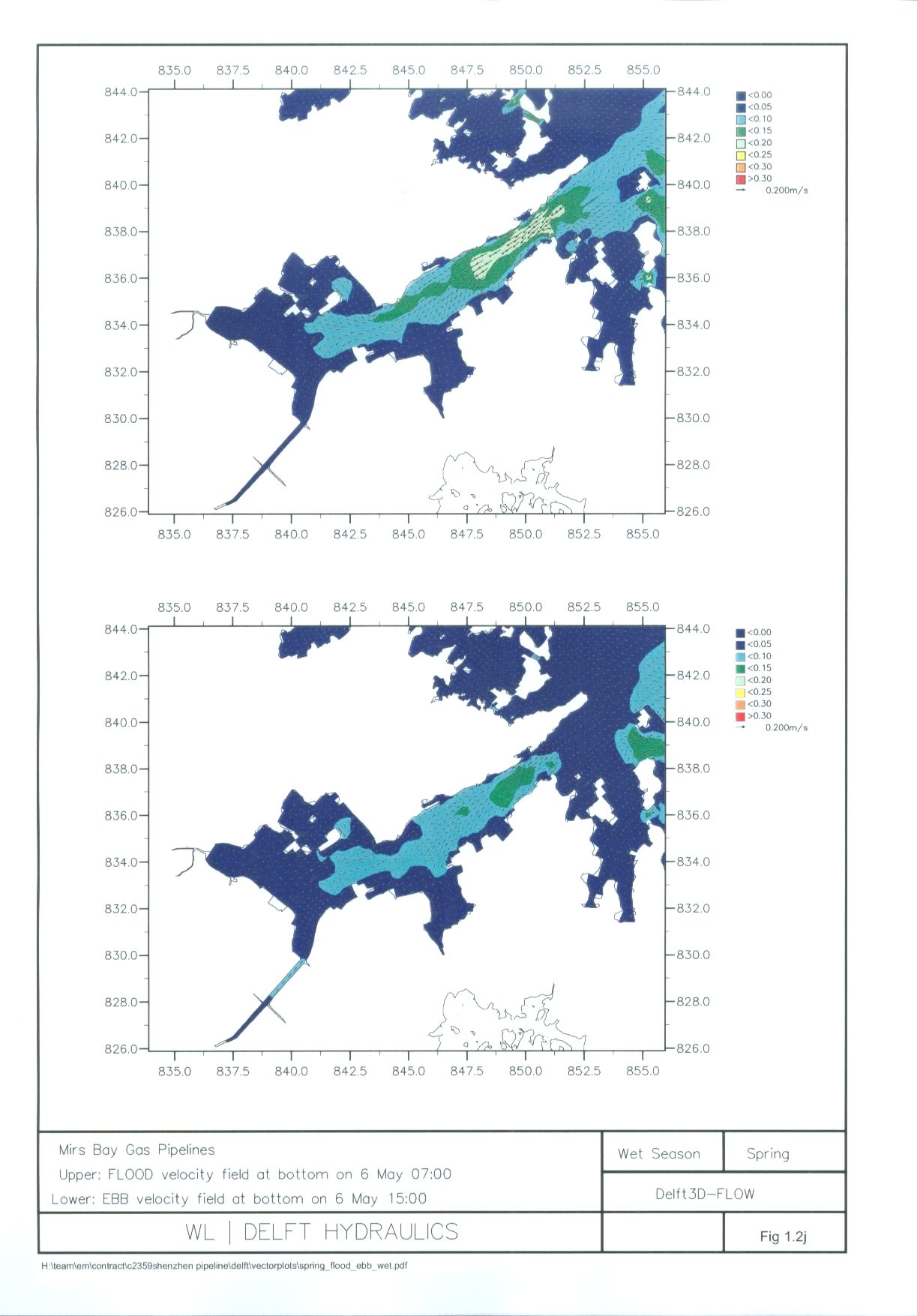
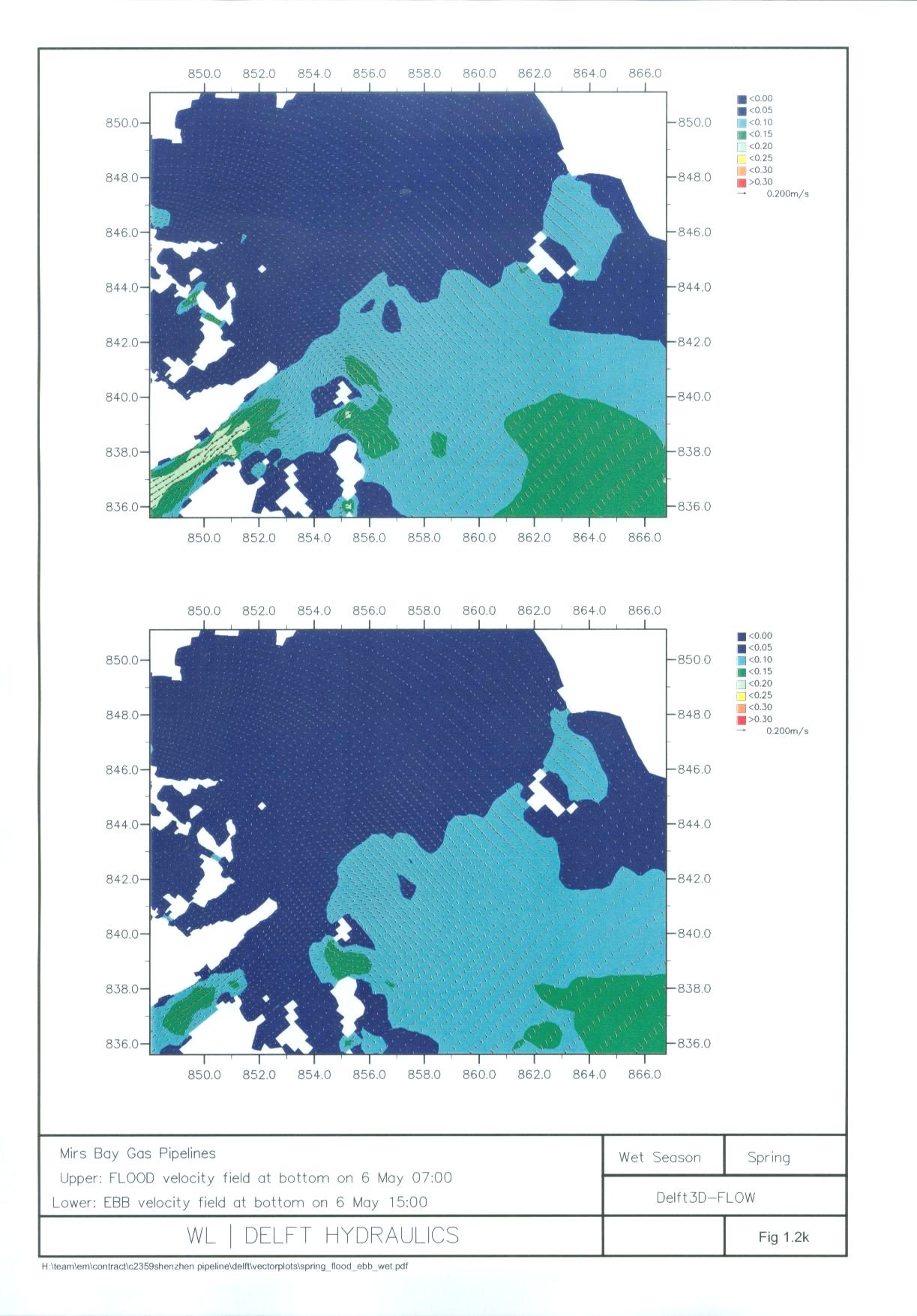
1.2k Vector
Plots for Mirs Bay in Wet Season (Spring)
Figure
1.2l Vector
Plots for Tolo Harbour and Channel in Wet Season (Neap)
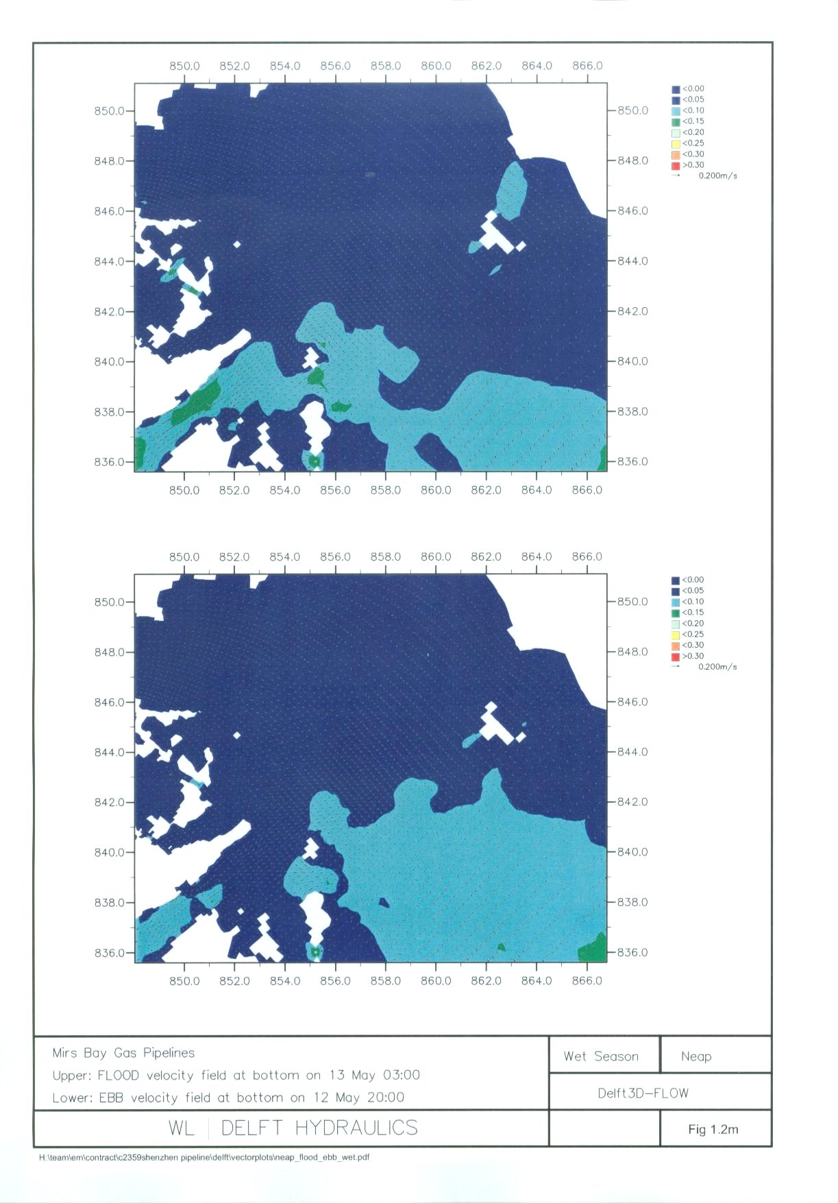
Figure
1.2m Vector
Plots for Mirs Bay in Wet Season (Neap)
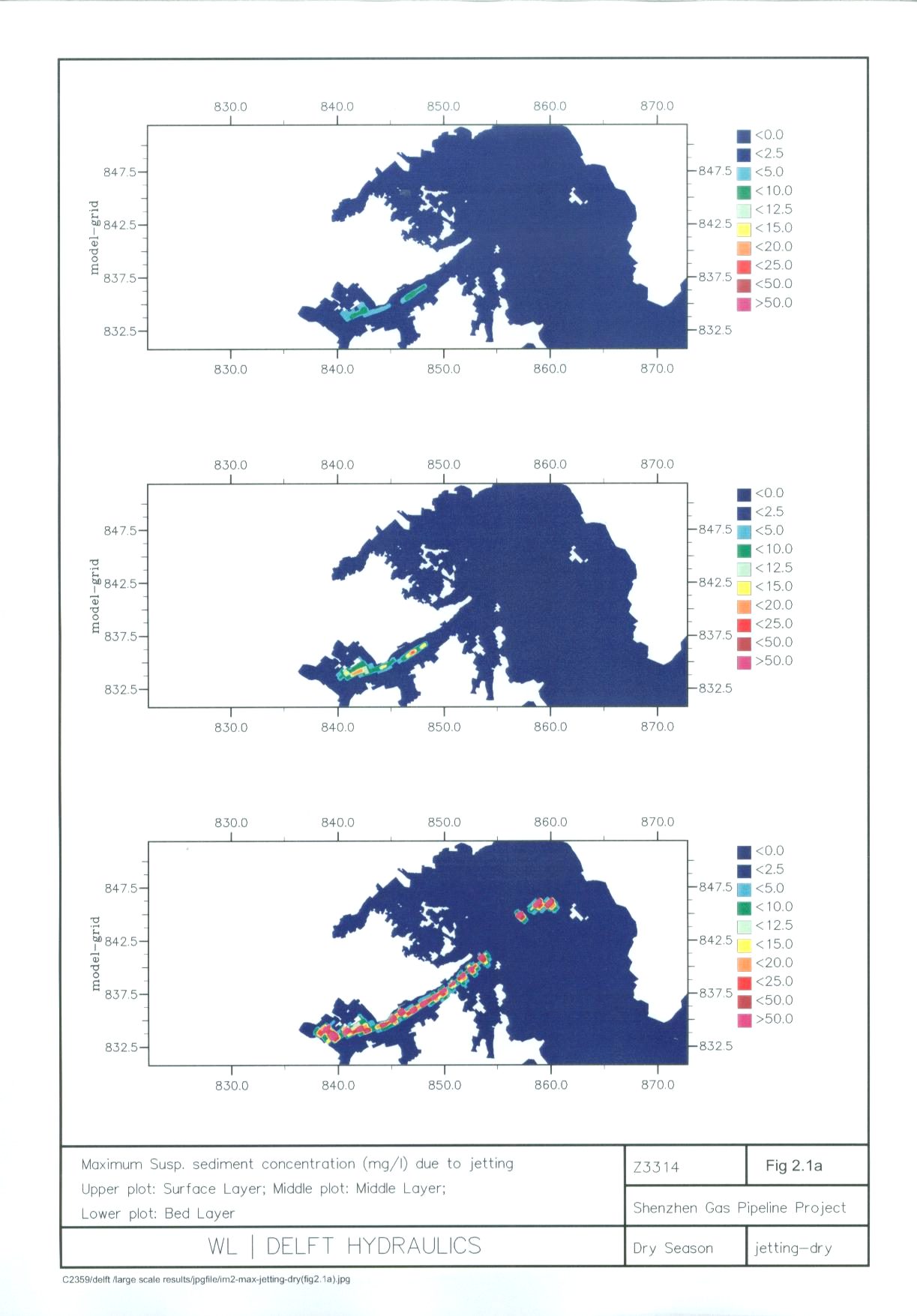
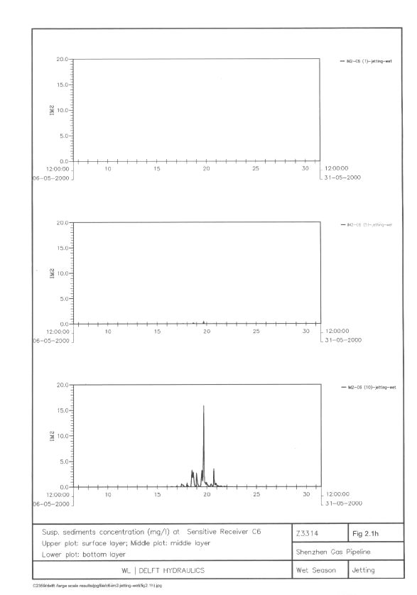
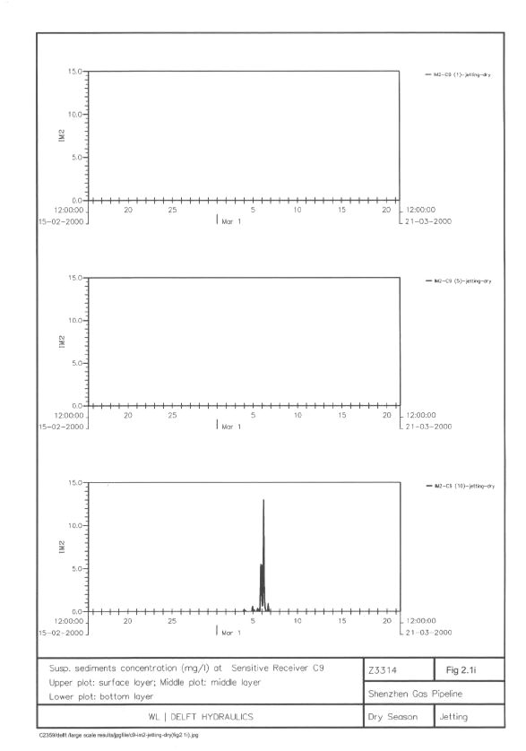
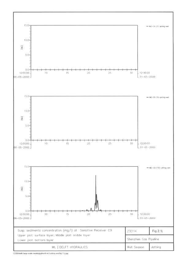
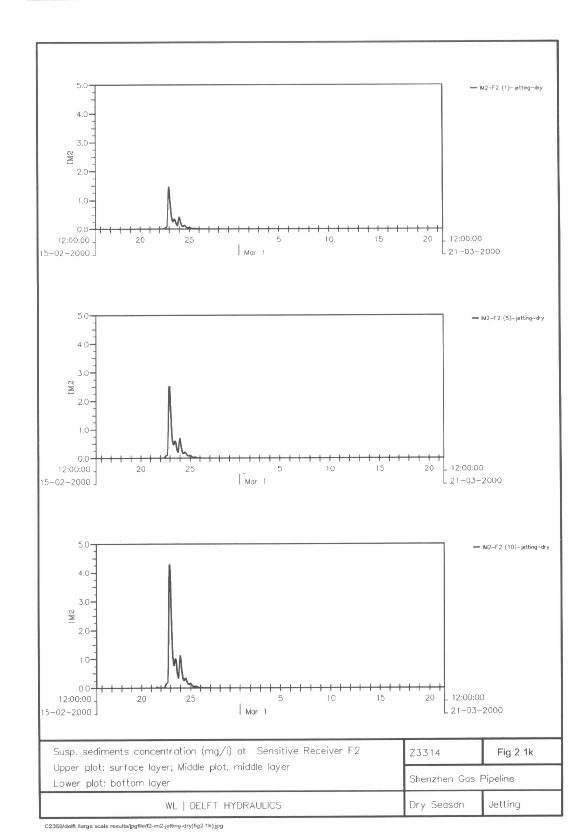
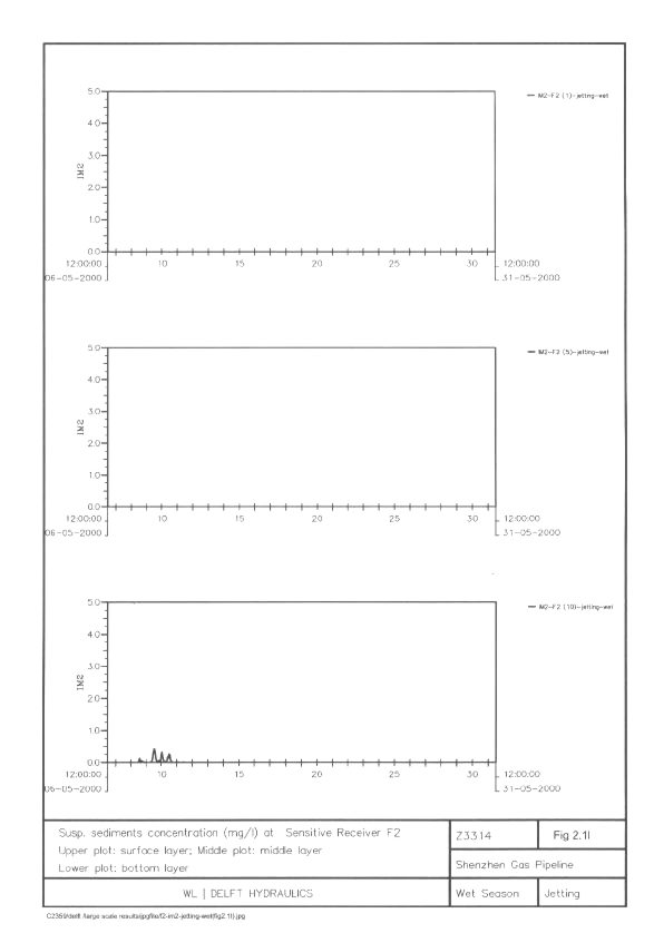
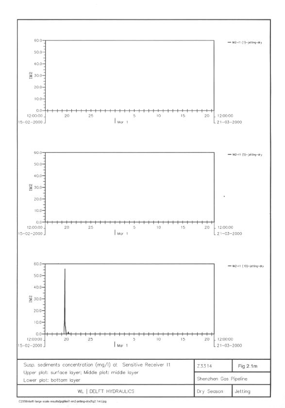
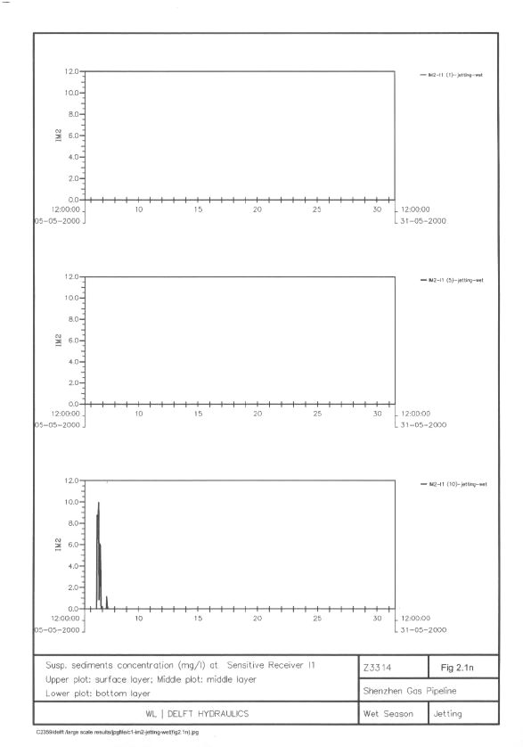
Figure
2.1a Maximum
Suspended Sediment Concentration (mg L-1) due to Jetting (Dry
Season)
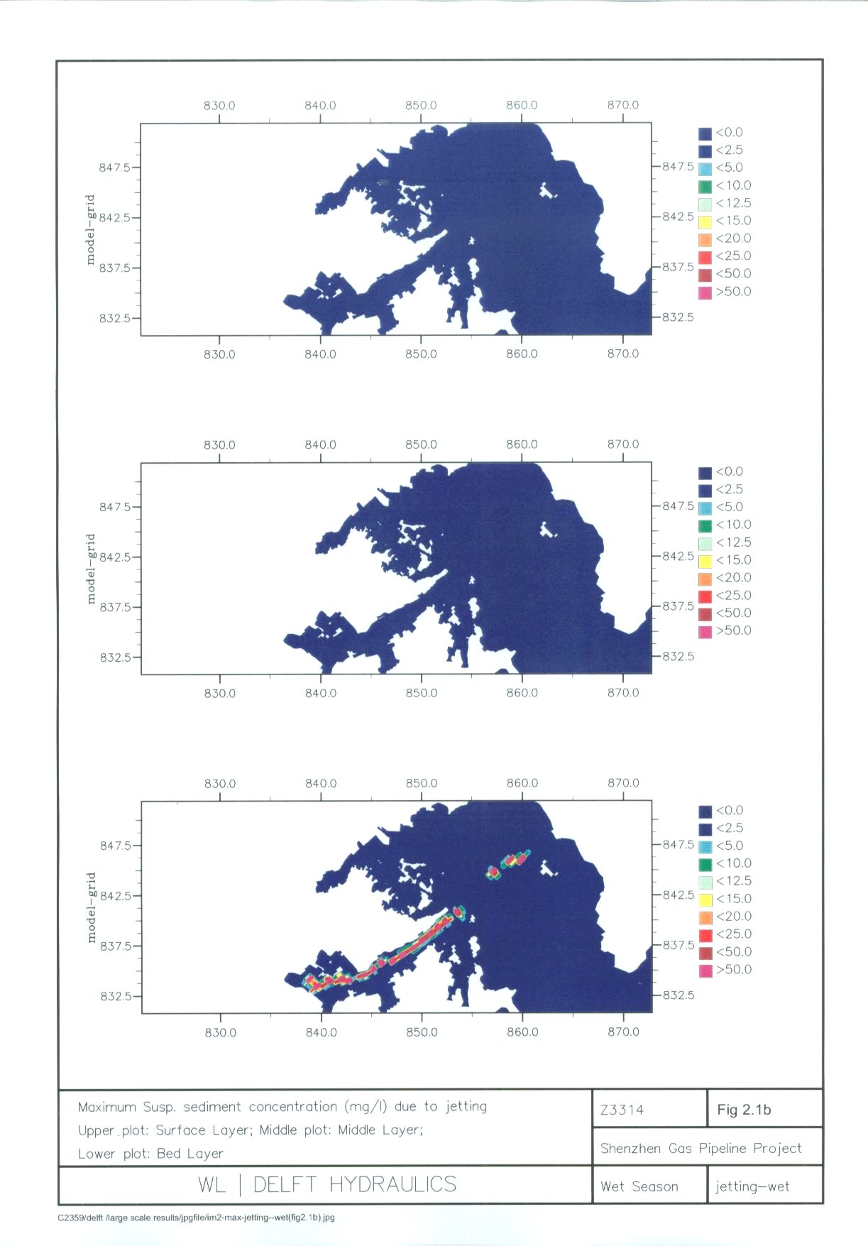
Figure
2.1b Maximum
Suspended Sediment Concentration (mg L-1) due to Jetting (Wet
Season)
Figure
2.1c Maximum
Suspended Sediment Concentration (mg L-1) due to Dredging (Dry
Season)
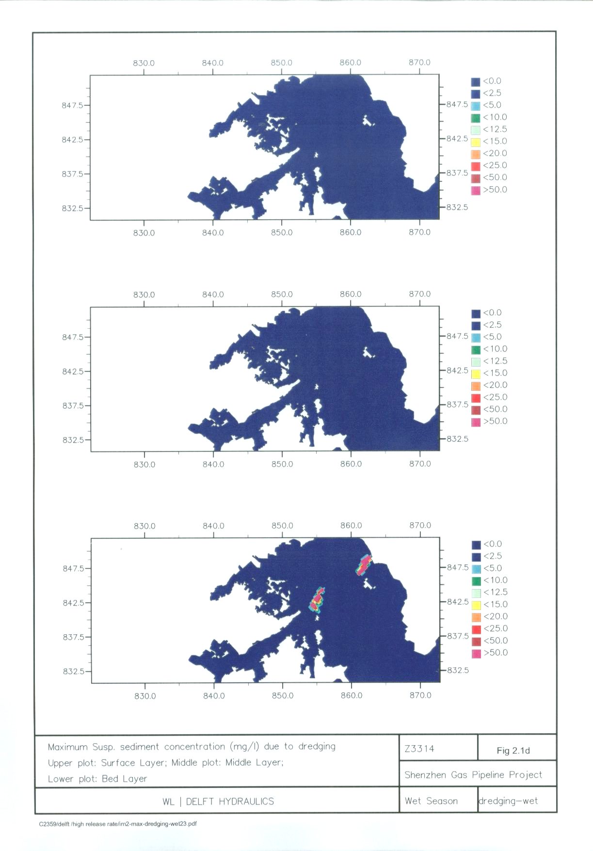
Figure
2.1d Maximum
Suspended Sediment Concentration (mg L-1) due to Dredging (Wet
Season)
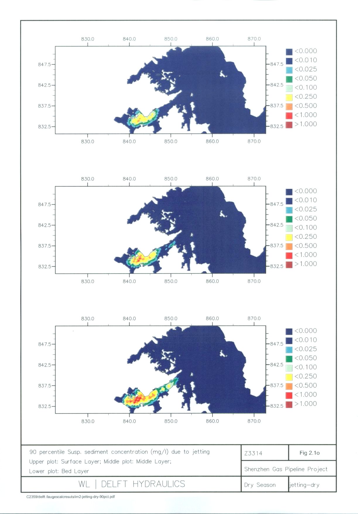
Figure
2.1o 90
Percentile of Suspended Sediment Concentration (mg L-1) due to
Jetting (Dry Season)
Figure
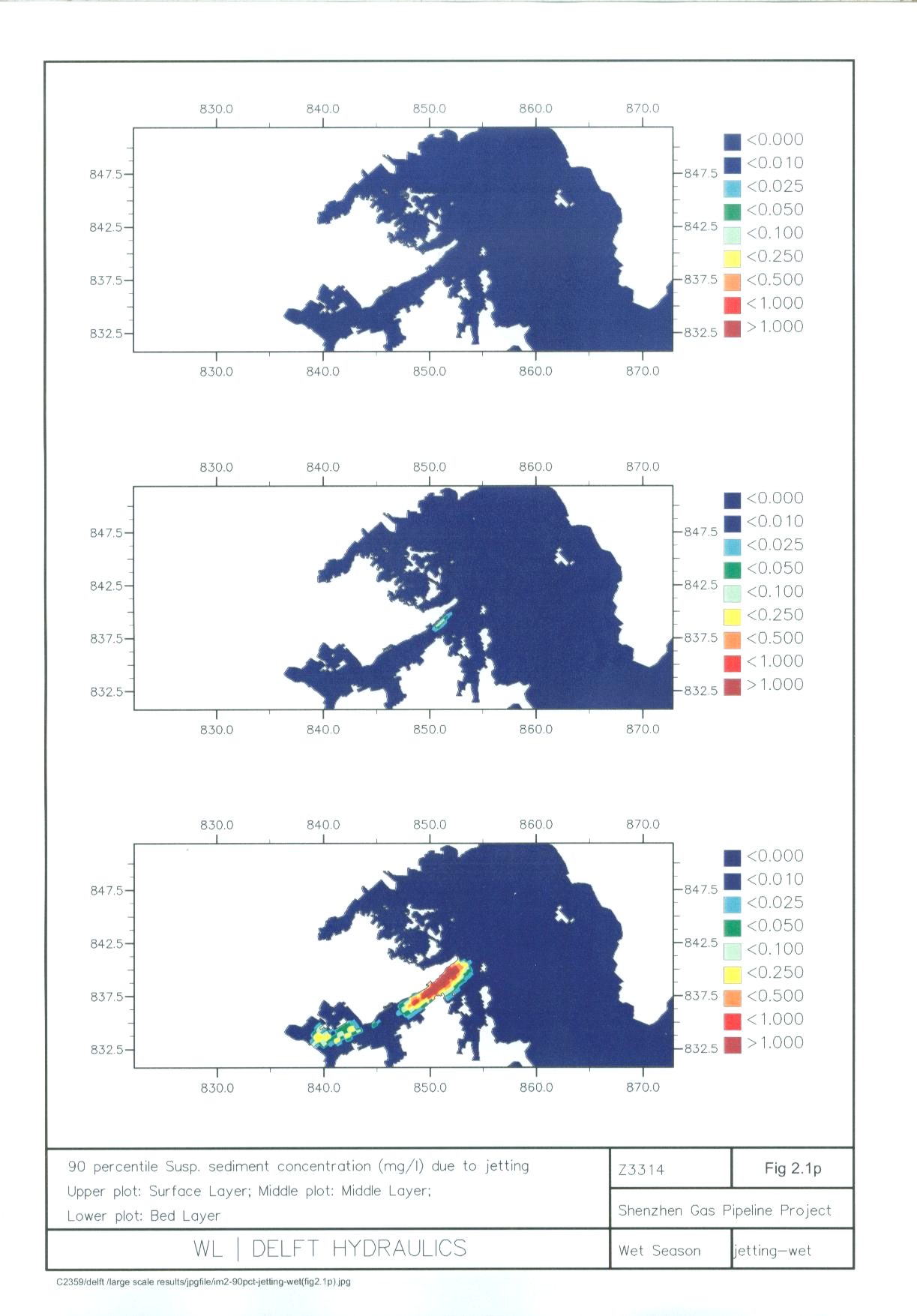
2.1p 90
Percentile of Suspended Sediment Concentration (mg L-1) due to
Jetting (Wet Season)
Figure
2.1q 90
Percentile of Suspended Sediment Concentration (mg L-1) due to
Dredging (Dry Season)
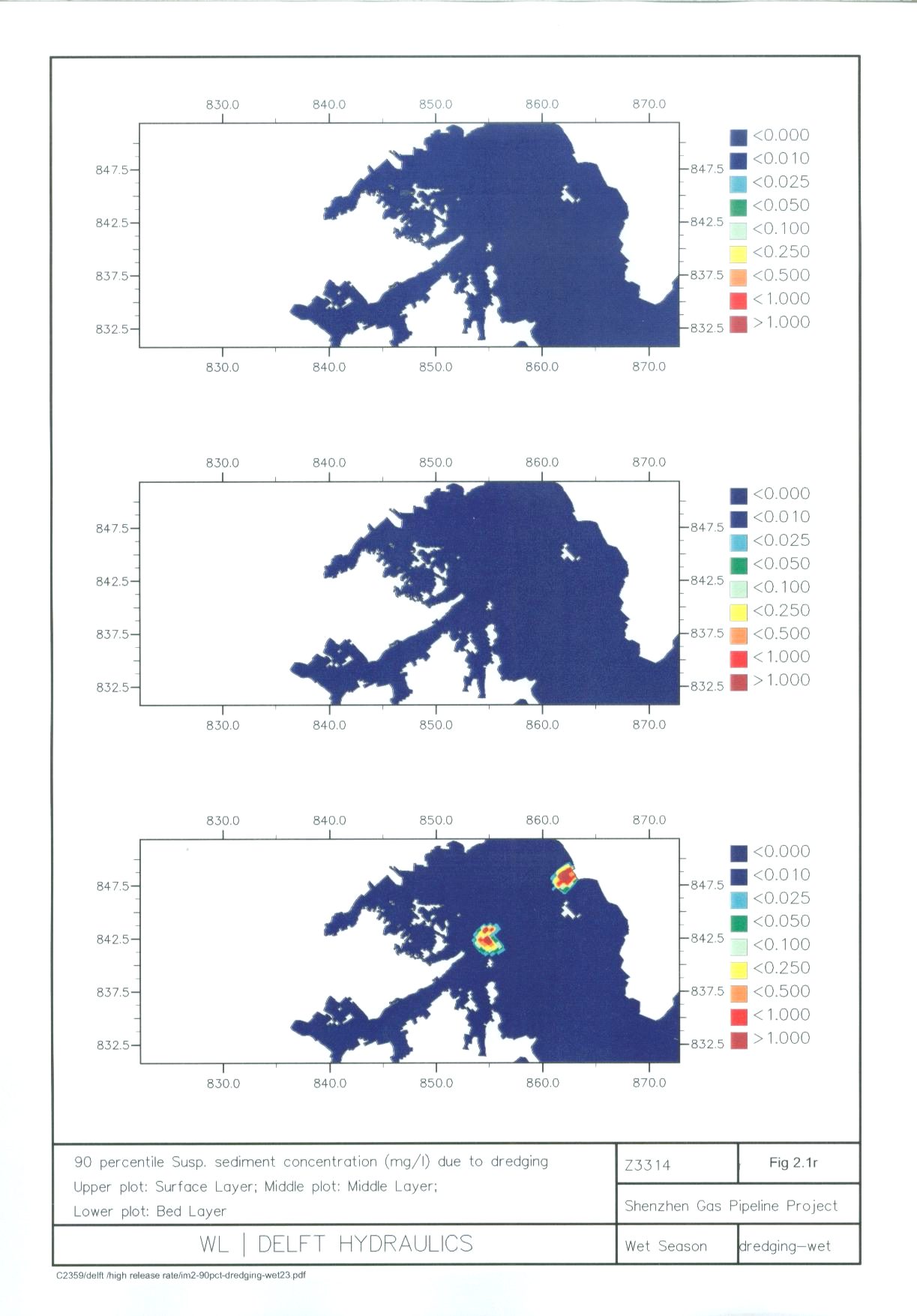
Figure
2.1r 90
Percentile of Suspended Sediment Concentration (mg L-1) due to
Dredging (Wet Season)
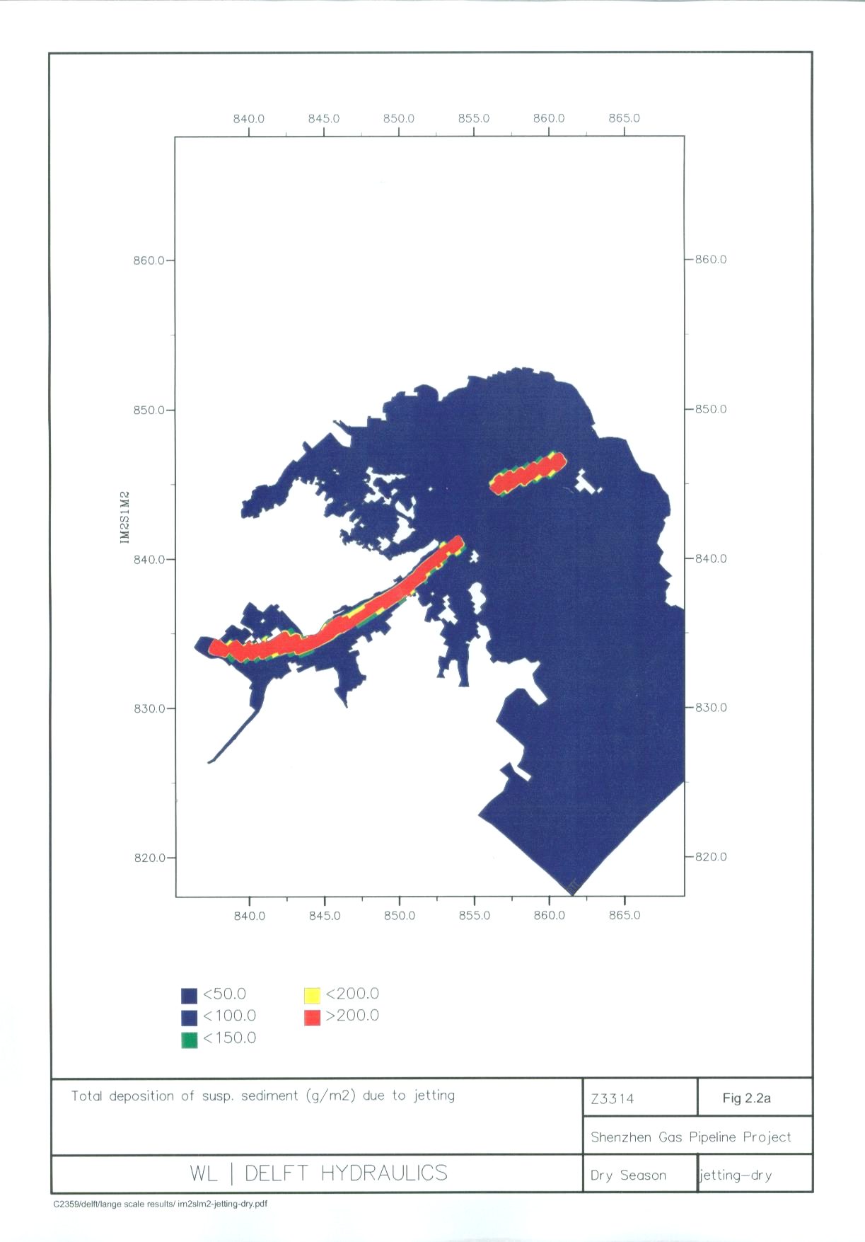
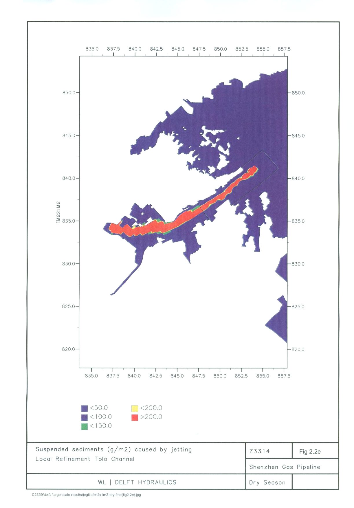
Figure
2.2a Total
Deposition of Suspended Sediment (g m-2) due to Jetting (Dry Season)
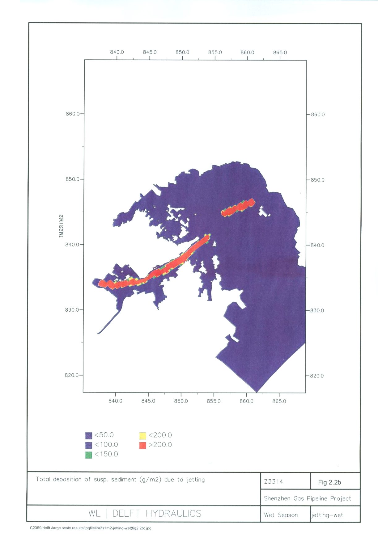
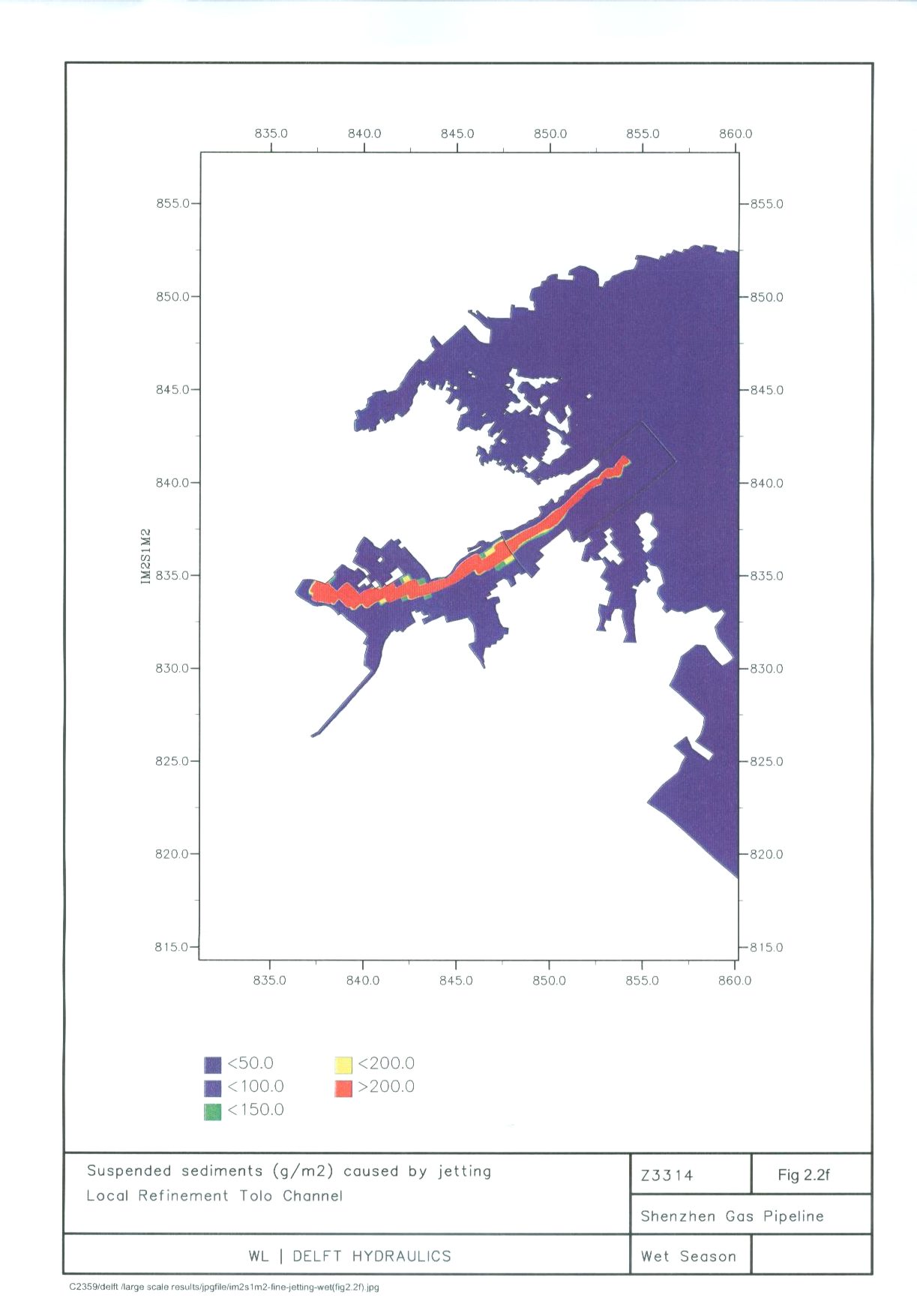
Figure
2.2b Total
Deposition of Suspended Sediment (g m-2) due to Jetting (Wet Season)
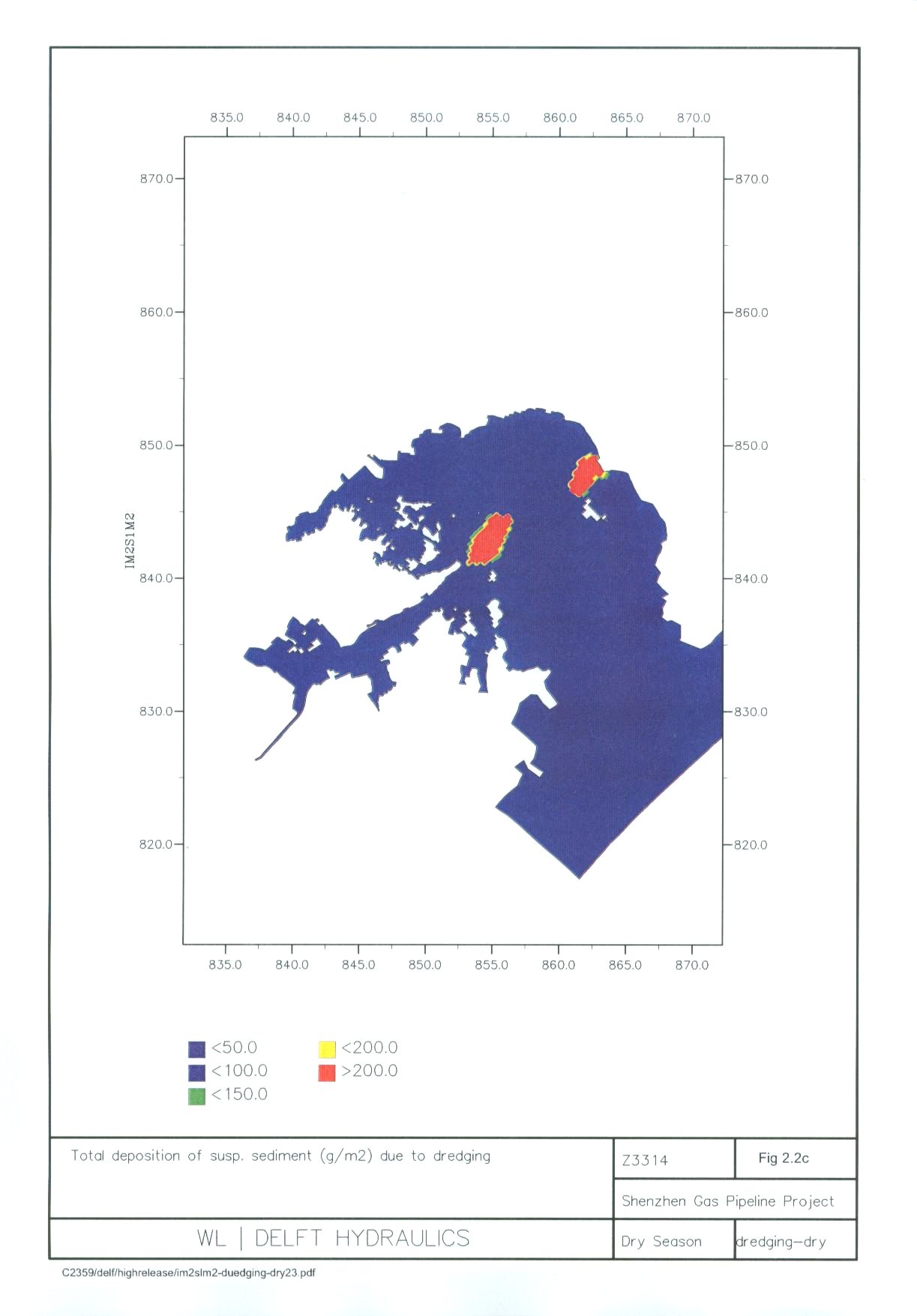
Figure 2.2c Total Deposition of Suspended
Sediment (g m-2) due to Dredging (Dry Season)
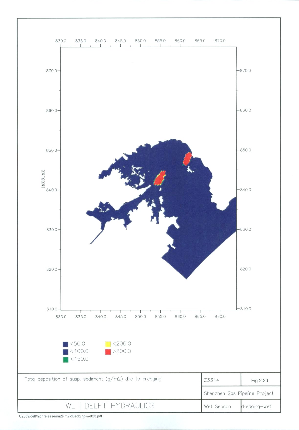
Figure
2.2d Total
Deposition of Suspended Sediment (g m-2) due to Dredging (Wet
Season)
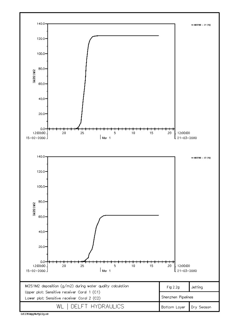
Figure 2.2g Sediment Deposition (g m-2) at C1 and C2 (Dry Season)
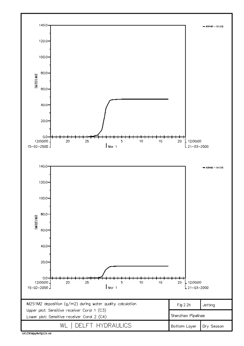
Figure 2.2h Sediment Deposition (g m-2) at C3 and C4 (Dry Season)
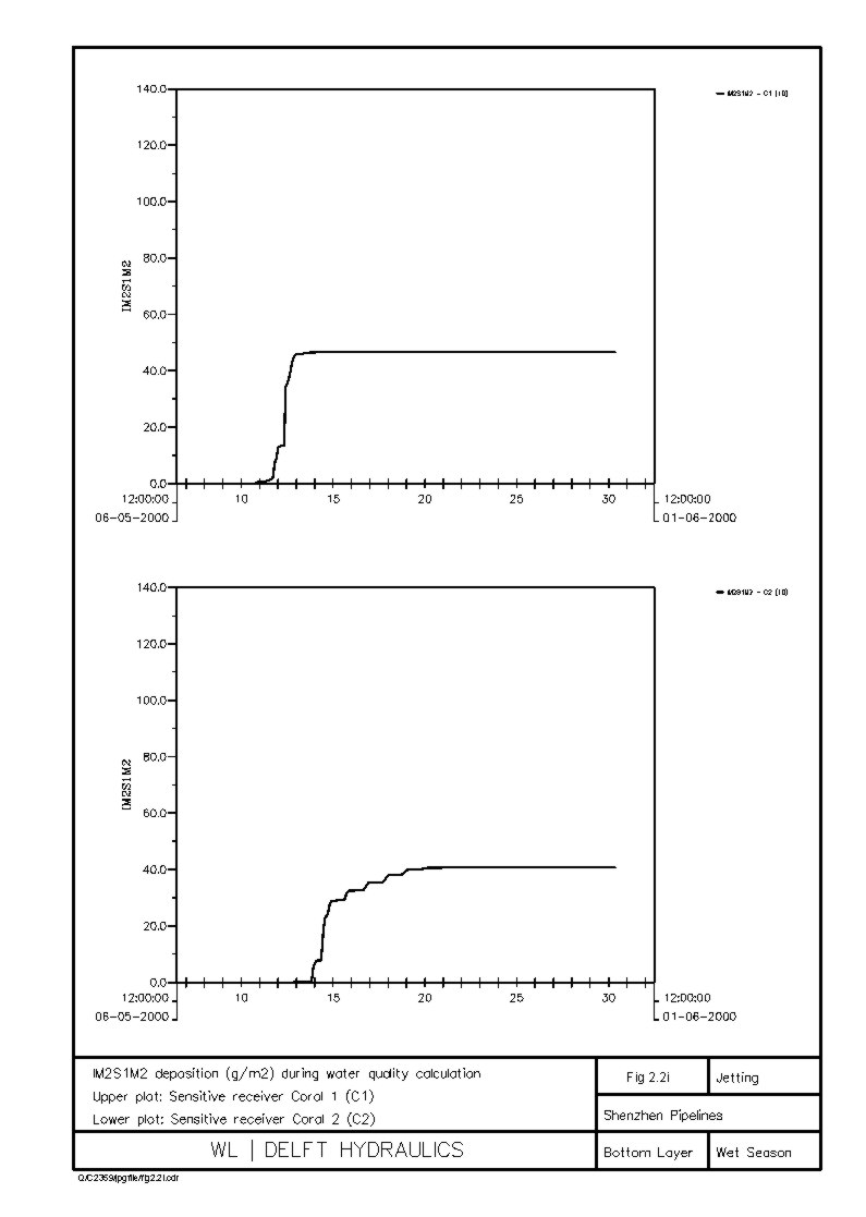
Figure 2.2i Sediment Deposition (g m-2) at C1 and C2 (Wet Season)
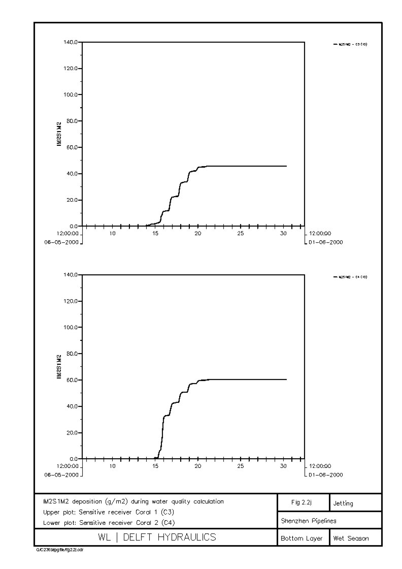
Figure 2.2j Sediment Deposition (g m-2) at C3 and C4 (Wet Season)
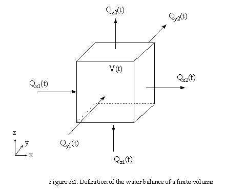
Figure A1 Definition
of the Water Balance of a Finite Volume
Annex C
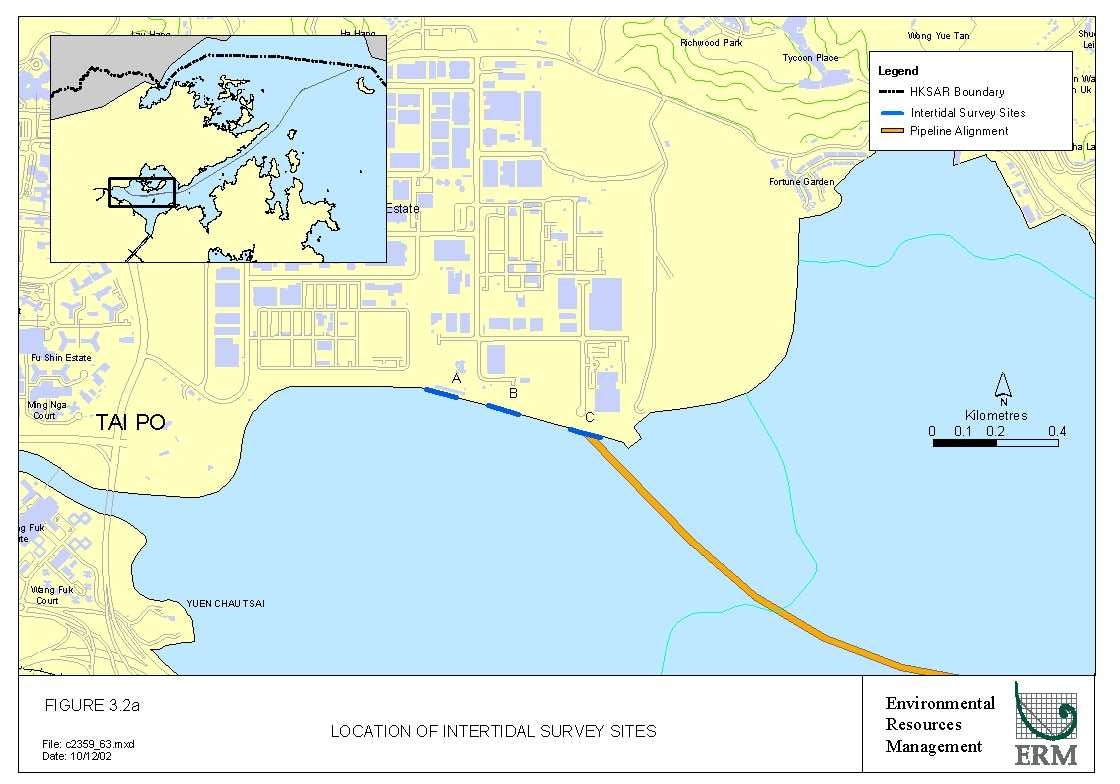
Figure
3.2a Location
of Intertidal Survey Sites
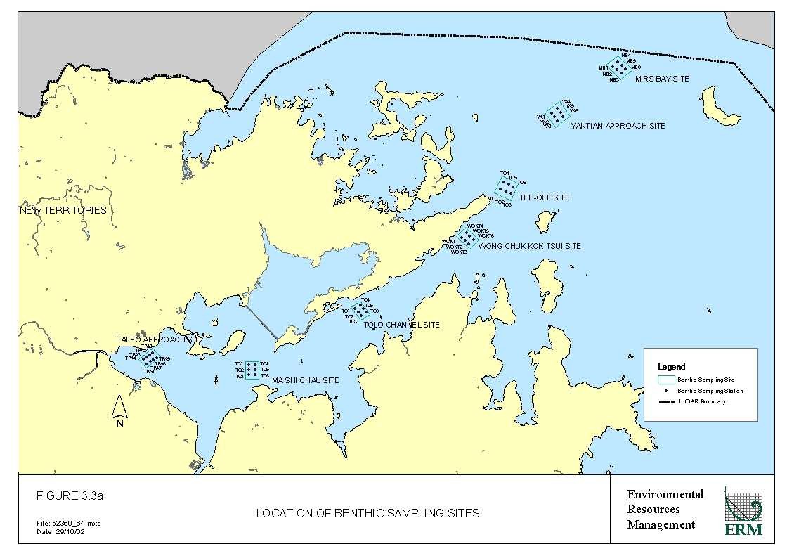
Figure
3.3a Location
of Benthic Sampling Sites
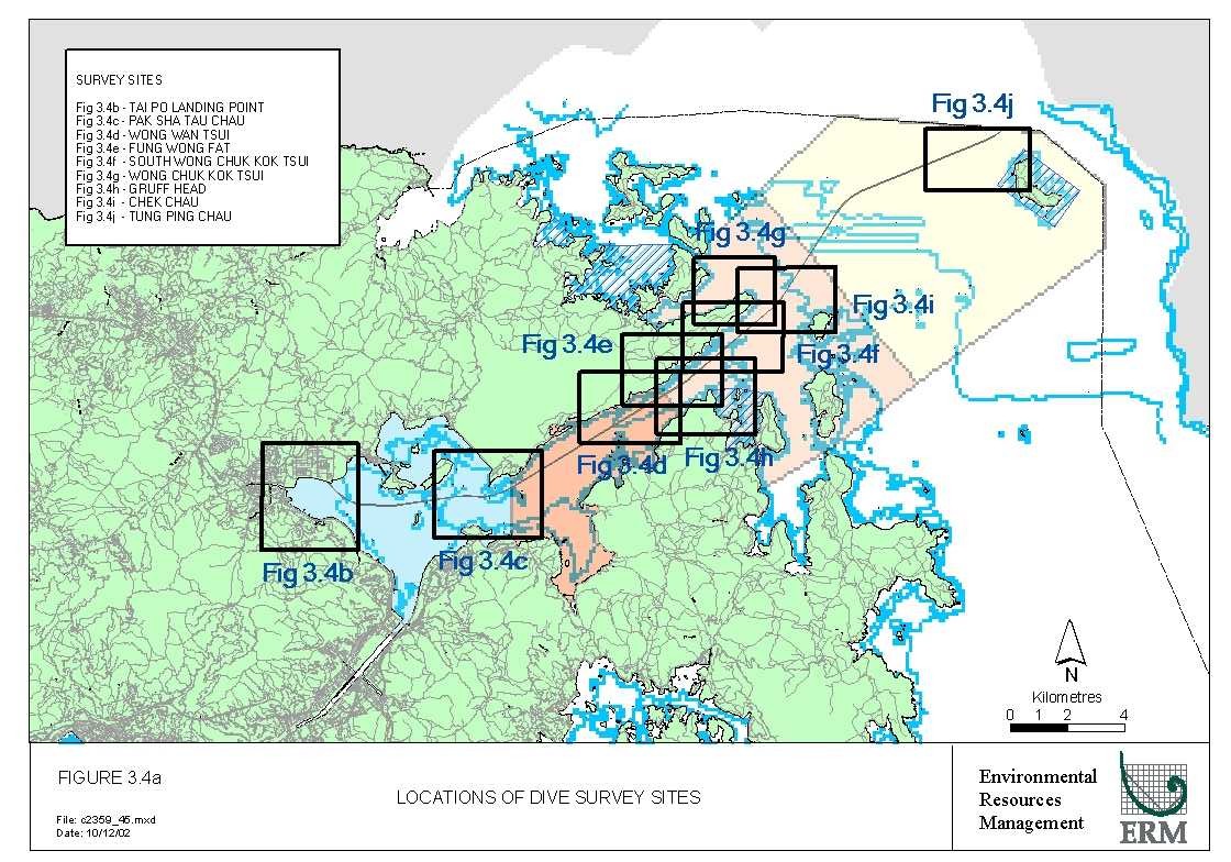
Figure
3.4a Locations
of Dive Survey Sites
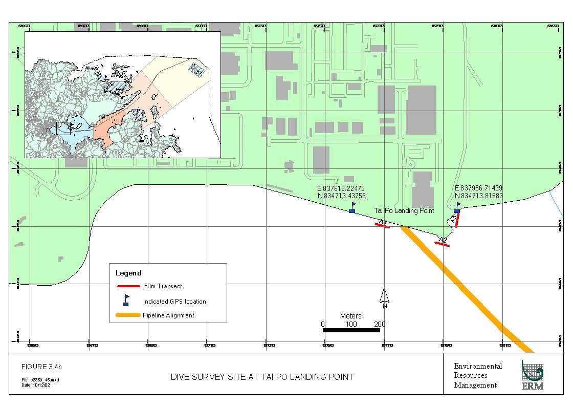
Figure
3.4b Dive
Survey Site at Tai Po Landing Point
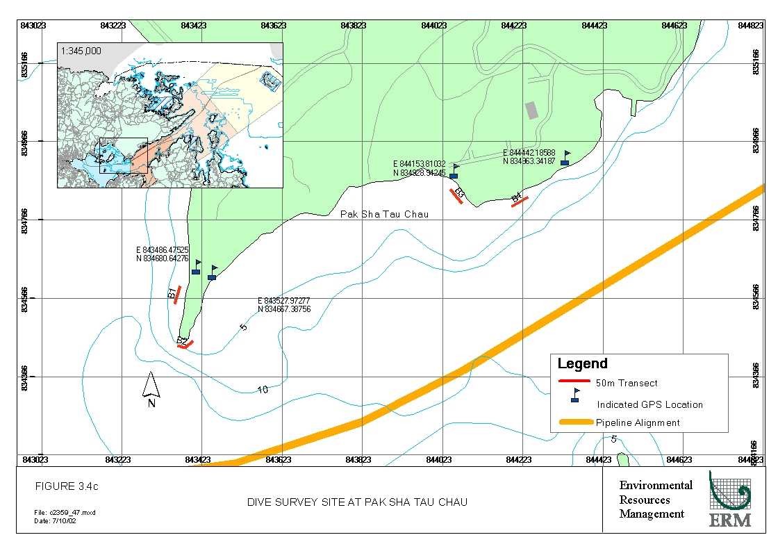
Figure
3.4c Dive
Survey Site at Pak Sha Tau Chau
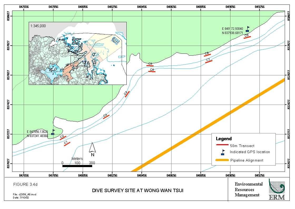
Figure
3.4d Dive
Survey Site at Wong Wan Tsui
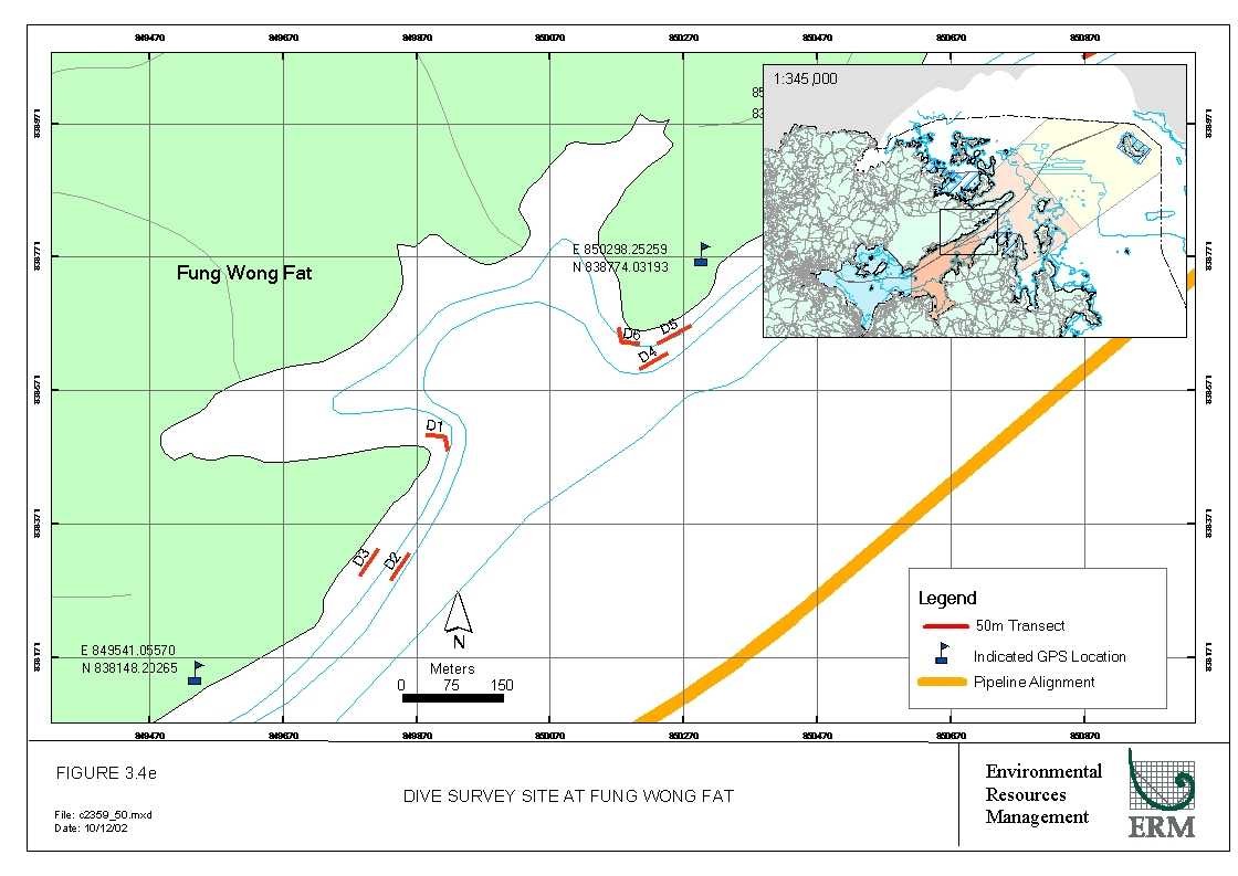
Figure
3.4e Dive
Survey Site at Fung Wong Fat
Figure
3.4f Dive
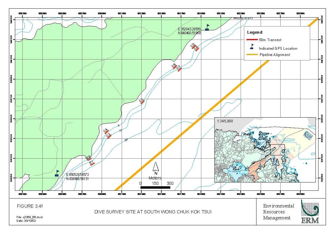
Survey Site at South Wong Chuk Kok Tsui
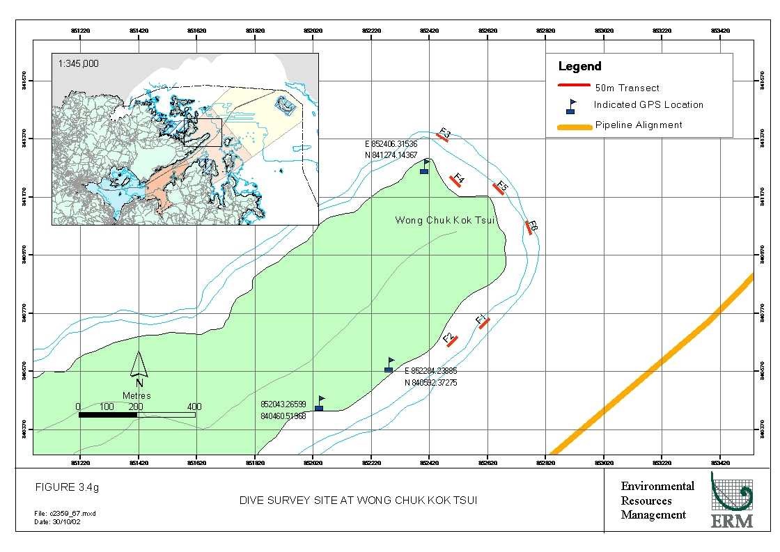
Figure
3.4g Dive
Survey Site at Wong Chuk Kok Tsui
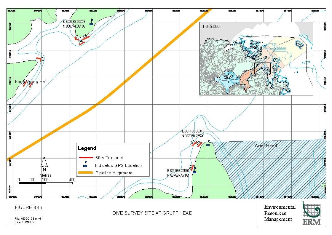
Figure
3.4h Dive
Survey Site at Gruff Head
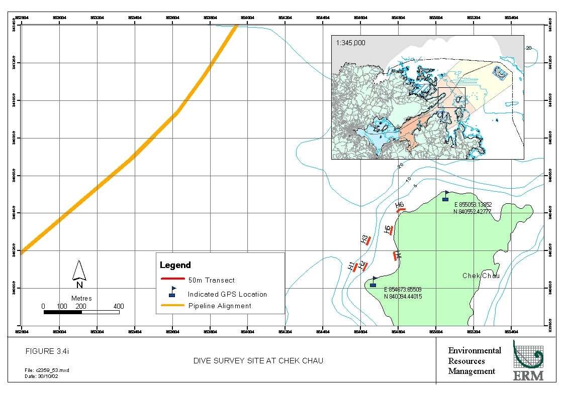
Figure
3.4i Dive
Survey Site at Chek Chau
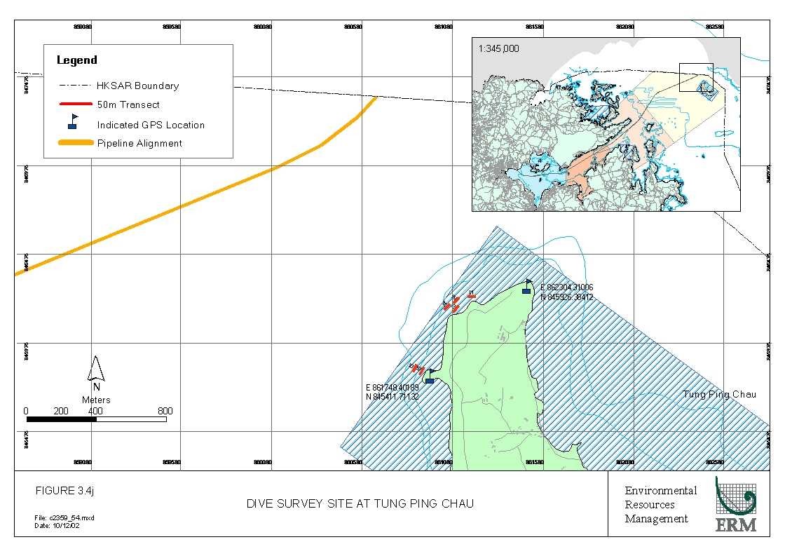
Figure
3.4j Dive
Survey Site at Tung Ping Chau
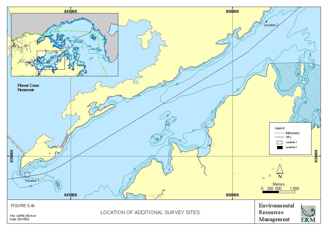
Figure 3.4k Location of Additional Survey Sites
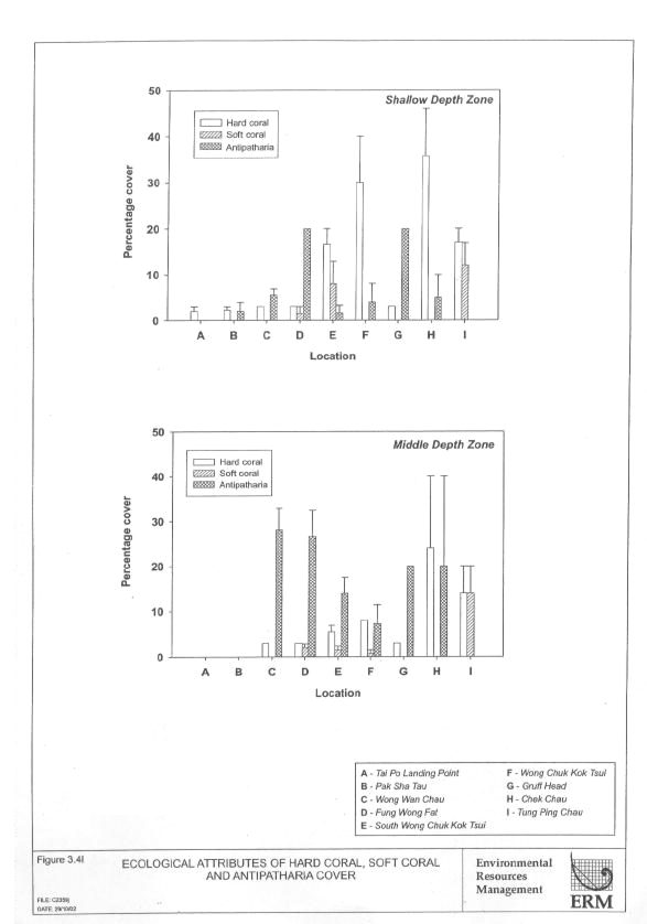
Figure 3.4l Ecological Attributes of Hard Coral, Soft Coral and Antipatharia Cover
Figure
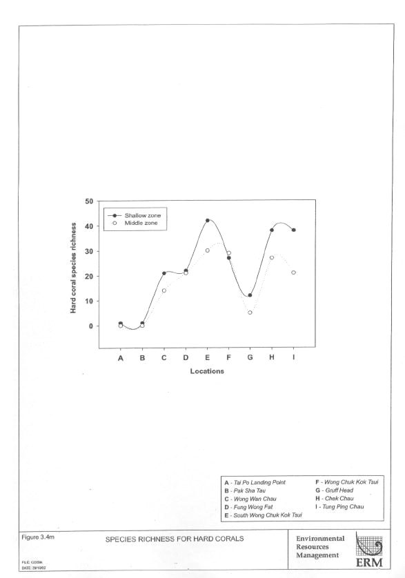
3.4m Species
Richness for Hard Corals
Figure
4.1a Summary
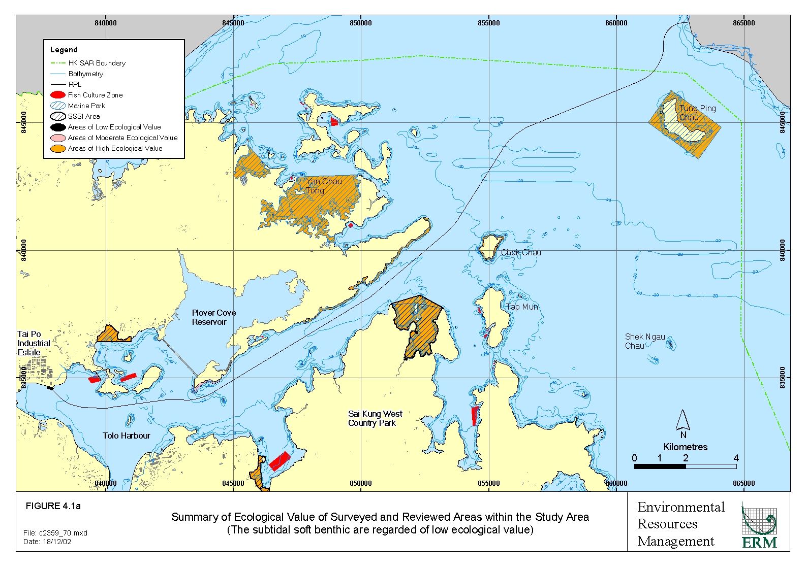
of Ecological Value of Surveyed and Reviewed Areas within the Study Area
Annex F
Figure
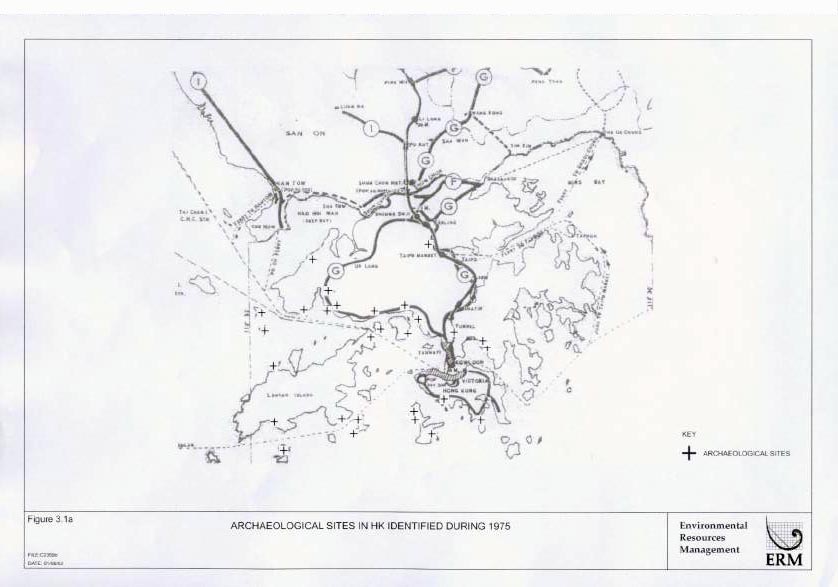
3.1a Archaeological
Sites in HK Identified During 1975
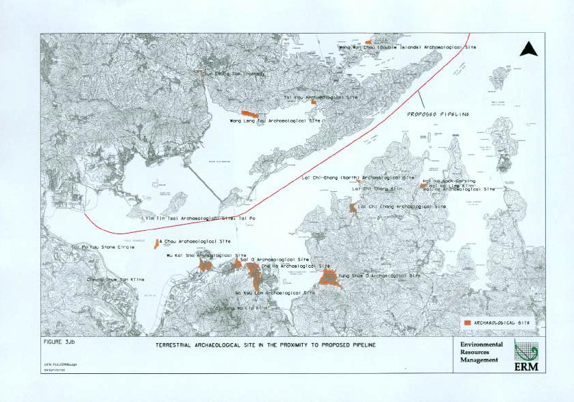
Figure
3.1b Terrestrial
Archaeological Site in the Proximity to Proposed Pipeline
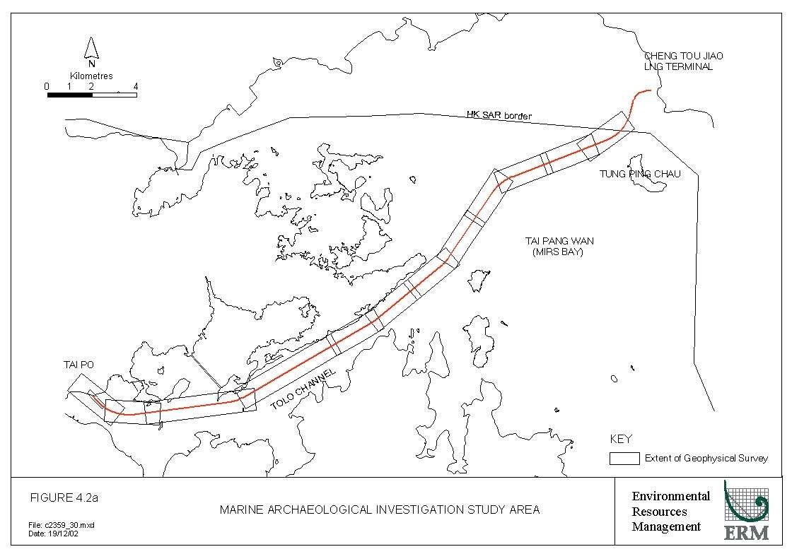
Figure
4.2a Marine
Archaeological Investigation Study Area
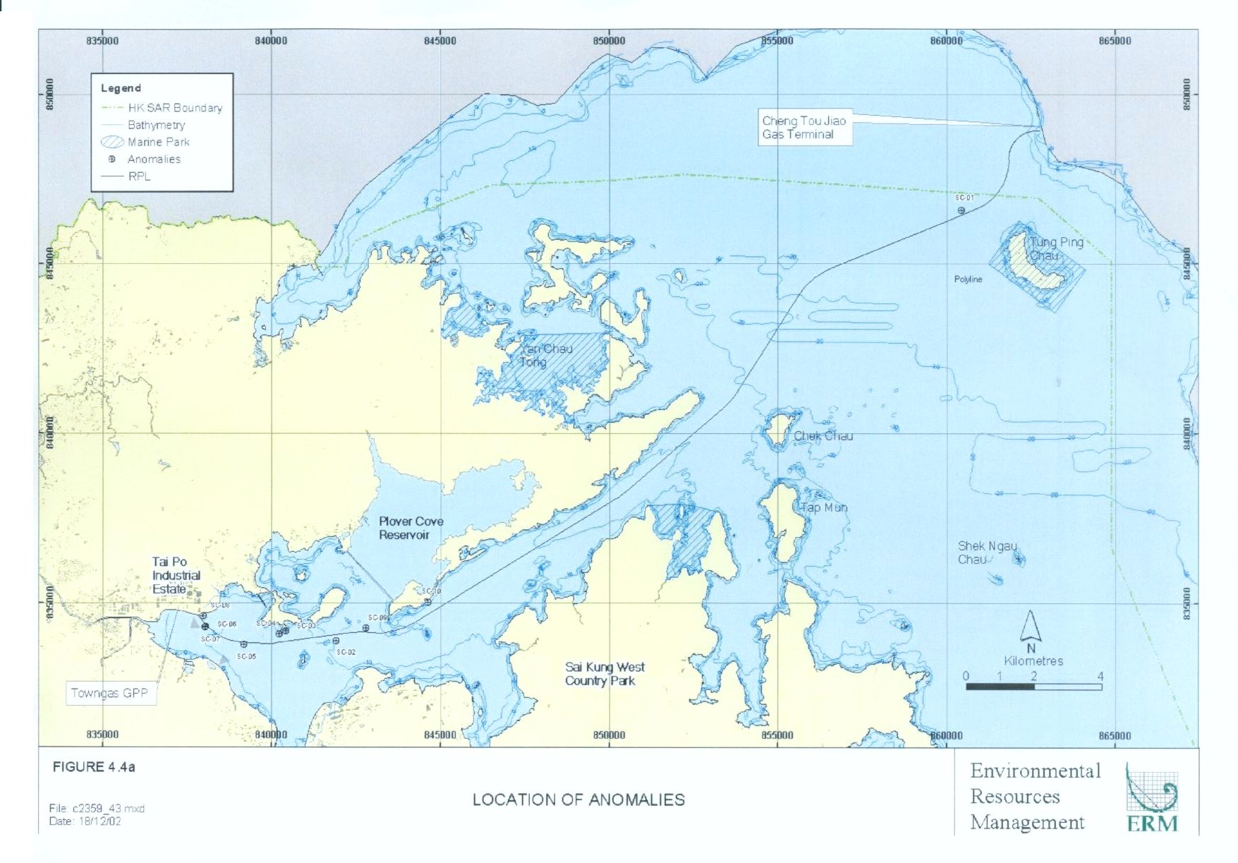
Figure
4.4a Location
of Anomalies
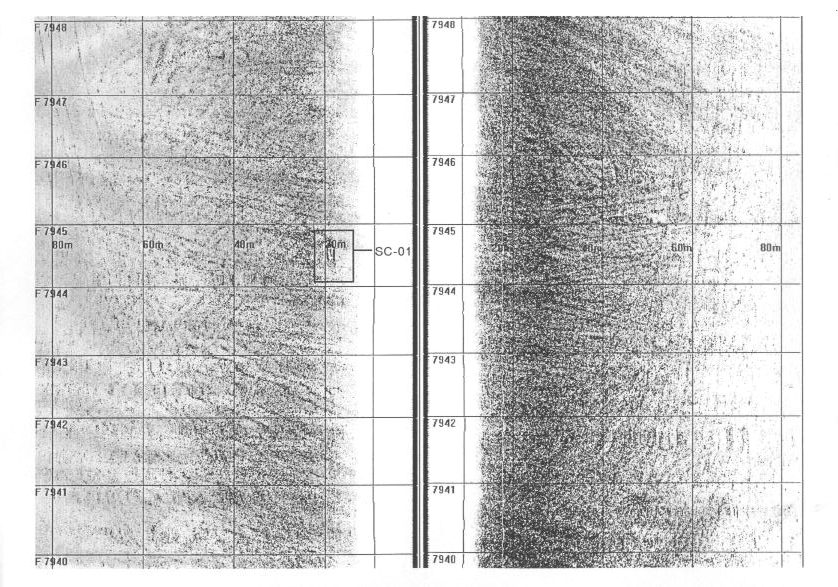
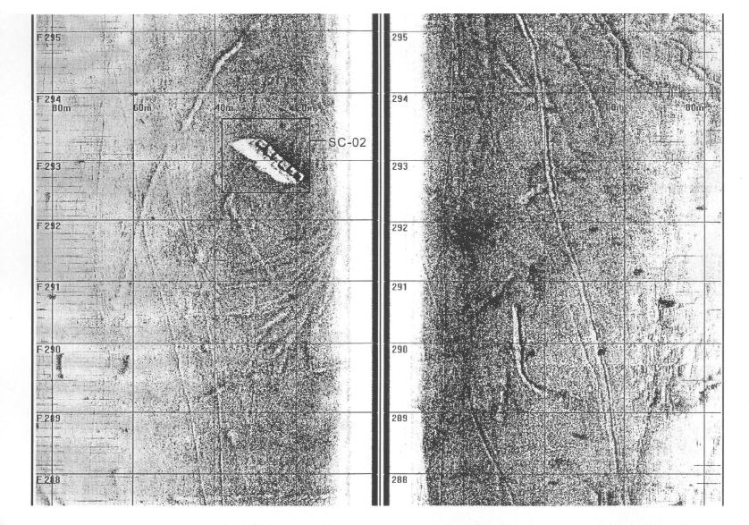
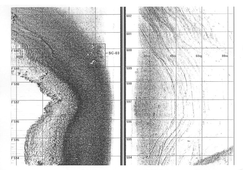
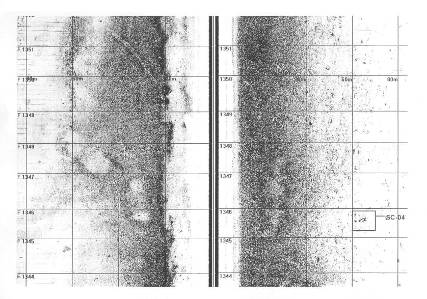
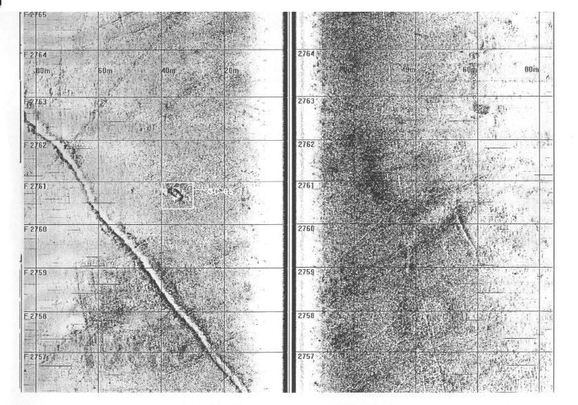
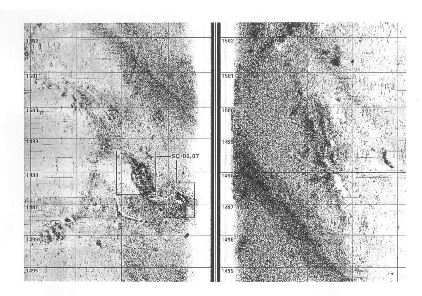
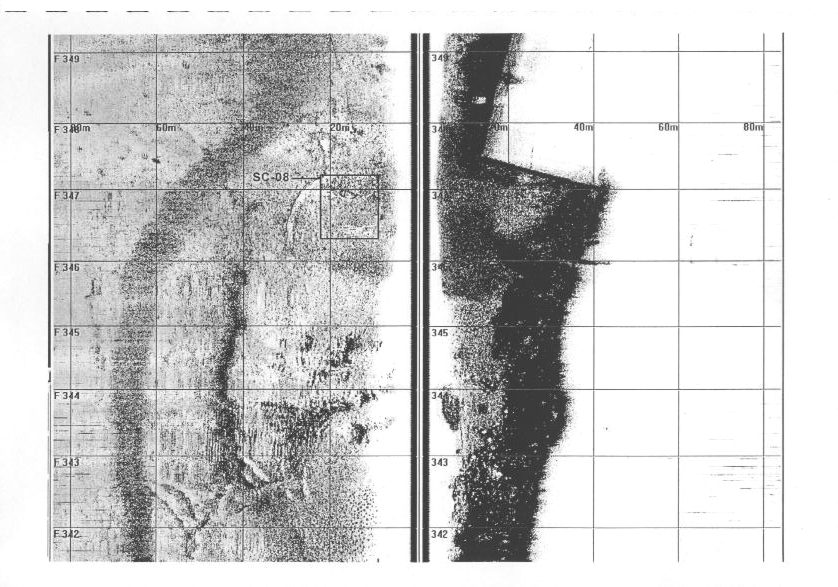
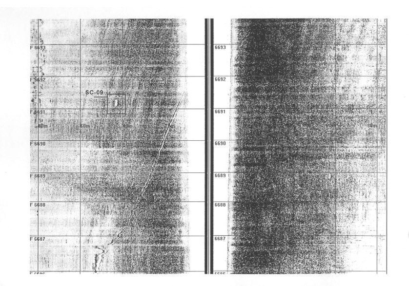
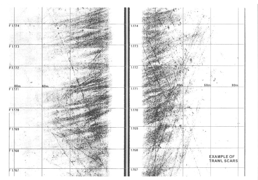
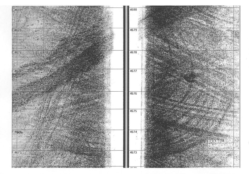
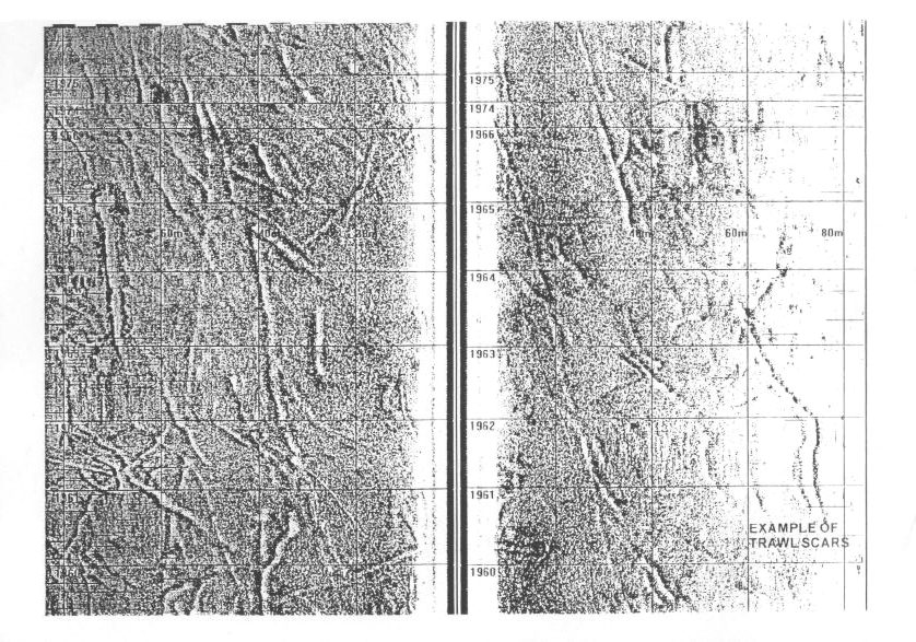
Appendix B Side
Scan Images(A)
Appendix B Side
Scan Images(B)
Appendix B Side
Scan Images(C)
Appendix B Side
Scan Images(D)
Appendix B Side
Scan Images(E)
Appendix B Side
Scan Images(F)
Appendix B Side
Scan Images(G)
Appendix B Side
Scan Images(H)
Appendix B Side
Scan Images(I)
Appendix B Side
Scan Images(J)
Appendix B Side
Scan Images(K)
Appendix B Side
Scan Images(L)
TABLES
Table 3.1 Potential Sources of Environmental Impacts
Table 3.2 Proposed Plant Inventory
Table 3.3 Identification of Noise Sensitive Receivers
Table 3.4 Predicted Noise Levels
Table 4.1 Water Quality Objectives
Table 4.2 EPD Routine Water Quality Monitoring Data
in the Vicinity of the Project Area
Table 4.3 Summary of Sediment Quality Data for the
Tolo Harbour and Channel WCZ and the Mirs Bay WCZ.
Table 4.4 Summary of Exceedance of Critical Values
for Sediment Quality
Table 4.5 Shortest Distance to Sensitive Receivers
Table 4.6 Summary of Assessment Criteria for Water
Quality Sensitive Receivers
Table 4.10 Maximum Increases in Suspended Sediment
Concentrations above Ambient (mg L-1) in Mainland Waters
Table 4.11 Predicted Concentrations of Dissolved Contaminants
Expressed as a % of the Allowable Standard
Table 5.1 Dredged/Excavated Sediment Quality Criteria
for the Classification under ETWBTC No 34/2002
Table 6.1 Summary of Ecological Value of Assemblages
Present Along the Pipelines Alignment
Table 7.1 Shortest Separation Distance of Fish
Culture Zones to the Pipelines Alignment
Table 8.1 Properties of Natural Gas
Table 8.2 Frequencies of Releases from Pig Receivers
from HCR Database
Table 8.3 Breakdown of EGIG Incidents by Cause (1970
– 1997)
Table 8.4 Causes of Subsea Pipeline
Incidents from PARLOC 96
Table 8.5 Risk Assessment of Gas Receiver Station and
Onshore Pipelines
Table
8.6 Risk Assessment of Subsea Pipelines
Table 9.1 Classification of Risk Category
Table 9.2 Summary of General Categorisations of Risk
Table 9.3 Summary of Landfill Gas Monitoring Results (From June 2000 to May 2002)
Table 9.4 Qualitative Assessment of Landfill Gas Hazard to the Proposed Pipelines and Towngas Complex
Table 10.1 Hong Kong Air Quality Objectives ((gm-3)
Table 10.2 Background Air Quality in 2000
Table 10.3 Air Sensitive Receivers
ANNEX A
Table 2.1a Environmental
Constraints
Table 2.1b Physical
Constraints
Table 3.1 Summary
of Impacts
Table 4.2a Failure
Frequencies for Pipeline Sections
Table 4.2b Population
Density - Marine Vessels/Land
Annex B
Table 1.1 Summary
of Partition Coefficients for the Release of Micro-pollutants
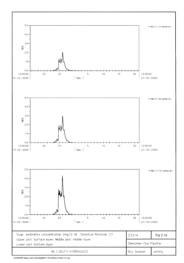
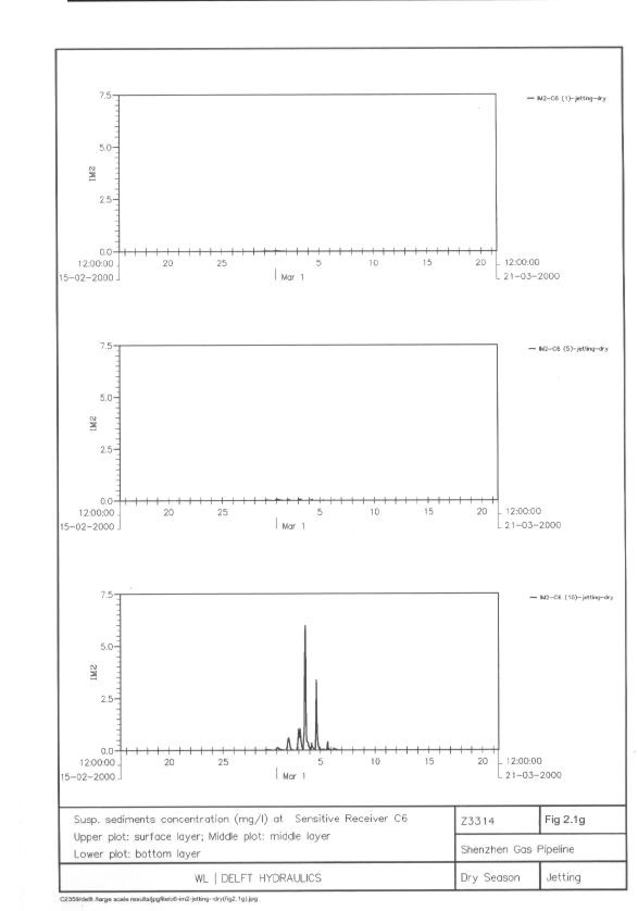
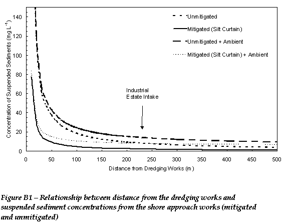
Table 2.1 Maximum Elevations of Suspended Sediment at Sensitive Receivers (mg L-1)
Table 2.2 Cumulative Sediment Deposition (g m-2) at Coral Sensitive Receivers for Each Pass
Table 2.3 Maximum Elevations of Chlorophyll-a at Sensitive Receivers (mg L-1)
Table
2.4 Maximum
Elevations of Total Inorganic Nitrogen at Sensitive Receivers (mg L-1)
Table
2.5 Maximum
Elevations of Unionised Ammonia at Sensitive Receivers (mg L-1)
Table
2.6 Minimum
Elevations of Dissolved Oxygen at Sensitive Receivers (mg L-1)
ANNEX C
Table 3.4a Recommended
Number of Transects to be Surveyed at Each Proposed Survey Site
Table
3.4b Categories to be
used in the Surveys - Benthic Attributes
Table
3.4c Categories to be
used in the Surveys - Ordinal Ranks of Percentage Cover
Table
3.4d Ordinal Ranks of
Taxon Abundance
Table 3.4e Seabed
Attributes Along the Survey Transects A1 to A3
Table 3.4f Benthic species
Recorded Along the Survey Transects A1 – A3
Table 3.4g Seabed
Attributes Along the Survey Transects B1 to B4
Table 3.4h Benthic species
Recorded Along the Survey Transects B1 – B4
Table 3.4i Seabed
Attributes Along the Survey Transects C1 to C9
Table 3.4j Benthic species
Recorded Along the Survey Transects C1 to C9
Table 3.4k Seabed
Attributes Along the Survey Transects D1 to D6
Table 3.4l Benthic species
Recorded Along the Survey Transects D1 to D6
Table 3.4m Seabed
Attributes Along the Survey Transects E1 to E9
Table 3.4n Benthic species
Recorded Along the Survey Transects E1 to E9
Table 3.4o Seabed
Attributes Along the Survey Transects F1 to F6
Table 3.4p Benthic species
Recorded Along the Survey Transects F1 to F6
Table3.4q Seabed
Attributes Along the Survey Transects G1 to G3
Table 3.4r Benthic species
Recorded Along the Survey Transects G1 to G3
Table 3.4s Seabed
Attributes Along the Survey Transects H1 to H6
Table 3.4t Benthic species
Recorded Along the Survey Transects H1 to H6
Table 3.4u Seabed
Attributes Along the Survey Transects I1 to I6
Table 3.4v Benthic species
Recorded Along the Survey Transects I1 to I6
Table 3.4x List of all Benthic Taxa Recorded from All Depth Ranges Presented with Mean Rank Abundance
Table 4.2a Ecological Value
of the Intertidal Artificial Seawall Within the Study Area
Table 4.3a Ecological Value
of the Subtidal Soft Benthos Assemblages
Table 4.3d Ecological Value
of the Subtidal Hard Substrate Habitat of Gruff Head, Chek Chau and Tung Ping
Chau
Table 4.3e Ecological Value of the Subtidal Hard Substrate Habitat of Additional Location 1 and 2
ANNEX
D
Table2.1 Area (Ha) and Number of Vessels Operating During 1996 - 1997 in Each AFCD Fishing Zone within the Study Area
Table 2.2 Total Value ($), Adult Catch (kg) and Fry Catch (tails) Displayed on a Total Production, Production (Ha-1) and Rank (Ha-1) Basis for the AFCD Fishing Zones in the Study Area (1996 - 1997 Port Survey)
Table 2.3 Top Five Adult Fish (by weight) Caught in Each AFCD Fishing Zone within the waters of the Study Area (1996 - 1997 Port Survey)
Table 2.4 Summary of Fish Culture Zones (as at 30 June 2002)
ANNEX
F
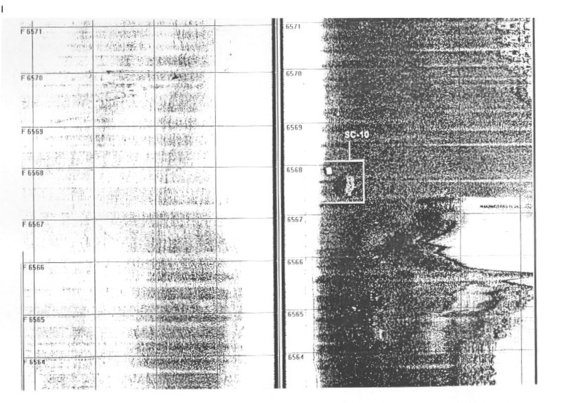
Table 4.4a Side Scan Sonar Anomalies (Possibly Small Boats or Other Submerged Features)
ANNEX
H
Table 5a Waste Management Audit Checklist