The EIA process
refers to the environmental assessment to identify, assess and report the
environmental impacts and benefits of the Project. It is consistent with the design process
to identify the potential environmental effects of various design options,
develop alternatives as well as mitigation measures to be incorporated into the
design, construction and operation phases of the Project. Comment and advice obtained from the
public have been considered and incorporated into the EIA process where
appropriate. Potential
environmental impacts are to be avoided, or to minimise or mitigate to
acceptable levels, by the proposed suitable measures.
3.2.1 Introduction
The air quality impacts during the construction and
operational phases of the Project have been assessed and evaluated in
accordance with the guidelines and criteria referred in Annexes 12 and 4 of the Technical Memorandum on
Environmental Impact Assessment Process (EIAO-TM)
respectively. Reference has also been made to other standards for
the control of air pollutants from a variety of stationary and mobile sources
established under the Air Pollution Control Ordinance (Cap. 311).
3.2.2
Construction Phase
Fugitive dust may be generated from works activities
including site clearance, excavation, handling of construction materials,
concrete breaking and from minor wind erosion. Each active construction activity
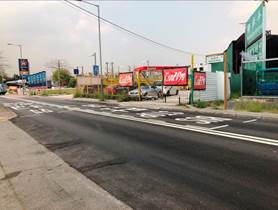
location shall occupy about 50m in length of the Project alignment at any one
time, and with a distance separation more than 600m between each location. The
area of the work front would be about 500m2 (10m x 50m). Given that each works area is small, dust impacts during
the construction phases are anticipated to be minor with the adoption of
mitigation measures stipulated in the Air Pollution Control (Construction Dust)
Regulation. In addition, activities that may induce significant dust emissions
such as extensive site formation and blasting are not required for the Project.
As such, a quantitative dust impact assessment is not considered necessary.
Small amount of sulphur dioxide (SO2), nitrogen
dioxide (NO2) and smoke shall be emitted from the diesel-powered
construction equipment. Under normal operation, however, such properly
maintained equipment shall not contribute any significant smoke or gaseous
emissions. With the implementation of mitigation measures following the Air
Pollution Control (Non-road Mobile Machinery) (Emission) Regulation, emissions
from construction equipment are considered relatively low and would not
anticipate to cause adverse air quality impact.
It is expected that only minor local-scale dust impacts
arising from the construction activities of the concurrent projects in the
vicinity are anticipated with proper mitigation measures implemented on-site.
As such, the cumulative dust impacts as a result of concurrent works within the
assessment area are not expected as there is large distance separation between
the Project Boundary and the concurrent projects; and provided that the
recommended dust suppression measures are implemented.
Although no adverse construction phase air quality impacts
are anticipated, a number of best practice measures have been recommended to
ensure compliance with the Air Pollution Control (Construction Dust)
Regulation. It is also recommended
that construction phase EM&A should be conducted to ensure construction
phase best practice measures are properly implemented and are effective.
No adverse residual impacts are
anticipated during the construction phase.
3.2.3 Operation Phase
The air dispersion model CALINE4
was adopted to predict vehicle exhaust emissions from the Project and major
surrounding roads. The 19th highest 1-hour average Nitrogen Dioxide
(NO2), 10th highest daily average Respirable Suspended
Particulates (RSP) and Fine Suspended Particulates (FSP), and annual average NO2,
RSP and FSP concentrations at identified Air Sensitive Receivers (ASRs) were
determined.
The predicted peak traffic flows
in the year 2025 were adopted to represent the worst-case scenario. The
emission model EMFAC-HK 4.1 was adopted to estimate the vehicle emission
factors of Nitrogen Oxides (NOx), RSP and FSP.
The future year background concentrations
are made reference to the EPD��s PATH-2016 modelling results. The PATH-2016
model results have been added to the sum of the CALINE4 model results to derive
the short-term and long-term cumulative impacts at the ASRs.
Results indicate that the 19th
highest 1-hour average NO2, 10th highest daily average
RSP and FSP, and annual average NO2, RSP and FSP concentrations at
all representative ASRs would comply with the AQOs. A summary of the predicted
concentrations for key representative air pollutants is given below.
Table 3.1 Summary
of Predicted Concentrations for Key Representative Air
Pollutants
|
Air Pollutants
|
|
AQO Compliance
|
|
NO2
|
RSP
|
FSP
|
|
19th Highest 1-hour
|
Annual
|
10th Highest Daily
|
Annual
|
10th Highest Daily
|
Annual
|
|
Criteria
|
200
|
40
|
100
|
50
|
75
|
35
|
|
Concentrations (µg/m3)
|
59 - 144
|
11 - 30
|
77 - 83
|
33 - 35
|
58 - 62
|
23 - 25
|
Yes
|
Results indicate that NO2
is the most critical pollutant among the three pollutants as the 10th
highest and annual RSP and FSP concentration are far below AQO emission limit.
The assessment results conclude
that the predicted cumulative 1-hour average and annual average NO2,
daily average and annual average RSP / FSP concentrations at representative
ASRs would comply with the AQOs.
Hence, no mitigation measures are required and no operation phase
EM&A is recommended.
3.3.1 Introduction
Noise impacts were assessed in
accordance with Annexes 5 and 13 of the EIAO-TM. �@Existing, committed and planned
Noise Sensitive Receivers (NSRs) in the assessment area have been identified
and the potential noise impacts from the Project on these NSRs have been
assessed.
3.3.2 Construction Phase
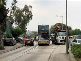
The use of powered mechanical equipment (PME) in
daytime is expected to be the major noise source during the construction phase
of the Project. No construction
works are scheduled to be undertaken during noise control restricted hours of
all days during the evening and night-time (i.e. 19:00-07:00 hours); and all
time during Sundays and public holidays.
No percussive piling works will
be required within the proposed Project Boundary.
Construction noise associated with
the use of PME for different stages of construction has been assessed. With the implementation of proposed
mitigation measures including good site practices, use of quality powered
mechanical equipment (QPME), use of temporary noise barrier, enclosure and/or
noise insulation fabric to screen noise from relatively static PME and alternative quiet construction method, the predicted
construction noise impact would be 43-75 dB(A) for existing NSRs. Hence, adverse construction noise
impacts are not anticipated. Yet,
EM&A has been proposed to ensure the implementation and effectiveness of
the mitigation measures during the construction phase.
Construction noise impact
arising from the Project can be properly mitigated by implementing the proposed
noise mitigation measures. Adverse
residual noise impacts are thus not anticipated.
3.3.3 Operation Phase
The road traffic noise levels
have been predicted by the RoadNoise Model, based on the peak hour traffic flow
of year 2040 adopted for the assessment.
The road sections within 300m from the proposed Project Boundary have
been included in the assessment.
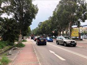
The traffic speed for all roads including Kam Tin Road and Lam Kam Road
to be adopted in the road traffic noise model is 50kph and a section of Kam Tin
Bypass (~40m in length within the assessment area) is 70kph. The existing
roadside noise barriers along Kam Tin Bypass and Tung Wui Road have been
included in the assessment. The road alignments, surrounding buildings and all
other structures that could have noise screening have been inputted in the road
traffic noise model.
Direct noise mitigation measures such as the use of low
noise road surface (LNRS) and noise barrier are evaluated to minimize the
operation noise impact. A total length of approximate 837m vertical noise
barrier with maximum height of 5m along Kam Tin Road and maximum height of 3m
along Lam Kam Road are recommended for the NSRs with exceedance in unmitigated
scenario. LNRS with total length of approximate 2.1km would be applied on
several road sections of Kam Tin Road.
A summary of the predicted road
traffic noise impacts after implementation of
mitigation measures is given below.
Table 3.2 Summary
of Predicted Road Traffic Noise Impacts
|
Uses
|
Noise
Criteria
(L10(1
hour)), dB(A)
|
Predicted
Maximum Noise Levels
(L10(1
hour)), dB(A)
|
|
Place for Worship
|
65
|
74
|
|
Residential
|
70
|
64-82
|
After implementing direct noise
mitigation measures, the predicted overall noise levels of some of the NSRs
still exceed the noise criteria, which are not directly affected by the Project.
Nevertheless, with the proposed direct mitigation measures, there will be 565
existing dwellings and 30 planned dwellings benefited, and 106 existing
dwellings protected. As no representative existing NSRs would fall within all
the three testing criteria, no indirect mitigation measures would be required.
The increase in road traffic
noise level due to the Project is considered not significant (less than 1.0dB(A) increase in all NSRs) after implementation of noise
mitigation measures when comparing to the without Project scenario. In fact,
the mitigated road traffic noise levels with the Project at many NSRs are less
than that of the without Project scenario.
Therefore, the residual road
traffic noise impact of the Project is considered acceptable.
3.4.1
Introduction
The water quality impact
assessment and evaluation have been conducted in accordance with the criteria
and guidelines as presented in Annexes 6 and 14 of the EIAO-TM respectively.
The relevant primary legislation
is the Water Pollution Control Ordinance (Cap. 358), the associated Technical
Memorandum on Standards for Effluents Discharged into Drainage and Sewerage
Systems, Inland and Coastal Waters; and the Water Quality Objectives (WQOs) for
the Deep Bay Water Control Zone (WCZ) and the Tolo Harbour Supplementary WCZ.
Water courses within the Project
Boundary comprise the channelized Kam Tin River and a
number of natural streams near Kadoorie Experimental Farm, Ling Wan Monastery,
Wong Chuk Yuen, Sheung Tsuen and Kam Tin Bypass with unpolluted and polluted
sections. The Project falls within two water control zones, with
the Kam Tin River and its tributaries carrying waters
generally polluted by organic pollution to the west towards Inner Deep Bay,
and with the clean tributaries of the Lam Tsuen River flowing
west towards Tolo Harbour. It is noted that there is an
encroachment of about 60m of the water gathering zone located at the eastern
end of the Project.
These observations are
consistent with EPD��s latest water quality index
classifying Lam Tsuen River as ��Excellent��
but Kam Tin River as ��Bad�� in 2017. Overall
compliance with WQOs for Lam Tsuen River and
Kam Tin River is 95% and 60% respectively.
3.4.2
Construction Phase
Potential water quality impact might be arisen from
the associated construction works of road widening and improvement works such
as retaining wall and geotechnical works. Key water pollution sources include:
• General construction activities
and site runoff from wash water from dust suppression measures, vehicle wheel
washing facilities and concrete casting;
• Surface runoff from rainfall and
wind erosion of exposed surface areas and material stockpiles;
• Spillage of chemicals,
lubrication oils, solvent and petroleum products;
• Sewage from the construction
workforce; and
• Construction works in close
proximity of nearby water bodies
Given both magnitude and duration of works and with
the implementation of the mitigation measures during the construction phase, no
significant water quality impacts are anticipated to be generated from the
Project. The implementation of the mitigation measures shall be included
to the works contracts. Regular site inspections are recommended during
construction to ensure the measures are implemented properly.
3.4.3
Operation Phase
Potential
water quality impacts during the operation phase may be arisen from highway
discharge. Material deposited and accumulated on the road surface, including
dust / sediment, heavy metals and vehicle oil, will be washed from the
carriageway during rainfall events into surface water drainage system and
discharged to storm drains. In addition, there will be no sewage generation
during the operation phase of the Project.
The
drainage system along Kam Tin Road and Lam Kam Road will be properly planned and upgraded to cater for the road surface runoff from highway with increased capacity after road widening. With the mitigation measures
mentioned in the EIA Report in place, no adverse residual water quality impacts are anticipated during the operation phase.
3.5.1
Introduction
The criteria and guidelines for accessing waste management
implications are outlined in Annexes 7 and 15 of the EIAO-TM respectively.
Reference has also been made to the Waste Disposal Ordinance (Cap. 354) and
subsidiary legislation, and relevant circulars issued by ETWB and the Development
Bureau.
3.5.2
Construction Phase
The types of waste generated from the construction activities of the
Project include:
• Construction and demolition (C&D)
materials;
• Chemical waste; and
• General refuse
C&D Materials
C&D materials would be
generated from the construction activities of the Project during the course of
the works between Year 2021 and 2025. It is estimated that the total volume of
the C&D materials generated from the Project would be approximately 42,320m3.
All C&D materials generated
shall be sorted on site into inert portion ��inert C&D materials�� including
soil, building debris, broken rock, concrete, etc., and the non-inert portion
is the "C&D wastes" comprising timber, paper, plastics, general
refuse etc. The inert C&D materials, the reusable and/or recyclable
materials shall be recovered before disposal of the waste portion off site as a
last resort. The surplus
portion of the inert C&D materials may be transported to the public fill
reception facility at Tuen Mun Area 38 for beneficial reuse, and the C&D
wastes at North East New Territories (NENT) Landfill in Ta Kwu Ling. It is estimated that 32,970m3
of inert C&D material (public fill) to be disposed of at public fill
reception facility at Tuen Mun Area 38 for other beneficial uses, 2,690 m3
of inert C&D material to be reused on-site, and 6,660 m3 of
non-inert C&D waste to be disposed of at NENT landfill.
Methods to minimise the
generation of C&D material will be addressed during detail design and in
planning of the construction works. A Waste Management System will be
incorporated into the Waste Management Plan (WMP) to effectively manage and
avoid/reduce/minimise the generation of C&D material during construction.
To prevent fly-tipping of
C&D materials, a Trip Ticket System will be implemented to monitor C&D
wastes from the Project, a truck carrying debris should first obtain a ticket
on leaving the construction site, then dump the debris at the designated
location and finally have the ticket stamped and returned to the construction
site.
Chemical Waste
Construction plant and vehicle
maintenance may generate a small amount of chemical wastes during construction
works, such as cleaning fluids, solvents, lubrication oil and fuel.
The potential volume of chemical
waste would be limited and anticipated in few cubic metres per month. The
amount of chemical waste to be generated will be quantified in the site WMP to
be prepared by the Contractor.
Materials classified as chemical
wastes will require special handling and storage arrangements before removal
for appropriate treatment at the Chemical Waste Treatment Centre (CWTC) or
other licensed facilities. Wherever possible opportunities should be taken to
reuse and recycle materials.
General Refuse
The workforce would generate refuse comprising food scraps, waste
paper, empty containers, etc. Such refuse will be
properly collected on-site and transfer to the nearby refuse collection
point. Disposal of refuse at sites
other than approved waste transfer or disposal facilities will be
prohibited. Effective collection of
site wastes will prevent waste materials being blown around by wind, or
creating an odour nuisance or pest and vermin problem. Waste storage areas will be well
maintained and cleaned regularly.
The maximum number of
construction workers to be employed is estimated to be about 80 workers. Based on a generation rate of 0.65kg per
worker per day, the maximum daily arising of general refuse during the
construction period would be approximately 52kg and this waste can be
effectively controlled by normal measures.
With the implementation of good waste management practices at the site,
adverse environmental impacts are not expected to arise from the storage,
handling and transportation of workforce wastes.
With the implementation of the
mitigation measures during the construction phase of the Project, no
significant waste management impacts are anticipated. The
implementation of the mitigation measures shall be included to the works
contracts. Regular site inspections
are recommended during construction to ensure the measures are implemented
properly.
3.5.3 Operation Phase
Upon Project operation phase, it
is anticipated that major source of wastes would only be from roadside
littering.
Roadside litters include food
scraps, waste paper, empty containers, etc. Sufficient rubbish bins/recycling bins
will be provided. Such refuse will
be collected by Food and Environmental Hygiene Department or relevant
departments for disposal.
It is expected that there would
be limited quantities of waste to be generated from the operation phase of the
Project. Waste monitoring and audit
programme for the operation phase of the Project would not be required.
3.6.1
Introduction
The Ecological Impact Assessment was conducted following
the criteria and guidelines for evaluating and assessing ecological impact as
stated in Annexes 8 and 16 of the EIAO-TM respectively.
The assessment area for the purpose of terrestrial
ecological assessment included all areas within 500m from the Project Boundary
and the areas likely to be impacted by the Project. For aquatic ecology, the assessment area
was the same as the water quality impact assessment, i.e. included 500m from
the Project Boundary and covered the Deep Bay Water Control Zone.
A literature review and 9-month ecological field survey
covering both dry and wet seasons have been conducted. It was determined
that about 56% of the terrestrial assessment area is occupied by urbanised /
disturbed (including roadside plantation), with the remainder comprising
secondary woodland, (largely abandoned) agricultural land, shrubland/grassland,
watercourses and artificial wetland. All these ecological resources identified
have been mapped to form the habitat map.
The ecological survey programme covered terrestrial and
aquatic habitats and important habitats within the assessment area from
September 2018 to May 2019. The ecological surveys included habitat and
vegetation, terrestrial mammal, birds, herpetofauna, dragonflies and
butterflies, and aquatic fauna. Summary of ecological survey results is given
below.
Table
3.3 Summary of
Ecological Survey Results
|
Types
|
Total
Number of Species Recorded within Assessment Area
|
Species
of Conservation Importance Recorded within Assessment Area
|
|
Habitat and vegetation
|
183
|
Aquilaria sinensis, Cibotium barometz
|
|
Terrestrial mammal
|
5
|
Japanese Pipistrelle Pipistrellus abramus, Short-nosed
Fruit Bat Cynopterus sphinx and
Pallas��s Squirrel Callosciurus
erythraeus
|
|
Birds
|
37
|
Chinese Pond Heron Ardeola
bacchus, Grey Heron Ardea cinerea,
Little Egret Egretta garzetta, Black Kite Milvus migrans,
Eastern Buzzard Buteo japonicus, Northern Lapwing Vanellus vanellus, Little Ringed Plover Charadrius dubius, Common Greenshank Tringa nebularia and White-shouldered Starling Sturnia sinensis
|
|
Herpetofauna
|
5 species of reptile
11 species of amphibian
|
Hong Kong Cascade Frog Amolops hongkongensis, Brown Wood Frog Rana latouchii, Chinese Bullfrog Hoplobatrachus chinensis and Hong Kong Newt Paramesotriton hongkongensis
|
|
Dragonflies
|
6
|
Nil
|
|
Butterflies
|
21
|
Small Cabbage White Pieris rapae
|
|
Aquatic fauna
|
16
|
Nil
|
3.6.2
Construction Phase
Potential direct impacts due to proposed construction shall
include habitat loss, fragmentation of natural habitats and influence on
recognized sites of conservation importance and species of conservation
importance.
The majority works of the Project will be located in the
existing roads and the surrounding roadside plantation, resulting in only
limited areas of habitat loss. Urbanized / disturbed area with roadside
plantation will be the major habitat to be lost. Some construction works will be
conducted in three watercourses and secondary woodland within the Project
Boundary. The direct impact due to habitat loss of agricultural land is
considered insignificant, while for the urbanized/disturbed (including roadside
plantation), semi-natural watercourses as well as secondary woodland is
considered as minor. Due to the
nature of works along the existing roads, no adverse ecological impact is
anticipated from habitat fragmentation upon the proposed works.
Recognized sites of conservation importance within the
assessment area include Conservation Areas, Lam Tsuen Country Park and Pat Heung
Temple FSW. The country park and
the FSW will not be affected directly due to the Project. The potential encroachment to
Conservation Area due to the proposed works will be limited only to shotcreted
slopes with common roadside trees, mixed woodland edge, and slopes covered with
herbaceous plants with a few common trees and shrubs, which have relatively low
ecological values. Hence, the
ecological impacts to the Conservation Area are regarded as minor.
Given that protection measures shall be implemented to
avoid any possible construction impacts upon the Aquilaria sinensis
located next to the existing road, direct impacts to Aquilaria sinensis
are considered minor. Bird species of conservation importance recorded within
the Project Boundary are mobile species, direct impacts to them are not
expected.
Indirect impacts due to disturbance from construction
activities, changes in water quality, are considered as minor without
mitigation measure.
Ecological monitoring is not considered necessary, although
regular construction phase site inspections by an experienced ecologist are
recommended to ensure proper implementation of mitigation measures.
3.6.3
Operation Phase
No increased traffic is expected during operation phase and
no increased direct mortality of fauna due to road-kill is anticipated. Road
traffic is the noise source to the nearby wildlife during project operation
phase. Due to close proximity to
road traffic and the existing level of disturbance along the roadside, wildlife
use preference is given in areas more remote from the roadside. Besides, road traffic noise from
the operation phase will not change significantly from existing
conditions. As there will be no
diversion and fragmentation of the watercourses, change in hydrology is not
anticipated. Therefore, the operation phase
impact is considered insignificant.
3.7.1
Introduction
Land contamination assessment has been conducted in
accordance with Section 3 (Potential Contaminated Land Issues) of Annex 19
��Guidelines for Assessment of Impact on Sites of Cultural Heritage and Other
Impacts�� of the EIAO-TM.
3.7.2
Land Contamination Assessment
The land contamination assessment examined the potential
contaminative land use within Project Boundary. The assessment involved desktop
review, site surveys, the proposed environmental site investigation and their
potential impacts to future land use.
A total of 44 potentially contaminated sites were
identified, of which over 90% of the potentially contaminated sites are
currently used as vehicle repairing/dismantling workshops and open storage
area.
As all the sites are inaccessible, only preliminary site
appraisal through peripheral site surveys was conducted. Land contamination
causing insurmountable impacts would be unlikely due to the fact that potential
contaminated area encroaching onto the Project boundary is small and there are
proven and commonly adopted remediation methods to properly treat the
contaminants potentially found in the site.
Site re-appraisal is required for the identified
potentially contaminated sites as well as other areas within the Project
Boundary to address any change in land use that may give rise to potential land
contamination issues as soon as the sites become accessible and a supplementary
Contamination Assessment Plan (CAP) should be submitted and endorsed by EPD
before site investigation. A Contamination Assessment Report (CAR) which
includes the site investigation sampling and testing results will be prepared
for EPD's agreement upon completion of the site investigation. If contamination
is identified, Remediation Action Plan (RAP) shall be also prepared and
submitted to EPD for agreement prior to the commencement of the remediation
works. Upon completion of the remediation, a Remediation Report (RR) shall be
submitted to EPD for agreement. No construction works of site should be carried
out prior to the agreement of the RR.
3.8.1
Introduction
In accordance with the criteria and guidelines stated in
Annexes 10 and 18 of the EIAO-TM and EIAO Guidance Note No. 8/2010 ��Preparation
of Landscape and Visual Impact Assessment (LVIA) under the EIAO��, the landscape
and visual impacts during the construction and operation phases are assessed.
The assessment area for the landscape impact assessment includes areas within
100m from Project Boundary while the assessment area for the visual impact
assessment is defined by the visual envelope.
Landscape mitigation measures have been recommended to
ameliorate the potential landscape and visual impacts and ensure that the
implementation the Project will fit into the existing landscape and visual
context. These measures include the careful design of the engineering measures
to minimize the potential impacts upon the existing landscape resources and the
visual amenity for both nearby residents, vehicle travelers and pedestrians.
This includes retaining existing trees which are located along the road and are
important to both landscape context of the road corridor, and providing a
screening effect of the road in views from adjacent Visually Sensitive
Receivers (VSRs). Another important aspect of the landscape mitigation approach
is the compensatory planting of trees where practicable to further restore and
enhance the landscape setting and visual amenity of the road and its ecological
value.
3.8.2 Impact on Planning and Development Control
Framework
The Project will partially encroach upon the land use
zonings Kam Tin North OZP (S/YL-KTN/9), Kam Tin South OZP (S/YL-KTS/15), Pat
Heung OZP (S/YL-PH/11), Shek Kong OZP (S/YL-SK/9) and Lam Tsuen OZP (No. S/NE-LT/11) as discussed in the LVIA including Village Type
Development (V), Residential Group C 2 (R(C)2), Residential Group D (R(D)),
Open Space (O), Government, Institution or Community (G/IC), Other Specified Uses
(OU), Conservation Area (CA), Conservation
Area (CA(1)), Open Storage (OS), Agriculture (AGR), Industrial Group D I(D) and
Green Belt (GB).
The Project will not directly
affect CA and GB.
However, the Project will lead to the limited loss of area from this zone due to the widening of
the carriageway, the provision of pedestrian footpath for land use zonings
including V, R(C)2, R(D), O, G/IC, OS, AGR,
OU and I(D). The road is designed for the
convenience and road safety of local residence and the general public, thus the
Project is compatible to the existing and planned land uses and planning
framework. The proposed mitigation
measures including roadside planting, compensatory tree planting and an
integrated design approach will further allow for landscape and visual
integration of the Project within a largely rural/ semi-rural landscape.
3.8.3 Landscape Impacts
Landscape
Resources
As the construction works of the Project will be mainly
carried out adjacent to the existing roads, the predicted residual impacts on
the majority of the landscape resources within the assessment area will be
slight to negligible within the construction phase and Day 1 of operation phase
and mitigated to be negligible as the works at Year 10 as the mitigation
measures mature. These include, LR6
Developed Rural Land, LR7 Grassland/Shrubland Mosaic, LR8 Modified
Watercourses, LR9 Open Spaces and Sports Fields. There would be moderate to slight
impacts for LR1 Major Road Corridor, LR2 Agricultural Fields, LR4 Residential
Settlements, LR5 Hillside and Mixed Woodland during construction phase and at
Day 1 of operation phase although these impacts would be mitigated to slight at
Year 10. The loss of LR3 Roadside
Plantation is significant during the construction phase but mitigated to slight
during operation phase after implementing mitigation measures.
Landscape
Character Areas
The landscape of the assessment area is characterized by a
combination of lowland residential settlements which consist of both private
residences and village settlements, abandoned agricultural fields, open storage
areas, which are further surrounded by upland areas with wooded hill slopes
giving way to shrub and coarse grassland. The Project have sought to preserve and
where possible enhance the landscape character of the road corridor through the
careful design (and implementation) of the upgrading works. This includes the
preservation of existing trees, the compensatory planting of new trees for
trees that have been fell, the design of new engineering structures which are
designed to have an enhanced aesthetic appearance compared to the existing
structures.
The potential impacts on LCA1 Pang Ka Tsuen Lowland Rural
and Low-rise Residential Landscape, LCA2 Kam Tin Lowland Rural Landscape and
LCA10 Kwun Yam Shan Miscellaneous Rural Fringe Landscape would be slight during
the construction stage but further be mitigated to negligible at Year 10 during
the operation stage with the growth to maturity of the proposed mitigation
planting.
The potential impacts on LCA3 Shek Kong Barracks Landscape
(Shek Kong), LCA4 Kam Tin Modified Water Course Landscape, LCA5 Shek Kong
Lowland Rural Landscape, LCA6 Lam Tsuen Country Park Hillside Landscape, LCA7
Sheung Tsuen Lowland Rural Landscape, LCA8 Shek Kong Barracks Landscape (Shek
Kong Tsuen), LCA9 Kwun Yam Shan Upland and Hillside Landscape, LCA12 Wang Toi
Shan Village Landscape is slight during the construction stage and operation
stage as these LCAs are adjacent to the Project.
The potential impacts on LCA11 Kam Tin Road and Lam Kam
Road Corridor would be significant during the construction stage due to the
direct impacts along the full length of the road from the Project. With the
implementation of mitigation measures including the proposed roadside tree
planting, these impacts would be reduced to moderate during the operational
phase of the Project.
Impact
on Existing Trees
A
preliminary tree survey was undertaken and a total of 2049 trees, which include
1199 roadside trees and 850 trees in two tree groups, is recorded within the
Project Boundary.
With
respect to the latest available engineering information, a total number of 1250 trees of no
direct conflict with the Project works would be retained. After considerations
of the latest condition of the tree including both size, health, form, amenity
value, as well as chance of survival after transplanting, 43 trees are considered to be suitable for transplanting and 756 trees would require felling for the
implementation of the Project.
The design of the
proposed engineering works has been carefully considered to retain as many of
the existing trees as possible. Most of the trees found were planted ornamental
plant and fast-growing exotic species and none of them were recorded as listed
or qualified to be registered in the Register of Old and Valuable Trees. The
tree loss will be compensated through the planting and growth to maturity of
not less than 756 heavy standard trees (with a
DBH not less than 10cm) would be required for compensation in 1:1 ratio.
3.8.4 Visual Impacts
Given the scale and nature of the Project, the quality and
extent of existing views to the adjacent VSRs would be subject to slight
adverse impact. It should be noted that for many of the village settlements and
residential developments, the views of the Project are limited to properties on
the periphery of the settlement. Views from inner houses of the settlements
would be blocked by surrounding properties and vegetation at the edge of the
village settlements. Thus, the two key groups which would experience the main
impacts would be vehicle travellers and pedestrians using the road alignment
and residential properties which are directly adjacent to the main engineering
works which include widening of road, construction of noise barriers and slope
works.
For vehicle travellers and pedestrians, they would have
��moderate�� mitigated impacts during the operational phase at Day 1 and Year 10
(when the tree and shrub planting have matured). Although the mitigation
measures would allow for improvement and softening of the Project, the impacts
would persist. However, it should be noted that the visual amenity for these
VSRs are characterized by the structures of the existing road, thus changes to
the visual amenity are not significant.
For residential VSRs, the mitigated impacts are also
considered to be moderate during construction phase and Day 1 and Year 10 of
the operation phase. It should be noted that these impacts represent the
worst-case scenario for these VSRs located at the periphery of the settlements
and that their view is characterized by Kam Tin and Lam Kam Roads.
For other VSRs, which are occupational, trail walkers and
recreation users, the mitigated impacts would be slight and negligible during
Day 1 and Year 10 of the operation phase. This is due to the restricted nature
of the upgrading proposals and the roadside character of the existing view and
having a small part of the scheme being visible to them.
3.8.5
Residual Impacts
Residual Landscape Impact
Despite
careful planning, the proposals will also affect a number of trees and so a
comprehensive tree planting scheme is proposed to not only compensate for the
loss of existing vegetation, but also designed to enhance the landscape and
visual amenity of the road corridor. Given a combination of the nature of the
existing condition of the road corridor and the proposed mitigation measures,
it is considered that the road widening Project will not cause a permanent
impact to landscape character and resources and thus the residual impact is acceptable
with mitigation measures implemented.
Residual
Visual Impact
The
Project will have a low level of disturbance to the visual context and visual
amenity available to the VSRs as they are largely screened from the VSRs,
however mitigation measures including pleasing design of noise barriers,
appropriate treatment of retaining walls and slopes and roadside planting will
further enhance the visual amenity. Thus, it is considered that the residual visual
impact will be acceptable with appropriate mitigation measures implemented.
Assessments of the potential environmental impacts
associated with the construction and operation phases of the Project in various
technical aspects have been conducted. The environmental aspects covered in
this EIA study include:
• Air Quality Impact
• Noise Impact
• Water Quality Impact
• Waste Management Implications
• Ecological Impact
• Land Contamination
• Landscape and Visual Impact
Avoidance of environmental impacts has been one of the key
considerations throughout the entire project development and design. The key
environmental problems that have been avoided and any sensitive areas protected
are summarised in below sections.
Protected
Air Quality Impact
Fugitive dust impact from construction works activities can
be minimized with proper implementation of mitigation measures. The population
protected by the mitigation measures includes all ASRs within 500m from Project
Boundary, which include residents, place for worship, offices, parks and
elderly centre along Kam Tin Road and Lam Kam Road. Cumulative air quality
impact arising from the vehicular emissions at representative ASRs would comply
with Air Quality Objectives.
Noise Impact
All representative existing NSRs identified within 300m
from Project Boundary can be protected from the construction noise of PME with
proper implementation of mitigation measures. The protected NSRs includes
residents, place for worship and elderly centre along Kam Tin Road and Lam Kam
Road. Direct noise mitigation measures such as LNRS
and vertical noise barrier are evaluated to minimize the operation noise impact
from road traffic. The benefited NSRs includes residents and planned
residential areas, place for worship and elderly centre along Kam Tin Road and
Lam Kam Road.
Water Quality Impact
Major impact to Water Sensitive Receivers will be site
runoff, which can be minimised with proper implementation of mitigation measures.
The protected environmental sensitive areas include water gathering ground from
eastern end of the Project, local streams near Kadoorie Experimental Farm, Ling
Wan Monastery, Wong Chuk Yuen, Sheung Tsuen and Kam Tin Bypass; nullah near
Wang Toi Shan Hung Mo Tam, Shek Kong Barracks and the channelized Kam Tin
River.
Ecological Impact
Disturbance from construction activities to nearby habitats
and site runoff during construction phase can be minimised for the sensitive
areas, such as nearby waterbodies, natural habitats and wildlife, with proper
implementation of mitigation measures.
Land Contamination
Site re-appraisal is required for the identified
potentially contaminated sites as well as other areas within the Project Boundary
to address any change in land use that may give rise to potential land
contamination issues as soon as the sites become accessible. A supplementary
CAP should be submitted and endorsed by EPD before site investigation and a CAR
should be prepared for EPD's agreement upon completion of the site
investigation. If contamination was identified, RAP shall be also prepared and
submitted to EPD for agreement prior to the commencement of the remediation
works. Upon completion of the remediation, a Remediation Report
(RR) shall be submitted to EPD for agreement.
Landscape and Visual Impact
Based on the preliminary tree survey conducted, it is
estimated that 1250 trees will be retained, 43 trees
will be transplanted and 756 trees will be felled. Due to the scope of
works, the trees of direct conflict with the Project are mainly located
alongside of Kam Tin Road and Lam Kam Road. The tree loss will be compensated
through the planting and growth to maturity of not less than 756 heavy standard trees (with a DBH not less than 10cm) would be required for
compensation in 1:1 ratio.
Summaries of environmental impacts, assessment
methodologies, assumptions and limitations are given in Appendix 13.1 and 13.2
of the EIA Report.
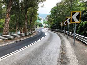
The proposed works aim to upgrading the existing
sub-standard road to a standard road. Alternative options have been considered in terms of the
following aspects:
• Alignment;
• Design;
• Construction method; and
• Construction sequence.
For alignment and design alternatives, the proposed work is
aimed to upgrade the existing sub-standard road to a standard road. The road
sections of Kam Tin Road and Lam Kam Road to be upgraded are rural roads which
are serving many existing roadside developments. To minimize the impacts to the
existing roadside developments, the proposed road alignment thus follows
closely with the existing alignment. The proposed alignment is designed
according to the principle of minimizing land resumption and environmental
impacts. Constructing a new road and/or off-line realigning road will not be
one of optimum and feasible options, especially constructing a new road, which
would incur additional land resumption and bring undesirable impacts to the
environment during and after the new road construction. Thus, it is considered
that such alternative alignment and design for the road sections of Kam Tin
Road and Lam Kam Road should not be pursued.
For construction methods and sequence of construction works
alternatives, the existing Kam Tin Road and Lam Kam Road are the main roads to
Yuen Long, Fanling and Tai Po for the residents in Kam Tin. In order to
minimize the traffic impact during implementation of Temporary Traffic
Arrangement (TTA), the upgrading of at-grade road sections is a straight forward
construction process that will not involve complicated construction sequences.
Typical work fronts of maximum 50m in length would be implemented at minimum
600m separation simultaneously along Kam Tin Road and Lam Kam Road in stages,
i.e. lane by lane. Conventional construction method of open-cut excavation
should be adopted on the upgrading works of existing rural roads in Kam Tin
area.
In view of the existing heavy traffic and potential traffic
congestion during peak hours, using this construction method, although involves
a longer construction period, less complicated scheme of traffic diversion and
less disturbance to the existing roadside developments would be expected. In
addition, the number of trees to be affected and temporary land resumption
required facilitating the temporary traffic diversion could be minimized using
this construction method. In conclusion, the above proposed construction method
and sequence of works are considered to be the most cost effective causing
least adverse impact to the traffic and public.
In addition, the following measures have also been taken to
minimise the environmental impacts.
Road section between Chainage CHB 43+90 and CHB 49+30 of
Lam Kam Road
l
Option A is to widen
the carriageway northwards to minimize encroachment of two CA zones while
Option B is to widen southwards. The sections forming the two alternative
options are reviewed and made a detailed comparison, Option A is adopted as the
preferred option. A brief summary of the assessment findings is described
below:
i. The preferred option reduced the encroachment of CA
zones, resulting in only slight encroachment of the two CA zones at south of
section from CHB 44+30 to CHB 44+80 and CHB 49+00 to CHB 49+30 of Lam Kam Road.
However, the concerned CA zones are at the woodland edge and partly shotcreted
respectively, and hence the potential impact to habitat loss/vegetation
clearance is considered to be low. Detailed ecological impact assessment is in
Section 7 of EIA study report.
ii. Apart from less CA encroachment, another advantage of
the preferred option is the need to resume relatively small area of private
land.
Road section between Chainage CHB 48+00 and CHB 48+80 of
South of Lam Kam Road
l
The southern footway
is proposed to be cut back in order to preserve the existing road side trees
thereat.
Road section between Chainage CHB 49+10 and CHB 50+20 of
Lam Kam Road
l
The preferred option
upgrades the carriageway and the footway, but the carriageway shall not follow
the existing alignment and shift northwards. Such arrangement is to minimize
the extent of CA encroachment at south of section between CHB 49+10 and CHB
50+20 of Lam Kam Road. Besides, considering that extensive geotechnical works
will be required for providing the concerned southern footway, such arrangement
can reduce waste, noise, air quality, landscape and visual impacts.
The sections of Kam Tin Road and Lam Kam Road to be
upgraded are rural roads serving many road side residence and developments.
Hence, the proposed road alignment follows closely with the existing alignment
as far as practical. In addition, the proposed road alignment is designed based
on the principle of minimising land resumption and environmental impacts. Two
options have been proposed for the upgrading works.
Among the two options proposed, Option A is selected as it
will cause less impact on local community, and involve in smaller scale
construction works, which leads to smaller environmental impact during
construction phase. Although Option A will slightly encroach on CA, the
concerned area is a paved footway with isolated trees, and hence the potential
impact to habitat loss/vegetation clearance is considered to be low.
During the course of the EIA study, comments obtained from
consultations with green groups and members of the public have been duly
revisited and were incorporated in the design and construction phases of the
Project where appropriate.
Meetings presenting the Project were held with the Rural Committee (RC) of Kam Tin and Pat
Heung in April and May 2019. The Project was also presented during the meetings
held with Traffic & Transportation Committee (T&TC) of Yuen Long District Council and
Tai Po District Council
in July 2019. Both RC and T&TC members supported the proposed
Project.