|
Pearl River Estuary
Hong Kong is situated at the mouth of the Pearl River and we have witnessed the most rapid economic development in the Pearl River Delta (PRD) in the past years. Nonetheless, increasing pollution load arising from developments and human activities have inevitably posed increasing pressure on the water environment.
| No Table Header |
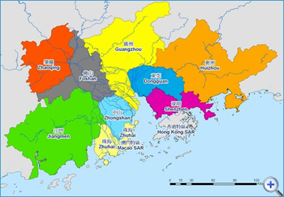 |
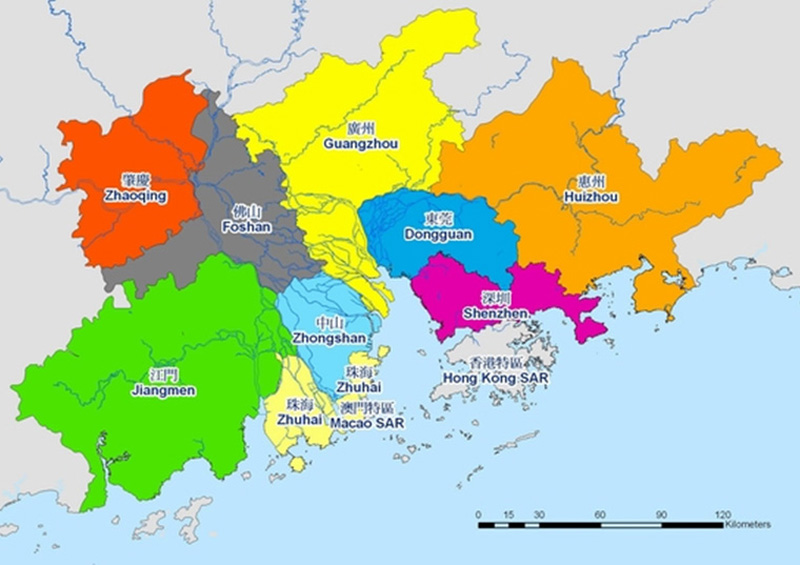
| Coverage of the Pearl River Delta |
In August 2000, the Hong Kong and Guangdong Governments jointly established the PRD Water Quality Protection Special Panel (the Special Panel) under the Hong Kong-Guangdong Joint Working Group on Sustainable Development and Environmental Protection (the Joint Working Group) to promote exchange and cooperation on the protection of the water environment in the Pearl River Estuary region.
Water Environment in the Pearl River Estuary Region
Effective management and protection of the water environment in the Pearl River Estuary region is no easy task due to its complicated natural settings and wide spatial coverage. The estuary water body comprises two main components: the river network and the coastal waters. The flow dynamics and interactions between the two water bodies are extremely complex.
First of all, fresh water gathered in the upstream catchments will pass through the complicated river network in the PRD where flows are distributed to many smaller distributaries and eventually discharged into the estuary via the 8 river outlets, namely Humen, Jiaomen, Hongqimen, Hengmen, Modaomen, Jitimen, Hutiaomen and Yamen. The discharge varies significantly from less than 4,000 cu. m/s in the dry season to 28,000 cu. m/s in the wet season. During a flood event, the peak discharge can exceed 40,000 cu. m/s.
The estuary is under the tidal influence of coastal waters. As the estuary topography is relatively flat, the tidal motion can propagate upstream into the river network and bring in saline marine water. Adding to the complexity is the strong stratification in the estuary and coastal waters, especially during the wet season, due to the large density difference between fresh river discharges and marine waters, as well as surface heating.
PRD Model
To strengthen the scientific basis for water quality management and to enhance cooperation in the region, the Special Panel jointly developed a computer water quality model for the Pearl River Estuary region (the PRD Model) in 2008. The primary objective is to construct a computer model that is capable of simulating the complicated flow distributions and water quality processes in both the river network and the coastal waters.
In the past, models were either specifically designed and built for the study of river networks (river models), or solely developed for the study of estuarine and coastal waters (estuary models). These models adopt completely different modelling approaches due to the very different nature of the river and estuary systems, and are used independently to simulate their respective areas. But in reality, the river network, the estuary and the coastal waters are inseparable units interacting dynamically with one another.
To provide a holistic understanding of the highly complex estuarine environment, a 1-dimensional river model (using computer software SOBEK) and a 3-dimensional estuary model (using computer software Delft3D) were built and joined together numerically to concurrently simulate the hydrodynamics and water quality in the river network and the coastal waters. This approach required the development of an advanced flexible coupling mechanism between the two totally different types of model, which was a pioneer attempt in the PRD.
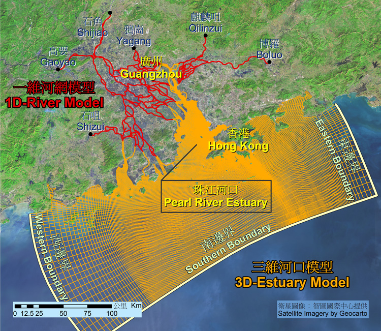
The coverage of the river model domain extends along Beijiang to Shijiao and Yagang in the north, along Dongjiang to Boluo and Qilinzui in the east, and along Xijiang and Tanjiang to Gaoyao and Shizui respectively in the west. On the other hand, the coverage of the estuary model domain extends to Zhenhai Bay in the west, to Daya Bay in the east, and covering approximately the 75m depth contour in the off-shore direction.
Both the river and estuary models are capable of simulating the transport of pollutants and various water quality processes. More than 30 water quality parameters in the water body and the sediment, e.g. salinity, temperature, suspended solids, dissolved oxygen (DO), biochemical oxygen demand (BOD) and nutrients, together with the relevant physical and biochemical processes, e.g. water re-aeration, settling of suspended solids, decay of organic matters, algal growth and nitrification, are included in the PRD Model.
The model was endorsed by a panel of experts formed by both Hong Kong and Guangdong sides. The panel reckoned that the study methodology and modelling approach adopted were state-of-the-art and the overall design reasonable. The model met high international standards, yet practical and flexible in operation. The PRD model developed is on par with the best in the world in terms of its spatial coverage, the range of water quality parameters considered, dynamic coupling of the 1-dimensional river and 3-dimensional estuary water quality models and visualisation of the modelling results. For more details, please see "Development of a Pearl River Delta Water Quality Model - Final Study Report".
Enhanced Cooperation on Water Quality Management
The Hong Kong and Guangdong governments completed a study in 2014, using the PRD model to assess the pollution load carrying capacity of the estuary under different water quality targets. The study findings indicated that the organic pollution level (in terms of Chemical Oxygen Demand) in the Pearl River Estuary met the relevant sea water quality standards with the progressive extension and improvement of sewerage infrastructure by both governments. The corresponding nutrient levels (in terms of nitrogen and phosphorus), however, do not meet the relevant standards. Both governments will continue to take forward pollution control measures to cope with future development needs and to enhance water quality management cooperation with a common objective of protecting the water quality of the estuary.
| No Table Header |
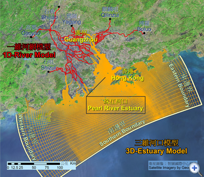 |
| Schematic layout of the PRD Model which is composed of a 1D river model (SOBEK) and a 3D estuary model (Delft3D) |
Model Simulations
To illustrate the capability of the PRD model, we have prepared two simulations below using a 3-dimensional visualisation tool to show the pollutant dispersion process in the PRD river network and the estuary due to a hypothetical continuous point source discharge within the river network.
|