9. Cultural Heritage
9.1 Introduction
This Section presents the cultural heritage impact assessment (CHIA) associated with the construction of the proposed Project. In accordance with Clause 3.4.9 of the Study Brief No. ESB-325/2019, a Marine Archaeological Investigation (MAI) including impact assessment was undertaken by the qualified marine archaeologist (Dr. William Jeffery) and the findings of the MAI are presented herein.
9.2 Legislative Requirements and Evaluation Criteria
The following legislations/standards/guidelines/requirements are applicable to the assessment of archaeological and historic resources in Hong Kong.
§ Environmental Impact Assessment Ordinance (Cap. 499) and the associated Technical Memorandum on the EIA Process (EIAO-TM);
§ Antiquities and Monuments Ordinance (Cap. 53) (AM Ordinance);
§ Hong Kong Planning Standards and Guidelines; and
§ Requirements for Marine Archaeological Investigation (MAI) (Appendix H of the EIA Study Brief).
9.2.1 Environmental Impact Assessment Ordinance (Cap 499)
Annex 10 of the EIAO-TM outlines the criteria for assessment of impact on sites of cultural heritage. The general presumption is in favour of the protection and conservation of all sites of cultural heritage. In addition, adverse impacts on sites of cultural heritage shall be kept to the absolute minimum.
Annex 19 of the EIAO-TM outlines the approaches required in investigating and assessing the impacts on sites of cultural heritage. There is no quantitative standard in deciding the relative importance of these sites, but in general, sites of unique archaeological, historical or architectural value will be considered as highly significant. Preservation in totality is preferred. If, due to site constraints and other factors, only preservation in part is possible, this must be fully justified with alternative proposals or layout designs, which confirm the impracticability of total preservation.
9.2.2 Antiquities and Monuments Ordinance (Cap 53)
The Antiquities and Monuments Ordinance (Cap. 53) (AM Ordinance) provides statutory protection against the threat of development on Declared Monuments to enable their preservation for posterity. The AM Ordinance also establishes the statutory procedures to be followed in making such a declaration.
Any person who discovers an antiquity, or supposed antiquity, is required to report the discovery to the Antiquities Authority.
9.2.3 Hong Kong Planning Standards and Guidelines (HKPSG)
The Chapter 10, Conservation, of the HKPSG provides general guidelines and measures for the conservation of historical buildings, sites of archaeological interest and other antiquities.
9.2.4 Requirements for Marine Archaeological Investigation (MAI)
Requirements for MAI provided in Appendix H of the Study Brief details the standard practice, procedures and methodology which must be undertaken in determining marine archaeological baseline and potential, presence of archaeological artefacts, evaluating the potential impact and establishing suitable mitigation measures.
9.3 Assessment Methodology
9.3.1 Introduction
The CHIA follows the criteria and guidelines in Annexes 10 and 19 of the EIAO-TM. It also follows the Requirements for MAI as stated in Appendix H of the EIA Study Brief. It should be noted that the Project is marine-based and thus potential impacts on built heritage and terrestrial archaeological resources are not anticipated. Findings of the MAI of this Project are presented in the following sections.
9.3.2 Assessment Area
As the construction works of the proposed Outer Tap Mun Fish Culture Zone (FCZ) would mainly be the assembly and anchorage of fish rafts / cages that will be carried out by the fish farmers who obtain marine fish culture licences in this new FCZ which is limited to marine area, no built heritage impact assessment and terrestrial archaeological impact assessment will be conducted for the Cultural Heritage Impact Assessment (CHIA). Therefore, the CHIA will only cover the Marine Archaeological Investigation (MAI).
The Assessment Area for the MAI includes an area to be affected by the marine works associated with the anchoring system of fish rafts/cages as shown in the Project site location in Figure 9.1.
9.3.3 Baseline Review
A baseline review was conducted to collate existing information to identify the archaeological potential and their likely character, extent, quality and value. The baseline review will focus on known sources including:
a) Civil Engineering and Development Department, Geotechnical Engineering Office – The Department holds extensive seabed survey data collected from previous geological research;
b) Marine Department, Hydrographic Office – the Department holds a substantial achieve of hydrographic data and charts;
c) The Royal Naval Hydrographic Department in the UK – the Department maintains an archive of all survey data collected by naval hydrographers;
d) Relevant Government departments such as Antiquities and Monuments Office, Environmental Protection Department etc. to obtain information on dredging history on the Project site locations; and
e) Internet and libraries sources of relevant studies.
The findings will provide historical records and more detailed geological analysis of submarine features which may have been subsequently masked by more recent sediment deposits and accumulated debris.
9.3.4 Marine Geophysical Survey
A marine geophysical survey of the proposed Outer Tap Mun FCZ was conducted and deployed high resolution boomer, side scan sonar, an echo sounder and high resolution multi beam sonar. The data received from the survey were analysed in detail to provide:
§ Exact definition of the areas of greatest archaeological potential;
§ Assessment of the depth and nature of the seabed sediments to define which areas consist of suitable material to bury and preserve archaeological material;
§ Detailed examination of survey records to map anomalies in and on the seabed which may be archaeological material; and
§ Detailed examination of the multi beam sonar data to assess the archaeological potential of the sonar contact.
9.3.5 Establishing Marine Archaeological Potential
The data examined during baseline review and marine geophysical survey data review were analysed to provide an indication of the likely character and extent of archaeological resources within the assessment area. The results are presented in below sections.
9.3.6 Further Archaeological Actions (Provisional)
Subject to the results of establishing archaeological potential, accepted marine archaeological practices could be recommended to acquire more detailed data on areas with archaeological potential that may potentially be impacted by the Project site at Outer Tap Mun. These may include further detailed marine geophysical surveys of potential areas, including Remote Operated Vehicle, visual diver survey, or employing a watching brief. If it is considered necessary, the detailed plan and scope will be agreed with AFCD, EPD and Antiquities and Monuments Office (AMO).
9.3.7 Impact Assessment and Recommendations
Based on the findings and analysis of the baseline conditions and result of the evaluation of the marine archaeological potential, an impact assessment was conducted to evaluate the potential marine impacts of the Project on marine archaeological resources / sites, and recommend necessary marine archaeological actions or mitigation measures.
9.4 Marine Archaeological Review
9.4.1 Baseline Review
9.4.1.1 Review of Historical Documents
The Assessment Area is located in the waters to the west of Tap Mun island in the Northeast New Territories which is around 55 hectares (1,630 m long and 330 m wide) in size and lies in between two land masses, Tai Leng Tun and Grass Island (Tap Mun). The closest Site of Archaeological Interest (SAI) (Hoi Ha SAI) is located over 2.5 km at the west of the assessment area, where prehistoric pottery sherds, stone implements and ceramic sherds of Tang, Ming and Qing periods were found. Moreover, lime kilns of Qing period (AFCD, 2020) and stone-built track road which its historical dating was to be ascertained, (AMO, 2012a) had also been found (B.A.V.Peacock & T.J.P.Nixon, 1986).
According to a tablet in the Tin Hau Temple on Tap Mun, Tap Mun was registered under the administration of the Dongguan County, as part of Mirs Bay, before 1573. By the late 17th century, Tanka fishermen began to use the anchorage and started fishery around the nearby waters. They were later granted the topsoil right of the entire island in the mid-18th century by the Magistrate and Prefect of the Dongguan County Court. (Faure, Luk, Ng, 1986) By the time of British colonial rule, the topsoil holder's interest in the land passed to the village ancestral trust of the Tanka (Hase, 2013).
Besides, Hakka started moving into southern China after the Mongol invasions of the Song dynasty. Although they were often associated with stonemasonry, farming and building rather than seafaring and maritime trade, they also engaged in fishing and made their principal routes to market for their products by sea, due to the very basic and steep unpaved paths that connected Hakka villages until late in the 20th century (ARUP, 2020).
Sea bandits and pirates were a periodic scourge especially in the years 1790-1810 when large piratical fleets caused havoc in the Pearl River Delta. Coastal dwellers themselves were not above resorting to piracy or receiving stolen goods. The region was also notorious for its inter lineage and inter village wars, sometimes conducted along ethnic lines. In the late 19th century the coastal regions of the new territories had long acquired a reputation for unruliness (ARUP, 2020).
The maritime history of the coastal Hakka villages of the New Territories is not widely explored but it is evident that fishing and maritime transport plus maritime deities like Tin Hau (Matsui) were an essential part of the culture and economy of village life and formed the links with neighbouring villages and the wider economy and official administration cantered around Shenzhen (ARUP, 2020).
The Project site has been identified as being within a nursey ground of commercial fisheries resources, which is located in an area with a water depth of -10mPD to -15mPD. Hoi Ha Wan, an SSSI (Site of Special Scientific Interest) established in 1989 (Morton B, 1996) owning to the high coral coverage and designated as a Marine Park in 1996 (AFCD, 2020), is located over 750m west of Outer Tap Mun FCZ. Sai Kung West Country Park is also located over 750 m to the west of Outer Tap Mun FCZ (EGS, 2021).
9.4.1.2 Geological Conditions
The solid geology of the Assessment Area consists of Hang Hau Formation with shallow marine sediments comprising beach sand, intertidal (mud and sand) and estuarine deposits (mud, clayey silt and sand). Onshore geology in the vicinity of Outer Tap Mun belongs to Long Harbour Formation comprising coarse ash crystal tuff with distinctive pink alkali feldspar crystals (EGS, 2021).
9.4.1.3 Review of Charts
A review of admiralty charts covering the Assessment Area did not identify any sites of potential marine archaeological interest. Chart number 2593 “Hong Kong to Mirs Bay” from the United States Hydrographic Office was compiled from British surveys until 1906, and no sites / shipwrecks were found to be in the Assessment Area.
9.4.1.4 United Kingdom Hydrographic Office ‘Wreck’ Files
The United Kingdom Hydrographic Office in Taunton maintains a database of known shipwrecks / undefined sites in the HKSAR. This is the same data held by the Hong Kong Marine Department, Hydrographic Office. The review showed that no wrecks were found to be within the MAI Assessment Area.
9.4.1.5 Summary of Marine Archaeological Potential
Based on the historical review, the human activities have occurred since Neolithic period around the area as prehistoric pottery sherds were found on Hoi Ha SAI. The Track Road also demonstrates connection of Hoi Ha with neighbouring villages in the past. Evidence shows that fishing and maritime transport associated with the old villages has been the major maritime activities at the adjacent area. While on this basis the waters of the Assessment Area may have marine archaeological potential, no shipwrecks of marine archaeological potential could be identified from the Charts and the Wreck Databases.
9.4.2 Marine Geophysical Survey Result
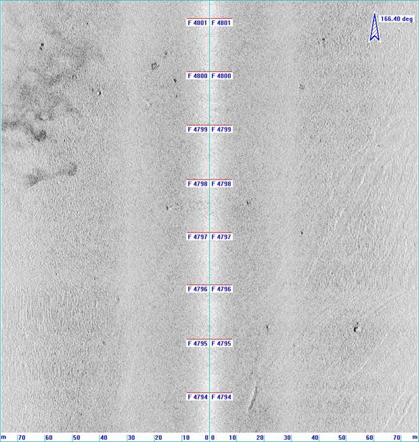
A marine geophysical survey as part of the site investigations of the Project was conducted on 3rd and 4th March 2021 to study the seabed features and to locate anomalous features in the surveyed area. The survey covered the areas to be affected by marine works associated with the anchoring system of fish rafts. The survey findings were processed by the geophysicists and reviewed by the qualified marine archaeologist, Dr William Jeffery, and cultural heritage specialist, Ms Peggy Wong. Figure 9.1 shows the marine geophysical survey coverage. The survey track plots are shown in Appendix 9A. Details of survey types with objectives and survey spacing are shown in Table 9.1, and the equipment list is shown in Table 9.2.
The seabed is primarily covered with fine sediment consist of silty mud and numerous seabed scars including anchor scar, trawling scars and pockmarks (see Figure 9.2). A rock outcrop is observed in the southern end. An example is illustrated in Figure 9.3.
Review of the survey findings identified 27 sonar contacts (B-SC001 to B-SC027). They are located at a range of water depth from 15 m to 16.7 m and their dimensions are shown in Table 9.3. With the exception of B-SC011 which is identified as an unknown object and B-SC021 which is identified as a linear object, the majority of the sonar contacts are interpreted to be debris. Given Sonar Contact B-SC001 shows an interesting 3D signature, it may be of marine archaeological potential. For the remaining sonar contacts, due to their random placement, the diminished intensity of the sonar contacts, small in size, irregular shape, and lack of a shadow to indicate they have some elevation, they have been interpreted as natural material and of no marine archaeological potential. Their locations are shown in Figure 9.1 and the sonar contact images are illustrated in Appendix 9B. No sub-bottom anomalies of marine archaeology potential were observed.
Table 9.1 Survey Types with Objectives and Survey Spacing
|
Survey Type |
Objective |
Survey Spacing |
|
Multi-beam echo sounding (MBES) |
To provide detailed seabed level variations |
50m, infill lines in shallow areas |
|
Single beam echo sounding (SBES) |
For cross check of MBES data |
50m, infill lines in shallow areas |
|
Side scan sonar (SSS) |
To locate anomalous features and map sediment types on the seabed |
50m, infill lines along the coast |
|
Seismic sub-bottom profiling (SBP) |
To identify sub-bottom features and stratigraphy |
50m x 200m grid |
Table 9.2 Equipment List
|
Type |
Equipment |
|
Survey Vessel |
Class II licenced survey vessel Wing Hung 2 |
|
Horizontal positioning |
C-Nav Globally Corrected Global Positioning System (GcGPS) Model 3050M |
|
Single beam echo sounding |
Knudsen 320M dual frequency Single-beam Echo Sounder |
|
TSS 320B Motion Sensor |
|
|
Multi-beam echo sounding |
R2Sonic SONIC2024 Multi-beam Echo Sounder |
|
Side scan sonar |
EdgeTech 4200 (100kHz & 400kHz) |
|
Seismic sub-bottom profile |
C-Boom Low Voltage high-resolution Boomer system |
|
C-Phone hydrophone system |
|
|
Software |
C-Nav computerized navigation suite |
|
C-View digital recording and processing system |
|
|
|
3-D seismic interpretation environment |
|
Others |
A/C generators, computers and bar check equipment |
Table 9.3 Sonar Contact Summary Table
|
Contact number |
Latitude Longitude |
Easting Northing |
Water depth (m) |
Dimensions (m) |
Description |
|
B-SC001 |
22° 28.531' N 114° 21.088' E |
854235.7E 837342.0N |
15 |
1.9x0.8x0.6 |
Debris |
|
B-SC002 |
22° 28.472' N 114° 20.972' E |
854036.7E 837232.4N |
15.3 |
1.1x1.1x<0.5 |
Debris |
|
B-SC003 |
22° 28.314' N 114° 21.154' E |
854350.5E 836941.6N |
15 |
3.7x1.6x<0.5 |
Debris |
|
B-SC004 |
22° 28.201' N 114° 21.221' E |
854465.3E 836733.5N |
15 |
2x1x<0.5 |
Debris |
|
B-SC005 |
22° 28.138' N 114° 21.166' E |
854370.1E 836616.7N |
15.2 |
3.1x0.9x<0.5 |
Debris |
|
B-SC006 |
22° 28.123' N 114° 21.183' E |
854400.5E 836588.4N |
15.1 |
0.7x0.5xnmh |
Debris |
|
B-SC007 |
22° 28.096' N 114° 21.159' E |
854358.3E 836539.3N |
14.8 |
2.9x1.3x0.7 |
Debris |
|
B-SC008 |
22° 28.105' N 114° 21.230' E |
854481.0E 836555.4N |
15.3 |
1.3x0.6xnmh |
Debris |
|
B-SC009 |
22° 28.103' N 114° 21.236' E |
854491.6E 836552.0N |
15.3 |
1.2x0.6xnmh |
Debris |
|
B-SC010 |
22° 28.100' N 114° 21.216' E |
854455.8E 836546.6N |
15.3 |
1.8x0.7x<0.5 |
Debris |
|
B-SC011 |
22° 28.098' N 114° 21.221' E |
854464.5E 836542.7N |
15.4 |
1.8x1.3xnmh |
Unknown object |
|
B-SC012 |
22° 28.085' N 114° 21.230' E |
854480.9E 836519.7N |
15.3 |
1.5x0.8x<0.5 |
Debris |
|
B-SC013 |
22° 28.071' N 114° 21.163' E |
854366.0E 836492.4N |
15.4 |
1.5x1.5x<0.5 |
Debris |
|
B-SC014 |
22° 28.061' N 114° 21.203' E |
854434.2E 836474.0N |
15.4 |
0.9x0.5xnmh |
Debris |
|
B-SC015 |
22° 28.047' N 114° 21.209' E |
854444.7E 836448.8N |
15.4 |
2.3x1.3x<0.5 |
Debris |
|
B-SC016 |
22° 28.040' N 114° 21.233' E |
854486.7E 836437.0N |
15.4 |
0.8x0.5xnmh |
Debris |
|
B-SC017 |
22° 28.035' N 114° 21.240' E |
854498.5E 836427.2N |
15.3 |
0.7x<0.5x<0.5 |
Debris |
|
B-SC018 |
22° 28.023' N 114° 21.152' E |
854347.0E 836404.5N |
15.3 |
1.5x1.5x<0.5 |
Debris |
|
B-SC019 |
22° 28.018' N 114° 21.134' E |
854316.5E 836395.1N |
15.3 |
1.4x0.5x<0.5 |
Debris |
|
B-SC020 |
22° 28.004' N 114° 21.120' E |
854292.0E 836368.9N |
15.4 |
2.2x0.6x<0.5 |
Debris |
|
B-SC021 |
22° 27.988' N 114° 21.131' E |
854310.9E 836340.0N |
15.5 |
5.5x1.7x<0.5 |
Linear object |
|
B-SC022 |
22° 27.948' N 114° 21.141' E |
854327.4E 836267.0N |
16 |
2.7x1.7x<0.5 |
Debris |
|
B-SC023 |
22° 27.994' N 114° 21.223' E |
854469.6E 836350.5N |
16.1 |
1x0.5xnmh |
Debris |
|
B-SC024 |
22° 27.968' N 114° 21.227' E |
854476.1E 836303.2N |
16.2 |
2.2x0.8x<0.5 |
Debris |
|
B-SC025 |
22° 27.945' N 114° 21.248' E |
854511.4E 836261.0N |
16.7 |
3x2x<0.5 |
Debris |
|
B-SC026 |
22° 27.914' N 114° 21.233' E |
854485.5E 836203.7N |
16.7 |
2.5x1.0x<0.5 |
Debris |
|
B-SC027 |
22° 27.890' N 114° 21.215' E |
854454.7E 836158.8N |
16.6 |
2.1x1.3x<0.5 |
Debris |
Figure 9.2 Example of Side Scan Sonar (SSS) Rectified Image Showing Pockmarks, Trawling Scars and an Anchor Scar and Fine Sediment Seabed
|
|

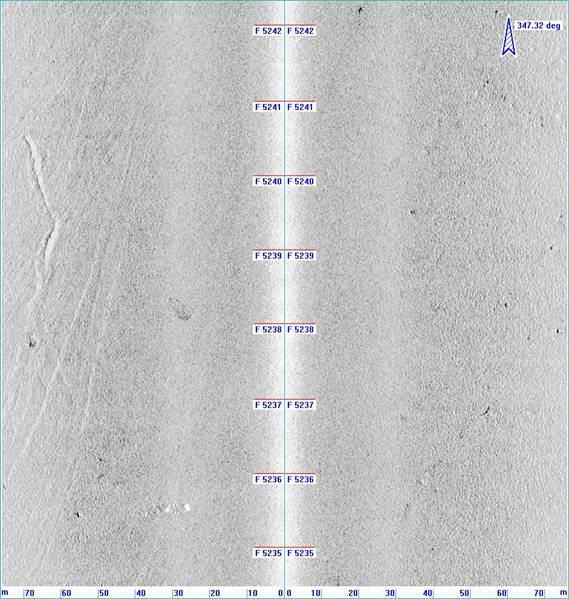
Figure 9.3 SSS Rectified Image showing Sonar Contacts and Various Types of Seabed Features
|
|

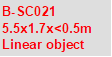


Figure 9.4 SSS Rectified Image showing Sonar Contacts B-SC001
|
|
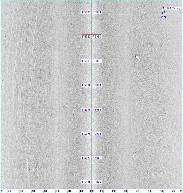
Figure 9.5 SSS Rectified Image showing Sonar Contacts B-SC005, B-SC006, B-SC008 to B-SC011
|
|
9.4.3 Establishment of Marine Archaeological Potential
There are 27 sonar contacts (B-SC001 to B-SC027) identified in the Assessment Area, majority of them are interpreted as debris without archaeological potential, except B-SC011 and B-SC021 which are identified as unknown object and linear object respectively. Sonar Contact B-SC001 shows an interesting 3D signature, and therefore is potentially of marine archaeological interest (See Figure 9.4). Nevertheless, because of the muddy/silty seabed, objects such as cannon would sink into the seabed, the three sonar contact are most likely to be modern, recently deposited objects that would not be of high archaeological potential. There are no wrecks / obstructions found in the UKHO Wrecks database in the MAI Assessment Area. No other features of archaeological interest were observed in the area.
No sub-bottom anomalies of marine archaeology potential were observed.
9.5 Potential Sources of Impact
The construction works of the proposed Outer Tap Mun FCZ, would mainly be on-site assembly and anchorage of fish rafts/cages that will be carried out by the fish farmers who obtain marine fish culture licences in this new FCZ. Maintenance dredging or removal of sediments is not anticipated during FCZ operation under the Project.
Potential impacts arising from these activities include:
n Direct loss of potential marine archaeological deposits due to seabed disturbance works during anchorage of the fish rafts/cages;
n Indirect impact on access for future archaeological surveys; and
n Permanent access disturbance to marine archaeological deposits if they are found to be within the Project Area.
9.6 Impact Assessment
The desktop review found no sites of archaeological interest, declared monuments, proposed monuments, graded historic sites/buildings/structures, and Government historic sites identified by the AMO fall within the Assessment Area. No construction phase and operation phase impact to these cultural heritage resources is anticipated. However, 27 sonar contacts were identified from marine geophysical survey. Their impact assessment is discussed below.
9.6.1 Construction Phase
The construction of fish rafts / cages will simply involve the use of tug boats to tow the main part of the fish rafts / cages to within the Project site, and to be assembled and anchored therein. No major marine construction works, such as dredging or works with significant seabed disturbance, is expected. The fish rafts / cages will generally be gravity cages and the four corners of each cage will be anchored using weights and ropes and it is expected that the seabed to be disturbed by anchoring will be confined to a thin vertical surface layer (<0.5 m), and <2 m horizontally. Geophysical survey identified 27 sonar contacts (B-SC001 to B-SC027) located in Assessment Area as in Figure 9.1, majority of them are interpreted as debris without archaeological potential, except B-SC011 and B-SC021 that are identified as unknown object and linear object respectively, and B-SC001 (See Figure 9.5). Nevertheless, because of the muddy / silty seabed, objects such as cannon would sink into the seabed, the three sonar contact are most likely to be modern, recently deposited objects that would not be of high archaeological potential. Potential direct impact on these three sonar contacts that may be of marine archaeological potential due to the construction work of fish rafts / cages is possible.
Although potential impact to sonar contacts B-SC002 to B-SC010, and B-SC012 to B-SC020, and B SC-022 to B-SC027 is possible, they are of no marine archaeological potential.
9.6.2 Operation Phase
Potential direct impact on sonar contacts B-SC001, B-SC011 and B-SC021 during operation phase of the Project is possible.
Although potential impact to sonar contacts B-SC002 to B-SC010, and B-SC012 to B-SC020, and B SC-022 to B-SC027 is possible, they are of no marine archaeological potential.
9.7 Mitigation Measures
As no impacts to sites of archaeological interest, declared monuments, proposed monuments, graded historic sites/buildings/structures and Government historic sites identified by AMO are expected, no construction phase and operation phase mitigation measure for terrestrial cultural heritage is required. Also, Sonar contacts B-SC002 to B-SC010, and B-SC012 to B-SC020, and B SC-022 to B-SC027 are regarded as of no marine archaeological potential. No construction phase and operation phase mitigation measures is required for these sonar contacts. However, the mitigation measures recommended for sonar contact B-SC001, B-SC011 and B-SC021 are discussed below.
9.7.1 Construction Phase
According to Annex 10 of EIAO-TM, the general presumption is in favour of the protection and conservation of all sites of cultural heritage, the potential direct impact on 3 sonar contacts (B-SC001, B-SC011 and B-SC021) that may have archaeological potential will be avoided by isolating it with a 20 m radius buffer area from any tug boat anchoring and anchoring of the fish rafts/cages as shown in Figure 9.1. The locations and relocations of fish rafts/cages are regulated by the Marine Fish Culture Ordinance (Cap. 353), and AFCD will ensure the locations of anchoring of vessels and fish rafts/cages will not be located within the buffer area. Site inspections on a regular basis by the Environmental Team are recommended to check if any seabed disturbance work is conducted in the buffer area.
9.7.2 Operation Phase
The buffer area as shown in Figure 9.1 with 20 m radius from sonar contacts B-SC001, B-SC011, and B-SC021 should be implemented during operation phase of the Project. AFCD will maintain the record of the buffer area and the locations of the fish rafts/cages. The locations and relocations of fish rafts/cages are regulated by the Marine Fish Culture Ordinance (Cap. 353), and AFCD will ensure the locations of anchoring of vessels and fish rafts / cages will not be located within the buffer area. AFCD will conduct regular site inspections to check if any seabed disturbance work is conducted in the buffer area.
9.8 Cumulative Impacts
At present, there are no planned projects within the Assessment Area that could have cumulative cultural heritage impacts with the proposed Project. No cumulative impact or adverse residual impacts on marine archaeological resources are expected.
9.9 Conclusion
The desktop review supplemented with the results of marine geophysical survey conducted for the Project identified 3 sonar contacts (B-SC001, B-SC011 and B-SC021) within the Project Area boundary that may be of marine archaeological potential. Nevertheless, because of the muddy/silty seabed, objects such as cannon would sink into the seabed, the three sonar contact are most likely to be modern, recently deposited objects that would not be of high archaeological potential. A buffer area with 20 m radius from each of the 3 sonar contacts (B-SC001, B-SC011, and B-SC021) is recommended to avoid any tug boat anchoring and anchoring of the fish rafts/cages in the areas so as to avoid any impact to them during construction and operation phases of the Project. The locations and relocations of fish rafts/cages are regulated by the Marine Fish Culture Ordinance (Cap. 353), and AFCD will ensure the locations of anchoring of vessels and fish rafts/cages will not be located within the buffer area. Site inspections on a regular basis by the Environmental Team are recommended to check if any seabed disturbance work is conducted in the buffer area during construction phase of the Project. AFCD will conduct regular inspections to check if any seabed disturbance work is conducted in the buffer area during operation phase of the Project.
9.10 Bibliography
9.10.1 English
AFCD, 2020, Designate Marine Parks and Marine Reserves. From AFCD web site.
AMO, 2012a, Heritage Hong Kong e-Newsletter 2012. From AMO web site.
AMO, 2012b, Sites of Archaeological Interest in Hong Kong (as at Nov 2012). From AMO web site.
EGS, 2021, Marine Geophysical Survey for Fish Culture Zone EIA Study: Site B – Outer Tap Mun - Preliminary Report. March 2021.
Faure, David; Luk, Bernard; Ng, Alice (1986). The Historical Inscriptions of Hong Kong. Urban Council of Hong Kong. pp. 27–28
Hase, Patrick (1 April 2013). Custom, Land and Livelihood in Rural South China: The Traditional Land Law of Hong Kong's New Territories, 1750-1950. Hong Kong University Press. p. 40.
Morton B (1996) The Marine Biology of the South China Sea III. Proceedings of the Third International Conference on the Marine Biology of the South China Sea. Hong Kong University Press.
Ove Arup & Partners Limited (ARUP), 2020, Pier Improvement at Lai Chi Wo – Environment Impact Assessment Report for Civil Engineering and Development Department, Hong Kong.
Peacock, B.A.V and Nixon, T.J.P (1986), Report of the Hong Kong Archaeological Survey Volume III Part II & Volume IV Part I, Hong Kong Heritage Discovery Centre Library
9.10.2 Chart
Chart number 2593 “Hong Kong to Mirs Bay” from the United States Hydrographic Office was compiled from British surveys until 1906