Liquefied Natural Gas (LNG) Receiving Terminal and Associated Facilities
EIA Report - Introduction
Table of Contents
Chapter
Title
1.
Introduction
2.
The need for a LNG Receiving Terminal in Hong Kong
3.
What is Required to Bring LNG to Hong Kong
4.
Identification of Alternative Site Locations
FIGURE
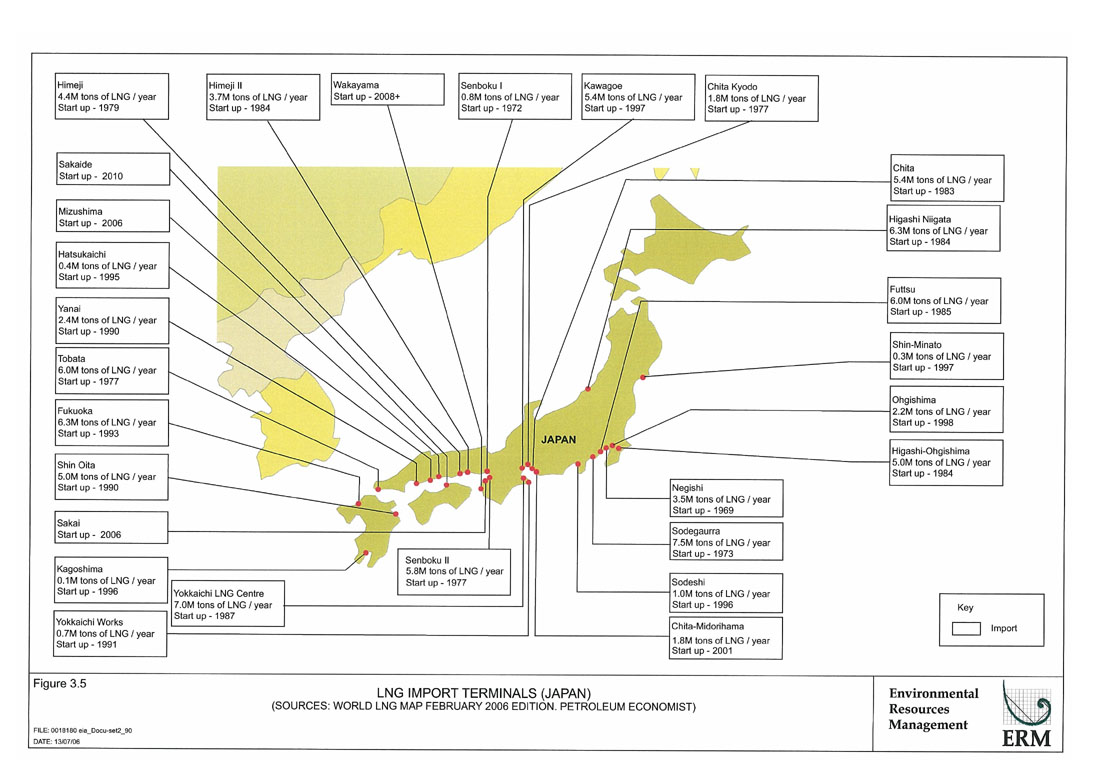
Figure 3.5
LNG Import Terminals (JAPAN)
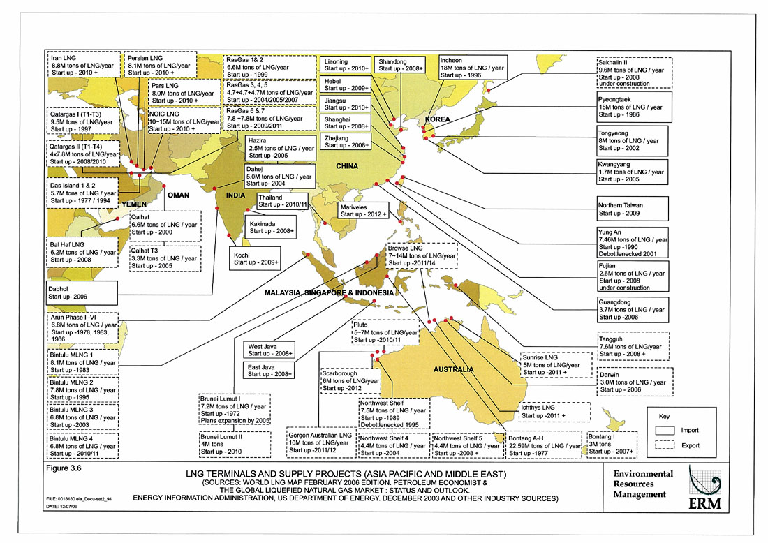
Figure 3.6
LNG Terminals and Supply Projects (Asia Pacific and Middle East)
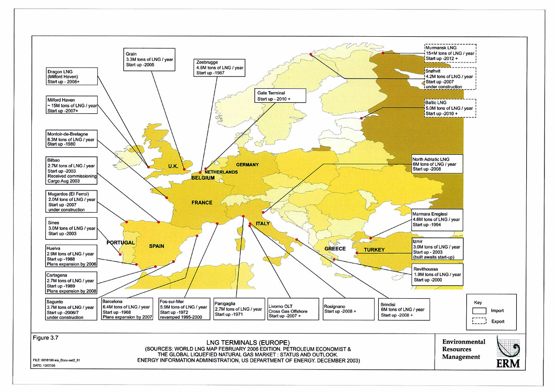
Figure 3.7
LNG Terminals (EUROPE)
Figure 3.8
LNG Terminals (North & Central Americas)
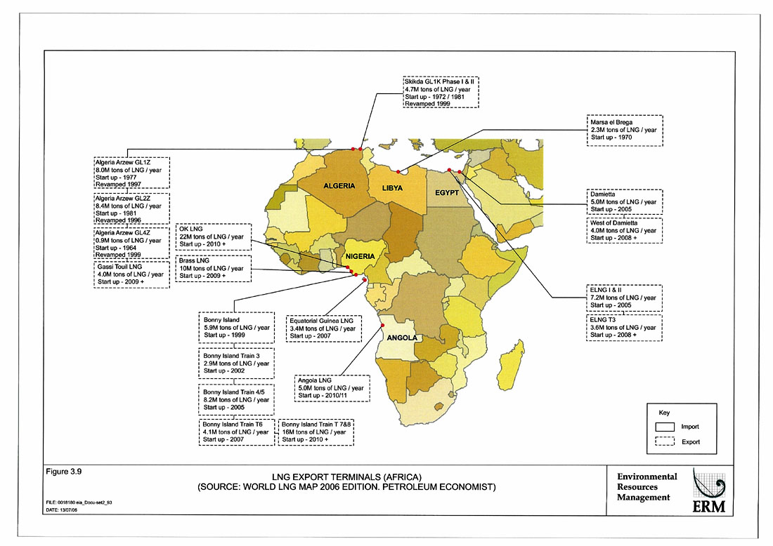
Figure 3.9
LNG Export Terminals (Africa)
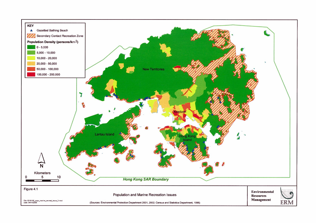
Figure 4.1
Population and Marine Recreation Issues
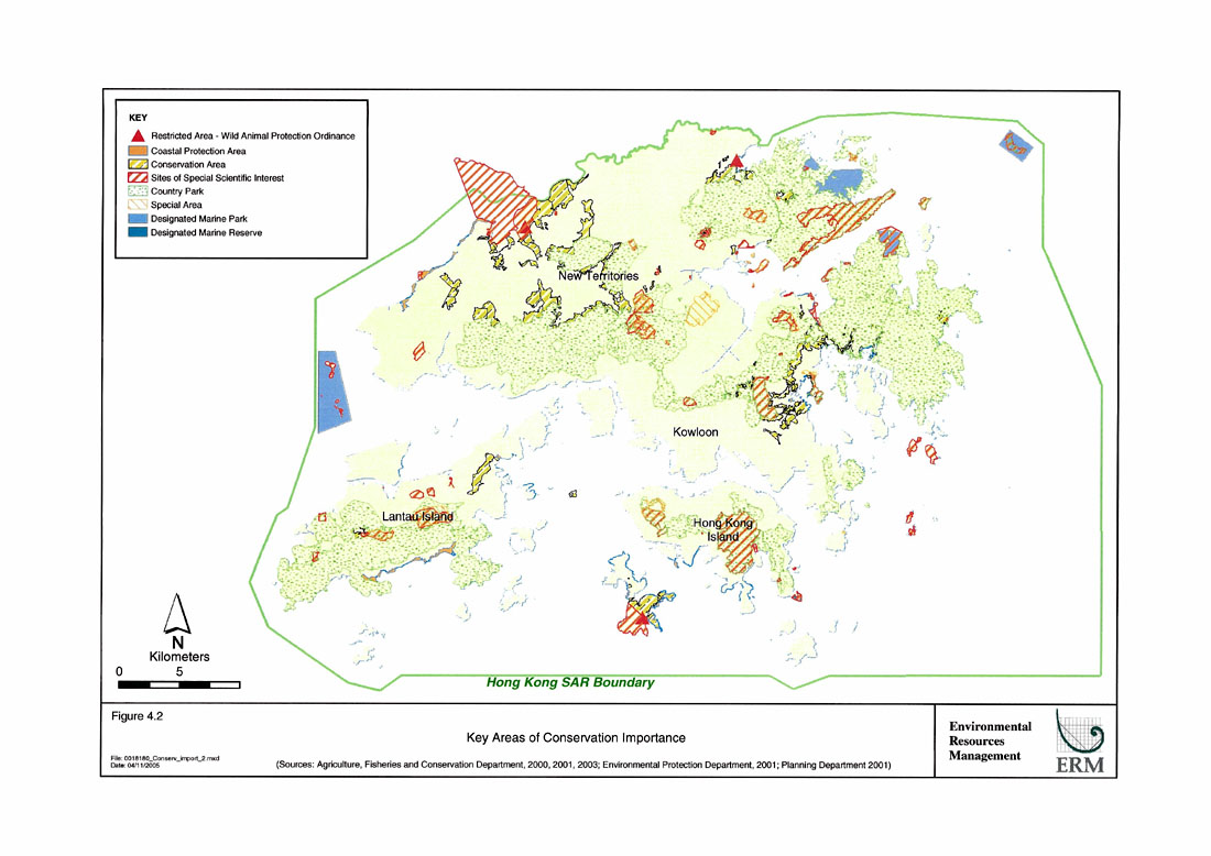
Figure 4.2
Key Areas of Conservation Importance
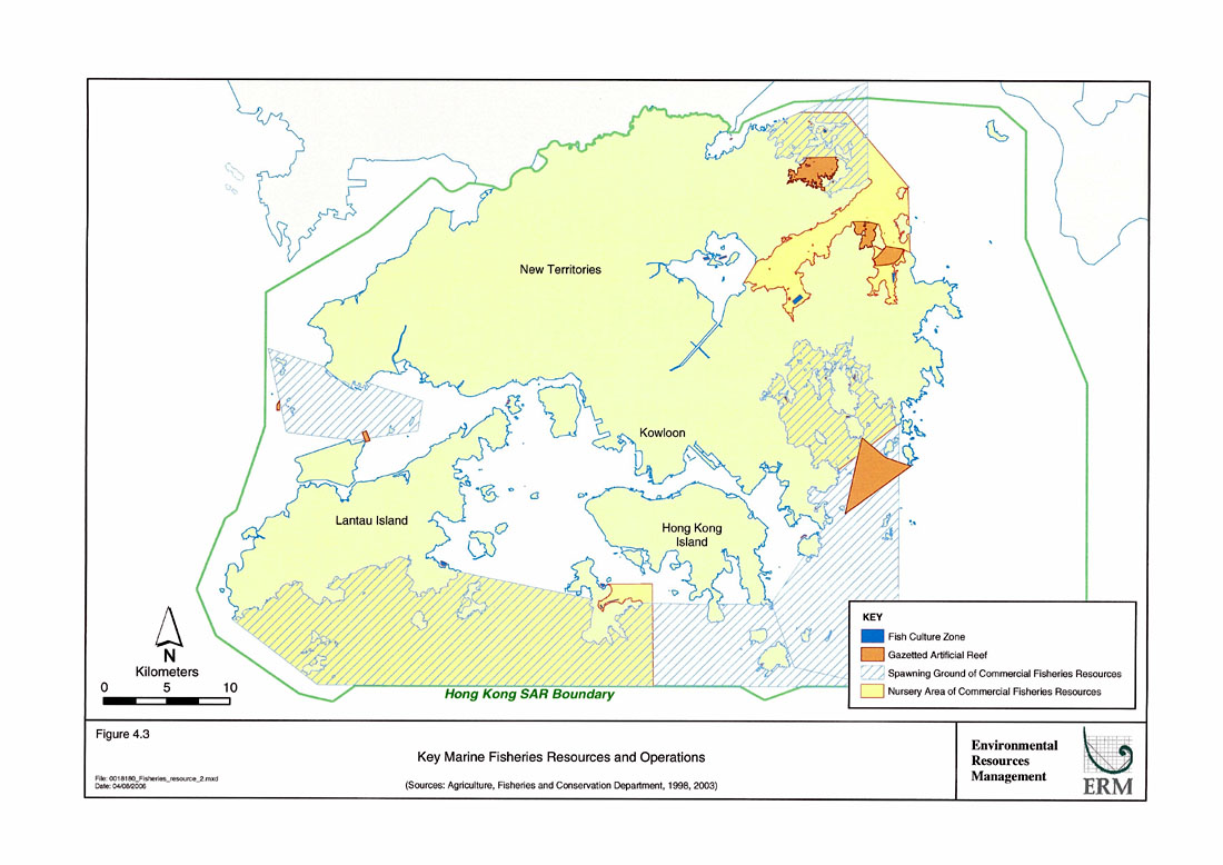
Figure 4.3
Key Marine Fisheries Resources and Operations
Figure 4.4
Key Marine Ecological Resources
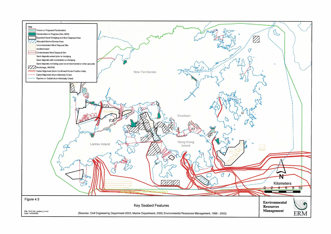
Figure 4.5
Key Seabed Features
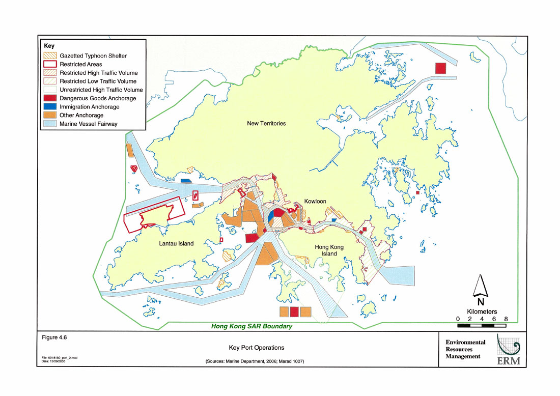
Figure 4.6
Key Port Operations
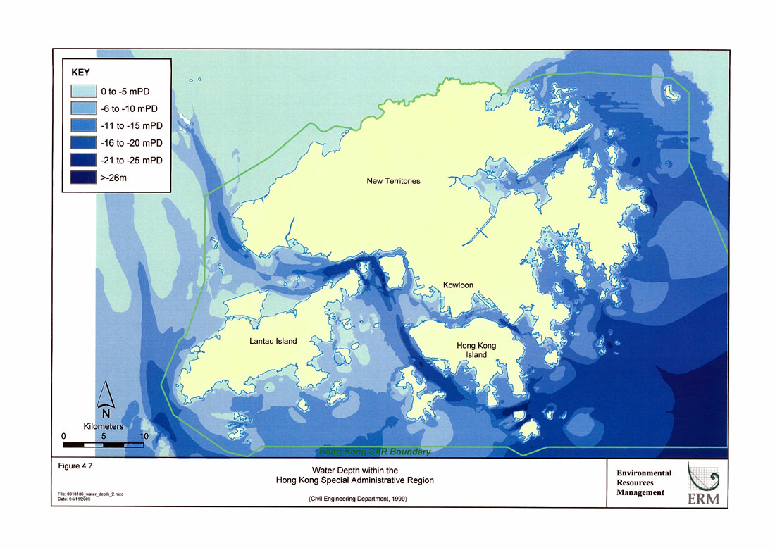
Figure 4.7
Water Depth within the Hong Kong Special Administrative Region
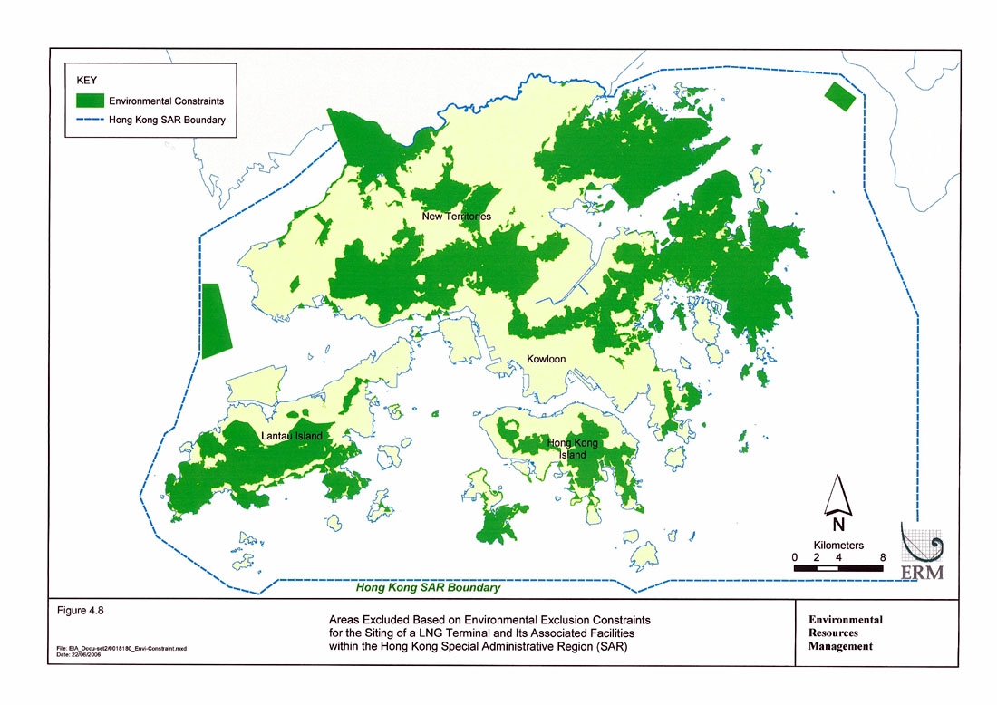
Figure 4.8
Areas Excluded Based on Environmental Exclusion Constraints for Siting of a LNG Terminal and Its Associated Facilities within the Hong Kong Special Administrative Region (SAR)
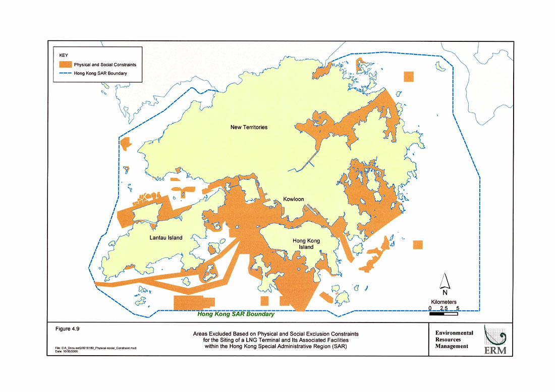
Figure 4.9
Areas Excluded Based on Physical and Social Exclusion Constraints for the Siting of a LNG Terminal and Its Associated Facilities within the Hong Kong Special Administrative Region (SAR)
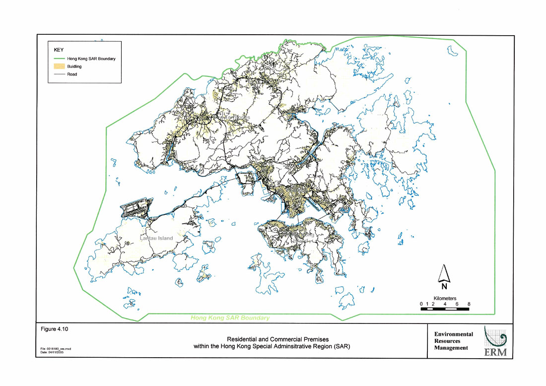
Figure 4.10
Residential and Commercial Premises within the Hong Kong Special Administrative Region (SAR)
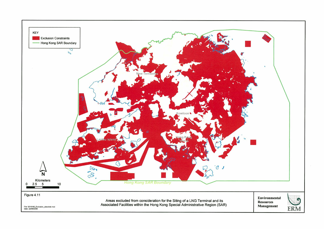
Figure 4.11
Areas excluded from consideration for the Siting of a LNG Terminal and its Associated Facilities within the Hong Kong Special Administrative Region (SAR)
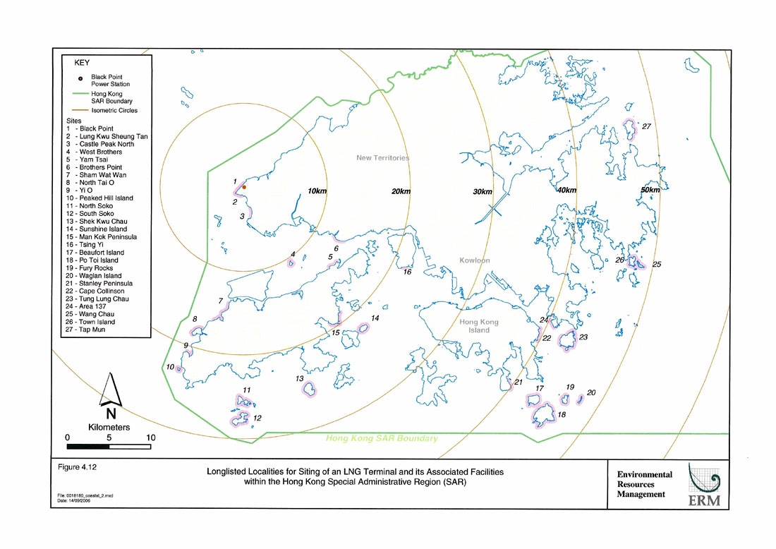
Figure 4.12
Longlisted Localities for Siting of an LNG Terminal and its Associated Facilities within the Hong Kong Special Administrative Region (SAR)
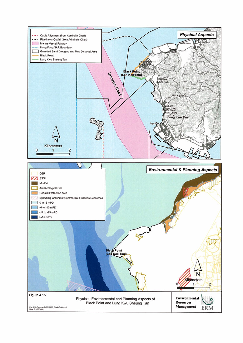
Figure 4.15
Physical, Environmental and Planning Aspects of Black Point and Lung Kwu Sheung Tan
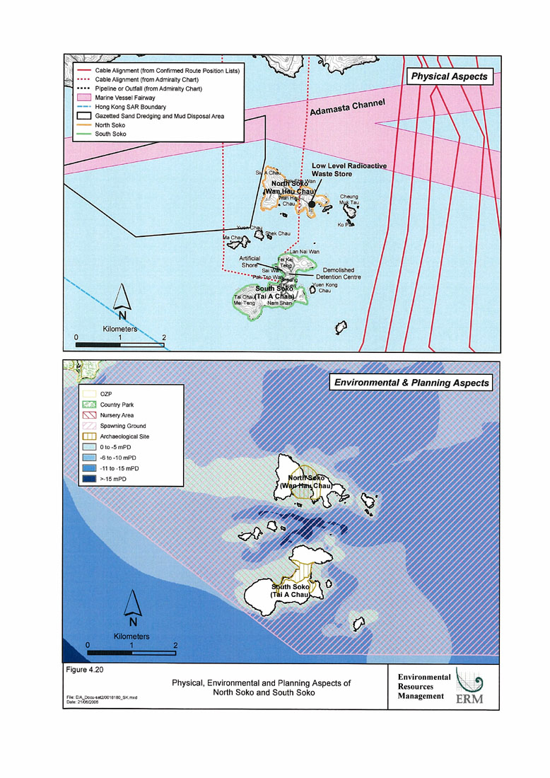
Figure 4.20
Physical, Environmental and Planning Aspects of North Soko and South Soko
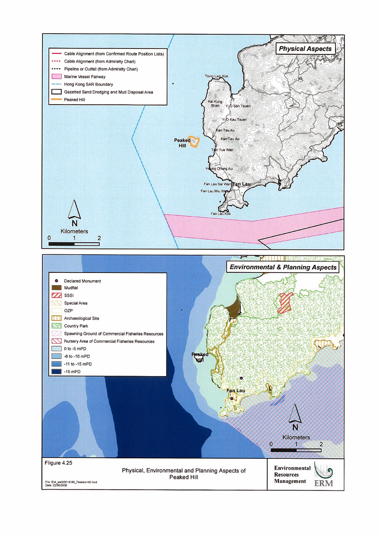
Figure 4.25
Physical, Environmental and Planning Aspects of Peaked Hill
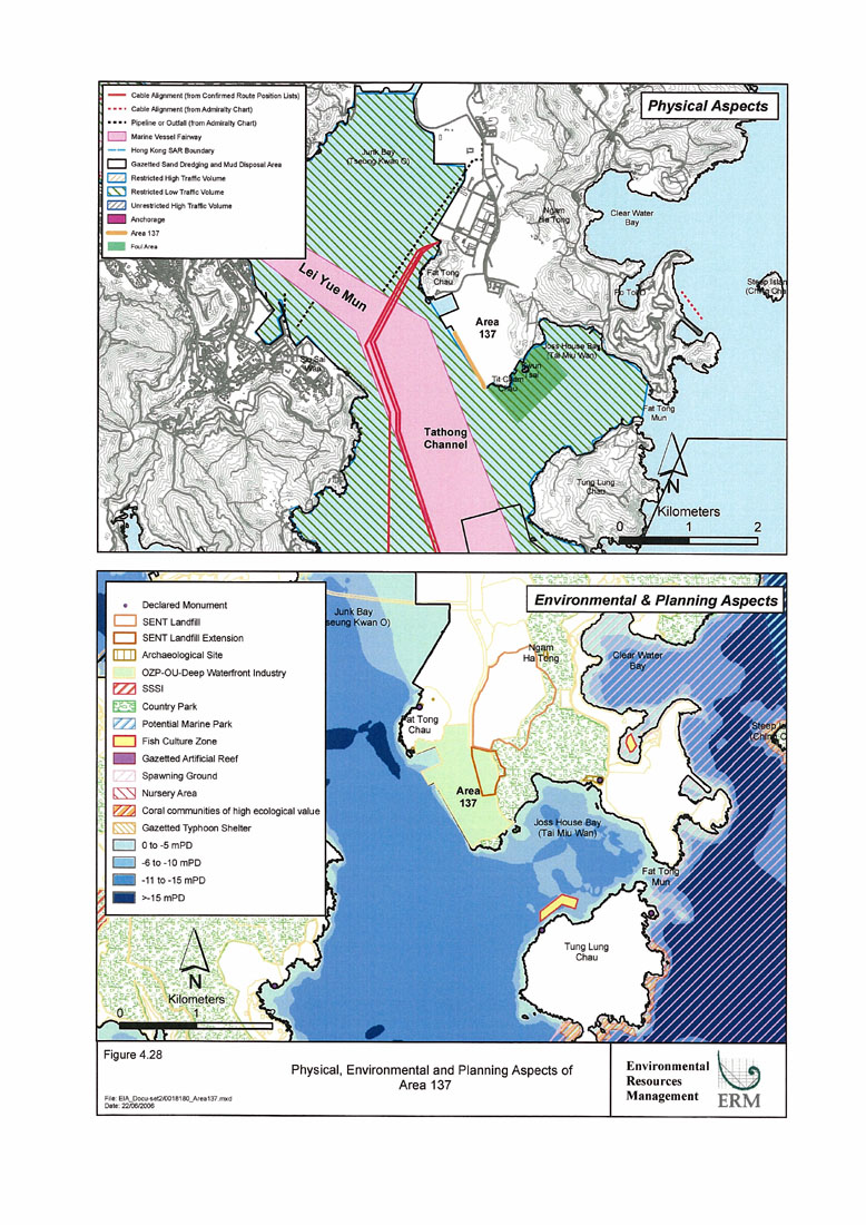
Figure 4.28
Physical, Environmental and Planning Aspects of Area 137
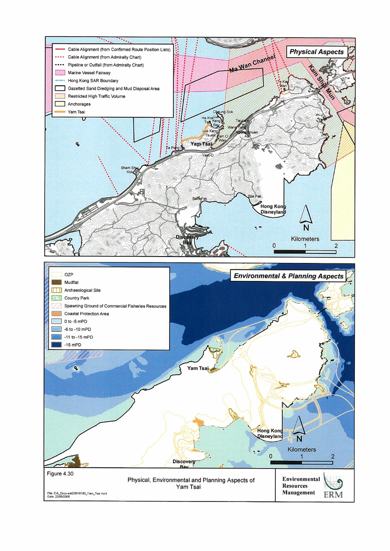
Figure 4.30
Physical, Environmental and Planning Aspects of Yam Tsai
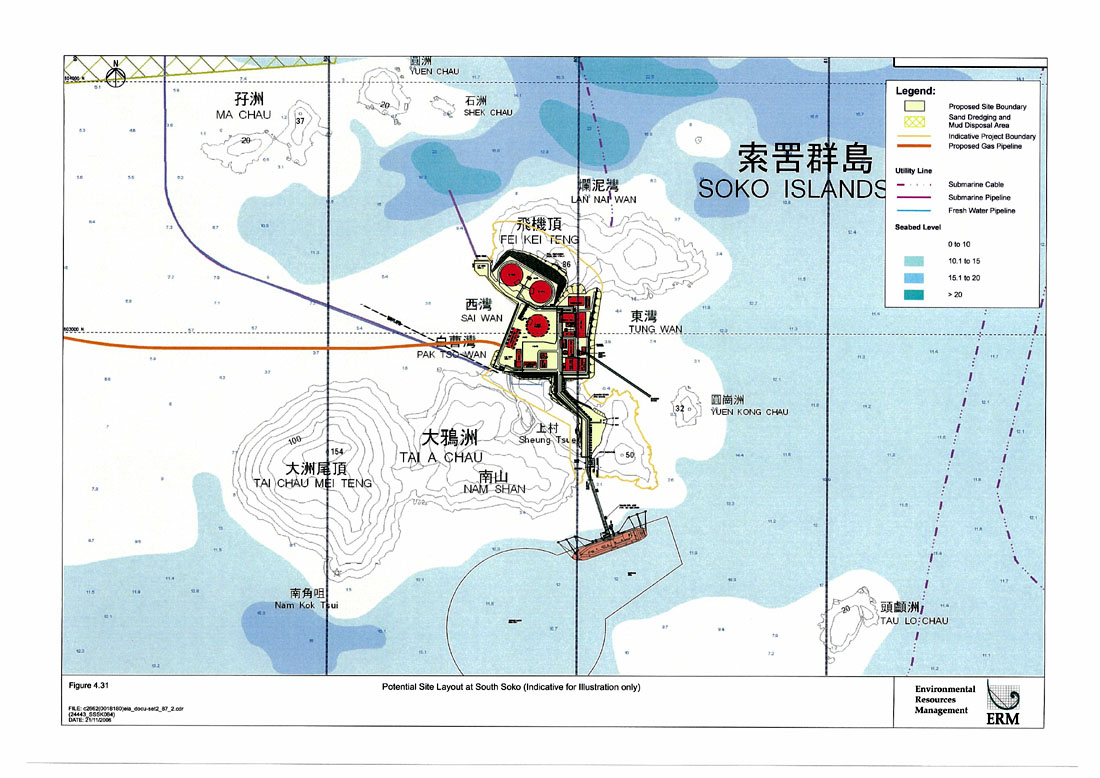
Figure 4.31
Potential Site Layout at South Soko
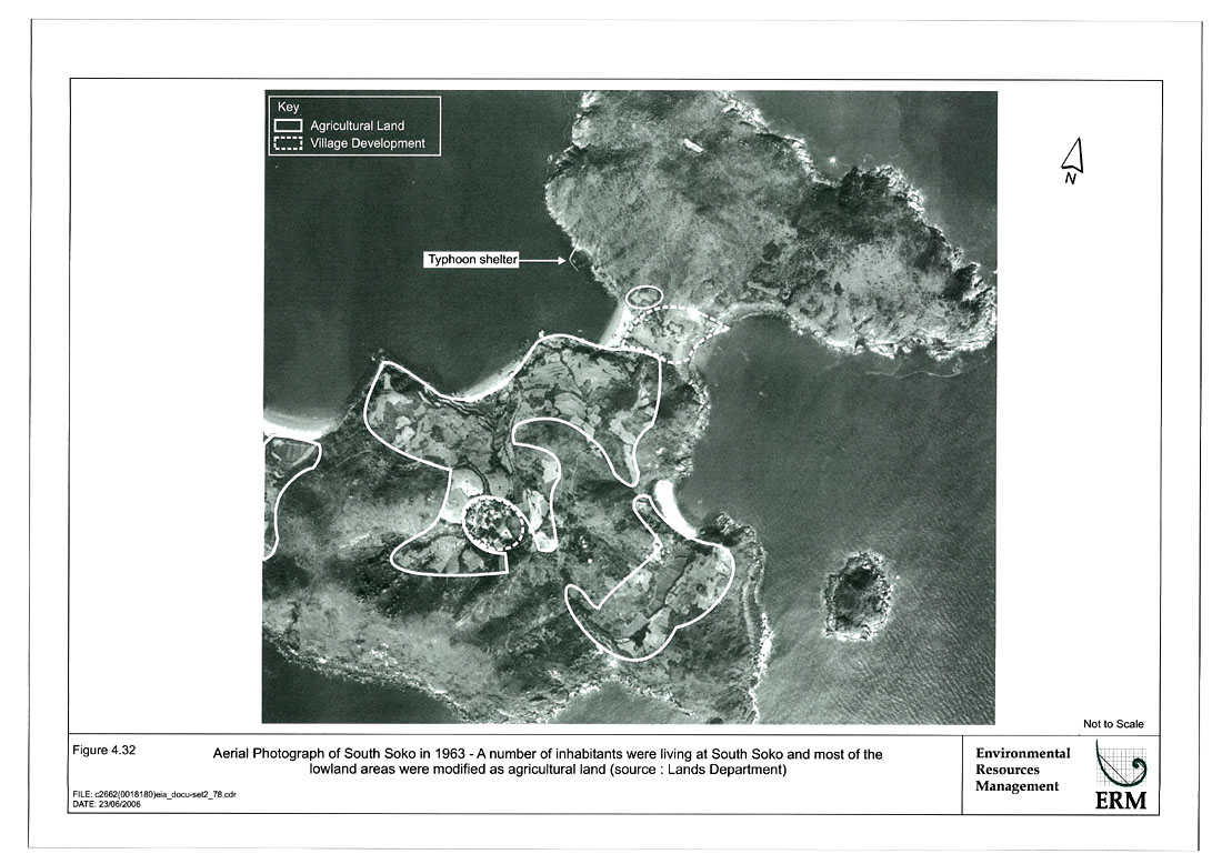
Figure 4.32
Aerial Photograph of South Soko in 1963 – A Number of Inhabitants were Living at South Soko and most of the Lowland Areas were Modified as Agricultural Land
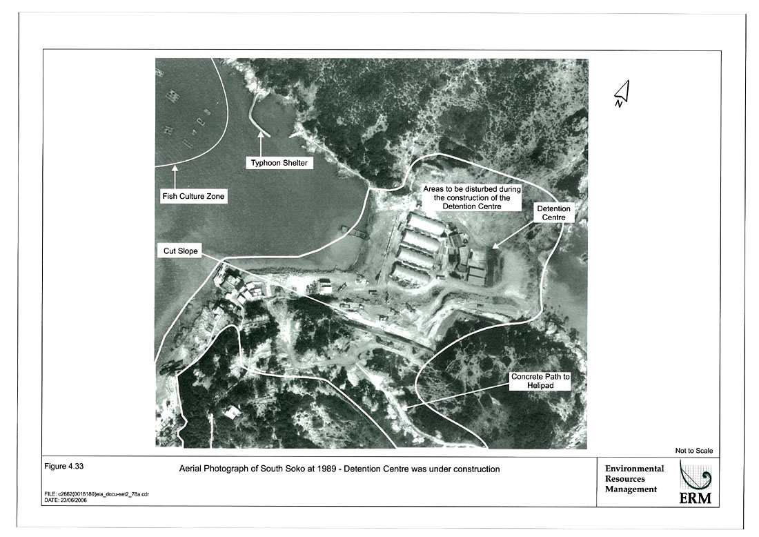
Figure 4.33
Aerial Photograph of South Soko at 1989 – Detention Centre was under Construction
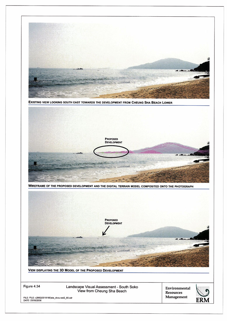
Figure 4.34
Landscape Visual Assessment – South Soko View from Cheung Sha Beach
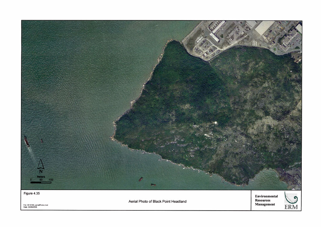
Figure 4.35
Aerial Photo of Black Point Headland
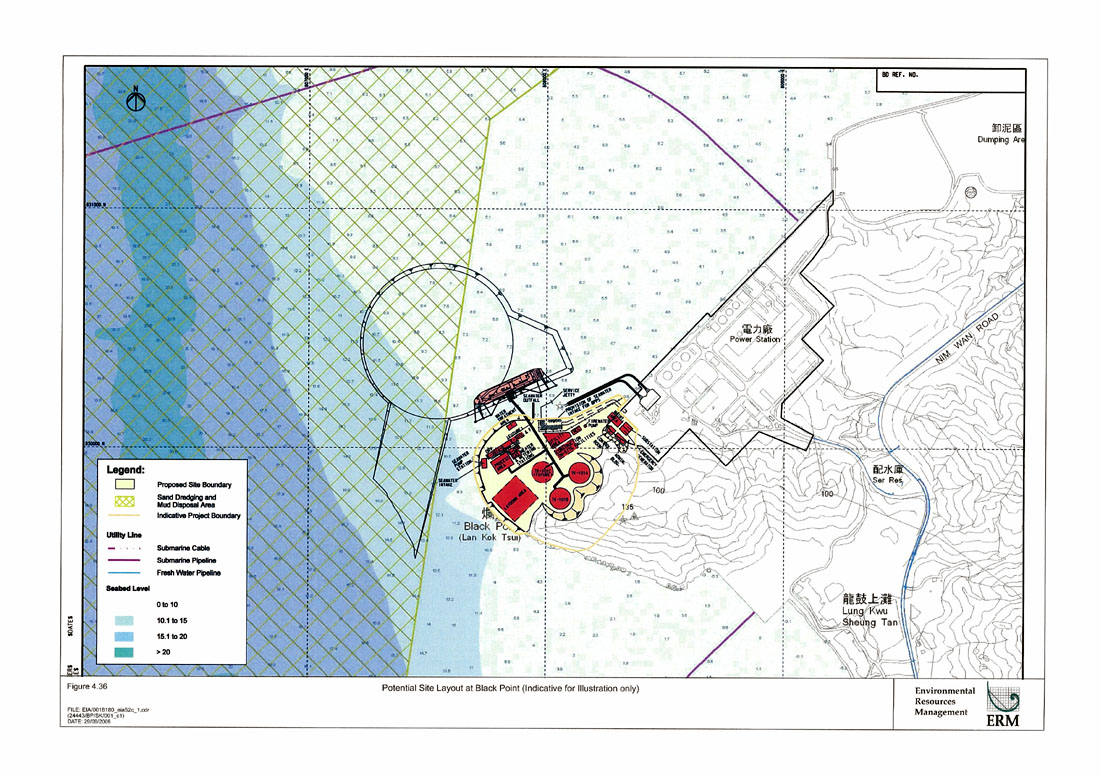
Figure 4.36
Potential Site Layout at Black Point (Indicative for Illustration only)
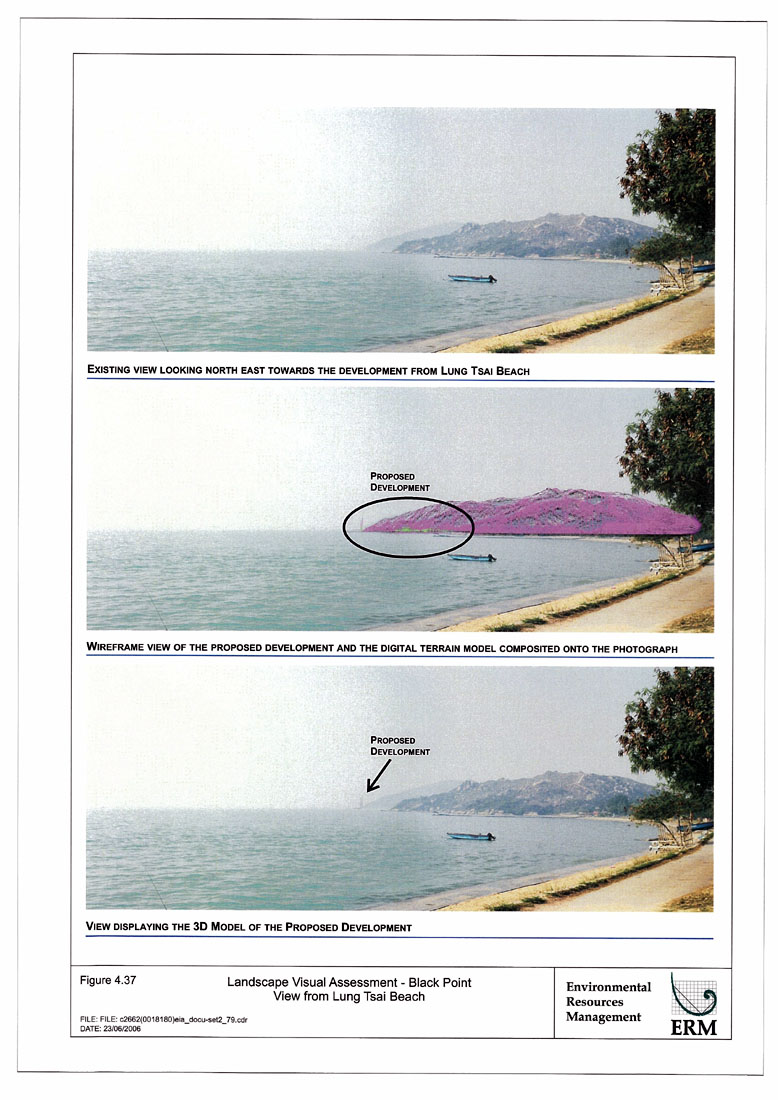
Figure 4.37
Landscape Visual Assessment – Black Point View from Lung Tsai Beach
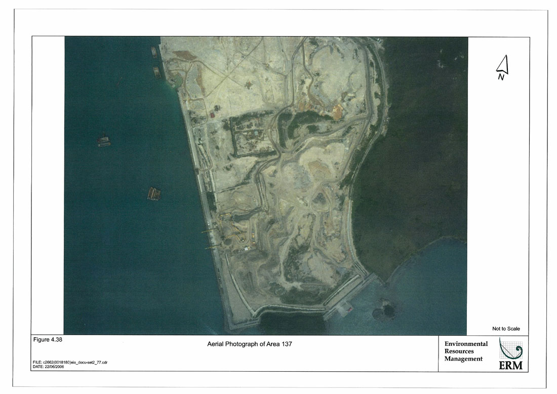
Figure 4.38
Aerial Photograph of Area 137
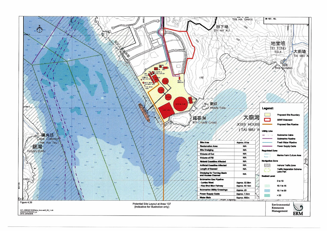
Figure 4.39
Potential Site Layout at Area 137 (Indicative for Illustration only)
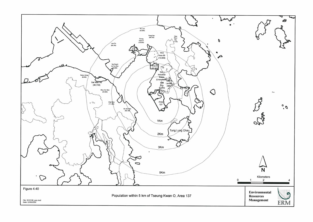
Figure 4.40
Population within 5km of Tseung Kwan O, Area 137
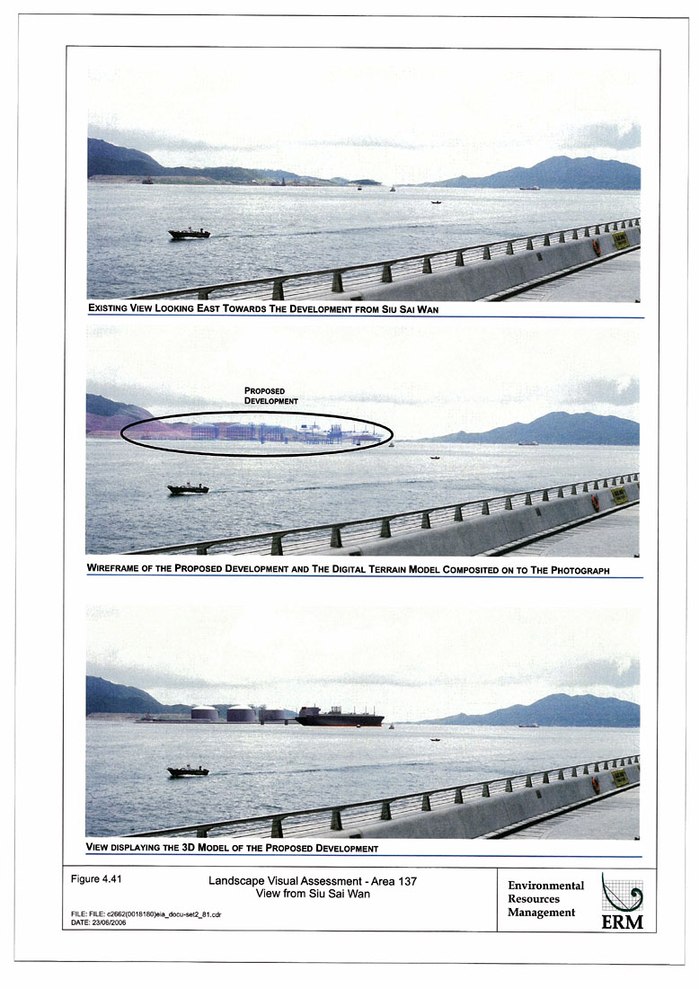
Figure 4.41
Landscape Visual Assessment – Area 137 View from Siu Sai Wan
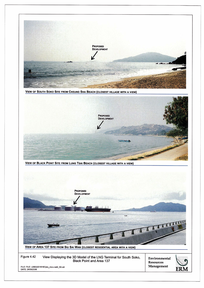
Figure 4.42
View Displaying the 3D Model of the LNG Terminal for South Soko, Black Point and Area 137