2.1 Purposes and Objectives of the Project
2.2 Environmental Benefits of the Project
2.3 Scenarios “With” and “Without” the Project
2.4 Tackling Environmental Challenges and Options Considered
2.5 Proposed Development Scheme
2.6 Consideration of Alternative Construction Methodologies
2.7 Environmental Conscious Turfgrass Management Plan (TMP) – An Outline
2.9 Collating and Addressing Public Views
2.10 Tentative Implementation Programme
2.12 Summary of Environmental Benefits and Environmental Achievements of the Project
|
Project Layout (Tentative) |
|
|
Indicative Illustration of Site Formation and Landscape Planting in Phases |
|
|
Layout Comparison |
|
|
Locations of Concurrent Projects |
|
Monthly Means of Rainfall Statistics for Tai Po (2000 – 2018) |
|
|
Construction Programme |
|
|
Engineering Drawings |
2.1 Purposes and Objectives of the Project
2.1.1.1 According to Outline Zoning Plan (OZP) Plan No. S/TP/28, the piece of land at the Shuen Wan Landfill in Tai Po has been zoned for use as “Other Specified Uses (Golf Course)”. Hence, the primary objective of the Project is to implement the prevailing landuse zoning as stipulated in the relevant OZP. The proposed Project is the construction and operation of an 18-hole golf course, serving both members and the public. The proposed golf course would be a sustainable and environmentally conscious golf course.
2.1.1.2 By implementing the prevailing landuse zoning as “Golf Course”, it would make a better use of the land which was once a landfill site and subsequently used as a driving range. This would also fulfil the aspiration from the district council to implement a golf course as soon as practicable.
2.2 Environmental Benefits of the Project
2.2.1 Conserving Sha Lo Tung
Development History of Sha Lo Tung
2.2.1.1 Sha Lo Tung is recognized as important for conservation because of its primary dragonfly and stream habitats. The wider Sha Lo Tung area, including the stream course down to Hok Tau, is a very important site for breeding and development of an extremely diverse community of dragonflies. The stream courses and associated riparian habitat have been designated as Site of Special Scientific Interest (SSSI) zone to afford protection to the dragonfly fauna. In the announcement of the New Nature Conservation Policy on 12 November 2004, Sha Lo Tung (the Sha Lo Tung Valley) was ranked no. 2 (scored 2.7 out of 3.0) among the 12 Priority Sites for Enhanced Conservation identified by an expert group convened by the Government based on an agreed scoring system.
2.2.1.2 In response to the New Nature Conservation Policy, the Project Proponent submitted proposals for areas selected as potential “pilot projects” for “Public-Private Partnership” (PPP) schemes. The proposal is also a Designated Project under Environmental Impact Assessment Ordinance (EIAO) and an EIA study was conducted. The latest EIA was submitted under the EIAO in May 2012. The proposal in the EIA is fully in line with Government’s announced policy intentions for conserving Priority Sites for Enhanced Conservation such as Sha Lo Tung, by packaging long term conservation management at the ecologically sensitive area with sustainable, commercial activities within the ecologically less sensitive area within the site. The EIA was circulated in the Advisory Council on the Environment but the Project Proponent decided to put the project on hold. In 2014, the Sha Lo Tung case was reviewed due to the sensitivity of the site and public concern. The government reckoned that an alternative option mentioned in the New Nature Conservation Policy, in particular a non-in-situ land exchange for the private land with high ecological significance at Sha Lo Tung by offering the rehabilitated Shuen Wan Landfill in Tai Po, would be more appropriate for long term conservation of the area. The 2012 EIA application was withdrawn by the Project Proponent in Jan 2017. In responses to the Policy Address in Jan 2017 regarding the non-in-situ exchange proposal for Sha Lo Tung, liaison is being made with government regarding the land exchange condition terms. At the same time, an application for EIA Study Brief for the Project at Shuen Wan Landfill was submitted to Environmental Protection Department (EPD) under the EIAO for the proposed development.
Current Environmental Conditions at Sha Lo Tung
2.2.1.3 As mentioned in the previous Conservation Management Proposal and EIA Study for the Sha Lo Tung proposal in May 2012, the valley has been and will continue to be subject to various threats without active management. These included hillfire, four-wheeled drive vehicle encroachment, vegetation removal, etc. The latest threat to the valley was unauthorized development which has been well documented in local medias. It again illustrated the continuous threat to the valley without active management (https://www.scmp.com/news/hong-kong/health-environment/article/1890877/fears-wildlife-hong-kong- villagers-strip-land, https://www.scmp.com/news/hong-kong/health-environment/article/1916491/rapeseed-saga-hong-kong-developer-reports-planting).
2.2.1.4 Upon approval of the EIA for the Project and completion of the non-in-situ land exchange procedure, the majority of the valley will be consolidated as government land. It will be feasible for the Government to implement long-term active management.
2.3 Scenarios “With” and “Without” the Project
2.3.1.1 With the implementation of the proposed Project, the ex-landfill with a temporary driving range will be turned into an 18-hole golf course. According to the traffic forecast, there would be an induced traffic of around 120 vehicles during peak hour of the operation of the Project at Year 2024 (i.e. commencement year). This is equivalent to about 10% of that along Ting Kok Road at the same period.
2.3.1.2 As discussed in Section 2.1, while an existing temporary driving range has been being operated within the Project Boundary for some years, the Project Site has also been zoned as “Other Specified Uses (Golf Course)” (OU(Golf Course)) on the approved Tai Po OZP No. S/TP/28. Under this landuse zoning, "Golf Course" and "Golf Driving Range" as well as "Utility Installation ancillary to Golf Course/Golf Driving Range/Landfill Restoration Use" are always permitted (i.e. Column I uses).
2.3.1.3 Hence, the Project is to implement the prevailing landuse zoning as stipulated in the relevant OZP. This would also fulfil the aspiration from the district council to implement a golf course as soon as practicable.
2.3.1.4 By implementing the prevailing landuse zoning as “Golf Course”, it would make a better use of the land, which was once a landfill site and subsequently used as a driving range, including provision of sport facilities for the communities, long-term and environmentally conscious management, opportunities to enhance biodiversity and landscape context through the introduction of various featuring landscape elements, etc.
2.3.1.5 If the Project is not proceeded, the intended landuse as golf course could not be materialised and probably would maintain as the existing driving range. This would not address the views from Tai Po District Council to establish a proper golf course in Tai Po area.
2.3.1.6 It is also observed that majority of the existing trees within the Project Site are pioneer or exotic species with varying tree conditions, low amenity value individually and with many of them in poor condition. It is largely due to the dense and sloping growing condition. Invasive and weedy tree species also account for a number of trees. Without the Project, all these existing trees species would remain as their existing conditions, gradually decrease and replaced by young trees or weedy species, under limiting management resources and natural succession process. The implementation of the Project would allow an opportunity for comprehensive management of tree resources and introduction of more native and locally adopted species into the future tree mix. Vegetation composed of diverse species combination would be aesthetically and ecologically contribute to the local context. With sufficient time allowed and proper tree management, local biodiversity within the Project Site would be enhanced and create stable habitats for flora and fauna species.
2.3.1.7 Section 2.2 has outlined the ecological importance of Sha Lo Tung which is covered under the current non-in-situ land exchange proposal. Hence, if the Project is not proceeded, opportunities to consolidate the private lots into government land would not happen, and any long-term active management by government for Sha Lo Tung would not be materialised in the recent coming future as well.
2.3.1.8 To summarise, the Project would help to materialize the intended landuse zoning as Golf Course. Besides, it would also enable opportunities for a swift implementation of any long-term active management by government for Sha Lo Tung as well, which would help to enhance the overall biodiversity of the community.
2.4 Tackling Environmental Challenges and Options Considered
2.4.1.1 Due consideration has been given in formulating the golf course design to overcome environmental challenges facing by the Project. The hierarchy of “Avoid, Minimize and Mitigate” has been fully adopted during the process to protect the environment as much as practicable. The key principles adopted to tackle all the environmental challenges are discussed below.
2.4.2 Environmental Challenges Posed by the Characteristics of Tolo Harbour
2.4.2.1 According to the latest literature review and comprehensive ecological surveys conducted as part of this EIA (see Section 10 for more details), the area in the neighbourhood of the Project accommodates a number of marine ecological resources as well as fishery resources including those at intertidal and those at marine. The key marine ecological and fishery resources include the following.
· Coral and mangroves colonies in the vicinity of the Project Site;
· Ting Kok Site of Special Scientific Interest (SSSI); and
· Yim Tin Tsai Fish Culture Zone and Yim Tin Tsai (East) Fish Culture Zone.
2.4.2.2 While the above marine ecological and fishery resources are located at various distances (i.e. 700 – 2100m) from the Project Site, they are however connected to the Project Site via the water body of Tolo Harbour. In fact, Tolo Harbour has rather unique hydrodynamic and water quality characteristics that need cautious attention. According to EPD’s Study on the Review and Development of Marine Water Quality Objectives (WQOs) in 2009, the elongated configuration of Tolo Harbour has resulted in a retention time of 38 days in the dry season and 14.4 days in the wet season. Any pollutants will still be eventually flushed out of Tolo Harbour though it may take a longer time than other open water bodies in Hong Kong. According to EPD’s Marine Water Quality Report in Hong Kong in 2017, Tolo Harbour’s landlocked situation and narrow exit weaken the water circulation with the Mirs Bay. This is exacerbated by the north-easterly winds which blow against the outgoing current. The harbour also suffers from weaker mixing in the water column due to the temperature and salinity stratification in summer, leading to hypoxia (low oxygen levels) at the bottom layer of the sea. With the implementation of the Tolo Harbour Action Plan in the mid-80s, there has been a steady improvement in water quality in the Tolo Harbour in the past decade.
2.4.2.3 Other than retention time, Tolo Harbour is also one of the Water Control Zones (WCZs) at which red tides occur relatively more frequently. In Year 2017, it is reported in EPD’s Marine Water Quality Report in Hong Kong in 2017 that red tides occur more commonly in semi-enclosed bays (e.g. Tolo Harbour) with low turbidity and flushing rate. In 2017, there were 15 red tide incidents were reported in Hong Kong waters. In the past, Tolo Harbour had the highest number of red tide incidents. The number of red tide incidents in Tolo Harbour has dropped significantly from the record high of 43 in 1988 to an annual average of about 5 incidents for the past five years. Factors contributing to the steady improvement in water quality in Tolo Harbour in the past decades due to the Tolo Harbour Action Plan. Again, this is higher than the case as in Deep Bay and significantly higher than all other WCZs in Hong Kong. This is also attributable to the relatively longer retention time in Tolo Harbour since any nutrient released to the water body could only be diluted after many days. In fact, the government has implemented lot of initiatives such as the Traffic Control and Surveillance Systems to control the pollution loading to Tolo Harbour and hence improve it’s water quality.
2.4.3 Avoidance of Marine Works During Construction
2.4.3.1 Since the above ecological and fishery resources are marine based and hence are particularly sensitive to water quality, it is very important that the Project shall not cause any adverse water impacts on Tolo Harbour.
2.4.3.2 In order to achieve this, the current design has adopted the following approaches to avoid impacts to the marine water quality during the construction period.
· No modification of the existing seawall;
· No marine dredging works on existing seabed; and
· No need for construction barges.
2.4.3.3 By adopting the above approaches, all the marine works during the construction phase would be avoided. Other measures to avoid water quality impacts are discussed in the following sections.
2.4.4 Avoidance of Effluent Discharge to Tolo Harbour
Handling Sewage Generated during Operational Phase
2.4.4.1 The ancillary facilities including food and beverage, offices, etc. within the Project would inevitably generate some sewage during their daily operation. Although the number of population and hence quantity of sewage generated is small (i.e. only about 500m3/day of Average Dry Weather Flow (ADWF)), it still needs to be properly handled in order to avoid any adverse impacts on the neighbouring Tolo Harbour water body.
2.4.4.2 Two options have been considered in tackling the sewage generated from the Project, including the following:
· Option 1: Install a new Sewage Treatment Works (STW) on site.
· Option 2: Convey the sewage generated to Tai Po Sewage Treatment Works (TPSTW).
2.4.4.3 Option 1 (New STW) – It involves the establishment of a new STW on site to treat the sewage generated. This would inevitably require discharging the treated effluent into Tolo Harbour during normal operation. This would also need to install a submarine outfall inside Tolo Harbour which would require certain dredging of the sediment along the alignment of the submarine pipe. Besides, the operation of the new STW would also need to cater for the release during emergency. In other words, this option would need marine works during construction and would require discharging treated effluent into Tolo Harbour in which many ecological and fishery resources have been identified.
2.4.4.4 Option 2 (Convey to TPSTW) - Instead of constructing a new STW within the Project Boundary, Option 2 would convey the sewage generated to a neighbouring government sewer that connects back to TPSTW located in Tai Po Industrial Estate (TPIE). Since TPSTW would have sufficient capacity to handle the additional approximately 500m3/day, it would not cause any adverse water quality and hence ecological and fishery impacts.
2.4.4.5 After examining the environmental pros and cons of Options 1 & 2 as discussed above, it is considered more advantages in environmental perspective to adopt Option 2 (i.e. conveying the sewage generated to TPSTW for treatment).
Omitting Desalination Plant Option during Operational Phase
2.4.4.6 As discussed in Section 2.4.6, the option of a desalination plant was considered but was not adopted due to environmental considerations. Without a desalination plant, the potential effluent discharge is avoided.
Recycling Surface Runoff during both Construction and Operational Phases
2.4.4.7 Other than the sewage generated during operational phase, another water pollution source would be the surface runoff during both construction and operational phases (see Section 6.4 and Section 6.5 for more details).
2.4.4.8 During the operational phase, surface runoff from the turf area would inevitably contain certain amount of agrochemicals including fertilizers, pesticides, herbicides and insecticides. The concentration would generally be higher during the first flush but would decrease with the increase of the rainfall duration / rate. Besides, higher rainfall density would also help to dilute the concentration of agrochemicals as well. It is considered that the first flush would contain the highest chemical concentrations regardless of the size of rainfall event.
2.4.4.9 In order to avoid / minimise any uncontrolled surface runoff generated within Project Site being bypassed into Tolo Harbour, in particular the first flush from raining, it is proposed to construct water storage tanks with sufficient capacity to intercept the storm flow, and the volume of which shall be sufficient to response to collect the stormwater runoff from most of the daily accumulated rainfall on historical rainfall data.
2.4.4.10 A detailed analysis has therefore been conducted for the statistics of heavy rainfall events occurred in Hong Kong for the last 21 years (from 1998 - 2018). In Hong Kong, heavy rainfall events are reported under the Rainstorm Warning Signals which are classified as Amber, Red or Black, with Amber events being less strong and Black being the strongest events. A summary of the event statistics is given in the following table.
Table 2.1 Statistic of rainfall events under Rainstorm Warning Signals (for Hong Kong)
|
Rainstorm Warning Signals |
No.s of Yearly Events |
Duration (Hours) |
Rainfall Criteria |
||
|
(1998 – 2018) |
Range |
Avg. |
Range |
Avg. |
mm/hour |
|
Amber |
12 - 40 |
22 |
0.33 – 17.42 |
2.66 |
>30 |
|
Red |
1 - 11 |
5 |
0.17 – 13.22 |
2.35 |
>50 |
|
Black |
0 - 3 |
1 |
0.67 – 5.78 |
2.79 |
>70 |
2.4.4.11 In additional to the rainstorm warning events, the analysis has reviewed the monthly means of total rainfall and numbers of rainfall days for Tai Po area between Year 2000 and 2018 based on published information on Hong Kong Observatory (HKO)’s website (As shown in Appendix 2.1). It is noted that there are significant variations on the monthly total rainfall depth in Tai Po over previous years. The following table summarises the statistical analysis of the monthly means of total rainfall statistics.
Table 2.2 Monthly means of total rainfall statistic
|
Monthly Mean Rainfall, mm |
Probability |
|
< 0.5 |
59.2% |
|
0.5 – 25.0 |
32.3% |
|
25.0 – 50.0 |
6.0% |
|
> 50.0 |
2.5% |
2.4.4.12 It is identified the nearest existing rain-gauge is located at Tai Po Wong Shui Chi Secondary School. The daily total rainfall (mm) recorded at this rain-gauge were reviewed to estimate the quantity of surface runoff within Project Site during heavy rainfall events for the past 21 years (from 1998 - 2018) and this estimated volume of surface runoff is one of the considerations to determine the size of water storage tank.
2.4.4.13 The calculation of surface runoff volume was based on the design parameters shown below:
|
Paved Area within Project Site |
35,750 |
m2 |
|
Unpaved Area within Project Site |
498,020 |
m2 |
|
Paved Area Coefficient |
0.9 |
|
|
Unpaved Area Coefficient |
0.35 |
|
|
Effective Catchment Area within Project Site |
206,482 |
m2 |
2.4.4.14 It can be seen from Table 2.3 below that there were 113 days of total daily accumulated rainfall depth that exceeded 85mm in the past 21-year records around studied rain-gauge location with the maximum annual exceedance of 14 days occurred in Year 2001. All these exceedances were occurred during April to the following November. When looking at the total daily accumulated rainfall depth that exceeded 145mm, there were a total of 38 days in the historical records with the average annual exceedance of 1.81 days for the past 21 years.
Table 2.3 Recorded number of rainfall exceedance events
|
Daily Accumulated Rainfall > (mm)
Year |
85 |
95 |
105 |
115 |
125 |
135 |
145 |
|
1998 |
3 |
3 |
3 |
2 |
2 |
2 |
2 |
|
1999 |
6 |
5 |
4 |
4 |
4 |
4 |
2 |
|
2000 |
5 |
4 |
3 |
3 |
3 |
3 |
3 |
|
2001 |
14 |
11 |
8 |
7 |
5 |
3 |
3 |
|
2002 |
7 |
5 |
5 |
3 |
3 |
2 |
2 |
|
2003 |
5 |
5 |
3 |
2 |
1 |
1 |
1 |
|
2004 |
2 |
2 |
1 |
1 |
1 |
1 |
1 |
|
2005 |
4 |
3 |
3 |
3 |
2 |
2 |
2 |
|
2006 |
7 |
6 |
5 |
5 |
4 |
3 |
2 |
|
2007 |
1 |
1 |
1 |
0 |
0 |
0 |
0 |
|
2008 |
8 |
6 |
5 |
5 |
5 |
5 |
4 |
|
2009 |
4 |
3 |
3 |
2 |
2 |
2 |
0 |
|
2010 |
2 |
1 |
1 |
1 |
1 |
1 |
1 |
|
2011 |
3 |
2 |
2 |
2 |
2 |
1 |
0 |
|
2012 |
5 |
4 |
2 |
1 |
0 |
0 |
0 |
|
2013 |
5 |
4 |
3 |
3 |
3 |
3 |
2 |
|
2014 |
4 |
3 |
2 |
2 |
2 |
1 |
1 |
|
2015 |
5 |
3 |
2 |
2 |
1 |
1 |
1 |
|
2016 |
10 |
8 |
5 |
5 |
4 |
3 |
3 |
|
2017 |
7 |
6 |
5 |
5 |
5 |
3 |
3 |
|
2018 |
6 |
5 |
5 |
5 |
5 |
5 |
5 |
|
Total |
113 |
90 |
71 |
63 |
55 |
46 |
38 |
|
Estimated Size of Proposed Water Storage Tank (m3) |
17,599 |
19,670 |
21,741 |
23,811 |
25,882 |
27,952 |
30,023 |
2.4.4.15 Having considered the available space within Project Site, the proposed water storage tanks will have a volume of approximate 30,000m3 which is of similar volume as 12 Olympic-size swimming pools. The water storage tanks will be designed to have two main functions, rainwater harvesting during the dry season for on-site irrigation purpose and peak flow retention to avoid / minimise bypassing to Tolo Harbour during wet season as much as practicable.
2.4.4.16 In order to illustrate the occasions when rainfall events continue for days, the daily rainfall data in 2016, which is of the highest total annual rainfall in the past 21 years, has been adopted. The objective of the analysis of consecutive days of rainfall is to illustrate the performance of the drainage system during heavy rainfall. The bypass from the water storage tanks would be triggered when the amount of stored water reaches 30,000m3 (total capacity of the water storage tanks) and any additional water would bypass the water storage tank.
2.4.4.17 With the stormwater control practice in place, and assuming a constant daily consumption of 1,800 m3/day in place, it is estimated in 2016 that there would be 203,000m3 of stormwater bypassing to the sea. This is equivalent to a total of 29 bypass events out of 365 days, which is around 8% bypass probability. Among this 29 bypass events, which is 18.6% of 156 rainy days in 2016, about 70% (20 bypass events) of those would occur around the time when tropical cyclone warning signals and/or red or black rainstorm warning signals were issued. In fact, it should be noted that all the agrochemicals carried along by the first flush will be contained in the water storage tanks and will be subsequently reused for irrigation. The analysis of bypass events for 2016 is for illustration purpose only and would not affect the actual water quality. The Detailed analysis of continual rainfall events has been given in Section 6.
2.4.4.18 The water storage tanks will also have dual functions for both construction and operational phases. Besides receiving turf area runoff during operation phase, the water storage tanks are also doubled as part of the temporary drainage system during the construction phase to receive site runoff. In order to contain surface runoff during construction phase, the construction programme has been duly adjusted to ensure that the water storage tanks will be completed prior to the bulk site formation work in each construction phase. Temporary drainage system would be installed around the Project Site perimeter to intercept all the construction runoff and divert to the water storage tanks which would enable sufficient sedimentation before the effluent is bypassed to Tolo Harbour. As a contingency measure, a 300mm bund wall is also recommended along the seawall during construction stage to prevent any potential overflow of stormwater into Tolo Harbour.
2.4.5 Optimal Use of Agrochemicals
2.4.5.1 As discussed in Section 2.4.2, Tolo Harbour has a retention time generally longer than other WCZs. According to EPD’s monitoring statistics, it is also one of the WCZs that has a higher record for the occurrence of red tides. The following table summarises the occurrence record of red tides in various WCZs in recent years.
Table 2.4 – Red Tide Occurrence Events in different WCZs (2012 – 2017)
|
|
Year |
|
|||||
|
WCZ |
2012 |
2013 |
2014 |
2015 |
2016 |
2017 |
Total |
|
Tolo Harbour |
8 |
4 |
10 |
3 |
4 |
4 |
33 |
|
Deep Bay |
1 |
0 |
0 |
1 |
0 |
1 |
3 |
|
Port Shelter |
5 |
1 |
9 |
3 |
6 |
3 |
27 |
|
Mirs Bay |
2 |
1 |
4 |
4 |
4 |
2 |
17 |
2.4.5.2 Given that the occurrence of red tides is highly related to the abundance of nutrient content and retention time, the higher occurrence records of red tides in Tolo Harbour reveals the importance to have due consideration on the use of agrochemicals which includes fertilizer. For the purpose of this EIA, Section 2.7 presents an outline of the environmental conscious Turfgrass Management Plan (TMP) which would need to be further developed during the detailed design stage.
2.4.6 Minimisation of Fresh Water Consumption
2.4.6.1 According to the current golf course design, the average daily consumption of water during the operational phase for irrigation of green, tee, fairway, vegetation etc. would be approximately 1,800m3/day during dry season. This water consumption would be relatively less during wet season. In order to fulfil the irrigation need and minimize such consumption for fresh water from Water Supplies Department (WSD), the following options of water supply have been duly considered.
· Option A : Rainwater harvesting;
· Option B : Seawater desalination;
· Option C : Treated sewage effluent from TPSTW;
· Option D : Greywater recycling;
· Option E : Use of underground water;
· Option F : Water extraction from existing open channel;
· Option G : Use of leachate from landfill site; and
· Option H : Freshwater supply from WSD.
2.4.6.2 Option A (Rainwater harvesting) – This involves the construction of a large retention of about 30,000m3 to tackle runoff associated with heavy rainfalls. Only for very rare cases of extremely strong and prolonged rainfall events with excessive surface runoff, the water storage tanks would be able to intercept agrochemicals containing runoff carried by the first flush and hence reduce the likelihood of bypassing directly to Tolo Harbour. The stored stormwater would be able to be reused for irrigation purposes and minimise the demand for freshwater. Besides, upon filling up the water storage tanks, much diluted runoff from extremely strong and prolonged events would bypass the water storage tanks to Tolo Harbour and reduce any potential water quality impact.
2.4.6.3 Option B (Seawater desalination) – This option requires the establishment of a seawater desalination plant within the Project Site. The plant would extract seawater from Tolo Harbour and using Reverse Osmosis (RO) membrane technology to reduce the salinity and ensure other parameters such as iron (Fe), anti-scalant, total inorganic nitrogen (TIN) and suspended solids (SS) would achieve the requirements stipulated by WSD. While this desalination technology would provide a very constant source of freshwater supply for the golf course, the desalination technology would produce some effluent that has a very high concentration of salinity, anti-scalant and SS. Given the high concentration of these effluent, they could not be conveyed to the TPSTW in TPIE. Hence, the only option of disposal of these residual is discharging to Tolo Harbour.
2.4.6.4 Option C (Treated sewage effluent from TPSTW) – TPSTW has implemented some facilities to further polish part of the treated effluent to achieve a higher water quality standard. This option would involve the establishment of similar facilities inside the Project Site and utilize some of those treated effluent for polishing to provide reclaimed water for irrigation. However, further treatment involving brackish water RO technology would be required to further elevate the water quality standard that is suitable for irrigation. Similar to Option B (Seawater Desalination), this process would generate some effluent that has a high concentration of salinity, SS, total N, ammonia N, total phosphate and E.coli etc. Given the high concentration of these residual, they could not be conveyed to the TPSTW in TPIE. Hence, the only option of disposal of these residual is to discharge to Tolo Harbour.
2.4.6.5 Option D (Greywater recycling) – This option would treat the sewage generated on site to a standard suitable for irrigation. However, for the scale of the sewage generated from the ancillary facilities, the sewage generation is anticipated to be very small and would not be significant for the purpose of irrigation for the golf course.
2.4.6.6 Option E (Use of underground water) – The use of underground water will draw down the water table of the nearby area. If a large amount of underground water is constantly extracted, it may potentially affect the vegetation in the nearby habitats. Besides, being next to the seafront, a higher salinity level is expected from the underground water, and hence is not suitable for irrigation.
2.4.6.7 Option F (Water extraction from exiting open channel) – According to the utilities information, there is an open channel in close proximity 300m away from Project Site. The upstream of the open channel is a natural watercourse which connect back to a natural catchment area of approximate 36ha. The runoff collected in open channel will be eventually discharged into Tolo Harbour via downstream box culvert with dimension of 4m(W) x 2.7m(D). This box culvert has another 12 connections from other upstream catchments, the range of other connections is between 150mm dia. pipe to 1800mm dia. pipes. There will be a gate valve to separate the water in the existing channel and the proposed water pipes. The gate valve will remain closed in the normal operation. When there is a need to extract water from the existing channel for irrigation purpose, the gate valve will be opened so that the water from the existing channel will be conveyed to the water storage tanks. This option would involve having some local modifications to that existing open channel so that the runoff within the open channel would be extracted for irrigation when needed. DSD’s comment has been sought for this option and they had no in-principle objection.
2.4.6.8 Option G (Use of leachate from landfill site) – Leachate from landfill is characteristized by high values of COD, pH, ammonia nitrogen and heavy metals, as well as strong color and bad odour. Treated leachate also contains high nitrogen content and hence is not suitable for irrigation.
2.4.6.9 Option H (Freshwater supply from WSD) – This option requires a freshwater supply from WSD, just as in any other developments. This would serve as a backup supply for the selected major water sources from above options.
2.4.6.10 Since both Option B (Seawater desalination) and Option C (Treatment effluent from TPSTW) would inevitably require discharging some effluent into Tolo Harbour, it would not be preferred from environmental point of view given the hydrodynamic characteristics and the presence of ecological and fishery resources of Tolo Harbour. Option D (Greywater recycling) could not provide significant supply of fresh water and Option E (Use of underground water) may have negative impacts on the neighbouring vegetation. The effluent from Option G (Use of leachate from landfill site) would not be suitable for irrigation. On this basis, it is recommended to adopt a combination of the following options as the strategy for providing the freshwater for irrigation of the golf course. Section 2.5 presents more details on the combination of these options.
· Option A : Rainwater harvesting; and
· Option F : Water extraction from existing open channel; and
· Option H : Freshwater supply from WSD as backup supply.
2.4.6.11 The average daily irrigation water demand during implementation stage has been estimated to be approximately 1,800m3/day. The proposed irrigation network will comprise of the water storage tanks, pump facilities, distribution network and irrigation points (manual or automatic). A comprehensive irrigation network will be provided for the Project (Details refer to Section 2.5).
2.4.6.12 There are two water storage tanks proposed to serve dual function of peak flow attenuation and water storage for irrigation. One tank with approximately 7,000m2 area and 2.5m deep locates underneath of car park area and another tank with approximately 6,030m2 and 6.7m wide and 2.1m deep along approximate 900m long under the access road. An irrigation pumping facilities will be also provided close to water storage tank underneath the car park area to the distribution network. A higher level water storage tank along the access road will be connected to the lower level water storage tank underneath the car park via overflow pipes; while the water storage tank underneath the car park will deliver the water flow by pressured water head. A pump room would be required to extract water from the water storage tank under the car park for irrigation purpose. Moreover, dual feed power supply or backup power supply facilities and standby pumps will be provided to avoid overflow. Therefore, no adverse water quality impact from the pump room is anticipated.
2.4.7 Minimisation of Potential Impact of Runoff Bypass
2.4.7.1 To reduce the water quality impact by the turf area runoff, special considerations have been formulated in designing the drainage system of the Project. In particular for the outfall location, it has been duly situated to allow an optimum distance from the adjacent water sensitive receivers and ecological resources and has been selected from one of the existing drainage outfalls so that no marine works are required. As such, potential water quality impact at receivers could be further minimised. Nearby water sensitive receivers and marine ecological resources include:
· Seawater Intake in Tai Po;
· Corals locate at south of Project Site and outside TPIE;
· Location with seahorse record outside TPIE; and
· Ting Kok SSSI.
2.4.8 Ecological Considerations and Constraints during Development of Layout Options
Constraints for Minimization of Ecological Impacts
2.4.8.1 Ecological considerations have been among the priorities during the design and development of various golf course layout scheme options. As the ecological survey findings had revealed, night roosting behaviours of bird species of conservation importance were confirmed and constituted a constraint for the layout design.
2.4.8.2 It is also aware that there are other inherent constraints of the site due to the nature and history of the site. It is important to understand those other constraints and review their implications for ecological constraint and ecological considerations. Those key inherent constraints identified include the following and would be further elaborated in the subsequent sections:
· Constraints due to bird species of conservation interest;
· Constraints due to Project Site area size; and
· Constraints due to waste boundary and topography.
2.4.8.3 All these constraints have been duly identified and stipulated at the onset of the scheme development, and were taken into account during the scheme development. Among the above key constraints, due considerations have been given to address the constraints due to bird species of conservation interest as much as practicable. The constraints due to the small site size and waste boundary and topography would also impose practical limitations on the design of the golf course.
2.4.8.4 When constraints are identified conflicting with each other, efforts were made to resolve the conflicts. Measures were also proposed to overcome the constraints, refine the recommended scheme where practicable without adversely compromising the ecological considerations. When the conflicts could not be completely resolved, due to those inherent constraints, methods to minimize the conflicts were explored to retain as much those ecological considerations as possible. The intention is to make sure the proposed schemes are both ecologically conscious and also practicable during implementation.
Constraints due to Bird Species of Conservation Interest and Targets of Ecological Conservation
2.4.8.5 Extensive ecological surveys have been conducted as part of this EIA (details refer to Section 10). All those survey findings have revealed and confirmed that the existing Shuen Wan Restored Landfill is night roost sites for two bird species of conservation interest, i.e. Collared Crow (CC) and Black Kite (BK).
2.4.8.6 While CC occasionally pre-roost at different turf areas within the existing driving range which would inevitably be affected, the major pre-roost location of CC is TPSTW which is outside the project boundary and thus their major pre-roost is therefore secured.
2.4.8.7 Ecological surveys also revealed that, unlike CC, BK would mainly be soaring before night roosting, without pre-roost behaviour. Hence, there will not be a pre-roost site issue for BK.
2.4.8.8 Locations of CC and BK final night roosts were found not fixed but shifting from day to day during the surveys. CC and BK roosts were both scattered among the existing plantation strip along the eastern to southern boundary of the Project Site.
2.4.8.9 According to the analysis of the survey results for both CC and BK , the key high use areas include the following:
· The Southern Area – Plantation used by both species; with the highest CC usage;
· The South-eastern Area - Plantation used by both species; with a relatively high BK usage; and
· The Eastern Area – Plantation used by both species; but the usage is rather scattered.
2.4.8.10 Based up on the survey findings and the nature of the proposed development, three targets of Ecological Conservation were formulated and the design of the Project should consider achieving these three targets. i.e.:
· Target 1 – Preservation of existing plantation used as night roosts of both bird species as much as practicable, in particular those to be used more frequently;
· Target 2 – Prevention of disturbance to the preserved night roost locations of CC and BK during both construction and operational phases; and
· Target 3 – Provision of new tree groups for the two bird species as part of the ecological enhancement package for the site which including other general ecological resource enhancements.
Constraints due to Small Area Size of the Site
2.4.8.11 The Project Site was previously the Shuen Wan Landfill which has a site area of about 53ha. The objective of the Project is to develop an 18-hole golf course to implement the previously planned land use (see Section 2.1). An 18-hole golf course would require the following elements to make the Project viable:
· 18 fairways;
· connecting paths among the fairways;
· ancillary facilities for visitors;
· car park;
· driving range;
· facilities related to maintenance and management; and
· water storage and irrigation system, etc.
2.4.8.12 This site area is significantly smaller than other golf courses in HK and other neighbouring areas. A comparison is given in the following table.
Table 2.5 Summary of golf course sizes in terms of number of holes and areas
|
Golf Courses |
Nos of Holes |
Area (ha) |
|
The Clearwater Bay Golf and Country Club Hong Kong |
1 set of 18 |
Approx. 120 |
|
The Jockey Club Public Golf Course at Kau Sai Chau |
3 sets of 18 |
Approx. 250 |
|
Mission Hills’ Blackstone Course in Haikou |
1 set of 18 |
Approx. 140 |
2.4.8.13 It can therefore be seen from the above table that the proposed 18-hole golf course at Shuen Wan has an area significantly smaller than other golf courses in HK and neighbouring area. In fact, according to the American Society of Golf Course Architects (https://asgca.org/wp-content/uploads/2016/07/Building-a-Practical-Golf-Facility.pdf), the minimum area for an 18-hole golf course shall be at least 49ha. Hence, the proposed golf course at Shuen Wan Landfill Site is close the lowest end in terms of site area, not to mention that the additional constraints as being on a restored landfill site. This constraint would fundamentally limit the layout options that would be practicable to the golf architect.
Constraints due to Waste Boundary and Topography
2.4.8.14 Review of available information such as aerial photos and drawings reveal that the waste boundary within which waste was dumped has occupied the majority of the entire site area. All the area within or very close to the waste boundary cannot accommodate excessive loading and hence cannot be considered for uses such as ancillary facilities, access roads, water tanks etc.
2.4.8.15 It should also be noted that the previous landfill design has maximized the waste capacity and hence the waste boundaries are located relatively very close to the site boundary. This has therefore resulted in relatively steeper slope areas around the waste boundaries, which would impose challenges to the golf design as well as preservation of trees. The only area where the ancillary facilities can be located is the south-eastern part of the site.
2.4.8.16 Section 2.4 has discussed the need for a 30,000m3 water tanks to recycle surface run-off as much as practicable. This water tank is a relatively heavy structure especially when fully loaded with water. Hence, it can only be located at area beyond the waste boundaries. As explained in the above sections, most of the area within the Project Boundary are waste boundaries and hence are not suitable for heavy loading structure. However, most of those areas outside the waste boundaries are located along the eastern edge of the site and the southeast end of the site (and the southeast end has been used for ancillary facilities), etc. Hence, the current design has placed the 30,000m3 water tanks along the eastern site boundary.
2.4.8.17 To save the very limited space, the access road connecting the ancillary facilities is located on the top of the water tank. This would require a much higher construction cost but would have avoided the need for an extra area for the access road.
Resolving Conflicts between Ecological Targets and the Site Constraints
2.4.8.18 The following sections discuss how the golf design has evolved to optimize the opportunities for achieving the three ecological targets and the conservation of CC and BK.
Conflicts with the target of Preservation of plantation used as Night Roost
2.4.8.19 Currently plantation inside the Project Site covered over 31 ha out of the about 53 ha Project Site (close to 60% of the Project Site). Due to the behaviours of shifting night roost locations by both bird species as observed during the survey for this EIA, the locations of plantations with records of night roost usage are quite scattered (including the eastern, south-eastern and southern sides of the plantation). It is neither feasible for the golf course design nor viable for the Project to fully preserve all plantations with night roost records, as it would mean the area size becomes infeasible for an 18-hole golf course layout.
2.4.8.20 Alternatively, it is proposed to preserve existing roosting location plantation as much as practicable, in particular those to be used more frequently. For those roosting locations which could not be avoided, similar habitats will be re-provided (planting new trees in groups) in the design of the golf course.
2.4.8.21 As mentioned above, according to the analysis of the use frequencies by both CC and BK in terms of night roosting sites within the Project Site, the areas with the highest use frequencies include the southern area, the south-eastern area and the eastern area.
2.4.8.22 The following summarises the approaches adopted during the design of the golf course to avoid and minimize the impacts on CC and BK.
(i) The Southern Area
2.4.8.23 The plantation located at the southern end of the Project Site (immediately to the south of the existing driving range) is more frequently used by CC and BK as night roosting areas (used by both species and with the highest CC usage inside the Project Site). This area is adjacent to the south-eastern end which is the only location where the ancillary facilities could be accommodated. In most golf courses, the areas surrounding the ancillary facilities are often used for car parks, putting green and driving range. After the ecological survey results become available and the importance of roosting sites confirmed, the design and layout have been substantially amended, in order to preserve the plantation trees in this area. In contrary to typical golf course which would arrange these immediately next to their ancillary facilities, the current design has relocated these facilities. The current design has turned the usual open carpark into an underground carpark, and put it underneath the ancillary facilities. This would definitely escalate the construction cost for the Ancillary Facilities, similar to the case of the access road but would avoid the need for an extra area for the car park.
2.4.8.24 And the layout has also opted to locate the putting green and golf driving range further away from the ancillary facilities, by at least 250m in order to preserve this major tree group utilised as roosting site. The adjacent golf hole alignments have also been modified, and the size of the driving range has also been proactively reduced from 25,000m2 to 20,000m2 to maximise the area size of this major tree group to be preserved. During the detailed design stage of the Project, opportunities for further improvement of the golf course layout will be explored, aiming at allowing preservation of more existing plantation trees where practicable.
2.4.8.25 New trees will be proposed in the future detailed planting plans, adjacent to the preserved trees where possible, to expand the tree group sizes and also provide additional buffer.
(ii) The South-Eastern Area
2.4.8.26 The plantation trees in the south-eastern area are used by both bird species as night roosts, with a relatively higher usage by BK. As discussed in Section 2.4.8.11-13, the site area is considered as very small for an 18-hole golf course, and would probably be the smallest 18-hole golf course in HK. In addition, the waste boundaries underneath have imposed significant constraints for various essential elements for this golf course such as ancillary facilities and water storage tanks, etc. The south-eastern area is the only location feasible for the ancillary facilities. Due to the construction works and necessary re-profiling works for the ancillary facilities, plantations at and adjacent to the ancillary facilities would be impacted. Though preservation is not feasible, larger areas of new planting trees are proposed in and near this area, and mature-size trees will be used for planting to provide suitable tree groups as fast as possible.
(iii) The Eastern Area
2.4.8.27 Plantation trees in the eastern area are also used by both species but the usage is rather scattered. The current design has put the 30,000m3 water tank along the eastern edge of the site, which is the only solid ground left available for facilities with loading. The access road was put on the top of the water tanks to save the space though this would definitely escalate the construction cost for the water tank. For the eastern area in particular, while the need for the water tanks has inevitably to run along the eastern site boundary and hence would cause some impacts on the existing plantation habitat. Besides, some further areas would inevitably need to be used for fairway construction. Efforts were still made to preserve two groups of existing plantation trees close to the recorded night roost locations. Like in the case of the southern area, new trees (heavy standard, or mature size where possible) will be proposed to be planted adjacent to the preserved trees as much as possible to enlarge the tree group sizes.
Conflicts for Prevention of Disturbance
2.4.8.28 It is important to prevent disturbance to the preserved tree groups and the adjacent new planting trees to facilitate the continuous usage of these trees as night roosts by both bird species. However, there are potential disturbance during both construction and operational phases which might jeopardize the intention of the preservation of trees.
2.4.8.29 In addition to preservation of tree groups for roosting, the construction programme has also been designed to minimise potential disturbance to bird roosting within the Project Site and to reprovide additional roosting sites. Construction phasing is designed to minimise the duration of possible indirect disturbance to the major preserved tree group as roost sites. Construction activities in the Project Site will be implemented by phases. This will enable existing plantation trees to be removed gradually, and new planting will also be provided in advance during the construction, rather than after all construction is finished as in other projects. Upon completion of site formation at each phase, landscape planting will be implemented immediately before the beginning of next phase such that new tree groups aiming for roosting site provision will be planted before site clearance in the next phase (see Figure 2.2 for indicative illustration). Extensive new tree planting is proposed under Landscape Impact Assessment of the present EIA and the new tree groups will cover about 10 ha. The new trees will be planted in patches or several rows (see inserts in Figure 10.9), to allow the future tree groups suitable for bird roosting. Heavy standard trees (or mature-size where possible) will be included in the planting list to facilitate the establishment of new tree groups as early as possible.
2.4.8.30 The construction site will be divided into three areas (i.e. northern, middle and southern in Area 1, 2 and 3 respectively, Drawing 2.7 of Appendix 2.3) and the major earth works in each area will be conducted separately in three phases, starting from landward side. As such, the roosting habitats which are not feasible for preservation will not all be lost in one time, but by phases. As no roost site used by both CC and BK was recorded in the works area of Area 1 during the surveys, so no impacts to the roosting colonies are anticipated during Area 1 construction, and the roosting habitats in Area 2 and Area 3 will not be impacted in one time, but by phases. Site re-profiling of the area near the major preserved tree group in the southern end would fall under the last phase (Area 3) of construction.
2.4.8.31 In addition, working hours will be restricted during construction phase to minimise potential disturbance to utilisation of the preserved plantations by CC and BK as night roosts. While the normal works hours are 0700-1900, work hours of Powered Mechanical Equipment (PME) in Area 3 of the construction programme (i.e. the southern part of the Project Site, near the major preserved tree group), ancillary facilities (including part of the water storage tanks and traffic along the existing access road), and the eastern part of Area 2 (near another preserved tree groups), will be restricted to at least one hour before sunset, Table 10.9.1 has shown the proposed restriction hours derived from the earliest sunset time in each month between 2018 and 2020 (source: Hong Kong Observatory). The proposed restriction of works hours would slightly extend the construction programme as a trade-off, but still would provide sufficient time for the PME to halt before sunset when CC and BK might be in search of a roost site. Therefore, given these multiple protection measures, the potential construction disturbance to the preserved tree group for CC and BK would be minimised.
2.4.8.32 The potential disturbance during operational phase is also considered. For the major tree group at the southern end of the Project Site, the future driving range will be located to its west. This will be similar with the present conditions as the existing driving range is immediately to the north of the location of this tree groups.
2.4.8.33 Besides, to maximize the benefits of preserving the major tree group, the direction of golf shots at the driving range has been duly considered from the ecological perspective. A typical arrangement is to have the golf shots directed to the south (i.e. facing the shoreline), so that the golf players can enjoy the sea view while practicing (Figure 2.3). The current layout has strategically positioned the golf driving range in order to direct the golf shots towards the north, and lighting will also be limited to the driving bay area. This would minimise the potential impacts on the major preserved tree group, in the cost of compromising the view enjoyed by the users at the golf driving range.
2.4.8.34 Protective fencing without foundations will be erected surrounding the major preserved tree group to further protect from construction disturbance. Upon completion of construction works, these protective fencing will be removed at the end of the construction period.
2.4.8.35 In addition, advance enhancement planting would be implemented at the preserved tree group. Whip planting will be conducted to replace those in poor conditions/collapsed to secure the conditions of the trees at the preserved area for night roost. Additional tree planting would also be proposed in the future detailed planting plans adjacent to the preserved tree group to expand the plantation area size as roosting sites for CC and BK.
2.4.8.36 Besides preservation of existing tree groups, the proposed phasing of construction shall allow the planting of new tree groups, with the functions of roosting site reprovision, to be conducted in early stage.
2.4.9 Minimise Landscape and Visual Impact
Avoidance and Minimization of Affecting Important Trees and Protected Tree Species
2.4.9.1 This Project has strived to avoid and minimize influencing any important tree (mature specimen) and tree species as far as possible. Two nos. of trees with Diameter at Breast Height (DBH) greater than 1m were identified within the Project Site, including, Ficus elastica and Ficus microcarpa, which can meet the criteria of registrable old and valuable trees due to their large sizes. They are located along the northern boundary and centre north-west of the Project Site. Respecting the significance of these mature specimens as part of the valuable landscape resources, these trees will be preserved and retained in situ continuing their contribution to the landscape context and future use.
2.4.9.2 Two numbers of Aquilaria sinensis were identified in the tree survey. This species has been listed under Chapter 586 Protection of Endangered Species of Animals and Plants Ordinance, “Near Threatened” species of Rare and Precious Plants of Hong Kong published by Agriculture, Fisheries and Conservation Department (AFCD), and recorded in China Plant Red Data Book. They are at the north eastern portion of the Project Site. Both of them will be preserved in situ with other retained trees as a tree group.
Avoidance and Minimization of Affecting Existing Trees
2.4.9.3 According to the recent field survey carried out in October 2018, a total of 11,198 trees were identified within the Project Site, which was 16% less when compared to the field survey carried out in early 2018. The loss of trees is mainly due to the inclement weather brought by typhoon Mangkhut hoisted in September 2018.
2.4.9.4 Over 60% of the Project site is covered by trees for temporary landscape measures for ex-landfill site. They are densely planted on slopes for screening and restoration purposes. They are either largely exotic or pioneer species. It is inevitably to affect these trees for accommodating an 18-hole golf course, ancillary facilities and access road. As such the proposal has sought to retain trees as much as possible to minimize the impact on existing trees, particularly for those are important and have high amenity value.
2.4.9.5 The current design has minimized the site formation works as far as possible to maintain the existing sloping profile for retaining the trees at their original ground levels, especially those along the edge of the site, so as to continue their contribution to the landscape context as well as maintain screening effect and buffer in the views of the adjoining visually sensitive receivers. Development set back at the north-west, west, south and east of the site maximizes trees preservation. Approximately 1,874 nos. of the existing trees (16.7%) are retained at its original location and 326 nos. of trees (2.9%) will be transplanted within the site. Compensatory tree planting is proposed to maximise tree coverage within Project Site by planting 4,180 trees and 4,818 whips. With the selection of good quality trees and use of diverse tree planting mix including native and locally adapted tree species, amenity and ecological value of the vegetation in Project Site will subsequently be enhanced. Opportunities of tree replanting within the golf course have been maximised considering enough space reserved for tree preservation and tree transplanting and reserved enough for healthy tree establishment. A mix of tree stock selection for tree replanting, whip, standard to heavy standard size in general and mature size at strategic location, is subject to detailed design of the golf course and planting area profile and condition at later stage.
Minimization of Site Formation Work and Maintenance of Existing Sloping Profile
2.4.9.6 Site formation work at north west, west, south and east along the boundary are limited to maintain the sloping profile. Site formation work is mainly found at the inner part of the site and is unavoidable for accommodating necessary ancillary facilities for golf course. The development of golf course with limited low profile building and utilities structures at this ex-landfill site has minimized the increase of site level ranging from +1 to 4m, with majority of the site area are within +1m site level changes for adding planting soil for future tree planting and avoid impact to landfill protective layer underneath. Such minor amendment of site level change assists to maintain the green amenity and visual context of the site prominent to the waterfront and to reduce the visual impact to its adjoining sensitive receivers and create insubstantial influence to those sensitive receivers when viewing in a long range of views.
Use of Green Roof and Limitation of Number of Building Structure and its Height
2.4.9.7 The current layout only has a small number of ancillary facilities within the Project Site, including but not limited to car parks, food and beverage, storage, offices, golf cart parking and maintenance area, nursery, pump rooms / plant rooms etc. To allow flexibility of future development and operational requirement of the Project, other than provision of the above mentioned facilities, staff quarters and overnight accommodation have also been considered. Therefore, besides the original project development with neither staff quarters nor overnight accommodations (i.e. Scenario 1), an additional scenario with both staff quarters and overnight accommodations (i.e. Scenario 2) will be studied in the EIA.
2.4.9.8 Among the above mentioned ancillary facilities, one of them is the driving range of a 2-storey low-rise platform with building height of 9m located at the southwest boundary of the site, which will be partially screened by the preserved tree and the newly planted trees when viewing northwest from Tai Po Waterfront Pier. The ancillary facilities building is located at the southeast edge fronting to Tolo Harbour. It is a 2-storey ancillary facilities building with VR Training Rooms (Scenario 1) / Overnight Accommodations (Scenario 2). This 8 – 9m high building is covered by green roof which is specially designed to blend in with the surrounding golf course amenity. Such design assists to reduce the building bulk when viewing from the east and the south across Tolo Harbour in distance. The design approach is also adopted on 2 storey Administrative Office (Scenario 1) / Senior Staff quarters (Scenario 2) at the south boundary. Besides, integrated design of access road and E&M facilities under the road, e.g. water storage tanks and pump room, will minimize cumulative impacts on existing landscape resources including existing trees and visual mass on Project Site.
Phasing of Construction Works to Facilitate Tree Transplantation
2.4.9.9 To be further discussed in Section 2.6.1, the Project is divided into 3 areas to reduce the impact of the development. Area 1 development will be applied at the northern part of the site, while Area 2 and Area 3 of the Project will be at the centre and the southern part of the Project Site respectively. The programme allows early preparation of receipt site for tree transplanting and encourages direct tree transplanting from their original locations to final recipient site.
Provision of Landscape Area in the Development
2.4.9.10 As described above, the proposed golf course development expands the existing uses of 145-bay driving range on site which implied that the new improvement would not make magnificent visual change and impact to sensitive receivers. The preservation of existing trees / tree planting along the site boundary continue their contribution to the landscape context and maintained landscape buffer to screen off the development in views of sensitive receivers who are adjoining to the site and in distance. New tree planting is planned in strategic locations where do not interfere the golf playing or endangered the safety of the players. Avenue trees are planted along access road and maintenance path within the Project Site. Landscape ponds/lakes are designed to create watered habitat and new landscape elements in the site as to enhance the landscape context and visual amenity and biodiversity of the site.
2.4.9.11 Key landscape and visual mitigation measures for the Project, including the adoption of innovative and responsive disposition and height profile design for the buildings and associated engineering structures, creation of landscape buffer for screening purposes with preserved trees and in-filled tree planting, introduction of terraced planters along part of the site periphery, compensation for the loss of existing trees, introduction of new landscape elements/features such as landscape ponds/lake, application of alternative greening measures such as green roof on built structures, introduction of roadside planting, including tree, shrub and hedge, will soften the development mass, enhance the visual amenity and landscape context. As such the level of visual intrusion and landscape impact arising from the implementation of the Project will be further mitigated by the proposed planting and greening proposals within the Project and the architectural design approach and therefore the landscape and visual impact will be alleviated to an extent.
2.4.9.12 Due to the scale of the Project, the mitigation measures implemented during construction including preservation of existing trees, responsive hoarding design, tidy site management and careful planning of the construction program, responsive construction method, the predicted level of impacts on the landscape resources and landscape character and the majority of sensitive receivers would be alleviated to an extent.
2.4.9.13 The visual amenity of sensitive receivers in proximity to the Project Site, such as residents of low-rises along Lo Fai Road, planned low-rises along Lo Fai Road, Fortune Garden and Beverly Hills will experience a substantial unmitigated impact with the implementation of the Project. This potential visual changes resulting from built structures and site formation works will be alleviated to an extent through the programming phases of works, responsive building disposition, building height profile, architectural and engineering design; and the restoration of the ex-landfill site with new amenity tree and shrub and hedge planting creating a continuous landscape buffer at the periphery of the Project Site and making better integration with recreational facilities with the restarted green landscape context particularly in views looking from elevated levels. These mitigation measures also maintained the green landscape context in the wider context of the Ting Kok Road urban development context.
2.4.10 Minimise Odour Impact to Project Site
2.4.10.1 Four key odour sources have been identified within and in the vicinity of the Project as below:
· TPSTW;
· The committed Food Waste Pre-treatment Facilities (FWPF);
· The proposed upgraded Sewage Pumping Station (SPS) at Ting Kok Road; and
· The proposed SPS within Project Site.
2.4.10.2 TPSTW is an existing odour source that adjoins the western Project Site. According to the latest Environmental Permit (EP) for TPSTW (EP-265/2007/A), the odour removal efficiencies for some deodorisers has further increased from 99% to up to 99.95% to reduce the odour that may be generated throughout the wastewater treatment process.
2.4.10.3 Another future odour source is located at the immediate north of TPSTW which is the committed FWPF that serves for food waste / sewage sludge anaerobic co-digestion. Shuen Wan Leachate Pre-treatment Plant, where the committed FWPF would be located, has no noticeable odour at its periphery according to site visit. Meanwhile, the committed FWPF has been proposed an odour removal efficiency of 98%. Potential cumulative odour impact from the TPSTW and the committed FWPF to the Project are assessed.
2.4.10.4 According to the project profile submitted for the application of Direct EP (DIR-258/2017), an SPS is located at the north of the Project Site. The SPS and its associated sewer would be upgraded from 11,520m3/day to 21,200m3/day and the upgrading works is anticipated to be completed in Year 2022. Based on the project profile, it indicated that all facilities and areas with potential odour emission, such as wet wells, inlet chamber and screen chambers, will be housed by a fully enclosed and reinforced concrete structure. The exhaust will be conveyed to the deodourising units with odour removal efficiency of 99.5%. The project profile also indicated that existing SPSs in Hong Kong of even larger pumping capacity (ranging from 5,606 to 36,900 m3/day) would not have noticeable odour around their boundaries provided 99.5% odour removal efficiency has been implemented. On this basis, it is considered that cumulative odour impact during operational phase is not anticipated.
2.4.10.5 The Project has also proposed a new SPS with a capacity of conveying the peak flow of around 40 l/s at the southern portion of the Project Site. The exhaust from the proposed SPS is recommended to convey to the deodourising units with odour removal efficiency of 99.5% and divert away from the sensitive uses. Sufficient separation distance of at least 10m between the proposed SPS and relatively more sensitive uses (e.g. ancillary facilities) would also be maintained. Considering the capacity of the proposed SPS would be rather small, the potential odour impact from the proposed SPS could be readily controlled by the above measures and adverse odour impacts to identified ASRs is not anticipated. Cumulative odour impact during operational phase is therefore not anticipated.
2.4.10.6 After taking into account of these control measures, the cumulative odour impacts within the Project Boundary would fully comply with the 5OU requirement. Nevertheless, the current golf course layout has proactively allowed for a buffer planting of approximately 20 m wide between the TPSTW, the committed FWPF and the golf area. This would help to create a more positive environment for the golfers at the western side of the golf course.
2.4.11 Optimise Project Design for Other Environmental Aspects
Hazard-to-Life
2.4.11.1 Having considered the Project Site would be partially fall within the Consultation Zone (CZ) of Tai Po Gas Production Plant (TPGPP), the design of the Project has proactively avoided facilities that would be more densely populated (i.e. ancillary facilities) outside the CZ. The ancillary facilities would be located at the far southeast corner of the Project Site with more than 1200m separation from the TPGPP (See Section 4 for details).
2.4.11.2 Furthermore, population arrangements would be made to limit the population size to be occurred within the Project Site that is partially encroaching to the CZ (see Section 4 for details) to minimise potential impacts on the hazards-to-life.
Waste Management
2.4.11.3 According to the best available information such as as-built drawings, the locations of the ancillary facilities and the access road, under which the water storage tanks for surface runoff is retained during normal conditions, are located on area outside the waste boundary. Any excavation works for these facilities would not encroach into the waste boundary. The proposed ancillary structures and box culvert will not be constructed on the capping layer of the Shuen Wan Landfill. Only a maximum of 300mm thick top soil would be excavated within the landfill area at the Project Site. Certain amount of top soil and inert C&D materials would be excavated during construction. Approximately 70% of the excavated top soil and almost all excavated inert materials would be reused on site for site formation and roadworks at the Project Site (See Section 7 for details).
Landfill Gas Hazards
2.4.11.4 To avoid potential landfill gas hazards, current layout and locations of landfill facilities, such as landfill gas management system, leachate management system, engineering capping layer etc. have been reviewed and incorporated to formulate the current layout of the proposed golf course. The current layout has been optimised to and maintain accessibility of existing landfill facilities such as gas monitoring probes, passive venting trenches and leachate wells etc., while maximise the utilisation of land for the development of 18-hole golf course. The current layout minimises the needs of alteration of existing landfill facilities so as to avoid potential landfill gas hazards associated with the construction/modification works (See Section 9 for details).
2.5 Proposed Development Scheme
2.5.1 Overall Design
2.5.1.1 Having considered all the environmental challenges as discussed in Section 2.4, the schematic layout of the golf course has been developed for the purposes of this EIA. It is anticipated that the layout and design of the golf course would undergo further development and refinement during subsequent detailed design stage.
2.5.1.2 Figure 2.1 presents the latest layout of the golf course. A summary of the key development parameters is given in Tables 2.6a and 2.6b.
Table 2.6a Summary of Development Parameters (Scenario 1)
|
Development Parameters |
Units |
|
Number of Holes |
18 Holes |
|
Number of Bays in Driving Range |
28 Bays |
|
Total Site Area |
53Ha Approx. |
|
Terrain Level |
8-40 mPD Approx. |
|
Water Storage Tanks |
30,000m3 Approx. |
|
Number of Carparks |
300 Numbers Approx. |
|
Number of Rooms for VR Training Rooms |
84 (Tentatively) |
|
Number of Storeys for VR Training Rooms |
2 |
|
Number of Rooms for Administrative Office |
2 (Tentatively) |
|
Number of Storeys for Administrative Office |
2 |
|
Building Height(s) |
8-9m |
|
Total GFA |
No More than 15,000m2 |
Table 2.6b Summary of Development Parameters (Scenario 2)
|
Development Parameters |
Units |
|
Number of Holes |
18 Holes |
|
Number of Bays in Driving Range |
28 Bays |
|
Total Site Area |
53Ha Approx. |
|
Terrain Level |
8-40 mPD Approx. |
|
Water Storage Tanks |
30,000m3 Approx. |
|
Number of Carparks |
300 Numbers Approx. |
|
Number of Rooms for Staff Quarters |
26 (Tentatively) |
|
Number of Storeys for Staff Quarters |
2 |
|
Number of Rooms for Overnight Accommodations |
60 (Tentatively) |
|
Number of Storeys for Overnight Accommodations |
2 |
|
Building Height(s) |
8-9m |
|
Total GFA |
No More than 15,000m2 |
2.5.1.3 The operational hours of the golf playing area normally would be tentatively from 7am till dark. In summer time when the daylight is longer, it is anticipated to close at around 6pm. During winter period when daylight is shorter, it might be closed as early as 5pm. The driving range operating hours will be tentatively from 7am to 10pm for both summer time and winter time.
2.5.2 Irrigation and Surface Runoff Control System
2.5.2.1 As discussed in Section 2.4.6, a number of options have been duly considered to minimise freshwater consumption. After considering the practicability of all these options, it has been recommended to adopt a combination of 3 options (i.e. Option A – rainwater harvesting, Option F – water extraction from existing open channel and Option H – freshwater supply from WSD as back-up. To provide adequate and reliable irrigation water supply for the proposed golf course development, Diagram 1 and the bullet points below summarize the irrigation water supply strategy.
Diagram 1: Schematic diagram
for the proposed irrigation system
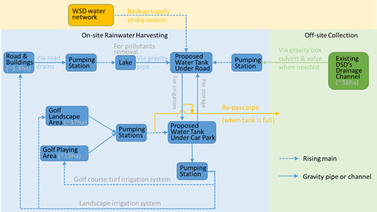
· Option A – rainwater harvesting: the rainwater within the Project Site would be collected and conveyed into the proposed water storage tank beneath the car park of the ancillary facilities and the water storage tank beneath the access road, through a series of U-channels, drainage pipes, rainwater pumping stations, box culverts. (refer to Drawing 2.1 of Appendix 2.3 and Section 2.5.2.9 for detail of the stormwater collection system). In particular, the runoff from the road and buildings would be first conveyed to the lake through road drains and pumping stations for pollutants removal before using it for irrigation.
· Option F – water extraction from existing open channel: water extraction from existing 5.4m drainage channel next to the Project Site (refer to Drawing 2.2 of Appendix 2.3). Most of the proposed pipe works would be along the northern edge of the boundary of Project Site and only around 60m pipe works would be laid outside of the boundary of the Project Site to connect the extraction point and the Project Site. The total catchment area of the 5.4m drainage channel is about 40 ha.
· Option H – freshwater supply from WSD as back-up: at dry season from the existing WSD DN450 fresh water main along Ting Kok Road. Refer to Section 2.5.4 for detail of the fresh water connection location.
2.5.2.2 There would be water storage tanks of a total capacity of 30,000m3 within the Project Site. According to the latest design, two interconnected water storage tanks, one of them will be located underneath the access road running generally along the eastern side of the Project and another one will be located underneath the car park. A pumping station will be constructed to pump the water inside the water storage tanks to feed to the golf course turf irrigation system, the landscape irrigation system for building and access road area.
2.5.2.3 The surface runoff from both the golf landscape area and the golf playing area would be collected by surface channels and then conveyed back to pumping stations, and from which the surface runoff would be pumped back to the water storage tank under the car park. Similarly, the surface runoff from buildings and access road would be collected by road drains which connect to pumping stations, and from which the surface runoff would be pumped to the lakes within the golf course for pollution removal treatment and then reach the water storage tank under the access road. The total design area of these lakes would be about 19,310m2 and with a depth of 1-1.5m. These lakes would provide certain pollutant removal capability through settling and biological uptake by aquatic vegetation. Any overflow from these lakes will be drained via gravity pipes back to the water storage tank underneath the access road.
2.5.2.4 The water storage tanks would also receive freshwater from WSD and those water flow to be extracted from an existing DSD drainage channel (see Section 2.4.6).
2.5.2.5 During December to the following March (4 months), the water storage tanks will mainly function as rainwater harvesting storage for on-site irrigation. The water storage tank shall be kept at approximately 40% full at all time which is equivalent to about 7 days irrigation demand. The remain 60% storage (approximate 18,000m3) will be spared for rainwater storage to minimize bypassing into Tolo Harbour. The available retention storage can resist a 85mm daily accumulated rainfall. Based on the historical daily rainfall in the past 21 years, it is understood that no exceedance of 85mm daily accumulated rainfall was recorded during December to the following March.
2.5.2.6 Between April and the following November (8 months), the weather forecast by HKO will be closely monitored. The water storage tanks will be set to store approximately 15% full with the spare 85% (approximately 25,500m3) capacity to cope with the additional rain water. This storage is estimated to be capable of resisting the daily accumulated rainfall of about 125mm. When consecutive rainfall or tropical cyclone warning signals is forecasted in the coming days, the golf course operator will cease the application of agrochemicals in the golf course. And the stored water in the water storage tanks will be fully consumed for the preparation to store 30,000m3 rain water which can resist daily accumulated rainfall of about 145mm.
2.5.2.7 The analysis of continual rainfall events has also been conducted with details given in Section 6.
2.5.2.8 Hence, the water storage tanks would be sufficient to reduce the likelihood of bypassing surface runoff to Tolo Harhour and most time of the year while maintaining sufficient water supply for irrigation purposes. Only during very heavy and prolonged rainfall events would the surface runoff be bypassed.
2.5.2.9 The contour of the Project Site will generally follow the current site contour, i.e., the high point at the middle while sloping towards east and west for both sides. The drainage system will be designed according to DSD’s Stormwater Manual to collect the surface runoff from the Project Site. As shown in the Drawing 2.1 of Appendix 2.3, a U channel will be provided along the perimeter of the Project Site at the toe of the hill which will collect the surface runoff running from the hill. The U channel at the eastern edge of the hill will collect the surface runoff from the eastern portion of the Project Site and convey it to the underground water storage tanks beneath the access road. The U channel at the western edge of the hill will collect the surface runoff from the western portion of the Project Site and convey it to the pumping stations located at the two local low points within the western portion of the Project Site, i.e. at the northwest corner and the middle of west boundary. Stormwater from the pumping station at the northwest corner of the site will be pumped to the water storage tanks beneath the entrance of the access road while stormwater from the pumping station at the middle of west boundary will be pumped to the water storage tanks beneath the Ancillary Facilities. The whole drainage system will be adequate to convey the peak runoff under 1 in 50 year design rainfall following DSD Stormwater Manual. During the construction stage, a 300mm bund wall is also recommended along the seawall during to prevent any potential overflow of stormwater with construction waste into the Tolo Harbour in case portion of the temporary drainage system is blocked.
2.5.2.10 Apart from the surface runoff conveying system illustrated above, a subsoil drain system would be implemented beneath the surface of the Project Site to facilitate the drainage of infiltration within the surface backfill soil. During rainfall event, portion of the rainfall will be quickly collected by the surface U channel directly through the overland surface runoff during rainfall. Portion of the rainfall will infiltrate underground and slowly infiltrate though the soil into the subsoil drain. As it will take several days for the infiltration to arrive at the subsoil drain, the infiltration collected by the subsoil drain is considered to impose only relatively minor impact to the capacity of the water storage tanks. This is attributable to lots of the water collected through the surface runoff several days ago during rainfall event has already been consumed for irrigation when the infiltration arrives at the water storage tanks. An indicative section is shown below for the process of collecting infiltration.
Diagram 2: Indicative
section of infiltration collection
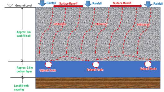
2.5.2.11 The subsoil drain will collect the infiltration beneath the Project Site as illustrate above and further convey it into the U-channel at the toe of the slope. The gradient of the subsoil drain will generally follow the slope gradient of the Project Site. An indicative connection section between the subsoil drain and the U channel is shown below.
Diagram 3: Indicative connection section between subsoil drain and U channel
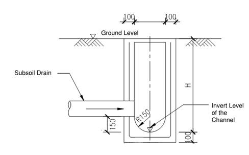
2.5.3 Sewerage Connection
2.5.3.1 It is estimated that approximately 500m3/day will be generated from the guests and staff using the ancillary facilities within the golf course.
2.5.3.2 As shown in Drawing 2.3 of Appendix 2.3, a new Sewage Pumping Station (SPS) and a set of DN300 sewer will be provided to collect and convey the sewage flows generated from the Project to the existing DN600 sewer through connecting to the existing manhole located in front of main entrance of Project on Ting Kok Road, which will be further conveyed to TPSTW through DSD’s public sewerage network (see Drawing 2.3 of Appendix 2.3, for the location of the sewage connection point), for proper treatment. Hydraulic assessment indicates that the existing immediate downstream sewerage network of the Project has adequate capacity to serve both the existing and Proposed Development (a detailed Sewage Impact Assessment report has been submitted separately). Therefore, it appears that no adverse sewerage impacts on the existing sewerage system due to the proposed development would be anticipated.
2.5.3.3 Contractor shall submit a summary plan to describe the construction sequence of the new SPS in construction stage. The key construction sequence of the new SPS is summarized as follows:
1. Install the excavation and lateral support (ELS) system for the proposed new SPS.
2. Excavate to the required formation level of the new SPS.
3. Construct the structure of the new SPS and remove the ELS system.
2.5.3.4 Alternative sewer alignment going west directly to the TPSTW has also been considered. However, sewer pipe on this alignment would mainly be laid on the slope which would impose severe maintenance constraints and hence is not further considered.
2.5.3.5 Contingency planning for disruption of normal SPS operations will need to be considered in the planning and design of the SPS. Scenarios like power failure, failure of the duty pump, fire or flooding, should be considered.
2.5.3.6 The following initial contingency measures can be considered to control the emergency overflows from the SPS thereby polluting the receiving water bodies at Tolo Harbour:
· Dual feed power supply for the SPS;
· Standby pump; and
· Sewage tanker vehicles.
2.5.3.7 Moreover, as the proposed SPS is designed to only serve the Proposed Development, it would be possible to prevent the discharge to the SPS when malfunctions by temporarily suspending the use of some facilities of the Proposed Development if such unlikely catastrophic failure happens. This could prevent the emergency bypass from the SPS. During that period, portable toilets could be considered for temporary service. Therefore, no adverse water quality arising from the emergency bypass from the SPS is anticipated.
2.5.3.8 As the sewage flows is relatively small (500 m3/day ADWF), sewage tanker vehicles (each vehicle can remove 12m3 of sewage) could also be considered to remove sewage from the SPS to existing public sewer manhole located in front of main entrance of golf development on Ting Kok Road at during emergency case.
2.5.4 Freshwater and Flushing Water Supply
2.5.4.1 For the purpose of potable water, flushing water and fire service water, water supply from WSD will be sought. It is proposed to tee from the existing DN450 fresh water main at the entrance of the access road of the Project Site and a DN200 salt water flushing water main running along the edge of the Ting Kok Road at northwest of the Project Site (See Drawing 2.4 of Appendix 2.3,). It is estimated that approximately 150m3/day and 30m3/day of fresh water demand and saltwater demand respectively, whose quantities deem insignificant to the existing water mains.
2.5.5 Site Formation Works
2.5.5.1 The existing landfill site profile would be modified to support the construction of the proposed golf course development. Based on the preliminary findings, the stability of the landfill area is stable to accommodate the proposed development. To avoid damaging the geomembrane in the capping layer, the layer of soil fill covering the waste in the landfill would not be adversely disturbed. However, to facilitate the site formation work, the top soil of not more than 300mm will be removed. Thus, extensive excavation works is not recommended and only re-profiling of the golf course development would be conducted by filling instead. The filling layer would be approximately 1 to 2m thick to form the required contour of the golf course. The stability of the landfill area for further development shall be subject to the findings of the detailed geotechnical assessment to be conducted in design stage and before the commencement of construction works. Prior written approval from EPD will be obtained before commencement of any excavations within the landfill area.
2.5.6 Access Road
2.5.6.1 An access road with a road width of approximately 7.3m will be proposed for the proposed golf course development. It will have a 1.6m wide single-sided footpath and would run along the eastern side of the site to connect Ting Kok Road to the waterfront area. The access road will have a total length of about 1,100m and will be constructed above the existing ground with a water tank and other utilities connected underneath. The proposed road level will vary from +8.3mPD to +21.8 mPD. Drawing 2.5 of Appendix 2.3 shows the preliminary layout and sections of the proposed access road.
2.5.7 Ancillary Facilities
2.5.7.1 Other than the above key infrastructure elements of the Project, there would also be a number of ancillary facilities that support the necessary operations of the Project. These facilities include but not limited to car parks, food and beverage, storage, offices, golf cart parking and maintenance area, nursery, pump rooms / plant rooms, VR training rooms, administrative office etc.
2.5.8 Provision of Staff Quarters and Overnight Accommodations
2.5.8.1 In order to allow for more flexible uses and development of the Project to suit contemporary circumstances and operational requirements, the provision for staff quarters and overnight accommodations have been duly considered.
2.5.8.2 These staff quarters and overnight accommodations are located close to and overlooking onto the east and south seafront instead of Ting Kok Road and the Tai Po Industrial Estate. The separation distances from Ting Kok Road and Tai Po Industrial Estate are about 350 – 780m and 320 – 520m respectively. Besides, all the staff quarters and overnight accommodations are 1-2 storeys only and the upper roof structures are built into the slope and form part of the golf course. Hence, both the staff quarters and overnight accommodations would be substantially screened by the proposed golf course terrain which would reach a maximum height of about 42mPD. These overnight accommodations would not induce significant additional traffic, waste, sewage etc as well.
2.5.8.3 Hence, this EIA has therefore considered the original project development with neither staff quarters nor overnight accommodations (i.e. Scenario 1), and an additional development scenario with both staff quarters and overnight accommodations (i.e. Scenario 2) as indicated in Figure 2.1. Assessment results (see Section 3 – Section 12) have concluded that the environmental impacts caused by both scenarios are environmentally acceptable.
2.5.9 Modification of Existing Landfill Restoration Facilities
2.5.9.1 The following modifications are proposed (See Drawing 2.6 of Appendix 2.3).
Modification of landfill gas and leachate extraction wells
2.5.9.2 To facilitate the construction and operation of the Project, the capping layer or liner during the relocation of the landfill gas wells and leachate wells would require some relatively minor works. Any affected liner will be properly sealed with new liner and sufficient overlapping will be provided between the old and new liners. Capping layer will be reinstated after the completion of the modification of wells.
2.5.9.3 To facilitate the future monitoring works in the restored landfill, the Project Proponent will install the advance monitoring system for remote / automatic monitoring for groundwater, landfill gas and leachate including data loggers and transmitters system. The proposed automatic monitoring system with the aims to improve the productivity, reliability and availability as well as to enhance the overall environmental performance of the restored landfill / golf course.
2.5.9.4 There are numerous of vertical shafts for extracting the landfill gas and leachate. In order to suit the future ground profile of the Project, some of the vertical wells will be extended and access shafts will be provided for monitoring and maintenance. To suit the Project layout, some of the extraction wells will be relocated to avoid conflict with the teeing ground and fairway. New extraction wells will be drilled into the waste mass and the new horizontal header pipes will be installed to convey the landfill gas and leachate to the nearby existing network.
Relocation of leachate pumphouse #1 and associated pipeworks
2.5.9.5 The location of the leachate pumphouse #1 will conflict with the ancillary facilities of the Project. It is thus proposed to relocate the pumphouse #1 as well as the associated leachate extraction wells and horizontal header pipes. New extraction wells will be drilled into the waste mass and new horizontal header pipes will be installed to convey the leachate from the waste mass to the new pumphouse. Modification to the capping layer will be required and sufficient overlapping will be provided for both existing and new capping to avoid adverse odour impact.
Modification of leachate pumphouse #2
2.5.9.6 The access road of the Project will run over the existing leachate pumphouse #2. The existing control panel of the pumphouse and the manhole access shafts will be relocated and modified to suit the future road layout.
Relocation of landfill gas passive vents and groundwater monitoring wells
2.5.9.7 There are existing landfill gas passive vents along the boundary of the Project close to the Fortune Garden. As there will be a new internal road running along the site boundary to the ancillary facilities, the existing landfill gas passive vents will be abandoned and new passive vents will be installed along the access road.
2.5.9.8 There are existing groundwater monitoring wells near the seawall, and will conflict with the access road and ancillary facilities. New groundwater monitoring wells will be installed and the existing wells will be abandoned.
2.5.9.9 As both passive vents and groundwater monitoring wells are located outside the waste mass, there should be no adverse impact due to the relocation works.
2.5.9.10 During the design stage, the Project Proponent shall employ a Specialist Contractor who shall prepare and provide a detailed Design Plan and a Works Plan to the EPD for approval regarding the proposed demolition, relocation, reprovisioning and modification works and associated mitigation measures before commencement of the works, with the aim to minimise the disruption to the landfill operation and to avoid adverse environmental impact.
2.5.10 Construction Issues
Construction Characteristics
2.5.10.1 The existing landfill site would be modified in phase to support the construction of the Project. Following completion of the Project and landscaping works, the re-engineered terrain would be fully vegetated with a variety of plant and tree species.
2.5.10.2 The drainage layout of the whole development site would be rerouted, reconfigured, and restored. The proposed drainage is a box culvert that will convey stormwater runoff into the municipal storm drain system at Ting Kok Road. Trenchless construction method has been adopted to construct the box culvert underneath the access road. This will reduce the amount of excavation and fill significantly.
2.5.10.3 Site formation for the Project would involve conventional cut and fill grading techniques. A substantial amount of existing fill is present on the site and would be either removed or consolidated and recompacted prior to the grading of Project building pads. Site grading would be required to prepare the proposed building pads for construction. Grading would also be required in order to construct the proposed box culvert, roads, parking areas, and drainage improvements, and to install utilities. Fill material would be imported to the site.
2.5.10.4 The site formation levels have been critically reviewed in order to achieve cut/fill balance for each phase of construction. In addition, the proposed site formation levels taking into account the flood levels to ensure the proposed development would not be subject to flooding. The approach of cut and fill balance will give rise to minimizing earthwork. Reusing excavated materials for backfilling purposes will be adopted on site as far as practicable whilst specification may be revised and adjusted so that characteristics of excavated materials of this landfill can be reused as general fill material on site.
Cut-and-Fill
2.5.10.5 The site formation levels have been critically reviewed in order to achieve cut/fill balance as much as practicable for each stage of development of the proposed golf course. The site formation levels and the slope works have been critically reviewed to minimise the generation of excavated materials and maximise the on-site reuse of the generated materials. On-site sorting, reuse and recycling of different excavated materials have been proposed. It is anticipated that only the top layer of turf will be disposed offsite.
2.5.10.6 Most of the excavated materials from the site will be inert C&D soft materials or rock fragment materials suitable to be reused for filling works. Non-inert C&D wastes such as turf are proposed to be disposed of at the landfills, in accordance with the current waste management policy.
2.5.10.7 A preliminary estimation of the amount of filling works required for three stages of development of the proposed golf course was carried out. In general, the estimated quantities of filling works are more than excavated quantities. As the site is relatively low-lying, filling is required to raise the site formation levels to provide undulant terrain as a golf course and sufficient protection against flooding. The proposed golf course requires a net import of general fill of about 1.5 million tons from the public fill bank, or possible exchange with other sites. Such matching of surplus excavated material and deficit of fill material can be assisted by the information provided by Fill Management Division of the Civil Engineering and Development Department (CEDD).
Construction Vehicles
2.5.10.8 The Project Site is close to Ting Kok Road. Ting Kok Road is the main road serving the villages and housing developments between TPIE and Tai Mei Tuk at Tolo Harbour. Regarding Ting Kok Road, the current speed limits are 50 km/h and 70km/h over different sections of the road in accordance with Gazette notices published and they are also indicated by traffic signs on site.
2.5.10.9 The transportation of fill would be by dump trucks from/to the public fill bank via Ting Kok Road. It is anticipated that an addition of about 15 dump trucks per hour will be imposed onto the existing traffic loading at Ting Kok Road during April 2021 to October 2023. The traffic impact is considerably insignificant due to such additional traffic impact.
No Marine-Based Works
2.5.10.10 The performance of the sea wall adjacent the Project Site is based on keeping the area behind the wall relatively dry. The soils used must not become saturated during construction and the site formation sequence must route water away from the back of the sea wall. Incorporating berms into the construction is a practical way to direct surface water away. No marine-based works are anticipated.
2.5.10.11 In order to avoid impacts on marine ecology during the construction, silt curtains will be adopted at each outfall to enclose turbidity and minimize influence on outside sea area. Silt curtains are particularly suitable for shallow water environments in Tolo Harbour adjacent to the proposed golf course, with water depths less than 10 meters.
2.5.11 Preliminary Geotechnical Assessment
2.5.11.1 Based on the preliminary investigation, the site is stable to accommodate the golf course development although there is a limitation on the load bearing capacity for the proposed development on the platform and slopes, which are made of municipal solid waste. According to available information. the landfill site is only able to support a loading of 5 kN/m2 plus a dead load of 3m of soil cover, or equivalent.
2.5.11.2 The allowable bearing capacity of the waste fill platform and slopes should be further verified with plate load test during the detailed design stage.
2.5.11.3 A detailed geotechnical assessment shall be conducted in design stage and before commencement of construction works to ensure the proposed golf course development is safe. In addition, as the Site is a restored landfill site where its waste is subject to continuous decomposition, settlement monitoring and precautionary measures shall be developed in the detailed design stage to control the potential settlement due to the proposed golf course development.
2.6 Consideration of Alternative Construction Methodologies
2.6.1 Proposed Construction Programme
2.6.1.1 The construction is divided into three areas (i.e. Area 1, 2 and 3), from the north (inland) to the south (seashore) (See Appendix 2.2 and Drawing 2.7 of Appendix 2.3) and to be conducted in three phases from Year 2021 to 2023.
2.6.1.2 Works include the formation of a 7.3-m wide 2-lane carriageway at the northern site boundary, a 1.6m wide walkway, planting strip, retaining walls below the carriageway, construction of water storage tanks (including water storage tank below the ancillary facilities), site formation works at Area 1 of the Project Site and landscaping works.
2.6.1.3 In order to prevent surface runoff from discharging into the sea or outside the site boundary during construction, Practice Note for Professional Persons, Construction Site Drainage (ProPECC PN 1/94) will be followed. In particular, temporary drainage measures will be setup in low-lying area along the site boundary. The measures include erecting sand bag barrier, temporary stormwater drainage channel and temporary stormwater storage tank. Surface runoff will be treated in a desilting tank, where sand and silt will be removed before discharging into the existing stormwater collection system or into the sea.
2.6.1.4 Retaining walls and water storage tanks (including water tank below the ancillary facilities) will be constructed in early stage to enhance the surface runoff flow control and storage for protecting marine environment.
2.6.1.5 After completion of the temporary drainage measures, plants and topsoil within the Project Site will be removed and disposed at landfills.
2.6.1.6 Backfill material will be delivered to the Project Site and be used for site formation works to the design terrain.
2.6.1.7 As part of the site formation works in Area 1 is progressively completed, tree planting and turfing will be carried out subsequently.
Phase Two (Year 2021 - 2022)
2.6.1.8 The construction of Area 1 continues whilst the construction of the ancillary facilities commences.
2.6.1.9 To utilise the sand bag barrier, temporary stormwater drainage channel, temporary stormwater storage tank and desilting tank to treat the surface runoff before discharging into the existing stormwater collection system or into the sea. Meanwhile, surface runoff will be temporarily stored in the stormwater storage tank constructed in Area 1 to enhance the control of surface runoff and avoid direct discharge of site runoff.
2.6.1.10 Continue the construction of the retaining walls along boundary of the Project and the water storage tanks.
2.6.1.11 After completion of the temporary drainage measures in Area 2, plants and topsoil within the Project Site will be removed and disposed at landfills.
2.6.1.12 Backfill material will be delivered to the Project Site and be used for site formation works to the design terrain.
2.6.1.13 As part of the site formation works in Area 2 is progressively completed, tree planting and turfing will be carried out subsequently.
2.6.1.14 In the meantime, construct the superstructure of the ancillary facilities.
2.6.1.15 To avoid affecting the night roosting habitat for CC and BK near the eastern side of the Project Site the use of PME shall be minimised at the eastern part of Area 2 (near preserved tree groups) and cease to work at least one hour before the earliest sunset time of the month. The proposed restriction hours derived from the earliest sunset time in each month between 2018 and 2020 (source: Hong Kong Observatory) is given in Table 10.9.1.
Phase Three (Year 2022 - 2023)
2.6.1.16 The remaining works in the previous two areas continue whilst construction of the ancillary facilities to be completed.
2.6.1.17 To utilise the sand bag barrier, temporary stormwater drainage channel, temporary stormwater storage tank and desilting tank to treat the surface runoff before discharging into the existing stormwater collection system or into the sea. Meanwhile, surface runoff will be temporarily stored in the water storage tanks constructed in Area 1 and Area 2 to enhance the control of surface runoff and avoid direct discharge of site runoff.
2.6.1.18 Continue the construction of the retaining walls along boundary of the Project and the water storage tanks.
2.6.1.19 After completion of the temporary drainage measures in Area 3, plants and topsoil within the Project Site will be removed and disposed at landfills.
2.6.1.20 Backfill material will be delivered to the Project Site and be used for site formation works to the design terrain.
2.6.1.21 As part of the site formation works in Area 3 is progressively completed, tree planting and turfing will be carried out subsequently.
2.6.1.22 In the meantime, complete the superstructure of the ancillary facilities.
2.6.1.23 To avoid affecting the night roosting habitat for CC and BK near the southern end of the Project Site, use of PME shall be minimized in Area 3 (Drawing 2.7 of Appendix 2.3) and cease to work at least one hour before the earliest sunset time of the month. The proposed restriction hours derived from the earliest sunset time in each month between 2018 and 2020 (source: Hong Kong Observatory) is given in Table 10.9.1
2.6.2 Consideration of Alternative Construction Methods for Proposed Access and Drainage System
2.6.2.1 Access to the golf course would be from Ting Kok Road. The proposed access to the ancillary facilities will also provide along the northern side boundary of the Project. This new access road would not form part of the public highway. The proposed drainage system will be formed and aligned underneath this proposed access.
Cut and cover approach
2.6.2.2 Under this scenario, the proposed drainage system will be formed in a box culvert and aligned exactly underneath the proposed access road. Cut and cover approach involves excavating the drainage box culvert in an open cut. Excavation begins at the surface and extends downward. The sides of the excavation must be protected by ELS or in gentle sloping surfaces, which may be temporary (e.g., sheeting). In preparation for excavation, utilities must be relocated or supported in place. Also, site traffic must be detoured to create a work zone to perform the excavation. After the excavation is completed and the permanent wall of the box culvert constructed, the roof (typically, reinforced concrete) is installed, which can be precast or cast-in-situ dependent on the site restrictions. The formation of the access road could then be made and the road surfacing follows on.
Trenchless approach
2.6.2.3 Pipe jacking / microtunnelling is a non-disruptive method of installing drainage conduits by thrusting pipes through the ground as controlled excavation is undertaken at the face. Pipes manufactured in a variety of materials to include concrete, clay, grp and steel can be jacked and standard pipe diameters generally range from 150mm to 2,400mm, or greater when required. Jacking lengths achievable can be considerably in excess of 1km depending on pipe diameters, ground conditions and excavation methods. However, drive lengths are limited by practical engineering considerations and economics and drives either in a straight line or to a relatively large radius. Pipe jacking can deliver environmental benefits compared to open-cut construction, which requires considerably greater amounts of excavation and backfill material. But, pipe jacking is over 50% more expensive than box culvert construction by cut and cover method.
2.6.3 Preferred Construction Methodologies
2.6.3.1 Culverts allow water to pass beneath the access road or other structure e.g. the ancillary facilities. They are designed buried or embedded in the ground. The box culvert can be used as a water-carrying structure, for storage as water storage tanks underneath the ancillary facilities. In this design, the culverts can accommodate vehicular and pedestrian traffic. However, precast culverts can be formed in various shapes and sizes that mostly suit the usage in the Project.
2.6.3.2 Precast concrete box culverts are an alternative to circular concrete pipes. Box culverts drain high volumes of water and can generally handle a higher flow rate than pipes. The design culverts could meet the required traffic load capacity. Box culverts are flexible in construction, they can be either precast concrete that allows for strict control during manufacturing, or cast-in-situ concrete that can vary to suit the construction with variations in sequence and site traffic among other construction activities. Box culverts offer superior strength and flexible for installation when compared to systems such as multi-barrel circular drains, especially based on soft ground foundation. In between of precast box culverts at some locations, cast-in-situ box culverts can be constructed to suit the site constraints and other construction activities.
2.6.3.3 Precast concrete culverts can be manufactured well in advance. When it’s time to install, the culvert requires a crane and a small work crew and for backfill around the structure as soon as it is installed. Once in place, other construction can be carried out concurrently. This ease of installation reduces potential delays of the project. Precast concrete can be installed during wet conditions. Factory production of precast concrete box culverts allows flexibility of surface finishing, colour range and special shapes (such as bend units), and provide precast concrete box culverts of reduced tolerances, thinner sections compared with cast-in-situ concrete. Additionally the quality of each precast concrete box culvert unit can be checked before a unit is put to use on site. On-site installation of precast box culverts require fewer workers and time which can ultimately save money, but also safer. The costs to repair and rectify defective cast-in-situ concrete are always high and time-consuming.
2.6.3.4 As well as having many advantages, pipe jacking can acquire many disadvantages such as its cost. Due to the technology used its cost is quite high. For the application in the proposed golf course, multiple pipes have to be installed to meet the overall large size required, a typically cross sectional area of 20m2. If a fail does occur, there is great difficulty in replacing those damaged pipes. To achieve a fully functioning system, the pipes must align perfectly but which may not be easily achieved in soft ground condition if no ground improvement is done in advance which may cost extra costs.
2.6.3.5 The selection of the preferred scenario of precast box culverts brings environmental and engineering benefits to the proposed golf course. These benefits have arisen through modifications to the engineering layout stimulated by issues raised during the course of assessment, as well as through engineering optimisation.
2.6.3.6 Summary of the alternative options and mitigation measures considered are included in Table 2.7 below.
Table 2.7 Summary of alternative options and mitigation measures
|
Aspect |
Options Considered |
Major Environmental Benefits |
Major Environmental Dis-benefits |
Preferred Option |
|
Project Siting (Section 2.2)
|
1. Shuen Wan Landfill Site (Under non-in-situ land exchange, therefore no other options considered) |
· Allow active conservation at Sha Lo Tung Valley |
· Potential disturbance to species of conservation importance, i.e. CC and BK · Loss of man-made habitat |
1.
|
|
Layout Options (Section 2.4.8 and Figure 2.3) |
1. Optimal design of driving range (with minimal regards on roosting site locations) |
- |
· Significant loss of roosting area |
3. |
|
2. Minor adjustment of size of driving range (with slight considerations regards on roosting site locations) |
- |
· Moderate loss of roosting area |
||
|
3. Substantial reduction of size and change of orientation of driving range (with optimal considerations on roosting site locations) |
· Maximised the preservation of core roosting area by downsizing golf driving range and preserve important tree groups within the Project Site · Alternate the golf swing direction from south to north to avoid physical impact to roosting birds |
· Not a typical arrangement and will compromise views of golfers at golf driving range by diverting golf swing direction towards the north |
||
|
Construction Method of drainage system along the access road (Section 2.6.2) |
1. Open-cut method with box culverts (allow space for water storage tanks) |
· Provide storage volume to intercept storm flow |
· Involves minor excavation, backfilling and hence dusty construction activities |
1. |
|
2. Pipe Jacking / Microtunnelling with drainage conduits |
· Non-disruptive method that avoids excavation and backfilling |
· Storage volume is comparatively lower than the open-cut method with box culverts |
||
|
Water Abstraction Method (Section 2.4.6) |
1. Combination of rainwater harvesting / water abstraction from open channel / freshwater from WSD |
· Reduce the use of freshwater |
· Minor alteration works at existing open channel |
1. |
|
2. Seawater desalination |
· Reduce the use of freshwater |
· Discharge of effluent to Tolo Harbour |
||
|
3. Reuse of treated sewage effluent |
· Reduce the use of freshwater |
· Discharge of effluent to Tolo Harbour |
||
|
4. Greywater recycling |
· Marginally reduce the use of freshwater |
· Insufficient supply of greywater on site and likely to require substantial amount of freshwater from WSD |
||
|
5. Use of underground water |
· Reduce the use of freshwater |
· Potential ecological impacts to nearby water bodies and habitats |
||
|
6. Use of leachate |
· Reduce the use of freshwater |
· Odour impact · High nitrogen content of treated leachate |
||
|
Sewage Handling (Section 2.4.4) |
1. Establish new STW |
- |
· Routine discharge to Tolo Harbour · Induce marine works and ecological impact · Risks of emergency bypass |
2. |
|
2. Convey sewage to TPSTW |
· Avoid discharge of treated effluent · Avoid marine works |
· Require constructing SPS for pumping sewage, induce a risk of emergency bypass |
||
|
Mitigation Measures to night roosts during construction phase (Section 2.4.8) |
1. Carry out construction works by phases |
· Dissipate the loss of habitats in phases |
· Slightly prolonged construction period |
1, 2, 3, 4 |
|
2. Conduct landscaping planting right before clearance in next phase |
· Provide roosting sites before vegetation removal in the next construction phase |
- |
||
|
3. Limit the operation hours of PME near roosting area to one hour before sunset |
· Protect roosting of birds with specific attention to roosting time exhibited |
· Limit available hours for works within a day, resulting in prolonged construction period |
||
|
4. Whips planting to replace existing trees in poor conditions |
· Enhance conditions of preserved tree groups |
- |
2.7 Environmental Conscious Turfgrass Management Plan (TMP) – An Outline
2.7.1.1 It is extremely important to develop a very comprehensive strategy and plan to devise the approach in applying agrochemicals including fertilizer, pesticides and herbicides to the golf course. Obviously, the selection of agrochemicals would be highly dependent on a number of factors including but not limited to golf course design, selection of turf / vegetation, soil substrate design, irrigation strategy, management of golf course, cultural practices etc.
2.7.1.2 All the above have to be further developed and refined when the future golf course operator is on board and the detailed design is established. The future operator should therefore be required to submit a TMP as one of the EP conditions to present the rationale and strategy in various aspects as identified above.
2.7.1.3 Nevertheless, for the purposes of this EIA, it is considered beneficial to include an outline of the TMP which demonstrates how various environmental concerns should be properly addressed. The following sections present the key elements of the future TMP.
2.7.2 Guiding Principles
2.7.2.1 The guiding principles provide a framework within which the design of the golf course should be adhered to. As a modern and environmentally conscious golf course, it is proposed to adhere to the following 4 guiding principles:
1) To comply with all local statutory requirements and best practices relevant to the industry
2) To establish an environmentally responsible golf course achieving international quality
3) To ensure that the procedures for agrochemical applications and course management are followed in an environmentally acceptable manner
4) To demonstrate / promote sustainable design suitable for golf course and ancillary facilities
2.7.3 Design and Management Approaches
2.7.3.1 In order to materialise the above guiding principles, it is necessary to implement best practices design and management approaches. Some key considerations include but not limited to the following:
· Adopt good practice in the design, construction and management of the golf course and ancillary facilities to avoid / minimise impacts on the environment as much as practicable;
· Maximise the reuse of resources, such as water, and agrochemicals and hence minimise their use on the golf course;
· Improve nutrient – retention capacity of the soil and hence avoid the overuse of fertilizers;
· Minimise the amount of surface runoff into marine water through suitable drainage design;
· Capacity building of a competent management team;
· Optimum design for irrigation and rainwater harvesting system; and
· Adoptive monitoring and management of the turf.
2.7.4 Suitable Selection of Turf Grass Species, Cultivars and Agrochemicals
2.7.4.1 The selection of turf grass species and alternatives should be optimum for the Project Site in Tai Po taking into account the surrounding environment including local ecological conditions, micro-climate, soil characteristics etc. Typical types of turf grass species that may be selected are as follow although the future operator may decide to review and adjust according to actual operating conditions:
· Seashore Paspalum (Greens and Tees);
· TifEagle (Greens and Tees); and
· Zoysia matrella (Fairways and roughs).
2.7.4.2 Types of turfgrasses selected should possess the following characteristics and adaptive traits:
· Proven adaptable to Hong Kong’s subtropical growth environment and soil conditions;
· Be able to provide and maintain a quality playing surface year-round with the minimum inputs of agrochemicals;
· Rapid recuperative potentials, with special emphasis on resistance to wear- and- tear, compaction, weeds invasion, and vegetative regrowth;
· Low fertilizer requirement to avoid pollution of nearby water bodies;
· Resistant to pests including insects, diseases, nematodes etc to minimize the use of pesticides ; and
· Low water requirement, and be able to withstand short period of droughts that can occur in Hong Kong.
2.7.4.3 Zoysia matrella, though slower growing than Seashore Paspalum, is a hardy species that is resistant to wear-and-tear, pests and compaction. It also has a low fertilizer requirement and is relatively drought-resistant.
2.7.4.4 To allow for a proper management of the golf course, an application plan of the agrochemicals including fungicide, herbicides, insecticides and fertilizers should be derived. Prevention is better than cure, appropriate and suitable cultural practices will be implemented to minimize the invasion of weeds, and outbreaks of insects and diseases throughout the year.
2.7.4.5 The preliminary results show that mechanical methods (e.g., hand weeding) of removing turf grass weeds manually shall be the primary means of control. Herbicides would only be applied, when needed, by spot spraying of the weeds (e.g., Eleusine indica). In the event blanket spray is required, selective herbicides will be used, following regulatory conditions imposed by the government and instructions set out in the manufacturers’ note.
2.7.4.6 Plants require 14 nutrients for growth including the macro-nutrients of nitrogen (N), phosphorus (P) and potassium (K). Turf grasses are no exception and the problem of nutrient deficiency is exacerbated by the removal of grass clippings on greens and tees. With the use of Zozia matrella, a low nutrient-demanding species, on fairways and rough areas the amount of fertilizers used on the golf course will be substantially reduced. Where nutrient replenishment is needed on greens and tees, fertilizers will be applied following best practices known to the industry. These shall include avoidance of excessive application and over-irrigation, balanced NPK formulation, and where appropriate the use of slow-release fertilizer etc.
2.7.4.7 Likewise, a cautious approach will be followed in the spray of insecticides and fungicides. The spray programme will tie in with a close and continuous monitoring of the growth cycle of the pests in order to reduce the amount and frequency of spray. Calendar spray will be avoided as much as practicable. The corresponding application of agrochemicals on the course is summarized in Table 2.8. It should be noted that none of the currently proposed agrochemicals are Persistent Organic Pollutants set out in Schedule 1 of Pesticides Ordinance (Cap.133), significant accumulation is therefore not anticipated. In fact, the import, export, manufacture, sale, supply, possession, use or transhipment (except air transhipment cargo) of all scheduled pesticides is prohibited except under a Pesticide Permit issued by DAFC under Cap. 133.
Table 2.8 Proposed agrochemicals and corresponding application area
|
Agrochemicals [1] |
Turf[3] |
|||
|
Green |
Tee |
Fairway |
Rough |
|
|
Fungicides [4][5] |
||||
|
Daconil |
✓ |
✓ |
✓ |
✓ |
|
Bayleton |
✓ |
✓ |
✓ |
✓ |
|
Herbicides [4] |
||||
|
Monosodium Methanearsonate (MSMA) |
✓ |
✓ |
✓ |
✓ |
|
Roundup/ Glyphosate |
|
|
[2] |
[2] |
|
Monument |
✓ |
✓ |
✓ |
✓ |
|
Ronstar (Pre-emergence) |
✓ |
✓ |
✓ |
✓ |
|
Insecticides [5] |
||||
|
Chlorpyrifos |
✓ |
✓ |
✓ |
✓ |
|
Fipronil |
✓ |
✓ |
✓ |
✓ |
|
Fertilizers |
||||
|
Anderson 18-9-18 |
✓ |
✓ |
|
|
|
Gypsum/ Dolomite |
✓ |
✓ |
✓ |
✓ |
|
Ferrous Sulfate |
✓ |
✓ |
✓ |
✓ |
|
Nitrophoska 12:12:17:2 |
|
✓ |
✓ |
✓ |
Notes:
[1] The selection of agrochemicals shall be further reviewed by the operator and documented in the future TMP and reviewed as necessary.
[2] Spot spray, hence the application area is not fixed.
[3] Percentage of green: 3%, tee:2%, fairway: 35% and rough: 60%.
[4] The use of salt water will also be explored as fungi control or weed control.
[5] Fungicides/ insecticides will be applied to at most one of the golf course parts Green, Tee, Fairway or Rough at a time. Furthermore, the use of fungicides/ insecticides in Fairway may be sub-divided into multiple times according to the turfgrass species and it is anticipated that fungicides/ insecticides will seldom be used in Rough.
2.7.4.8 The application rates of fungicides, insecticides and fertilizers are listed in the following table.
Table 2.9 Application rates of agrochemicals
|
Agrochemicals |
Application Rate in Each Application (kg/ha) |
Application Frequency |
|
Fungicides |
||
|
Daconil |
8.2 |
Weekly |
|
Bayleton |
3.0 |
Biweekly |
|
Herbicides |
||
|
Monosodium Methanearsonate (MSMA) |
[1] |
[4] |
|
Roundup/ Glyphosate |
[2] |
[4] |
|
Monument |
[1] |
[4] |
|
Ronstar |
[1] |
[4] |
|
Insecticides |
||
|
Chlorpyrifos |
3.0 |
[5] |
|
Fipronil |
0.014 |
Annually |
|
Fertilizers |
||
|
Anderson 18-9-18 |
54.3 |
Monthly |
|
Gypsum/ Dolomite |
Soil pH dependent |
Monthly |
|
Ferrous Sulfate |
[3] |
Monthly |
|
Nitrophoska 12:12:17:2 |
100.0 |
Monthly |
Notes:
[1] Rate of application dependent on: (a) target weeds, (b) turfgrass mix with types of weed, and (c) product type.
[2] Spot spray, strength dependent on target weeds and their stage of growth.
[3] Rate dependent on turf grass species and their acceptable level of injury symptoms.
[4] As mentioned above, herbicides will only be applied, when needed. Thus, the application frequency is not fixed.
[5] Apply when pests appear.
2.7.4.9 Again, the future operator shall take into account all the necessary requirements from international bodies (e.g. USGA Green Specifications) to devise the recovery arrangement practices and soil testing requirements that are specific to the Project Site and review the turf grass species and agrochemicals progressively to ensure the optimum design can be achieved.
2.7.5 Others
2.7.5.1 The operator shall also make due considerations on cultural practices such as mowing, vertical mowing (scarification), verti-draining, aeration, topdressing and effective maintenance of equipment, all of which are essential to enhancing a healthy and resilient growth of the turfgrasses. This can, in turn, reduce weeds invasion and outbreaks of pests. The irrigation system shall also receive due considerations, and programmable irrigation system shall be implemented to minimise the use of water resources and achieve effective application of agrochemicals. This would help avoid excessive irrigation and hence prevent leaching of nutrients. The future TMP shall also provide the details for the future monitoring programme and any contingency plan that may be required.
2.7.5.2 Details on the application, handling and storage of agrochemicals as well as measures to be carried out in the occurrence of chemical spillage will be provided in the TMP.
2.8.1.1 While a number of design initiatives have been proactively implemented to tackle various environmental challenges as discussed in Section 2.4, the Project aims to achieve more than the statutory requirements. In order to achieve that, a number of environmental initiatives has been identified for the Project. These initiatives cover different aspects including:
· Clean Energy / Energy Saving;
· Sponge Design;
· Waste Minimisation; and
· Enhance biodiversity / Greening.
2.8.1.2 However, while these initiatives are generally considered as practicable at this stage, the extent of applications and other details have to be revisited and further established during the detailed design stage when more engineering information becomes available. The following table summarises all those environmental initiatives envisioned at this stage.
Table 2.10 Environmental Initiatives to be further developed during detailed design stage
|
Aspect |
Environmental Initiatives |
Environmental Benefits |
|
Clean energy / energy saving (Photo 1 and 2) |
· E-shuttles and associated charging facilities in basement carpark · Charging facilities for visitor car parks in basement carpark · PV panels (eg street lights along the access road, external lighting system for ancillary facilities etc) · Wind scoop / wind turbine for the ancillary facilities · Priority using of LED lighting |
· Promote the use of e-cars to abate road side air quality emissions · Use of solar energy to minimise energy consumption · Seize the opportunity to capitalise on renewable wind energy
|
|
Sponge design (Photo 3 and 4) |
· Rainwater harvesting and recycling · Certain permeable surface for the public area in the ancillary facilities |
· Minimise freshwater consumption which is an important source for the society · Enable rainfall infiltration and minimise surface runoff quantity |
|
Waste minimization (Photo 5 and 6) |
· Foodwaste decomposing for organic farming for restaurant and landscaping areas · Use recycle glass bricks for footpath · Make use of felled trees to produce wood chips for garden mulch · Compost grass clippings and food waste |
· Minimise the generation of organic waste that need to be disposed off-site · Promote the use if recycle materials / products |
|
Enhance biodiversity / Greening (Photo 7 and 8) |
· Plant native species in landscaping as much as practicable · Vertical green walls along the at grade water tanks |
· Promote seamless integration of biodiversity and greening into golf course design |
|
|
|
|
Photo 1: Electric car and charging facilities |
Photo 2: PV Panels |
|
|
|
|
Photo 3: Rainwater harvest system (Photo credit: Green Power) |
Photo 4: Permeable surfaces |
|
|
|
|
Photo 5: Food waste composting machine (Photo credit: Green Power) |
Photo 6: Eco Bricks (Photo credit: Green Power) |
|
|
|
|
Photo 7: Vertical greenings (Photo credit: Green Power) |
Photo 8: Landscape with local species |

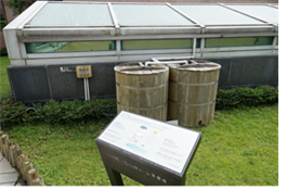
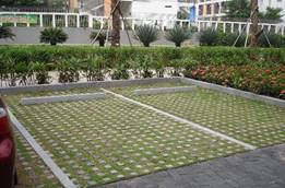

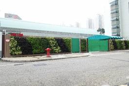
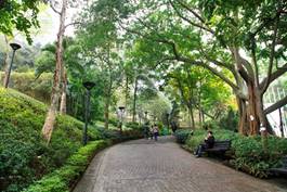
2.9 Collating and Addressing Public Views
Support from Tai Po District Council Members
2.9.1.1 This project has been fully discussed in Tai Po District Council (DC). According to the Tai Po DC meeting minutes from Year 2004 to 2017, the majority of the DC members expressed strong support on this project and urged the government to implement this as soon as practicable so as to response to the need for a golf course instead of a driving range in Tai Po District (Ref: TPDC Paper No. DFM22/2010, DFM29/2010, DFM21/2011, DFMC6/2014, DFM9/2016, etc.). Some discussions have been summarised below:
|
Year |
View from Tai Po District Council |
|
2016 – 2017 |
· Requested that the development of golf course should be implemented as quickly as possible as it has been on the agenda for more than a decade · Welcomed the government’s adoption of non-in-situ land exchange for the purpose of conservation but would need more consultation · Concerned about any structural and liner damage brought from the development on an existing landfill site · More time should be allowed to public to enjoy golf course facilities · Consideration of cycle track to enhance the connectivity between TPIE and Tai Mei Tuk |
|
2012 – 2015 |
· The development of golf course had been planned for almost twenty years and was requested to speed up the progress since the public had expressed their concern on the development of golf course for a long period of time · Public concerned safety issues with the operation of golf course and proposed to erect safety nets to along the side of the golf course next to Fortune Garden |
|
2008 – 2011 |
· The development of golf course would enhance leisure and cultural facilities in Tai Po and the public expressed the need to develop a golf course with training facilities and to replace the existing golf driving range |
|
2004 – 2007 |
· Supported the proposal of golf course since there was a shortage of facilities locally · The proposal of golf course had been on the agenda since the days of the Provisional Regional Council |
Comments Received During the EIA Process
2.9.1.2 During the course of the EIA study, comments obtained from consultations with green groups and members of the public have been duly revisited and were incorporated in the design and construction of the Project where appropriate. The following table summarises all these comments and how the Project Proponent has addressed them suitably.
Table 2.11 Summary of key comments and approaches adopted to address comments collated
|
Issues |
Comments |
Responses & Approaches Adopted |
|
General |
Given the proximity of the site to residential areas, environmental practices for golf courses should be adopted to minimise the construction and operation impacts of the proposed golf course on the environment.
|
Possible environmental management practices will be reviewed during the detailed design stage and incorporated as much as practicable. The environmental management practices may include: · A map highlights wildlife habitat, water resources, and management zone; · Identify the dominant native plant community and ecological region in the golf course; · Maintain an on-going inventory of bird and mammal species; · Maintain natural wildlife habitat; · Complete any mitigation projects required; · Educate maintenance staff about the risks to human health and the environment associated with chemical manufacturing, use, storage, and disposal; · Chemical storage structure should be secure, well ventilated, and allow limited personnel access; · Train key staff to operate and manage the irrigation system appropriately. |
|
Since the area of this project is substantially large, Project Proponent and his team shall participate meetings arranged by the concerned parties.
|
Continuous liaison with concerned parties will be made during design development. |
|
|
Ecology |
The conservation plan of Sha Lo Tung should be included in this project profile and thus the EIA study to be conducted. |
The conservation plan for Sha Lo Tung would be separately administrated and implemented. |
|
Potential impacts on CC should be addressed by investigating into the pre-roosting / roosting site within the Project Site and propose measures to avoid and minimize the associated ecological impacts. |
Detailed study on the roosting sites used by CC have been conducted and presented in Section 10. The Project layout has proactively minimized impact on the roosting site of, see Section 2.4.8 for more details. |
|
|
Project Proponent should identify all ecological sensitive receivers (including the former SSSI – Sam Mun Tsai Egretry) and assess all ecological impacts to ensure no adverse impacts on CC.
|
Ecological resources had been identified through a series of site survey, literature review and desktop review. Any potential impacts on CC had been addressed in Section 10. Direct impact on CC would not be anticipated. |
|
|
Careful phasing of the construction programme and management are recommended to avoid / minimize the disturbance impacts to CC. |
The proposed construction phasing (Section 2.6.1) allow the impact on roosting site to be progressively.
The construction works hours (S.2.4.8.31) has duly considered the roosting behavior of CC (e.g. restriction of works hours for PME at certain areas, at least one hour before sunset, well before the time when Collared Crow and Black Kite might be in search of a roost site, see Section 2.4.8.31. |
|
|
Tree Preservation |
The site is well landscaped, though mainly with exotic trees. The design of the tees and fairways should avoid cutting patches with a high concentration of native trees. In fact, the design of the golf course should minimise the number of trees to be cut. The landscape/ tree compensation plan of the project should aim at using native tree species for promoting biodiversity on site. A full ecological impact assessment with a tree survey should be included in the EIA. |
The proposed layout has considered to avoid, minimise and mitigate the impact of tree felling as much as practicable during design process. The proposed layout allows groups of existing trees to be retained along site peripheries. Trees which would be felled will be compensated accordingly and predominantly native trees or locally adopted species will be used as much as practicable and suit the purpose of a golf course. The proposed planting tree mix could introduce diversity and more native tree species enhancing their ecological value. In addition, ecological impact assessment has indicated that with the proposed mitigation measures, impacts are acceptable. |
|
Water Quality |
From the past experience of Kau Sai Chau Golf Course construction, there would be high risk of releasing top soils to the coastal marine environment during the construction phase when there were heavy rainfalls. It would trigger elevation of suspended solids leading to fish kills. Hence, it is important to make a more in depth EIA on this aspect, and provide a plan how to minimize the chance of releasing top solids during rainfalls. |
The risk of releasing soils to Tolo Harbour has been avoided through careful design during construction phase. Water storage tanks will be built first in order to prevent/minimise any surface runoff and soils before discharging to Tolo Harbour. Details refer to Section 2.4.4. |
|
During the plantation and operation, fertilisers and pesticides will be applied. It is essential to provide a detailed EIA on the chemical uses and their potential impacts to the ecosystems, including the impact of contaminated surface runoff to the coastal marine ecosystem (e.g. eutrophication and ecotoxicity). |
A turfgrass management plan will be designed and fully implemented during operation of the Project. Details of the outline is given in Section 2.7. In addition, the surface runoff to marine ecosystem will be minimised through the water storage tanks as discussed in Section 2.4.4. |
|
|
Water Quality / Fisheries |
The potential impact from nutrient-rich runoff should be addressed in the water quality assessment and fisheries impact assessment as the runoff would contribute to algal bloom and affect nearby fisheries resources. |
The surface runoff to marine ecosystem will be minimised through the water storage tanks as discussed in Section 2.4.4. |
|
Air Quality |
Tycoon Place, Forest Hill, Richwood and other planned development should be considered as air sensitive receivers. |
Key air sensitive receivers have been selected for assessment in Section 3, which would be able to represent all air sensitive receivers in the vicinity of the Project. |
|
Project Construction |
Minimise earth works and cut and fill should be balanced. |
The prevailing design of the Project is intended to have suitable changes on the terrain profile. Only 1-2m thick filling would be required to establish the desired level and minimized earth works as much as practiable. Furthermore, only minor excavation works would be required for the construction of ancillary facilities and the access road. Please refer to Section 2.5.10 for more details. |
|
Project Operations
|
The potential impact of the golf course to the adjacent residential area in terms of pesticide plumes should be assessed. If a driving range will be included which will operate during the night time, light pollution to the nearby residential areas should be assessed. |
Pesticides that would be applied to the Golf Course would be in form of liquid. Hence, pesticides would not be easily carried away by wind. Moreover, in order to limit spray drift, spraying of pesticides will be avoided on windy days. The operational hours of the golf playing area normally would be tentatively from 7am till dark. In summer time when the daylight is longer, it is anticipated to close at around 6pm. During winter period when daylight is shorter, it might be closed as early as 5pm. The driving range operating hours will be tentatively from 7am to 10pm for both summer time and winter time. Glare impact from golf playing area on the nearby residential area would not be anticipated as it would be not opened at night. Potential glare impact from the future golf driving range would be limited as the driving range would be located away from closest residential area by at least 2km away and any residual impact could be minimised by optimising the design and choice of floodlight (e.g. the floodlight should be directed away from residential areas.). |
|
Minimize the use of fertilizers and pesticides. |
The use of fertilizers and pesticides would be carefully planned and the application plan would be documented in the future TMP for operators to follow, see Section 2.7 for more details. |
|
|
Sustainability |
Renewable energy should be deployed as much as possible in this development project.
|
Environmental initiatives including but not limited to renewable energy will be implemented during detailed design of the Project. Details refer to Section 2.8. |
2.10 Tentative Implementation Programme
2.10.1.1 A tentative programme for the construction of the project is shown in Appendix 2.2. Construction is scheduled to commence at the beginning of Year 2021 and completed by end 2023. The works will be divided into three main phases including site formation, golf course area, water storage tanks, ancillary facilities, access road and box culver. Construction works is planned to be carried out during non-restricted hours (i.e. 0700-1900 hours from Monday to Saturday other than public holidays), with exceptions for Area 3 and eastern part of Area 2 (see Section 2.4.8.31). The exact schedule of construction depends upon factors such as the granting of necessary permit for its construction and the awarding of the contract to the contractor.
2.11.1.1 The potential impacts of concurrent projects during the construction and operational phases of the proposed Project are identified as follows. Figure 2.4 shows the locations of these concurrent projects, which includes the following:
· Shuen Wan Landfill Restoration Contract;
· Food Waste Pre-treatment Facilities (FWPF) for Food Waste / Sewage Sludge Anaerobic Co-Digestion Pilot Trial in Tai Po Sewage Treatment Works (TPSTW);
· Upgrading of Sewage Pumping Stations and Sewerage along Ting Kok Road;
· Columbarium Development at Shuen Wan Landfill, Tai Po; and
· Development of a Bathing Beach at Lung Mei, Tai Po.
2.11.1.2 Detailed justifications on consideration of various environmental cumulative impacts from individual concurrent projects has been included in corresponding sections.
Shuen Wan Landfill Restoration Contract
2.11.1.3 The project comprises design, construction and operation. It consisted of installation of landfill gas and leachate extraction systems, landfill gas utilization, site formation and the installation of a geosynthetic cap on the platform areas of the landfill, upgrading and extending existing surface water collection system, environmental monitoring and maintenance, landscaping, development of an afteruse facility etc. The construction period was between December 1996 and November 1997 and was completed before the commencement of construction phase of the Project. Hence, cumulative dust and noise during construction phase are not anticipated.
2.11.1.4 For operational phase /aftercare phase of the contract, the operation works would be completed in Q4 2027 and mainly environmental monitoring and maintenance works would be carried out. Therefore, impacts from air quality, noise, water quality and landscape and visual are therefore not anticipated during operational phase.
Food Waste Pre-treatment Facilities (FWPF) for Food Waste / Sewage Sludge Anaerobic Co-Digestion Pilot Trial in Tai Po Sewage Treatment Works (TPSTW)
2.11.1.5 The project comprises design, construction, operation and maintenance for the Food Waste Pre-treatment Facilities for the Food Waste / Sewage Sludge Anaerobic Co-digestion Trial Scheme at the existing Shuen Wan Leachate Pre-treatment Works in Tai Po to feed pre-treated food waste to the anaerobic digester in the TPSTW. The project is scheduled to commence in Q4 2017 with the design, construction, testing and commissioning works completed in Q1 2019. Apart from the design and construction works, the project includes operation and maintenance of the food waste pre-treatment facilities for a period of 6 years.
2.11.1.6 As the boundary of the FWPF project is located adjacent to the Project but its construction works would be completed before commencement of the Project, no cumulative construction impacts would therefore be anticipated. For operational phase, potential impact from odour may be anticipated. For fixed noise impact, the identified NSRs of the Project will be located at least 300m away from the FWPF. In addition, the closest NSR is Village House at 53 Ting Kok Road which is located at about 350m away. The FWPF is screened by the proposed golf course, existing Kee Wah Group Limited, existing Tai Po East Fire Station and existing Drainage Services Department Ting Kok Road Pumping Station. Hence have no cumulative fixed noise impact is anticipated. As for water quality, the wastewater generated from the food waste pre-treatment facilities will be conveyed to TPSTW and hence cumulative water quality impact is not anticipated.
Upgrading of Sewage Pumping Stations and Sewerage along Ting Kok Road
2.11.1.7 With reference to the Agreement No. CE 8/2014, three existing Ting Kok Road sewage pumping stations (TKSPSs, namely TKSPS No.5, No.7 and No.8) and the associated gravity sewers and rising mains will be upgraded to suit the need of future developments in the vicinity. The construction of the upgrading works will commence in Q4 of Year 2018 and complete in Year 2022. Part of the upgrading works (TKSPS No.5 and its associated sewer) would fall within 500m assessment area of Shuen Wan Golf Course.
2.11.1.8 According to its project profile submitted for the application for permission to apply directly for an Environmental Permit (DIR-258/2017), the upgrading works area which are of close proximity with other concurrent projects would not be implemented concurrently. This Project has been identified as one of the concurrent projects in the project profile. Contractor shall also be required to schedule and coordinate carefully their dusty / noisy construction activities to avoid overlap of major dusty / noisy construction activities. Nevertheless, it should be noted the construction works involved for the project would be mainly along Ting Kok Road and footprint of the SPS upgrading works would be rather small, such that dust emissions from those site formation or excavation works would be considered insignificant. Hence the cumulative construction dust impact could be considered negligible. However, cumulative construction and fixed noise impact has been included in the noise assessment for conservative purposes.
2.11.1.9 All facilities and areas with potential odour emission such as wet wells, inlet chamber and screen chambers will be housed by a fully enclosed and reinforced concrete structure and the exhaust will be conveyed to the deodourising units with odour removal efficiency of 99.5%. The findings of the project profile also indicated that existing SPSs of even larger capacity with the same odour removal efficiency would not have noticeable odour around their boundaries. Hence, cumulative odour impact during operational phase would not be anticipated.
2.11.1.10 All the fixed plant equipment of the new SPS No. 5 would be housed inside reinforced concrete structures with soundproof doors. Silencers or other acoustic treatment equipment would be installed at the outlet of the air exhaust fans which openings would be facing away from the residential areas. Since the new SPS No. 5 is located within 300m from the identified NSRs and planned fixed noise source (i.e. pumping stations for drainage) of the Project, cumulative fixed noise impact from the SPS during operational phase will be taken into account.
Columbarium Development at Shuen Wan Landfill, Tai Po
2.11.1.11 As mentioned in the Legislative Council Paper No. CB(2)761/16-17(01), under the district-based columbarium development scheme, a site at the southwestern corner of the Shuen Wan Ex-Landfill, near Tai Po Industrial Estate has been identified as one of 24 potential sites for columbarium development. However, this project is still under planning stage and the programme is yet to be confirmed. Therefore, cumulative impacts are not included in both construction and operational phases.
Development of a Bathing Beach at Lung Mei, Tai Po
2.11.1.12 The project is to construct a 200-metre long bathing beach with a groyne at each end, a shark prevention net, a public car park, retaining walls, and the associated roadworks, drainage and sewerage works.
2.11.1.13 According to the information from Civil Engineering and Development Department (CEDD) website, the construction of the development commenced in June 2013 and the completion date is not yet to be confirmed. As the development are located over 3km away from Project, cumulative impact during construction phase is not anticipated. Nevertheless, cumulative impact from induced traffic is not included in the assessments during the operational phase as there is no completion date confirmed.
Table 2.12 Potential impacts of concurrent projects
|
Concurrent Projects |
Project Proponent |
Construction Programme |
Potential Cumulative Environmental Impacts |
||
|
Start |
Complete |
Construction Phase |
Operation Phase |
||
|
Shuen Wan Landfill Restoration Contract |
EPD |
1996 |
1997 |
· [3] |
· NA |
|
Food Waste Pre-treatment Facilities for Food Waste / Sewage Sludge Anaerobic Co-Digestion Pilot Trial in Tai Po Sewage Treatment Works |
EPD |
2017 |
2019 |
· [3]
|
· Odour · [2]
|
|
Upgrading of Sewage Pumping Stations and Sewerage along Ting Kok Road |
DSD |
2018 |
2022 |
· [5] |
· Fixed noise sources |
|
Columbarium Development at Shuen Wan Landfill, Tai Po |
FEHD |
- |
- |
· [4] |
· [4] |
|
Development of a Bathing Beach at Lung Mei, Tai Po |
CEDD |
2013 |
- |
· [1] |
· NA |
Notes:
[1] The concurrent projects are located outside of the 500m assessment area of the proposed development.
[2] Vehicular emission caused by induced traffic.
[3] The construction phase of the concurrent projects would be completed before the commencement of construction phase of the proposed Project. Thus, cumulative environmental impacts are not anticipated.
[4] This concurrent project is still under planning stage and the programme is yet to be confirmed.
[5] The cumulative construction noise impacts from the concurrent sewerage project has been considered. Mitigation measures have also been proposed including scheduling and coordinating of construction works between the contractors. Details refer to Section 5.4.2.
2.12 Summary of Environmental Benefits and Environmental Achievements of the Project
2.12.1.1 This section has presented the importance and opportunity of conserving Sha Lo Tung by exercising the land-exchange mechanism to implement the Project. Given the landuse history of the site, all the engineering and environmental constraints have been identified and the design and construction of the golf course has been reviewed to ensure that all those constraints are duly addressed and the environmental constraints are avoided or minimised as practicable. Comments from district councils and stakeholders have also been reviewed and incorporated where practicable. An outline for the environmental conscious turfgrass management plan has also been prepared to guide the selection and management of turf and agrochemicals suitably. Last but not least, a number of environmental initiatives covering clean energy / energy saving, sponge design, waste minimisation and enhance biodiversity / greening have been recommended for incorporation in the detained design.
2.12.1.2 A summary of the key environmental benefits and achievements of the Project is given below for reference (see Section 2.2 – Section 2.4 for more details):
|
Key Environmental Benefits / Achievements |
Remarks |
|
Opportunity to realize the conservation of Sha Lo Tung |
Upon completion of the non-situ land exchange procedure, the majority of the valley in Sha Lo Tung will be consolidated as government land and it would be feasible for the government to implement long-term active management (see Section 2.2.1) |
|
Minimal export of inert construction & demolition materials |
The terrain profile of the Project has been designed to minimise the export of fill materials. This would minimise the need for construction vehicles on Ting Kok Road (see Section 2.5.10) |
|
No marine construction works |
Given the hydraulic characteristics of Tolo Harbour and the presence of marine ecological resources in the vicinity, the construction methodology has been designed to avoid marine construction works such as dredging etc (see Section 2.5.10). |
|
No discharge of first flush surface runoff to Tolo Harbour with the implementation of water storage tanks |
The bypass from the water storage tanks would be triggered when the amount of stored water reaches 30,000m3 (total capacity of the water storage tanks) and any additional water would bypass the tank and enter Tolo Harbour. (See Section 2.4.4) |
|
No discharge from water storage tanks to Tolo Harbour |
A water storage tank of 30,000m3 has been proactively included in the design to intercept and recycle surface runoff as much as practicable. There would not be any surface runoff during normal conditions (see Section 2.4.4) |
|
Optimal use of agrochemicals |
An outline turfgrass management plan has been prepared to ensure that all the best practices are incorporated in order to establish an environmental responsible golf course, and establish procedures for agrochemical applications (see Section 2.7) |
|
Minimisation of fresh water consumption |
Rainwater harvesting has been adopted as the key strategy to minimise fresh water consumption (see Section 2.4.6) |
|
Rehabilitation of landfill site landscape character
|
Replace amenity landscape of ex-landfill site with recreational landscape enhanced the local landscape character, landscape and bio-diversity Benefit the general public with increase of recreation uses in Tai Po district |
|
Reinstatement and enhancement of ex-landfill site planting areas |
Existing tree and vegetation were densely planted on slopes for amenity and screening purposes only. Majorities are getting health degraded and have defective form due to their age and growing condition, which is a necessary process of natural succession. In addition, many trees were found damaged due to subsequent adverse weather, particularly after the super typhoon Mangkhut on 2018 New tree planting surrounding the play areas and in-fill whip planting on preserved slopes with native and locally adopted species would enhance the structure of the forest habitat and character |
|
Maximise recycling of natural resources |
Reuse wood and bark recovered from tree and shrub reused as mulching for planting areas as much as possible, subject to detailed design |
|
Ecological enhancements |
The existing plantation are either largely exotic or pioneer species. After the implementation of the Project, local species will be given the priority. This would improve the overall ecological values for the nearby wildlife. |