Page
8 Ecological Impact (Terrestrial and Marine)
8.2 Environmental
Legislation, Standards and Criteria
8.3.3 Ecological
Survey Methodology
8.4 Description
of the Environment
8.4.1 Sites
of Conservation Importance
8.5.3 Marine
Ecological Resources
8.7 Impact
Identification and Evaluation
8.7.3 Evaluation
of Ecological Impact
8.8 Mitigation
of Adverse Ecological Impacts
8.9 Evaluation
of Residual Ecological Impacts
8.10 Environmental
Monitoring and Audit
LIST
OF TABLES
Table 8.1 Baseline Information of Ecological Resources in the
Assessment Area
Table 8.2 Ecological Survey Schedule
Table 8.3 Flora Species of Conservation Importance Previously
Recorded within the Assessment Area
Table 8.4 Avifauna Species of Conservation Importance Previously
Recorded within the Assessment Area
Table 8.7 Mammal Species of Conservation Importance Previously
Recorded within the Assessment Area
Table 8.8 Fish Species of Conservation Importance Previously
Recorded within the Assessment Area
Table 8.9 Habitats Recorded within the Assessment Area
Table 8.11 Number of Nests Recorded at Penfold Park Egretry in
2015
Table 8.12 Flight Heights of Ardeids that took off from Penfold
Park Egretry
Table 8.13 Relative Percentage of Ardeid Usage in each Flight Line
Table 8.18 Species, Coverage and Size of Corals Found at the
Spot-check Dive Sites
Table 8.19 Total Abundance and Biomass of Each Faunal Group
Table 8.20 Total Abundance and Biomass Recorded from Each Sampling
Sites
Table 8.21 Intertidal Species Recorded during the Walk-through
Survey
Table 8.22 Ecological Evaluation of Woodland within the Assessment
Area
Table 8.23 Ecological Evaluation of Fung Shui Wood within the
Assessment Area
Table 8.24 Ecological Evaluation of Plantation within the
Assessment Area
Table 8.25 Ecological Evaluation of Shrubland within the
Assessment Area
Table 8.26 Ecological Evaluation of Cultivated Land within the
Assessment Area
Table 8.27 Ecological Evaluation of Developed Area within the
Assessment Area
Table 8.28 Ecological Evaluation of the Streams S1 to S3 within
the Assessment Area
Table 8.32 Loss of Terrestrial Habitats
Table 8.33 Evaluation of Ecological Impacts to Woodland within the
Assessment Area
Table 8.34 Evaluation of Ecological Impacts to Fung Shui Wood
within the Assessment Area
Table 8.35 Evaluation of Ecological Impacts to Plantation within
the Assessment Area
Table 8.36 Evaluation of Ecological Impacts to Shrubland within
the Assessment Area
Table 8.37 Evaluation of Ecological Impacts to Cultivated Land
within the Assessment Area
Table 8.38 Evaluation of Ecological Impacts to Developed Area
within the Assessment Area
Table 8.39 Evaluation of Ecological Impacts to Stream within the
Assessment Area
Table 8.42 Compensatory Planting Proposed under the Project
Table 8.43 Flora Species to be Considered for Compensatory
Planting
List
of DIAGRAMS
Diagram 8.01 Indicative Section of Access Road at Nui Po Shan
LIST OF FIGURES
60334056/EIA/8.01 Assessment
Area for Terrestrial Ecology and Sites of Conservation Importance
60334056/EIA/8.02 Locations of Marine
Ecological Surveys
60334056/EIA/8.03 Locations
of Terrestrial Ecological Surveys
60334056/EIA/8.04 Marine
Ecological Resources and Sites of Conservation Importance
60334056/EIA/8.05 Habitat
Map and Location of Proposed Aboveground Works �V Key Plan
60334056/EIA/8.05a Habitat Map
and Location of Proposed Aboveground Works (Sheet 1 of 2)
60334056/EIA/8.05b Habitat Map
and Location of Proposed Aboveground Works (Sheet 2 of 2)
60334056/EIA/8.06 Flight
Path of Ardeids in Penfold Park Egretry
60334056/EIA/8.08a Location
for Compensatory Planting (Sheet 1 of 3)
60334056/EIA/8.08b Location
for Compensatory Planting (Sheet 2 of 3)
60334056/EIA/8.08c Location
for Compensatory Planting (Sheet 3 of 3)
LIST OF APPENDICES
Appendix 8.01 Rapid
Ecological Assessment
Appendix 8.02 Representative
Photographs of Habitat Types Recorded within the Assessment Area
Appendix 8.03 Plant
Species Recorded within the Assessment Area
Appendix 8.05 Benthos
Survey Results (Abundance/Biomass) during Dry Season and Wet Seasons
8
Ecological
Impact (Terrestrial and Marine)
8.1 Introduction
8.1.1.1 This section presents the ecological baseline resource within the assessment area, and the results of assessment of the potential ecological impacts resulting from the construction and operation of the Project, and decommissioning and demolition of existing STSTW. According to the EIAO-TM, baseline conditions for ecological components of the terrestrial and marine environment were evaluated based on information from available literature and field surveys conducted for the purposes of this EIA. Measures required to mitigate any identified adverse impacts are recommended, where appropriate, and residual impacts assessed.
8.2 Environmental Legislation, Standards and Criteria
8.2.1.1 This assessment makes reference to the following Hong Kong Special Administrative Region (HKSAR) Government ordinances, regulations, standards, guidelines, and documents when identifying ecological importance of habitats and species, evaluating and assessing potential impacts of the Project on the ecological resources:
�P
EIAO
(Cap. 499) �V aims to avoid, minimize and control the adverse effects on the
environment by designated projects through the application of the environmental
impacts assessment process and the environmental permit system.
�P
EIAO-TM Annex 8 �V recommends the criteria that can be used for evaluating habitat
and ecological impact.
�P
EIAO-TM
Annex 16 �V sets out the general approach and methodology for assessment of
ecological impacts arising from a project or proposal, to allow a complete and
objective identification, prediction and evaluation of the potential ecological
impacts.
�P
EIAO
Guidance Note No. 3/2010 �V provides guiding principles on the approach to
assess the recommended environmental mitigation measures in EIA reports.
�P
EIAO
Guidance Note No. 6/2010 �V clarifies the requirement of ecological assessments
under the EIAO.
�P
EIAO
Guidance Note No. 7/2010 �V provides general guidelines for conducting
ecological baseline surveys in order to fulfil requirements stipulated in the
EIAO-TM.
�P
EIAO
Guidance Note No. 10/2010 �V introduces some general methodologies for terrestrial
and freshwater ecological baseline surveys.
�P
EIAO
Guidance Note No. 11/2010 �V introduces some general methodologies for marine
ecological baseline surveys.
�P
Country
Parks Ordinance (Cap. 208) �V provides a legal framework for the designation,
development and management of country parks and special areas. Country parks are designated for the
purposes of nature conservation, countryside recreation and outdoor education.
Special Areas are created mainly for the purpose of nature conservation.
�P
Forests
and Countryside Ordinance (Cap. 96) �V prohibits felling, cutting, burning or
destroying of trees and growing plants in forests and plantations on Government
land. Related subsidiary
Regulations prohibit the selling or possession of listed restricted and protected
plant species. The list of
protected species in Hong Kong that comes under the Forestry Regulations was
last amended on 11 June 1993 under the Forestry (Amendment) Regulation 1993
made under Section 3 of the Forests and Countryside Ordinance.
�P
Wild
Animals Protection Ordinance (Cap. 170) �V designated wild animals are protected
from being hunted, whilst their nests and eggs are protected from injury
destruction and removal. All birds
and most mammals, including marine cetaceans, are protected under this
Ordinance. The Second Schedule of
the Ordinance, which lists all the animals protected, was last revised in June
1997.
�P
Town
Planning Ordinance (Cap. 131) �V provides for the designation of Coastal
Protection Areas, Sites of Special Scientific Interest (SSSIs), Conservation
Area (CA), Country
Park, Green Belt (GB) or other specified uses that promote conservation or protection of the
environment.
�P
Chapter
10 of the HKPSG �V covers planning considerations relevant to
conservation. This chapter details the principles of conservation,
the conservation of natural landscape and habitats, historic buildings,
archaeological sites and other antiquities. It also describes
enforcement issue. The appendices list the legislation and administrative
controls for conservation, other conservation related measures in Hong Kong and
government departments involved in conservation.
�P
Marine
Parks Ordinance (Cap. 476) and Subsidiary Legislation �V allows for designation,
control and management of marine parks and marine reserves through regulation
of activities therein to protect, conserve and enhance the marine environment for the purposes of nature
conservation, education, scientific research and recreation. The
Ordinance came into effect on 1 June 1995.
�P
Water
Pollution Control Ordinance (Cap. 358) �V aims to control water pollution in
waters of Hong Kong. WCZs are designated with individual water
quality objective to promote the conservation and best use of those waters in
the public interest. The most updated water quality objectives for
the Victoria Harbour WCZ were revised in June 1997.
�P
Protection of Endangered Species of
Animals and Plants Ordinance (Cap. 586) �V provides protection for certain plant
and animal species through controlling or prohibiting trade in the species. Certain types of corals are listed in
Schedule 1 of the Ordinance, including Blue coral (Heliopora coerulea), Organ pipe corals (family Tubiporidae), Black
corals (order Antipatharia), Stony corals (order Scleractinia), Firecorals
(family Milleporidae) and Lace corals (family Stylasteridae). Cetacean including whales, dolphins,
porpoises, and rorquals are also listed under Schedules 1 & 2 of the
Ordinance. The import, export and
possession of scheduled corals, no matter dead or living, is restricted.
�P
Environment, Transport and Works Bureau (ETWB) Technical Circular (Works) (TCW)
No. 29/2004 Registration of Old and Valuable Trees, and Guidelines for their
Preservation �V sets out the procedures for registration of old and valuable
trees on unleased Government land within built-up areas and tourist attraction
spots in village areas. Guidelines
are also given for preservation and maintenance of the registered trees.
�P
ETWB
TCW No. 5/2005 Protection of Natural Streams/Rivers from Adverse Impacts
arising from Construction Works �V provides an administrative framework to
better protect all natural streams/rivers from the impacts of construction
works. The procedures promulgated
under this Circular aim to clarify and strengthen existing measures for
protection of natural streams/rivers from government projects and private
developments.
�P
Development
Bureau (DEVB) TC(W) No. 7/2015 Tree Preservation �V sets out the policy on tree
preservation, and the procedures for control of tree felling, transplanting and
pruning in Government projects.
�P
DSD
Practice Note No. 1/2005 Guidelines on Environmental Consideration for River
Channel Design �V presents the environmental considerations that should be taken
into account and incorporated whenever practicable in design of river channels.
�P
DSD
Technical Circular No. 2/2004 Protection of Natural Rivers and Streams from
Adverse Impacts Arising from Construction Works �V provide guidelines for the
planning and execution of construction works and for the vetting of public and
private development proposals that affect natural rivers and streams, i.e.
including those not classified as environmentally sensitive.
8.2.1.2 This section also makes reference to the following international conventions and national legislation:
�P
The
International Union for Conservation of Nature (IUCN) Red List of Threatened Species provides taxonomic, conservation status
and distribution information on taxa that have been evaluated using the IUCN
Red List Categories and Criteria.
This system is designed to determine the relative risk of extinction,
and the main purpose of the IUCN Red List is to catalogue and highlight those
taxa that are facing a higher risk of global extinction. The IUCN Red List also includes
information on taxa that are either close to meeting the threatened thresholds
or that would be threatened were it not for an ongoing taxon-specific
conservation programme.
�P
The
Potential Regional Concern (PRC) National
Protection Lists of Important Wild Animals and Plants �V lists detailed Category
I and Category II key protected animals and plant species under Mainland
Chinese Legislation. The list
was last updated in November 2002.
�P
The
Convention on Biological Diversity (CBD) opened for signature at the Rio Earth Summit
in 1992 with three main objectives: to conserve biodiversity, to ensure
sustainable use of the components of biodiversity, and to share the benefits
arising from the use of genetic resources in a fair and equitable manner. There are currently over 190 Parties to
the Convention, including China. In
May 2011, the CBD was formally extended to Hong Kong. The Environment Bureau and the
Agriculture, Fisheries and Conservation Department (AFCD) have embarked on an
exercise to develop a city-level Biodiversity Strategy and Action Plan (BSAP)
under the Convention on Biological Diversity (the Convention).
8.3 Assessment Methodology
8.3.1 Assessment Area
8.3.1.1 The assessment area for terrestrial ecological impact assessment included areas within 500 m distance from the boundary of the Project (including the proposed site for the CSTW and associated facilities, ancillary facilities, portal facilities and slope stabilisation works, etc.), as well as the existing STSTW site and other areas likely to be impacted by the Project (e.g. Penfold Park Egretry, and the potential flight lines and foraging habitats of the ardeids such as Shing Mun River and coastal habitats around the existing STSTW). However, detailed design and the location of other related works were not available at the early stage of the Project. As such, a conservative approach was adopted. The terrestrial assessment area was extended beyond 500 m from the Project boundary to cover other potential sites for related works (refer to Figure No. 60334056/EIA/8.01 and Figure No. 60334056/EIA/8.03).
8.3.1.2 The existing STSTW is located within urban developed area, surrounded by residential buildings in the west, Sha Tin Race Course in the southwest, and a hotel and the CUHK in the north (refer to Figure No. 60334056/EIA/8.01). As no natural habitats would be directly affected by the decommissioning of the existing STSTW, adverse impacts to nearby habitats are not anticipated. Nonetheless, Penfold Park Egretry is located approximately 750 m southwest of the existing STSTW (refer to Figure No. 60334056/EIA/8.01). The ardeids utilizing the egretry may fly over the existing STSTW during breeding season. Therefore, ecological survey and ecological impact assessment for the existing STSTW focusing on the egretry were conducted. These included breeding bird survey and flight line survey which are discussed in Section 8.3.3 below. Ecological survey and impact assessment for other wildlife groups in other urban developed areas were scoped out.
8.3.1.3 Marine works of the Project include the connection to the existing emergency bypass at the existing STSTW, as stated in Section 2. The assessment area for marine ecological impact assessment was the same as the assessment area for water quality impact assessment (i.e. Tolo Harbour and Channel WCZ; Victoria Harbour WCZ) and included other areas likely to be impacted by the Project (refer to Figure No. 60334056/EIA/8.02). However, there would be no disturbance to marine or riverbed sediments in Victoria Harbour under this Project. The effluent from CSTW would be disposed of via the existing THEES effluent export tunnel in accordance with the effluent standards for existing STSTW (where the existing THEES system is exporting the treated effluent of Tai Po Sewage Treatment Works and STSTW to Kai Tak River for onward conveyance to Victoria Harbour). There would be no loss of marine habitats by construction and operation of the CSTW. Therefore, Victoria Harbour WCZ was scoped out from marine ecological survey and impact assessment.
8.3.2 Literature Review
8.3.2.1 The ecological characteristics of the assessment area were identified through a comprehensive review of the available literature. This review collated ecological information from various reports and publications that included:
Table 8.1 Baseline
Information of Ecological Resources in the Assessment Area
|
Relevant Literatures |
Terrestrial Ecology |
Corals |
Benthos |
Intertidal |
Marine
Mammals and Seahorse |
|
(1)
Relocation of Sha Tin Sewage Treatment Works to
Caverns �V Feasibility Study �V
Preliminary Environmental Review (PER) (DSD, 2014) |
✓ |
✓ |
✓ |
✓ |
|
|
(2) Summer 2015
Report: Egretry Counts in Hong Kong with Particular Reference to the Mai Po Inner
Deep Bay (Anon, 2015) |
✓ |
|
|
|
|
|
(3)
East Rail
Extensions �V Tai Wai to Ma On Shan, EIA Report (KCRC, 1999) |
✓ |
|
|
|
|
|
(4)
Ecological
Status and Revised Species Records of Hong Kong��s Scleractinian Corals (AFCD,
2004) |
|
✓ |
|
|
|
|
(5)
Drainage Improvement
in Sha Tin and Tai Po �V EIA Report (DSD, 2007) |
|
✓ |
|
✓ |
|
|
(6)
Development of a Bathing Beach at Lung Mei, Tai Po �V
EIA Report (CEDD, 2007) |
|
✓ |
✓ |
✓ |
|
|
(7)
The Proposed Submarine Gas Pipelines from Cheng Tou
Jiao Liquefied Natural Gas Receiving Terminal, Shenzhen to Tai Po Gas
Production Plant, Hong Kong �V EIA Report (HKCGCL, 2003) |
|
✓ |
✓ |
✓ |
|
|
(8)
Feasibility Study for Housing Development at
Whitehead and Lee On in Ma On Shan, Sha Tin �V EIA Report (TDD, 2002) |
|
✓ |
|
|
|
|
(9)
Consultancy Study on Marine Benthic Communities in Hong
Kong (AFCD, 2002) |
|
|
✓ |
|
|
|
(10)
Monitoring of Marine Mammals in Hong Kong Waters (2014-15) Final
Report (1 April 2014 to 31 March 2015 (Hung, 2015) |
|
|
|
|
✓ |
|
(11) Phase II of the
��Systematic Pipefish and Seahorse Survey�� �V Press Release (Green Power, 2014) |
|
|
|
|
✓ |
8.3.3 Ecological Survey Methodology
8.3.3.1 Comprehensive terrestrial and marine ecological surveys were conducted between October 2012 and May 2013 covering 8 months under the PER for the Relocation of STSTW to Cavern �V Feasibility Study (DSD, 2014) to collect site-specific information of the assessment area. In addition, there were no major change in the layout of the Project except the location for ventilation shaft and the proposed assessment area for the EIA remained the same as that for the PER. No major information gaps on the ecological baseline information within the assessment area were identified. For the sake for this EIA Study, ecological surveys were proposed with an aim to verify and update the information collected from the PER study. Methodologies of the proposed ecological surveys are discussed below, and the proposed survey locations are presented in Figure Nos. 60334056/EIA/8.01 to 8.03.
Habitat Mapping and Vegetation Survey
8.3.3.2 The methodologies for ecological surveys and impact assessment were prepared in accordance with the criteria and guidelines in Annexes 8 and 16 of the EIAO-TM and EIAO Guidance Note No. 10/2010. Terrestrial habitats within the assessment area were preliminarily identified with aerial photographs, the latest countryside series maps published by Survey and Mapping Office of Lands Department (LandsD), and literature review (including existing site-specific information (DSD, 2014)), and were identified, sized and mapped. A habitat map of suitable scale (1:1000 to 1:5000) showing the types and locations of terrestrial habitats within the assessment area was prepared from aerial photographs. During habitat surveys, ecological characteristics of each habitat type, including size, vegetation type, species present, dominant species found, species diversity and abundance, community structure, ecological value and inter-dependence of the habitats and species, and presence of any features of ecological importance were defined and characterized for each habitat type. Ground truthing was carried out during the surveys to check and verify each identified habitat, with boundary between habitats demarcated on habitat maps, as far as accessible and with particular attention on Project Area. The seasonal patterns of each habitat type were also identified between wet and dry season surveys. This includes streams identified from countryside series maps and previous studies, where potential seasonal pattern were also observed (e.g. existence of surface flowing water during prolonged dry period / dry season). Binoculars were used to observe ecological structure of inaccessible areas. Photographs and videos were captured using aerial drones for further verification of all habitats. Representative photographs of the habitat types and/or any important ecological features identified were taken (refer to Appendix 8.02).
8.3.3.3 Vegetation surveys were conducted by direct observation to record diversity and dominance of plant species present in different habitat types. The location of any plant species of conservation importance was recorded. Identification of flora species and status in Hong Kong was made with reference to Corlett et al. (2000), Hu et al. (2003), Hong Kong Herbarium (2012), and Hong Kong Herbarium and South China Botanical Gardens (2007; 2008; 2009; 2011).
8.3.3.4 The presence and abundance of avifauna species at various habitats were recorded visually and aurally. Avifauna within the assessment area were surveyed quantitatively using the transect count method. The location of any avifauna species of conservation importance encountered was recorded, along with notable behaviour (e.g. breeding behaviour such as nesting and presence of recently fledged juveniles, roosting, and feeding activities). Ornithological nomenclature in this report follows Carey et al. (2001), Viney et al. (2005) and the most recent updated list from Hong Kong Bird Watching Society.
Breeding Bird Survey and Flight Line
Survey
8.3.3.5 A breeding bird survey was also undertaken at the Penfold Park Egretry during the breeding season to investigate its status and nesting activities (refer to Figure No. 60334056/EIA/8.03). The extent of the egretry was mapped and the physical environment was described including identification of trees that are supporting nests, their sizes, crown spread and any presence of human disturbance within or in close proximity to the egretry. The distribution and abundance of nests from all ardeid species were identified from ground level using binoculars. The nest status (vacant or occupied) and presence of adult/juveniles were recorded.
8.3.3.6 Flight line surveys were undertaken for the egretry during the breeding season to assess the importance of the potential foraging habitats (e.g. coastline along Shing Mun River, the existing STSTW and Tolo Harbour) in the assessment area to nesting ardeids, in particular if the ardeids would fly over the Project site and the existing STSTW. The flight line surveys at the egretry were undertaken continuously for two hours during the period of peak activity, which starts around sunrise, from at least one vantage point. The exact time of sunrise on the date of survey was referred from Hong Kong Observatory. The flight line of ardeid individuals was followed by means of high power binoculars to identify their landing locations, wherever possible. If the ardeids flied out of sight prior to landing, the location at which they were lost from sight was recorded. Vantage points (availability of open views for the survey) were identified prior to the flight line survey. The vantage points were identified so that the potential flight lines to the Project areas (i.e. flying over the Project site and the existing STSTW) and potential foraging habitats (i.e. coastline along the existing STSTW, 500 m section of coastline along Shing Mun River and 500 m section of coastline along Tolo Harbour at the southwest and north of the existing STSTW respectively) could be observed (refer to Figure No. 60334056/EIA/8.03).
8.3.3.7 Both the breeding bird survey and flight line survey at the egretry were undertaken for four times from March to July 2015 within the ardeid breeding season. Flight height surveys were conducted in April, May and July 2015.
8.3.3.8 Butterflies and odonates (dragonflies and damselflies) within the assessment area were surveyed. Attention was given to their potential habitats. Relative abundance of butterfly, dragonfly and damselfly were recorded. Nomenclature of butterfly follows Lo (2005) and nomenclature of dragonfly and damselfly follows Tam et al. (2011).
8.3.3.9 Herpetofauna within the assessment area was surveyed qualitatively. Potential microhabitats (e.g., leaf litter, underneath of rotten logs) were searched. All reptiles and amphibians sighted were recorded.
8.3.3.10 Amphibian survey was conducted whenever possible on evening following or during periods of rainfall, focusing on areas suitable for amphibians (e.g. forests, shrublands, grasslands, streams, catchwaters, fishponds and marshes, if any). Records of calling amphibians formed the bulk of the data collected, but this was also being supplemented when possible by visual observation of eggs, tadpoles and adult frogs and toads.
8.3.3.11 During reptile surveys, careful searches of appropriate microhabitats and refugia (e.g. stones, pond bunds, crevices, leaf litter/debris, rotten log) were undertaken. All reptiles observed were identified. In addition to active searching, observation of exposed, basking or foraging reptiles was recorded.
8.3.3.12 Nomenclature of amphibian and reptile follows Chan et al. (2005a) and Karsen et al. (1998), respectively.
8.3.3.13 Surveys were conducted in areas which might potentially be utilized by terrestrial mammals. The surveys focused on searching for field signs such as droppings, footprints, diggings or burrows left by larger terrestrial mammals. Mammal identification was made as accurate as possible from the field signs encountered. In addition, any mammal directly observed was identified. Nomenclature of mammal follows Shek (2006). Flying mammals (e.g. bat species) were also taken into account during the mammal survey. Bat surveys were undertaken by an experienced surveyor equipped with an ultrasonic bat detector. A digital MP3 recorder was employed to record all bat calls for later analysis using computer software. The bat species were also located by direct sighting and field observation (e.g. their behaviours such as flying pattern and height, size of bat species, nearby habitats, etc.) was recorded to aid in the identification of the bat species.
8.3.3.14 Freshwater fish and invertebrate communities were surveyed via active searching and direct observation at streams within the assessment area. Representative locations (sampling points F1 �V F6 at stream S1) were chosen for surveys, where boulders within the streams were turned over to locate any aquatic animals beneath. Hand net was used to collect organisms along the streams. Organisms encountered were recorded and identified to the lowest possible taxon level. Freshwater community surveys were conducted at accessible permanent natural streams only.
8.3.3.15 After the completion of the scheduled dry and wet season surveys in 2015, access to some proposed works areas on Nui Po Shan was subsequently made available during site investigation works conducted under the Project. Additional freshwater community surveys were conducted at sampling points F7 �V F12 (at streams S2 and S3) to cover the permanent streams identified in the said areas, adopting the same survey methodologies. The freshwater survey locations are shown in Figure No. 60334056/EIA/8.03.
8.3.3.16 Spot-check dive surveys were conducted, with regular zig-zag dive routes covering the existing emergency submarine outfall at STSTW, the shoreline at the proposed new emergency outfall for CSTW, and the waters near the shore to record presence of any coral. Subtidal substrata (hard substratum seabed and seawall, etc.) at the proposed spot-check dive locations (refer to Figure No. 60334056/EIA/8.02) were surveyed for any presence of coral communities, including hard corals (order Scleractinia), octocorals (sub-class Octocorallia) and black corals (order Antipatharia), as well as other species of conservation importance such as Spotted Seahorse (Hippocampus kuda).
8.3.3.17
As corals were recorded during
the spot-check dives, a more detailed Rapid Ecological Assessment (REA) was
carried out with reference to DeVantier et al. (1998) (see Appendix 8.01 for
details). The location of 100 m REA transect(s) were proposed, based on
the preliminary results from the spot-check dives. For each transect, the locations (Global
Positioning System, GPS) of dive routes, distance surveyed, number of colonies,
sizes and types of corals, their coverage, abundance, condition, translocation
feasibility and the conservation status of coral species in Hong Kong waters
were recorded. Representative photographs
were taken.
8.3.3.18
To survey the marine soft
bottom benthic fauna, grab sampling of seabed sediment were carried out at two
locations (refer to Figure No.
60334056/EIA/8.02). At each
sampling sites, three replicates of grab samples over a 0.1 m2 area
seabed substrate were collected using a van Veen grab and sample was sieved
through 0.5 mm sieves and
stained with Rose Bengal. Collected
organisms were counted, weighed and identified to the lowest practicable taxon
as possible.
8.3.3.19 Abundance, biomass, species diversity H�� and evenness J were calculated for pooled data, using the formulae:
H��= -å ( Ni / N ) ln ( Ni / N
) ; and
J = H�� / ln S
where S is the total
number of species in the sample, N is the total number of individuals, and Ni
is the number of individuals of the i th species.
Intertidal Survey
8.3.3.20 Survey on intertidal communities were conducted at the five proposed survey locations (refer to Figure No. 60334056/EIA/8.02) by line transect method, in order to establish an ecological profile on the intertidal habitats located at the assessment area.
8.3.3.21 At each survey location, a qualitative or walk-through survey was conducted to find out the intertidal flora and fauna present and their occurrence in the survey location. It could help assess whether the sampling exercise in the later quantitative survey had collected representative data (e.g. the number and type of species encountered) and whether the sampling effort was deemed adequate. Effort spent in such qualitative or walk-through survey, such as number of surveyors involved and the time spent were recorded and provided as appropriate.
8.3.3.22
After the walk-through survey,
quantitative survey was conducted using line transect method. One line transect was deployed at each
proposed survey location. The
transects were laid perpendicular to shoreline from high water mark down to low
water mark during the low tide period (tide level below 1 m ).
Along each transect, standard ecological sampling quadrat (dimensions 0.5 m x 0.5 m ) was laid at 1 m intervals (or other suitable quadrat dimension and
interval distance depending on the field situation). Intertidal epifauna and flora within
each quadrat were identified and enumerated. In general, mobile fauna were counted in
terms of abundance per unit area.
Sessile organisms such as barnacles, oysters and algae were estimated in
terms of percentage cover per fixed area.
Intertidal fauna were identified to species level as far as
possible. Representative photographs
of intertidal habitat and flora / fauna species identified were taken.
8.3.3.23 The ecological surveys followed the requirements as stipulated under EIAO Guidance Note 7/2010 Ecological Baseline Survey for Ecological Assessment. All field surveys were carried out in such ways that no unnecessary stress or damage to the existing habitats and wildlife was resulted. Relevant permits for collecting specimens were obtained from AFCD prior to the surveys where necessary.
8.3.3.24 The schedule for the ecological surveys is given in Table 8.2.
Table 8.2 Ecological
Survey Schedule
|
Survey |
Dry
Season |
Wet
Season |
|||||||
|
Jan
2015 |
Feb
2015 |
Mar
2015 |
Apr
2015 |
May
2015 |
June
2015 |
July
2015 |
Aug
2015 |
Sep
2015 |
|
|
Terrestrial
Ecology |
|||||||||
|
Habitat and Vegetation |
✓ |
|
|
|
✓ |
|
|
|
|
|
Avifauna Survey (Day) |
✓ |
|
|
|
|
✓ |
|
|
|
|
Avifauna Survey (Night) |
|
✓ |
|
|
|
|
|
✓ |
|
|
Avifauna Survey (Egretry) |
|
|
✓ |
✓ |
✓ |
|
✓ |
|
|
|
Butterfly and Dragonfly Survey |
✓ |
|
|
|
|
✓ |
|
|
|
|
Herpetofauna Survey (Day) |
✓ |
|
|
|
|
✓ |
|
|
|
|
Herpetofauna Survey (Night) |
|
✓ |
|
|
|
|
|
✓ |
|
|
Mammal Survey (Day) |
✓ |
|
|
|
|
✓ |
|
|
|
|
Mammal Survey (Night) |
|
✓ |
|
|
|
|
|
✓ |
|
|
Freshwater Communities Survey (1) |
|
|
✓ |
|
|
|
|
|
✓ |
|
Marine Ecology |
|||||||||
|
Dive Survey |
|
✓ |
|
|
|
|
|
|
|
|
Benthos Survey |
|
✓ |
|
|
✓ |
|
|
|
|
|
Intertidal Survey |
|
✓ |
|
|
✓ |
|
|
|
|
Note:
(1) Additional surveys
were conducted at streams in Nui Po Shan between December 2015 and February
2016, and in April 2016
8.3.4 Assessment Approach
8.3.4.1 The criteria and guidelines as stated in Annexes 8 and 16 of the EIAO-TM were followed for evaluating and assessing ecological impact arising from the construction, operation and decommissioning of the Project. Potential direct/indirect, on-site/off-site, primary, secondary, cumulative and residual ecological impacts arising from the Project were identified and evaluated where possible. Mitigation measures and monitoring and audit programme were recommended, where necessary.
8.4 Description of the Environment
8.4.1 Sites of Conservation Importance
Kei Ling Ha Mangal Site of Special
Scientific Interest
8.4.1.1 Within the Tolo Harbour and Channel WCZ, there exists the Kei Ling Ha Mangal, one of the largest stands of mangrove in Hong Kong which is zoned as a SSSI and is approximately 7 km away from the proposed submarine works. Almost all mangroves and their associated plants recorded in Hong Kong can be found here, these include the rare Bruguiera gymnorrhiza and the uncommon Lumnitzera racemosa (PlanD, 1995). Refer to Figure No. 60334056/EIA/8.04 for the location of Kei Ling Ha Mangal SSSI.
Ting Kok Site of Special Scientific
Interest
8.4.1.2 Ting Kok SSSI lies along the coastal area of Ting Kok Road just south of Lai Pek Shan San Tsuen (more than 6 km from the proposed submarine works). This site supports mangrove community consisting of Kandelia obovata, Aegiceras corniculatum, Lumnitzera racemosa, Avicennia marina and Bruguiera gymnorhiza (PlanD, 1995). The species composition of this site presents a good example of plant succession. Refer to Figure No. 60334056/EIA/8.04 for the location of Ting Kok SSSI.
Hoi Ha Wan Site of Special
Scientific Interest
8.4.1.3 Hoi Ha Wan SSSI is a sheltered bay located at the northern coastline of Sai Kung Peninsula, approximately 14 km away from the proposed submarine works. This site is particularly favourable to coral communities as it is a sheltered bay under the influence of oceanic waters. Coral species such as Pavona decussata, Platygyra sinensis and Porites lobata occupy the shallow habitats and Alveopora irregularis and Stylocoeniella guentheri occupy the deeper habitats, while Cyphastrea spp. are found throughout different depths. Refer to Figure No. 60334056/EIA/8.04 for the location of Hoi Ha Wan SSSI.
Conservation Area
8.4.1.4 A small piece of CA is located at the south side of the terrestrial assessment area, zoned under the Kwun Yam Shan & Fa Sam Hang Outline Zoning Plan (OZP) S/ST-KYS/11. This CA covers the vegetated slopes on the south of Fa Sam Hang, designated to protect the natural landscape and its ecology for conservation and educational purposes, and to separate Country Park from the adverse effects of development. Developments in CA are generally presumed against unless the development itself is needed to support the conservation purpose. Refer to Figure No. 60334056/EIA/8.01 for the CA location.
Penfold Park Egretry
8.4.1.5 Inside Penfold Park, approximately 750 m southwest of the existing STSTW, there is an egretry where four ardeid species had been recorded. This egretry is approximately 400 m away from the nearest edge of the terrestrial assessment area for the EIA, just on the other side of the Shing Mun River Channel. These species included Great Egret (Ardea alba), Little Egret (Egretta garzetta), Black-crowned Night Heron (Nycticorax nycticorax) and Chinese Pond Heron (Ardeola bacchus). Survey from 2015 recorded 24 nests of Great Egret, 20 nests of Little Egret and 17 nests of Black-crowned Night Heron and 3 nests of Chinese Pond Heron (Anon, 2015). Refer to Figure No. 60334056/EIA/8.01 for the Egretry location.
Ma On Shan Country Park
8.4.1.6 The terrestrial assessment area (located at Nui Po Shan) is located partially within the western border of the Ma On Shan Country Park. Country Parks typically comprise hills, forests, reservoirs and coastline in different parts of Hong Kong and are generally rich in biodiversity (e.g. woodland, fauna, flora, avifauna, natural streams, etc). Mammal species that had been recorded within the Ma On Shan Country Park include Chinese Pangolin (Manis pentadactyla), Chinese Porcupine (Hystrix brachyura), Wild Boar (Sus scrofa) and Red Muntjac (Munitacus muntjac) (AFCD, 2015b). Refer to Figure No. 60334056/EIA/8.01 for the outline of Ma On Shan Country Park.
Mui Tsz Lam Fung Shui Wood
8.4.1.7 Mui Tsz Lam fung shui wood, which forms part of the Mui Tsz Lam and Mau Ping Priority Site, is located approximately 1.1 km southeast of the Project Site (CSTW) and 1.3 km southeast of the secondary portal area. This fung shui wood is 1.62 ha in size and zoned as GB, which is primarily for defining the limits of urban development areas by natural features and is generally presumed against development. In a previous study conducted by Chu and Xing (1997), 171 flora species were identified within the Mui Tsz Lam fung shui wood. Generally speaking, fung shui woods are typically made of mature native woods with high species diversity (Yip et al., 2004).
8.4.2 Literature Review
Habitat and Vegetation
8.4.2.1 Only three types of habitats (secondary woodland, shrubland and developed area) had been previously mapped by Kowloon-Canton Railway Corporation (KCRC) (1999), while surveys in 2012-13 recorded seven types of habitats including woodland, fung shui wood, plantation, shrubland, cultivated land, developed area and stream, with 14 flora species of conservation importance recorded in these habitats (DSD, 2014). The flora species of conservation importance recorded in previous study are presented in Table 8.3.
Table 8.3 Flora
Species of Conservation Importance Previously Recorded within the Assessment
Area
|
Common Name (Scientific
Name) |
Distribution
in Hong Kong (1) |
Protection
Status |
Habitat
Recorded (2) |
|
Banana Orchid (Acampe rigida) |
Common |
Cap. 96 (4) Cap. 586 (4) |
Stream |
|
Purple Bulb Orchid (Ania hongkongensis) |
Very common |
Cap. 96 (4) Cap. 586 (4) |
Woodland |
|
Hong Kong Eagle��s Claw (Artabotrys hongkongensis) |
Restricted Rare (3) |
None |
Woodland |
|
Incense Tree (Aquilaria sinensis) |
Common |
Cap. 586 (4) Category II (5) Vulnerable (6) Vulnerable (7) |
Woodland |
|
Lamb of Tartary (Cibotium barometz) |
Very common |
Cap. 586 (4) Category II (5) Vulnerable (7) |
Woodland; Fung Shui Wood; Plantation; Shrubland |
|
Terete Cleisostoma (Cleisostoma simondii var. guangdongense) |
Very common |
Cap. 96 (4) Cap. 586 (4) |
Stream |
|
Corner��s Eria (Eria corneri) |
Widespread but rare |
Cap. 96 (4) Cap. 586 (4) |
Stream |
|
Long-leaved Euonymus (Euonymus tsoi) |
Rare |
Endangered (7) |
Fung Shui Wood |
|
Bottlebrush Orchid (Goodyera procera) |
Very common |
Cap. 96 (4) Cap. 586 (4) |
Stream |
|
Bhutan Twayblade (Liparis bootanensis) |
Common |
Cap. 96 (4) Cap. 586 (4) |
Woodland; Stream |
|
Discolor Ludisia (Ludisia discolor) |
Very rare |
Cap. 96 (4) Cap. 586 (4) |
Stream |
|
Hairy-fruited Ormosia (Ormosia
pachycarpa) |
Restricted |
Endangered (7) |
Stream |
|
Hong Kong Pavatta (Pavetta hongkongensis) |
Common |
Cap. 96 (4) |
Woodland; Fung Shui Wood;
Stream; Shrubland |
|
Rhodoleia (Rhodoleia championii) |
Very rare |
Cap. 96 (4) |
Developed Area |
Note:
1.
Corlett et al.
(2000).
2.
DSD (2014).
3.
Hu et al.
(2003).
4.
Forests and Countryside Ordinance (Cap. 96).
Protection of Endangered Species of Animals and Plants Ordinance (Cap. 586).
5.
List of Wild Plants under State Protection
(promulgated by State Forestry Administration and Ministry of Agriculture on 4
August, 1999).
6.
IUCN (2015). IUCN Red List Version 2015.2.
7.
Fu & Chin (1992). China Plant Red Data Book �V Rare
and Endangered Plants.
Terrestrial Fauna
Avifauna
8.4.2.2 A total of 37 avifauna species were recorded within the assessment area in previous study (DSD, 2014). Eight species of conservation importance were recorded as presented in Table 8.4.
Table 8.4 Avifauna
Species of Conservation Importance Previously Recorded within the Assessment
Area
|
Common
Name (Scientific
Name) (1) |
Distribution
in Hong Kong (2) |
Protection
Status |
Habitat
Recorded (3) |
|
Chinese Pond Heron (Ardeola bacchus) |
Common |
PRC (RC) (4) |
Stream |
|
Great Egret (Ardea alba) |
Common |
PRC (RC) (4) |
Stream |
|
Little Egret (Egretta garzetta) |
Common |
PRC (RC) (4) |
Woodland; Stream |
|
Black Kite (8) (Milvus migrans) |
Common |
(RC) (4) Class II (5) Cap. 586 (6) |
Woodland; Shrubland |
|
Crested Serpent Eagle (8) (Spilornis cheela) |
Uncommon |
(LC) (4) Class II (5) Cap. 586 (6) Vulnerable (7) |
Woodland |
|
Lesser Coucal (Centropus bengalensis) |
Common |
Class II (5) Vulnerable (7) |
Woodland |
|
Collared Scops Owl (Otus lettia) |
Common |
Class II (5) Cap. 586 (6) |
Woodland |
|
Rufous-capped Babbler (Stachyris ruficeps) |
Uncommon |
LC (4) |
Woodland; Fung Shui Wood |
Note:
1.
All wild birds are protected under Wild Animals
Protection Ordinance (Cap. 170).
2.
AFCD (2015a).
3.
DSD (2014).
4.
Fellowes et al.
(2002): LC=Local Concern; RC=Regional Concern; PRC=Potential Regional Concern.
Letter
in parentheses indicate that the assessment is on the basis of restrictedness
in breeding and/or roosting sites rather than in general occurrence.
5.
List of Wild Animals under State Protection
(promulgated by State Forestry Administration and Ministry of Agriculture on 14
January, 1989).
6.
Protection of Endangered Species of Animals and Plants
Ordinance (Cap. 586).
7.
Zheng & Wang (1998). China Red Data Book of
Endangered Animals: Aves.
8.
Recorded in-flight.
8.4.2.3 An egretry was identified in Penfold Park, approximately 750 m southwest of the existing STSTW. Four ardeid species had been recorded, including Great Egret, Little Egret, Black-crowned Night Heron and Chinese Pond Heron (Anon, 2015).
Butterfly
8.4.2.4 Twenty-eight butterfly species were recorded within the assessment area in previous study. Most of the recorded species are common and very common in Hong Kong, with one rare species White Dragontail (Lamproptera curius walkeri) and one uncommon species Large Eight-ring (Neope muirheadii) (DSD, 2014). White Dragontail is considered a species of conservation importance, with its protection status listed in Table 8.5.
Table 8.5 Butterfly
Species of Conservation Importance Previously Recorded within the Assessment
Area
|
Common Name (Scientific Name) |
Distribution in Hong Kong (1) |
Protection Status |
Habitat Recorded (2) |
|
White Dragontail (Lamproptera curius walkeri) |
Rare |
LC (3) |
Cultivated Land |
Note:
1.
AFCD (2015a).
2.
DSD (2014).
3.
Fellowes et al.
(2002): LC=Local Concern.
Dragonfly
8.4.2.5 Four dragonfly species were recorded within the assessment area in previous study, none of which are of conservation importance (DSD, 2014).
Herpetofauna
8.4.2.6 Two reptile species were recorded within the assessment area in previous study, none of which are of conservation importance (DSD, 2014).
8.4.2.7 Eight species of amphibians were recorded within the assessment area in previous study. Four species of conservation importance were recorded within the assessment area in the stream near Mui Tsz Lam Village, which are presented in Table 8.6.
Table 8.6 Amphibian
Species of Conservation Importance Previously Recorded within the Assessment
Area
|
Common Name (Scientific Name) |
Distribution in Hong Kong (1) |
Protection Status |
Habitat Recorded (2) |
|
Hong Kong Newt (Paramesotriton hongkongensis) |
Common |
Cap.170 (3) PGC (4) Near Threatened (5) |
Stream |
|
Chinese Bullfrog (Hoplobatrachus rugulosus) |
Widely distributed |
PRC (4) Class II (6) |
Stream |
|
Lesser Spiny Frog (Quasipaa exilispinosa) |
Widely distributed |
PGC (4) Vulnerable (5) |
Stream |
|
Hong Kong Cascade Frog (Amolops hongkongensis) |
Widely distributed in
mountain streams |
Cap.170 (3) PGC (4) Endangered (5) |
Stream |
Note:
1.
AFCD (2015a).
2.
DSD (2014).
3.
Wild Animals Protection Ordinance (Cap. 170).
4.
Fellowes et al.
(2002): PGC=Potential Global Concern; PRC=Potential Regional Concern.
5.
IUCN (2015). IUCN Red List Version 2015.2.
6.
List of Wild Animals under State Protection
(promulgated by State Forestry Administration and Ministry of Agriculture on 14
January, 1989).
Mammal
8.4.2.8 A total of four species of mammals were recorded within the assessment area in previous study, all of which are of conservation importance (refer to Table 8.7). Droppings of East Asian Porcupine (Hystrix brachyura), Red Muntjac (Muntiacus muntjak) and Masked Palm Civet (Paguma larvata) were identified at shrubland and woodland habitats within the assessment area. Droppings of Red Muntjac were found within the shrubland habitat at the northern portion of the assessment area while droppings of Masked Palm Civet were found within the shrubland habitat north of Nui Po Au. Droppings of East Asian Porcupine were found within the woodland habitat south-east of Mui Tsz Lam Village. Individuals of Japanese Pipistrelle (Pipistrellus abramus) were recorded foraging in flight during the night time surveys near Mui Tsz Lam Village.
Table 8.7 Mammal
Species of Conservation Importance Previously Recorded within the Assessment
Area
|
Common Name (Scientific Name) |
Distribution in Hong Kong (1) |
Protection Status |
Habitat Recorded (2) |
|
Japanese Pipistrelle (Pipistrellus abramus) |
Very Common |
Cap. 170 (3) LC (4) |
Cultivated Land |
|
East Asian Porcupine (Hystrix brachyura) |
Very Common |
Cap. 170 (3) PGC (4) |
Woodland |
|
Masked Palm Civet (Paguma larvata) |
Common |
Cap. 170 (3) PRC (4) |
Shrubland |
|
Red Muntjac (Muntiacus muntjak) |
Very Common |
PRC (4) |
Shrubland |
Note:
1.
AFCD (2015a).
2.
DSD (2014).
3.
Fellowes et al.
(2002): LC=Local Concern; PGC=Potential Global Concern; PRC=Potential Regional
Concern.
Freshwater Fish and Macroinvertebrates
8.4.2.9 Three freshwater fish and four freshwater macroinvertebrate species were identified within a major stream adjacent to Mui Tsz Lam Road (S1). One fish species of conservation importance Predaceous Chub (Parazacco spilurus) and one crab species Nanhaipotamon hongkongense were recorded, as presented in Table 8.8.
Table 8.8 Fish
Species of Conservation Importance Previously Recorded within the Assessment
Area
|
Common Name (Scientific Name) |
Distribution in Hong Kong (1) |
Protection Status |
Habitat Recorded (2) |
|
Predaceous Chub (Parazacco
spilurus) |
Common |
Vulnerable
(3) |
Stream |
|
Nanhaipotamon
hongkongense |
Endemic to |
PGC (4) |
Stream |
Note:
1.
AFCD (2015a).
2.
DSD (2014).
3.
Yue & Chen (1998). China Red Data Book of
Endangered Animals: Pisces.
4.
Fellowes et al.
(2002): PGC=Potential Global Concern
Marine Ecological Resources
Coral Communities
8.4.2.10 During dive surveys undertaken for the Relocation of STSTW to Cavern �V Feasibility Study �V PER, three species of hard corals including Oulastrea crispata, Favites chinensis, and Porites lutea were recorded within Tolo Harbour between STSTW and Tai Po. Low coverage of hard corals (around 1% to less than 5%) was recorded (DSD, 2014).
8.4.2.11 In the Development of a Bathing Beach at Lung Mei, Tai Po �V EIA Report (CEDD, 2007), dive surveys recorded a number of coral colonies of Oulastrea crispata, Cyphastrea serailia and Psammocora superficialis along the artificial shoreline of Tai Mei Tuk, east of Ma Shi Chau, and north and east of Yeung Chau, which are all located more than 5 km away from the proposed marine works area. Each site sustained less than 10 colonies with coral coverage being less than 5%. All coral species recorded were common and abundant, no soft or black corals were found.
8.4.2.12 In the Drainage Improvement in Sha Tin and Tai Po �V EIA Report (DSD, 2007), a subtidal survey was undertaken off the shore of Shuen Wan. This area did not support corals as no individual colonies of either hard or soft corals were recorded.
8.4.2.13 Coral communities had been recorded at Hoi Ha Wan Marine Park and Port Island at the outfall of the Tolo Channel just on the eastern edge of the Tolo Harbour and Channel WCZ (AFCD, 2004). These coral communities are located more than 6 km away from the proposed marine works area.
8.4.2.14 Dive surveys were conducted along the coasts of Tai Po Landing Point and Pak Sha Tau Chau for the Proposed Submarine Gas Pipelines from Cheng Tou Jiao Liquefied Natural Gas Receiving Terminal, Shenzhen to Tai Po Gas Production Plant, Hong Kong �V EIA Report. The Tai Po Landing only supported low coverage of hard coral (Oulastrea crispata) (HKCGCL, 2003).
8.4.2.15 Coral surveys were undertaken in 2001 off the western coast of Wu Kai Sha Tsui for the Feasibility Study for Housing Development at Whitehead and Lee On in Ma On Shan, Sha Tin �V EIA Report. One colony of black coral (approximately 0.7 m in height and 0.8 m in width) Antipathes sp. was identified (TDD, 2002). The black coral colony was small and covered less than 1% coverage, and is located more than 3 km away from the proposed marine works. No hard corals or other rare species were observed.
Benthos
8.4.2.16 Benthos surveys were conducted within the Tolo Harbour between STSTW and Tai Po for the Relocation of STSTW to Cavern �V Feasibility Study �V PER. In total, 14 benthos fauna species were recorded with Annelids recorded as the dominant phylum (DSD, 2014). No species of conservation importance was recorded.
8.4.2.17 During the benthos surveys undertaken for the Development of a Bathing Beach at Lung Mei, Tai Po �V EIA Report, core sampling was conducted in Shuen Wan Hoi. The biomass of benthic organisms recorded was dominated by organisms from the Phyla Annelida and Mollusca. Samples taken in shallow waters contained high biomass and low diversity and vice versa in deep waters. No rare species or species of conservation importance was observed (CEDD, 2007).
8.4.2.18 Benthic grab samples were conducted in inner Tolo Harbour just south of the Tai Po Industrial Estate. Survey result showed the benthic community to be dominated by polychaetes and was characterized as low species diversity and low species biomass (HKCGCL, 2003). No species of conservation importance was recorded.
8.4.2.19 Four grab samples were taken from Tolo Harbour and Tolo Channel in a territory-wide study on marine benthic communities in Hong Kong (AFCD, 2002). Low species richness (4 �V 23 species per 0.5 m2) and abundance (26 �V 106 individuals per m2) were recorded from the two grab samples taken from Tolo Harbour. The other two grab samples, taken from Tolo Channel, also recorded low species richness (7 �V 26 species per 0.5 m2) and abundance (30 �V 174 individuals per m2) (AFCD, 2002). No species of conservation importance was recorded.
Intertidal Communities
8.4.2.20 Intertidal surveys were conducted along on the artificial shoreline of STSTW, Ma On Shan and Tai Po during the Relocation of STSTW to Cavern �V Feasibility Study �V PER. A total of 15 species were recorded at the ten sampling locations with rock oyster (Saccostrea cucullata), mussel (Septifer virgatus) and barnacle (Tetraclita squamosa) dominating the intertidal community (DSD, 2014). No species of conservation importance was recorded.
8.4.2.21 The intertidal communities in the mudflats of Shuen Wan were surveyed in the Drainage Improvement in Sha Tin and Tai Po EIA report. Mudsnails (Batillaria spp. and Cerithidea spp.) and rock oyster (Saccostrea cucullata) dominated these mudflats (DSD, 2007). No species of conservation importance was recorded.
8.4.2.22 During the intertidal surveys undertaken for the Development of a Bathing Beach at Lung Mei, Tai Po �V EIA Report, sandy shore, mangrove and artificial shoreline were identified and surveyed. Sandy shore supported a low diversity of species dominated by common and typical rocky shore species found in Hong Kong (CEDD, 2007). The mangroves were relatively undisturbed and were found at the mouth of Shan Liu River and Ting Kok SSSI. Dominant species with the height ranging from 0.3 m to 1.5 m included Kandelia obovata, Excoecaria agallocha, Bruguiera gymnorrhiza and Aegiceras corniculatum (CEDD, 2007). These mangroves are more than 6 km away from the proposed marine works. The artificial shoreline located adjacent to the Tai Mei Tuk barbecue sites was disturbed and species diversity was low. No species of conservation importance was recorded.
8.4.2.23 An intertidal survey was conducted along the artificial seawall at the Tai Po Waterfront Park (south of the Tai Po Industrial Estate). Periwinkles, gastropod (Thais clavigera) and other sessile filter-feeder organisms, such as rock oysters (Saccostrea cucullata) and barnacles (Tetraclita squamosa) were recorded to dominate this habitat. No species of conservation importance was recorded (HKCGCL, 2003).
8.4.2.24 An intertidal survey was conducted in 1997 off the shore of Tolo Highway near Deerhill Bay and Pak Shek Kok Sports Center, before the development of Pak Shek Kok. Upon the development of Pak Shek Kok, this area is now reclaimed land. During the survey, the man-made intertidal habitat consisted of large boulders (>1 m diameter). Each intertidal region displayed different species composition. High shore was dominated by littorinids and topshells, mid shore was dominated by gastropods and lower shore was dominated by sea slater (Ligia exotica) (TDD, 1998). All species recorded are typical of sheltered shores in Hong Kong. No species of conservation importance was recorded.
Marine Mammals
8.4.2.25 Tolo Harbour and Tolo Channel are not important habitats for Chinese White Dolphin (Sousa chinensis) and Finless Porpoise (Neophocaena phocaenoides) (Hung, 2015).
Seahorse
8.4.2.26 Surveys were conducted between March 2012 and October 2013 under Phase II of the ��Systematic Pipefish and Seahorse Survey��, in which Spotted Seahorse (Hippocampus kuda) was recorded at various locations within Tolo Harbour, namely Lung Mei, Yeung Chau, Three Fathoms Cove, Lo Fu Wat, Fung Wong Wat, Hoi Ha Wan and Tap Mun. The closest location, Three Fathoms Cove, is located at least 4 km east of the proposed marine works area.
8.5 Survey Findings
8.5.1 Habitat and Vegetation
8.5.1.1 A total of seven habitat types were recorded from recent surveys, including woodland, fung shui wood, plantation, shrubland, cultivated land, developed area, and stream (including both permanent streams and seasonal streams). No seasonal patterns were identified on other habitat types. The sizes of these habitats within the assessment area are summarised in Table 8.9 below. Appendix 8.03 lists the flora recorded during the ecological surveys.
Table 8.9 Habitats
Recorded within the Assessment Area
|
Habitat Type |
Size (ha) |
Percentage of Area |
|
Woodland |
143.66 |
21.24% |
|
Fung
Shui Wood |
2.21 |
0.33% |
|
Plantation |
39.87 |
5.90% |
|
Shrubland |
345.61 |
51.11% |
|
Cultivated
Land |
11.85 |
1.75% |
|
Developed
Area |
126.57 |
18.72% |
|
Stream |
6.46 (17.8 km) |
0.95% |
|
Total |
676.23 |
100% |
Woodland
8.5.1.2 Woodland was recorded on both sides of Mui Tsz Lam Road, with trees of approximately 6 �V 15 m tall. It was composed of a moderate to high diversity of exotic and native species including Acacia confusa, Leucaena leucocephala, Macaranga tanarius, Mallotus paniculatus, Schefflera heptaphylla and Cinnamomum camphora. The understorey was colonised by a variety of young trees, shrubs and herbs, including Psychotria asiatica, Ligustrum sinense, Ilex asprella, and Alocasia odora. Seven flora species of conservation importance were recorded including Aquilaria sinensis, Canthium dicoccum, Cibotium barometz, Diospyros vaccinioides, Gnetum luofuense, Pavetta hongkongensis and Rhodoleia championii.
8.5.1.3 Small area of woodland was also identified on Nui Po Shan along the riparian zone along Streams S2b and S2c. This section of woodland is relative young as compared to other woodland habitats within the Assessment Area (e.g. along Mui Tsz Lam Road). A similar composition of vegetation species was recorded, while the vegetation coverage was less dense than the woodland recorded along Mui Tsz Lam Road. The canopy layer was approximately 5 �V 8 m tall.
Fung Shui Wood
8.5.1.4 A piece of Fung Shui Wood occurred at the southern edge of Mui Tsz Lam Village. A total of 22 flora species were recorded within this habitat, including species such as Ardisia quinquegona, Ficus variegata, Psychotria asiatica, Schefflera heptaphylla, and Syzygium levinei. Three flora species of conservation importance were recorded including Ania hongkongensis, Aquilaria sinensis and Cibotium barometz.
Plantation
8.5.1.5 Patches of plantation habitats were recorded within the assessment area on slopes between Mui Tsz Lam Road and stream S1, along A Kung Kok Shan Road, and on some engineered slopes within the assessment area. The structure of this habitat was simple, with trees ranging from 8 to 12 m tall. Dominant canopy tree species included Acacia confusa, Leucaena leucocephala, Ficus microcarpa and Mallotus paniculatus, while understorey species included Alocasia odora and Psychotria asiatica. Four flora species of conservation importance were recorded, including Canthium dicoccum, Cibotium barometz, Diospyros vaccinioides and Pavetta hongkongensis.
Shrubland
8.5.1.6 Shrubland dominated the majority of assessment area, mostly covering hillside slopes of Nui Po Shan. Species recorded are commonly and typically found in shrubland habitat, including Rhodomyrtus tomentosa, Baeckea frutescens, Melastoma sanguineum, Dicranopteris pedata, Ilex asprella, Gordonia axillaris and Cratoxylum cochinchinensis. It was interspersed with a variety of plantation tree saplings including species like Acacia spp., Eucalyptus spp., Lophostemon confertus and Schima superba. Five flora species of conservation importance were recorded, including Canthium dicoccum, Cibotium barometz, Diospyros vaccinioides, Gnetum luofuense and Rhododendron simsii.
Cultivated Land
8.5.1.7 Small patches of cultivated land, both active and abandoned, was recorded at Mui Tsz Lam Village and near Fa Sam Hang Village outside the Project site. Fruit trees including Clausena lansium, Musa x paradisiaca, Syzygium jambos, and Artocarpus macrocarpon were planted in the cultivated lands. Abandoned cultivated lands were colonised with weeds and natural colonised species including Eupatorium catarium and Ficus hispida. One flora species of conservation importance Pavetta hongkongensis was recorded within this habitat.
Developed Area
8.5.1.8 Developed areas within the assessment area mainly comprised roads, roadside plantings, residential areas, and public facilities (e.g. school and playgrounds). This habitat is mostly located at the northern and western fringes of the assessment area. Vegetation recorded was mainly composed of landscape and roadside planting and exotic plants, such as Acacia confusa, Delonix regia, Ficus microcarpa, Leucaena leucocephala, and Melaleuca cajuputi. One flora species of conservation importance Mucuna championii was recorded. Rhododendron simsii was also recorded in this habitat, but was planted within the existing STSTW, hence was not considered as a species of conservation importance.
Stream
8.5.1.9 A number of permanent streams of various sizes were identified within the assessment area from previous studies and countryside maps, which were further checked during habitat surveys (including potential seasonal patterns). Most of them are fairly natural and intact with little disturbance, with surface flowing water observed in both dry and wet season surveys. There are three major permanent streams (S1, S2 and S3) located within or close to the Project Area.
8.5.1.10 A major stream (S1) was recorded flowing northwest from Mui Tsz Lam Village and discharges into Shing Mun River and Tolo Harbour. Condition varies along S1, with width of approximately 1 m and fast water flow at upstream sampling location F1, to width of 10 m and slow flow at downstream sampling location F6. Water depth is shallow (< 1 m) at sampling locations F1 to F6, except some rock pools with 2 m depth identified. The upper course of S1 is mainly made up of gravel and coarse sand, while its lower course is highly modified and laid with concrete. Common native riparian and woodland tree species including Adina pilulifera, Cleistocalyx nervosum, Ficus fistulosa and Sterculia lanceolata were recorded along S1. Flora species of conservation importance Acampe rigida and Cleisostoma simondii var. guangdongense were recorded on the main stream of S1 (Mui Tsz Lam Stream), while Cibotium barometz, Diospyros vaccinioides, and Goodyera procera were recorded at the tributaries on the southwest of S1.
8.5.1.11 Other smaller streams were also recorded in uphill areas of Nui Po Shan. A stream (S2) and its tributaries (S2a, S2b, and S2c) are located near the proposed access road for the magazine site. S2 and its tributaries run through steep terrain along Nui Po Shan, with widths ranging from 0.5 to 6 m and depths ranging from 0.2 to 1 m. Clear water was generally observed along the stream and water flow is relatively fast. The stream mainly comprises rocky substrate with occasional sandy and muddy bottom. Pools and small waterfalls were observed at S2b and S2c. The streams pass through habitats dominated by shrubland interspersed some isolated patches of woodland and plantation. Vegetation in the riparian habitat is generally contiguous with that of the surrounding habitat. Riparian vegetation includes trees Machilus pauhoi and Garcinia oblongifolia, shrubs Baeckea frutescens and Miscanthus floridulus, and herbs Blechnum orientale and Liriope spicata. Two flora species of conservation importance Arundina graminifolia and Peristylis tentaculatus were recorded at S2a and S2b respectively.
8.5.1.12 Another stream (S3) was identified at the east of A Kung Kok Shan Road, flowing northwest from Nui Po Shan towards A Kung Kok. Width of S3 is generally narrow (<1 m) and shallow (< 0.5 m). Water flow is fast at upper course and mild at lower course, with substrata mainly made up of gravel and coarse sand. S3 mainly runs through shrubland and woodland habitat with common riparian vegetation species such as Adina pilulifera, Cleistocalyx nervosum, Ficus fistulosa and Sterculia lanceolata. No flora species of conservation importance was recorded at S3.
8.5.1.13 Other permanent streams and seasonal streams were also identified within the assessment area. No evident surface flow was observed at seasonal streams during dry seasons and/or periodically dry periods (McDonough et al., 2011), in contrast with permanent streams where constant flowing water was observed throughout the year. Both permanent and seasonal streams are mainly on the northeastern versant of Nui Po Shan adjacent to Mui Tsz Lam Road, including a number of drainage channels. Most of these streams flows northeast across shrubland and woodland habitats, eventually discharging into Mui Tsz Lam Stream (S1) or intercepted and diverted to stormwater drains. The width of these streams are approximately 1 to 2 m with muddy or rocky substrate at natural sections, and laid with concrete at the drainage channels. Common riparian vegetation observed at the seasonal streams includes Garcinia oblongifolia, Rubus reflexus, and herbs Blechnum orientale, Liriope spicata. No running water was observed in seasonal streams during dry season.
8.5.2 Terrestrial Fauna
Avifauna
8.5.2.1 A total of 65 avifauna species were recorded from recent survey within the assessment area (refer to Appendix 8.04 for a full list of avifauna species recorded, their protection status, and the habitats in which they were recorded), with 18 species of conservation importance recorded, as presented in Table 8.10.
Table 8.10 Avifauna Species of
Conservation Importance Recorded within the Assessment Area from Recent Survey
|
Common
Name (Scientific
Name) (1) |
Distribution
in Hong Kong (2) |
Protection
Status |
Habitat
Recorded |
|
Black-crowned Night Heron (Nycticorax nycticorax) |
Common |
(LC) (3) |
Woodland; |
|
Chinese Pond Heron (Ardeola bacchus) |
Common |
PRC (RC) (3) |
Developed Area |
|
Grey Heron (Ardea cinerea) |
Common |
PRC (3) |
Developed Area |
|
Great Egret (Ardea alba) |
Common |
PRC (RC) (3) |
Developed Area |
|
Little Egret (Egretta garzetta) |
Common |
PRC (RC) (3) |
Developed Area; Stream (S1) |
|
Black Kite (Milvus migrans) |
Common |
(RC) (3) Class II (4) Cap. 586 (5) |
Woodland; |
|
Crested Serpent Eagle (Spilornis cheela) |
Uncommon |
(LC) (3) Class II (4) Cap. 586 (5) Vulnerable (6) |
Woodland; Shrubland |
|
Crested Goshawk (Accipiter trivirgatus) |
Uncommon |
Class II (4) Cap. 586 (5) Rare (6) |
Woodland; Shrubland |
|
Greater Coucal (Centropus sinensis) |
Common |
Class II (4) Vulnerable (6) |
Woodland; |
|
Collared Scops Owl (Otus lettia) |
Common |
Class II (4) Cap. 586 (5) |
Woodland; Plantation;
Shrubland |
|
Grey-chinned Minivet (Pericrocotus solaris) |
Common |
LC (3) |
Woodland; |
|
Grey Treepie (Dendrocitta formosae) |
Scarce |
LC (3) |
Shrubland |
|
Collared Crow (Corvus torquatus) |
Uncommon |
LC (3) Near Threatened (7) |
Developed Area |
|
Pygmy Wren-babbler (Pnoepyga pusilla) |
Rare |
LC (3) |
Woodland |
|
Rufous-capped Babbler (Stachyris ruficeps) |
Uncommon |
LC (3) |
Woodland; Stream (S1) |
|
Chinese Hwamei (Garrulax canorus) |
Common |
Cap. 586 (5) |
Plantation; Shrubland |
|
Lesser Shortwing (Brachypteryx leucophris) |
Uncommon |
LC (3) |
Woodland |
|
Orange-bellied Leafbird (Chloropsis hardwickii) |
Uncommon |
LC (3) |
Shrubland |
Note:
1.
All wild birds are protected under Wild Animals
Protection Ordinance (Cap. 170).
2.
AFCD (2015a).
3.
Fellowes et al.
(2002): LC=Local Concern; RC=Regional Concern; PRC=Potential Regional Concern.
Letter
in parentheses indicate that the assessment is on the basis of restrictedness
in breeding and/or roosting sites rather than in general occurrence.
4.
List of Wild Animals under State Protection
(promulgated by State Forestry Administration and Ministry of Agriculture on 14
January, 1989).
5.
Protection of Endangered Species of Animals and Plants
Ordinance (Cap. 586).
6.
Zheng & Wang (1998). China Red Data Book of
Endangered Animals: Aves.
7.
IUCN (2015). IUCN Red List Version 2015.2
8.5.2.2 Breeding bird survey has been conducted in Penfold Park Egretry between March and July 2015. A total of four ardeid species has been identified using the Egretry. No active nests were observed in March 2015. Records of nesting activities at the Egretry are presented in Table 8.11. Grey Heron was observed at the Egretry but no nesting activity was recorded.
Table 8.11 Number of Nests
Recorded at Penfold Park Egretry in 2015
|
Species |
March (1) |
April |
May |
July |
Maximum Count |
|
Black-crowned
Night Heron (Nycticorax nycticorax) |
- |
2 |
13 |
1 |
13 |
|
Chinese
Pond Heron (Ardeola bacchus) |
- |
3 |
2 |
- |
3 |
|
Great
Egret (Ardea alba) |
- |
10 |
13 |
4 |
13 |
|
Little
Egret (Egretta garzetta) |
- |
8 |
16 |
1 |
16 |
|
Total |
- |
23 |
44 |
6 |
- |
Note:
1. No active
nests were observed
8.5.2.3 During flight line survey, a total of 141 ardeids taking off from the Penfold Park Egretry were followed. Most birds flew at heights below 20 m. Most of the ardeids flew out of sight towards the direction to the mouth of Shing Mun River. Some of the ardeids were observed to land along Shing Mun River Channel or at lakes in Penfold Park. Shing Mun River is observed to be a foraging habitat for the breeding ardeids as they were found landing and foraging along the river. Other potential foraging habitats of the breeding ardeids include the shorelines (e.g. artificial seawall, sandy shores, mudflats, mangroves, etc.) along Tolo Harbour, however the exact locations could not be determined as most of the ardeids flew out of sight. Flight heights of ardeids that took off from the Penfold Park Egretry were recorded, where feasible, and are presented in Table 8.12. While the relative percentages of ardeid usage in each flight line are presented in Table 8.13. Results from flight line survey are presented in Figure No. 60334056/EIA/8.06.
Table 8.12 Flight Heights of
Ardeids that took off from Penfold Park Egretry
|
Ardeid Species |
Number of Ardeids
Recorded at Different Flight Heights |
||||
|
0 �V 10 m |
10 �V 20 m |
20 �V 30 m |
30 �V 40 m |
> 40 m |
|
|
Black-crowned
Night Heron (Nycticorax nycticorax) |
2 |
1 |
- |
- |
- |
|
Chinese
Pond Heron (Ardeola bacchus) |
2 |
3 |
1 |
- |
- |
|
Great
Egret (Ardea alba) |
15 |
23 |
7 |
1 |
1 |
|
Little
Egret (Egretta garzetta) |
24 |
26 |
15 |
4 |
- |
|
Total |
43 |
53 |
23 |
5 |
1 |
Note:
1. This table does not
reflect the actual number of ardeids utilising the Egretry, as the number of
ardeids recorded flying away from the Egretry may include those flew back and
out again.
2. Flight line surveys
were undertaken four times from March to July 2015, with flight height surveys
conducted in April, May and July 2015.
Table 8.13 Relative Percentage of Ardeid Usage in each Flight Line
|
Flight Lines |
Number of Ardeids |
Relative Percentage of |
|
Flight
Line 1 |
26 |
18.4% |
|
Flight
Line 2 |
34 |
24.1% |
|
Flight
Line 3 |
38 |
27.0% |
|
Flight
Line 4 |
34 |
24.1% |
|
Flight
Line 5 |
9 |
6.4% |
Note:
This table does not
reflect the actual number of ardeids utilising the Egretry, as the number of
ardeids recorded flying away from the Egretry may include those flew back and
out again.
Mammals
8.5.2.4 Three mammal species were recorded from recent survey within the assessment area (refer to Appendix 8.04 for a full list of mammal species recorded, their protection status, and the habitats in which they were recorded), with two species of conservation importance recorded including Pallas's Squirrel (Callosciurus erythraeus) and an unknown bat species, as presented in Table 8.14.
Table 8.14 Mammal Species of
Conservation Importance Recorded within the Assessment Area from Recent Survey
|
Common Name (Scientific Name) |
Distribution in Hong Kong (1) |
Protection Status |
Habitat Recorded |
|
Unknown Bat |
- |
Cap. 170 (2) |
Woodland |
|
Pallas's Squirrel (Callosciurus erythraeus) |
Fairly widely distributed |
Cap. 170 (2) |
Woodland |
Note:
1.
AFCD (2015a).
2.
Wild Animals Protection Ordinance (Cap. 170).
Herpetofauna
8.5.2.5 A total of five reptile and seven amphibian species were recorded from recent survey within the assessment area (refer to Appendix 8.04 for a full list of herpetofauna species recorded, their protection status, and the habitats in which they were recorded). All of the recorded reptile species are common and widely distributed in Hong Kong, with no reptile species of conservation importance recorded. Three amphibian species of conservation importance Hong Kong Newt (Paramesotriton hongkongensis), Hong Kong Cascade Frog (Amolops hongkongensis), and Lesser Spiny Frog (Quasipaa exilispinosa) were recorded. Hong Kong Newt was also recorded in woodland on the south of the assessment area.
Table 8.15 Herpetofauna Species of
Conservation Importance Recorded within the Assessment Area from Recent Survey
|
Common Name (Scientific Name) |
Distribution in Hong Kong (1) |
Protection Status |
Habitat Recorded |
|
Hong Kong Newt (Paramesotriton hongkongensis) |
Common |
PGC (2) Near Threatened (3) |
Woodland; Stream (S1) |
|
Hong Kong Cascade Frog (Amolops
hongkongensis) |
Widely distributed in
mountain streams |
Cap. 170 (4) PGC (2) Endangered (3) |
Stream (S2b) |
|
Lesser Spiny Frog (Quasipaa exilispinosa) |
Widely distributed |
PGC (2) Vulnerable (3) |
Stream (S2c) |
Note:
1.
AFCD (2015a).
2.
Fellowes et al.
(2002): PGC=Potential Global Concern.
3.
IUCN (2015). IUCN Red List Version 2015.2.
4.
Wild Animals Protection Ordinance (Cap. 170).
8.5.2.6 Lesser Spiny Frog was recorded in stream S2c located at the southwest of the proposed access road. Approximately ten tadpoles of this species were observed in a water pool connecting to the stream, suggesting that the species is utilising the habitat for breeding.
8.5.2.7 Hong Kong Cascade Frog was recorded during additional survey conducted in April 2016 at stream S2b located at the southwest of the proposed access road. Two individuals of the species were recorded at water pools along the stream. Egg mass was observed attached at rock surfaces.
Butterflies
8.5.2.8 A total of 38 butterfly species were recorded from recent survey within the assessment area (refer to Appendix 8.04 for a full list of butterfly species recorded, their protection status, and the habitats in which they were recorded). No butterfly species of conservation importance was recorded.
Odonates
8.5.2.9 A total of 18 odonate species were recorded from recent survey within the assessment area (refer to Appendix 8.04 for a full list of odonate species recorded, their protection status, and the habitats in which they were recorded), with two species of conservation importance recorded. Indochinese Copperwing (Mnais mneme) was recorded at woodland, fung shui wood, and stream habitats, while Emerald Cascader (Zygonyx iris insignis) was recorded over stream S2b.
Table 8.16 Odonate Species of
Conservation Importance Recorded within the Assessment Area from Recent Survey
|
Common Name (Scientific Name) |
Distribution in Hong Kong (1) |
Protection Status |
Habitat Recorded |
|
Indochinese Copperwing (Mnais mneme) |
Common |
LC (2) |
Woodland; |
|
Emerald Cascader |
Abundant |
PGC (2) |
Stream (S2b) |
Note:
1.
AFCD (2015a).
2.
Fellowes et al.
(2002): LC=Local Concern; PGC=Potential Global Concern.
Freshwater Communities
8.5.2.10 A total of 19 freshwater species were recorded from recent survey (refer to Appendix 8.04 for a full list of freshwater species recorded, their protection status, and the habitats in which they were recorded), with four freshwater species of conservation importance recorded, including two fish species Acrossocheilus parallens and Predaceous Chub (Parazacco spilurus), and two crab species Cryptopotamon anacoluthon and Nanhaipotamon hongkongense, as presented in Table 8.17. The crab species Nanhaipotamon hongkongense was recorded at S1 outside freshwater sampling points during a plant survey conducted in the wet season. Cryptopotamon anacoluthon was recorded at S2b near the proposed access road.
Table 8.17 Freshwater Species of Conservation
Importance Recorded within the Assessment Area from Recent Survey
|
Common Name (Scientific Name) |
Distribution in Hong Kong (1) |
Protection Status |
Habitat Recorded |
|
Acrossocheilus
parallens |
Rare |
GC (2) |
Stream (S1) |
|
Cryptopotamon
anacoluthon |
Endemic to Hong Kong |
PGC (2) Vulnerable (3) |
Stream (S2b) |
|
Nanhaipotamon
hongkongense |
Endemic to Hong Kong |
PGC (2) |
Stream (S1) |
|
Predaceous Chub (Parazacco spilurus) |
Common |
Vulnerable (4) |
Stream (S1) |
Note:
1.
AFCD (2015a).
2.
Fellowes et al.
(2002): GC=Global Concern; PGC=Potential Global Concern.
3.
Yue & Chen (1998). China Red Data Book of
Endangered Animals: Pisces.
4.
IUCN (2015). IUCN Red List Version 2015.2
8.5.3 Marine Ecological Resources
Coral Communities
8.5.3.1 Spot-check dives for the current study were carried out along three spot-check dive routes (SC1 to SC3) (refer to Figure No. 60334056/EIA/8.02). The water depth along the dive routes ranges from 2 m to 8.5 m. The subtidal habitats at the dive routes mainly comprise artificial vertical seawall and artificial sloping boulders, with occasional sandy substrate. Limited marine life was recorded from the spot-check dive, with three coral species recorded, including Favites chinensis, Oulastrea crispata, and Porites lutea. A low coral coverage was recorded in both SC1 and SC3, while no corals were recorded at SC2. Details of coral recorded from spot-check dives are presented in Table 8.18.
Table 8.18 Species, Coverage and
Size of Corals Found at the Spot-check Dive Sites
|
Site |
Depth (m) |
Approximate Coral Coverage (%) |
Coral Species |
Distribution in Hong Kong (1) |
|
SC1 |
2 �V
6.5 |
1 �V
5% |
Favites
chinensis |
Dominant |
|
Oulastrea
crispata |
Common |
|||
|
Porites
lutea |
Dominant |
|||
|
SC2 |
4 �V
7.5 |
- |
- |
- |
|
SC3 |
5.5
�V 8.5 |
<1% |
Oulastrea
crispata |
Common |
Note:
1.
Chan et al.
(2005b).
8.5.3.2 Four REA transects (T1 to T4) were deployed, which corresponded to spot-check dive routes SC1 and SC3 (refer to Figure No. 60334056/EIA/8.02). Results from the REA dive transects was consistent with the spot-check dive survey, with low coverage of coral species recorded, including Favites chinensis, Oulastrea crispata, and Porites lutea. While all three recorded species were either dominant or common in Hong Kong, they are species of conservation importance protected under the Protection of Endangered Species of Animals and Plants Ordinance (Cap. 586).
Benthic Communities
8.5.3.3 Benthic grab sampling surveys were conducted at sampling sites B1 and B2 (refer to Figure No. 60334056/EIA/8.02). A total of 830 and 33 specimens were collected during dry season and wet season respectively (refer to Table 8.19). A total of 22 species were identified, with Annelids (Phylum Annelida) recorded as the most abundant and the most diverse phylum. No species of conservation importance was recorded. Details on all recorded individuals in the benthic community are presented in Appendix 8.05.
8.5.3.4 The subtidal soft-bottom habitat in the assessment area was dominated by oligochaete Limnodriloides sp. during dry season, with no particular dominance observed during wet season (a high species evenness index) (refer to Table 8.20). Both Shannon Diversity Index (H��) and Pielou��s Evenness Index (J) were similar across both sampling sites.
Table 8.19 Total Abundance and
Biomass of Each Faunal Group
|
Faunal Group |
No. of individuals |
Percentage (%) |
Biomass (g) |
Percentage (%) |
|
Dry Season |
||||
|
Annelida |
633 |
76.3 |
0.57 |
31 |
|
Anthozoa |
16 |
1.9 |
0.05 |
3 |
|
Arthropoda |
179 |
21.6 |
0.84 |
45 |
|
Chordata (1) |
1 |
0.1 |
0.38 |
20 |
|
Nemertinea (1) |
1 |
0.1 |
0.02 |
1 |
|
Total |
830 |
- |
1.86 |
- |
|
Wet Season |
||||
|
Annelida |
8 |
24.2 |
0.07 |
4 |
|
Arthropoda (1) |
5 |
15.2 |
0.01 |
0 |
|
Mollusca |
13 |
39.4 |
1.68 |
95 |
|
Sipuncula |
7 |
21.2 |
0.01 |
1 |
|
Total |
33 |
- |
1.77 |
- |
Note:
1. 0% denotes total individual / biomass of the faunal
group is less than 1% of all organisms recorded.
Table 8.20 Total Abundance and
Biomass Recorded from Each Sampling Sites
|
Sampling Site |
No. of individuals |
Biomass (g) |
Species Evenness (J) |
Species Diversity (H��) |
|
Dry Season |
||||
|
B1 |
233 |
1.27 |
0.6 |
1.43 |
|
B2 |
597 |
0.59 |
0.62 |
1.36 |
|
Total |
830 |
1.86 |
- |
- |
|
Wet Season |
||||
|
B1 |
13 |
0.15 |
0.95 |
1.85 |
|
B2 |
20 |
1.62 |
0.94 |
1.82 |
|
Total |
33 |
1.77 |
- |
- |
Intertidal Communities
8.5.3.5 Intertidal communities were sampled at five sampling locations (N1 to N5) during both dry and wet season (refer to Figure No. 60334056/EIA/8.02 for location of intertidal surveys). All of the sampled intertidal habitats were made up of artificial sloping boulders or artificial vertical seawall. A total of 21 and 18 intertidal species were recorded from dry and wet season respectively (refer to Appendix 8.06). Abundance and diversity of species were generally higher at sampling N1 in both dry and wet seasons (refer to Table 8.21). No intertidal species of conservation importance were recorded.
Table 8.21 Intertidal Species
Recorded during the Walk-through Survey
|
Species Name |
N1 |
N2 |
N3 |
N4 |
N5 |
|
Erect Algae |
|||||
|
Ulva sp. |
x |
|
|
|
|
|
Sea Anemone |
|||||
|
Haliplanella lineata |
|
|
|
|
x |
|
Tube-worm |
|||||
|
Hydroides sp. |
x |
|
|
|
x |
|
Limpet |
|||||
|
Cellana grata |
x |
|
x |
|
x |
|
Collisella dorsuosa |
|
x |
|
|
|
|
Nipponacmea concinna |
|
x |
|
|
|
|
Patelloida saccharina |
x |
|
|
|
|
|
False Limpet |
|||||
|
Siphonaria japonica |
x |
|
|
|
|
|
Siphonaria laciniosa |
x |
|
|
|
|
|
Chiton |
|||||
|
Acanthopleura japonica |
x |
|
|
|
|
|
Gastropod |
|||||
|
Batillaria multiformis |
|
|
|
x |
|
|
Clithon oualaniensis |
|
|
|
x |
|
|
Clithon faba |
|
|
|
x |
|
|
Echinolittorina radiata |
x |
x |
|
|
|
|
Echinolittorina trochoides |
x |
|
|
|
|
|
Lunella coronata |
|
|
x |
|
|
|
Monodonta labio |
|
|
x |
|
x |
|
Onchidium spp. |
|
|
x |
|
|
|
Planaxis sulcatus |
x |
|
|
|
x |
|
Thais clavigera |
x |
|
|
|
|
|
Bivalve |
|||||
|
Barbatia virescens |
|
x |
|
|
|
|
Cardita leana |
x |
|
|
|
|
|
Perna viridis |
x |
|
|
|
x |
|
Septifer virgatus |
x |
x |
x |
x |
x |
|
Isognomon isognomum |
x |
x |
x |
|
x |
|
Saccostrea cucullata |
x |
x |
x |
x |
x |
|
Crustacean |
|||||
|
Balanus amphitrite |
x |
x |
x |
x |
x |
|
Chthamalus malayensis |
|
|
x |
x |
|
|
Hemigrapsus sp. |
x |
|
|
|
x |
|
Ligia exotica |
|
|
x |
|
|
|
Tunicate |
|||||
|
Styela plicata |
x |
|
|
|
x |
8.6 Ecological Value
8.6.1.1 The ecological importance of recorded habitats was evaluated in accordance with the EIAO-TM Annex 8 criteria and presented in Table 8.22 to Table 8.30 below. Species of conservation importance identified from recent survey findings and literature review of previous study (DSD, 2014) are presented in Table 8.31 (representative photographs refer to Appendix 8.07).
Woodland
8.6.1.2 The woodland habitat identified within the assessment area was considered to be of moderate to high value due to its naturalness, size, flora and fauna diversity, and its ecological linkage to the Ma On Shan Country Park.
Table 8.22 Ecological Evaluation
of Woodland within the Assessment Area
|
Criteria |
Woodland |
|
Naturalness |
High �V habitat generated from
natural succession |
|
Size |
Large (143.66 ha) |
|
Diversity |
Moderate
to high �V 205 flora
species and 88 fauna species recorded from recent surveys |
|
Rarity |
Common habitat in Hong Kong 10 flora species and 17 fauna
species (12 avifauna, 3 mammals, 1 amphibian and 1 odonate species) of
conservation importance recorded from recent survey and previous study |
|
Re-creatability |
Low to moderate �V decades needed for woodland to
establish and mature |
|
Fragmentation |
Moderate �V woodland habitats in assessment area are interspersed with
developed area and cultivated lands |
|
Ecological
linkage |
Structurally and functionally
connected to Ma On Shan Country Park |
|
Potential
value |
Moderate to high (given protection
for natural succession) |
|
Nursery
ground |
No record of nursery or breeding
ground. |
|
Age |
20 �V 40 years |
|
Abundance/
Richness of Wildlife |
Moderate to High |
|
Ecological Value |
Moderate to High |
Fung Shui Wood
8.6.1.3 Fung Shui Wood within the assessment area was considered to be of moderate ecological value as this habitat is highly natural, uncommon in Hong Kong, and is difficult to re-create.
Table 8.23 Ecological Evaluation
of Fung Shui Wood within the Assessment Area
|
Criteria |
Fung Shui Wood |
|
Naturalness |
High |
|
Size |
Small
(2.21 ha) |
|
Diversity |
Low �V 22 flora species and 27 fauna
species recorded from recent surveys |
|
Rarity |
Fung Shui Woods are uncommon
habitats in Hong Kong 5 flora species and 2 fauna
species (1 avifauna and 1 odonate species) of conservation importance
recorded from recent survey and previous study |
|
Re-creatability |
Low |
|
Fragmentation |
No fragmentation observed |
|
Ecological
linkage |
Structurally connected to adjacent
stream and woodland, as well as Ma On Shan Country Park |
|
Potential
value |
Moderate |
|
Nursery
ground |
No record of nursery or breeding
ground. |
|
Age |
N/A |
|
Abundance/
Richness of Wildlife |
Low to moderate |
|
Ecological Value |
Moderate |
Plantation
8.6.1.4 Plantation habitats within the assessment area are artificially created and mainly comprise roadside plantation with relatively low diversity and abundance of flora and fauna. This habitat is considered as of low to moderate ecological value.
Table 8.24 Ecological Evaluation
of Plantation within the Assessment Area
|
Criteria |
Plantation |
|
Naturalness |
Low �V artificial habitat |
|
Size |
Small (39.87 ha) |
|
Diversity |
Low to
moderate �V 114 flora
species and 32 fauna species recorded from recent surveys |
|
Rarity |
Common habitat in Hong Kong 4 flora species and 2 avifauna
species of conservation importance recorded from recent survey and previous
study |
|
Re-creatability |
High |
|
Fragmentation |
Moderate �V Scattered plantation habitats in assessment area |
|
Ecological
linkage |
Structurally connected to adjacent
streams and woodland. |
|
Potential
value |
Moderate |
|
Nursery
ground |
No record of nursery or breeding
ground. |
|
Age |
Over 20 years |
|
Abundance/
Richness of Wildlife |
Low |
|
Ecological Value |
Low to moderate |
Shrubland
8.6.1.5 A large shrubland habitat was recorded within the assessment area, with limited human disturbance. Moderate diversity of flora and fauna was recorded in this habitat, with low to moderate abundance. Shrubland habitats within the assessment area are considered to be of low to moderate ecological value.
Table 8.25 Ecological Evaluation
of Shrubland within the Assessment Area
|
Criteria |
Shrubland |
|
Naturalness |
High �V natural habitat |
|
Size |
Large (345.61 ha) |
|
Diversity |
Moderate �V
147 flora species and
61 fauna species recorded from recent surveys |
|
Rarity |
Common habitat in Hong Kong 6 flora species and 10 fauna (8
avifauna, 2 mammal) species of conservation importance recorded from recent
survey and previous study |
|
Re-creatability |
Moderate �V Time needed to establish shrubland habitat |
|
Fragmentation |
Moderate �V Shrubland habitat largely occurs at the woodland or
shrubland margin |
|
Ecological
linkage |
Structurally and functionally
connected to Ma On Shan Country Park and woodland habitats |
|
Potential
value |
Moderate |
|
Nursery
ground |
No record of any nursery or
breeding ground. |
|
Age |
N/A |
|
Abundance/
Richness of Wildlife |
Low to moderate |
|
Ecological Value |
Low to moderate |
Cultivated Land
8.6.1.6 Small scattered areas of cultivated lands were recorded near villages within the assessment area, mainly comprising artificially planted vegetation. This habitat is considered as of low ecological value.
Table 8.26 Ecological Evaluation of Cultivated Land within the Assessment Area
|
Criteria |
Cultivated Land |
|
Naturalness |
Low �V mainly comprising
artificially planted vegetation |
|
Size |
Small (11.85 ha) |
|
Diversity |
Low �V 31 flora species and 22 fauna
species recorded from recent surveys |
|
Rarity |
Common habitat in Hong Kong 1 flora species and 3 fauna (1
avifauna, 1 mammal, 1 butterfly) species of conservation importance recorded
from recent survey and previous study |
|
Re-creatability |
High |
|
Fragmentation |
High �V cultivated lands are
scattered in assessment area |
|
Ecological
linkage |
Structurally connected to adjacent
woodland. |
|
Potential
value |
Low |
|
Nursery
ground |
No record of any nursery or
breeding ground. |
|
Age |
N/A |
|
Abundance/
Richness of Wildlife |
Low |
|
Ecological Value |
Low |
Developed Area
8.6.1.7 Developed areas within the assessment area comprised roads, residential areas, garden, urban plantations and public facilities which are subjected to high levels of human disturbance. Flora species recorded within this habitat are mostly planted exotic species. Flora and fauna diversity recorded was also low. Developed areas within the assessment area are considered to be of low ecological value.
Table 8.27 Ecological Evaluation of Developed Area within the Assessment Area
|
Criteria |
Developed Area |
|
Naturalness |
Low |
|
Size |
Moderate (126.75 ha) |
|
Diversity |
Low to
moderate �V 115 flora
species and 50 fauna species recorded from recent surveys |
|
Rarity |
Common habitat in Hong Kong 2 flora species and 8 avifauna
species of conservation importance recorded from recent survey and previous
study |
|
Re-creatability |
High |
|
Fragmentation |
Low |
|
Ecological
linkage |
None observed |
|
Potential
value |
Low |
|
Nursery
ground |
No record of any nursery or
breeding ground. |
|
Age |
N/A |
|
Abundance/
Richness of Wildlife |
Low |
|
Ecological Value |
Low |
Stream
8.6.1.8 Three major permanent streams (S1 �V S3) were identified within the assessment area. The three major streams are mostly natural, except the highly modified downstream section of S1. The ecological value of S1 is rated moderate to high as the stream has direct connection with country park. Its substantial size and length also supports a couple of flora and fauna species of conservation importance. S2 is relatively small in size but some of its tributaries provide habitat and nursery ground to fauna species of protection status. Its ecological value is therefore considered as low to moderate. Similar to S2, S3 is also small in scale but only one fauna of conservation importance were recorded. Its ecological value is rated as low to moderate.
8.6.1.9 Other permanent and seasonal streams mainly occur at the southwestern side of Mui Tsz Lam Road, including both natural streams and modified channels. Most of these watercourses flows towards northeast, and are partially fragmented by the Mui Tsz Lam Road and subject to human disturbance such as traffic and pedestrians. Low to moderate diversity of flora and fauna was recorded from the stream habitats.
Table 8.28 Ecological Evaluation
of the Streams S1 to S3 within the Assessment Area
|
Criteria |
S1 |
S2 |
S3 |
|
Naturalness |
High at upstream Low at downstream |
High |
High |
|
Size |
4.0 km |
1.7 km |
1.4 km |
|
Diversity |
Low to moderate �V 73
flora species and 51 fauna species recorded from recent surveys |
||
|
Rarity |
Common habitat in Hong Kong 8 flora species and 12 (4 avifauna, 4 amphibian, 1 odonate, and 3 freshwater)
species of conservation importance recorded from recent survey and previous
study |
Common habitat in Hong Kong 2 flora species and 4 fauna (2 amphibian, 1 odonate and 1 freshwater)
species of conservation importance recorded from recent survey |
Common habitat in Hong Kong 1 amphibian species of conservation importance recorded from recent
survey |
|
Re-creatability |
Low at upstream High at downstream |
Low |
Low |
|
Fragmentation |
Low |
Low |
Low |
|
Ecological
linkage |
Structurally connected to Ma On Shan Country Park and adjacent
woodland. |
Structurally connected to adjacent woodland. |
Structurally connected to adjacent woodland. |
|
Potential
value |
Moderate |
Moderate |
Moderate |
|
Nursery
ground |
No record of nursery or breeding ground. |
Tadpoles of Lesser Spiny Frog recorded at S2c. Hong Kong Cascade Frog recorded breeding at S2b. |
No record of nursery or breeding ground. |
|
Age |
N/A |
N/A |
N/A |
|
Abundance/
Richness of Wildlife |
Low to moderate |
Low to moderate |
Low to moderate |
|
Ecological Value |
Moderate to high |
Low to Moderate |
Low to Moderate |
Table 8.29 Ecological Evaluation
of the Other Permanent and Seasonal Streams within the Assessment Area
|
Criteria |
Other Permanent
Streams |
Seasonal Streams |
|
Naturalness |
Low to moderate |
Low to moderate |
|
Size |
6.0 km in total |
3.9 km in total |
|
Diversity |
Low to moderate �V 73
flora species and 51 fauna species recorded from recent surveys |
|
|
Rarity |
Common habitat in Hong Kong 3 flora and 2 fauna (1 avifauna and 1 freshwater) species of
conservation importance recorded from recent survey and previous study |
Common habitat in Hong Kong No species of conservation importance recorded from recent survey and
previous study |
|
Re-creatability |
Low for natural sections |
Low for natural sections |
|
Fragmentation |
Low to moderate |
Low to moderate |
|
Ecological
linkage |
Structurally connected to adjacent woodland. |
Structurally connected to adjacent woodland. |
|
Potential
value |
Low |
Low |
|
Nursery
ground |
No record of nursery or breeding ground. |
No record of nursery or breeding ground. |
|
Age |
N/A |
N/A |
|
Abundance/
Richness of Wildlife |
Low to moderate |
Low to moderate |
|
Ecological Value |
Moderate |
Low to Moderate |
Subtidal Hard Substrate Habitat
8.6.1.10 Subtidal hard substrate habitat is considered to be of low ecological value. Common coral species were present, however their diversity and abundance were low. Only sparse coverage of three coral species was recorded.
Soft Bottom Habitat
8.6.1.11 The soft bottom habitat is considered to be of low ecological value. No rare species or species of conservation importance were recorded.
Intertidal Habitat
8.6.1.12 Intertidal habitats within the assessment area are considered to be of low ecological value due to its man-made features and the low fauna diversity recorded. No rare species or species of conservation importance were recorded.
Table 8.30 Ecological Evaluation
of the Subtidal Hard Substrate, Soft Bottom and Intertidal Habitats within the
Assessment Area
|
Criteria |
Subtidal
Hard Substrate Habitat |
Soft
Bottom Habitat |
Intertidal
Habitats |
|
Naturalness |
Low �V boulders and
artificial seawall |
High �V natural
habitat |
Low �V artificial
seawall |
|
Size |
Large |
Large |
Large |
|
Diversity |
Low |
Low |
Low |
|
Rarity |
Common habitat in
Hong Kong Three common coral
species of conservation importance (Favites
chinensis, Oulastrea crispata, Porites lutea) recorded. |
Common habitat in
Hong Kong No rare species or
species of conservation importance recorded |
Common habitat in
Hong Kong No rare species or
species of conservation importance recorded |
|
Re-creatability |
High |
Low |
High |
|
Fragmentation |
No fragmentation
observed |
No fragmentation
observed |
No fragmentation
observed |
|
Ecological linkage |
None observed |
None observed |
None observed |
|
Potential value |
Low |
Low |
Low |
|
Nursery ground |
No record of
nursery or breeding ground. |
No record of
nursery or breeding ground. |
No record of
nursery or breeding ground. |
|
Age |
N/A |
N/A |
N/A |
|
Abundance/ Richness of Wildlife |
Low |
Low |
Low |
|
Ecological Value |
Low |
Low |
Low |
Table 8.31 Species of Conservation
Importance Recorded within the Assessment Area during Recent Surveys and
Previous Study
|
Species |
Distribution
in Hong Kong |
Protection
Status |
Recorded
Habitats (13) |
|
|
DSD
(2014) |
Recent
Survey |
|||
|
Flora |
||||
|
Banana Orchid (Acampe
rigida) |
Common (1) |
Cap. 96 (5) Cap. 586 (5) |
Stream (S1) |
Stream (S1) |
|
Purple Bulb Orchid (Ania
hongkongensis) |
Very common (1) |
Cap. 96 (5) Cap. 586 (5) |
Woodland |
Fung Shui Wood |
|
Hong Kong Eagle��s Claw (Artabotrys hongkongensis) |
Restricted (1) Rare (2) |
- |
Woodland |
- |
|
Incense Tree (Aquilaria
sinensis) |
Common (1) |
Cap. 586 (5) Category II (6) Vulnerable (12) Near Threatened (2) |
Woodland |
Woodland; |
|
Bamboo Orchid (Arundina graminifolia) |
Very common (1) |
Cap. 96 (5) Cap. 586 (5) |
- |
Stream (S2a) |
|
Butulang Canthium (Canthium dicoccum) |
Common (1) |
Vulnerable (12) |
- |
Woodland; Shrubland; Plantation |
|
Lamb of Tartary (Cibotium barometz) |
Common (1) |
Cap. 586 (5) Category II (6) Vulnerable (12) Vulnerable (2) |
Woodland; |
Woodland; |
|
Terete Cleisostoma (Cleisostoma simondii var. guangdongense) |
Very common (1) |
Cap. 96 (5); Cap. 586 (5) |
Stream (S1) |
Stream (S1) |
|
Small Persimmon (Diospyros vaccinioides) |
Very common (1) |
Critically Endangered (12) |
- |
Woodland; Plantation; Shrubland; Stream (PS) |
|
Corner��s Eria (Eria corneri) |
Widespread but rare (1) |
Cap. 96 (5) Cap. 586 (5) |
Stream (S1) |
- |
|
Long-leaved Euonymus (Euonymus tsoi) |
Rare (1) |
Endangered (2) |
Fung Shui Wood |
- |
|
Luofushan Joint-fir (Gnetum luofuense) |
Common (1) |
Near Threatened (12) |
- |
Woodland; Shrubland |
|
Bottlebrush Orchid (Goodyera procera) |
Very common (1) |
Cap. 96 (5) Cap. 586 (5) |
Stream (S1; PS) |
Stream (S1; PS) |
|
Bhutan Twayblade (Liparis bootanensis) |
Common (1) |
Cap. 96 (5) Cap. 586 (5) |
Woodland; Stream (S1) |
- |
|
Discolor Ludisia (Ludisia discolor) |
Very rare (1) |
Cap. 96 (5) Cap. 586 (5) Endangered (2) |
Stream (S1) |
- |
|
Hong Kong Mucuna (Mucuna championii) |
Rare; Fung Yuen, Kuk Po and She Shan; Endemic to Hong Kong (1) |
Endangered (2) |
- |
Developed Area |
|
Hairy-fruited Ormosia (Ormosia pachycarpa) |
Restricted (1) |
Endangered (2) |
Stream (S1) |
- |
|
Hong Kong Pavetta (Pavetta hongkongensis) |
Common (1) |
Cap. 96 (5) |
Woodland; |
Woodland; Plantation; Cultivated Land |
|
Club-spurred Tentacle Orchid (Peristylus tentaculatus) |
Very common (1) |
Cap. 96 (5) Cap. 586 (5) |
- |
Stream (S2b) |
|
Red Azalea (Rhododendron simsii) |
Very rare, also widely planted (1) |
Cap. 96 (5) Vulnerable (12) |
- |
Shrubland |
|
Rhodoleia (Rhodoleia championii) |
Very rare (1) |
Cap. 96 (5) Vulnerable (2) |
Woodland; Developed Area |
Woodland |
|
Fauna |
||||
|
Avifauna |
||||
|
Black-crowned Night Heron (Nycticorax nycticorax) |
Common (3) |
(LC) (8) |
- |
Woodland; Developed Area |
|
Chinese Pond Heron (Ardeola bacchus) |
Common (3) |
PRC (RC) (8) |
Stream (S1) |
Developed Area |
|
Grey Heron (Ardea cinerea) |
Common (3) |
PRC (8) |
- |
Developed Area |
|
Great Egret (Ardea alba) |
Common (3) |
PRC (RC) (8) |
Stream (S1) |
Developed Area |
|
Little Egret (Egretta garzetta) |
Common (3) |
PRC (RC) (8) |
Woodland; |
Developed Area; Stream (S1) |
|
Black Kite (Milvus migrans) |
Common (3) |
(RC) (8) Class II (7) |
Woodland; |
Woodland; Shrubland; |
|
Crested Serpent Eagle (Spilornis cheela) |
Uncommon (3) |
(LC) (8) Class II (7) Vulnerable (10) |
Woodland |
Woodland; Shrubland |
|
Crested Goshawk (Accipiter trivirgatus) |
Uncommon (3) |
Class II (7) |
- |
Woodland; Shrubland |
|
Greater Coucal (Centropus sinensis) |
Common (3) |
Class II (7) |
- |
Woodland; Developed Area |
|
Lesser Coucal (Centropus bengalensis) |
Common (3) |
Class II (7) Vulnerable (10) |
Woodland |
- |
|
Collared Scops Owl (Otus lettia) |
Common (3) |
Class II (7) |
Woodland |
Woodland; Plantation; Shrubland |
|
Grey-chinned Minivet (Pericrocotus solaris) |
Common (3) |
LC (8) |
- |
Woodland; Cultivated Land |
|
Grey Treepie (Dendrocitta formosae) |
Scarce (3) |
LC (8) |
- |
Shrubland |
|
Collared Crow (Corvus torquatus) |
Uncommon (3) |
LC (8) |
- |
Developed Area |
|
Pygmy Wren-babbler (Pnoepyga pusilla) |
Rare (3) |
LC (8) |
- |
Woodland |
|
Rufous-capped Babbler (Stachyris ruficeps) |
Uncommon (3) |
LC (8) |
Woodland; |
Woodland; Shrubland; Stream (S1; PS) |
|
Chinese Hwamei (Garrulax canorus) |
Common (3) |
Cap. 586 (5) |
- |
Plantation; Shrubland |
|
Lesser Shortwing (Brachypteryx leucophris) |
Uncommon (3) |
LC (8) |
- |
Woodland |
|
Orange-bellied Leafbird (Chloropsis hardwickii) |
Uncommon (3) |
LC (8) |
- |
Shrubland |
|
Mammal |
||||
|
Japanese Pipistrelle (Pipistrellus abramus) |
Very Common (3) |
Cap. 170 (5) LC (8) |
Cultivated Land |
- |
|
Unknown Bat |
- |
Cap. 170 (5) |
- |
Woodland |
|
Pallas's Squirrel (Callosciurus erythraeus) |
Fairly widely distributed (3) |
Cap. 170 (5) |
- |
Woodland |
|
East Asian Porcupine (Hystrix
brachyura) |
Very Common (3) |
Cap. 170 (5) PGC (8) |
Woodland |
- |
|
Masked Palm Civet (Paguma larvata) |
Common (3) |
Cap. 170 (5) PRC (8) |
Shrubland |
- |
|
Red Muntjac (Muntiacus muntjak) |
Very Common (3) |
PRC (8) |
Shrubland |
- |
|
Amphibian |
||||
|
Hong Kong Newt (Paramesotriton hongkongensis) |
Common (3) |
PGC (8) Near Threatened (12) |
Stream (S1) |
Woodland; Stream (S1) |
|
Chinese Bullfrog (Hoplobatrachus rugulosus) |
Widely distributed (3) |
PRC (8) Class II (7) |
Stream (S1) |
- |
|
Lesser Spiny Frog (Quasipaa
exilispinosa) |
Widely distributed (3) |
PGC (8) Vulnerable (12) |
Stream (S1) |
Stream (S2c; S3) |
|
Hong Kong Cascade Frog (Amolops hongkongensis) |
Widely distributed (3) |
PGC (8) Endangered (12) |
Stream (S1) |
Stream (S2b) |
|
Butterfly |
||||
|
White Dragontail (Lamproptera curius walkeri) |
Rare (3) |
LC (8) |
Cultivated Land |
- |
|
Odonate |
||||
|
Indochinese Copperwing (Mnais mneme) |
Common (3) |
LC (8) |
- |
Woodland; |
|
Emerald Cascader |
Abundant |
PGC (8) |
- |
Stream (S2b) |
|
Freshwater Fauna |
||||
|
Fish |
||||
|
Acrossocheilus
parallens |
Rare (3) |
GC (8) |
- |
Stream (S1) |
|
Predaceous Chub (Parazacco spilurus) |
Common (3) |
Vulnerable (11) |
Stream (S1) |
Stream (S1; PS) |
|
Crustacean |
||||
|
Cryptopotamon
anacoluthon |
Endemic to Hong Kong (3) |
PGC (8) Vulnerable (12) |
- |
Stream (S2a; S2b) |
|
Nanhaipotamon
hongkongense |
Endemic to Hong Kong (3) |
PGC (8) |
Stream (S1) |
Stream (S1) |
|
Coral |
||||
|
Favites chinensis |
Dominant (3) |
Cap. 586 (5) |
Subtidal Hard Substrate Habitat |
Subtidal Hard Substrate Habitat |
|
Oulastrea crispata |
Common (3) |
Cap. 586 (5) |
Subtidal Hard Substrate Habitat |
Subtidal Hard Substrate Habitat |
|
Porites lutea |
Dominant (3) |
Cap. 586 (5) |
Subtidal Hard Substrate Habitat |
Subtidal Hard Substrate Habitat |
1.
Corlett et al.
(2000)
2.
Hu et al.
(2003)
3.
AFCD (2015a)
4.
Chan et al.
(2005b)
5.
(Cap. 96): Forests and Countryside Ordinance
(Cap. 170): Wild
Animals Protection Ordinance
(Cap. 586):
Protection of Endangered Species of Animals and Plants Ordinance
6.
List of Wild Plants under State Protection (promulgated
by State Forestry Administration and Ministry of Agriculture on 4 August, 1999)
7.
List of Wild Animals under State Protection
(promulgated by State Forestry Administration and Ministry of Agriculture on 14
January, 1989)
8.
Fellowes et al.
(2002): LC=Local Concern; RC=Regional Concern; PRC=Potential Regional Concern;
PGC: Potential Global Concern
Letter in parentheses indicate that the assessment is on the basis of
restrictedness in breeding and/or roosting sites rather than in general
occurrence
9.
Fu & Chin (1992). China Plant Red Data Book �V Rare
and Endangered Plants
10.
Zheng & Wang (1998). China Red Data Book of
Endangered Animals �V Aves
11.
Yue & Chen (1998). China Red Data Book of
Endangered Animals �V Pisces
12.
IUCN (2015). IUCN Red List Version 2015.2
13.
Stream habitats include major streams (S1, S2, S3) and
other permanent streams (PS) within assessment area
8.7 Impact Identification and Evaluation
8.7.1 Construction Phase
Direct Impact
No Direct Impact on Sites of Conservation Importance
8.7.1.1 Terrestrial sites of conservation importance within the assessment area include Ma On Shan Country Park, Mui Tsz Lam fung shui wood, CA, and Penfold Park Egretry. Given the distances between the Project site and Mui Tsz Lam fung shui wood, CA, and Penfold Park Egretry, no direct impact is anticipated on these sites of conservation importance. While Ma On Shan Country Park is adjacent to the Project site, the Project boundary is designed to avoid encroachment on the Country Park. No direct impact on the Country Park is anticipated.
8.7.1.2 Marine sites of conservation importance within the assessment area include Kei Ling Ha Mangal SSSI, Ting Kok SSSI, and Hoi Ha Wan SSSI. Given the large distances from the Project site to these sites of conservation importance and that there would be no disturbance to marine or riverbed sediments under the Project, no direct impact on these sites are anticipated.
Avoidance of Marine Habitats
8.7.1.3 The Project will only involve land-based construction works. Construction of the connection pipes to emergency outfall by trenchless method underneath Shing Mun River was proposed. There will be no disturbance to marine or riverbed sediments. Under the Project design, any Project effluent bypass to the Tolo Harbour will be discharged through the existing emergency submarine outfall of the STSTW, which is located in Sha Tin Hoi (refer to Figure No. 60334056/EIA/8.02).
Impact on Terrestrial Habitats
8.7.1.4 The majority of the cavern system will be constructed underground, hence resulting in only limited areas of terrestrial habitat loss, arising from the aboveground works areas of the Project. The aboveground works areas include the main portal, the secondary portal, the ventilation shaft, the access road and its associated slope works, as well as temporary explosive magazine site and other temporary works areas (refer to Figure No. 60334056/EIA/8.05). Alternative design options have been considered to avoid and minimise impacts to natural habitats as summarised in Sections 8.8.2.2 �V 8.8.2.3 (refer to Figure No. 60334056/EIA/2.09 for alignment options). Nevertheless, the construction works would unavoidably result in permanent loss of some woodland, shrubland, plantation and developed area. Temporary works area near the main portal will result in temporary loss of developed area, while temporary loss of woodland, plantation, and shrubland habitats would arise from the construction of portal areas, and along both sides of the proposed access road at Nui Po Shan. The magazine site will be decommissioned and reinstated after the completion of construction works. No further habitat loss is anticipated during the decommissioning of the magazine site. A summary of permanent and temporary terrestrial habitat loss is presented in Table 8.32.
8.7.1.5 In addition, a separate natural terrain hazard study conducted under this Project preliminarily identified the installation of boulder fences and check dams as potential mitigation strategies. The proposed measures would result in potential loss of shrubland and / or plantation habitats near the portals. Given the small scale of the slope works, only very small and localised area of loss would be anticipated. Ecological mitigation measures would be implemented to avoid / minimise the potential impact arising from the proposed slope works.
Table 8.32 Loss of Terrestrial
Habitats
|
Habitats |
Woodland (ha) |
Plantation (ha) |
Shrubland (ha) |
Developed Area (ha) |
Sub-total (ha) |
|
Permanent
Loss |
|||||
|
Main Portal |
0.22 |
1.12 |
0.25 |
0.88 |
2.47 |
|
Secondary Portal |
0.35 |
- |
- |
0.31 |
0.66 |
|
Access Road and
Ventilation Shaft |
0.08 |
0.41 |
0.09 |
0.01 |
0.59 |
|
Total permanent loss (ha) |
0.65 |
1.53 |
0.34 |
1.2 |
3.72 |
|
Temporary Loss |
|||||
|
Temporary Works Area at Main Portal |
0.44 |
0.45 |
0.32 |
- |
1.21 |
|
Temporary Works Area near Main Portal |
- |
- |
- |
5.86 |
5.86 |
|
Temporary Works Area at Secondary Portal |
0.33 |
- |
- |
- |
0.33 |
|
Temporary Works Area at Access Road |
0.10 |
0.32 |
0.15 |
- |
0.57 |
|
Magazine Site |
- |
0.37 |
- |
- |
0.37 |
|
Total temporary loss (ha) |
0.87 |
1.14 |
0.47 |
5.86 |
8.34 |
Fragmentation of Natural Terrestrial Habitats
8.7.1.6 Loss of natural habitats would arise from the construction of main portal and secondary portal. Both portal areas occur on the edge of woodland and / or shrubland habitats, thus would not cause fragmentation. Some plantation habitat at footprint of main portal would be affected by works and slightly fragmented but reinstatement planting would be provided on the areas adjacent to the portal after project completion. These habitats would stay connected with other more natural shrubland and woodland habitats at Nui Po Shan. No adverse ecological impact is anticipated from habitat fragmentation upon the formation of these portals.
8.7.1.7 The proposed access road (about 550 m in length) would be extended from A Kung Kok Shan Road to the proposed magazine site across vegetated slopes. A small area of isolated woodland and plantation surrounded by the shrubland habitat would also be affected, but the shrubland would remain connected in a broader scale within Nui Po Shan. No fauna species of conservation importance were found to be closely associated with these affected vegetated areas. Given the width of the access road is about 6m, only minor fragmentation would be anticipated on shrubland, woodland and plantation habitats (refer to Diagram 8.01 for indicative sections of access road). In addition, a natural stream (S2) supporting some fauna species of conservation importance is also located with access road footprint. Nevertheless, direct impact to the stream would be avoided by careful construction design (e.g. elevated road structure). The water flow, stream substrate and riparian habitat would be maintained, no direct impact or fragmentation on the stream habitats is anticipated.
Diagram 8.01 Indicative
Section of Access Road at Nui Po Shan
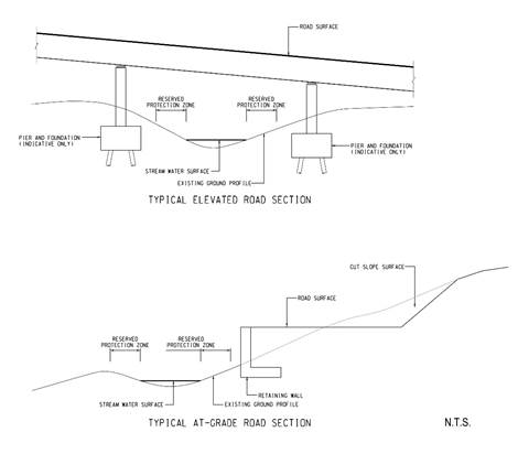
Direct Injury / Mortality
8.7.1.8 In addition to the direct impact due to terrestrial habitat loss and fragmentation, the construction activities could potentially cause direct injury / mortality to wildlife. Fauna with high mobility (e.g. avifauna and dragonflies) are not anticipated to be significantly impacted, while fauna with lower mobility (e.g. amphibians, freshwater invertebrates) and flora would be subject to higher risk of damage or mortality, and could be injured or killed by construction activities.
8.7.1.9 Species of conservation importance were recorded within the footprint of the proposed works areas, including fern Cibotium barometz and avifauna Little Egret within the main portal area; plant Canthium dicoccum on the boundary of the secondary portal area; as well as plant Peristylus tentaculatus and freshwater crab Cryptopotamon anacoluthon within the footprint of the access road. Avifauna species are highly mobile and are expected to utilise the large area of alternative habitats outside the Project site. While no major adverse impacts are expected on avifauna, other species of conservation importance (e.g. plants and freshwater crab) which are relatively confined to their recorded habitats would be subjected to higher risk of injury. A Detailed Vegetation Survey of the affected plant species of conservation importance should be conducted to identify the affected individuals prior to the commencement of works. To avoid direct impact, the identified individuals should be labelled and fenced off on site for preservation. In the case of unavoidable loss of species of conservation importance, mitigation measures such as transplantation or translocation should be implemented to minimise impact. With careful construction design (e.g. elevated structure), no adverse direct impact is anticipated on natural stream habitats and the crab species of conservation importance utilising the stream.
Indirect Impact
Disturbance from Construction Activities
8.7.1.10 Indirect impacts on the habitats and associated fauna would arise from the increase in human disturbance during the construction phase. Construction activities would increase human activities and noise disturbance from traffic and construction machinery, and would bring about indirect impacts to nearby habitats and their associated fauna. Potential impacts include decrease of animal usage in habitats in the vicinity of the works areas, and subsequent decrease in wildlife density.
8.7.1.11 Sites of conservation importance identified within the assessment area include Ma On Shan Country Park, Mui Tsz Lam fung shui wood, CA, and Penfold Park Egretry. Given the distance of Mui Tsz Lam fung shui wood and the CA with the proposed aboveground works (more than 500 m), no significant disturbance impact to the Fung Shui Wood and the CA are anticipated.
8.7.1.12 Aboveground and underground works of the Project would not encroach into the boundary of the Ma On Shan Country Park, hence direct impact is not anticipated. The proposed location of the secondary portal is located approximately 200 m northwest to the boundary of the Country Park. Indirect impact to the Country Park may arise from the air quality impact (dust generated from construction), increase in human disturbance such as noise and glare / lighting.
8.7.1.13 Penfold Park Egretry is located approximately 750 m southwest of the existing STSTW. Noise and dust would be generated from the STSTW decommissioning. Given the Egretry is distant from the existing STSTW and with the implementation of good site practice (e.g. noise and dust emission control measures), adverse indirect impacts to Penfold Park Egretry arising from disturbance during the construction phase are not anticipated.
8.7.1.14 The construction of main portal, secondary portal, magazine site, ventilation shaft and access road would increase human activities and noise disturbance from traffic and construction machinery. Indirect impact could be experienced by the nearby habitats and associated fauna. Given the proximity between the proposed portals and the existing urban developed areas (e.g. roads and residential areas), significant increase in disturbance impacts are not anticipated from the construction activities. Indirect impact may also arise from the construction of access road on Nui Po Shan, particularly on woodland and streams adjacent to the access road, as well as associated fauna in these habitats. Further evaluation of the indirect impact is presented in Section 8.7.3.
Impact on Water Quality of Watercourse
8.7.1.15 While the alignment of the access road will be carefully designed to avoid habitat loss and fragmentation of the natural stream, the proposed aboveground works may result in construction site runoff (e.g. runoff and erosion of exposed bare soil and earth, drainage channel, earth working area and stockpiles, etc.), indirectly impacting streams within the assessment area (including the section of stream S2 located in vicinity of the access road). Fauna species of conservation importance (freshwater crab Cryptopotamon anacoluthon, Lesser Spiny Frog, and Hong Kong Cascade Frog) were recorded within S2, which would be subjected to water quality impacts. Tadpoles of Lesser Spiny Frog and egg mass of Hong Kong Cascade Frog were recorded within S2, suggesting the species utilising the stream as a breeding ground. With the implementation of appropriate measures to control runoff from the construction site, as well as the adoption of guidelines and good site practices for handling and disposal of construction discharges (refer to Section 5), unacceptable impacts on water quality are not expected. Therefore, adverse ecological impacts on the streams due to water quality deterioration by land-based construction works are not expected.
Flight Lines and Foraging Habitats of Breeding Ardeids
8.7.1.16 The decommissioning and demolition of the existing STSTW may cause obstruction of flight paths and disturbance of foraging habitats, leading to potential displacement of flight path (i.e. ardeids selecting different routes to their destination, or flying at a greater height to avoid tall machineries/structures in the construction site). This would potentially cause an increase in energy exertion of the ardeids, thus potentially affecting their foraging and breeding success.
8.7.1.17 Based on the flight line survey results, Shing Mun River is observed to be a foraging habitat for the breeding ardeids as they were found landing on and foraging along the river. Other potential foraging habitats of the breeding ardeids include the shorelines (e.g. artificial seawall, sandy shores, mudflats, mangroves, etc.) along Tolo Harbour. Two of the flight lines (Flight Lines 2 and 3) pass through the existing STSTW, which accounts for about half of the flying ardeids (refer to Figure No. 60334056/EIA/8.06 and Table 8.13). During the decommissioning and demolition of the STSTW, indirect impacts would arise from the increase in human disturbance, noise, and glare. While disturbances may potentially affect flying ardeids and cause flight path displacement, Flight Lines 2 and 3 are currently situated over developed area habitats (including Tate��s Cairn Highway and Tolo Highway). Ardeids at Flight Lines 2 and 3 are subjected to existing disturbances from highways and human activities (e.g. at existing STSTW). With the implementation of good site practice during decommissioning and demolition (such as control of noise and glare / lighting), increase in disturbances is not anticipated to be significant. Indirect impact on the breeding ardeids flying over the existing STSTW is expected to be minor.
8.7.1.18 Nonetheless, ardeids may still potentially utilise other alternative flight paths in the close vicinity (e.g. Flight Line 1 �V towards Chinese University of Hong Kong, or Flight Line 4 �V across Shing Mun River), resulting in potential increase in energy exertion due to increased distance from their foraging habitats (shoreline along Shing Mun River and Tolo Harbour). The distances between the shoreline and the Egretry were similar at Flight Lines 2, 3, and 4; while the distance from the shoreline would be longer by less than 500 m at Flight Line 1. Such difference in distance is considered as minor. Therefore, potential indirect impact resulting from increase in energy exertion is also anticipated to be minor.
8.7.1.19 A temporary works area is located to the northwest of the main portal area. Ardeids from the Penfold Park Egretry have been recorded to land on the intertidal habitat along Shing Mun River, adjacent to the works area. While temporary works area would not encroach into the intertidal habitat, potential indirect impact would arise from noise, glare, and human disturbance. As described in Section 8.6, both intertidal habitat and developed area habitats were recorded to support low ecological value and these habitats also subject to existing disturbance arising from pedestrian and traffic. With the availability of alternative habitats in the vicinity, increase in disturbance on the ardeids is anticipated to be minor.
Bird Collision
8.7.1.20 Aesthetically pleasing architectural design (e.g. the use of glasses) of aboveground structures has been proposed at the main portal area as a mitigation measure for landscape and visual impact, as evaluated in Section 10. Potential of bird collisions may result from buildings or structures with materials that are transparent or reflective (e.g. glass) or otherwise difficult to see (e.g. cables, wires). The proposed location of the aboveground structures at the main portal area occurs within plantation habitat, adjacent to developed area and shrubland habitats, in which ��low�� and ��low to moderate�� bird abundances have been recorded. No bird species of conservation importance have been recorded within the proposed footprint of aboveground structure and in its immediate vicinity. With the small size of the main portal area and limited abundance of birds recorded in the vicinity, only a minor impact from bird collision is anticipated.
Ground-borne Vibration by Drill and Blast
Operation
8.7.1.21 The tunnel and cavern would be constructed by drill and blast method, which could cause noise and vibration disturbance to the aboveground habitats and associated fauna, and hence displacement of fauna. However, the drilling and blasting works will be carried out at a significant depth of 80 to 300 m below ground surface at Nui Po Shan. Therefore, the construction works are not expected to cause significant disturbance to the terrestrial habitats and fauna above.
THEES Connection Works
8.7.1.22 In order to maintain the current arrangement in discharging effluent to KTN (Kai Tak River after the re-construction and upgrading works currently being undertaken by CEDD) through THEES tunnel, provision of a dry construction zone within the THEES tunnel system to allow connection to the CSTW would be essential for the Project as detailed in Section 2.8.4. During the connection works, the THEES needs to be temporarily suspended from its normal operation with effluent bypasses into the Tolo Harbour. Without effluent bypass to Tolo Harbour, effluent will be running inside the THEES tunnel system rendering the construction or connection works not possible.
8.7.1.23 Detailed engineering assessments have been conducted to determine the required duration of effluent bypass with reference to the anticipated construction method and sequences. The recommended duration of the effluent bypass has already been reduced to the minimum amount necessary to meet the construction needs.
8.7.1.24 On the other hand, under the existing practice, regular inspection and repair of the THEES would be carried out when necessary to maintain proper functioning and integrity of the THEES. During each THEES maintenance event, secondarily treated and disinfected effluent from TPSTW and STSTW would be temporarily discharged to the Tolo Harbour to provide a dry zone within the THEES tunnel for a maximum duration of 4 weeks in non-algal bloom season with frequency less than once per year. To minimize water quality impact to Tolo Harbour, the necessary THEES connection works required for this Project will be split into a number of steps for sequential and synchronized implementation with THEES maintenance, thereby avoiding the need for additional temporary suspension of the THEES.
Changes in Water
Quality by Land-based Construction Works
8.7.1.25 Site formation works will be required for the cavern portals near stream S1 as well as the proposed access road near stream S2. Accidental spills of oils and other chemicals from construction site could affect aquatic communities, resulting in lethal / sublethal impacts (e.g. direct mortality, reproductive retardation) on aquatic organisms. Removal of vegetation within works areas during site formation could also elevate sediment levels in site runoff, potentially increasing SS level in the stream and hence increasing turbidity.
8.7.1.26 Discharge from land-based construction works (general cleaning and polishing, wheel washing, dust suppression, utility installation, etc.) and construction site runoff (e.g. runoff and erosion of exposed bare soil and earth, drainage channel, earth working area and stockpiles, etc.) during the cavern development and demolition of the existing STSTW may also cause a temporary increase in SS level. The suspended particles could potentially injure the aquatic organisms and clog their respiratory and feeding systems, while the increased turbidity could reduce photosynthetic rate of aquatic plants, and affect feeding and other activities of fauna by hindering their vision. With the implementation of appropriate measures to control runoff and drainage from the construction site, as well as the adoption of guidelines and good site practices for handling and disposal of construction discharges (refer to Section 5.7.2), unacceptable impacts on water quality, and hence, ecological impacts due to water quality deterioration by land-based construction works are not expected.
Sewage Effluent from Construction Workforce
8.7.1.27 Domestic sewage would be generated from the workforce during the construction phase. However, this temporary sewage can be adequately treated by interim sewage treatment facilities, such as portable chemical toilets. Provided that sewage is not discharged directly into storm drains or inland waters adjacent to the construction site, and temporary sanitary facilities are used and properly maintained, it is unlikely that sewage generated from the site would have a significant water quality impact.
Groundwater Infiltration
8.7.1.28 Construction of rock caverns and tunnels may only result in very minor infiltration / drawdown of groundwater as compared to excavation in soft ground. The rock itself is a natural barrier with very low permeability which can prevent the potential groundwater drawdown in any soil and aquifer layers above the rock stratum. Thus it should not affect the groundwater level within the soil layer as well as the water level of the adjacent streams.
8.7.1.29 It is anticipated that the construction of rock caverns would have minor potential impacts on groundwater from activities such as bored tunneling works, and drill and blast works. While the proposed footprint of the cavern is currently situated in very competent rock stratum in Nui Po Shan, the potential drawdown of groundwater is insignificant, as compared to other substrata types such as soft soil / mud. Nonetheless, considerations should be taken in cavern design to minimize the potential impacts from the change in groundwater level. Appropriate measures during the construction of the cavern construction would also be adopted to minimize the potential impact from groundwater drawdown, as presented in Sections 8.8.3.7 �V 8.8.3.10. The effect on lowering of water table on the streams is expected to be minimal. Preventive measures such as pre-grouting and post-grouting, which have been successfully applied in other tunnel projects in Hong Kong, would be conducted to minimize any impact from the cavern construction activities to the adjacent groundwater table.
Groundwater from Potentially Contaminated Area
8.7.1.30 According to the CAP prepared for the Project, it is identified that the works areas at the existing STSTW site would have land contamination issues. Any contaminated material disturbed, or material which comes into contact with the contaminated material, has the potential to be washed with site runoff into watercourses and affect the marine organisms and fish. Mitigation measures should be implemented to control site runoff from the contaminated areas, and to prevent runoff from entering into the adjacent waters. Groundwater pumped out or from dewatering process during excavation works in the existing STSTW site would be potentially contaminated. Proper treatment, discharge or recharge of contaminated groundwater, if any, following the mitigation measures given in Section 5 would minimize the potential impacts. No direct discharge of contaminated groundwater will be allowed. Therefore, adverse ecological impacts due to water quality deterioration by contaminated groundwater are not expected.
8.7.2 Operational Phase
Indirect Impact
Disturbance to Habitats and Site of Conservation Importance
8.7.2.1 The operation of the CSTW would lead to an increase of local vehicles and human activities in A Kung Kok and Mui Tsz Lam areas, which would cause disturbance to adjacent habitats and associated fauna. As most of the CSTW would be operated underground and the increase in associated traffic is low, it is anticipated the areas near the portals as well as the existing Mui Tsz Lam Road would experience some disturbances. During the operation phase, access road on Nui Po Shan would be occasionally used to access ventilation shaft. Indirect impact on nearby woodland and streams as well as the associated fauna may arise from the minor usage of access road.
8.7.2.2 Given the proximity between the CSTW and developed areas (e.g. existing highway, roads and residential areas) and the low level of disturbance from the operation of CSTW, only limited ecological impact is anticipated. Ma On Shan Country Park which occurs approximately 200 m southeast of the secondary portal is not anticipated to adversely affected by operation of the CSTW. Further evaluation of the indirect impact is presented in Section 8.7.3.
Changes in Water Quality during Normal Plant
Operation
Elevation of Suspended Solids (SS)
8.7.2.3 The effect of SS on marine organisms depends on several factors, such as species tolerance, life mode of organisms (sessile or free-swimming), growth form or orientation of sessile organisms and water movement. Sessile filter feeders are susceptible to deleterious impacts from elevated SS in the water column through smothering and clogging of their respiratory and feeding apparatus. Increased turbidity due to elevation in SS may reduce the amount of light reaching beneath the water surface. Lethal (e.g. mortality) and sub-lethal (e.g. slow growth rate and low in reproductive success rate) impacts on marine life may occur. These impacts may eventually cause the reduction in population size of marine communities/populations.
8.7.2.4 Hard corals which are of particular ecological concern are highly susceptible to the light reduction effect. With less light, growth rate of zooxanthellate hard corals (coral which possesses photosynthetic algae called zooxanthellae) may be reduced. Hard corals possess mechanisms for rejecting sediment from their surfaces, but employment of these mechanisms expend energy and may cause stress ultimately leading to bleaching (expulsion of zooxanthellae) or tissue necrosis. Suspended sediment concentration which reefs can tolerate is below 10 mg/L (Rogers, 1990). Whilst, the threshold value of local corals to SS adopted by AFCD is 30% increase of ambient level (AFCD, 2005). High levels of SS can lead to fewer coral species, less live coral, lower coral growth rate, greater abundance of branching forms, reduced coral recruitment, decreased calcification and decreased net productivity of corals (Rogers, 1990).
8.7.2.5 According to the water quality impact assessment, operation of this Project (Scenario 5 �V ��with Project�� scenario) would slightly reduce the mean SS level in Sha Tin Hoi waters when compare with the baseline condition (Scenario 4). The SS level is predicted to be lower than or the same as the baseline condition at the ecological resources (refer to Appendix 5.05).
Decrease of Oxygen (DO)
8.7.2.1 Increase in SS in water column combined with a number of other physical or biotic factors would reduce DO in water column. Elevated SS reduces light penetration, lowers the photosynthetic rate of phytoplankton and so lowers the rate of oxygen production in the water column. Decreased oxygen could cause suffocation of marine organisms and fish. Also the release of inorganic substances from the temporary bypass events may cause eutrophication and algal bloom. Oxidation of dead algae may consume some of the oxygen in the water. If oxygen levels are depleted to low levels, fish, especially those in early life stages may be unable to tolerate such conditions and suffer hypoxia-induced mortality and / or stress including reduced feeding and growth rate. The DO levels predicted under the ��without Project�� scenario (Scenario 4) and ��with Project scenario�� (Scenario 5) are considered within a similar range. The DO levels predicted at all ecological resources would meet the WQO except for the mangrove site at Tolo Pond (M1) where the minimum surface and middle DO was only 1.5 and 3.4 mg/L respectively under the ��without Project�� scenario as compared to the WQO of no less than 4 mg/L (see Appendix 5.05). Operation of this Project (under Scenario 5) would improve the minimum middle DO level at this mangrove site to 3.5 mg/L (by about 1 mg/L). No change in the minimum surface DO at this mangrove site was predicted between the two scenarios. The low DO at M1 was mainly resulted from the background pollution loading assumed in the model and not induced by this Project.
Release of Nutrients
8.7.2.2 High nutrient levels in marine water may trigger rapid increase in phytoplankton, resulting in algal bloom. When a large number of algae die, degradation of dead algae would cause sudden drop in dissolved oxygen which leads to suffocation of fish and other marine organisms. The phytoplankton may also produce biotoxins which could be lethal to fish. The TIN levels are similar at the ecological resources under the ��without Project�� scenario (Scenario 4) and ��with Project�� scenario (Scenario 5).
Chlorophyll-a
8.7.2.3 Chlorophyll-a is a green pigment in plant. The level of chlorophyll-a can provide an indication of algae or phytoplankton concentration in marine water. It should be highlighted that the presence of algae / chlorophyll-a in water is generally not harmful. Only their uncontrolled growth as algal bloom or red tide would adversely affect the environment.
8.7.2.4 Algal bloom or red tide could lead to indirect water quality impacts such as oxygen depletion because the water can become completely deprived of oxygen when a bloom declines rapidly, since the biological degradation of dead algal material consumes large amounts of oxygen. Although the primary concern from algal blooms is oxygen depletion, a minority of blooms (about 10%) consist of toxin-producing species that synthesize phycotoxins.
8.7.2.5 It should however be highlighted that red tides are natural phenomena which occur seasonally in both polluted and unpolluted waters (EPD��s publication ��Marine Water Quality in Hong Kong 2014�� refers) and could be induced by many factors other than the availability of nutrients in marine waters (e.g. availability of sunlight, water circulation, temperature and wind conditions etc.). Red tide occurrence would depend on a combination of different factors including flow condition, light penetration, salinity distribution, nutrient concentrations, nutrient ratios and species competition, etc.
8.7.2.6 Operation of this Project under Scenario 5 would reduce the chlorophyll-a concentration in the Harbour and Buffer Subzones of the Tolo Harbour and Channel WCZ. Tolo Harbour is a shallow landlocked water body with low water exchange rate and poor flushing capacity, which is susceptible to algal formation and accumulation of algae. Thus, the maximum chlorophyll-a levels at all ecological resources are considered high under the ��without Project�� condition (Scenario 4) (refer to Appendix 5.05). Implementation of this Project (Scenario 5) would minimize the chlorophyll-a level at the ecological resources. In comparison with the ��without Project�� levels of 9 �V 64 µg/L (under Scenario 4), the maximum chlorophyll-a predicted during operation of this Project (Scenario 5) would be reduced to 8 �V 58 µg/L at the ecological resources. Thus this Project would potentially reduce the risk of red tide in Tolo Harbour.
8.7.2.7 The Project operation will improve the water quality in Tolo Harbour (including the ecological resources) as compared to the baseline condition. This Project will not cause any unacceptable water quality impact to the Tolo Harbour. This Project will in fact have a positive water quality effect in Tolo Harbour, minimizing the pollution level and also the risk of algal bloom in the Tolo Harbour (due to the predicted decrease in the chlorophyll-a and nutrient level) in the long term. No unacceptable water quality impact would be resulted from this Project during the operation phase. Therefore, unacceptable ecological impacts by changes in water quality are not expected.
Changes in Water Quality during THEES
Maintenance Discharge
8.7.2.8 In Section 5, scenarios assuming a continuous THEES maintenance discharge for a period of 4 weeks during operation phase were assessed. During the THEES maintenance period, secondarily treated and disinfected effluent would be discharged from both STSTW and TPSTW. Under the water quality model, Scenario 6a simulated a possible worst case that the THEES maintenance events could be scheduled in March (within the algal blooming season). Scenario 6b however simulated an optimized case recommended under this Project to avoid THEES maintenance in algal blooming season (January to May). The water quality modelling results for Scenarios 6a and 6b (with THEES maintenance discharge) are compared with the model results for Scenario 5 (normal Project operation without THEES maintenance) to identify the water quality changes due to the THEES maintenance.
8.7.2.9 The predicted SS level at all ecological resources during the maintenance period of THEES tunnel (Scenarios 6a and 6b) would be below 10 mg/L (refer to Appendix 5.05). The maximum increase in SS level at the ecological resources during THEES maintenance would be less than 30% of ambient level as compared to the normal operation of the Project (Scenario 5). Therefore, adverse ecological impacts due to SS elevation are not expected.
8.7.2.10 The DO levels predicted at all ecological resources under Scenarios 6a and 6b would meet the DO criterion except for the mangrove site at Tolo Pond (M1) where the minimum surface and middle DO would be 1.5 and 3.2 mg/L and 1.5 and 3.5 mg/L for Scenarios 6a and 6b respectively, as compared to the WQO of no less than 4 mg/L (see Appendix 5.05). However, the baseline minimum DO under Scenario 5 was also low with a surface and middle value of 1.5 and 3.5 mg/L respectively. Hence, the low DO at M1 was not caused by this Project and is mainly resulted from the background pollution loading. The change in DO at M1 caused by the THEES maintenance is considered small or negligible. The time series plots in Figure 19 of Appendices 5.04b and 5.04c also showed that the maintenance discharge would not cause any obvious DO decrease at M1. It should also be noted that the DO levels mentioned above represent the minimum values over the entire 1-year simulation period for comparison with the WQO. The time series plots showed that the DO levels at M1 would actually be higher than these minimum values for most of the times. Meanwhile, the TIN levels are similar at the ecological resources in general under the Scenarios 5, 6a and 6b. Therefore, unacceptable ecological impacts due to oxygen depletion and release of nutrients are not expected.
8.7.2.11 Tolo Harbour is a shallow landlocked water body with low water exchange rate and poor flushing capacity, which is susceptible to algal formation and accumulation of algae. Hence, the maximum chlorophyll-a levels at all ecological resources under normal operation of the THEES in UDS (Scenario 5) is already considered high (refer to Appendix 5.05). The chlorophyll-a predicted at the ecological resources would range from 11 �V 159 µg/L under existing practice of THEES maintenance (Scenario 6a) as compared to the normal situation (Scenario 5) of 8 �V 58 µg/L. This Project would optimize the THEES maintenance operation and significantly reduce the peak chlorophyll-a values at the ecological resources to 8 �V 58 µg/L, which is same as the normal range under Scenario 5. It should be noted that the chlorophyll-a levels mentioned above represent the maximum 5-day running means over the entire 1-year simulation period. The actual chlorophyll-a levels at these marine ecological resources would be varying and these highest chlorophyll-a levels would only occur for a short period of times as indicated in the time series plots in Figures 01 �V 09 of Appendices 5.04b and 5.04c. The time series plots in Appendices 5.04d and 5.04e however showed that the chlorophyll-a elevations caused by the THEES maintenance discharge would be reversible. The model predicted that the chlorophyll-a levels can return to the condition similar to the baseline levels within about 1.5 months after termination of the effluent bypass under Scenario 6a, whilst Scenario 6b is predicted to have a shorter recovery time of about 2 weeks after the end of the maintenance discharge.
Changes in Water Quality during Emergency
Discharge from CSTW
8.7.2.12 During the operation phase, it is assumed that an emergency discharge of primarily treated sewage from the CSTW would occur for a period of 6 hours in case of power or plant failure. According to the water quality modelling results, the short-term discharge under Scenario 7 would not cause significant impact upon the predicted mean SS, DO and TIN levels at all ecological resources (including coral communities nearby) as compared to the normal plant operation under Scenario 5 (refer to Appendix 5.05). In addition, the waters at Sha Tin Hoi only supported low benthic species diversity and richness. Any potential impacts to the marine benthic environment would be transient and minor. Therefore, adverse ecological impacts due to SS elevation, oxygen depletion and release of nutrients are not expected. The short-term discharge would not cause significant impact upon the maximum 5-day moving mean chlorophyll-a at the ecological resources.
Treated Effluent Reuse in CSTW
8.7.2.13 Reuse of treated effluent from the Project by general public is not proposed since it is not an effective option as assessed under this Assignment. Treated effluent from the Project would be limited to non-potable uses inside the plant and the effluent would subsequently be treated again for discharge and would not contribute to additional pollution load. Thus, no additional impact on the water environment, and hence, no additional marine ecological impact will be induced by the proposed treated effluent reuse.
8.7.3 Evaluation of Ecological Impact
8.7.3.1 Potential ecological impacts on the identified habitats within the assessment area associated with the construction and operation of the Project have been evaluated in accordance with the EIAO-TM Annex 8, as presented in the following Table 8.33 to Table 8.40.
8.7.3.2 The main impact on woodland within assessment area includes permanent habitat loss, temporary habitat loss, and habitat fragmentation by the construction of access road. The woodland was considered as of moderate to high ecological value, supporting moderate to high species diversity. However, it should be noted that the woodland margin within the footprint of main and secondary portal areas are situated next to urban areas (e.g. A Kung Kok Street and Mui Tsz Lam Road), and has already subjected to relatively higher disturbance compared with woodland at the inner parts of Nui Po Shan. The small area of permanent woodland loss at the portal areas may potentially result in minor to moderate ecological impacts. Minor ecological impact is anticipated from the temporary loss and habitat fragmentation.
8.7.3.3 Within woodland habitat, plant Canthium dicoccum was recorded on the edge of the secondary portal (refer to Figure No. 60334056/EIA/8.05a). Mitigation measures will be implemented to avoid and minimise potential direct impact to the plant species.
Table 8.33 Evaluation of
Ecological Impacts to Woodland within the Assessment Area
|
Criteria
\ Habitats |
Woodland |
|
Habitat quality |
Moderate to High |
|
Species |
Moderate to high species diversity (205 flora species and 88 fauna
species) recorded in woodland from recent survey. 10 flora species and 17 fauna (12 avifauna, 3 mammals, 1 amphibian,
and 1 odonate) species of conservation importance were recorded from recent
survey and previous study. |
|
Size/Abundance |
Permanent loss
from construction of main portal (0.22 ha), secondary portal (0.35 ha), and
access road (0.08 ha). Temporary loss
from construction of main portal (0.44 ha), secondary portal (0.33 ha), and
access road (0.1 ha). Direct impact on a
flora species of conservation importance (Canthium
dicoccum). |
|
Duration |
Direct Impact Permanent loss of
0.65 ha of woodland and habitat fragmentation. Temporary loss of
0.87 ha of woodland. Indirect Impact Disturbance and
increased human activities from construction phase would be temporary. Disturbance and
increased human activities from operation phase would be permanent. |
|
Reversibility |
Permanent habitat
loss and habitat fragmentation are irreversible. Temporary habitat
loss and construction phase indirect impacts due to disturbance and increased
human activities would be reversible. Operation phase
indirect impacts due to disturbance and increased human activities would be
irreversible. |
|
Magnitude |
Low |
|
Overall Impact Evaluation |
Minor to moderate |
Fung
Shui Wood
8.7.3.4 Fung shui wood would experience low level of indirect impact due to disturbance and increase in human activities arising from the Project. Considering the large distance between the fung shui wood and the construction activities, only very low magnitude of minor indirect impact is anticipated.
Table 8.34 Evaluation of
Ecological Impacts to Fung Shui Wood within the Assessment Area
|
Criteria
\ Habitats |
Fung
Shui Wood |
|
Habitat quality |
Moderate |
|
Species |
Low species diversity (22 flora species and 27 fauna species) recorded
in fung shui wood from recent survey. 5 flora species and 2 fauna (1 avifauna and 1 odonate) species of
conservation importance recorded from recent survey and previous study. |
|
Size/Abundance |
Habitat would not
be directly affected. |
|
Duration |
Indirect Impact Disturbance and increased
human activities from construction phase would be temporary. Disturbance and
increased human activities from operation phase would be permanent. |
|
Reversibility |
Construction phase
indirect impacts due to disturbance and increased human activities would be
reversible. Operation phase
indirect impacts due to disturbance and increased human activities would be
irreversible. |
|
Magnitude |
Very low |
|
Overall Impact Evaluation |
Minor |
8.7.3.5 The main impact to plantation is the permanent habitat loss due to construction of main portal, access road and ventilation shaft, as well as temporary habitat loss and habitat fragmentation from the construction of access road and magazine site. Plantation habitat within the assessment area is subject to certain level of existing disturbance (e.g. adjacent to A Kung Kok Street). Considering the low to moderate ecological value and low to moderate species diversity, minor ecological impact is anticipated from the habitat loss and fragmentation.
8.7.3.6 Within plantation habitat, a fern species of conservation importance (Cibotium barometz) were recorded within the footprint of the main portal (refer to Figure No. 60334056/EIA/8.05a). Mitigation measures would be required to minimise potential direct impact to the plant species.
Table 8.35 Evaluation of
Ecological Impacts to Plantation within the Assessment Area
|
Criteria
\ Habitats |
Plantation |
|
Habitat quality |
Low to moderate |
|
Species |
Low to moderate species diversity (114 flora species and 32 fauna
species) recorded in plantation from recent survey. 4 flora species and 2 avifauna species of conservation importance
recorded from recent survey and previous study. |
|
Size/Abundance |
Permanent loss
from construction of main portal (1.12 ha), access road and ventilation shaft
(0.41 ha). Temporary loss
from construction of main portal (0.45 ha), access road (0.32 ha), and
magazine site on Nui Po Shan (0.37 ha). Direct impact on a
flora species of conservation importance (Cibotium
barometz). |
|
Duration |
Direct Impact Permanent loss of
1.53 ha of plantation and habitat fragmentation. Indirect Impact Disturbance and increased
human activities from construction phase would be temporary. Disturbance and
increased human activities from operation phase would be permanent. |
|
Reversibility |
Permanent habitat
loss and habitat fragmentation are irreversible. Temporary habitat
loss and construction phase indirect impacts due to disturbance and increased
human activities would be reversible. Operation phase
indirect impacts due to disturbance and increased human activities would be
irreversible. |
|
Magnitude |
Low |
|
Overall Impact Evaluation |
Minor |
Shrubland
8.7.3.7 Main impact arising from the Project to shrubland within assessment area includes permanent loss and temporary loss of habitats). Considering the existing low to moderate ecological value of the shrubland habitat, and the small area to be impacted by the Project, minor ecological impact is anticipated from the Project.
Table 8.36 Evaluation of
Ecological Impacts to Shrubland within the Assessment Area
|
Criteria
\ Habitats |
Shrubland |
|
Habitat quality |
Low to moderate |
|
Species |
Moderate species diversity (147 flora species and 61 fauna species)
recorded in shrubland from recent survey. 6 flora species and 10 fauna species (8 avifauna and 2 mammals) of
conservation importance recorded from recent survey and previous study. |
|
Size/Abundance |
Permanent loss
from construction of main portal (0.25 ha), and access road (0.09 ha). Temporary loss
from construction of main portal (0.32 ha), and access road (0.15 ha). |
|
Duration |
Direct Impact Permanent loss of
0.34 ha shrubland. Temporary loss of
0.47 ha shrubland. Indirect Impact Disturbance and
increased human activities from construction phase would be temporary. Disturbance and
increased human activities from operation phase would be permanent. |
|
Reversibility |
Permanent habitat
loss is irreversible. Temporary habitat
loss is reversible. Construction phase
indirect impacts due to disturbance and increased human activities would be
reversible. Operation phase
indirect impacts due to disturbance and increased human activities would be
irreversible. |
|
Magnitude |
Low |
|
Overall Impact Evaluation |
Minor |
8.7.3.8 Considering the large distance between the cultivated land and the construction activities, only a low magnitude of very minor indirect impact is anticipated on cultivated land due to disturbance and increase in human activities arising from the Project.
Table 8.37 Evaluation of
Ecological Impacts to Cultivated Land within the Assessment Area
|
Criteria
\ Habitats |
Cultivated
Land |
|
Habitat quality |
Low |
|
Species |
Low species diversity (31 flora species and 22 fauna species) recorded
in cultivated land from recent survey. 1 flora species and 3 fauna species (1 avifauna, 1 mammal, and 1
butterfly) of conservation importance recorded from recent survey and
previous study. |
|
Size/Abundance |
Habitat would not
be directly affected. |
|
Duration |
Indirect Impact Disturbance and
increased human activities from construction phase would be temporary. Disturbance and
increased human activities from operation phase would be permanent. |
|
Reversibility |
Construction phase
indirect impacts due to disturbance and increased human activities would be
reversible. Operation phase
indirect impacts due to disturbance and increased human activities would be
irreversible. |
|
Magnitude |
Low |
|
Overall Impact Evaluation |
Very minor |
Developed
Area
8.7.3.9 The main impact to developed area within assessment area arising from the Project is permanent loss and temporary loss of habitats). Developed area within the assessment area is subject to high level of existing disturbance (e.g. from highways, residential areas and recreational areas). Considering the low ecological value of the habitat, permanent and temporary losses are anticipated to result in minor ecological impacts.
8.7.3.10 Within the developed area, Little Egret was recorded on a bridge in vicinity to the main portal and the temporary works area (refer to Figure No. 60334056/EIA/8.05a). This species is common in Hong Kong and is frequently recorded along the shoreline and Shing Mun River. As avifauna individuals are highly mobile, they are anticipated to utilise other areas within the assessment area.
Table 8.38 Evaluation of
Ecological Impacts to Developed Area within the Assessment Area
|
Criteria
\ Habitats |
Developed
Area |
|
Habitat quality |
Low |
|
Species |
Low to moderate species diversity (115 flora species and 50 fauna
species) recorded in developed area from recent survey. 2 flora species and 8 avifauna species of conservation importance
recorded from recent survey and previous study. |
|
Size/Abundance |
Permanent loss
from construction of main portal (0.88 ha), secondary portal (0.31 ha), and
access road (0.01 ha). Temporary loss
from temporary works area near main portal (5.86 ha). |
|
Duration |
Direct Impact Permanent loss of
1.2 ha developed area. Temporary loss of
5.86 ha developed area. Indirect Impact Disturbance and
increased human activities from construction phase would be temporary. Disturbance and
increased human activities from operation phase would be permanent. |
|
Reversibility |
Permanent habitat
loss is irreversible. Temporary habitat
loss is reversible. Construction phase
indirect impacts due to increased disturbance and human activities would be
reversible. Operation phase
indirect impacts due to disturbance and increased human activities would be
irreversible. |
|
Magnitude |
Low |
|
Overall Impact Evaluation |
Minor |
Stream
8.7.3.11 Some sections of stream S2 are located either near or within the footprint of the proposed access road, with some sections supporting species of conservation importance. Plant species Peristylus tentaculatus and freshwater crab species Crytopotamon anacoluthon were recorded in section S2b within the footprint of the proposed access road (refer to Figure No. 60334056/EIA/8.05b). Potential injury and/or mortality on these species may result from construction of access road, if unmitigated. Careful engineering design and precautionary measures (e.g. elevated road above stream sections) would be required to avoid direct impact to the stream.
8.7.3.12 Indirect impact from the Project on streams would arise from surface runoff and potential groundwater infiltration resulting from underground construction. Give the distance of between the works area and most of the sizable streams (including S1 and S3), no adverse ecological impact is anticipated with the implementation of appropriate measures and good site practice. S2 would be subject to minor indirect impact due to its proximity with the proposed access road. Species of conservation importance recorded at S2 include plant species Arundina graminifolia and Peristylus tentaculatus, as well as fauna species Hong Kong Cascade Frog, Lesser Spiny Frog, Crytopotamon anacoluthon and Emerald Cascader. Nursery ground of Hong Kong Cascade Frog and Lesser Spiny Frog were also recorded in pools along S2. While the plants, birds and dragonfly species are not likely to be impacted by the change of water quality at the streams, the nursery site of amphibians may be potentially impacted by the surface runoff. With the implementation of appropriate measures to control runoff from the construction site, as well as the adoption of relevant guidelines and good site practices for handling and disposal of construction discharges (refer to Section 5), unacceptable impacts on water quality due to land-based construction works are not expected.
8.7.3.13 During both construction and operation phases, other indirect impact on the streams may arise from air quality impact (dust generated from construction), and increase in human disturbance such as noise (e.g. from vehicle activities) and glare / lighting. Given the distance between the works area and most of the streams, no adverse ecological impact is anticipated. While S1 may be indirectly affected by the construction of main portal and secondary portal, only three ardeid species (Chinese Pond Heron, Great Egret, and Little Egret) were recorded at S1 near the portal areas. These species are highly mobile and adapted to urban disturbance from the existing Mui Tsz Lam Road. With the implementation of good site practice, only minor indirect impact is anticipated on S1, and other stream habitats suitable for ardeid species are also readily available in the vicinity.
8.7.3.14 Stream S2 would also be subjected to the aforementioned indirect impacts including air quality impact, noise and lighting disturbances. Plant species are not likely impacted by the indirect impacts, while the bird species and dragonfly species are highly mobile and are expected to use alternative habitats in the vicinity. Noise disturbance may potentially affect stream fauna (e.g. Lesser Spiny Frog, Hong Kong Cascade Frog, freshwater crab Cryptopotamon anacoluthon). With the implementation of good site practice, disturbance impact during construction phase on S2 is anticipated to be controlled to an acceptable level. Moreover, breeding activities of amphibians are primarily nocturnal while construction works would normally be conducted in day-time. Disturbances are anticipated to be minimal. During operation phase, access road would only be used to access ventilation shaft of the cavern, where infrequent and low level of usage is anticipated. Noise disturbance from the road use is expected to have limited impact on the stream habitat and the species of conservation importance (including amphibians and freshwater crab). Ecological impact arising from the usage of access road would be insignificant.
Table 8.39 Evaluation of
Ecological Impacts to Stream within the Assessment Area
|
Criteria
\ Habitats |
S1 |
S2 |
S3 |
|
Habitat quality |
Moderate to high |
Low to Moderate |
Low to Moderate |
|
Species |
Low to moderate species diversity (73 flora species and 51 fauna
species) recorded from recent survey. |
||
|
8 flora species and 12 (4 avifauna, 4 amphibian, 1 odonate, and 3
freshwater) species of conservation importance recorded from recent survey
and previous study |
2 flora species and 4 fauna (2 amphibian, 1 odonate and 1 freshwater)
species of conservation importance recorded from recent survey |
1 amphibian species of conservation importance recorded from recent
survey |
|
|
Size/Abundance |
Habitat would not
be directly affected. |
||
|
Duration |
Indirect impacts
due to site runoff, disturbance and increased human activities from
construction phase would be temporary. Disturbance and
increased human activities from operation phase would be permanent. |
||
|
Reversibility |
Construction phase
indirect impacts due to disturbance and increased human activities would be
reversible. Operation phase
indirect impacts due to disturbance and increased human activities would be
irreversible. |
||
|
Magnitude |
Low |
Moderate |
Low |
|
Overall Impact Evaluation |
Minor |
Minor to Moderate |
Minor |
Table 8.40 Evaluation of
Ecological Impacts to Other Permanent and Seasonal Streams within the
Assessment Area
|
Criteria
\ Habitats |
Other Permanent Streams |
Seasonal Streams |
|
Habitat quality |
Moderate |
Low to Moderate |
|
Species |
Low to moderate species diversity (73 flora species and 51 fauna
species) recorded from recent survey. |
|
|
3 flora and 2 fauna (1 avifauna and 1 freshwater) species of conservation
importance recorded from recent survey and previous study |
No species of conservation importance recorded from recent survey and
previous study |
|
|
Size/Abundance |
Habitat would not
be directly affected. |
|
|
Duration |
Indirect impacts
due to site runoff, disturbance and increased human activities from
construction phase would be temporary. Disturbance and
increased human activities from operation phase would be permanent. |
|
|
Reversibility |
Construction phase
indirect impacts due to disturbance and increased human activities would be
reversible. Operation phase
indirect impacts due to disturbance and increased human activities would be
irreversible. |
|
|
Magnitude |
Low |
Low |
|
Overall Impact Evaluation |
Minor |
Minor |
Subtidal Hard Substrate, Soft Bottom and Intertidal Habitats
8.7.3.15 Construction of the connection pipes to emergency outfall by trenchless method underneath Shing Mun River was proposed. With the adoption of trenchless method, no loss of marine habitat is anticipated.
Table 8.41 Evaluation of
Ecological Impacts to Subtidal Hard Substrate, Soft Bottom and Intertidal
Habitats within the Assessment Area
|
Criteria
\ Habitats |
Subtidal
Hard Substrate Habitat |
Soft
Bottom Habitat |
Intertidal
Habitats |
|
Habitat quality |
Low |
Low |
Low |
|
Species |
3 coral species of
conservation importance recorded.
|
No species of
conservation importance were recorded. |
No species of
conservation importance were recorded. |
|
Size/Abundance |
Habitat would not be directly affected. |
||
|
Duration |
Construction Phase Indirect water
quality impacts due to sewage effluent, site runoff, and effluent bypass
would be temporary. Operational Phase Indirect water quality
impacts due to THEES maintenance discharge and emergency discharge of
effluent would be temporary. |
||
|
Reversibility |
Indirect water
quality impacts due to effluent, site runoff, and effluent bypass would be
temporary. |
||
|
Magnitude |
Low |
Low |
Low |
|
Overall Impact Evaluation |
Minor |
Minor |
Minor |
8.8 Mitigation of Adverse Ecological Impacts
8.8.1.1 According to the EIAO-TM Annex 16 and EIAO Guidance Note. 3/2010, ecological impacts on important habitats and the associated wildlife should be mitigated by, in order of priority, avoidance, minimization, and compensation approaches to the maximum practical extent.
8.8.2 Avoidance
Avoidance of Recognised Site of Conservation Importance
8.8.2.1 Recognised sites of conservation importance within the assessment area include Ma On Shan Country Park, Mui Tsz Lam fung shui wood, CA, and Penfold Park Egretry, Kei Ling Ha Mangal SSSI, Ting Kok SSSI, and Hoi Ha Wan SSSI. The Project boundary is designed to avoid encroachment on these recognised sites of conservation importance. No direct impact is anticipated.
Ecologically Friendly Designs
8.8.2.2 The proposed access road to the ventilation shaft and temporary magazine site would cross some natural stream sections (at stream S2b) within Nui Po Shan. Construction of access roads and other temporary works will be carefully designed (e.g. elevated road for crossing streams) to avoid habitat loss and fragmentation. Design of the access road alignment would follow the topography level of the existing steep natural terrain as far as practicable to avoid potential extensive excavation works of hilly terrain and minimise slope cutting and vegetation removal. Moreover, the proposed location of the ventilation shaft at Feasibility Study stage has been relocated such that the access road alignment can be shortened (refer to Figure No. 60334056/EIA/2.09 for alignment options).
8.8.2.3 The design Option 1B has been adopted in this Project. Under this Option, connection pipes to existing emergency outfall of STSTW would be constructed by trenchless method underneath Shing Mun River. There would be no disturbance to marine or riverbed sediments under the Project. This Option is also anticipated to have the least water quality impact from emergency outfall. Impacts to marine habitats would therefore be avoided and minimised. In addition, the temporary effluent bypass event would be arranged within the regular THEES maintenance events and be undertaken within the THEES maintenance period. Therefore, additional water quality impact and marine ecological impact from changes of water quality have been avoided. Furthermore, the THEES maintenance discharge would avoid the blooming season of algae (i.e. January to May) to minimize the potential water quality impacts. It is recommended that any THEES maintenance period should be shortened as far as possible.
Protection of Species of Conservation Importance
8.8.2.4 Some species of conservation importance were recorded within the footprint of the proposed work areas. While no major adverse impact are expected on avifauna species with high mobility, direct impact to plant species of conservation importance recorded in the vicinity of the construction sites would be avoided as far as practicable during construction phase (e.g. Cibotium barometz within main portal area; Canthium dicoccum on the southern edge of the secondary portal area; Peristylus tentaculatus at the proposed access road). A Detailed Vegetation Survey would be conducted within the proposed works areas to identify any potentially affected plant species of conservation importance. These identified individuals should be labelled and fenced off on site prior to the commencement of works for better protection accordingly to the Protection and Transplantation Plan (refer to Section 8.10.1.3).
8.8.2.5 A freshwater crab species Cryptopotamon anacoluthon recorded from a natural stream section (S2b) on Nui Po Shan would be potentially impacted by the construction of access road. The proposed avoidance measure by provision of elevated road (refer to Section 8.8.2.1) would protect the freshwater crab and their habitats from direct impact.
8.8.3 Minimization
General Minimization Measures
8.8.3.1 To minimize habitat loss to the nearby habitats and associated wildlife, the following mitigation measures should also be implemented:-
�P confining the works within the site boundary; and
�P controlling access of site staff to avoid damage to the vegetation in surrounding areas.
�P placement of equipment or stockpile in the existing disturbed / urbanized land within the site boundary of the Project to minimize disturbance to vegetated areas;
Reinstatement and Enhancement of Temporarily Affected Habitats
8.8.3.2 As discussed in Section 8.7.3, minor ecological impacts may arise from the temporary loss of woodland, plantation, and shrubland habitats (about 2.48 ha) during construction phase. In general, replanting would be implemented upon the completion of construction works to reinstate the temporarily affected areas to condition similar to original status. For the magazine site, given the availability of a relatively flat and ample area after decommissioning, reinstatement / enhancement in form of native tree and shrub planting would be provided, where practicable. With the implementation of mitigation measure, no adverse ecological impact is anticipated from the temporary habitat loss.
Protection of Vegetation (including Flora Species of Conservation
Importance)
8.8.3.3 Small area of shrubland may be affected due to installation of boulder fences and check dams proposed under the natural terrain hazard study. The location of the installation should be carefully selected and adjusted on-site to avoid / minimise tree felling as well as the damage to root system of the existing plants. Plant species of conservation importance have been identified within the footprint of construction (i.e. Cibotium barometz at plantation within main portal; Canthium dicoccum at woodland within secondary portal; and Peristylus tentaculatus within the footprint of the access road). As described in Section 8.8.2.4, a Detailed Vegetation Survey shall be to identify plant species of conservation importance in the immediate vicinity of the proposed works areas. The potentially affected individuals shall be preserved, or in the case of unavoidable loss, transplanted according to the Protection and Transplantation Plan (refer to Section 8.10.1.3).
Controlling Site Runoff
8.8.3.4 Stream S2 and other streams within the assessment area would be subjected to minor indirect impact due to surface runoff resulting from construction works. Fauna species of conservation importance (i.e. amphibian Lesser Spiny Frog, Hong Kong Cascade Frog, and freshwater crab Cryptopotamon anacoluthon) were recorded within S2, which would be subjected to such indirect impacts. Surface runoff may also indirectly impact the breeding behaviour of Lesser Spiny Frog and Hong Kong Cascade Frog in S2. Appropriate mitigation measures should be implemented to control runoff from the construction site, as well as adopting guidelines and good site practices for handling and disposal of construction discharges (refer to Section 5) in order to minimise the potential indirect impact on the streams. Other precautionary measures will also be implemented in accordance with ETWB TCW No. 5/2005 Protection of natural streams/rivers from adverse impacts arising from construction works to minimise indirect impacts to the streams, such as isolating the works site by placing sandbags and silt curtains, covering up construction materials, debris and spoil to avoid being washed into the stream, and properly collecting and treating construction effluent and sewage.
Reducing Glare / Lighting
8.8.3.5 The overall reduction of glare during both construction and operation phases should also be considered. A balance between lighting for safety, and avoiding excessive lighting can be achieved through the use of directional lighting to avoid light spill into sensitive areas, and control/timing of lighting periods of some facilities, particularly at the secondary portal which lies approximately 200 m northwest of Ma On Shan Country Park. During the decommissioning and demolition of the existing STSTW, the direction and lighting periods should also be controlled during ardeid breeding season (March to August), hence minimizing the potential indirect impact on Penfold Park Egretry and the ardeids flying over the STSTW.
Minimising Disturbance Impacts
8.8.3.6 Good site practice should be implemented to further minimise impacts from disturbance such as noise, air quality and water quality issues. The measures include:
�P the use of quiet plant and EPD��s Quality Powered Mechanical Equipment (QPME) and the availability of British Standards 5228 has been considered;
�P the use of movable noise barrier;
�P the use of temporary noise screening structures or purpose-built temporary noise barriers;
�P install site hoarding as temporary noise barrier where construction works are undertaken;
�P only well-maintained plant should be operated on site and plant should be serviced regularly during the construction programme;
�P Mitigation measures stipulated in the ProPECC PN 1/94 ��Construction Site Drainage�� should be complied to minimise water quality impact; and
�P installation of stand-by pump, emergency power supply and telemetry system to avoid sewage overflow and surcharge to sewerage system due to power/equipment failure .
Control of Groundwater Infiltration
8.8.3.7 Appropriate measures during the construction of the cavern construction should be implemented to minimise the groundwater infiltration. The water control strategies include:
�P Probing Ahead: As a normal practice, the Contractor will undertake rigorous probing of the ground ahead of excavation works to identify zones of significant water inflow. The probe drilling results will be evaluated to determine specific grouting requirements in line with the tunnel / cavern advance. In such zones of significant water inflow that could occur as a result of discrete, permeable features, the intent would be to reduce overall inflow by means of cut-off grouting executed ahead of the tunnel / cavern advance.
�P Pre-grouting: Where water inflow quantities are excessive, pre-grouting will be required to reduce the water inflow into the tunnel / cavern. The pre-grouting will be achieved via a systematic and carefully specified protocol of grouting.
�P In principle, the grout pre-treatment would be designed on the basis of probe hole drilling ahead of the tunnel / cavern face.
�P
The installation of waterproof lining
would also be adopted after the formation of the tunnels and caverns.
8.8.3.8 In the event of excessive infiltration being observed as a result of the tunnelling or excavation works even after incorporation of the water control strategies, post-grouting should be applied as far as practicable as described below:
�P
Post-grouting:
Groundwater drawdown would be most likely due to inflows of water into the
tunnel / cavern that have not been sufficiently controlled by the pre-grouting
measures. Where this occurs post
grouting will be undertaken before the lining is cast. Such a contingency should be allowed for
reduction in permeability of the tunnel / cavern surround (by grouting) to
limit inflow to acceptable levels.
8.8.3.9 The groundwater control measures stated above are proven technologies and have been extensively applied in other past projects. These measures or other similar methods, as approved by the Engineer to suit the works condition shall be applied to minimize the groundwater infiltration.
8.8.3.10 In case seepage of groundwater occurs, groundwater should be pumped out from works areas and discharged to the stormwater drainage system via silt trap. Uncontaminated groundwater from dewatering process should also be discharged to the stormwater drainage system via silt removal facilities.
Marine Water Quality Control Measures
8.8.3.11 Mitigation measures recommended in the water quality impact assessment for controlling water quality impact will also serve to protect marine ecological resources from indirect impacts and ensure no unacceptable impact on marine ecological resources. For more detailed mitigation measures regarding water quality refer to Section 5 of the EIA Report.
8.8.3.12 Relevant government departments including EPD, WSD and AFCD as well as key stakeholders for mariculture and fisheries in Tolo Harbour should be informed prior to the THEES maintenance / emergency discharge events.
8.8.4 Compensation
Compensatory Planting for Unavoidable Woodland Loss
8.8.4.1 Permanent loss of woodland (about 0.65 ha) would arise from the construction works, which would include removal of woodland on Nui Po Shan. Minor to moderate ecological impacts is anticipated from the loss. To compensate for the ecological impact resulting from unavoidable loss of woodland, habitat compensation would be provided in a ��no net loss�� and ��like for like�� basis, or by providing a compensation area with equivalent or higher ecological function.
8.8.4.2 Compensatory planting with a total area of about 0.9 ha would be provided at the main and secondary portal areas, and along the access road (refer to Table 8.42 and Figure Nos. 60334056/EIA/8.08a �V 8.08c). Native species are preferred for the purpose of compensatory planting, where list of species can be made reference to the native trees occurring in the existing similar habitat (refer to Table 8.43). At maturity, the compensatory planting areas would create a habitat with different layers (e.g. canopy, middle layer and understorey), which promotes habitat complexity and in turn enhancing the ecological value. Proposed areas for compensatory planting occur in close proximity to existing woodland habitats. As compared with fragmented planting at other urban areas, compensatory planting at the proposed area would be preferable to enhance connectivity and ecological linkage.
Table 8.42 Compensatory Planting
Proposed under the Project
|
Locations |
Area (ha) |
|
Main Portal |
0.54 |
|
Secondary Portal |
0.28 |
|
Near Access Road |
0.1 |
|
Total (ha) |
0.92 |
Table 8.43 Flora Species to be
Considered for Compensatory Planting
|
Flora Species |
Growth Form |
|
Acronychia pedunculata |
Tree |
|
Alangium chinense |
Tree or shrub |
|
Aquilaria sinensis |
Tree |
|
Bischofia javanica |
Tree |
|
Bridelia tomentosa |
Shrub or small tree |
|
Canthium dicoccum |
Tree
or shrub |
|
Celtis sinensis |
Tree |
|
Cinnamomum camphora |
Tree |
|
Cleistocalyx nervosum |
Tree |
|
Daphniphyllum calycinum |
Tree |
|
Elaeocarpus chinensis |
Tree
or small tree |
|
Ficus microcarpa |
Tree |
|
Garcinia oblongifolia |
Tree |
|
Litsea glutinosa |
Tree |
|
Machilus pauhoi |
Tree |
|
Mallotus paniculatus |
Tree
or shrub |
|
Phyllanthus emblica |
Tree or shrub |
|
Schefflera heptaphylla |
Tree |
|
Schima superba |
Tree |
|
Sterculia lanceolata |
Semi-deciduous tree |
|
Viburnum odoratissimum |
Shrub or small tree |
8.8.4.3 Compensatory planting would be provided sequentially after completion of works at each works area. As such, based on the current tentative construction programme, compensatory planting would first be implemented along access road in early 2024, while compensatory planting at main portal and secondary portal would be implemented in 2027.
8.8.4.4 To facilitate successful planting, a detailed Woodland Compensation Plan should be prepared by local ecologists with at least 10 years relevant experience to form the basis to guide the implementation of the proposed compensatory planting. The Woodland Compensation Plan should include implementation details, management requirement, as well as monitoring requirements (e.g. frequency and parameters) of the compensatory planting area (refer to Section 8.10.1.4). Approval of the Plan should be obtained from EPD at least three months before the commencement of compensatory woodland planting. Upon the completion of planting, monitoring of the woodland compensation areas should be implemented, with maintenance works (e.g. irrigation, weeding, pruning, control of pests and diseases, replacement planting, repair of damage, etc.) conducted as necessary.
8.8.4.5 With the implementation of the proposed compensatory planting, ecological impact arising from the permanent loss of woodland habitat would be compensated.
Enhancement Measures to Promote Ecological Value
8.8.4.6 Other greening opportunities would be explored in the Project, including green roofs and buffer planting to be implemented at building structures. Further details of such greening opportunities are described in Section 10 of the EIA Report.
8.9 Evaluation of Residual Ecological Impacts
8.9.1.1 Minor to moderate ecological impact is anticipated to arise from the permanent woodland loss (0.65 ha). With the implementation of compensatory planting (0.92 ha), the ecological impact arising from the woodland loss would be mitigated to an acceptable level. Residual impact would arise from the permanent loss of plantation (1.53 ha) and shrubland (0.34 ha), which were both evaluated to be of low ecological values, with only minor impacts anticipated. Therefore, the residual ecological impacts from the loss of plantation and shrubland habitats are insignificant.
8.10 Environmental Monitoring and Audit
8.10.1.1 Details of EM&A requirement are discussed in the separate EM&A manual and summarised as follows:
Terrestrial Ecology
8.10.1.2 Recommended mitigation measures described in Section 8.8 (e.g. avoidance of stream and riparian habitats; control of site runoff, reduction in glare / lighting) should be monitored and audited monthly by local ecologist(s) with at least 10 years relevant experience throughout the construction phase to ensure proper implementation.
8.10.1.3 All flora species of conservation importance (e.g. Cibotium barometz, Canthium dicoccum, and Peristylus tentaculatus) should be protected as far as practicable. As a mitigation measure, all the unavoidably affected individuals should be preserved on site, or transplanted to nearby suitable habitat(s) prior to the commencement of site clearance as a last resort. A Detailed Vegetation Survey should be conducted by a suitably qualified botanist / ecologist to identify and record the affected individuals prior to the commencement of any site clearance works. A Protection and Transplantation Proposal including the subsequent monitoring visit for the affected individuals should be prepared and conducted by a suitably qualified local ecologist / horticulturist with at least 10 years relevant experience. The Proposal should be submitted for approval from EPD at least one month before works commencement.
8.10.1.4 Compensatory planting would be provided within the works area, including the main portal, secondary portal and along access road to compensate for the affected woodland habitat. A detailed Woodland Compensation Plan should be prepared by local ecologist / botanist with at least 10 years relevant experience to form the basis of the proposed compensatory planting. The Woodland Compensation Plan should include implementation details, management requirement, as well as monitoring requirements (e.g. frequency and parameters) of the compensatory planting area. Upon completion of compensatory planting, monitoring by local ecologist / botanist with at least 10 years relevant experience is recommended. The monitoring frequency should be monthly within the first year after planting. Parameters, such as health condition and survival rate of the plant, presence of weedy plant, should be monitored. Maintenance works (e.g. irrigation, weeding, pruning, control of pests and disease, replacement planting, repair of damage, etc.) should also be conducted as necessary. The Woodland Compensation Plan should be submitted for approval from EPD at least three months before commencement of compensatory woodland planting.
8.10.1.5 It is anticipated that the construction of rock caverns would not have adverse impacts on groundwater in Nui Po Shan. Nonetheless, precautionary measures should be taken in cavern design and construction to minimize the potential impacts from the change in groundwater level. Surface water level or groundwater level near the caverns will be closely monitored during the construction and operation stage.
Marine Ecology
8.10.1.6 As described in Section 5, monitoring of water quality parameters would be required to ensure the effectiveness of the mitigation measures.
8.10.1.7 The potential water quality impact from the land-based construction works can be controlled by the recommended mitigation measures. Regular site inspections should be undertaken during the construction phase to inspect the construction activities and works areas in order to ensure the recommended mitigation measures are properly implemented. Details of the EM&A programme are presented in the standalone EM&A Manual.
8.10.1.8 During normal plant / THEES operation, monitoring of the treated effluent quality from the CSTW should be carried out in accordance with the WPCO license to ensure that the effluent quality would comply with the design standards, which is under the ambit of Regional Office (RO) of EPD.
8.10.1.9 Marine water quality monitoring is recommended in Tolo Harbour for THEES maintenance during both construction and operational phases of this Project. Marine water quality parameters such as SS, BOD, E.coli, chlorophyll-a, TIN, UIA and NH3-N should be monitored. A seven-month baseline monitoring programme covering the period from June to December (outside the algae blooming season) is proposed at a frequency of twice per month to establish the baseline water quality conditions at selected monitoring points. In case of THEES maintenance during the construction and operational phases of this Project, marine water quality in Tolo Harbour should be monitored at a frequency of 3 times per week throughout the maintenance period until the baseline water quality is restored or at least 1 month after termination of the effluent bypass (whichever is longer).
8.10.1.10 The monitoring programme for THEES maintenance during the construction and operational phases of this Project as discussed above shall continue in the first 3 years after commissioning of this Project. After 3 years of post-Project commission period, a review shall be conducted by DSD to determine whether such monitoring shall be continued. The review results shall be submitted to EPD, AFCD, WSD and other relevant parties. Any amendment on the monitoring programme shall be agreed by EPD, AFCD and WSD. Details of the monitoring programme and an event and action plan for the THEES maintenance are provided in the standalone EM&A Manual.
8.10.1.11 Marine water quality monitoring is also recommended in Tolo Harbour for emergency discharge during operational phase of this Project. Marine water quality parameters such as SS, BOD, E.coli, chlorophyll-a, TIN, UIA and NH3-N should be monitored. A one-year baseline monitoring programme covering both dry and wet seasons is proposed at a frequency of twice per month to establish the baseline water quality conditions at selected monitoring points. In case of emergency discharge during the operational phase of this Project, marine water quality in Tolo Harbour should be monitored daily throughout the emergency discharge period until the baseline water quality is restored or at least 2 weeks after termination of the discharge (whichever is longer).
8.10.1.12 The monitoring programme for emergency discharge during the operational phase of this Project as discussed above shall continue in the first 3 years after commissioning of this Project. After 3 years of post-Project commission period, a review shall be conducted by DSD to determine whether such monitoring shall be continued. The review results shall be submitted to EPD, AFCD, WSD and other relevant parties. Any amendment on the monitoring programme shall be agreed by EPD, AFCD and WSD. Details of the monitoring programme and an event and action plan for the emergency discharge are provided in the standalone EM&A Manual.
8.11 Environmental Benefits
8.11.1.1 The Project operation will improve the water quality in Tolo Harbour (including the ecological resources) as compared to the baseline condition. This Project will in fact have a positive effect to Tolo Harbour, minimizing the pollution level and also the risk of algal bloom in the Tolo Harbour (due to the predicted decrease in the chlorophyll-a and nutrient level) in the long run.
8.11.1.2 While the Project would result in minor to moderate ecological impact due to the loss of woodland habitat, compensatory planting with total area of approximately 0.92 ha would be provided. Upon maturation, the permanent loss of woodland habitat would be compensated. Enhancement measures (including reinstatement / enhancement planting at magazine site, and green roof at portal areas) would also be implemented under the Project to promote ecological value in the assessment area upon the completion of the Project.
8.12 Conclusion
8.12.1.1 Ecological impact assessment for the relocation of STSTW to cavern has been conducted following the guidelines of the EIAO-TM Annex 8 and Annex 16.
8.12.1.2 Terrestrial habitats identified within the assessment area include woodland, fung shui wood, plantation, shrubland, cultivated land, developed area, and stream. Marine habitats within the assessment area include subtidal hard substrata, soft bottom habitats, and intertidal habitats. The ecological values of the identified habitats are rated between low and moderate to high. No sites of conservation importance will be directly affected.
8.12.1.3 Direct impacts arising from the proposed land-based works include permanent loss (about 2.52 ha) and temporary loss (about 2.48 ha) of some woodland, plantation, and shrubland, as well as minor habitat fragmentation of woodland and plantation in Nui Po Shan. Given the relatively low to moderate ecological values of the habitats and the small area affected, impacts are anticipated to be generally minor in nature. Nevertheless, ecological impacts due to the permanent loss of woodland habitats (0.65 ha) is rated as minor to moderate. The permanent loss of woodland will be mitigated by compensatory planting (approximately 0.92 ha) of native species, where a Woodland Compensation Plan should be prepared to form the basis (e.g. implementation details, management requirement, and monitoring requirements) and submitted for approval from EPD at least three months before commencement of the compensatory planting. All temporarily affected works area will be reinstated. Avoidance measures (e.g. provision of elevated road for crossing streams) would be implemented to preserve a natural stream in vicinity of the proposed access road at Nui Po Shan.
8.12.1.4 Some plant species of conservation importance were recorded within the Project boundary. To minimise impacts, Detailed Vegetation Survey should be conducted prior to the commencement of construction works to identify potentially affected plant species. All identified species would be labelled and fenced off on site for better preservation, or in case of unavoidable loss, for transplantation according to the Protection and Transplantation Proposal.
8.12.1.5 There would be no disturbance to marine or riverbed sediments under the Project and hence loss of marine habitat is avoided. According to the water quality impact assessment, no unacceptable ecological impact is anticipated on marine ecological resources. Nevertheless, an event and action plan and a water quality monitoring programme should be implemented during construction and operation phases to verify whether or not impact predictions are representative, and to ensure that it would not result in unacceptable impacts. During operation phase, monitoring of the treated effluent quality from the CSTW should be carried out to ensure that the effluent quality would comply with the design standards.
8.12.1.6 Construction site runoff and other disturbance impacts resulting from the proposed aboveground works may potentially result in indirect impact on the streams, wildlife, and some fauna species of conservation importance. Standard mitigation measures such as good site practice, control of glare / lighting, minimisation of groundwater infiltration, and water quality impact control measures are proposed.
8.12.1.7 It is anticipated that the construction of rock caverns would not have adverse impacts on groundwater in Nui Po Shan. Nonetheless, precautionary measures should be taken in cavern design and construction to minimize the potential impacts from the change in groundwater level. Surface water level or groundwater level near the caverns will be closely monitored during the construction and operation stage.
8.12.1.8 With the proper implementation of mitigation measures, no adverse residual ecological impacts are expected from the Project. The implementation of mitigation measures would be subject to regular audit as part of the EM&A programme.
8.13 References
Agriculture,
Fisheries and Conservation Department (AFCD) (2002) Consultancy Study on Marine
Benthic Communities in Hong Kong.
Prepared by Centre for Coastal Pollution and Conservation, City U
Professional Services Limited to Agriculture, Fisheries and Conservation
Department, The Government of the Hong Kong Special Administrative Region.
Agriculture,
Fisheries and Conservation Department (AFCD) (2004) Ecological Status and
Revised Species Records of Hong Kong��s Scleractinian Corals. Marine Conservation Divisions,
Agriculture, Fisheries and Conservation Department, The Government of the Hong
Kong Special Administrative Region.
Agriculture,
Fisheries and Conservation Department (AFCD) (2015a) Hong Kong Biodiversity
Database. Agriculture, Fisheries and Conservation Department.
http://www.afcd.gov.hk/english/conservation/hkbiodiversity/database/search.asp
Agriculture,
Fisheries and Conservation Department (AFCD) (2015b) Country Parks: Ma On Shan
Country Park
http://www.afcd.gov.hk/english/country/cou_vis/cou_vis_cou/cou_vis_cou_mos/cou_vis_cou_mos.html
Agriculture, Fisheries
and Conservation Department (AFCD) (2015c) List of Priority Sites for Enhanced
Conservation
http://www.afcd.gov.hk/english/conservation/con_nncp/con_nncp_list/con_nncp_list.html
Anon. (2015)
Summer 2015 Report: Egretry Counts in Hong Kong with Particular Reference to
the Mai Po Inner Deep Bay Ramsar Site.
Report by Hong Kong Bird Watching Society (HKBWS) to the Agriculture,
Fisheries and Conservation Department, The Government of the Hong Kong Special Administrative
Region.
Carey, G.J.,
Chalmers, M.L., Diskin, D.A., Kennerley, P.R., Leader, P.J., Leven, M.R.,
Lewthwaite, R.W., Melville, D.S., Turnbill, M. and Young, L. (2001) The
Avifauna of Hong Kong. Hong Kong Bird Watching Society, Hong Kong.
Chan, S.K.F.,
Cheung, K.S., Ho, C.Y., Lam, F.N., Tang, W.S., Lau, M.W.N. & Bogadek, A.
(2005a) A Field Guide to the Amphibians of Hong Kong. Friends of the Country
Parks.
Chan, A.L.K., Choi, C.L.S, McCorry, D., Chan, K.K., Lee, M.W., Ang, P.
Jr. (2005b). Field Guides to Hard Corals of Hong Kong. Agriculture, Fisheries
and Conservation Department, Government of HKSAR.
Civil
Engineering and Development Department (CEDD) (2007) Development of a Bathing
Beach at Lung Mei, Tai Po �V EIA Report.
Prepared by Halcrow China Limited for the Civil Engineering and Development
Department, The Government of the Hong Kong Special Administrative Region.
Corlett, R.,
Xing, F., Sai-Chit, N., Chau, L., Wong, L. (2000) Hong Kong Vascular Plants:
Distribution and Status. Memoirs of The Hong Kong Natural History Society. Hong
Kong.
Drainage
Services Department (DSD) (2007) Drainage Improvement in Sha Tin and Tai Po �V
EIA Report. Prepared by Maunsell
Consultants for Drainage Services Department, The Government of the Hong Kong
Special Administrative Region.
Drainage
Services Department (DSD) (2014) Relocation of Sha Tin Sewage Treatment Works
to Caverns �V Feasibility Study �V Preliminary Environmental Report. Prepared by AECOM Asia Co. Ltd. for
Drainage Services Department, The Government of the Hong Kong Special
Administrative Region.
Fellowes,
J.R., Lau, M.W.N., Dudgeon, D., Reels, G.T., Ades, G.W.J., Carey, G.J., Chan,
B.P.L., Kendrick, R.C., Lee, K.S., Leven, M.R., Wilson, K.D.P. and Yu, Y.T.
(2002) Wild animals to watch: Terrestrial and freshwater fauna of conservation
concern in Hong Kong. Memoirs of the Hong Kong Natural History Society No. 25,
123-160.
Fu, L. and
Chin, C. (1992) China Plant Red Data Book �V Rare and Endangered Plants. Science
Press, Beijing.
Green Power
and Eco-Education and Resources Centre (2014) Phase II of the ��Systematic
Pipefish and Seahorse Survey�� �V Joint Press Release.
Hong Kong
Herbarium (2012) Check List of Hong Kong Plants 2012. Agriculture, Fisheries
and Conservation Department, The Government of the Hong Kong Special
Administrative Region.
Hong Kong
Herbarium and South China Botanical Garden (2007) Flora of Hong Kong. Volume 1.
Agriculture, Fisheries and Conservation Department, The Government of the Hong
Kong Special Administrative Region.
Hong Kong
Herbarium and South China Botanical Garden (2008) Flora of Hong Kong. Volume 2. Agriculture, Fisheries and
Conservation Department, The Government of Hong Kong Special Administrative
Region.
Hong Kong
Herbarium and South China Botanical Garden (2009) Flora of Hong Kong. Volume 3. Agriculture, Fisheries and
Conservation Department, The Government of Hong Kong Special Administrative
Region.
Hong Kong
Herbarium and South China Botanical Garden (2011) Flora of Hong Kong. Volume 4. Agriculture, Fisheries and
Conservation Department, The Government of Hong Kong Special Administrative
Region.
Hu, Q.M, Wu,
T.L., Xia, N.H., Xing F.W., Lai, C.C.P., Yip, K.W. (2003) Rare and Precious
Plants of Hong Kong. Agriculture, Fisheries and Conservation Department, The
Government of the Hong Kong Special Administrative Region.
Hung, S.K.Y.
(2015) Monitoring of Marine Mammals in Hong Kong Waters (2014-15) Final Report
(1 April 2014 to 31 March 2015). Prepared by Hong Kong Cetacean Research
Project to Agriculture, Fisheries and Conservation Department, The Government of
the Hong Kong Special Administrative Region.
IUCN (2015) IUCN Red List of Threatened Species. 2015.2. http://www.iucnredlist.org
Kadoorie Farm
and Botanic Garden (2016) KFBG Native Tree Nursery Stocklist 2016.
http://www.kfbg.org/eng/flo-conservation-resources.aspx
Karsen, S.,
Lau, M. and Bogadek, A. (1998) Hong Kong Amphibians and Reptiles. 2nd edition.
The Provisional Urban Council, Hong Kong.
Kowloon-Canton
Railway Corporation (KCRC) (1999) East Rail Extensions �V Tai Wai to Ma On Shan
�V EIA Report. Prepared by ERM Hong
Kong for Kowloon-Canton Railway Corporation.
Lo, P.Y.F.
(2005) Hong Kong Butterflies, 2nd edition. Agriculture, Fisheries and
Conservation Department, The Government of the Hong Kong Special Administrative
Region.
Rogers, C.S. (1990) Response of coral reefs and
reef organisms to sedimentation. Marine Ecological Progress Series 62: 185-202
Shek, C.T.
(2006) A Field Guide to the Terrestrial Mammals of Hong Kong. Agriculture,
Fisheries and Conservation Department, The Government of the Hong Kong Special
Administrative Region.
Tam, T.W.,
Leung, K.K., Kwan, B.S.P., Wu, K.K.Y., Tang, S.S.H., So, I.W.Y., Cheng, J.C.Y.,
Yuen, E.F.M., Tsang, Y.M., and Hui, W.L. (2011) The Hong Kong Dragonflies.
Agriculture, Fisheries and Conservation Department, The Government of the Hong
Kong Special Administrative Region.
Territory
Development Department (TDD) (1998) Pak Shek Kok Development �V EIA report. Prepared by Maunsell Consultants Asia
Limited for the Territory Development Department.
Territory
Development Department (TDD) (2002) Feasibility Study for Housing Development
at Whitehead and Lee On in Ma On Shan, Sha Tin �V EIA Report. Prepared by Binnie Black & Veatch
Hong Kong Limited for the Territory Development Department.
The Hong Kong
and China Gas Company Limited (HKCGCL) (2003) The Proposed Submarine Gas
Pipelines from Cheng Tou Jiao Liquefied Natural Gas Receiving Terminal,
Shenzhen to Tai Po Gas Production Plant, Hong Kong. Prepared by ERM Hong Kong
for The Hong Kong and China Gas Company Limited.
Viney, C.,
Phillipps, K. Lam, C.Y. (2005) The Birds of Hong Kong and South China. 8th
Edition. Information Services Department, The Government of the Hong Kong
Special Administrative Region.
Yue, P. and
Chen, Y. (1998) China Red Data Book of Endangered Animals: Pisces. Science
Press, Beijing
Zheng, G. and
Wang, Q. (1998) China Red Data Book of Endangered Animals: Aves. Science Press, Beijing.
<End of Section 8>